SOS CHUVA Contribution to...
30
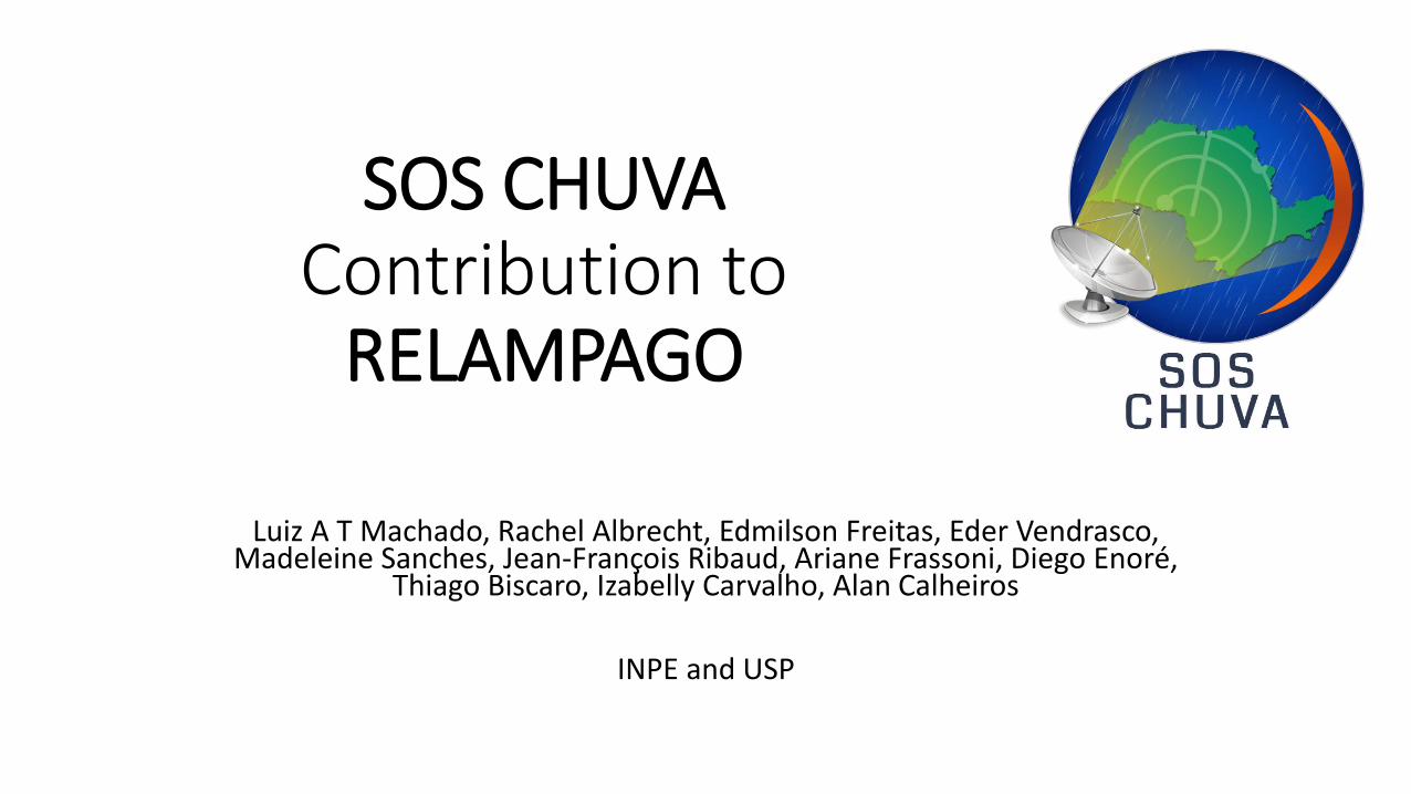
SOS CHUVA Contribution to RELAMPAGO Luiz A T Machado, Rachel Albrecht, Edmilson Freitas, Eder Vendrasco, Madeleine Sanches, Jean-François Ribaud, Ariane Frassoni, Diego Enoré, Thiago Biscaro, Izabelly Carvalho, Alan Calheiros INPE and USP
Transcript of SOS CHUVA Contribution to...
SOS CHUVA Contribution to
RELAMPAGO
Luiz A T Machado, Rachel Albrecht, Edmilson Freitas, Eder Vendrasco, Madeleine Sanches, Jean-François Ribaud, Ariane Frassoni, Diego Enoré,
Thiago Biscaro, Izabelly Carvalho, Alan Calheiros
INPE and USP
Outline
• The Main Goals of SOS CHUVA Activities in Relampago
• The instrumentation in Relampago
• The Activities During Relampago
• The SOS CHUVA Campaign – Open for possible participations-cooperation
The Main Goals of SOS CHUVA Activities in Relampago
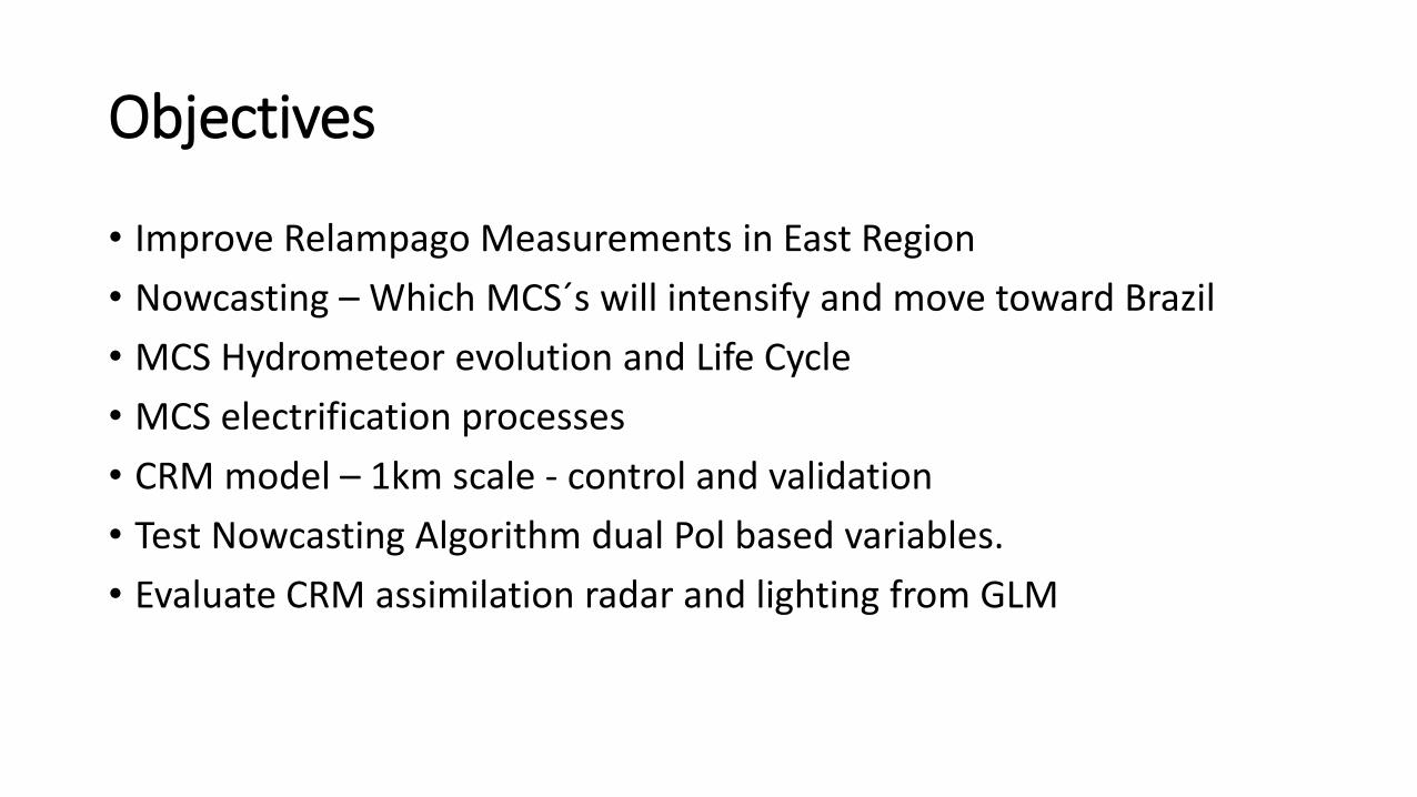
Objectives
• Improve Relampago Measurements in East Region
• Nowcasting – Which MCS´s will intensify and move toward Brazil
• MCS Hydrometeor evolution and Life Cycle
• MCS electrification processes
• CRM model – 1km scale - control and validation
• Test Nowcasting Algorithm dual Pol based variables.
• Evaluate CRM assimilation radar and lighting from GLM
Relampago Instrumentation
Sao Borja - RS
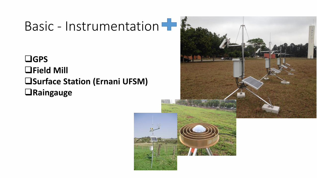
Basic - Instrumentation
GPSField MillSurface Station (Ernani UFSM)Raingauge
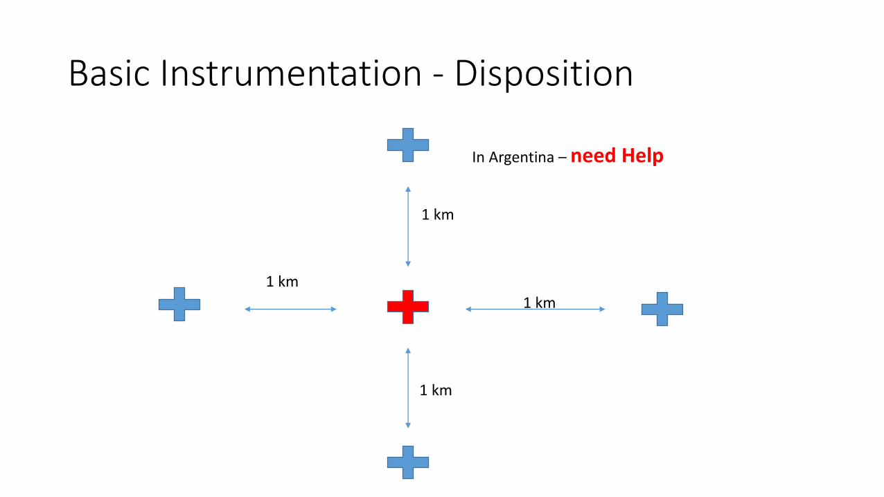
Basic Instrumentation - Disposition
1 km
1 km
1 km
1 km
In Argentina – need Help
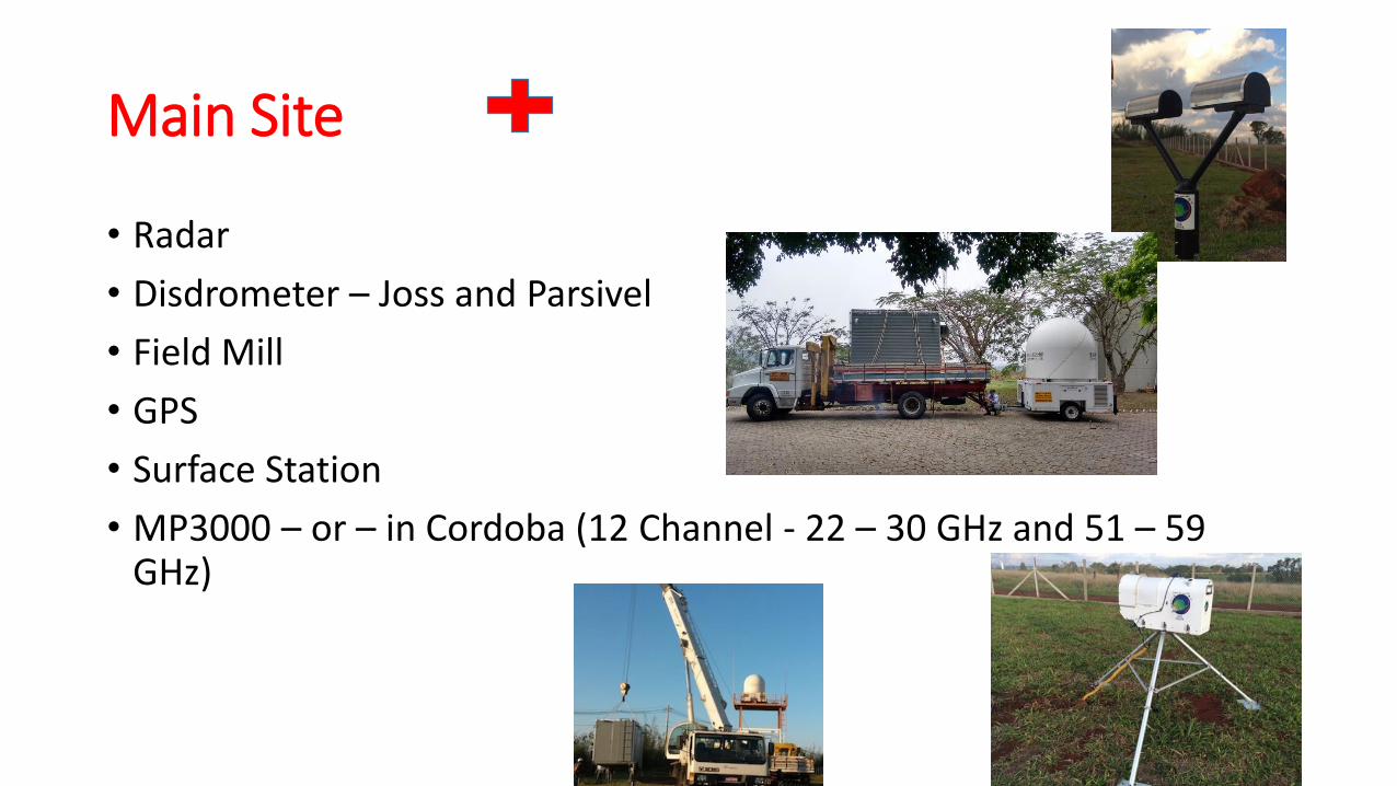
Main Site
• Radar
• Disdrometer – Joss and Parsivel
• Field Mill
• GPS
• Surface Station
• MP3000 – or – in Cordoba (12 Channel - 22 – 30 GHz and 51 – 59 GHz)

The Activities During Relampago
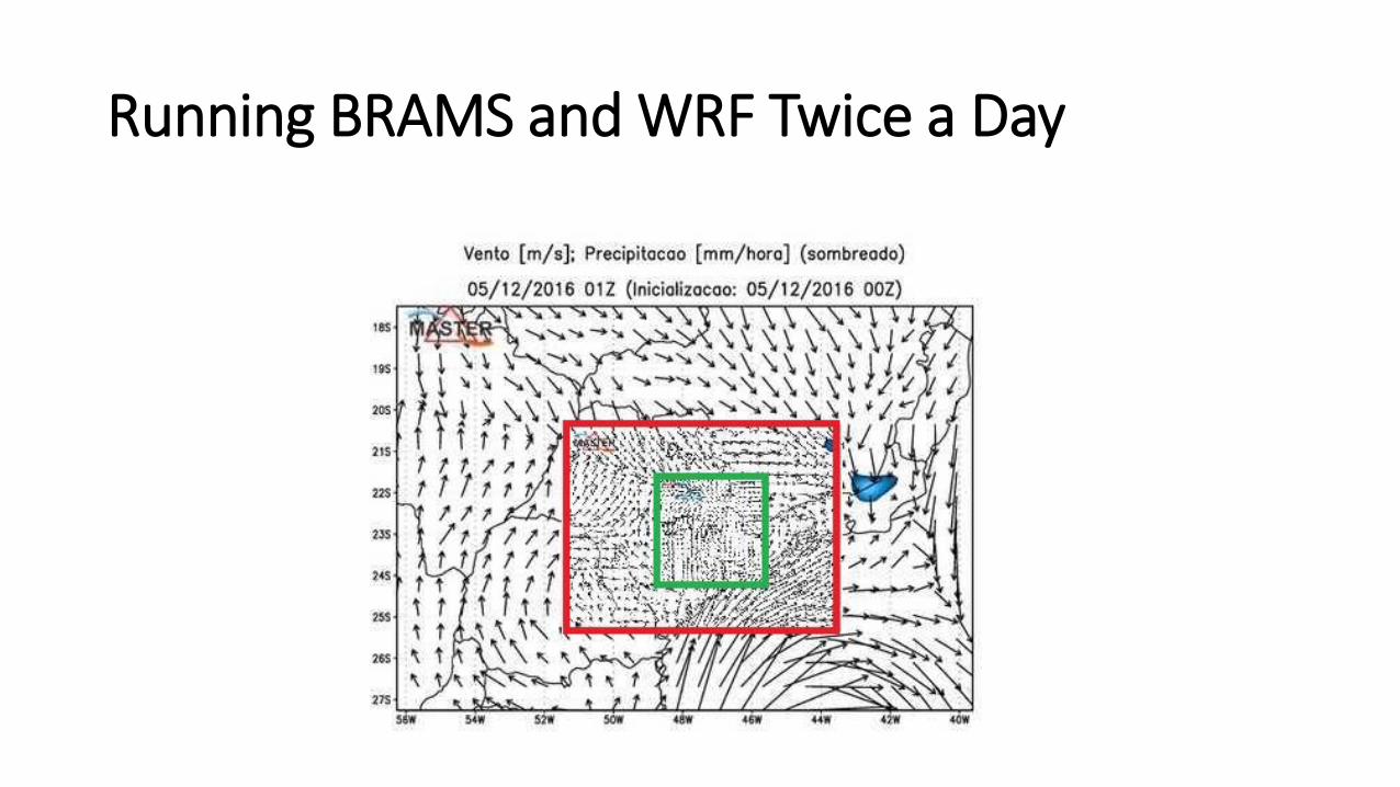
Running BRAMS and WRF Twice a Day
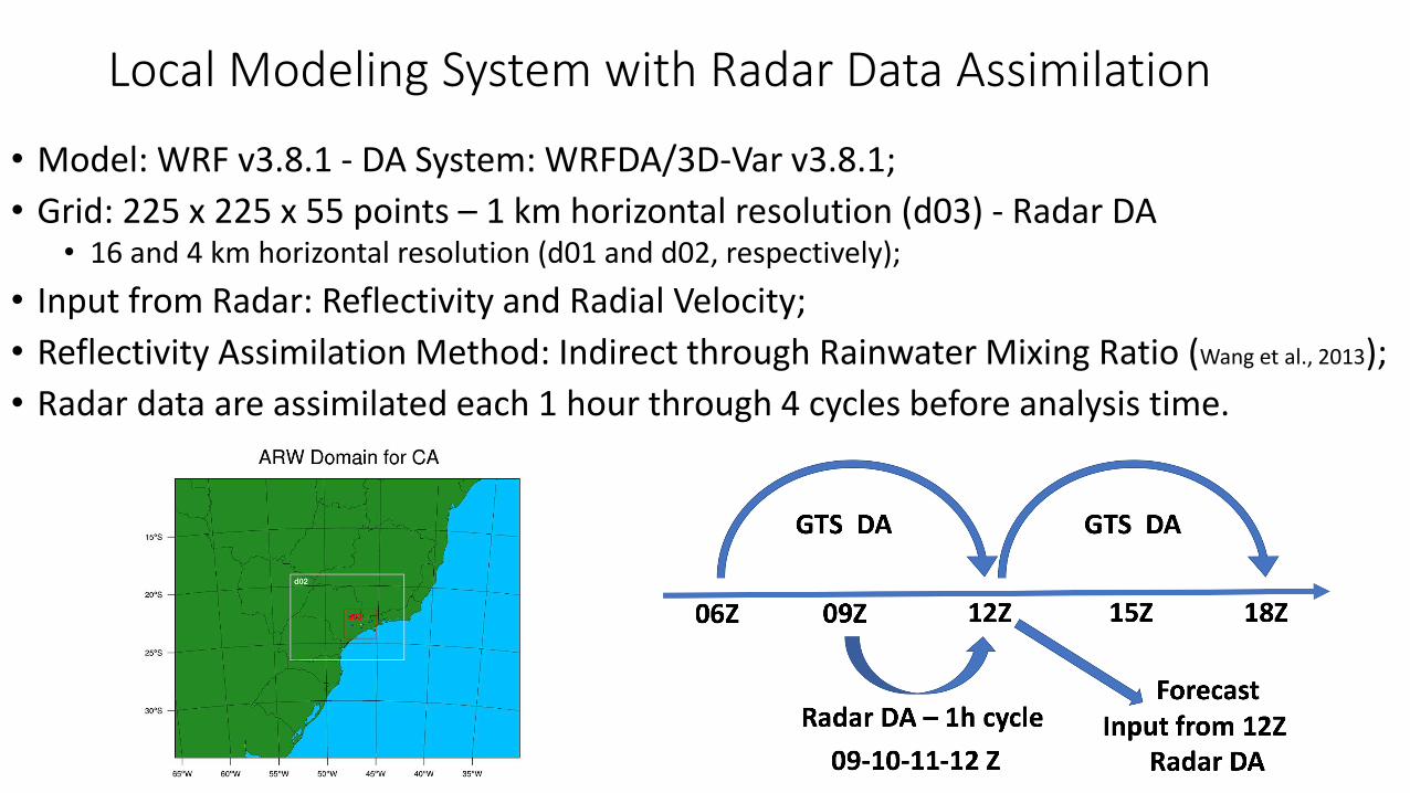
Local Modeling System with Radar Data Assimilation
• Model: WRF v3.8.1 - DA System: WRFDA/3D-Var v3.8.1;
• Grid: 225 x 225 x 55 points – 1 km horizontal resolution (d03) - Radar DA• 16 and 4 km horizontal resolution (d01 and d02, respectively);
• Input from Radar: Reflectivity and Radial Velocity;
• Reflectivity Assimilation Method: Indirect through Rainwater Mixing Ratio (Wang et al., 2013);
• Radar data are assimilated each 1 hour through 4 cycles before analysis time.
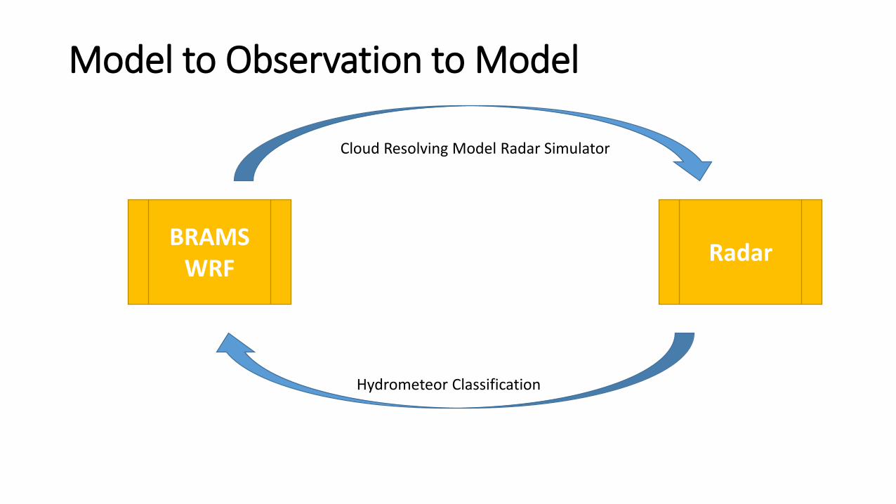
Model to Observation to Model
BRAMSWRF
Radar
Hydrometeor Classification
Cloud Resolving Model Radar Simulator
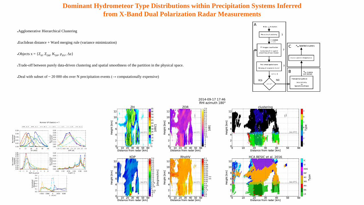
Dominant Hydrometeor Type Distributions within Precipitation Systems Inferred
from X-Band Dual Polarization Radar Measurements
●Agglomerative Hierarchical Clustering
●Euclidean distance + Ward merging rule (variance minimization)
●Objects x = {ZH, Z
DR, K
DP, ρ
HV, Δz}
●Trade-off between purely data-driven clustering and spatial smoothness of the partition in the physical space.
●Deal with subset of ~ 20 000 obs over N precipitation events (→ computationally expensive)
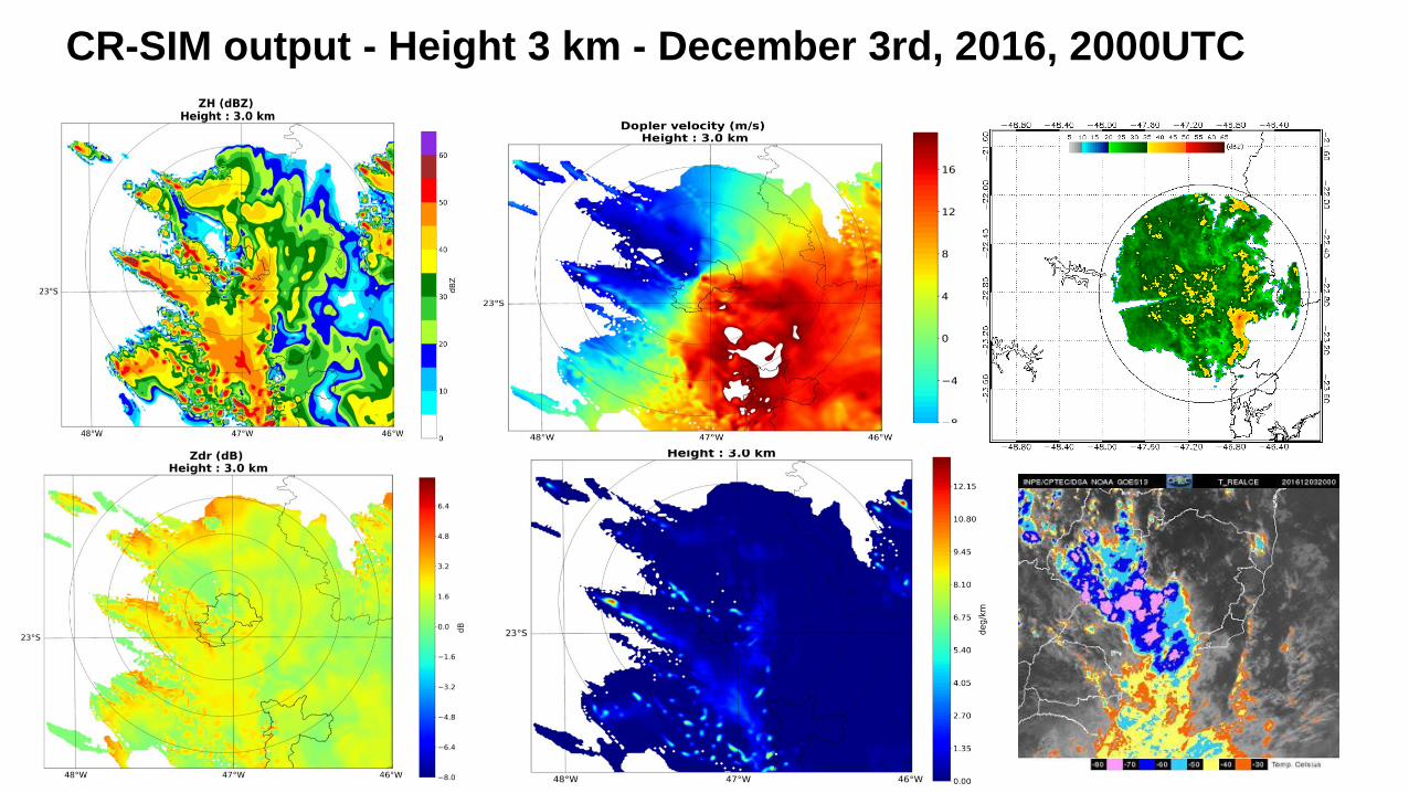
CR-SIM output - Height 3 km - December 3rd, 2016, 2000UTC
The SOS CHUVA Campaign – Open for possible participations-cooperation
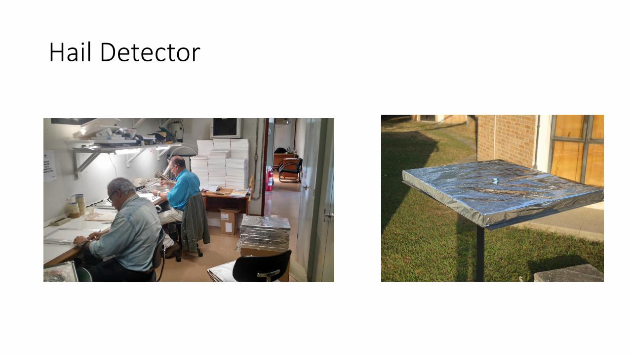
Hail Detector
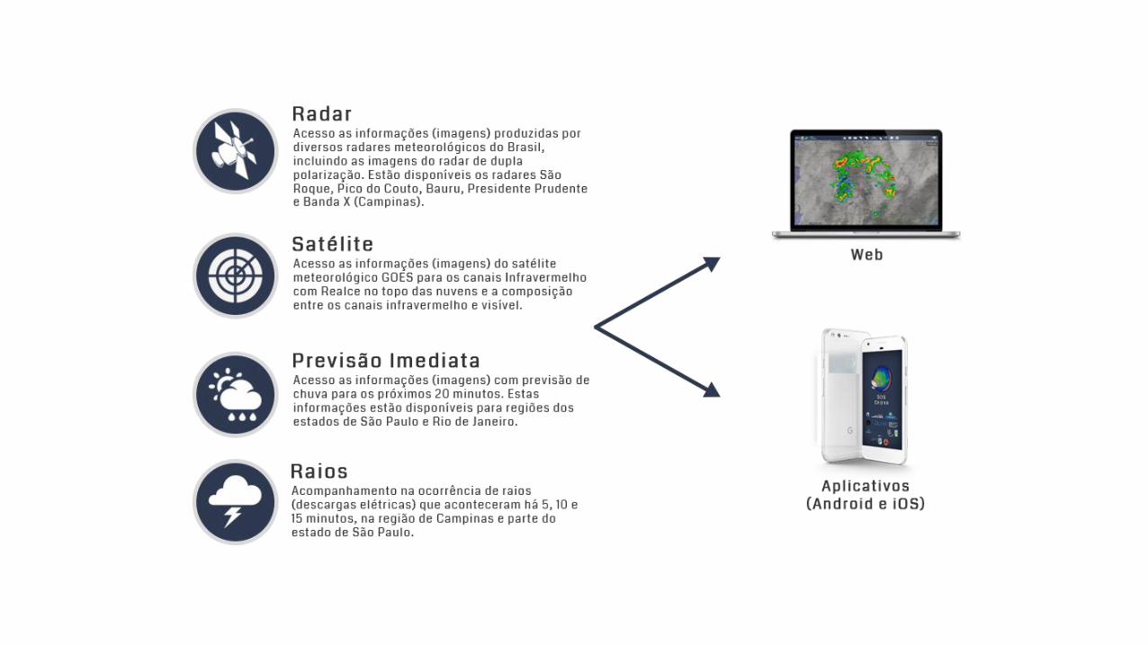
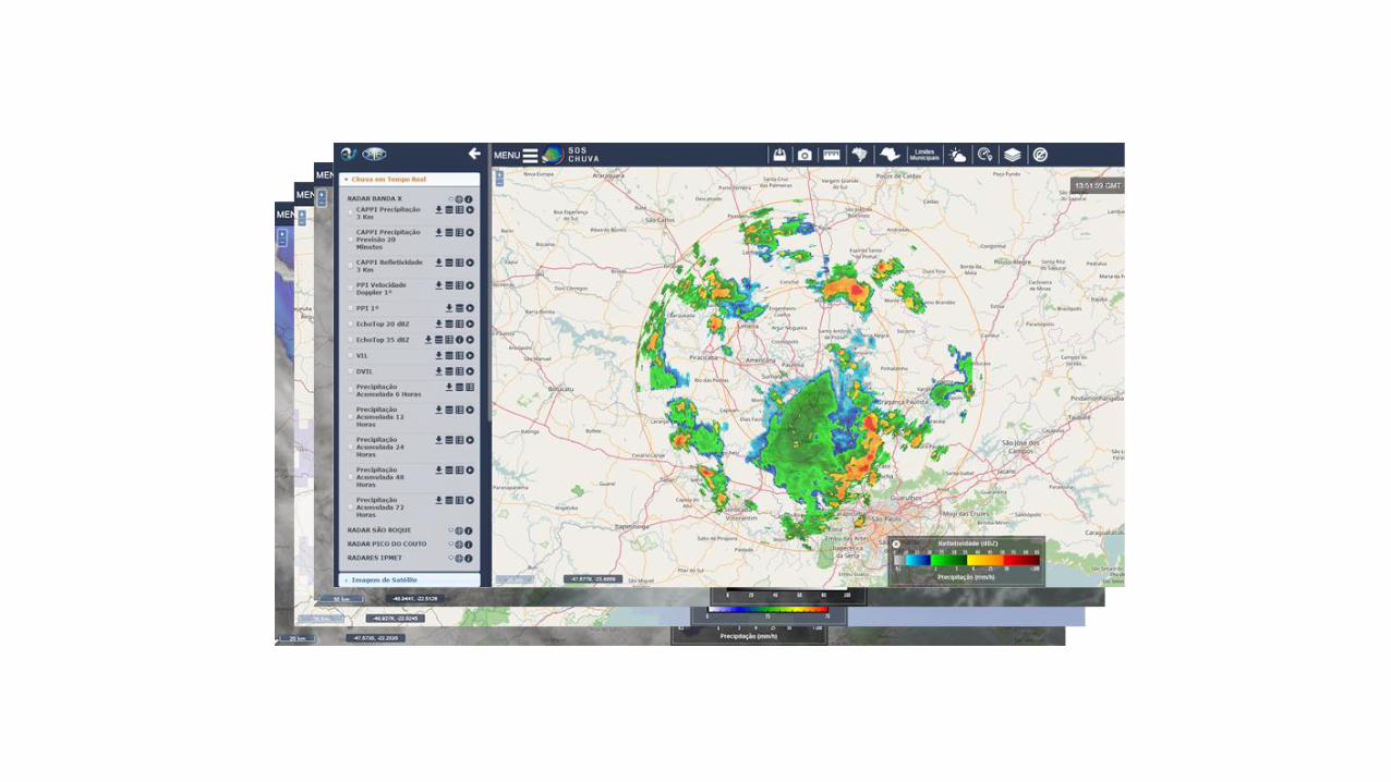
PRODUTOS
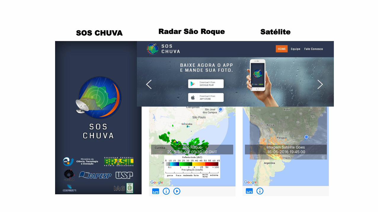
Radar São Roque SatéliteSOS CHUVA
Operacional Web SOS-CHUVA Service
http://soschuva.cptec.inpe.br/soschuva/ (WRF+BRAMS+Radar+Satellite Products)
www.master.iag.usp.br (BRAMS)
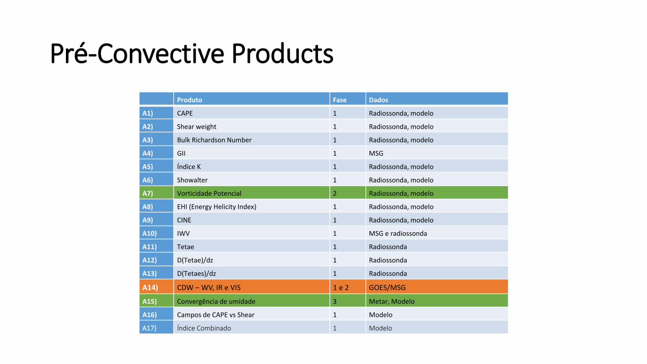
Produto Fase Dados
A1) CAPE 1 Radiossonda, modelo
A2) Shear weight 1 Radiossonda, modelo
A3) Bulk Richardson Number 1 Radiossonda, modelo
A4) GII 1 MSG
A5) Índice K 1 Radiossonda, modelo
A6) Showalter 1 Radiossonda, modelo
A7) Vorticidade Potencial 2 Radiossonda, modelo
A8) EHI (Energy Helicity Index) 1 Radiossonda, modelo
A9) CINE 1 Radiossonda, modelo
A10) IWV 1 MSG e radiossonda
A11) Tetae 1 Radiossonda
A12) D(Tetae)/dz 1 Radiossonda
A13) D(Tetaes)/dz 1 Radiossonda
A14) CDW – WV, IR e VIS 1 e 2 GOES/MSG
A15) Convergência de umidade 3 Metar, Modelo
A16) Campos de CAPE vs Shear 1 Modelo
A17) Índice Combinado 1 Modelo
Pré-Convective Products
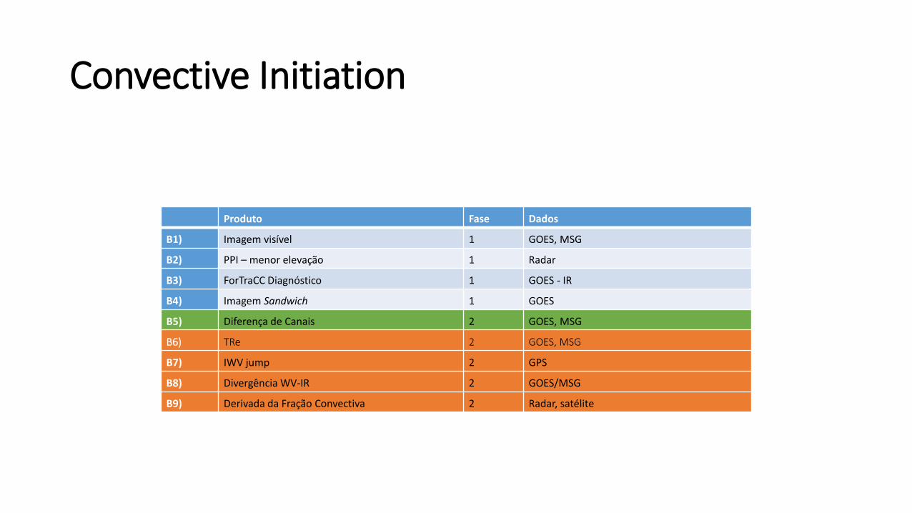
Convective Initiation
Produto Fase Dados
B1) Imagem visível 1 GOES, MSG
B2) PPI – menor elevação 1 Radar
B3) ForTraCC Diagnóstico 1 GOES - IR
B4) Imagem Sandwich 1 GOES
B5) Diferença de Canais 2 GOES, MSG
B6) TRe 2 GOES, MSG
B7) IWV jump 2 GPS
B8) Divergência WV-IR 2 GOES/MSG
B9) Derivada da Fração Convectiva 2 Radar, satélite
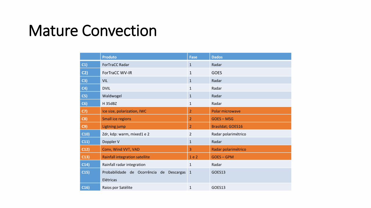
Mature Convection
Produto Fase Dados
C1) ForTraCC Radar 1 Radar
C2) ForTraCC WV-IR 1 GOES
C3) VIL 1 Radar
C4) DVIL 1 Radar
C5) Waldwogel 1 Radar
C6) H 35dBZ 1 Radar
C7) Ice size, polarization, IWC 2 Polar microwave
C8) Small ice regions 2 GOES – MSG
C9) Ligtning jump 2 Brasildat; GOES16
C10) Zdr, kdp: warm, mixed1 e 2 2 Radar polarimétrico
C11) Doppler V 1 Radar
C12) Conv, Wind VVT, VAD 3 Radar polarimétrico
C13) Rainfall integration satellite 1 e 2 GOES – GPM
C14) Rainfall radar integration 1 Radar
C15) Probabilidade de Ocorrência de Descargas
Elétricas
1 GOES13
C16) Raios por Satélite 1 GOES13
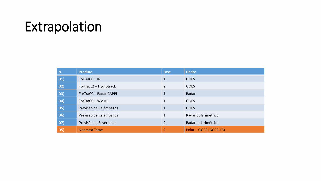
Extrapolation
N. Produto Fase Dados
D1) ForTraCC – IR 1 GOES
D2) Fortracc2 – Hydrotrack 2 GOES
D3) ForTraCC – Radar CAPPI 1 Radar
D4) ForTraCC – WV-IR 1 GOES
D5) Previsão de Relâmpagos 1 GOES
D6) Previsão de Relâmpagos 1 Radar polarimétrico
D7) Previsão de Severidade 2 Radar polarimétrico
D5) Nearcast Tetae 2 Polar – GOES (GOES-16)
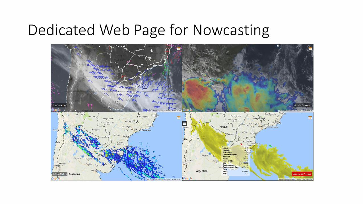
Dedicated Web Page for Nowcasting
WEB

Thank you
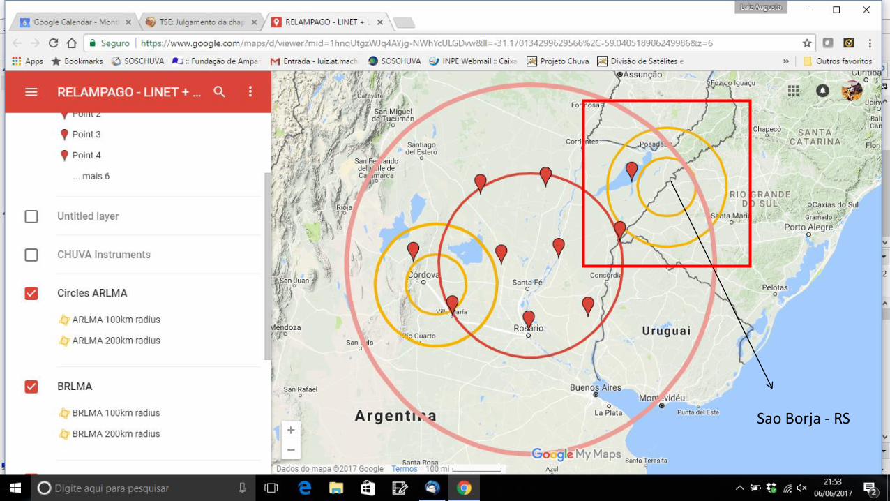
Planejamento do experimento de campo RELAMPAGO
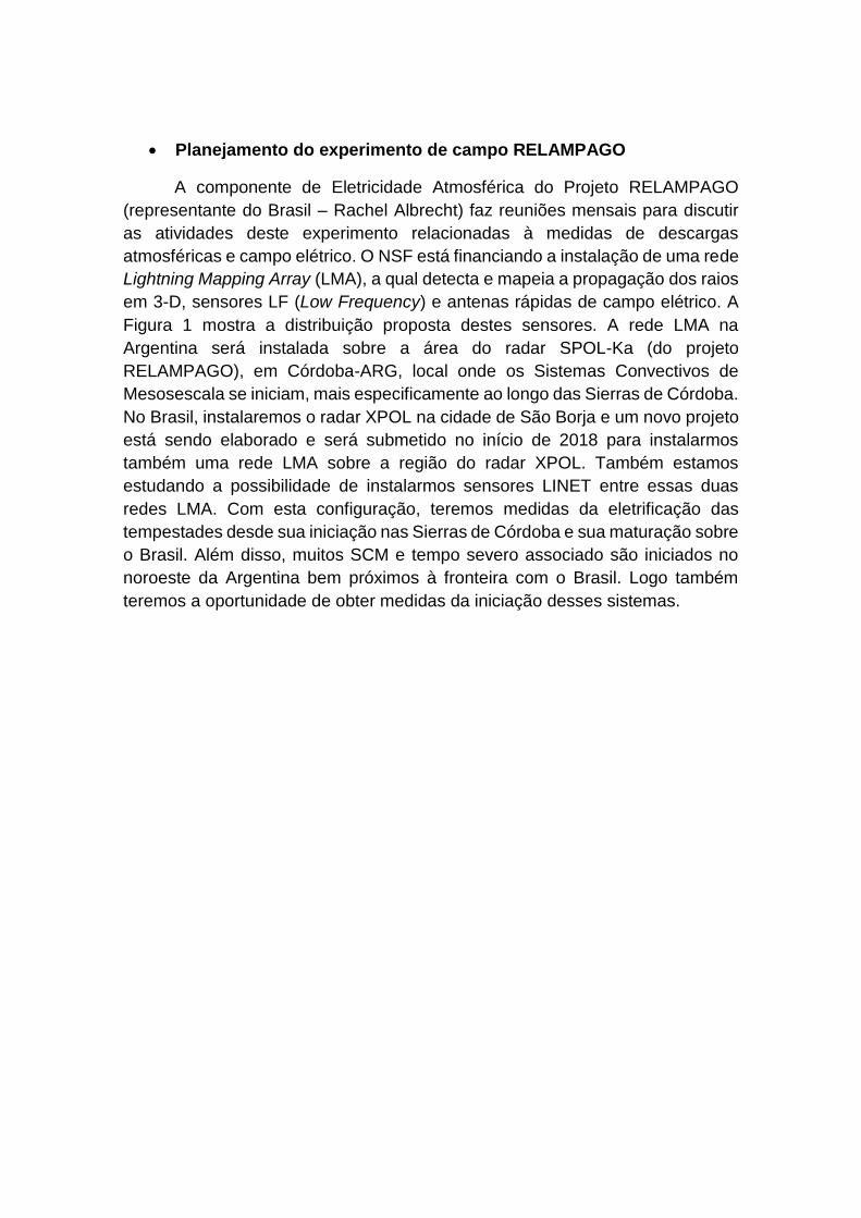
A componente de Eletricidade Atmosférica do Projeto RELAMPAGO
(representante do Brasil – Rachel Albrecht) faz reuniões mensais para discutir
as atividades deste experimento relacionadas à medidas de descargas
atmosféricas e campo elétrico. O NSF está financiando a instalação de uma rede
Lightning Mapping Array (LMA), a qual detecta e mapeia a propagação dos raios
em 3-D, sensores LF (Low Frequency) e antenas rápidas de campo elétrico. A
Figura 1 mostra a distribuição proposta destes sensores. A rede LMA na
Argentina será instalada sobre a área do radar SPOL-Ka (do projeto
RELAMPAGO), em Córdoba-ARG, local onde os Sistemas Convectivos de
Mesosescala se iniciam, mais especificamente ao longo das Sierras de Córdoba.
No Brasil, instalaremos o radar XPOL na cidade de São Borja e um novo projeto
está sendo elaborado e será submetido no início de 2018 para instalarmos
também uma rede LMA sobre a região do radar XPOL. Também estamos
estudando a possibilidade de instalarmos sensores LINET entre essas duas
redes LMA. Com esta configuração, teremos medidas da eletrificação das
tempestades desde sua iniciação nas Sierras de Córdoba e sua maturação sobre
o Brasil. Além disso, muitos SCM e tempo severo associado são iniciados no
noroeste da Argentina bem próximos à fronteira com o Brasil. Logo também
teremos a oportunidade de obter medidas da iniciação desses sistemas.
Figura 1 – Distribuição dos equipamentos relacionados à Eletricidade
Atmosférica do Projeto RELAMPAGO. Ícones laranja = estações LMA; Ícones
vermelhos = estações LINET; Ícones verde = sensores LF; Círculos laranja = 100
e 200 km de raio das redes LMA; Balão rosa = XPOL, Círculos rosa = 60 (XPOL),
100 (SPOL-Ka) e 200 (SPOL-Ka) km de cobertura dos radares; Círculos azuis =
cobertura dos sensores LF. Veja online em: http://goo.gl/3KDJfy.