PennDOT’s Maintenance-IQ€™s Maintenance-IQ • PennDOT’s mobile application team developed...
18
Mid-Atlantic Quality Assurance Workshop 2017 PennDOT’s Maintenance-IQ Nate M. Reck (GeoDecisions, Project Director) Shawn P. Crane (PennDOT, Project Manager) February 8, 2017
Transcript of PennDOT’s Maintenance-IQ€™s Maintenance-IQ • PennDOT’s mobile application team developed...
Mid-Atlantic Quality Assurance Workshop 2017
PennDOT’s Maintenance-IQNate M. Reck (GeoDecisions, Project Director)Shawn P. Crane (PennDOT, Project Manager)
February 8, 2017
PennDOT’s Maintenance-IQ
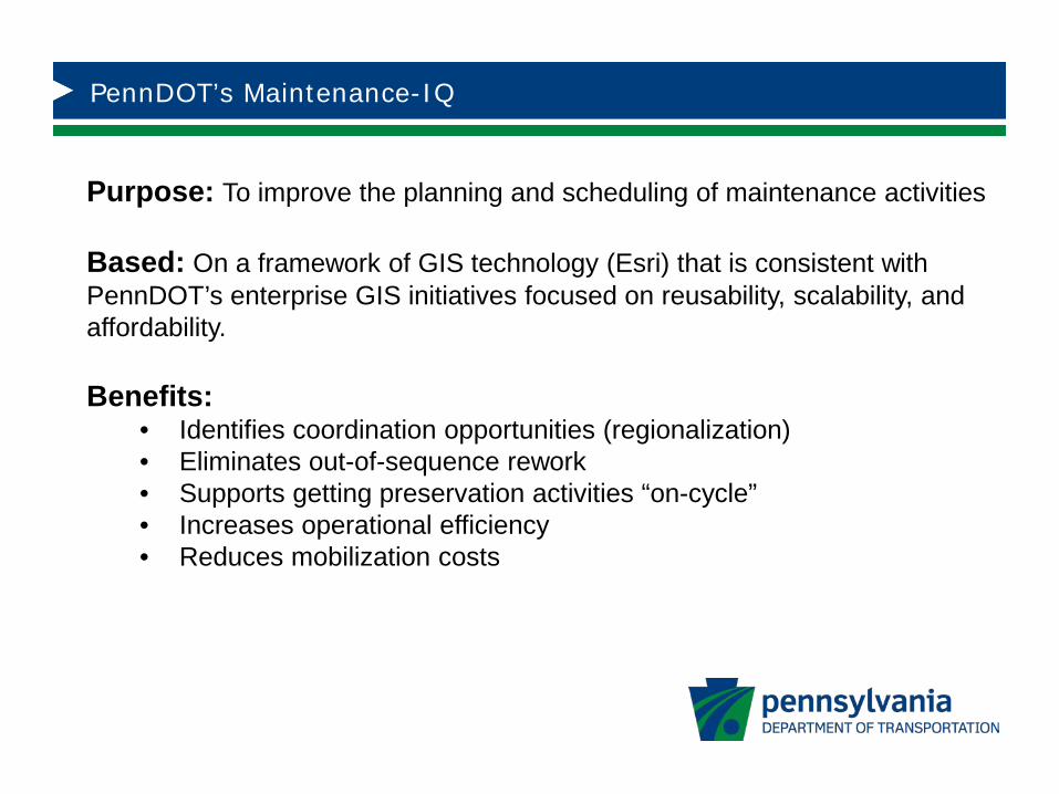
Purpose: To improve the planning and scheduling of maintenance activities
Based: On a framework of GIS technology (Esri) that is consistent with PennDOT’s enterprise GIS initiatives focused on reusability, scalability, and affordability.
Benefits:• Identifies coordination opportunities (regionalization)• Eliminates out-of-sequence rework• Supports getting preservation activities “on-cycle”• Increases operational efficiency• Reduces mobilization costs
PennDOT’s Maintenance-IQ
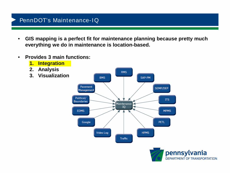
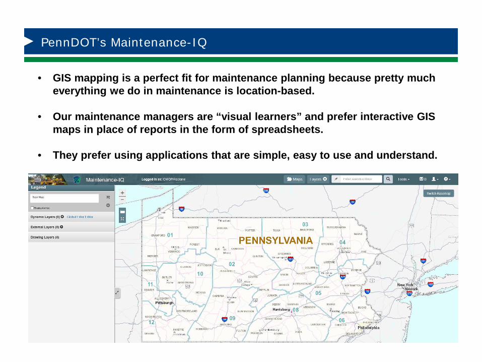
• GIS mapping is a perfect fit for maintenance planning because pretty much everything we do in maintenance is location-based.
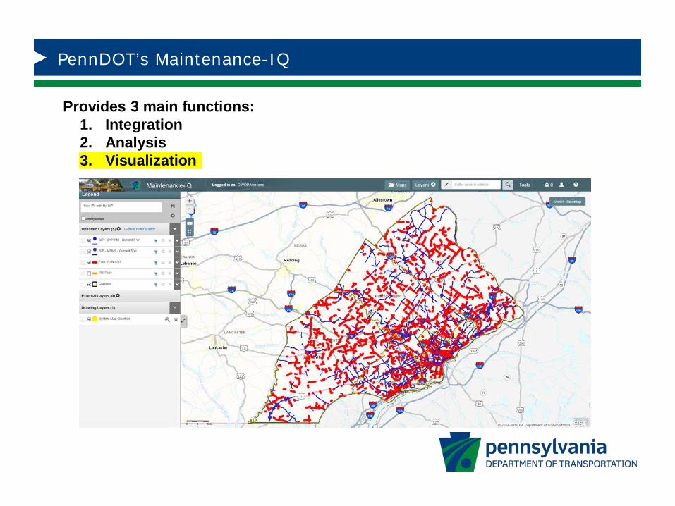
• Provides 3 main functions:1. Integration2. Analysis3. Visualization
PennDOT’s Maintenance-IQ
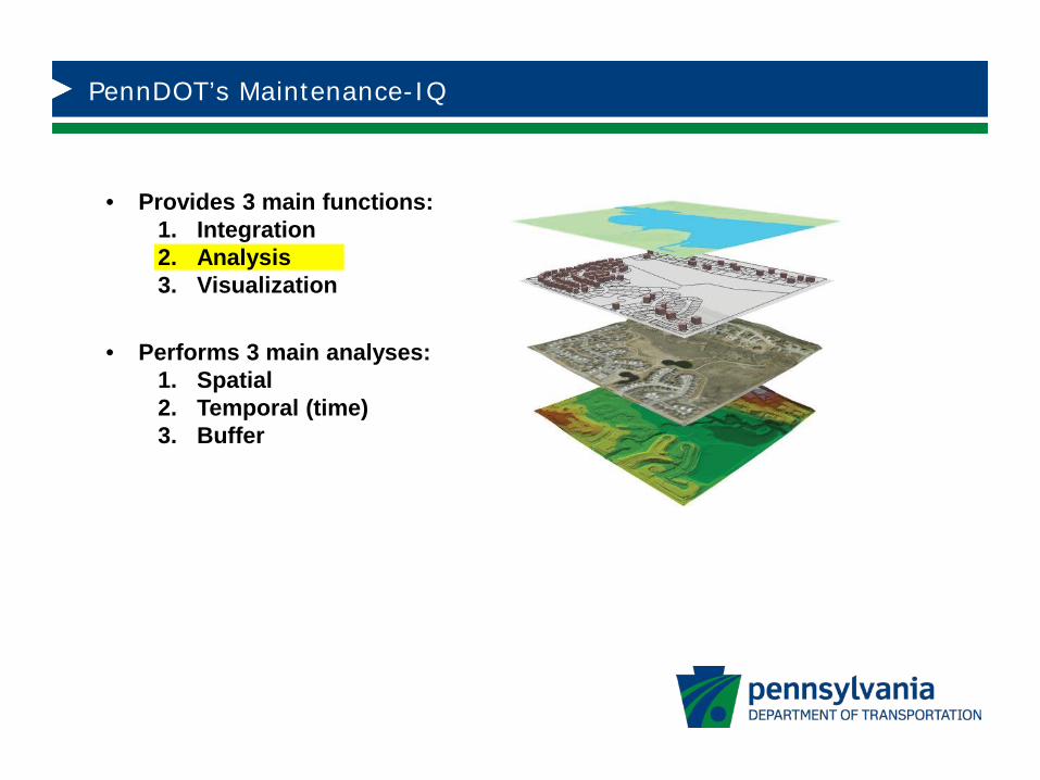
• Provides 3 main functions:1. Integration2. Analysis3. Visualization
• Performs 3 main analyses:1. Spatial2. Temporal (time)3. Buffer
PennDOT’s Maintenance-IQ
Provides 3 main functions:1. Integration2. Analysis3. Visualization
PennDOT’s Maintenance-IQ
• GIS mapping is a perfect fit for maintenance planning because pretty much everything we do in maintenance is location-based.
• Our maintenance managers are “visual learners” and prefer interactive GIS maps in place of reports in the form of spreadsheets.
• They prefer using applications that are simple, easy to use and understand.
PennDOT’s Maintenance-IQ
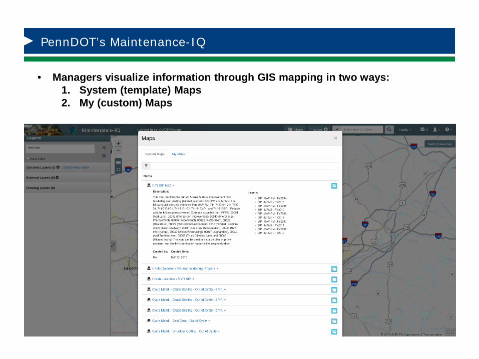
• Managers visualize information through GIS mapping in two ways:1. System (template) Maps2. My (custom) Maps
PennDOT’s Maintenance-IQ
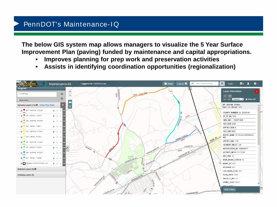
The below GIS system map allows managers to visualize the 5 Year Surface Improvement Plan (paving) funded by maintenance and capital appropriations.
• Improves planning for prep work and preservation activities• Assists in identifying coordination opportunities (regionalization)
PennDOT’s Maintenance-IQ
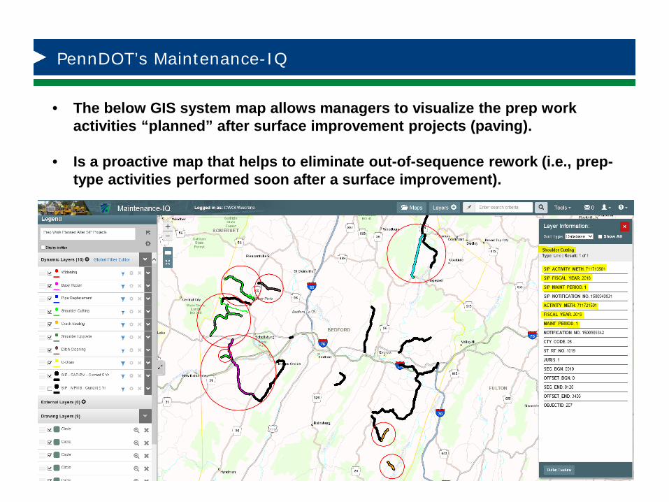
• The below GIS system map allows managers to visualize the prep work activities “planned” after surface improvement projects (paving).
• Is a proactive map that helps to eliminate out-of-sequence rework (i.e., prep-type activities performed soon after a surface improvement).
PennDOT’s Maintenance-IQ
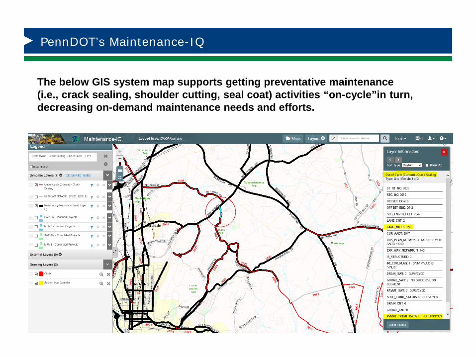
The below GIS system map supports getting preventative maintenance (i.e., crack sealing, shoulder cutting, seal coat) activities “on-cycle”in turn, decreasing on-demand maintenance needs and efforts.

PennDOT’s Maintenance-IQ
The below GIS map demonstrates how Maintenance-IQ was used to develop a “cycle-sectional” maintenance crack sealing program (4 year cycle). By working within geographic zones; we further optimize the efficiency of the operation by reducing mobilization costs via travel time.
PennDOT’s Maintenance-IQ
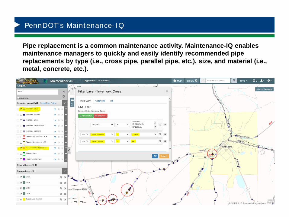
Pipe replacement is a common maintenance activity. Maintenance-IQ enables maintenance managers to quickly and easily identify recommended pipe replacements by type (i.e., cross pipe, parallel pipe, etc.), size, and material (i.e., metal, concrete, etc.).
PennDOT’s Maintenance-IQ
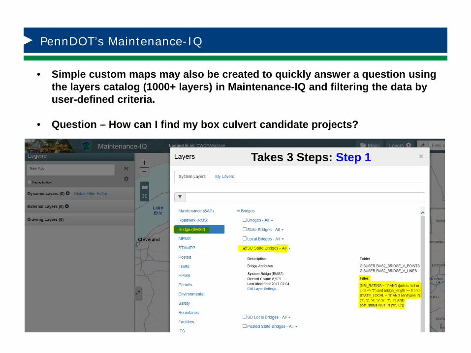
• Simple custom maps may also be created to quickly answer a question using the layers catalog (1000+ layers) in Maintenance-IQ and filtering the data by user-defined criteria.
• Question – How can I find my box culvert candidate projects?
Takes 3 Steps: Step 1
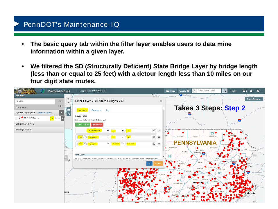
PennDOT’s Maintenance-IQ
• The basic query tab within the filter layer enables users to data mine information within a given layer.
• We filtered the SD (Structurally Deficient) State Bridge Layer by bridge length (less than or equal to 25 feet) with a detour length less than 10 miles on our four digit state routes.
Takes 3 Steps: Step 2
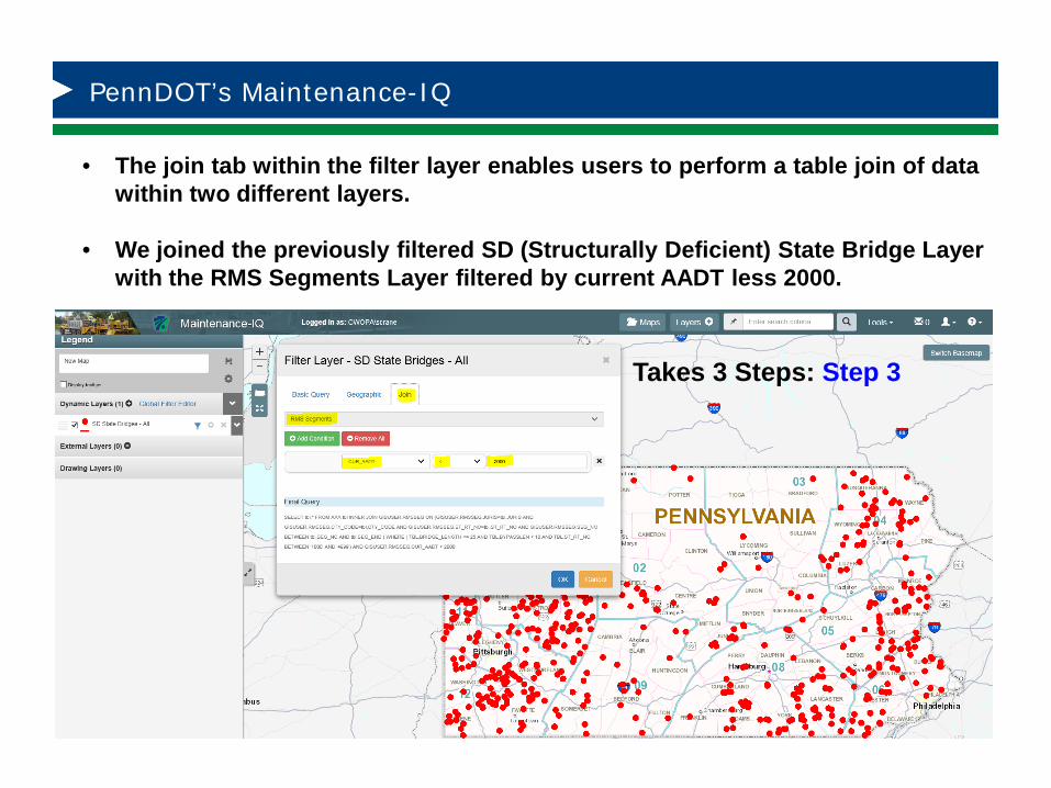
PennDOT’s Maintenance-IQ
• The join tab within the filter layer enables users to perform a table join of data within two different layers.
• We joined the previously filtered SD (Structurally Deficient) State Bridge Layer with the RMS Segments Layer filtered by current AADT less 2000.
Takes 3 Steps: Step 3
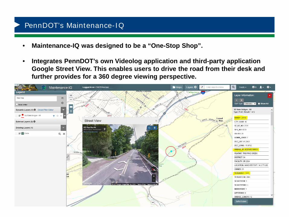
PennDOT’s Maintenance-IQ
• Maintenance-IQ was designed to be a “One-Stop Shop”.
• Integrates PennDOT’s own Videolog application and third-party application Google Street View. This enables users to drive the road from their desk and further provides for a 360 degree viewing perspective.
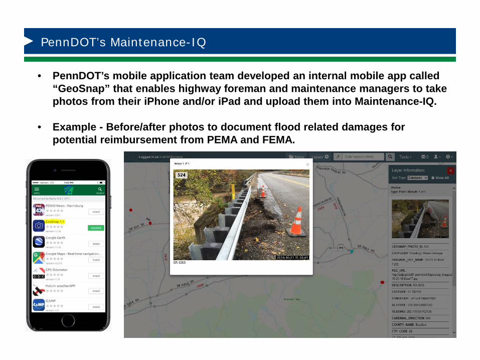
PennDOT’s Maintenance-IQ
• PennDOT’s mobile application team developed an internal mobile app called “GeoSnap” that enables highway foreman and maintenance managers to take photos from their iPhone and/or iPad and upload them into Maintenance-IQ.
• Example - Before/after photos to document flood related damages for potential reimbursement from PEMA and FEMA.
PennDOT’s Maintenance-IQ
Thank You!Any Questions?
Contact Information:Nate M. Reck, email: [email protected] P. Crane, email: [email protected]