KYTC’s Highway Information System (HIS) Helping You Jump Start Your Planning and Design Data...
29
KYTC’s Highway Information System (HIS) Helping You Jump Start Your Planning and Design Data Gathering Efforts Josh Wentz KYTC Division of Planning Data Management Branch Manager
-
Upload
veronica-goodwin -
Category
Documents
-
view
213 -
download
0
Transcript of KYTC’s Highway Information System (HIS) Helping You Jump Start Your Planning and Design Data...
KYTC’s Highway Information System(HIS)
Helping You Jump Start YourPlanning and Design
Data Gathering Efforts
Josh WentzKYTC Division of Planning
Data Management Branch Manager
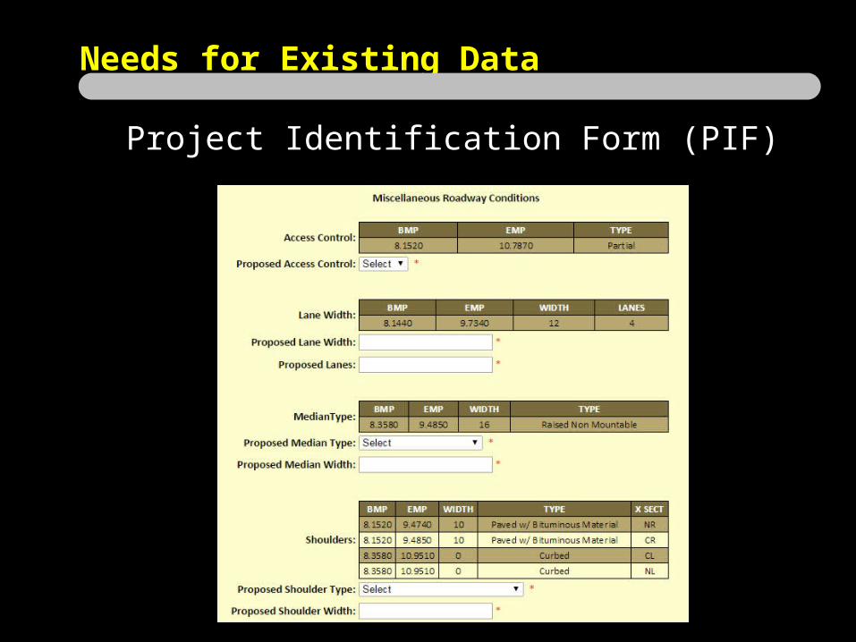
Needs for Existing Data
Project Identification Form (PIF)

Needs for Existing Data
Purpose and Need Statement

Needs for Existing Data
Data Needs Analysis Study (DNA)

Needs for Existing Data
Planning Study

Needs for Existing Data
Project Approach
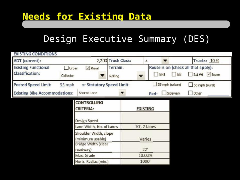
Needs for Existing Data
Design Executive Summary (DES)

Session Plan
• HIS Overview – What’s in it?• Demo – HIVEi• Usage Limitations• Future Enhancements

HIS
Two Major Components
Road CenterlinesTabular Road Data

• Spatial/GIS representation of all public road centerlines• KYTC, County, City, State Agencies, Federal• 88,000 miles
•Dual-carriageway• Linear Referencing System (LRS)• County, Route, & Milepoint locations
Road Centerlines

Road Centerlines

Attribute CommentsRoute Unique County #, Rt Prefix, Rt #, Rt Suffix, and Rt SectionBegin MilepointEnd MilepointRoad Name As provided by local agenciesSurface TypeDMI Length In miles, 3 decimal placesGovernment Level Road ownership indicatorType of Operation 1-way, 2-way, Divided
Road Centerlines
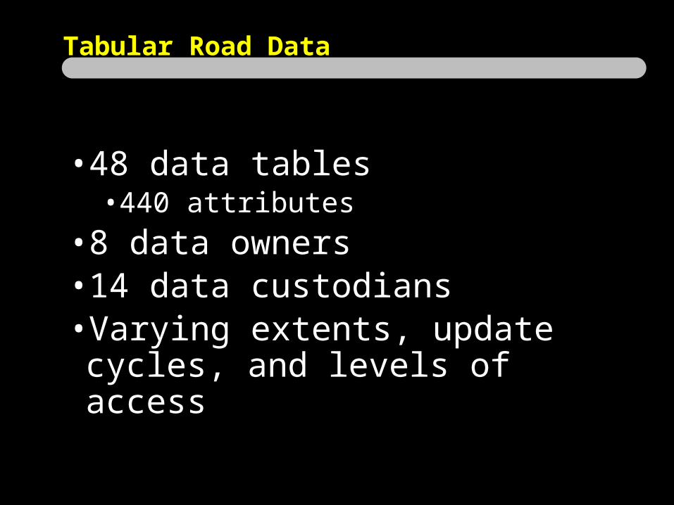
Tabular Road Data
•48 data tables• 440 attributes
•8 data owners•14 data custodians•Varying extents, update cycles, and
levels of access
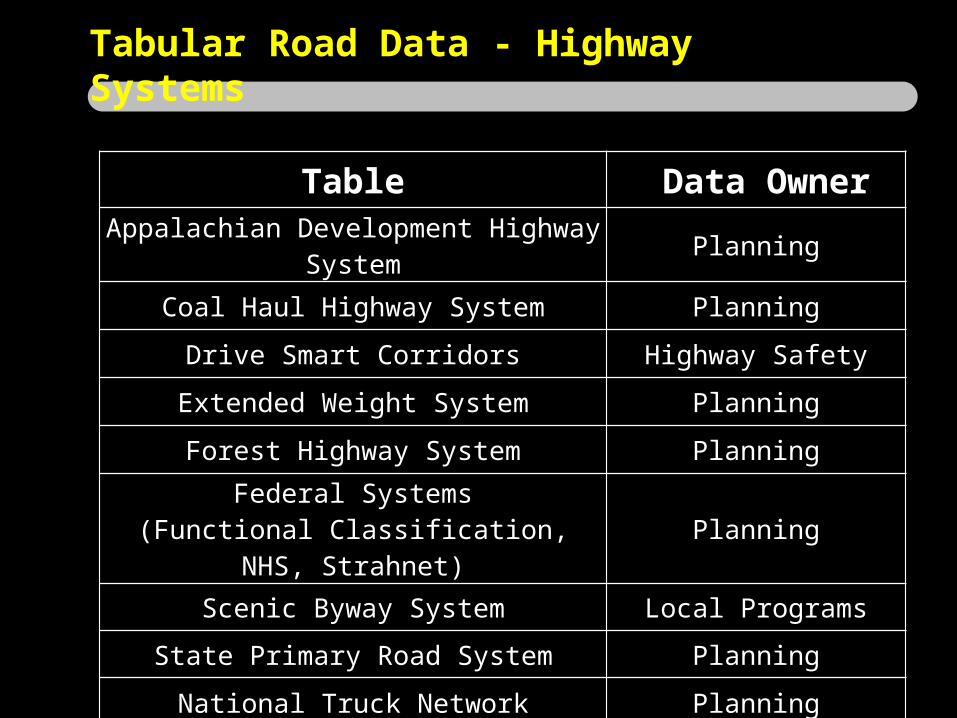
Table Data OwnerAppalachian Development Highway System Planning
Coal Haul Highway System Planning
Drive Smart Corridors Highway Safety
Extended Weight System Planning
Forest Highway System PlanningFederal Systems
(Functional Classification, NHS, Strahnet) Planning
Scenic Byway System Local Programs
State Primary Road System Planning
National Truck Network Planning
Tabular Road Data - Highway Systems

Table Data Owner
Access Control PlanningEvaluation Sections
(Homogenous Road Sections) Planning
Type of Operation PlanningRoute Log
(Intersection Information) Planning
Speed Limit Traffic Operations
Truck Weight Classification Maintenance
Tabular Road Data - Roadway Information

Table Data OwnerAuxiliary Lanes
(Turn, TWLTL, Truck Climbing) Planning
Bicycle and Pedestrian Facilities Planning
Horizontal Curves Planning
Vertical Curves / Grades Planning
Through Lanes Planning
Medians Planning
Shoulders Planning
Tabular Road Data - Roadway Features
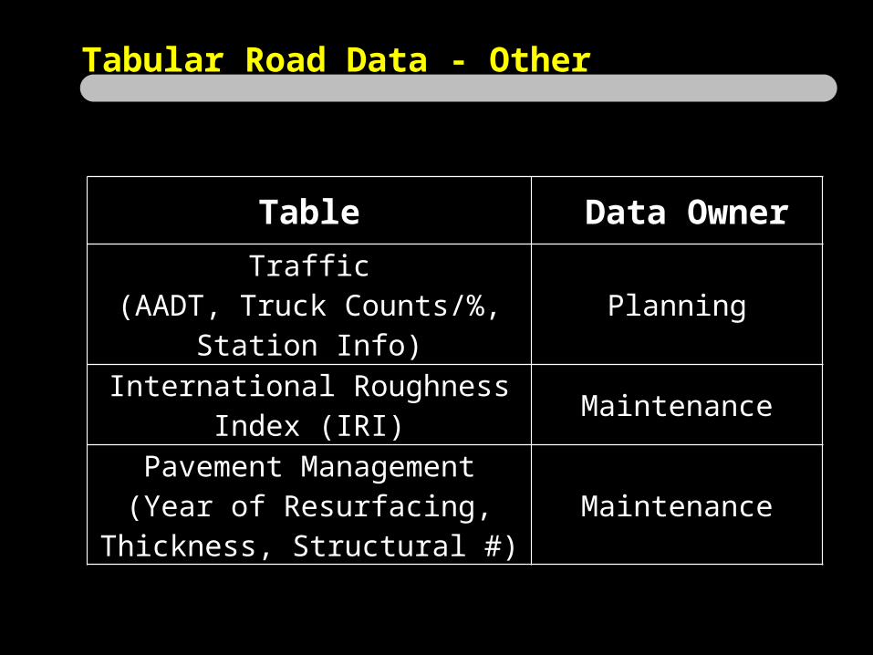
Table Data Owner
Traffic(AADT, Truck Counts/%, Station Info) Planning
International Roughness Index (IRI) Maintenance
Pavement Management(Year of Resurfacing, Thickness,
Structural #)Maintenance
Tabular Road Data - Other

Highway Information View and Extract Interface
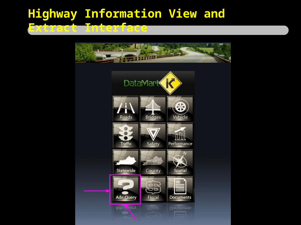
Highway Information View and Extract Interface

Highway Information View and Extract Interface

Highway Information View and Extract Interface
http://datamart.business.transportation.ky.gov/EDSB_SOLUTIONS/hisextracts/

Usage Limitations
“Qualified customers only. Available only at participating authorized dealers. Subject to credit approval.”
“Qualified customers only. Available only at participating authorized dealers. Subject to credit
approval.”
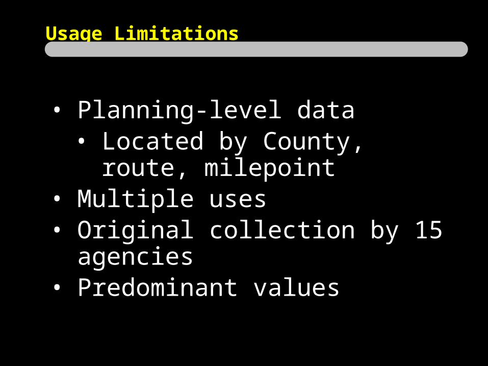
Usage Limitations
• Planning-level data• Located by County, route, milepoint
• Multiple uses• Original collection by 15 agencies• Predominant values

Usage Limitations
• Horizontal Curve and Vertical Curve• Several different collection methods• Data affected by collector’s subjectivity• Best used for averaging over a section• Spot locations should be verified with other
methods
• Speed Limit• Combination of Traffic Operations speed zone
Official Orders and field observations• Sign installations don’t always match location
specified in speed zone Official Order

Usage Limitations
• Shoulders• Predominant values• Some inconsistencies with “combination” type
and lack of an attribute to hold paved width

Future Enhancements
•More accessible, usable, and consistent•More data about the data (metadata)•Better integration with other KYTC
Bentley products•Paved width on “combination” shoulder•More intersection data•More bike/ped data• Speed data
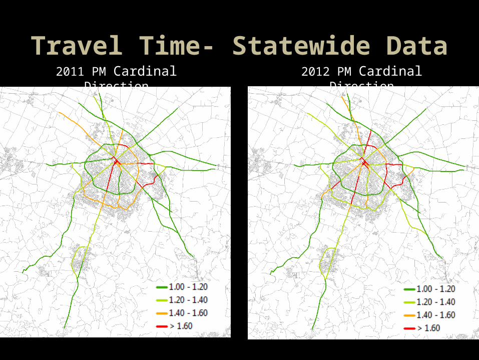
Travel Time- Statewide Data 2011 PM Cardinal Direction 2012 PM Cardinal Direction

Travel Time - Corridor Profiles
Blue are Minimum SpeedsRed are Maximum SpeedsArrow is the direction of travel at Average Speed