Connecticut River Bodkin Rock to Hartford - Quick Links · Connecticut River Bodkin Rock to...
16
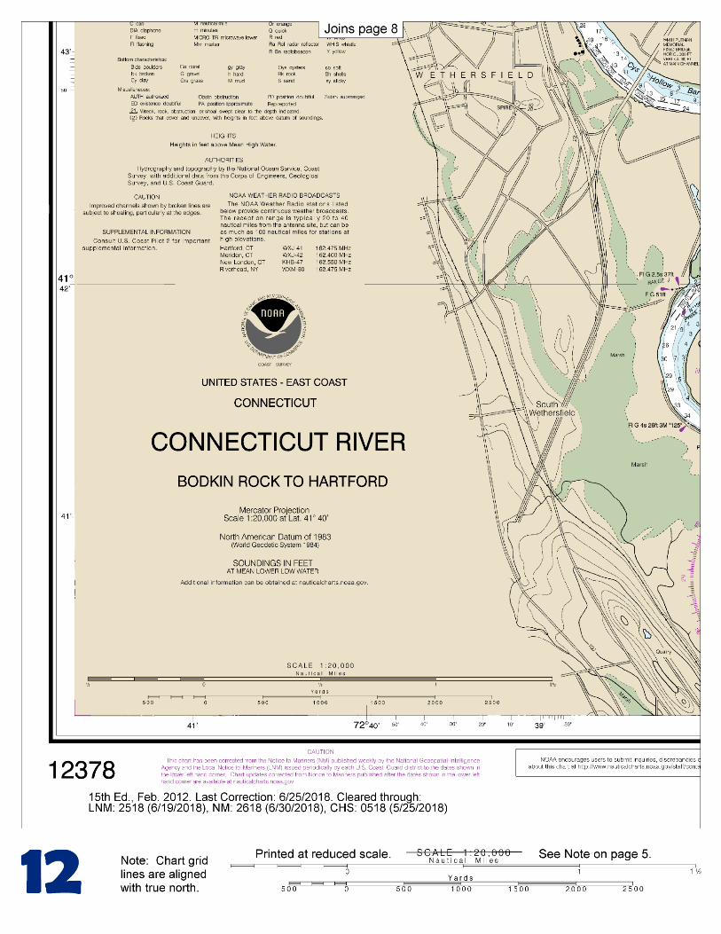
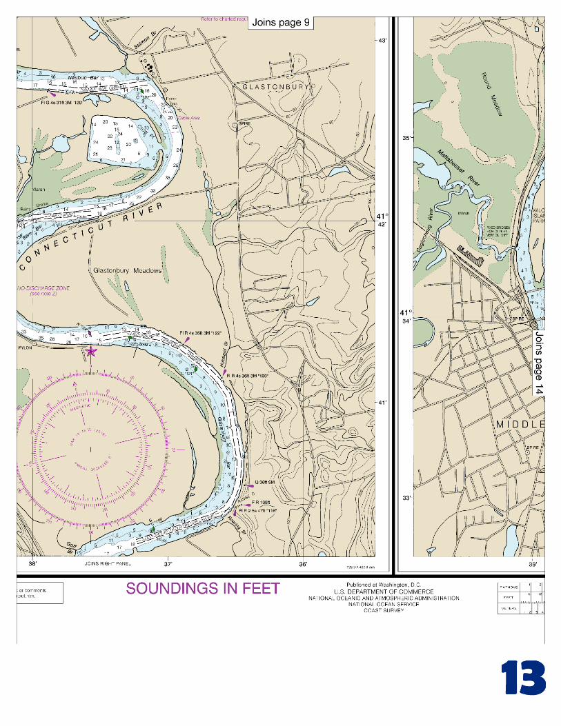
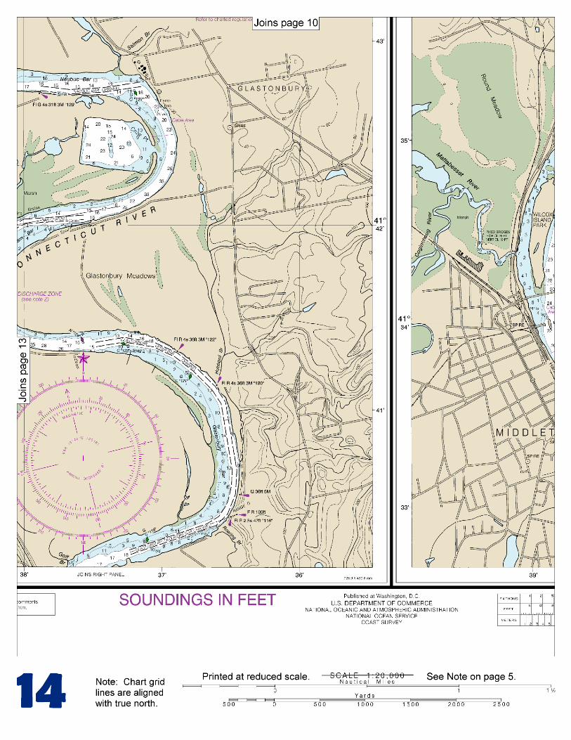
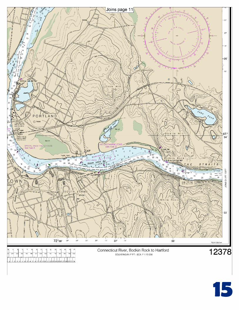
BookletChart ™ Connecticut River – Bodkin Rock to Hartford NOAA Chart 12378 A reduced-scale NOAA nautical chart for small boaters When possible, use the full-size NOAA chart for navigation.
Transcript of Connecticut River Bodkin Rock to Hartford - Quick Links · Connecticut River Bodkin Rock to...
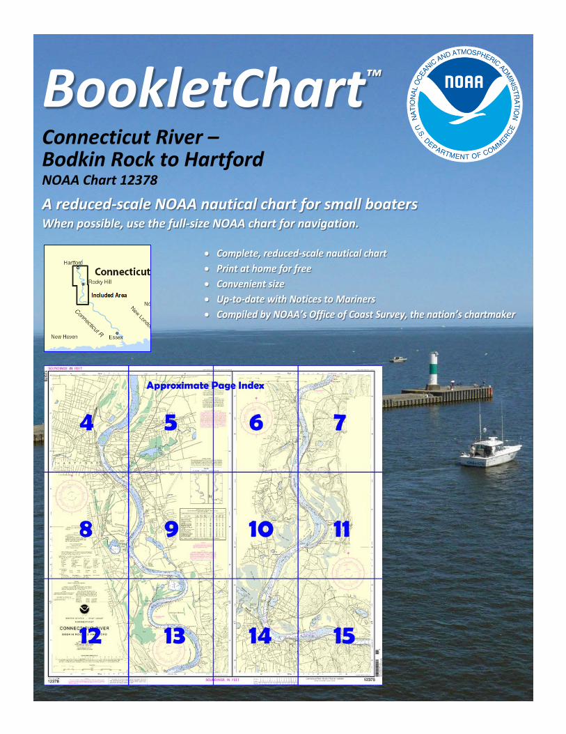
BookletChart™ Connecticut River – Bodkin Rock to Hartford NOAA Chart 12378
A reduced-scale NOAA nautical chart for small boaters When possible, use the full-size NOAA chart for navigation.
2
Published by the National Oceanic and Atmospheric Administration
National Ocean Service Office of Coast Survey
www.NauticalCharts.NOAA.gov 888-990-NOAA
What are Nautical Charts?
Nautical charts are a fundamental tool of marine navigation. They show water depths, obstructions, buoys, other aids to navigation, and much more. The information is shown in a way that promotes safe and efficient navigation. Chart carriage is mandatory on the commercial ships that carry America’s commerce. They are also used on every Navy and Coast Guard ship, fishing and passenger vessels, and are widely carried by recreational boaters.
What is a BookletChart?
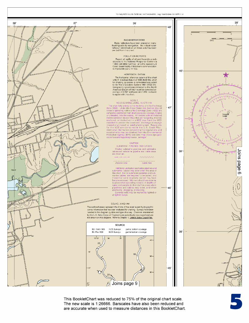
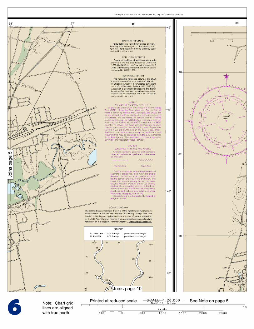
This BookletChart is made to help recreational boaters locate themselves on the water. It has been reduced in scale for convenience, but otherwise contains all the information of the full-scale nautical chart. The bar scales have also been reduced, and are accurate when used to measure distances in this BookletChart. See the Note at the bottom of page 5 for the reduction in scale applied to this chart.
Whenever possible, use the official, full scale NOAA nautical chart for navigation. Nautical chart sales agents are listed on the Internet at http://www.NauticalCharts.NOAA.gov.
This BookletChart does NOT fulfill chart carriage requirements for regulated commercial vessels under Titles 33 and 44 of the Code of Federal Regulations.
Notice to Mariners Correction Status
This BookletChart has been updated for chart corrections published in the U.S. Coast Guard Local Notice to Mariners, the National Geospatial Intelligence Agency Weekly Notice to Mariners, and, where applicable, the Canadian Coast Guard Notice to Mariners. Additional chart corrections have been made by NOAA in advance of their publication in a Notice to Mariners. The last Notices to Mariners applied to this chart are listed in the Note at the bottom of page 7. Coast Pilot excerpts are not being corrected.
For latest Coast Pilot excerpt visit the Office of Coast Survey website at http://www.nauticalcharts.noaa.gov/nsd/searchbychart.php?chart=12378.
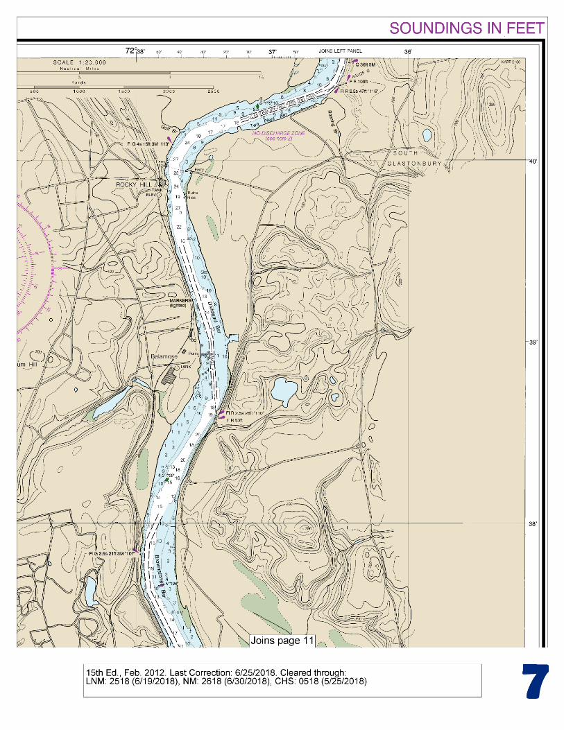
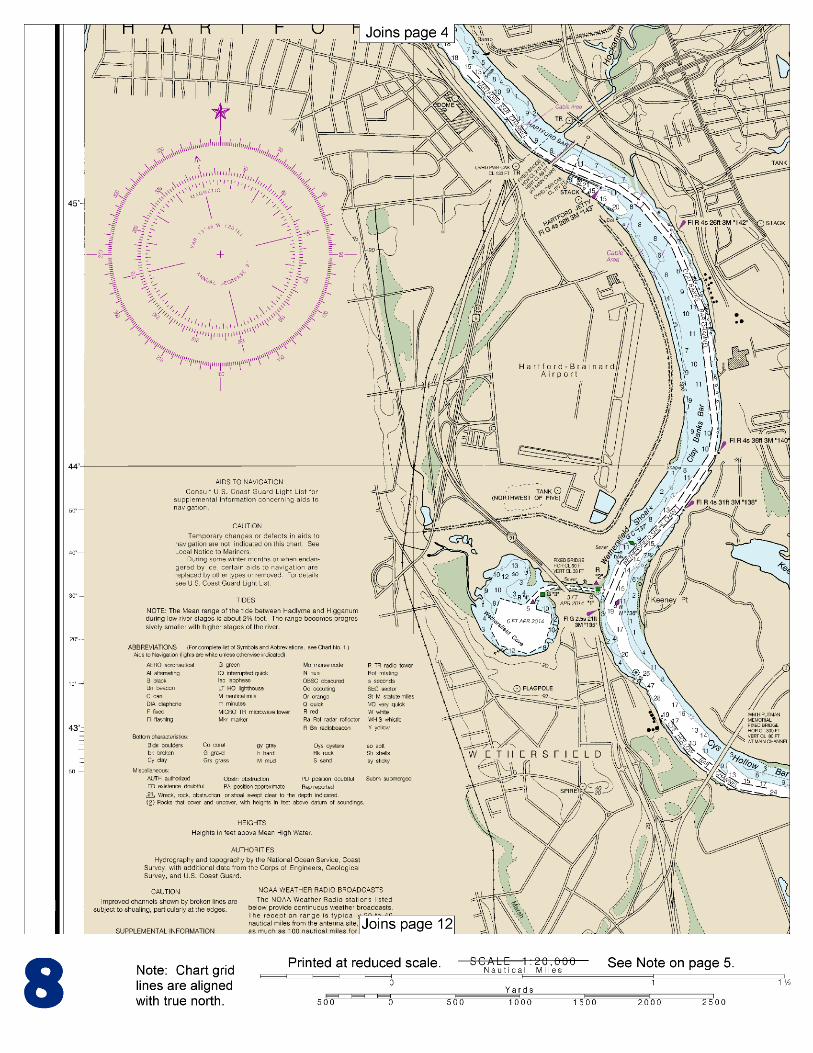
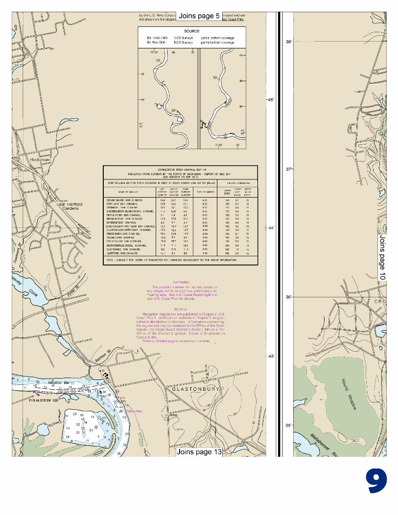
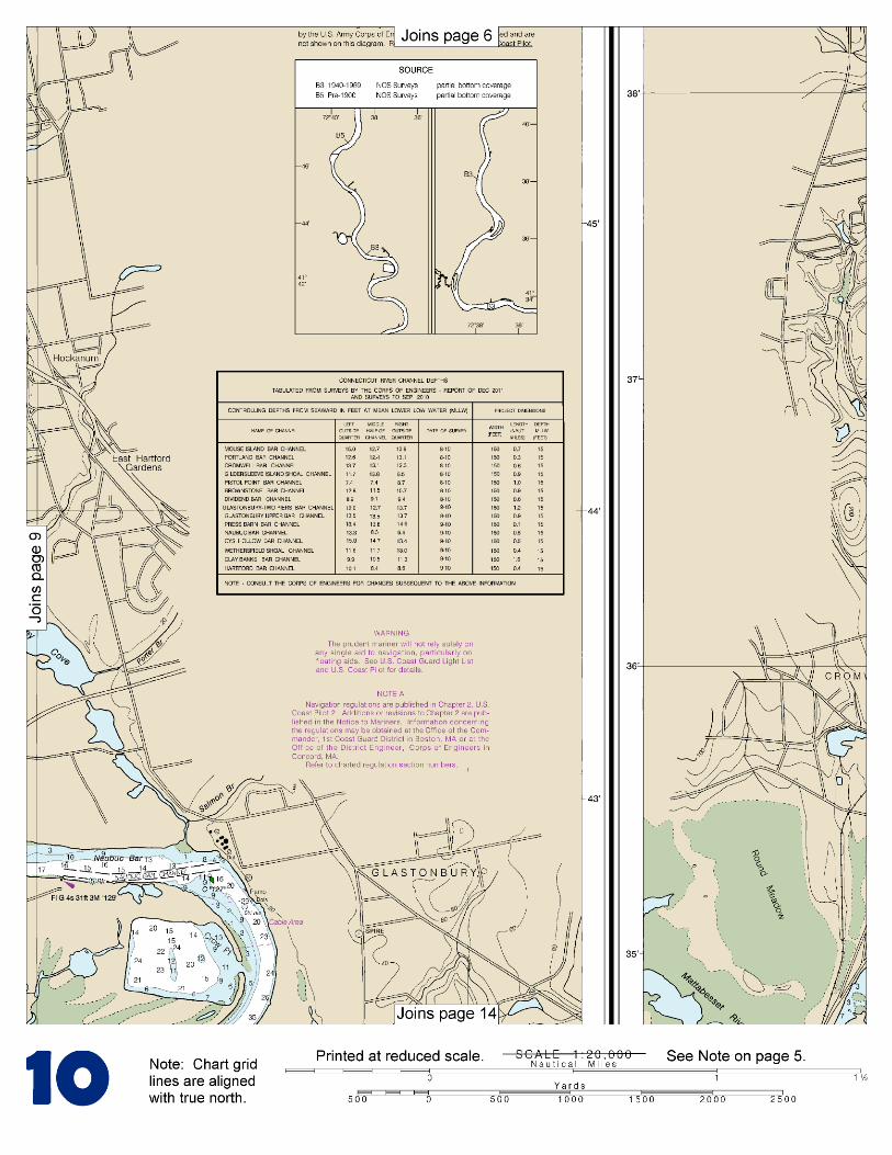
(Selected Excerpts from Coast Pilot) Connecticut River rises in the extreme northern part of New Hampshire, near the Canadian border, and flows southerly between the States of Vermont and New Hampshire and across Massachusetts and Connecticut to Long Island Sound. It is approximately 375 miles long and is one of the largest and most important rivers in New England. The head of commercial navigation is at Hartford, about 45 miles from the mouth. Waterborne commerce on
the river is mostly in petroleum products and chemicals. The river water is fresh at and above Deep River. Each year after the spring freshets, shoals with least depths of 10 feet are found in places
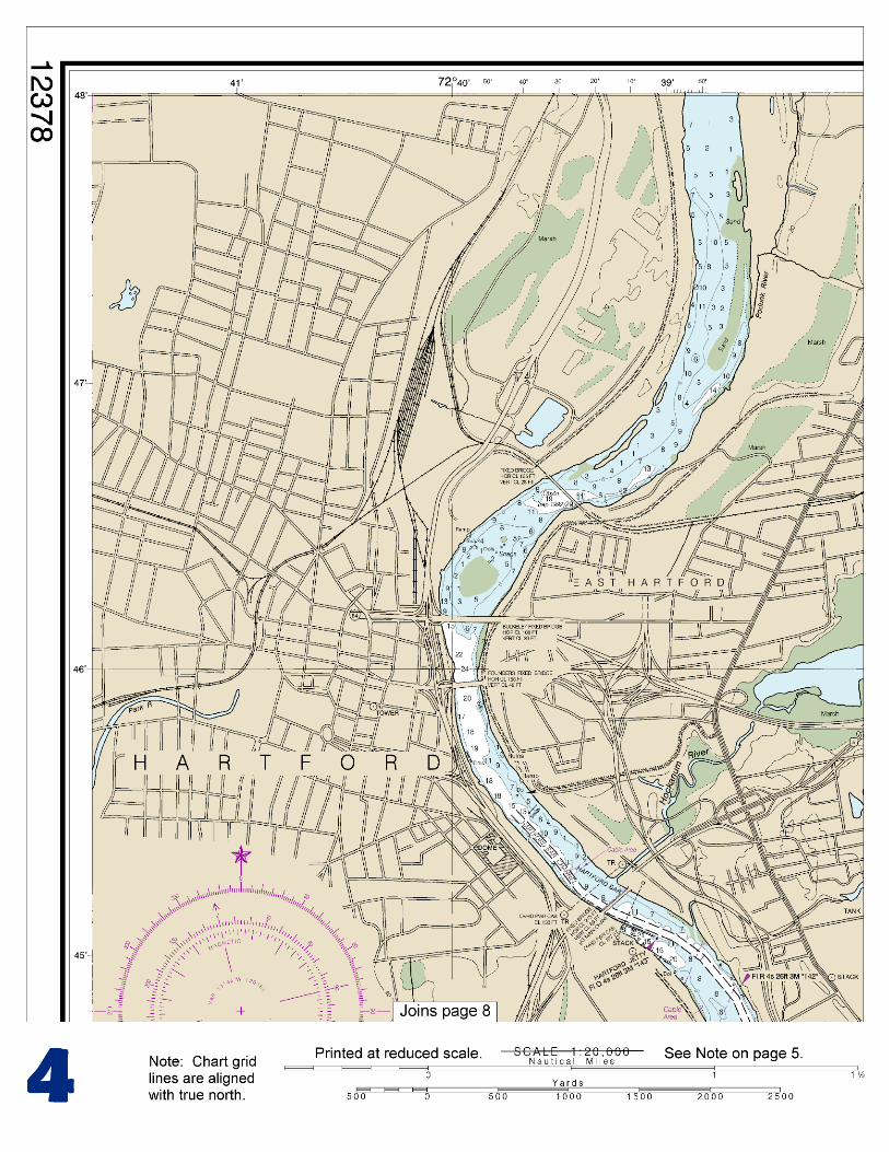
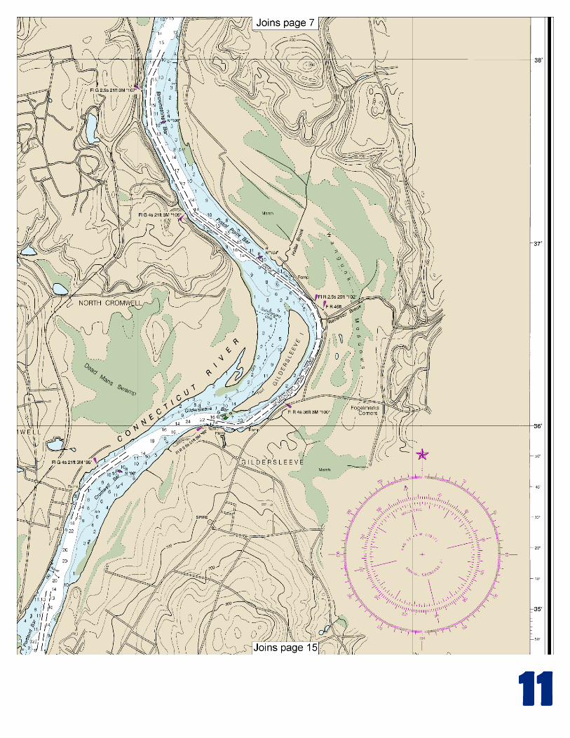
on bars in the upper river; dredging to remove such shoals is begun as soon as the water subsides. Between the entrance and Middletown the river banks are hard and in some places rocky, but between Middletown and Hartford the river flows through alluvial bottom land, where freshets and ice jams may cause shoaling. The channel above the jettied entrance channel usually follows the banks on the outside of the curves of the river, except through the dredged cuts across the bars which are marked by navigational aids. Anchorages.–Secure anchorage can be had eastward or northeastward of Lynde Point Light. Farther up anchorage can be selected in the wider parts of the channel. Special anchorages are at Old Saybrook, Essex, Chester, Lord Island, Eddy Rock Shoal in the vicinity of Connecticut River Light 45, and Mouse Island Bar vicinity. (See 110.1 and 110.55, chapter 2, for limits and regulations.) Dangers.–Saybrook Outer Bar, which obstructs the mouth of the Connecticut River, is shifting, with depths of 2 to 12 feet extending nearly 2 miles off the mouth; it is marked off its southeastern end by a lighted bell buoy. In 1976, obstructions were reported in the channel at the railroad bascule bridge 3 miles above the mouth of the Connecticut River; a least depth of 13 feet is reported in the channel in area 40 to 50 feet from the east abutment of the bridge. Mariners requiring greater depths are advised to avoid this area of the channel during passages. Bridges.–Several drawbridges and fixed bridges cross Connecticut River between the entrance and Hartford. The distance above the mouth, type, and clearance of each bridge follows: 3 miles, railroad with bascule span, 19 feet; 3.5 miles, Raymond E. Baldwin (IS 95) Bridge, fixed highway, 81 feet; 14.6 miles, State Route 82 highway with swing span at East Haddam, 22 feet; 27.8 miles, railroad with swing span at Middletown, 25 feet; 32.2 miles, Arrigoni Bridge (State Route 66), fixed highway, 89 feet; 41.2 miles, Wm. H. Putnam Bridge (State Route 3), fixed highway near Wethersfield, 80 feet over main channel; 44 miles, Charter Oak Bridge (U.S. 5/State Route 15), a fixed highway bridge at Hartford, 69 feet for a width of 215 feet; 44.9 miles, Founders Bridge, fixed highway, 49 feet; 45.2 miles, Bulkeley Bridge (I-84), fixed highway, 39 feet; and 46 miles, fixed railroad, 28 feet. (See 117.1 through 117.59 and 117.205, chapter 2, for drawbridge regulations.) Tides.–The time of tide becomes later and the range diminishes in progressing up the river. High water and low water at Hartford occur about 4.5 and 6 hours later, respectively, than at the entrance. Currents.–At the entrance the currents have considerable velocity at times and always require careful attention, as the tidal current of the sound often sets directly across the direction of the current setting out or in between jetties. This condition is reported to be especially dangerous during the first 3 hours of ebb tide. (Consult the Tidal Current Tables for times and velocities of currents at a number of locations in Connecticut River.) During the ebb, a strong current runs from the Lyme Landing toward the center of the railroad bridge. Towboats with vessels in tow should steer for the east pier of the draw and should not swing out for the draw until almost in it, to avoid being set to the west side of the channel. Because of river discharge, the ebb current usually will be considerably stronger than the flood. Ebb current velocities of 1 knot or more have been observed under normal conditions on the bars in Connecticut River between Higganum and Hartford; velocities of flood currents are less.
U.S. Coast Guard Rescue Coordination Center 24 hour Regional Contact for Emergencies
RCC Boston Commander
1st CG District (617) 223-8555 Boston, MA
G
NOAA’s navigation managers serve as ambassadors to the maritime community. They help identify navigational challenges facing professional and recreational mariners, and provide NOAA resources and information for safe navigation. For additional information, please visit nauticalcharts.noaa.gov/service/navmanagers
To make suggestions or ask questions online, go to nauticalcharts.noaa.gov/inquiry. To report a chart discrepancy, please use ocsdata.ncd.noaa.gov/idrs/discrepancy.aspx.
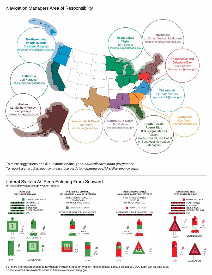
Lateral System As Seen Entering From Seaward on navigable waters except Western Rivers
PORT SIDE
ODD NUMBERED AIDS
GREEN LIGHT ONLY
FLASHING (2)
PREFERRED CHANNEL
NO NUMBERS – MAY BE LETTERED
PREFERRED CHANNEL TO
STARBOARD
TOPMOST BAND GREEN
PREFERRED CHANNEL
NO NUMBERS – MAY BE LETTERED
PREFERRED CHANNEL
TO PORT
TOPMOST BAND RED
STARBOARD SIDE
EVEN NUMBERED AIDS
RED LIGHT ONLY
FLASHING (2)
FLASHING FLASHING
OCCULTING GREEN LIGHT ONLY RED LIGHT ONLY OCCULTING QUICK FLASHING QUICK FLASHING
ISO COMPOSITE GROUP FLASHING (2+1) COMPOSITE GROUP FLASHING (2+1) ISO
"1"
Fl G 6s
G "9"
Fl G 4s
GR "A"
Fl (2+1) G 6s
RG "B"
Fl (2+1) R 6s
"2"
Fl R 6s
8
R "8"
Fl R 4s
LIGHT
G
C "1"
LIGHTED BUOY
G
"5"
GR
"U"
GR
C "S"
RG
N "C"
RG
"G"
LIGHT
6
R
N "6"
LIGHTED BUOY
R
"2
"
CAN DAYBEACON
CAN NUN NUN
DAYBEACON
For more information on aids to navigation, including those on Western Rivers, please consult the latest USCG Light List for your area.
These volumes are available online at http://www.navcen.uscg.gov
Navigation Managers Area of Responsibility
Northeast
Lt. Meghan McGovern
Northwest and
Pacific Islands
Crescent Moegling
Great Lakes Region
Tom Loeper
Chesapeake and
Delaware Bay
Steve Soherr
California
Jeff Ferguson
[email protected] Mid-Atlantic
Lt. Ryan Wartick
Alaska
Lt. Timothy M. Smith
Western Gulf Coast
Alan Bunn
Central Gulf Coast
Tim Osborn
[email protected] South Florida
Puerto Rico
U.S. Virgin Islands
Michael Henderson
Southeast
Kyle Ward
2
2 C U 5
1
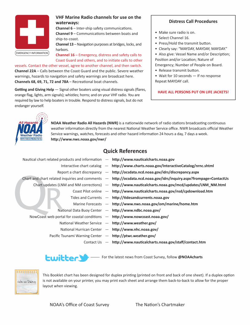
VHF Marine Radio channels for use on the waterways:Channel 6 – Inter-ship safety communications.Channel 9 – Communications between boats and ship-to-coast.Channel 13 – Navigation purposes at bridges, locks, and harbors.Channel 16 – Emergency, distress and safety calls to Coast Guard and others, and to initiate calls to other
vessels. Contact the other vessel, agree to another channel, and then switch.Channel 22A – Calls between the Coast Guard and the public. Severe weather warnings, hazards to navigation and safety warnings are broadcast here.Channels 68, 69, 71, 72 and 78A – Recreational boat channels.
Getting and Giving Help — Signal other boaters using visual distress signals (flares, orange flag, lights, arm signals); whistles; horns; and on your VHF radio. You are required by law to help boaters in trouble. Respond to distress signals, but do not endanger yourself.
EMERGENCY INFORMATION
Distress Call Procedures
• Make sure radio is on.• Select Channel 16.• Press/Hold the transmit button.• Clearly say: “MAYDAY, MAYDAY, MAYDAY.”• Also give: Vessel Name and/or Description;Position and/or Location; Nature of Emergency; Number of People on Board.• Release transmit button.• Wait for 10 seconds — If no responseRepeat MAYDAY call.
HAVE ALL PERSONS PUT ON LIFE JACKETS!
This Booklet chart has been designed for duplex printing (printed on front and back of one sheet). If a duplex option is not available on your printer, you may print each sheet and arrange them back-to-back to allow for the proper layout when viewing.
QR
Quick ReferencesNautical chart related products and information - http://www.nauticalcharts.noaa.gov
Interactive chart catalog - http://www.charts.noaa.gov/InteractiveCatalog/nrnc.shtmlReport a chart discrepancy - http://ocsdata.ncd.noaa.gov/idrs/discrepancy.aspx
Chart and chart related inquiries and comments - http://ocsdata.ncd.noaa.gov/idrs/inquiry.aspx?frompage=ContactUs
Chart updates (LNM and NM corrections) - http://www.nauticalcharts.noaa.gov/mcd/updates/LNM_NM.html
Coast Pilot online - http://www.nauticalcharts.noaa.gov/nsd/cpdownload.htm
Tides and Currents - http://tidesandcurrents.noaa.gov
Marine Forecasts - http://www.nws.noaa.gov/om/marine/home.htm
National Data Buoy Center - http://www.ndbc.noaa.gov/
NowCoast web portal for coastal conditions - http://www.nowcoast.noaa.gov/
National Weather Service - http://www.weather.gov/
National Hurrican Center - http://www.nhc.noaa.gov/
Pacific Tsunami Warning Center - http://ptwc.weather.gov/
Contact Us - http://www.nauticalcharts.noaa.gov/staff/contact.htm
NOAA’s Office of Coast Survey The Nation’s Chartmaker
For the latest news from Coast Survey, follow @NOAAcharts
NOAA Weather Radio All Hazards (NWR) is a nationwide network of radio stations broadcasting continuous weather information directly from the nearest National Weather Service office. NWR broadcasts official Weather Service warnings, watches, forecasts and other hazard information 24 hours a day, 7 days a week. http://www.nws.noaa.gov/nwr/


![The Hartford republican. (Hartford, KY) 1903-03-06 [p ].](https://static.fdocuments.us/doc/165x107/61a0afc1d05d2f067c3828b5/the-hartford-republican-hartford-ky-1903-03-06-p-.jpg)