WRA DelDOT WL Presentation
71
-
Upload
andrew-der -
Category
Documents
-
view
61 -
download
1
Transcript of WRA DelDOT WL Presentation
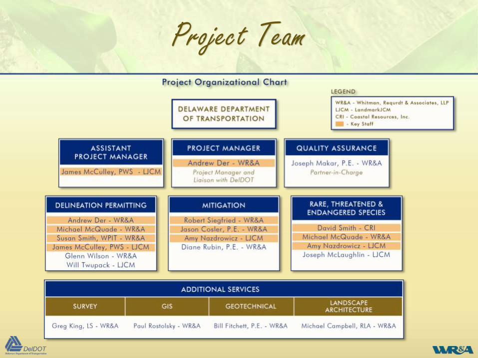
Project Team
• Experienced staff – 5 key staff with over 25 years and 2 with
10 years in delineation, permitting, mitigation
• All have DelDOT experience - know current regulatory
climate, jurisdictional and RTE criteria and stream restoration
• Staff serve on industry and stakeholder committees in
forefront of regulatory wetland developments
• Team knows the ramifications of recent court rulings and
federal delineation manual supplements
• Project Manager can offer insights of 17 years of experience
with MDE (DNREC sister agency) working with transportation
agencies as well 10 years on the private sector
Project Team
Project Team
Immediate Extension of DelDOT Staff
• Over 50 Environmental Scientists
• Multiple assignment capability and ability
to meet schedules
• Local staff located within 2 hours of
DelDOT
• Continuity and commitment of staff -
WR&A has a proven track record of staff
commitment
Project Team
Key Staff
Andrew Der – Project Manager, WRA• Director of Environmental Services, 28 years experience in water resources
• 17 years with MDE culminating as Regional Chief in Wetlands Program
• Expertise in wetland and water quality regulation and permitting
• Serves on regional public and industry advisory committees - keeps current
James McCulley, PWS – Assistant Project Manager, LandmarkJCM
• Principal and Professional Wetlands Scientist, 26 years experience including DelDOT work
• National Academy of Sciences Wetland Characterization Committee
• Serves on regional public and industry advisory committees - keeps current
Robert Siegfried – Mitigation and Restoration Manager, WR&A• Restoration Specialist, 25 years of experience including DelDOT work, 10 years
experience in wetland and stream design and innovative stormwater management
• Stream assessment and restoration
• Designed over 15,000 l. f. of stream restoration, over 100 acres of wetland mitigation
Key Staff
Key Staff
Jason Cosler – Vice President, WR&A
• Senior Engineer, 25 years experience, 5 with DelDOT work
• Stormwater management, hydrology and hydraulics, and erosion and sediment control
• Stream stability, culvert and bridge design, scour analysis
• Stream assessment and restoration per Rosgen methodologies
Michael McQuade – Senior Environmental Scientist, WR&A
• 10 years of Experience, 5 with Delaware work
• Wetland delineation and permitting, RTE species surveys
• Botany and forestry, Certified Arborist
Susan Smith – Senior Environmental Scientist, WR&A
• 25 years of experience, 5 with DelDOT work
• Wetland delineation and permitting, RTE species surveys
• NEPA specialist
Key Staff
Key Staff
Amy Nazdrowicz – Environmental Scientist, LandmarkJCM
• 9 years of Experience including DelDOT work
• Wetland delineation, impact permitting, mitigation, habitat
assessment, and hydrologic studies
• RTE species surveys, published author on mitigation
David Smith, PWS – Senior Environmental Scientist, Coastal
Resources, Inc.
• Committed to DBE goals
• 24 years experience including DelDOT work
• Wetland delineation and mitigation, RTE species surveys, Bog
Turtle qualified surveyor
Key Staff
Services
Services that May Be Required under this Contract
• Wetland, habitat, RTE evaluations and other potential environmental studies
• Permit application preparation and submission; federal, state and local agency
coordination
• Development of mitigation proposals, design plans for wetland creation, restoration or
enhancement, site selection pre-construction monitoring
• Design plans for stream restoration and stabilization and evaluation of bioengineering
techniques
• Development of monitoring plans, site monitoring and preparation of monitoring reports
• Development of invasive plant species eradication plans
• Construction consultation and preparation of construction contracts including
specifications and cost estimates suitable for competitive public bidding
• Survey
• Coordination with other DelDOT Divisions
• Public Involvement
Services
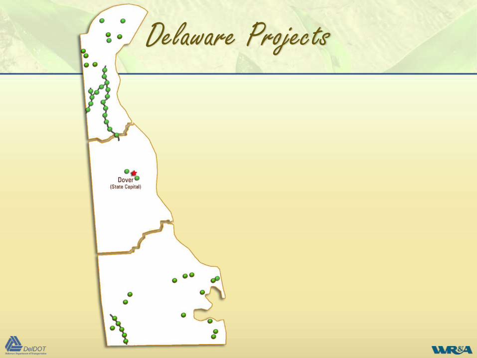
Delaware Projects
• Project team familiar with all
regions and characteristics of
Delaware
• Worked on small to major projects
• Expertise in simple to complex
environmental permitting
Delaware Projects
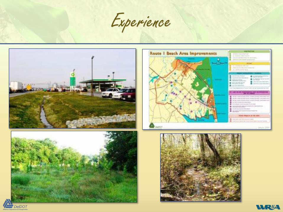
Experience
• Rt. 113 – DEISs and EAs, agency coordination, wetlands and RTE species (Swamp Pink) investigations, highway design, GIS mapping to identify NEPA and Section 404 issues regarding highway location.
• I-95 Toll Plaza Improvements – CE, evaluate impacts to wetlands and subaqueous lands, mitigation, permits, environmental compliance plans per DelDOT and DNREC standards.
• SR 7, Newtown Road to SR 273 – wetland delineation, evaluate impacts to wetlands and subaqueous lands, permits, mitigation, environmental compliance plans per DelDOT and DNREC standards.
• City of Dover Garrison Oak Force Main & Pump Station - wetland delineation within 4,200 linear foot study area, evaluate impacts to wetlands and subaqueous lands, mitigation, permits.
• SR 41 Lancaster Pike, Hockessin Road Safety Project – wetland delineation for 1-mile roadway widening project study area, permitting, mitigation, environmental compliance plans per DelDOT and DNREC standards, stream bank stabilization.
Experience
Experience
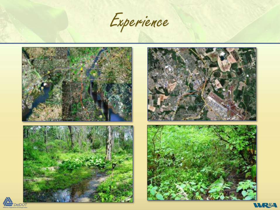
LJCM
• DelDOT Rt 1, Scott Run to Smyrna, New Castle & Kent County
• Wetland delineations, impact permitting, creation, restoration
• Rare species and habitat studies
• Agency coordination
CRI
• DelDOT Agreement 1414 highway projects, New Castle County
• Phase 1 bog turtle habitat assessment
• Wetlands assessments
• Agency coordination
Experience
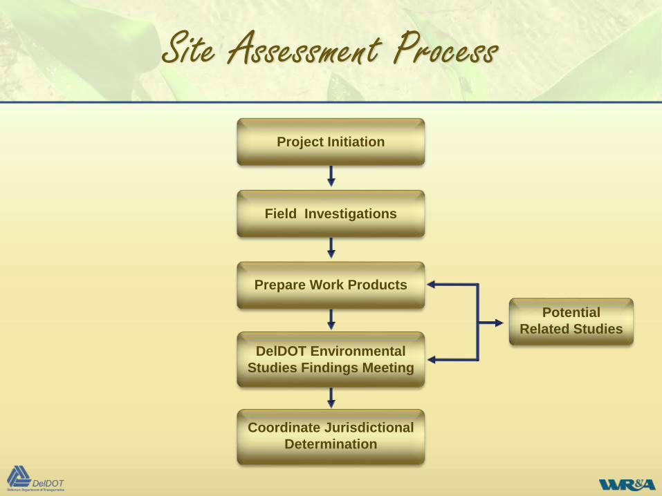
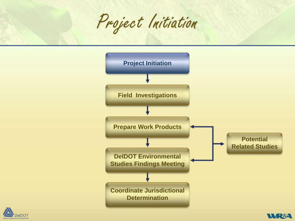
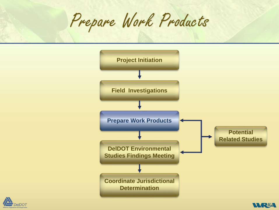
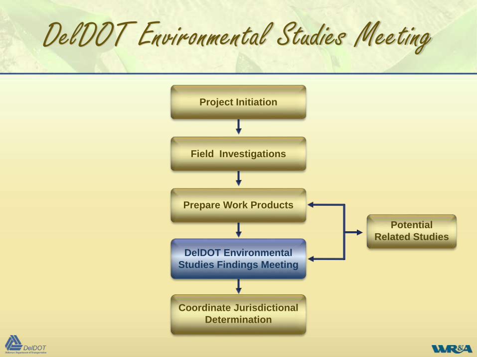
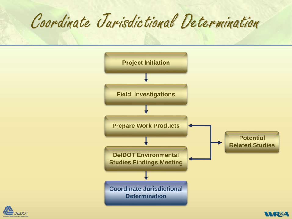
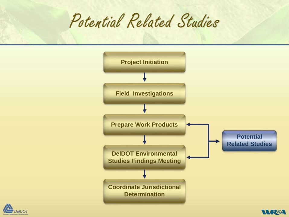
Site Assessment Process
DelDOT Environmental
Studies Findings Meeting
Coordinate Jurisdictional
Determination
Project Initiation
Field Investigations
Prepare Work Products
Potential
Related Studies
Site Assessment Process
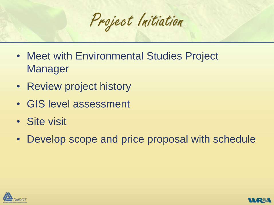
Project Initiation
• Meet with Environmental Studies Project
Manager
• Review project history
• GIS level assessment
• Site visit
• Develop scope and price proposal with schedule
DelDOT Environmental
Studies Findings Meeting
Coordinate Jurisdictional
Determination
Project Initiation
Field Investigations
Prepare Work Products
Potential
Related Studies
Project Initiation
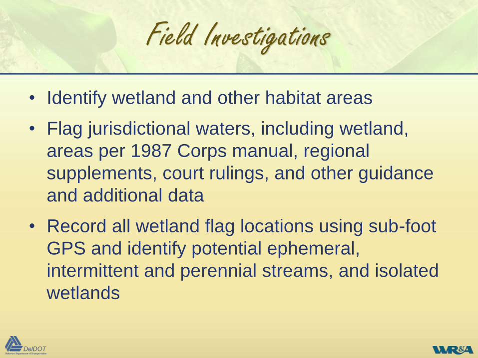
Field Investigations
• Identify wetland and other habitat areas
• Flag jurisdictional waters, including wetland,
areas per 1987 Corps manual, regional
supplements, court rulings, and other guidance
and additional data
• Record all wetland flag locations using sub-foot
GPS and identify potential ephemeral,
intermittent and perennial streams, and isolated
wetlands
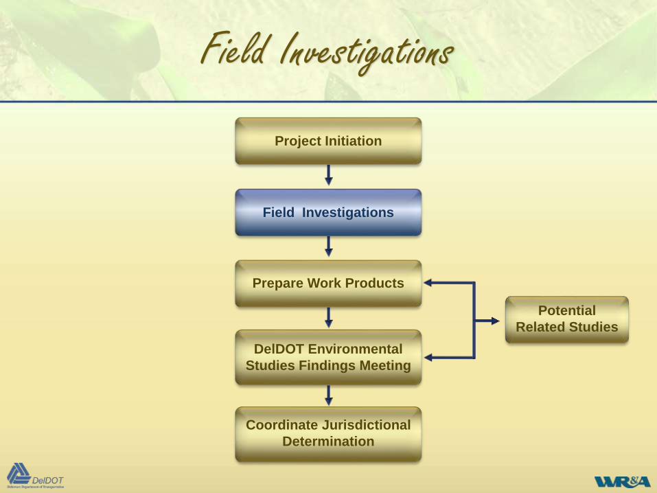
DelDOT Environmental
Studies Findings Meeting
Coordinate Jurisdictional
Determination
Project Initiation
Field Investigations
Prepare Work Products
Potential
Related Studies
Field Investigations
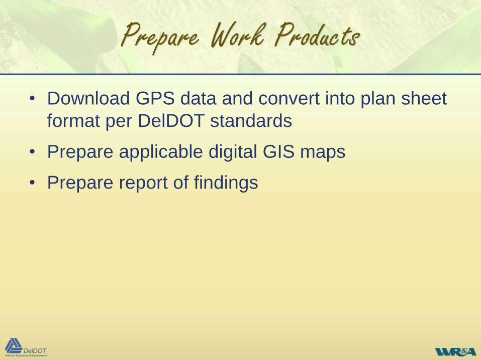
Prepare Work Products
• Download GPS data and convert into plan sheet
format per DelDOT standards
• Prepare applicable digital GIS maps
• Prepare report of findings
Prepare Work Products
DelDOT Environmental
Studies Findings Meeting
Coordinate Jurisdictional
Determination
Project Initiation
Field Investigations
Prepare Work Products
Potential
Related Studies
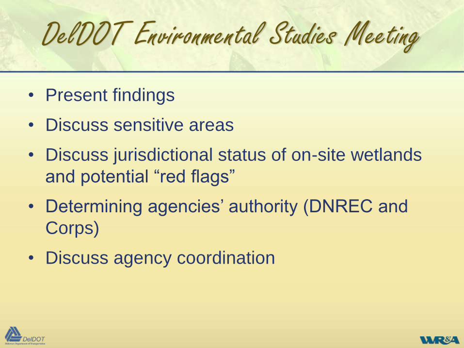
DelDOT Environmental Studies Meeting
• Present findings
• Discuss sensitive areas
• Discuss jurisdictional status of on-site wetlands
and potential “red flags”
• Determining agencies’ authority (DNREC and
Corps)
• Discuss agency coordination
DelDOT Environmental Studies Meeting
DelDOT Environmental
Studies Findings Meeting
Coordinate Jurisdictional
Determination
Project Initiation
Field Investigations
Prepare Work Products
Potential
Related Studies
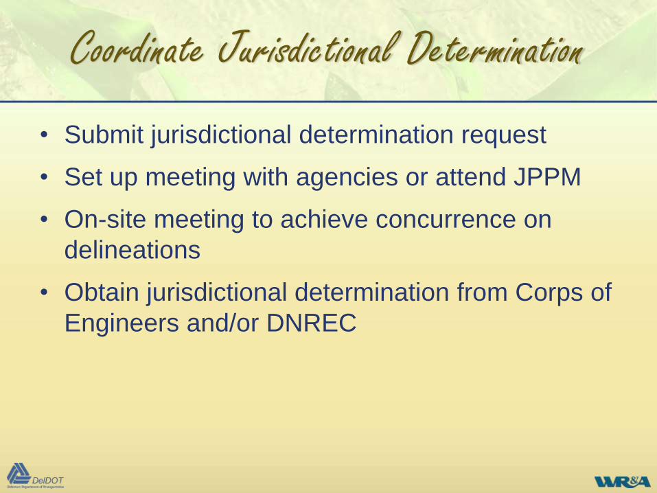
Coordinate Jurisdictional Determination
• Submit jurisdictional determination request
• Set up meeting with agencies or attend JPPM
• On-site meeting to achieve concurrence on
delineations
• Obtain jurisdictional determination from Corps of
Engineers and/or DNREC
Coordinate Jurisdictional Determination
DelDOT Environmental
Studies Findings Meeting
Coordinate Jurisdictional
Determination
Project Initiation
Field Investigations
Prepare Work Products
Potential
Related Studies
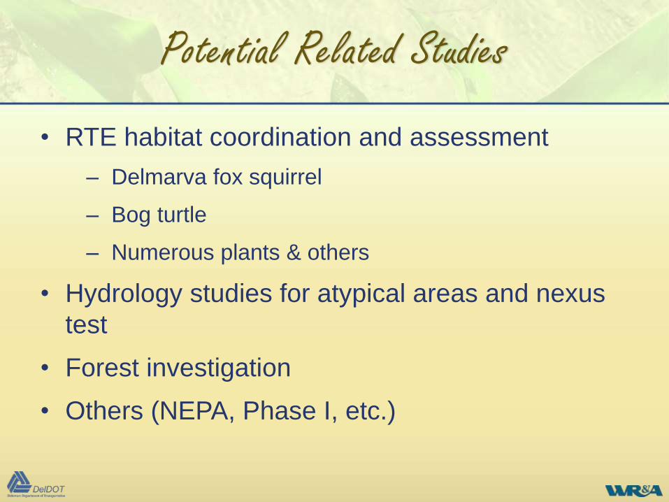
Potential Related Studies
• RTE habitat coordination and assessment
– Delmarva fox squirrel
– Bog turtle
– Numerous plants & others
• Hydrology studies for atypical areas and nexus
test
• Forest investigation
• Others (NEPA, Phase I, etc.)
Potential Related Studies
DelDOT Environmental
Studies Findings Meeting
Coordinate Jurisdictional
Determination
Project Initiation
Field Investigations
Prepare Work Products
Potential
Related Studies
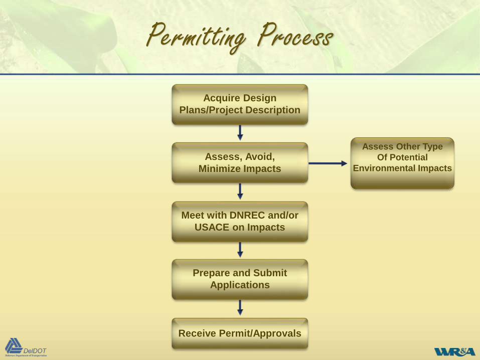
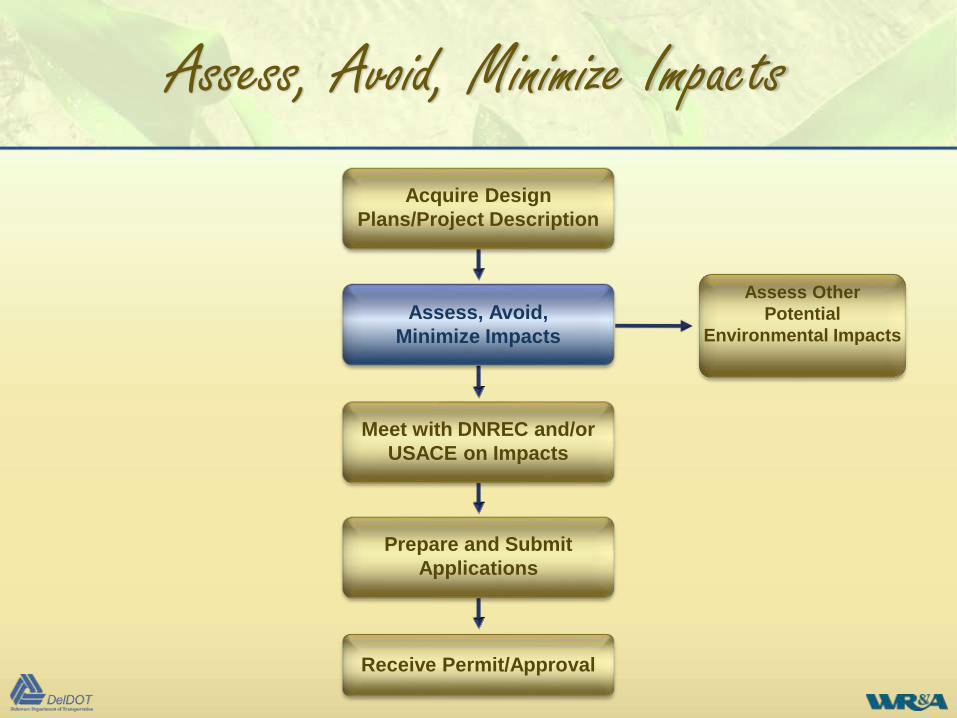
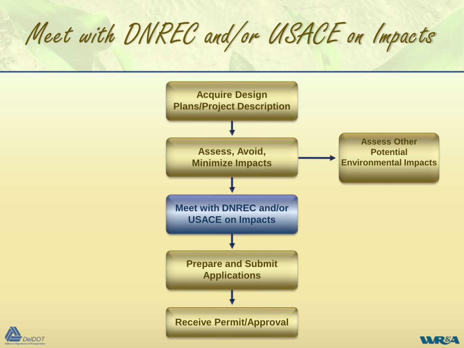
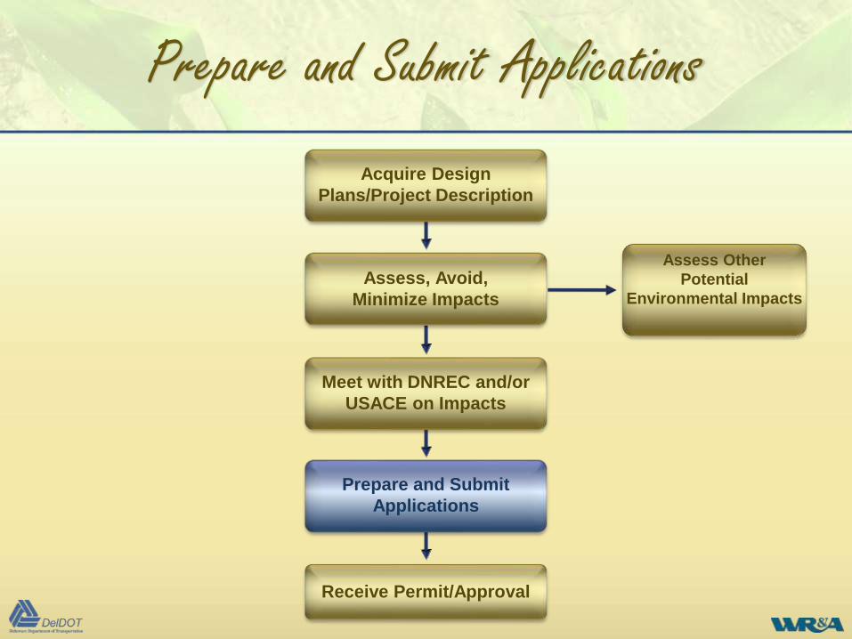
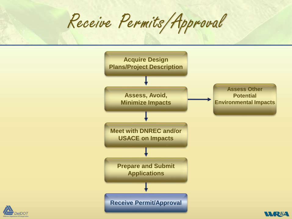
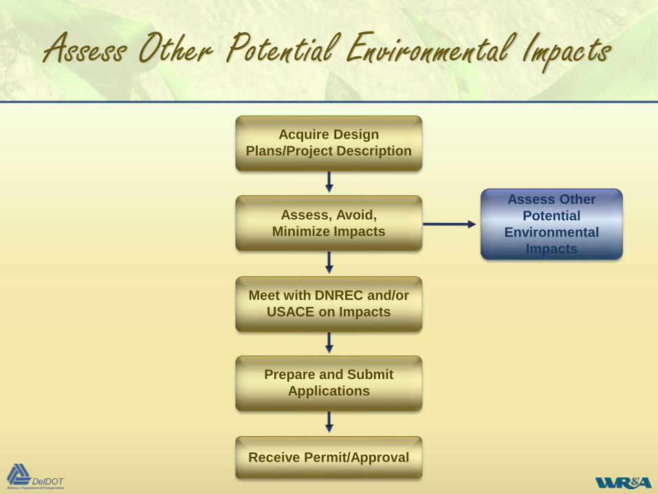
Permitting Process
Prepare and Submit
Applications
Receive Permit/Approvals
Acquire Design
Plans/Project Description
Assess, Avoid,
Minimize Impacts
Meet with DNREC and/or
USACE on Impacts
Assess Other Type
Of Potential
Environmental Impacts
Permitting Process
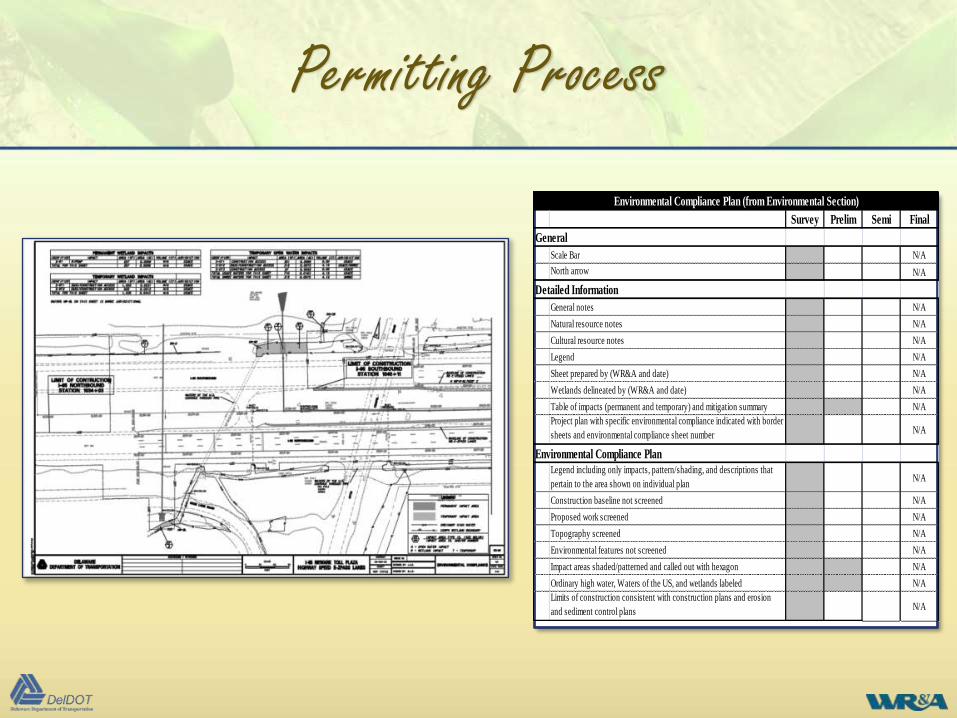
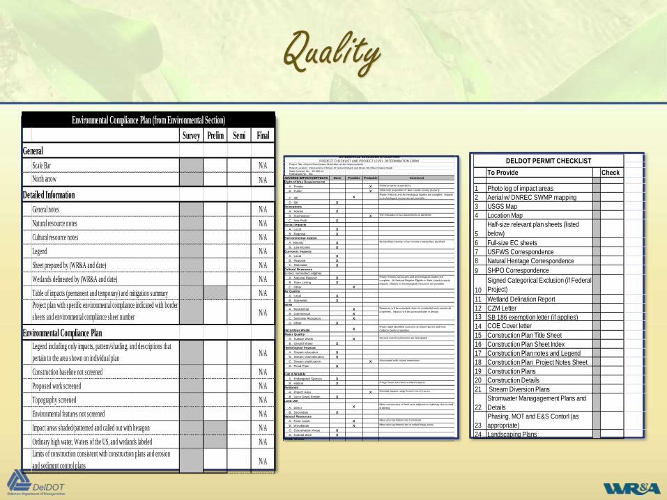
Environmental Compliance Plan (from Environmental Section)
Survey Prelim Semi Final
General
Scale Bar N/A
North arrow N/A
Detailed Information
General notes N/A
Natural resource notes N/A
Cultural resource notes N/A
Legend N/A
Sheet prepared by (WR&A and date) N/A
Wetlands delineated by (WR&A and date) N/A
Table of impacts (permanent and temporary) and mitigation summary N/A
Project plan with specific environmental compliance indicated with border
sheets and environmental compliance sheet numberN/A
Environmental Compliance Plan
Legend including only impacts, pattern/shading, and descriptions that
pertain to the area shown on individual planN/A
Construction baseline not screened N/A
Proposed work screened N/A
Topography screened N/A
Environmental features not screened N/A
Impact areas shaded/patterned and called out with hexagon N/A
Ordinary high water, Waters of the US, and wetlands labeled N/A
Limits of construction consistent with construction plans and erosion
and sediment control plansN/A
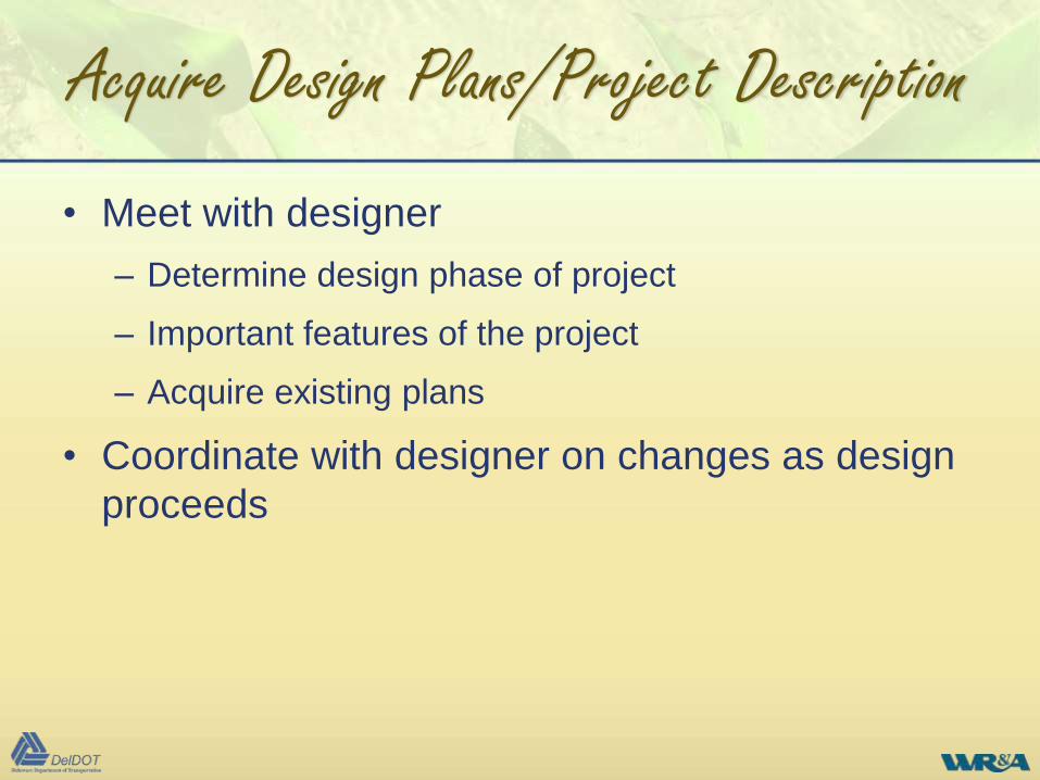
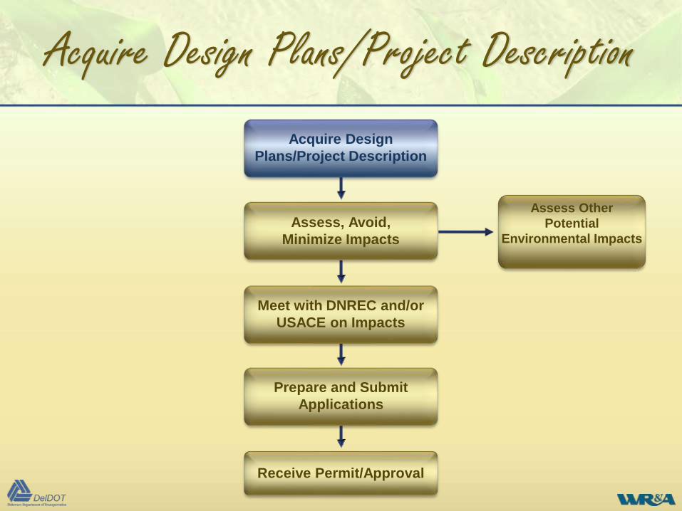
Acquire Design Plans/Project Description
• Meet with designer
– Determine design phase of project
– Important features of the project
– Acquire existing plans
• Coordinate with designer on changes as design
proceeds
Prepare and Submit
Applications
Receive Permit/Approval
Acquire Design
Plans/Project Description
Assess, Avoid,
Minimize Impacts
Meet with DNREC and/or
USACE on Impacts
Assess Other
Potential
Environmental Impacts
Acquire Design Plans/Project Description
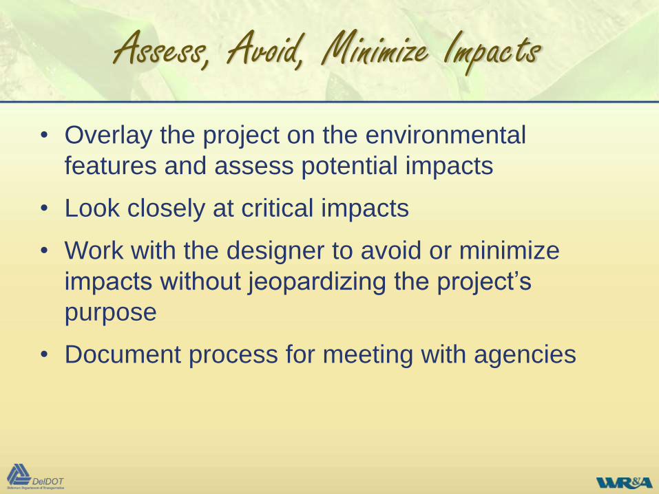
Assess, Avoid, Minimize Impacts
• Overlay the project on the environmental
features and assess potential impacts
• Look closely at critical impacts
• Work with the designer to avoid or minimize
impacts without jeopardizing the project’s
purpose
• Document process for meeting with agencies
Prepare and Submit
Applications
Receive Permit/Approval
Acquire Design
Plans/Project Description
Assess, Avoid,
Minimize Impacts
Meet with DNREC and/or
USACE on Impacts
Assess Other
Potential
Environmental Impacts
Assess, Avoid, Minimize Impacts
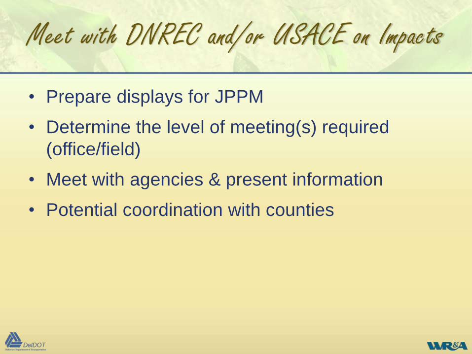
Meet with DNREC and/or USACE on Impacts
• Prepare displays for JPPM
• Determine the level of meeting(s) required
(office/field)
• Meet with agencies & present information
• Potential coordination with counties
Prepare and Submit
Applications
Receive Permit/Approval
Acquire Design
Plans/Project Description
Assess, Avoid,
Minimize Impacts
Meet with DNREC and/or
USACE on Impacts
Assess Other
Potential
Environmental Impacts
Meet with DNREC and/or USACE on Impacts
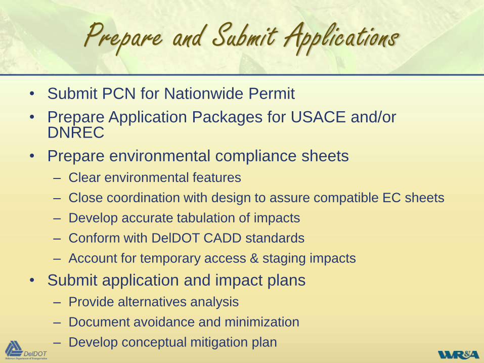
Prepare and Submit Applications
• Submit PCN for Nationwide Permit
• Prepare Application Packages for USACE and/or DNREC
• Prepare environmental compliance sheets
– Clear environmental features
– Close coordination with design to assure compatible EC sheets
– Develop accurate tabulation of impacts
– Conform with DelDOT CADD standards
– Account for temporary access & staging impacts
• Submit application and impact plans
– Provide alternatives analysis
– Document avoidance and minimization
– Develop conceptual mitigation plan
Prepare and Submit Applications
Prepare and Submit
Applications
Receive Permit/Approval
Acquire Design
Plans/Project Description
Assess, Avoid,
Minimize Impacts
Meet with DNREC and/or
USACE on Impacts
Assess Other
Potential
Environmental Impacts
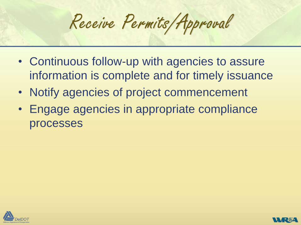
Receive Permits/Approval
• Continuous follow-up with agencies to assure
information is complete and for timely issuance
• Notify agencies of project commencement
• Engage agencies in appropriate compliance
processes
Receive Permits/Approval
Prepare and Submit
Applications
Receive Permit/Approval
Acquire Design
Plans/Project Description
Assess, Avoid,
Minimize Impacts
Meet with DNREC and/or
USACE on Impacts
Assess Other
Potential
Environmental Impacts
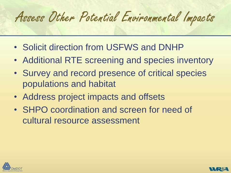
Assess Other Potential Environmental Impacts
• Solicit direction from USFWS and DNHP
• Additional RTE screening and species inventory
• Survey and record presence of critical species
populations and habitat
• Address project impacts and offsets
• SHPO coordination and screen for need of
cultural resource assessment
Prepare and Submit
Applications
Receive Permit/Approval
Acquire Design
Plans/Project Description
Assess, Avoid,
Minimize Impacts
Meet with DNREC and/or
USACE on Impacts
Assess Other
Potential
Environmental
Impacts
Assess Other Potential Environmental Impacts
Opportunities for Streamlining
Each project’s degree of impact and resource
sensitivity can vary, offering opportunities for
efficiency
• Combine concurrent field assessment and project impact
comment processes
• Utilize and re-purpose previous assessment studies or permitting
work products in project area by others
• Evaluate project design for refinements to avoid impacts and
maximize use of Nationwide Permits
• Maximize other contemporary on-site mitigation and offset
strategies: enhancement of degraded areas, vegetative
restoration, re-establishing fish passage, and urban stormwater
retrofit opportunities to reduce customary mitigation and permitting
burdens
Opportunities for Streamlining
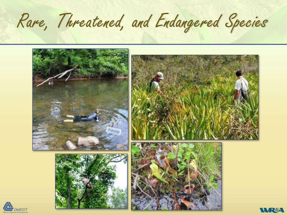
Rare, Threatened, and Endangered Species
• All team scientists thoroughly experienced in
species identification
• Plants and animals
• Upland/wetland
• Insects, mammals, reptiles
• Timing of assessments
Rare, Threatened, and Endangered Species
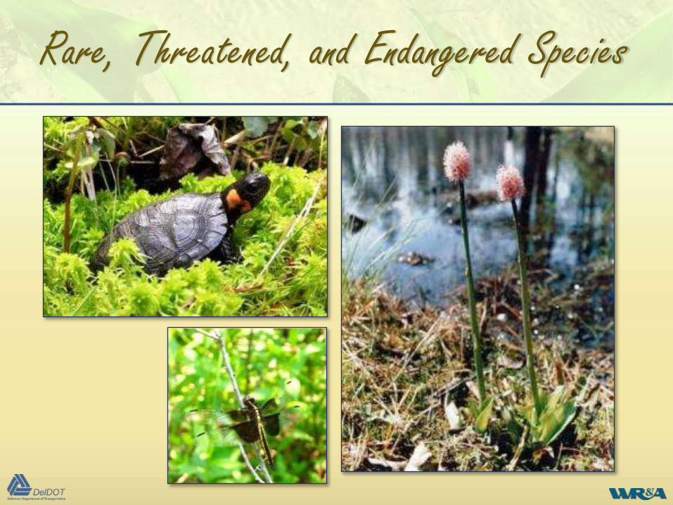
Rare, Threatened, and Endangered Species
• Pre-application coordination with wildlife
agencies
• Waters and wetlands evaluation suited to
potential species habitat
• Findings documented and presence located
• Potential issues coordinated with agencies
Rare, Threatened, and Endangered Species
Wetland Mitigation
• Select sites based on landscape position to
maximize success and minimize costs
– Target historically drained or modified wetlands
– Minimize excavation
– Proximity to multiple sources of hydrology
• Example projects
– Restored agriculturally drained Delmarva Bay
– Created 5 acre tidal wetland with minimal excavation
Ridgely
Rt 33 Tidal Wetlands
Wetland Mitigation
Wetland Mitigation
• Use reference wetlands to optimize site design
– Selecting plant community and species
– Identify appropriate hydrology
– Prepare appropriate soil conditions
• Leading cause of wetland failure is soil compaction
– Use low ground pressure equipment
– Minimize use of equipment on final grade
– Rip and disk soils post-final grade
– Add organic matter to decrease bulk density, increase moisture
retention, and increase hydric soil development
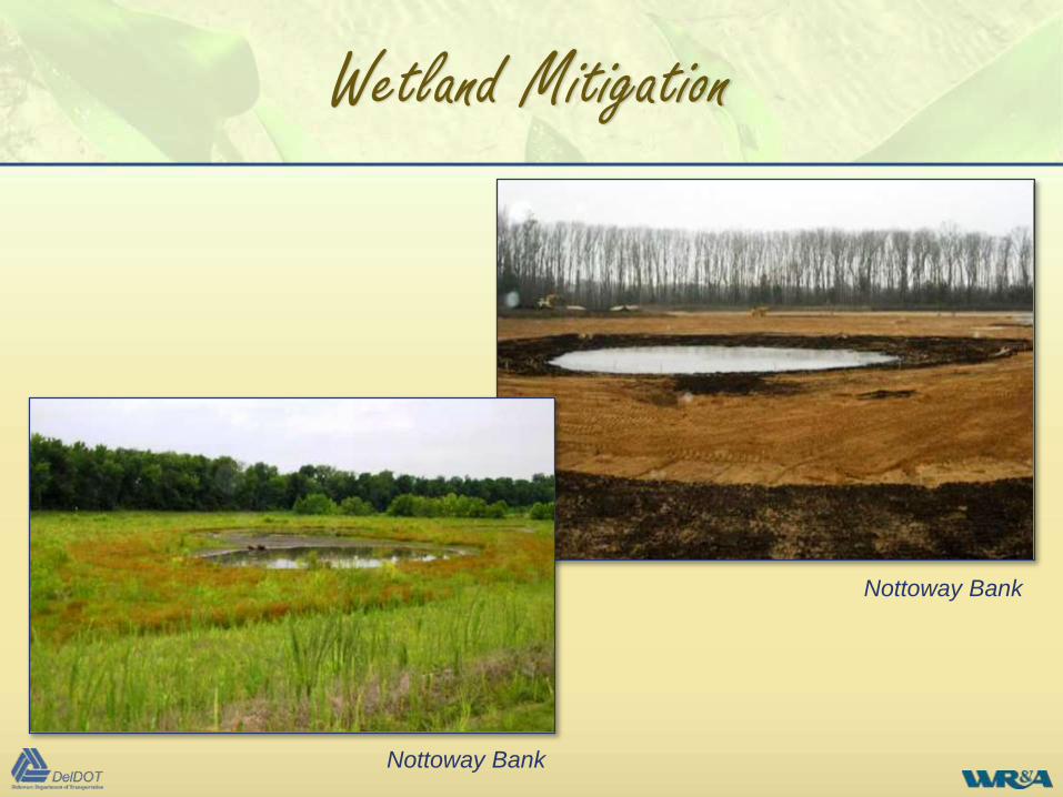
Nottoway Bank
Nottoway Bank
Wetland Mitigation
Stream Mitigation
• Use reference systems to identify appropriate
habitat and geomorphic structures
– Use constructed riffles for most coastal and piedmont streams
– Large woody debris for habitat enhancement in pools
• Restore geomorphic and ecological processes to
maximize success
– Fish passage
– Nutrient retention & reduction
– Reconnect floodplain & wetlands to stream
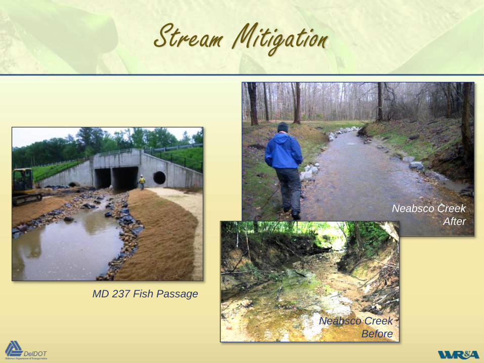
MD 237 Fish Passage
Stream Mitigation
Neabsco Creek
After
Neabsco Creek
Before
Mitigation Construction
Keys to successful mitigation/restoration construction
• Experienced restoration contractors
• Specialized construction equipment
• Designer on-site during construction
• Anticipate changes to the design
• Expect weather related issues
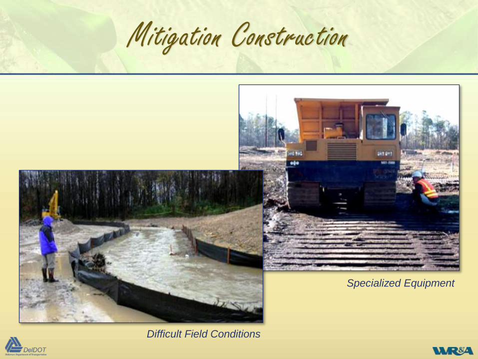
Specialized Equipment
Difficult Field Conditions
Mitigation Construction
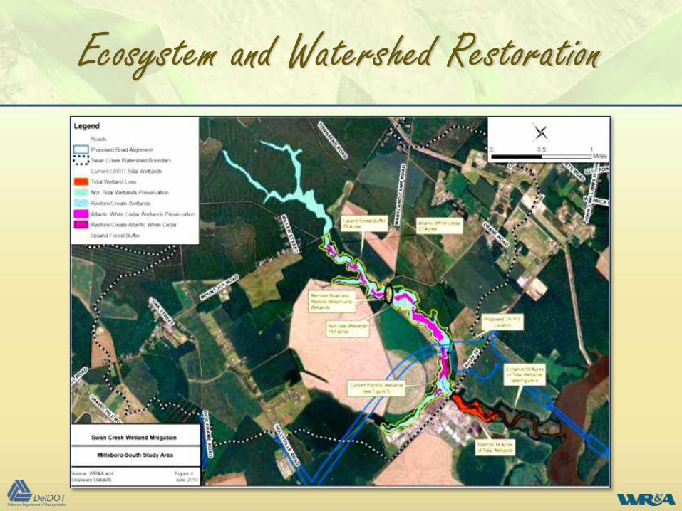
Ecosystem and Watershed Restoration
• Move toward ecosystem and watershed
restoration
– Focus on system scale instead of reach scale
– Combine wetlands, streams, buffers, stormwater
management, and other requirements into
comprehensive solutions
– Contribute to NPDES water quality, TMDL, and
watershed restoration goals
Ecosystem and Watershed Restoration
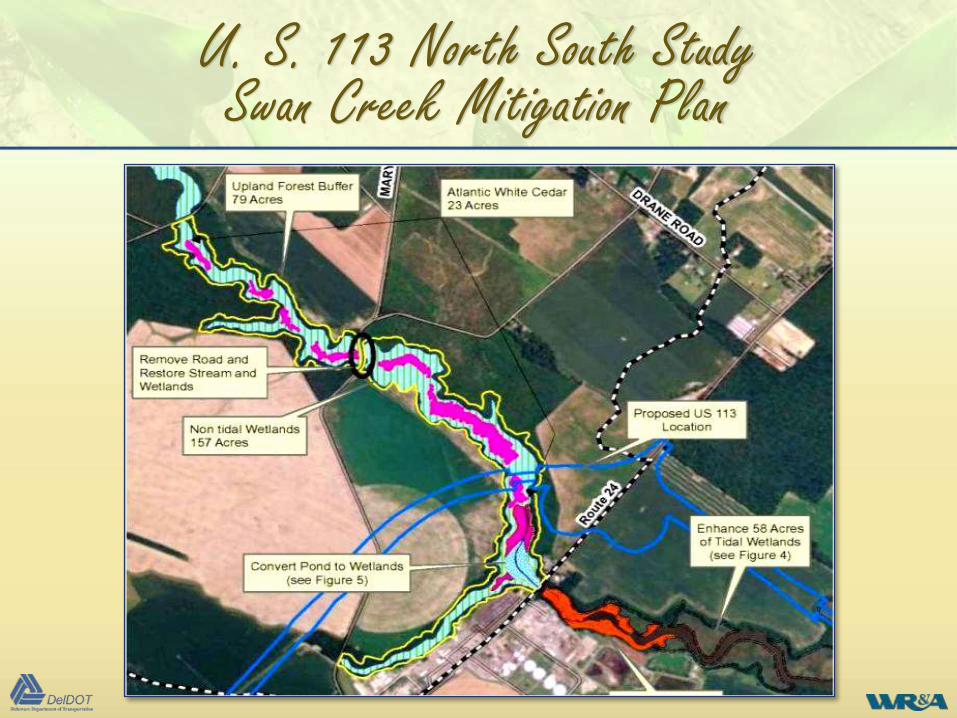
U. S. 113 North South StudySwan Creek Mitigation Plan
• Restore, enhance and preserve Swan Creek
Stream Valley
– Remove fish barriers
– Restore 14 acres of tidal wetlands
– Enhance 58 acres of tidal wetlands
– Create 7 acres of tidal wetlands
– Create 8 acres Atlantic White Cedar Wetlands
– Preserve 157 acres of forested wetlands, including
23 acres of AWC wetlands
– Preserve 79 acres of upland buffers
U. S. 113 North South StudySwan Creek Mitigation Plan
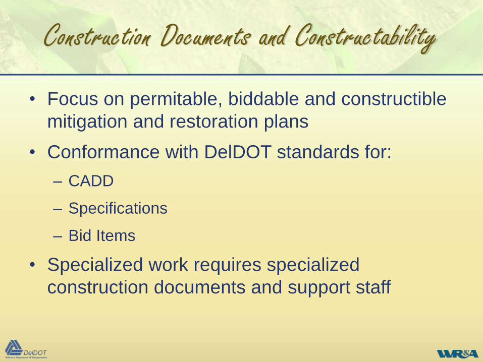
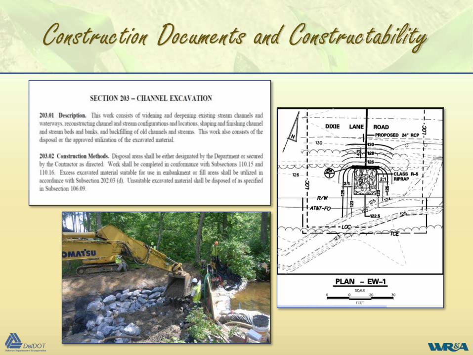
Construction Documents and Constructability
• Focus on permitable, biddable and constructible
mitigation and restoration plans
• Conformance with DelDOT standards for:
– CADD
– Specifications
– Bid Items
• Specialized work requires specialized
construction documents and support staff
Construction Documents and Constructability
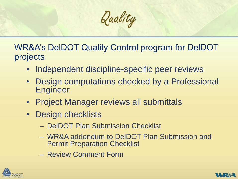
Quality
WR&A’s DelDOT Quality Control program for DelDOT projects
• Independent discipline-specific peer reviews
• Design computations checked by a Professional Engineer
• Project Manager reviews all submittals
• Design checklists
– DelDOT Plan Submission Checklist
– WR&A addendum to DelDOT Plan Submission and Permit Preparation Checklist
– Review Comment Form
Environmental Compliance Plan (from Environmental Section)
Survey Prelim Semi Final
General
Scale Bar N/A
North arrow N/A
Detailed Information
General notes N/A
Natural resource notes N/A
Cultural resource notes N/A
Legend N/A
Sheet prepared by (WR&A and date) N/A
Wetlands delineated by (WR&A and date) N/A
Table of impacts (permanent and temporary) and mitigation summary N/A
Project plan with specific environmental compliance indicated with border
sheets and environmental compliance sheet numberN/A
Environmental Compliance Plan
Legend including only impacts, pattern/shading, and descriptions that
pertain to the area shown on individual planN/A
Construction baseline not screened N/A
Proposed work screened N/A
Topography screened N/A
Environmental features not screened N/A
Impact areas shaded/patterned and called out with hexagon N/A
Ordinary high water, Waters of the US, and wetlands labeled N/A
Limits of construction consistent with construction plans and erosion
and sediment control plansN/A
Project Title: Airport/Churchmans Road Intersection Improvements
Project Location: Intersection of Route 37 (Airport Road) and Route 58 (Churchmans Road)
State Contract No.: 99-002-01 Federal Aid No.: N/A
ADVERSE IMPACTS/EFFECTS None Possible Probable Comment
Right-of-Way Requirements
A. Private X Partial property acquisitions.
B. Public X Small strip acquisition of New Castle County property.
C. 4(f) XPhase I Historic and Archeological studies are complete. Impacts
to archeological resources are possible.
D. 6(f) X
Relocations
A. Homes X
B. Businesses X The relocation of tw o businesses is identif ied.
C. Non-Profit X
Social Impacts
A. Local X
B. Regional X
Environmental Justice
A. Minority X
B. Low-Income XEconomic Impacts
A. Local X
B. Regional X
C. Statewide X
Cultural Resources
(Listed, nominated, eligible)
A. National Register X
B. State Listing X
C. Other XAir Quality
A. Local X
B. Statewide X
Noise
A. Residential X
B. Commercial X
C. Sensitive Receptors X
D. Other X
Hazardous Waste XPhase I ESA identif ied concerns at Airport Exxon and Auto
Collision Center properties
Water Quality
A. Surface Water X Several culvert extensions are anticipated
B. Ground Water X
Hydrological Impacts
A. Stream relocation X
B. Stream channelization X
C. Stream stabilization X Associated w ith culvert extensions
D. Flood Plain X
Fish & Wildlife
A. Endangered Species X
B. Habitat X Fringe forest and minor w etland impacts
Wetlands
A. Project Area X Potential impacts range from 0.1 to 0.3 acres
B. Up or Down Stream X
Land Use
A. Direct XMinor conversions of land uses adjacent to roadw ay due to road
w idening
B. Secondary X
Natural Resources
A. Farm Lands X Minor encroachments into farm lands
B. Woodlands X Minor encroachments into w ooded fringe areas
C. Conservation Areas X
D. Coastal Zone X
Modal Choice
CATEGORICAL EXCLUSION EVALUATION
PROJECT CHECKLIST AND PROJECT LEVEL DETERMINATION FORM
No identif ied minority or low income communities identif ied
Phase I historic structures and archeological studies are
complete. No National Register Eligible or State Listed property
impacts. Impacts to archeological resources are possible.
Roadw ay w ill be extended closer to residential and commercial
properties. Impacts w ill be assessed later in design.
To Provide Check
1 Photo log of impact areas
2 Aerial w/ DNREC SWMP mapping
3 USGS Map
4 Location Map
5
Half-size relevant plan sheets (listed
below)
6 Full-size EC sheets
7 USFWS Correspondence
8 Natural Heritage Correspondence
9 SHPO Correspondence
10
Signed Categorical Exclusion (if Federal
Project)
11 Wetland Delination Report
12 CZM Letter
13 SB 186 exemption letter (if applies)
14 COE Cover letter
15 Construction Plan Title Sheet
16 Construction Plan Sheet Index
17 Construction Plan notes and Legend
18 Construction Plan Project Notes Sheet
19 Construction Plans
20 Construction Details
21 Stream Diversion Plans
22
Stromwater Managagement Plans and
Details
23
Phasing, MOT and E&S Contorl (as
appropriate)
24 Landscaping Plans
DELDOT PERMIT CHECKLIST
Quality

Questions
and
Answers