What does radar measure? - Keck Institute for Space...
30
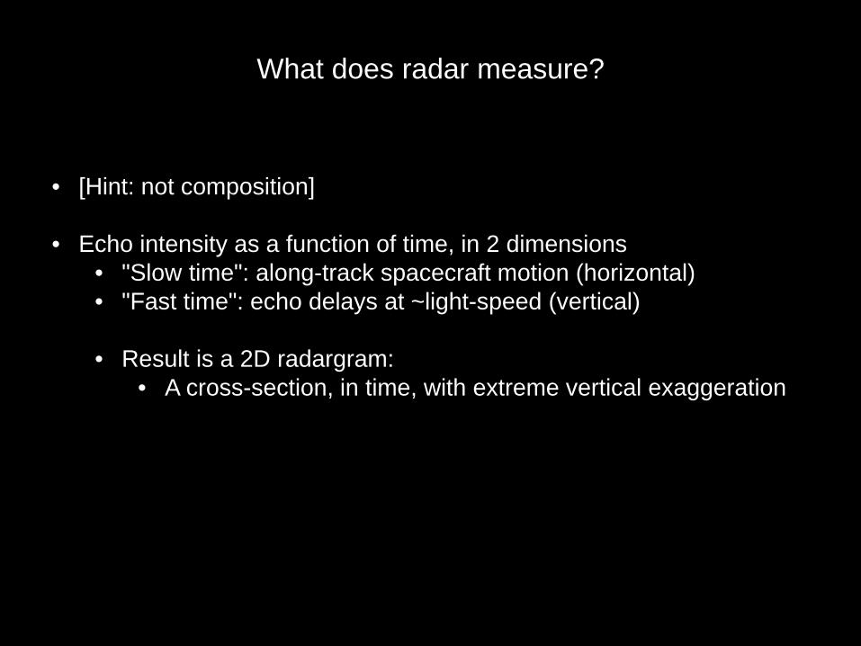
What does radar measure? • [Hint: not composition] • Echo intensity as a function of time, in 2 dimensions • "Slow time": along-track spacecraft motion (horizontal) • "Fast time": echo delays at ~light-speed (vertical) • Result is a 2D radargram: • A cross-section, in time, with extreme vertical exaggeration
Transcript of What does radar measure? - Keck Institute for Space...
What does radar measure?
• [Hint: not composition]
• Echo intensity as a function of time, in 2 dimensions• "Slow time": along-track spacecraft motion (horizontal)• "Fast time": echo delays at ~light-speed (vertical)
• Result is a 2D radargram:• A cross-section, in time, with extreme vertical exaggeration
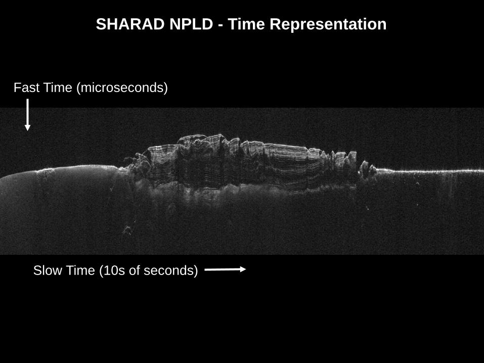
SHARAD NPLD - Time Representation
Slow Time (10s of seconds)
Fast Time (microseconds)

SHARAD NPLD - Depth Representation
Depth
Vertical Exaggeration ~ 100:1
Distance
250 km
3 km

What causes a reflection?
• Reflections occur a boundaries of packets of material of differing dielectric constant (refractive index)
• Examples:• Atmosphere over regolith (always see this)• Ice over rock (base of polar ice, a glacier's bed)• Ice over water (Lake Vostok)• Clean ice against dirty ice (polar layered deposits, NPLD over
basal unit)• Various contacts of rock units (lava flows, sediments, paleo-
regolith)

Time
250 km
MARSIS NPLD

Depth
250 km
MARSIS NPLD

Depth
2.3 km
250 km
MARSIS NPLD

250 km
Basal Unit
Olympia UndaeReflective Horizons
Dune Faces(Clutter)
Basal Contact
MARSIS NPLD

How do we "know" it's ice?
• Radar does not uniquely determine composition• Waves are affected by the complex dielectic constant
• Real part (reflectivity at interface, speed of wave in volume)• Imaginary part (loss across a volume)
• Ice and sedimentary rock may have the same real dielectric• But clean ice has very low loss; lithics much higher
• Best indications of ice:• Speed of the wave (geometry)• Strong reflection at basal interface indicates low loss on round trip• Supporting evidence from other sources: morphology from
images, thermal environment

A Resource-rich, Scientifically Compelling Exploration Zone for Human Missions at DeuteronilusMensae, Mars

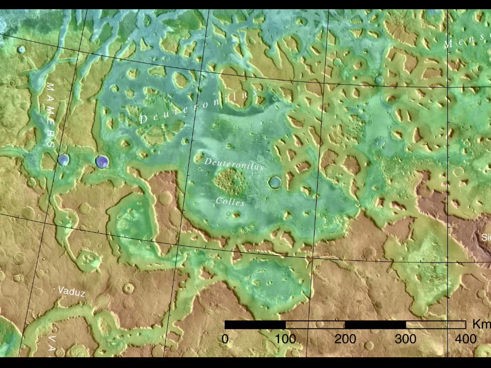

Center lat/lon:41° N; 22°E

Center lat/lon:41° N; 22°E See, for example
Salt Lake CityNew York City
MadridRome

Detections of Thick Ice in Deuteronilus
200 km

THEMIS Night IR (color) Over Day IR Image

Resource ROI 1 – Margin of Apron

Resource ROI 1 – Margin of Apron

2145_01
HRSC
SHARAD Soundingof Lobate DebrisAprons
~ 500 m

Converting Time to Depth
Time
50 km

Converting Time to Depth
~ 700 mDepth
50 km

Converting Time to Depth
Depth
50 km

Constraining the thickness of overburden (How deep is the top of the ice?)
• No enhancement in H content is seen in Odyssey GRS or Neutron data.• Implies that the upper 0.5-1.0 m is “dry”.
• No shallow boundary between dry overburden and massive ice is seen in SHARAD data. Implies either:
• a) boundary is in the near-surface blind zone (~10m), or• b) boundary does not provide sufficient dielectric contrast to produce an
echo.
• Preferred interpretation is a) above, because a thick debris layer is unlikely to be low enough in density (source is mass wasted bedrock; compaction of thick layer will increase density).
• Best current estimate of overburden thickness is 1-10 m.

Science ROI 1 – Margin of Apron
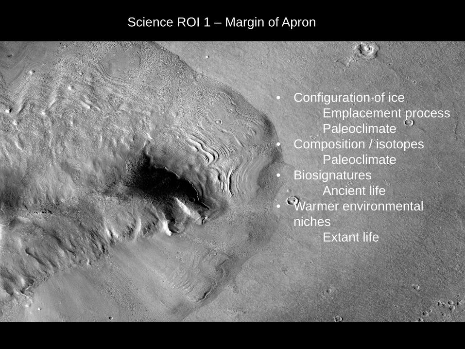
Science ROI 1 – Margin of Apron
• Configuration of iceEmplacement processPaleoclimate
• Composition / isotopesPaleoclimate
• BiosignaturesAncient life
• Warmer environmental niches
Extant life

Summary
• Vast quantities of readily accessible pure water ice
• Benign environment for safety and operations
• Science targets cover all periods of Mars history
• Address issues in:• Paleoclimate / volatile
history• Ancient and extant life• Structural and
stratigraphic history

Clifford et al., 2010

Possible Explanations for the Absence of Subsurface Reflections Indicative of Groundwater
1. Subpermafrost groundwater may no longer survive on Mars,having been cold-trapped into the pore volume of the thickening cryosphere or lost by other processes (e.g., chemical weathering).
2. Groundwater is present but the cryosphere is deeper than previously believed, placing it beyond the maximum sounding depth of MARSIS.
3. Gradients of unfrozen water in the lower cryosphere, or above a subpermafrost groundwater table, have reduced the dielectric contrast necessary to obtain a reflection.
4. The dielectric loss and scattering properties of subsurface may be greater than previously thought, resulting in lower than expected MARSIS sounding depths.


Resource ROI 1 – Margin of Apron