Keck North Slope Projects
34
SEDIMENTOLOGY AND GEOCHEMISTRY OF THE CRETACEOUS TOROK & NANUSHUK FORMATIONS, NORTH SLOPE, ALASKA Kevin Joe Ashley Sarah Lauren Evan
-
Upload
evan-lewis -
Category
Documents
-
view
117 -
download
2
Transcript of Keck North Slope Projects
SEDIMENTOLOGY AND GEOCHEMISTRY OF THE CRETACEOUS TOROK & NANUSHUK FORMATIONS, NORTH SLOPE, ALASKA
KevinJoe
Ashley
Sarah
LaurenEvan
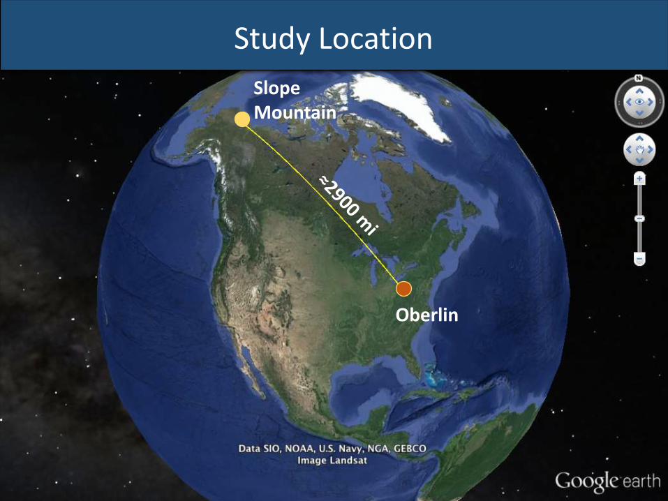
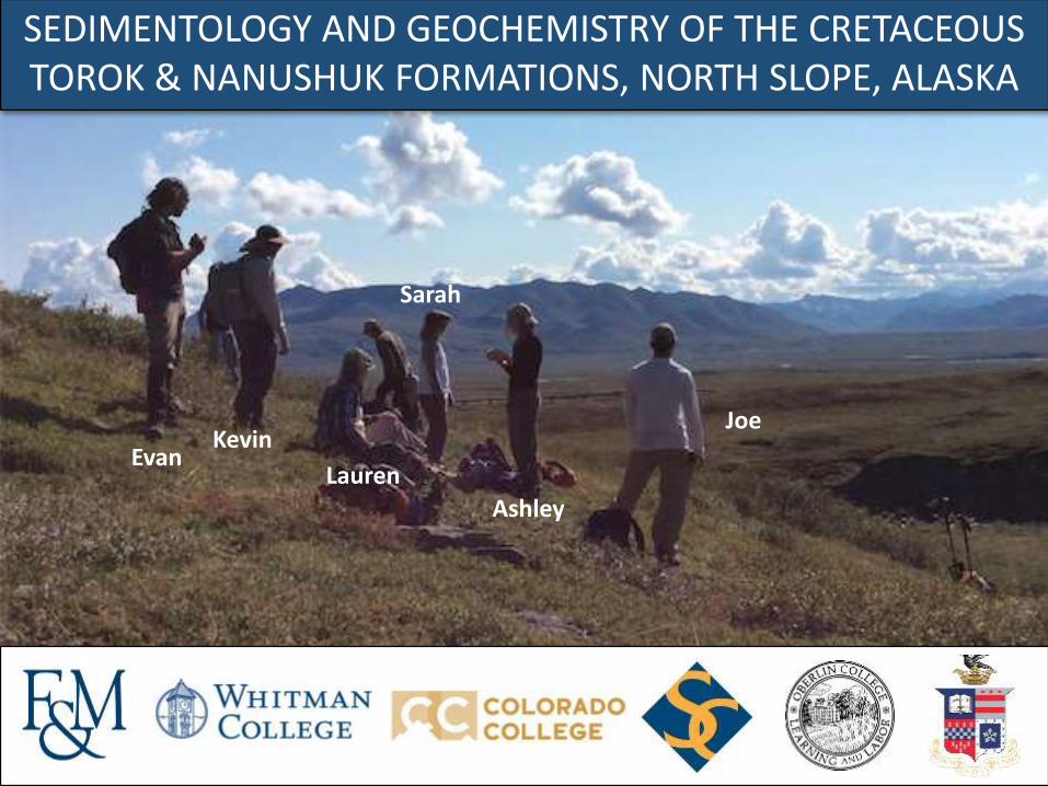
Study Location
Slope Mountain
Oberlin
North on the Dalton Highway
Photo Credit: Beth Hook, Perot Museum
Photo Credit: Beth Hook, Perot Museum
Evan KevinJoe
Ashley
SarahLauren
Arctic Circle Campground
Study Location
Dalton Highway
Galbraith Lake Campground
Slope Mountain
Approximate Location:68.74° N 149.02°W
Slope Mtn.
A
B
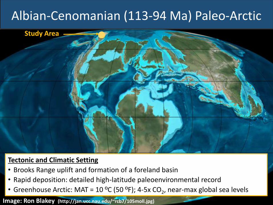
Tectonic and Climatic Setting
• Brooks Range uplift and formation of a foreland basin
• Rapid deposition: detailed high-latitude paleoenvironmental record
• Greenhouse Arctic: MAT = 10 ºC (50 ºF); 4-5x CO2, near-max global sea levels
Study Area
Image: Ron Blakey (http://jan.ucc.nau.edu/~rcb7/105moll.jpg)
Albian-Cenomanian (113-94 Ma) Paleo-Arctic
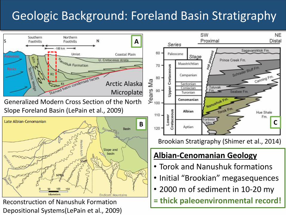
Geologic Background: Foreland Basin Stratigraphy
Arctic Alaska Microplate
Generalized Modern Cross Section of the North Slope Foreland Basin (LePain et al., 2009)
Brookian Stratigraphy (Shimer et al., 2014)
Reconstruction of Nanushuk Formation Depositional Systems(LePain et al., 2009)
Albian-Cenomanian Geology
• Torok and Nanushuk formations
• Initial “Brookian” megasequences
• 2000 m of sediment in 10-20 my
= thick paleoenvironmental record!
A
B C
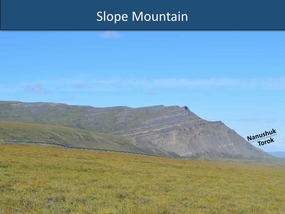
Slope Mountain
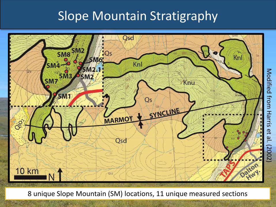
Slope Mountain StratigraphyM
od
ified fro
m H
arris et al. (20
02
)
8 unique Slope Mountain (SM) locations, 11 unique measured sections
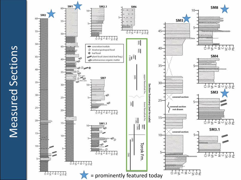
Measured SectionsM
easu
red
Sec
tio
ns
= prominently featured today
Toro
kFm
.
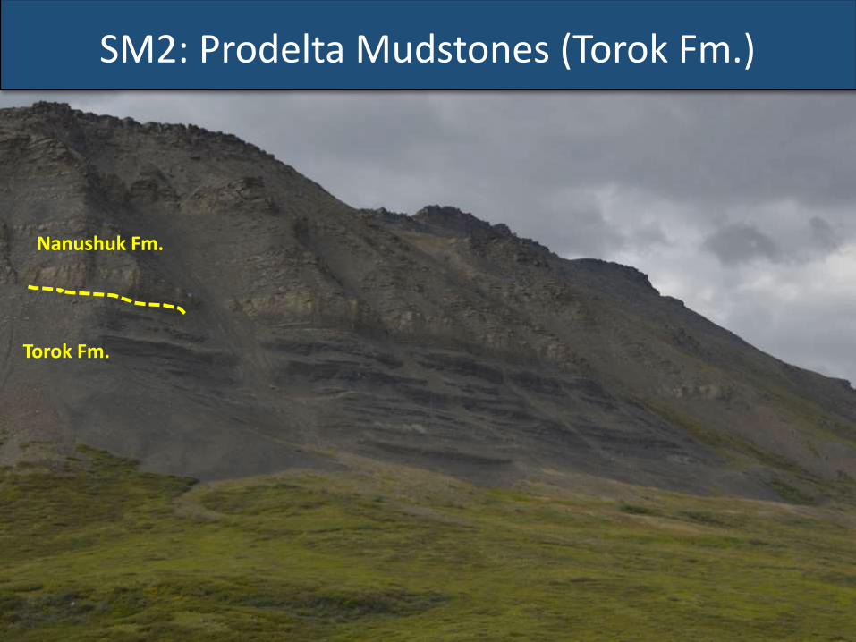
SM2: Prodelta Mudstones (Torok Fm.)
Nanushuk Fm.
Torok Fm.
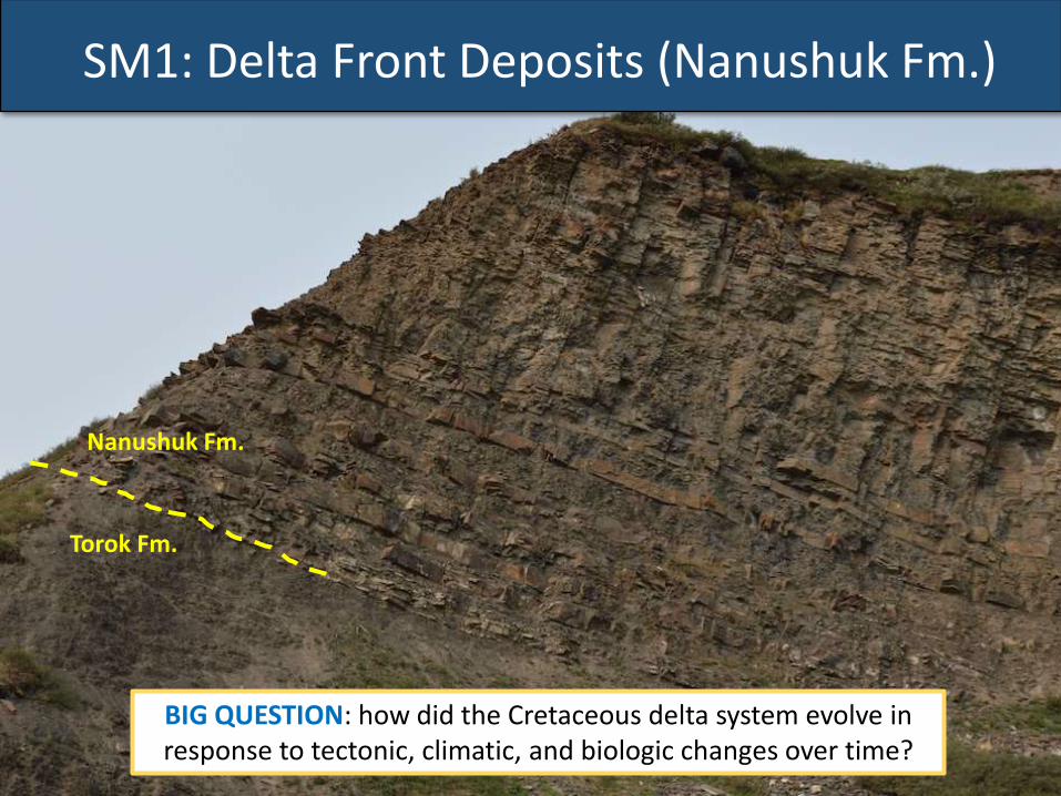
SM1: Delta Front Deposits (Nanushuk Fm.)
Nanushuk Fm.
Torok Fm.
BIG QUESTION: how did the Cretaceous delta system evolve in response to tectonic, climatic, and biologic changes over time?
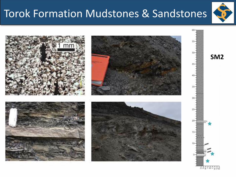
Torok Formation Mudstones & Sandstones
SM2
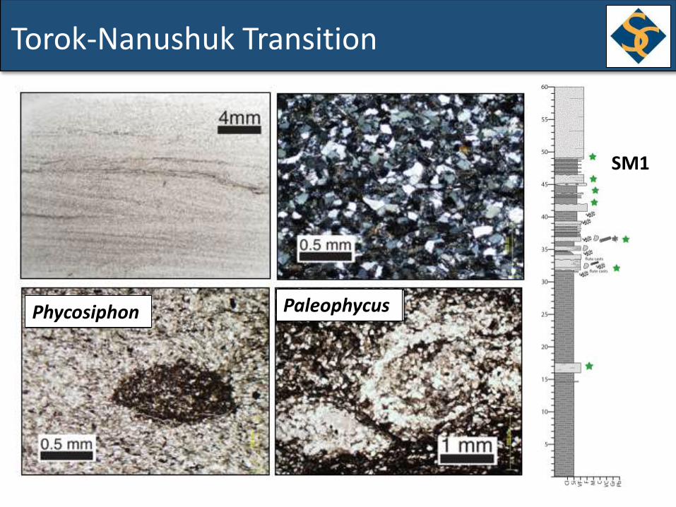
Torok-Nanushuk Transition
SM1
Phycosiphon Paleophycus
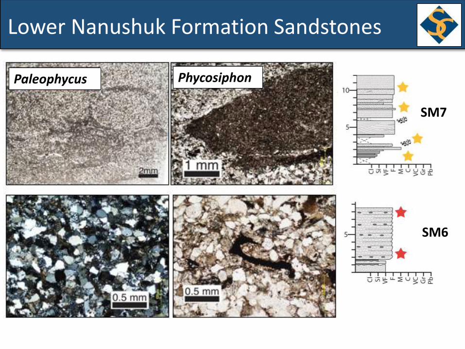
Lower Nanushuk Formation Sandstones
SM7
SM6
Paleophycus Phycosiphon
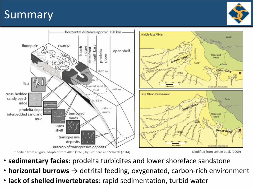
Summary
• sedimentary facies: prodelta turbidites and lower shoreface sandstone
• horizontal burrows → detrital feeding, oxygenated, carbon-rich environment
• lack of shelled invertebrates: rapid sedimentation, turbid water
modified from a figure adopted from Allen (1970) by Prothero and Schwab (2014) Modified from LePain et al. (2009)
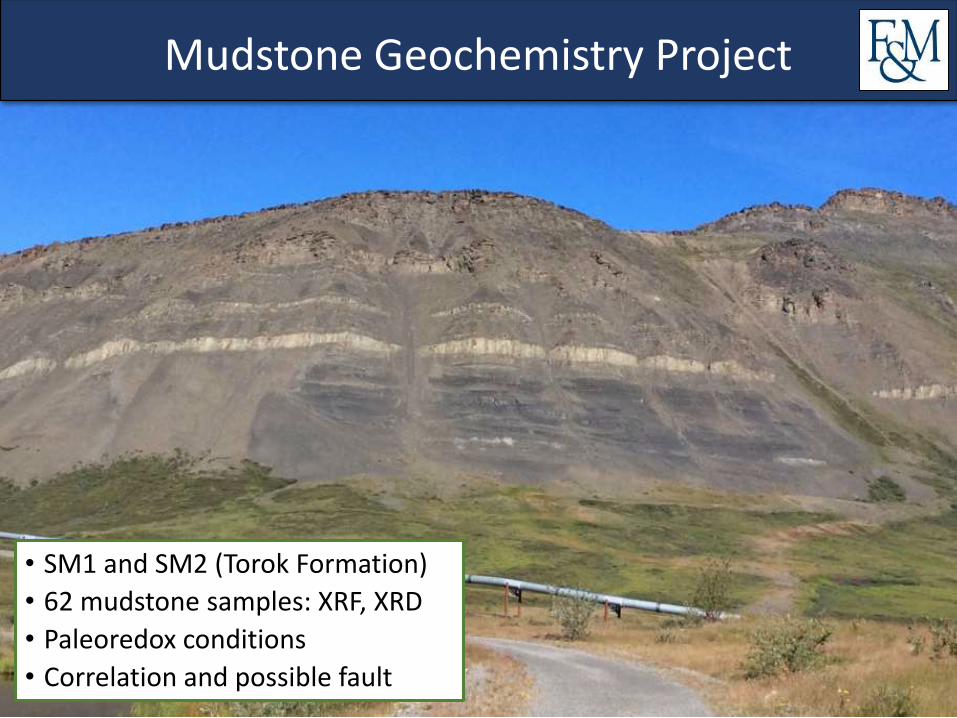
Mudstone Geochemistry Project
• SM1 and SM2 (Torok Formation)
• 62 mudstone samples: XRF, XRD
• Paleoredox conditions
• Correlation and possible fault
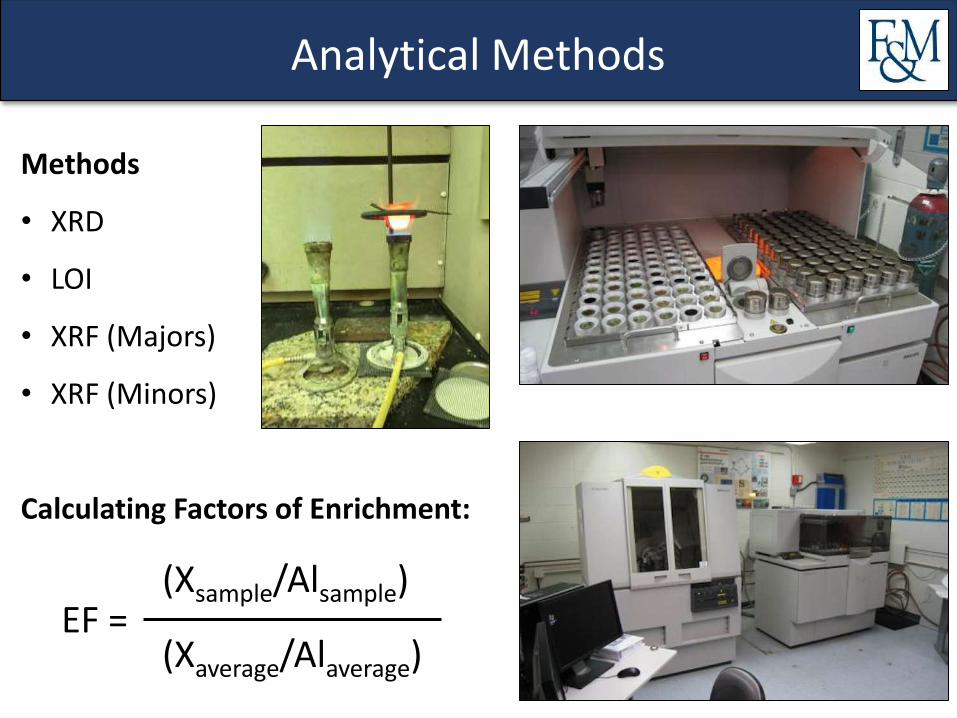
Analytical Methods
Methods
• XRD
• LOI
• XRF (Majors)
• XRF (Minors)
Calculating Factors of Enrichment:
EF = (Xsample/Alsample)
(Xaverage/Alaverage)
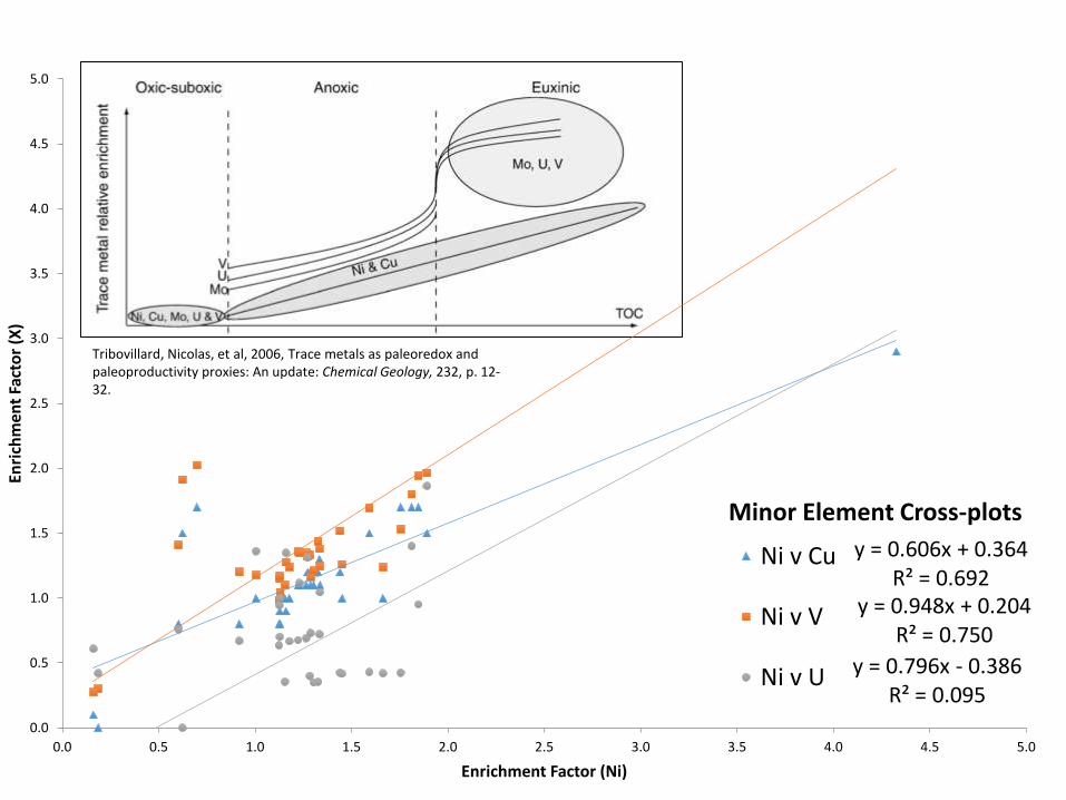
y = 0.606x + 0.364R² = 0.692
y = 0.948x + 0.204R² = 0.750
y = 0.796x - 0.386R² = 0.095
0.0
0.5
1.0
1.5
2.0
2.5
3.0
3.5
4.0
4.5
5.0
0.0 0.5 1.0 1.5 2.0 2.5 3.0 3.5 4.0 4.5 5.0
Enri
chm
ent
Fact
or
(X)
Enrichment Factor (Ni)
Minor Element Cross-plots
Ni v Cu
Ni v V
Ni v U
Tribovillard, Nicolas, et al, 2006, Trace metals as paleoredox and paleoproductivity proxies: An update: Chemical Geology, 232, p. 12-32.
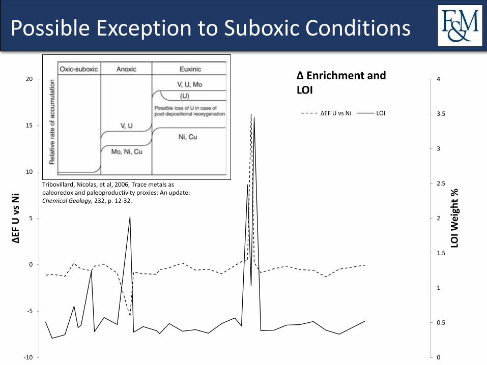
Possible Exception to Suboxic Conditions
0
0.5
1
1.5
2
2.5
3
3.5
4
-10
-5
0
5
10
15
20
LOI W
eig
ht
%
∆EF
U v
sN
i
∆EF U vs Ni LOI
∆ Enrichment and LOI
Tribovillard, Nicolas, et al, 2006, Trace metals as paleoredox and paleoproductivity proxies: An update: Chemical Geology, 232, p. 12-32.
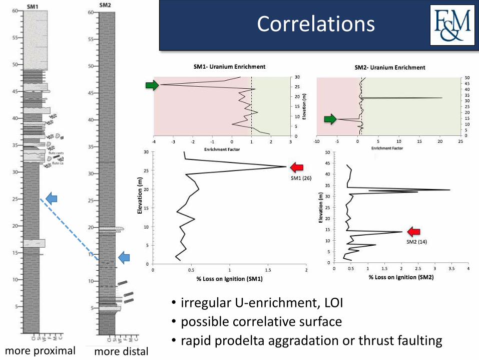
Correlations
more proximal more distal
Ele
vati
on
(m
)
• irregular U-enrichment, LOI
• possible correlative surface
• rapid prodelta aggradation or thrust faulting
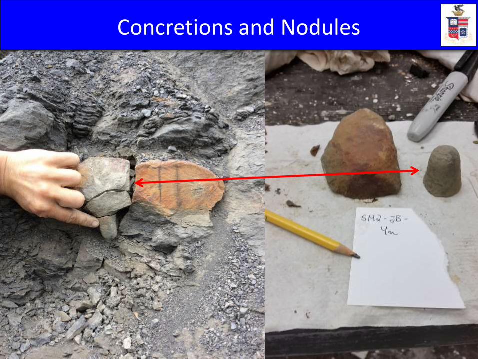
Concretions and Nodules
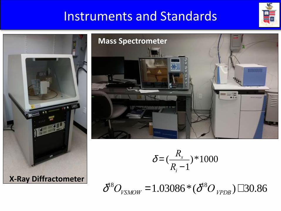
X-Ray Diffractometer
Mass Spectrometer
Instruments and Standards
d = (Rs
Ri -1)*1000
d18OVSMOW =1.03086*(d18O VPDB )+30.86
d = (Rs
Ri -1)*1000
d = (Rs
Ri -1)*1000
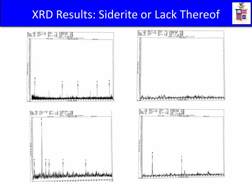
XRD Results: Siderite or Lack Thereof
0
10
20
30
40
50
60
-30.0 -20.0 -10.0 0.0 10.0 20.0 30.0
Str
atig
raph
ic P
osi
tion (
m)
Average δ13C (VPDB) and δ18O (VSMOW)
δ13C
δ18O
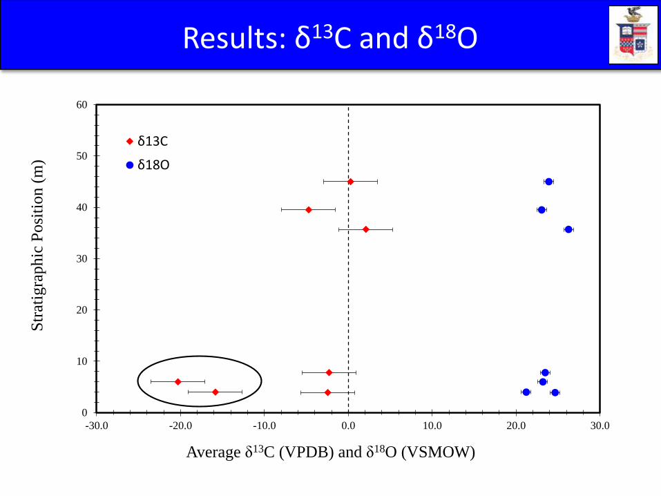
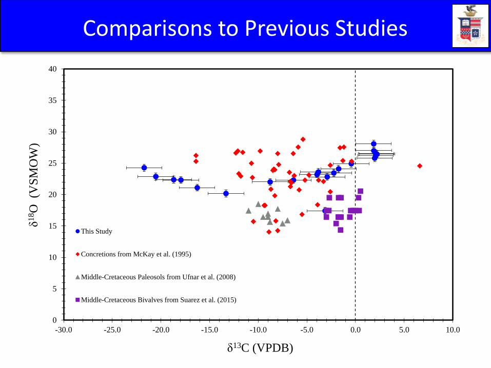
Results: δ13C and δ18O
0
5
10
15
20
25
30
35
40
-30.0 -25.0 -20.0 -15.0 -10.0 -5.0 0.0 5.0 10.0
δ18O
(VS
MO
W)
δ13C (VPDB)
This Study
Concretions from McKay et al. (1995)
Middle-Cretaceous Paleosols from Ufnar et al. (2008)
Middle-Cretaceous Bivalves from Suarez et al. (2015)
Comparisons to Previous Studies
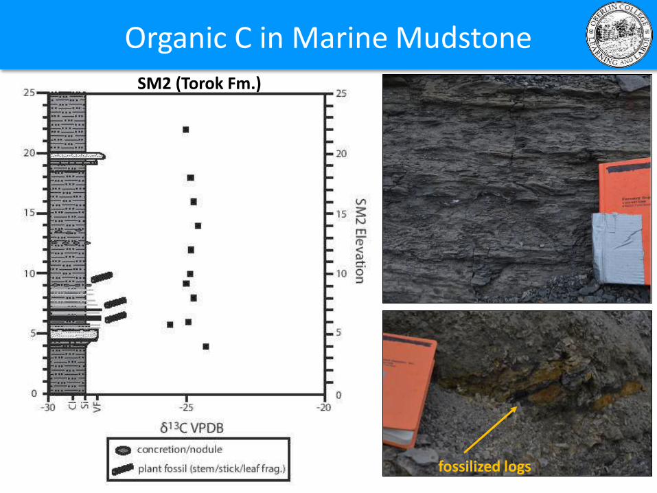
Organic C in Marine Mudstone
SM2 (Torok Fm.)
fossilized logs
C3 plants
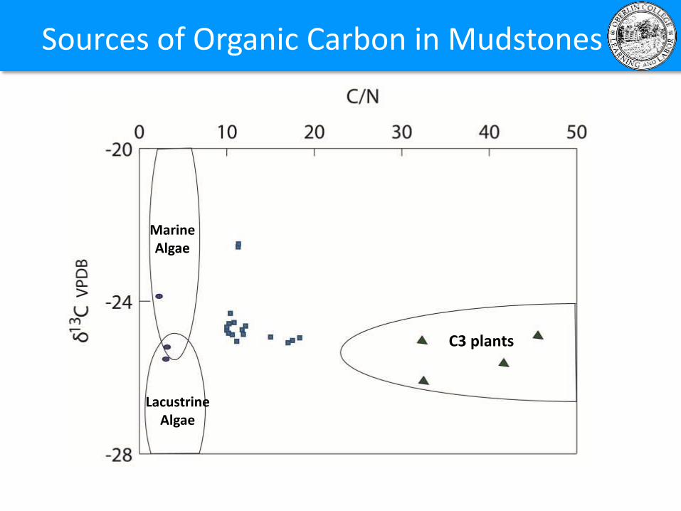
Marine Algae
LacustrineAlgae
Sources of Organic Carbon in Mudstones
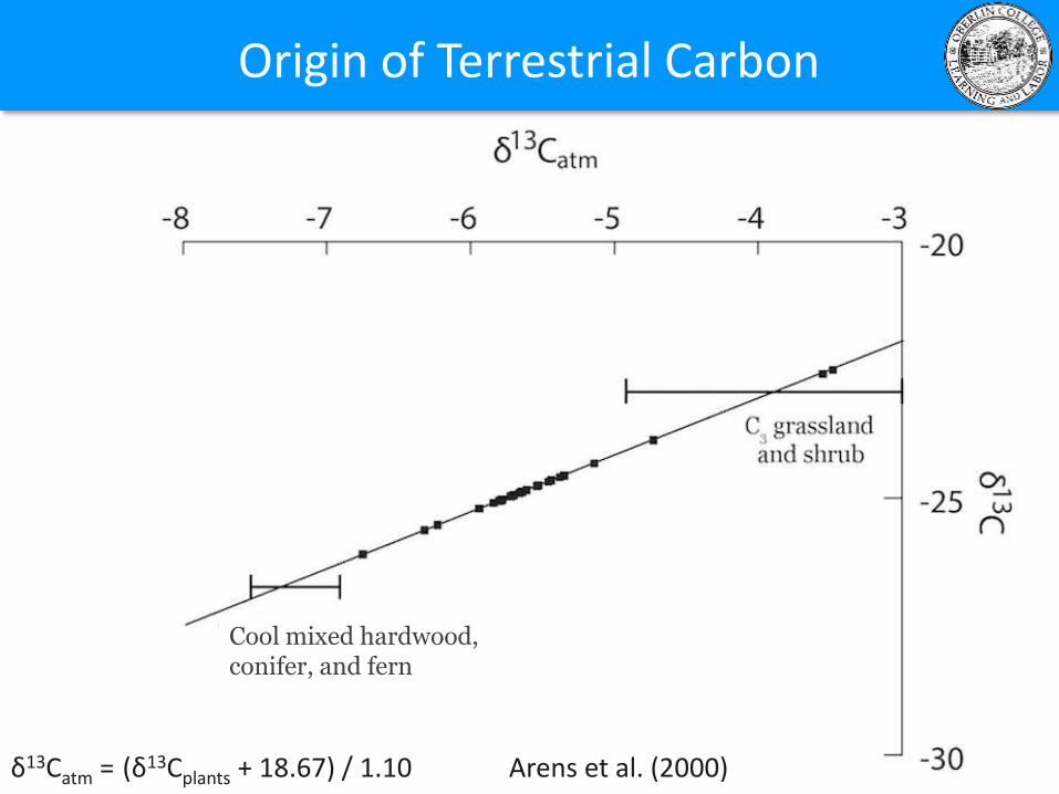
Origin of Terrestrial Carbon
δ13Catm = (δ13Cplants + 18.67) / 1.10 Arens et al. (2000)
Cool mixed hardwood, conifer, and fern
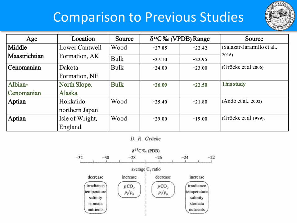
Age Location Source 13C ‰ (VPDB) Range Source
Middle
Maastrichtian
Lower Cantwell
Formation, AK
Wood -27.85 -22.42 (Salazar-Jaramillo et al.,
2016)Bulk -27.10 -22.95
Cenomanian Dakota
Formation, NE
Bulk -24.00 -23.00 (Gröcke et al 2006)
Albian-
Cenomanian
North Slope,
Alaska
Bulk -26.09 -22.50 This study
Aptian Hokkaido,
northern Japan
Wood -25.40 -21.80 (Ando et al., 2002)
Aptian Isle of Wright,
England
Wood -29.00 -19.00 (Gröcke et al 1999).
Comparison to Previous Studies
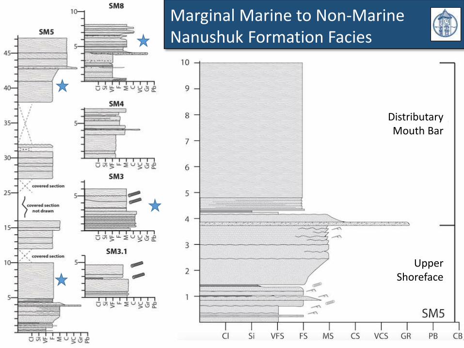
Marginal Marine to Non-Marine Nanushuk Formation Facies
Distributary Mouth Bar
Upper Shoreface
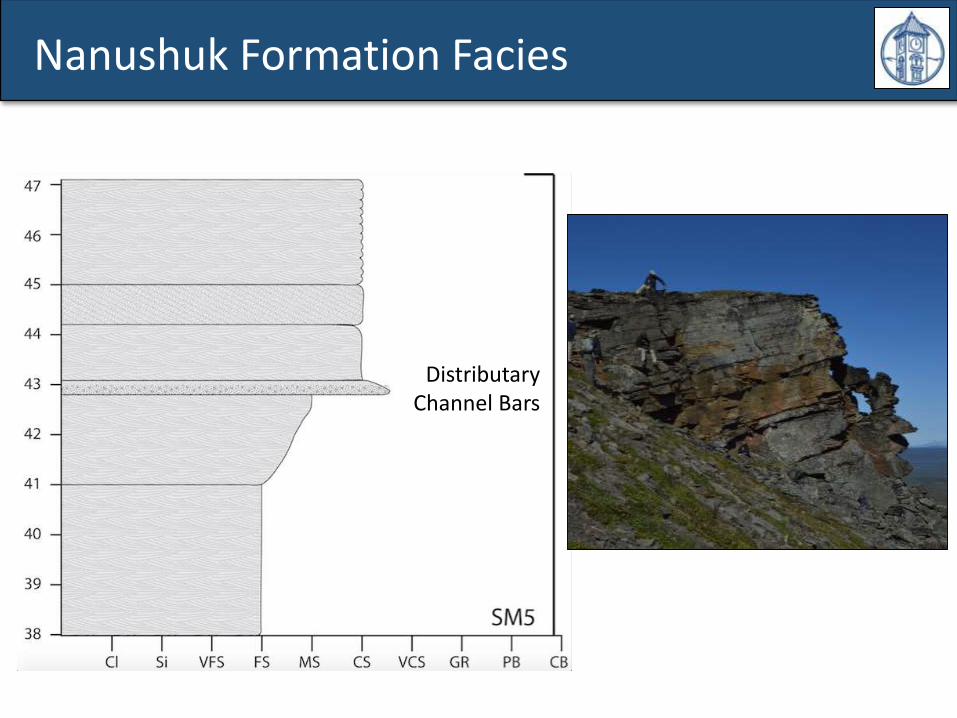
Distributary Channel Bars
Nanushuk Formation Facies
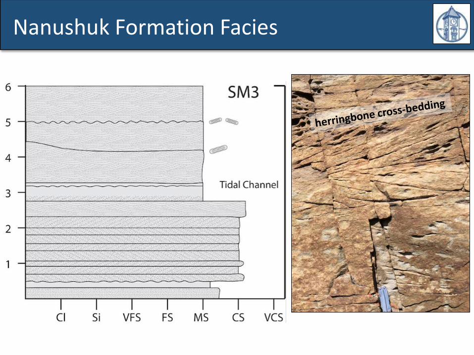
Nanushuk Formation Facies
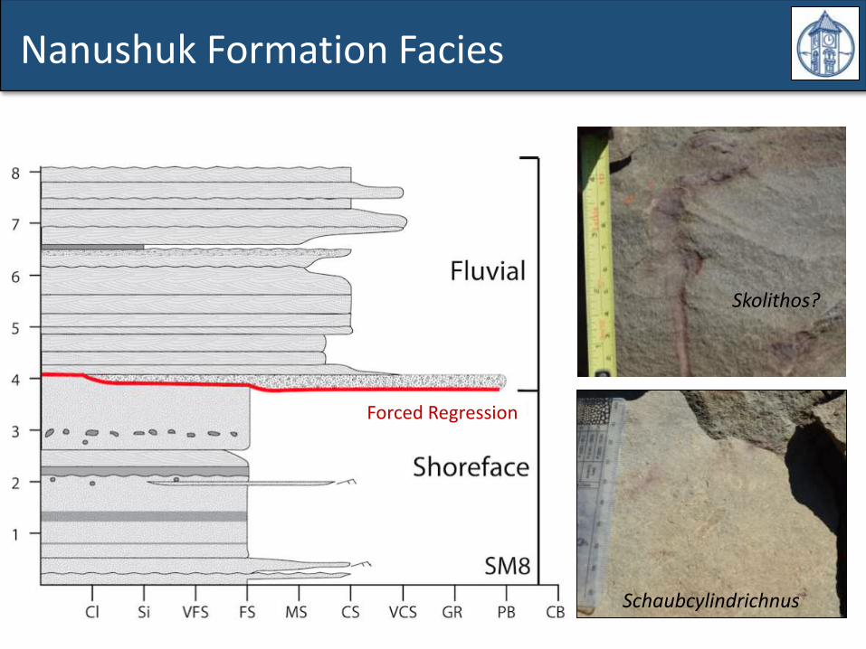
Nanushuk Formation Facies
Schaubcylindrichnus
Skolithos?
Forced Regression
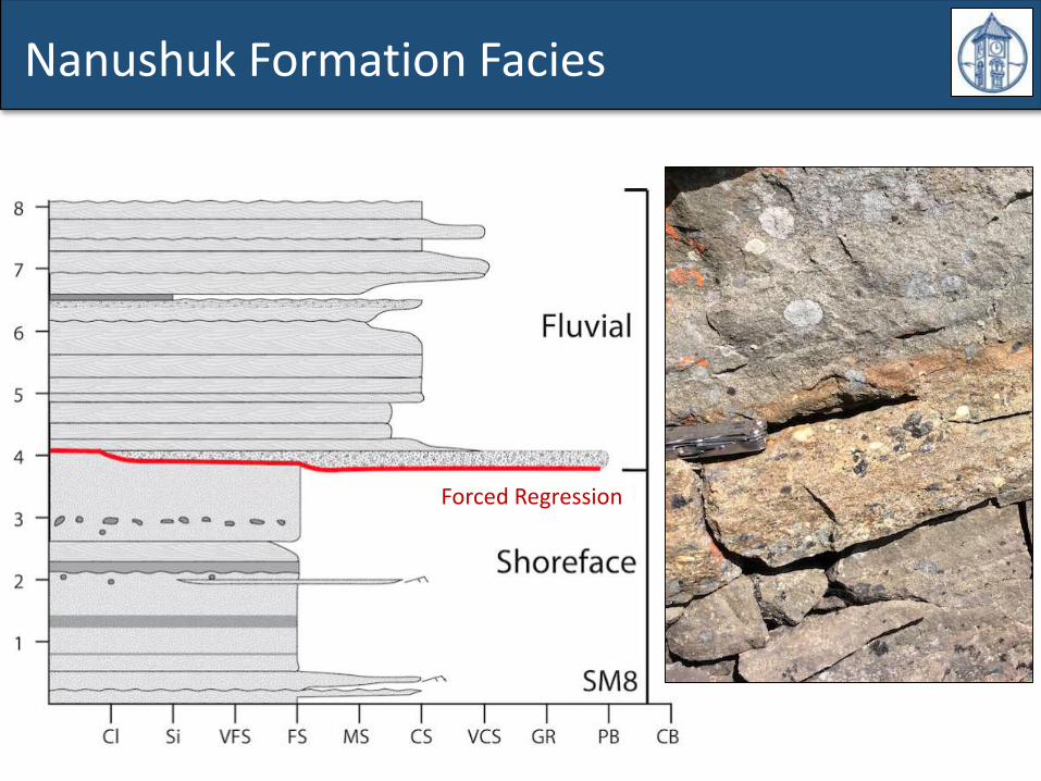
Nanushuk Formation Facies
Forced Regression
Acknowledgements: Bob Varga, Whitman College Geology Dept., UAF Geosciences, Lisa Greer (W&L), Bosiljka Glumac (Smith), Carol deWetand Stan Mertzman (F&M), Karla Hubbard (Oberlin), Paul Myrow, (CC), WSU Stable Isotope Core Lab, Tom Gillispie (AK-OHA), Tony Fiorillo and Beth Hook (Perot Museum), Yoshi Kobayashi (Hokkaido University)
Support From:
Additional Support:
QUESTIONS?