Uttrakhand disaster tad 2014-11
46
UTTARAKHAND DISASTER (HIMALAYAN TSUNAMI) ( June 2013 ) T. Naga Lakshmi TAD/14-11 Dept. Plant pathology
-
Upload
vijay-kumar -
Category
Documents
-
view
128 -
download
4
Transcript of Uttrakhand disaster tad 2014-11

UTTARAKHAND DISASTER(HIMALAYAN TSUNAMI)
(June 2013 )
T. Naga LakshmiTAD/14-11Dept. Plant pathology
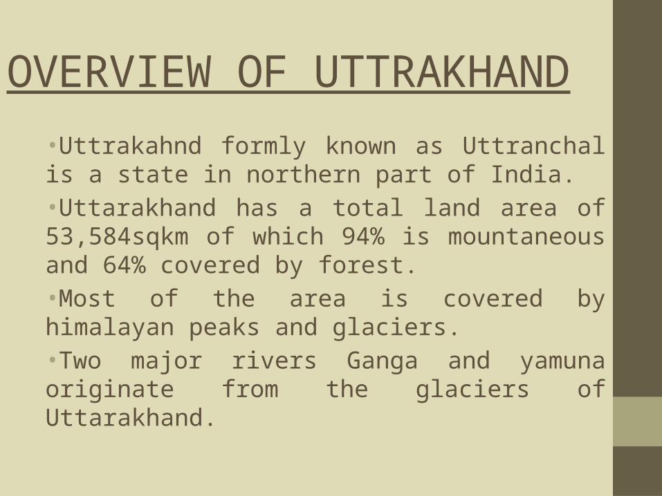
OVERVIEW OF UTTRAKHAND
•Uttrakahnd formly known as Uttranchal is a state in northern part of India.•Uttarakhand has a total land area of 53,584sqkm of which 94% is mountaneous and 64% covered by forest.•Most of the area is covered by himalayan peaks and glaciers.•Two major rivers Ganga and yamuna originate from the glaciers of Uttarakhand.

Continued……
• Uttrakhand is also referred as THE LAND OF GOD.• The state is well known for “Chota Char
Dham”BadrinathKedarnathGangotriYamunotri
• Uttrakhand is considered as one of the most beautiful state.
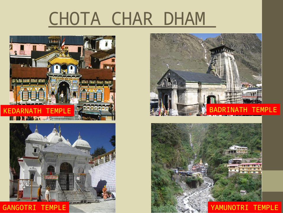
CHOTA CHAR DHAM
KEDARNATH TEMPLE BADRINATH TEMPLE
GANGOTRI TEMPLE YAMUNOTRI TEMPLE
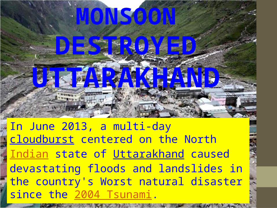
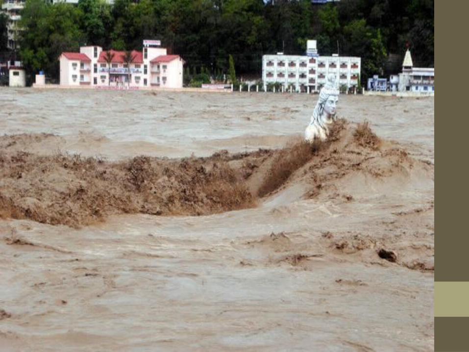
MONSOONDESTROYED
UTTARAKHAND
In June 2013, a multi-day cloudburst centered on the North Indian state of Uttarakhand caused devastating floods and landslides in the country's Worst natural disaster since the 2004 Tsunami.

Who is Responsible
for this disaster
Nature or Human??
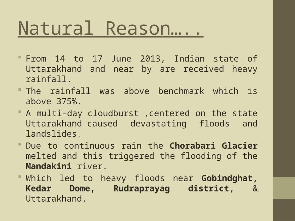
Natural Reason….. From 14 to 17 June 2013, Indian state of
Uttarakhand and near by are received heavy rainfall.
The rainfall was above benchmark which is above 375%.
A multi-day cloudburst ,centered on the state Uttarakhand caused devastating floods and landslides.
Due to continuous rain the Chorabari Glacier melted and this triggered the flooding of the Mandakini river.
Which led to heavy floods near Gobindghat, Kedar Dome, Rudraprayag district, & Uttarakhand.
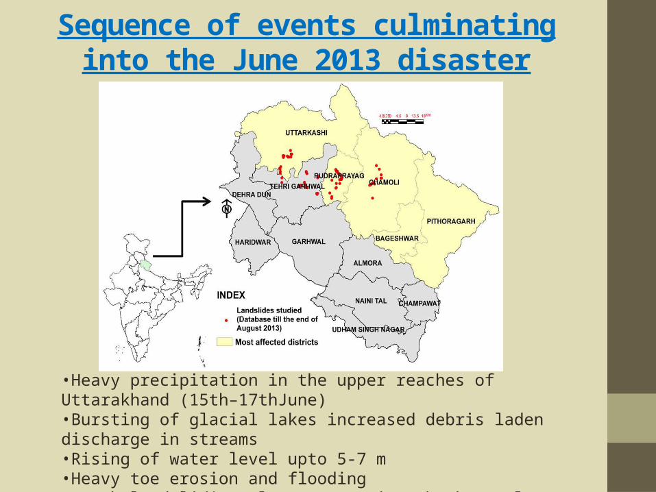
Sequence of events culminating into the June 2013 disaster
•Heavy precipitation in the upper reaches of Uttarakhand (15th–17thJune)•Bursting of glacial lakes increased debris laden discharge in streams•Rising of water level upto 5-7 m•Heavy toe erosion and flooding•Fresh landsliding along steep river banks & slopes•Loss of properties and lives & road links

Heavy incessant rainfall –a trigger for Uttarakhand DisasterHeavy rainfall in the higher altitude areas325mm in 24 hours between 5pm 15th June and 5pm 16th June at Chorabari Lake (3960m asl) as against 272mm in 3 days (15-17June) at Ghuttu (~1430mm asl)•Sudden increase in daily rainfall in the month of June 2013 as compared to total rainfall of June for last 5years
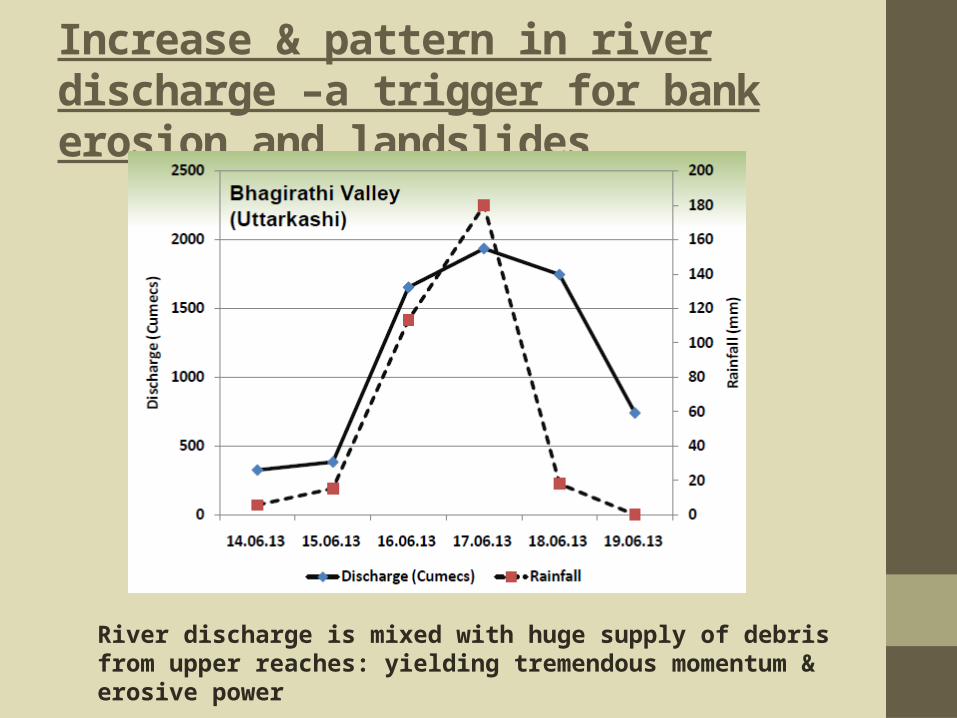
Increase & pattern in river discharge –a trigger for bank erosion and landslides
River discharge is mixed with huge supply of debris from upper reaches: yielding tremendous momentum & erosive power

● HEAVY RAINFALL● WAY OF EXCESSIVE FLOODS● 144% SURPLUS RAIN HITS UTTARAKHAND● GOVERNMENT NEGLIGENCE●INFRASRUCTURE
CAUSES

WHY HEAVY RAINFALL…?•Cloud Bursting- A cloudburst is
an extreme amount of precipitation, sometimes with hail and thunder, which normally lasts no longer than a few minutes but is capable of creating flood conditions. • Meteorologists say the rain fall rate
equal to or greater than 100 mm (3.94 inches) per hour is a cloudburst.

•Convective Activity – It is associate with low pressure systems and these attracts moisture bearing winds.• National Institute of Oceanography
(Goa) has predicted the high convective activity in Bay of Bengal and Eastern Equatorial Indian Ocean bring rainfall in over subcontinent.• This brought about a rapid advance of
monsoon a month ahead across the subcontinent by wind originating from Eastern Indian Ocean.
Heavy Flooding…• Another cause for heavy flooding of river
was that it snowed heavily in Himalayas in the pre-monsoon season and by the June the snow started melting and thus increasing the water level in rivers.• Another reason was intense rainfall helped
in causing the melting of snow much faster. According to NIO that water which has highest heat capacity than air, helps in melting of snow or ice much faster when it come in contact even when both air and water have same temperature.

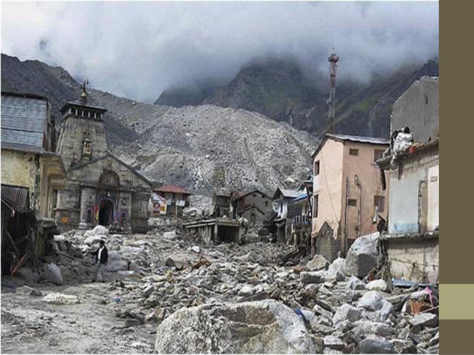
Damages within flood plains (an example from Kedarnath)

DAMEGES WITH FLOOD PLAIN
Kedarnath

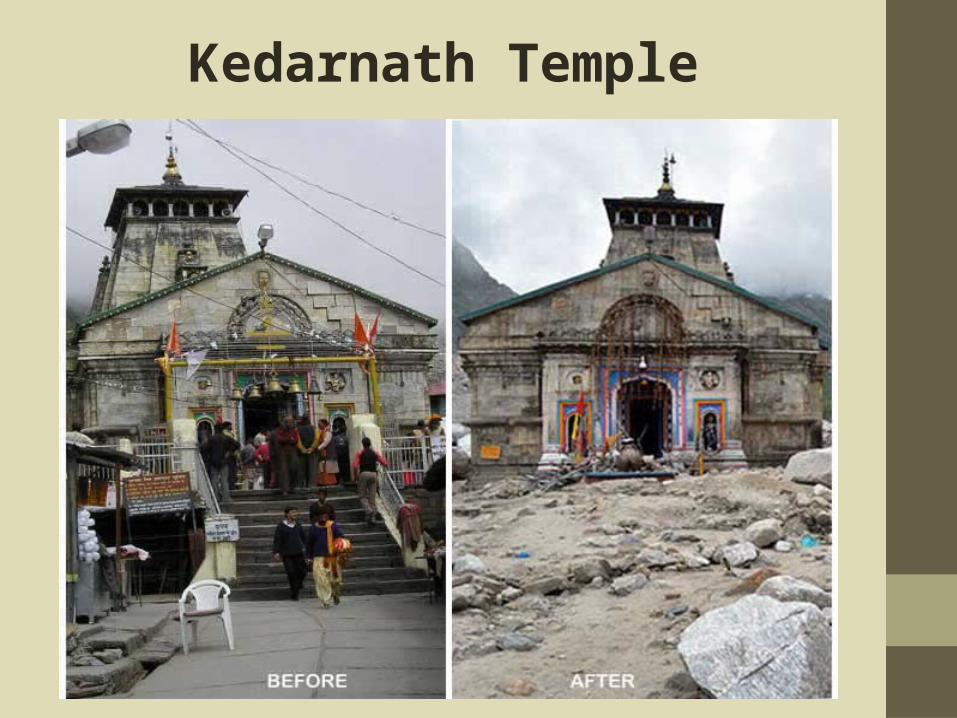
Although the temple withstood the severity of the floods, the temple complex and surrounding areas were destroyed by the flood, resulting in the death of several pilgrims and local people. All the shops and hotels were destroyed and all roads were broken. Number of people took shelter inside the temple for hours together , until Indian army airlifted them to safer places.
Kedarnath Temple

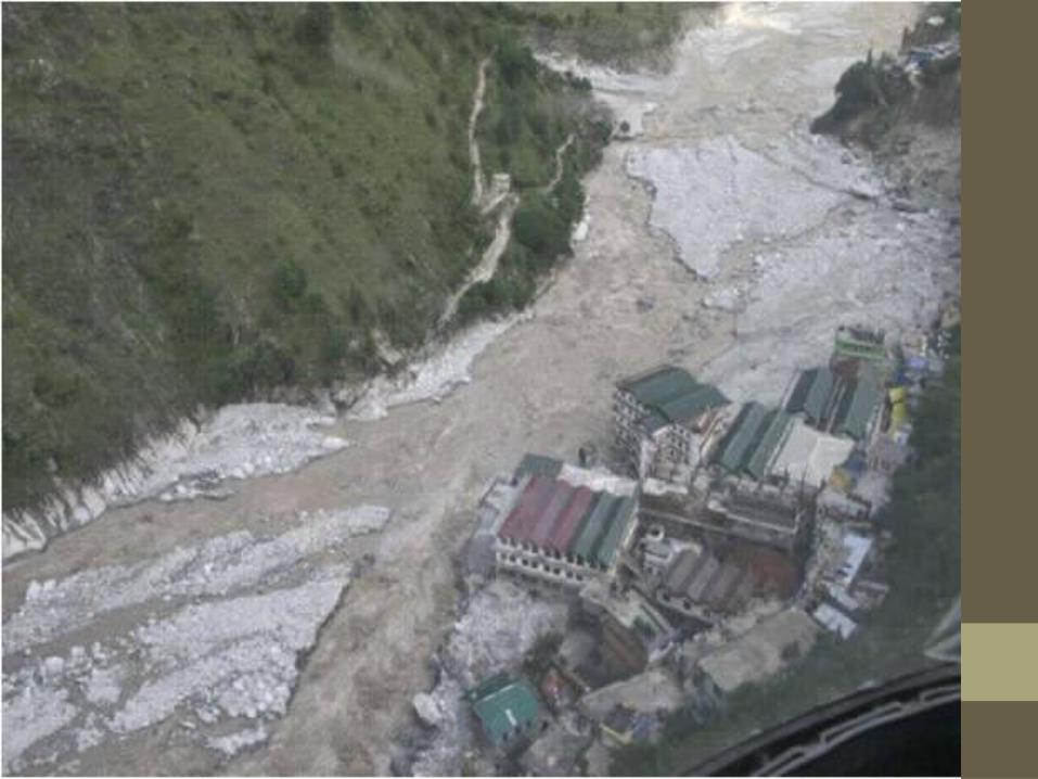
Landslides on banks due to toe erosion

Debris slides & flows on banks
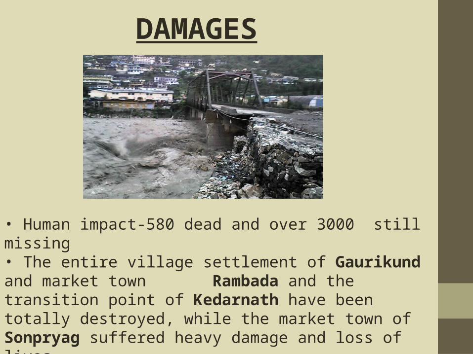
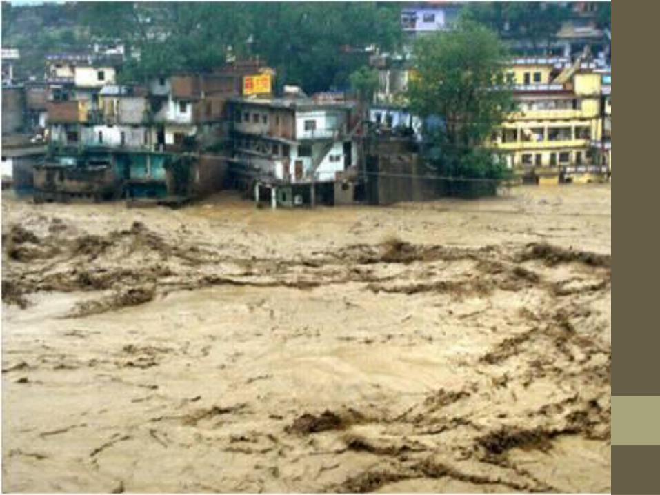
• Human impact-580 dead and over 3000 still missing• The entire village settlement of Gaurikund and market town Rambada and the transition point of Kedarnath have been totally destroyed, while the market town of Sonpryag suffered heavy damage and loss of lives.• On June 18 more than 12000 pilgrims were stranded at Badrinath located at bank of Alaknanda river.
DAMAGES

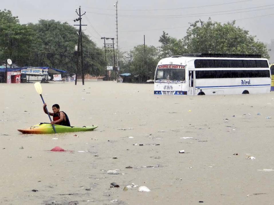
• Over 85000 people were struck in various region of damaged or road blocked.• People in important location like Valley of Flowers, Roopkund and the Hemkund were stranded for more than 3 days without ration or survived with little food.•National Highway 58 neat Jyotimath and many other places were washed away.• Rescuers at Haridwar on the river Ganga recovered bodies of 40 victims washed down by flooded river on 21 June• In UP more than 600 villages covering population of 7 lakh were affected by flood and more than 120 deaths were reported.
Conti….
Kedarnath Temple
DEVASTATING EFFECTS OF THE TSUNAMI IN UTTARAKHAND
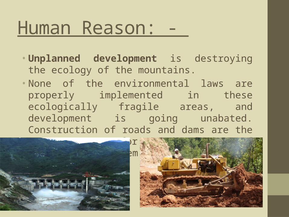
Human Reason: -
• Unplanned development is destroying the ecology of the mountains.• None of the environmental laws are properly
implemented in these ecologically fragile areas, and development is going unabated. Construction of roads and dams are the main reason for the plight of Himalayan ecosystem.
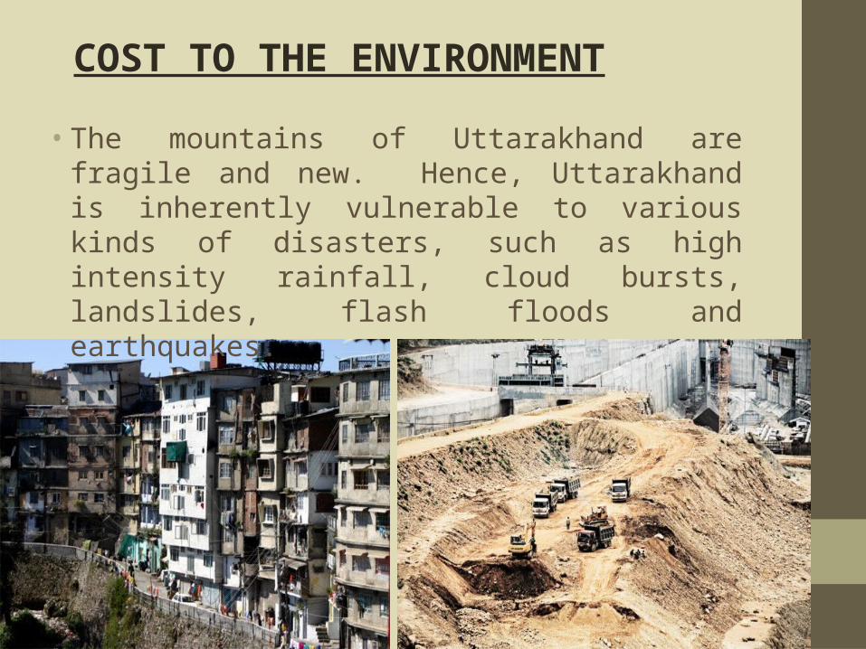
• The mountains of Uttarakhand are fragile and new. Hence, Uttarakhand is inherently vulnerable to various kinds of disasters, such as high intensity rainfall, cloud bursts, landslides, flash floods and earthquakes.
COST TO THE ENVIRONMENT
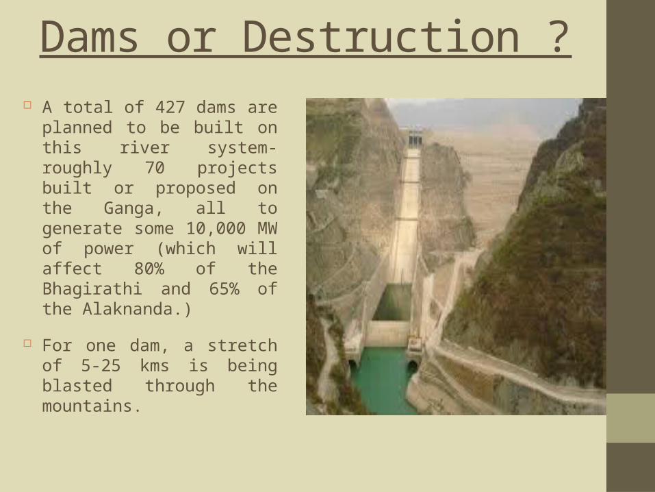
Dams or Destruction ? A total of 427 dams
are planned to be built on this river system-roughly 70 projects built or proposed on the Ganga, all to generate some 10,000 MW of power (which will affect 80% of the Bhagirathi and 65% of the Alaknanda.)
For one dam, a stretch of 5-25 kms is being blasted through the mountains.
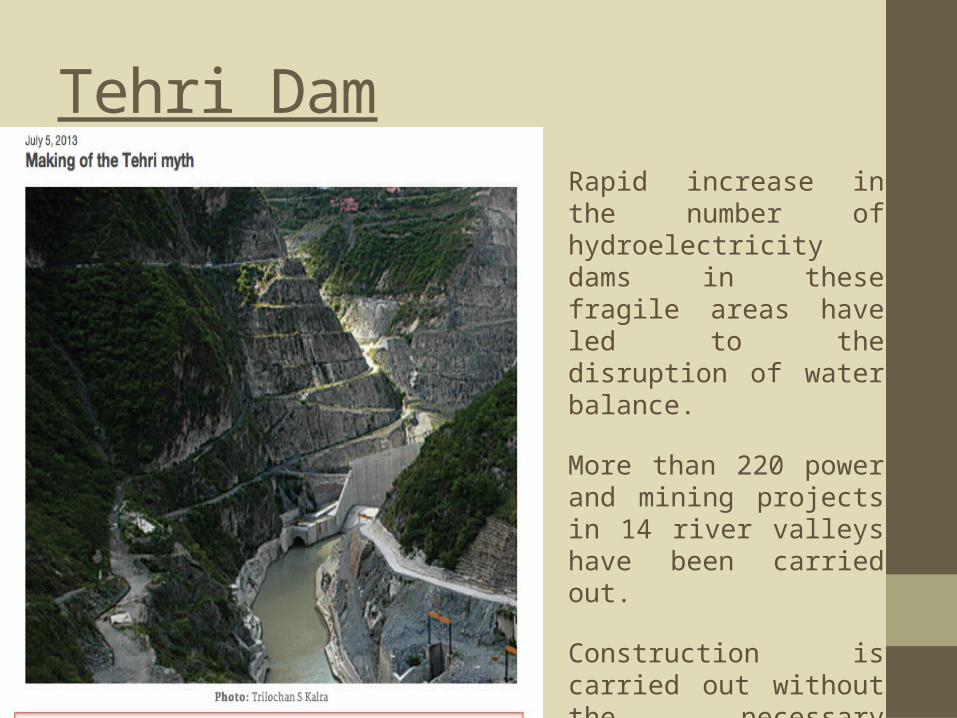
Tehri DamRapid increase in the number of hydroelectricity dams in these fragile areas have led to the disruption of water balance.
More than 220 power and mining projects in 14 river valleys have been carried out.
Construction is carried out without the necessary precautions to minimize the risks of landslides.
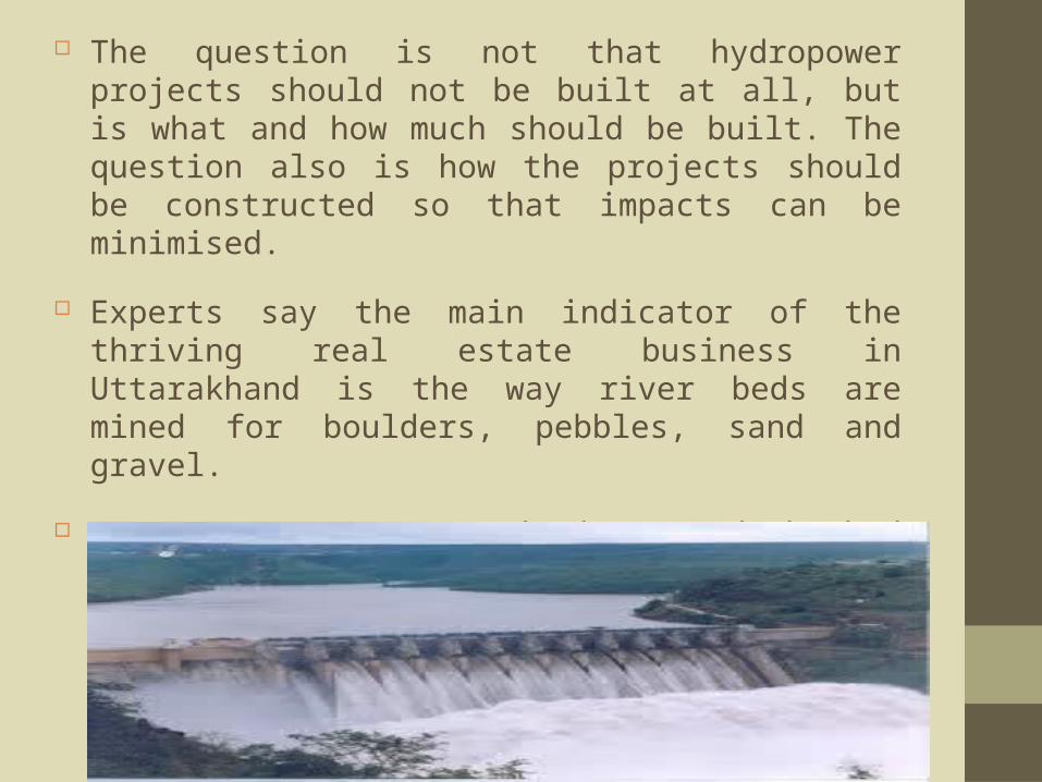
The question is not that hydropower projects should not be built at all, but is what and how much should be built. The question also is how the projects should be constructed so that impacts can be minimised.
Experts say the main indicator of the thriving real estate business in Uttarakhand is the way river beds are mined for boulders, pebbles, sand and gravel.
On June 13, 2011, Swami Nigamanand who had been fasting for 68 days in protest against the indiscriminate and illegal mining on the Ganga river bed by a local quarrying and sand mining company, died.
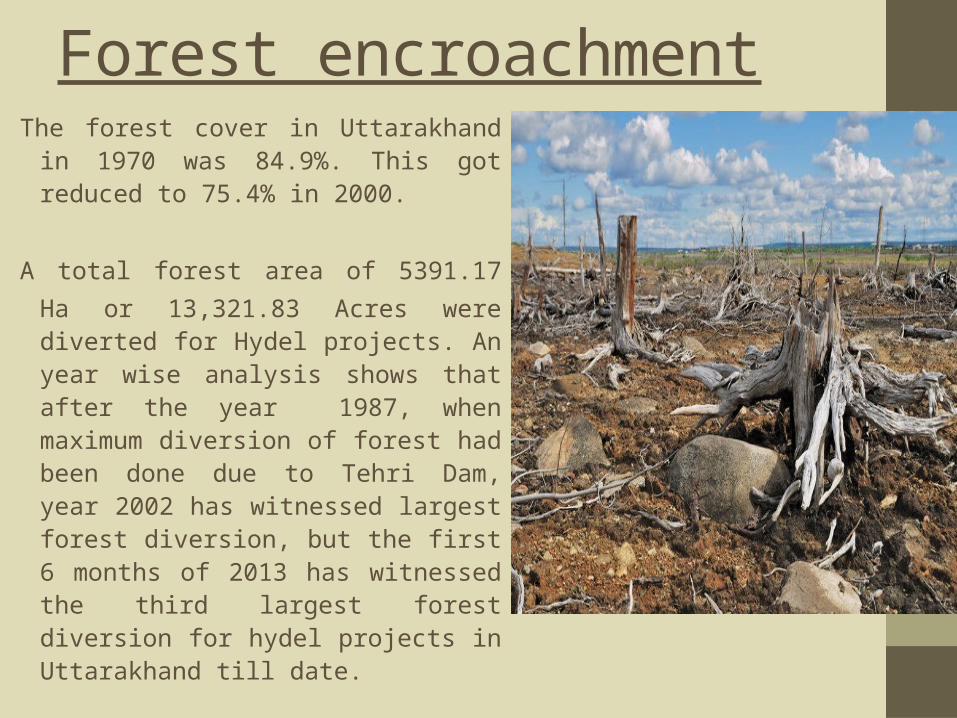
Forest encroachmentThe forest cover in Uttarakhand in
1970 was 84.9%. This got reduced to 75.4% in 2000.
A total forest area of 5391.17 Ha
or 13,321.83 Acres were diverted for Hydel projects. An year wise analysis shows that after the year 1987, when maximum diversion of forest had been done due to Tehri Dam, year 2002 has witnessed largest forest diversion, but the first 6 months of 2013 has witnessed the third largest forest diversion for hydel projects in Uttarakhand till date.

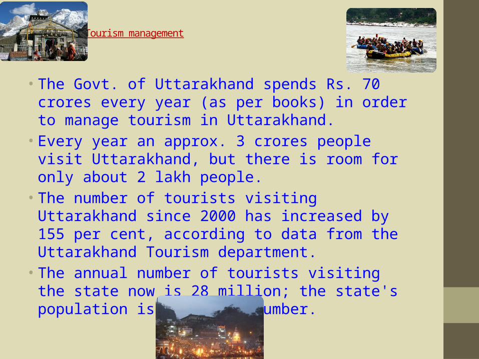
Tourism management
• The Govt. of Uttarakhand spends Rs. 70 crores every year (as per books) in order to manage tourism in Uttarakhand.
• Every year an approx. 3 crores people visit Uttarakhand, but there is room for only about 2 lakh people.
• The number of tourists visiting Uttarakhand since 2000 has increased by 155 per cent, according to data from the Uttarakhand Tourism department.
• The annual number of tourists visiting the state now is 28 million; the state's population is half this number.
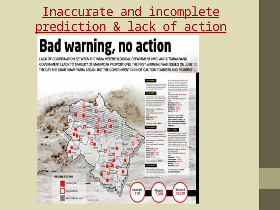
Inaccurate and incomplete prediction & lack of action plans.
Death & destruction
90 per cent of cash crops, particularly the apple crop, has been completely destroyed by the floods.
Loss to the public and private property estimate around Rs 2,575 crores as mentioned by the government, June 30, 2013. Insurance companies are looking at claims worth more than Rs 1,000 crore
Hundreds of porters and over 2,000 ponies are still untraceable. A total of 2145 animal loss and 185 animal owners have been affected.

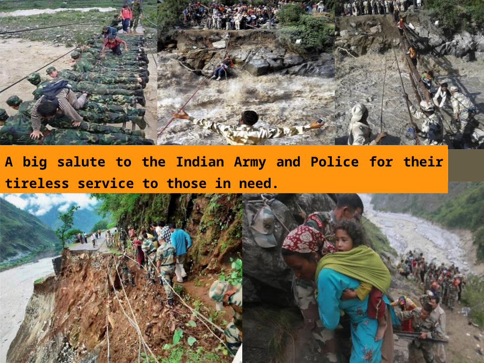
National Disaster Response Force (NDRF) and Indo-Tibetan Border Police (ITBP) personnel have so far rescued 32,772 people from different areas of Uttarakhand following landslides and floods, Of the 32,772, including pilgrims and residents, 26,538 were rescued by ITBP while 6,234 were evacuated by NDRF personnel.
RESCUE OPERATION

Defending its role in the rescue operations in the flood-ravaged Uttarakhand, ISRO had played its role in the largest rescue operations in the country, saving thousands of lives.
Uttarakhand floods: ISRO defends role in rescue operations
01/12/13
A big salute to the Indian Army and Police for their
tireless service to those in need.
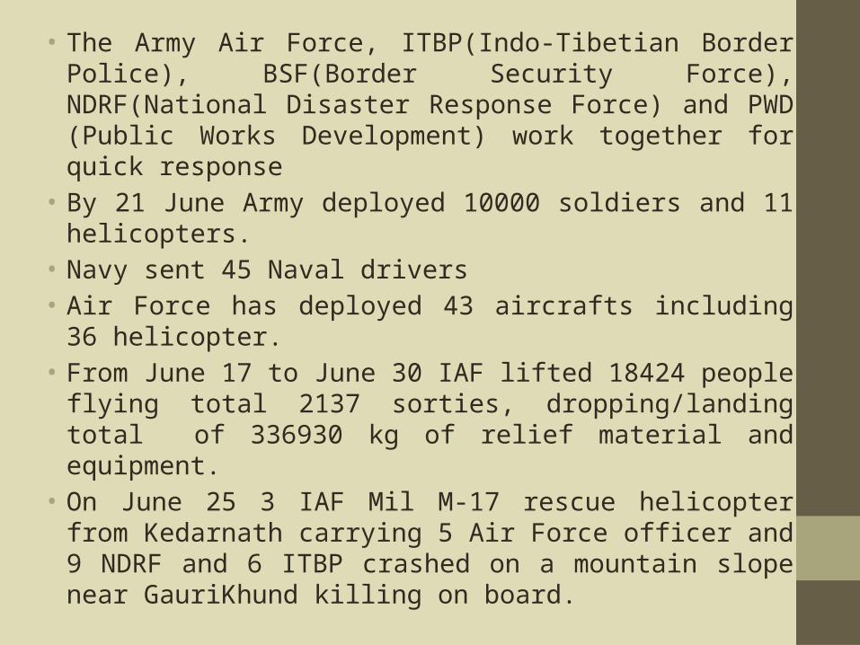
• The Army Air Force, ITBP(Indo-Tibetian Border Police), BSF(Border Security Force), NDRF(National Disaster Response Force) and PWD (Public Works Development) work together for quick response
• By 21 June Army deployed 10000 soldiers and 11 helicopters.
• Navy sent 45 Naval drivers• Air Force has deployed 43 aircrafts including 36
helicopter.• From June 17 to June 30 IAF lifted 18424 people
flying total 2137 sorties, dropping/landing total of 336930 kg of relief material and equipment.
• On June 25 3 IAF Mil M-17 rescue helicopter from Kedarnath carrying 5 Air Force officer and 9 NDRF and 6 ITBP crashed on a mountain slope near GauriKhund killing on board.
Points to be Considered…• Proper land use policies should also be
framed in order to regulate construction activities in the floodplains of the rivers.
• There is need for the development of mechanisms for better management of tourism and the tourist.
• There is definitely a lack of coordination for disaster management strategies at the local level.
• Application of remote sensing technology for the development of holistic data base for agriculture, water, forests, pastures, landscapes and other natural resources for the sustainable management of Himalayas should be in place.

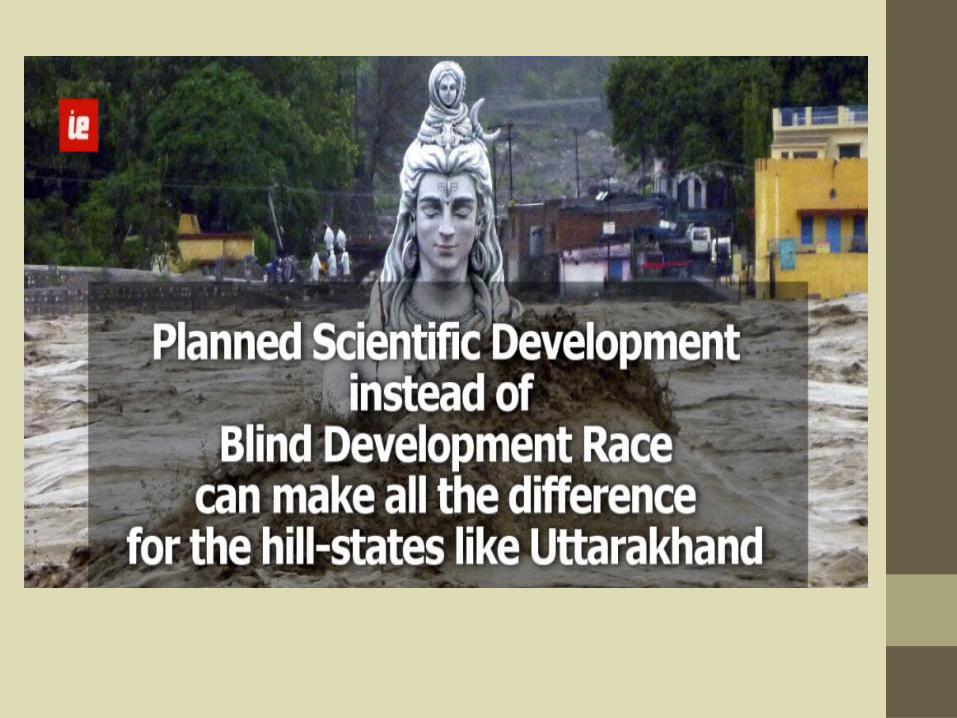
Green Development We need to concentrate on areas like water-shed
development and afforestation.
Green development is far more sustainable and equitable than profit driven development.
Lastly, these calamities and destruction may primarily be caused by nature but they are man-made too.
→ Global warming, greenhouse effect, melting of glaciers, deforestation etc., to begin with.
We don't realise the extent of the circumstances of our own activities.

Our take-home message…
Each of us must take steps to protect our Earth's climate.
Thank you for your kind attention