Southeast Michigan Council of Governments. Working Together to Improve Regional Operations through...
29
Southeast Michigan Council of Governments
-
Upload
bryan-douglas -
Category
Documents
-
view
215 -
download
0
Transcript of Southeast Michigan Council of Governments. Working Together to Improve Regional Operations through...

Southeast Michigan Council of Governments

Working Together to Improve Working Together to Improve Regional Operations through Regional Operations through Traffic Incident Management Traffic Incident Management


St. Clair
MacombOakland
Livingston
WayneWashtenaw
Monroe
* City of Detroit
4.9 million people

22,800 miles of public road22,800 miles of public road
4,884 miles of truck routes4,884 miles of truck routes
140 million vehicle miles 140 million vehicle miles traveled dailytraveled daily
1,000 miles currently congested1,000 miles currently congested
Over 5,400 traffic signalsOver 5,400 traffic signals
Over 3,500 bridgesOver 3,500 bridges
Over 140,000 crashesOver 140,000 crashes
950 miles in poor condition950 miles in poor condition

Metro Detroit Traffic Incident Metro Detroit Traffic Incident Management HistoryManagement History
• November, 1991 – Greater Detroit Incident November, 1991 – Greater Detroit Incident Management Conference (NIMC sponsor)Management Conference (NIMC sponsor)
• February, 1992 – Volunteers established the February, 1992 – Volunteers established the Metropolitan Detroit Incident Management Metropolitan Detroit Incident Management Coordinating Committee Coordinating Committee
• 1993 – Eight Task Forces established to 1993 – Eight Task Forces established to develop recommendations regarding develop recommendations regarding detection, response, removal, alt. routes, detection, response, removal, alt. routes, information, jurisdiction, legislation and information, jurisdiction, legislation and budget.budget.

Metro Detroit Incident Metro Detroit Incident Management Coordination Management Coordination
CoalitionCoalition• Michigan Department of TransportationMichigan Department of Transportation• Michigan State PoliceMichigan State Police• Southeast Michigan Council of GovernmentsSoutheast Michigan Council of Governments• Road Commission for Oakland CountyRoad Commission for Oakland County• Road Commission of Macomb CountyRoad Commission of Macomb County• Wayne County RoadsWayne County Roads• Federal Highway AdministrationFederal Highway Administration

Metro Detroit Incident Metro Detroit Incident Management Coordination Management Coordination
Coalition (cont’d)Coalition (cont’d)• City of DetroitCity of Detroit• City of SouthfieldCity of Southfield• City of Troy City of Troy • WWJ radioWWJ radio• Emergency Road ResponseEmergency Road Response• MDOT – Grand RegionMDOT – Grand Region• Wayne State UniversityWayne State University• Hubbell, Roth & Clark, Inc.Hubbell, Roth & Clark, Inc.

Blueprint for Action, 1994Blueprint for Action, 1994RecommendationsRecommendations
• Create Incident Management CenterCreate Incident Management Center• Remove abandoned vehicles in Remove abandoned vehicles in
4 hours instead of 48 hours4 hours instead of 48 hours• First agency on scene to take chargeFirst agency on scene to take charge• Prepare standard boundary mapsPrepare standard boundary maps• Install intermediate location markersInstall intermediate location markers• Notify jurisdiction’s road agencyNotify jurisdiction’s road agency

Blueprint for Action, 1994 Blueprint for Action, 1994 Recommendations (cont’d)Recommendations (cont’d)
• Expand coverage of Detroit’s Expand coverage of Detroit’s Freeway OperationsFreeway Operations
• Encourage towing/courtesy patrolEncourage towing/courtesy patrol• Educate police and fire departmentsEducate police and fire departments• Legislate/educate moving disabled Legislate/educate moving disabled
vehicles from travel lanesvehicles from travel lanes• Develop alternate route plansDevelop alternate route plans• Formalize jurisdictional agreementsFormalize jurisdictional agreements

Blueprint for Action Blueprint for Action AccomplishmentsAccomplishments

SurveillanceSurveillance
• System ExpansionSystem Expansion 1957 – 1971: John C. Lodge Freeway 1957 – 1971: John C. Lodge Freeway
Traffic Management Center, 2 milesTraffic Management Center, 2 miles 1976 – 1991: SCANDI, 1,300 detectors, 4 1976 – 1991: SCANDI, 1,300 detectors, 4
cameras, 9 advisory signs, along 32.5 cameras, 9 advisory signs, along 32.5 miles of freeway.miles of freeway.
1983: ramp metering1983: ramp metering 1991: expansion to 180 miles of freeway, 1991: expansion to 180 miles of freeway,
180 CCTVs, 59 DMSs, 2,260 loops180 CCTVs, 59 DMSs, 2,260 loops

Established Freeway Established Freeway Courtesy Patrol (FCP), 1994Courtesy Patrol (FCP), 1994
• A service of MDOTA service of MDOT
• 24 vehicles patrol Metro 24 vehicles patrol Metro Detroit freewaysDetroit freeways
• Vehicles available 24 Vehicles available 24 hours/7 dayshours/7 days
• In 2007 there were 51,000 In 2007 there were 51,000 vehicle stops and 35,000 vehicle stops and 35,000 assists to stranded assists to stranded motoristsmotorists

FCP Coverage MapFCP Coverage Map

FCP Coordination ActivitiesFCP Coordination Activities
• Established FCP Operations CommitteeEstablished FCP Operations Committee• Developed Freeway Courtesy Patrol Developed Freeway Courtesy Patrol
Operations GuidelinesOperations Guidelines• Developed Incident Management Developed Incident Management
ProceduresProcedures Incident Severity ClassificationIncident Severity Classification Responder Matrix for each Incident LevelResponder Matrix for each Incident Level
• After-Action Review of Incident ResponseAfter-Action Review of Incident Response

Levels of IncidentsLevels of Incidents
LevelLevel CriteriaCriteria
Level ILevel I Construction or weather-related Construction or weather-related lane restrictionslane restrictions
Level IILevel II Freeway or median shoulder closureFreeway or median shoulder closure
Level IIILevel III One or more lanes closed in one or One or more lanes closed in one or both directionsboth directions
Level IVLevel IV One-direction freeway closureOne-direction freeway closure
Level VLevel V Full freeway closureFull freeway closure

Combined MDOT ITS TOC Combined MDOT ITS TOC and MSP 911 Dispatch, 1995and MSP 911 Dispatch, 1995

Disseminating Operations Disseminating Operations InformationInformation
MDOT MITS Center Control Room
www.michigan.gov/drive

Disseminating Operations Disseminating Operations InformationInformation

Special Events PlanningSpecial Events Planning• Lions, Tigers, and Red WingsLions, Tigers, and Red Wings• Thanksgiving Day ParadeThanksgiving Day Parade• July 4July 4thth Fireworks Fireworks• Dream CruisesDream Cruises• And much moreAnd much more
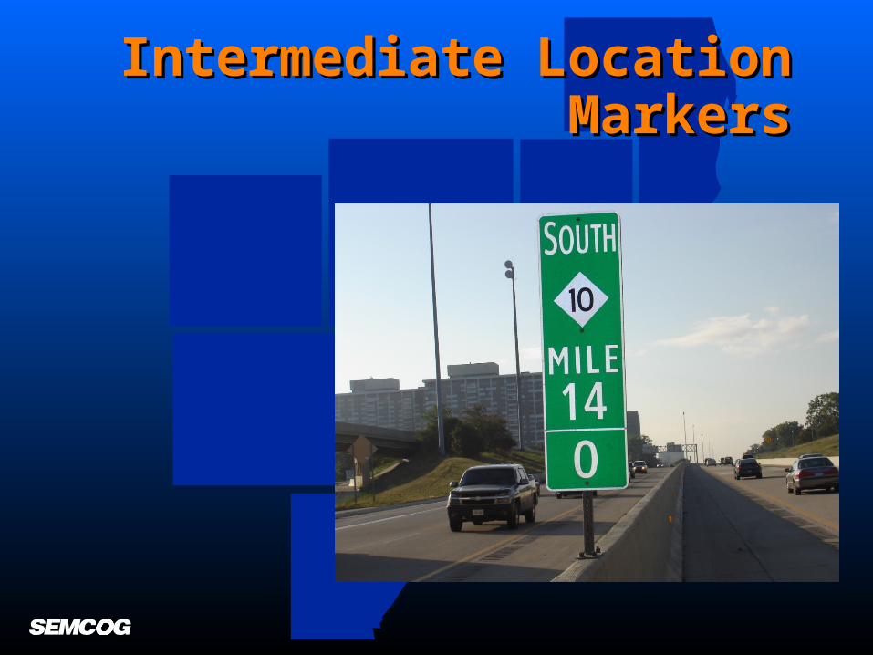
Intermediate Location Intermediate Location MarkersMarkers

Construction Impact Mitigation:Construction Impact Mitigation: Ambassador Bridge Gateway ProjectAmbassador Bridge Gateway Project
• Alternative Route PlanningAlternative Route Planning
• Crash Investigation SitesCrash Investigation Sites
• Redeployed Freeway Redeployed Freeway Courtesy PatrolCourtesy Patrol
• Transit Transit Alternatives/Commuter Alternatives/Commuter ChallengeChallenge
• Communicate, Coordinate, Communicate, Coordinate, and Cooperate and Cooperate

Incident Responder Safety Incident Responder Safety TrainingTraining

High VisibilityHigh Visibility

Regional Concept for Regional Concept for Transportation Operations Transportation Operations
(RCTO), 2005(RCTO), 2005
Planning GroupPlanning Group• SEMCOGSEMCOG• MDOTMDOT• Michigan State PoliceMichigan State Police• Assistance by Hubbell, Roth & Clark, Assistance by Hubbell, Roth & Clark,
Inc.Inc.

RCTO VisionRCTO Vision
““Southeast Michigan will have a reliable and Southeast Michigan will have a reliable and managed transportation operations across managed transportation operations across geographic and modal boundaries for both geographic and modal boundaries for both routine traffic operations and traffic incident routine traffic operations and traffic incident management that saves time, lives, and management that saves time, lives, and money for its travelers.”money for its travelers.”

Metro Detroit (Stakeholder) Metro Detroit (Stakeholder) SuggestionsSuggestions
• ObjectivesObjectives Identify arterial streets as priority corridors, making them Identify arterial streets as priority corridors, making them
candidates for investments in traffic signal optimization, candidates for investments in traffic signal optimization, communications infrastructure, and closed circuit television communications infrastructure, and closed circuit television cameras.cameras.
Disseminate operations information to stakeholders, the Disseminate operations information to stakeholders, the media, and individual travelers (i.e., video sharing).media, and individual travelers (i.e., video sharing).
Retime traffic signals regularly.Retime traffic signals regularly. Reduce congestion and improve travel times by clearing Reduce congestion and improve travel times by clearing
incidents quickly and safely.incidents quickly and safely.

Transportation Operations Transportation Operations NetworkNetwork
Arterial (Operations)
Traffic Management
Communications(Urban Area
Security Initiative, PSAPs)
MaintenanceBorder
Operations
Transit Operations
Freeway Operations
Traffic Incident
Management Planning
Regional Operations
Steering Committee
Courtesy Patrol
Abandoned
Vehicles
Special Events
Vehicle Infrastructure
Integration
Traffic Signal Coordination
SEMSIM

For More InformationFor More Information
• SEMCOG’s Web siteSEMCOG’s Web sitewww.semcog.org/Data.aspx?id=254www.semcog.org/Data.aspx?id=254
• Contact SEMCOGContact SEMCOG– Ms. Wei Chen, Transportation Engineer,Ms. Wei Chen, Transportation Engineer,
[email protected] or [email protected] or 313-324-3322– Mr. Chade Saghir, Senior Transportation Planner, Mr. Chade Saghir, Senior Transportation Planner,
[email protected] or [email protected] or 313-324-3342– Mr. Tom Bruff, Transportation Coordinator, Mr. Tom Bruff, Transportation Coordinator,
[email protected], [email protected], 313-324-3340