Group... · Web viewLIM, Kheng Yong Company Singapore Government ...
date post
19-Dec-2015Category
view
214download
0
Improving radar Doppler wind information extraction
Yong Kheng Goh, Anthony HoltUniversity of Essex, U. K.
Günther Haase, Tomas Landelius SMHI, Sweden

Radar Observations
● Some radars used in operational forecasting only provide Reflectivity data.
● Some others provide Radial Velocity data from Doppler measurements. They can suffer from velocity ambiguity due to folding.
● In this study we also make use of the reasonably close proximity of two Doppler radars in the Po Valley in Italy.

CARPE DIEM WP2 objectives
● Improve the use of Doppler wind data via:
1) Super-observation product (SMHI)
2) Operational dual-Doppler wind retrieval
(ESSEX)

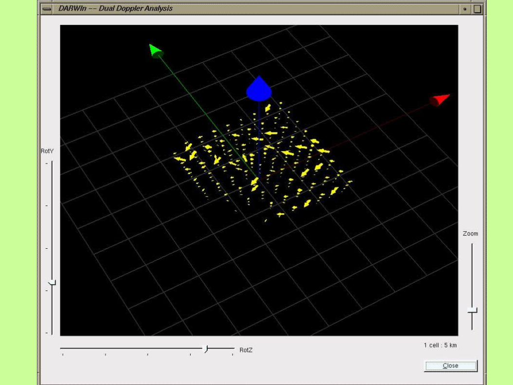
Dual Doppler Wind Retrieval
Procedure:1) Terrain analysis – establish areas
amenable to dual-Doppler analysis.2) Data gridding – interpolating polar
data into Cartesian data.3) Calculating wind field.4) Verifying wind field (a) by re-constructing PPI and
comparing with original PPI; (b) comparing “along-track” components.
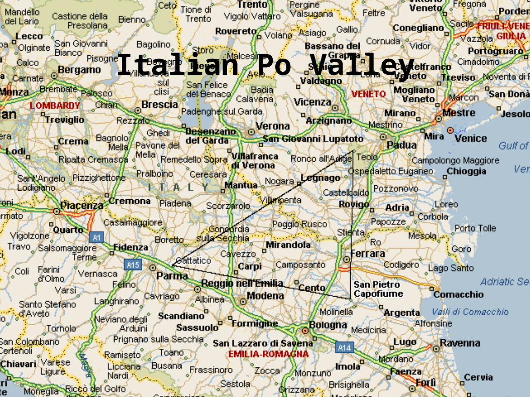
Italian Po Valley

Problems with terrain and radar orientation

Height Profile

Italian terrain

Location of Po Valley study region

Data Gridding● Typical dimension:
– 60 x 60 cells x 4 layers– 0.5 km x 0.5 km x 0.9
km● Search and average
method.● Resource hungry
process.● E.g. 60x60x50x50x4
= 36,000,000 times per data set.

Example of polar to Cartesian conversion
● Data type : Doppler velocity● 60 x 60 grid, lattice length = 0.5 km.

Calculating wind field
● Fundamental equations:
iiti
r
iiiiii
Vwv
wvu
sin
sincoscoscossinˆ)(
vr
0
vvv
tt
velocityterminal velocityradialnet
radar at t measuremenlocity Doppler ve
vector(velocity) wind),,()(
ti
ir
wV
iv
wvuv

Numerical procedures● Iterative method:
– horizontal components
– vertical component
● Boundary conditions: – zero velocity on ground
● Typical convergent factor
11, nnnn wDCvwBAu
dz
dw
z
w
y
v
x
u 1
where0
030.0,,
)1(,,
)(
,,)(
,,)1(
max
kjin
kjin
kjin
kjin
ww
ww

Comparison of reconstructed radial velocity field and radar measurement
measurement Reconstructed

“along-track” componentsv
r1
r2
r12
v . (r12 + r2 – r1) = 0
= v(cal).r12 + vr2 (obs) r2 – vr1 (obs) r1
Typical relative deviation, /(v .r12) < ±1%


Assimilation into NWP models
Quality control(e.g. de-aliasing)
WP2: de-aliasing & super-observations (SMHI)
Radarwinds
VVP profiles andsuper-observations

• Innovation: radar observations are mapped onto the surface of a torus (assuming linear winds)
• Advantage: no need for additional wind data from other instruments or NWP models
• Performance: accurate and robust tool for eliminating multiple folding
• Assimilation: benefits through improved quality of wind profiles and super-observations
De-aliasing algorithm

Vantaa (Finland): 4 December 1999, 12:00 UTC
Wind velocity profiles (VVP)

Wind direction profiles (VVP)
Vantaa (Finland): 4 December 1999, 12:00 UTC
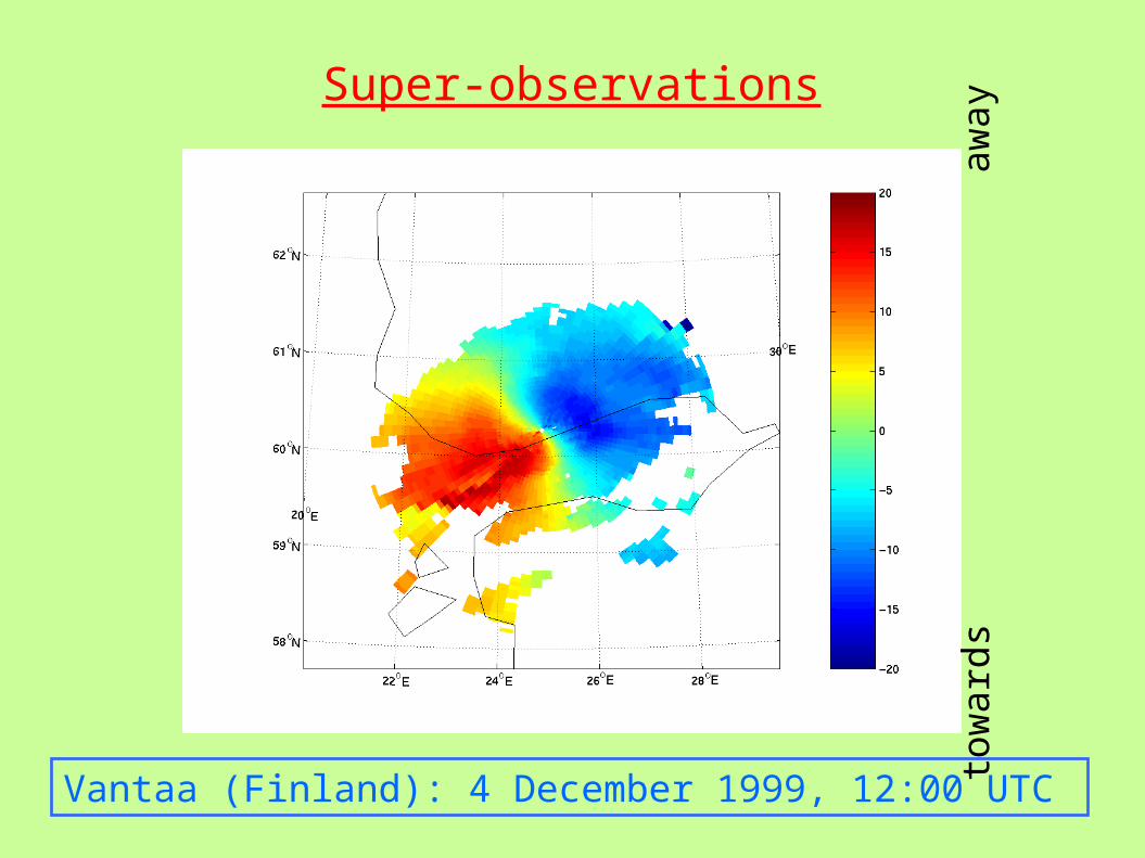
Super-observations
Vantaa (Finland): 4 December 1999, 12:00 UTC
tow
ard
s
a
wa
y
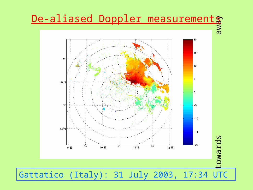
De-aliased Doppler measurements
Gattatico (Italy): 31 July 2003, 17:34 UTC
tow
ard
s
a
wa
y

Summary
● Real time dual Doppler wind retrieval can provide useful 3D wind velocity field information to the weather radar operators.
● De-aliased Doppler winds can be assimilated into NWP models through super-observations.
● To-do:– Comparison with NWP model.– Triple Doppler wind retrieval.