HSIS Guidebook – WA
215
Guidebook for State Data Files WASHINGTON www.HSISinfo.org Prepared by: Anusha patel Nujjetty Yusuf M. Mohamedshah LENDIS Corporation Turner Fairbank Highway Research Center Federal Highway Administration 6300 Georgetown Pike McLean, VA 22101-2296 Forrest M. Council University of North Carolina Highway Safety Research Center 730 Airport Road Chapel Hill, NC 27599-3430 Prepared for: Federal Highway Administration Office of Safety and Office of Safety Research & Development U.S. Department of Transportation Washington, DC 20590 Revised, June 2014
Transcript of HSIS Guidebook – WA
*Times New Roman Bold
Guidebook for State Data Files
WASHINGTON
www.HSISinfo.org
Prepared by:Anusha patel NujjettyYusuf M. MohamedshahLENDIS CorporationTurner Fairbank Highway Research CenterFederal Highway Administration6300 Georgetown PikeMcLean, VA 22101-2296
Forrest M. CouncilUniversity of North CarolinaHighway Safety Research Center730 Airport RoadChapel Hill, NC 27599-3430
Prepared for:Federal Highway AdministrationOffice of Safety and Office of Safety Research & DevelopmentU.S. Department of TransportationWashington, DC 20590
Revised, June 2014

HSIS Guidebook – WA 2
Table of Contents
Introduction 4
Details of Major Files 6
The Accident Files 6
The Roadway Inventory Files 10
The Roadlog File 12
The Curve File and The Grade File 13
The Ramp File 14
The Special-Use Lanes File 15
The Features File 15
The Left/Right File 15
The Railroad Grade Crossing Index 16
Traffic Information 16
Issues Related to Developing and Merging Files 18
Composite List of Elements 20
Crash File 36
Accident Subfile 36
Vehicle Subfile 77
Occupant Subfile 108
Pedestrian Subfile 114
Roadlog File 122
Curve File 159
Grade File 164
Ramp File 168
Special-Use Lane File 189
HSIS Guidebook – WA 3
Table of Contents
Features File 194
Left/Right File Crossing File 203
Railroad Crossing File 213
HSIS Guidebook – WA 4
Introduction
Introduction to the Washington State HSIS Guidebook
The Washington database incorporated into the HSIS system is derived from the Washington TRIPS system. The system, maintained by the Transportation Data Office (TDO) of the Washington DOT, is a relational database system which, like Utah, is based on ADABAS computer software.
The Washington TDO provides the data to HSIS in the form of nine different data files. These include:
• Accident data (including accident, vehicle and occupant data) • Basic roadway inventory data • Curve/grade/features data • Roadway crossings and roadside facilities ("left/right") data • Special-use lane information • Railroad grade crossing index • Traffic data
As originally received, all files except the basic roadway inventory data are "point"
files, describing information about specific points (rather than sections) on the roadway. As will be described below, some of these point-files have been modified to a section-related format for ease of use in the HSIS system.
Raw file data are provided to the Highway Safety Research Center where they are
retained as backup information. The documentation (variable listings, definitions, etc.) for these raw files and for the SAS files that are developed from them are available at FHWA offices.
Beginning in 2004, the HSIS system was converted from a SYBASE relational
database to an ORACLE relational database for internal use. Data files for a given State are linked and manipulated by HSIS staff using SAS code and, as in the past, we have continued to produce SAS format libraries for each of the variables in each of the files. This Guidebook will concern these SAS files - their formats, completeness, and quality. However, researchers requesting data from HSIS can request the output in various formats such as SAS, Microsoft Excel® and Access®, dBase, ASCII, etc.
As noted above, the SAS accident data are divided into three separate subfiles, the
first containing the basic accident information on a case-by-case basis, the second
HSIS Guidebook – WA 5
Introduction containing information on up to three vehicles in each accident, and the third containing information on up to seven occupants in each of the three possible vehicles. The vehicle and occupant data can be linked to the basic accident file for a specific case using the accident report number and vehicle number. The accident subfile can be linked to roadway inventory and traffic files using an 11 character route/milepost variable. Also a separate pedestrian file is available from 1999 onwards. This file has information on the pedestrians that were involved in a crash. Just as with the vehicle and occupant files, this file can be linked to the accident sub-file using the accident report number.
Unlike the accident file which is referenced to a point on the roadway, each record in
the Roadlog File contains information on a homogeneous section of roadway (i.e., a stretch of road which is consistent in terms of certain characteristics, with anew section being defined each time any of the characteristics changes). Each record on the basic inventory file contains current characteristics of the roadway system and includes such variables as surface width, lane width and type, shoulder width and type, median information and other variables. As will be noted below, unlike other HSIS state inventories, this file also contains information on the specifics of turn lanes and acceleration lanes.
Data on horizontal curvature and grade have been extracted from an original point-
based file and converted in two homogenous section files -- the Curve File and the Grade File. Each contains information concerning the location (i.e., beginning and ending milepoints) of a specific curve or grade, and descriptive information such as degree of curvature, direction of curve, curve length, percent grade, and grade length.
The Ramp File, a supplemental roadlog file, contains information on the location and
roadway characteristics of ramps. This file is available from 2002 onwards. As is the case with other supplemental files, this file is linkable to the accident data.
The Special-Use Lanes File, unique to Washington, contains additional information
on special auxiliary lanes or on usage of the paved shoulder as special lanes. For example, this file contains information on the presence of bike lanes, the presence of two-way turn lanes in the median, and the presence of auxiliary climbing lanes.
The Features File is a supplemental roadway inventory file which contains limited
information on bridges, tunnels, and underpasses. These are point data, with location and limited descriptive information given for each point on the file. The bridge data have been formatted such that they are linkable with the National Bridge Index (NBI) file available from FHWA.
HSIS Guidebook – WA 6
Details of Major files
The Left/Right File is another unique file to Washington which contains descriptive information on crossing roadways and milepost markers, and the locations of roadside facilities such as park and ride lots, rest areas, and truck weight stations.
While the Railroad Grade Crossing Index does not contain detailed information on
the railroad crossing, it does contain information which will allow one to link this file with the federally- required railroad grade crossing file.
DETAILS OF MAJOR FILES - The Accident Files
Accident data is collected statewide by all police departments in the state on a standard form. The prescribed accident reporting threshold is currently $750 or personal injury. Prior to 1 January 2000, this used to be $500 or personal injury. It is felt that this threshold is generally used for accidents that occur on state system roads in most of the rural areas. It is the feeling of the TDO staff that city police in Tacoma and Seattle, two of the larger cities, may have begun to report fewer non- injury crashes than the official threshold would require, using something like a tow-away criteria.
There are approximately 40,000 accidents in the entire state each year. For each
crash that is investigated, an accident report form is sent to the Washington State Patrol (WSP) Accident Reports Division, which is the central repository of the data. The WSP then separates the forms into those occurring on state routes and those on non-state routes, and sends the state- route hard copies to the Transportation Data Office (TDO) for location coding. The location coding is done by coding staff using logs showing virtually every possible reference point beside the roadway, including bridges, businesses, intersections, and a number of other references. The crash location is coded based on location-related information provided by the investigating officer on the form and on his/her reference map/sketch. In addition to the standard coding done by other states, all accidents which occur on interchange ramps are located to the specific interchange ramp on which they occur.
Each unit of the Washington State Patrol has been given a copy of the accident
locator log to provide them with listings of possible reference points. In addition, physical reference markers are installed on Interstates and other state routes in both urban and rural locations. While some may be missing in urban areas, the rural state systems seem to be intact. TDO staff estimate that there are problems in location provided by the
HSIS Guidebook – WA 7
Details of Major files officers in only one to two percent of the accidents that the staff codes. These are sent back to the police officers for correction.
Because of the above-noted locating and coding procedures, it is felt that the
location coding for these state-route accidents is probably as accurate as would be found in any state in the U.S., with over 95% of the rural accidents being located to at least the nearest 1/10 of a mile, and over 95% of the urban accidents being located within 100 feet.
After location coding by the TDO staff, the hard copies are sent back to the
Washington State Patrol for coding of all other variables. Once keypunched and entered into the computer by the State Patrol, the complete computer file is sent back to the TDO office for their use. Approximately 15 to 20 percent of the crashes in the location-coded file are reported by citizens using a "citizen reports." This is a higher proportion of citizen-reported crashes than in other states. Because of the size of this sample, these reports are location coded by Washington staff, and are used in calculation of rates and in identification of high-accident sites. The form used by citizens is designed to eliminate some of the possible self-reporting biases by deleting some of the items found on the normal police report. However, because of the possible remaining biases, and in order to be consistent with the other state databases, these citizen reports have been deleted from the Washington HSIS file. Deleting these reports results an HSIS file of approximately 42,000 accidents. The corresponding number of accidents in HSIS in its first year – 1993 – was about 34,000.
Currently the HSIS system contains accident data for 1993 to 1996 and 1999
onwards. The 1997 and 1998 accident data were not included by WADOT in the TRIPS system due to budget restrictions and problem encountered in year 2000 conversion efforts. Thus, these data are also not present in HSIS.
The Accident Subfile contains over 69 variables and approximately 42,000 crash
records, and includes all basic variables that would be expected on standard police forms. The file provides a “first harmful event” variable but does not provide a "most harmful event." However, since 1993, the accident file has contained information on the sequence of events. This information includes the movements prior to the impact for up to two vehicles (e.g., "moving straight," "turning right"), and the specific type of the impact (e.g., "strikes other vehicle head on," "strikes appurtenance"). In addition, the accident file contains a variable concerning whether or not one or more vehicles was towed from the scene, which will allow analysis based on “towaway” vehicles in addition to standard
HSIS Guidebook – WA 8
Details of Major files analysis which include all vehicles meeting the dollar damage threshold, whether towed or not.
Also, the accident file contains a variable indicating the presence of a work zone
at the crash location from 1999 onwards. The Vehicle Subfile, containing approximately 78,000 vehicles each year, contains
information on up to three vehicles in the crash. It contains specific information on the driver (including ejection information) as well as information on vehicle make/model, movements related to crash, miscellaneous actions, crash circumstances and causes. VIN data is not found on the TRIPS file available to HSIS. Crash-involved pedestrian information on such items as pedestrian age, sex, injury status, actions prior to the crash, sobriety, and crash circumstances is also included in the Vehicle Subfile up to 1996. From 1999 onwards, a separate pedestrian file has been developed that included information on all pedestrian related items.
Due to budget restrictions and conversions to post-2000 formatting, Washington
stopped collecting some vehicle and occupant variables during the 1999-2001 period. Hence, some of the variables in the vehicle and occupant files are either missing or have limited coding, and the coding varies by year. Relevant notes under specific variables in the format section of the guidebook identify these variables. For these variables, the end-user is advised to examine the frequency distributions across years to determine the extent of missing values and the consistency of coding before using them in any analysis.
The Occupant Subfile contains information on up to seven occupants (including
the driver) for any of the three vehicles, resulting in a file of approximately 700,000 entries each year. It contains information on occupant’s sex, age, seating position, injury class, restraint use, and ejection. For 1999 and later years, this file does not contain information on the driver and the total number of observations in the file are about 20,000. The driver information continues to be captured in the Vehicle Subfile for all years.
Finally, as noted above, some Occupant Subfile variables are missing or
inconsistent for the 1999-2001 period. Pertinent notes are included in the format section. The Pedestrian Subfile, available from 1999 onwards contains information on
pedestrians involved in a crash – approximately 1,200 entries per year. It contains information on various pedestrian characteristics like age, clothing, sex, injury,
HSIS Guidebook – WA 9
Details of Major files contributing circumstances, etc. Previously, these variables were available in the vehicle sub-file.
In order to assess the accuracy of accident variables, we both questioned the TDO
staff concerning their feelings of variables that were incompletely coded or might be inaccurate and examined a series of single variable tables for 80 key variables. The TDO staff indicated that the truck-type codes in "vehicle type" variable are in error in some cases. In addition, there is no information on the crash report form concerning whether or not hazardous materials were spilled. It is noted that Washington may move toward capturing better truck information through incorporation of NGA accident data elements in the future. Second, the staff feel that the “road character” variable in the accident file, which include information such as "straight and level," "curve and grade", etc. is a poor variable. Also, while information is provided on the report form (and in two variables) concerning whether an accident occurred in a construction zone, the staff feels that there are some problems in accuracy because of work zone definition and interpretation problems. (Based on a recent HSIS staff analysis of work zone accident data in other HSIS and non-HSIS states, this problem is common across almost all states.) All other variables were felt to be accurate. Finally, as noted above some vehicle and occupant related variables are not coded or coded inconsistently from 1999 to 2001 and a series of computerized quality control checks conducted by HSIS staff each time a new annual set of files is received from Washington. These checks compare the new year data to that of the preceding year and screen for changes in file frequencies (e.g., total crashes, total vehicles), percent of “unknowns” or blanks and changes in coding distributions for each variable in each subfile (e.g., changes in driver gender or crash type distributions between years). When problems are found, HSIS staff works with the State staff to correct them, and where needed, additional information was added below that variable in the later format sections of this Guidebook.
In addition to information received from the TDO staff, single variable tabulations
were run to examine the questions of reporting completeness and data accuracy for accident, vehicle, and occupant variables. Here study of the percent of “unknown,” “not applicable,“ and “not stated” values for over 80 key variables found in these files indicate that, in general, the data is coded to a high degree of completeness. The data also appear to be quite consistent across years, and similar variables appear to have similar values.
In general, from the interviews and the data comparisons conducted, the data
appear quite accurate. In the limited number of cases where possible inaccuracies were found, they are noted under the specific variables.
HSIS Guidebook – WA 10
Details of Major files
The Roadway Inventory Files
As noted above, using the multiple files provided by Washington from their TRIPS system (Transportation Information and Planning Support System), a series of roadway inventory files which contain current characteristics of the state road system have been developed for the HSIS. There is a basic Roadlog File containing information on such things as lane and shoulder width and type; two supplemental files on horizontal and vertical alignment; a supplemental Roadway Features file containing information on bridges, tunnels, underpasses and other features; a Left/Right file containing information on crossing roadways, milepost markers, and roadside features such as rest areas and weigh stations; and a supplemental Special-Use Lanes File which contains information on bike lanes, climbing lanes, etc.
The Roadlog, Curve, Grade and Ramp Files are "section" files, with each homogeneous roadway section being defined by a beginning and ending milepost. The remaining files are "point data" files describing characteristics at a given milepost. However, some variables in these "point" files include information on the length of a given feature from that point (e.g., the length of a bike lane from the milepost provided). Each of these files is described in the following narrative.
The basic inventory file and supplemental files which are part of the TRIPS were developed in the past based on inventory information collected through a series of field surveys. Prior to 1986, a field survey covering half of the state was conducted each year to verify the information on the file. Due to lack of funds, this process ended after 1986. However, an update to the file is now done on a routine basis by the TDO inventory staff based on new construction drawings. In addition, whenever a major construction or reconstruction project is completed, a manual physical inventory is conducted as a check of the final “as built” construction plans. The only updates that would be missed by the TDO staff are maintenance operations done at the district level. Districts are allowed to do maintenance projects on the roadway for projects which cost up to $30,000. Even for these projects, when it becomes apparent to the central office staff that certain things have been done in the district but have not been reported to them, they request the information from the district. The fact that they do not get systematic reports of these maintenance activities from the district leads the TDO staff to believe that they are missing some data on approximately 10-15 percent of the roadways. However, they feel that the data on 85-90 percent of the inventory system is quite complete and quite accurate.
The HSIS files, developed from files in TRIPS, contain information on approximately 7,200 miles of mainline (non-ramp) roadway and approximately 1000 additional miles of ramp, frontage road, and other non-mainline roadway. This includes all functional classes of roads within the state system -- Interstate, U.S. and state routes. (Note that there are no county- or
HSIS Guidebook – WA 11
Details of Major files
municipal-owned roads in the file.) Currently, inventory data is available for 1993 to 1996 and from 2002 onwards. Data for intermediate years is unavailable because Washington stopped creating electronic files for those years due to budget restrictions. However, HSIS has AADT files for 1998-2000. While the beginning and end-points of these AADT records differ from the segments in the 1996 and 2002 roadlog file, HSIS staff will work with users in matching these data to the roadlog sections for either or both of those years. Unlike other states, many of the variables in all of the roadway inventory files contain not only a description of the item, but also information concerning the date that the item was last modified. This should allow "before/after" analyses related to the specific roadway changes. Because a new record is generated each time any of the items on a file changes, the sections that are generated are fairly short, resulting in a large number of individual records on the file. For example, the 8,000 miles of basic inventory information is divided into 46,000 records, resulting in an average section length of two tenths of a mile.
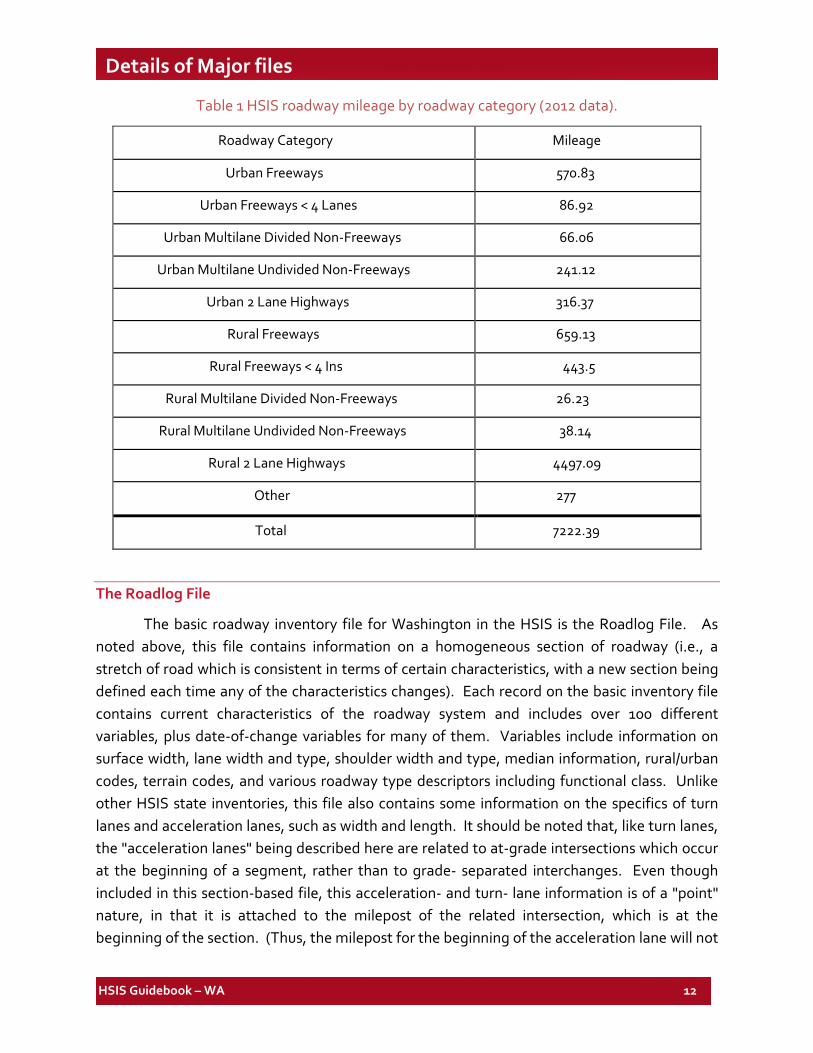
Table 1 presents mileage breakdowns for all paved, two-way, mainline roadways (i.e., omitting all unpaved and one-way roadways). As expected since it is a state-controlled system, the file is predominantly rural in nature, with close to 80% of the roadways being in rural areas.
HSIS Guidebook – WA 12
Details of Major files
Table 1 HSIS roadway mileage by roadway category (2012 data).
Roadway Category Mileage
Urban Freeways 570.83
Urban Freeways < 4 Lanes 86.92
Urban Multilane Divided Non-Freeways 66.06
Urban Multilane Undivided Non-Freeways 241.12
Urban 2 Lane Highways 316.37
Rural Freeways 659.13
Rural Freeways < 4 Ins 443.5
Rural Multilane Divided Non-Freeways 26.23
Rural Multilane Undivided Non-Freeways 38.14
Rural 2 Lane Highways 4497.09
Other 277
Total 7222.39
The Roadlog File
The basic roadway inventory file for Washington in the HSIS is the Roadlog File. As noted above, this file contains information on a homogeneous section of roadway (i.e., a stretch of road which is consistent in terms of certain characteristics, with a new section being defined each time any of the characteristics changes). Each record on the basic inventory file contains current characteristics of the roadway system and includes over 100 different variables, plus date-of-change variables for many of them. Variables include information on surface width, lane width and type, shoulder width and type, median information, rural/urban codes, terrain codes, and various roadway type descriptors including functional class. Unlike other HSIS state inventories, this file also contains some information on the specifics of turn lanes and acceleration lanes, such as width and length. It should be noted that, like turn lanes, the "acceleration lanes" being described here are related to at-grade intersections which occur at the beginning of a segment, rather than to grade- separated interchanges. Even though included in this section-based file, this acceleration- and turn- lane information is of a "point" nature, in that it is attached to the milepost of the related intersection, which is at the beginning of the section. (Thus, the milepost for the beginning of the acceleration lane will not
HSIS Guidebook – WA 13
Details of Major files
begin a new section.) The same is true for additional variables related to intersection lighting and traffic control (for the mainline). It is also noted that there may be other intersections within a section that are not noted on this file. Thus, while a new section will begin at some (but not all) intersections with acceleration and/or turn lanes, a new section will not necessarily begin at other intersections. To obtain information on the number of intersections within a given section, one would link this file with the "Left/Right File" described later. Finally, to facilitate analyses, variables related to Average Annual Daily Traffic (AADT) and Legal Speed Limit (SPD_LIMT) were extracted from other files and merged into the Roadlog File.
As with the accident files, Washington TDO staff were questioned concerning the completeness and accuracy of the variables on the Roadlog File. As noted above, there feeling is that the data are very accurate for between 85-90 percent of the inventoried system. In addition, a series of single variable tabulations for 48 key variables were reviewed. These runs indicated that almost all of the variables have less than five percent of the data uncoded. Where variables should be somewhat consistent (e.g., miles of median type and median width), they are. In summary, the data appear to have a high overall degree of completeness and consistency.
Two new variables, RODWYCLS and MVMT, have been created by HSIS staff in the roadway segment file of each of the HSIS states. The RODWYCLS (Roadway Class) variable is based on the combination of rural/urban, access control, number of lanes and median type variables. This variable classifies each roadway segment into one of ten roadway types described in the later “Format” section. This variable is also included as an accident-file variable by matching each crash to its corresponding roadway segment. The MVMT variable (Million Vehicle Miles of Travel) is calculated for each segment in the roadway file by multiplying the segment length, AADT and 365 days in a year, and dividing by one million. Both these variables were created in response to inquire from data users, whose most frequent questions have concerned either crash frequencies or rates (per MVMT) for one or more of these roadway classes.
The Curve File and the Grade File
Initially, data on horizontal curvature and grade were captured in the roadway features inventory as point data, along with information on bridges, tunnels, underpasses and changes in speed limit. For ease of use and consistency with other HSIS states, two separate section-based files have now been developed -- a Curve File and a Grade File. In each case, a new section begins whenever there is a horizontal curve (in the first file) or a change in grade (in the second file.) For use in specific analyses, these files can be merged with the Roadlog File, the
HSIS Guidebook – WA 14
Details of Major files
Accident File, or with each other using the beginning and ending milepoint variables and the “Road Inventoried” variable.
The Curve File contains information on approximately 16,200 curves. It includes variables related to angle, direction, degree (and radius), length, maximum super-elevation (for a very limited number of curves), legal speed limit, the date of last change to the curve, and whether the curve overlaps with a preceding curve. The latter would occur due to slight errors in ending milepoints resulting from the use of curve length in the calculation of this milepoint. This occurs in less than one percent of the cases. Note that when the curve file is merged with the Roadlog File to put curvature variables on the roadway sections, 70 to 80 percent of the roadway sections will show missing degree of curve and other variables. These "missing sections" actually denote tangent sections where the degree of curve is zero. This should be anticipated and handled by the analyst.
The Grade File contains approximately 34,200 records. In addition to beginning and ending milepoint, the Grade File contains information on the percent grade, direction ("+" or "-"), and length. In addition, the file contains information concerning "Grade Type," which denotes whether the downstream end of the grade is an angle point (i.e., a minor change in grade without a vertical curve) or is connected to the succeeding grade with a vertical curve.
Both curvature and grade information was originally developed from construction drawings and straight-line diagrams. It is updated yearly through review of new construction plans. As with the basic roadway inventory information, Washington TDO staff feels that the data are accurate for approximately 85-90 percent of the inventoried mileage on the TRIPS.
The Ramp File
Ramp file, describing the roadway characteristics on ramps is created from the basic roadlog file. There is information on about 12,300 ramps in the ramp file. This file is available from 1993 to 1996 and then again from 2002 onwards. Each ramp has a beginning and ending mile point, and accidents can be linked to the ramp. (Indeed, accidents occurring at the end of a diamond- interchange ramp are located to the end of the ramp rather than to the crossing roadway, giving a clearer picture of ramp-related crashes.) While there is no information on the degree of curve for the ramp, there is information on surface type and width, shoulder type and width, number of lanes and location descriptors (e.g., urban/rural). Also traffic volumes are available only on a limited number of ramps. While there is no variable which will allow one to group the ramps for a given interchange, schematic drawings of each interchange in the state are available at the HSIS offices at FHWA.
HSIS Guidebook – WA 15
Details of Major files
The Special-Use Lanes File
In contrast to other states, Washington also provided to HSIS a file containing additional information on approximately 4,600 special auxiliary lanes. The file contains information on the type of special-use lane (e.g., bike lanes, two-way turn lanes in the median, auxiliary climbing lanes), the side of the roadway where the lanes are located, and the length, width and surface-type associated with the lanes. Where data are provided, accuracy is expected to be similar to that in the other inventory files.
The Features File
This file contains supplemental information on bridges, tunnels, and overpasses. (Speed limit data which was originally in this file have been merged into the Roadlog File.) A new record appears anytime one of these features occurs on the roadway, resulting in approximately 6,000 records. These are point data, with a location and limited descriptive information given for each point on the file. The original TRIPS file also contained the curvature and grade information which was used to build the preceding two HSIS files. While "unique" curve and grade records were eliminated from this Features File, all remaining records still contain all information on curvature and grade. Thus, it is possible to determine whether a bridge or tunnel are located on a curve (or grade), and if so, the specifics of that curve/grade. It is noted, however, that there will be multiple records for the same bridge, tunnel, or overpass, since there will be a record for both the beginning and ending milepoint, and possible additional records if any of the other variables change between these end points (such as a change in grade). As noted earlier, information on the speed limit changes has been merged into the Roadlog File.
In general, except for curve/grade and speed limit information, the file provides little or no additional descriptive information. There is information on whether a feature is lighted or not. However, it is noted that the bridge data have been formatted such that they are linkable with the National Bridge Index (NBI) file available from FHWA, a file which contains a wealth of descriptive information.
The Left/Right File
This file contains information on crossings, milepost markers, and various types of facilities found on the left and right sides of the mainline. Of the 51,400 records in the file, the overwhelming majority are related to crossing routes and milepost markers. Milepost marker information is primarily related to the location of the marker. The 25,500 records related to crossing routes contains information on the location of the crossing on the main route, the
HSIS Guidebook – WA 16
Details of Major files
type of crossing (e.g., intersection, ramp entry/exit), and a brief narrative descriptive of the crossing route (e.g., name or number of street or route). Unfortunately, the file does not contain the related milepost on the crossing route, and thus cannot be linked with inventory data related to that route. The remainder of records on the file is related to various types of facilities including transit ("flyer") stops, park and ride lots, rest areas, truck weight stations, toll booths, ferry terminals, and state border crossing facilities. A new record is created for each point (milepost) where one or more of these facilities exist. In addition to the milepost information, the file contains descriptive information, facility owner, and date of last change for each facility. The samples of these facilities are, as expected, limited. For example, there are approximately 100 rest area and weight station records, and approximately 50 records concerning transit stops. The accuracy of the data in the file is considered quite good.
The Railroad Grade Crossing Index
This file contains information for each milepost where a railroad crosses a state route. The file contains only limited descriptive data (e.g., whether the crossing is at-grade or on a structure). However, it does contain detailed location data, linkage variables and information which will allow one to link this file with the federally-required railroad grade crossing file. The latter file is available at FHWA, and contains a large variety of information on each crossing.
Traffic Information
As noted above, traffic count data captured on the TRIPS file contain a number of variables including AADT, single-trailer truck percentage, double-trailer truck percentage, and various peak- hour descriptive percentages. For WA data up to 2004, HSIS staff merged the variables related to AADT and truck percentages into the Roadlog file. The merging method used was based on information received from the WADOT traffic staff during the 1990’s. The basic assumption followed at that time was that a new traffic record began when there was change in the AADT. At that point, it appeared that the traffic census staff was identifying “discontinuities” along the routes in terms of volumes – locations where the staff expected there to be significant changes in the AADT, such as intersection with a significant turning volume, or a location of a major traffic generator such as a shopping mall exit. This resulted in a file of what might be considered “homogeneous traffic sections.” Until 2004, the HSIS staff used this information to apply AADTs and truck percentages to each roadway segment in the Roadlog file. However, new information was received from WADOT staff in 2004 indicating that the AADTs on the traffic file sent to HSIS are simply coded to the nearest roadway feature to which the count was conducted. This means that “homogeneous AADT sections” are not actually being defined. Beginning in 2004, WADOT began assigning AADTs to roadway
HSIS Guidebook – WA 17
Details of Major files
segments based on a more refined procedure that takes into consideration various roadway features such as presence of an interchange and intersection, presence of a couplet, presence of a jurisdiction boundary, and other factors to assign the AADT to the roadway segments. From 2004 onwards, the roadway segments in the WA HSIS roadway file contain this WADOT-assigned AADT data. Note that this will result in some discrepancies between AADT counts for 2004 and prior years for the same roadway segment. (WADOT staff did not correct historic AADTs.) HSIS staff is working to minimize these differences by revising the AADT-to- segment linkage algorithm for these pre-2004 data. However, it will not be possible to exactly match the new methodology, so differences will exist.
For both pre- and post-2004 years, the basis for the traffic information is a series of permanent and non-permanent count stations across the state. While the number has changed over the life of the HSIS files, there are 163 permanent Automatic Traffic Recorders (ATR’s) in the state as of July 2013. These 163 Permanent Traffic recorder (PTR) sites are comprised of 107 Permanent Traffic Recorder (PTR) sites, 37 weigh-in-Motion (WIM) sites, 18 Strategic Highway Research Program (SHRP)/Long Term Pavement Performance (LTPP) sites and 1 volume recorder.
The goal of the count program is to have timely count data (i.e., counted within the last four years) for approximately 3,900 mainline locations and 2,600 ancillary locations (e.g., ramps, frontage roads, overcrossings). This is done in a three-year count cycle. To meet this goal, the traffic census staff conducts approximately 2,300 tube counts and computes an additional 200 ramp balanced estimates each year (some being repeated at the same location multiple times in the same year). In general, the tube counts capture 72 hours of midweek (Tuesday through Thursday) data. Of these tube counts, approximately 770 per year capture vehicle classification information. For some locations where the required classification data can’t be captured with tubes, a 12-hour manual count is performed and statistically expanded to a 24-hour period. The counts are not always taken at the exact same locations, but do cover all 3,200 HPMS locations as well as certain project counts for projects that are conducted each year.
With respect to accuracy and completeness, the TDO staff feels that they have very good data on approximately 90 to 95 percent of the roadway in the trips system. They feel that the least accurate information on the file is vehicle classification data (e.g., truck percentages). This is because classification information is often annualized in a much less accurate fashion than total vehicle volume. In addition, vehicle classification data is much less complete, since roadway characteristics often preclude setting short-duration mechanical traffic counters to classify.
HSIS Guidebook – WA 18
Details of Major files
As noted under specific variable descriptions in the later format section, certain other variables (such as "Peak Hour Percentage" and "Peak Hour Split") have significant numbers of uncoded ("zero") locations. These represent locations where counts were not made or where old, erroneous counts have been deleted from the file.
Issues Related to Developing and Merging Files
As noted above, the accident data are subdivided into three subfiles -- accident, vehicle and occupant. These subfiles can be linked together using the "case number" variable which includes the accident year (i.e., CASENO) present in each of the three files. When linking the occupant subfile, the additional linking variable "vehicle number" (i.e., VEHNO) must match so that the occupants are associated with the vehicle in which they were traveling. To link the Vehicle subfile with the Accident alone, first sort both subfiles by case number. To link the Occupant file with the other two subfiles, first sort both the Vehicle subfile and Occupant subfile by case number and vehicle position number. Next sort the Accident subfile by case number. Alternatively, the separate subfiles can be linked by specifying an SQL JOIN operation with the constraining condition that case number and vehicle number from each table are equal. SQL processing does not require the data to be presorted and the output will not be in any particular sort order unless ORDER BY is specified.
The Accident subfile can then be linked with the Roadlog File using information related to county, route number, and milepost on the route. The actual linkage variables on the Accident file which are used in the merging operation are RD_INV and MILEPOST. The linkage variables on the Roadlog File are BEGMP, ENDMP and ROAD_INV. (Note that in merging the Accident or Roadlog file with other files, the merging variables are the same two milepost variables, and either RD_INV or some variation of the latter variable always ending in "_INV." For example, on the Facilities File, the latter variable is LR_INV.)
To prepare the Accident subfile for linking with the Roadlog File using a SAS data step process, the analyst must sort both the Accident and the Roadway File into location order by RD_INV and MILEPOST on the Accident file and by ROAD_INV and BEGMP on the Roadlog File. Similar sorts would be done with other files to be merged. For the alternative SQL join, the analyst must specify an exact match on RD_INV with ROAD_INV, and a range match where MILEPOST occurs between BEGMP and ENDMP. (Programs to accomplish this merging and division are documented in the HSIS Programmer's Guidebook, available at FHWA.)
Finally, where appropriate and possible, a format which defines categories within a given variable has been developed for HSIS SAS variables. These categories are shown in the pages below. These formats have been saved in a format library which can be provided to the
HSIS Guidebook – WA 19
Details of Major files
user. As a naming convention, the "format name" is the same as the variable name, with the only exception being for certain character variables (in contrast with numeric variables). More specifically, a SAS format name has to be preceded by a "$" if the variable is character in nature.
HSIS Guidebook – WA 20
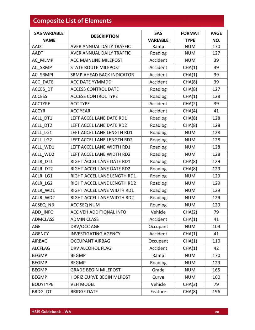
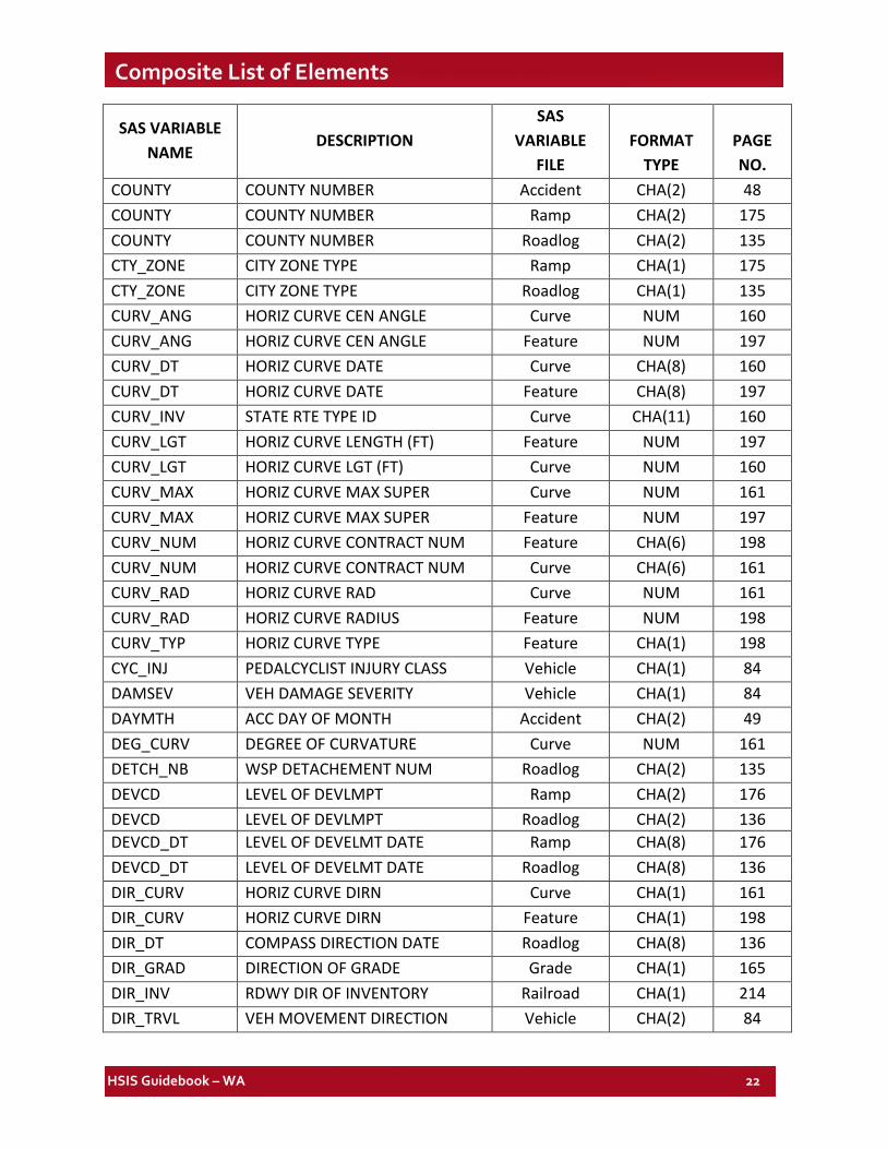
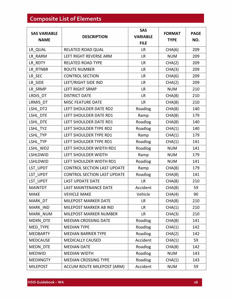
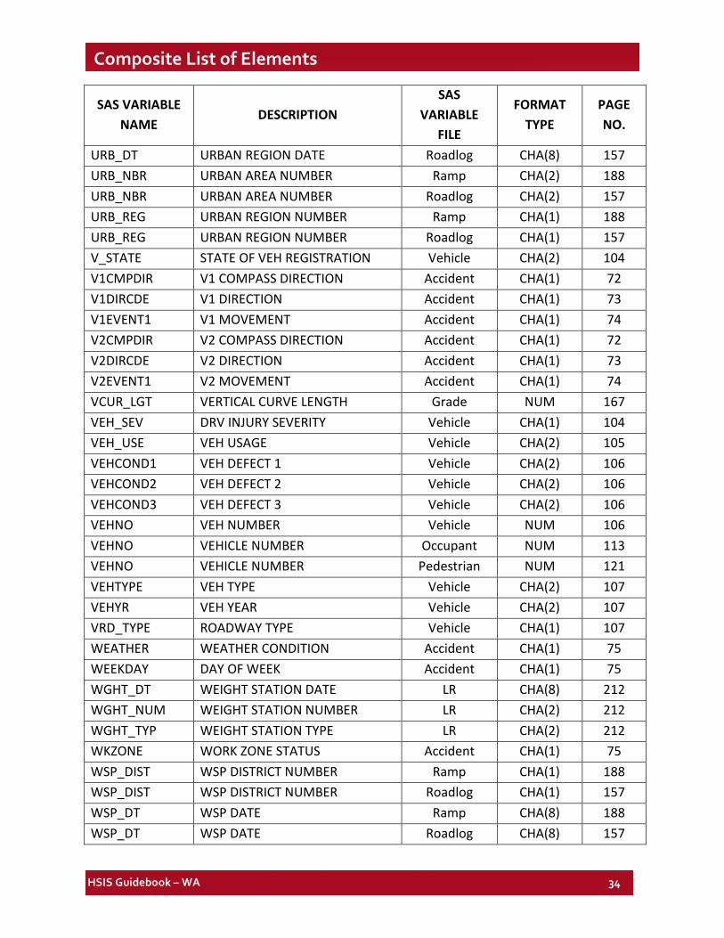
Composite List of Elements SAS VARIABLE
NAME DESCRIPTION SAS
VARIABLE
FORMAT TYPE
PAGE NO.
AADT AVER ANNUAL DAILY TRAFFIC Ramp NUM 170 AADT AVER ANNUAL DAILY TRAFFIC Roadlog NUM 127 AC_MLMP ACC MAINLINE MILEPOST Accident NUM 39 AC_SRMP STATE ROUTE MILEPOST Accident CHA(1) 39 AC_SRMPI SRMP AHEAD BACK INDICATOR Accident CHA(1) 39 ACC_DATE ACC DATE YYMMDD Accident CHA(8) 39 ACCES_DT ACCESS CONTROL DATE Roadlog CHA(8) 127 ACCESS ACCESS CONTROL TYPE Roadlog CHA(1) 128 ACCTYPE ACC TYPE Accident CHA(2) 39 ACCYR ACC YEAR Accident CHA(4) 41 ACLL_DT1 LEFT ACCEL LANE DATE RD1 Roadlog CHA(8) 128 ACLL_DT2 LEFT ACCEL LANE DATE RD2 Roadlog CHA(8) 128 ACLL_LG1 LEFT ACCEL LANE LENGTH RD1 Roadlog NUM 128 ACLL_LG2 LEFT ACCEL LANE LENGTH RD2 Roadlog NUM 128 ACLL_WD1 LEFT ACCEL LANE WIDTH RD1 Roadlog NUM 128 ACLL_WD2 LEFT ACCEL LANE WIDTH RD2 Roadlog NUM 128 ACLR_DT1 RIGHT ACCEL LANE DATE RD1 Roadlog CHA(8) 129 ACLR_DT2 RIGHT ACCEL LANE DATE RD2 Roadlog CHA(8) 129 ACLR_LG1 RIGHT ACCEL LANE LENGTH RD1 Roadlog NUM 129 ACLR_LG2 RIGHT ACCEL LANE LENGTH RD2 Roadlog NUM 129 ACLR_WD1 RIGHT ACCEL LANE WIDTH RD1 Roadlog NUM 129 ACLR_WD2 RIGHT ACCEL LANE WIDTH RD2 Roadlog NUM 129 ACSEQ_NB ACC SEQ NUM Roadlog NUM 129 ADD_INFO ACC VEH ADDITIONAL INFO Vehicle CHA(2) 79 ADMCLASS ADMIN CLASS Accident CHA(1) 41 AGE DRV/OCC AGE Occupant NUM 109 AGENCY INVESTIGATING AGENCY Accident CHA(1) 41 AIRBAG OCCUPANT AIRBAG Occupant CHA(1) 110 ALCFLAG DRV ALCOHOL FLAG Accident CHA(1) 42 BEGMP BEGMP Ramp NUM 170 BEGMP BEGMP Roadlog NUM 129 BEGMP GRADE BEGIN MILEPOST Grade NUM 165 BEGMP HORIZ CURVE BEGIN MLPOST Curve NUM 160 BODYTYPE VEH MODEL Vehicle CHA(3) 79 BRDG_DT BRIDGE DATE Feature CHA(8) 196

HSIS Guidebook – WA 21
Composite List of Elements
SAS VARIABLE NAME
DESCRIPTION SAS
VARIABLE FILE
FORMAT TYPE
PAGE NO.
BRDG_LGT BRIDGE LIGHTING Feature CHA(1) 196 BRDG_NBR BRIDGE NUMBER Feature CHA(9) 196 BRDG_OWN BRIDGE XROAD OWNER CD Feature CHA(2) 197 BRDG_XRD BRIDGE XROAD DESC Feature CHA(24) 197 CASENO ACC REPORT NUMBER Vehicle CHA(10) 80 CASENO ACC RPT NUMBER Occupant CHA(6) 110 CASENO ACCIDENT CASE NUMBER Pedestrian CHA(10) 115 CASENO CASE NUMBER Accident CHA(10) 42 CDHAZNM COMM CARRIER HAZMAT Vehicle CHA(17) 80 CDPLACCD COMM CARRIER PLACARD Vehicle CHA(1) 80 CDPLACNO COMM CARRIER PLACARD NUM Vehicle CHA(4) 80 CDPLACSU COMM CARRIER PLACARD SUFFIX Vehicle CHA(1) 80 CENTURY ACC CENTURY Accident CHA(2) 42 CITY CITY NUMBER Ramp CHA(4) 171 CITY CITY NUMBER Roadlog CHA(4) 129 CITY CITY NUMBER Accident CHA(4) 42 CITY_DT CITY DATE Ramp CHA(8) 174 CITY_DT CITY DATE Roadlog CHA(8) 133 CLOTHING PED CLOTHING Pedestrian CHA(1) 115 CMAXLES COMM CARRIER NUM OF AXLES Vehicle CHA(2) 81 CMCONFIG COMM CARRIER CONFIG Vehicle CHA(1) 81 CNTL_SEC CONTROL SECTION Ramp CHA(8) 174 CNTL_SEC CONTROL SECTION Roadlog CHA(8) 133 CNTY_DT COUNTY DATE Ramp CHA(8) 175 CNTY_DT COUNTY DATE Roadlog CHA(8) 133 COLTYPE1 COLLISION TYPE 1 Accident CHA(2) 46 COLTYPE2 COLLISION TYPE 2 Accident CHA(2) 46 COM_BODY COMM CARRIER CARGO BODY Vehicle CHA(1) 81 COM_GWR COMMERCIAL CARRIER WEIGHT Vehicle CHA(6) 82 COMP_DIR COMPASS DIRECTION Roadlog CHA(2) 134 CONTRIB1 DRV CONTRIB CIRCUMS 1 Vehicle CHA(2) 83 CONTRIB1 PED/CYC CIRCUMSTANCES 1 Pedestrian CHA(2) 116 CONTRIB2 DRV CONTRIB CIRCUMS 2 Vehicle CHA(2) 83 CONTRIB2 PED/CYC CIRCUMSTANCES 2 Pedestrian CHA(2) 116
HSIS Guidebook – WA 22
Composite List of Elements
SAS VARIABLE NAME
DESCRIPTION SAS
VARIABLE FILE
FORMAT TYPE
PAGE NO.
COUNTY COUNTY NUMBER Accident CHA(2) 48 COUNTY COUNTY NUMBER Ramp CHA(2) 175 COUNTY COUNTY NUMBER Roadlog CHA(2) 135 CTY_ZONE CITY ZONE TYPE Ramp CHA(1) 175 CTY_ZONE CITY ZONE TYPE Roadlog CHA(1) 135 CURV_ANG HORIZ CURVE CEN ANGLE Curve NUM 160 CURV_ANG HORIZ CURVE CEN ANGLE Feature NUM 197 CURV_DT HORIZ CURVE DATE Curve CHA(8) 160 CURV_DT HORIZ CURVE DATE Feature CHA(8) 197 CURV_INV STATE RTE TYPE ID Curve CHA(11) 160 CURV_LGT HORIZ CURVE LENGTH (FT) Feature NUM 197 CURV_LGT HORIZ CURVE LGT (FT) Curve NUM 160 CURV_MAX HORIZ CURVE MAX SUPER Curve NUM 161 CURV_MAX HORIZ CURVE MAX SUPER Feature NUM 197 CURV_NUM HORIZ CURVE CONTRACT NUM Feature CHA(6) 198 CURV_NUM HORIZ CURVE CONTRACT NUM Curve CHA(6) 161 CURV_RAD HORIZ CURVE RAD Curve NUM 161 CURV_RAD HORIZ CURVE RADIUS Feature NUM 198 CURV_TYP HORIZ CURVE TYPE Feature CHA(1) 198 CYC_INJ PEDALCYCLIST INJURY CLASS Vehicle CHA(1) 84 DAMSEV VEH DAMAGE SEVERITY Vehicle CHA(1) 84 DAYMTH ACC DAY OF MONTH Accident CHA(2) 49 DEG_CURV DEGREE OF CURVATURE Curve NUM 161 DETCH_NB WSP DETACHEMENT NUM Roadlog CHA(2) 135 DEVCD LEVEL OF DEVLMPT Ramp CHA(2) 176 DEVCD LEVEL OF DEVLMPT Roadlog CHA(2) 136 DEVCD_DT LEVEL OF DEVELMT DATE Ramp CHA(8) 176 DEVCD_DT LEVEL OF DEVELMT DATE Roadlog CHA(8) 136 DIR_CURV HORIZ CURVE DIRN Curve CHA(1) 161 DIR_CURV HORIZ CURVE DIRN Feature CHA(1) 198 DIR_DT COMPASS DIRECTION DATE Roadlog CHA(8) 136 DIR_GRAD DIRECTION OF GRADE Grade CHA(1) 165 DIR_INV RDWY DIR OF INVENTORY Railroad CHA(1) 214 DIR_TRVL VEH MOVEMENT DIRECTION Vehicle CHA(2) 84
HSIS Guidebook – WA 23
Composite List of Elements
SAS VARIABLE NAME
DESCRIPTION SAS
VARIABLE FILE
FORMAT TYPE
PAGE NO.
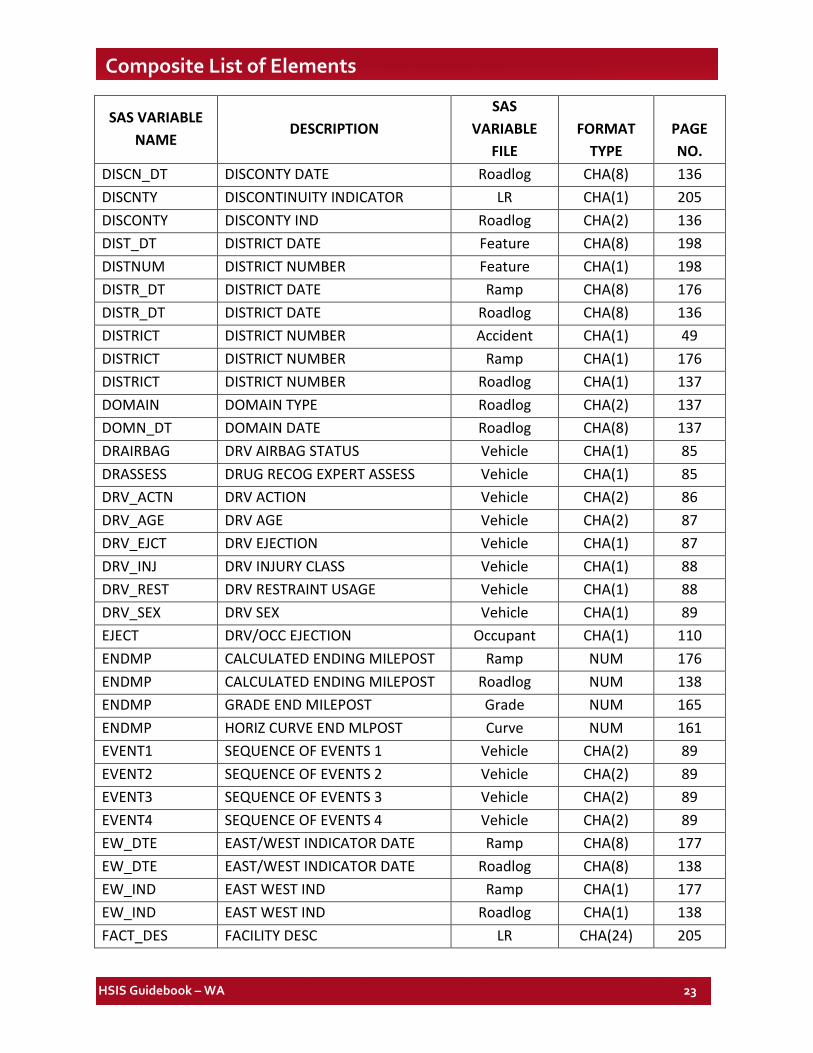
DISCN_DT DISCONTY DATE Roadlog CHA(8) 136 DISCNTY DISCONTINUITY INDICATOR LR CHA(1) 205 DISCONTY DISCONTY IND Roadlog CHA(2) 136 DIST_DT DISTRICT DATE Feature CHA(8) 198 DISTNUM DISTRICT NUMBER Feature CHA(1) 198 DISTR_DT DISTRICT DATE Ramp CHA(8) 176 DISTR_DT DISTRICT DATE Roadlog CHA(8) 136 DISTRICT DISTRICT NUMBER Accident CHA(1) 49 DISTRICT DISTRICT NUMBER Ramp CHA(1) 176 DISTRICT DISTRICT NUMBER Roadlog CHA(1) 137 DOMAIN DOMAIN TYPE Roadlog CHA(2) 137 DOMN_DT DOMAIN DATE Roadlog CHA(8) 137 DRAIRBAG DRV AIRBAG STATUS Vehicle CHA(1) 85 DRASSESS DRUG RECOG EXPERT ASSESS Vehicle CHA(1) 85 DRV_ACTN DRV ACTION Vehicle CHA(2) 86 DRV_AGE DRV AGE Vehicle CHA(2) 87 DRV_EJCT DRV EJECTION Vehicle CHA(1) 87 DRV_INJ DRV INJURY CLASS Vehicle CHA(1) 88 DRV_REST DRV RESTRAINT USAGE Vehicle CHA(1) 88 DRV_SEX DRV SEX Vehicle CHA(1) 89 EJECT DRV/OCC EJECTION Occupant CHA(1) 110 ENDMP CALCULATED ENDING MILEPOST Ramp NUM 176 ENDMP CALCULATED ENDING MILEPOST Roadlog NUM 138 ENDMP GRADE END MILEPOST Grade NUM 165 ENDMP HORIZ CURVE END MLPOST Curve NUM 161 EVENT1 SEQUENCE OF EVENTS 1 Vehicle CHA(2) 89 EVENT2 SEQUENCE OF EVENTS 2 Vehicle CHA(2) 89 EVENT3 SEQUENCE OF EVENTS 3 Vehicle CHA(2) 89 EVENT4 SEQUENCE OF EVENTS 4 Vehicle CHA(2) 89 EW_DTE EAST/WEST INDICATOR DATE Ramp CHA(8) 177 EW_DTE EAST/WEST INDICATOR DATE Roadlog CHA(8) 138 EW_IND EAST WEST IND Ramp CHA(1) 177 EW_IND EAST WEST IND Roadlog CHA(1) 138 FACT_DES FACILITY DESC LR CHA(24) 205
HSIS Guidebook – WA 24
Composite List of Elements
SAS VARIABLE NAME
DESCRIPTION SAS
VARIABLE FILE
FORMAT TYPE
PAGE NO.
FACT_DT FACILITY DATE LR CHA(8) 205 FACT_OWN FACILITY OWNER LR CHA(3) 205 FACT_TYP FACILITY TYPE LR CHA(1) 206 FED_AID FED AID CLASS Ramp CHA(1) 177 FED_AID FED AID CLASS Roadlog CHA(1) 138 FED_CD FED AID TYPE Ramp CHA(4) 177 FED_CD FED AID TYPE Roadlog CHA(4) 138 FEDAD_DT FED-AID DATE Ramp CHA(8) 177 FEDAD_DT FED-AID DATE Roadlog CHA(8) 138 FIRE FIRE Accident CHA(1) 50 FLY_DT FLYER STOP DATE LR CHA(8) 206 FLY_NUM FLYER STOP NUMBER LR CHA(2) 206 FLY_OWN FLYER STOP OWNER LR CHA(2) 207 FORM_REPT_NO
TRAFFIC COLLISION REPORT FORM NUMBER Accident CHA(7)
50
FUNC_CLS FEDERAL FUNC CLASS Ramp CHA(2) 178 FUNC_CLS FEDERAL FUNC CLASS Roadlog CHA(2) 139 FUNC_CLS FUNCTIONAL CLASS Accident CHA(2) 51 FUNC_DT FUNCTIONAL CLASS DATE Ramp CHA(8) 178 FUNC_DT FUNCTIONAL CLASS DATE Roadlog CHA(8) 139 GPS_LATX GPS X Accident NUM 51 GPS_LATY GPS Y Accident NUM 51 GPS_LATZ GPS Z Accident NUM 51 GRAD_AHD VERT ALIGN GRADE AHEAD Feature NUM 199 GRAD_BAK VERT ALIGN GRADE BACK Feature NUM 199 GRAD_DT VERT ALIGN DATE OF CHNG Grade CHA(8) 165 GRAD_DT VERT ALIGN DATE Feature CHA(8) 199 GRAD_INV STATE RTE TYPE ID Grade CHA(11) 165 GRAD_LGT VERT CURVE LENGTH (FT) Feature NUM 199 GRAD_NUM VERT ALIGN CONTRACT NUM Grade CHA(6) 165 GRAD_NUM VERT ALIGN CONTRACT NUM Feature CHA(6) 199 GRAD_TYP VERT CURVE TYPE Feature CHA(1) 199 GRAD_TYP VERT CURVE TYPE Grade CHA(1) 166 HAZMAT HAZARDOUS MATERIAL Accident CHA(1) 52
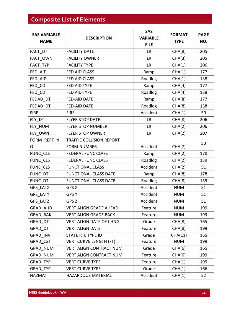
HSIS Guidebook – WA 25
Composite List of Elements
SAS VARIABLE NAME
DESCRIPTION SAS
VARIABLE FILE
FORMAT TYPE
PAGE NO.
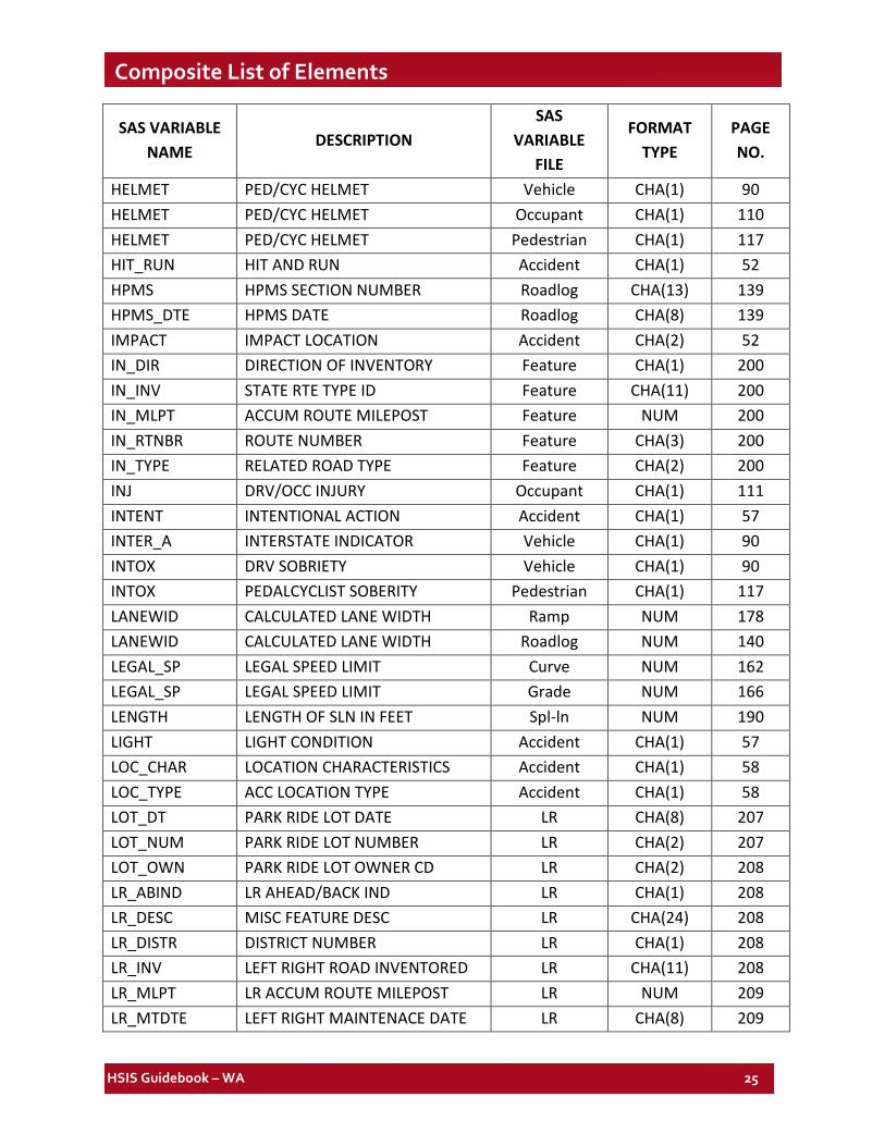
HELMET PED/CYC HELMET Vehicle CHA(1) 90 HELMET PED/CYC HELMET Occupant CHA(1) 110 HELMET PED/CYC HELMET Pedestrian CHA(1) 117 HIT_RUN HIT AND RUN Accident CHA(1) 52 HPMS HPMS SECTION NUMBER Roadlog CHA(13) 139 HPMS_DTE HPMS DATE Roadlog CHA(8) 139 IMPACT IMPACT LOCATION Accident CHA(2) 52 IN_DIR DIRECTION OF INVENTORY Feature CHA(1) 200 IN_INV STATE RTE TYPE ID Feature CHA(11) 200 IN_MLPT ACCUM ROUTE MILEPOST Feature NUM 200 IN_RTNBR ROUTE NUMBER Feature CHA(3) 200 IN_TYPE RELATED ROAD TYPE Feature CHA(2) 200 INJ DRV/OCC INJURY Occupant CHA(1) 111 INTENT INTENTIONAL ACTION Accident CHA(1) 57 INTER_A INTERSTATE INDICATOR Vehicle CHA(1) 90 INTOX DRV SOBRIETY Vehicle CHA(1) 90 INTOX PEDALCYCLIST SOBERITY Pedestrian CHA(1) 117 LANEWID CALCULATED LANE WIDTH Ramp NUM 178 LANEWID CALCULATED LANE WIDTH Roadlog NUM 140 LEGAL_SP LEGAL SPEED LIMIT Curve NUM 162 LEGAL_SP LEGAL SPEED LIMIT Grade NUM 166 LENGTH LENGTH OF SLN IN FEET Spl-ln NUM 190 LIGHT LIGHT CONDITION Accident CHA(1) 57 LOC_CHAR LOCATION CHARACTERISTICS Accident CHA(1) 58 LOC_TYPE ACC LOCATION TYPE Accident CHA(1) 58 LOT_DT PARK RIDE LOT DATE LR CHA(8) 207 LOT_NUM PARK RIDE LOT NUMBER LR CHA(2) 207 LOT_OWN PARK RIDE LOT OWNER CD LR CHA(2) 208 LR_ABIND LR AHEAD/BACK IND LR CHA(1) 208 LR_DESC MISC FEATURE DESC LR CHA(24) 208 LR_DISTR DISTRICT NUMBER LR CHA(1) 208 LR_INV LEFT RIGHT ROAD INVENTORED LR CHA(11) 208 LR_MLPT LR ACCUM ROUTE MILEPOST LR NUM 209 LR_MTDTE LEFT RIGHT MAINTENACE DATE LR CHA(8) 209
HSIS Guidebook – WA 26
Composite List of Elements
SAS VARIABLE NAME
DESCRIPTION SAS
VARIABLE FILE
FORMAT TYPE
PAGE NO.
LR_QUAL RELATED ROAD QUAL LR CHA(6) 209 LR_RARM LEFT RIGHT REVERSE ARM LR NUM 209 LR_RDTY RELATED ROAD TYPE LR CHA(2) 209 LR_RTNBR ROUTE NUMBER LR CHA(3) 209 LR_SEC CONTROL SECTION LR CHA(6) 209 LR_SIDE LEFT/RIGHT SIDE IND LR CHA(2) 209 LR_SRMP LEFT RIGHT SRMP LR NUM 210 LRDIS_DT DISTRICT DATE LR CHA(8) 210 LRMIS_DT MISC FEATURE DATE LR CHA(8) 210 LSHL_DT2 LEFT SHOULDER DATE RD2 Roadlog CHA(8) 140 LSHL_DTE LEFT SHOULDER DATE RD1 Ramp CHA(8) 179 LSHL_DTE LEFT SHOULDER DATE RD1 Roadlog CHA(8) 140 LSHL_TY2 LEFT SHOULDER TYPE RD2 Roadlog CHA(1) 140 LSHL_TYP LEFT SHOULDER TYPE RD1 Ramp CHA(1) 179 LSHL_TYP LEFT SHOULDER TYPE RD1 Roadlog CHA(1) 141 LSHL_WD2 LEFT SHOULDER WIDTH RD1 Roadlog NUM 141 LSHLDWID LEFT SHOULDER WIDTH Ramp NUM 179 LSHLDWID LEFT SHOULDER WIDTH RD1 Roadlog NUM 141 LST_UPDT CONTROL SECTION LAST UPDATE Ramp CHA(8) 179 LST_UPDT CONTROL SECTION LAST UPDATE Roadlog CHA(8) 141 LST_UPDT LAST UPDATE DATE LR CHA(8) 210 MAINTDT LAST MAINTENANCE DATE Accident CHA(8) 59 MAKE VEHICLE MAKE Vehicle CHA(4) 90 MARK_DT MILEPOST MARKER DATE LR CHA(8) 210 MARK_IND MILEPOST MARKER AB IND LR CHA(1) 210 MARK_NUM MILEPOST MARKER NUMBER LR CHA(3) 210 MDXN_DTE MEDIAN CROSSING DATE Roadlog CHA(8) 141 MED_TYPE MEDIAN TYPE Roadlog CHA(1) 142 MEDBARTY MEDIAN BARRIER TYPE Roadlog CHA(2) 142 MEDCAUSE MEDICALLY CAUSED Accident CHA(1) 59 MEDN_DTE MEDIAN DATE Roadlog CHA(8) 142 MEDWID MEDIAN WIDTH Roadlog NUM 143 MEDXNGTY MEDIAN CROSSING TYPE Roadlog CHA(1) 143 MILEPOST ACCUM ROUTE MILEPOST (ARM) Accident NUM 59
HSIS Guidebook – WA 27
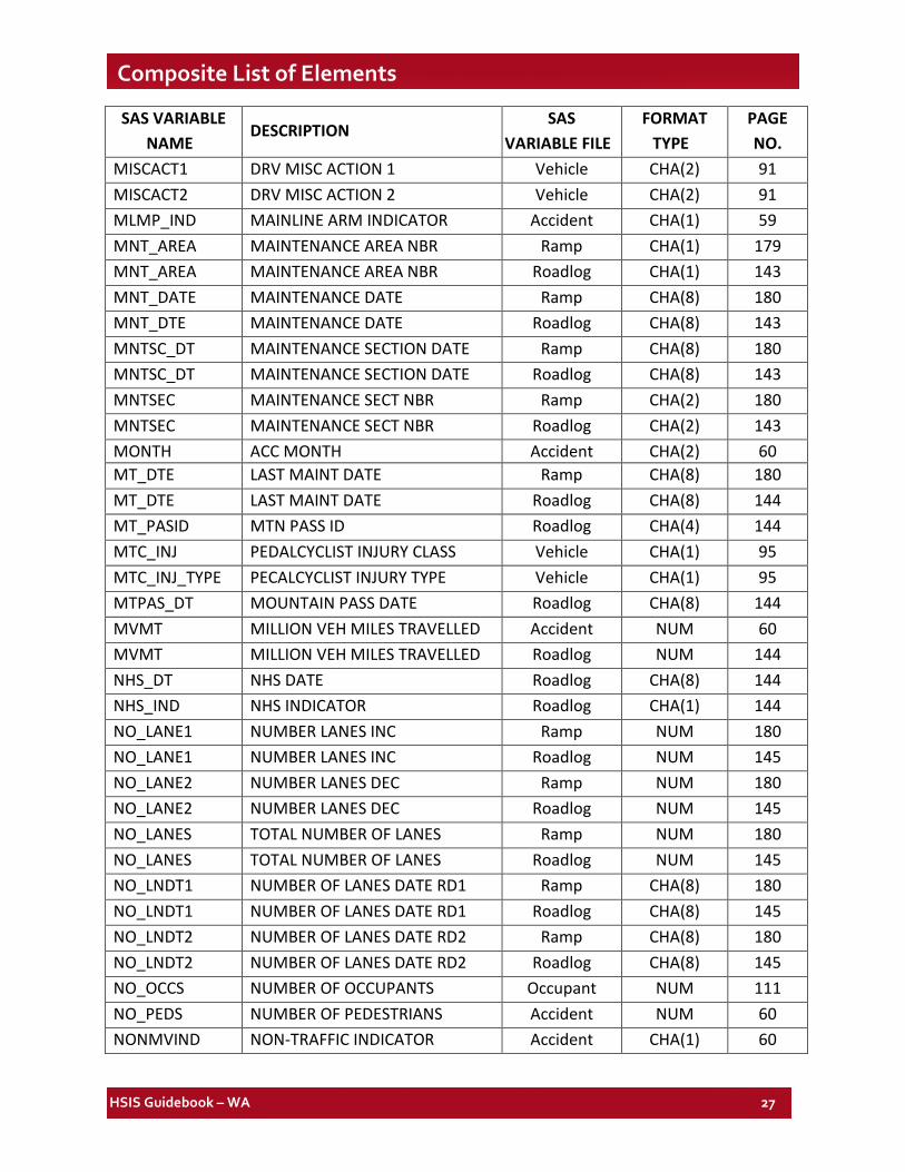
Composite List of Elements SAS VARIABLE
NAME DESCRIPTION
SAS VARIABLE FILE
FORMAT TYPE
PAGE NO.
MISCACT1 DRV MISC ACTION 1 Vehicle CHA(2) 91 MISCACT2 DRV MISC ACTION 2 Vehicle CHA(2) 91 MLMP_IND MAINLINE ARM INDICATOR Accident CHA(1) 59 MNT_AREA MAINTENANCE AREA NBR Ramp CHA(1) 179 MNT_AREA MAINTENANCE AREA NBR Roadlog CHA(1) 143 MNT_DATE MAINTENANCE DATE Ramp CHA(8) 180 MNT_DTE MAINTENANCE DATE Roadlog CHA(8) 143 MNTSC_DT MAINTENANCE SECTION DATE Ramp CHA(8) 180 MNTSC_DT MAINTENANCE SECTION DATE Roadlog CHA(8) 143 MNTSEC MAINTENANCE SECT NBR Ramp CHA(2) 180 MNTSEC MAINTENANCE SECT NBR Roadlog CHA(2) 143 MONTH ACC MONTH Accident CHA(2) 60 MT_DTE LAST MAINT DATE Ramp CHA(8) 180 MT_DTE LAST MAINT DATE Roadlog CHA(8) 144 MT_PASID MTN PASS ID Roadlog CHA(4) 144 MTC_INJ PEDALCYCLIST INJURY CLASS Vehicle CHA(1) 95 MTC_INJ_TYPE PECALCYCLIST INJURY TYPE Vehicle CHA(1) 95 MTPAS_DT MOUNTAIN PASS DATE Roadlog CHA(8) 144 MVMT MILLION VEH MILES TRAVELLED Accident NUM 60 MVMT MILLION VEH MILES TRAVELLED Roadlog NUM 144 NHS_DT NHS DATE Roadlog CHA(8) 144 NHS_IND NHS INDICATOR Roadlog CHA(1) 144 NO_LANE1 NUMBER LANES INC Ramp NUM 180 NO_LANE1 NUMBER LANES INC Roadlog NUM 145 NO_LANE2 NUMBER LANES DEC Ramp NUM 180 NO_LANE2 NUMBER LANES DEC Roadlog NUM 145 NO_LANES TOTAL NUMBER OF LANES Ramp NUM 180 NO_LANES TOTAL NUMBER OF LANES Roadlog NUM 145 NO_LNDT1 NUMBER OF LANES DATE RD1 Ramp CHA(8) 180 NO_LNDT1 NUMBER OF LANES DATE RD1 Roadlog CHA(8) 145 NO_LNDT2 NUMBER OF LANES DATE RD2 Ramp CHA(8) 180 NO_LNDT2 NUMBER OF LANES DATE RD2 Roadlog CHA(8) 145 NO_OCCS NUMBER OF OCCUPANTS Occupant NUM 111 NO_PEDS NUMBER OF PEDESTRIANS Accident NUM 60 NONMVIND NON-TRAFFIC INDICATOR Accident CHA(1) 60
HSIS Guidebook – WA 28
Composite List of Elements
SAS VARIABLE NAME
DESCRIPTION SAS
VARIABLE FILE
FORMAT TYPE
PAGE NO.
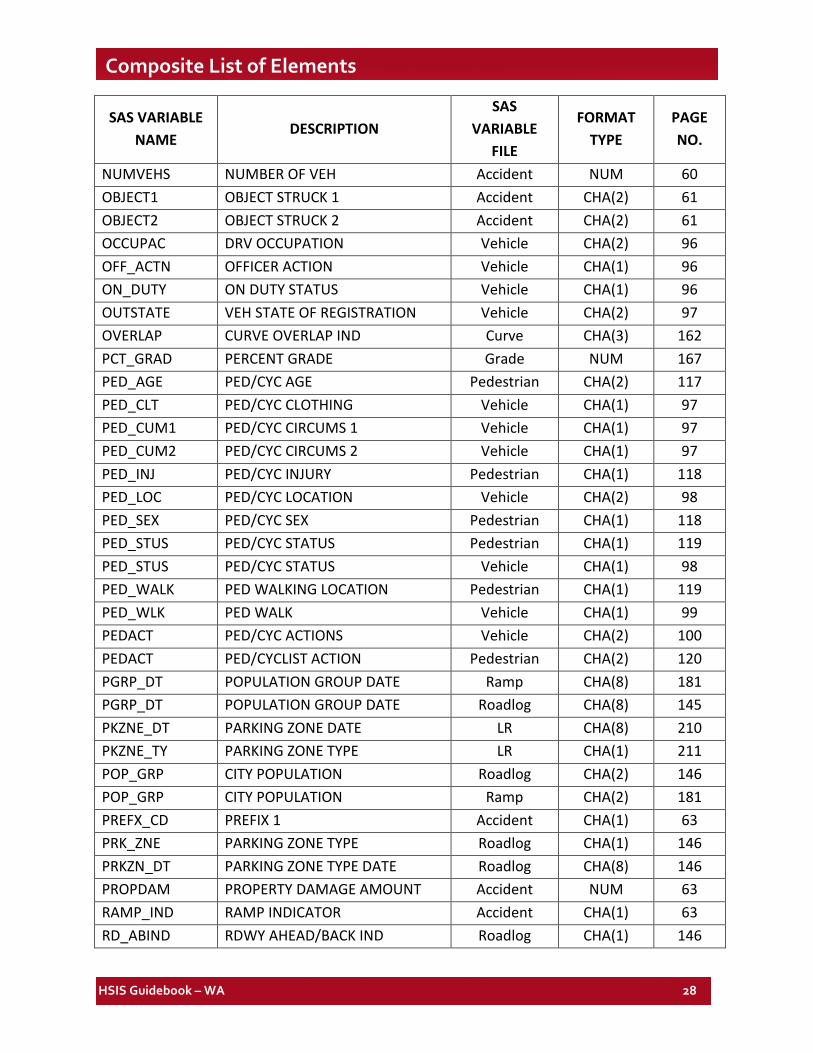
NUMVEHS NUMBER OF VEH Accident NUM 60 OBJECT1 OBJECT STRUCK 1 Accident CHA(2) 61 OBJECT2 OBJECT STRUCK 2 Accident CHA(2) 61 OCCUPAC DRV OCCUPATION Vehicle CHA(2) 96 OFF_ACTN OFFICER ACTION Vehicle CHA(1) 96 ON_DUTY ON DUTY STATUS Vehicle CHA(1) 96 OUTSTATE VEH STATE OF REGISTRATION Vehicle CHA(2) 97 OVERLAP CURVE OVERLAP IND Curve CHA(3) 162 PCT_GRAD PERCENT GRADE Grade NUM 167 PED_AGE PED/CYC AGE Pedestrian CHA(2) 117 PED_CLT PED/CYC CLOTHING Vehicle CHA(1) 97 PED_CUM1 PED/CYC CIRCUMS 1 Vehicle CHA(1) 97 PED_CUM2 PED/CYC CIRCUMS 2 Vehicle CHA(1) 97 PED_INJ PED/CYC INJURY Pedestrian CHA(1) 118 PED_LOC PED/CYC LOCATION Vehicle CHA(2) 98 PED_SEX PED/CYC SEX Pedestrian CHA(1) 118 PED_STUS PED/CYC STATUS Pedestrian CHA(1) 119 PED_STUS PED/CYC STATUS Vehicle CHA(1) 98 PED_WALK PED WALKING LOCATION Pedestrian CHA(1) 119 PED_WLK PED WALK Vehicle CHA(1) 99 PEDACT PED/CYC ACTIONS Vehicle CHA(2) 100 PEDACT PED/CYCLIST ACTION Pedestrian CHA(2) 120 PGRP_DT POPULATION GROUP DATE Ramp CHA(8) 181 PGRP_DT POPULATION GROUP DATE Roadlog CHA(8) 145 PKZNE_DT PARKING ZONE DATE LR CHA(8) 210 PKZNE_TY PARKING ZONE TYPE LR CHA(1) 211 POP_GRP CITY POPULATION Roadlog CHA(2) 146 POP_GRP CITY POPULATION Ramp CHA(2) 181 PREFX_CD PREFIX 1 Accident CHA(1) 63 PRK_ZNE PARKING ZONE TYPE Roadlog CHA(1) 146 PRKZN_DT PARKING ZONE TYPE DATE Roadlog CHA(8) 146 PROPDAM PROPERTY DAMAGE AMOUNT Accident NUM 63 RAMP_IND RAMP INDICATOR Accident CHA(1) 63 RD_ABIND RDWY AHEAD/BACK IND Roadlog CHA(1) 146
HSIS Guidebook – WA 29
Composite List of Elements
SAS VARIABLE NAME
DESCRIPTION SAS
VARIABLE FILE
FORMAT TYPE
PAGE NO.
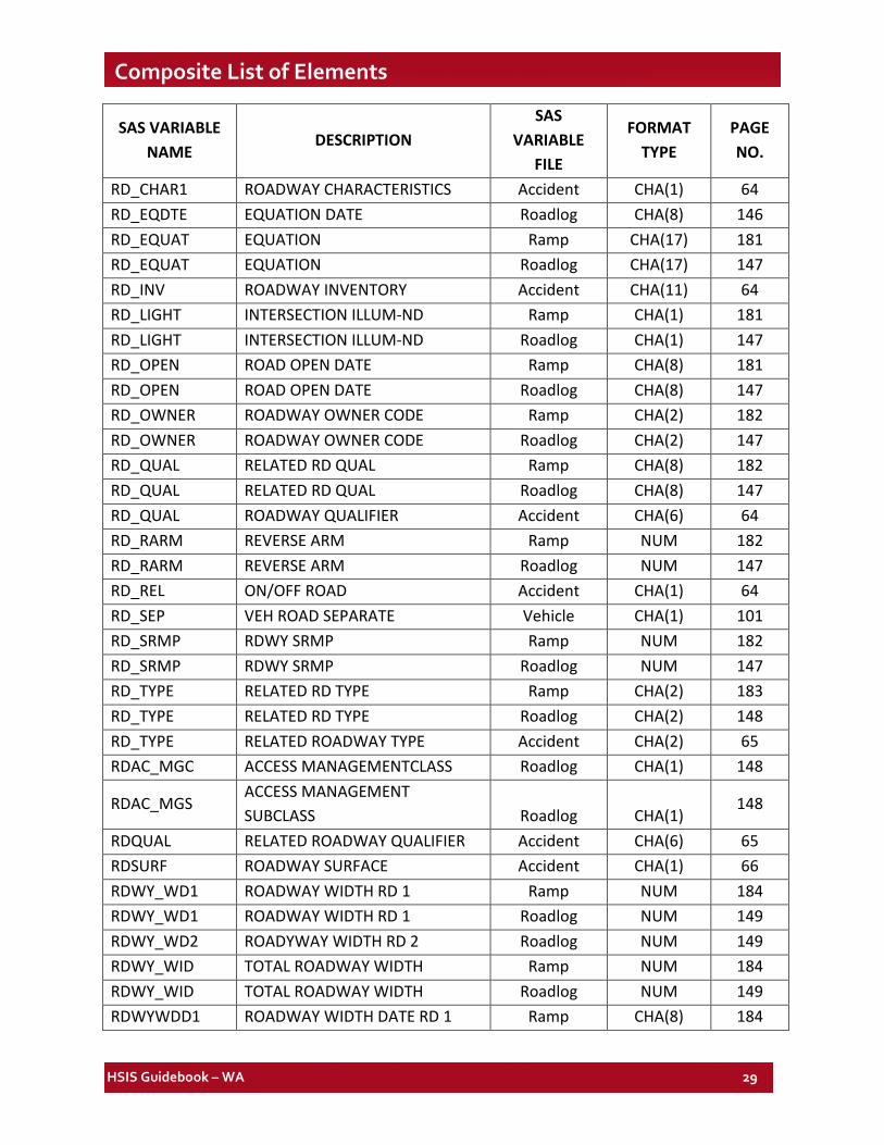
RD_CHAR1 ROADWAY CHARACTERISTICS Accident CHA(1) 64 RD_EQDTE EQUATION DATE Roadlog CHA(8) 146 RD_EQUAT EQUATION Ramp CHA(17) 181 RD_EQUAT EQUATION Roadlog CHA(17) 147 RD_INV ROADWAY INVENTORY Accident CHA(11) 64 RD_LIGHT INTERSECTION ILLUM-ND Ramp CHA(1) 181 RD_LIGHT INTERSECTION ILLUM-ND Roadlog CHA(1) 147 RD_OPEN ROAD OPEN DATE Ramp CHA(8) 181 RD_OPEN ROAD OPEN DATE Roadlog CHA(8) 147 RD_OWNER ROADWAY OWNER CODE Ramp CHA(2) 182 RD_OWNER ROADWAY OWNER CODE Roadlog CHA(2) 147 RD_QUAL RELATED RD QUAL Ramp CHA(8) 182 RD_QUAL RELATED RD QUAL Roadlog CHA(8) 147 RD_QUAL ROADWAY QUALIFIER Accident CHA(6) 64 RD_RARM REVERSE ARM Ramp NUM 182 RD_RARM REVERSE ARM Roadlog NUM 147 RD_REL ON/OFF ROAD Accident CHA(1) 64 RD_SEP VEH ROAD SEPARATE Vehicle CHA(1) 101 RD_SRMP RDWY SRMP Ramp NUM 182 RD_SRMP RDWY SRMP Roadlog NUM 147 RD_TYPE RELATED RD TYPE Ramp CHA(2) 183 RD_TYPE RELATED RD TYPE Roadlog CHA(2) 148 RD_TYPE RELATED ROADWAY TYPE Accident CHA(2) 65 RDAC_MGC ACCESS MANAGEMENTCLASS Roadlog CHA(1) 148
RDAC_MGS ACCESS MANAGEMENT SUBCLASS Roadlog CHA(1)
148
RDQUAL RELATED ROADWAY QUALIFIER Accident CHA(6) 65 RDSURF ROADWAY SURFACE Accident CHA(1) 66 RDWY_WD1 ROADWAY WIDTH RD 1 Ramp NUM 184 RDWY_WD1 ROADWAY WIDTH RD 1 Roadlog NUM 149 RDWY_WD2 ROADYWAY WIDTH RD 2 Roadlog NUM 149 RDWY_WID TOTAL ROADWAY WIDTH Ramp NUM 184 RDWY_WID TOTAL ROADWAY WIDTH Roadlog NUM 149 RDWYWDD1 ROADWAY WIDTH DATE RD 1 Ramp CHA(8) 184
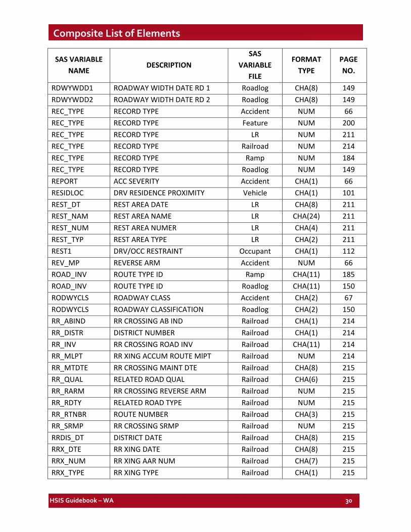
HSIS Guidebook – WA 30
Composite List of Elements
SAS VARIABLE NAME
DESCRIPTION SAS
VARIABLE FILE
FORMAT TYPE
PAGE NO.
RDWYWDD1 ROADWAY WIDTH DATE RD 1 Roadlog CHA(8) 149 RDWYWDD2 ROADWAY WIDTH DATE RD 2 Roadlog CHA(8) 149 REC_TYPE RECORD TYPE Accident NUM 66 REC_TYPE RECORD TYPE Feature NUM 200 REC_TYPE RECORD TYPE LR NUM 211 REC_TYPE RECORD TYPE Railroad NUM 214 REC_TYPE RECORD TYPE Ramp NUM 184 REC_TYPE RECORD TYPE Roadlog NUM 149 REPORT ACC SEVERITY Accident CHA(1) 66 RESIDLOC DRV RESIDENCE PROXIMITY Vehicle CHA(1) 101 REST_DT REST AREA DATE LR CHA(8) 211 REST_NAM REST AREA NAME LR CHA(24) 211 REST_NUM REST AREA NUMER LR CHA(4) 211 REST_TYP REST AREA TYPE LR CHA(2) 211 REST1 DRV/OCC RESTRAINT Occupant CHA(1) 112 REV_MP REVERSE ARM Accident NUM 66 ROAD_INV ROUTE TYPE ID Ramp CHA(11) 185 ROAD_INV ROUTE TYPE ID Roadlog CHA(11) 150 RODWYCLS ROADWAY CLASS Accident CHA(2) 67 RODWYCLS ROADWAY CLASSIFICATION Roadlog CHA(2) 150 RR_ABIND RR CROSSING AB IND Railroad CHA(1) 214 RR_DISTR DISTRICT NUMBER Railroad CHA(1) 214 RR_INV RR CROSSING ROAD INV Railroad CHA(11) 214 RR_MLPT RR XING ACCUM ROUTE MlPT Railroad NUM 214 RR_MTDTE RR CROSSING MAINT DTE Railroad CHA(8) 215 RR_QUAL RELATED ROAD QUAL Railroad CHA(6) 215 RR_RARM RR CROSSING REVERSE ARM Railroad NUM 215 RR_RDTY RELATED ROAD TYPE Railroad NUM 215 RR_RTNBR ROUTE NUMBER Railroad CHA(3) 215 RR_SRMP RR CROSSING SRMP Railroad NUM 215 RRDIS_DT DISTRICT DATE Railroad CHA(8) 215 RRX_DTE RR XING DATE Railroad CHA(8) 215 RRX_NUM RR XING AAR NUM Railroad CHA(7) 215 RRX_TYPE RR XING TYPE Railroad CHA(1) 215
HSIS Guidebook – WA 31
Composite List of Elements
SAS VARIABLE NAME
DESCRIPTION SAS
VARIABLE FILE
FORMAT TYPE
PAGE NO.
RSHL_DT2 RIGHT SHOULDER DATE RD2 Roadlog CHA(8) 150 RSHL_DTE RIGHT SHOULDER DATE RD1 Ramp CHA(8) 185 RSHL_DTE RIGHT SHOULDER DATE RD1 Roadlog CHA(8) 150 RSHL_TY2 RIGHT SHOULDER TYPE RD2 Roadlog CHA(1) 151 RSHL_TYP RIGHT SHOULDER TYPE RD1 Ramp CHA(1) 185 RSHL_TYP RIGHT SHOULDER TYPE RD1 Roadlog CHA(1) 151 RSHL_WD2 RIGHT SHOULDER WIDTH RD2 Roadlog NUM 151 RSHLDWID RIGHT SHOULDER WIDTH Ramp NUM 185 RSHLDWID RIGHT SHOULDER WIDTH RD1 Roadlog NUM 151 RTE_NBR ROUTE NUMBER Grade CHA(3) 167 RTE_NBR ROUTE NUMBER Curve CHA(3) 162 RTE_NBR ROUTE NUMBER Ramp CHA(3) 186 RTE_NBR ROUTE NUMBER Roadlog CHA(3) 151 RTE_NBR STATE ROUTE NUMBER Accident CHA(3) 67 RUR_URB RURAL URBAN Accident CHA(1) 67 RURURB RURAL URBAN Ramp CHA(1) 186 RURURB RURAL URBAN Roadlog CHA(1) 152 SEATPOS DRV/OCC SEAT POSITION Occupant CHA(1) 113 SEG_LNG GRADE LENGTH (MI) Grade NUM 167 SEG_LNG HORIZ CURVE LGT (MI) Curve NUM 163 SEG_LNG RD CALCULATED SECT LNGTH Ramp NUM 186 SEG_LNG RD CALCULATED SECT LNGTH Roadlog NUM 152 SEQNO SEQUENCE NUMBER Accident NUM 67 SEVERITY MOST SEVERE INJURY Accident CHA(1) 68 SEX DRV/OCC SEX Occupant CHA(1) 113
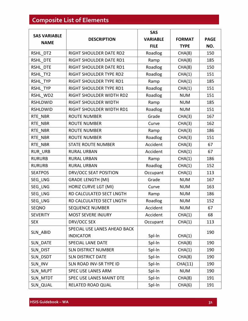
SLN_ABID SPECIAL USE LANES AHEAD BACK INDICATOR Spl-ln CHA(1)
190
SLN_DATE SPECIAL LANE DATE Spl-ln CHA(8) 190 SLN_DIST SLN DISTRICT NUMBER Spl-ln CHA(1) 190 SLN_DSDT SLN DISTRICT DATE Spl-ln CHA(8) 190 SLN_INV SLN ROAD INV-SR TYPE ID Spl-ln CHA(11) 190 SLN_MLPT SPEC USE LANES ARM Spl-ln NUM 190 SLN_MTDT SPEC USE LANES MAINT DTE Spl-ln CHA(8) 191 SLN_QUAL RELATED ROAD QUAL Spl-ln CHA(6) 191
HSIS Guidebook – WA 32
Composite List of Elements
SAS VARIABLE NAME
DESCRIPTION SAS
VARIABLE FILE
FORMAT TYPE
PAGE NO.
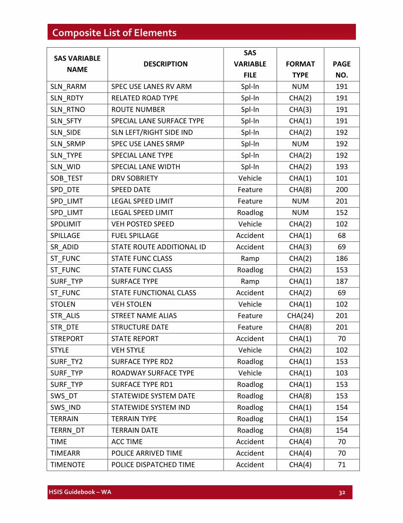
SLN_RARM SPEC USE LANES RV ARM Spl-ln NUM 191 SLN_RDTY RELATED ROAD TYPE Spl-ln CHA(2) 191 SLN_RTNO ROUTE NUMBER Spl-ln CHA(3) 191 SLN_SFTY SPECIAL LANE SURFACE TYPE Spl-ln CHA(1) 191 SLN_SIDE SLN LEFT/RIGHT SIDE IND Spl-ln CHA(2) 192 SLN_SRMP SPEC USE LANES SRMP Spl-ln NUM 192 SLN_TYPE SPECIAL LANE TYPE Spl-ln CHA(2) 192 SLN_WID SPECIAL LANE WIDTH Spl-ln CHA(2) 193 SOB_TEST DRV SOBRIETY Vehicle CHA(1) 101 SPD_DTE SPEED DATE Feature CHA(8) 200 SPD_LIMT LEGAL SPEED LIMIT Feature NUM 201 SPD_LIMT LEGAL SPEED LIMIT Roadlog NUM 152 SPDLIMIT VEH POSTED SPEED Vehicle CHA(2) 102 SPILLAGE FUEL SPILLAGE Accident CHA(1) 68 SR_ADID STATE ROUTE ADDITIONAL ID Accident CHA(3) 69 ST_FUNC STATE FUNC CLASS Ramp CHA(2) 186 ST_FUNC STATE FUNC CLASS Roadlog CHA(2) 153 SURF_TYP SURFACE TYPE Ramp CHA(1) 187 ST_FUNC STATE FUNCTIONAL CLASS Accident CHA(2) 69 STOLEN VEH STOLEN Vehicle CHA(1) 102 STR_ALIS STREET NAME ALIAS Feature CHA(24) 201 STR_DTE STRUCTURE DATE Feature CHA(8) 201 STREPORT STATE REPORT Accident CHA(1) 70 STYLE VEH STYLE Vehicle CHA(2) 102 SURF_TY2 SURFACE TYPE RD2 Roadlog CHA(1) 153 SURF_TYP ROADWAY SURFACE TYPE Vehicle CHA(1) 103 SURF_TYP SURFACE TYPE RD1 Roadlog CHA(1) 153 SWS_DT STATEWIDE SYSTEM DATE Roadlog CHA(8) 153 SWS_IND STATEWIDE SYSTEM IND Roadlog CHA(1) 154 TERRAIN TERRAIN TYPE Roadlog CHA(1) 154 TERRN_DT TERRAIN DATE Roadlog CHA(8) 154 TIME ACC TIME Accident CHA(4) 70 TIMEARR POLICE ARRIVED TIME Accident CHA(4) 70 TIMENOTE POLICE DISPATCHED TIME Accident CHA(4) 71
HSIS Guidebook – WA 33
Composite List of Elements
SAS VARIABLE NAME
DESCRIPTION SAS
VARIABLE FILE
FORMAT TYPE
PAGE NO.
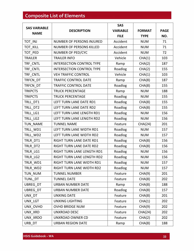
TOT_INJ NUMBER OF PERSONS INJURED Accident NUM 71 TOT_KILL NUMBER OF PERSONS KILLED Accident NUM 71 TOT_PED NUMBER OF PED/CYC Accident NUM 72 TRAILER TRAILER INFO Vehicle CHA(1) 103 TRF_CNTL INTERSECTION CONTROL TYPE Ramp CHA(2) 187 TRF_CNTL INTERSECTION CONTROL TYPE Roadlog CHA(2) 155 TRF_CNTL VEH TRAFFIC CONTROL Vehicle CHA(1) 103 TRFCN_DT TRAFFIC CONTROL DATE Ramp CHA(8) 187 TRFCN_DT TRAFFIC CONTROL DATE Roadlog CHA(8) 155 TRKPCTS TRUCK PERCENTAGE Ramp NUM 188 TRKPCTS TRUCK PERCENTAGE Roadlog NUM 155 TRLL_DT1 LEFT TURN LANE DATE RD1 Roadlog CHA(8) 155 TRLL_DT2 LEFT TURN LANE DATE RD2 Roadlog CHA(8) 155 TRLL_LG1 LEFT TURN LANE LENGTH RD1 Roadlog NUM 156 TRLL_LG2 LEFT TURN LANE LENGTH RD2 Roadlog NUM 156 TUN_NAME TUNNEL NAME Feature CHA(24) 201 TRLL_WD1 LEFT TURN LANE WIDTH RD1 Roadlog NUM 157 TRLL_WD2 LEFT TURN LANE WIDTH RD2 Roadlog NUM 157 TRLR_DT1 RIGHT TURN LANE DATE RD1 Roadlog CHA(8) 156 TRLR_DT2 RIGHT TURN LANE DATE RD2 Roadlog CHA(8) 156 TRLR_LG1 RIGHT TURN LANE LENGTH RD1 Roadlog NUM 156 TRLR_LG2 RIGHT TURN LANE LENGTH RD2 Roadlog NUM 156 TRLR_WD1 RIGHT TURN LANE WIDTH RD1 Roadlog NUM 157 TRLR_WD2 RIGHT TURN LANE WIDTH RD2 Roadlog NUM 157 TUN_NUM TUNNEL NUMBER Feature CHA(9) 201 TUNL_DT TUNNEL DATE Feature CHA(8) 202 UBREG_DT URBAN NUMBER DATE Ramp CHA(8) 188 UBREG_DT URBAN NUMBER DATE Roadlog CHA(8) 157 UNX_DT UNXING DATE Feature CHA(8) 201 UNX_LGT UNXING LIGHTING Feature CHA(1) 202 UNX_OVHD OVHD BRIDGE NUM Feature CHA(9) 202 UNX_XRD UNXROAD DESC Feature CHA(24) 202 UNX_XRDO UNXROAD OWNER CD Feature CHA(2) 202 URB_DT URBAN REGION DATE Ramp CHA(8) 188
HSIS Guidebook – WA 34
Composite List of Elements
SAS VARIABLE NAME
DESCRIPTION SAS
VARIABLE FILE
FORMAT TYPE
PAGE NO.
URB_DT URBAN REGION DATE Roadlog CHA(8) 157 URB_NBR URBAN AREA NUMBER Ramp CHA(2) 188 URB_NBR URBAN AREA NUMBER Roadlog CHA(2) 157 URB_REG URBAN REGION NUMBER Ramp CHA(1) 188 URB_REG URBAN REGION NUMBER Roadlog CHA(1) 157 V_STATE STATE OF VEH REGISTRATION Vehicle CHA(2) 104 V1CMPDIR V1 COMPASS DIRECTION Accident CHA(1) 72 V1DIRCDE V1 DIRECTION Accident CHA(1) 73 V1EVENT1 V1 MOVEMENT Accident CHA(1) 74 V2CMPDIR V2 COMPASS DIRECTION Accident CHA(1) 72 V2DIRCDE V2 DIRECTION Accident CHA(1) 73 V2EVENT1 V2 MOVEMENT Accident CHA(1) 74 VCUR_LGT VERTICAL CURVE LENGTH Grade NUM 167 VEH_SEV DRV INJURY SEVERITY Vehicle CHA(1) 104 VEH_USE VEH USAGE Vehicle CHA(2) 105 VEHCOND1 VEH DEFECT 1 Vehicle CHA(2) 106 VEHCOND2 VEH DEFECT 2 Vehicle CHA(2) 106 VEHCOND3 VEH DEFECT 3 Vehicle CHA(2) 106 VEHNO VEH NUMBER Vehicle NUM 106 VEHNO VEHICLE NUMBER Occupant NUM 113 VEHNO VEHICLE NUMBER Pedestrian NUM 121 VEHTYPE VEH TYPE Vehicle CHA(2) 107 VEHYR VEH YEAR Vehicle CHA(2) 107 VRD_TYPE ROADWAY TYPE Vehicle CHA(1) 107 WEATHER WEATHER CONDITION Accident CHA(1) 75 WEEKDAY DAY OF WEEK Accident CHA(1) 75 WGHT_DT WEIGHT STATION DATE LR CHA(8) 212 WGHT_NUM WEIGHT STATION NUMBER LR CHA(2) 212 WGHT_TYP WEIGHT STATION TYPE LR CHA(2) 212 WKZONE WORK ZONE STATUS Accident CHA(1) 75 WSP_DIST WSP DISTRICT NUMBER Ramp CHA(1) 188 WSP_DIST WSP DISTRICT NUMBER Roadlog CHA(1) 157 WSP_DT WSP DATE Ramp CHA(8) 188 WSP_DT WSP DATE Roadlog CHA(8) 157
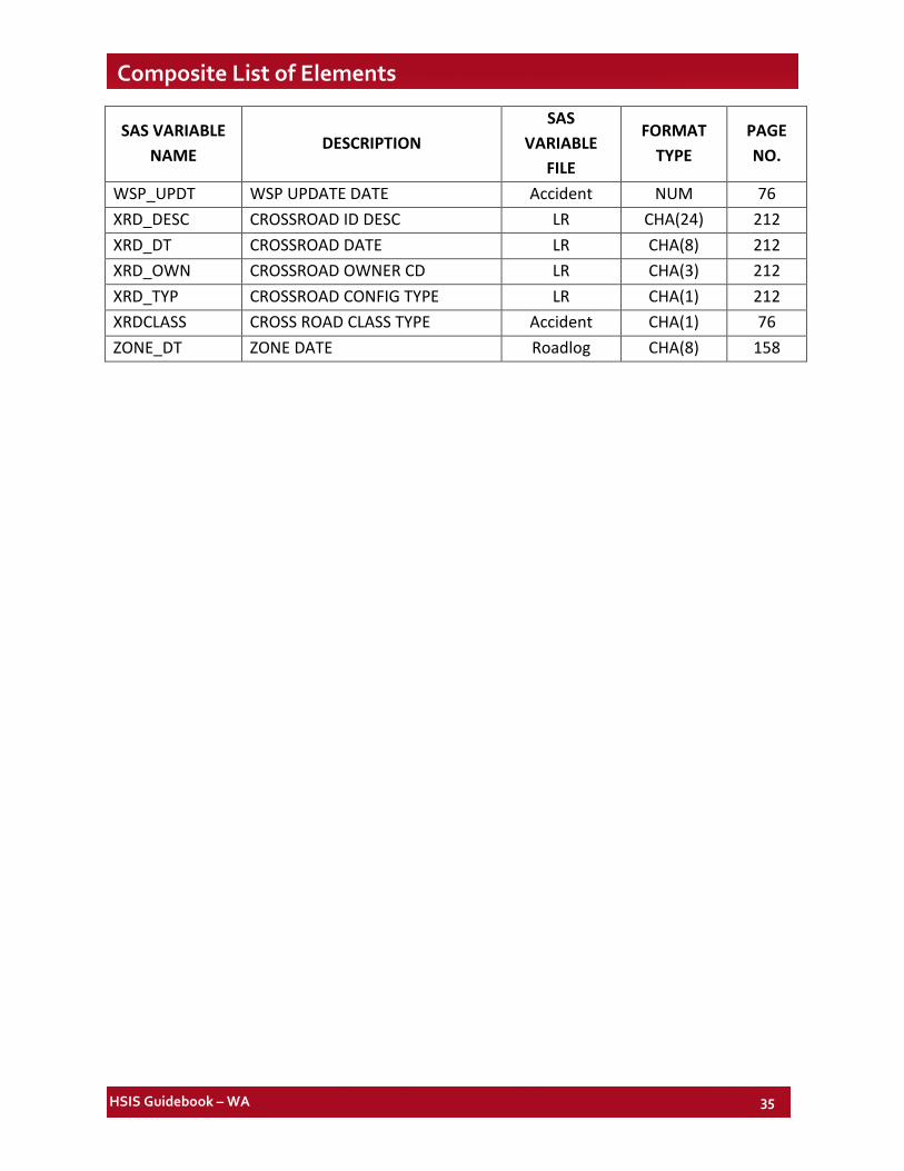
HSIS Guidebook – WA 35
Composite List of Elements
SAS VARIABLE NAME
DESCRIPTION SAS
VARIABLE FILE
FORMAT TYPE
PAGE NO.
WSP_UPDT WSP UPDATE DATE Accident NUM 76 XRD_DESC CROSSROAD ID DESC LR CHA(24) 212 XRD_DT CROSSROAD DATE LR CHA(8) 212 XRD_OWN CROSSROAD OWNER CD LR CHA(3) 212 XRD_TYP CROSSROAD CONFIG TYPE LR CHA(1) 212 XRDCLASS CROSS ROAD CLASS TYPE Accident CHA(1) 76 ZONE_DT ZONE DATE Roadlog CHA(8) 158
HSIS Guidebook – WA 36
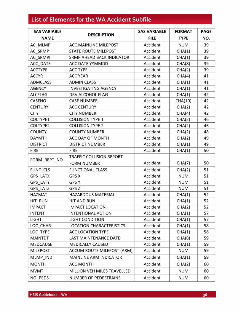
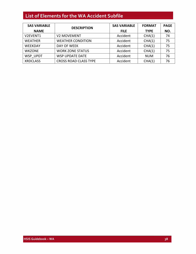
List of Elements for the WA Accident Subfile
SAS VARIABLE NAME
DESCRIPTION SAS VARIABLE
FILE FORMAT
TYPE PAGE NO.
AC_MLMP ACC MAINLINE MILEPOST Accident NUM 39 AC_SRMP STATE ROUTE MILEPOST Accident CHA(1) 39 AC_SRMPI SRMP AHEAD BACK INDICATOR Accident CHA(1) 39 ACC_DATE ACC DATE YYMMDD Accident CHA(8) 39 ACCTYPE ACC TYPE Accident CHA(2) 39 ACCYR ACC YEAR Accident CHA(4) 41 ADMCLASS ADMIN CLASS Accident CHA(1) 41 AGENCY INVESTIGATING AGENCY Accident CHA(1) 41 ALCFLAG DRV ALCOHOL FLAG Accident CHA(1) 42 CASENO CASE NUMBER Accident CHA(10) 42 CENTURY ACC CENTURY Accident CHA(2) 42 CITY CITY NUMBER Accident CHA(4) 42 COLTYPE1 COLLISION TYPE 1 Accident CHA(2) 46 COLTYPE2 COLLISION TYPE 2 Accident CHA(2) 46 COUNTY COUNTY NUMBER Accident CHA(2) 48 DAYMTH ACC DAY OF MONTH Accident CHA(2) 49 DISTRICT DISTRICT NUMBER Accident CHA(1) 49 FIRE FIRE Accident CHA(1) 50
FORM_REPT_NO TRAFFIC COLLISION REPORT FORM NUMBER Accident CHA(7) 50
FUNC_CLS FUNCTIONAL CLASS Accident CHA(2) 51 GPS_LATX GPS X Accident NUM 51 GPS_LATY GPS Y Accident NUM 51 GPS_LATZ GPS Z Accident NUM 51 HAZMAT HAZARDOUS MATERIAL Accident CHA(1) 52 HIT_RUN HIT AND RUN Accident CHA(1) 52 IMPACT IMPACT LOCATION Accident CHA(2) 52 INTENT INTENTIONAL ACTION Accident CHA(1) 57 LIGHT LIGHT CONDITION Accident CHA(1) 57 LOC_CHAR LOCATION CHARACTERISTICS Accident CHA(1) 58 LOC_TYPE ACC LOCATION TYPE Accident CHA(1) 58 MAINTDT LAST MAINTENANCE DATE Accident CHA(8) 59 MEDCAUSE MEDICALLY CAUSED Accident CHA(1) 59 MILEPOST ACCUM ROUTE MILEPOST (ARM) Accident NUM 59 MLMP_IND MAINLINE ARM INDICATOR Accident CHA(1) 59 MONTH ACC MONTH Accident CHA(2) 60 MVMT MILLION VEH MILES TRAVELLED Accident NUM 60 NO_PEDS NUMBER OF PEDESTRAINS Accident NUM 60
HSIS Guidebook – WA 37
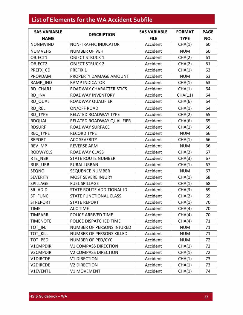
List of Elements for the WA Accident Subfile
SAS VARIABLE
NAME DESCRIPTION SAS VARIABLE
FILE FORMAT
TYPE PAGE NO.
NONMVIND NON-TRAFFIC INDICATOR Accident CHA(1) 60 NUMVEHS NUMBER OF VEH Accident NUM 60 OBJECT1 OBJECT STRUCK 1 Accident CHA(2) 61 OBJECT2 OBJECT STRUCK 2 Accident CHA(2) 61 PREFX_CD PREFIX 1 Accident CHA(1) 63 PROPDAM PROPERTY DAMAGE AMOUNT Accident NUM 63 RAMP_IND RAMP INDICATOR Accident CHA(1) 63 RD_CHAR1 ROADWAY CHARACTERISTICS Accident CHA(1) 64 RD_INV ROADWAY INVENTORY Accident CHA(11) 64 RD_QUAL ROADWAY QUALIFIER Accident CHA(6) 64 RD_REL ON/OFF ROAD Accident CHA(1) 64 RD_TYPE RELATED ROADWAY TYPE Accident CHA(2) 65 RDQUAL RELATED ROADWAY QUALIFIER Accident CHA(6) 65 RDSURF ROADWAY SURFACE Accident CHA(1) 66 REC_TYPE RECORD TYPE Accident NUM 66 REPORT ACC SEVERITY Accident CHA(1) 66 REV_MP REVERSE ARM Accident NUM 66 RODWYCLS ROADWAY CLASS Accident CHA(2) 67 RTE_NBR STATE ROUTE NUMBER Accident CHA(3) 67 RUR_URB RURAL URBAN Accident CHA(1) 67 SEQNO SEQUENCE NUMBER Accident NUM 67 SEVERITY MOST SEVERE INJURY Accident CHA(1) 68 SPILLAGE FUEL SPILLAGE Accident CHA(1) 68 SR_ADID STATE ROUTE ADDITIONAL ID Accident CHA(3) 69 ST_FUNC STATE FUNCTIONAL CLASS Accident CHA(2) 69 STREPORT STATE REPORT Accident CHA(1) 70 TIME ACC TIME Accident CHA(4) 70 TIMEARR POLICE ARRIVED TIME Accident CHA(4) 70 TIMENOTE POLICE DISPATCHED TIME Accident CHA(4) 71 TOT_INJ NUMBER OF PERSONS INJURED Accident NUM 71 TOT_KILL NUMBER OF PERSONS KILLED Accident NUM 71 TOT_PED NUMBER OF PED/CYC Accident NUM 72 V1CMPDIR V1 COMPASS DIRECTION Accident CHA(1) 72 V2CMPDIR V2 COMPASS DIRECTION Accident CHA(1) 72 V1DIRCDE V1 DIRECTION Accident CHA(1) 73 V2DIRCDE V2 DIRECTION Accident CHA(1) 73 V1EVENT1 V1 MOVEMENT Accident CHA(1) 74
HSIS Guidebook – WA 38
List of Elements for the WA Accident Subfile
SAS VARIABLE
NAME DESCRIPTION SAS VARIABLE
FILE FORMAT
TYPE PAGE NO.
V2EVENT1 V2 MOVEMENT Accident CHA(1) 74 WEATHER WEATHER CONDITION Accident CHA(1) 75 WEEKDAY DAY OF WEEK Accident CHA(1) 75 WKZONE WORK ZONE STATUS Accident CHA(1) 75 WSP_UPDT WSP UPDATE DATE Accident NUM 76 XRDCLASS CROSS ROAD CLASS TYPE Accident CHA(1) 76
HSIS Guidebook – WA 39
Crash File Accident Subfile
NOTES:
1. SAS element names and longer explanatory names are shown above each listing. (See Discussion for information on SAS formats.)
2. For all SAS-formatted elements below, an extra category labeled as "ERROR CODES" consolidates all values not listed as legitimate codes. This category is printed when elements are listed in tables.
Accident Mainline Milepost SAS Name: AC_MLMP
Definition: Mainline milepost where crash occurred
Additional Information: Element discontinued in 1999.
State Route Milepost SAS Name: AC_SRMP
Definition: State route milepost where crash occurred
Additional Information: Link with the Roadlog and other files with the MILEPOST element rather than with this element.
SRMP Ahead Back Indicator SAS Name: AC_SRMPI
Definition: SRMP ahead and back indicator where crash occurred.
Date Accident Occurred SAS Name: ACC_DATE
Definition: Date when the accident occurred.
Additional Information: Element discontinued in 1999. Can be created using the DAYMTH and MONTH variables below.
Accident Type SAS Name: ACCTYPE
Definition: Type of accident that occurred.
Additional Information: Because this element was developed by WA DOT staff using vehicle maneuvers, each basic crash type (e.g., head-on, rear-end) has both a “strikes other vehicle” and a “struck by other vehicle” component. See code pairs 01 and 11, 02 and 12, etc. The user
HSIS Guidebook – WA 40
Crash File > Accident Subfile
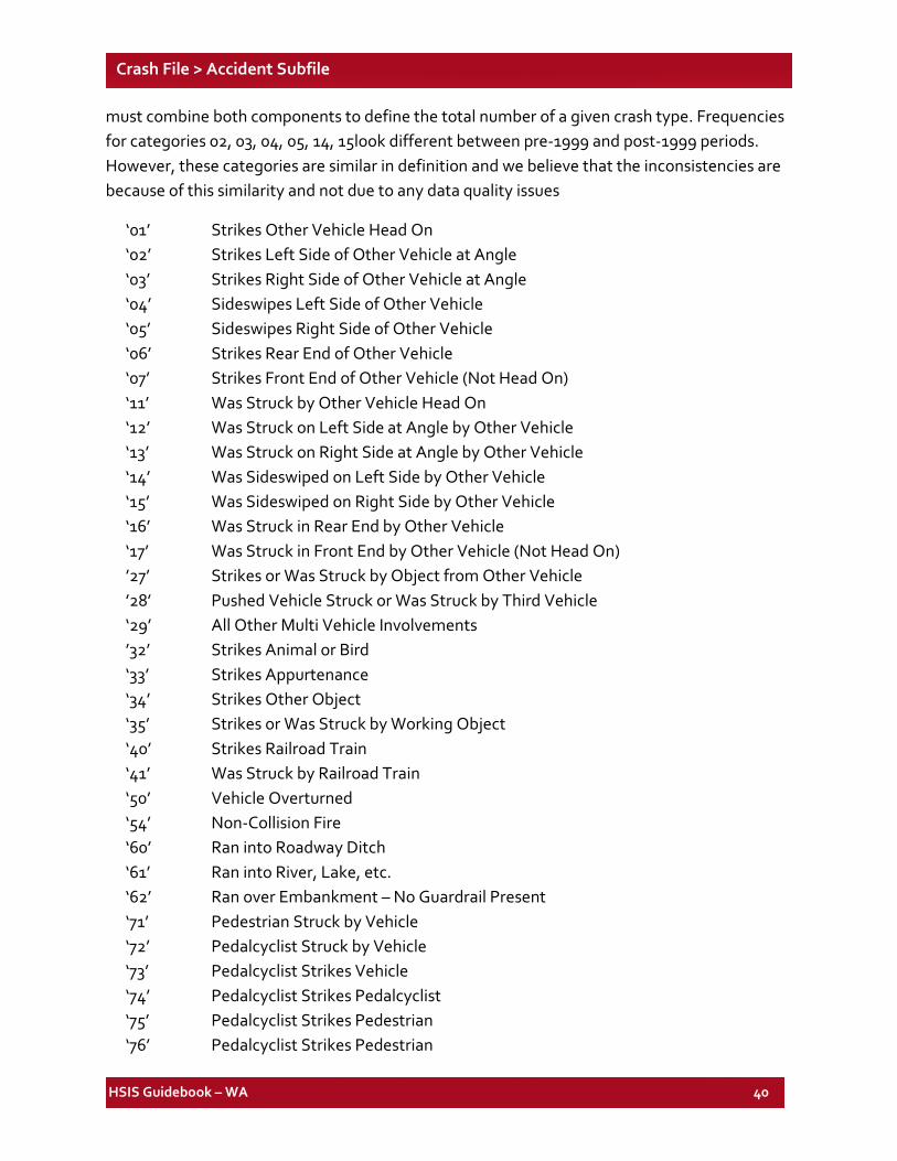
must combine both components to define the total number of a given crash type. Frequencies for categories 02, 03, 04, 05, 14, 15look different between pre-1999 and post-1999 periods. However, these categories are similar in definition and we believe that the inconsistencies are because of this similarity and not due to any data quality issues
‘01’ Strikes Other Vehicle Head On ‘02’ Strikes Left Side of Other Vehicle at Angle ‘03’ Strikes Right Side of Other Vehicle at Angle ‘04’ Sideswipes Left Side of Other Vehicle ‘05’ Sideswipes Right Side of Other Vehicle ‘06’ Strikes Rear End of Other Vehicle ‘07’ Strikes Front End of Other Vehicle (Not Head On) ‘11’ Was Struck by Other Vehicle Head On ‘12’ Was Struck on Left Side at Angle by Other Vehicle ‘13’ Was Struck on Right Side at Angle by Other Vehicle ‘14’ Was Sideswiped on Left Side by Other Vehicle ‘15’ Was Sideswiped on Right Side by Other Vehicle ‘16’ Was Struck in Rear End by Other Vehicle ‘17’ Was Struck in Front End by Other Vehicle (Not Head On) ’27’ Strikes or Was Struck by Object from Other Vehicle ’28’ Pushed Vehicle Struck or Was Struck by Third Vehicle ‘29’ All Other Multi Vehicle Involvements ’32’ Strikes Animal or Bird ‘33’ Strikes Appurtenance ‘34’ Strikes Other Object ‘35’ Strikes or Was Struck by Working Object ‘40’ Strikes Railroad Train ‘41’ Was Struck by Railroad Train ‘50’ Vehicle Overturned ‘54’ Non-Collision Fire ‘60’ Ran into Roadway Ditch ‘61’ Ran into River, Lake, etc. ‘62’ Ran over Embankment – No Guardrail Present ‘71’ Pedestrian Struck by Vehicle ‘72’ Pedalcyclist Struck by Vehicle ‘73’ Pedalcyclist Strikes Vehicle ‘74’ Pedalcyclist Strikes Pedalcyclist ‘75’ Pedalcyclist Strikes Pedestrian ‘76’ Pedalcyclist Strikes Pedestrian
HSIS Guidebook – WA 41
Crash File > Accident Subfile
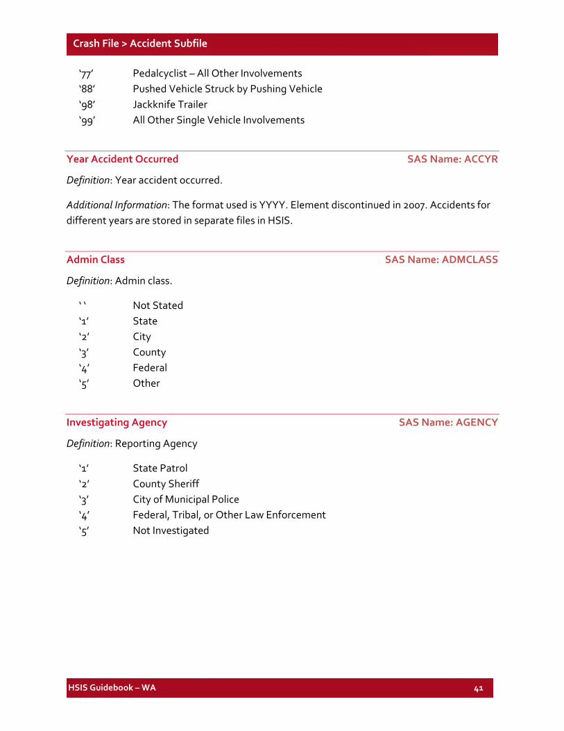
‘77’ Pedalcyclist – All Other Involvements ‘88’ Pushed Vehicle Struck by Pushing Vehicle ‘98’ Jackknife Trailer ‘99’ All Other Single Vehicle Involvements
Year Accident Occurred SAS Name: ACCYR
Definition: Year accident occurred.
Additional Information: The format used is YYYY. Element discontinued in 2007. Accidents for different years are stored in separate files in HSIS.
Admin Class SAS Name: ADMCLASS
Definition: Admin class.
‘ ‘ Not Stated ‘1’ State ‘2’ City ‘3’ County ‘4’ Federal ‘5’ Other
Investigating Agency SAS Name: AGENCY
Definition: Reporting Agency
‘1’ State Patrol ‘2’ County Sheriff ‘3’ City of Municipal Police ‘4’ Federal, Tribal, or Other Law Enforcement ‘5’ Not Investigated
HSIS Guidebook – WA 42
Crash File > Accident Subfile
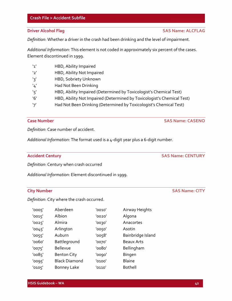
Driver Alcohol Flag SAS Name: ALCFLAG
Definition: Whether a driver in the crash had been drinking and the level of impairment.
Additional Information: This element is not coded in approximately six percent of the cases. Element discontinued in 1999.
‘1’ HBD, Ability Impaired ‘2’ HBD, Ability Not Impaired ‘3’ HBD, Sobriety Unknown ‘4’ Had Not Been Drinking ‘5’ HBD, Ability Impaired (Determined by Toxicologist’s Chemical Test) ‘6’ HBD, Ability Not Impaired (Determined by Toxicologist’s Chemical Test) ‘7’ Had Not Been Drinking (Determined by Toxicologist’s Chemical Test)
Case Number SAS Name: CASENO
Definition: Case number of accident.
Additional Information: The format used is a 4-digit year plus a 6-digit number.
Accident Century SAS Name: CENTURY
Definition: Century when crash occurred
Additional Information: Element discontinued in 1999.
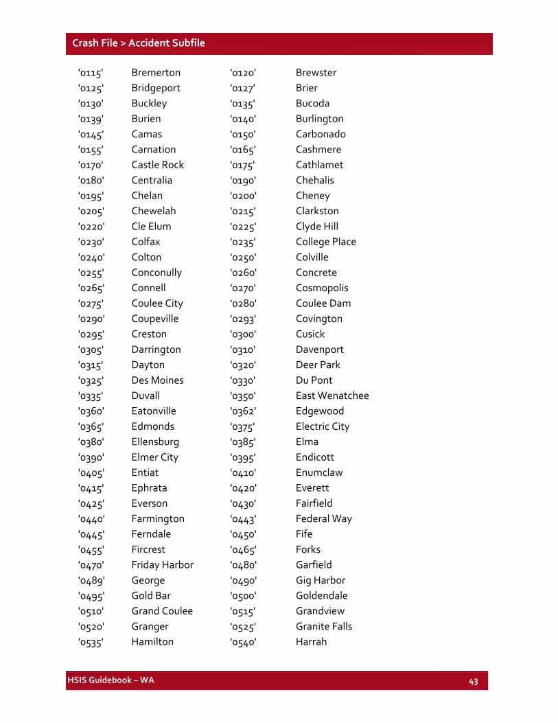
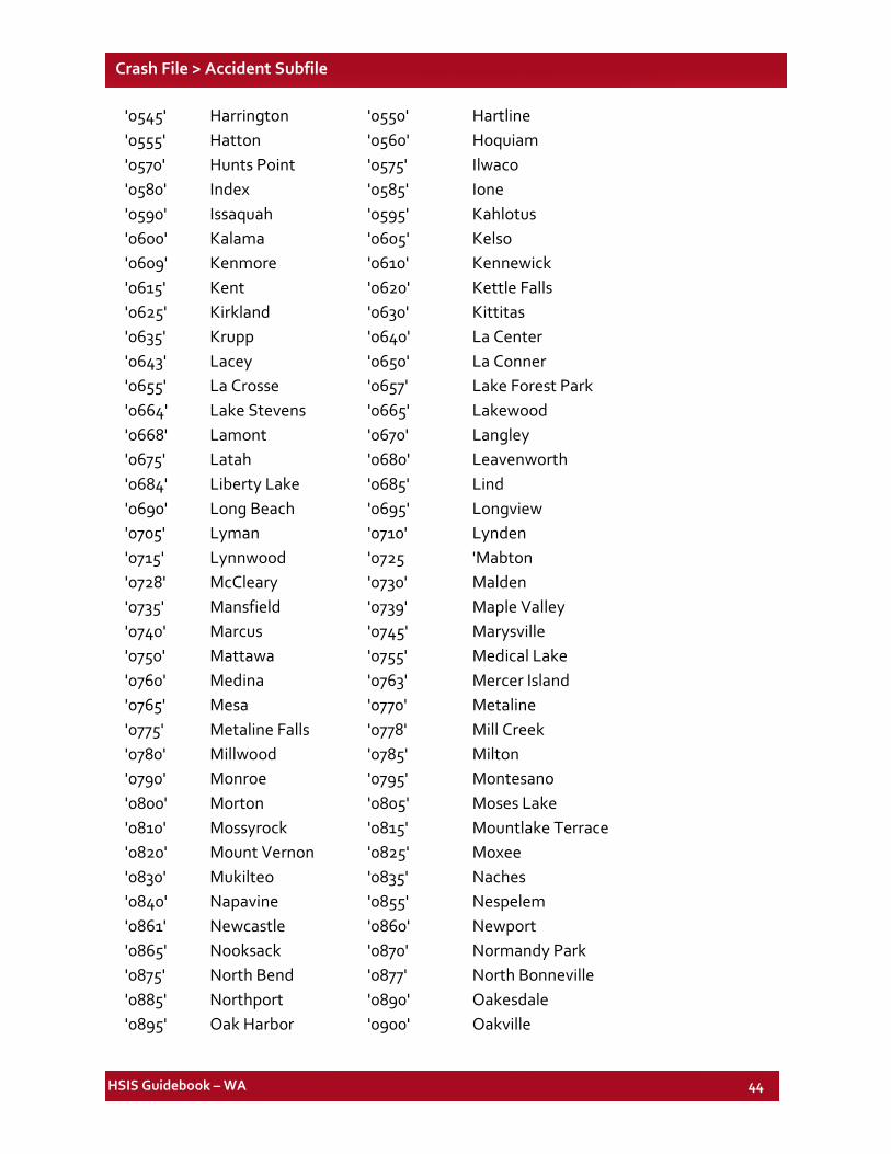
City Number SAS Name: CITY
Definition: City where the crash occurred.
'0005' Aberdeen '0010' Airway Heights '0015' Albion '0020' Algona '0025' Almira '0030' Anacortes '0045' Arlington '0050' Asotin '0055' Auburn '0058' Bainbridge Island '0060' Battleground '0070' Beaux Arts '0075' Bellevue '0080' Bellingham '0085' Benton City '0090' Bingen '0095' Black Diamond '0100' Blaine '0105' Bonney Lake '0110' Bothell
HSIS Guidebook – WA 43
Crash File > Accident Subfile
'0115' Bremerton '0120' Brewster '0125' Bridgeport '0127' Brier '0130' Buckley '0135' Bucoda '0139' Burien '0140' Burlington '0145' Camas '0150' Carbonado '0155' Carnation '0165' Cashmere '0170' Castle Rock '0175' Cathlamet '0180' Centralia '0190' Chehalis '0195' Chelan '0200' Cheney '0205' Chewelah '0215' Clarkston '0220' Cle Elum '0225' Clyde Hill '0230' Colfax '0235' College Place '0240' Colton '0250' Colville '0255' Conconully '0260' Concrete '0265' Connell '0270' Cosmopolis '0275' Coulee City '0280' Coulee Dam '0290' Coupeville '0293' Covington '0295' Creston '0300' Cusick '0305' Darrington '0310' Davenport '0315' Dayton '0320' Deer Park '0325' Des Moines '0330' Du Pont '0335' Duvall '0350' East Wenatchee '0360' Eatonville '0362' Edgewood '0365' Edmonds '0375' Electric City '0380' Ellensburg '0385' Elma '0390' Elmer City '0395' Endicott '0405' Entiat '0410' Enumclaw '0415' Ephrata '0420' Everett '0425' Everson '0430' Fairfield '0440' Farmington '0443' Federal Way '0445' Ferndale '0450' Fife '0455' Fircrest '0465' Forks '0470' Friday Harbor '0480' Garfield '0489' George '0490' Gig Harbor '0495' Gold Bar '0500' Goldendale '0510' Grand Coulee '0515' Grandview '0520' Granger '0525' Granite Falls '0535' Hamilton '0540' Harrah
HSIS Guidebook – WA 44
Crash File > Accident Subfile
'0545' Harrington '0550' Hartline '0555' Hatton '0560' Hoquiam '0570' Hunts Point '0575' Ilwaco '0580' Index '0585' Ione '0590' Issaquah '0595' Kahlotus '0600' Kalama '0605' Kelso '0609' Kenmore '0610' Kennewick '0615' Kent '0620' Kettle Falls '0625' Kirkland '0630' Kittitas '0635' Krupp '0640' La Center '0643' Lacey '0650' La Conner '0655' La Crosse '0657' Lake Forest Park '0664' Lake Stevens '0665' Lakewood '0668' Lamont '0670' Langley '0675' Latah '0680' Leavenworth '0684' Liberty Lake '0685' Lind '0690' Long Beach '0695' Longview '0705' Lyman '0710' Lynden '0715' Lynnwood '0725 'Mabton '0728' McCleary '0730' Malden '0735' Mansfield '0739' Maple Valley '0740' Marcus '0745' Marysville '0750' Mattawa '0755' Medical Lake '0760' Medina '0763' Mercer Island '0765' Mesa '0770' Metaline '0775' Metaline Falls '0778' Mill Creek '0780' Millwood '0785' Milton '0790' Monroe '0795' Montesano '0800' Morton '0805' Moses Lake '0810' Mossyrock '0815' Mountlake Terrace '0820' Mount Vernon '0825' Moxee '0830' Mukilteo '0835' Naches '0840' Napavine '0855' Nespelem '0861' Newcastle '0860' Newport '0865' Nooksack '0870' Normandy Park '0875' North Bend '0877' North Bonneville '0885' Northport '0890' Oakesdale '0895' Oak Harbor '0900' Oakville
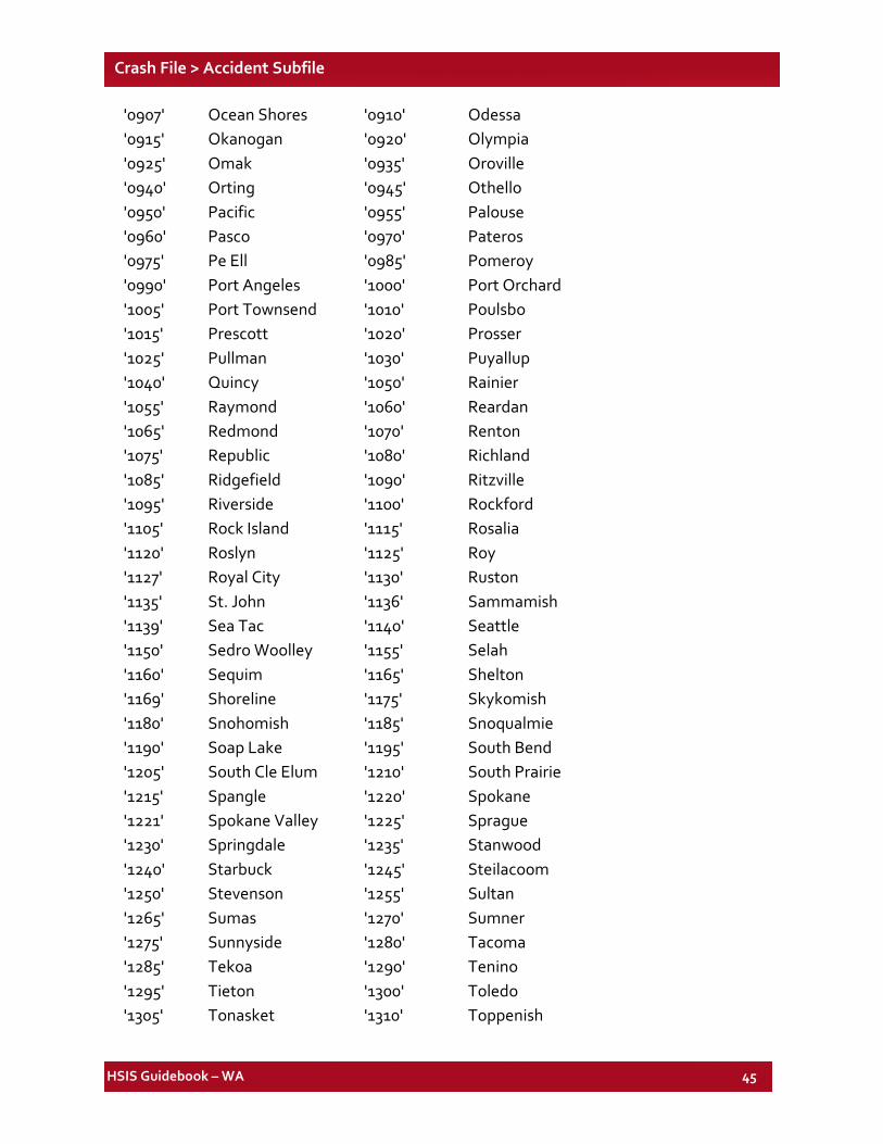
HSIS Guidebook – WA 45
Crash File > Accident Subfile
'0907' Ocean Shores '0910' Odessa '0915' Okanogan '0920' Olympia '0925' Omak '0935' Oroville '0940' Orting '0945' Othello '0950' Pacific '0955' Palouse '0960' Pasco '0970' Pateros '0975' Pe Ell '0985' Pomeroy '0990' Port Angeles '1000' Port Orchard '1005' Port Townsend '1010' Poulsbo '1015' Prescott '1020' Prosser '1025' Pullman '1030' Puyallup '1040' Quincy '1050' Rainier '1055' Raymond '1060' Reardan '1065' Redmond '1070' Renton '1075' Republic '1080' Richland '1085' Ridgefield '1090' Ritzville '1095' Riverside '1100' Rockford '1105' Rock Island '1115' Rosalia '1120' Roslyn '1125' Roy '1127' Royal City '1130' Ruston '1135' St. John '1136' Sammamish '1139' Sea Tac '1140' Seattle '1150' Sedro Woolley '1155' Selah '1160' Sequim '1165' Shelton '1169' Shoreline '1175' Skykomish '1180' Snohomish '1185' Snoqualmie '1190' Soap Lake '1195' South Bend '1205' South Cle Elum '1210' South Prairie '1215' Spangle '1220' Spokane '1221' Spokane Valley '1225' Sprague '1230' Springdale '1235' Stanwood '1240' Starbuck '1245' Steilacoom '1250' Stevenson '1255' Sultan '1265' Sumas '1270' Sumner '1275' Sunnyside '1280' Tacoma '1285' Tekoa '1290' Tenino '1295' Tieton '1300' Toledo '1305' Tonasket '1310' Toppenish
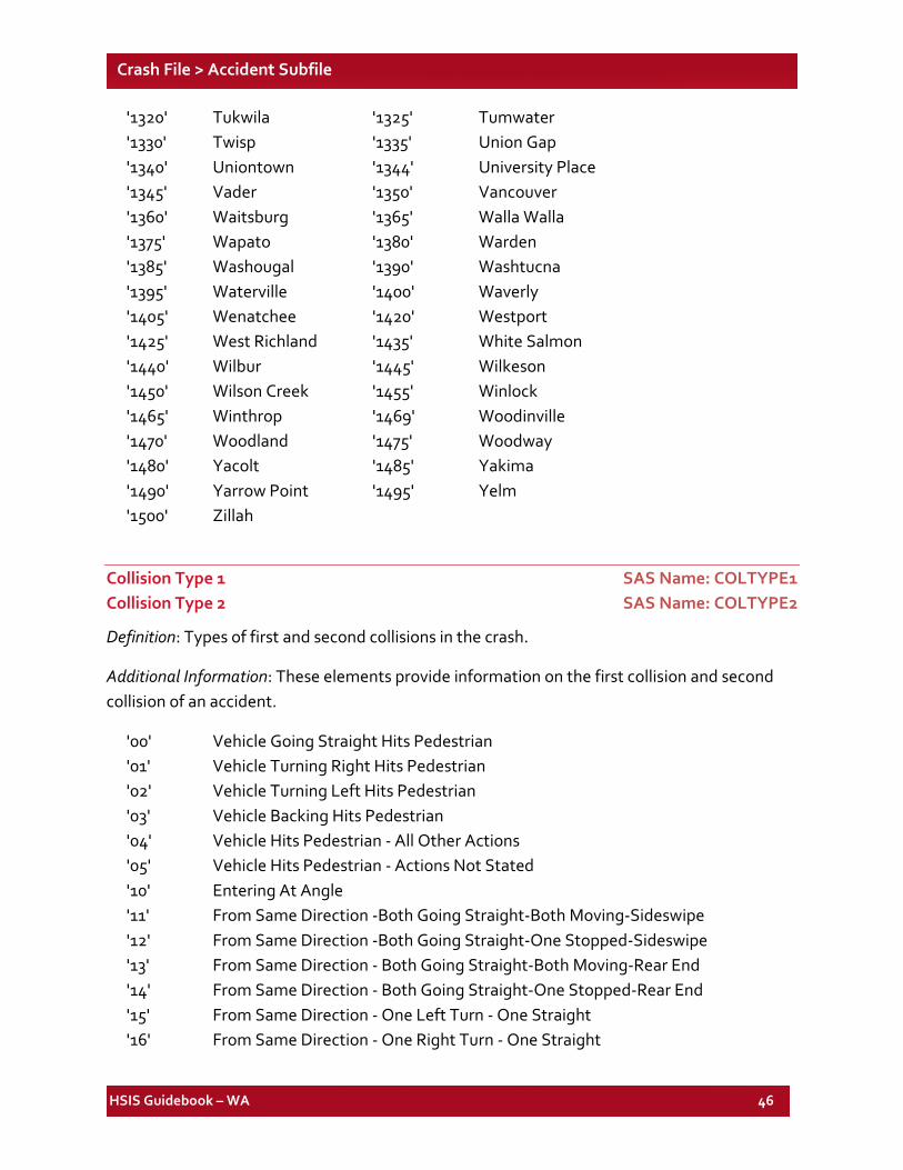
HSIS Guidebook – WA 46
Crash File > Accident Subfile
'1320' Tukwila '1325' Tumwater '1330' Twisp '1335' Union Gap '1340' Uniontown '1344' University Place '1345' Vader '1350' Vancouver '1360' Waitsburg '1365' Walla Walla '1375' Wapato '1380' Warden '1385' Washougal '1390' Washtucna '1395' Waterville '1400' Waverly '1405' Wenatchee '1420' Westport '1425' West Richland '1435' White Salmon '1440' Wilbur '1445' Wilkeson '1450' Wilson Creek '1455' Winlock '1465' Winthrop '1469' Woodinville '1470' Woodland '1475' Woodway '1480' Yacolt '1485' Yakima '1490' Yarrow Point '1495' Yelm '1500' Zillah
Collision Type 1 SAS Name: COLTYPE1 Collision Type 2 SAS Name: COLTYPE2
Definition: Types of first and second collisions in the crash.
Additional Information: These elements provide information on the first collision and second collision of an accident.
'00' Vehicle Going Straight Hits Pedestrian '01' Vehicle Turning Right Hits Pedestrian '02' Vehicle Turning Left Hits Pedestrian '03' Vehicle Backing Hits Pedestrian '04' Vehicle Hits Pedestrian - All Other Actions '05' Vehicle Hits Pedestrian - Actions Not Stated '10' Entering At Angle '11' From Same Direction -Both Going Straight-Both Moving-Sideswipe '12' From Same Direction -Both Going Straight-One Stopped-Sideswipe '13' From Same Direction - Both Going Straight-Both Moving-Rear End '14' From Same Direction - Both Going Straight-One Stopped-Rear End '15' From Same Direction - One Left Turn - One Straight '16' From Same Direction - One Right Turn - One Straight
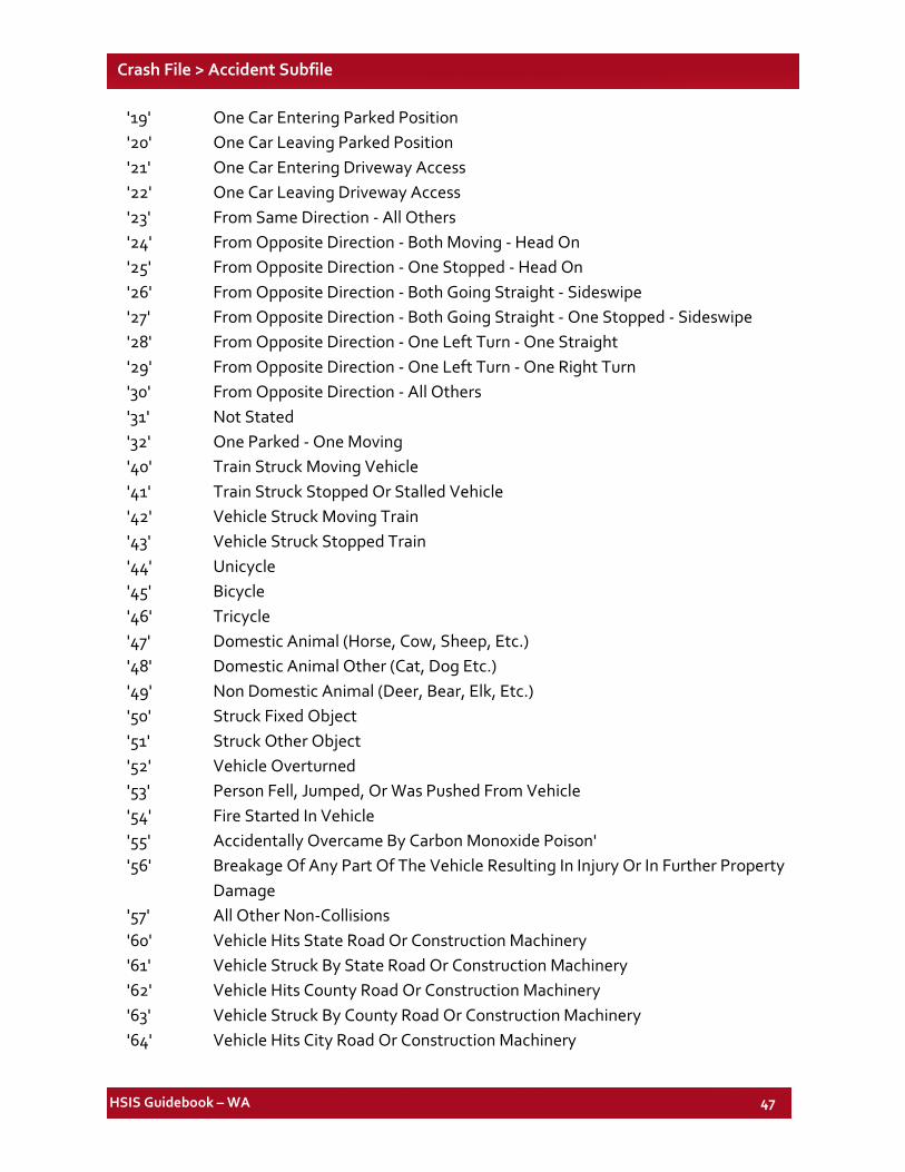
HSIS Guidebook – WA 47
Crash File > Accident Subfile
'19' One Car Entering Parked Position '20' One Car Leaving Parked Position '21' One Car Entering Driveway Access '22' One Car Leaving Driveway Access '23' From Same Direction - All Others '24' From Opposite Direction - Both Moving - Head On '25' From Opposite Direction - One Stopped - Head On '26' From Opposite Direction - Both Going Straight - Sideswipe '27' From Opposite Direction - Both Going Straight - One Stopped - Sideswipe '28' From Opposite Direction - One Left Turn - One Straight '29' From Opposite Direction - One Left Turn - One Right Turn '30' From Opposite Direction - All Others '31' Not Stated '32' One Parked - One Moving '40' Train Struck Moving Vehicle '41' Train Struck Stopped Or Stalled Vehicle '42' Vehicle Struck Moving Train '43' Vehicle Struck Stopped Train '44' Unicycle '45' Bicycle '46' Tricycle '47' Domestic Animal (Horse, Cow, Sheep, Etc.) '48' Domestic Animal Other (Cat, Dog Etc.) '49' Non Domestic Animal (Deer, Bear, Elk, Etc.) '50' Struck Fixed Object '51' Struck Other Object '52' Vehicle Overturned '53' Person Fell, Jumped, Or Was Pushed From Vehicle '54' Fire Started In Vehicle '55' Accidentally Overcame By Carbon Monoxide Poison' '56' Breakage Of Any Part Of The Vehicle Resulting In Injury Or In Further Property Damage '57' All Other Non-Collisions '60' Vehicle Hits State Road Or Construction Machinery '61' Vehicle Struck By State Road Or Construction Machinery '62' Vehicle Hits County Road Or Construction Machinery '63' Vehicle Struck By County Road Or Construction Machinery '64' Vehicle Hits City Road Or Construction Machinery
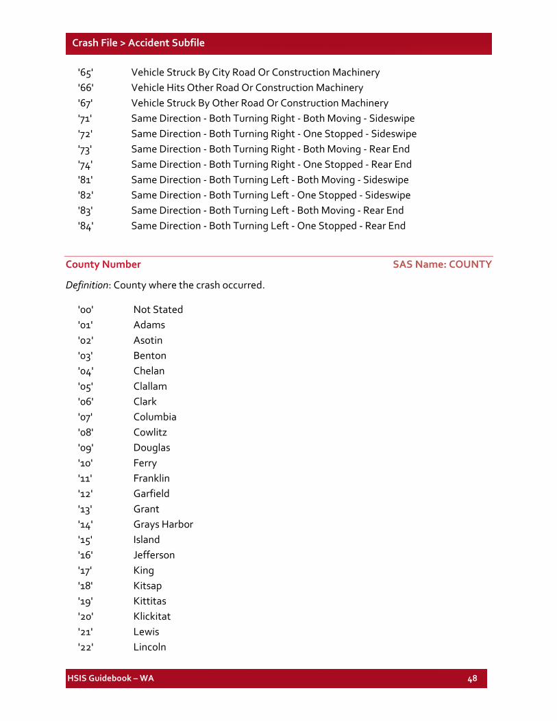
HSIS Guidebook – WA 48
Crash File > Accident Subfile
'65' Vehicle Struck By City Road Or Construction Machinery '66' Vehicle Hits Other Road Or Construction Machinery '67' Vehicle Struck By Other Road Or Construction Machinery '71' Same Direction - Both Turning Right - Both Moving - Sideswipe '72' Same Direction - Both Turning Right - One Stopped - Sideswipe '73' Same Direction - Both Turning Right - Both Moving - Rear End '74' Same Direction - Both Turning Right - One Stopped - Rear End '81' Same Direction - Both Turning Left - Both Moving - Sideswipe '82' Same Direction - Both Turning Left - One Stopped - Sideswipe '83' Same Direction - Both Turning Left - Both Moving - Rear End '84' Same Direction - Both Turning Left - One Stopped - Rear End
County Number SAS Name: COUNTY
Definition: County where the crash occurred.
'00' Not Stated '01' Adams '02' Asotin '03' Benton '04' Chelan '05' Clallam '06' Clark '07' Columbia '08' Cowlitz '09' Douglas '10' Ferry '11' Franklin '12' Garfield '13' Grant '14' Grays Harbor '15' Island '16' Jefferson '17' King '18' Kitsap '19' Kittitas '20' Klickitat '21' Lewis '22' Lincoln
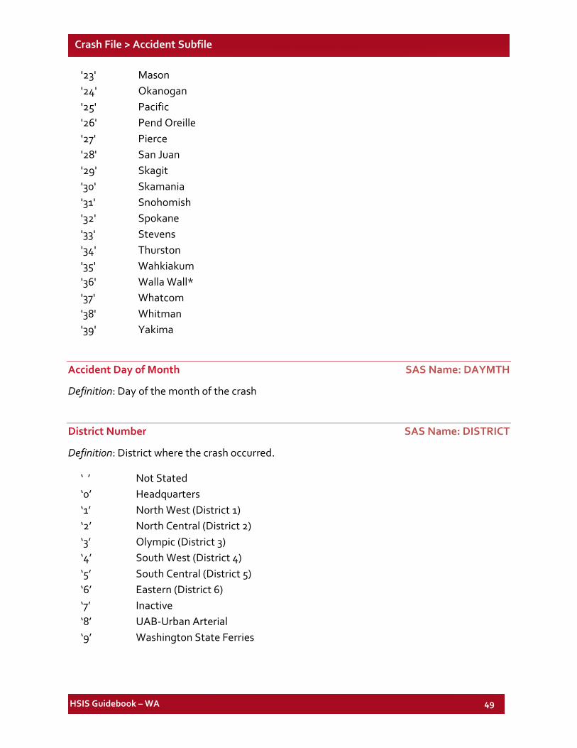
HSIS Guidebook – WA 49
Crash File > Accident Subfile
'23' Mason '24' Okanogan '25' Pacific '26' Pend Oreille '27' Pierce '28' San Juan '29' Skagit '30' Skamania '31' Snohomish '32' Spokane '33' Stevens '34' Thurston '35' Wahkiakum '36' Walla Wall* '37' Whatcom '38' Whitman '39' Yakima
Accident Day of Month SAS Name: DAYMTH
Definition: Day of the month of the crash
District Number SAS Name: DISTRICT
Definition: District where the crash occurred.
‘ ’ Not Stated ‘0’ Headquarters ‘1’ North West (District 1) ‘2’ North Central (District 2) ‘3’ Olympic (District 3) ‘4’ South West (District 4) ‘5’ South Central (District 5) ‘6’ Eastern (District 6) ‘7’ Inactive ‘8’ UAB-Urban Arterial ‘9’ Washington State Ferries
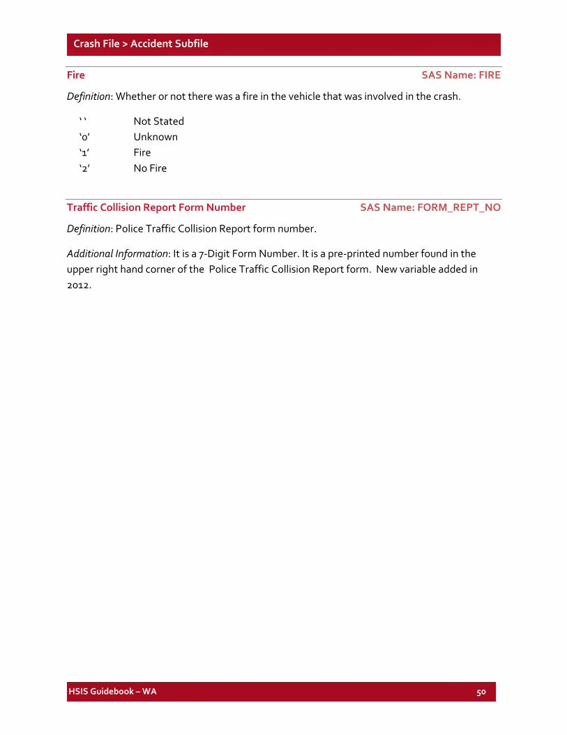
HSIS Guidebook – WA 50
Crash File > Accident Subfile
Fire SAS Name: FIRE
Definition: Whether or not there was a fire in the vehicle that was involved in the crash.
‘ ‘ Not Stated ‘0’ Unknown ‘1’ Fire ‘2’ No Fire
Traffic Collision Report Form Number SAS Name: FORM_REPT_NO
Definition: Police Traffic Collision Report form number.
Additional Information: It is a 7-Digit Form Number. It is a pre-printed number found in the upper right hand corner of the Police Traffic Collision Report form. New variable added in 2012.
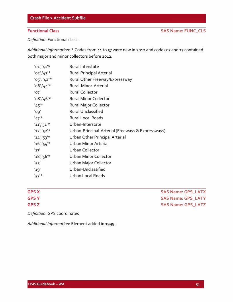
HSIS Guidebook – WA 51
Crash File > Accident Subfile
Functional Class SAS Name: FUNC_CLS
Definition: Functional class.
Additional Information: * Codes from 41 to 57 were new in 2012 and codes 07 and 17 contained both major and minor collectors before 2012.
'01','41'* Rural Interstate '02','43'* Rural Principal Arterial '05', '42'* Rural Other Freeway/Expressway '06','44'* Rural-Minor-Arterial '07' Rural Collector '08','46'* Rural Minor Collector '45'* Rural Major Collector '09' Rural Unclassified '47'* Rural Local Roads '11','51'* Urban-Interstate '12','52'* Urban-Principal-Arterial (Freeways & Expressways) '14','53'* Urban Other Principal Arterial '16','54'* Urban Minor Arterial '17' Urban Collector '18','56'* Urban Minor Collector '55' Urban Major Collector '19' Urban-Unclassified '57'* Urban Local Roads
GPS X SAS Name: GPS_LATX GPS Y SAS Name: GPS_LATY GPS Z SAS Name: GPS_LATZ
Definition: GPS coordinates
Additional Information: Element added in 1999.
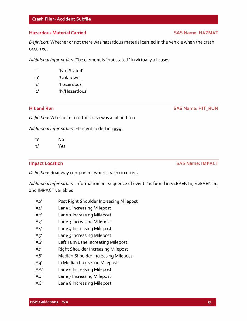
HSIS Guidebook – WA 52
Crash File > Accident Subfile
Hazardous Material Carried SAS Name: HAZMAT
Definition: Whether or not there was hazardous material carried in the vehicle when the crash occurred.
Additional Information: The element is “not stated” in virtually all cases.
' ' 'Not Stated' '0' 'Unknown' '1' 'Hazardous' '2' 'N/Hazardous'
Hit and Run SAS Name: HIT_RUN
Definition: Whether or not the crash was a hit and run.
Additional Information: Element added in 1999.
‘0’ No ‘1’ Yes
Impact Location SAS Name: IMPACT
Definition: Roadway component where crash occurred.
Additional Information: Information on "sequence of events" is found in V1EVENT1, V2EVENT1, and IMPACT variables
'A0' Past Right Shoulder Increasing Milepost 'A1' Lane 1 Increasing Milepost 'A2' Lane 2 Increasing Milepost 'A3' Lane 3 Increasing Milepost 'A4' Lane 4 Increasing Milepost 'A5' Lane 5 Increasing Milepost 'A6' Left Turn Lane Increasing Milepost 'A7' Right Shoulder Increasing Milepost 'A8' Median Shoulder Increasing Milepost 'A9' In Median Increasing Milepost 'AA' Lane 6 Increasing Milepost 'AB' Lane 7 Increasing Milepost 'AC' Lane 8 Increasing Milepost
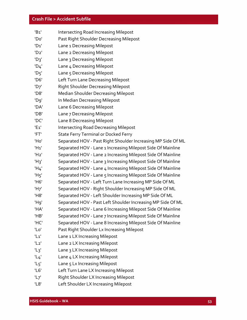
HSIS Guidebook – WA 53
Crash File > Accident Subfile
'B1' Intersecting Road Increasing Milepost 'D0' Past Right Shoulder Decreasing Milepost 'D1' Lane 1 Decreasing Milepost 'D2' Lane 2 Decreasing Milepost 'D3' Lane 3 Decreasing Milepost 'D4' Lane 4 Decreasing Milepost 'D5' Lane 5 Decreasing Milepost 'D6' Left Turn Lane Decreasing Milepost 'D7' Right Shoulder Decreasing Milepost 'D8' Median Shoulder Decreasing Milepost 'D9' In Median Decreasing Milepost 'DA' Lane 6 Decreasing Milepost 'DB' Lane 7 Decreasing Milepost 'DC' Lane 8 Decreasing Milepost 'E1' Intersecting Road Decreasing Milepost 'FT' State Ferry Terminal or Docked Ferry 'H0' Separated HOV - Past Right Shoulder Increasing MP Side Of ML 'H1' Separated HOV - Lane 1 Increasing Milepost Side Of Mainline 'H2' Separated HOV - Lane 2 Increasing Milepost Side Of Mainline 'H3' Separated HOV - Lane 3 Increasing Milepost Side Of Mainline 'H4' Separated HOV - Lane 4 Increasing Milepost Side Of Mainline 'H5' Separated HOV - Lane 5 Increasing Milepost Side Of Mainline 'H6' Separated HOV - Left Turn Lane Increasing MP Side Of ML 'H7' Separated HOV - Right Shoulder Increasing MP Side Of ML 'H8' Separated HOV - Left Shoulder Increasing MP Side Of ML 'H9' Separated HOV - Past Left Shoulder Increasing MP Side Of ML 'HA' Separated HOV - Lane 6 Increasing Milepost Side Of Mainline 'HB' Separated HOV - Lane 7 Increasing Milepost Side Of Mainline 'HC' Separated HOV - Lane 8 Increasing Milepost Side Of Mainline 'L0' Past Right Shoulder Lx Increasing Milepost 'L1' Lane 1 LX Increasing Milepost 'L2' Lane 2 LX Increasing Milepost 'L3' Lane 3 LX Increasing Milepost 'L4' Lane 4 LX Increasing Milepost 'L5' Lane 5 Lx Increasing Milepost 'L6' Left Turn Lane LX Increasing Milepost 'L7' Right Shoulder LX Increasing Milepost 'L8' Left Shoulder LX Increasing Milepost
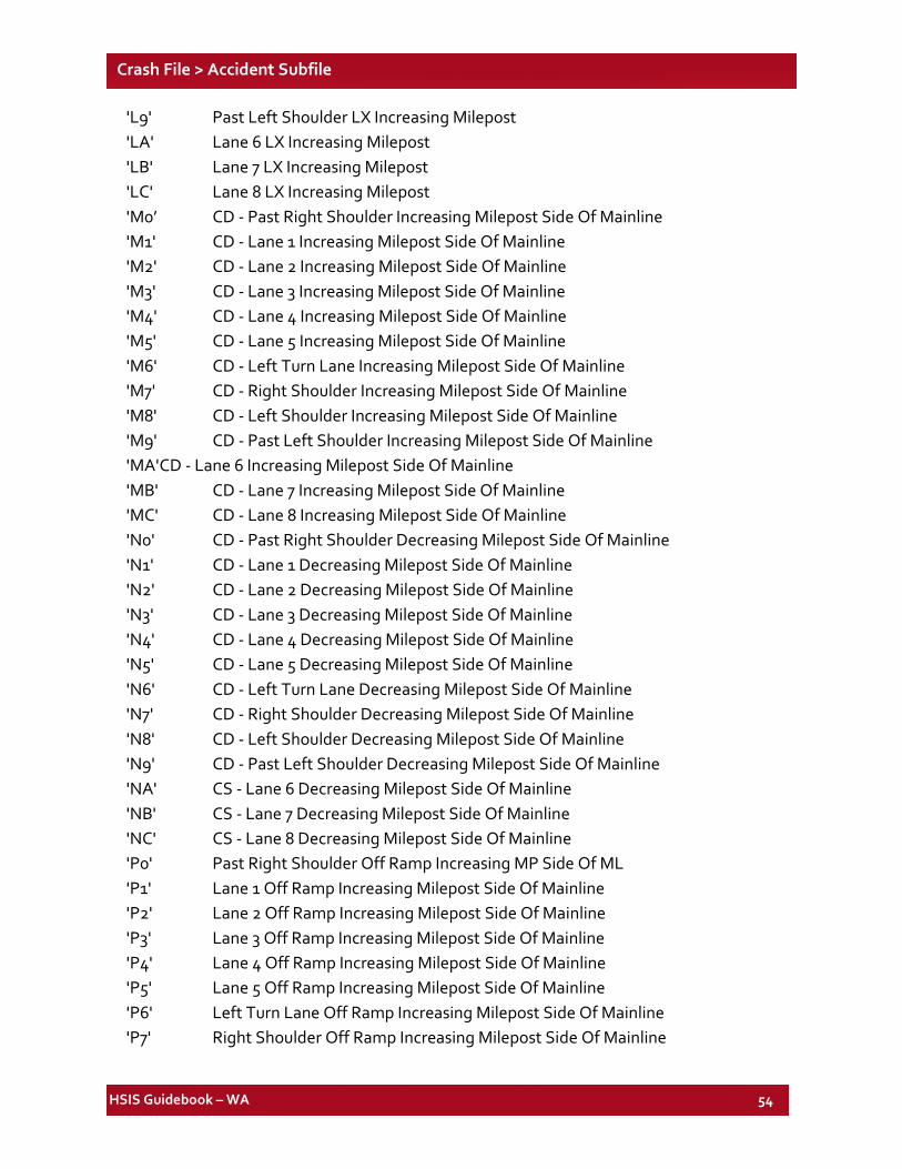
HSIS Guidebook – WA 54
Crash File > Accident Subfile
'L9' Past Left Shoulder LX Increasing Milepost 'LA' Lane 6 LX Increasing Milepost 'LB' Lane 7 LX Increasing Milepost 'LC' Lane 8 LX Increasing Milepost 'M0’ CD - Past Right Shoulder Increasing Milepost Side Of Mainline 'M1' CD - Lane 1 Increasing Milepost Side Of Mainline 'M2' CD - Lane 2 Increasing Milepost Side Of Mainline 'M3' CD - Lane 3 Increasing Milepost Side Of Mainline 'M4' CD - Lane 4 Increasing Milepost Side Of Mainline 'M5' CD - Lane 5 Increasing Milepost Side Of Mainline 'M6' CD - Left Turn Lane Increasing Milepost Side Of Mainline 'M7' CD - Right Shoulder Increasing Milepost Side Of Mainline 'M8' CD - Left Shoulder Increasing Milepost Side Of Mainline 'M9' CD - Past Left Shoulder Increasing Milepost Side Of Mainline 'MA' CD - Lane 6 Increasing Milepost Side Of Mainline 'MB' CD - Lane 7 Increasing Milepost Side Of Mainline 'MC' CD - Lane 8 Increasing Milepost Side Of Mainline 'N0' CD - Past Right Shoulder Decreasing Milepost Side Of Mainline 'N1' CD - Lane 1 Decreasing Milepost Side Of Mainline 'N2' CD - Lane 2 Decreasing Milepost Side Of Mainline 'N3' CD - Lane 3 Decreasing Milepost Side Of Mainline 'N4' CD - Lane 4 Decreasing Milepost Side Of Mainline 'N5' CD - Lane 5 Decreasing Milepost Side Of Mainline 'N6' CD - Left Turn Lane Decreasing Milepost Side Of Mainline 'N7' CD - Right Shoulder Decreasing Milepost Side Of Mainline 'N8' CD - Left Shoulder Decreasing Milepost Side Of Mainline 'N9' CD - Past Left Shoulder Decreasing Milepost Side Of Mainline 'NA' CS - Lane 6 Decreasing Milepost Side Of Mainline 'NB' CS - Lane 7 Decreasing Milepost Side Of Mainline 'NC' CS - Lane 8 Decreasing Milepost Side Of Mainline 'P0' Past Right Shoulder Off Ramp Increasing MP Side Of ML 'P1' Lane 1 Off Ramp Increasing Milepost Side Of Mainline 'P2' Lane 2 Off Ramp Increasing Milepost Side Of Mainline 'P3' Lane 3 Off Ramp Increasing Milepost Side Of Mainline 'P4' Lane 4 Off Ramp Increasing Milepost Side Of Mainline 'P5' Lane 5 Off Ramp Increasing Milepost Side Of Mainline 'P6' Left Turn Lane Off Ramp Increasing Milepost Side Of Mainline 'P7' Right Shoulder Off Ramp Increasing Milepost Side Of Mainline
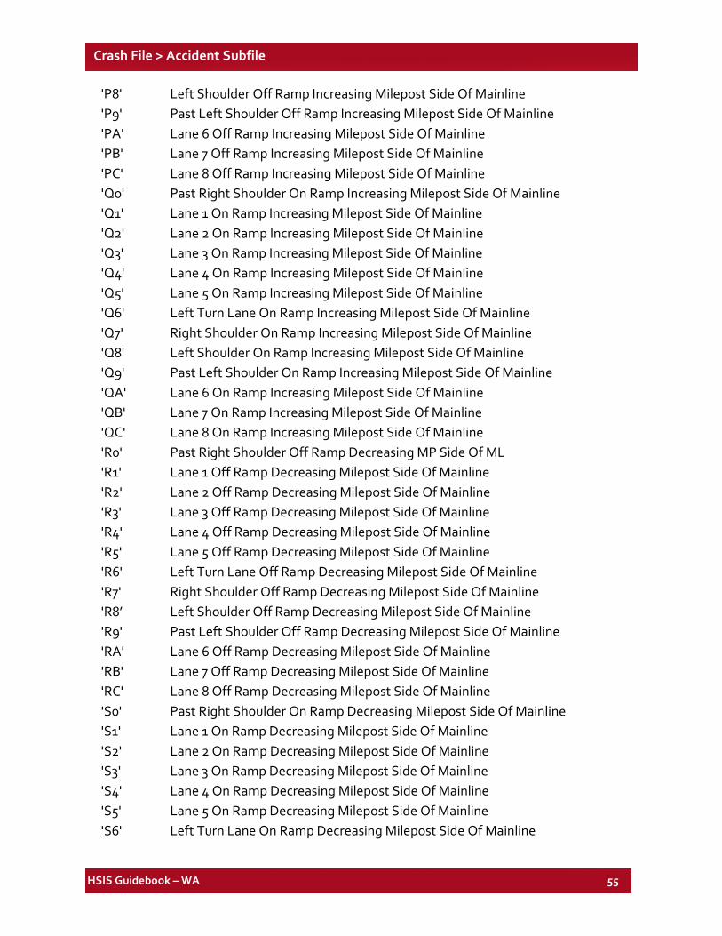
HSIS Guidebook – WA 55
Crash File > Accident Subfile
'P8' Left Shoulder Off Ramp Increasing Milepost Side Of Mainline 'P9' Past Left Shoulder Off Ramp Increasing Milepost Side Of Mainline 'PA' Lane 6 Off Ramp Increasing Milepost Side Of Mainline 'PB' Lane 7 Off Ramp Increasing Milepost Side Of Mainline 'PC' Lane 8 Off Ramp Increasing Milepost Side Of Mainline 'Q0' Past Right Shoulder On Ramp Increasing Milepost Side Of Mainline 'Q1' Lane 1 On Ramp Increasing Milepost Side Of Mainline 'Q2' Lane 2 On Ramp Increasing Milepost Side Of Mainline 'Q3' Lane 3 On Ramp Increasing Milepost Side Of Mainline 'Q4' Lane 4 On Ramp Increasing Milepost Side Of Mainline 'Q5' Lane 5 On Ramp Increasing Milepost Side Of Mainline 'Q6' Left Turn Lane On Ramp Increasing Milepost Side Of Mainline 'Q7' Right Shoulder On Ramp Increasing Milepost Side Of Mainline 'Q8' Left Shoulder On Ramp Increasing Milepost Side Of Mainline 'Q9' Past Left Shoulder On Ramp Increasing Milepost Side Of Mainline 'QA' Lane 6 On Ramp Increasing Milepost Side Of Mainline 'QB' Lane 7 On Ramp Increasing Milepost Side Of Mainline 'QC' Lane 8 On Ramp Increasing Milepost Side Of Mainline 'R0' Past Right Shoulder Off Ramp Decreasing MP Side Of ML 'R1' Lane 1 Off Ramp Decreasing Milepost Side Of Mainline 'R2' Lane 2 Off Ramp Decreasing Milepost Side Of Mainline 'R3' Lane 3 Off Ramp Decreasing Milepost Side Of Mainline 'R4' Lane 4 Off Ramp Decreasing Milepost Side Of Mainline 'R5' Lane 5 Off Ramp Decreasing Milepost Side Of Mainline 'R6' Left Turn Lane Off Ramp Decreasing Milepost Side Of Mainline 'R7' Right Shoulder Off Ramp Decreasing Milepost Side Of Mainline 'R8’ Left Shoulder Off Ramp Decreasing Milepost Side Of Mainline 'R9' Past Left Shoulder Off Ramp Decreasing Milepost Side Of Mainline 'RA' Lane 6 Off Ramp Decreasing Milepost Side Of Mainline 'RB' Lane 7 Off Ramp Decreasing Milepost Side Of Mainline 'RC' Lane 8 Off Ramp Decreasing Milepost Side Of Mainline 'S0' Past Right Shoulder On Ramp Decreasing Milepost Side Of Mainline 'S1' Lane 1 On Ramp Decreasing Milepost Side Of Mainline 'S2' Lane 2 On Ramp Decreasing Milepost Side Of Mainline 'S3' Lane 3 On Ramp Decreasing Milepost Side Of Mainline 'S4' Lane 4 On Ramp Decreasing Milepost Side Of Mainline 'S5' Lane 5 On Ramp Decreasing Milepost Side Of Mainline 'S6' Left Turn Lane On Ramp Decreasing Milepost Side Of Mainline
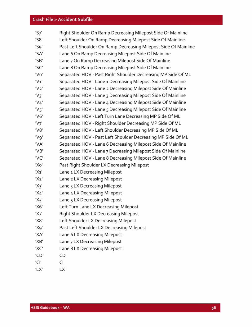
HSIS Guidebook – WA 56
Crash File > Accident Subfile
'S7' Right Shoulder On Ramp Decreasing Milepost Side Of Mainline 'S8' Left Shoulder On Ramp Decreasing Milepost Side Of Mainline 'S9' Past Left Shoulder On Ramp Decreasing Milepost Side Of Mainline 'SA' Lane 6 On Ramp Decreasing Milepost Side Of Mainline 'SB' Lane 7 On Ramp Decreasing Milepost Side Of Mainline 'SC' Lane 8 On Ramp Decreasing Milepost Side Of Mainline 'V0' Separated HOV - Past Right Shoulder Decreasing MP Side Of ML 'V1' Separated HOV - Lane 1 Decreasing Milepost Side Of Mainline 'V2' Separated HOV - Lane 2 Decreasing Milepost Side Of Mainline 'V3' Separated HOV - Lane 3 Decreasing Milepost Side Of Mainline 'V4' Separated HOV - Lane 4 Decreasing Milepost Side Of Mainline 'V5' Separated HOV - Lane 5 Decreasing Milepost Side Of Mainline 'V6' Separated HOV - Left Turn Lane Decreasing MP Side Of ML 'V7' Separated HOV - Right Shoulder Decreasing MP Side Of ML 'V8' Separated HOV - Left Shoulder Decreasing MP Side Of ML 'V9' Separated HOV - Past Left Shoulder Decreasing MP Side Of ML 'VA' Separated HOV - Lane 6 Decreasing Milepost Side Of Mainline 'VB' Separated HOV - Lane 7 Decreasing Milepost Side Of Mainline 'VC' Separated HOV - Lane 8 Decreasing Milepost Side Of Mainline 'X0' Past Right Shoulder LX Decreasing Milepost 'X1' Lane 1 LX Decreasing Milepost 'X2' Lane 2 LX Decreasing Milepost 'X3' Lane 3 LX Decreasing Milepost 'X4' Lane 4 LX Decreasing Milepost 'X5' Lane 5 LX Decreasing Milepost 'X6' Left Turn Lane LX Decreasing Milepost 'X7' Right Shoulder LX Decreasing Milepost 'X8' Left Shoulder LX Decreasing Milepost 'X9' Past Left Shoulder LX Decreasing Milepost 'XA' Lane 6 LX Decreasing Milepost 'XB' Lane 7 LX Decreasing Milepost 'XC’ Lane 8 LX Decreasing Milepost 'CD' CD 'CI' CI 'LX' LX
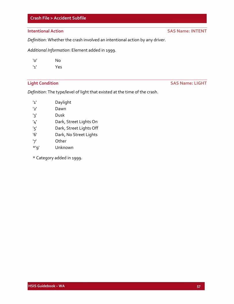
HSIS Guidebook – WA 57
Crash File > Accident Subfile
Intentional Action SAS Name: INTENT
Definition: Whether the crash involved an intentional action by any driver.
Additional Information: Element added in 1999.
‘0’ No ‘1’ Yes
Light Condition SAS Name: LIGHT
Definition: The type/level of light that existed at the time of the crash.
'1' Daylight '2' Dawn '3' Dusk '4' Dark, Street Lights On '5' Dark, Street Lights Off '6' Dark, No Street Lights '7' Other *'9' Unknown
* Category added in 1999.
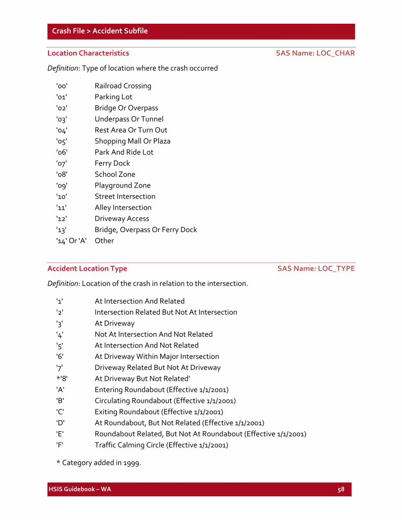
HSIS Guidebook – WA 58
Crash File > Accident Subfile
Location Characteristics SAS Name: LOC_CHAR
Definition: Type of location where the crash occurred
'00' Railroad Crossing '01' Parking Lot '02' Bridge Or Overpass '03' Underpass Or Tunnel '04' Rest Area Or Turn Out '05' Shopping Mall Or Plaza '06' Park And Ride Lot '07' Ferry Dock '08' School Zone '09' Playground Zone '10’ Street Intersection '11' Alley Intersection '12' Driveway Access '13' Bridge, Overpass Or Ferry Dock '14' Or 'A' Other
Accident Location Type SAS Name: LOC_TYPE
Definition: Location of the crash in relation to the intersection.
'1' At Intersection And Related '2' Intersection Related But Not At Intersection '3' At Driveway '4' Not At Intersection And Not Related '5' At Intersection And Not Related '6' At Driveway Within Major Intersection '7' Driveway Related But Not At Driveway *'8' At Driveway But Not Related' 'A' Entering Roundabout (Effective 1/1/2001) 'B' Circulating Roundabout (Effective 1/1/2001) 'C' Exiting Roundabout (Effective 1/1/2001) 'D' At Roundabout, But Not Related (Effective 1/1/2001) 'E' Roundabout Related, But Not At Roundabout (Effective 1/1/2001) 'F' Traffic Calming Circle (Effective 1/1/2001)
* Category added in 1999.
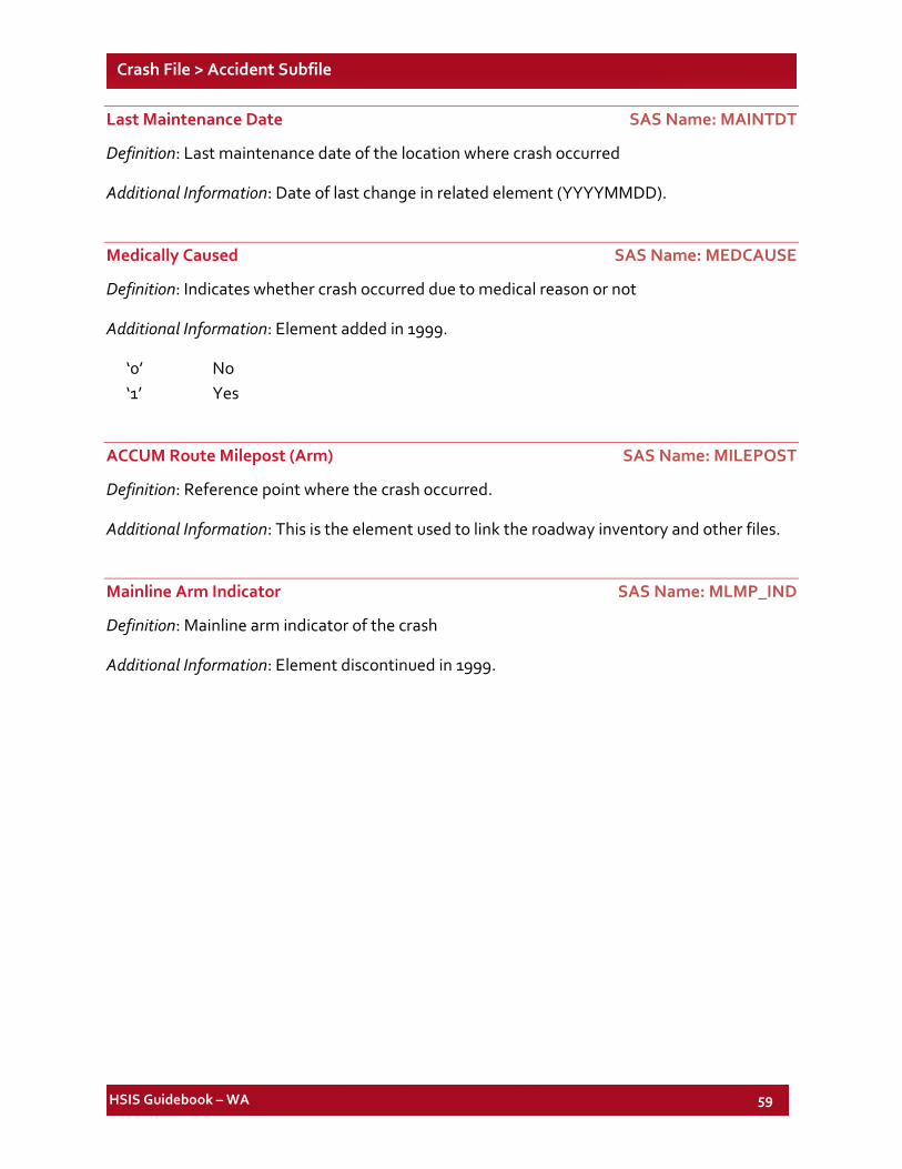
HSIS Guidebook – WA 59
Crash File > Accident Subfile
Last Maintenance Date SAS Name: MAINTDT
Definition: Last maintenance date of the location where crash occurred
Additional Information: Date of last change in related element (YYYYMMDD).
Medically Caused SAS Name: MEDCAUSE
Definition: Indicates whether crash occurred due to medical reason or not
Additional Information: Element added in 1999.
‘0’ No ‘1’ Yes
ACCUM Route Milepost (Arm) SAS Name: MILEPOST
Definition: Reference point where the crash occurred.
Additional Information: This is the element used to link the roadway inventory and other files.
Mainline Arm Indicator SAS Name: MLMP_IND
Definition: Mainline arm indicator of the crash
Additional Information: Element discontinued in 1999.
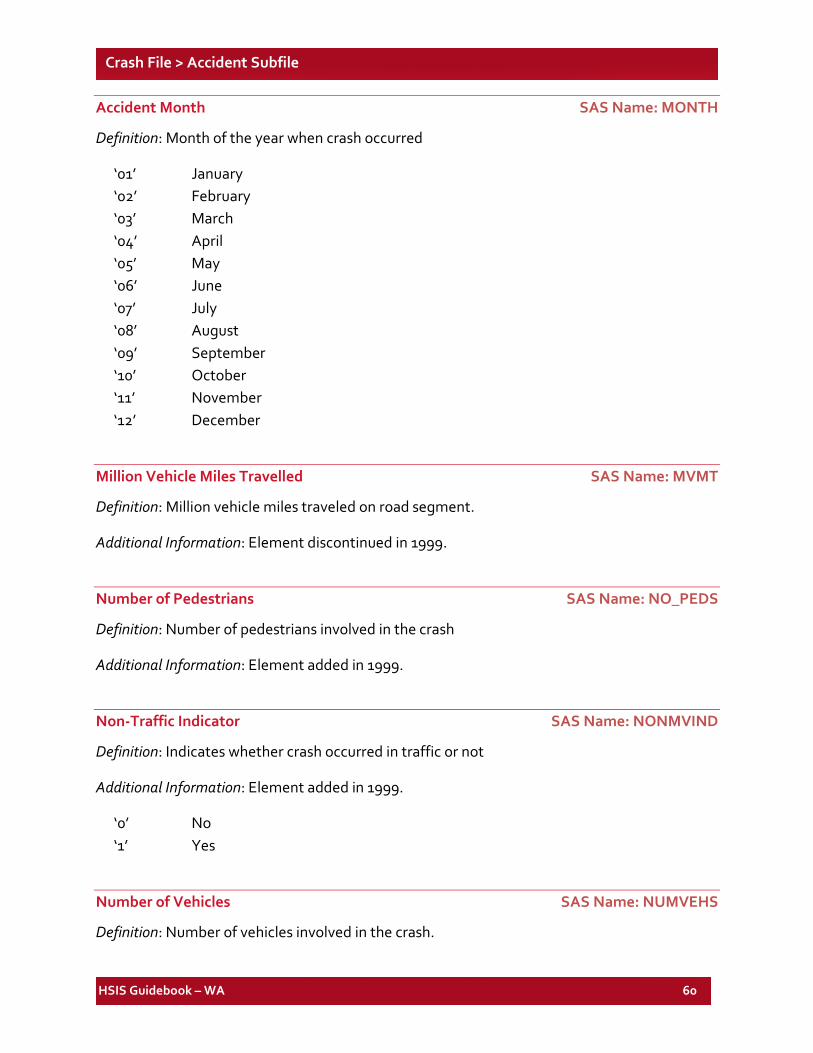
HSIS Guidebook – WA 60
Crash File > Accident Subfile
Accident Month SAS Name: MONTH
Definition: Month of the year when crash occurred
‘01’ January ‘02’ February ‘03’ March ‘04’ April ‘05’ May ‘06’ June ‘07’ July ‘08’ August ‘09’ September ‘10’ October ‘11’ November ‘12’ December
Million Vehicle Miles Travelled SAS Name: MVMT
Definition: Million vehicle miles traveled on road segment.
Additional Information: Element discontinued in 1999.
Number of Pedestrians SAS Name: NO_PEDS
Definition: Number of pedestrians involved in the crash
Additional Information: Element added in 1999.
Non-Traffic Indicator SAS Name: NONMVIND
Definition: Indicates whether crash occurred in traffic or not
Additional Information: Element added in 1999.
‘0’ No ‘1’ Yes
Number of Vehicles SAS Name: NUMVEHS
Definition: Number of vehicles involved in the crash.
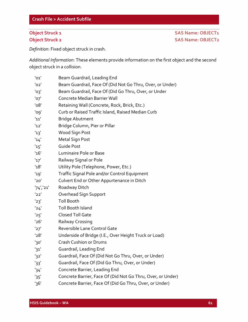
HSIS Guidebook – WA 61
Crash File > Accident Subfile
Object Struck 1 SAS Name: OBJECT1 Object Struck 2 SAS Name: OBJECT2
Definition: Fixed object struck in crash.
Additional Information: These elements provide information on the first object and the second object struck in a collision.
'01' Beam Guardrail, Leading End '02' Beam Guardrail, Face Of (Did Not Go Thru, Over, or Under) '03' Beam Guardrail, Face Of (Did Go Thru, Over, or Under '07' Concrete Median Barrier Wall '08' Retaining Wall (Concrete, Rock, Brick, Etc.) '09' Curb or Raised Traffic Island, Raised Median Curb '11' Bridge Abutment '12' Bridge Column, Pier or Pillar '13' Wood Sign Post '14' Metal Sign Post '15' Guide Post '16' Luminaire Pole or Base '17' Railway Signal or Pole '18' Utility Pole (Telephone, Power, Etc.) '19' Traffic Signal Pole and/or Control Equipment '20' Culvert End or Other Appurtenance in Ditch '74','21' Roadway Ditch '22' Overhead Sign Support '23' Toll Booth '24' Toll Booth Island '25' Closed Toll Gate '26' Railway Crossing '27' Reversible Lane Control Gate '28' Underside of Bridge (I.E., Over Height Truck or Load) '30' Crash Cushion or Drums '31' Guardrail, Leading End '32' Guardrail, Face Of (Did Not Go Thru, Over, or Under) '33' Guardrail, Face Of (Did Go Thru, Over, or Under) '34' Concrete Barrier, Leading End '35' Concrete Barrier, Face Of (Did Not Go Thru, Over, or Under) '36' Concrete Barrier, Face Of (Did Go Thru, Over, or Under)
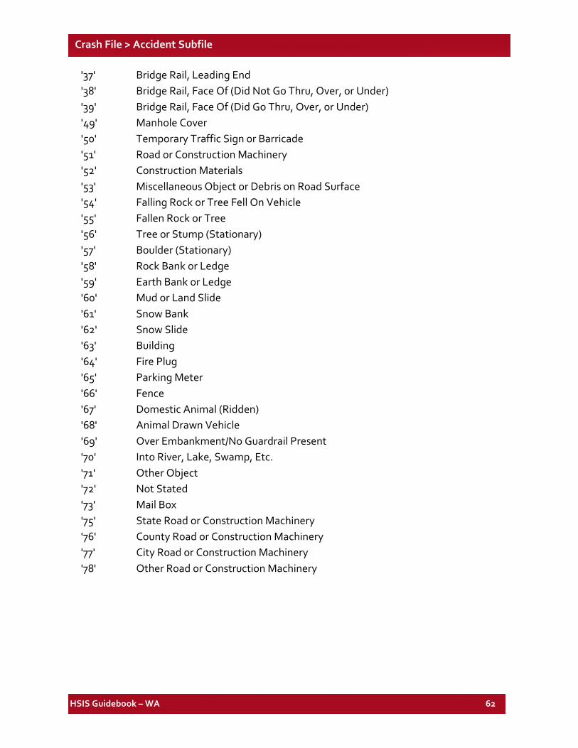
HSIS Guidebook – WA 62
Crash File > Accident Subfile
'37' Bridge Rail, Leading End '38' Bridge Rail, Face Of (Did Not Go Thru, Over, or Under) '39' Bridge Rail, Face Of (Did Go Thru, Over, or Under) '49' Manhole Cover '50' Temporary Traffic Sign or Barricade '51' Road or Construction Machinery '52' Construction Materials '53' Miscellaneous Object or Debris on Road Surface '54' Falling Rock or Tree Fell On Vehicle '55' Fallen Rock or Tree '56' Tree or Stump (Stationary) '57' Boulder (Stationary) '58' Rock Bank or Ledge '59' Earth Bank or Ledge '60' Mud or Land Slide '61' Snow Bank '62' Snow Slide '63' Building '64' Fire Plug '65' Parking Meter '66' Fence '67' Domestic Animal (Ridden) '68' Animal Drawn Vehicle '69' Over Embankment/No Guardrail Present '70' Into River, Lake, Swamp, Etc. '71' Other Object '72' Not Stated '73' Mail Box '75' State Road or Construction Machinery '76' County Road or Construction Machinery '77' City Road or Construction Machinery '78' Other Road or Construction Machinery
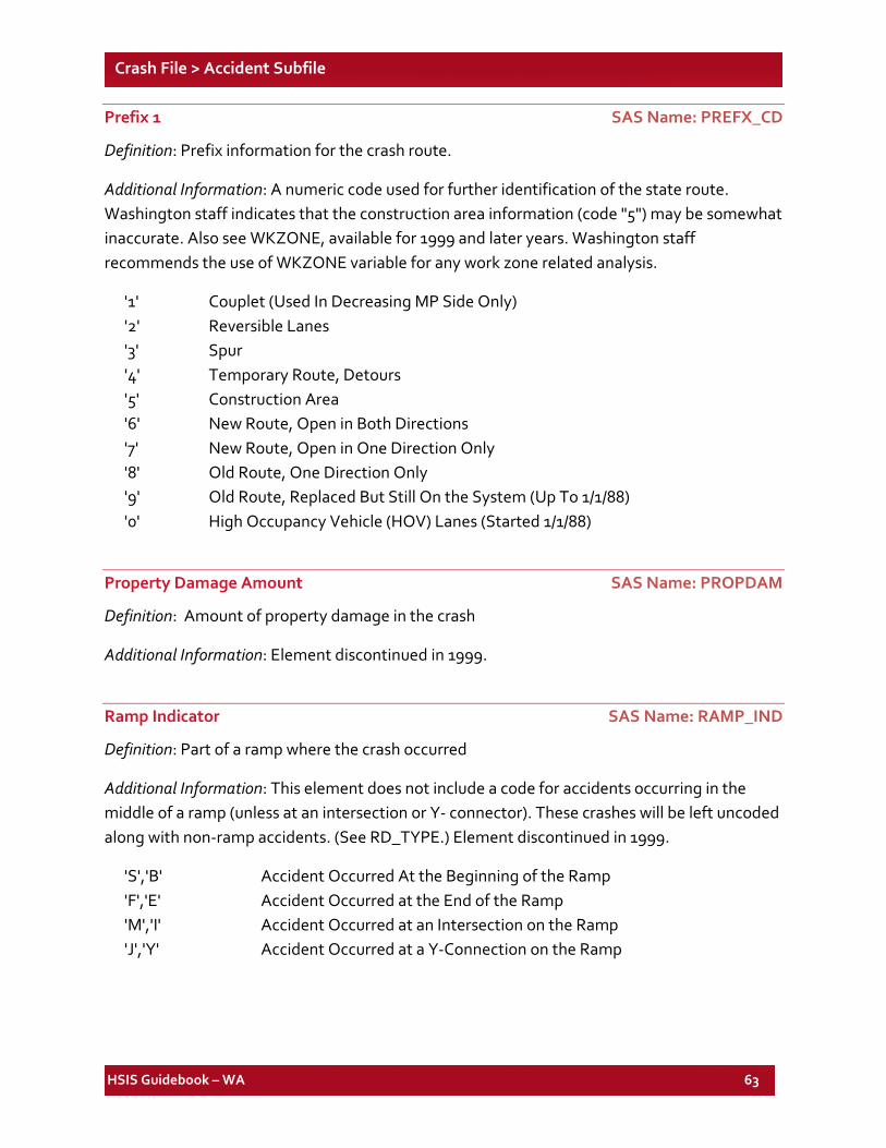
HSIS Guidebook – WA 63
Crash File > Accident Subfile
Prefix 1 SAS Name: PREFX_CD
Definition: Prefix information for the crash route.
Additional Information: A numeric code used for further identification of the state route. Washington staff indicates that the construction area information (code "5") may be somewhat inaccurate. Also see WKZONE, available for 1999 and later years. Washington staff recommends the use of WKZONE variable for any work zone related analysis.
'1' Couplet (Used In Decreasing MP Side Only) '2' Reversible Lanes '3' Spur '4' Temporary Route, Detours '5' Construction Area '6' New Route, Open in Both Directions '7' New Route, Open in One Direction Only '8' Old Route, One Direction Only '9' Old Route, Replaced But Still On the System (Up To 1/1/88) '0' High Occupancy Vehicle (HOV) Lanes (Started 1/1/88)
Property Damage Amount SAS Name: PROPDAM
Definition: Amount of property damage in the crash
Additional Information: Element discontinued in 1999.
Ramp Indicator SAS Name: RAMP_IND
Definition: Part of a ramp where the crash occurred
Additional Information: This element does not include a code for accidents occurring in the middle of a ramp (unless at an intersection or Y- connector). These crashes will be left uncoded along with non-ramp accidents. (See RD_TYPE.) Element discontinued in 1999.
'S','B' Accident Occurred At the Beginning of the Ramp 'F','E' Accident Occurred at the End of the Ramp 'M','I' Accident Occurred at an Intersection on the Ramp 'J','Y' Accident Occurred at a Y-Connection on the Ramp
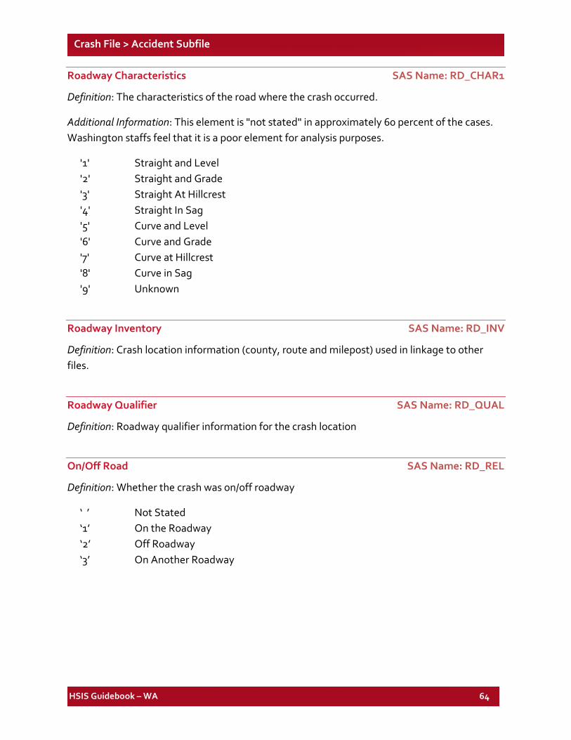
HSIS Guidebook – WA 64
Crash File > Accident Subfile
Roadway Characteristics SAS Name: RD_CHAR1
Definition: The characteristics of the road where the crash occurred.
Additional Information: This element is "not stated" in approximately 60 percent of the cases. Washington staffs feel that it is a poor element for analysis purposes.
'1' Straight and Level '2' Straight and Grade '3' Straight At Hillcrest '4' Straight In Sag '5' Curve and Level '6' Curve and Grade '7' Curve at Hillcrest '8' Curve in Sag '9' Unknown
Roadway Inventory SAS Name: RD_INV
Definition: Crash location information (county, route and milepost) used in linkage to other files.
Roadway Qualifier SAS Name: RD_QUAL
Definition: Roadway qualifier information for the crash location
On/Off Road SAS Name: RD_REL
Definition: Whether the crash was on/off roadway
‘ ’ Not Stated ‘1’ On the Roadway ‘2’ Off Roadway ‘3’ On Another Roadway
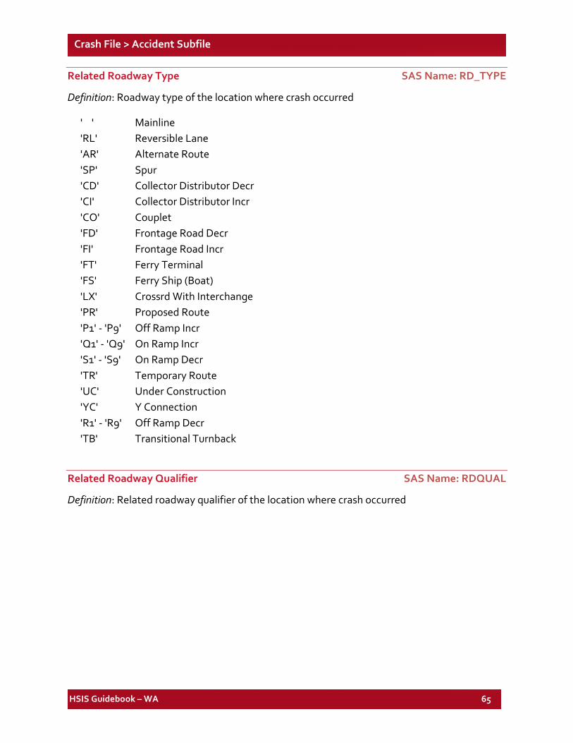
HSIS Guidebook – WA 65
Crash File > Accident Subfile
Related Roadway Type SAS Name: RD_TYPE
Definition: Roadway type of the location where crash occurred
' ' Mainline 'RL' Reversible Lane 'AR' Alternate Route 'SP' Spur 'CD' Collector Distributor Decr 'CI' Collector Distributor Incr 'CO' Couplet 'FD' Frontage Road Decr 'FI' Frontage Road Incr 'FT' Ferry Terminal 'FS' Ferry Ship (Boat) 'LX' Crossrd With Interchange 'PR' Proposed Route 'P1' - 'P9' Off Ramp Incr 'Q1' - 'Q9' On Ramp Incr 'S1' - 'S9' On Ramp Decr 'TR' Temporary Route 'UC' Under Construction 'YC' Y Connection 'R1' - 'R9' Off Ramp Decr 'TB' Transitional Turnback
Related Roadway Qualifier SAS Name: RDQUAL
Definition: Related roadway qualifier of the location where crash occurred
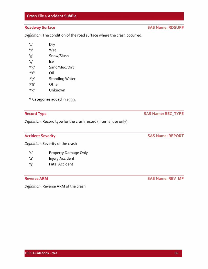
HSIS Guidebook – WA 66
Crash File > Accident Subfile
Roadway Surface SAS Name: RDSURF
Definition: The condition of the road surface where the crash occurred.
'1' Dry '2' Wet '3' Snow/Slush '4' Ice *'5' Sand/Mud/Dirt *'6' Oil *'7' Standing Water *'8' Other *'9' Unknown
* Categories added in 1999.
Record Type SAS Name: REC_TYPE
Definition: Record type for the crash record (internal use only)
Accident Severity SAS Name: REPORT
Definition: Severity of the crash
‘1’ Property Damage Only ‘2’ Injury Accident ‘3’ Fatal Accident
Reverse ARM SAS Name: REV_MP
Definition: Reverse ARM of the crash
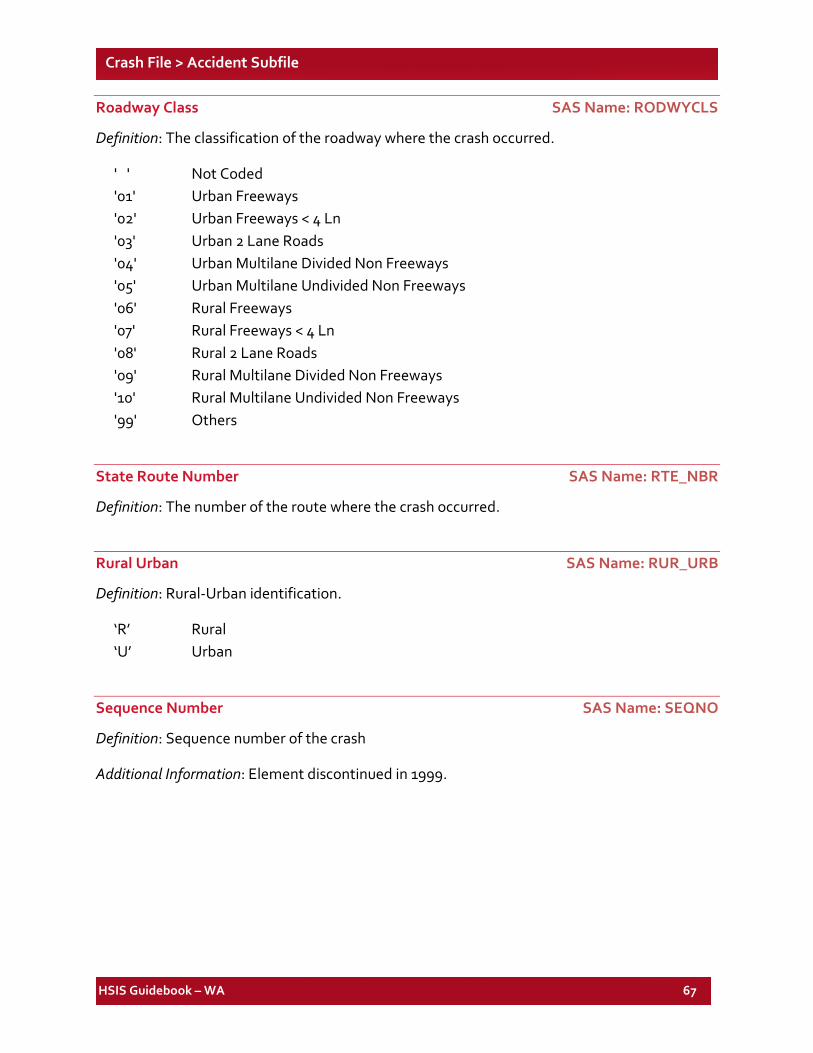
HSIS Guidebook – WA 67
Crash File > Accident Subfile
Roadway Class SAS Name: RODWYCLS
Definition: The classification of the roadway where the crash occurred.
' ' Not Coded '01' Urban Freeways '02' Urban Freeways < 4 Ln '03' Urban 2 Lane Roads '04' Urban Multilane Divided Non Freeways '05' Urban Multilane Undivided Non Freeways '06' Rural Freeways '07' Rural Freeways < 4 Ln '08' Rural 2 Lane Roads '09' Rural Multilane Divided Non Freeways '10' Rural Multilane Undivided Non Freeways '99' Others
State Route Number SAS Name: RTE_NBR
Definition: The number of the route where the crash occurred.
Rural Urban SAS Name: RUR_URB
Definition: Rural-Urban identification.
‘R’ Rural ‘U’ Urban
Sequence Number SAS Name: SEQNO
Definition: Sequence number of the crash
Additional Information: Element discontinued in 1999.
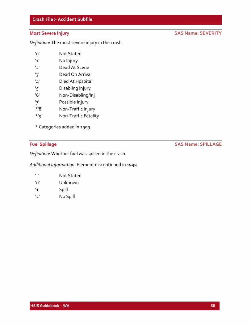
HSIS Guidebook – WA 68
Crash File > Accident Subfile
Most Severe Injury SAS Name: SEVERITY
Definition: The most severe injury in the crash.
'0' Not Stated '1' No Injury '2' Dead At Scene '3' Dead On Arrival '4' Died At Hospital '5' Disabling Injury '6' Non-Disabling/Inj '7' Possible Injury *'8' Non-Traffic Injury *'9' Non-Traffic Fatality
* Categories added in 1999.
Fuel Spillage SAS Name: SPILLAGE
Definition: Whether fuel was spilled in the crash
Additional Information: Element discontinued in 1999.
‘ ’ Not Stated ‘0’ Unknown ‘1’ Spill ‘2’ No Spill
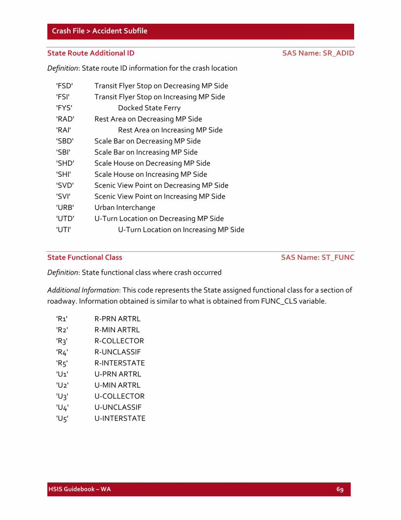
HSIS Guidebook – WA 69
Crash File > Accident Subfile
State Route Additional ID SAS Name: SR_ADID
Definition: State route ID information for the crash location
'FSD' Transit Flyer Stop on Decreasing MP Side 'FSI' Transit Flyer Stop on Increasing MP Side 'FYS' Docked State Ferry 'RAD' Rest Area on Decreasing MP Side 'RAI' Rest Area on Increasing MP Side 'SBD' Scale Bar on Decreasing MP Side 'SBI' Scale Bar on Increasing MP Side 'SHD' Scale House on Decreasing MP Side 'SHI' Scale House on Increasing MP Side 'SVD' Scenic View Point on Decreasing MP Side 'SVI' Scenic View Point on Increasing MP Side 'URB' Urban Interchange 'UTD' U-Turn Location on Decreasing MP Side 'UTI' U-Turn Location on Increasing MP Side
State Functional Class SAS Name: ST_FUNC
Definition: State functional class where crash occurred
Additional Information: This code represents the State assigned functional class for a section of roadway. Information obtained is similar to what is obtained from FUNC_CLS variable.
'R1' R-PRN ARTRL 'R2' R-MIN ARTRL 'R3' R-COLLECTOR 'R4' R-UNCLASSIF 'R5' R-INTERSTATE 'U1' U-PRN ARTRL 'U2' U-MIN ARTRL 'U3' U-COLLECTOR 'U4' U-UNCLASSIF 'U5' U-INTERSTATE
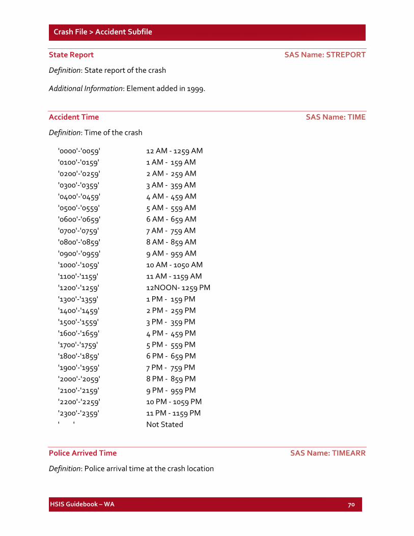
HSIS Guidebook – WA 70
Crash File > Accident Subfile
State Report SAS Name: STREPORT
Definition: State report of the crash
Additional Information: Element added in 1999.
Accident Time SAS Name: TIME
Definition: Time of the crash
'0000'-'0059' 12 AM - 1259 AM '0100'-'0159' 1 AM - 159 AM '0200'-'0259' 2 AM - 259 AM '0300'-'0359' 3 AM - 359 AM '0400'-'0459' 4 AM - 459 AM '0500'-'0559' 5 AM - 559 AM '0600'-'0659' 6 AM - 659 AM '0700'-'0759' 7 AM - 759 AM '0800'-'0859' 8 AM - 859 AM '0900'-'0959' 9 AM - 959 AM '1000'-'1059' 10 AM - 1050 AM '1100'-'1159' 11 AM - 1159 AM '1200'-'1259' 12NOON- 1259 PM '1300'-'1359' 1 PM - 159 PM '1400'-'1459' 2 PM - 259 PM '1500'-'1559' 3 PM - 359 PM '1600'-'1659' 4 PM - 459 PM '1700'-'1759' 5 PM - 559 PM '1800'-'1859' 6 PM - 659 PM '1900'-'1959' 7 PM - 759 PM '2000'-'2059' 8 PM - 859 PM '2100'-'2159' 9 PM - 959 PM '2200'-'2259' 10 PM - 1059 PM '2300'-'2359' 11 PM - 1159 PM ' ' Not Stated
Police Arrived Time SAS Name: TIMEARR
Definition: Police arrival time at the crash location
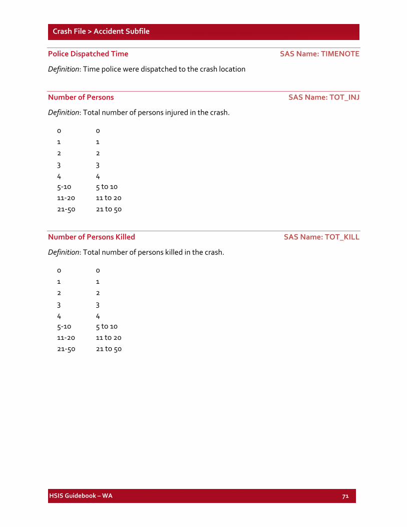
HSIS Guidebook – WA 71
Crash File > Accident Subfile
Police Dispatched Time SAS Name: TIMENOTE
Definition: Time police were dispatched to the crash location
Number of Persons SAS Name: TOT_INJ
Definition: Total number of persons injured in the crash.
0 0 1 1 2 2 3 3 4 4 5-10 5 to 10 11-20 11 to 20 21-50 21 to 50
Number of Persons Killed SAS Name: TOT_KILL
Definition: Total number of persons killed in the crash.
0 0 1 1 2 2 3 3 4 4 5-10 5 to 10 11-20 11 to 20 21-50 21 to 50
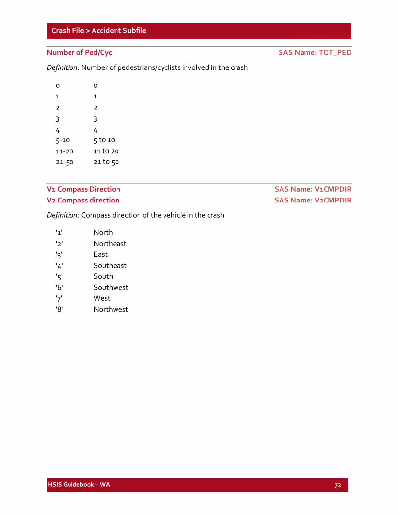
HSIS Guidebook – WA 72
Crash File > Accident Subfile
Number of Ped/Cyc SAS Name: TOT_PED
Definition: Number of pedestrians/cyclists involved in the crash
0 0 1 1 2 2 3 3 4 4 5-10 5 to 10 11-20 11 to 20 21-50 21 to 50
V1 Compass Direction SAS Name: V1CMPDIR V2 Compass direction SAS Name: V2CMPDIR
Definition: Compass direction of the vehicle in the crash
'1' North '2' Northeast '3' East '4' Southeast '5' South '6' Southwest '7' West '8' Northwest
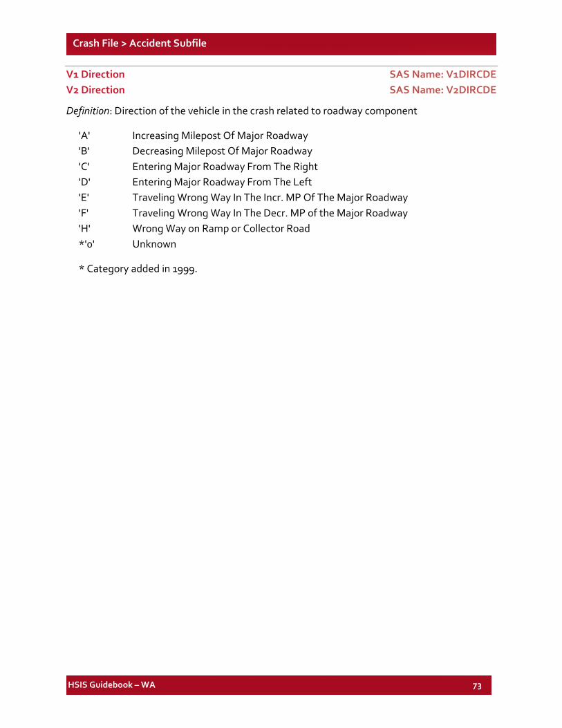
HSIS Guidebook – WA 73
Crash File > Accident Subfile
V1 Direction SAS Name: V1DIRCDE V2 Direction SAS Name: V2DIRCDE
Definition: Direction of the vehicle in the crash related to roadway component
'A' Increasing Milepost Of Major Roadway 'B' Decreasing Milepost Of Major Roadway 'C' Entering Major Roadway From The Right 'D' Entering Major Roadway From The Left 'E' Traveling Wrong Way In The Incr. MP Of The Major Roadway 'F' Traveling Wrong Way In The Decr. MP of the Major Roadway 'H' Wrong Way on Ramp or Collector Road *'0' Unknown
* Category added in 1999.
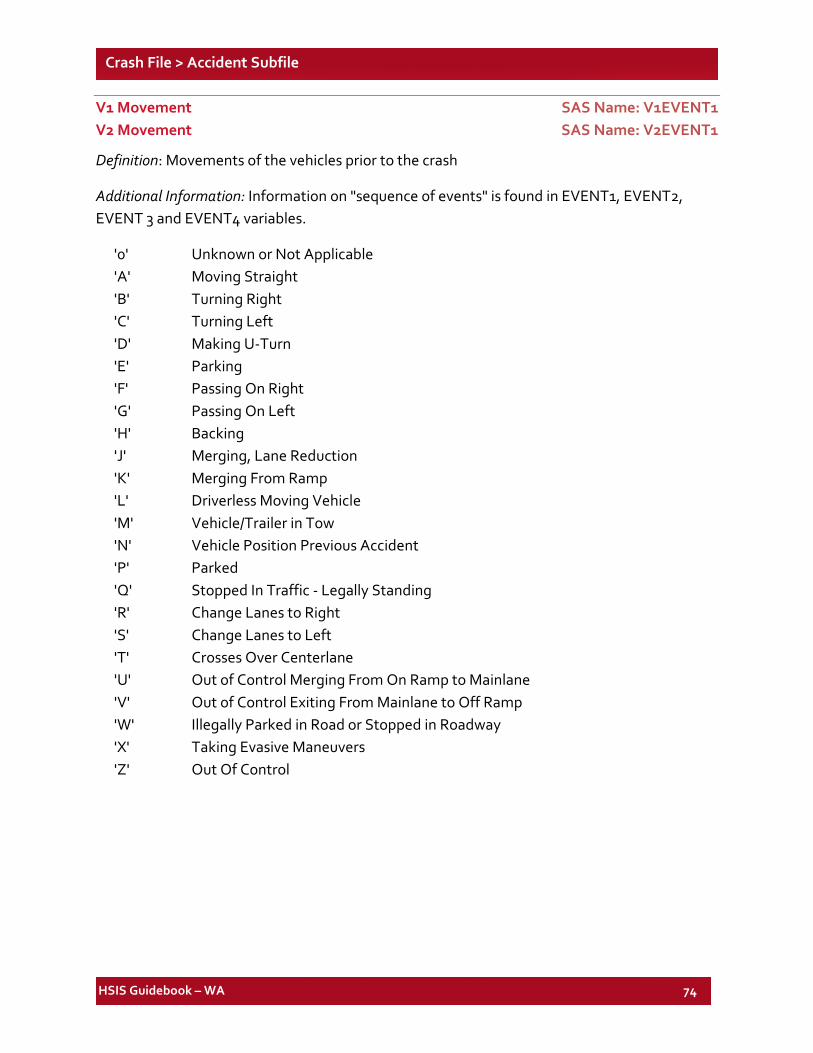
HSIS Guidebook – WA 74
Crash File > Accident Subfile
V1 Movement SAS Name: V1EVENT1 V2 Movement SAS Name: V2EVENT1
Definition: Movements of the vehicles prior to the crash
Additional Information: Information on "sequence of events" is found in EVENT1, EVENT2, EVENT 3 and EVENT4 variables.
'0' Unknown or Not Applicable 'A' Moving Straight 'B' Turning Right 'C' Turning Left 'D' Making U-Turn 'E' Parking 'F' Passing On Right 'G' Passing On Left 'H' Backing 'J' Merging, Lane Reduction 'K' Merging From Ramp 'L' Driverless Moving Vehicle 'M' Vehicle/Trailer in Tow 'N' Vehicle Position Previous Accident 'P' Parked 'Q' Stopped In Traffic - Legally Standing 'R' Change Lanes to Right 'S' Change Lanes to Left 'T' Crosses Over Centerlane 'U' Out of Control Merging From On Ramp to Mainlane 'V' Out of Control Exiting From Mainlane to Off Ramp 'W' Illegally Parked in Road or Stopped in Roadway 'X' Taking Evasive Maneuvers 'Z' Out Of Control
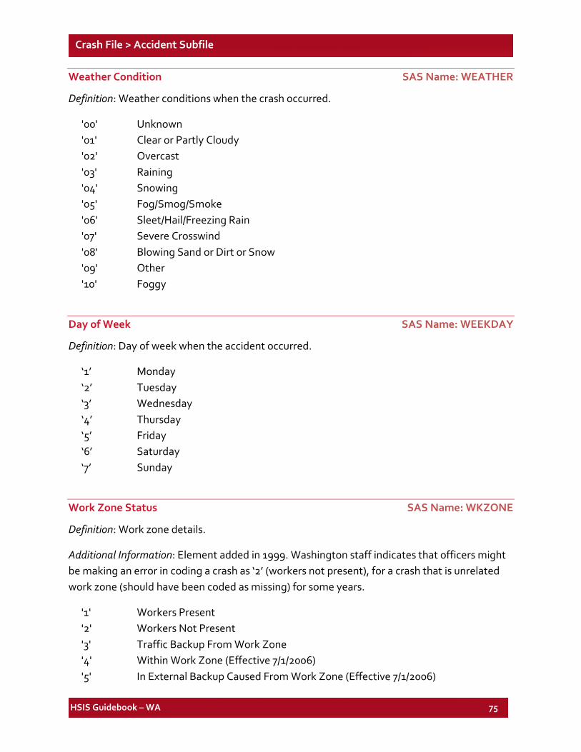
HSIS Guidebook – WA 75
Crash File > Accident Subfile
Weather Condition SAS Name: WEATHER
Definition: Weather conditions when the crash occurred.
'00' Unknown '01' Clear or Partly Cloudy '02' Overcast '03' Raining '04' Snowing '05' Fog/Smog/Smoke '06' Sleet/Hail/Freezing Rain '07' Severe Crosswind '08' Blowing Sand or Dirt or Snow '09' Other '10' Foggy
Day of Week SAS Name: WEEKDAY
Definition: Day of week when the accident occurred.
‘1’ Monday ‘2’ Tuesday ‘3’ Wednesday ‘4’ Thursday ‘5’ Friday ‘6’ Saturday ‘7’ Sunday
Work Zone Status SAS Name: WKZONE
Definition: Work zone details.
Additional Information: Element added in 1999. Washington staff indicates that officers might be making an error in coding a crash as ‘2’ (workers not present), for a crash that is unrelated work zone (should have been coded as missing) for some years.
'1' Workers Present '2' Workers Not Present '3' Traffic Backup From Work Zone '4' Within Work Zone (Effective 7/1/2006) '5' In External Backup Caused From Work Zone (Effective 7/1/2006)
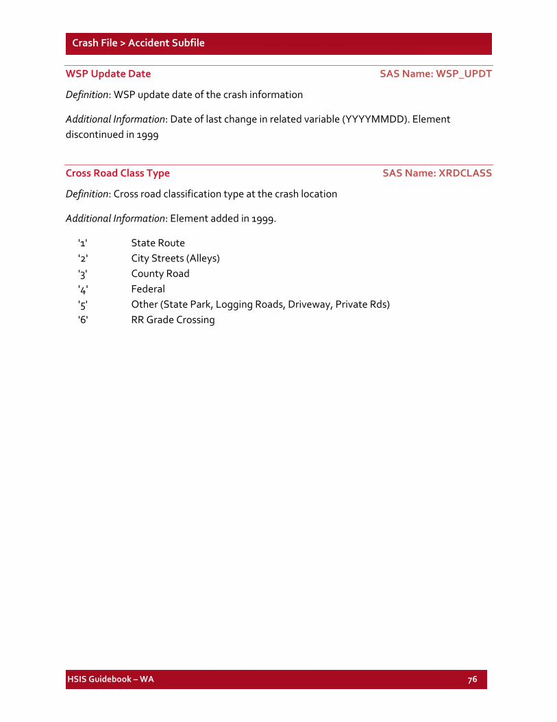
HSIS Guidebook – WA 76
Crash File > Accident Subfile
WSP Update Date SAS Name: WSP_UPDT
Definition: WSP update date of the crash information
Additional Information: Date of last change in related variable (YYYYMMDD). Element discontinued in 1999
Cross Road Class Type SAS Name: XRDCLASS
Definition: Cross road classification type at the crash location
Additional Information: Element added in 1999.
'1' State Route '2' City Streets (Alleys) '3' County Road '4' Federal '5' Other (State Park, Logging Roads, Driveway, Private Rds) '6' RR Grade Crossing
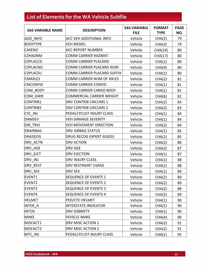
HSIS Guidebook – WA 77
List of Elements for the WA Vehicle Subfile
SAS VARIABLE NAME DESCRIPTION SAS VARIABLE FILE
FORMAT TYPE
PAGE NO.
ADD_INFO ACC VEH ADDITIONAL INFO Vehicle CHA(2) 79 BODYTYPE VEH MODEL Vehicle CHA(3) 79 CASENO ACC REPORT NUMBER Vehicle CHA(10) 80 CDHAZNM COMM CARRIER HAZMAT Vehicle CHA(17) 80 CDPLACCD COMM CARRIER PLACARD Vehicle CHA(1) 80 CDPLACNO COMM CARRIER PLACARD NUM Vehicle CHA(4) 80 CDPLACSU COMM CARRIER PLACARD SUFFIX Vehicle CHA(1) 80 CMAXLES COMM CARRIER NUM OF AXLES Vehicle CHA(2) 81 CMCONFIG COMM CARRIER CONFIG Vehicle CHA(1) 81 COM_BODY COMM CARRIER CARGO BODY Vehicle CHA(1) 81 COM_GWR COMMERCIAL CARRIER WEIGHT Vehicle CHA(6) 82 CONTRIB1 DRV CONTRIB CIRCUMS 1 Vehicle CHA(2) 83 CONTRIB2 DRV CONTRIB CIRCUMS 2 Vehicle CHA(2) 83 CYC_INJ PEDALCYCLIST INJURY CLASS Vehicle CHA(1) 84 DAMSEV VEH DAMAGE SEVERITY Vehicle CHA(1) 84 DIR_TRVL VEH MOVEMENT DIRECTION Vehicle CHA(2) 84 DRAIRBAG DRV AIRBAG STATUS Vehicle CHA(1) 85 DRASSESS DRUG RECOG EXPERT ASSESS Vehicle CHA(1) 85 DRV_ACTN DRV ACTION Vehicle CHA(2) 86 DRV_AGE DRV AGE Vehicle CHA(2) 87 DRV_EJCT DRV EJECTION Vehicle CHA(1) 87 DRV_INJ DRV INJURY CLASS Vehicle CHA(1) 88 DRV_REST DRV RESTRAINT USAGE Vehicle CHA(1) 88 DRV_SEX DRV SEX Vehicle CHA(1) 89 EVENT1 SEQUENCE OF EVENTS 1 Vehicle CHA(2) 89 EVENT2 SEQUENCE OF EVENTS 2 Vehicle CHA(2) 89 EVENT3 SEQUENCE OF EVENTS 3 Vehicle CHA(2) 89 EVENT4 SEQUENCE OF EVENTS 4 Vehicle CHA(2) 89 HELMET PED/CYC HELMET Vehicle CHA(1) 90 INTER_A INTERSTATE INDICATOR Vehicle CHA(1) 90 INTOX DRV SOBRIETY Vehicle CHA(1) 90 MAKE VEHICLE MAKE Vehicle CHA(4) 90 MISCACT1 DRV MISC ACTION 1 Vehicle CHA(2) 91 MISCACT2 DRV MISC ACTION 2 Vehicle CHA(2) 91 MTC_INJ PEDALCYCLIST INJURY CLASS Vehicle CHA(1) 95
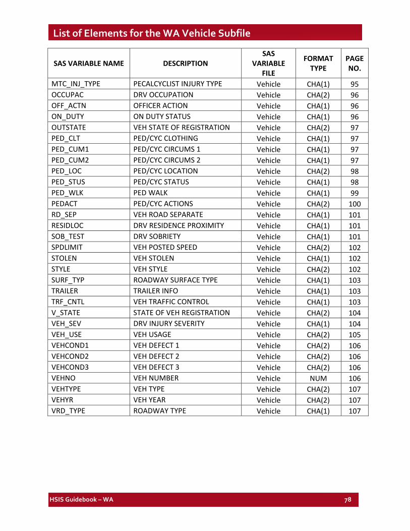
HSIS Guidebook – WA 78
List of Elements for the WA Vehicle Subfile
SAS VARIABLE NAME DESCRIPTION SAS
VARIABLE FILE
FORMAT TYPE
PAGE NO.
MTC_INJ_TYPE PECALCYCLIST INJURY TYPE Vehicle CHA(1) 95 OCCUPAC DRV OCCUPATION Vehicle CHA(2) 96 OFF_ACTN OFFICER ACTION Vehicle CHA(1) 96 ON_DUTY ON DUTY STATUS Vehicle CHA(1) 96 OUTSTATE VEH STATE OF REGISTRATION Vehicle CHA(2) 97 PED_CLT PED/CYC CLOTHING Vehicle CHA(1) 97 PED_CUM1 PED/CYC CIRCUMS 1 Vehicle CHA(1) 97 PED_CUM2 PED/CYC CIRCUMS 2 Vehicle CHA(1) 97 PED_LOC PED/CYC LOCATION Vehicle CHA(2) 98 PED_STUS PED/CYC STATUS Vehicle CHA(1) 98 PED_WLK PED WALK Vehicle CHA(1) 99 PEDACT PED/CYC ACTIONS Vehicle CHA(2) 100 RD_SEP VEH ROAD SEPARATE Vehicle CHA(1) 101 RESIDLOC DRV RESIDENCE PROXIMITY Vehicle CHA(1) 101 SOB_TEST DRV SOBRIETY Vehicle CHA(1) 101 SPDLIMIT VEH POSTED SPEED Vehicle CHA(2) 102 STOLEN VEH STOLEN Vehicle CHA(1) 102 STYLE VEH STYLE Vehicle CHA(2) 102 SURF_TYP ROADWAY SURFACE TYPE Vehicle CHA(1) 103 TRAILER TRAILER INFO Vehicle CHA(1) 103 TRF_CNTL VEH TRAFFIC CONTROL Vehicle CHA(1) 103 V_STATE STATE OF VEH REGISTRATION Vehicle CHA(2) 104 VEH_SEV DRV INJURY SEVERITY Vehicle CHA(1) 104 VEH_USE VEH USAGE Vehicle CHA(2) 105 VEHCOND1 VEH DEFECT 1 Vehicle CHA(2) 106 VEHCOND2 VEH DEFECT 2 Vehicle CHA(2) 106 VEHCOND3 VEH DEFECT 3 Vehicle CHA(2) 106 VEHNO VEH NUMBER Vehicle NUM 106 VEHTYPE VEH TYPE Vehicle CHA(2) 107 VEHYR VEH YEAR Vehicle CHA(2) 107 VRD_TYPE ROADWAY TYPE Vehicle CHA(1) 107
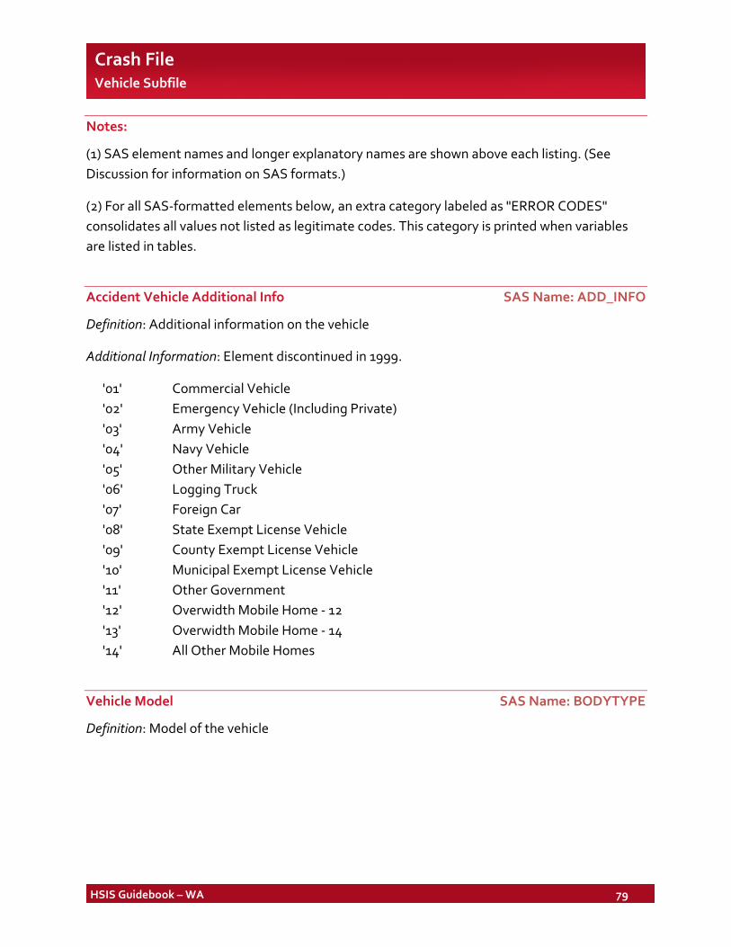
HSIS Guidebook – WA 79
Crash File Vehicle Subfile
Notes:
(1) SAS element names and longer explanatory names are shown above each listing. (See Discussion for information on SAS formats.)
(2) For all SAS-formatted elements below, an extra category labeled as "ERROR CODES" consolidates all values not listed as legitimate codes. This category is printed when variables are listed in tables.
Accident Vehicle Additional Info SAS Name: ADD_INFO
Definition: Additional information on the vehicle
Additional Information: Element discontinued in 1999.
'01' Commercial Vehicle '02' Emergency Vehicle (Including Private) '03' Army Vehicle '04' Navy Vehicle '05' Other Military Vehicle '06' Logging Truck '07' Foreign Car '08' State Exempt License Vehicle '09' County Exempt License Vehicle '10' Municipal Exempt License Vehicle '11' Other Government '12' Overwidth Mobile Home - 12 '13' Overwidth Mobile Home - 14 '14' All Other Mobile Homes
Vehicle Model SAS Name: BODYTYPE
Definition: Model of the vehicle
HSIS Guidebook – WA 80
Crash File > Vehicle Subfile
Accident Report Number SAS Name: CASENO
Definition: Case number of accident.
Additional Information: Element discontinued in 1999. The format used is a 4-digit year plus a 6-digit number.
Commercial Carrier Hazmat SAS Name: CDHAZNM
Definition: Hazardous materials carried by commercial vehicle.
Additional Information: Element added in 1999.
Commercial Carrier Placard SAS Name: CDPLACCD
Definition: Whether the vehicle had a commercial carrier placard
Additional Information: Element added in 1999.
Commercial Carrier Placard Number SAS Name: CDPLACNO
Definition: Commercial carrier placard number of the vehicle
Additional Information: Element added in 1999.
Commercial Carrier Placard Suffix SAS Name: CDPLACSU
Definition: Commercial carrier placard suffix
Additional Information: Element added in 1999.
'1' Explosive '2' Gas '3' Combustible '4' Alkaline '5' Oxidizer '6' Infectious '7' Radioactive '8' Corrosive '9' Other
HSIS Guidebook – WA 81
Crash File > Vehicle Subfile
Commercial Carrier Number of Axles SAS Name: CMAXLES
Definition: Number of axles on this commercial carrier
Additional Information: Element added in 1999.
Commercial Carrier Configuration SAS Name: CMCONFIG
Definition: Commercial carrier configuration
Additional Information: Element added in 1999.
' ' Not Applicable '1' Bus '2' Single-Unit Truck; 2 Axle, 6 Tires '3' Single-Unit Truck; 3 or More Axles '4' Truck/Trailer '5' Truck Tractor (Bob-Tail) '6' Tractor/Semi-Trailer '7' Tractor/Doubles '8' Tractor/Triples '9' Other/Cannot Classify
Commercial Carrier Cargo Body SAS Name: COM_BODY
Definition: Commercial carrier cargo body type
Additional Information: Element added in 1999.
' ' Not Applicable '1' Bus '2' Van/Enclosed Box '3' Cargo Tank '4' Flatbed '5' Dump '6' Concrete Mixer '7' Auto Transporter '8' Garbage/Refuse '9' Other
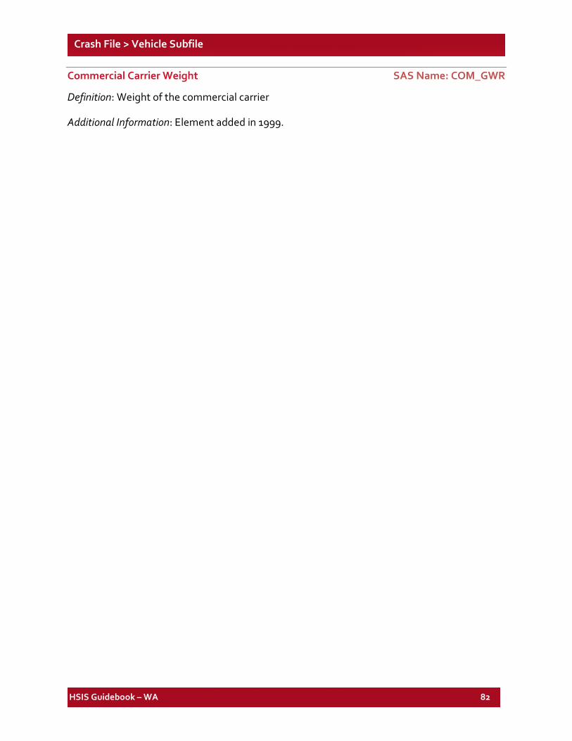
HSIS Guidebook – WA 82
Crash File > Vehicle Subfile
Commercial Carrier Weight SAS Name: COM_GWR
Definition: Weight of the commercial carrier
Additional Information: Element added in 1999.
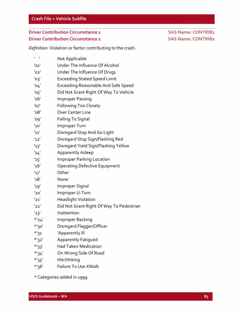
HSIS Guidebook – WA 83
Crash File > Vehicle Subfile
Driver Contribution Circumstance 1 SAS Name: CONTRIB1 Driver Contribution Circumstance 2 SAS Name: CONTRIB2
Definition: Violation or factor contributing to the crash.
' ' Not Applicable '01' Under The Influence Of Alcohol '02' Under The Influence Of Drugs '03' Exceeding Stated Speed Limit '04' Exceeding Reasonable And Safe Speed '05' Did Not Grant Right Of Way To Vehicle '06' Improper Passing '07' Following Too Closely '08' Over Center Line '09' Failing To Signal '10' Improper Turn '11' Disregard Stop And Go Light '12' Disregard Stop Sign/Flashing Red '13' Disregard Yield Sign/Flashing Yellow '14' Apparently Asleep '15' Improper Parking Location '16' Operating Defective Equipment '17' Other '18' None '19' Improper Signal '20' Improper U-Turn '21' Headlight Violation '22' Did Not Grant Right Of Way To Pedestrian '23' Inattention *'24' Improper Backing *'30' Disregard Flagger/Officer *'31 'Apparently Ill *'32' Apparently Fatigued *'33' Had Taken Medication *'34' On Wrong Side Of Road *'35' Hitchhiking *'36' Failure To Use XWalk
* Categories added in 1999.
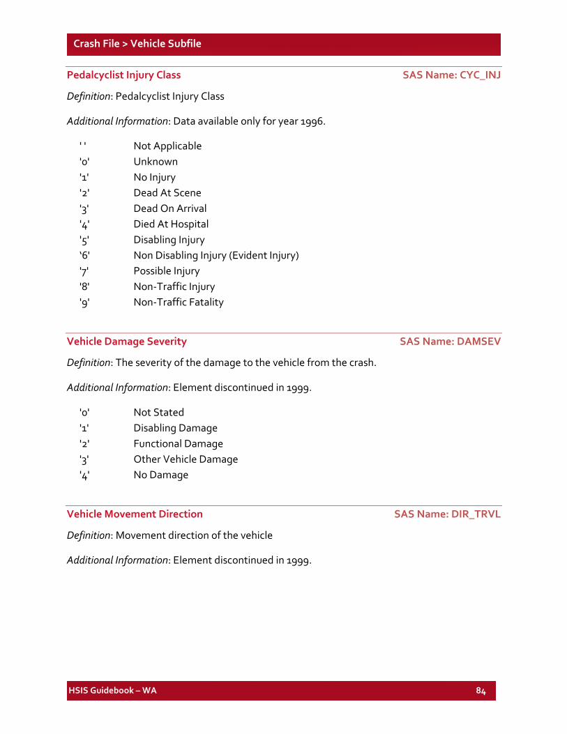
HSIS Guidebook – WA 84
Crash File > Vehicle Subfile
Pedalcyclist Injury Class SAS Name: CYC_INJ
Definition: Pedalcyclist Injury Class
Additional Information: Data available only for year 1996.
' ' Not Applicable '0' Unknown '1' No Injury '2' Dead At Scene '3' Dead On Arrival '4' Died At Hospital '5' Disabling Injury ‘6' Non Disabling Injury (Evident Injury) '7' Possible Injury '8' Non-Traffic Injury '9' Non-Traffic Fatality
Vehicle Damage Severity SAS Name: DAMSEV
Definition: The severity of the damage to the vehicle from the crash.
Additional Information: Element discontinued in 1999.
'0' Not Stated '1' Disabling Damage '2' Functional Damage '3' Other Vehicle Damage '4' No Damage
Vehicle Movement Direction SAS Name: DIR_TRVL
Definition: Movement direction of the vehicle
Additional Information: Element discontinued in 1999.
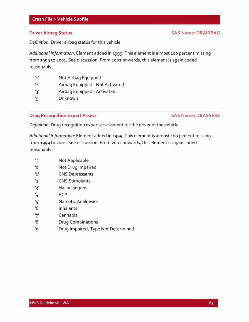
HSIS Guidebook – WA 85
Crash File > Vehicle Subfile
Driver Airbag Status SAS Name: DRAIRBAG
Definition: Driver airbag status for this vehicle
Additional Information: Element added in 1999. This element is almost 100 percent missing from 1999 to 2001. See discussion. From 2002 onwards, this element is again coded reasonably.
'1' Not Airbag Equipped '2' Airbag Equipped - Not Activated '3' Airbag Equipped - Activated '9' Unknown
Drug Recognition Expert Assess SAS Name: DRASSESS
Definition: Drug recognition expert assessment for the driver of the vehicle
Additional Information: Element added in 1999. This element is almost 100 percent missing from 1999 to 2001. See discussion. From 2002 onwards, this element is again coded reasonably.
' ' Not Applicable '0' Not Drug Impaired '1' CNS Depressants '2' CNS Stimulants '3' Hallucinogens '4' PCP '5' Narcotic Analgesics '6' Inhalants '7' Cannabis '8' Drug Combinations '9' Drug Impaired, Type Not Determined
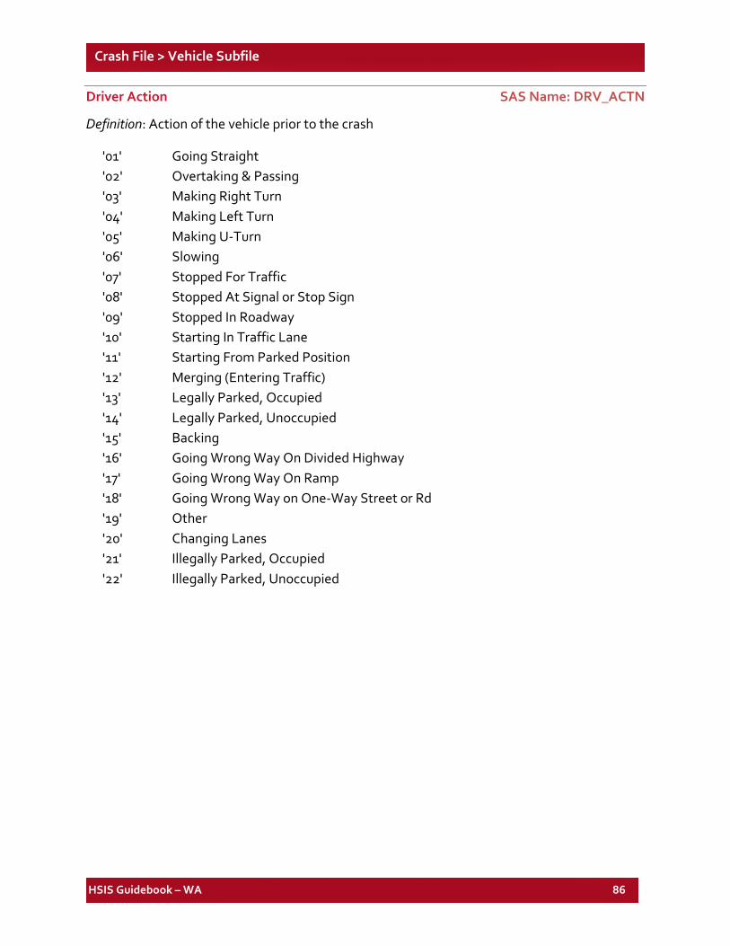
HSIS Guidebook – WA 86
Crash File > Vehicle Subfile
Driver Action SAS Name: DRV_ACTN
Definition: Action of the vehicle prior to the crash
'01' Going Straight '02' Overtaking & Passing '03' Making Right Turn '04' Making Left Turn '05' Making U-Turn '06' Slowing '07' Stopped For Traffic '08' Stopped At Signal or Stop Sign '09' Stopped In Roadway '10' Starting In Traffic Lane '11' Starting From Parked Position '12' Merging (Entering Traffic) '13' Legally Parked, Occupied '14' Legally Parked, Unoccupied '15' Backing '16' Going Wrong Way On Divided Highway '17' Going Wrong Way On Ramp '18' Going Wrong Way on One-Way Street or Rd '19' Other '20' Changing Lanes '21' Illegally Parked, Occupied '22' Illegally Parked, Unoccupied
HSIS Guidebook – WA 87
Crash File > Vehicle Subfile
Driver Age SAS Name: DRV_AGE
Definition: The age of the driver of the vehicle involved in the crash.
Additional Information: Approximately six percent of cases are uncoded.
'00-01' Infant - 1 YR '02-04' 02-04 YRS '05-10' 05-10 YRS '11-14' 11-14 YRS '15' 15 YRS '16' 16 YRS '17' 17 YRS '18' 18 YRS '19' 19 YRS '20' 20 YRS '21-25' 21-25 YRS '26-30' 26-30 YRS '31-35' 31-35 YRS '36-45' 36-45 YRS '46-55' 46-55 YRS '56-65' 56-65 YRS '66-89' 66-89 YRS '90-99' 90-99 YRS
Driver Ejection SAS Name: DRV_EJCT
Definition: Whether the driver was ejected from the vehicle
Additional Information: This element is almost 100 percent missing from 1999 to 2001. See discussion. From 2002 onwards, this element is again coded reasonably.
'1' Not Ejected '2' Totally Ejected '3' Partially Ejected '4','9' Unknown If Ejected
HSIS Guidebook – WA 88
Crash File > Vehicle Subfile
Driver Injury Class SAS Name: DRV_INJ
Definition: Extent of injury to the driver of the vehicle.
' ' Not Applicable '0' Unknown '1' No Injury '2' Dead At Scene '3' Dead On Arrival '4' Died At Hospital '5' Disabling Injury '6' Non Disabling Injury (Evident Injury) '7' Possible Injury *'8' Non-Traffic Injury *'9' Non-Traffic Fatality * Categories added in 1999.
Driver Restraint Usage SAS Name: DRV_REST
Definition: Type of safety restraint used by the driver.
Additional Information: Approximately 12 percent of the cases are uncoded. As with all states with mandatory usage laws, this element should be used with some caution.
'01' No Restraints Used '02' Lap Belt Used '03' Shoulder Belt Used '04' Lap and Shoulder Belt Used '05' Child Infant Seat Used '06' Child Convertible Seat Used '07' Child Built-In Seat Used '08' Child Booster Seat Used '09' Unknown *'10' Child Restraint Used *'11' Non-Activated Air Bag/Belt Used *'12' Non-Activated Air Bag/No Belt Used *'13' Air Bag Activated/Belt Used *'14' Air Bag Activated/No Belt Used
* Categories discontinued from 1999 onwards.
HSIS Guidebook – WA 89
Crash File > Vehicle Subfile
Driver Sex SAS Name: DRV_SEX
Definition: Sex of the driver of the vehicle involved in crash.
Additional Information: This element is almost 100 percent missing from 1999 to 2001. See discussion. From 2002 onwards, this element is again coded reasonably.
’0’ Not Stated ‘1’ Male ‘2’ Female
Sequence of Events 1 SAS Name: EVENT1 Sequence of Events 2 SAS Name: EVENT2 Sequence of Events 3 SAS Name: EVENT3 Sequence of Events 4 SAS Name: EVENT4
Definition: First, second, third, fourth event in the crash sequence of this vehicle.
Additional Information: Element added in 1999. This element is almost 100 percent missing from 1999 to 2001. See discussion. From 2002 onwards, this element is again coded reasonably.
'01' Collision Involving Motor Vehicle in Transport '02' Collision Involving Fixed Object '03' Collision Involving Other Object '04' Collision Involving Parked Vehicle '05' Collision Involving Pedestrian '06' Collision Involving Pedalcyclist '07' Collision Involving Animal '08' Collision Involving Train '09' Ran Off the Road '10' Jackknife '11' Overturn (Rollover) '12' Downhill Runaway '13' Cargo Loss or Shift '14' Explosion or Fire '15' Separation of Units '16' Other ' ' Not Applicable
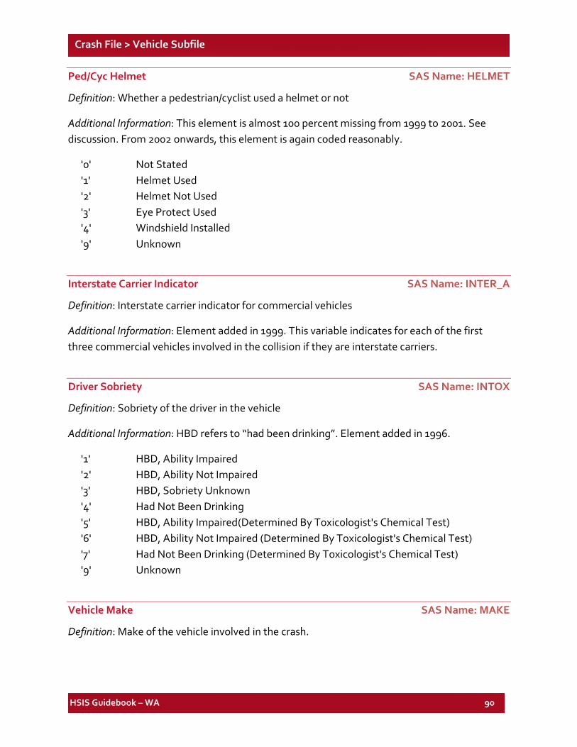
HSIS Guidebook – WA 90
Crash File > Vehicle Subfile
Ped/Cyc Helmet SAS Name: HELMET
Definition: Whether a pedestrian/cyclist used a helmet or not
Additional Information: This element is almost 100 percent missing from 1999 to 2001. See discussion. From 2002 onwards, this element is again coded reasonably.
'0' Not Stated '1' Helmet Used '2' Helmet Not Used '3' Eye Protect Used '4' Windshield Installed '9' Unknown
Interstate Carrier Indicator SAS Name: INTER_A
Definition: Interstate carrier indicator for commercial vehicles
Additional Information: Element added in 1999. This variable indicates for each of the first three commercial vehicles involved in the collision if they are interstate carriers.
Driver Sobriety SAS Name: INTOX
Definition: Sobriety of the driver in the vehicle
Additional Information: HBD refers to “had been drinking”. Element added in 1996.
'1' HBD, Ability Impaired '2' HBD, Ability Not Impaired '3' HBD, Sobriety Unknown '4' Had Not Been Drinking '5' HBD, Ability Impaired (Determined By Toxicologist's Chemical Test) '6' HBD, Ability Not Impaired (Determined By Toxicologist's Chemical Test) '7' Had Not Been Drinking (Determined By Toxicologist's Chemical Test) '9' Unknown
Vehicle Make SAS Name: MAKE
Definition: Make of the vehicle involved in the crash.
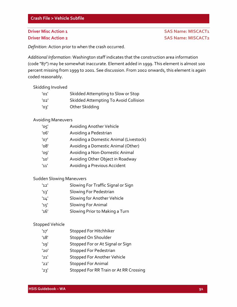
HSIS Guidebook – WA 91
Crash File > Vehicle Subfile
Driver Misc Action 1 SAS Name: MISCACT1 Driver Misc Action 2 SAS Name: MISCACT2
Definition: Action prior to when the crash occurred.
Additional Information: Washington staff indicates that the construction area information (code "87") may be somewhat inaccurate. Element added in 1999. This element is almost 100 percent missing from 1999 to 2001. See discussion. From 2002 onwards, this element is again coded reasonably.
Skidding Involved '01' Skidded Attempting to Slow or Stop '02' Skidded Attempting To Avoid Collision '03' Other Skidding
Avoiding Maneuvers
'05' Avoiding Another Vehicle '06' Avoiding a Pedestrian '07' Avoiding a Domestic Animal (Livestock) '08' Avoiding a Domestic Animal (Other) '09' Avoiding a Non-Domestic Animal '10' Avoiding Other Object in Roadway '11' Avoiding a Previous Accident
Sudden Slowing Maneuvers
'12' Slowing For Traffic Signal or Sign '13' Slowing For Pedestrian '14' Slowing for Another Vehicle '15' Slowing For Animal '16' Slowing Prior to Making a Turn
Stopped Vehicle
'17' Stopped For Hitchhiker '18' Stopped On Shoulder '19' Stopped For or At Signal or Sign '20' Stopped For Pedestrian '21' Stopped For Another Vehicle '22' Stopped For Animal '23' Stopped For RR Train or At RR Crossing
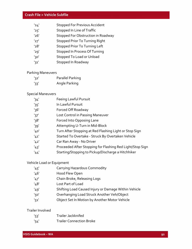
HSIS Guidebook – WA 92
Crash File > Vehicle Subfile
'24' Stopped For Previous Accident '25' Stopped In Line of Traffic '26' Stopped For Obstruction in Roadway '27' Stopped Prior To Turning Right '28' Stopped Prior To Turning Left '29' Stopped In Process Of Turning '30' Stopped To Load or Unload '31' Stopped In Roadway
Parking Maneuvers
'32' Parallel Parking '33' Angle Parking
Special Maneuvers
'34' Feeing Lawful Pursuit '35' In Lawful Pursuit '36' Forced Off Roadway '37' Lost Control in Passing Maneuver '38' Forced Into Opposing Lane '39' Attempting U-Turn in Mid-Block '40' Turn After Stopping at Red Flashing Light or Stop Sign '41' Started To Overtake - Struck By Overtaken Vehicle '42' Car Ran Away - No Driver '43' Proceeded After Stopping for Flashing Red Light/Stop Sign '44' Starting/Stopping to Pickup/Discharge a Hitchhiker
Vehicle Load or Equipment
'45' Carrying Hazardous Commodity '46' Hood Flew Open '47' Chain Broke, Releasing Logs '48' Lost Part of Load '49' Shifting Load Caused Injury or Damage Within Vehicle '50' Overhanging Load Struck Another Veh/Object '51' Object Set In Motion by Another Motor Vehicle
Trailer Involved
'53' Trailer Jackknifed '54' Trailer Connection Broke
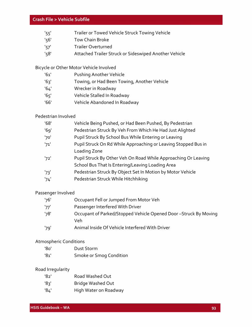
HSIS Guidebook – WA 93
Crash File > Vehicle Subfile
'55' Trailer or Towed Vehicle Struck Towing Vehicle '56' Tow Chain Broke '57' Trailer Overturned '58' Attached Trailer Struck or Sideswiped Another Vehicle
Bicycle or Other Motor Vehicle Involved
'61' Pushing Another Vehicle '63' Towing, or Had Been Towing, Another Vehicle '64' Wrecker in Roadway '65' Vehicle Stalled In Roadway '66' Vehicle Abandoned In Roadway
Pedestrian Involved
'68' Vehicle Being Pushed, or Had Been Pushed, By Pedestrian '69' Pedestrian Struck By Veh From Which He Had Just Alighted '70' Pupil Struck By School Bus While Entering or Leaving '71' Pupil Struck On Rd While Approaching or Leaving Stopped Bus in
Loading Zone '72' Pupil Struck By Other Veh On Road While Approaching Or Leaving
School Bus That Is Entering/Leaving Loading Area '73' Pedestrian Struck By Object Set In Motion by Motor Vehicle '74' Pedestrian Struck While Hitchhiking
Passenger Involved
'76' Occupant Fell or Jumped From Motor Veh '77' Passenger Interfered With Driver '78' Occupant of Parked/Stopped Vehicle Opened Door –Struck By Moving
Veh '79' Animal Inside Of Vehicle Interfered With Driver
Atmospheric Conditions
'80' Dust Storm '81' Smoke or Smog Condition
Road Irregularity
'82' Road Washed Out '83' Bridge Washed Out '84' High Water on Roadway
HSIS Guidebook – WA 94
Crash File > Vehicle Subfile
'85' Hazardous Materials on Road Surface '86' Mud and/or Debris on Roadway '87' Construction Area
Other Action
'88' Foot Slipped Off Clutch or Brake '89' Gust Of Wind '90' Blinded By Sun '91' Blinded By Headlights '92' View Obscured By Other Vehicle '93' Fire Started After Collision '94' Drowned After Running into Water '95' Physical Illness '96' Stolen Vehicle Involved '97' Hit & Run '98' View Obscured By Frost, Ice, Etc. On Windshield '99' Struck an Object Before Impact (I.E., Curb)
Volcano Caused Roadway Conditions
'AL' Volcanic Ash (Dusts) On Roadway (No Measurable Volume) 'A2' Accumulation of Volcanic Ash (Dry) On Roadway 'A3' Accumulation of Volcanic Ash (Wet) On Roadway (Volcanic Mud) 'A4' Accumulation of Mixed Debris on Roadway by Volcanic Activity 'A5' Volcanic Lava on Roadway 'A6' Flooded Due To Volcanic Activity
Volcano Caused Vehicle Conditions
'BL' Windshield Obstructed By Ash 'B2' Vehicle Mechanically Incapacitated By Ash/Other
Volcano Caused Driving Conditions
'CL' Sight Obstructed By Volcanic Ash in Air 'C2' Sight Obstructed By Volcanic Ash in Eyes 'C3'` Coughing or Other Reflex Distraction Due To Volcanic Ash
Interference
'D1' Driver Inattention Due To Electrical Gadget Within Vehicle (Cell Phone, Stereo, Etc.)
HSIS Guidebook – WA 95
Crash File > Vehicle Subfile
Street Racing
'E1' Two or More Vehicles Racing at High Speeds or Acceleration (Drag Racing-Officer Must Specify This in the Narrative as Compared to Speeding or Reckless Driving)
Pedalcyclist Injury Class SAS Name: MTC_INJ
Definition: Pedalcyclist injury class
Additional Information: Element discontinued in 1999.
' ' Not Applicable '0' Unknown '1' No Injury '2' Dead At Scene '3 'Dead On Arrival '4' Died At Hospital '5' Disabling Injury '6' Non Disabling Injury (Evident Injury) '7' Possible Injury '8' Non-Traffic Injury '9' Non-Traffic Fatality
Pedalcyclist Injury Type SAS Name: MTC_INJ_TYPE
Definition: Pedalcyclist injury type
Additional Information: Element discontinued in 1999.
'0' Not Stated '1' Head '2' Neck '3' Shoulder '4' Arms '5' Legs '6' Internal '7' Multiple '8' No Injury '9' Torso
HSIS Guidebook – WA 96
Crash File > Vehicle Subfile
Driver Occupation SAS Name: OCCUPAC
Definition: Occupation of the driver of the vehicle
Additional Information: Element discontinued in 1999.
'00' Not Stated '01' Professional Or Business Person '02' Farmers & Farm Laborers '03' Clerical, Sales, Stenographers, Etc. '04' Other Commercial Drivers '05' Army Personnel '06' Navy Personnel '07' Other Military '08' Skilled & Semi Skilled Workers '09' All Other Workers (Except Domestic Help) '10' Housewives & Domestic Servants '11' Students & Children Under School Age '12' All Others (Retired, Pensions, Etc.) '13' Law Enforcement Officers '14' Flag Persons
Officer Action SAS Name: OFF_ACTN
Definition: Action taken by the investigating officer
Additional Information: Element discontinued in 1999.
'1' Driver In Violation, Arrest Ticket '2' Driver In Violation, Warning Ticket '3' Driver In Violation, No Ticket '4' Driver Not In Violation
On Duty Status SAS Name: ON_DUTY
Definition: Whether the officer was on duty.
Additional Information: Element added in 1999.
HSIS Guidebook – WA 97
Crash File > Vehicle Subfile
Vehicle State of Registration SAS Name: OUTSTATE
Definition: State of registration of the vehicle
Additional Information: Element discontinued in 1999.
Pedestrian/Cyclist Clothing SAS Name: PED_CLT
Definition: Pedestrian/cyclist clothing
Additional Information: Element discontinued in 1999. See pedestrian file element and discussion section.
Pedestrian/Cyclist Circumstance 1 SAS Name: PED_CUM1 Pedestrian/Cyclist Circumstance 2 SAS Name: PED_CUM2
Definition: Pedestrian/cyclist circumstance
Additional Information: Element discontinued in 1999. See pedestrian file.
'1' Intoxicated '2' Disregarded Traffic Controls '3' Did Not Yield Right-Of-Way to Veh '4' Inattention '5' Walking/Riding on Wrong Side of Road '8' Hitchhiking On Road '9' Bicycle (Pedal Cycle) Not Lighted '0' Failure to Use Crosswalk
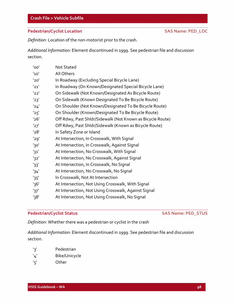
HSIS Guidebook – WA 98
Crash File > Vehicle Subfile
Pedestrian/Cyclist Location SAS Name: PED_LOC
Definition: Location of the non-motorist prior to the crash.
Additional Information: Element discontinued in 1999. See pedestrian file and discussion section.
'00' Not Stated '10' All Others '20' In Roadway (Excluding Special Bicycle Lane) '21' In Roadway (On Known/Designated Special Bicycle Lane) '22' On Sidewalk (Not Known/Designated As Bicycle Route) '23' On Sidewalk (Known Designated To Be Bicycle Route) '24' On Shoulder (Not Known/Designated To Be Bicycle Route) '25' On Shoulder (Known/Designated To Be Bicycle Route) '26' Off Rdwy, Past Shldr/Sidewalk (Not Known as Bicycle Route) '27' Off Rdwy, Past Shldr/Sidewalk (Known as Bicycle Route) '28' In Safety Zone or Island '29' At Intersection, In Crosswalk, With Signal '30' At Intersection, In Crosswalk, Against Signal '31' At Intersection, No Crosswalk, With Signal '32' At Intersection, No Crosswalk, Against Signal '33' At Intersection, In Crosswalk, No Signal '34' At Intersection, No Crosswalk, No Signal '35' In Crosswalk, Not At Intersection '36' At Intersection, Not Using Crosswalk, With Signal '37' At Intersection, Not Using Crosswalk, Against Signal '38' At Intersection, Not Using Crosswalk, No Signal
Pedestrian/Cyclist Status SAS Name: PED_STUS
Definition: Whether there was a pedestrian or cyclist in the crash
Additional Information: Element discontinued in 1999. See pedestrian file and discussion section.
‘3’ Pedestrian ‘4’ Bike/Unicycle ‘5’ Other

HSIS Guidebook – WA 99
Crash File > Vehicle Subfile
Pedestrian Walk SAS Name: PED_WLK
Definition: Walking location of the pedestrian
'1' Sidewalk '2' Walkway '3' Shoulder '4' Marked Cross Walk '5' Unmarked Crosswalk '6' Other '7' Designated Bike Route '8' Roadway
Additional Information: Element discontinued from 1999. See PED_WALK in pedestrian file and discussion section.
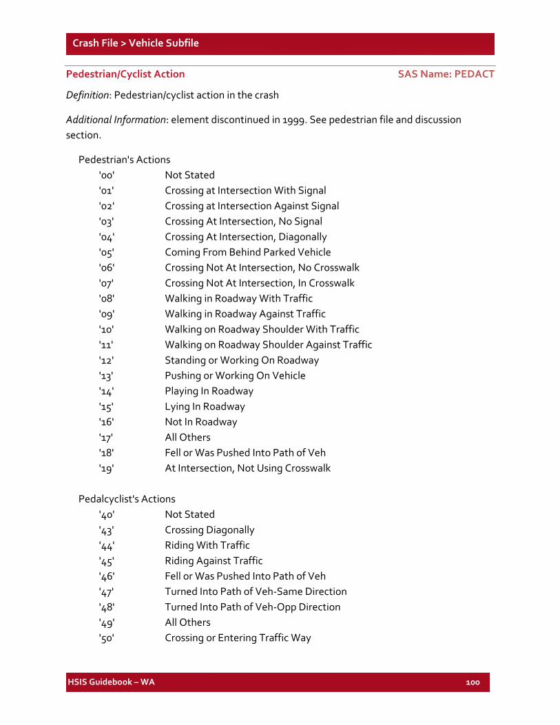
HSIS Guidebook – WA 100
Crash File > Vehicle Subfile
Pedestrian/Cyclist Action SAS Name: PEDACT
Definition: Pedestrian/cyclist action in the crash
Additional Information: element discontinued in 1999. See pedestrian file and discussion section.
Pedestrian's Actions '00' Not Stated '01' Crossing at Intersection With Signal '02' Crossing at Intersection Against Signal '03' Crossing At Intersection, No Signal '04' Crossing At Intersection, Diagonally '05' Coming From Behind Parked Vehicle '06' Crossing Not At Intersection, No Crosswalk '07' Crossing Not At Intersection, In Crosswalk '08' Walking in Roadway With Traffic '09' Walking in Roadway Against Traffic '10' Walking on Roadway Shoulder With Traffic '11' Walking on Roadway Shoulder Against Traffic '12' Standing or Working On Roadway '13' Pushing or Working On Vehicle '14' Playing In Roadway '15' Lying In Roadway '16' Not In Roadway '17' All Others '18' Fell or Was Pushed Into Path of Veh '19' At Intersection, Not Using Crosswalk Pedalcyclist's Actions '40' Not Stated '43' Crossing Diagonally '44' Riding With Traffic '45' Riding Against Traffic '46' Fell or Was Pushed Into Path of Veh '47' Turned Into Path of Veh-Same Direction '48' Turned Into Path of Veh-Opp Direction '49' All Others '50' Crossing or Entering Traffic Way
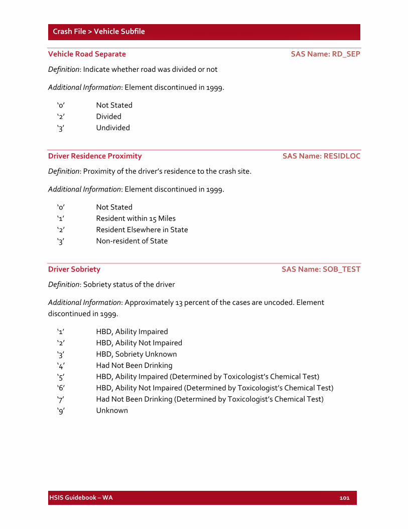
HSIS Guidebook – WA 101
Crash File > Vehicle Subfile
Vehicle Road Separate SAS Name: RD_SEP
Definition: Indicate whether road was divided or not
Additional Information: Element discontinued in 1999.
‘0’ Not Stated ‘2’ Divided ‘3’ Undivided
Driver Residence Proximity SAS Name: RESIDLOC
Definition: Proximity of the driver’s residence to the crash site.
Additional Information: Element discontinued in 1999.
‘0’ Not Stated ‘1’ Resident within 15 Miles ‘2’ Resident Elsewhere in State ‘3’ Non-resident of State
Driver Sobriety SAS Name: SOB_TEST
Definition: Sobriety status of the driver
Additional Information: Approximately 13 percent of the cases are uncoded. Element discontinued in 1999.
‘1’ HBD, Ability Impaired ‘2’ HBD, Ability Not Impaired ‘3’ HBD, Sobriety Unknown ‘4’ Had Not Been Drinking ‘5’ HBD, Ability Impaired (Determined by Toxicologist’s Chemical Test) ‘6’ HBD, Ability Not Impaired (Determined by Toxicologist’s Chemical Test) ‘7’ Had Not Been Drinking (Determined by Toxicologist’s Chemical Test) ‘9’ Unknown
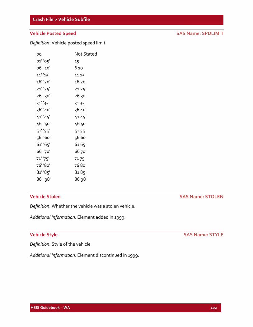
HSIS Guidebook – WA 102
Crash File > Vehicle Subfile
Vehicle Posted Speed SAS Name: SPDLIMIT
Definition: Vehicle posted speed limit
'00' Not Stated '01' '05' 15 '06' '10' 6 10 '11' '15' 11 15 '16' '20' 16 20 '21' '25' 21 25 '26' '30' 26 30 '31' '35' 31 35 '36' '40' 36 40 '41' '45' 41 45 '46' '50' 46 50 '51' '55' 51 55 '56' '60' 56 60 '61' '65' 61 65 '66' '70' 66 70 '71' '75' 71 75 '76' '80' 76 80 '81' '85' 81 85 '86' '98' 86 98
Vehicle Stolen SAS Name: STOLEN
Definition: Whether the vehicle was a stolen vehicle.
Additional Information: Element added in 1999.
Vehicle Style SAS Name: STYLE
Definition: Style of the vehicle
Additional Information: Element discontinued in 1999.
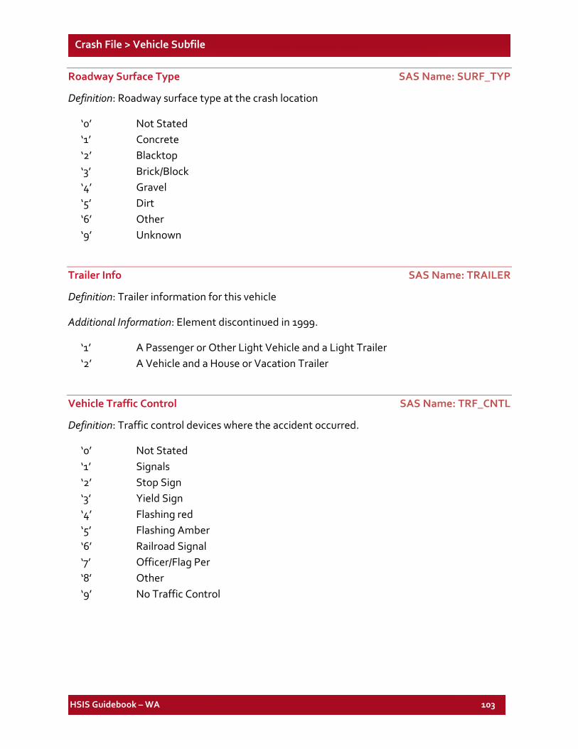
HSIS Guidebook – WA 103
Crash File > Vehicle Subfile
Roadway Surface Type SAS Name: SURF_TYP
Definition: Roadway surface type at the crash location
‘0’ Not Stated ‘1’ Concrete ‘2’ Blacktop ‘3’ Brick/Block ‘4’ Gravel ‘5’ Dirt ‘6’ Other ‘9’ Unknown
Trailer Info SAS Name: TRAILER
Definition: Trailer information for this vehicle
Additional Information: Element discontinued in 1999.
‘1’ A Passenger or Other Light Vehicle and a Light Trailer ‘2’ A Vehicle and a House or Vacation Trailer
Vehicle Traffic Control SAS Name: TRF_CNTL
Definition: Traffic control devices where the accident occurred.
‘0’ Not Stated ‘1’ Signals ‘2’ Stop Sign ‘3’ Yield Sign ‘4’ Flashing red ‘5’ Flashing Amber ‘6’ Railroad Signal ‘7’ Officer/Flag Per ‘8’ Other ‘9’ No Traffic Control
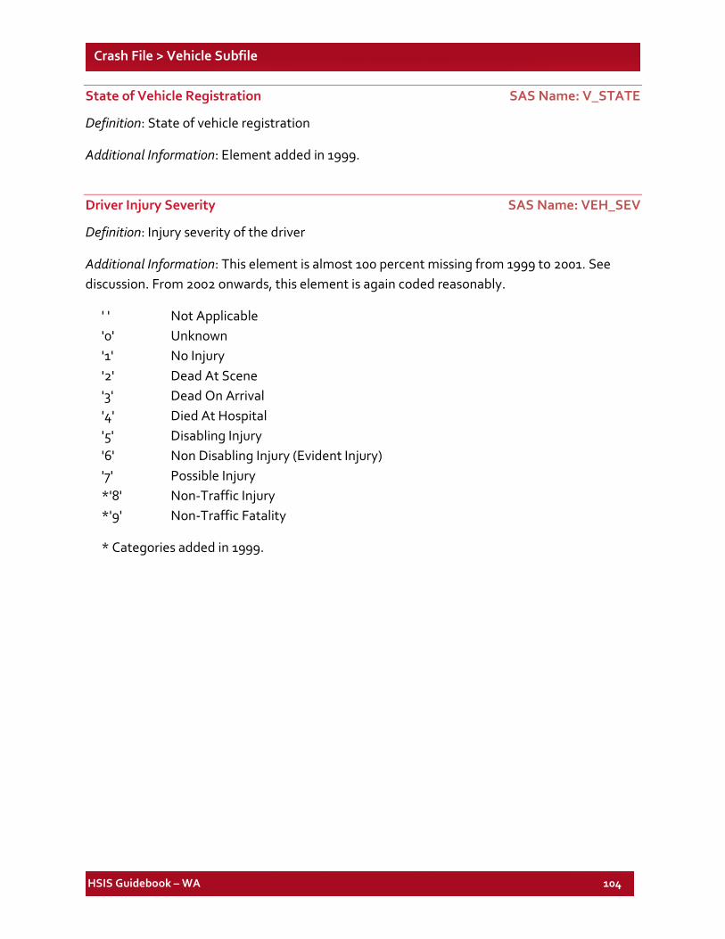
HSIS Guidebook – WA 104
Crash File > Vehicle Subfile
State of Vehicle Registration SAS Name: V_STATE
Definition: State of vehicle registration
Additional Information: Element added in 1999.
Driver Injury Severity SAS Name: VEH_SEV
Definition: Injury severity of the driver
Additional Information: This element is almost 100 percent missing from 1999 to 2001. See discussion. From 2002 onwards, this element is again coded reasonably.
' ' Not Applicable '0' Unknown '1' No Injury '2' Dead At Scene '3' Dead On Arrival '4' Died At Hospital '5' Disabling Injury '6' Non Disabling Injury (Evident Injury) '7' Possible Injury *'8' Non-Traffic Injury *'9' Non-Traffic Fatality
* Categories added in 1999.
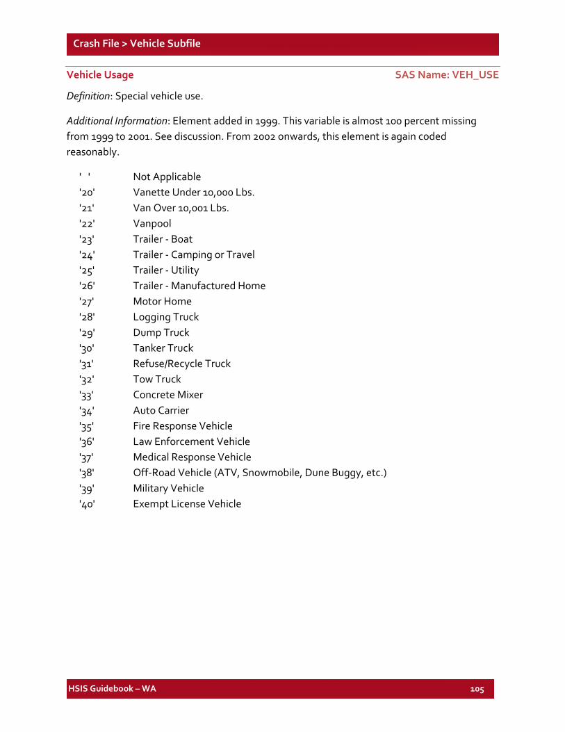
HSIS Guidebook – WA 105
Crash File > Vehicle Subfile
Vehicle Usage SAS Name: VEH_USE
Definition: Special vehicle use.
Additional Information: Element added in 1999. This variable is almost 100 percent missing from 1999 to 2001. See discussion. From 2002 onwards, this element is again coded reasonably.
' ' Not Applicable '20' Vanette Under 10,000 Lbs. '21' Van Over 10,001 Lbs. '22' Vanpool '23' Trailer - Boat '24' Trailer - Camping or Travel '25' Trailer - Utility '26' Trailer - Manufactured Home '27' Motor Home '28' Logging Truck '29' Dump Truck '30' Tanker Truck '31' Refuse/Recycle Truck '32' Tow Truck '33' Concrete Mixer '34' Auto Carrier '35' Fire Response Vehicle '36' Law Enforcement Vehicle '37' Medical Response Vehicle '38' Off-Road Vehicle (ATV, Snowmobile, Dune Buggy, etc.) '39' Military Vehicle '40' Exempt License Vehicle
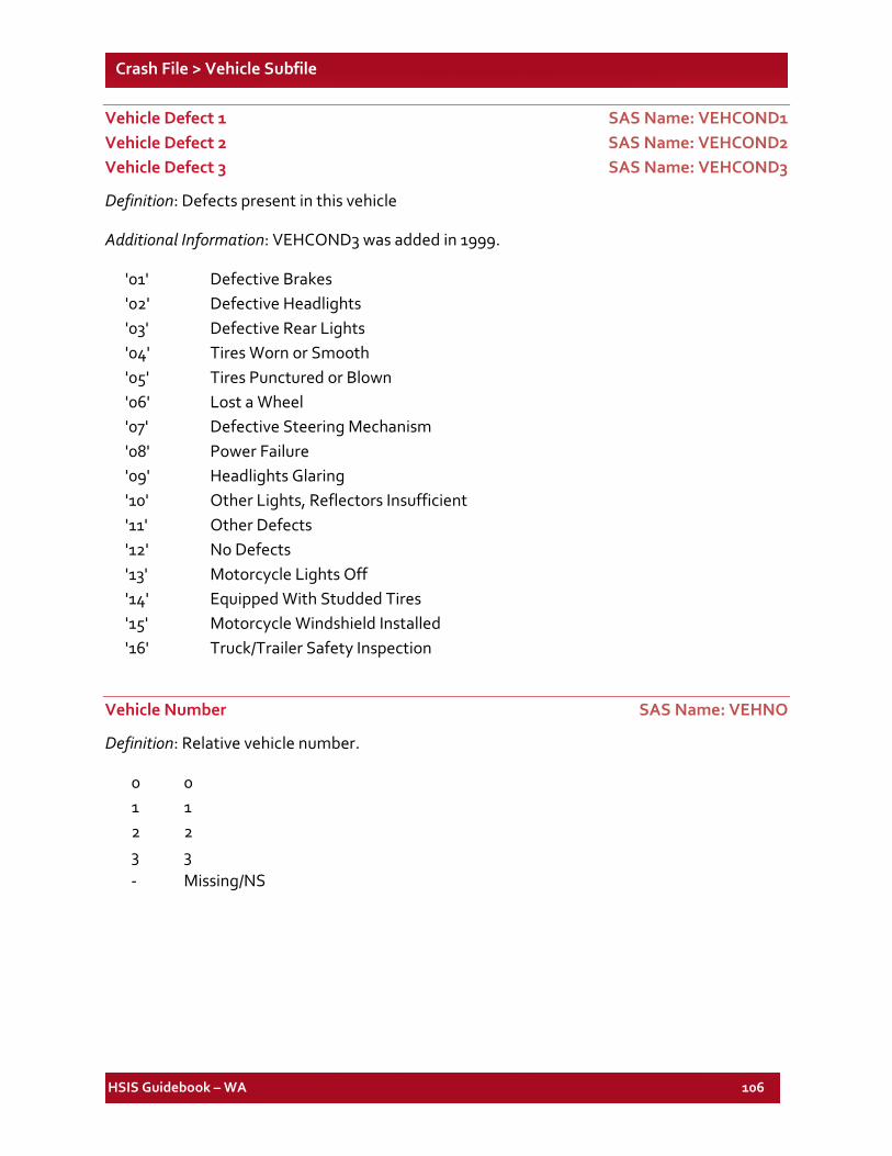
HSIS Guidebook – WA 106
Crash File > Vehicle Subfile
Vehicle Defect 1 SAS Name: VEHCOND1 Vehicle Defect 2 SAS Name: VEHCOND2 Vehicle Defect 3 SAS Name: VEHCOND3
Definition: Defects present in this vehicle
Additional Information: VEHCOND3 was added in 1999.
'01' Defective Brakes '02' Defective Headlights '03' Defective Rear Lights '04' Tires Worn or Smooth '05' Tires Punctured or Blown '06' Lost a Wheel '07' Defective Steering Mechanism '08' Power Failure '09' Headlights Glaring '10' Other Lights, Reflectors Insufficient '11' Other Defects '12' No Defects '13' Motorcycle Lights Off '14' Equipped With Studded Tires '15' Motorcycle Windshield Installed '16' Truck/Trailer Safety Inspection
Vehicle Number SAS Name: VEHNO
Definition: Relative vehicle number.
0 0 1 1 2 2 3 3 - Missing/NS
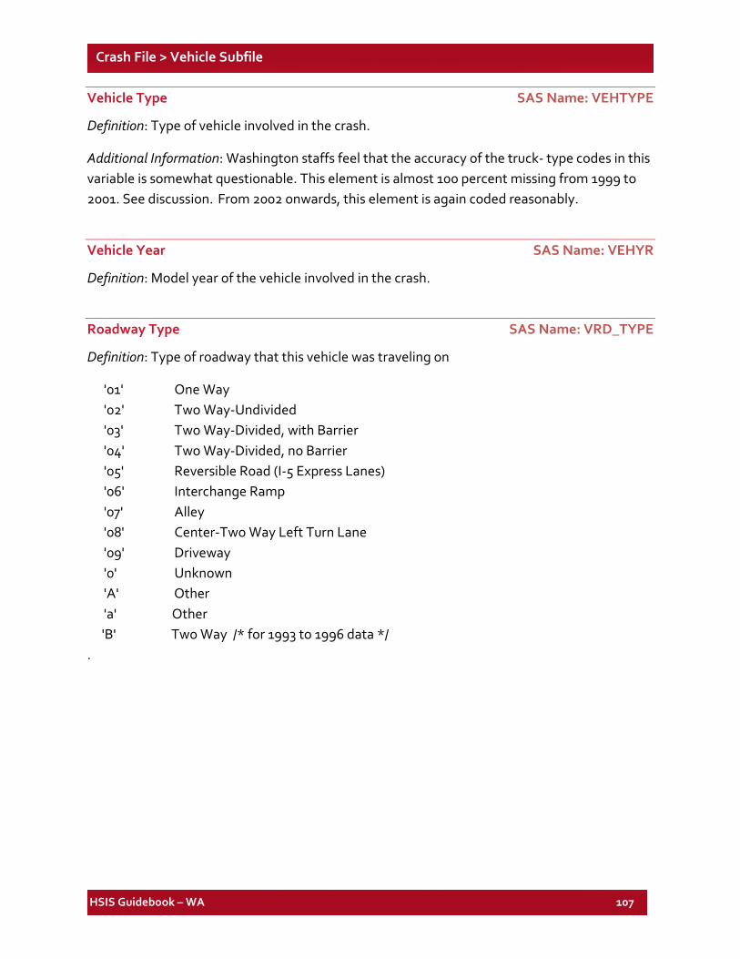
HSIS Guidebook – WA 107
Crash File > Vehicle Subfile
Vehicle Type SAS Name: VEHTYPE
Definition: Type of vehicle involved in the crash.
Additional Information: Washington staffs feel that the accuracy of the truck- type codes in this variable is somewhat questionable. This element is almost 100 percent missing from 1999 to 2001. See discussion. From 2002 onwards, this element is again coded reasonably.
Vehicle Year SAS Name: VEHYR
Definition: Model year of the vehicle involved in the crash.
Roadway Type SAS Name: VRD_TYPE
Definition: Type of roadway that this vehicle was traveling on
'01' One Way '02' Two Way-Undivided '03' Two Way-Divided, with Barrier '04' Two Way-Divided, no Barrier '05' Reversible Road (I-5 Express Lanes) '06' Interchange Ramp '07' Alley '08' Center-Two Way Left Turn Lane '09' Driveway '0' Unknown 'A' Other 'a' Other
'B' Two Way /* for 1993 to 1996 data */ .
HSIS Guidebook – WA 108
List of Elements for the WA Occupant Subfile
SAS VARIABLE NAME DESCRIPTION SAS VARIABLE
FILE FORMAT
TYPE PAGE NO.
AGE DRV/OCC AGE Occupant NUM 109 AIRBAG OCCUPANT AIRBAG Occupant CHA(1) 110 CASENO ACC RPT NUMBER Occupant CHA(6) 110 EJECT DRV/OCC EJECTION Occupant CHA(1) 110 HELMET PED/CYC HELMET Occupant CHA(1) 110 INJ DRV/OCC INJURY Occupant CHA(1) 111 NO_OCCS NUMBER OF OCCUPANTS Occupant NUM 111 REST1 DRV/OCC RESTRAINT Occupant CHA(1) 112 SEATPOS DRV/OCC SEAT POSITION Occupant CHA(1) 113 SEX DRV/OCC SEX Occupant CHA(1) 113 VEHNO VEHICLE NUMBER Occupant NUM 113
HSIS Guidebook – WA 109
Crash File Occupant Subfile
Notes:
1. SAS variable names and longer explanatory names are shown above each listing. (See Discussion for information on SAS formats.)
2. For all SAS-formatted elements below, an extra category labeled as "ERROR CODES" consolidates all values not listed as legitimate codes. This category is printed when elements are listed in tables.
Driver/Occupant Age SAS Name: AGE
Definition: Age of the injured/killed occupant.
Additional Information: Approximately six percent of the cases are uncoded.
00-01 Infant - 1 YR 02-04 02-04 YRS 05-10 05-10 YRS 11-14 11-14 YRS 15 15 YRS 16 16 YRS 17 17 YRS 18 18 YRS 19 19 YRS 20 20 YRS 21-25 21-25 YRS 26-30 26-30 YRS 31-35 31-35 YRS 36-45 36-45 YRS 46-55 46-55 YRS 56-65 56-65 YRS 66-89 66-89 YRS 90-99 91+ YRS
HSIS Guidebook – WA 110
Crash File > Occupant Subfile
Occupant Airbag SAS Name: AIRBAG
Definition: Whether or not the airbag in this vehicle deployed in the crash.
Additional Information: Element added in 1999. This element is almost 100 percent missing from 1999 to 2001. See discussion. From 2002 onwards, this element is again coded reasonably.
‘1’ Not Airbag Equipped ‘2’ Airbag Equipped – Not Activated ‘3’ Airbag Equipped – Activated ‘9’ Unknown
Accident Report Number SAS Name: CASENO
Definition: Accident case number.
Additional Information: The format used is a 4-digit year plus a 6-digit number.
Driver/Occupant Ejection SAS Name: EJECT
Definition: Whether or not the occupant was ejected when the crash occurred.
‘1’ Not Ejected ‘2’ Totally Ejected ‘3’ Partially Ejected ‘4’ Unk if Ejected *’9’ Unknown
* Category added in 1999.
Pedestrian/Cyclist Helmet SAS Name: HELMET
Definition: Pedestrian/cyclist helmet use
Additional Information: Element added in 2006.
‘1’ Helmet Used ‘2’ Helmet Not Used ‘9’ Unknown
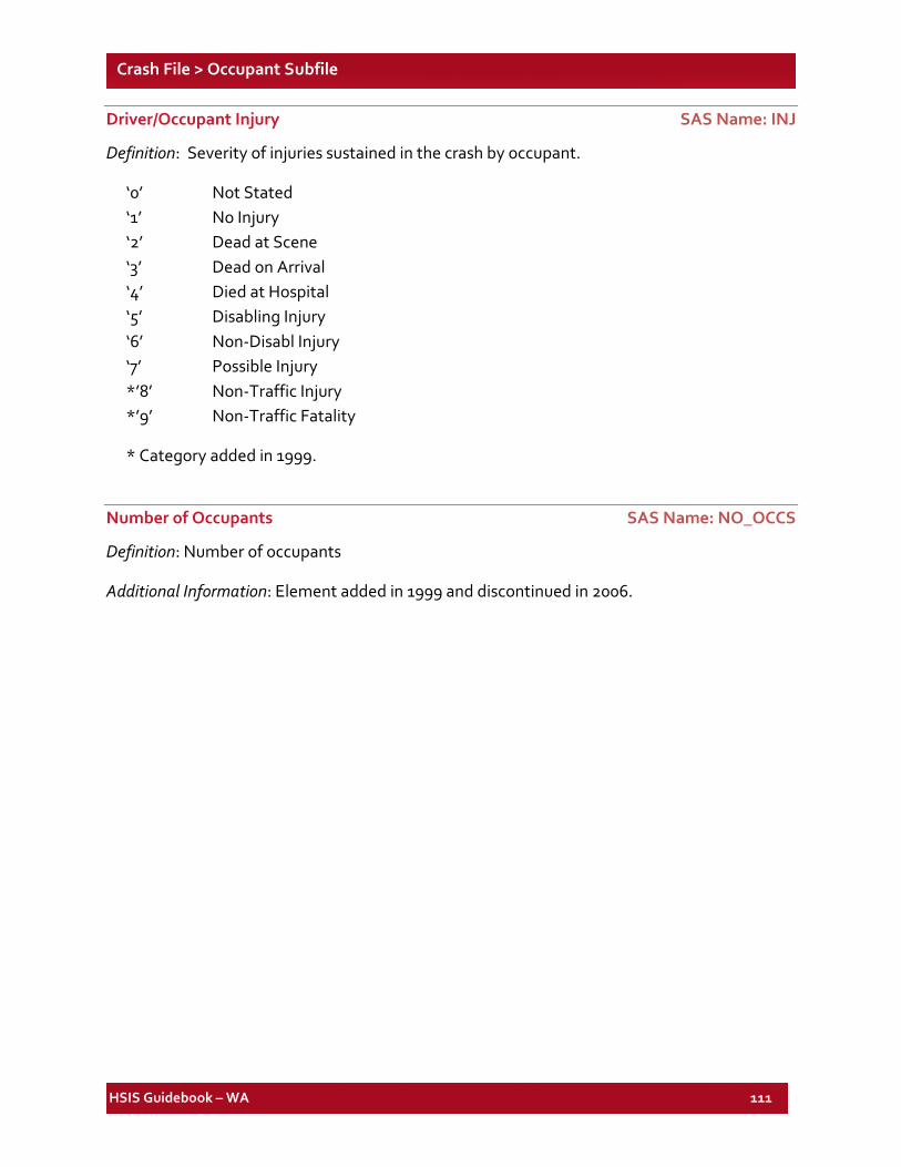
HSIS Guidebook – WA 111
Crash File > Occupant Subfile
Driver/Occupant Injury SAS Name: INJ
Definition: Severity of injuries sustained in the crash by occupant.
‘0’ Not Stated ‘1’ No Injury ‘2’ Dead at Scene ‘3’ Dead on Arrival ‘4’ Died at Hospital ‘5’ Disabling Injury ‘6’ Non-Disabl Injury ‘7’ Possible Injury *’8’ Non-Traffic Injury *’9’ Non-Traffic Fatality
* Category added in 1999.
Number of Occupants SAS Name: NO_OCCS
Definition: Number of occupants
Additional Information: Element added in 1999 and discontinued in 2006.
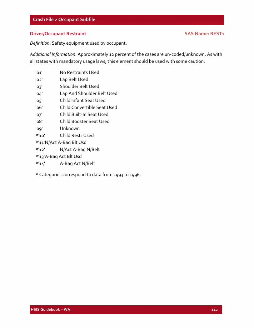
HSIS Guidebook – WA 112
Crash File > Occupant Subfile
Driver/Occupant Restraint SAS Name: REST1
Definition: Safety equipment used by occupant.
Additional Information: Approximately 12 percent of the cases are un-coded/unknown. As with all states with mandatory usage laws, this element should be used with some caution.
'01' No Restraints Used '02' Lap Belt Used '03' Shoulder Belt Used '04' Lap And Shoulder Belt Used' '05' Child Infant Seat Used '06' Child Convertible Seat Used '07' Child Built-In Seat Used '08' Child Booster Seat Used '09' Unknown *'10' Child Restr Used *'11' N/Act A-Bag Blt Usd *'12' N/Act A-Bag N/Belt *'13' A-Bag Act Blt Usd *'14' A-Bag Act N/Belt
* Categories correspond to data from 1993 to 1996.
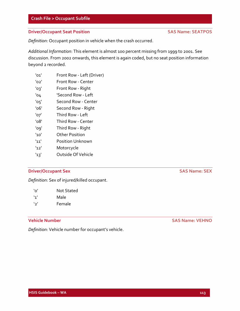
HSIS Guidebook – WA 113
Crash File > Occupant Subfile
Driver/Occupant Seat Position SAS Name: SEATPOS
Definition: Occupant position in vehicle when the crash occurred.
Additional Information: This element is almost 100 percent missing from 1999 to 2001. See discussion. From 2002 onwards, this element is again coded, but no seat position information beyond 2 recorded.
'01' Front Row - Left (Driver) '02' Front Row - Center '03' Front Row - Right '04 'Second Row - Left '05' Second Row - Center '06' Second Row - Right '07' Third Row - Left '08' Third Row - Center '09' Third Row - Right '10' Other Position '11' Position Unknown '12' Motorcycle '13' Outside Of Vehicle
Driver/Occupant Sex SAS Name: SEX
Definition: Sex of injured/killed occupant.
‘0’ Not Stated ‘1’ Male ‘2’ Female
Vehicle Number SAS Name: VEHNO
Definition: Vehicle number for occupant’s vehicle.
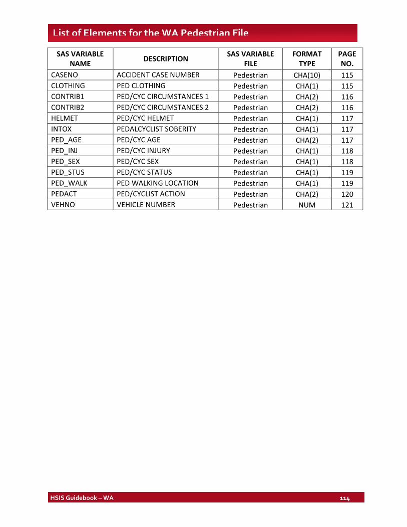
HSIS Guidebook – WA 114
List of Elements for the WA Pedestrian File
SAS VARIABLE NAME DESCRIPTION SAS VARIABLE
FILE FORMAT
TYPE PAGE NO.
CASENO ACCIDENT CASE NUMBER Pedestrian CHA(10) 115 CLOTHING PED CLOTHING Pedestrian CHA(1) 115 CONTRIB1 PED/CYC CIRCUMSTANCES 1 Pedestrian CHA(2) 116 CONTRIB2 PED/CYC CIRCUMSTANCES 2 Pedestrian CHA(2) 116 HELMET PED/CYC HELMET Pedestrian CHA(1) 117 INTOX PEDALCYCLIST SOBERITY Pedestrian CHA(1) 117 PED_AGE PED/CYC AGE Pedestrian CHA(2) 117 PED_INJ PED/CYC INJURY Pedestrian CHA(1) 118 PED_SEX PED/CYC SEX Pedestrian CHA(1) 118 PED_STUS PED/CYC STATUS Pedestrian CHA(1) 119 PED_WALK PED WALKING LOCATION Pedestrian CHA(1) 119 PEDACT PED/CYCLIST ACTION Pedestrian CHA(2) 120 VEHNO VEHICLE NUMBER Pedestrian NUM 121
HSIS Guidebook – WA 115
Crash File Pedestrian Subfile
Notes:
1. SAS element names and longer explanatory names are shown above each listing. (See Discussion for information on SAS formats.)
2. For all SAS-formatted elements below, an extra category labeled as "ERROR CODES" consolidates all values not listed as legitimate codes. This category is printed when elements are listed in tables.
3. Pedestrian subfile is available for 1999-2002.
Accident Case Number SAS Name: CASENO
Definition: Case number of accident.
Additional Information: Data available for years 1999 and later. The format used is a 4-digit year plus a 6-digit number.
Pedestrian Clothing SAS Name: CLOTHING
Definition: Pedestrian clothing information
Additional Information: Data available for years 1999 and later.
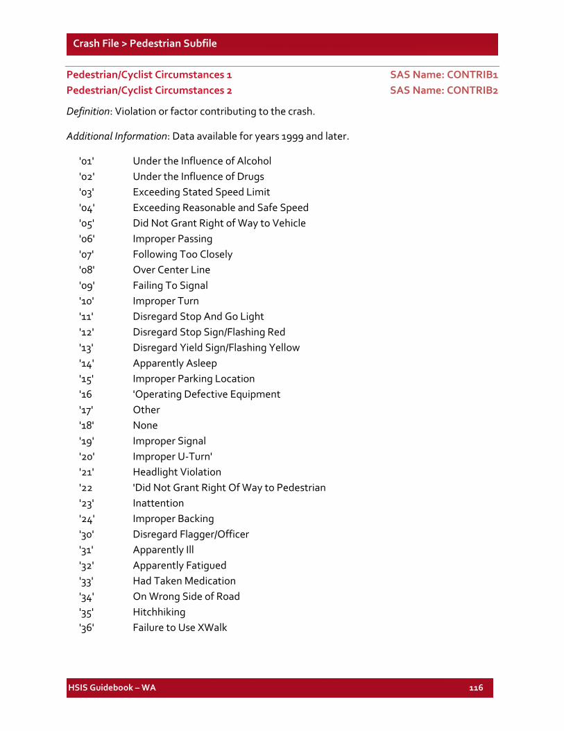
HSIS Guidebook – WA 116
Crash File > Pedestrian Subfile
Pedestrian/Cyclist Circumstances 1 SAS Name: CONTRIB1 Pedestrian/Cyclist Circumstances 2 SAS Name: CONTRIB2
Definition: Violation or factor contributing to the crash.
Additional Information: Data available for years 1999 and later.
'01' Under the Influence of Alcohol '02' Under the Influence of Drugs '03' Exceeding Stated Speed Limit '04' Exceeding Reasonable and Safe Speed '05' Did Not Grant Right of Way to Vehicle '06' Improper Passing '07' Following Too Closely '08' Over Center Line '09' Failing To Signal '10' Improper Turn '11' Disregard Stop And Go Light '12' Disregard Stop Sign/Flashing Red '13' Disregard Yield Sign/Flashing Yellow '14' Apparently Asleep '15' Improper Parking Location '16 'Operating Defective Equipment '17' Other '18' None '19' Improper Signal '20' Improper U-Turn' '21' Headlight Violation '22 'Did Not Grant Right Of Way to Pedestrian '23' Inattention '24' Improper Backing '30' Disregard Flagger/Officer '31' Apparently Ill '32' Apparently Fatigued '33' Had Taken Medication '34' On Wrong Side of Road '35' Hitchhiking '36' Failure to Use XWalk
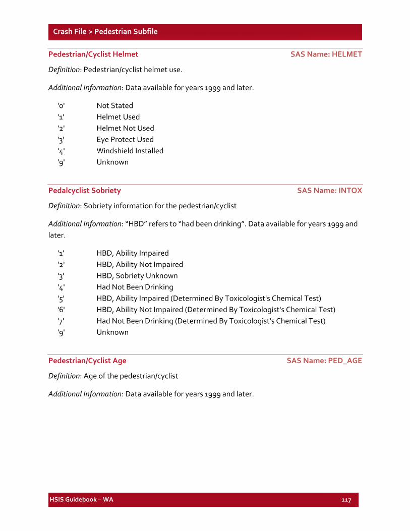
HSIS Guidebook – WA 117
Crash File > Pedestrian Subfile
Pedestrian/Cyclist Helmet SAS Name: HELMET
Definition: Pedestrian/cyclist helmet use.
Additional Information: Data available for years 1999 and later.
'0' Not Stated '1' Helmet Used '2' Helmet Not Used '3' Eye Protect Used '4' Windshield Installed '9' Unknown
Pedalcyclist Sobriety SAS Name: INTOX
Definition: Sobriety information for the pedestrian/cyclist
Additional Information: “HBD” refers to “had been drinking”. Data available for years 1999 and later.
'1' HBD, Ability Impaired '2' HBD, Ability Not Impaired '3' HBD, Sobriety Unknown '4' Had Not Been Drinking '5' HBD, Ability Impaired (Determined By Toxicologist's Chemical Test) '6' HBD, Ability Not Impaired (Determined By Toxicologist's Chemical Test) '7' Had Not Been Drinking (Determined By Toxicologist's Chemical Test) '9' Unknown
Pedestrian/Cyclist Age SAS Name: PED_AGE
Definition: Age of the pedestrian/cyclist
Additional Information: Data available for years 1999 and later.
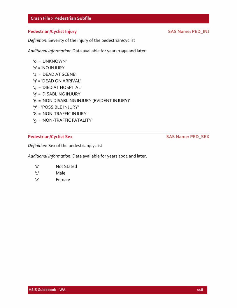
HSIS Guidebook – WA 118
Crash File > Pedestrian Subfile
Pedestrian/Cyclist Injury SAS Name: PED_INJ
Definition: Severity of the injury of the pedestrian/cyclist
Additional Information: Data available for years 1999 and later.
'0' = 'UNKNOWN' '1' = 'NO INJURY' '2' = 'DEAD AT SCENE' '3' = 'DEAD ON ARRIVAL' '4' = 'DIED AT HOSPITAL' '5' = 'DISABLING INJURY' '6' = 'NON DISABLING INJURY (EVIDENT INJURY)' '7' = 'POSSIBLE INJURY' '8' = 'NON-TRAFFIC INJURY' '9' = 'NON-TRAFFIC FATALITY'
Pedestrian/Cyclist Sex SAS Name: PED_SEX
Definition: Sex of the pedestrian/cyclist
Additional Information: Data available for years 2002 and later.
'0' Not Stated '1' Male '2' Female
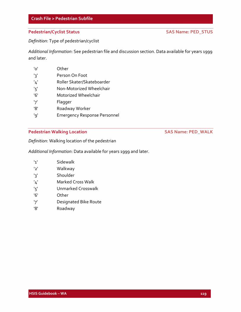
HSIS Guidebook – WA 119
Crash File > Pedestrian Subfile
Pedestrian/Cyclist Status SAS Name: PED_STUS
Definition: Type of pedestrian/cyclist
Additional Information: See pedestrian file and discussion section. Data available for years 1999 and later.
'0' Other '3' Person On Foot '4' Roller Skater/Skateboarder '5' Non-Motorized Wheelchair '6' Motorized Wheelchair '7' Flagger '8' Roadway Worker '9' Emergency Response Personnel
Pedestrian Walking Location SAS Name: PED_WALK
Definition: Walking location of the pedestrian
Additional Information: Data available for years 1999 and later.
'1' Sidewalk '2' Walkway '3' Shoulder '4' Marked Cross Walk '5' Unmarked Crosswalk '6' Other '7' Designated Bike Route '8' Roadway
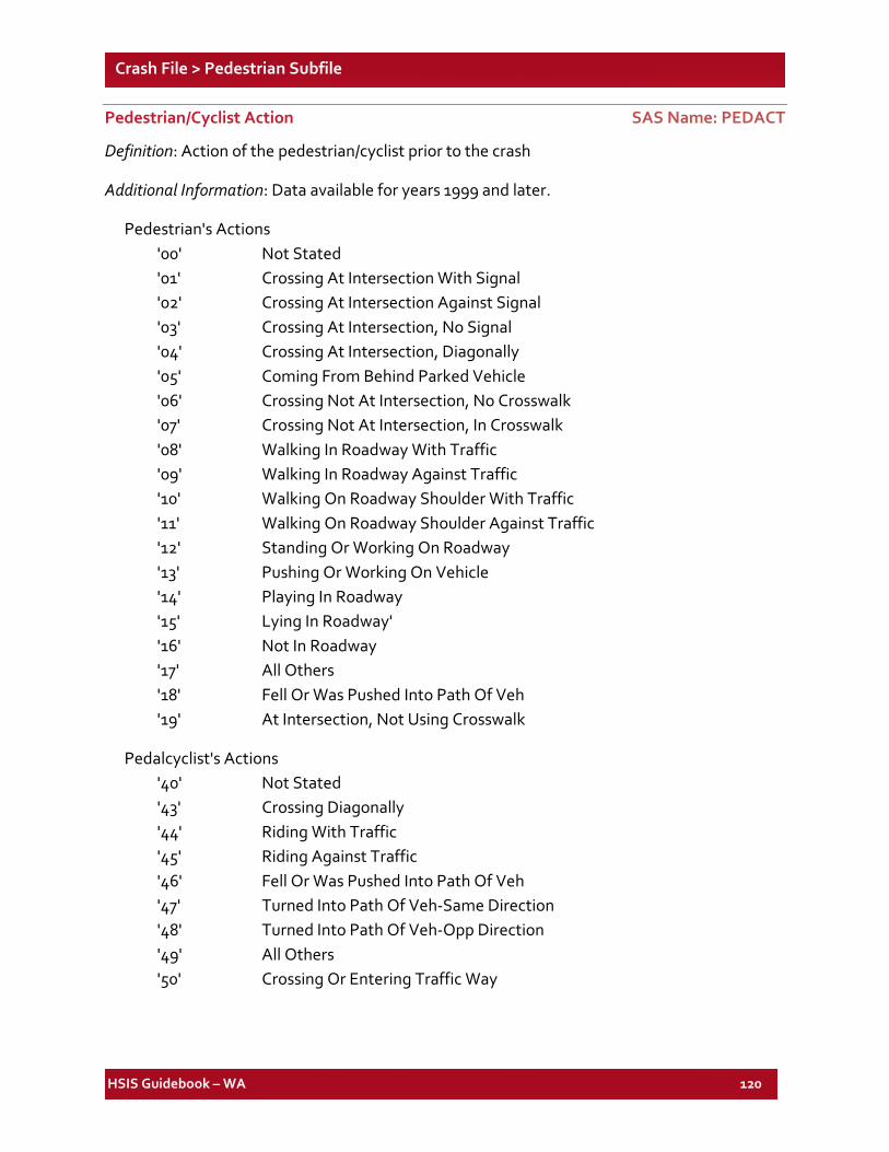
HSIS Guidebook – WA 120
Crash File > Pedestrian Subfile
Pedestrian/Cyclist Action SAS Name: PEDACT
Definition: Action of the pedestrian/cyclist prior to the crash
Additional Information: Data available for years 1999 and later.
Pedestrian's Actions '00' Not Stated '01' Crossing At Intersection With Signal '02' Crossing At Intersection Against Signal '03' Crossing At Intersection, No Signal '04' Crossing At Intersection, Diagonally '05' Coming From Behind Parked Vehicle '06' Crossing Not At Intersection, No Crosswalk '07' Crossing Not At Intersection, In Crosswalk '08' Walking In Roadway With Traffic '09' Walking In Roadway Against Traffic '10' Walking On Roadway Shoulder With Traffic '11' Walking On Roadway Shoulder Against Traffic '12' Standing Or Working On Roadway '13' Pushing Or Working On Vehicle '14' Playing In Roadway '15' Lying In Roadway' '16' Not In Roadway '17' All Others '18' Fell Or Was Pushed Into Path Of Veh '19' At Intersection, Not Using Crosswalk
Pedalcyclist's Actions '40' Not Stated '43' Crossing Diagonally '44' Riding With Traffic '45' Riding Against Traffic '46' Fell Or Was Pushed Into Path Of Veh '47' Turned Into Path Of Veh-Same Direction '48' Turned Into Path Of Veh-Opp Direction '49' All Others '50' Crossing Or Entering Traffic Way
HSIS Guidebook – WA 121
Crash File > Pedestrian Subfile
Vehicle Number SAS Name: VEHNO
Definition: Relative vehicle number.

HSIS Guidebook – WA 122
List of Elements for the WA Roadlog File
SAS VARIABLE NAME DESCRIPTION SAS VARIABLE
FILE FORMAT
TYPE PAGE NO.
AADT AVER ANNUAL DAILY TRAFFIC Roadlog NUM 127 ACCES_DT ACCESS CONTROL DATE Roadlog CHA(8) 127 ACCESS ACCESS CONTROL TYPE Roadlog CHA(1) 128 ACLL_DT1 LEFT ACCEL LANE DATE RD1 Roadlog CHA(8) 128 ACLL_DT2 LEFT ACCEL LANE DATE RD2 Roadlog CHA(8) 128
ACLL_LG1 LEFT ACCEL LANE LENGTH RD1 Roadlog NUM 128
ACLL_LG2 LEFT ACCEL LANE LENGTH RD2 Roadlog NUM 128
ACLL_WD1 LEFT ACCEL LANE WIDTH RD1 Roadlog NUM 128 ACLL_WD2 LEFT ACCEL LANE WIDTH RD2 Roadlog NUM 128 ACLR_DT1 RIGHT ACCEL LANE DATE RD1 Roadlog CHA(8) 129 ACLR_DT2 RIGHT ACCEL LANE DATE RD2 Roadlog CHA(8) 129
ACLR_LG1 RIGHT ACCEL LANE LENGTH RD1 Roadlog NUM 129
ACLR_LG2 RIGHT ACCEL LANE LENGTH RD2 Roadlog NUM 129
ACLR_WD1 RIGHT ACCEL LANE WIDTH RD1 Roadlog NUM 129
ACLR_WD2 RIGHT ACCEL LANE WIDTH RD2 Roadlog NUM 129
ACSEQ_NB ACC SEQ NUM Roadlog NUM 129 BEGMP BEGMP Roadlog NUM 129 CITY CITY NUMBER Roadlog CHA(4) 129 CITY_DT CITY DATE Roadlog CHA(8) 133 CNTL_SEC CONTROL SECTION Roadlog CHA(8) 133 CNTY_DT COUNTY DATE Roadlog CHA(8) 133 COMP_DIR COMPASS DIRECTION Roadlog CHA(2) 134 COUNTY COUNTY NUMBER Roadlog CHA(2) 135 CTY_ZONE CITY ZONE TYPE Roadlog CHA(1) 135 DETCH_NB WSP DETACHEMENT NUM Roadlog CHA(2) 135 DEVCD LEVEL OF DEVLMPT Roadlog CHA(2) 136 DEVCD_DT LEVEL OF DEVELMT DATE Roadlog CHA(8) 136 DIR_DT COMPASS DIRECTION DATE Roadlog CHA(8) 136 DISCN_DT DISCONTY DATE Roadlog CHA(8) 136 DISCONTY DISCONTY IND Roadlog CHA(2) 136 DISTR_DT DISTRICT DATE Roadlog CHA(8) 136 DISTRICT DISTRICT NUMBER Roadlog CHA(1) 137
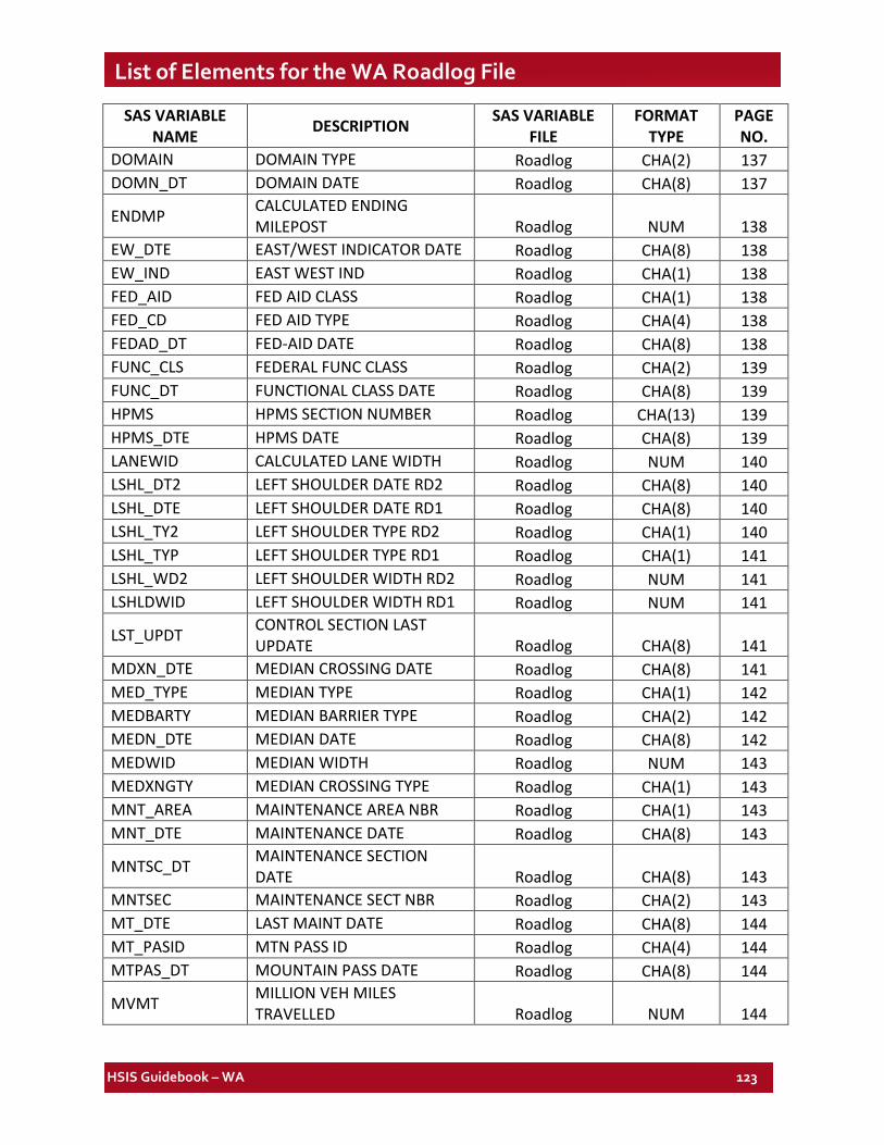
HSIS Guidebook – WA 123
List of Elements for the WA Roadlog File
SAS VARIABLE NAME DESCRIPTION SAS VARIABLE
FILE FORMAT
TYPE PAGE NO.
DOMAIN DOMAIN TYPE Roadlog CHA(2) 137 DOMN_DT DOMAIN DATE Roadlog CHA(8) 137
ENDMP CALCULATED ENDING MILEPOST Roadlog NUM 138
EW_DTE EAST/WEST INDICATOR DATE Roadlog CHA(8) 138 EW_IND EAST WEST IND Roadlog CHA(1) 138 FED_AID FED AID CLASS Roadlog CHA(1) 138 FED_CD FED AID TYPE Roadlog CHA(4) 138 FEDAD_DT FED-AID DATE Roadlog CHA(8) 138 FUNC_CLS FEDERAL FUNC CLASS Roadlog CHA(2) 139 FUNC_DT FUNCTIONAL CLASS DATE Roadlog CHA(8) 139 HPMS HPMS SECTION NUMBER Roadlog CHA(13) 139 HPMS_DTE HPMS DATE Roadlog CHA(8) 139 LANEWID CALCULATED LANE WIDTH Roadlog NUM 140 LSHL_DT2 LEFT SHOULDER DATE RD2 Roadlog CHA(8) 140 LSHL_DTE LEFT SHOULDER DATE RD1 Roadlog CHA(8) 140 LSHL_TY2 LEFT SHOULDER TYPE RD2 Roadlog CHA(1) 140 LSHL_TYP LEFT SHOULDER TYPE RD1 Roadlog CHA(1) 141 LSHL_WD2 LEFT SHOULDER WIDTH RD2 Roadlog NUM 141 LSHLDWID LEFT SHOULDER WIDTH RD1 Roadlog NUM 141
LST_UPDT CONTROL SECTION LAST UPDATE Roadlog CHA(8) 141
MDXN_DTE MEDIAN CROSSING DATE Roadlog CHA(8) 141 MED_TYPE MEDIAN TYPE Roadlog CHA(1) 142 MEDBARTY MEDIAN BARRIER TYPE Roadlog CHA(2) 142 MEDN_DTE MEDIAN DATE Roadlog CHA(8) 142 MEDWID MEDIAN WIDTH Roadlog NUM 143 MEDXNGTY MEDIAN CROSSING TYPE Roadlog CHA(1) 143 MNT_AREA MAINTENANCE AREA NBR Roadlog CHA(1) 143 MNT_DTE MAINTENANCE DATE Roadlog CHA(8) 143
MNTSC_DT MAINTENANCE SECTION DATE Roadlog CHA(8) 143
MNTSEC MAINTENANCE SECT NBR Roadlog CHA(2) 143 MT_DTE LAST MAINT DATE Roadlog CHA(8) 144 MT_PASID MTN PASS ID Roadlog CHA(4) 144 MTPAS_DT MOUNTAIN PASS DATE Roadlog CHA(8) 144
MVMT MILLION VEH MILES TRAVELLED Roadlog NUM 144
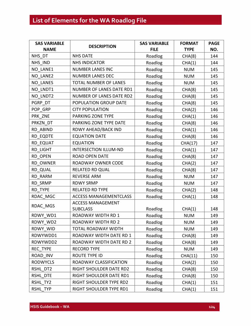
HSIS Guidebook – WA 124
List of Elements for the WA Roadlog File
SAS VARIABLE NAME DESCRIPTION SAS VARIABLE
FILE FORMAT
TYPE PAGE NO.
NHS_DT NHS DATE Roadlog CHA(8) 144 NHS_IND NHS INDICATOR Roadlog CHA(1) 144 NO_LANE1 NUMBER LANES INC Roadlog NUM 145 NO_LANE2 NUMBER LANES DEC Roadlog NUM 145 NO_LANES TOTAL NUMBER OF LANES Roadlog NUM 145 NO_LNDT1 NUMBER OF LANES DATE RD1 Roadlog CHA(8) 145 NO_LNDT2 NUMBER OF LANES DATE RD2 Roadlog CHA(8) 145 PGRP_DT POPULATION GROUP DATE Roadlog CHA(8) 145 POP_GRP CITY POPULATION Roadlog CHA(2) 146 PRK_ZNE PARKING ZONE TYPE Roadlog CHA(1) 146 PRKZN_DT PARKING ZONE TYPE DATE Roadlog CHA(8) 146 RD_ABIND RDWY AHEAD/BACK IND Roadlog CHA(1) 146 RD_EQDTE EQUATION DATE Roadlog CHA(8) 146 RD_EQUAT EQUATION Roadlog CHA(17) 147 RD_LIGHT INTERSECTION ILLUM-ND Roadlog CHA(1) 147 RD_OPEN ROAD OPEN DATE Roadlog CHA(8) 147 RD_OWNER ROADWAY OWNER CODE Roadlog CHA(2) 147 RD_QUAL RELATED RD QUAL Roadlog CHA(8) 147 RD_RARM REVERSE ARM Roadlog NUM 147 RD_SRMP RDWY SRMP Roadlog NUM 147 RD_TYPE RELATED RD TYPE Roadlog CHA(2) 148 RDAC_MGC ACCESS MANAGEMENTCLASS Roadlog CHA(1) 148
RDAC_MGS ACCESS MANAGEMENT SUBCLASS Roadlog CHA(1) 148
RDWY_WD1 ROADWAY WIDTH RD 1 Roadlog NUM 149 RDWY_WD2 ROADWAY WIDTH RD 2 Roadlog NUM 149 RDWY_WID TOTAL ROADWAY WIDTH Roadlog NUM 149 RDWYWDD1 ROADWAY WIDTH DATE RD 1 Roadlog CHA(8) 149 RDWYWDD2 ROADWAY WIDTH DATE RD 2 Roadlog CHA(8) 149 REC_TYPE RECORD TYPE Roadlog NUM 149 ROAD_INV ROUTE TYPE ID Roadlog CHA(11) 150 RODWYCLS ROADWAY CLASSIFICATION Roadlog CHA(2) 150 RSHL_DT2 RIGHT SHOULDER DATE RD2 Roadlog CHA(8) 150 RSHL_DTE RIGHT SHOULDER DATE RD1 Roadlog CHA(8) 150 RSHL_TY2 RIGHT SHOULDER TYPE RD2 Roadlog CHA(1) 151 RSHL_TYP RIGHT SHOULDER TYPE RD1 Roadlog CHA(1) 151
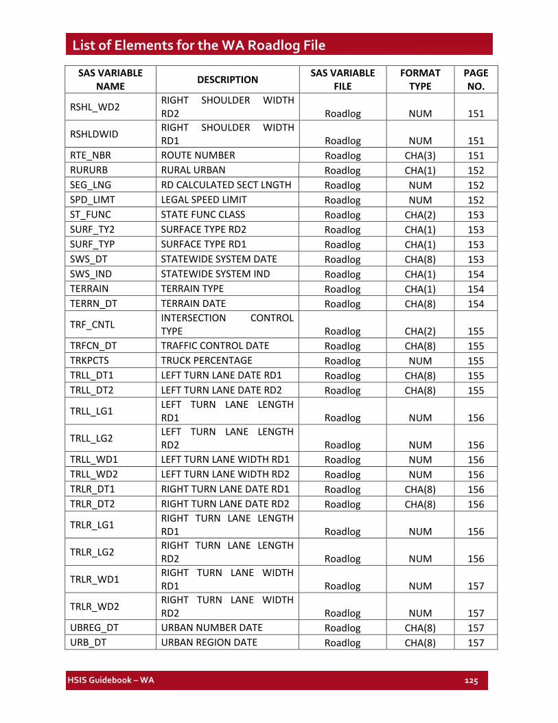
HSIS Guidebook – WA 125
List of Elements for the WA Roadlog File
SAS VARIABLE NAME DESCRIPTION SAS VARIABLE
FILE FORMAT
TYPE PAGE NO.
RSHL_WD2 RIGHT SHOULDER WIDTH RD2 Roadlog NUM 151
RSHLDWID RIGHT SHOULDER WIDTH RD1 Roadlog NUM 151
RTE_NBR ROUTE NUMBER Roadlog CHA(3) 151 RURURB RURAL URBAN Roadlog CHA(1) 152 SEG_LNG RD CALCULATED SECT LNGTH Roadlog NUM 152 SPD_LIMT LEGAL SPEED LIMIT Roadlog NUM 152 ST_FUNC STATE FUNC CLASS Roadlog CHA(2) 153 SURF_TY2 SURFACE TYPE RD2 Roadlog CHA(1) 153 SURF_TYP SURFACE TYPE RD1 Roadlog CHA(1) 153 SWS_DT STATEWIDE SYSTEM DATE Roadlog CHA(8) 153 SWS_IND STATEWIDE SYSTEM IND Roadlog CHA(1) 154 TERRAIN TERRAIN TYPE Roadlog CHA(1) 154 TERRN_DT TERRAIN DATE Roadlog CHA(8) 154
TRF_CNTL INTERSECTION CONTROL TYPE Roadlog CHA(2) 155
TRFCN_DT TRAFFIC CONTROL DATE Roadlog CHA(8) 155 TRKPCTS TRUCK PERCENTAGE Roadlog NUM 155 TRLL_DT1 LEFT TURN LANE DATE RD1 Roadlog CHA(8) 155 TRLL_DT2 LEFT TURN LANE DATE RD2 Roadlog CHA(8) 155
TRLL_LG1 LEFT TURN LANE LENGTH RD1 Roadlog NUM 156
TRLL_LG2 LEFT TURN LANE LENGTH RD2 Roadlog NUM 156
TRLL_WD1 LEFT TURN LANE WIDTH RD1 Roadlog NUM 156 TRLL_WD2 LEFT TURN LANE WIDTH RD2 Roadlog NUM 156 TRLR_DT1 RIGHT TURN LANE DATE RD1 Roadlog CHA(8) 156 TRLR_DT2 RIGHT TURN LANE DATE RD2 Roadlog CHA(8) 156
TRLR_LG1 RIGHT TURN LANE LENGTH RD1 Roadlog NUM 156
TRLR_LG2 RIGHT TURN LANE LENGTH RD2 Roadlog NUM 156
TRLR_WD1 RIGHT TURN LANE WIDTH RD1 Roadlog NUM 157
TRLR_WD2 RIGHT TURN LANE WIDTH RD2 Roadlog NUM 157
UBREG_DT URBAN NUMBER DATE Roadlog CHA(8) 157 URB_DT URBAN REGION DATE Roadlog CHA(8) 157
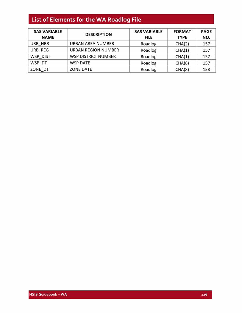
HSIS Guidebook – WA 126
List of Elements for the WA Roadlog File
SAS VARIABLE NAME DESCRIPTION SAS VARIABLE
FILE FORMAT
TYPE PAGE NO.
URB_NBR URBAN AREA NUMBER Roadlog CHA(2) 157 URB_REG URBAN REGION NUMBER Roadlog CHA(1) 157 WSP_DIST WSP DISTRICT NUMBER Roadlog CHA(1) 157 WSP_DT WSP DATE Roadlog CHA(8) 157 ZONE_DT ZONE DATE Roadlog CHA(8) 158
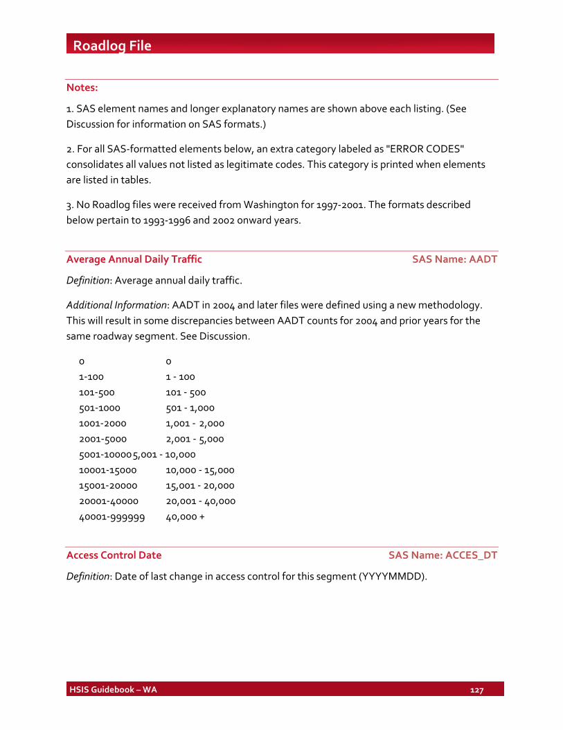
HSIS Guidebook – WA 127
Roadlog File
Notes:
1. SAS element names and longer explanatory names are shown above each listing. (See Discussion for information on SAS formats.)
2. For all SAS-formatted elements below, an extra category labeled as "ERROR CODES" consolidates all values not listed as legitimate codes. This category is printed when elements are listed in tables.
3. No Roadlog files were received from Washington for 1997-2001. The formats described below pertain to 1993-1996 and 2002 onward years.
Average Annual Daily Traffic SAS Name: AADT
Definition: Average annual daily traffic.
Additional Information: AADT in 2004 and later files were defined using a new methodology. This will result in some discrepancies between AADT counts for 2004 and prior years for the same roadway segment. See Discussion.
0 0 1-100 1 - 100 101-500 101 - 500 501-1000 501 - 1,000 1001-2000 1,001 - 2,000 2001-5000 2,001 - 5,000 5001-10000 5,001 - 10,000 10001-15000 10,000 - 15,000 15001-20000 15,001 - 20,000 20001-40000 20,001 - 40,000 40001-999999 40,000 +
Access Control Date SAS Name: ACCES_DT
Definition: Date of last change in access control for this segment (YYYYMMDD).
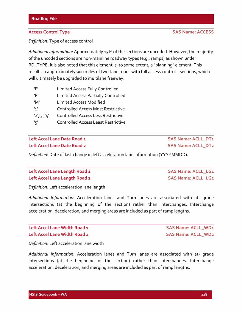
HSIS Guidebook – WA 128
Roadlog File
Access Control Type SAS Name: ACCESS
Definition: Type of access control
Additional Information: Approximately 15% of the sections are uncoded. However, the majority of the uncoded sections are non-mainline roadway types (e.g., ramps) as shown under RD_TYPE. It is also noted that this element is, to some extent, a "planning" element. This results in approximately 900 miles of two-lane roads with full access control – sections, which will ultimately be upgraded to multilane freeway.
'F' Limited Access Fully Controlled 'P' Limited Access Partially Controlled 'M' Limited Access Modified '1' Controlled Access Most Restrictive '2','3','4' Controlled Access Less Restrictive '5' Controlled Access Least Restrictive
Left Accel Lane Date Road 1 SAS Name: ACLL_DT1 Left Accel Lane Date Road 2 SAS Name: ACLL_DT2
Definition: Date of last change in left acceleration lane information (YYYYMMDD).
Left Accel Lane Length Road 1 SAS Name: ACLL_LG1 Left Accel Lane Length Road 2 SAS Name: ACLL_LG2
Definition: Left acceleration lane length
Additional Information: Acceleration lanes and Turn lanes are associated with at- grade intersections (at the beginning of the section) rather than interchanges. Interchange acceleration, deceleration, and merging areas are included as part of ramp lengths.
Left Accel Lane Width Road 1 SAS Name: ACLL_WD1 Left Accel Lane Width Road 2 SAS Name: ACLL_WD2
Definition: Left acceleration lane width
Additional Information: Acceleration lanes and Turn lanes are associated with at- grade intersections (at the beginning of the section) rather than interchanges. Interchange acceleration, deceleration, and merging areas are included as part of ramp lengths.
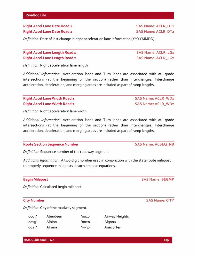
HSIS Guidebook – WA 129
Roadlog File
Right Accel Lane Date Road 1 SAS Name: ACLR_DT1 Right Accel Lane Date Road 2 SAS Name: ACLR_DT2
Definition: Date of last change in right acceleration lane information (YYYYMMDD).
Right Accel Lane Length Road 1 SAS Name: ACLR_LG1 Right Accel Lane Length Road 2 SAS Name: ACLR_LG2
Definition: Right acceleration lane length
Additional Information: Acceleration lanes and Turn lanes are associated with at- grade intersections (at the beginning of the section) rather than interchanges. Interchange acceleration, deceleration, and merging areas are included as part of ramp lengths.
Right Accel Lane Width Road 1 SAS Name: ACLR_WD1 Right Accel Lane Width Road 2 SAS Name: ACLR_WD2
Definition: Right acceleration lane width
Additional Information: Acceleration lanes and Turn lanes are associated with at- grade intersections (at the beginning of the section) rather than interchanges. Interchange acceleration, deceleration, and merging areas are included as part of ramp lengths.
Route Section Sequence Number SAS Name: ACSEQ_NB
Definition: Sequence number of the roadway segment
Additional Information: A two-digit number used in conjunction with the state route milepost to properly sequence mileposts in such areas as equations.
Begin Milepost SAS Name: BEGMP
Definition: Calculated begin milepost.
City Number SAS Name: CITY
Definition: City of the roadway segment.
'0005' Aberdeen '0010' Airway Heights '0015' Albion '0020' Algona '0025' Almira '0030' Anacortes
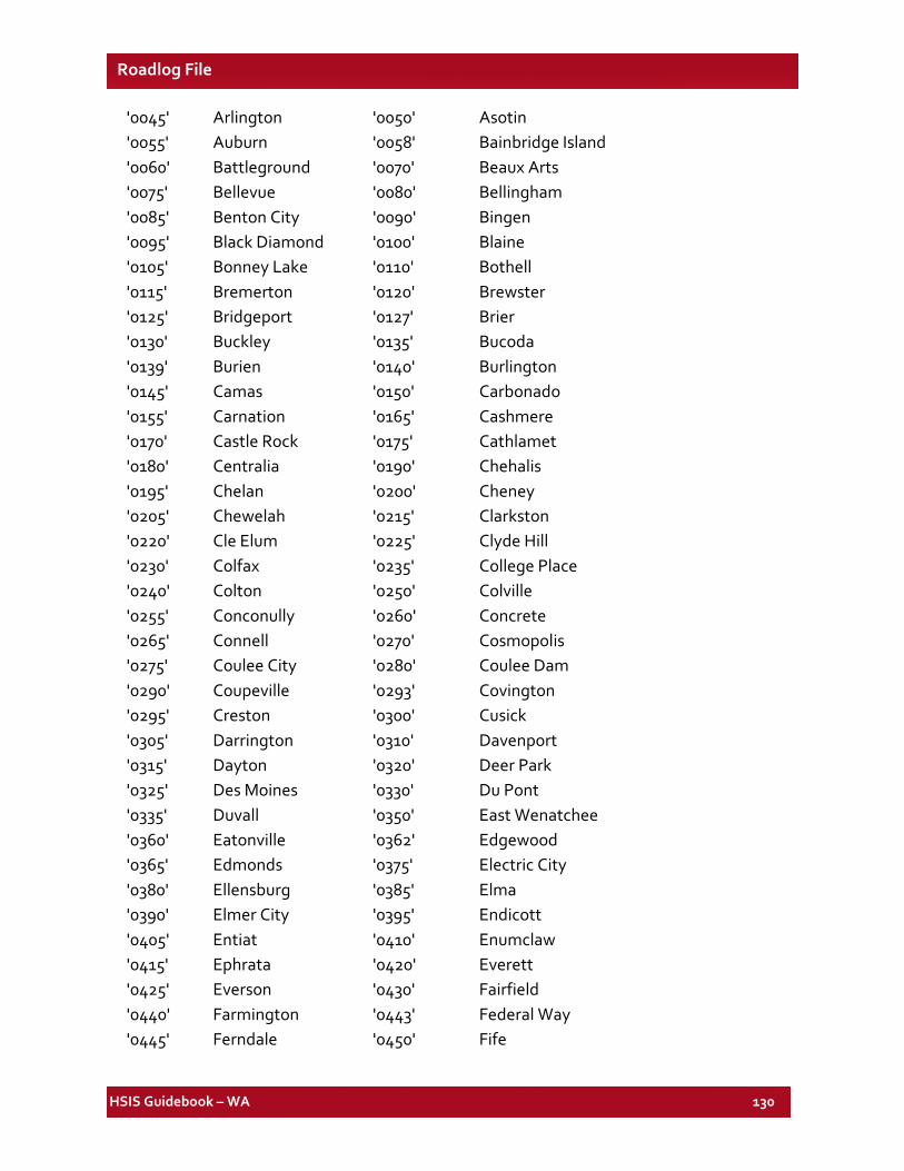
HSIS Guidebook – WA 130
Roadlog File
'0045' Arlington '0050' Asotin '0055' Auburn '0058' Bainbridge Island '0060' Battleground '0070' Beaux Arts '0075' Bellevue '0080' Bellingham '0085' Benton City '0090' Bingen '0095' Black Diamond '0100' Blaine '0105' Bonney Lake '0110' Bothell '0115' Bremerton '0120' Brewster '0125' Bridgeport '0127' Brier '0130' Buckley '0135' Bucoda '0139' Burien '0140' Burlington '0145' Camas '0150' Carbonado '0155' Carnation '0165' Cashmere '0170' Castle Rock '0175' Cathlamet '0180' Centralia '0190' Chehalis '0195' Chelan '0200' Cheney '0205' Chewelah '0215' Clarkston '0220' Cle Elum '0225' Clyde Hill '0230' Colfax '0235' College Place '0240' Colton '0250' Colville '0255' Conconully '0260' Concrete '0265' Connell '0270' Cosmopolis '0275' Coulee City '0280' Coulee Dam '0290' Coupeville '0293' Covington '0295' Creston '0300' Cusick '0305' Darrington '0310' Davenport '0315' Dayton '0320' Deer Park '0325' Des Moines '0330' Du Pont '0335' Duvall '0350' East Wenatchee '0360' Eatonville '0362' Edgewood '0365' Edmonds '0375' Electric City '0380' Ellensburg '0385' Elma '0390' Elmer City '0395' Endicott '0405' Entiat '0410' Enumclaw '0415' Ephrata '0420' Everett '0425' Everson '0430' Fairfield '0440' Farmington '0443' Federal Way '0445' Ferndale '0450' Fife
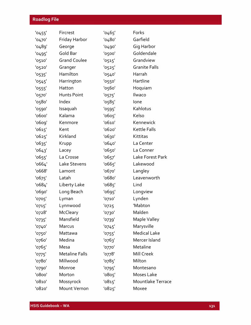
HSIS Guidebook – WA 131
Roadlog File
'0455' Fircrest '0465' Forks '0470' Friday Harbor '0480' Garfield '0489' George '0490' Gig Harbor '0495' Gold Bar '0500' Goldendale '0510' Grand Coulee '0515' Grandview '0520' Granger '0525' Granite Falls '0535' Hamilton '0540' Harrah '0545' Harrington '0550' Hartline '0555' Hatton '0560' Hoquiam '0570' Hunts Point '0575' Ilwaco '0580' Index '0585' Ione '0590' Issaquah '0595' Kahlotus '0600' Kalama '0605' Kelso '0609' Kenmore '0610' Kennewick '0615' Kent '0620' Kettle Falls '0625' Kirkland '0630' Kittitas '0635' Krupp '0640' La Center '0643' Lacey '0650' La Conner '0655' La Crosse '0657' Lake Forest Park '0664' Lake Stevens '0665' Lakewood '0668' Lamont '0670' Langley '0675' Latah '0680' Leavenworth '0684' Liberty Lake '0685' Lind '0690' Long Beach '0695' Longview '0705' Lyman '0710' Lynden '0715' Lynnwood '0725 'Mabton '0728' McCleary '0730' Malden '0735' Mansfield '0739' Maple Valley '0740' Marcus '0745' Marysville '0750' Mattawa '0755' Medical Lake '0760' Medina '0763' Mercer Island '0765' Mesa '0770' Metaline '0775' Metaline Falls '0778' Mill Creek '0780' Millwood '0785' Milton '0790' Monroe '0795' Montesano '0800' Morton '0805' Moses Lake '0810' Mossyrock '0815' Mountlake Terrace '0820' Mount Vernon '0825' Moxee
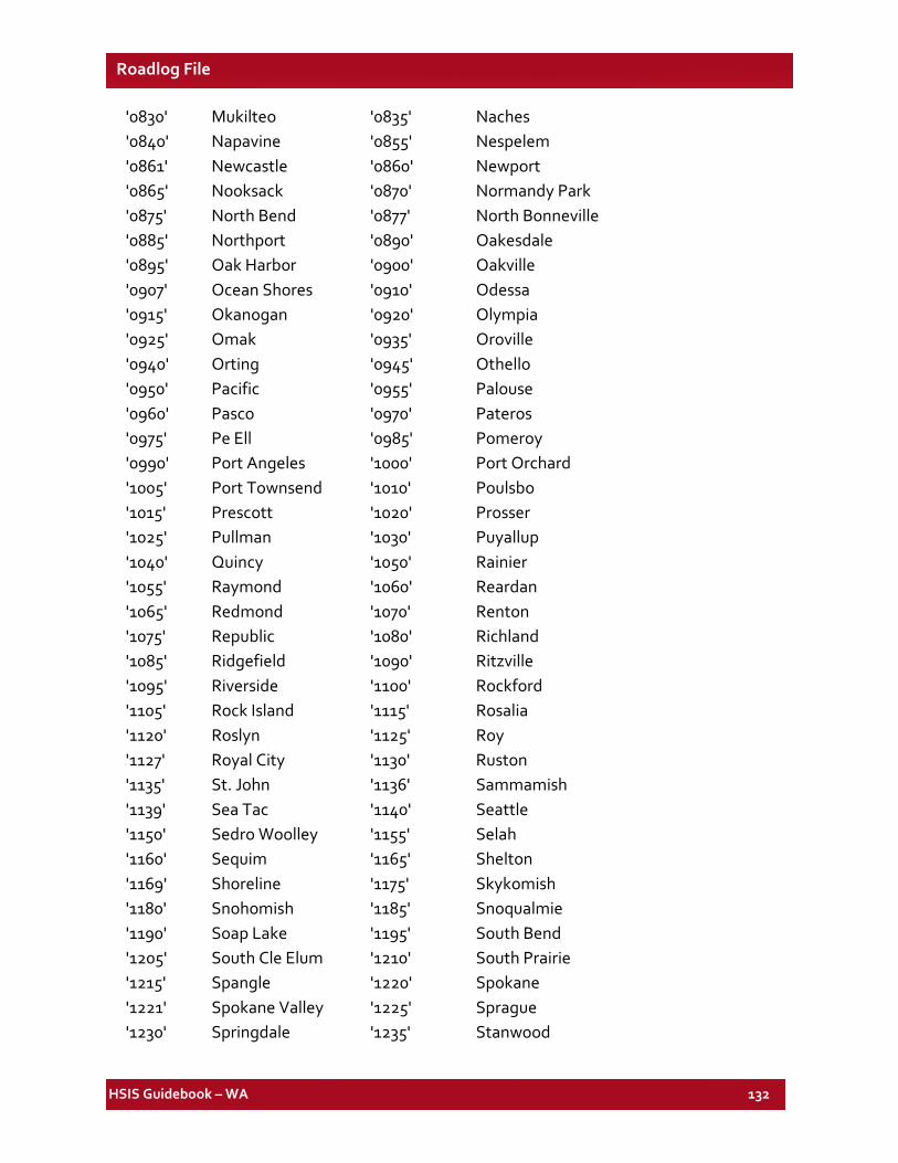
HSIS Guidebook – WA 132
Roadlog File
'0830' Mukilteo '0835' Naches '0840' Napavine '0855' Nespelem '0861' Newcastle '0860' Newport '0865' Nooksack '0870' Normandy Park '0875' North Bend '0877' North Bonneville '0885' Northport '0890' Oakesdale '0895' Oak Harbor '0900' Oakville '0907' Ocean Shores '0910' Odessa '0915' Okanogan '0920' Olympia '0925' Omak '0935' Oroville '0940' Orting '0945' Othello '0950' Pacific '0955' Palouse '0960' Pasco '0970' Pateros '0975' Pe Ell '0985' Pomeroy '0990' Port Angeles '1000' Port Orchard '1005' Port Townsend '1010' Poulsbo '1015' Prescott '1020' Prosser '1025' Pullman '1030' Puyallup '1040' Quincy '1050' Rainier '1055' Raymond '1060' Reardan '1065' Redmond '1070' Renton '1075' Republic '1080' Richland '1085' Ridgefield '1090' Ritzville '1095' Riverside '1100' Rockford '1105' Rock Island '1115' Rosalia '1120' Roslyn '1125' Roy '1127' Royal City '1130' Ruston '1135' St. John '1136' Sammamish '1139' Sea Tac '1140' Seattle '1150' Sedro Woolley '1155' Selah '1160' Sequim '1165' Shelton '1169' Shoreline '1175' Skykomish '1180' Snohomish '1185' Snoqualmie '1190' Soap Lake '1195' South Bend '1205' South Cle Elum '1210' South Prairie '1215' Spangle '1220' Spokane '1221' Spokane Valley '1225' Sprague '1230' Springdale '1235' Stanwood
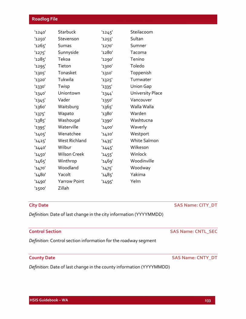
HSIS Guidebook – WA 133
Roadlog File
'1240' Starbuck '1245' Steilacoom '1250' Stevenson '1255' Sultan '1265' Sumas '1270' Sumner '1275' Sunnyside '1280' Tacoma '1285' Tekoa '1290' Tenino '1295' Tieton '1300' Toledo '1305' Tonasket '1310' Toppenish '1320' Tukwila '1325' Tumwater '1330' Twisp '1335' Union Gap '1340' Uniontown '1344' University Place '1345' Vader '1350' Vancouver '1360' Waitsburg '1365' Walla Walla '1375' Wapato '1380' Warden '1385' Washougal '1390' Washtucna '1395' Waterville '1400' Waverly '1405' Wenatchee '1420' Westport '1425' West Richland '1435' White Salmon '1440' Wilbur '1445' Wilkeson '1450' Wilson Creek '1455' Winlock '1465' Winthrop '1469' Woodinville '1470' Woodland '1475' Woodway '1480' Yacolt '1485' Yakima '1490' Yarrow Point '1495' Yelm '1500' Zillah
City Date SAS Name: CITY_DT
Definition: Date of last change in the city information (YYYYMMDD)
Control Section SAS Name: CNTL_SEC
Definition: Control section information for the roadway segment
County Date SAS Name: CNTY_DT
Definition: Date of last change in the county information (YYYYMMDD)
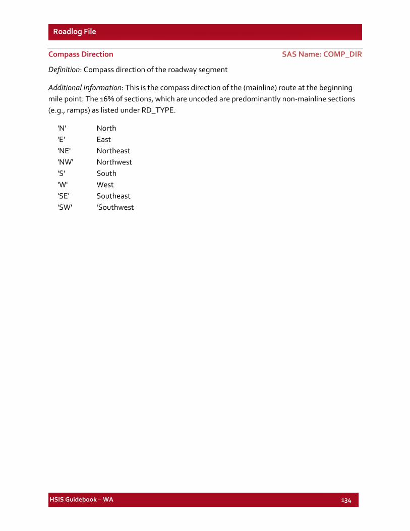
HSIS Guidebook – WA 134
Roadlog File
Compass Direction SAS Name: COMP_DIR
Definition: Compass direction of the roadway segment
Additional Information: This is the compass direction of the (mainline) route at the beginning mile point. The 16% of sections, which are uncoded are predominantly non-mainline sections (e.g., ramps) as listed under RD_TYPE.
'N' North 'E' East 'NE' Northeast 'NW' Northwest 'S' South 'W' West 'SE' Southeast 'SW' 'Southwest
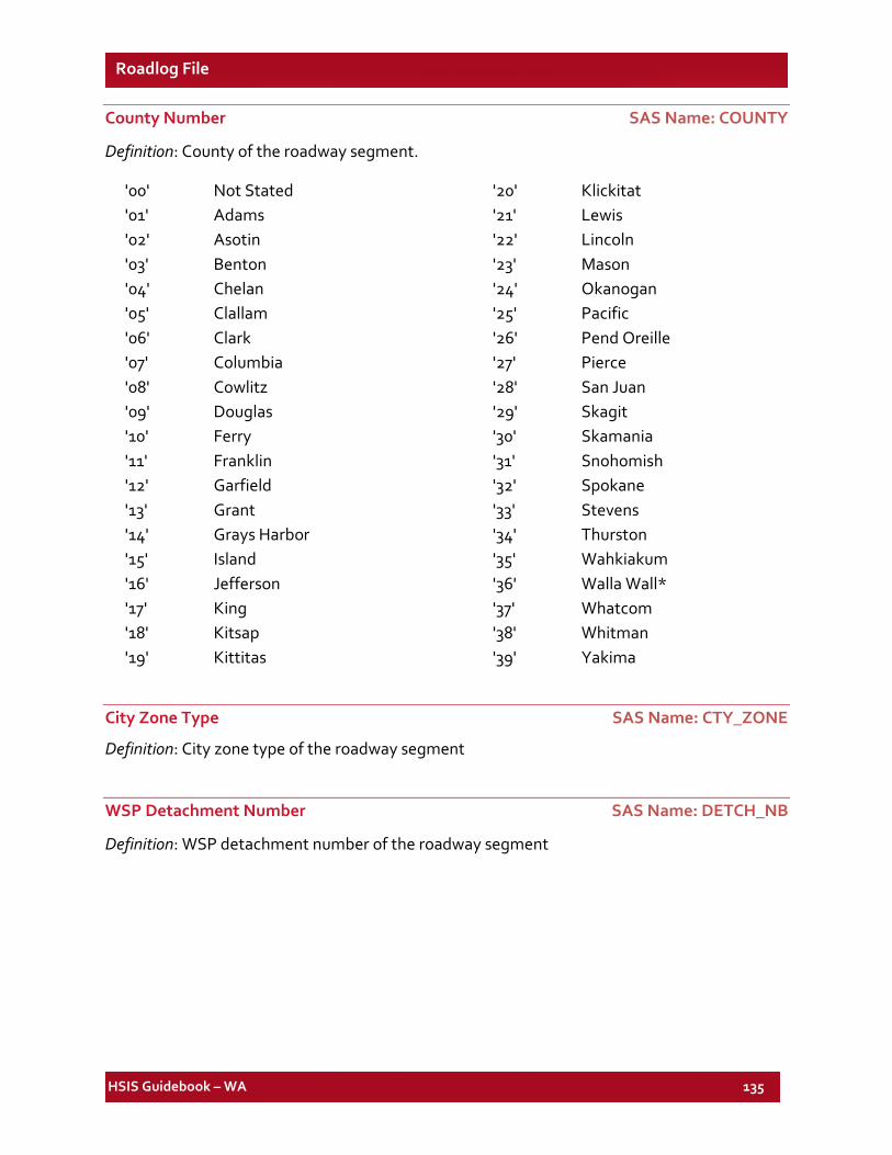
HSIS Guidebook – WA 135
Roadlog File
County Number SAS Name: COUNTY
Definition: County of the roadway segment.
'00' Not Stated '01' Adams '02' Asotin '03' Benton '04' Chelan '05' Clallam '06' Clark '07' Columbia '08' Cowlitz '09' Douglas '10' Ferry '11' Franklin '12' Garfield '13' Grant '14' Grays Harbor '15' Island '16' Jefferson '17' King '18' Kitsap '19' Kittitas
'20' Klickitat '21' Lewis '22' Lincoln '23' Mason '24' Okanogan '25' Pacific '26' Pend Oreille '27' Pierce '28' San Juan '29' Skagit '30' Skamania '31' Snohomish '32' Spokane '33' Stevens '34' Thurston '35' Wahkiakum '36' Walla Wall* '37' Whatcom '38' Whitman '39' Yakima
City Zone Type SAS Name: CTY_ZONE
Definition: City zone type of the roadway segment
WSP Detachment Number SAS Name: DETCH_NB
Definition: WSP detachment number of the roadway segment
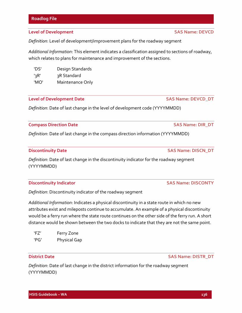
HSIS Guidebook – WA 136
Roadlog File
Level of Development SAS Name: DEVCD
Definition: Level of development/improvement plans for the roadway segment
Additional Information: This element indicates a classification assigned to sections of roadway, which relates to plans for maintenance and improvement of the sections.
'DS' Design Standards '3R' 3R Standard 'MO' Maintenance Only
Level of Development Date SAS Name: DEVCD_DT
Definition: Date of last change in the level of development code (YYYYMMDD)
Compass Direction Date SAS Name: DIR_DT
Definition: Date of last change in the compass direction information (YYYYMMDD)
Discontinuity Date SAS Name: DISCN_DT
Definition: Date of last change in the discontinuity indicator for the roadway segment (YYYYMMDD)
Discontinuity Indicator SAS Name: DISCONTY
Definition: Discontinuity indicator of the roadway segment
Additional Information: Indicates a physical discontinuity in a state route in which no new attributes exist and mileposts continue to accumulate. An example of a physical discontinuity would be a ferry run where the state route continues on the other side of the ferry run. A short distance would be shown between the two docks to indicate that they are not the same point.
‘FZ’ Ferry Zone ‘PG’ Physical Gap
District Date SAS Name: DISTR_DT
Definition: Date of last change in the district information for the roadway segment (YYYYMMDD)
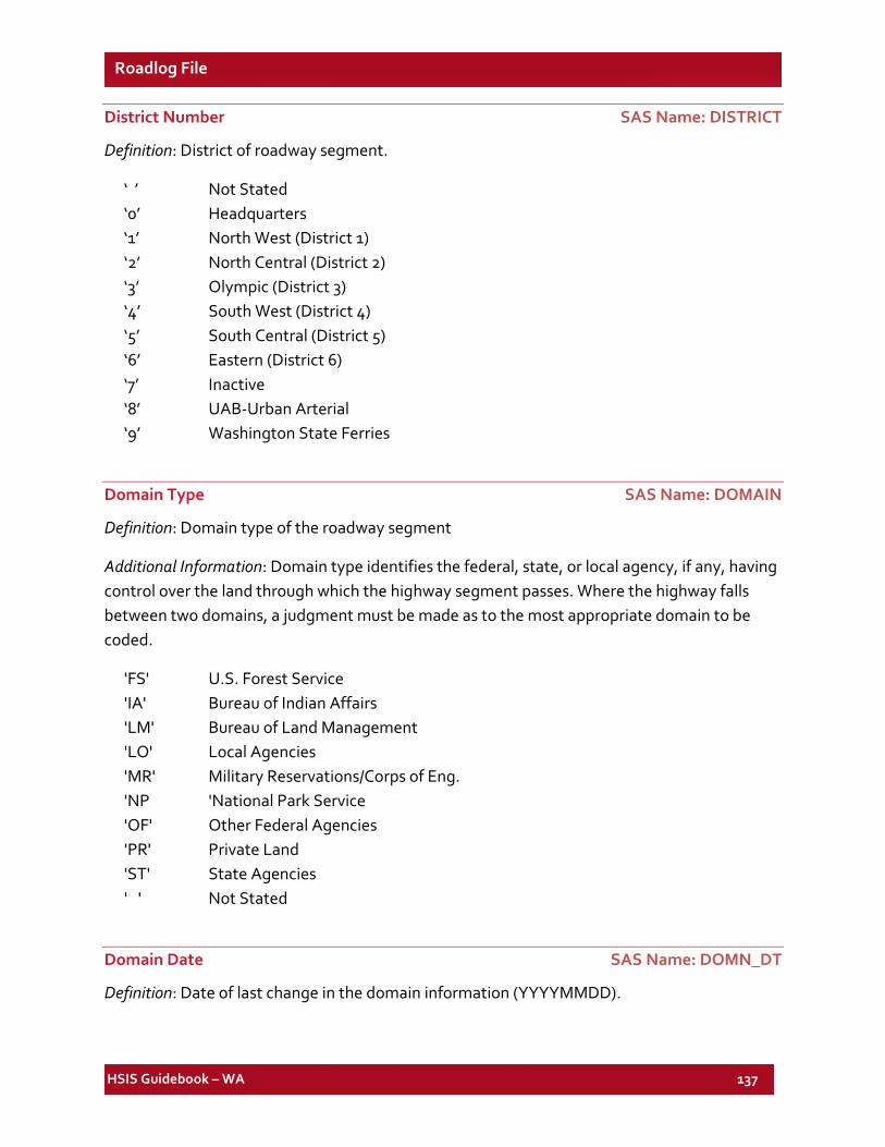
HSIS Guidebook – WA 137
Roadlog File
District Number SAS Name: DISTRICT
Definition: District of roadway segment.
‘ ’ Not Stated ‘0’ Headquarters ‘1’ North West (District 1) ‘2’ North Central (District 2) ‘3’ Olympic (District 3) ‘4’ South West (District 4) ‘5’ South Central (District 5) ‘6’ Eastern (District 6) ‘7’ Inactive ‘8’ UAB-Urban Arterial ‘9’ Washington State Ferries
Domain Type SAS Name: DOMAIN
Definition: Domain type of the roadway segment
Additional Information: Domain type identifies the federal, state, or local agency, if any, having control over the land through which the highway segment passes. Where the highway falls between two domains, a judgment must be made as to the most appropriate domain to be coded.
'FS' U.S. Forest Service 'IA' Bureau of Indian Affairs 'LM' Bureau of Land Management 'LO' Local Agencies 'MR' Military Reservations/Corps of Eng. 'NP 'National Park Service 'OF' Other Federal Agencies 'PR' Private Land 'ST' State Agencies ' ' Not Stated
Domain Date SAS Name: DOMN_DT
Definition: Date of last change in the domain information (YYYYMMDD).
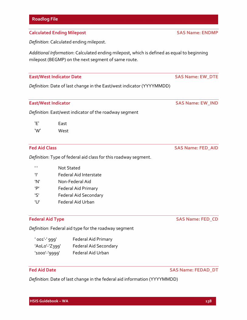
HSIS Guidebook – WA 138
Roadlog File
Calculated Ending Milepost SAS Name: ENDMP
Definition: Calculated ending milepost.
Additional Information: Calculated ending milepost, which is defined as equal to beginning milepost (BEGMP) on the next segment of same route.
East/West Indicator Date SAS Name: EW_DTE
Definition: Date of last change in the East/west indicator (YYYYMMDD)
East/West Indicator SAS Name: EW_IND
Definition: East/west indicator of the roadway segment
'E' East 'W' West
Fed Aid Class SAS Name: FED_AID
Definition: Type of federal aid class for this roadway segment.
' ' Not Stated 'I' Federal Aid Interstate 'N' Non-Federal Aid 'P' Federal Aid Primary 'S' Federal Aid Secondary 'U' Federal Aid Urban
Federal Aid Type SAS Name: FED_CD
Definition: Federal aid type for the roadway segment
' 001'-' 999' Federal Aid Primary 'A0L0'-'Z399' Federal Aid Secondary '1000'-'9999' Federal Aid Urban
Fed Aid Date SAS Name: FEDAD_DT
Definition: Date of last change in the federal aid information (YYYYMMDD)
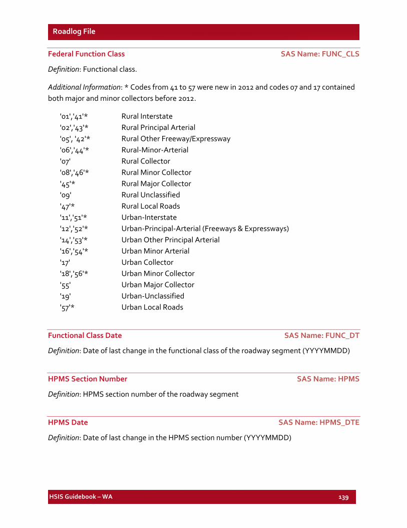
HSIS Guidebook – WA 139
Roadlog File
Federal Function Class SAS Name: FUNC_CLS
Definition: Functional class.
Additional Information: * Codes from 41 to 57 were new in 2012 and codes 07 and 17 contained both major and minor collectors before 2012.
'01','41'* Rural Interstate '02','43'* Rural Principal Arterial '05', '42'* Rural Other Freeway/Expressway '06','44'* Rural-Minor-Arterial '07' Rural Collector '08','46'* Rural Minor Collector '45'* Rural Major Collector '09' Rural Unclassified '47'* Rural Local Roads '11','51'* Urban-Interstate '12','52'* Urban-Principal-Arterial (Freeways & Expressways) '14','53'* Urban Other Principal Arterial '16','54'* Urban Minor Arterial '17' Urban Collector '18','56'* Urban Minor Collector '55' Urban Major Collector '19' Urban-Unclassified '57'* Urban Local Roads
Functional Class Date SAS Name: FUNC_DT
Definition: Date of last change in the functional class of the roadway segment (YYYYMMDD)
HPMS Section Number SAS Name: HPMS
Definition: HPMS section number of the roadway segment
HPMS Date SAS Name: HPMS_DTE
Definition: Date of last change in the HPMS section number (YYYYMMDD)
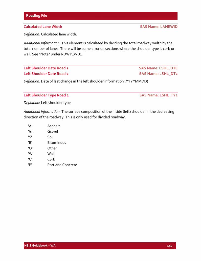
HSIS Guidebook – WA 140
Roadlog File
Calculated Lane Width SAS Name: LANEWID
Definition: Calculated lane width.
Additional Information: This element is calculated by dividing the total roadway width by the total number of lanes. There will be some error on sections where the shoulder type is curb or wall. See "Note" under RDWY_WD1.
Left Shoulder Date Road 1 SAS Name: LSHL_DTE Left Shoulder Date Road 2 SAS Name: LSHL_DT2
Definition: Date of last change in the left shoulder information (YYYYMMDD)
Left Shoulder Type Road 2 SAS Name: LSHL_TY2
Definition: Left shoulder type
Additional Information: The surface composition of the inside (left) shoulder in the decreasing direction of the roadway. This is only used for divided roadway.
'A' Asphalt 'G' Gravel 'S' Soil 'B' Bituminous 'O' Other 'W' Wall 'C' Curb 'P' Portland Concrete
HSIS Guidebook – WA 141
Roadlog File
Left Shoulder Type Road 1 SAS Name: LSHL_TYP
Definition: Left shoulder type
Additional Information: The surface composition of the inside (left) shoulder in the increasing direction of the roadway. This variable refers to both divided and undivided roadways.
'A' Asphalt 'G' Gravel 'S' Soil 'B' Bituminous 'O' Other 'W' Wall 'C' Curb 'P' Portland Concrete
Left Shoulder Width Road 1 SAS Name: LSHLDWID Left Shoulder Width Road 2 SAS Name: LSHL_WD2
Definition: Left shoulder width.
Additional Information: The width of the inside (left) shoulder of road 1 in feet in the increasing direction of the roadway. This element refers to both divided and undivided roadways. The approximately 14% "no shoulder" category includes both curb sections and, unfortunately, some uncoded sections. The width of the inside (left) shoulder of road 2 in feet in the decreasing direction of the roadway. This is only used for divided roadway.
0 No Shoulder 1-3 01 - 03 4-6 04 - 06 7-9 07 - 09 10-13 10 - 13 14-99 > 13
Control Section Last Update SAS Name: LST_UPDT
Definition: Date of last change in the control section information (YYYYMMDD).
Median Crossing Date SAS Name: MDXN_DTE
Definition: Date of last change in the median crossing information (YYYYMMDD).
HSIS Guidebook – WA 142
Roadlog File
Median Type SAS Name: MED_TYPE
Definition: Type of median on the roadway segment.
'A' Asphalt 'G' Gravel 'S' Soil 'B' Bituminous 'O' Other 'W' Wall 'C' Curb 'P' Portland Concrete
Median Barrier Type SAS Name: MEDBARTY
Definition: Type of median barrier on the roadway segment
'BE' Bridge Attenuators 'FE' Fence 'RG' Rock Wall & Gabions 'CA' Cable 'GP' Guide Posts 'SS' Snow Shed 'CU' Curb 'GR' Guard Rail 'UP' Unprotected 'DE' Depressed 'IA' Impact Attenuates 'WA' Wall 'FB' Flex Beam 'JE' Jersey Type Barr
Median Date SAS Name: MEDN_DTE
Definition: Date of last change in the median information (YYYYMMDD).
HSIS Guidebook – WA 143
Roadlog File
Median Width SAS Name: MEDWID
Definition: Median width (in feet).
Additional Information: The distance from inside shoulder edge to inside shoulder edge on a divided highway (median width includes inside shoulders). This is measured in feet.
0 No Median 1-10 01 - 10 11-20 11 - 20 21-30 21 - 30 31-40 31 - 40 41-60 41 - 60 61-90 61 - 90 91-999 91 +
Median Crossing Type SAS Name: MEDXNGTY
Definition: Whether a median crossing is officially recognized by WSDOT.
'O' Official Crossng 'N' N/Offic Crossng
Maintenance Area Number SAS Name: MNT_AREA
Definition: Maintenance area number for the roadway segment
Maintenance Date SAS Name: MNT_DTE
Definition: Date of last change in the maintenance information (YYYYMMDD).
Maintenance Section Date SAS Name: MNTSC_DT
Definition: Date of last change in the maintenance section information (YYYYMMDD).
Maintenance Section Number SAS Name: MNTSEC
Definition: Maintenance sequence number of the roadway segment
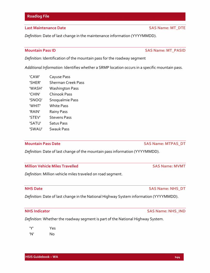
HSIS Guidebook – WA 144
Roadlog File
Last Maintenance Date SAS Name: MT_DTE
Definition: Date of last change in the maintenance information (YYYYMMDD).
Mountain Pass ID SAS Name: MT_PASID
Definition: Identification of the mountain pass for the roadway segment
Additional Information: Identifies whether a SRMP location occurs in a specific mountain pass.
'CAW' Cayuse Pass 'SHER' Sherman Creek Pass 'WASH' Washington Pass 'CHIN' Chinook Pass 'SNOQ' Snoqualmie Pass 'WHIT' White Pass 'RAIN' Rainy Pass 'STEV' Stevens Pass 'SATU' Satus Pass 'SWAU' Swauk Pass
Mountain Pass Date SAS Name: MTPAS_DT
Definition: Date of last change of the mountain pass information (YYYYMMDD).
Million Vehicle Miles Travelled SAS Name: MVMT
Definition: Million vehicle miles traveled on road segment.
NHS Date SAS Name: NHS_DT
Definition: Date of last change in the National Highway System information (YYYYMMDD).
NHS Indicator SAS Name: NHS_IND
Definition: Whether the roadway segment is part of the National Highway System.
'Y' Yes 'N' No
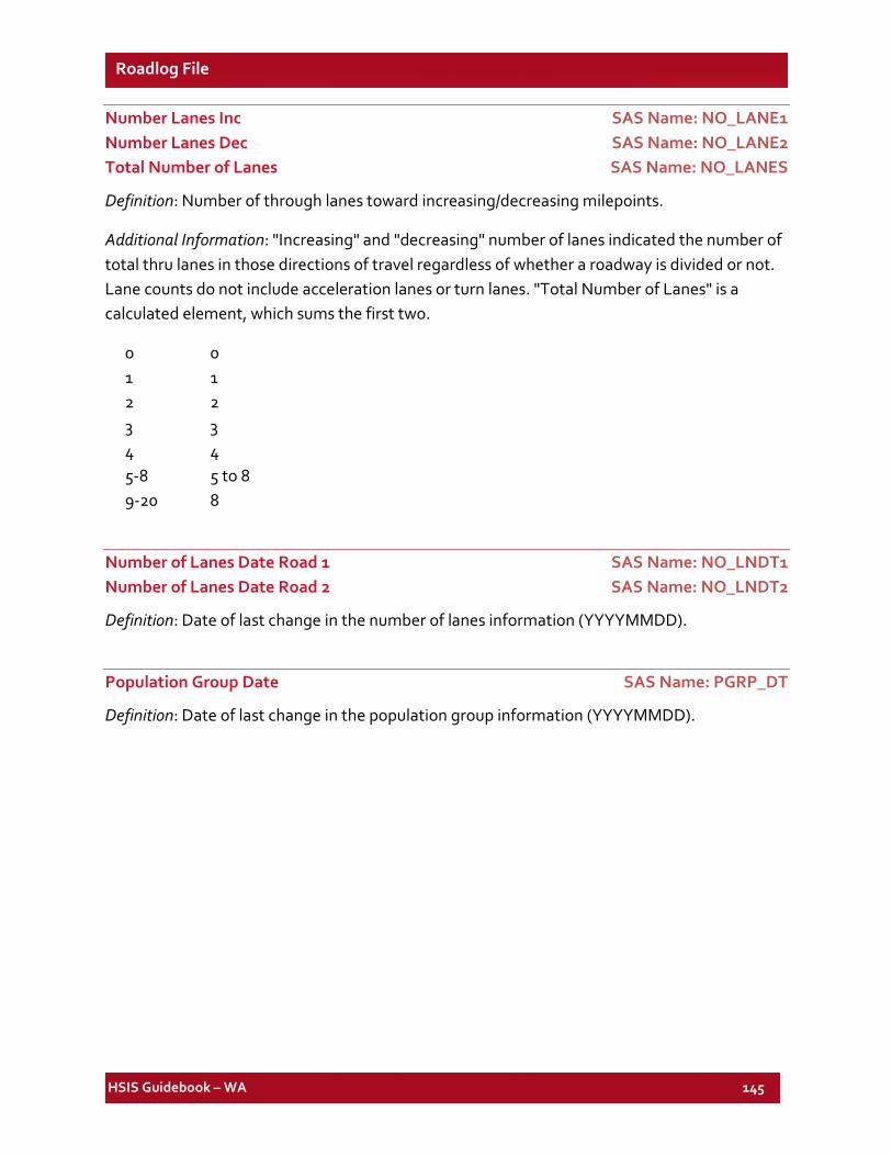
HSIS Guidebook – WA 145
Roadlog File
Number Lanes Inc SAS Name: NO_LANE1 Number Lanes Dec SAS Name: NO_LANE2 Total Number of Lanes SAS Name: NO_LANES
Definition: Number of through lanes toward increasing/decreasing milepoints.
Additional Information: "Increasing" and "decreasing" number of lanes indicated the number of total thru lanes in those directions of travel regardless of whether a roadway is divided or not. Lane counts do not include acceleration lanes or turn lanes. "Total Number of Lanes" is a calculated element, which sums the first two.
0 0 1 1 2 2 3 3 4 4 5-8 5 to 8 9-20 8
Number of Lanes Date Road 1 SAS Name: NO_LNDT1 Number of Lanes Date Road 2 SAS Name: NO_LNDT2
Definition: Date of last change in the number of lanes information (YYYYMMDD).
Population Group Date SAS Name: PGRP_DT
Definition: Date of last change in the population group information (YYYYMMDD).
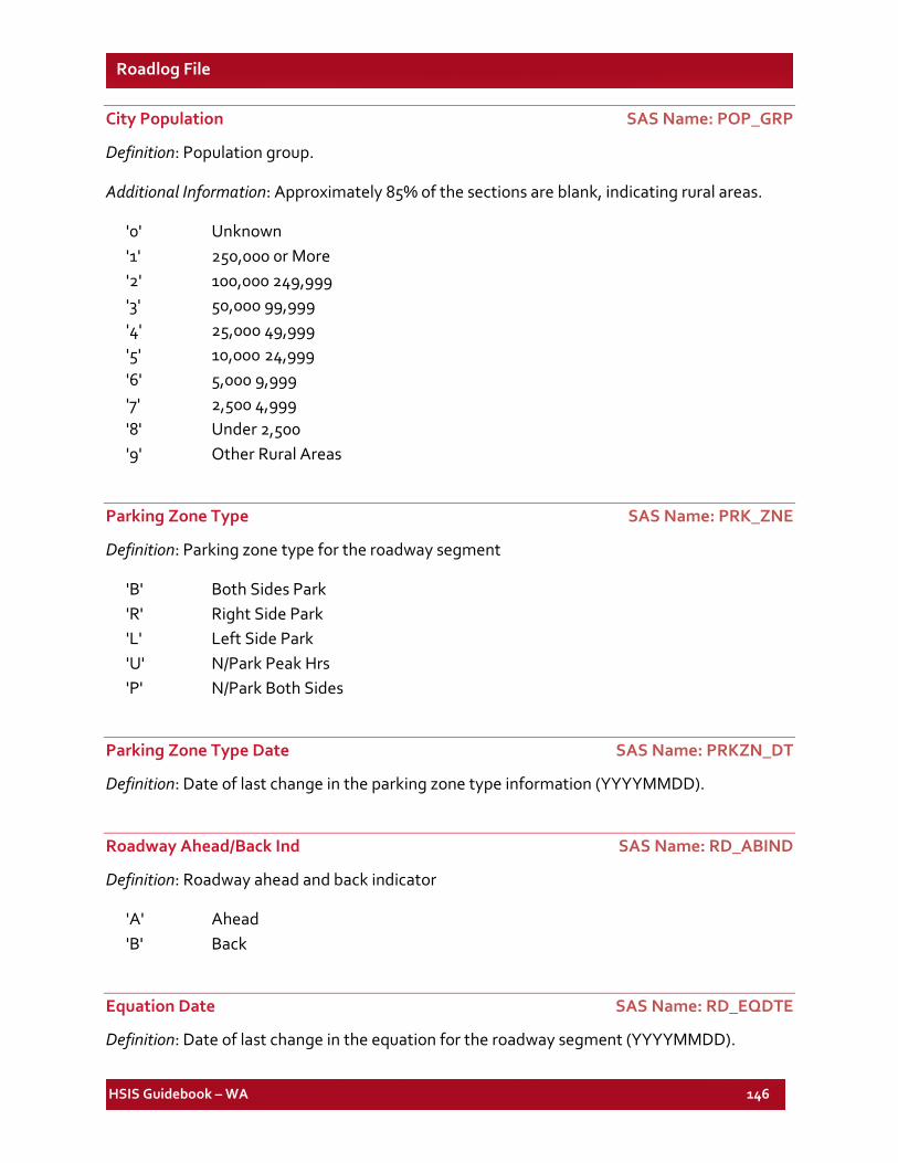
HSIS Guidebook – WA 146
Roadlog File
City Population SAS Name: POP_GRP
Definition: Population group.
Additional Information: Approximately 85% of the sections are blank, indicating rural areas.
'0' Unknown '1' 250,000 0r More '2' 100,000 249,999 '3' 50,000 99,999 '4' 25,000 49,999 '5' 10,000 24,999 '6' 5,000 9,999 '7' 2,500 4,999 '8' Under 2,500 '9' Other Rural Areas
Parking Zone Type SAS Name: PRK_ZNE
Definition: Parking zone type for the roadway segment
'B' Both Sides Park 'R' Right Side Park 'L' Left Side Park 'U' N/Park Peak Hrs 'P' N/Park Both Sides
Parking Zone Type Date SAS Name: PRKZN_DT
Definition: Date of last change in the parking zone type information (YYYYMMDD).
Roadway Ahead/Back Ind SAS Name: RD_ABIND
Definition: Roadway ahead and back indicator
'A' Ahead 'B' Back
Equation Date SAS Name: RD_EQDTE
Definition: Date of last change in the equation for the roadway segment (YYYYMMDD).
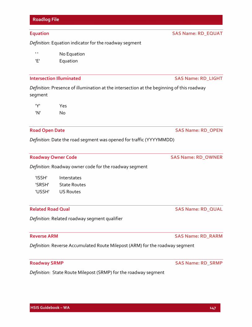
HSIS Guidebook – WA 147
Roadlog File
Equation SAS Name: RD_EQUAT
Definition: Equation indicator for the roadway segment
' ' No Equation 'E' Equation
Intersection Illuminated SAS Name: RD_LIGHT
Definition: Presence of illumination at the intersection at the beginning of this roadway segment
'Y' Yes 'N' No
Road Open Date SAS Name: RD_OPEN
Definition: Date the road segment was opened for traffic (YYYYMMDD)
Roadway Owner Code SAS Name: RD_OWNER
Definition: Roadway owner code for the roadway segment
'ISSH' Interstates 'SRSH' State Routes 'USSH' US Routes
Related Road Qual SAS Name: RD_QUAL
Definition: Related roadway segment qualifier
Reverse ARM SAS Name: RD_RARM
Definition: Reverse Accumulated Route Milepost (ARM) for the roadway segment
Roadway SRMP SAS Name: RD_SRMP
Definition: State Route Milepost (SRMP) for the roadway segment
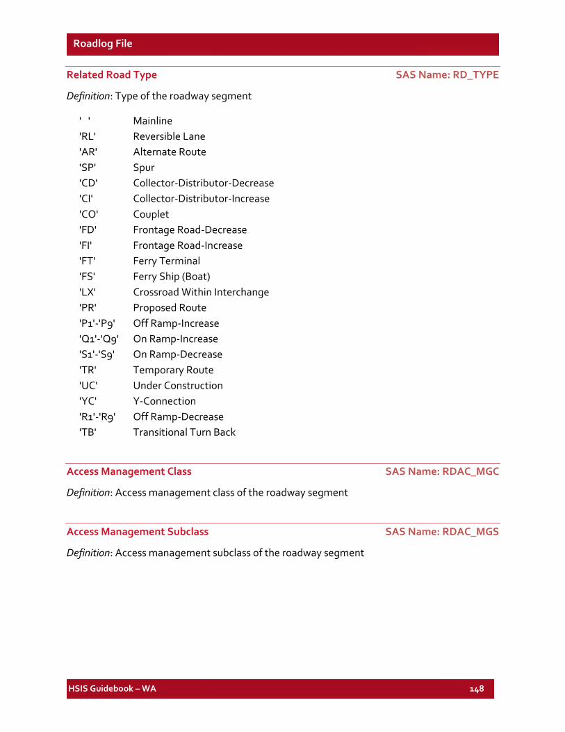
HSIS Guidebook – WA 148
Roadlog File
Related Road Type SAS Name: RD_TYPE
Definition: Type of the roadway segment
' ' Mainline 'RL' Reversible Lane 'AR' Alternate Route 'SP' Spur 'CD' Collector-Distributor-Decrease 'CI' Collector-Distributor-Increase 'CO' Couplet 'FD' Frontage Road-Decrease 'FI' Frontage Road-Increase 'FT' Ferry Terminal 'FS' Ferry Ship (Boat) 'LX' Crossroad Within Interchange 'PR' Proposed Route 'P1'-'P9' Off Ramp-Increase 'Q1'-'Q9' On Ramp-Increase 'S1'-'S9' On Ramp-Decrease 'TR' Temporary Route 'UC' Under Construction 'YC' Y-Connection 'R1'-'R9' Off Ramp-Decrease 'TB' Transitional Turn Back
Access Management Class SAS Name: RDAC_MGC
Definition: Access management class of the roadway segment
Access Management Subclass SAS Name: RDAC_MGS
Definition: Access management subclass of the roadway segment
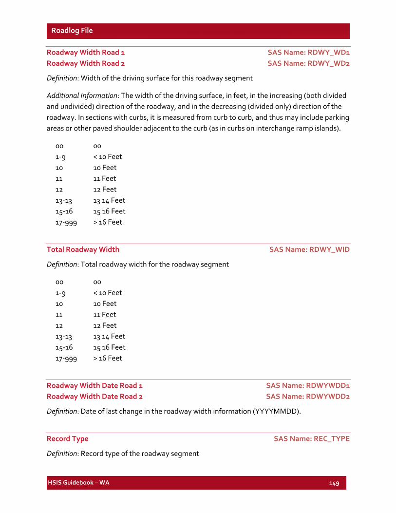
HSIS Guidebook – WA 149
Roadlog File
Roadway Width Road 1 SAS Name: RDWY_WD1 Roadway Width Road 2 SAS Name: RDWY_WD2
Definition: Width of the driving surface for this roadway segment
Additional Information: The width of the driving surface, in feet, in the increasing (both divided and undivided) direction of the roadway, and in the decreasing (divided only) direction of the roadway. In sections with curbs, it is measured from curb to curb, and thus may include parking areas or other paved shoulder adjacent to the curb (as in curbs on interchange ramp islands).
00 00 1-9 < 10 Feet 10 10 Feet 11 11 Feet 12 12 Feet 13-13 13 14 Feet 15-16 15 16 Feet 17-999 > 16 Feet
Total Roadway Width SAS Name: RDWY_WID
Definition: Total roadway width for the roadway segment
00 00 1-9 < 10 Feet 10 10 Feet 11 11 Feet 12 12 Feet 13-13 13 14 Feet 15-16 15 16 Feet 17-999 > 16 Feet
Roadway Width Date Road 1 SAS Name: RDWYWDD1 Roadway Width Date Road 2 SAS Name: RDWYWDD2
Definition: Date of last change in the roadway width information (YYYYMMDD).
Record Type SAS Name: REC_TYPE
Definition: Record type of the roadway segment
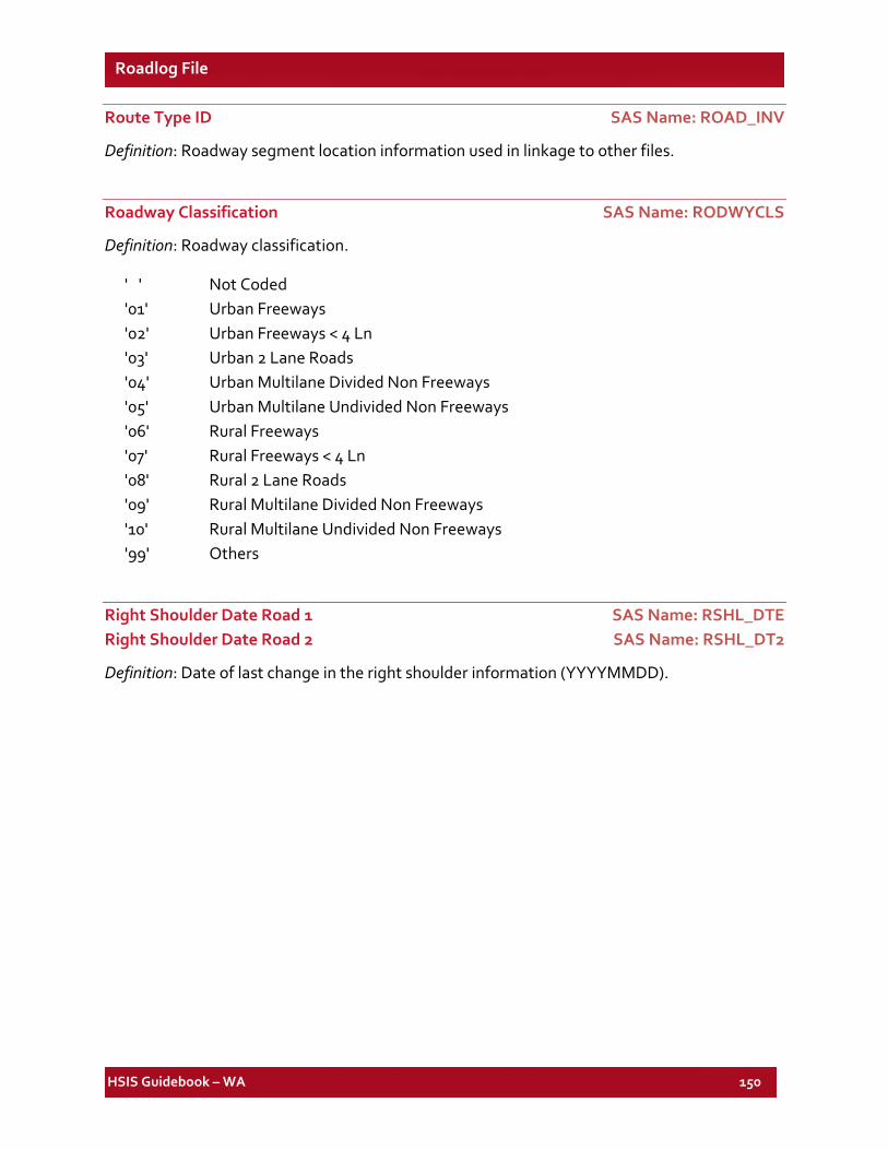
HSIS Guidebook – WA 150
Roadlog File
Route Type ID SAS Name: ROAD_INV
Definition: Roadway segment location information used in linkage to other files.
Roadway Classification SAS Name: RODWYCLS
Definition: Roadway classification.
' ' Not Coded '01' Urban Freeways '02' Urban Freeways < 4 Ln '03' Urban 2 Lane Roads '04' Urban Multilane Divided Non Freeways '05' Urban Multilane Undivided Non Freeways '06' Rural Freeways '07' Rural Freeways < 4 Ln '08' Rural 2 Lane Roads '09' Rural Multilane Divided Non Freeways '10' Rural Multilane Undivided Non Freeways '99' Others
Right Shoulder Date Road 1 SAS Name: RSHL_DTE Right Shoulder Date Road 2 SAS Name: RSHL_DT2
Definition: Date of last change in the right shoulder information (YYYYMMDD).
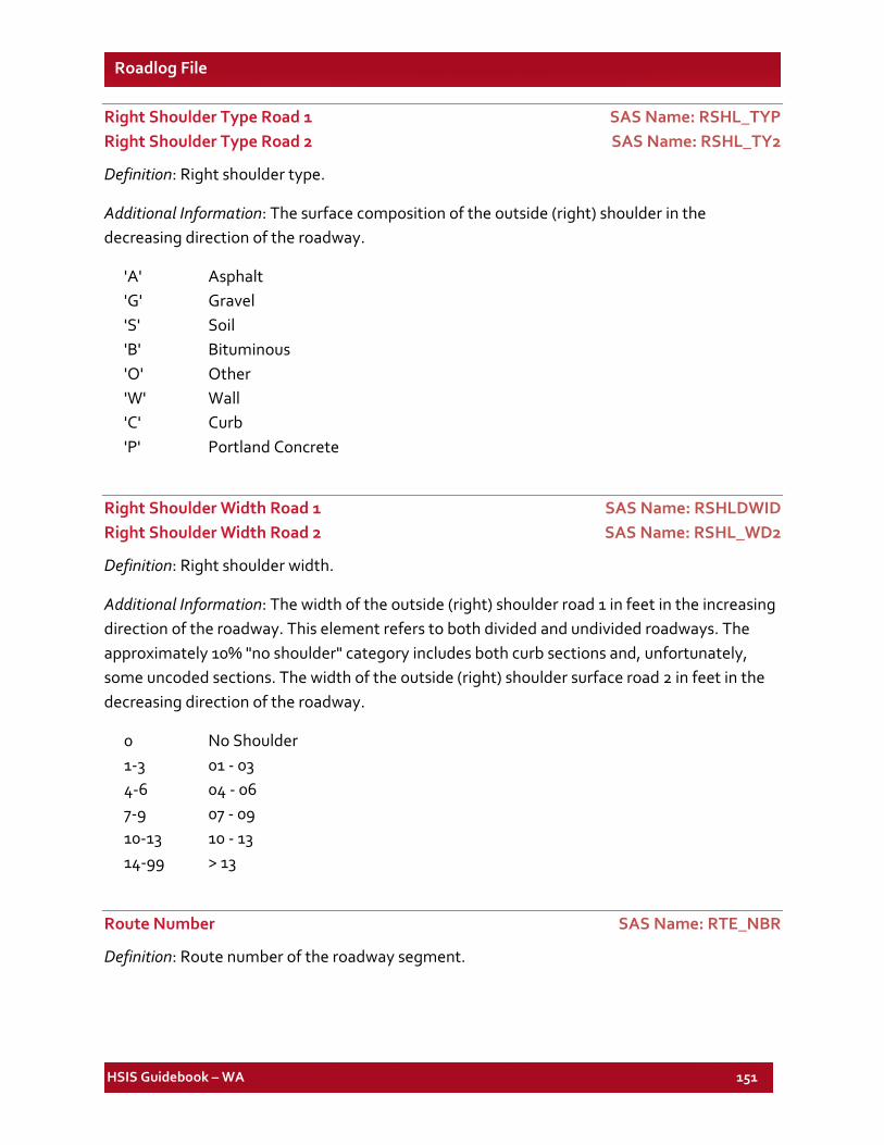
HSIS Guidebook – WA 151
Roadlog File
Right Shoulder Type Road 1 SAS Name: RSHL_TYP Right Shoulder Type Road 2 SAS Name: RSHL_TY2
Definition: Right shoulder type.
Additional Information: The surface composition of the outside (right) shoulder in the decreasing direction of the roadway.
'A' Asphalt 'G' Gravel 'S' Soil 'B' Bituminous 'O' Other 'W' Wall 'C' Curb 'P' Portland Concrete
Right Shoulder Width Road 1 SAS Name: RSHLDWID Right Shoulder Width Road 2 SAS Name: RSHL_WD2
Definition: Right shoulder width.
Additional Information: The width of the outside (right) shoulder road 1 in feet in the increasing direction of the roadway. This element refers to both divided and undivided roadways. The approximately 10% "no shoulder" category includes both curb sections and, unfortunately, some uncoded sections. The width of the outside (right) shoulder surface road 2 in feet in the decreasing direction of the roadway.
0 No Shoulder 1-3 01 - 03 4-6 04 - 06 7-9 07 - 09 10-13 10 - 13 14-99 > 13
Route Number SAS Name: RTE_NBR
Definition: Route number of the roadway segment.
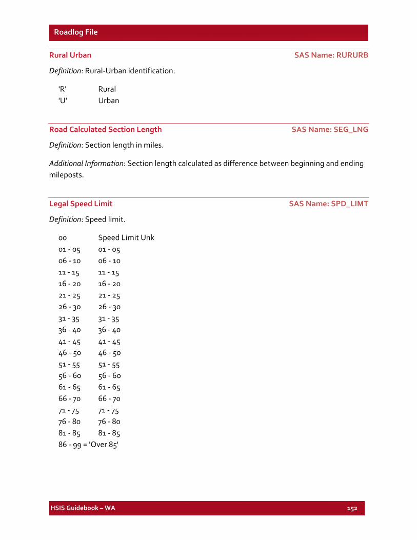
HSIS Guidebook – WA 152
Roadlog File
Rural Urban SAS Name: RURURB
Definition: Rural-Urban identification.
'R' Rural 'U' Urban
Road Calculated Section Length SAS Name: SEG_LNG
Definition: Section length in miles.
Additional Information: Section length calculated as difference between beginning and ending mileposts.
Legal Speed Limit SAS Name: SPD_LIMT
Definition: Speed limit.
00 Speed Limit Unk 01 - 05 01 - 05 06 - 10 06 - 10 11 - 15 11 - 15 16 - 20 16 - 20 21 - 25 21 - 25 26 - 30 26 - 30 31 - 35 31 - 35 36 - 40 36 - 40 41 - 45 41 - 45 46 - 50 46 - 50 51 - 55 51 - 55 56 - 60 56 - 60 61 - 65 61 - 65 66 - 70 66 - 70 71 - 75 71 - 75 76 - 80 76 - 80 81 - 85 81 - 85 86 - 99 = 'Over 85'
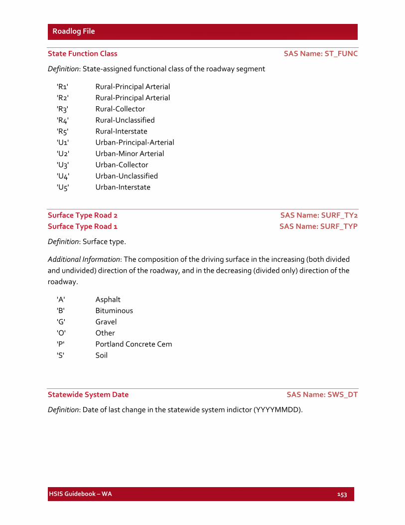
HSIS Guidebook – WA 153
Roadlog File
State Function Class SAS Name: ST_FUNC
Definition: State-assigned functional class of the roadway segment
'R1' Rural-Principal Arterial 'R2' Rural-Principal Arterial 'R3' Rural-Collector 'R4' Rural-Unclassified 'R5' Rural-Interstate 'U1' Urban-Principal-Arterial 'U2' Urban-Minor Arterial 'U3' Urban-Collector 'U4' Urban-Unclassified 'U5' Urban-Interstate
Surface Type Road 2 SAS Name: SURF_TY2 Surface Type Road 1 SAS Name: SURF_TYP
Definition: Surface type.
Additional Information: The composition of the driving surface in the increasing (both divided and undivided) direction of the roadway, and in the decreasing (divided only) direction of the roadway.
'A' Asphalt 'B' Bituminous 'G' Gravel 'O' Other 'P' Portland Concrete Cem 'S' Soil
Statewide System Date SAS Name: SWS_DT
Definition: Date of last change in the statewide system indictor (YYYYMMDD).
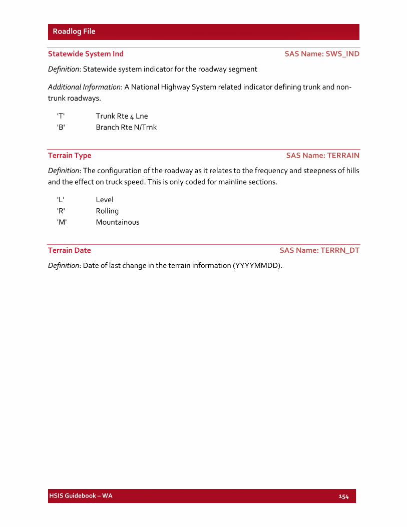
HSIS Guidebook – WA 154
Roadlog File
Statewide System Ind SAS Name: SWS_IND
Definition: Statewide system indicator for the roadway segment
Additional Information: A National Highway System related indicator defining trunk and non-trunk roadways.
'T' Trunk Rte 4 Lne 'B' Branch Rte N/Trnk
Terrain Type SAS Name: TERRAIN
Definition: The configuration of the roadway as it relates to the frequency and steepness of hills and the effect on truck speed. This is only coded for mainline sections.
'L' Level 'R' Rolling 'M' Mountainous
Terrain Date SAS Name: TERRN_DT
Definition: Date of last change in the terrain information (YYYYMMDD).
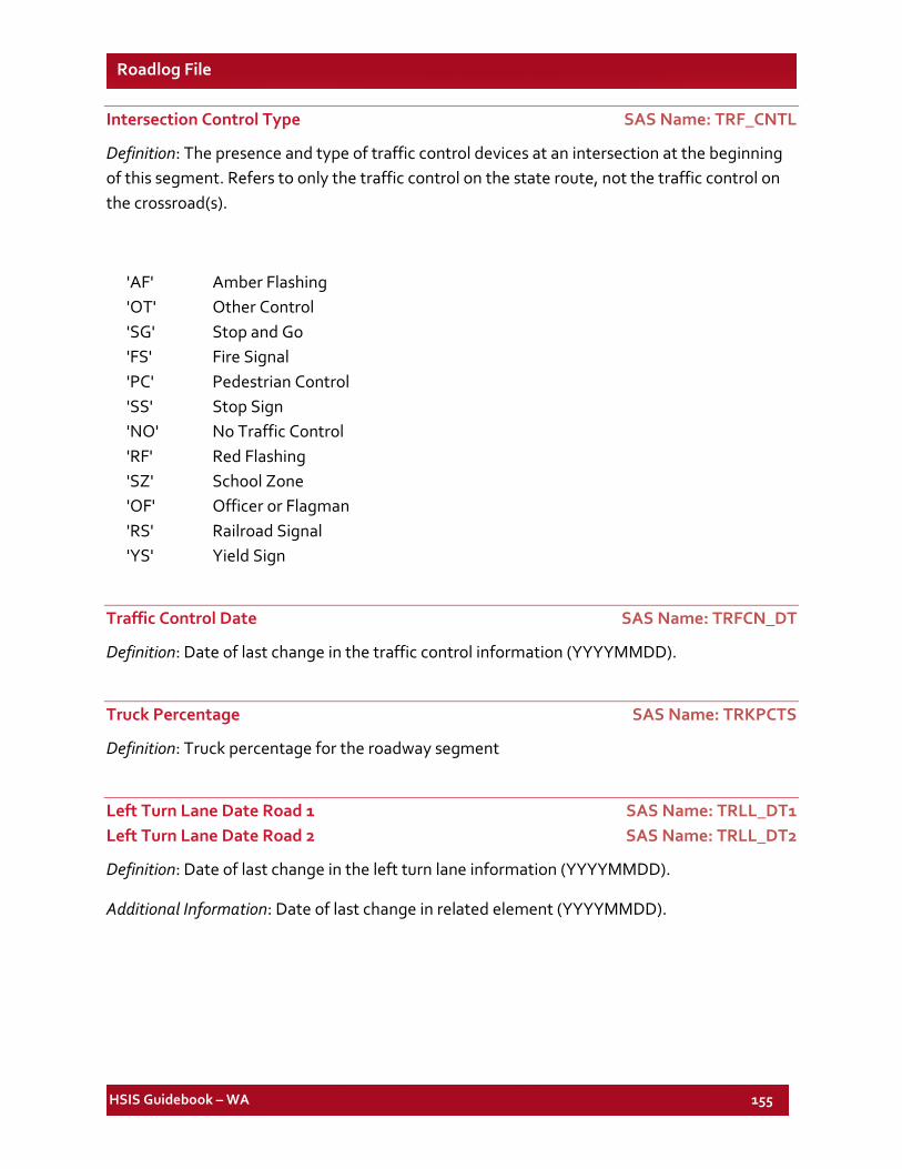
HSIS Guidebook – WA 155
Roadlog File
Intersection Control Type SAS Name: TRF_CNTL
Definition: The presence and type of traffic control devices at an intersection at the beginning of this segment. Refers to only the traffic control on the state route, not the traffic control on the crossroad(s).
'AF' Amber Flashing 'OT' Other Control 'SG' Stop and Go 'FS' Fire Signal 'PC' Pedestrian Control 'SS' Stop Sign 'NO' No Traffic Control 'RF' Red Flashing 'SZ' School Zone 'OF' Officer or Flagman 'RS' Railroad Signal 'YS' Yield Sign
Traffic Control Date SAS Name: TRFCN_DT
Definition: Date of last change in the traffic control information (YYYYMMDD).
Truck Percentage SAS Name: TRKPCTS
Definition: Truck percentage for the roadway segment
Left Turn Lane Date Road 1 SAS Name: TRLL_DT1 Left Turn Lane Date Road 2 SAS Name: TRLL_DT2
Definition: Date of last change in the left turn lane information (YYYYMMDD).
Additional Information: Date of last change in related element (YYYYMMDD).
HSIS Guidebook – WA 156
Roadlog File
Left Turn Lane Length Road 1 SAS Name: TRLL_LG1 Left Turn Lane Length Road 2 SAS Name: TRLL_LG2
Definition: Length of left turn lane at the intersection at the beginning of the segment.
Additional Information: Acceleration lanes and Turn lanes are associated with at- grade intersections (at the beginning of the section) rather than interchanges. Interchange acceleration, deceleration, and merging areas are included as part of ramp lengths.
Left Turn Lane Width Road 1 SAS Name: TRLL_WD1 Left Turn Lane Width Road 2 SAS Name: TRLL_WD2
Definition: Width of the left turn lane at the intersection at the beginning of the segment
Additional Information: Acceleration lanes and Turn lanes are associated with at- grade intersections (at the beginning of the section) rather than interchanges. Interchange acceleration, deceleration, and merging areas are included as part of ramp lengths.
Right Turn Lane Date Road 1 SAS Name: TRLR_DT1 Right Turn Lane Date Road 2 SAS Name: TRLR_DT2
Definition: Date of last change to the right turn lane information (YYYYMMDD).
Additional Information: Right Turn Lane Date Road 2 data is not available for 1999 to 2001.
Right Turn Lane Length Road 1 SAS Name: TRLR_LG1 Right Turn Lane Length Road 2 SAS Name: TRLR_LG2
Definition: Length of the right turn lane at the intersection at the beginning of the segment
Additional Information: Acceleration lanes and Turn lanes are associated with at- grade intersections (at the beginning of the section) rather than interchanges. Interchange acceleration, deceleration, and merging areas are included as part of ramp lengths.
HSIS Guidebook – WA 157
Roadlog File
Right Turn Lane Width Road 1 SAS Name: TRLR_WD1 Right Turn Lane Width Road 2 SAS Name: TRLR_WD2
Definition: Width of the right turn lane at the intersection at the beginning of the segment
Additional Information: Acceleration lanes and Turn lanes are associated with at- grade intersections (at the beginning of the section) rather than interchanges. Interchange acceleration, deceleration, and merging areas are included as part of ramp lengths.
Urban Number Date SAS Name: UBREG_DT
Definition: Date of last change in the urban number information (YYYYMMDD).
Urban Region Date SAS Name: URB_DT
Definition: Date of last change in the urban region information (YYYYMMDD)
Additional Information: Date of last change in related element (YYYYMMDD).
Urban Area Number SAS Name: URB_NBR
Definition: Urban area number of the roadway segment
'01' Puget Sound '02' Northwest '03' Northeast '04' Southeast '05' Southwest
Urban Region Number SAS Name: URB_REG
Definition: Urban region number of the roadway segment
WSP District Number SAS Name: WSP_DIST
Definition: WSP district number of the roadway segment
WSP Date SAS Name: WSP_DT
Definition: Date of last change in the WSP district information (YYYYMMDD).
HSIS Guidebook – WA 158
Roadlog File
Zone Date SAS Name: ZONE_DT
Definition: Date of last change in the zone information (YYYYMMDD)
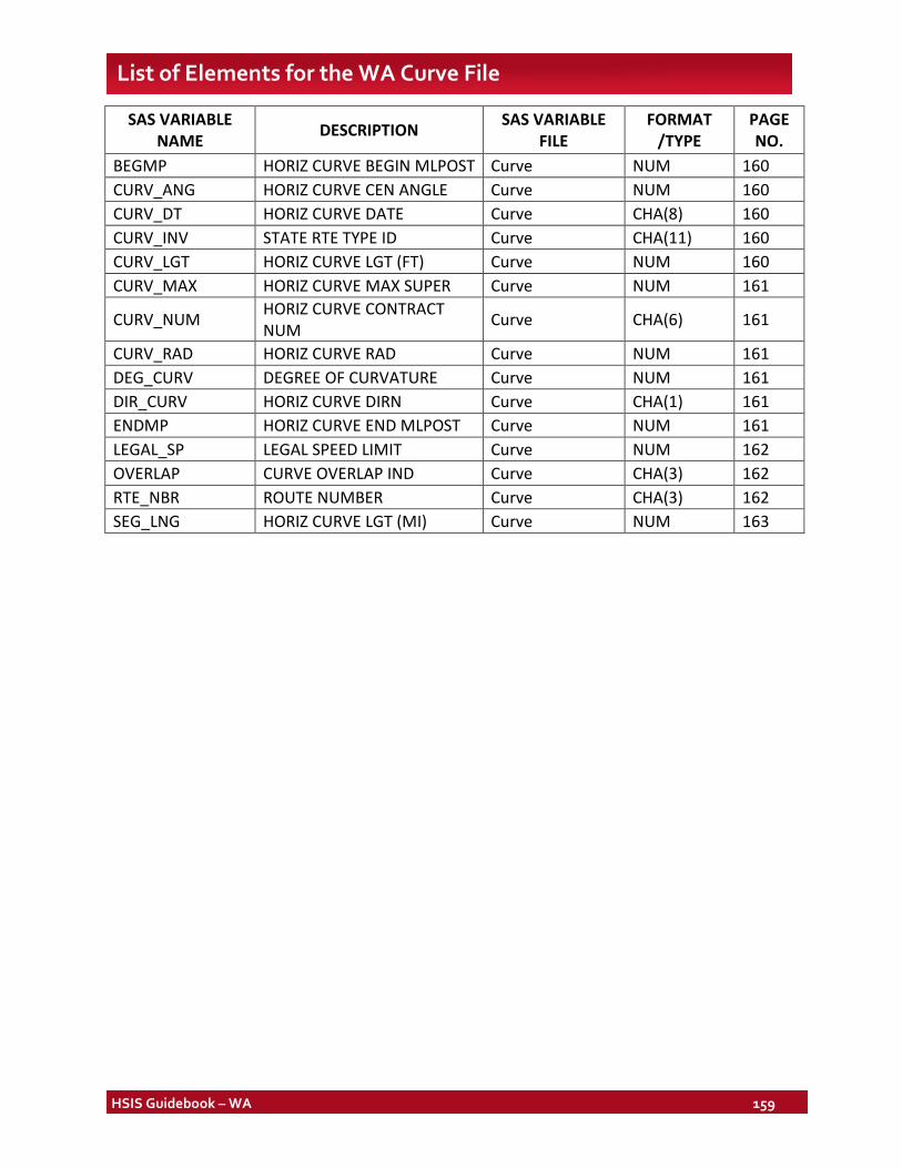
HSIS Guidebook – WA 159
List of Elements for the WA Curve File
SAS VARIABLE NAME DESCRIPTION SAS VARIABLE
FILE FORMAT
/TYPE PAGE NO.
BEGMP HORIZ CURVE BEGIN MLPOST Curve NUM 160 CURV_ANG HORIZ CURVE CEN ANGLE Curve NUM 160 CURV_DT HORIZ CURVE DATE Curve CHA(8) 160 CURV_INV STATE RTE TYPE ID Curve CHA(11) 160 CURV_LGT HORIZ CURVE LGT (FT) Curve NUM 160 CURV_MAX HORIZ CURVE MAX SUPER Curve NUM 161
CURV_NUM HORIZ CURVE CONTRACT NUM Curve CHA(6) 161
CURV_RAD HORIZ CURVE RAD Curve NUM 161 DEG_CURV DEGREE OF CURVATURE Curve NUM 161 DIR_CURV HORIZ CURVE DIRN Curve CHA(1) 161 ENDMP HORIZ CURVE END MLPOST Curve NUM 161 LEGAL_SP LEGAL SPEED LIMIT Curve NUM 162 OVERLAP CURVE OVERLAP IND Curve CHA(3) 162 RTE_NBR ROUTE NUMBER Curve CHA(3) 162 SEG_LNG HORIZ CURVE LGT (MI) Curve NUM 163
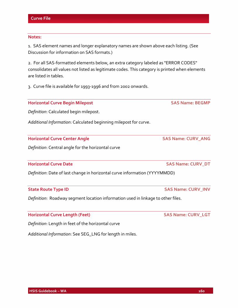
HSIS Guidebook – WA 160
Curve File
Notes:
1. SAS element names and longer explanatory names are shown above each listing. (See Discussion for information on SAS formats.)
2. For all SAS-formatted elements below, an extra category labeled as "ERROR CODES" consolidates all values not listed as legitimate codes. This category is printed when elements are listed in tables.
3. Curve file is available for 1993-1996 and from 2002 onwards.
Horizontal Curve Begin Milepost SAS Name: BEGMP
Definition: Calculated begin milepost.
Additional Information: Calculated beginning milepost for curve.
Horizontal Curve Center Angle SAS Name: CURV_ANG
Definition: Central angle for the horizontal curve
Horizontal Curve Date SAS Name: CURV_DT
Definition: Date of last change in horizontal curve information (YYYYMMDD)
State Route Type ID SAS Name: CURV_INV
Definition: Roadway segment location information used in linkage to other files.
Horizontal Curve Length (Feet) SAS Name: CURV_LGT
Definition: Length in feet of the horizontal curve
Additional Information: See SEG_LNG for length in miles.
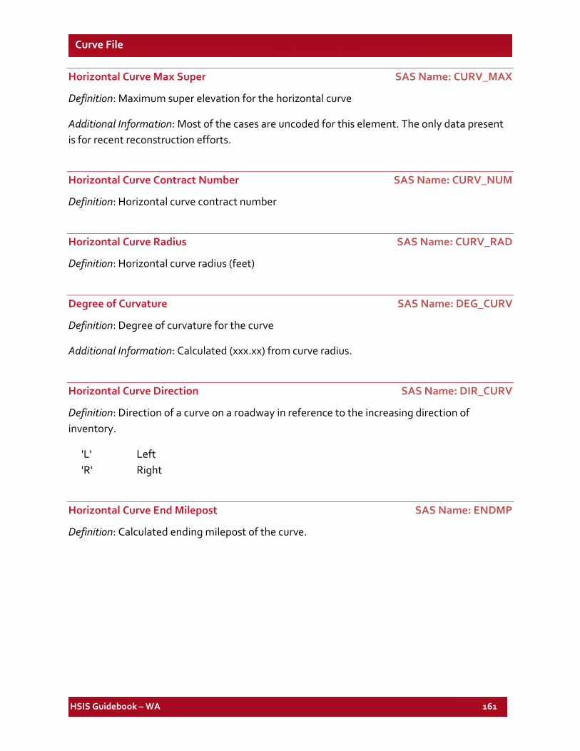
HSIS Guidebook – WA 161
Curve File
Horizontal Curve Max Super SAS Name: CURV_MAX
Definition: Maximum super elevation for the horizontal curve
Additional Information: Most of the cases are uncoded for this element. The only data present is for recent reconstruction efforts.
Horizontal Curve Contract Number SAS Name: CURV_NUM
Definition: Horizontal curve contract number
Horizontal Curve Radius SAS Name: CURV_RAD
Definition: Horizontal curve radius (feet)
Degree of Curvature SAS Name: DEG_CURV
Definition: Degree of curvature for the curve
Additional Information: Calculated (xxx.xx) from curve radius.
Horizontal Curve Direction SAS Name: DIR_CURV
Definition: Direction of a curve on a roadway in reference to the increasing direction of inventory.
'L' Left 'R' Right
Horizontal Curve End Milepost SAS Name: ENDMP
Definition: Calculated ending milepost of the curve.
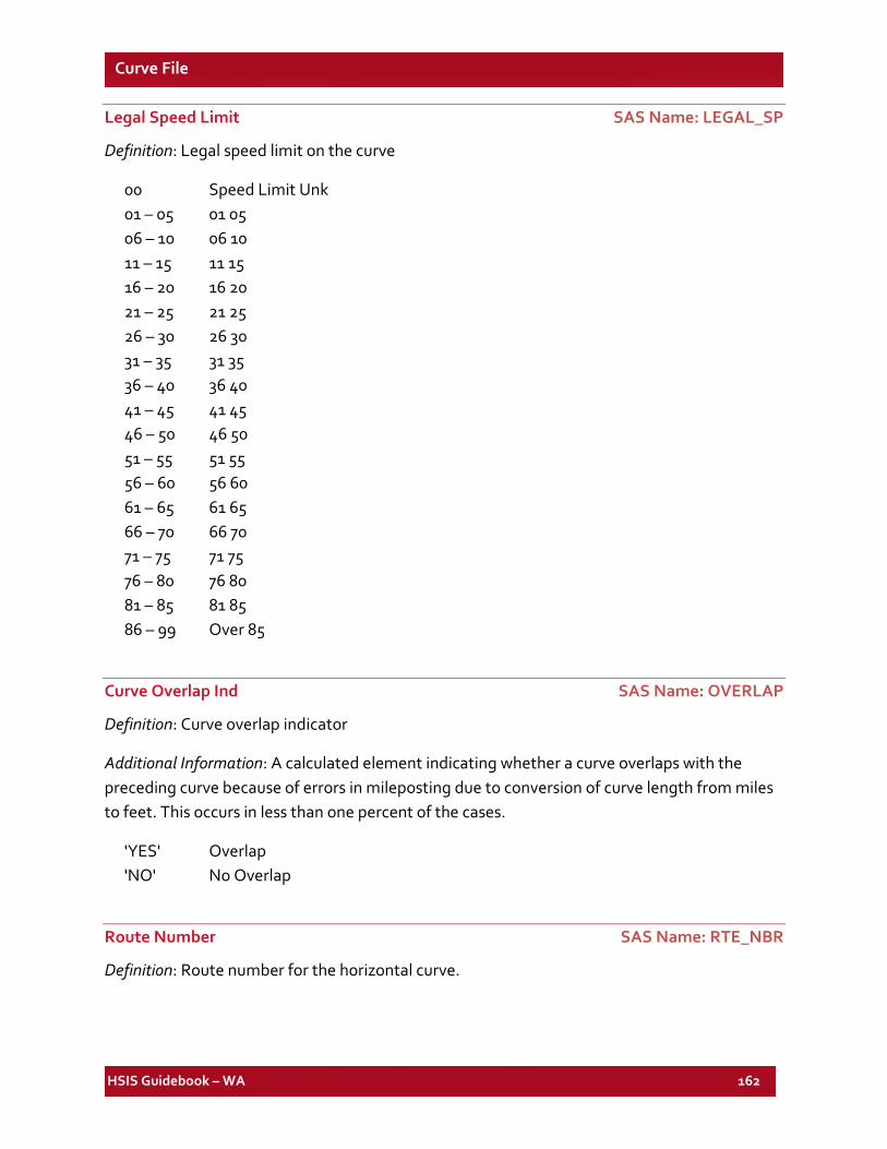
HSIS Guidebook – WA 162
Curve File
Legal Speed Limit SAS Name: LEGAL_SP
Definition: Legal speed limit on the curve
00 Speed Limit Unk 01 – 05 01 05 06 – 10 06 10 11 – 15 11 15 16 – 20 16 20 21 – 25 21 25 26 – 30 26 30 31 – 35 31 35 36 – 40 36 40 41 – 45 41 45 46 – 50 46 50 51 – 55 51 55 56 – 60 56 60 61 – 65 61 65 66 – 70 66 70 71 – 75 71 75 76 – 80 76 80 81 – 85 81 85 86 – 99 Over 85
Curve Overlap Ind SAS Name: OVERLAP
Definition: Curve overlap indicator
Additional Information: A calculated element indicating whether a curve overlaps with the preceding curve because of errors in mileposting due to conversion of curve length from miles to feet. This occurs in less than one percent of the cases.
'YES' Overlap 'NO' No Overlap
Route Number SAS Name: RTE_NBR
Definition: Route number for the horizontal curve.
HSIS Guidebook – WA 163
Curve File
Horizontal Curve Length (Mile) SAS Name: SEG_LNG
Definition: Calculated length of horizontal curve in miles (xxx.xx).
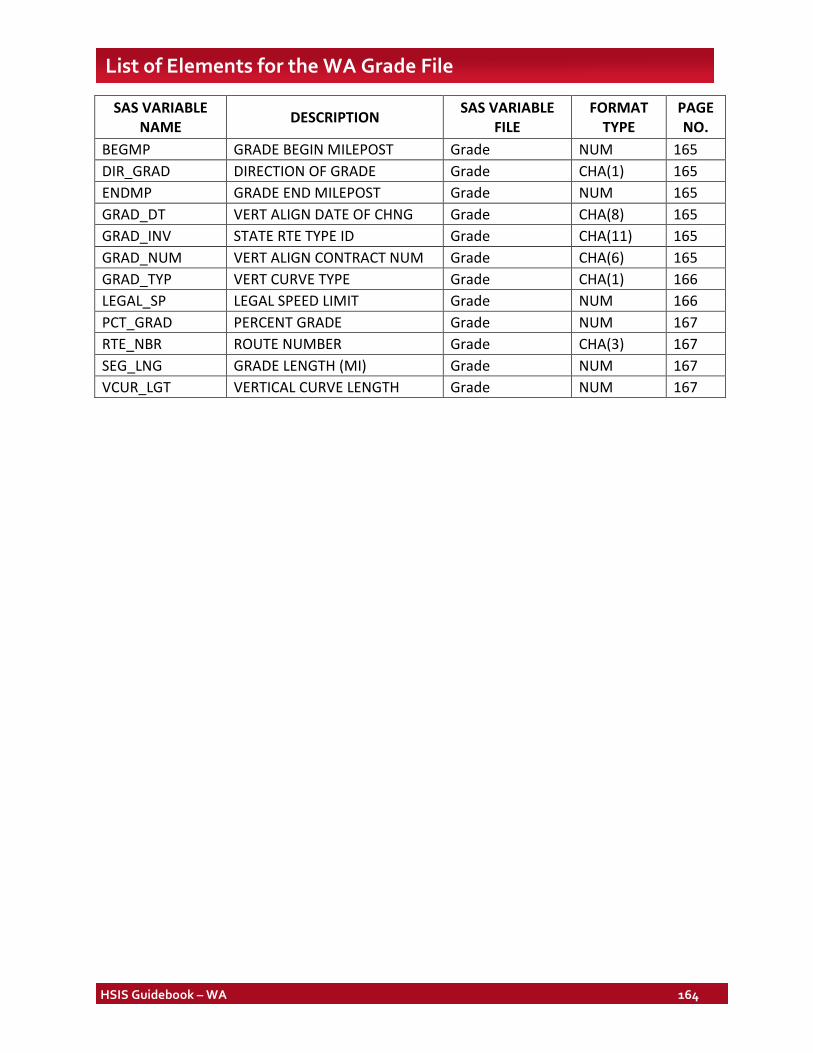
HSIS Guidebook – WA 164
List of Elements for the WA Grade File
SAS VARIABLE NAME DESCRIPTION SAS VARIABLE
FILE FORMAT
TYPE PAGE NO.
BEGMP GRADE BEGIN MILEPOST Grade NUM 165 DIR_GRAD DIRECTION OF GRADE Grade CHA(1) 165 ENDMP GRADE END MILEPOST Grade NUM 165 GRAD_DT VERT ALIGN DATE OF CHNG Grade CHA(8) 165 GRAD_INV STATE RTE TYPE ID Grade CHA(11) 165 GRAD_NUM VERT ALIGN CONTRACT NUM Grade CHA(6) 165 GRAD_TYP VERT CURVE TYPE Grade CHA(1) 166 LEGAL_SP LEGAL SPEED LIMIT Grade NUM 166 PCT_GRAD PERCENT GRADE Grade NUM 167 RTE_NBR ROUTE NUMBER Grade CHA(3) 167 SEG_LNG GRADE LENGTH (MI) Grade NUM 167 VCUR_LGT VERTICAL CURVE LENGTH Grade NUM 167
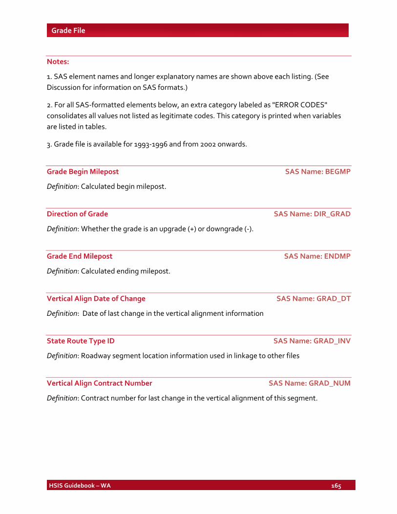
HSIS Guidebook – WA 165
Grade File
Notes:
1. SAS element names and longer explanatory names are shown above each listing. (See Discussion for information on SAS formats.)
2. For all SAS-formatted elements below, an extra category labeled as "ERROR CODES" consolidates all values not listed as legitimate codes. This category is printed when variables are listed in tables.
3. Grade file is available for 1993-1996 and from 2002 onwards.
Grade Begin Milepost SAS Name: BEGMP
Definition: Calculated begin milepost.
Direction of Grade SAS Name: DIR_GRAD
Definition: Whether the grade is an upgrade (+) or downgrade (-).
Grade End Milepost SAS Name: ENDMP
Definition: Calculated ending milepost.
Vertical Align Date of Change SAS Name: GRAD_DT
Definition: Date of last change in the vertical alignment information
State Route Type ID SAS Name: GRAD_INV
Definition: Roadway segment location information used in linkage to other files
Vertical Align Contract Number SAS Name: GRAD_NUM
Definition: Contract number for last change in the vertical alignment of this segment.
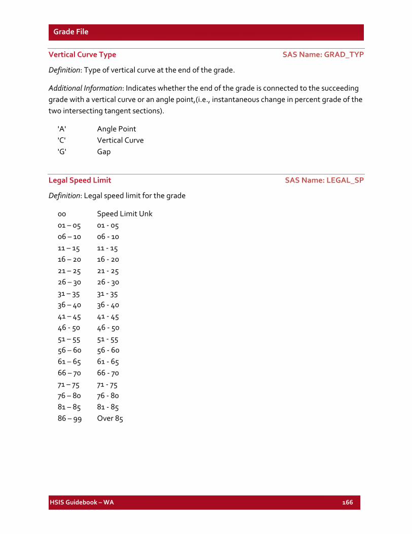
HSIS Guidebook – WA 166
Grade File
Vertical Curve Type SAS Name: GRAD_TYP
Definition: Type of vertical curve at the end of the grade.
Additional Information: Indicates whether the end of the grade is connected to the succeeding grade with a vertical curve or an angle point,(i.e., instantaneous change in percent grade of the two intersecting tangent sections).
'A' Angle Point 'C' Vertical Curve 'G' Gap
Legal Speed Limit SAS Name: LEGAL_SP
Definition: Legal speed limit for the grade
00 Speed Limit Unk 01 – 05 01 - 05 06 – 10 06 - 10 11 – 15 11 - 15 16 – 20 16 - 20 21 – 25 21 - 25 26 – 30 26 - 30 31 – 35 31 - 35 36 – 40 36 - 40 41 – 45 41 - 45 46 - 50 46 - 50 51 – 55 51 - 55 56 – 60 56 - 60 61 – 65 61 - 65 66 – 70 66 - 70 71 – 75 71 - 75 76 – 80 76 - 80 81 – 85 81 - 85 86 – 99 Over 85
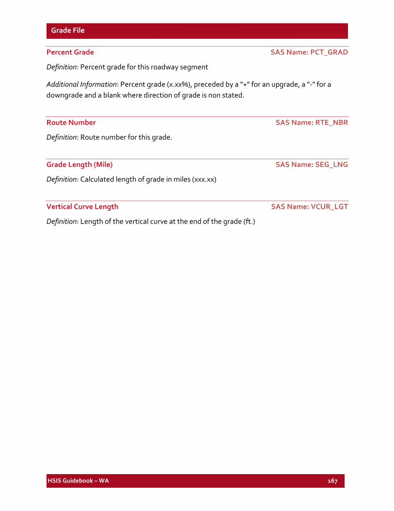
HSIS Guidebook – WA 167
Grade File
Percent Grade SAS Name: PCT_GRAD
Definition: Percent grade for this roadway segment
Additional Information: Percent grade (x.xx%), preceded by a "+" for an upgrade, a "-" for a downgrade and a blank where direction of grade is non stated.
Route Number SAS Name: RTE_NBR
Definition: Route number for this grade.
Grade Length (Mile) SAS Name: SEG_LNG
Definition: Calculated length of grade in miles (xxx.xx)
Vertical Curve Length SAS Name: VCUR_LGT
Definition: Length of the vertical curve at the end of the grade (ft.)

HSIS Guidebook – WA 168
List of Elements for the WA Ramp File
SAS VARIABLE NAME DESCRIPTION SAS VARIABLE
FILE FORMAT
TYPE PAGE NO.
AADT AVER ANNUAL DAILY TRAFFIC Ramp NUM 170 BEGMP BEGMP Ramp NUM 170 CITY CITY NUMBER Ramp CHA(4) 171 CITY_DT CITY DATE Ramp CHA(8) 174 CNTL_SEC CONTROL SECTION Ramp CHA(8) 174 CNTY_DT COUNTY DATE Ramp CHA(8) 175 COUNTY COUNTY NUMBER Ramp CHA(2) 175 CTY_ZONE CITY ZONE TYPE Ramp CHA(1) 175 DEVCD LEVEL OF DEVLMPT Ramp CHA(2) 176 DEVCD_DT LEVEL OF DEVELMT DATE Ramp CHA(8) 176 DISTR_DT DISTRICT DATE Ramp CHA(8) 176 DISTRICT DISTRICT NUMBER Ramp CHA(1) 176
ENDMP CALCULATED ENDING MILEPOST Ramp NUM 176
EW_DTE EAST/WEST INDICATOR DATE Ramp CHA(8) 177 EW_IND EAST WEST IND Ramp CHA(1) 177 FED_AID FED AID CLASS Ramp CHA(1) 177 FED_CD FED AID TYPE Ramp CHA(4) 177 FEDAD_DT FED-AID DATE Ramp CHA(8) 177 FUNC_CLS FEDERAL FUNC CLASS Ramp CHA(2) 178 FUNC_DT FUNCTIONAL CLASS DATE Ramp CHA(8) 178 LANEWID CALCULATED LANE WIDTH Ramp NUM 178 LSHL_DTE LEFT SHOULDER DATE RD1 Ramp CHA(8) 179 LSHL_TYP LEFT SHOULDER TYPE RD1 Ramp CHA(1) 179 LSHLDWID LEFT SHOULDER WIDTH Ramp NUM 179
LST_UPDT CONTROL SECTION LAST UPDATE Ramp CHA(8) 179
MNT_AREA MAINTENANCE AREA NBR Ramp CHA(1) 179 MNT_DATE MAINTENANCE DATE Ramp CHA(8) 180 MNTSC_DT MAINTENANCE SECTION DATE Ramp CHA(8) 180 MNTSEC MAINTENANCE SECT NBR Ramp CHA(2) 180 MT_DTE LAST MAINT DATE Ramp CHA(8) 180 NO_LANE1 NUMBER LANES INC Ramp NUM 180 NO_LANE2 NUMBER LANES DEC Ramp NUM 180 NO_LANES TOTAL NUMBER OF LANES Ramp NUM 180 NO_LNDT1 NUMBER OF LANES DATE RD1 Ramp CHA(8) 180 NO_LNDT2 NUMBER OF LANES DATE RD2 Ramp CHA(8) 180
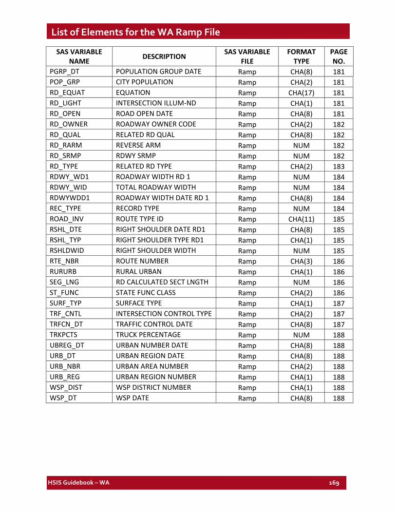
HSIS Guidebook – WA 169
List of Elements for the WA Ramp File
SAS VARIABLE NAME DESCRIPTION SAS VARIABLE
FILE FORMAT
TYPE PAGE NO.
PGRP_DT POPULATION GROUP DATE Ramp CHA(8) 181 POP_GRP CITY POPULATION Ramp CHA(2) 181 RD_EQUAT EQUATION Ramp CHA(17) 181 RD_LIGHT INTERSECTION ILLUM-ND Ramp CHA(1) 181 RD_OPEN ROAD OPEN DATE Ramp CHA(8) 181 RD_OWNER ROADWAY OWNER CODE Ramp CHA(2) 182 RD_QUAL RELATED RD QUAL Ramp CHA(8) 182 RD_RARM REVERSE ARM Ramp NUM 182 RD_SRMP RDWY SRMP Ramp NUM 182 RD_TYPE RELATED RD TYPE Ramp CHA(2) 183 RDWY_WD1 ROADWAY WIDTH RD 1 Ramp NUM 184 RDWY_WID TOTAL ROADWAY WIDTH Ramp NUM 184 RDWYWDD1 ROADWAY WIDTH DATE RD 1 Ramp CHA(8) 184 REC_TYPE RECORD TYPE Ramp NUM 184 ROAD_INV ROUTE TYPE ID Ramp CHA(11) 185 RSHL_DTE RIGHT SHOULDER DATE RD1 Ramp CHA(8) 185 RSHL_TYP RIGHT SHOULDER TYPE RD1 Ramp CHA(1) 185 RSHLDWID RIGHT SHOULDER WIDTH Ramp NUM 185 RTE_NBR ROUTE NUMBER Ramp CHA(3) 186 RURURB RURAL URBAN Ramp CHA(1) 186 SEG_LNG RD CALCULATED SECT LNGTH Ramp NUM 186 ST_FUNC STATE FUNC CLASS Ramp CHA(2) 186 SURF_TYP SURFACE TYPE Ramp CHA(1) 187 TRF_CNTL INTERSECTION CONTROL TYPE Ramp CHA(2) 187 TRFCN_DT TRAFFIC CONTROL DATE Ramp CHA(8) 187 TRKPCTS TRUCK PERCENTAGE Ramp NUM 188 UBREG_DT URBAN NUMBER DATE Ramp CHA(8) 188 URB_DT URBAN REGION DATE Ramp CHA(8) 188 URB_NBR URBAN AREA NUMBER Ramp CHA(2) 188 URB_REG URBAN REGION NUMBER Ramp CHA(1) 188 WSP_DIST WSP DISTRICT NUMBER Ramp CHA(1) 188 WSP_DT WSP DATE Ramp CHA(8) 188
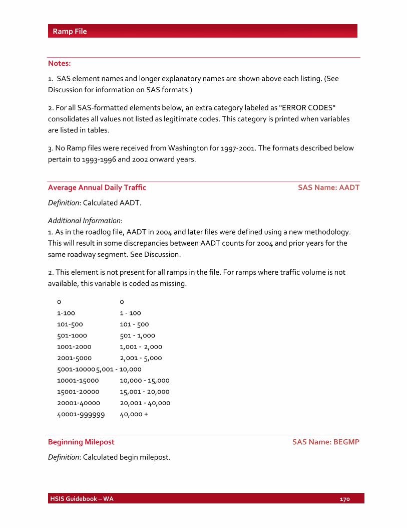
HSIS Guidebook – WA 170
Ramp File
Notes:
1. SAS element names and longer explanatory names are shown above each listing. (See Discussion for information on SAS formats.)
2. For all SAS-formatted elements below, an extra category labeled as "ERROR CODES" consolidates all values not listed as legitimate codes. This category is printed when variables are listed in tables.
3. No Ramp files were received from Washington for 1997-2001. The formats described below pertain to 1993-1996 and 2002 onward years.
Average Annual Daily Traffic SAS Name: AADT
Definition: Calculated AADT.
Additional Information: 1. As in the roadlog file, AADT in 2004 and later files were defined using a new methodology. This will result in some discrepancies between AADT counts for 2004 and prior years for the same roadway segment. See Discussion.
2. This element is not present for all ramps in the file. For ramps where traffic volume is not available, this variable is coded as missing.
0 0 1-100 1 - 100 101-500 101 - 500 501-1000 501 - 1,000 1001-2000 1,001 - 2,000 2001-5000 2,001 - 5,000 5001-10000 5,001 - 10,000 10001-15000 10,000 - 15,000 15001-20000 15,001 - 20,000 20001-40000 20,001 - 40,000 40001-999999 40,000 +
Beginning Milepost SAS Name: BEGMP
Definition: Calculated begin milepost.
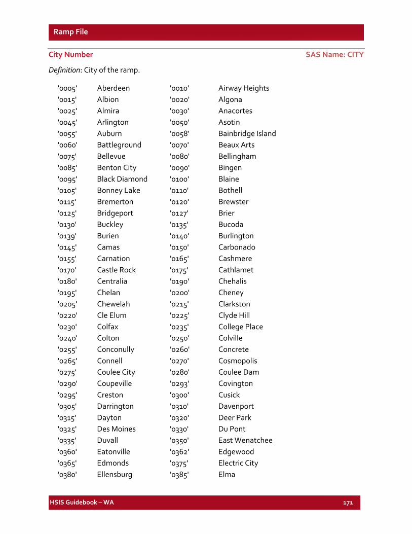
HSIS Guidebook – WA 171
Ramp File
City Number SAS Name: CITY
Definition: City of the ramp.
'0005' Aberdeen '0010' Airway Heights '0015' Albion '0020' Algona '0025' Almira '0030' Anacortes '0045' Arlington '0050' Asotin '0055' Auburn '0058' Bainbridge Island '0060' Battleground '0070' Beaux Arts '0075' Bellevue '0080' Bellingham '0085' Benton City '0090' Bingen '0095' Black Diamond '0100' Blaine '0105' Bonney Lake '0110' Bothell '0115' Bremerton '0120' Brewster '0125' Bridgeport '0127' Brier '0130' Buckley '0135' Bucoda '0139' Burien '0140' Burlington '0145' Camas '0150' Carbonado '0155' Carnation '0165' Cashmere '0170' Castle Rock '0175' Cathlamet '0180' Centralia '0190' Chehalis '0195' Chelan '0200' Cheney '0205' Chewelah '0215' Clarkston '0220' Cle Elum '0225' Clyde Hill '0230' Colfax '0235' College Place '0240' Colton '0250' Colville '0255' Conconully '0260' Concrete '0265' Connell '0270' Cosmopolis '0275' Coulee City '0280' Coulee Dam '0290' Coupeville '0293' Covington '0295' Creston '0300' Cusick '0305' Darrington '0310' Davenport '0315' Dayton '0320' Deer Park '0325' Des Moines '0330' Du Pont '0335' Duvall '0350' East Wenatchee '0360' Eatonville '0362' Edgewood '0365' Edmonds '0375' Electric City '0380' Ellensburg '0385' Elma
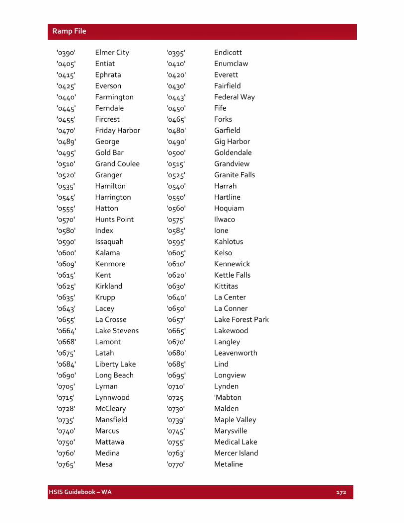
HSIS Guidebook – WA 172
Ramp File
'0390' Elmer City '0395' Endicott '0405' Entiat '0410' Enumclaw '0415' Ephrata '0420' Everett '0425' Everson '0430' Fairfield '0440' Farmington '0443' Federal Way '0445' Ferndale '0450' Fife '0455' Fircrest '0465' Forks '0470' Friday Harbor '0480' Garfield '0489' George '0490' Gig Harbor '0495' Gold Bar '0500' Goldendale '0510' Grand Coulee '0515' Grandview '0520' Granger '0525' Granite Falls '0535' Hamilton '0540' Harrah '0545' Harrington '0550' Hartline '0555' Hatton '0560' Hoquiam '0570' Hunts Point '0575' Ilwaco '0580' Index '0585' Ione '0590' Issaquah '0595' Kahlotus '0600' Kalama '0605' Kelso '0609' Kenmore '0610' Kennewick '0615' Kent '0620' Kettle Falls '0625' Kirkland '0630' Kittitas '0635' Krupp '0640' La Center '0643' Lacey '0650' La Conner '0655' La Crosse '0657' Lake Forest Park '0664' Lake Stevens '0665' Lakewood '0668' Lamont '0670' Langley '0675' Latah '0680' Leavenworth '0684' Liberty Lake '0685' Lind '0690' Long Beach '0695' Longview '0705' Lyman '0710' Lynden '0715' Lynnwood '0725 'Mabton '0728' McCleary '0730' Malden '0735' Mansfield '0739' Maple Valley '0740' Marcus '0745' Marysville '0750' Mattawa '0755' Medical Lake '0760' Medina '0763' Mercer Island '0765' Mesa '0770' Metaline
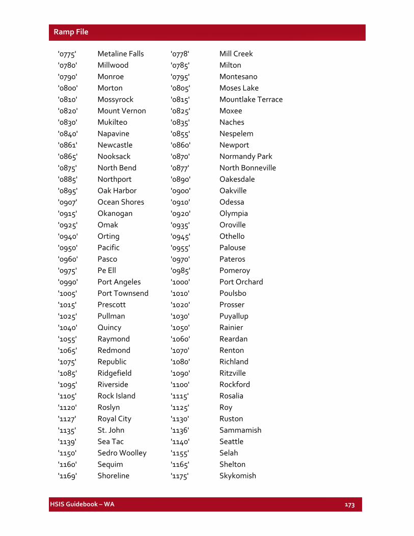
HSIS Guidebook – WA 173
Ramp File
'0775' Metaline Falls '0778' Mill Creek '0780' Millwood '0785' Milton '0790' Monroe '0795' Montesano '0800' Morton '0805' Moses Lake '0810' Mossyrock '0815' Mountlake Terrace '0820' Mount Vernon '0825' Moxee '0830' Mukilteo '0835' Naches '0840' Napavine '0855' Nespelem '0861' Newcastle '0860' Newport '0865' Nooksack '0870' Normandy Park '0875' North Bend '0877' North Bonneville '0885' Northport '0890' Oakesdale '0895' Oak Harbor '0900' Oakville '0907' Ocean Shores '0910' Odessa '0915' Okanogan '0920' Olympia '0925' Omak '0935' Oroville '0940' Orting '0945' Othello '0950' Pacific '0955' Palouse '0960' Pasco '0970' Pateros '0975' Pe Ell '0985' Pomeroy '0990' Port Angeles '1000' Port Orchard '1005' Port Townsend '1010' Poulsbo '1015' Prescott '1020' Prosser '1025' Pullman '1030' Puyallup '1040' Quincy '1050' Rainier '1055' Raymond '1060' Reardan '1065' Redmond '1070' Renton '1075' Republic '1080' Richland '1085' Ridgefield '1090' Ritzville '1095' Riverside '1100' Rockford '1105' Rock Island '1115' Rosalia '1120' Roslyn '1125' Roy '1127' Royal City '1130' Ruston '1135' St. John '1136' Sammamish '1139' Sea Tac '1140' Seattle '1150' Sedro Woolley '1155' Selah '1160' Sequim '1165' Shelton '1169' Shoreline '1175' Skykomish
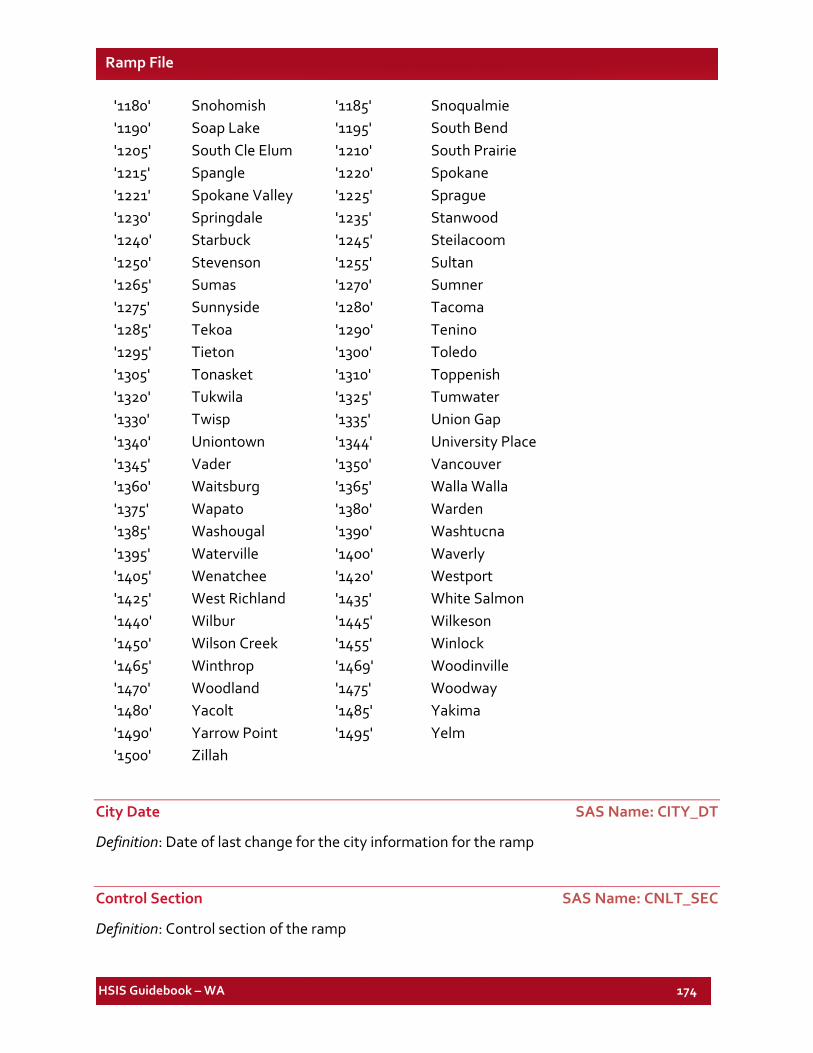
HSIS Guidebook – WA 174
Ramp File
'1180' Snohomish '1185' Snoqualmie '1190' Soap Lake '1195' South Bend '1205' South Cle Elum '1210' South Prairie '1215' Spangle '1220' Spokane '1221' Spokane Valley '1225' Sprague '1230' Springdale '1235' Stanwood '1240' Starbuck '1245' Steilacoom '1250' Stevenson '1255' Sultan '1265' Sumas '1270' Sumner '1275' Sunnyside '1280' Tacoma '1285' Tekoa '1290' Tenino '1295' Tieton '1300' Toledo '1305' Tonasket '1310' Toppenish '1320' Tukwila '1325' Tumwater '1330' Twisp '1335' Union Gap '1340' Uniontown '1344' University Place '1345' Vader '1350' Vancouver '1360' Waitsburg '1365' Walla Walla '1375' Wapato '1380' Warden '1385' Washougal '1390' Washtucna '1395' Waterville '1400' Waverly '1405' Wenatchee '1420' Westport '1425' West Richland '1435' White Salmon '1440' Wilbur '1445' Wilkeson '1450' Wilson Creek '1455' Winlock '1465' Winthrop '1469' Woodinville '1470' Woodland '1475' Woodway '1480' Yacolt '1485' Yakima '1490' Yarrow Point '1495' Yelm '1500' Zillah
City Date SAS Name: CITY_DT
Definition: Date of last change for the city information for the ramp
Control Section SAS Name: CNLT_SEC
Definition: Control section of the ramp
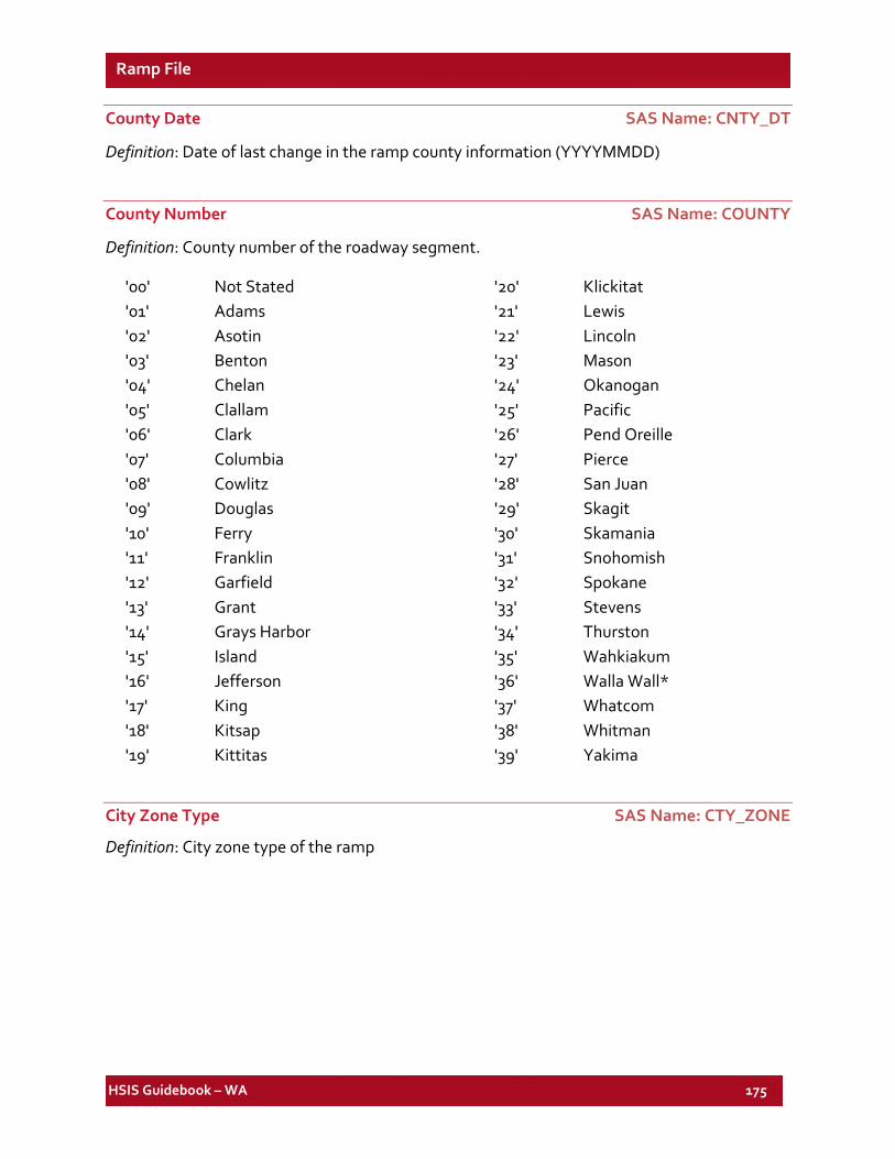
HSIS Guidebook – WA 175
Ramp File
County Date SAS Name: CNTY_DT
Definition: Date of last change in the ramp county information (YYYYMMDD)
County Number SAS Name: COUNTY
Definition: County number of the roadway segment.
'00' Not Stated '01' Adams '02' Asotin '03' Benton '04' Chelan '05' Clallam '06' Clark '07' Columbia '08' Cowlitz '09' Douglas '10' Ferry '11' Franklin '12' Garfield '13' Grant '14' Grays Harbor '15' Island '16' Jefferson '17' King '18' Kitsap '19' Kittitas
'20' Klickitat '21' Lewis '22' Lincoln '23' Mason '24' Okanogan '25' Pacific '26' Pend Oreille '27' Pierce '28' San Juan '29' Skagit '30' Skamania '31' Snohomish '32' Spokane '33' Stevens '34' Thurston '35' Wahkiakum '36' Walla Wall* '37' Whatcom '38' Whitman '39' Yakima
City Zone Type SAS Name: CTY_ZONE
Definition: City zone type of the ramp
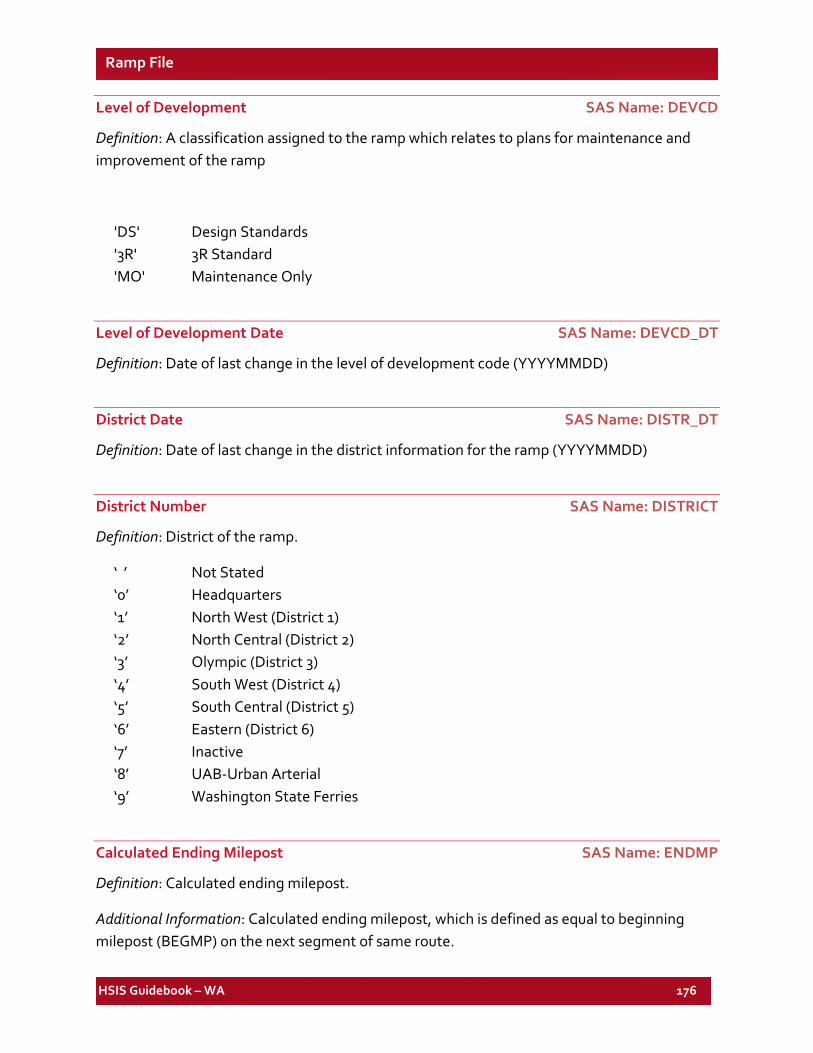
HSIS Guidebook – WA 176
Ramp File
Level of Development SAS Name: DEVCD
Definition: A classification assigned to the ramp which relates to plans for maintenance and improvement of the ramp
'DS' Design Standards '3R' 3R Standard 'MO' Maintenance Only
Level of Development Date SAS Name: DEVCD_DT
Definition: Date of last change in the level of development code (YYYYMMDD)
District Date SAS Name: DISTR_DT
Definition: Date of last change in the district information for the ramp (YYYYMMDD)
District Number SAS Name: DISTRICT
Definition: District of the ramp.
‘ ’ Not Stated ‘0’ Headquarters ‘1’ North West (District 1) ‘2’ North Central (District 2) ‘3’ Olympic (District 3) ‘4’ South West (District 4) ‘5’ South Central (District 5) ‘6’ Eastern (District 6) ‘7’ Inactive ‘8’ UAB-Urban Arterial ‘9’ Washington State Ferries
Calculated Ending Milepost SAS Name: ENDMP
Definition: Calculated ending milepost.
Additional Information: Calculated ending milepost, which is defined as equal to beginning milepost (BEGMP) on the next segment of same route.
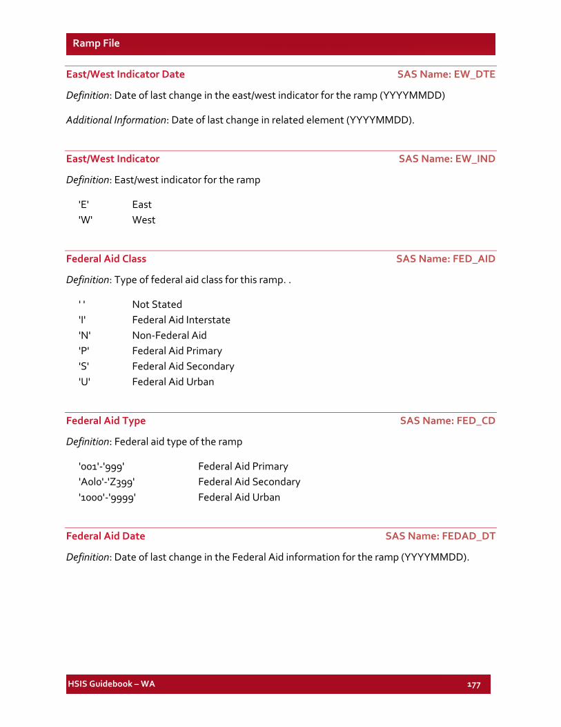
HSIS Guidebook – WA 177
Ramp File
East/West Indicator Date SAS Name: EW_DTE
Definition: Date of last change in the east/west indicator for the ramp (YYYYMMDD)
Additional Information: Date of last change in related element (YYYYMMDD).
East/West Indicator SAS Name: EW_IND
Definition: East/west indicator for the ramp
'E' East 'W' West
Federal Aid Class SAS Name: FED_AID
Definition: Type of federal aid class for this ramp. .
' ' Not Stated 'I' Federal Aid Interstate 'N' Non-Federal Aid 'P' Federal Aid Primary 'S' Federal Aid Secondary 'U' Federal Aid Urban
Federal Aid Type SAS Name: FED_CD
Definition: Federal aid type of the ramp
'001'-'999' Federal Aid Primary 'A0l0'-'Z399' Federal Aid Secondary '1000'-'9999' Federal Aid Urban
Federal Aid Date SAS Name: FEDAD_DT
Definition: Date of last change in the Federal Aid information for the ramp (YYYYMMDD).
HSIS Guidebook – WA 178
Ramp File
Federal Functional Class SAS Name: FUNC_CLS
Definition: Functional class.
Additional Information: * Codes from 41 to 57 were new in 2012 and codes 07 and 17 contained both major and minor collectors before 2012.
'01','41'* Rural Interstate '02','43'* Rural Principal Arterial '05', '42'* Rural Other Freeway/Expressway '06','44'* Rural-Minor-Arterial '07' Rural Collector '08','46'* Rural Minor Collector '45'* Rural Major Collector '09' Rural Unclassified '47'* Rural Local Roads '11','51'* Urban-Interstate '12','52'* Urban-Principal-Arterial (Freeways & Expressways) '14','53'* Urban Other Principal Arterial '16','54'* Urban Minor Arterial '17' Urban Collector '18','56'* Urban Minor Collector '55' Urban Major Collector '19' Urban-Unclassified '57'* Urban Local Roads
Functional Class Date SAS Name: FUNC_DT
Definition: Date of last change in the functional class for the ramp (YYYYMMDD).
Calculated Lane Width SAS Name: LANEWID
Definition: Calculated lane width.
Additional Information: This element is calculated by dividing the total roadway width by the total number of lanes. There will be some error on sections where the shoulder type is curb or wall. See "Note" under RDWY_WD1.
HSIS Guidebook – WA 179
Ramp File
Left Shoulder Date SAS Name: LSHL_DTE
Definition: Date of last change in the left shoulder information for the ramp (YYYYMMDD).
Left Shoulder Type SAS Name: LSHL_TYP
Definition: Left shoulder type.
Additional Information: The surface composition of the left shoulder in the increasing direction of the ramp.
'A' Asphalt 'G' Gravel 'S' Soil 'B' Bituminous 'O' Other 'W' Wall 'C' Curb 'P' Portland Concrete
Left Shoulder Width SAS Name: LSHLDWID
Definition: Left shoulder width.
Additional Information: The width of the left shoulder in feet in the increasing direction of the ramp.
0 No Shoulder 1 - 3 01 - 03 4 - 6 04 - 06 7 - 9 07 - 09 10 -13 10 - 13 14 -99 > 13
Control Section Last Update SAS Name: LST_UPDT
Definition: Date of last change in the control section information for the ramp (YYYYMMDD).
Maintenance Area Number SAS Name: MNT_AREA
Definition: Maintenance area number of the ramp
HSIS Guidebook – WA 180
Ramp File
Maintenance Date SAS Name: MNT_DATE
Definition: Date of last change in the maintenance area information (YYYYMMDD)
Maintenance Section Date SAS Name: MNTSC_DT
Definition: Date of last change in the maintenance section information (YYYYMMDD)
Maintenance Section Number SAS Name: MNTSEC
Definition: Maintenance section number of the ramp
Last Maintenance Date SAS Name: MT_DTE
Definition: Last maintenance date of the ramp (YYYYMMDD)
Number of Lanes Increasing SAS Name: NO_LANE1 Number of Lanes Decreasing SAS Name: NO_LANE2 Total Number of Lanes SAS Name: NO_LANES
Definition: Number through lanes toward increasing/decreasing milepoints.
Additional Information: "Increasing" and "decreasing" number of lanes indicated the number of total thru lanes in those directions of travel regardless of whether a ramp is divided or not. "Total Number of Lanes" is a calculated element, which sums the first two.
0 0 1 1 2 2 3 3 4 4 5 - 8 5 to 8' 9 - 20 > 8'
Number of Lanes Date Road 1 SAS Name: NO_LNDT1 Number of Lanes Date Road 2 SAS Name: NO_LNDT2
Definition: Date of last change in number of lanes information (YYYYMMDD)
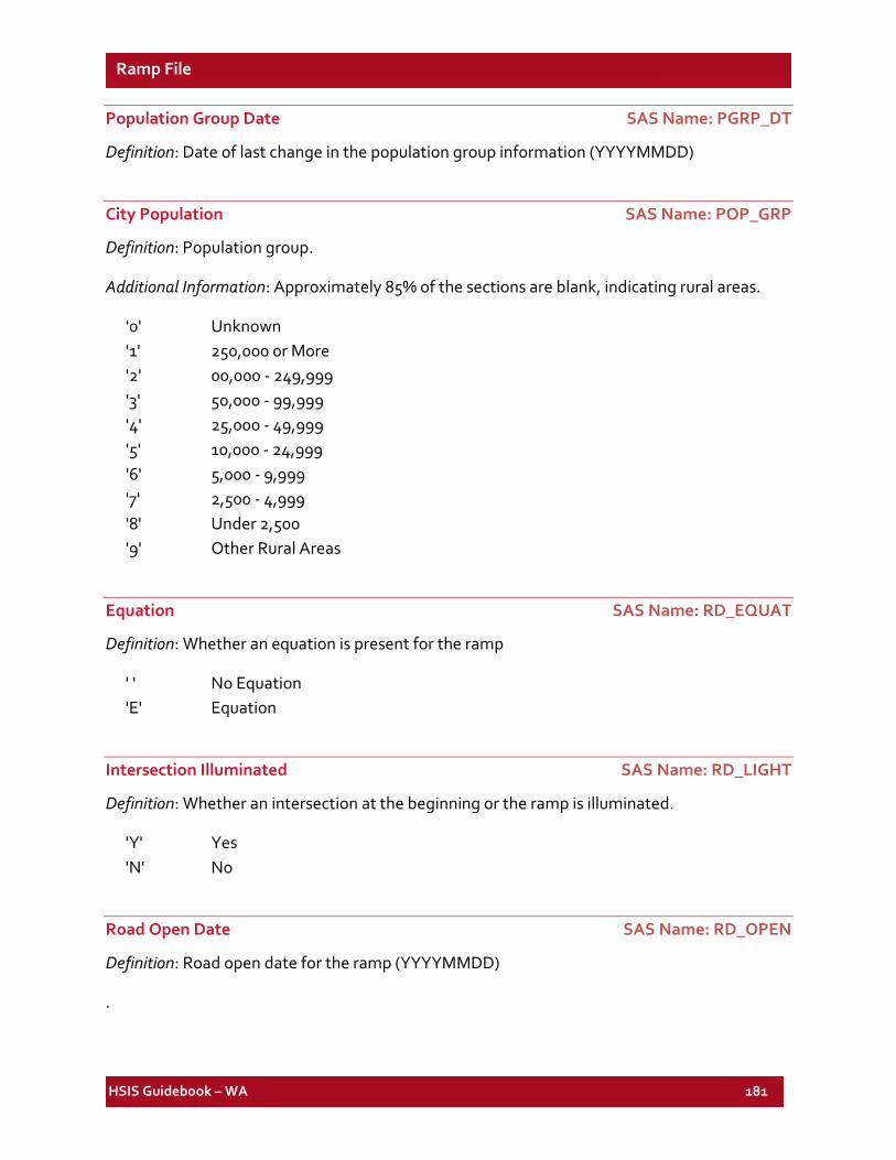
HSIS Guidebook – WA 181
Ramp File
Population Group Date SAS Name: PGRP_DT
Definition: Date of last change in the population group information (YYYYMMDD)
City Population SAS Name: POP_GRP
Definition: Population group.
Additional Information: Approximately 85% of the sections are blank, indicating rural areas.
'0' Unknown '1' 250,000 0r More '2' 00,000 - 249,999 '3' 50,000 - 99,999 '4' 25,000 - 49,999 '5' 10,000 - 24,999 '6' 5,000 - 9,999 '7' 2,500 - 4,999 '8' Under 2,500 '9' Other Rural Areas
Equation SAS Name: RD_EQUAT
Definition: Whether an equation is present for the ramp
' ' No Equation 'E' Equation
Intersection Illuminated SAS Name: RD_LIGHT
Definition: Whether an intersection at the beginning or the ramp is illuminated.
'Y' Yes 'N' No
Road Open Date SAS Name: RD_OPEN
Definition: Road open date for the ramp (YYYYMMDD)
.
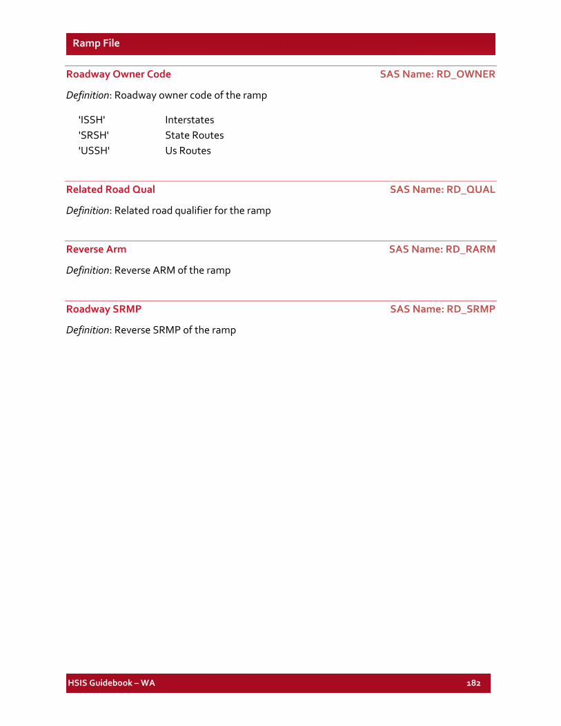
HSIS Guidebook – WA 182
Ramp File
Roadway Owner Code SAS Name: RD_OWNER
Definition: Roadway owner code of the ramp
'ISSH' Interstates 'SRSH' State Routes 'USSH' Us Routes
Related Road Qual SAS Name: RD_QUAL
Definition: Related road qualifier for the ramp
Reverse Arm SAS Name: RD_RARM
Definition: Reverse ARM of the ramp
Roadway SRMP SAS Name: RD_SRMP
Definition: Reverse SRMP of the ramp
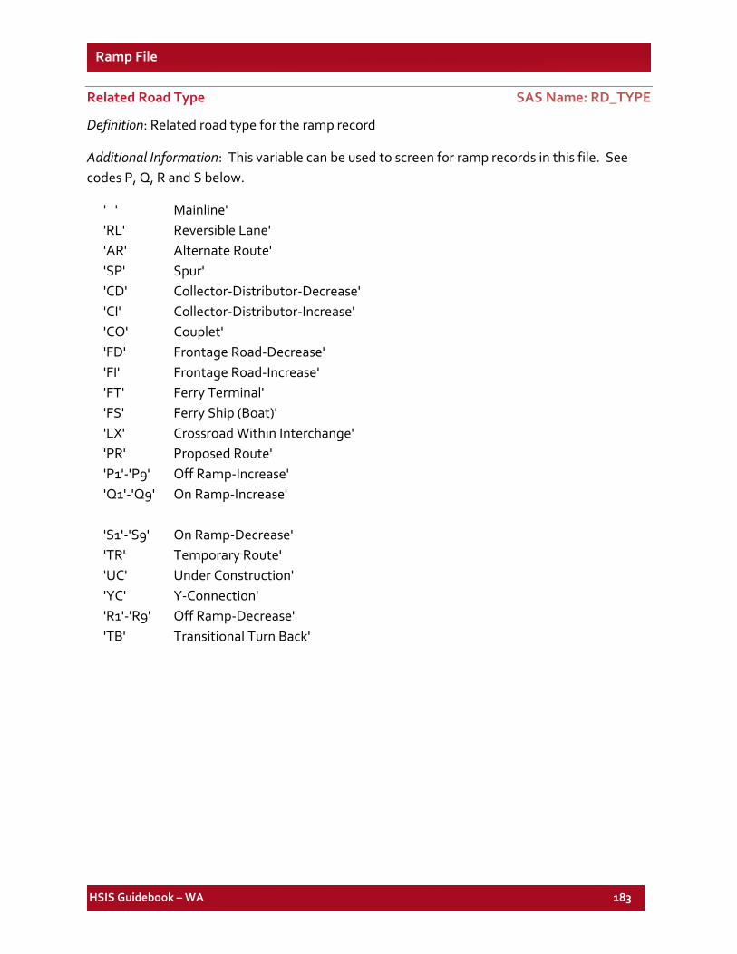
HSIS Guidebook – WA 183
Ramp File
Related Road Type SAS Name: RD_TYPE
Definition: Related road type for the ramp record
Additional Information: This variable can be used to screen for ramp records in this file. See codes P, Q, R and S below.
' ' Mainline' 'RL' Reversible Lane' 'AR' Alternate Route' 'SP' Spur' 'CD' Collector-Distributor-Decrease' 'CI' Collector-Distributor-Increase' 'CO' Couplet' 'FD' Frontage Road-Decrease' 'FI' Frontage Road-Increase' 'FT' Ferry Terminal' 'FS' Ferry Ship (Boat)' 'LX' Crossroad Within Interchange' 'PR' Proposed Route' 'P1'-'P9' Off Ramp-Increase' 'Q1'-'Q9' On Ramp-Increase' 'S1'-'S9' On Ramp-Decrease' 'TR' Temporary Route' 'UC' Under Construction' 'YC' Y-Connection' 'R1'-'R9' Off Ramp-Decrease' 'TB' Transitional Turn Back'
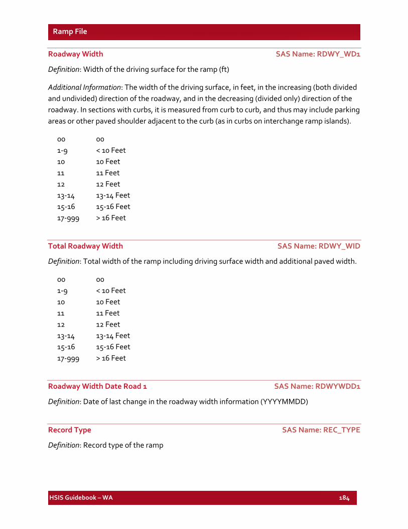
HSIS Guidebook – WA 184
Ramp File
Roadway Width SAS Name: RDWY_WD1
Definition: Width of the driving surface for the ramp (ft)
Additional Information: The width of the driving surface, in feet, in the increasing (both divided and undivided) direction of the roadway, and in the decreasing (divided only) direction of the roadway. In sections with curbs, it is measured from curb to curb, and thus may include parking areas or other paved shoulder adjacent to the curb (as in curbs on interchange ramp islands).
00 00 1-9 < 10 Feet 10 10 Feet 11 11 Feet 12 12 Feet 13-14 13-14 Feet 15-16 15-16 Feet 17-999 > 16 Feet
Total Roadway Width SAS Name: RDWY_WID
Definition: Total width of the ramp including driving surface width and additional paved width.
00 00 1-9 < 10 Feet 10 10 Feet 11 11 Feet 12 12 Feet 13-14 13-14 Feet 15-16 15-16 Feet 17-999 > 16 Feet
Roadway Width Date Road 1 SAS Name: RDWYWDD1
Definition: Date of last change in the roadway width information (YYYYMMDD)
Record Type SAS Name: REC_TYPE
Definition: Record type of the ramp
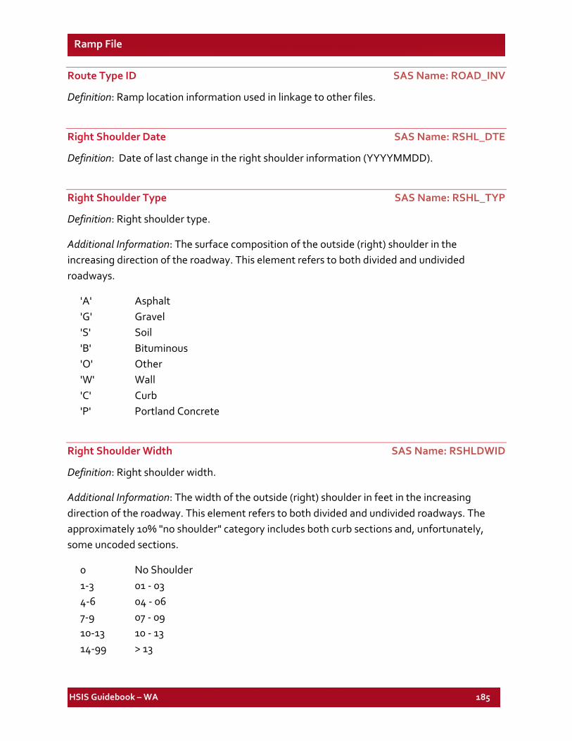
HSIS Guidebook – WA 185
Ramp File
Route Type ID SAS Name: ROAD_INV
Definition: Ramp location information used in linkage to other files.
Right Shoulder Date SAS Name: RSHL_DTE
Definition: Date of last change in the right shoulder information (YYYYMMDD).
Right Shoulder Type SAS Name: RSHL_TYP
Definition: Right shoulder type.
Additional Information: The surface composition of the outside (right) shoulder in the increasing direction of the roadway. This element refers to both divided and undivided roadways.
'A' Asphalt 'G' Gravel 'S' Soil 'B' Bituminous 'O' Other 'W' Wall 'C' Curb 'P' Portland Concrete
Right Shoulder Width SAS Name: RSHLDWID
Definition: Right shoulder width.
Additional Information: The width of the outside (right) shoulder in feet in the increasing direction of the roadway. This element refers to both divided and undivided roadways. The approximately 10% "no shoulder" category includes both curb sections and, unfortunately, some uncoded sections.
0 No Shoulder 1-3 01 - 03 4-6 04 - 06 7-9 07 - 09 10-13 10 - 13 14-99 > 13
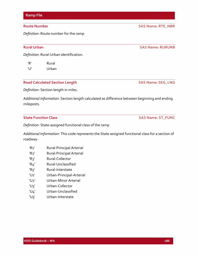
HSIS Guidebook – WA 186
Ramp File
Route Number SAS Name: RTE_NBR
Definition: Route number for the ramp
Rural Urban SAS Name: RURURB
Definition: Rural-Urban identification.
'R' Rural 'U' Urban
Road Calculated Section Length SAS Name: SEG_LNG
Definition: Section length in miles.
Additional Information: Section length calculated as difference between beginning and ending mileposts.
State Function Class SAS Name: ST_FUNC
Definition: State-assigned functional class of the ramp
Additional Information: This code represents the State assigned functional class for a section of roadway.
'R1' Rural-Principal Arterial 'R2' Rural-Principal Arterial 'R3' Rural-Collector 'R4' Rural-Unclassified 'R5' Rural-Interstate 'U1' Urban-Principal-Arterial 'U2' Urban-Minor Arterial 'U3' Urban-Collector 'U4' Urban-Unclassified 'U5' Urban-Interstate
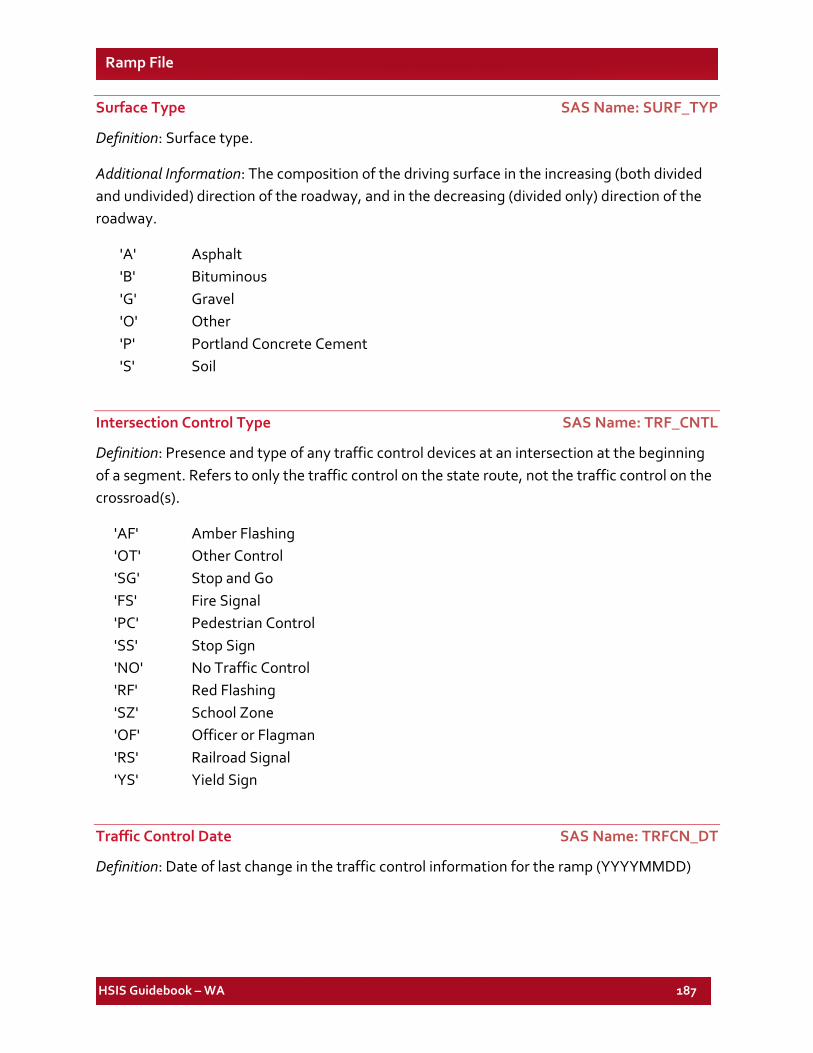
HSIS Guidebook – WA 187
Ramp File
Surface Type SAS Name: SURF_TYP
Definition: Surface type.
Additional Information: The composition of the driving surface in the increasing (both divided and undivided) direction of the roadway, and in the decreasing (divided only) direction of the roadway.
'A' Asphalt 'B' Bituminous 'G' Gravel 'O' Other 'P' Portland Concrete Cement 'S' Soil
Intersection Control Type SAS Name: TRF_CNTL
Definition: Presence and type of any traffic control devices at an intersection at the beginning of a segment. Refers to only the traffic control on the state route, not the traffic control on the crossroad(s).
'AF' Amber Flashing 'OT' Other Control 'SG' Stop and Go 'FS' Fire Signal 'PC' Pedestrian Control 'SS' Stop Sign 'NO' No Traffic Control 'RF' Red Flashing 'SZ' School Zone 'OF' Officer or Flagman 'RS' Railroad Signal 'YS' Yield Sign
Traffic Control Date SAS Name: TRFCN_DT
Definition: Date of last change in the traffic control information for the ramp (YYYYMMDD)
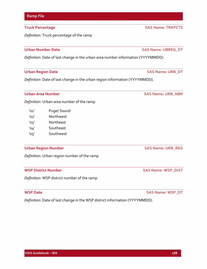
HSIS Guidebook – WA 188
Ramp File
Truck Percentage SAS Name: TRKPCTS
Definition: Truck percentage of the ramp
Urban Number Date SAS Name: UBREG_DT
Definition: Date of last change in the urban area number information (YYYYMMDD)
Urban Region Date SAS Name: URB_DT
Definition: Date of last change in the urban region information (YYYYMMDD).
Urban Area Number SAS Name: URB_NBR
Definition: Urban area number of the ramp
'01' Puget Sound '02' Northwest '03' Northeast '04' Southeast '05' Southwest
Urban Region Number SAS Name: URB_REG
Definition: Urban region number of the ramp
WSP District Number SAS Name: WSP_DIST
Definition: WSP district number of the ramp
WSP Date SAS Name: WSP_DT
Definition: Date of last change in the WSP district information (YYYYMMDD).
HSIS Guidebook – WA 189
List of Elements for the WA Special-Use Lane File
SAS VARIABLE NAME DESCRIPTION SAS VARIABLE
FILE FORMAT
TYPE PAGE NO.
LENGTH LENGTH OF SLN IN FEET Spl-ln NUM 190
SLN_ABID SPECIAL USE LANES AHEAD BACK INDICATOR Spl-ln CHA(1) 190
SLN_DATE SPECIAL LANE DATE Spl-ln CHA(8) 190 SLN_DIST SLN DISTRICT NUMBER Spl-ln CHA(1) 190 SLN_DSDT SLN DISTRICT DATE Spl-ln CHA(8) 190 SLN_INV SLN ROAD INV-SR TYPE ID Spl-ln CHA(11) 190 SLN_MLPT SPEC USE LANES ARM Spl-ln NUM 190 SLN_MTDT SPEC USE LANES MAINT DTE Spl-ln CHA(8) 191 SLN_QUAL RELATED ROAD QUAL Spl-ln CHA(6) 191 SLN_RARM SPEC USE LANES RV ARM Spl-ln NUM 191 SLN_RDTY RELATED ROAD TYPE Spl-ln CHA(2) 191 SLN_RTNO ROUTE NUMBER Spl-ln CHA(3) 191 SLN_SFTY SPECIAL LANE SURFACE TYPE Spl-ln CHA(1) 191 SLN_SIDE SLN LEFT/RIGHT SIDE IND Spl-ln CHA(2) 192 SLN_SRMP SPEC USE LANES SRMP Spl-ln NUM 192 SLN_TYPE SPECIAL LANE TYPE Spl-ln CHA(2) 192 SLN_WID SPECIAL LANE WIDTH Spl-ln CHA(2) 193
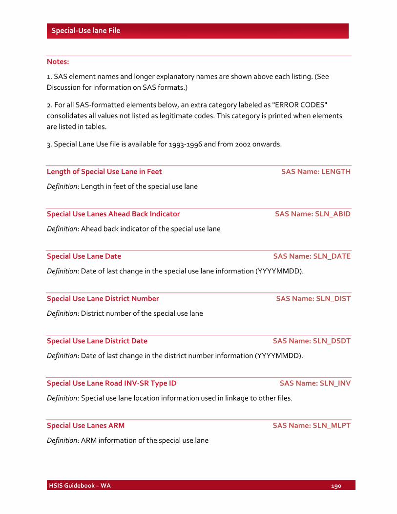
HSIS Guidebook – WA 190
Special-Use lane File
Notes:
1. SAS element names and longer explanatory names are shown above each listing. (See Discussion for information on SAS formats.)
2. For all SAS-formatted elements below, an extra category labeled as "ERROR CODES" consolidates all values not listed as legitimate codes. This category is printed when elements are listed in tables.
3. Special Lane Use file is available for 1993-1996 and from 2002 onwards.
Length of Special Use Lane in Feet SAS Name: LENGTH
Definition: Length in feet of the special use lane
Special Use Lanes Ahead Back Indicator SAS Name: SLN_ABID
Definition: Ahead back indicator of the special use lane
Special Use Lane Date SAS Name: SLN_DATE
Definition: Date of last change in the special use lane information (YYYYMMDD).
Special Use Lane District Number SAS Name: SLN_DIST
Definition: District number of the special use lane
Special Use Lane District Date SAS Name: SLN_DSDT
Definition: Date of last change in the district number information (YYYYMMDD).
Special Use Lane Road INV-SR Type ID SAS Name: SLN_INV
Definition: Special use lane location information used in linkage to other files.
Special Use Lanes ARM SAS Name: SLN_MLPT
Definition: ARM information of the special use lane
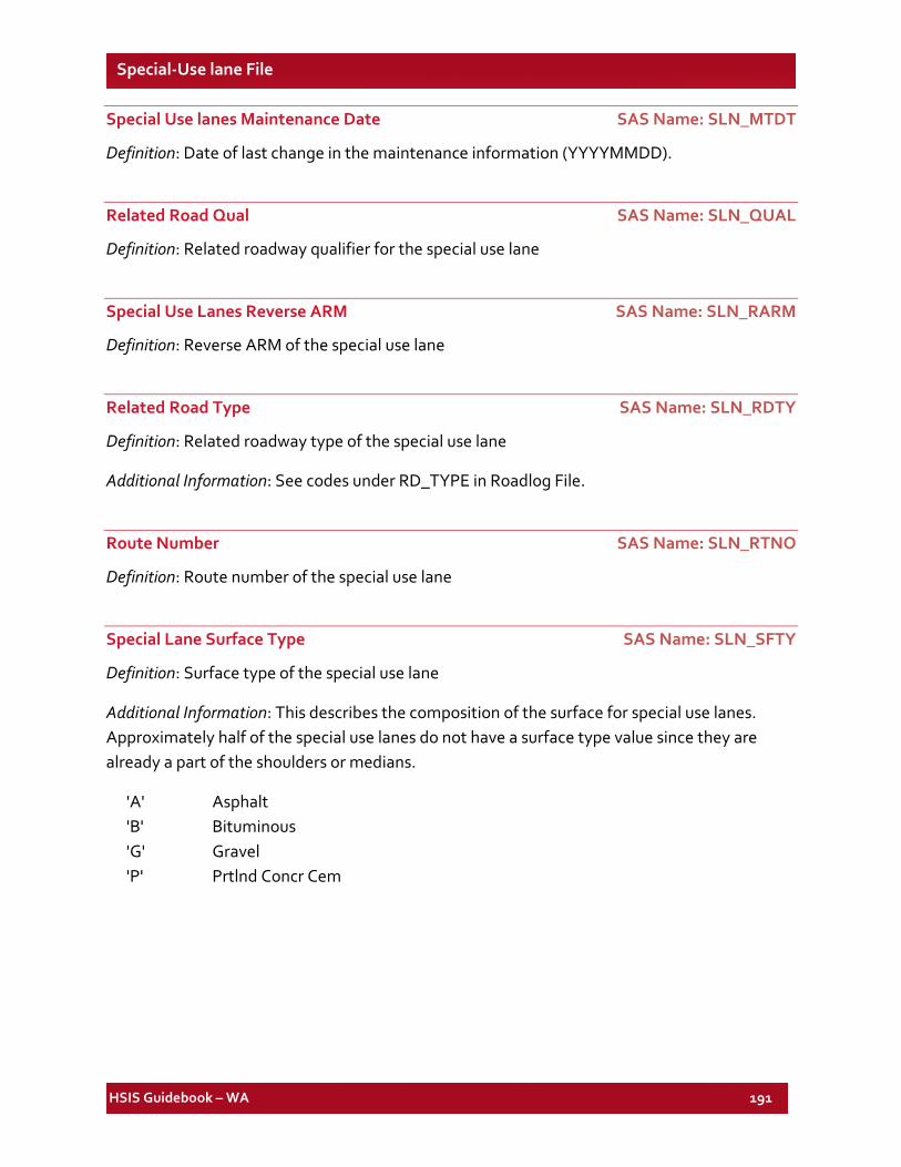
HSIS Guidebook – WA 191
Special-Use lane File
Special Use lanes Maintenance Date SAS Name: SLN_MTDT
Definition: Date of last change in the maintenance information (YYYYMMDD).
Related Road Qual SAS Name: SLN_QUAL
Definition: Related roadway qualifier for the special use lane
Special Use Lanes Reverse ARM SAS Name: SLN_RARM
Definition: Reverse ARM of the special use lane
Related Road Type SAS Name: SLN_RDTY
Definition: Related roadway type of the special use lane
Additional Information: See codes under RD_TYPE in Roadlog File.
Route Number SAS Name: SLN_RTNO
Definition: Route number of the special use lane
Special Lane Surface Type SAS Name: SLN_SFTY
Definition: Surface type of the special use lane
Additional Information: This describes the composition of the surface for special use lanes. Approximately half of the special use lanes do not have a surface type value since they are already a part of the shoulders or medians.
'A' Asphalt 'B' Bituminous 'G' Gravel 'P' Prtlnd Concr Cem
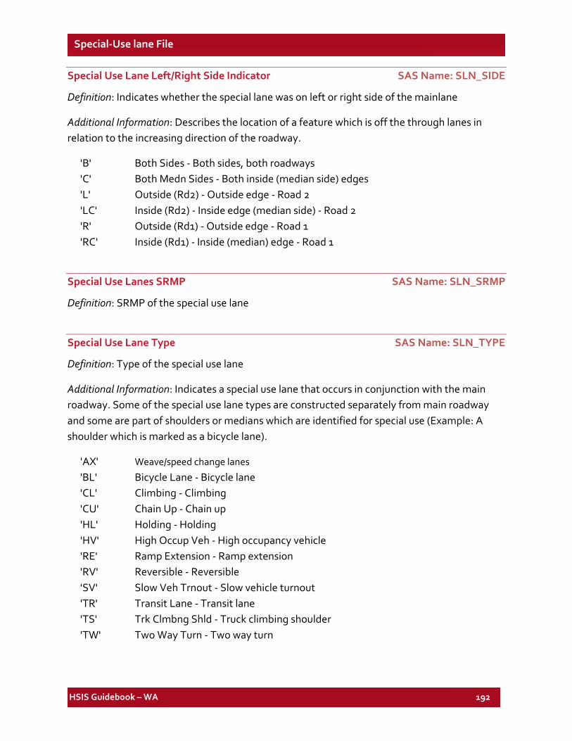
HSIS Guidebook – WA 192
Special-Use lane File
Special Use Lane Left/Right Side Indicator SAS Name: SLN_SIDE
Definition: Indicates whether the special lane was on left or right side of the mainlane
Additional Information: Describes the location of a feature which is off the through lanes in relation to the increasing direction of the roadway.
'B' Both Sides - Both sides, both roadways 'C' Both Medn Sides - Both inside (median side) edges 'L' Outside (Rd2) - Outside edge - Road 2 'LC' Inside (Rd2) - Inside edge (median side) - Road 2 'R' Outside (Rd1) - Outside edge - Road 1 'RC' Inside (Rd1) - Inside (median) edge - Road 1
Special Use Lanes SRMP SAS Name: SLN_SRMP
Definition: SRMP of the special use lane
Special Use Lane Type SAS Name: SLN_TYPE
Definition: Type of the special use lane
Additional Information: Indicates a special use lane that occurs in conjunction with the main roadway. Some of the special use lane types are constructed separately from main roadway and some are part of shoulders or medians which are identified for special use (Example: A shoulder which is marked as a bicycle lane).
'AX' Weave/speed change lanes 'BL' Bicycle Lane - Bicycle lane 'CL' Climbing - Climbing 'CU' Chain Up - Chain up 'HL' Holding - Holding 'HV' High Occup Veh - High occupancy vehicle 'RE' Ramp Extension - Ramp extension 'RV' Reversible - Reversible 'SV' Slow Veh Trnout - Slow vehicle turnout 'TR' Transit Lane - Transit lane 'TS' Trk Clmbng Shld - Truck climbing shoulder 'TW' Two Way Turn - Two way turn
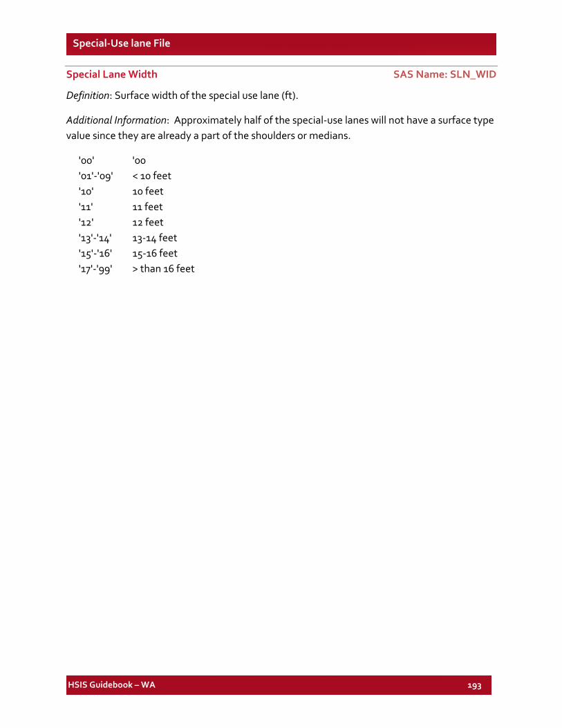
HSIS Guidebook – WA 193
Special-Use lane File
Special Lane Width SAS Name: SLN_WID
Definition: Surface width of the special use lane (ft).
Additional Information: Approximately half of the special-use lanes will not have a surface type value since they are already a part of the shoulders or medians.
'00' '00 '01'-'09' < 10 feet '10' 10 feet '11' 11 feet '12' 12 feet '13'-'14' 13-14 feet '15'-'16' 15-16 feet '17'-'99' > than 16 feet
HSIS Guidebook – WA 194
List of Elements for the WA Features File
SAS VARIABLE NAME DESCRIPTION SAS VARIABLE
FILE FORMAT
TYPE PAGE NO.
BRDG_DT BRIDGE DATE Feature CHA(8) 196 BRDG_LGT BRIDGE LIGHTING Feature CHA(1) 196 BRDG_NBR BRIDGE NUMBER Feature CHA(9) 196 BRDG_OWN BRIDGE XROAD OWNER CD Feature CHA(2) 197 BRDG_XRD BRIDGE XROAD DESC Feature CHA(24) 197 CURV_ANG HORIZ CURVE CEN ANGLE Feature NUM 197 CURV_DT HORIZ CURVE DATE Feature CHA(8) 197 CURV_LGT HORIZ CURVE LENGTH (FT) Feature NUM 197 CURV_MAX HORIZ CURVE MAX SUPER Feature NUM 197
CURV_NUM HORIZ CURVE CONTRACT NUM Feature CHA(6) 198
CURV_RAD HORIZ CURVE RADIUS Feature NUM 198 CURV_TYP HORIZ CURVE TYPE Feature CHA(1) 198 DIR_CURV HORIZ CURVE DIRN Feature CHA(1) 198 DIST_DT DISTRICT DATE Feature CHA(8) 198 DISTNUM DISTRICT NUMBER Feature CHA(1) 198 GRAD_AHD VERT ALIGN GRADE AHEAD Feature NUM 199 GRAD_BAK VERT ALIGN GRADE BACK Feature NUM 199 GRAD_DT VERT ALIGN DATE Feature CHA(8) 199 GRAD_LGT VERT CURVE LENGTH (FT) Feature NUM 199 GRAD_NUM VERT ALIGN CONTRACT NUM Feature CHA(6) 199 GRAD_TYP VERT CURVE TYPE Feature CHA(1) 199 IN_DIR DIRECTION OF INVENTORY Feature CHA(1) 200 IN_INV STATE RTE TYPE ID Feature CHA(11) 200 IN_MLPT ACCUM ROUTE MILEPOST Feature NUM 200 IN_RTNBR ROUTE NUMBER Feature CHA(3) 200 IN_TYPE RELATED ROAD TYPE Feature CHA(2) 200 REC_TYPE RECORD TYPE Feature NUM 200 SPD_DTE SPEED DATE Feature CHA(8) 200 SPD_LIMT LEGAL SPEED LIMIT Feature NUM 201 STR_ALIS STREET NAME ALIAS Feature CHA(24) 201 STR_DTE STRUCTURE DATE Feature CHA(8) 201 TUN_NAME TUNNEL NAME Feature CHA(24) 201 TUN_NUM TUNNEL NUMBER Feature CHA(9) 201 TUNL_DT TUNNEL DATE Feature CHA(8) 202 UNX_DT UNXING DATE Feature CHA(8) 201
HSIS Guidebook – WA 195
List of Elements for the WA Features File
SAS VARIABLE NAME DESCRIPTION SAS VARIABLE
FILE FORMAT
TYPE PAGE NO.
UNX_LGT UNXING LIGHTING Feature CHA(1) 202 UNX_OVHD OVHD BRIDGE NUM Feature CHA(9) 202 UNX_XRD UNXROAD DESC Feature CHA(24) 202 UNX_XRDO UNXROAD OWNER CD Feature CHA(2) 202
HSIS Guidebook – WA 196
Features File
Notes:
1. SAS element names and longer explanatory names are shown above each listing. (See Discussion for information on SAS formats.)
2. For all SAS-formatted elements below, an extra category labeled as "ERROR CODES" consolidates all values not listed as legitimate codes. This category is printed when elements are listed in tables.
3. Feature file is available for 1993-1996 and from 2002 onwards.
Bridge Date SAS Name: BRDG_DT
Definition: Date of last change in the bridge information (YYYYMMDD).
Bridge Lighting SAS Name: BRDG_LGT
Definition: Whether the bridge was illuminated
'Y' Yes 'N' No
Bridge Number SAS Name: BRDG_NBR
Definition: Bridge number
Additional Information: Linkage to National Bridge Index.
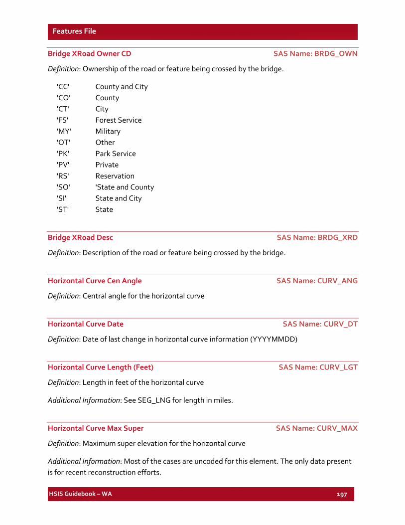
HSIS Guidebook – WA 197
Features File
Bridge XRoad Owner CD SAS Name: BRDG_OWN
Definition: Ownership of the road or feature being crossed by the bridge.
'CC' County and City 'CO' County 'CT' City 'FS' Forest Service 'MY' Military 'OT' Other 'PK' Park Service 'PV' Private 'RS' Reservation 'SO' 'State and County 'SI' State and City 'ST' State
Bridge XRoad Desc SAS Name: BRDG_XRD
Definition: Description of the road or feature being crossed by the bridge.
Horizontal Curve Cen Angle SAS Name: CURV_ANG
Definition: Central angle for the horizontal curve
Horizontal Curve Date SAS Name: CURV_DT
Definition: Date of last change in horizontal curve information (YYYYMMDD)
Horizontal Curve Length (Feet) SAS Name: CURV_LGT
Definition: Length in feet of the horizontal curve
Additional Information: See SEG_LNG for length in miles.
Horizontal Curve Max Super SAS Name: CURV_MAX
Definition: Maximum super elevation for the horizontal curve
Additional Information: Most of the cases are uncoded for this element. The only data present is for recent reconstruction efforts.
HSIS Guidebook – WA 198
Features File
Horizontal Curve Contract Number SAS Name: CURV_NUM
Definition: Horizontal curve contract number
Horizontal Curve Radius (Feet) SAS Name: CURV_RAD
Definition: Horizontal curve radius (feet)
Horizontal Curve Type SAS Name: CURV_TYP
Definition: Horizontal curve type of the feature
Additional Information: Indicates whether the horizontal curve is a regular curve, an angle point, (i.e., an instantaneous change in direction between two intersecting tangent sections), or a gap where no information on the horizontal alignment is available. Code values are specific to the TRIPS system. The element is stored at the SRMP of the curve PC (beginning) with all other data relating to the curve.
'A' Angle Point 'C' Curve (PC/PT) 'G' Gap
Horizontal Curve Direction SAS Name: DIR_CURV
Definition: Direction of a curve on a roadway in reference to the increasing direction of inventory.
'L' Left 'R' Right
District Date SAS Name: DIST_DT
Definition: District date of the feature
Additional Information: Date of last change in related element (YYYYMMDD).
District Number SAS Name: DISTNUM
Definition: District number of the feature
HSIS Guidebook – WA 199
Features File
Vertical Align Grade Ahead SAS Name: GRAD_AHD
Definition: Vertical align grade ahead of the feature
Additional Information: Percent grade (x.xx%).
Vertical Align Grade Back SAS Name: GRAD_BAK
Definition: Vertical align grade back of the feature
Additional Information: Percent grade (x.xx%).
Vertical Align Date SAS Name: GRAD_DT
Definition: Date of last change in the vertical alignment information
Vertical Curve Length (Feet) SAS Name: GRAD_LGT
Definition: Vertical curve length of the feature
Vertical Align Contract Number SAS Name: GRAD_NUM
Definition: Vertical align contract number of the special use lane
Additional Information: The contract number of the last contract that changed the vertical alignment of a roadway section
Vertical Curve Type SAS Name: GRAD_TYP
Definition: Type of vertical curve at the end of the grade.
Additional Information: Indicates whether the end of the grade is connected to the succeeding grade with a vertical curve or an angle point,(i.e., instantaneous change in percent grade of the two intersecting tangent sections).
'A' Angle Point 'C' Vertical Curve 'G' Gap
HSIS Guidebook – WA 200
Features File
Direction of Inventory SAS Name: IN_DIR
Definition: Direction of inventory of the feature
Additional Information: The inventory direction indicates the direction of mileposting on a state route. State routes are mileposted from a south to north or from west to east.
'I' SRMP Incr dir - Increasing direction (SRMP increases when traveling in the increasing direction)
'D' SRMP decr dir - Decreasing direction (SRMP decreases when traveling in the decreasing direction)
'B' Both directions - B = Both directions of the roadway.
State Route Type ID SAS Name: IN_INV
Definition: State route type ID of the feature
Accum Route Milepost SAS Name: IN_MLPT
Definition: Accumulated Route Milepost (ARM) of the feature
Route Number SAS Name: IN_RTNBR
Definition: Route number of the feature
Related Road Type SAS Name: IN_TYPE
Definition: Related road type of the feature
Record Type SAS Name: REC_TYPE
Definition: Record type of the feature
Additional Information: File type identification.
Speed Date SAS Name: SPD_DTE
Definition: Date of last change in the speed limit information (YYYYMMDD).
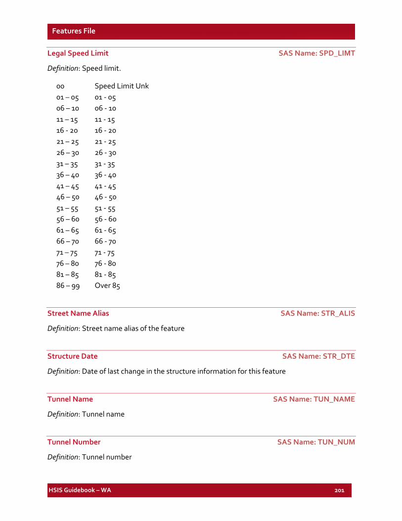
HSIS Guidebook – WA 201
Features File
Legal Speed Limit SAS Name: SPD_LIMT
Definition: Speed limit.
00 Speed Limit Unk 01 – 05 01 - 05 06 – 10 06 - 10 11 – 15 11 - 15 16 - 20 16 - 20 21 – 25 21 - 25 26 – 30 26 - 30 31 – 35 31 - 35 36 – 40 36 - 40 41 – 45 41 - 45 46 – 50 46 - 50 51 – 55 51 - 55 56 – 60 56 - 60 61 – 65 61 - 65 66 – 70 66 - 70 71 – 75 71 - 75 76 – 80 76 - 80 81 – 85 81 - 85 86 – 99 Over 85
Street Name Alias SAS Name: STR_ALIS
Definition: Street name alias of the feature
Structure Date SAS Name: STR_DTE
Definition: Date of last change in the structure information for this feature
Tunnel Name SAS Name: TUN_NAME
Definition: Tunnel name
Tunnel Number SAS Name: TUN_NUM
Definition: Tunnel number
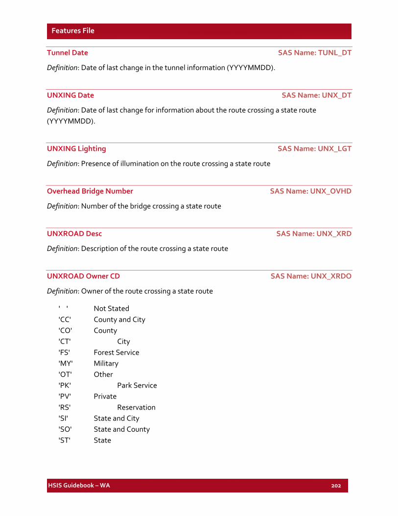
HSIS Guidebook – WA 202
Features File
Tunnel Date SAS Name: TUNL_DT
Definition: Date of last change in the tunnel information (YYYYMMDD).
UNXING Date SAS Name: UNX_DT
Definition: Date of last change for information about the route crossing a state route (YYYYMMDD).
UNXING Lighting SAS Name: UNX_LGT
Definition: Presence of illumination on the route crossing a state route
Overhead Bridge Number SAS Name: UNX_OVHD
Definition: Number of the bridge crossing a state route
UNXROAD Desc SAS Name: UNX_XRD
Definition: Description of the route crossing a state route
UNXROAD Owner CD SAS Name: UNX_XRDO
Definition: Owner of the route crossing a state route
' ' Not Stated 'CC' County and City 'CO' County 'CT' City 'FS' Forest Service 'MY' Military 'OT' Other 'PK' Park Service 'PV' Private 'RS' Reservation 'SI' State and City 'SO' State and County 'ST' State
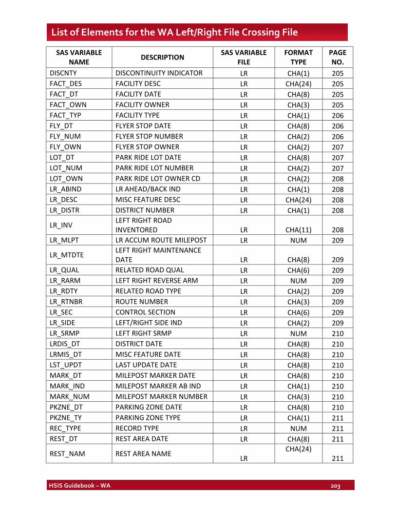
HSIS Guidebook – WA 203
List of Elements for the WA Left/Right File Crossing File
SAS VARIABLE NAME DESCRIPTION SAS VARIABLE
FILE FORMAT
TYPE PAGE NO.
DISCNTY DISCONTINUITY INDICATOR LR CHA(1) 205 FACT_DES FACILITY DESC LR CHA(24) 205 FACT_DT FACILITY DATE LR CHA(8) 205 FACT_OWN FACILITY OWNER LR CHA(3) 205 FACT_TYP FACILITY TYPE LR CHA(1) 206 FLY_DT FLYER STOP DATE LR CHA(8) 206 FLY_NUM FLYER STOP NUMBER LR CHA(2) 206 FLY_OWN FLYER STOP OWNER LR CHA(2) 207 LOT_DT PARK RIDE LOT DATE LR CHA(8) 207 LOT_NUM PARK RIDE LOT NUMBER LR CHA(2) 207 LOT_OWN PARK RIDE LOT OWNER CD LR CHA(2) 208 LR_ABIND LR AHEAD/BACK IND LR CHA(1) 208 LR_DESC MISC FEATURE DESC LR CHA(24) 208 LR_DISTR DISTRICT NUMBER LR CHA(1) 208
LR_INV LEFT RIGHT ROAD INVENTORED LR CHA(11) 208
LR_MLPT LR ACCUM ROUTE MILEPOST LR NUM 209
LR_MTDTE LEFT RIGHT MAINTENANCE DATE LR CHA(8) 209
LR_QUAL RELATED ROAD QUAL LR CHA(6) 209 LR_RARM LEFT RIGHT REVERSE ARM LR NUM 209 LR_RDTY RELATED ROAD TYPE LR CHA(2) 209 LR_RTNBR ROUTE NUMBER LR CHA(3) 209 LR_SEC CONTROL SECTION LR CHA(6) 209 LR_SIDE LEFT/RIGHT SIDE IND LR CHA(2) 209 LR_SRMP LEFT RIGHT SRMP LR NUM 210 LRDIS_DT DISTRICT DATE LR CHA(8) 210 LRMIS_DT MISC FEATURE DATE LR CHA(8) 210 LST_UPDT LAST UPDATE DATE LR CHA(8) 210 MARK_DT MILEPOST MARKER DATE LR CHA(8) 210 MARK_IND MILEPOST MARKER AB IND LR CHA(1) 210 MARK_NUM MILEPOST MARKER NUMBER LR CHA(3) 210 PKZNE_DT PARKING ZONE DATE LR CHA(8) 210 PKZNE_TY PARKING ZONE TYPE LR CHA(1) 211 REC_TYPE RECORD TYPE LR NUM 211 REST_DT REST AREA DATE LR CHA(8) 211
REST_NAM REST AREA NAME LR CHA(24)
211
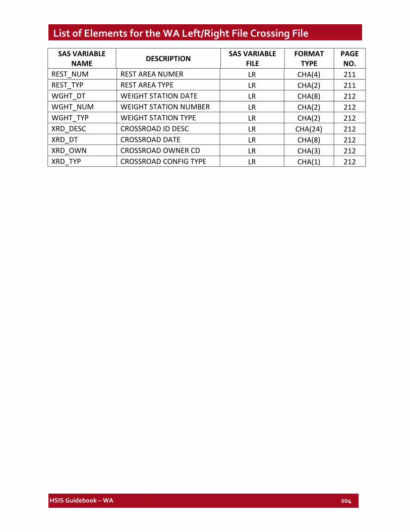
HSIS Guidebook – WA 204
List of Elements for the WA Left/Right File Crossing File
SAS VARIABLE NAME DESCRIPTION SAS VARIABLE
FILE FORMAT
TYPE PAGE NO.
REST_NUM REST AREA NUMER LR CHA(4) 211 REST_TYP REST AREA TYPE LR CHA(2) 211 WGHT_DT WEIGHT STATION DATE LR CHA(8) 212 WGHT_NUM WEIGHT STATION NUMBER LR CHA(2) 212 WGHT_TYP WEIGHT STATION TYPE LR CHA(2) 212 XRD_DESC CROSSROAD ID DESC LR CHA(24) 212 XRD_DT CROSSROAD DATE LR CHA(8) 212 XRD_OWN CROSSROAD OWNER CD LR CHA(3) 212 XRD_TYP CROSSROAD CONFIG TYPE LR CHA(1) 212
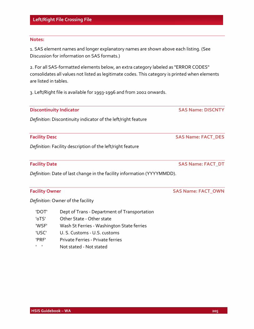
HSIS Guidebook – WA 205
Left/Right File Crossing File
Notes:
1. SAS element names and longer explanatory names are shown above each listing. (See Discussion for information on SAS formats.)
2. For all SAS-formatted elements below, an extra category labeled as "ERROR CODES" consolidates all values not listed as legitimate codes. This category is printed when elements are listed in tables.
3. Left/Right file is available for 1993-1996 and from 2002 onwards.
Discontinuity Indicator SAS Name: DISCNTY
Definition: Discontinuity indicator of the left/right feature
Facility Desc SAS Name: FACT_DES
Definition: Facility description of the left/right feature
Facility Date SAS Name: FACT_DT
Definition: Date of last change in the facility information (YYYYMMDD).
Facility Owner SAS Name: FACT_OWN
Definition: Owner of the facility
'DOT' Dept of Trans - Department of Transportation '0TS' Other State - Other state 'WSF' Wash St Ferries - Washington State ferries 'USC' U. S. Customs - U.S. customs 'PRF' Private Ferries - Private ferries ' ' Not stated - Not stated
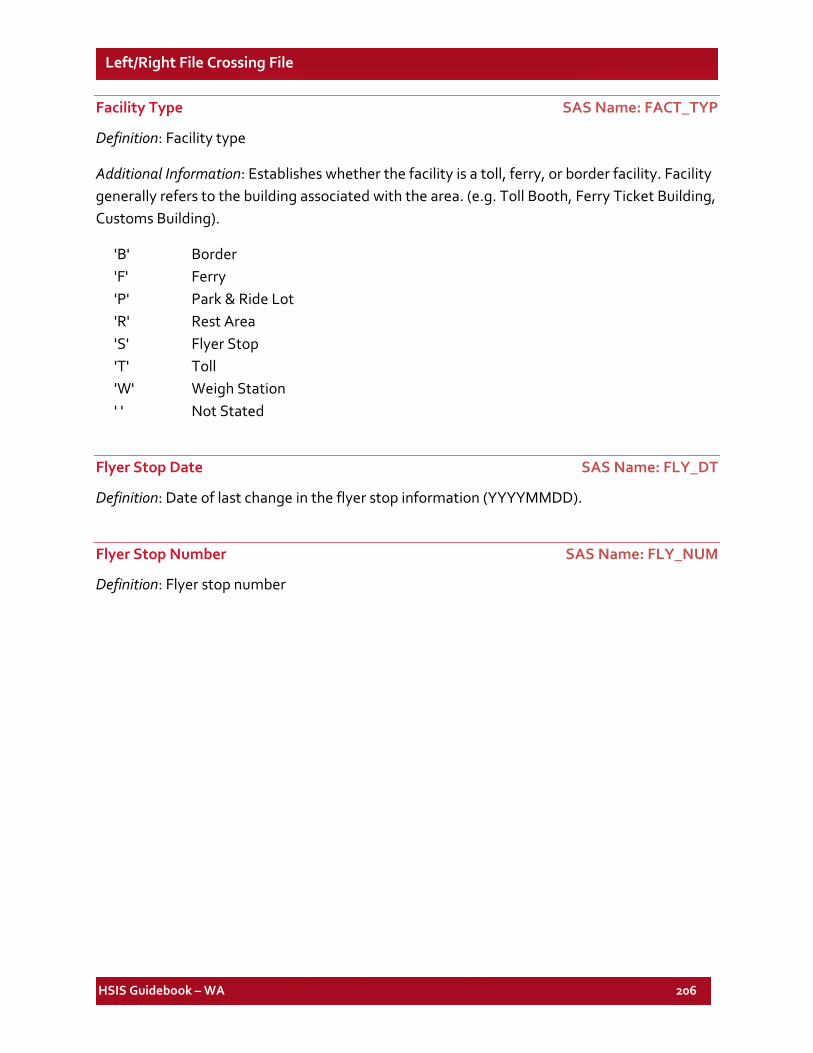
HSIS Guidebook – WA 206
Left/Right File Crossing File
Facility Type SAS Name: FACT_TYP
Definition: Facility type
Additional Information: Establishes whether the facility is a toll, ferry, or border facility. Facility generally refers to the building associated with the area. (e.g. Toll Booth, Ferry Ticket Building, Customs Building).
'B' Border 'F' Ferry 'P' Park & Ride Lot 'R' Rest Area 'S' Flyer Stop 'T' Toll 'W' Weigh Station ' ' Not Stated
Flyer Stop Date SAS Name: FLY_DT
Definition: Date of last change in the flyer stop information (YYYYMMDD).
Flyer Stop Number SAS Name: FLY_NUM
Definition: Flyer stop number
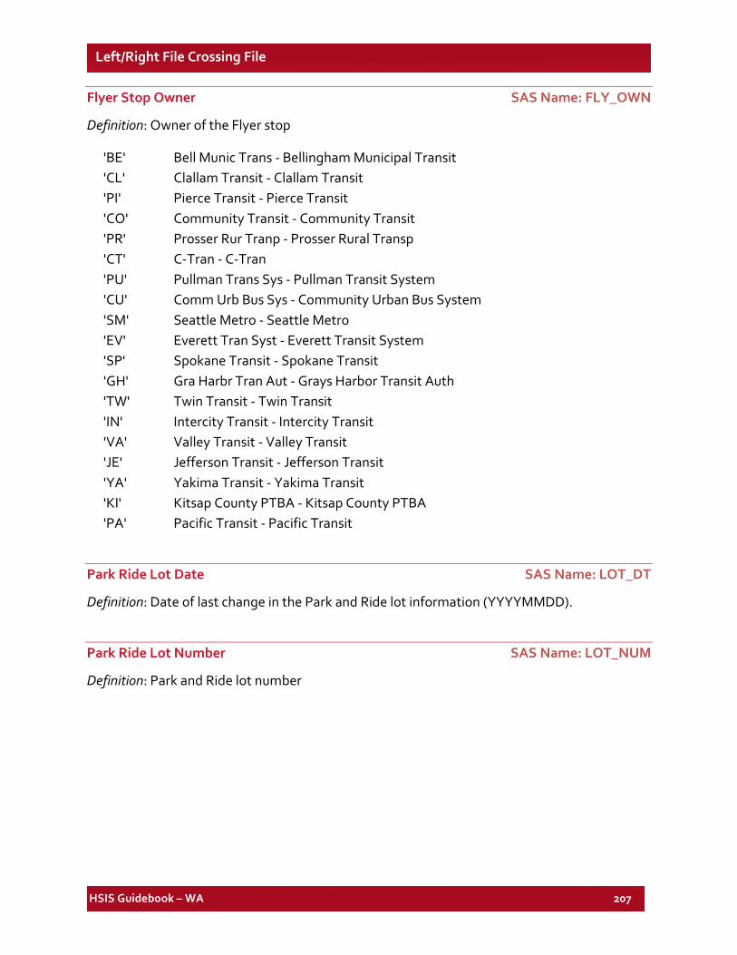
HSIS Guidebook – WA 207
Left/Right File Crossing File
Flyer Stop Owner SAS Name: FLY_OWN
Definition: Owner of the Flyer stop
'BE' Bell Munic Trans - Bellingham Municipal Transit 'CL' Clallam Transit - Clallam Transit 'PI' Pierce Transit - Pierce Transit 'CO' Community Transit - Community Transit 'PR' Prosser Rur Tranp - Prosser Rural Transp 'CT' C-Tran - C-Tran 'PU' Pullman Trans Sys - Pullman Transit System 'CU' Comm Urb Bus Sys - Community Urban Bus System 'SM' Seattle Metro - Seattle Metro 'EV' Everett Tran Syst - Everett Transit System 'SP' Spokane Transit - Spokane Transit 'GH' Gra Harbr Tran Aut - Grays Harbor Transit Auth 'TW' Twin Transit - Twin Transit 'IN' Intercity Transit - Intercity Transit 'VA' Valley Transit - Valley Transit 'JE' Jefferson Transit - Jefferson Transit 'YA' Yakima Transit - Yakima Transit 'KI' Kitsap County PTBA - Kitsap County PTBA 'PA' Pacific Transit - Pacific Transit
Park Ride Lot Date SAS Name: LOT_DT
Definition: Date of last change in the Park and Ride lot information (YYYYMMDD).
Park Ride Lot Number SAS Name: LOT_NUM
Definition: Park and Ride lot number
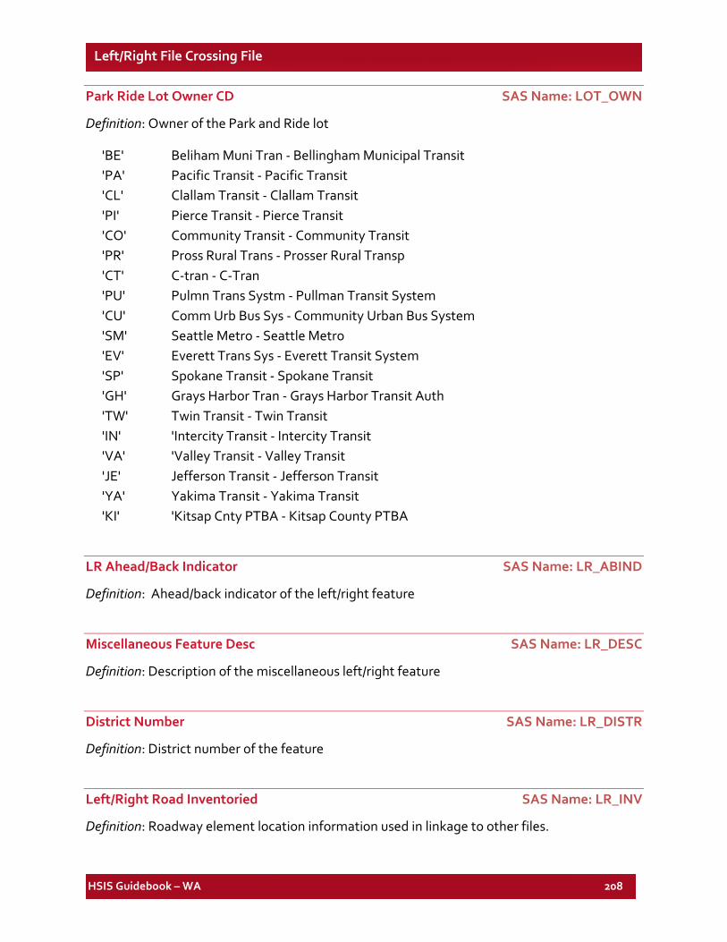
HSIS Guidebook – WA 208
Left/Right File Crossing File
Park Ride Lot Owner CD SAS Name: LOT_OWN
Definition: Owner of the Park and Ride lot
'BE' Beliham Muni Tran - Bellingham Municipal Transit 'PA' Pacific Transit - Pacific Transit 'CL' Clallam Transit - Clallam Transit 'PI' Pierce Transit - Pierce Transit 'CO' Community Transit - Community Transit 'PR' Pross Rural Trans - Prosser Rural Transp 'CT' C-tran - C-Tran 'PU' Pulmn Trans Systm - Pullman Transit System 'CU' Comm Urb Bus Sys - Community Urban Bus System 'SM' Seattle Metro - Seattle Metro 'EV' Everett Trans Sys - Everett Transit System 'SP' Spokane Transit - Spokane Transit 'GH' Grays Harbor Tran - Grays Harbor Transit Auth 'TW' Twin Transit - Twin Transit 'IN' 'Intercity Transit - Intercity Transit 'VA' 'Valley Transit - Valley Transit 'JE' Jefferson Transit - Jefferson Transit 'YA' Yakima Transit - Yakima Transit 'KI' 'Kitsap Cnty PTBA - Kitsap County PTBA
LR Ahead/Back Indicator SAS Name: LR_ABIND
Definition: Ahead/back indicator of the left/right feature
Miscellaneous Feature Desc SAS Name: LR_DESC
Definition: Description of the miscellaneous left/right feature
District Number SAS Name: LR_DISTR
Definition: District number of the feature
Left/Right Road Inventoried SAS Name: LR_INV
Definition: Roadway element location information used in linkage to other files.
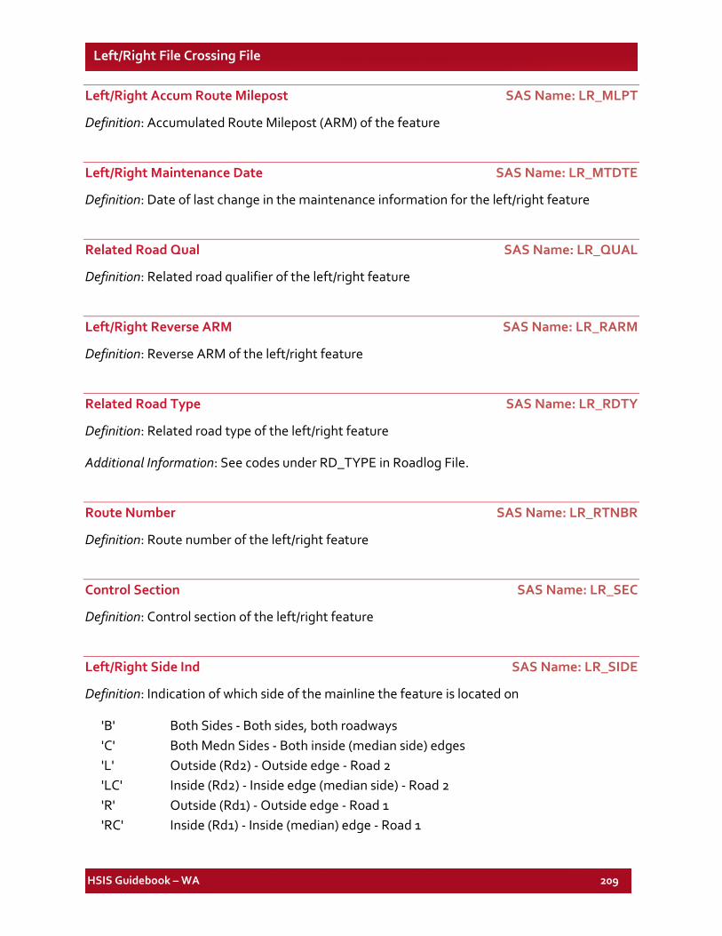
HSIS Guidebook – WA 209
Left/Right File Crossing File
Left/Right Accum Route Milepost SAS Name: LR_MLPT
Definition: Accumulated Route Milepost (ARM) of the feature
Left/Right Maintenance Date SAS Name: LR_MTDTE
Definition: Date of last change in the maintenance information for the left/right feature
Related Road Qual SAS Name: LR_QUAL
Definition: Related road qualifier of the left/right feature
Left/Right Reverse ARM SAS Name: LR_RARM
Definition: Reverse ARM of the left/right feature
Related Road Type SAS Name: LR_RDTY
Definition: Related road type of the left/right feature
Additional Information: See codes under RD_TYPE in Roadlog File.
Route Number SAS Name: LR_RTNBR
Definition: Route number of the left/right feature
Control Section SAS Name: LR_SEC
Definition: Control section of the left/right feature
Left/Right Side Ind SAS Name: LR_SIDE
Definition: Indication of which side of the mainline the feature is located on
'B' Both Sides - Both sides, both roadways 'C' Both Medn Sides - Both inside (median side) edges 'L' Outside (Rd2) - Outside edge - Road 2 'LC' Inside (Rd2) - Inside edge (median side) - Road 2 'R' Outside (Rd1) - Outside edge - Road 1 'RC' Inside (Rd1) - Inside (median) edge - Road 1
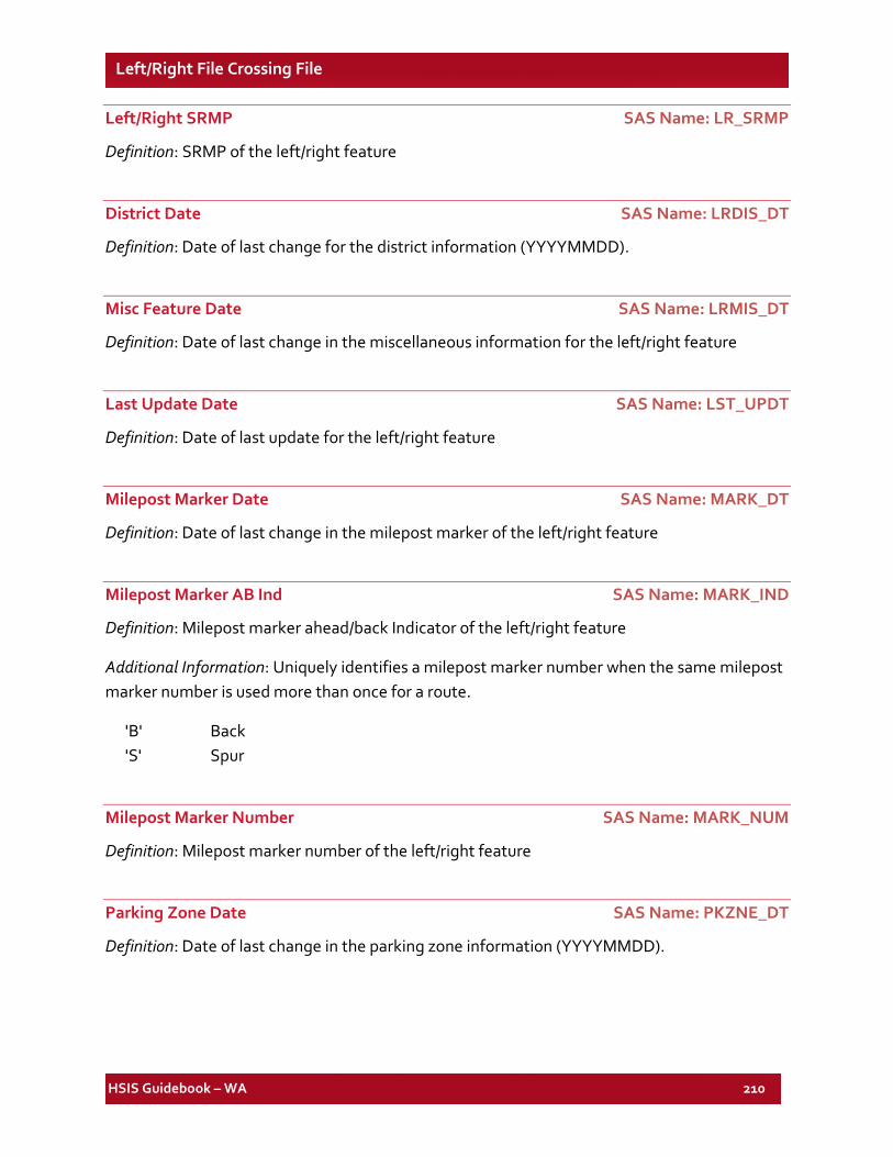
HSIS Guidebook – WA 210
Left/Right File Crossing File
Left/Right SRMP SAS Name: LR_SRMP
Definition: SRMP of the left/right feature
District Date SAS Name: LRDIS_DT
Definition: Date of last change for the district information (YYYYMMDD).
Misc Feature Date SAS Name: LRMIS_DT
Definition: Date of last change in the miscellaneous information for the left/right feature
Last Update Date SAS Name: LST_UPDT
Definition: Date of last update for the left/right feature
Milepost Marker Date SAS Name: MARK_DT
Definition: Date of last change in the milepost marker of the left/right feature
Milepost Marker AB Ind SAS Name: MARK_IND
Definition: Milepost marker ahead/back Indicator of the left/right feature
Additional Information: Uniquely identifies a milepost marker number when the same milepost marker number is used more than once for a route.
'B' Back 'S' Spur
Milepost Marker Number SAS Name: MARK_NUM
Definition: Milepost marker number of the left/right feature
Parking Zone Date SAS Name: PKZNE_DT
Definition: Date of last change in the parking zone information (YYYYMMDD).
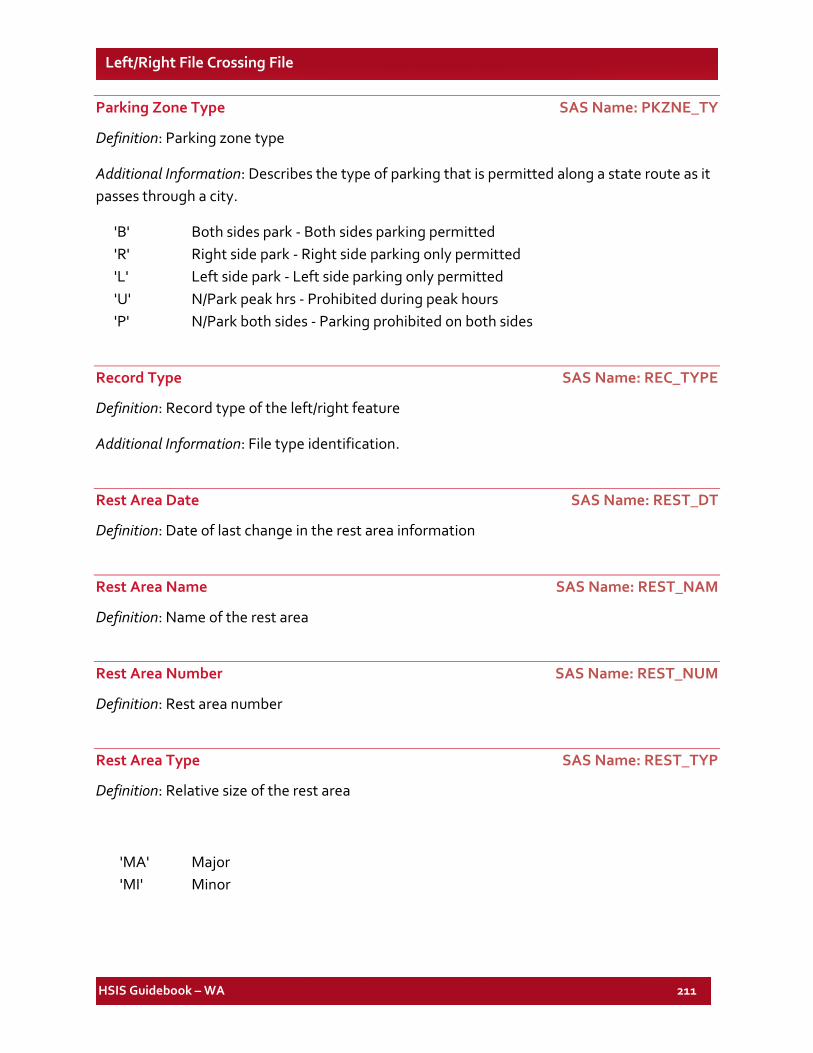
HSIS Guidebook – WA 211
Left/Right File Crossing File
Parking Zone Type SAS Name: PKZNE_TY
Definition: Parking zone type
Additional Information: Describes the type of parking that is permitted along a state route as it passes through a city.
'B' Both sides park - Both sides parking permitted 'R' Right side park - Right side parking only permitted 'L' Left side park - Left side parking only permitted 'U' N/Park peak hrs - Prohibited during peak hours 'P' N/Park both sides - Parking prohibited on both sides
Record Type SAS Name: REC_TYPE
Definition: Record type of the left/right feature
Additional Information: File type identification.
Rest Area Date SAS Name: REST_DT
Definition: Date of last change in the rest area information
Rest Area Name SAS Name: REST_NAM
Definition: Name of the rest area
Rest Area Number SAS Name: REST_NUM
Definition: Rest area number
Rest Area Type SAS Name: REST_TYP
Definition: Relative size of the rest area
'MA' Major 'MI' Minor
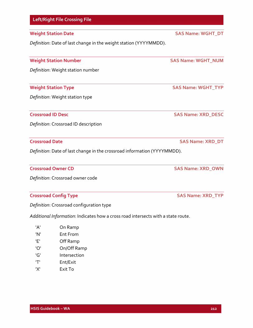
HSIS Guidebook – WA 212
Left/Right File Crossing File
Weight Station Date SAS Name: WGHT_DT
Definition: Date of last change in the weight station (YYYYMMDD).
Weight Station Number SAS Name: WGHT_NUM
Definition: Weight station number
Weight Station Type SAS Name: WGHT_TYP
Definition: Weight station type
Crossroad ID Desc SAS Name: XRD_DESC
Definition: Crossroad ID description
Crossroad Date SAS Name: XRD_DT
Definition: Date of last change in the crossroad information (YYYYMMDD).
Crossroad Owner CD SAS Name: XRD_OWN
Definition: Crossroad owner code
Crossroad Config Type SAS Name: XRD_TYP
Definition: Crossroad configuration type
Additional Information: Indicates how a cross road intersects with a state route.
'A' On Ramp 'N' Ent From 'E' Off Ramp 'O' On/Off Ramp 'G' Intersection 'T' Ent/Exit 'X' Exit To
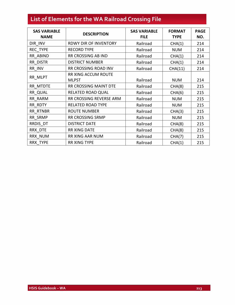
HSIS Guidebook – WA 213
List of Elements for the WA Railroad Crossing File
SAS VARIABLE NAME DESCRIPTION SAS VARIABLE
FILE FORMAT
TYPE PAGE NO.
DIR_INV RDWY DIR OF INVENTORY Railroad CHA(1) 214 REC_TYPE RECORD TYPE Railroad NUM 214 RR_ABIND RR CROSSING AB IND Railroad CHA(1) 214 RR_DISTR DISTRICT NUMBER Railroad CHA(1) 214 RR_INV RR CROSSING ROAD INV Railroad CHA(11) 214
RR_MLPT RR XING ACCUM ROUTE MLPST Railroad NUM 214
RR_MTDTE RR CROSSING MAINT DTE Railroad CHA(8) 215 RR_QUAL RELATED ROAD QUAL Railroad CHA(6) 215 RR_RARM RR CROSSING REVERSE ARM Railroad NUM 215 RR_RDTY RELATED ROAD TYPE Railroad NUM 215 RR_RTNBR ROUTE NUMBER Railroad CHA(3) 215 RR_SRMP RR CROSSING SRMP Railroad NUM 215 RRDIS_DT DISTRICT DATE Railroad CHA(8) 215 RRX_DTE RR XING DATE Railroad CHA(8) 215 RRX_NUM RR XING AAR NUM Railroad CHA(7) 215 RRX_TYPE RR XING TYPE Railroad CHA(1) 215
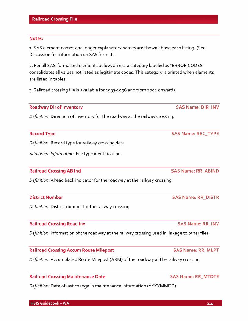
HSIS Guidebook – WA 214
Railroad Crossing File
Notes:
1. SAS element names and longer explanatory names are shown above each listing. (See Discussion for information on SAS formats.
2. For all SAS-formatted elements below, an extra category labeled as "ERROR CODES" consolidates all values not listed as legitimate codes. This category is printed when elements are listed in tables.
3. Railroad crossing file is available for 1993-1996 and from 2002 onwards.
Roadway Dir of Inventory SAS Name: DIR_INV
Definition: Direction of inventory for the roadway at the railway crossing.
Record Type SAS Name: REC_TYPE
Definition: Record type for railway crossing data
Additional Information: File type identification.
Railroad Crossing AB Ind SAS Name: RR_ABIND
Definition: Ahead back indicator for the roadway at the railway crossing
District Number SAS Name: RR_DISTR
Definition: District number for the railway crossing
Railroad Crossing Road Inv SAS Name: RR_INV
Definition: Information of the roadway at the railway crossing used in linkage to other files
Railroad Crossing Accum Route Milepost SAS Name: RR_MLPT
Definition: Accumulated Route Milepost (ARM) of the roadway at the railway crossing
Railroad Crossing Maintenance Date SAS Name: RR_MTDTE
Definition: Date of last change in maintenance information (YYYYMMDD).
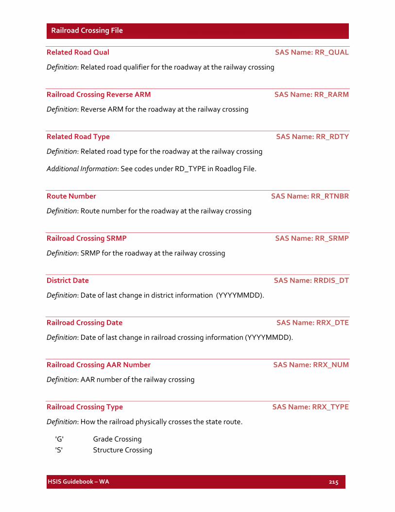
HSIS Guidebook – WA 215
Railroad Crossing File
Related Road Qual SAS Name: RR_QUAL
Definition: Related road qualifier for the roadway at the railway crossing
Railroad Crossing Reverse ARM SAS Name: RR_RARM
Definition: Reverse ARM for the roadway at the railway crossing
Related Road Type SAS Name: RR_RDTY
Definition: Related road type for the roadway at the railway crossing
Additional Information: See codes under RD_TYPE in Roadlog File.
Route Number SAS Name: RR_RTNBR
Definition: Route number for the roadway at the railway crossing
Railroad Crossing SRMP SAS Name: RR_SRMP
Definition: SRMP for the roadway at the railway crossing
District Date SAS Name: RRDIS_DT
Definition: Date of last change in district information (YYYYMMDD).
Railroad Crossing Date SAS Name: RRX_DTE
Definition: Date of last change in railroad crossing information (YYYYMMDD).
Railroad Crossing AAR Number SAS Name: RRX_NUM
Definition: AAR number of the railway crossing
Railroad Crossing Type SAS Name: RRX_TYPE
Definition: How the railroad physically crosses the state route.
'G' Grade Crossing 'S' Structure Crossing