GNSS & Victoria's CORS Network
30
Department of Sustainability and Environment Spatial Information Infrastructure Strategic Projects and Policy Melbourne GIS User Group GNSS & Victoria’s CORS Network Presenter: Hayden Asmussen - GPSnet Project Officer
-
Upload
bringit3004 -
Category
Documents
-
view
247 -
download
0
Transcript of GNSS & Victoria's CORS Network

8/9/2019 GNSS & Victoria's CORS Network
http://slidepdf.com/reader/full/gnss-victorias-cors-network 1/30
Department of Sustainability and Environment
Spatial Information InfrastructureStrategic Projects and Policy
Melbourne GIS User Group
GNSS & Victoria’s CORS Network
Presenter:
Hayden Asmussen - GPSnet Project Officer
8/9/2019 GNSS & Victoria's CORS Network
http://slidepdf.com/reader/full/gnss-victorias-cors-network 2/30
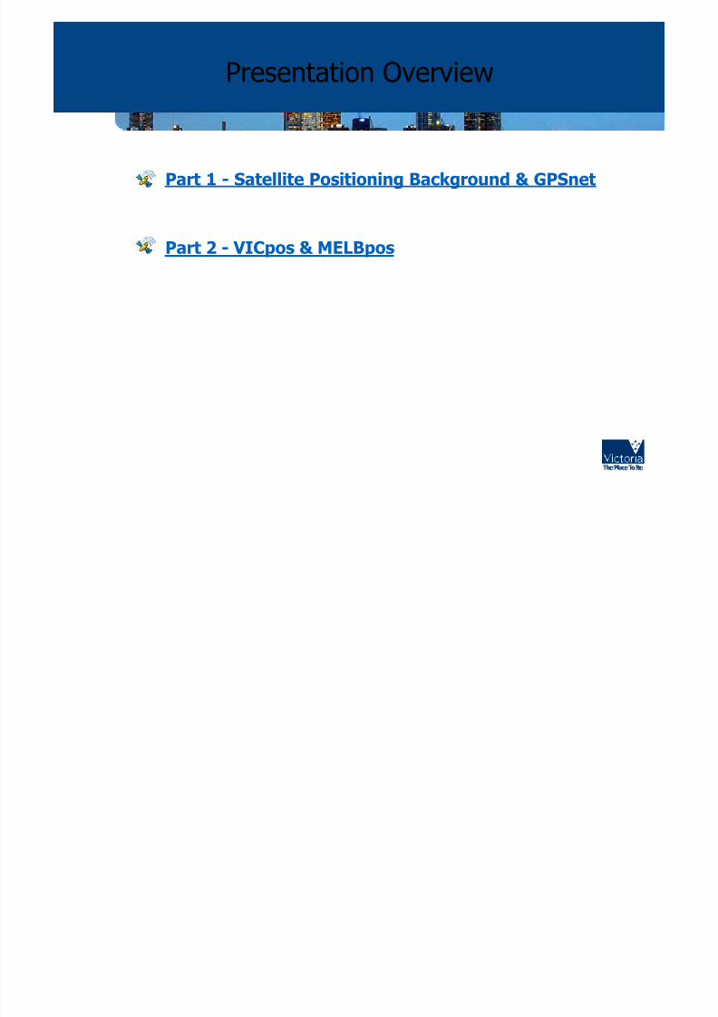
Presentation Overview
• Part 1 - Satellite Positioning Background & GPSnet
• Part 2 - VICpos & MELBpos

8/9/2019 GNSS & Victoria's CORS Network
http://slidepdf.com/reader/full/gnss-victorias-cors-network 3/30
Part 1 - GNSS and CORS
• GNSS:Global Navigation Satellite Systems
– Includes Satellite Constellations from:
GPS - American (currently 29)
GLONASS - Russian (currently 14)
GALILEO - European (currently 1 test Satellite)

8/9/2019 GNSS & Victoria's CORS Network
http://slidepdf.com/reader/full/gnss-victorias-cors-network 4/30
Continual Operating Reference Station Networks - Global Trends

8/9/2019 GNSS & Victoria's CORS Network
http://slidepdf.com/reader/full/gnss-victorias-cors-network 5/30
CORS Networks - Australia

8/9/2019 GNSS & Victoria's CORS Network
http://slidepdf.com/reader/full/gnss-victorias-cors-network 6/30
CORS Networks - State
SUNpoz
Darwin CORS
SydNET

8/9/2019 GNSS & Victoria's CORS Network
http://slidepdf.com/reader/full/gnss-victorias-cors-network 7/30
GPSnet Infrastructure – Base Stations

8/9/2019 GNSS & Victoria's CORS Network
http://slidepdf.com/reader/full/gnss-victorias-cors-network 8/30
GPSnetTM is a series of 24
(CORS) GPS Base Station
strategically located at
DSE/and non DSE locations
within Victoria.
Cooperative network of basestations developed and
installed in partnership with
government, academia, the
spatial industry and the
community.
It provides post processing
from all sites and Single
Base Real-time Kinematic
(RTK) from 9 sites via local
radio.
GPSnet Base Stations

8/9/2019 GNSS & Victoria's CORS Network
http://slidepdf.com/reader/full/gnss-victorias-cors-network 9/30
GPSnet Co-ordination
• Coordination of GPSnet CORS sites
– GDA94 compatibility
– VICpos/MELBpos centimetric absolute accuracy
– GPSnet designed for use in Victoria

8/9/2019 GNSS & Victoria's CORS Network
http://slidepdf.com/reader/full/gnss-victorias-cors-network 10/30
GPSnet Legal Traceability
• Legal Traceability of Position
– GPSnet certification
– ‘Best Practice’

8/9/2019 GNSS & Victoria's CORS Network
http://slidepdf.com/reader/full/gnss-victorias-cors-network 11/30
GPS/GPSnet and Cadastral Surveying
– Approved for Cadastral Surveying by SGV
– Land Surveyors using GPSnet for cadastral Surveys NOW

8/9/2019 GNSS & Victoria's CORS Network
http://slidepdf.com/reader/full/gnss-victorias-cors-network 12/30
• Part 1 - Satellite Positioning Background & GPSnet
• Part 2 - VICpos & MELBpos
Presentation Overview

8/9/2019 GNSS & Victoria's CORS Network
http://slidepdf.com/reader/full/gnss-victorias-cors-network 13/30
• VICposTM - a subset of 17
GPSnet Base Stations
• Provides Networked real-
time sub-metre DGPS
corrections across the entire
state.
• Applications include asset
mapping, real-time feature
navigation, GIS and
Precision Ag.
• Provides real-time Single
Base solutions at cm(s)
level. (Best Practice 20km)
Part 2 - VICpos & MELBpos

8/9/2019 GNSS & Victoria's CORS Network
http://slidepdf.com/reader/full/gnss-victorias-cors-network 14/30
GPSnet Infrastructure - Melbourne and Environs Network
• MELBpos Phase 1 -
Operational 10 Jan 2006
• Sub 2cm accuracy Horiz
using NRTK solution.
• GPSnet University of
Melbourne now operational
Melbourne University
• MELBpos Phase 2 -
Densification North, NorthWest and West of
Melbourne
• Targeting local
government, utility
companies and land
surveyors

8/9/2019 GNSS & Victoria's CORS Network
http://slidepdf.com/reader/full/gnss-victorias-cors-network 15/30
The VICpos/MELBpos Service
What it looks likeHow it works
• GPS data streamed to centralserver from 17 active GPSnet
base stations
• This data is processed and
distributed as a networked
DGPS or Networked RTK
• Real-time corrections
distributed over the internet via
(NTRIP) in CMR or RTCM
format
• Users access the data
corrections via a GPRS and
Bluetooth enabled mobile
phones
Internet MobilePhone
GPS
Bond devices
using Bluetooth
Connection tointernet via
GPRS
ADSL
connection
Field Applications
Mobile/Asset GISSurvey
NTRIP
Agriculture

8/9/2019 GNSS & Victoria's CORS Network
http://slidepdf.com/reader/full/gnss-victorias-cors-network 16/30
Reference Station dataReference Station data
is streamed to Centralis streamed to CentralServer Cluster in GeelongServer Cluster in Geelong
Initial Rover PositionInitial Rover Position
sent to server forsent to server forcorrectioncorrection
VRS corrected position VRS corrected position
is calculated at the Roveris calculated at the Rover
VRS position is based VRS position is based
on corrections fromon corrections from6 closest GPSnet Base6 closest GPSnet Base
StationsStations
Server uses VRS positionServer uses VRS position
to create correctedto create corrected
real-time datareal-time data
The Rover uses short rangeThe Rover uses short range
VRS data VRS data

8/9/2019 GNSS & Victoria's CORS Network
http://slidepdf.com/reader/full/gnss-victorias-cors-network 17/30
GPSnet Real Time Server Cluster

8/9/2019 GNSS & Victoria's CORS Network
http://slidepdf.com/reader/full/gnss-victorias-cors-network 18/30
GPSnet Nodes Streaming Real time Raw Data
To Central Server Cluster
8/9/2019 GNSS & Victoria's CORS Network
http://slidepdf.com/reader/full/gnss-victorias-cors-network 19/30
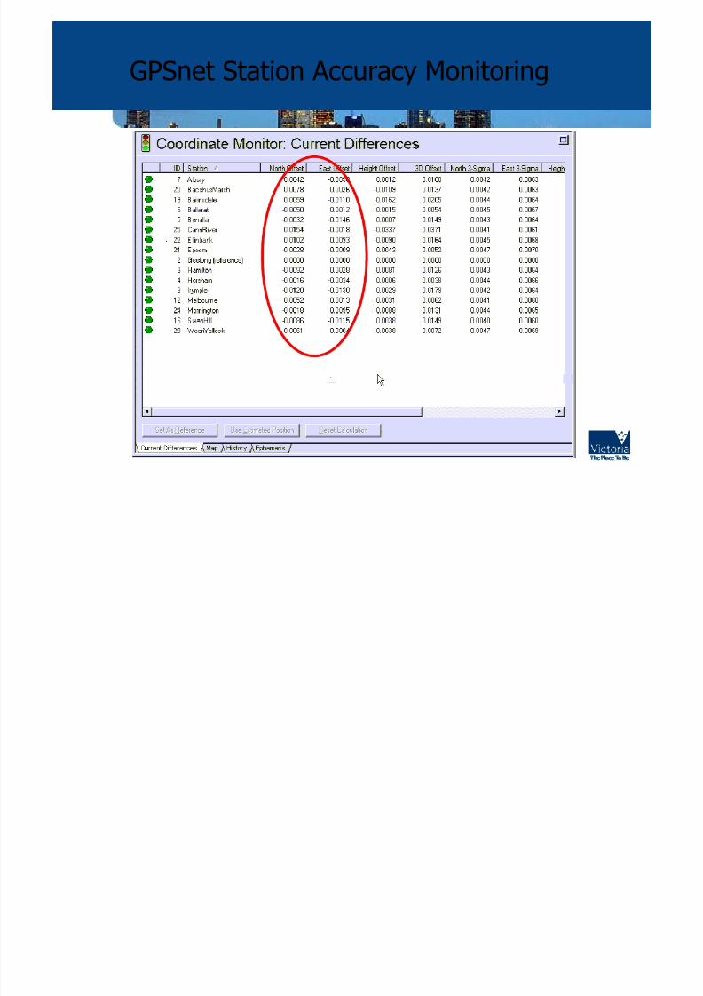
GPSnet Station Accuracy Monitoring

8/9/2019 GNSS & Victoria's CORS Network
http://slidepdf.com/reader/full/gnss-victorias-cors-network 20/30
MELBpos NRTK Compatible Equipment
GSR2700 IS
R8
SmartStation
8/9/2019 GNSS & Victoria's CORS Network
http://slidepdf.com/reader/full/gnss-victorias-cors-network 21/30
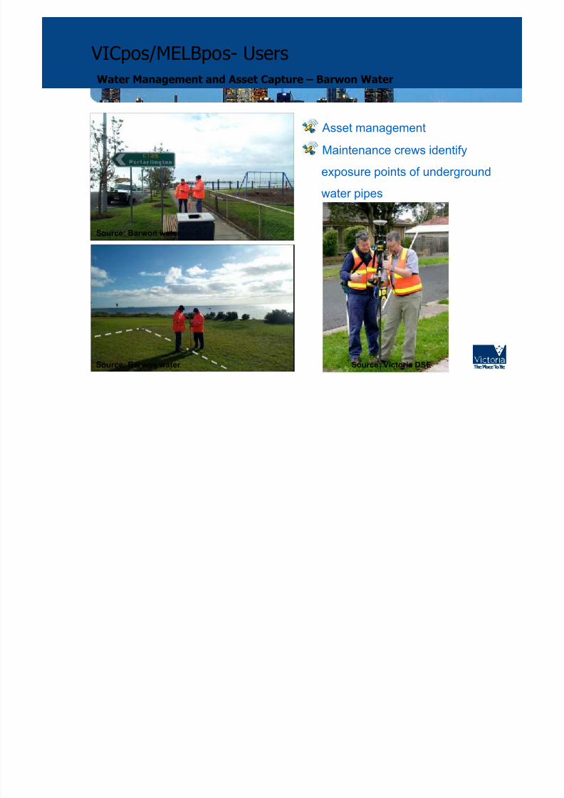
VICpos/MELBpos- Users
Water Management and Asset Capture – Barwon Water
• Asset management
• Maintenance crews identify
exposure points of underground
water pipes
Source: Victoria DSESource: Barwon water
Source: Barwon water

8/9/2019 GNSS & Victoria's CORS Network
http://slidepdf.com/reader/full/gnss-victorias-cors-network 22/30
30,000 Stormwater Drainage Pits
VICpos/MELBpos- Users
Survey and Engineering Applications – Dandenong City Council
Source: LandMark
Source: Victoria DSE
• Drainage mapping - 30,000 pits

8/9/2019 GNSS & Victoria's CORS Network
http://slidepdf.com/reader/full/gnss-victorias-cors-network 23/30
VICpos/MELBpos- Users
Asset Mapping/Risk Management – Moonee Valley City Council
• Identify footpath cracks and hazards
• Dispatch maintenance crews
Source: LandMark

8/9/2019 GNSS & Victoria's CORS Network
http://slidepdf.com/reader/full/gnss-victorias-cors-network 24/30
MELBpos- Users
Surveying – Land Development Consulting
• Surveyors using service
• Removes need for local base station
• Very quick initialisation
• 1 - 2 minute setup time from cold start
• Minimal costs
Source: Victoria DSE

8/9/2019 GNSS & Victoria's CORS Network
http://slidepdf.com/reader/full/gnss-victorias-cors-network 25/30
VICpos/MELBpos- Users
Precision Arborist - PRECISE GIS
Source: Victoria DSE Source: Victoria DSE

8/9/2019 GNSS & Victoria's CORS Network
http://slidepdf.com/reader/full/gnss-victorias-cors-network 26/30
VICpos- UsersPrecision Agriculture
• Precision Farming
(autosteer to 2cm)
Source: Victoria DSE

8/9/2019 GNSS & Victoria's CORS Network
http://slidepdf.com/reader/full/gnss-victorias-cors-network 27/30
MELBpos- Users
Search and Rescue – Victorian Water Police
Side Scan Sonar for submerged objects
• Identify potential targets during pass
• Dispatch divers on-site
• Record data about target
Source: Victoria DSE
8/9/2019 GNSS & Victoria's CORS Network
http://slidepdf.com/reader/full/gnss-victorias-cors-network 28/30
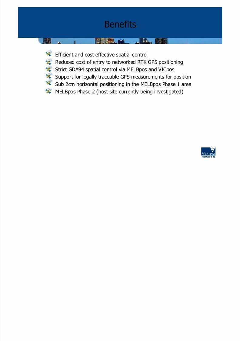
Benefits
• Efficient and cost effective spatial control
• Reduced cost of entry to networked RTK GPS positioning• Strict GDA94 spatial control via MELBpos and VICpos
• Support for legally traceable GPS measurements for position
• Sub 2cm horizontal positioning in the MELBpos Phase 1 area
• MELBpos Phase 2 (host site currently being investigated)

8/9/2019 GNSS & Victoria's CORS Network
http://slidepdf.com/reader/full/gnss-victorias-cors-network 29/30
To Subscribe Go To:
www.nre.vic.gov.au/gpsnet
See News and Events
GPS Technical Support Newsletter (free subscription)
For More Information

8/9/2019 GNSS & Victoria's CORS Network
http://slidepdf.com/reader/full/gnss-victorias-cors-network 30/30
QUESTIONS?


![CORS Program FY0945]09... · 2009-10-01 · CORS Program FY09 Giovanni Sella CORS Program Manager NOAA- National Geodetic Survey giovanni.sella @ noaa.gov CGSIC Savannah, GA CORS](https://static.fdocuments.us/doc/165x107/5f09f82f7e708231d4296126/cors-program-4509-2009-10-01-cors-program-fy09-giovanni-sella-cors-program.jpg)