Continuously Operating Reference Stations (CORS) GNSS ... · Best Practices in CORS operation When...
12
Continuously Operating Reference Stations (CORS) GNSS network :challenges and benefits in Indian context BY DR. S.K. SINGH DIRECTOR GEODETIC & RESEARCH BRANCH SURVEY OF INDIA DEHRADUN, INDIA
Transcript of Continuously Operating Reference Stations (CORS) GNSS ... · Best Practices in CORS operation When...
Continuously Operating
Reference Stations (CORS) GNSS
network :challenges and benefits
in Indian context
BY
DR. S.K. SINGH
DIRECTOR
GEODETIC & RESEARCH BRANCH
SURVEY OF INDIA
DEHRADUN, INDIA
Presented at th
e FIG W
orking Week 2019,
April 22-26, 2
019 in Hanoi, V
ietnam

CORS GNSS Network is used for
providing fit-for-purpose
positioning.
Corrections are instantly sent to the
rover receiver (user end) from
control centre which helps to
provide centimetre-level accuracy
services for positioning of rover in
real time.
CORS network need to have an
integrated national setup.
Network-based Real Time
Kinematic (NRTK) GPS positioning is
considered to be a superior
compared Real Time Kinematic
(RTK) which is highly affected by
the distance dependent errors such
as satellite orbital and atmospheric
biases.
CORS network envisaged is one
such model that correctly model
the distance-dependent errors.
CORS: As a Service
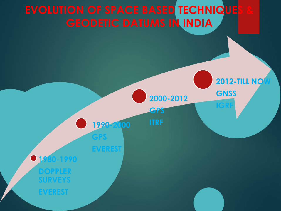
EVOLUTION OF SPACE BASED TECHNIQUES &
GEODETIC DATUMS IN INDIA
1980-1990
DOPPLER SURVEYS
EVEREST
1990-2000
GPS
EVEREST
2000-2012
GPS
ITRF
2012-TILL NOW
GNSS
IGRF

INDIAN GEODETICREFERENCE
FRAME (IGRF)
➢ Indian geodetic reference frame (IGRF) was
established through a “passive” network of
about 260 well spread Ground Control Points
(GCPs) at a spacing of 250-300 km apart
across the country during the period from
2006 to 2008.
➢ This network was observed and adjusted in
combination with few IGS stations surrounding
the Indian territory. The current Indian
horizontal reference frame is linked to the
International Terrestrial Reference Frame (ITRF)
epoch 2005.
➢ The network was further densified with 2260
precision Ground Control Points at a spacing
of 30 to 40 km apart withhin the framework
of IGRF.
➢ The IGRF is only suited for relative positioning,
primarily for mapping applications.
➢ The “passive” networks of groundmarks is
going to be replaced with “active” networks
of CORS receivers.
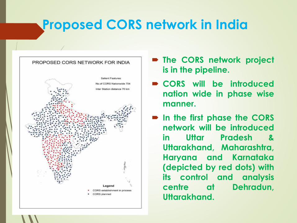
Proposed CORS network in India
The CORS network project
is in the pipeline.
CORS will be introduced
nation wide in phase wise
manner.
In the first phase the CORS
network will be introduced
in Uttar Pradesh &Uttarakhand, Maharashtra,
Haryana and Karnataka
(depicted by red dots) with
its control and analysiscentre at Dehradun,
Uttarakhand.

Best Practices in CORS operation When claiming to operate within the national reference frame, the
coordinates of the site need to be calculated in a traceable manner.
GNSS CORS antenna reference point should be continually monitored
for the stability.
The observation data is to be archived in the RINEX format to ensure
compatibility for post-processed applications with the greatest range
of equipment and processing software available.
The raw data is to be archived from the GNSS CORS equipment in a
proprietary format.
Comprehensive metadata is to be maintained for each CORS site.
o Site
o Receiver
o Antenna
o Monument
o Coordinate deviation
o Power
o Communications
o Data Formats
o Reliability of service
o Stability
o Additional Site Sensors
o Data Access
o Etc.

Methodology Adopted for CORS
Specify System
Target Density, Coverage,
Reliability and Availability
Site Quality
Equipment Quality
Geodetic Reference
Frame
Data Service Produced
Data Access Policy
Own Stations
Site Selection and
Construction
Equipment Purchasing and
Installation
Station Data Communication
Site Maintenance
Equipment Replacement
Cycle
Network the Data
Data Communication
from Network Stations
Control Center
Quality Control of Data
Data Archive
Process Network
Copy of Network
Data Processing
Production of Data Streams
Distribution of Data Streams
Deliver Service
Retail Sale of Data
products
Marketing
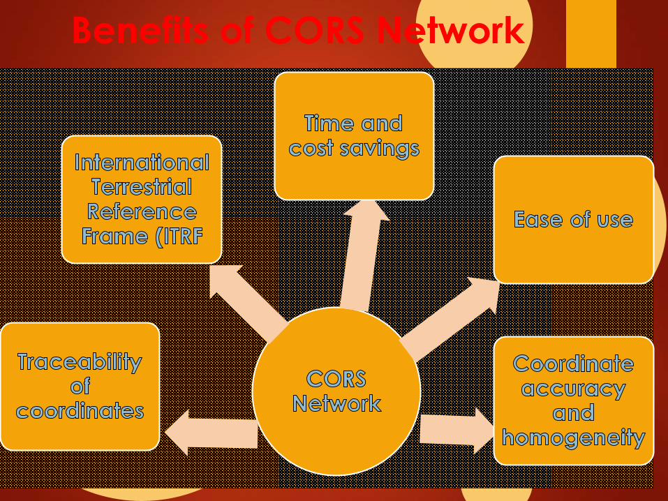
Benefits of CORS Network
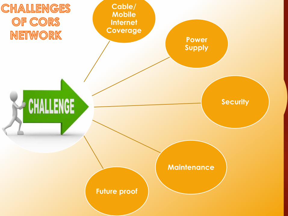
Cable/ Mobile Internet
Coverage
Power Supply
Security
Maintenance
Future proof
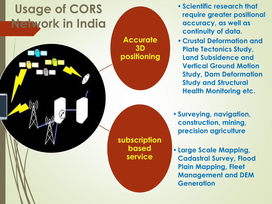
Accurate 3D
positioning
•Scientific research that
require greater positional
accuracy, as well as
continuity of data.
•Crustal Deformation and
Plate Tectonics Study,
Land Subsidence and
Vertical Ground Motion
Study, Dam Deformation
Study and Structural
Health Monitoring etc.
subscription based service
•Surveying, navigation,
construction, mining,
precision agriculture
• Large Scale Mapping,
Cadastral Survey, Flood
Plain Mapping, Fleet
Management and DEM
Generation
Usage of CORS
Network in India
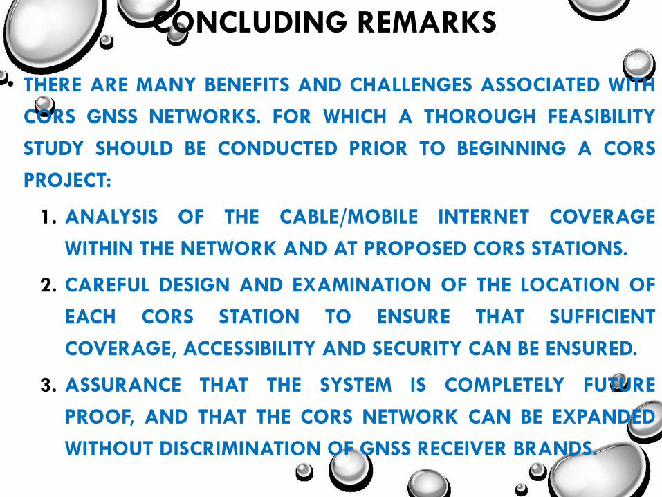
CONCLUDING REMARKS
• THERE ARE MANY BENEFITS AND CHALLENGES ASSOCIATED WITH
CORS GNSS NETWORKS. FOR WHICH A THOROUGH FEASIBILITY
STUDY SHOULD BE CONDUCTED PRIOR TO BEGINNING A CORS
PROJECT:
1. ANALYSIS OF THE CABLE/MOBILE INTERNET COVERAGE
WITHIN THE NETWORK AND AT PROPOSED CORS STATIONS.
2. CAREFUL DESIGN AND EXAMINATION OF THE LOCATION OF
EACH CORS STATION TO ENSURE THAT SUFFICIENT
COVERAGE, ACCESSIBILITY AND SECURITY CAN BE ENSURED.
3. ASSURANCE THAT THE SYSTEM IS COMPLETELY FUTURE
PROOF, AND THAT THE CORS NETWORK CAN BE EXPANDED
WITHOUT DISCRIMINATION OF GNSS RECEIVER BRANDS.

FIG WORKING WEEK APR 2019,HANOI,VIETNAM
![CORS Program FY0945]09... · 2009-10-01 · CORS Program FY09 Giovanni Sella CORS Program Manager NOAA- National Geodetic Survey giovanni.sella @ noaa.gov CGSIC Savannah, GA CORS](https://static.fdocuments.us/doc/165x107/5f09f82f7e708231d4296126/cors-program-4509-2009-10-01-cors-program-fy09-giovanni-sella-cors-program.jpg)