Georgia Geography Unit 2. Do Now Read this question silently and thing about the answer in your...
64
Georgia Geography Unit 2
-
Upload
kelly-gibson -
Category
Documents
-
view
219 -
download
2
Transcript of Georgia Geography Unit 2. Do Now Read this question silently and thing about the answer in your...

Georgia Geography
Unit 2

Do NowRead this question silently and thing about the answer in your head: In which region of the United States is Georgia located?a.Centralb.northeasternc. southeasternd. western

Answer to Today’s Question
• C. Southeastern
• Today in Georgia history• http://
www.todayingeorgiahistory.org/content/ty-cobb-gets-3000th-hit

Our unit’s Georgia Performance Standards
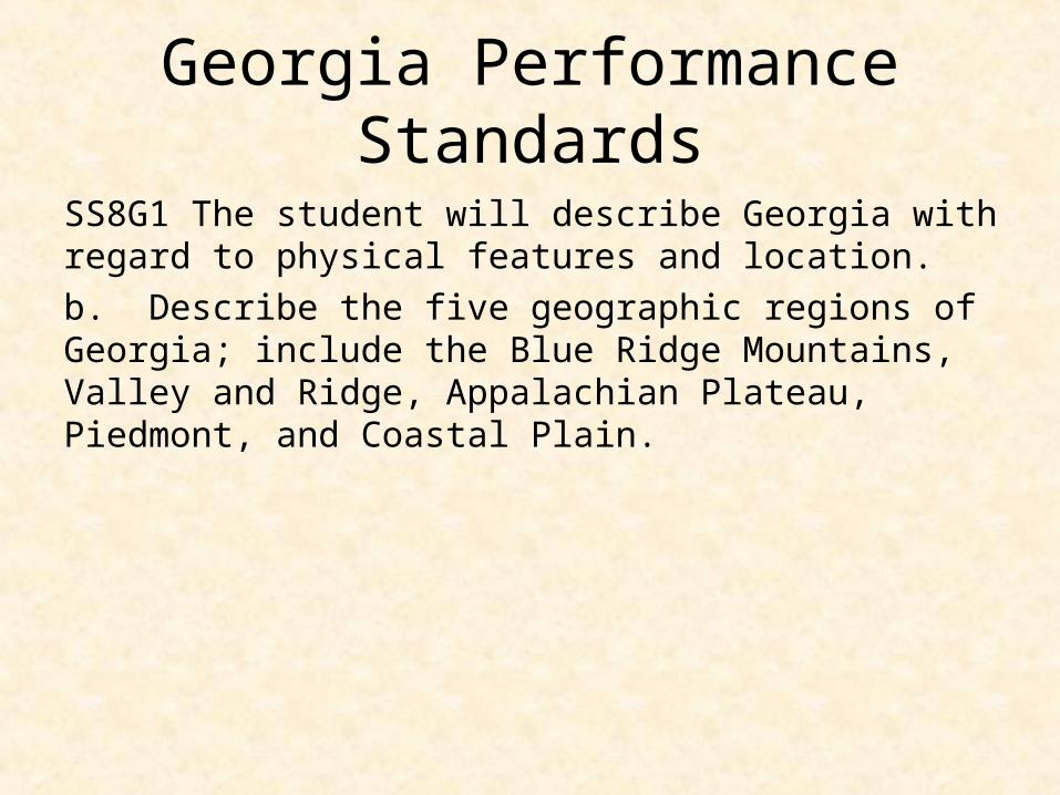
SS8G1 The student will describe Georgia with regard to physical features and location. a.Locate Georgia in relation to region, nation, continent, and hemispheres. b.Describe the five geographic regions of Georgia; include the Blue Ridge Mountains, Valley and Ridge, Appalachian Plateau, Piedmont, and Coastal Plain.c.Locate and evaluate the importance of key physical features on the development of Georgia; include the Fall Line, Okefenokee Swamp, Appalachian Mountains, Chattahoochee and Savannah Rivers, and barrier islands.d.Evaluate the impact of climate on Georgia’s development.

Essential Question
• Where is Georgia in terms of hemisphere, continent, nation, and region?

Georgia Performance Standards
SS8G1 The student will describe Georgia with regard to physical features and location. a.Locate Georgia in relation to region, nation, continent, and hemispheres.

LET’S LOCATE GEORGIA IN RELATION TO REGION, NATION, CONTINENT, AND HEMISPHERE.

Earth is a sphere.
A sphere can be divided into two halves called “hemispheres.”

Equator
• Divides the northern and southern hemispheres

Prime Meridian
• Divides the eastern and western hemispheres

Continents
• There are 7 continents: Europe, Asia, Australia, Africa, Antarctica, North America, and South America
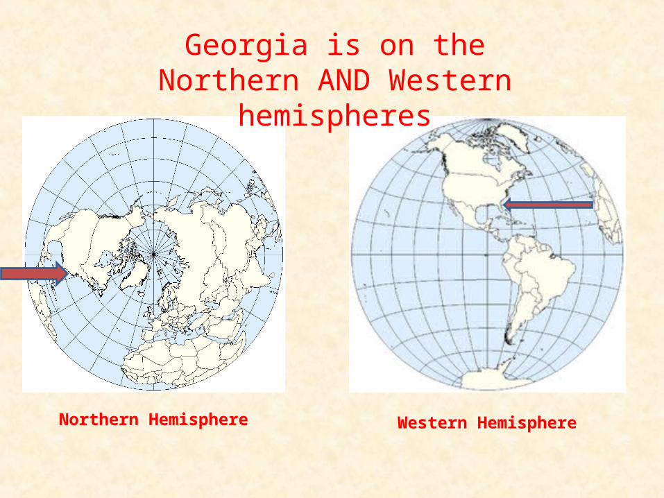
Northern Hemisphere Western Hemisphere
Georgia is on theNorthern AND Western hemispheres

Georgia is on the North American continent.

Georgia is one of the 50 states in the United States of America

Georgia is in the southeastern region of the US.

Do NowRead this question silently and think about the answer in your head: What is the highest peak in Georgia?
a. Amicalola Fallsb. Brasstown Baldc. Cloudland Canyond. Tallulah Gorge

Answer to today’s question
• B – Brasstown Bald
• Today in Georgia history: http://www.todayingeorgiahistory.org/content/beatles-play-atlanta

Essential Questions
• Which North American physiographic regions are found in Georgia and what are some distinguishing characteristics of each?
• What is the relative location of these physiographic regions within the boundaries of the State?
Georgia Performance Standards
SS8G1 The student will describe Georgia with regard to physical features and location. b. Describe the five geographic regions of Georgia; include the Blue Ridge Mountains, Valley and Ridge, Appalachian Plateau, Piedmont, and Coastal Plain.

The Regions of GeorgiaThe Regions of Georgia
© 2010 Clairmont Press© 2010 Clairmont Press
Geographic Regions of Georgia

What is Physical Geography?• Physical geography focuses on understanding the
processes and pattern of natural environment
• http://www.gpb.org/georgiastories/story/land_and_fossils

Time for “Max News”
http://www.youtube.com/watch?v=jh0B_GbZT8M

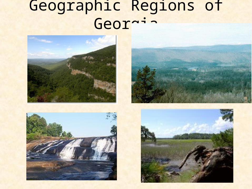
Georgia has 5 geographic regions.
• Appalachian Plateau• Valley and Ridge• Blue Ridge• Piedmont• Coastal PlainThe characteristics of each region make
unique contributions to our state.

• Also called the TAG corner bc Tennessee, Alabama, and Georgia connect
• Smallest region in GA• Mining was an important
economic activity in the region.
• Coal was the most important product.
Appalachian Plateau Region
25

Appalachian Plateau
• the location of Cloudland State Park. • Northwest corner of Georgia• Ellison’s Cave is 12th largest cave
http://www.gpb.org/georgiastories/story/geology_of_georgia
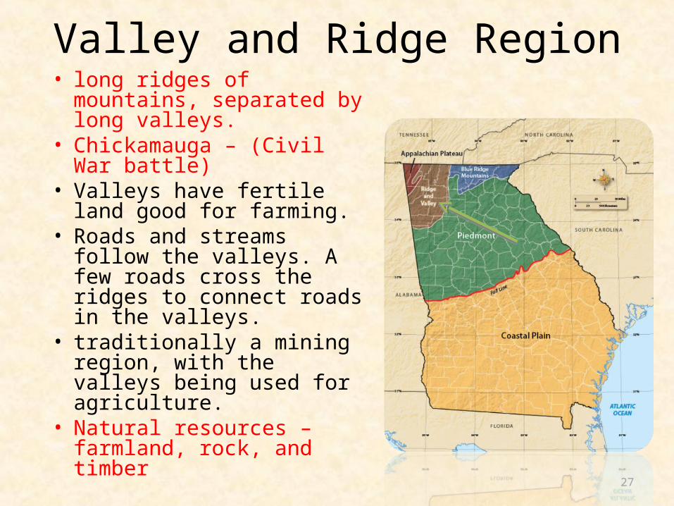
• long ridges of mountains, separated by long valleys.
• Chickamauga – (Civil War battle)
• Valleys have fertile land good for farming.
• Roads and streams follow the valleys. A few roads cross the ridges to connect roads in the valleys.
• traditionally a mining region, with the valleys being used for agriculture.
• Natural resources – farmland, rock, and timber
27
Valley and Ridge Region

Valley and Ridge• Lower elevation than Appalachian Plateau
• Soil good for forests, pastures, and crops such as grain and apples
• Industry includes textiles and carpet (Dalton is the carpet capital of the world)

• The Blue Ridge range is a part of the larger Appalachian Mountains.
• The mountains are more rugged and the valleys randomly arranged as compared to the Ridge and Valley region.
• Most roads follow the winding valleys.• Elevations of 1,600 to 4,700 feet above
sea level give the region a cooler climate.
• Brasstown Bald (4,784 feet) is tallest mountain.
• Appalachian Trail begins here.• Gold has been found in the region, and
marble is an important natural resource.
• Tourists come to hike, view wildlife, canoe, raft, and enjoy trees in their fall colors.
• Highest rainfall amounts in GA29
Blue Ridge Mountains Region

Blue Ridge• Highest mts. in the state.• Provides water for the entire state through
precipitation from trapping warm moist Gulf air• Sandy loam and clay soil good for hardwoods,
vegetable farming and apples• home to Amicalola Falls, Tallulah Gorge, and
Helen• 1800’s gold was found – first goldrush in US• Cherokee Indians lived here until forced off their
land

Blue Ridge Images
Brasstown Bald: You can see 3 states from this point. Can you name them?
Helen, Georgia has a strong German influence. Why do you think that is? How does the town of Helen contribute to our state?
Amicalola Falls
Ga. Fruits & Vegetables
Essential Questions
• What are the significant physical features of Georgia that have impacted its development?
• How is the impact of these features manifested?

• The Piedmont is known for its rolling hills between the mountains and Coastal Plain.
• Plentiful granite and clay soil with fertile farms.
• Many Georgians live in the region.• Rivers flow through the Piedmont,
including the Chattahoochee and Savannah.
• Pine trees as well as hardwood forests (oak, elm, maple, hickory, etc.).
• Southern boundary is the Fall Line.• Changes in rock type cause the ground
to fall away, creating waterfalls at the “fall” line across the state.
• Cities grew along the Fall Line since ships could navigate from the Atlantic to this point (Augusta: Savannah River; Milledgeville: Oconee River; Macon: Ocmulgee River; Columbus: Chattahoochee River).
33
Piedmont Region

Piedmont • Piedmont means “foot of the mountain”• Begins in the mountain foothills of N. Georgia and goes
to the central part of the state.• Rolling farmland• Soil is sandy loam and red clay suitable for growing
hardwoods, pine, and agriculture.• Granite mining and cotton production important in
region• Cotton belt before the Civil War, now wheat,
soybeans, corn, poultry, and cattle.• Some of the most densely populated cities and crossed
by Chattahoochee, Flint, Ocmulgee, and Oconee rivers.

Piedmont • Largest populated region• Rolling Hills• Chattahoochee River flows through this region • Stone Mountain is located in this region• Atlanta is located in this region

Piedmont Images
Why do you think most of Georgia’s major cities are located in the Piedmont region?
Georgia’s Flint River starts in Clayton County.
Why do you think most of Georgia’s rivers start in the Piedmont region?
Sandy loam and red clay are make good soil for agriculture.

• the southern half of state and is the largest region.
• Lower coastal plain has Georgia’s barrier islands, 100 miles of coastline, marshes, and the Okefenokee Swamp.
• Flatland makes for highways that are straight and level.
• Home to many types of wildlife.• Farming is important to the
region’s economy. • Longleaf pines grew above acres
of wiregrass before the 1800s; railroads made it possible to transport large trees for lumber. There are few of these areas left.
• Loblolly and slash pines are grown in the region today for lumber.
37
Coastal Plain Region

• Once covered by the Atlantic• Aquifers are the largest
source of fresh water• Low, flat, marshland• Okefenokee Swamp located
in region• Rivers in this region are used
for shipping and recreation• You live in this region.
38
Coastal Plain Region

Coastal PlainThere are two parts to Georgia’s coastal plain:•The Inner Coastal Plain•The Outer Coastal Plain
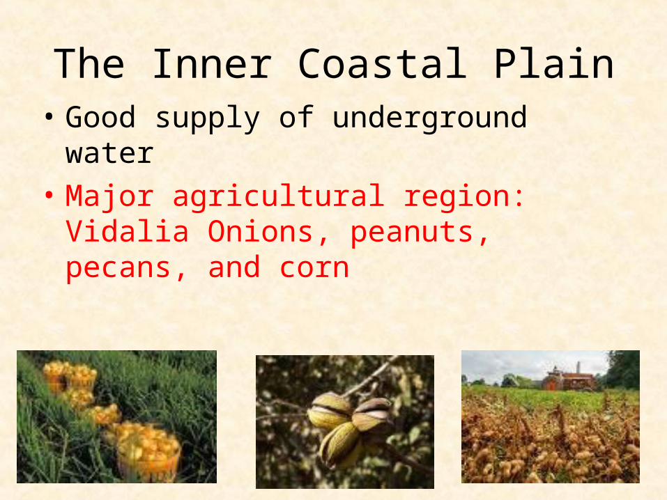
The Inner Coastal Plain• Good supply of underground water• Major agricultural region: Vidalia Onions,
peanuts, pecans, and corn
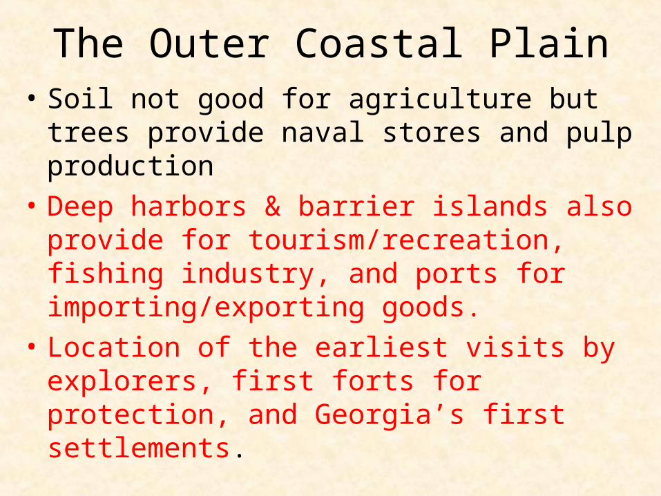
The Outer Coastal Plain• Soil not good for agriculture but trees provide
naval stores and pulp production• Deep harbors & barrier islands also provide for
tourism/recreation, fishing industry, and ports for importing/exporting goods.
• Location of the earliest visits by explorers, first forts for protection, and Georgia’s first settlements.

Outer Coastal Plain Images
Trees are used to produce pulp and naval stores. The processed goods are then shipped from our shores.
Why do you think a British flag flies over Fort Frederica?
Early map of Savannah
Our shores continue to bring visitors to our state.

western GA in the Coastal Plains
Jimmy Carter’s boyhood Farm is located in Plains, GA

western GA in the Coastal Plains
Andersonville, a Civil War prison

western GA in the Coastal Plains
Providence Canyon

Time for “Max News”
http://www.youtube.com/watch?v=jh0B_GbZT8M

Essential Questions
• What are the significant physical features of Georgia that have impacted its development?
• How is the impact of these features manifested?

Georgia Performance Standards
SS8G1 The student will describe Georgia with regard to physical features and location.
c. Locate and evaluate the importance of key physical features on the development of Georgia; include the Fall Line, Okefenokee Swamp, Appalachian Mountains, Chattahoochee and Savannah Rivers, and barrier islands.
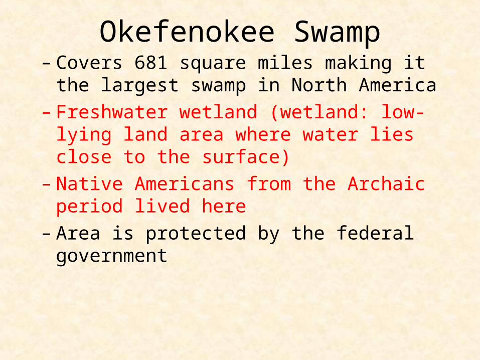
Okefenokee Swamp– Covers 681 square miles making it the largest swamp
in North America– Freshwater wetland (wetland: low-lying land area
where water lies close to the surface)– Native Americans from the Archaic period lived here– Area is protected by the federal government

Okefenokee Swamphttp://www.gpb.org/georgiastories/story/okefenokee_swamp
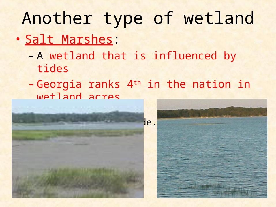
Another type of wetland• Salt Marshes:
– A wetland that is influenced by tides– Georgia ranks 4th in the nation in wetland acres
A marsh at low tide. The same marsh at high tide.

Georgia’s Barrier Islands“Islands of Gold”
• Barrier islands protect the mainland from wind, sand, and water that cause erosion.
• Georgia has 18 barrier islands.• These islands are tourist destinations but 2/3 of the
land remains wilderness sanctuaries.

Barrier Islands

• Continental Shelf:– Where the land meets the sea
• The Fall Line:– Natural boundary between Piedmont and Coastal
Plain– Where hilly land meets the coastal plain– Runs from Columbus through Macon to Augusta– Prevented exploration but provided for settlements

Fall Line
natural boundary between the Piedmont and Coastal Plain regions

Appalachian Mountains• The southernmost point of the Appalachian
Mountains is located in Georgia. • Georgia’s highest peaks are in here.• In the southern states these mountains are
often called the Blue Ridge due to the blue haze that appears around their peaks.
• The highest peak in Georgia is Brasstown Bald, w/ an elevation over 4700 ft. above sea level.

Appalachian Mountains

Chattahoochee River
• begins in Blue Ridge region of GA and ends at the Gulf of Mexico
• forms part of the border b/t Alabama and Georgia
• Native Americans & European settlers long used the river as a food and water source.
• Today, river is used as water source, for industry, and for recreation

Chattahoochee River

Savannah River• forms the border between Georgia and South
Carolina• One of Georgia’s longest waterways • The river has been a source of water, food, and
transportation for thousands of years. • Historically, it was used for three reasons:
– Transportation – cultures could move to other places easier
– Settlement – allowed cultures to settle near a steady source of food
– Economic – allowed cultures to trade with others

• Today, the river is navigable for over 200 miles between the city of Savannah and Augusta
• In addition to shipping, the river, today, is used as a major source of drinking water for Savannah and Augusta, to cool two nuclear power plants in South Carolina, and to generate hydroelectric power.

Savannah River

Do Now1. What river is the primary source of water for Atlanta?a. Altamahab. Chattahoochee c. Flintd. Savannah

Answer to Today’s Question
• B – Chattahoochee River