
GeoIntelligence March April 2015
44
RNI NO. UPENG/2011/37063 ` 100 US$ 10 ISSN 2277 – 3126 Architecture for Internal Security Decision Support System | P.21 Aircraft Recognition Training Using 3D Terrain Models | P. 35
Transcript of GeoIntelligence March April 2015
8/17/2019 GeoIntelligence March April 2015
http://slidepdf.com/reader/full/geointelligence-march-april-2015 1/44
RNI NO. UPENG/2011/37063 ` 100 US$ 10ISSN 2277 – 3126
Architecture for Internal
Security Decision SupportSystem
| P.21
Aircraft Recognition
Training Using 3D TerrainModels | P. 35

8/17/2019 GeoIntelligence March April 2015
http://slidepdf.com/reader/full/geointelligence-march-april-2015 2/44
Africa20 AUG 2015
11- 12 JUNE, 2015
BrasilSEPT 2015
AUG 2015ONWARDS
India Seminars
Six City Security Seminars
NOV 2015Latin America
Our offerings for
DEFENCEAND
INTERNALSECURITY
www.geointworld.net
8/17/2019 GeoIntelligence March April 2015
http://slidepdf.com/reader/full/geointelligence-march-april-2015 3/44
GIS Adoption: An IndianPerspectiveSpatial data is of crucial importanceto the Military Commander in thebattle and for decision-maker planningoperational contingencies
Brig Arun Sahgal (Retd)
Pg 32
Aircraft Recognition TrainingUsing 3D Terrain ModelsAircraft recognition training is essentialfor every soldier in air defenceBrig SC Sharma (Retd)
Pg 35
Interview
Chairman MP Narayanan
Publisher Sanjay Kumar
Managing Editor Lt Gen (Dr) AKS Chandele (Retd)
Executive Editor Bhanu Rekha
Product Manager Kushagra Agrawal
Sub Editor Sanskriti Shukla
Senior Designer Debjyoti Mukherjee
Circulation Manager Ashish Batra
Circulation Executive Vijay Kumar Singh
Owner, Publisher & Printer Sanjay Kumar
Printed at HT Media Limited, B-2, Sector-63,
Noida (U.P.) 201307
Publication Address A - 92, Sector - 52,
Gautam Budh Nagar, Noida, India
Editor Sanjay Kumar
Price ` 100, US$ 10
Geospatial Media and Communications Pvt. Ltd.
A - 145, Sector - 63, Noida, India
Tel + 91 120 4612500 Fax + 91 120 4612555/666
Geospatial Media and Communications Pvt.
Ltd. does not necessarily subscribe to the views
expressed in the publication. All views expressed
in this issue are those of the contributors. The
publication is not responsible for any loss to anyone
due to the information provided.
I
n s i d
e
REGULAR SECTIONS
Editorial........................................05
News..............................................06
Events............................................42
Guest Articles
India’s National Security Voidsin Geospatial AppsGeospatial information is a crucialcomponent for efficient threat analysis,response to and recovery from naturaldisasters and promoting rapid sharing ofcritical information
Lt Gen (Dr) Rajesh Pant (Retd)
Pg 18
Architecture for InternalSecurity Decision SupportSystemOpening up of automated informationservices on internal security matterscould be the harbinger of the proposedinternal security mechanism that woulddefeat a threat gaining ground acrossthe country
Lt Gen Gautam Banerjee (Retd)
Pg 21
Defining Learning Patternsin Geographical InformationSystemsConcept Definition Fomula (CDF), InputProcessing Output (IPO), Model ViewController (MVC) and Data InformationKnowedge Decision (DIKD) are someof the fundamental learning patternsexhibited by Geographic InformationSystems (GIS). And the effectiveness ofthese learning patterns are exhibitedand exercised by GIS in different forms
Narayan Panigrahi
Pg 26
C o v e r i m a g e : S wi s s F e d e r a l o f fi c e o f t o p o g r a ph y
David Belton, General Manager,Geospatial Services, MacDonald, Dettwilerand Associates Ltd (MDA)
Pg 39
3 |
G E O I N T
E L L I G E N C E M A R C H - A P R I L 2 0 1 5

8/17/2019 GeoIntelligence March April 2015
http://slidepdf.com/reader/full/geointelligence-march-april-2015 4/44
Other ExcitingOffers
No. of Issues You Pay
2 Years 12 1200
3 Years 18 1800
5 Years 30 3000
600*FOR 1 Year
Subscribe Online at www.geospatialworld.net
Great Subscription
Offer
to continue receiving
the magazines regularly
Want toupdate your
communication details?
Reach us at

8/17/2019 GeoIntelligence March April 2015
http://slidepdf.com/reader/full/geointelligence-march-april-2015 5/44
Despite the phenomenal progress made in Information Technology and
Military Engineering in the past few decades, the adoption of geospatial
technologies by armed forces globally has been rather slow due to the
numerous challenges faced.
One of the major challenges faced is the cost and complexity of geospatial
solutions. In an era of diminishing defence budgets, this transformation is usually
given lesser importance. The complexity of such systems adds to the resistance to
change. Then, there is a difcult choice of whether to upgrade legacy systems or
to procure new ones, obviously at a much higher cost. Whatever the choice, there
will be the need to ensure interoperability between the new and the legacy systems.
This interoperability must be across all functional levels as also between differentservices, i.e., Army, Navy, Air Force and Para Military and Central Armed Police
Forces, and also joint standards, to enable successful joint operations. Apart from
the high cost of the systems themselves is the issue of availability and access and
the high cost of remote sensing data. Then there is the issue of storage of a huge
amount of data and ensuring its reliability and security. The industry is more
than ready with latest dedicated geospatial solutions, but there is a problem of
holding the attention of decision makers. And, to add to their woes is the ever so
complicated procurement process. Therefore, the time taken between the choice of
a geospatial product to its nal implementation is usually a long one.
The current global spectrum of conict encompasses sub conventional
operations, low intensity conicts, counter terrorism operations,aerospace, maritime and amphibious operations and recently anti
satellite (ASAT) operations. In such a scenario, the need for being
network-enabled is not a choice, but a dire necessity. In such a
distributed operational environment, both in time and space with
multiple stakeholders, the need for network centricity was never as
pressing as it is now. Geographical systems are the facilitators which
ensure the networking and net-centricity would not be feasible without
GIS support.
Analysts and political, military and industry leaders of most developing
nations understand the need for transformation and the challenges in the
adoption of geospatial technologies. The roadmap and timelines mayvary, but a lot will depend on the leadership’s resolve and commitment
in preparing and sticking to a comprehensive plan for transformation.
For any developing nation to pursue its goal towards this transformation,
the government must be an active and constructive partner and come
out with adequate budgets and supporting policies that help to shorten
procurement cycles and adopt capabilities based acquisition. It may take
a decade or two before the geospatial concepts are fully realised, but
certainly it is in the nature of any transformation that the process will
never be complete.`
E d
i t o r i
a l Adoption of Geospatial Technologies
Will Enhance Combat Potential
Lt Gen (Dr) AKS Chandele PVSM, AVSM (Retd)
Managing Editor
5 |
G E O I N T
E L L I G E N C E M A R C H - A P R I L 2 0 1 5
8/17/2019 GeoIntelligence March April 2015
http://slidepdf.com/reader/full/geointelligence-march-april-2015 6/44
6 |
G E O I N T E L L I G E N C E M A R C H - A P R I L 2 0 1 5
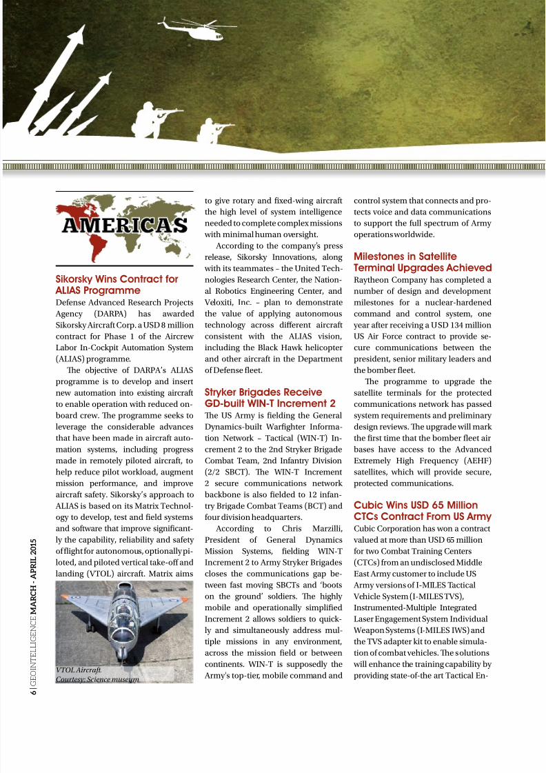
Sikorsky Wins Contract for ALIAS ProgrammeDefense Advanced Research Projects
Agency (DARPA) has awarded
Sikorsky Aircraft Corp. a USD 8 million
contract for Phase 1 of the Aircrew
Labor In-Cockpit Automation System
(ALIAS) programme.
Te objective of DARPA’s ALIAS
programme is to develop and insert
new automation into existing aircraft
to enable operation with reduced on-board crew. Te programme seeks to
leverage the considerable advances
that have been made in aircraft auto-
mation systems, including progress
made in remotely piloted aircraft, to
help reduce pilot workload, augment
mission performance, and improve
aircraft safety. Sikorsky’s approach to
ALIAS is based on its Matrix echnol-
ogy to develop, test and field systems
and software that improve significant-
ly the capability, reliability and safetyof flight for autonomous, optionally pi-
loted, and piloted vertical take-off and
landing (VOL) aircraft. Matrix aims
to give rotary and fixed-wing aircraft
the high level of system intelligence
needed to complete complex missions
with minimal human oversight.
According to the company’s press
release, Sikorsky Innovations, along
with its teammates – the United ech-nologies Research Center, the Nation-
al Robotics Engineering Center, and
Veloxiti, Inc. – plan to demonstrate
the value of applying autonomous
technology across different aircraft
consistent with the ALIAS vision,
including the Black Hawk helicopter
and other aircraft in the Department
of Defense fleet.
Stryker Brigades Receive
GD-built WIN-T Increment 2Te US Army is fielding the General
Dynamics-built Warfighter Informa-
tion Network – actical (WIN-) In-
crement 2 to the 2nd Stryker Brigade
Combat eam, 2nd Infantry Division
(2/2 SBC). Te WIN- Increment
2 secure communications network
backbone is also fielded to 12 infan-
try Brigade Combat eams (BC) and
four division headquarters.
According to Chris Marzilli,
President of General DynamicsMission Systems, fielding WIN-
Increment 2 to Army Stryker Brigades
closes the communications gap be-
tween fast moving SBCs and ‘boots
on the ground’ soldiers. Te highly
mobile and operationally simplified
Increment 2 allows soldiers to quick-
ly and simultaneously address mul-
tiple missions in any environment,
across the mission field or between
continents. WIN- is supposedly the
Army’s top-tier, mobile command and
control system that connects and pro-
tects voice and data communications
to support the full spectrum of Army
operations worldwide.
Milestones in Satellite
Terminal Upgrades AchievedRaytheon Company has completed a
number of design and development
milestones for a nuclear-hardened
command and control system, one
year after receiving a USD 134 million
US Air Force contract to provide se-
cure communications between the
president, senior military leaders and
the bomber fleet.
Te programme to upgrade the
satellite terminals for the protected
communications network has passedsystem requirements and preliminary
design reviews. Te upgrade will mark
the first time that the bomber fleet air
bases have access to the Advanced
Extremely High Frequency (AEHF)
satellites, which will provide secure,
protected communications.
Cubic Wins USD 65 MillionCTCs Contract From US Army Cubic Corporation has won a contract
valued at more than USD 65 millionfor two Combat raining Centers
(CCs) from an undisclosed Middle
East Army customer to include US
Army versions of I-MILES actical
Vehicle System (I-MILES VS),
Instrumented-Multiple Integrated
Laser Engagement System Individual
Weapon Systems (I-MILES IWS) and
the VS adapter kit to enable simula-
tion of combat vehicles. Te solutions
will enhance the training capability by
providing state-of-the art actical En-
VTOL Aircraft.
Courtesy: Science museum
8/17/2019 GeoIntelligence March April 2015
http://slidepdf.com/reader/full/geointelligence-march-april-2015 7/44
7 |
G
E O I N T E L L I G E N C E M A R C H - A P R I L 2 0 1 5
LM to Support US Navy’s Intelligence Sharing SolutionLockheed Martin is planning
to support the Navy systemthat allows secure sharing of
sensitive data between un-
classified and classified se-
curity domains. Te US Navy
recently awarded Lockheed
Martin two contracts with a
total ceiling value of USD 90
million to support the Radiant Mercury cross domain solution for five years.
While guarding classified data from unauthorised access, the system simul-
taneously allows those with the appropriate security classification to retrieve
sensitive and critical information. Radiant Mercury supports simultaneous
data flows to hundreds of channels, interfaces with most major C4ISR sys-tems, and supports most transport, network and data link protocols.
Used by both US and allied partners at more than 400 sites worldwide, Ra-
diant Mercury has streamlined the process of sharing critical operational and
intelligence information with coalition forces. Radiant Mercury is believed to
be compliant with the Intelligence Community Directive 503 policy, which
protects sensitive compartmented information within information systems.
It is also approved for both top secret and secret interoperability by the Uni-
fied Cross Domain Services Management Office, which lists systems verified
to transfer Department of Defence and intelligence community informa-
tion between multiple security domains with limited risk. Radiant Mercury
is available on the US General Services Administration schedule of products
and services.
NEWSgagement Simulation (ES) systems,
an advanced data collection system
for video, voice and other training
data that is not currently available in
the region.
According to a spokesperson from
Cubic, CC solutions enable com-
manders and soldiers to rehearsecombat skills and tactics, and learn
safely in a live battlefield setting. Tese
devices are used during live force-on-
force training, and provide the critical
real-time digital, audio and video data
feedback for forces to achieve and sus-
tain mission readiness. Cubic’s MILES
solutions enable small and large group
training from a custom squadron to a
battalion. Te systems are also believed
to be compatible with legacy equip-
ment, ensuring previous investmentsare preserved and long term cost of
ownership is lowered. I-MILES IWS
uses laser emitters that attach to mili-
tary weapons and on-body sensors to
replicate combat and records data for
a review. I-MILES VS, the vehicular
adaptation of Cubic’s man-worn Indi-
vidual Weapons System, equip tactical
vehicles with lasers, sensors and elec-
tronics. Te I-MILES VS solution will
also include Cubic’s ‘Shooter’ CVS kit
to enable superior weapon simulation
and casualty assessment accuracy for
vehicles and fixed structure.
USC Receives GEOINT AccreditationTe United States Geospatial Intelli-
gence Foundation (USGIF) has recentlyannounced the online graduate certifi-
cate in geospatial intelligence from the
Spatial Sciences Institute (SSI) at the
University of Southern California (USC)
as the 12th collegiate programme to re-
ceive USGIF accreditation.
SSI, launched in 2010, now offers
students a variety of undergraduate
and graduate programs in geodesign,
geospatial intelligence, geospatial
leadership, geohealth, spatial studies,
and geographic information science
and technology. Students completing
the SSI’s online graduate certificatein geospatial intelligence are also el-
igible to receive a USGIF GEOIN
certificate. Students who graduate
from USGIF-accredited programmes
receive—along with their accompa-
nying college degree or certificate—
USGIF’s GEOIN certificate, which
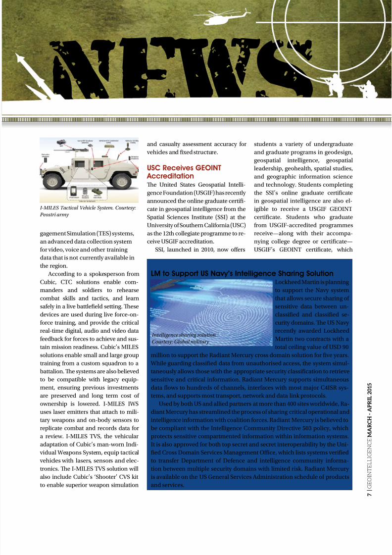
I-MILES Tactical Vehicle System. Courtesy:
Peostri army
Intelligence sharing solution.
Courtesy: Global military

8/17/2019 GeoIntelligence March April 2015
http://slidepdf.com/reader/full/geointelligence-march-april-2015 8/44
8 |
G E O I N T E L L I G E N C E M A R C H - A P R I L 2 0 1 5
Raytheon Unveils Extended Range AMRAAMRaytheon Company has
recently started developing
an extended range variant of
the combat-proven Advanced
Medium Range Air to Air
Missile (AMRAAM). Designed
specifically for ground-based
air defense, AMRAAM-ER will
enable intercepts at longerrange and higher altitudes.
Te new missile will be even faster and more maneuverable than the current
AMRAAM. By leveraging many existing AMRAAM components, Raytheon can
deliver AMRAAM-ER quickly and affordably with very low risk, claims Mike
Jarrett, Raytheon Vice President of Air Warfare Systems. Raytheon will integrate
AMRAAM-ER into the NASAMS launcher.
According to a spokesperson from the company, NASAMS is the latest
and most modern Medium Range Air Defense system. In partnership with
KONGSBERG, Raytheon has delivered more than 70 fire units to seven coun-
tries. It is the most commonly used Short and Medium Range Air Defense Sys-
tem in NAO.
helps ensure the GEOIN Community
has a robust workforce. o date, more
than 470 students have graduated
with USGIF GEOIN certificates from
accredited schools across the United
States, and several more universityprogrammes are in the pipeline.
According to Dr. Maxwell Baber,
USGIF’s Director of academic pro-
grammes, the new online geospatial
intelligence programme, provides an
option for current and aspiring GEO-
IN analysts working to advance their
professional capabilities.
Maritime Test Bed Help C4ICapability Gaps
Lockheed Martin has recentlydemonstrated how Maritime est Bed
can help the US Navy accelerate the
fielding of various sensor intelligence
capabilities in the maritime and joint
warfighting environments. According
to the company’s press release, the
goal of the demonstration was to
show how the test bed can bring sig-
nificant improvements in advanced
sensing, data integration, decision
support, electromagnetic support op-
erations, enhanced targeting and firecontrol and non-kinetic fires. Tese
areas were defined as capability gaps
in the Acquisition Gaps for Science &
echnology memorandum, which was
released by the Navy’s Programme
Executive Office for Command,
Control, Communications, Comput-ers and Intelligence (PEO C4I).
Using data fusion, workflow
automation, and electromagnetic
visualisation tools, the test bed ingest-
ed various types of simulated radar,
communications and signals intel-
ligence then depicted the emerging
tactical situation. Mimicking sea and
ashore naval environments, the test
bed expedited the entire intelligence
cycle from the initial intercept of the
signals through the sharing of a fusedtactical picture across multiple naval
platforms to combat identification
which can be used directly by combat
systems to determine an appropriate
kinetic or non-kinetic response.
Former Director of NGA Joinsthe UrtheCast BoardUrtheCast Corp. has appointed Letitia
Long, former director of the US
National Geospatial-Intelligence Agen-
cy (NGA), to its Board of Directors. It isbelieved that Ms. Long brings exten-
sive experience in the intelligence and
technology industries, most recently
serving as the fifth Director of the Na-
tional Geospatial-Intelligence Agency
(NGA) from 2010 to 2014. During hertenure at NGA, she led efforts to estab-
lish the agency’s first ‘Map of the World’,
for intelligence users. Under her guid-
ance, NGA became the first US agency
to adopt open-source software devel-
opment to deliver its software to first
responders for collaboration, during
and after natural disasters. Prior to her
appointment to NGA, Ms. Long served
as the Deputy Director of the Defense
Intelligence Agency (DIA) from 2006
until 2010. Among other professional
achievements, Ms. Long has been
the recipient of the Department of
Defense Medal for Distinguished
Civilian Service, the Presidential Rank
Award of Distinguished Executive, the
Navy Distinguished Civilian Service
Award, the Presidential Rank Award of
Meritorious Executive (two awards) and
the National Intelligence Distinguished
Service Medal (three awards). In 2011,
she received the Charlie Allen Award forDistinguished Intelligence Service from
the Armed Forces Communications and
Electronics Association, was decorated
with the Medal of Merit by the King of
Norway, and was appointed to the rank
of Chevalier in the National Order of
the Legion of Honor of France. She was
also named one of the Most Powerful
Women in the D.C. Metro area by Wash-
ingtonian magazine in 2013 and was
honored with a 2014 Federal 100 Award
by FCW magazine.
Former NGA Director Letitia Long.
Courtesy: NGA
Raytheon’s AMRAAM.
Courtesy: Raytheon

8/17/2019 GeoIntelligence March April 2015
http://slidepdf.com/reader/full/geointelligence-march-april-2015 9/44
9 |
G
E O I N T E L L I G E N C E M A R C H - A P R I L 2 0 1 5
Esri Cloud DeploymentEnables Information SharingLockheed Martin and Esri have
deployed commercial software to the
Amazon Web Services Commercial
Cloud Services (C2S) environment withan intelligence community customer,
the National Geospatial-Intelligence
Agency (NGA), in a move that enables
government agencies to better share
geospatial intelligence.
A detailed press release by
Lockheed Martin reveals that the
deployment of the portal for Esri’s
ArcGIS provides a single environment
for analysts to securely organise and
share data throughout the intelligence
community and Department of De-
fense. It’s also the foundational stepin consolidating multiple geospatial
intelligence portals into the single
NGA-provided portal, resulting in
technology and license cost savings. It
is believed that ArcGIS connects users
to maps and geographic information.
Users can create and view maps, com-
pile geographic data, analyse mapped
information and share geographic in-
formation in a range of applications.
BAE to Provide CriticalReadiness Support to USTe US Army Space and Missile
Defense Command has awarded BAE
Systems a two-year contract to pro-
vide hardware, software, and systems
integration support for the Battlespace
Command and Control Center. Under
the contract, BAE Systems will perform
upgrades to mobile training suites and
provide systems and network admin-
istration support to the Non-Organic
Radar Access programme. Te work
will minimise downtime for critical
systems and enhance the ability of
warfighters to analyse and manage
the increasing amounts of data, while
shortening the processing time for
critical decision making.
Lockheed Martin BagsContract for M-TADS/PNVSLockheed Martin received a USD 82
million Performance Based Logistics
(PBL) contract from the US Army for
AH-64 Apache helicopter Modernised
arget Acquisition Designation Sight/
Pilot Night Vision Sensor (M-ADS/
PNVS) system sustainment. Te con-
tract is the foundation for a compre-
hensive sustainment solution thatenables M-ADS/PNVS mission read-
iness, reduces operation and support
costs, and drives reliability and main-
tainability improvements.
During its peak operational tem-
po of more than 200,000 flying hours,
the M-ADS/PNVS PBL programme
averaged a worldwide supply avail-
ability rate of 98 percent, increasing
mission readiness for the aircrew, says
Rob Breter, Apache PBL Senior Pro-
gramme Manager at Lockheed MartinMissiles and Fire Control. M-ADS/
PNVS provides Apache helicopter pi-
lots long-range, precision engagement
and pilotage capabilities for mission
success and flight safety day or night,
or in adverse weather conditions.
Forward-looking infrared sensors
provide enhanced image resolution
that enables Apache aircrews to pros-
ecute targets and provide situational
awareness in support of ground troops
outside detection ranges. Lockheed
Martin has delivered more than 1,300
M-ADS/PNVS systems to the US
Army and international customers.
Leidos Awarded USD 46Million Contract by US Army Leidos has won a task order by the
US Army to provide mission support
services to the Communications-Elec-
tronics Research, Development and
Engineering Center (CERDEC) Proto-
typing Integration and esting (PI&)
Directorate. Te task order was award-
ed under the Rapid Prototyping and
echnology Insertion (RPI) Support
Contract. According to the company’s press
release, CERDEC advances soldier
capabilities that enable situational
awareness and understanding, estab-
lish and secure communications, and
protect Soldiers from surprise attack.
CP&I provides engineering design,
consultation and expert support ser-
vices for Command, Control, Com-
munications, Computers, Intelligence,
Surveillance and Reconnaissance
(C4ISR) platform systems integrationincluding design, fabrication, installa-
tion, integration, environmental test-
ing and fielding support. Under the
task order, Leidos will provide support
services including research, develop-
ment, engineering, design, purchas-
ing, fabrication, integration, testing,
logistics support, and shipping related
to the integration of mission equip-
ment into a Metrology System, and
related project efforts to support the
USMC MDE test, repair, and calibra-tion mission. Te tactical Metrology
Systems provide test, repair and cali-
bration of est, Measurement and Di-
agnostics Equipment (MDE) to sup-
port safety and mission effectiveness.
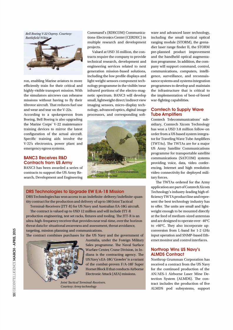
Boeing Readies Marine Pilotsfor High-Profile MissionTe V-22 team of Bell Helicopter and
Boeing recently delivered two MV-22
Osprey flight training simulators to
the HMX-1 Presidential Airlift Squad-
M-TADS/PNVS system.
Courtesy: Lockheed Martin
8/17/2019 GeoIntelligence March April 2015
http://slidepdf.com/reader/full/geointelligence-march-april-2015 10/44
1 0 |
G E O I N T E L L I G E N C E M A R C H - A P R I L 2 0 1
5
DRS Technologies to Upgrade EW E/A-18 MissionDRS echnologies has won access to an indefinite-delivery/indefinite-quan-
tity contract for the production and delivery of up to 180 Joint actical
erminal-Receivers (J-R) for US Navy and Australian EA-18G aircraft.
Te contract is valued up to USD 12 million and will include J-R
production engineering, test set racks, fixtures and tooling. Te J-R is an
ultra-high-frequency receiver that provides near real-time, over the horizon
threat data for situational awareness and assessment, threat avoidance,
targeting, mission planning and communications.Te contract combines purchases for the US Navy and the government of
Australia, under the Foreign Military
Sales programme. Te Naval Surface
Warfare Center, Crane Division, in In-
diana is the contracting agency. Te
US Navy’s EA-18G ‘Growler’ is a variant
of the combat-proven F/A-18F Super
Hornet Block II that conducts Airborne
Electronic Attack (AEA) missions.
ron, enabling Marine aviators to more
efficiently train for their critical and
highly-visible transport mission. With
the simulators aircrews can rehearse
missions without having to fly their
tiltrotor aircraft. Tat reduces fuel use
and wear and tear on the V-22s.
According to a spokesperson fromBoeing, Bell Boeing is also upgrading
the Marine Corps’ V-22 maintenance
training devices to mirror the latest
configuration of the actual aircraft.
Specific training aids involve the
V-22’s electronics, power plant and
emergency egress systems.
BANC3 Receives R&DContracts from US Army BANC3 has been awarded a series of
contracts to support the US Army Re-search, Development and Engineering
Command’s (RDECOM) Communica-
tions-Electronics Center (CERDEC) in
multiple research and development
projects.
Valued at USD 35 million, the con-
tracts require the company to providetechnical research, development and
engineering services related to next
generation mission-based solutions,
including the low profile displays and
light weight sensors component tech-
nology programme in the visible/near
infrared portions of the electro-mag-
netic spectrum. BANC3 will develop
small, lightweight direct/indirect view
imaging sensors, micro-display tech-
nology, advanced optics, digital image
processors, and corresponding soft-
ware and advanced laser technology,
including the small tactical optical
ranging module (SORM), the grena-
dier laser range finder II, the SORM
pre-planned product improvement
and the handheld optical augmenta-tion programme. In addition, the com-
pany will support command, control,
communications, computers, intelli-
gence, surveillance, and reconnais-
sance systems and systems integration
programmes to develop and maintain
the infrastructure that is critical to
the implementation of best-of-breed
war-fighting capabilities.
Comtech to Supply Wave
Tube AmplifiersComtech elecommunications’ sub-
sidiary, Comtech Xicom echnology
has won a USD 3.8 million follow-on
order from a US based system integra-
tor for raveling Wave ube Amplifiers
(WAs). Te WAs are for a major
US Army Satellite Communications
programme for transportable satellite
communications (SACOM) systems
providing voice, data, video confer-
encing, Internet and high resolution
video connectivity for deployed mili-tary forces.
Te WAs ordered for the Army
application are part of Comtech Xicom
echnology’s industry-leading high ef-
ficiency WA product line and repre-
sent the best technology industry has
to offer. Te units are small and light-
weight enough to be mounted directly
at the feed of medium-sized antennas
and are designed to operate over -40°C
to +60°C. Tey also incorporate up-
conversion from L-band for 1-2 GHzinput operation and SNMP-based Eth-
ernet monitor and control interfaces.
Northrop Wins US Navy’s ALMDS ContractNorthrop Grumman Corporation has
received a contract from the US Navy
for the continued production of the
AN/AES-1 Airborne Laser Mine De-
tection System (ALMDS). Te con-
tract includes the production of five
ALMDS pod subsystems, support
Bell Boeing V-22 Osprey. Courtesy:
Battlefield Wikia
US Army Satellite Communication.Courtesy: Army mil
Joint Tactical Terminal-Receivers.
Courtesy: Army technology
8/17/2019 GeoIntelligence March April 2015
http://slidepdf.com/reader/full/geointelligence-march-april-2015 11/44
1 1 |
G E O I N T E L L I G E N C E M A R C H - A P R I L 2 0
1 5
ULA Launches the USNavy’s MUOS-3
A United Launch Alliance (ULA)
Atlas V rocket carrying the third
Mobile User Objective System
(MUOS-3) satellite for the United
States Navy launched from Space
Launch Complex. Te MUOS-3
spacecraft will ensure continued
mission capability of the existingUltra High Frequency Satellite
Communications system that will
provide improved and assured
mobile communications to the
warfighter.
Jim Sponnick, Vice President,
Atlas and Delta Programmes, ULA,
has revealed that the MUOS-3
spacecraft is the heaviest payload
to launch atop an Atlas V launch
vehicle. Te mission was launched
aboard an Atlas V EvolvedExpendable Launch Vehicle (EELV)
551 configuration vehicle, which
includes a 5 m diameter payload
fairing along with five Aerojet
Rocketdyne solid rocket motors at-
tached to the Atlas booster. MUOS
is a next-generation narrowband
tactical satellite communications
system designed to significant-
ly improve ground communica-
tions to US forces on the move and
around the globe.
equipment, spares, and technical sup-
port. Te ALMDS is mounted on an
MH-60S helicopter. Flying over sea
lanes, it finds and geolocates mine-
like objects with its pulsed laser light
and streak tube receivers by imaging,in 3-D, day or night, the near-surface
of the ocean.
According to Doug Shaffer, Direc-
tor, electronic attack/maritime systems
integration, Northrop Grumman Aero-
space Systems, the airborne sensor has
the capability to keep sailors out of the
minefield and Northrop is producing it
while reducing the per-pod price over
previous buys that helps enable the
Navy to meet their cost targets.
SFS Wins US Navy C4ISRSystems Task OrdersSalient Federal Solutions (SFS) has re-
ceived awards for three task orders, from
the Space and Naval Warfare (SPAWAR)
Systems Center Pacific (SSC Pacific)
raining Development Support Center
(DSC). Te task orders were awarded
under the SPAWAR C4ISR raining Sup-
port Contract. Te contract supports the
US Navy Command, Control, Commu-
nications, Computers, Intelligence, Sur- veillance, and Reconnaissance (C4IS-
R)’s networks and systems.
Te SPAWAR Pacific, raining De-
velopment Support Center, is the Na-
vy’s Acquisition Commands raining
Support Activity specialists. With this
contract, Salient broadens its training
delivery footprint for US Navy custom-
ers that are looking to improve efficien-
cy and readiness of their programmes
of record. Under these task orders,
Salient will provide training analyses,curriculum development, conducting
an Analysis of Alternatives and Design
Analysis for the Virtual raining Envi-
ronment Project, and creating a rain-
ing Situation Analysis Report for a ma-
jor Navy shipboard network.
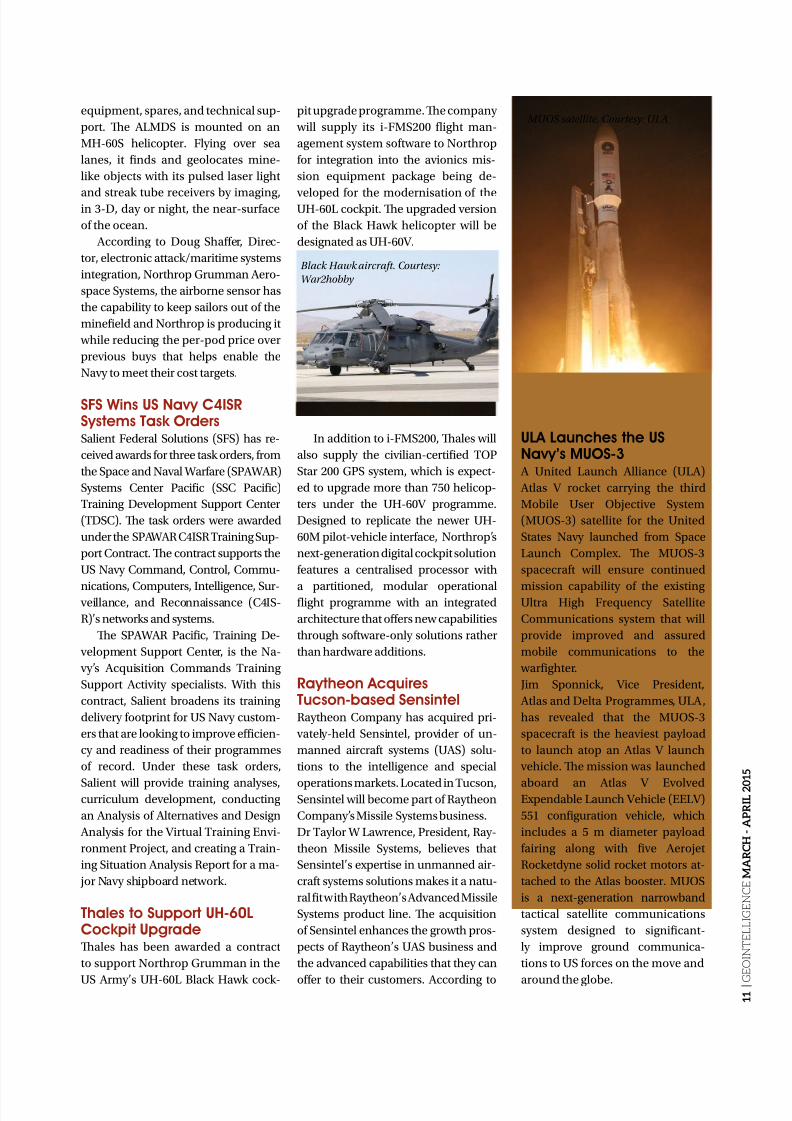
Thales to Support UH-60LCockpit UpgradeTales has been awarded a contract
to support Northrop Grumman in the
US Army’s UH-60L Black Hawk cock-
pit upgrade programme. Te company
will supply its i-FMS200 flight man-
agement system software to Northrop
for integration into the avionics mis-
sion equipment package being de-
veloped for the modernisation of theUH-60L cockpit. Te upgraded version
of the Black Hawk helicopter will be
designated as UH-60V.
In addition to i-FMS200, Tales will
also supply the civilian-certified OP
Star 200 GPS system, which is expect-
ed to upgrade more than 750 helicop-
ters under the UH-60V programme.
Designed to replicate the newer UH-
60M pilot-vehicle interface, Northrop’s
next-generation digital cockpit solution
features a centralised processor with
a partitioned, modular operationalflight programme with an integrated
architecture that offers new capabilities
through software-only solutions rather
than hardware additions.
Raytheon AcquiresTucson-based SensintelRaytheon Company has acquired pri-
vately-held Sensintel, provider of un-
manned aircraft systems (UAS) solu-
tions to the intelligence and special
operations markets. Located in ucson,Sensintel will become part of Raytheon
Company’s Missile Systems business.
Dr aylor W Lawrence, President, Ray-
theon Missile Systems, believes that
Sensintel’s expertise in unmanned air-
craft systems solutions makes it a natu-
ral fit with Raytheon’s Advanced Missile
Systems product line. Te acquisition
of Sensintel enhances the growth pros-
pects of Raytheon’s UAS business and
the advanced capabilities that they can
offer to their customers. According to
Black Hawk aircraft. Courtesy:
War2hobby
MUOS satellite. Courtesy: ULA
8/17/2019 GeoIntelligence March April 2015
http://slidepdf.com/reader/full/geointelligence-march-april-2015 12/44
1 2 |
G E O I N T E L L I G E N C E M A R C H - A P R I L 2 0 1
5
a spokesperson from Raytheon, Sen-
sintel brings additional strong talent,
technology, and relationships with the
Special Operations Command (SO-
COM), Office of Naval Research and US
Air Force Research Laboratory to Ray-
theon and its customers. Te compa-ny claims to be a leader in expendable
remote sensing and UAS engineering,
serving both government and com-
mercial customers by optimising and
integrating mission-specific sensors
and sub-systems into manned and
unmanned platforms. It also provides
training, technical and operational
support to military, scientific and com-
mercial sectors.
Northrop Performs CyberReadiness InspectionNorthrop Grumman Corporation pro-
vided invaluable assistance for the US
Missile Defense Agency’s (MDA) Excel-
lent rating from the Command Cyber
Readiness Inspection (CCRI) conduct-
ed on the Missile Defense Integration
and Operations Center (MDIOC) net-
works at Schriever Air Force Base. Te
CCRI evaluates a site’s compliance with
information assurance and network de-
raining and Education Command
(ECOM)
Dave Barile, Project Manager,
Battelle National Security, believes
that Battelle and GISi provide a unique
combination of geographic informa-
tion systems expertise, systems andsoftware engineering, and a thorough
understanding of aircraft and weap-
on characteristics, that combine with
military training experience. RMK is
a suite of tools and a software appli-
cation designed to help military per-
sonnel conduct rigorous and frequent
training exercises. Currently used by
military training managers, RMK is
a suite of tools and a software appli-
cation designed to help military per-
sonnel conduct rigorous and frequenttraining exercises. It enables operators
to train for the employment of direct
and indirect-fire weapons systems
such as machine guns, field artillery
and mortars, in addition to dropping
bombs or shooting guns, rockets and
missiles from aircraft and helicopters.
MUOS-3 Satellite Respondsto CommandsTe third Mobile User Objective System
(MUOS-3) satellite built by LockheedMartin for the US Navy is now respond-
ing to commands after being launched.
An initialisation team, led by the com-
pany, is operating the MUOS-3 satel-
lite from the Naval Satellite Operations
Center located at the Naval Base Ventu-
ra County, Point Mugu, California.
A company press release reveals
that the satellite constellation operates
like a smart phone network in the sky,
vastly improving current secure mobile
satellite communications for warfight-ers on the move. Unlike previous sys-
tems, MUOS provides users an on-de-
mand, beyond-line-of-sight capability
to transmit and receive high-quality,
prioritised voice and mission data, on
a high-speed Internet Protocol-based
system. MUOS is the Navy’s next
generation secure mobile satellite com-
munications system which will eventu-
ally replace the legacy Ultra High Fre-
quency (UHF) Follow-On system.
fense policies and configuration stand-
ards for technologies as dictated by the
Department of Defense (DOD) security
technical implementation guide.
Te CCRI is a five-day comprehen-
sive, graded inspection involving all
cybersecurity areas including physicalsecurity, administration, training, net-
work configuration, network operations,
organisational culture and leadership
management. Te MDIOC is the US
DOD’s premier missile defense center
for integration, deployment and op-
eration of the nation’s ballistic missile
defense system (BMDS). As the MDA’s
prime contractor at the center, Northrop
Grumman leads a world-class team to
conduct BMDS-level modelling and
simulation, ground and flight tests, wargames, exercises, mission-critical oper-
ations and related analysis.
GISi Provide Military TrainersRange Managers Tool KitBattelle and Geographic Information
Systems (GISi) have been awarded a
contract for the development and sus-
tainment of the US military’s range
managers tool kit (RMK). Te con-
tract awarded by the US Marine Corps
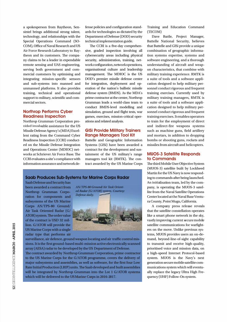
Saab Produces Sub-Systems for Marine Corps Radar Saab Defense and Security has
been awarded a contract from
Northrop Grumman Corpo-
ration for components and
subsystems of the US Marine
Corps AN/PS-80 Ground/
Air ask Oriented Radar (G/
AOR) system. Te order value
of the contract is USD 32 mil-
lion. G/AOR will provide theUS Marine Corps with a single
radar type that performs air
surveillance, air defence, ground weapon locating and air traffic control mis-
sions. It is the first ground-based multi-mission active electronically scanned
array (AESA) radar to be developed by the US Department of Defense.
Te contract awarded by Northrop Grumman Corporation, prime contractor
to the US Marine Corps for the G/AOR programme, covers the delivery of
major subsystems and assemblies, as well as software, for the first four Low
Rate Initial Production (LRIP) units. Te Saab developed and built assemblies
will be integrated by Northrop Grumman into the Lot 1 G/AOR systems
which will be delivered to the US Marine Corps in 2016-2017.
AN/TPS-80 Ground/Air Task Orient-
ed Radar (G/ATOR) system. Courtesy:
Defense daily.
8/17/2019 GeoIntelligence March April 2015
http://slidepdf.com/reader/full/geointelligence-march-april-2015 13/44
1 3 |
G E O I N T E L L I G E N C E M A R C H - A P R I L 2 0 1 5
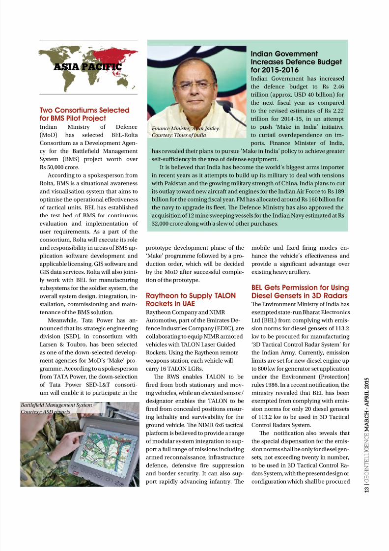
Indian GovernmentIncreases Defence Budgetfor 2015-2016Indian Government has increased
the defence budget to Rs 2.46
trillion (approx. USD 40 billion) forthe next fiscal year as compared
to the revised estimates of Rs 2.22
trillion for 2014-15, in an attempt
to push ‘Make in India’ initiative
to curtail overdependence on im-
ports. Finance Minister of India,
has revealed their plans to pursue ’Make in India’ policy to achieve greater
self-sufficiency in the area of defense equipment.
It is believed that India has become the world’s biggest arms importer
in recent years as it attempts to build up its military to deal with tensions
with Pakistan and the growing military strength of China. India plans to cut
its outlay toward new aircraft and engines for the Indian Air Force to Rs 189billion for the coming fiscal year. FM has allocated around Rs 160 billion for
the navy to upgrade its fleet. Te Defence Ministry has also approved the
acquisition of 12 mine sweeping vessels for the Indian Navy estimated at Rs
32,000 crore along with a slew of other purchases.
Two Consortiums Selectedfor BMS Pilot ProjectIndian Ministry of Defence
(MoD) has selected BEL-Rolta
Consortium as a Development Agen-
cy for the Battlefield Management
System (BMS) project worth over
Rs 50,000 crore.
According to a spokesperson from
Rolta, BMS is a situational awareness
and visualisation system that aims tooptimise the operational effectiveness
of tactical units. BEL has established
the test bed of BMS for continuous
evaluation and implementation of
user requirements. As a part of the
consortium, Rolta will execute its role
and responsibility in areas of BMS ap-
plication software development and
applicable licensing, GIS software and
GIS data services. Rolta will also joint-
ly work with BEL for manufacturing
subsystems for the soldier system, theoverall system design, integration, in-
stallation, commissioning and main-
tenance of the BMS solution.
Meanwhile, ata Power has an-
nounced that its strategic engineering
division (SED), in consortium with
Larsen & oubro, has been selected
as one of the down-selected develop-
ment agencies for MoD’s ‘Make’ pro-
gramme. According to a spokesperson
from AA Power, the down-selection
of ata Power SED-L& consorti-um will enable it to participate in the
prototype development phase of the
‘Make’ programme followed by a pro-
duction order, which will be decided
by the MoD after successful comple-
tion of the prototype.
Raytheon to Supply TALONRockets in UAERaytheon Company and NIMR
Automotive, part of the Emirates De-
fence Industries Company (EDIC), are
collaborating to equip NIMR armored
vehicles with ALON Laser Guided
Rockets. Using the Raytheon remote
weapons station, each vehicle will
carry 16 ALON LGRs.
Te RWS enables ALON to be
fired from both stationary and mov-ing vehicles, while an elevated sensor/
designator enables the ALON to be
fired from concealed positions ensur-
ing lethality and survivability for the
ground vehicle. Te NIMR 6x6 tactical
platform is believed to provide a range
of modular system integration to sup-
port a full range of missions including
armed reconnaissance, infrastructure
defence, defensive fire suppression
and border security. It can also sup-
port rapidly advancing infantry. Te
mobile and fixed firing modes en-
hance the vehicle’s effectiveness and
provide a significant advantage over
existing heavy artillery.
BEL Gets Permission for UsingDiesel Gensets in 3D RadarsTe Environment Ministry of India has
exempted state-run Bharat Electronics
Ltd (BEL) from complying with emis-
sion norms for diesel gensets of 113.2
kw to be procured for manufacturing
‘3D actical Control Radar System’ for
the Indian Army. Currently, emission
limits are set for new diesel engine up
to 800 kw for generator set application
under the Environment (Protection)
rules 1986. In a recent notification, theministry revealed that BEL has been
exempted from complying with emis-
sion norms for only 20 diesel gensets
of 113.2 kw to be used in 3D actical
Control Radars System.
Te notification also reveals that
the special dispensation for the emis-
sion norms shall be only for diesel gen-
sets, not exceeding twenty in number,
to be used in 3D actical Control Ra-
dars System, with the present design or
configuration which shall be procured
ASIA PACIFIC
Battlefield Management System.
Courtesy: ASD reports
Finance Minister, Arun Jaitley.
Courtesy: Times of india
8/17/2019 GeoIntelligence March April 2015
http://slidepdf.com/reader/full/geointelligence-march-april-2015 14/44
1 4 |
G E O I N T E L L I G E N C E M A R C H - A P R I L 2 0 1
5
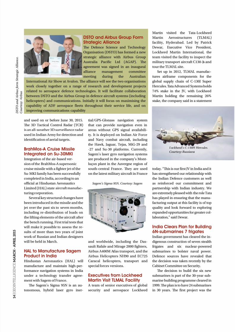
DSTO and Airbus Group FormStrategic AllianceTe Defence Science and echnology
Organisation (DSO) has formed a new
strategic alliance with Airbus Group Australia Pacific Ltd (AGAP). Te
agreement was signed in an inaugural
alliance management committee
meeting during the Australian
International Air Show at Avalon. Te alliance will see the two organisations
work closely together on a range of research and development projects
related to aerospace defence technologies. It will facilitate collaboration
between DSO and the Airbus Group in defence aircraft systems (including
helicopters) and communications. Initially it will focus on maximising the
capability of ADF aerospace fleets throughout their service life, and on
improving communications capability
and used on or before June 30, 2015.
Te 3D actical Control Radar (CR)
is an all-weather 3D surveillance radar
used in Indian Army for detection and
identification of aerial targets.
BrahMos-A Cruise MissileIntegrated on Su-30MKIIntegration of the air-based ver-
sion of the BrahMos-A supersonic
cruise missile with a fighter jet of the
Su-MKI family has been successfullycompleted in India, according to an
official at Hindustan Aeronautics
Limited (HAL) state aircraft manufac-
turing corporation.
Several key structural changes have
been introduced in the missile and the
jet over the past six to seven months,
including re-distribution of loads on
the lifting elements of the aircraft after
the bench running. First trial tests that
will make it possible to assess the re-
sults of more than two years of joint work of Russian and Indian designers
will be held in March.
HAL to Manufacture SagemProduct in IndiaHindustan Aeronautics (HAL) will
manufacture and maintain high-per-
formance navigation systems in India
under a technology transfer agree-
ment with Sagem of France.
Te Sagem’s Sigma 95N is an au-
tonomous, hybrid laser gyro iner-
tial/GPS-Glonass navigation system
that can provide navigation even in
areas without GPS signal availabili-
ty. It is deployed on Indian Air Force
and Navy combat aircraft, including
the Hawk, Jaguar, ejas, MiG-29 and
-27 and Su-30 platforms. Currently,
Sagem’s laser gyro navigation systems
are produced in the company’s Mont-
luçon plant in the Auvergne region of
south-central France. Tey are used
on the latest military aircraft in France
and worldwide, including the Das-
sault Rafale and Mirage 2000 fighters,
Airbus A400M Atlas transport, and the
Airbus Helicopters NH90 and EC725
Caracal helicopters, transport and
special forces versions.
Executives from LockheedMartin Visit TLMAL Facility
A team of senior executives of global
security and aerospace Lockheed
Martin visited the ata-Lockheed
Martin Aerostructures (LMAL)
facility, Hyderabad. Led by Patrick
Dewar, Executive Vice President,
Lockheed Martin International, the
team visited the facility to inspect themilitary transport aircraft C130-Js and
tour the LMAL site.
Set up in 2012, LMAL manufac-
tures airframe components for the
global supply chain of C-130J Super
Hercules. ata Advanced Systems holds
74% stake in the JV, with Lockheed
Martin holding the remaining 26%
stake, the company said in a statement
today. “Tis is our first JV in India and it
has strengthened our relationship withthe Indian Defence customers as well
as reinforced our commitment and
partnership with Indian industry. We
are extremely pleased with the role ata
has played in ensuring that the manu-
facturing output at this facility is of top
quality and look forward to exploring
expanded opportunities for greater col-
laboration,” said Dewar.
India Clears Plan for Building
6N-submarines 7 frigatesIndian government has cleared the in-
digenous construction of seven stealth
frigates and six nuclear-powered
submarines to bolster naval power.
Defence sources have revealed that
the decision was taken recently by the
Cabinet Committee on Security.
Te decision to build the six new
submarines is part of the 30-year sub-
marine building programme cleared in
1999. Te plan is to have 24 submarines
in 30 years. Te first project was the
D S T O a n d A i r b u s f o r m S
t r a t e g i c A l l i a n c e .
C o u r t e s y : A i r b u s
Sagem’s Sigma 95N. Courtesy: Sagem
Lockheed’s C-130H Hercules.
Courtesy: Russiava
8/17/2019 GeoIntelligence March April 2015
http://slidepdf.com/reader/full/geointelligence-march-april-2015 15/44
1 5 |
G E O I N T E L L I G E N C E M A R C H - A P R I L 2 0 1 5
P75, under which six Scorpene subma-
rines are being built in India. According
to defence sources, the government has
tweaked the project under which the
CCS has taken a decision that the next
six submarines would be nuclear-pow-ered, unlike the conventional ones that
were envisaged.
AAP Government to UseGeo-Tagging For WomenTe AAP government is looking at
solutions in technology to help wom-
en caught in distress situations real
time. In the near future, women in
distress will be able to summon help
from nearby PCR van or police station
and inform family by merely opening a
smart phone-based mobile application
or pressing a set of letters on the keypad
of a simple phone.
AAP’s inhouse elecom expert
and Dwarka MLA Adarsh Shastri said
that the administration will use ‘geo
tagging’ technology to implement
these ideas.
Canister-based Trial of Agni-V ConductedTe Indian Defence Research and De-
velopment Organisation (DRDO), has
conducted the first canister-based trial
of the Agni-V intercontinental ballis-
tic missile (ICBM) on Wheeler Island
off the Odisha coast. Launched from
a canister mounted on a road-mobile
launcher from the integrated test range’s
launch complex-IV, the nuclear-capable
missile climbed to a height of more than
600km in its parabolic trajectory and ac-
curately hit the designated target point
in the Indian Ocean after 20 minutes.
Te missile’s parameters were
monitored by radars and electro-op-
tical systems, while the ships locatedin mid-range and at the target point
tracked the vehicle and witnessed
the final event. Te road-mobile
canister-version will enable Agni-V
to be fired from stop-to-launch with-
in a few minutes and ensure higher
reliability, longer shelf-life and re-
duced maintenance.
DRS Wins CommunicationsSystems Contract from NZ
DRS echnologies is planning toprovide tactical integrated communi-
cations systems to the New Zealand
Ministry of Defense for the Royal New
Zealand Navy’s ANZAC-class frigates.
Te subcontract includes the provi-
sion of all internal tactical and secure
voice switching systems and termi-
nals. DRS will provide its Shipboard
Integrated Communications System
(SHINCOM 3100) central switching
unit, helicopter audio distribution
system, public address server, record-er storage units, console dual screen
terminals, outdoor terminals, jackbox-
es and ancillaries, as well as the Avaya
G450 PABX phone system.
According to Steve Zuber, Vice
President and General Manager, DRS
echnologies, the programme will
allow Navies to share key interoper-
ability, technology and applications,
ensuring that SHINCOM 3100 remains
the premier internal communications
Northrop Grumman WinsUK’s Cyber Security ContractNorthrop Grumman Corporation is
among the companies that have been
awarded a contract by the governmentof the United Kingdom to provide a
range of cyber security solutions. Un-
der the contract, Northrop Grumman
will provide engineering and develop-
ment services in support of data secu-
rity and information assurance.
Northrop Grumman continues to in-
vest in UK-based cyber security capa-
bilities with new facilities in England,
where it has set up an Advanced Cyber
echnology Centre of Excellence, a
global collaboration initiative to ad- vance high-end solutions to our cus-
tomers’ most challenging cyber prob-
lems. Te company is also investing in
the development of the next genera-
tion of cyber specialists. Te company
entered into a partnership with Cyber
Security Challenge UK under which it
has launched the youth-based cyber
defence competition CyberCenturion
in the UK aimed at building tomorrow’s
cyber workforce. Northrop Grumman
is also mentoring a diverse set of smalland medium enterprise partners and
investing in research and development
with select UK university partners.
MBDA Completes SecondTest Launch of MMP MissileMBDA has completed the second round
of testing of the medium-range missile
(MMP) at the French Defence Procure-
ment Agency’s (DGA) echniques er-
restres site in Bourges, France. Jointly
conducted by DGA, the French Army
Agni missile. Courtesy: DRDO
system for years to come. SHINCOM
3100 is supposedly the latest gener-
ation in shipboard communications
switch technology which provides re-
liable, red/black secure tactical com-
munications for Navy operators.
ANZAC-class frigates.
Courtesy: Progressive media group
8/17/2019 GeoIntelligence March April 2015
http://slidepdf.com/reader/full/geointelligence-march-april-2015 16/44
1 6 |
G E O I N T E L L I G E N C E M A R C H - A P R I L 2 0 1
5
and MBDA France earlier this month,
the first flight of the missile successful-
ly confirmed its enhanced accuracy in
locking onto a target hidden from view
at launch at a distance of more than
4,000 m. Conducted against a steel tar-
get positioned at an intermediate range,
the trial ensured optimal execution ofall aspects of the test, including launch,
flight trajectory and target impact, with
full conformation of the simulations.
esting was carried out in lock-on-be-
fore-launch mode (fire-and-forget),
using the missile seeker’s colour V
channel, and completes another stage
in the analysis of MMP’s deployment
envelope. Te MMP is a lightweight,
next-generation surface-attack missile
designed for destruction of both station-
ary and moving ground targets, includ-ing tanks, armoured and non-armoured
vehicles and infrastructures with mini-
mum collateral damage.
French DGA Orders Thales’s VENUS SATCOM TerminalsTales has secured a contract to
supply additional véhicules de com-
mandement nomades communiquant
par satellite (VENUS) SACOM
on-the-move terminals, as part of the
French military’s satellite-based radio
communication system (Syracuse) III
programme.
Awarded by the French Defence
Procurement Agency (DGA), the
agreement includes a further 20
ground terminals that will be in-stalled on the French Army’s VAB light
armoured vehicles, enabling com-
manders to stay in contact while on
the move in the theatre. Te SACOM
OM technology enables vehicles fit-
ted with satellite antennas to establish
and maintain a satellite link whether
they are moving or stationary. Featur-
ing standard interfaces to connect oth-
er tactical communication equipment
for higher data rates and overall avail-
ability, the terminals provide a per-
manent command communication
capability in the theatre of operations
to help address ground force require-
ments of on-the-move for information
exchange and force protection.
GE to Supply Computing
Subsystems for UK Army Awarded by General Dynamics (GD)
UK, the EURO 64 million contracts
cover the supply of a range of embed-
ded computing subsystems, including
Ethernet switches, gateway processors
and data and video servers, which is
believed to form the backbone of the
SV electronics architecture. Te Eth-
ernet switch is expected to connect
networked elements of the vehicle,
while the gateway processor provides
the GD software with the processing
capability needed to run the platform.
Data and video servers will enable the
vehicle to store and distribute vehicleand scenario data and video around
the platform and into the wider con-
nected battlefield. Te scalable, open
architecture subsystems delivered
under the contract will facilitate easy
upgrade of Scout SV vehicles during
their lifetime. Developed on a highly
adaptable and capable common base
platform, Scout SV is expected to offer
enhanced intelligence, surveillance,
protection, target acquisition and re-
connaissance capabilities, as well as ahighly effective 40mm cannon.
Airbus Defence and SpaceProvides Satellite AirtimeTe UK Ministry of Defence (MoD) has
selected Airbus Defence and Space
to provide satellite airtime for air and
ground tracking of ground assets and
helicopters on a worldwide basis. Te
contract is for the provision of Iridium
Short Burst Data and Iridium Rudics
Data Minutes for the MOD’s established Asset racking System (AS), Helicopter
AS (HeAS) and Ground AS (GrAS).
Te UK AS supposedly meets Opera-
tional Command situational awareness
requirements by providing the location
of tracked ground and air assets in near
real-time. Te strategic importance of
the AS requires reliability across all of
its components including the satellite
airtime provided by Airbus Defence and
Space to transmit GPS data from assets
in the field.
SCOUT SV.
Courtesy: General Dynamics
SATCOM terminal.
Courtesy: www.tfk racoms.com
MMP missile. Courtesy: MBDA

8/17/2019 GeoIntelligence March April 2015
http://slidepdf.com/reader/full/geointelligence-march-april-2015 17/44
The International Forum forthe Military Training, Educationand Simulation Sectors
28 - 30 April 2015PVA Expo, Prague
Save Up to £500 with the Early Bird Discount
From disaster management, cyber security, e-learning, mobile technologies, serious games and
visual display products, ITEC presents the full spectrum of the training and simulation sectors.
Thought-Leading Conference
Includes themes that capture the technological propositions and reveal key strategic andoperational military imperatives
Over 110 Exhibitors
Review, benchmark and engage with industry and academia showcasing solutions and ideas atthe forefront of military education, training, modelling and simulation
Networking OpportunitiesUnique and cost effective way to meet with senior military and policy customers, industrypartners, and those at the forefront of academic research
For more information and to register for ITEC 2015, please visit:WWW.ITEC.CO.UK /GEOINTELLIGENCE
Organised by:
www.itec.co.uk/facebookwww.itec.co.uk/linkedin
@ITEC2015

8/17/2019 GeoIntelligence March April 2015
http://slidepdf.com/reader/full/geointelligence-march-april-2015 18/44
1 8 |
G E O I N T E L L I G E N C E
M A R C H - A P R I L 2 0 1 5
NATIONAL SECURITY
National security implies
protecting a nation’s
population, economy,
critical infrastructure,
borders and prosperity in general.
In order to implement national se-
curity, there is a need to coordinate
action and exchange information
between various agencies such as
National Intelligence, Defence, Law
enforcement, Disaster Management,
First Responders and selected private
sector enterprises. In order to share
this critical information, there is a
requirement to create an enterprise
wide Geographical Information
System (GIS) with the necessary
tools. While the Forest Survey of
India has recently made a welcome
announcement on the implementationof a GIS-based Decision Support
System, this important facility has
to be extended across many other
agencies at the earliest.
Moreover, the recent tragic floods
in J&K and Assam have once again
proved the might of nature. However,
while man cannot stop the initiation
and the fury of nature, he can certainly
use technology to prevent and reduce
the loss to life and property. Just
look at how important the weatherbroadcasts have become around the
world, and how successfully people
are being evacuated time and again
from impending natural disasters
such as Hudhud and Phailin in India.
In fact the most important technology
for this purpose again revolves around
geospatial technology and GIS. If we
had a system to continuously monitor
the rise in water levels (cm accuracy
as of today) and predict the flooding
pattern (which is a standard feature of
In Geospatial Apps
India’s NationalSecurity Voids
Geospatial information is a crucial component for efficient threat
analysis, response to and recovery from natural disasters andpromoting rapid sharing of critical information
An illustration of WebGIS components.Courtesy: Esri
8/17/2019 GeoIntelligence March April 2015
http://slidepdf.com/reader/full/geointelligence-march-april-2015 19/44
1 9 |
G E O I N T E L L I G E N C E M A R C H - A P R I L 2 0 1 5
all GIS), then a large number of lives in
J&K and Assam could have been saved,
as also the relief effort prioritised
based on the time criticality of the
threat. Te lack of a suitably digitised
data base of maps for this purpose
adds to our problems. Alas, while werightfully dream of a digital India, our
efforts at the national and subordinate
levels related to efficient utilisation of
GIS for National Security, including
disaster management, are somewhat
lacking in their implementation.
WebGIS WebGIS plays a crucial role in
distributing geospatial services to
all the stakeholders implementing
the National Security mission. Teavailable data with the collecting and
analysing agencies is now shared and
converted into actionable intelligence,
which is further utilised for planning
and conduct of operations. Such
applications have been robustly
developed by various GIS firms like
Esri and BAE Systems, and are being
effectively used by many countries.
India had made a good start by
creating the National Spatial Data
Infrastructure and the National GIS,but the process seems to have been
mired in procedural tangles and got
unduly delayed. A need to coordinate
the development across various
ministries is therefore, the need of the
hour and any delay in this direction
may be costly to human lives.
Big Data Analytics A large number of smart device users
in the internationally networked
scenario have led to the so calledinformation overload. Tis data, which
largely comprises of unstructured
data of dynamic nature, is often a
warehouse of intelligence information.
Big data analytics refers to firstly
finding the dots and then connecting
them to create a multisource fusion
of intelligence. Te data is sourced
from various enterprises, social
media, sensor networks and human
geography inputs. Te threat vector is
now examined based on geospatial,temporal, behavioural and pattern
recognition techniques. Te analytics
now can be shared amongst users to
create a shared situational awareness
for undertaking preventive action.
Human Geography Human Geography is the creation of
the human footprint through the fusion
of map locations and human related
data, and differs from Physical Geog-
raphy it takes into account a dozen
themes related to people and maps the
same. Tis data is structured based on
the core themes of Human Geography
which include Demographics, Econo-
my, ransportation, Communication,
Education, Religion, Ethnicity, Health,Political Groupings, Language, Land
and Water. Tis new subject has
recently grown into prominence in
view of the large amounts of data
available from social media and
other surveys and the need to provide
actionable intelligence from the same.
An example of Human Geography
can be taken from a recent case study
of Algeria country subject to regular
terrorist attacks and extremist activity.
Locations of neighbourhoods andsentiments of populations where
violence and extremism can occur are
critical knowledge for searching and
finding radicalisation before it starts.
Tis is where foundational geospatial
data like Human Geography
Information Surveys (HGIS) assists
in gathering critical data which later
helps to identify causal factors. Teapproach adopted by them to tackle
this issue was to use a macro to micro
approach and, thereby identifying
regions where radicalised sentiments
were occurring. Tis was done by
conducting geospatial analysis models
to determine where future radical
sentiments would occur.
A similar approach was also
followed in narrowing down the
search area for the missing Malaysian
Airlines flight MH370. Te use ofPredictive Analytical tools, thus
help analysts to anticipate risk and
identify opportunities for leaders
and decision makers to focus their
limited resources.
Imagery AnalysisIn view of technological advances
in electro-optical devices, there has
been a paradigm shift in imagery
from aerial platforms such as satellites
and UAVs. Te latest imagery satellitenamed WorldView-3, which was
launched in August 2014, provides a
resolution of 31 cm. Tis comes at a
time when the US has also agreed to
WebGIS plays a crucial role in
distributing geospatial services to all
the stakeholders implementing the
National Security mission
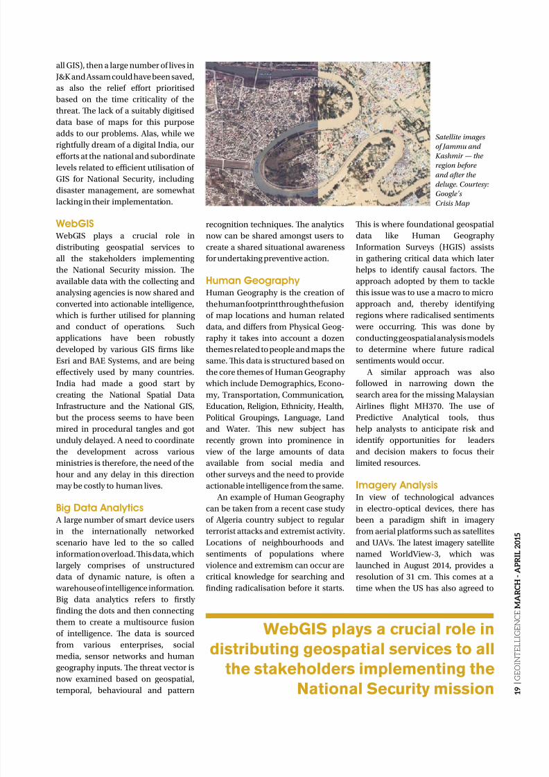
Satellite imagesof Jammu and
Kashmir — the
region before
and after the
deluge. Courtesy:
Google’s
Crisis Map
8/17/2019 GeoIntelligence March April 2015
http://slidepdf.com/reader/full/geointelligence-march-april-2015 20/44
2 0 |
G E O I N T E L L I G E N C E
M A R C H - A P R I L 2 0 1 5
NATIONAL SECURITY
The use of
Predictive
Analytical tools
helps analyststo anticipate
risk and identify
opportunities
for leaders and
decision makers
to focus their
limited resourcesLt Gen (Dr) Rajesh Pant, PVSM,
AVSM,VSM (Retd)[email protected]
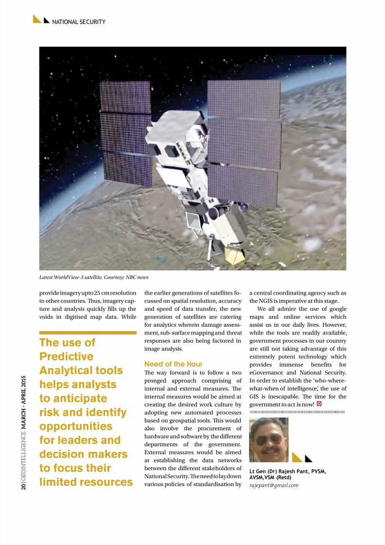
Latest WorldView-3 satellite. Courtesy: NBC news
provide imagery upto 25 cm resolution
to other countries. Tus, imagery cap-
ture and analysis quickly fills up the
voids in digitised map data. While
the earlier generations of satellites fo-
cussed on spatial resolution, accuracy
and speed of data transfer, the new
generation of satellites are catering
for analytics wherein damage assess-
ment, sub-surface mapping and threat
responses are also being factored in
image analysis.
Need of the Hour Te way forward is to follow a two
pronged approach comprising ofinternal and external measures. Te
internal measures would be aimed at
creating the desired work culture by
adopting new automated processes
based on geospatial tools. Tis would
also involve the procurement of
hardware and software by the different
departments of the government.
External measures would be aimed
at establishing the data networks
between the different stakeholders of
National Security. Te need to lay down various policies of standardisation by
a central coordinating agency such as
the NGIS is imperative at this stage.
We all admire the use of google
maps and online services which
assist us in our daily lives. However,
while the tools are readily available,
government processes in our country
are still not taking advantage of this
extremely potent technology which
provides immense benefits for
eGovernance and National Security.
In order to establish the ‘who-where- what-when of intelligence’, the use of
GIS is inescapable. Te time for the
government to act is now!

8/17/2019 GeoIntelligence March April 2015
http://slidepdf.com/reader/full/geointelligence-march-april-2015 21/44
2 1 |
G E O I N T E L L I G E N C E M A R C H - A P R I L 2 0 1 5
Opening up of automated informationservices on internal security matters
could be the harbinger of the proposedinternal security mechanism that woulddefeat a threat gaining ground acrossthe country
O ver the recent decades,
preservation of peace and
internal stability has as-
sumed larger dimensions
on account of rise of societal conflicts
that is sustained by the rise ofindividual aspirations and coalescence
of interest groups and empowerment
of such groups with the wherewithal
for resort to force in seeking fulfilment
of their designs, many of the methods
adopted being outside the norms of
constitutionally sanctioned behaviour.
Societal conflicts, economic dis-
parities, political aspirations and ideo-
logical urges are at the roots of internal
instability. Tat is but a normal trend
in today’s world. But when uncon-stitutional intransigence that sprout
from such roots are allowed to go un-
restrained due to weaknesses in leg-
islative, law enforcement and judicial
mechanisms, that licence brings profit
to mass agitation, mob lawlessness
and group revolt – a situation which
is rather common in our everyday ex-
periences. Unless nipped in the bud,
such situations are liable to morph
into armed insurgency, which inflicts
unfathomable damage to the cause of
nationhood. Te problem is further
exacerbated by the adoption of a new
form of waging war by our external
adversaries by way of overt and covert
instigation of internal intransigence
among the anti-national forces of various motivations. It is, therefore,
imperative for the Indian state to up-
lift its internal security mechanism by
all means — physical, administrative,
fiscal and technological — and defeat
a threat, which seems to be gaining
ground all across the country.
Science of Internal Security Te state’s responsibility to control,
rationalise, and if necessary, restrain
by force, the threats to internal peaceand stability is better served when de-
mographic, dynamics, ethnic diversi-
ties, vocational interests, habitation
issues, political, religious and linguis-
tic radicalism and infrastructural con-
ditions are minutely monitored by its
internal security apparatus. Given the
cap over the nation’s resources against
rising needs of an exploding spread
of population, this is a responsibility
of extreme sensitivity and complexi-
ty. Ironically however, while anti-na-
tional intransigency is aided by open
access to technology driven facilities,
the Indian state remains languid in
harnessing scientific tools to the pur-
pose of reconciliation and control of
its incessant societal churnings, thusleaving scope for it to frequently burst
out into destabilising turmoil.
Effective grip over a diverse, heavily
populated and vast Indian hinterland
is a challenge of immense propor-
tions; it cannot be met by law, order or
intelligence mechanism that has seen
little modernisation since its inception
a century-and-a-half back.
Utilising Automation
Technology Even if we have a fairly elaborate
national information system – those
maintained by National Information
and Informatics Centres, National
Investigation Agency, State police,
Enforcement Directorate, etc. for
example — which provides extensive
inputs covering wide fields of
activities at the national, institutional
and departmental levels, the system
will remain, but will be generalist in
its composition. We also have many
INTERNAL SECURITY

8/17/2019 GeoIntelligence March April 2015
http://slidepdf.com/reader/full/geointelligence-march-april-2015 22/44
2 2 |
G E O I N T E L L I G E N C E
M A R C H - A P R I L 2 0 1 5
INTERNAL SECURITY
informational data-banks which are
custom-devised by various secu-
rity agencies, but these are neither
comprehensive nor authenticated or
seamlessly integrated at the all-India
level to home on to specific inter-nal security challenges. Creating an
effective architecture for management
and articulation of a dedicated inter-
nal security information system is,
therefore, imperative for the hierarchy
of internal security of India.
Let us see how such a system may
have been conceptualised. Suppos-
edly, that system is identified as an
Internal Security Decision Support
System (ISDSS). Te role of this sys-
tem may tentatively be specified as theone which would enable the custodi-
ans of the nation’s internal security in:
• Marshalling the full range of
near-current, grass-roots information
of interest;
• Permit automated configuration
of information to respond to
intelligence queries in terms of
required range, depth and format;
• Facilitate real-time dissemination
of the output intelligence at two
distinct levels, viz, functional anddecision-making levels.
For sure the custodians as well as
main users of the ISDSS would be the
intelligence agencies, police and civil
administration, both at the Centre
as well as State levels and the static
military headquarters which are af-
filiated to various states or regions
within the country. May be at one
stage, the system might find utility in
controlling the latent threats to the
nation’s internal security — terror-ism linked contraband trade, human
trafficking and illegal money exchange
for example.
Internal Security DecisionSupport System (ISDSS)In its nascent form, the ISDSS would
constitute of three distinct information
bases, viz, the ‘Demographic
Information Base’ (DIB), ‘Geographical
Information Base’ (GIB) and the
‘Infrastructure Information Base’ (IIB).
Keeping India’s vast diversities
in mind, the information databases
would have to be created, stored and
maintained according to the principle
of ‘whole to part’, as it is followed in
case of geographical mapping. Tat isto say that the country would be sub-
divided into regions, states, districts,
sub-divisions, blocks, towns, villages,
and forested and barren areas before
drawing out a smallest standard grid-
ded module to which the information
would be tagged. For ease of recording
and retrieval of inputs, the nation’s
existing administrative divisions and
the gridding pattern followed by the
Survey of India would be a good bet
to follow. However, boundaries andscales of the ‘areas of intelligence in-
terest’ would have to be dictated not
just by administrative convenience
and geographical space respectively,
but by the criteria of sensitivity and
volume of information in the context
of internal security. In other words,
the extent of areas of interest to which
information would be decided accord-
ing to the range and density of sensi-
tive information rather than the ad-
ministrative boundaries. Similarly, thespread of these areas of intelligence
interest might consist of a fraction,
or one, or many topographical grid
squares; for best results in manipula-
tion of digitised data, the information
tagging modules may even follow dif-
ferent scales. Tus, a reconciliation of
boundaries and scales for the infor-
mation bases would be needed to se-
cure the best systemic advantage.
Once the basic gridded informa-
tion modules have been drawn, thedigitised information base may be
created, tagged and retrieved as
necessary and manipulated accord-
ing to the situation, just as it is done
while referring to digitised topograph-
ical maps. o this purpose, ‘Internal
Security Information Control Centres’(ISICC) would have to be planted at
the successive hubs of the above men-
tioned hierarchy of modules. In form,
these centres already exist; just a bit
of orientation, equipping, technical
staffing and codifying the business
rules may be needed to formalise
these into the ISDSS.
A robust communication net-
work for information recording,
advisory dissemination and retriev-
al of specifically formatted queries would have to be a part of that system.
Tis network could be similar to the
dedicated networks created by some
of the government departments as
well as private players for their purpos-
es and carried over common or joint
communication highways, though the
hierarchies and security classifications
would have to be unique. Te existing
countrywide data network system may
be built upon for this purpose.
Build Up of ISDSSMuch of the pattern discussed
above is already in place with vari-
ous public departments that operate
topographical, geological, mineral,
population census, public distribu-
tion and engineering schemes. But in-
puts obtainable from these sources
are neither comprehensive in char-
acteristics nor conducive to efficient
strategic or tactical decision mak-
ing. Te entire system will, therefore,have to be designed ab initio, with its
A robust communication network
for information recording, advisory
dissemination and retrieval of
specifically formatted queries would
have to be a part of the system
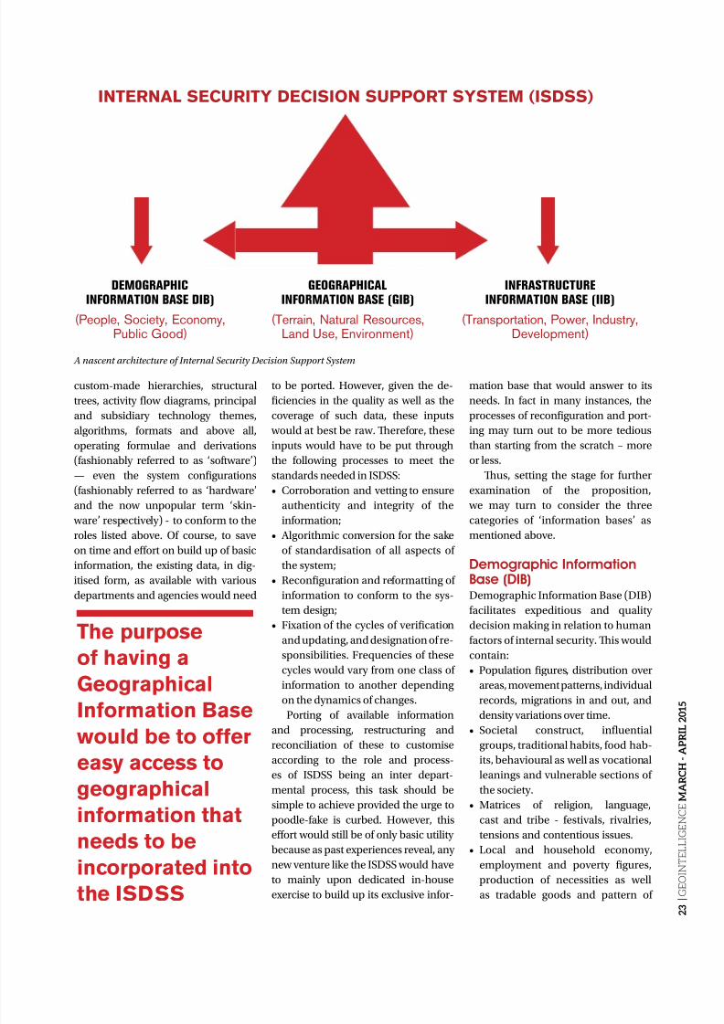
8/17/2019 GeoIntelligence March April 2015
http://slidepdf.com/reader/full/geointelligence-march-april-2015 23/44
2 3 |
G E O I N T E L L I G E N C E M A R C H - A P R I L 2 0 1 5
custom-made hierarchies, structural
trees, activity flow diagrams, principal
and subsidiary technology themes,
algorithms, formats and above all,
operating formulae and derivations
(fashionably referred to as ‘software’)
— even the system configurations
(fashionably referred to as ‘hardware’
and the now unpopular term ‘skin-
ware’ respectively) - to conform to the
roles listed above. Of course, to saveon time and effort on build up of basic
information, the existing data, in dig-
itised form, as available with various
departments and agencies would need
to be ported. However, given the de-
ficiencies in the quality as well as the
coverage of such data, these inputs
would at best be raw. Terefore, these
inputs would have to be put through
the following processes to meet the
standards needed in ISDSS:
• Corroboration and vetting to ensure
authenticity and integrity of the
information;
• Algorithmic conversion for the sakeof standardisation of all aspects of
the system;
• Reconfiguration and reformatting of
information to conform to the sys-
tem design;
• Fixation of the cycles of verification
and updating, and designation of re-
sponsibilities. Frequencies of these
cycles would vary from one class of
information to another depending
on the dynamics of changes.
Porting of available informationand processing, restructuring and
reconciliation of these to customise
according to the role and process-
es of ISDSS being an inter depart-
mental process, this task should be
simple to achieve provided the urge to
poodle-fake is curbed. However, this
effort would still be of only basic utility
because as past experiences reveal, any
new venture like the ISDSS would have
to mainly upon dedicated in-house
exercise to build up its exclusive infor-
mation base that would answer to its
needs. In fact in many instances, the
processes of reconfiguration and port-
ing may turn out to be more tedious
than starting from the scratch – more
or less.
Tus, setting the stage for further
examination of the proposition,
we may turn to consider the three
categories of ‘information bases’ as
mentioned above.
Demographic InformationBase (DIB)Demographic Information Base (DIB)
facilitates expeditious and quality
decision making in relation to human
factors of internal security. Tis would
contain:
• Population figures, distribution over
areas, movement patterns, individual
records, migrations in and out, and
density variations over time.• Societal construct, influential
groups, traditional habits, food hab-
its, behavioural as well as vocational
leanings and vulnerable sections of
the society.
• Matrices of religion, language,
cast and tribe - festivals, rivalries,
tensions and contentious issues.
• Local and household economy,
employment and poverty figures,
production of necessities as well
as tradable goods and pattern of
INTERNAL SECURITY DECISION SUPPORT SYSTEM (ISDSS)
DEMOGRAPHICINFORMATION BASE DIB)
(People, Society, Economy,Public Good)
GEOGRAPHICALINFORMATION BASE (GIB)
(Terrain, Natural Resources,Land Use, Environment)
INFRASTRUCTUREINFORMATION BASE (IIB)
(Transportation, Power, Industry,Development)
A nascent architecture of Internal Security Decision Support System
The purpose
of having a
Geographical
Information Basewould be to offer
easy access to
geographical
information that
needs to be
incorporated into
the ISDSS
8/17/2019 GeoIntelligence March April 2015
http://slidepdf.com/reader/full/geointelligence-march-april-2015 24/44
INTERNAL SECURITY
2 4 |
G E O I N T E L L I G E N C E
M A R C H - A P R I L 2 0 1 5
demand and actual consumption.
• States of education, health, public
discipline, law and order, and crime
trends.
Tis kind of information is readily
available at National Information Centreand National Informatics Centre, census
data, Public Distribution System, Elec-
toral Rolls, revenue records, banking,
the Unique Identification Scheme, the
National Investigation Agency, various
non-government samplings and social
surveys. However, these need to be cus-
tomised and the voids filled up. Notably,
neither the attributes, nor the fields and
properties within each attribute could
be exhaustive to begin with. Te volu-
metric and qualitative improvements would thus be a continuous process.
Geographical InformationBase (GIB)Te purpose of having a Geographical
Information Base (GIB) would be
to offer easy access to geographical
information that needs to be incorpo-
rated into the ISDSS. A large portion
of this information is obtainable from
topographical and geological maps, a
field in which India has excelled. But
the fact that these maps have not been
designed for the purpose of internal
security related information banking,
leaves most of the internal intelligence
queries unattended. Terefore, as stat-
ed earlier, build up of GIB needs to be afresh exercise. However, even if the in-
formation base has to be reconfigured
from what is available, it would make
sense for all the three information
bases to subscribe to common bound-
aries and adopt standard scales for the
information tagging modules that can
customise the role of ISDSS. Following
are some of the main attributes of GIB:
• errain information covering the
current spread and densities of veg-
etation, contours and gradients,road and rail communications,
habitations and so on;
• Data regarding water drainage, flood
and draught, natural produce like
minerals, forestry and cultivation;
• Land distribution and use;
• Environmental records and issues in
contention;
• Areas that lend to lawless activities,
covert transit, attacks etc.
In many ways, the GIB will be similar
to the GIS facility, but with built-in
intangibilities of human and natural di-
versities which shape the internal secu-
rity issues.
Infrastructure Information
Base (IIB)Te purpose of IIB would be to pro-
vide readily accessible information
about various categories of infra-
structure, public and private, availa-
ble as well as those in the process of
coming up, which may be of use in
planning and implementation of in-
ternal security measures. Te class of
information to be covered under this
information base would be as follows:
• ransportation infrastructure
to include road, rail, air and waterway networks, availability of
transport fleet and warehousing,
load handling, transit and station
facilities;
• Power, water, telecommunication
network including mobile phone
and internet, and food supply
infrastructure;
• Construction agencies and earth
moving plants as available in location
with public and private sector
undertakings;
8/17/2019 GeoIntelligence March April 2015
http://slidepdf.com/reader/full/geointelligence-march-april-2015 25/44
2 5 |
G E O I N T E L L I G E N C E M A R C H - A P R I L 2 0 1 5
• Local industry and its links with the
larger economy;
• Development projects, current as
well as impending;
• Public goods like Public Distribution
System, banking network, educational
institutions primary upwards, hospi-
tals and public health centres, pattern
of diseases, etc.;
• Law enforcement capabilities likemoney transfer records, police pres-
ence, maintenance of law and order,
juducial mechanism, rates of con-
viction and rehabilitation measures.
Inadequate and outdated knowledge
of infrastructural conditions and the
equation of industrial activities with the
societies and economy at the local level
has been a bug in our internal security
schemes. Tus, many times while solu-
tions — in terms of facilities, services,
tools and equipment - have lain ignoredin the backyard, frantic efforts are made
to find these from elsewhere. A compe-
tent and regularly updated IIB would be
an answer to that flaw.
Quick Tagging OptionsIt is natural for an elaborate system
like the ISDSS to grow its own tools for
more efficient and timely response. Tat
indeed would happen as the System
matures. It is, therefore, wise to visual-
ise the scope for future developments
at the starting stage itself – such
inquisitions lead to smooth transition
as well as saving in costs. Accordingly,
we may visualise coalescence over a
time of certain quick tagging options,
which would offer quick and focused
information thus making the systemincreasingly user-friendly and trust
worthy.
agging options are semi or fully pro-
cessed information duly tagged to loca-
tion — that is, the corresponding module
of information base — and the time of
its generation or update. As the pattern
of users’ approach to the information
base, kinds of queries and precedence’s
of decision making crystallises and the
‘ags’ earn credibility, these options
provide for readily formatted and an-notated intelligence, even if mostly in
primary form. Tat indeed is a great help
in management of internal security,
particularly under emergent situations.
At this stage, however, it would suffice
to mention just a few examples of quick
tagging, as follows:
• Counter-Insurgency Force Tag:
Tis tag is related to deployment,
disposition, strength, operational
wherewithal and movement of
security forces engaged in counter-in-surgency operations. Further, it may
offer the situational picture, rebel
strongholds, the leadership, their tac-
tical habits, capabilities and areas of
influence.
• Monetary Information Tag:
Information regarding monetary
flow, transactions, and trends may be
covered under this tag.
• Anti-National Elements Tag:
Tis ag may be dedicated to
identification and study of anti-na-tional individuals as well as the
groups. Notably, anti-nationals and
criminals are but two different class-
es of outlaws and therefore cannot
be dealt with by the same data base
or control methods. Terefore, a
dedicated information base is need-
ed to deal with the former category.
Even then, there are numerous in-
stances of build up of nexus between
the two. Many times the nexus turns
into coalition for ideological profit
in some cases and monetary profit
in the others. Nevertheless, tagged
information about these elements
go a long way in estimating their
ability to infuse poison into the so-
ciety.
In short, tagging options evolveover a period of time with experience
gained and offer information which
is readily retrievable in the required
format for collation, analysis, dissem-
ination and guidance in controlling
potentially harmful internal security
situations. With time, proliferation of
various information tags are expected
to be encouraged – with due regard to
accuracy. Needless to say, the Internal
Security Information Control Centres
(ISICC) would be the heart ISDSS andits effectiveness would determine the
success of the scheme.
Recent Awakening Automated information systems have
been in business for a long time. But
besides offering nonplussed lip service,
the pre-information age, non-science
stream of policy-makers have been
lukewarm to its possibilities and profits.
But as the recent developments unfold,
an understanding is observable at thelevel of national leadership. Indeed, the
latest initiative by the Union Ministry
of Home Affairs in opening up auto-
mated information services on internal
security matters could be the harbin-
ger of the proposed mechanism that
would be at ready call of the managers
of internal security. Reserved respons-
es from the States’ and low scientific
temper to accept technology as a tool of
empowerment are hurdles that we need
to overcome. Te proposition of ISDSS will efficiently manage India’s growing
complexities of internal churnings.
Reserved
responses from
the states and
low scientifictemper to accept
technology
as a tool of
empowerment
are hurdles
that we need to
overcome
Lt Gen Gautam Banerjee(Retd)
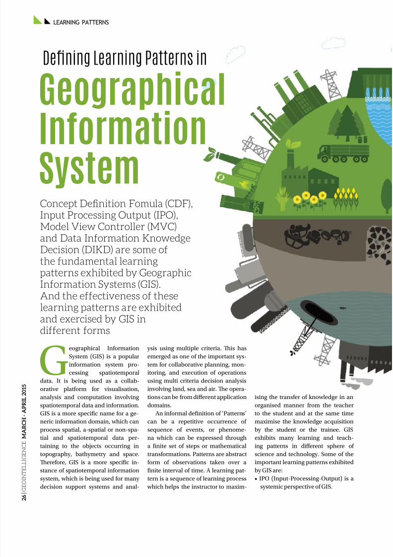
8/17/2019 GeoIntelligence March April 2015
http://slidepdf.com/reader/full/geointelligence-march-april-2015 26/44
LEARNING PATTERNS
2 6 |
G E O I N T E L L I G E N C E
M A R C H - A P R I L 2 0 1 5
Geographical Information
System (GIS) is a popular
information system pro-
cessing spatiotemporal
data. It is being used as a collab-
orative platform for visualisation,analysis and computation involving
spatiotemporal data and information.
GIS is a more specific name for a ge-
neric information domain, which can
process spatial, a-spatial or non-spa-
tial and spatiotemporal data per-
taining to the objects occurring in
topography, bathymetry and space.
Terefore, GIS is a more specific in-
stance of spatiotemporal information
system, which is being used for many
decision support systems and anal-
ysis using multiple criteria. Tis has
emerged as one of the important sys-
tem for collaborative planning, mon-
itoring, and execution of operations
using multi criteria decision analysis
involving land, sea and air. Te opera-tions can be from different application
domains.
An informal definition of ‘Patterns’
can be a repetitive occurrence of
sequence of events, or phenome-
na which can be expressed through
a finite set of steps or mathematical
transformations. Patterns are abstract
form of observations taken over a
finite interval of time. A learning pat-
tern is a sequence of learning process
which helps the instructor to maxim-
ising the transfer of knowledge in an
organised manner from the teacher
to the student and at the same time
maximise the knowledge acquisition
by the student or the trainee. GIS
exhibits many learning and teach-
ing patterns in different sphere of
science and technology. Some of the
important learning patterns exhibited
by GIS are:
• IPO (Input-Processing-Output) is a
systemic perspective of GIS.
GeographicalInformation
System
Defning Learning Patterns in
Concept Definition Fomula (CDF),Input Processing Output (IPO),Model View Controller (MVC)and Data Information KnowedgeDecision (DIKD) are some ofthe fundamental learningpatterns exhibited by GeographicInformation Systems (GIS).
And the effectiveness of theselearning patterns are exhibitedand exercised by GIS indifferent forms
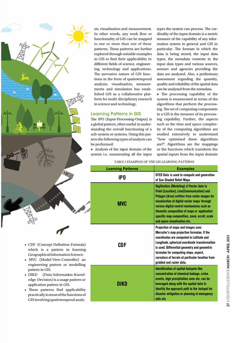
8/17/2019 GeoIntelligence March April 2015
http://slidepdf.com/reader/full/geointelligence-march-april-2015 27/44
2 7 |
G E O I N T E L L I G E N C E M A R C H - A P R I L 2 0 1 5
• CDF (Concept-Definition-Formula)
which is a pattern in learning
Geographical Information Science.
• MVC (Model-View-Controller) an
engineering pattern or modelling
pattern in GIS.
• DIKD (Data-Information-Knowl-
edge-Decision) is a usage pattern or
application pattern in GIS.
• Tese patterns find applicability
practically in most of the functions of
GIS involving spatiotemporal analy-
sis, visualisation and measurement.
In other words, any work flow or
functionality of GIS can be mapped
to one or more than one of these
patterns. Tese patterns are further
explored through suitable examples
in GIS to find their applicability indifferent fields of science, engineer-
ing, technology and applications.
Te pervasive nature of GIS func-
tions in the form of spatiotemporal
analysis, visualisation, measure-
ments and simulation has estab-
lished GIS as a collaborative plat-
form for multi-disciplinary research
in science and technology.
Learning Patterns in GIS
Te IPO (Input-Processing-Output) isa global pattern, often useful in under-
standing the overall functioning of a
sub-system or systems. Using this pat-
tern the following types of analysis can
be performed:
→ Analysis of the input domain of the
system i.e. enumerating all the input
types the system can process. Te car-
dinality of the input domain is a metric
measure of the capability of any infor-
mation system in general and GIS in
particular. Te formats in which the
data is being stored, the input data
types, the metadata contents in theinput data types and various sources,
sensors and agencies providing the
data are analysed. Also, a preliminary
assessment regarding the quantity,
quality and reliability of the spatial data
can be analysed from the metadata.
→ Te processing capability of the
system is enumerated in terms of the
algorithms that perform the process-
ing. Te set of computing components
in a GIS is the measure of its process-
ing capability. Further, the aspectssuch as the time and space complex-
ity of the computing algorithms are
studied extensively to understand
“how optimised these algorithms
are?”. Algorithms are the mappings
or the functions which transform the
spatial inputs from the input domain
Learning Patterns Examples
IPO
DTED Data is used to compute and generation
of Sun Shaded Relief Maps
MVC
Digitisation (Modeling) of Vector data to
Point (Location), Line(Communication) and
Polygon (Area) entities from raster images for
visualization of digital vector maps through
various digital control mechanisms such as
thematic composition of maps or application
specific map composition, zoom, scroll, scale
and space visualisation etc.
CDF
Projection of maps and images uses
Mercator’s map projection formulae. If the
coordinates are computed in Latitude and
Longitude, spherical coordinate transformation
is used. Differential geometry and geometric
formulae for computing slope, aspect,
curvature of terrain at particular location from
gridded and raster data.
DIKD
Identification of spatial hotspots like
concentration of chemical leakage, crime
events, high precipitation zone etc. can be
leveraged along with the spatial data to
identify the approach path to the hotspot for
disaster mitigation or planning of emergency
aids etc.
ABLE I EXAMPLES OF HE GIS LEARNING PAERNS
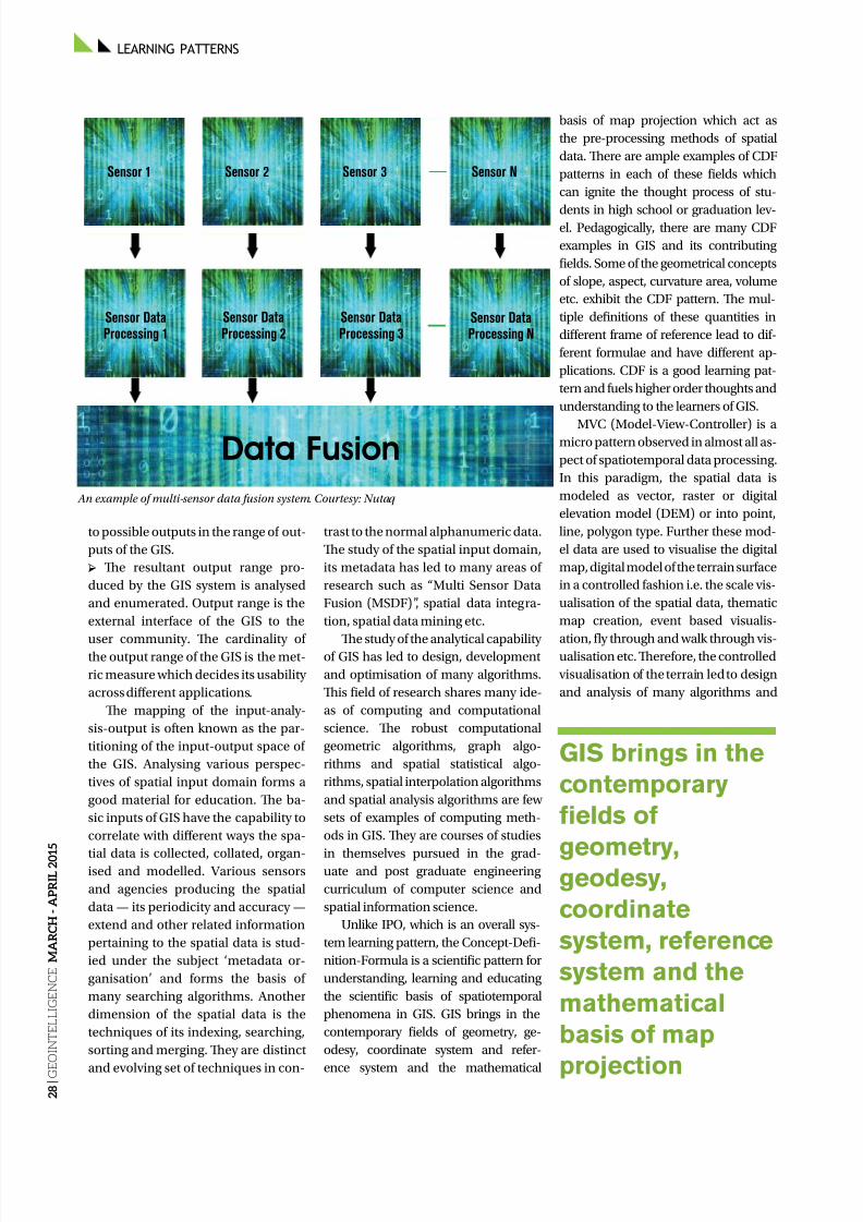
8/17/2019 GeoIntelligence March April 2015
http://slidepdf.com/reader/full/geointelligence-march-april-2015 28/44
LEARNING PATTERNS
2 8 |
G E O I N T E L L I G E N C E
M A R C H - A P R I L 2 0 1 5
to possible outputs in the range of out-
puts of the GIS.
→ Te resultant output range pro-
duced by the GIS system is analysed
and enumerated. Output range is the
external interface of the GIS to the
user community. Te cardinality ofthe output range of the GIS is the met-
ric measure which decides its usability
across different applications.
Te mapping of the input-analy-
sis-output is often known as the par-
titioning of the input-output space of
the GIS. Analysing various perspec-
tives of spatial input domain forms a
good material for education. Te ba-
sic inputs of GIS have the capability to
correlate with different ways the spa-
tial data is collected, collated, organ-ised and modelled. Various sensors
and agencies producing the spatial
data — its periodicity and accuracy —
extend and other related information
pertaining to the spatial data is stud-
ied under the subject ‘metadata or-
ganisation’ and forms the basis of
many searching algorithms. Another
dimension of the spatial data is the
techniques of its indexing, searching,
sorting and merging. Tey are distinct
and evolving set of techniques in con-
trast to the normal alphanumeric data.
Te study of the spatial input domain,
its metadata has led to many areas of
research such as “Multi Sensor Data
Fusion (MSDF)”, spatial data integra-
tion, spatial data mining etc.
Te study of the analytical capabilityof GIS has led to design, development
and optimisation of many algorithms.
Tis field of research shares many ide-
as of computing and computational
science. Te robust computational
geometric algorithms, graph algo-
rithms and spatial statistical algo-
rithms, spatial interpolation algorithms
and spatial analysis algorithms are few
sets of examples of computing meth-
ods in GIS. Tey are courses of studies
in themselves pursued in the grad-uate and post graduate engineering
curriculum of computer science and
spatial information science.
Unlike IPO, which is an overall sys-
tem learning pattern, the Concept-Defi-
nition-Formula is a scientific pattern for
understanding, learning and educating
the scientific basis of spatiotemporal
phenomena in GIS. GIS brings in the
contemporary fields of geometry, ge-
odesy, coordinate system and refer-
ence system and the mathematical
basis of map projection which act as
the pre-processing methods of spatial
data. Tere are ample examples of CDF
patterns in each of these fields which
can ignite the thought process of stu-
dents in high school or graduation lev-el. Pedagogically, there are many CDF
examples in GIS and its contributing
fields. Some of the geometrical concepts
of slope, aspect, curvature area, volume
etc. exhibit the CDF pattern. Te mul-
tiple definitions of these quantities in
different frame of reference lead to dif-
ferent formulae and have different ap-
plications. CDF is a good learning pat-
tern and fuels higher order thoughts and
understanding to the learners of GIS.
MVC (Model-View-Controller) is amicro pattern observed in almost all as-
pect of spatiotemporal data processing.
In this paradigm, the spatial data is
modeled as vector, raster or digital
elevation model (DEM) or into point,
line, polygon type. Further these mod-
el data are used to visualise the digital
map, digital model of the terrain surface
in a controlled fashion i.e. the scale vis-
ualisation of the spatial data, thematic
map creation, event based visualis-
ation, fly through and walk through vis-ualisation etc. Terefore, the controlled
visualisation of the terrain led to design
and analysis of many algorithms and
GIS brings in the
contemporary
fields of
geometry,geodesy,
coordinate
system, reference
system and the
mathematical
basis of map
projection
Sensor 1
Sensor DataProcessing 1
Data Fusion
Sensor DataProcessing 2
Sensor DataProcessing 3
Sensor DataProcessing N
Sensor 2 Sensor 3 Sensor N
An example of multi-sensor data fusion system. Courtesy: Nutaq

8/17/2019 GeoIntelligence March April 2015
http://slidepdf.com/reader/full/geointelligence-march-april-2015 29/44
2 9 |
G E O I N T E L L I G E N C E M A R C H - A P R I L 2 0 1 5
systems interfacing the software-hard-
ware and human cognitive system.
MVC has a profound impact in the
programming, design and develop-
ment of the algorithms in GIS and has
brought in the student community toharness their creative potential through
intelligent programs which binds the
HMI (Human Machine Interface) with
the GIS.
Terefore, MVC is a micro pattern
in the processing domain of GIS and
harnesses the algorithm and program
design skills of students. MVC has
ushered in the field of scientific visual-
isation, thematic map generation, vir-
tual visualisation or virtual reality and
augmented reality etc.Te DIKD is an overall learning
pattern in GIS that interconnects
the entire chain of GIS functions in
executing a spatial decision. Tis in-
volves the spatial data, the relevant
processing performed on the data to
transfer it to information and how the
information is processed to extract
knowledge for final spatial decision.
DIKD is a pattern repetitive in many
domains of applications involving
GIS with variation in data, processingand the end decision to be taken.
Presence of DIKD pattern establish-
es the GIS as a collaborative platform,
for spatiotemporal decision system.
In this pattern, spatial data is collect-
ed and collated contextually to bring
out the spatial information. Te spa-
tial information is further processed to
extract pattern from the data through
many algorithmic techniques known
under the banner of spatial data miningtechniques or spatial data analytics or
knowledge discovery algorithms. Tese
techniques applied on huge amount
of spatial data bring out the spatial
pattern or knowledge in the data. Te
spatial patterns and knowledge are lev-
eraged in different application areas to
take effective decision. A clear benefi-
ciary of these patterns is spatial deci-
sion support systems such as disaster
management system, Command and
Control System, Battlefield Manage-ment system (BMS) etc.
DIKD pattern interconnects and
leverages the entire chain of learning
patterns viz. CDF, MVC and IPO. DIKD
uses modelling of spatial data through
defined syntax to prepare spatial in-
formation out of the spatial data. Te
semantic networks, semantic rules the
spatial data patterns are extracted from
large volume of spatial data in pre-
paring actionable spatial information
for taking decisions. Further, thisspatial information is computed and
transformed using different spatial
processing algorithms often referred
as spatial data mining tools to extract
knowledge. Tis chain of processing
which transforms raw spatial data to
knowledge which, in turn is being used
for taking decision is called DIKD. En-
listed below in the table-I are few typi-
cal examples of these learning patterns.
Extensive use of GIS by armedforces for planning, execution and
analysis of operations cannot be over-
emphasised. Terefore, knowledge of
usage of GIS and understanding the
design and development of operation
systems and command and control
systems using GIS is quite important
for battle managers. Keeping in view
the above objectives, GIS training in
the form of CEP (Continuing Educa-
tion Programme) and user workshop
are imparted to the GIS users in thearmed forces and scientists. Te edu-
cation profile of the students attending
these courses is heterogeneous field of
engineering. Te impact of the GIS le-
sions imparted are evaluated through
a series of questions. Te questions set
were carefully crafted to be judicious
mixture of above four type of learning
patterns. Te observed data is consol-
idated in the table-II.
Conclusion Analysis of the data, trends emerging
from the MOOC (Massively Online
Courses) and classroom teachings
indicates the mixed pattern of learn-
ers from different field of engineering
Digital errain Model. Courtesy: MCE

8/17/2019 GeoIntelligence March April 2015
http://slidepdf.com/reader/full/geointelligence-march-april-2015 30/44
LEARNING PATTERNS
3 0 |
G E O I N T E L L I G E N C E
M A R C H - A P R I L 2 0 1 5
and applications. Tis gives a strong
indication of the fact that GIS is fast
emerging as a platform for interdis-
ciplinary learning. Also, GIS exhibits
number of patterns which are facili-tator for learning and remembering
for students and teaching community.
Te experimental data obtained from
classroom teaching is enlisted in the
able-II. Te data was analysed by
plotting them in the form of a PI chart
(Fig.1). On observation the following
inferences regarding the learning pat-
terns in GIS can be drawn.
→ Te CDF is the highly effective
learning pattern across all types of the
students and GIS professionals.→ Te MVC is a learning pattern most-
ly followed and utilised by scientists,
mathematicians and engineers en-
gaged in design and development of
the GIS systems.
→ DIKD is the learning patternfollowed by the domain users and
domain experts of the GIS system
engaged in day to day use of the GIS
for taking decisions.
→ IPO is the learning pattern under-
stood and practised by students, do-
main experts, users, developers. It is
the second best learning pattern fol-
lowing the CDF pattern.
References
[1] Goodchild, M. F., “Geographical infor-mation science”, International Journal of
26%
22%29%
23%
IPOMVC
CDF DIKD
Year Types of Learning Patterns
No of students IPO MVC CDF DIKD
2008 42 29 24 40 25
2009 31 28 21 30 25
2010 24 21 19 23 20
2012 25 22 19 24 17
2013 37 35 31 36 30
Total 159 135 114 153 117
Geographical Information Systems 6:31–45,1992 [2] Longley, Paul A., Michael F. Goodchild,David J. Maguire and David W. Rhind(eds.). Geographical Information Systems.vol 1, vol 2. 2nd ed. John Wiley & Sons. 1999.[3] Panigrahi, N., “Geographical Informa-tion Science”, University Press, 2009.[4] Chen, Yong-qi and Yuk-cheung Lee(eds.). Geographical Data Acquisition. NewYork: Springer Wien. 2001[5] Frank, A. U., Spatial concept, geomet-ric data models, and geometric data struc-ture. Computers and Geosciences 18:409–17.1992.[6] Houlding, S. Tree-dimensional Geo-sciences Modelling. Berlin: Springer.1994.[7] Worboys, M. F. GIS: A Computing Per-spective. London: aylor & Francis. 1995.[8] Snyder, John P. “Flattening the Earth –wo Tousand Years of Map Projections.”Chicago: University of Chicago Press. 1993.[9] Snyder, John P. “Map Projections – AWorking Manual.” U.S.G.S. ProfessionalPaper 1395. Washington D. C.: U.S. Govern-ment Printing Office. 1987. Reprinted 1989;1994 with corrections.[10] Snyder, John P. Map Projections Usedby the United States Geological Survey. 2nded. U.S.G.S. Bulletin No. 1532. WashingtonD.C.: U.S. Government Printing Office. 1983.[11] Steers, J. A. An Introduction to the Studyof Map Projections. London: University ofLondon Press. 1965. 1st ed. 1927; 15th ed.1970.[12] Preparata, Franco P. and Shamos, Mi-chael Ian. “Computational Geometry, AnIntroduction”, Springer-Verlag., 5th ed 1993.[13] Aurenhammer, F. Voronoi diagrams: A survey of fundamental geometric datastructure. ACM Computer Survey 23:345–405. 1991.[14] J. O’ Rourke, “Art Gallery Teorems and Algorithms”. New York: Oxford UniversityPress. 1987.[15] J. O’ Rourke, ”Computational Geome-try Using C”, New York: Cambridge Univer-sity Press., 2nd edn, 1998.[16] Mitasova, H., L. Mitas, B.M. Brown,D.P. Gerdes and I. Kosinovsky. Modelingspatially and temporally distributed phe-nomena: New methods and tools for GRASSGIS. International Journal of GIS 9 (4), Spe-cial issue on integration of environmentalmodeling and GIS. 1995.[17] Burrough, P.A. “Principles of Geograph-ical Information Systems for Land Resourc-es Assessment.”, Oxford: Clarendon Press.Chapter 8. 1986.[18] Densham, P. J. “Spatial decision sup-port systems. In Geographical InformationSystems: Principles and Applications”, ed-ited by D. J. Maguire, M. F. Goodchield andD. W. Rhind. Harlow, Longman/New York: John Wiley & Sons Inc. vol. 1:403–12. 1991.
Narayan PanigrahiCenter for Articial Intelligenceand Robotics
Smita Tripathy
Aeronautical DevelopmentAgency (ADA)
ABLE II EXPERIMENAL DAA
FiG-1, PI-Chart of the correctly answered questions
Te statistics of 40 questions with 10 questions each from each learning patterns

8/17/2019 GeoIntelligence March April 2015
http://slidepdf.com/reader/full/geointelligence-march-april-2015 31/44
JUNE 22-25 . WASHINGTON CONVENTION CENTER . WASHINGTON, DC
• Hear from more than 100 leading government,
military, and academia speakers• Network with over 4,000 geospatial technology,
mapping and GIS professionals
• See the latest in technology, services,
and solutions from 200+ exhibitors
GEOINT2015.COM
Symposium
USGIF’s
GEOINT 2015
DON’T MISS THE OPPORTUNITY TO:
Free for Government, Military & First Responders!
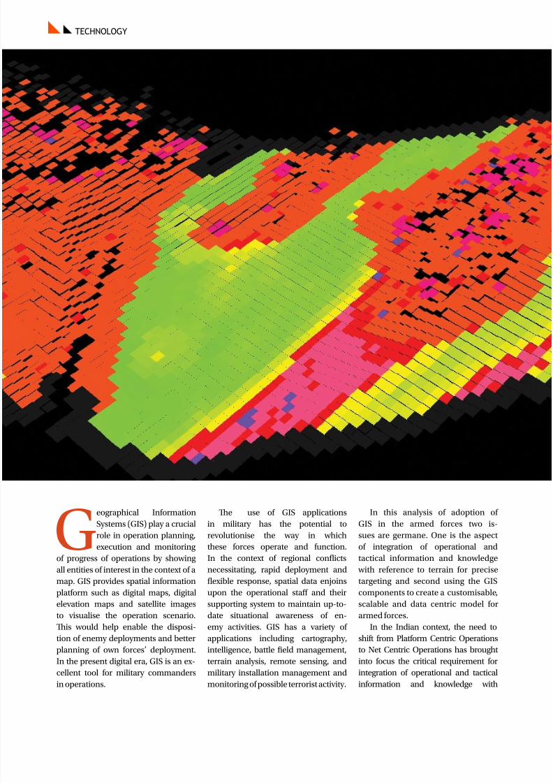
8/17/2019 GeoIntelligence March April 2015
http://slidepdf.com/reader/full/geointelligence-march-april-2015 32/44
TECHNOLOGY
G
eographical Information
Systems (GIS) play a crucial
role in operation planning,
execution and monitoringof progress of operations by showing
all entities of interest in the context of a
map. GIS provides spatial information
platform such as digital maps, digital
elevation maps and satellite images
to visualise the operation scenario.
Tis would help enable the disposi-
tion of enemy deployments and better
planning of own forces’ deployment.
In the present digital era, GIS is an ex-
cellent tool for military commanders
in operations.
Te use of GIS applications
in military has the potential to
revolutionise the way in which
these forces operate and function.In the context of regional conflicts
necessitating, rapid deployment and
flexible response, spatial data enjoins
upon the operational staff and their
supporting system to maintain up-to-
date situational awareness of en-
emy activities. GIS has a variety of
applications including cartography,
intelligence, battle field management,
terrain analysis, remote sensing, and
military installation management and
monitoring of possible terrorist activity.
In this analysis of adoption of
GIS in the armed forces two is-
sues are germane. One is the aspect
of integration of operational andtactical information and knowledge
with reference to terrain for precise
targeting and second using the GIS
components to create a customisable,
scalable and data centric model for
armed forces.
In the Indian context, the need to
shift from Platform Centric Operations
to Net Centric Operations has brought
into focus the critical requirement for
integration of operational and tactical
information and knowledge with
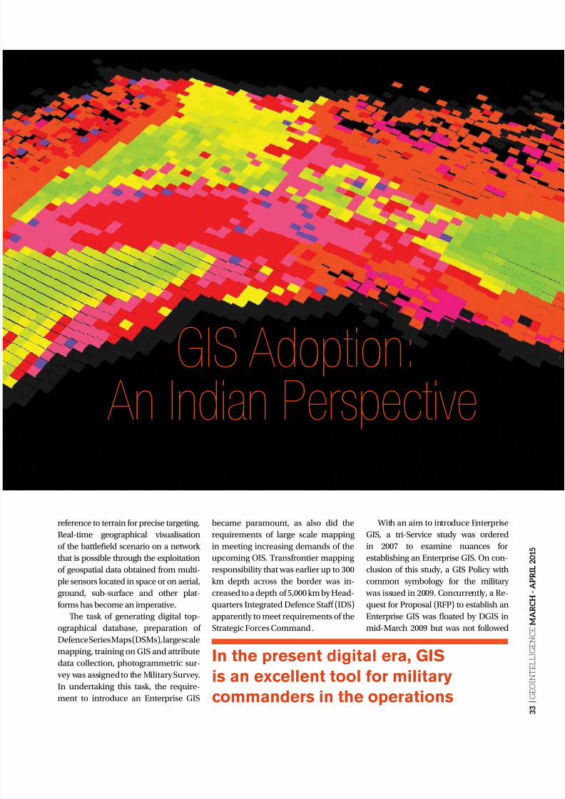
8/17/2019 GeoIntelligence March April 2015
http://slidepdf.com/reader/full/geointelligence-march-april-2015 33/44
3 3 |
G E O I N T E L L I G E N C E M A R C H - A P R I L 2 0 1 5
GIS Adoption:
An Indian PerspectiveSpatial data is of crucial importance to the MilitaryCommander in the battle and for decision-maker
planning operational contingencies
reference to terrain for precise targeting.
Real-time geographical visualisation
of the battlefield scenario on a network
that is possible through the exploitationof geospatial data obtained from multi-
ple sensors located in space or on aerial,
ground, sub-surface and other plat-
forms has become an imperative.
Te task of generating digital top-
ographical database, preparation of
Defence Series Maps (DSMs), large scale
mapping, training on GIS and attribute
data collection, photogrammetric sur-
vey was assigned to the Military Survey.
In undertaking this task, the require-
ment to introduce an Enterprise GIS
became paramount, as also did the
requirements of large scale mapping
in meeting increasing demands of the
upcoming OIS. ransfrontier mappingresponsibility that was earlier up to 300
km depth across the border was in-
creased to a depth of 5,000 km by Head-
quarters Integrated Defence Staff (IDS)
apparently to meet requirements of the
Strategic Forces Command .
With an aim to introduce Enterprise
GIS, a tri-Service study was ordered
in 2007 to examine nuances for
establishing an Enterprise GIS. On con-clusion of this study, a GIS Policy with
common symbology for the military
was issued in 2009. Concurrently, a Re-
quest for Proposal (RFP) to establish an
Enterprise GIS was floated by DGIS in
mid-March 2009 but was not followed
In the present digital era, GIS
is an excellent tool for military
commanders in the operations

8/17/2019 GeoIntelligence March April 2015
http://slidepdf.com/reader/full/geointelligence-march-april-2015 34/44
3 4 |
G E O I N T E L L I G E N C E
M A R C H - A P R I L 2 0 1 5
TECHNOLOGY
earlier the Military Survey which
was under the Military Operations
Directorate (MO Directorate) of
Army Headquarters, was moved to
Directorate General Information sys-
tems. However the Army hierarchy was not satisfied with the pace of work
of Military Survey as well as accuracy
of their digital maps. Concerned with
these errors in the Army’s acC3I,
Military Survey was reverted back to
MO Directorate in 2011-12.
According to informed sources, in
whatever little map digitisation has been
done, there are serious and persistent er-
rors even along the Line of Control (LC)
in number of cases alignment of LC is
off by as much as 50 meters or more. An-other issue is the pace of work; Military
Surveys time estimates to complete dig-
itisation of maps – a prerequisite for a vi-
able GIS – reportedly runs into 10 years
or so for maps astride the LC/Line of
Actual Control/IB and areas immediate-
ly beyond. Second issue is development
GIS based spatial information platform
such as digital maps, digital elevation
maps and satellite images to visualise
the operational scenario, such as enemy
deployments and dispositions, terrainfeatures for better operational planning.
Most of the GIS applications used
by Indian armed forces are based
on commercial off-the-shelf (COS)
software. Tese COS GIS come
with strict licensing policy and are
prone to technology denial. Teir
interoperability with other GIS systems
for exchange of spatial information
is limited.
o overcome these challenges and
pitfalls of COS GIS, the Centre for Artificial Intelligence and Robotics
(CAIR) has developed a home-grown
GIS software for military applications,
christened as INDIGIS. “Te INDIGIS
is a suite of GIS components which are
customisable, scalable and data centric
to meet the specific GIS requirements
of a collaborative defence environment.
It offers a common platform for display,
analysis and decision support involv-
ing spatio-temporal data for Net Cen-
tric Operation (NCO) systems,” Indig-
enous GIS kernel has been developed
as a library of software components
to cover the following major function.
Tey are: a) processing of geospatial
data in various formats of interest to
Indian military; b) creation and man-agement of a portable military symbol
library; c) geospatial data exchange,
analysis and visualisation with vari-
ous actical Command Control Com-
munication and Intelligence (acC3I)
systems; d) analysis and visualisation
of data from military sensors like GPS,
digital compass, Battlefield Surveil-
lance Radar, echo-sounder and un-
manned aerial vehicles; e) support
for all the usual features of COS GIS
including analysis and visualisation ofgeospatial data in 2D and 3D. Although
the INDGIS has been fielded in num-
ber of exercises, nonetheless the Ser-
vice HQ are nor very satisfied. In their
perception the system is at best a tech-
nology demonstrator which has yet to
be accepted for formal adoption by the
Army HQ.
Above analysis reveals that despite
attempts being made to develop a
robust and operational GIS System;
huge organisational and system gapsremain. Tis is primarily on account of
turf battles, perception gap between the
MO Directorate, DGIS and the DRDO.
Important issue is that as the IRNSS
and other space based assets become
available, delay in developing Enter-
prise GIS fast tracking digitisation by
Military Survey, taking a call INDIGIS
by Army HQ working in tandem with
CAIR, so that it can be fielded at the
earliest. One of the constant refrain
from DRDO and laboratories likeCAIR is the lack of feed back or enun-
ciation of desired operational and
system parameters.
up. Tis was followed by another study
addressing the organisational and out-
put oriented shortcomings of Military
Survey. Main issues addressed by the
study included — restructuring of Mil-
itary Survey in concert with available
global technology and modern tech-niques; examine existing system of
mapping, digitisation and how updating
can be speeded up through reorganisa-
tion; examine the role of Military Survey
in attribute data collection, rationalisa-
tion of existing manpower etc. some of
the important findings were; restruc-
turing of Military Survey including at
formation levels, changing its structure
to all arms, need to infuse new equip-
ment and technologies in particular,
emerging technologies like digital pho-togrammetric using digital aerial photo/
high resolution imagery/UAV inputs,
mobile data capture in field using PC
tablets, gravity and geomagnetic sur-
veys, Airborne Laser errain Mapping
(ALM)/LiDAR survey, online data
transfer for updation/web enabled
services, etc. based on visualisation of
future operational requirements. Te
study report despite approval remains
unimplemented.
In fact, the command and control
Most of the GIS
applications used
by Indian armedforces are based
on commercial
off-the-shelf
(COTS) software,
which come with
strict licensing
policy andare prone to
technology denial
Brig Arun Sahgal (Retd)

8/17/2019 GeoIntelligence March April 2015
http://slidepdf.com/reader/full/geointelligence-march-april-2015 35/44
3 5 |
G E O I N T E L L I G E N C E M A R C H - A P R I L 2 0 1 5
In their entire careers and maybe
even in their lifetime, Air Defence
operators may never be actually
attacked by an enemy aircraft.
If they do get such an opportunity, it
may be just once. In the fog of war, cana soldier afford to lose that one oppor-
tunity, that he gets in his lifetime, by
making a mistake and allowing the en-
emy aircraft to escape? It may be pos-
sible that the soldier mistakes enemy
aircraft as own and allows them to es-
cape. Alternately, the soldier may mis-
take own aircraft as enemy aircraft and
engage them. Unless the soldier has
faced actual or near actual situation
many times and practiced sufficient-
ly, he is likely to miss the opportuni-ty. Simulators can bring war-time or
operational situation to the soldier in
peacetime, in classrooms or in train-
ing areas. A soldier can now enter war
as a veteran, having experienced war-
like situations on the simulator.
Te Aircraft Recognition rainer
(AR) is computer based classroom
trainer that can be used to impart dy-
namic aircraft recognition training in
simulated operational situations. Te
system depicts fighter, transport andcommercial aircraft, helicopters and
UAVs in various modes and profiles
Aircraft Recognition Training
Using 3D Terrain ModelsAircraft recognition training is essential forevery soldier in air defence
of flight under realistic operational
terrain, weather and day/night condi-
tions. One such system is used to train
20 or more trainees at a time by an in-
structor. Realistic positional surround
sound with Doppler is integrated for alltypes of aircraft, helicopters and UAVs
in single aircraft and multiple aircraft in
various formations modes. Aircraft are
projected on a large screen in the class-
room to train the Air Defence operators.
Te operators have touch screen mon-
itors to answer questions and practice
aircraft recognition from a database of
realistic 3D models prepared.
System Configuration
Te AR comprises of an instructor workstation, one image generator
workstation, twenty desktop/thin cli-
ents based trainee workstations, one
projection system and audio system,
UPS and associated ethernet/wi-fi
based networking hardware. Te In-
structor Console is a suitable server
for the instructor to carry out group
training sessions and conduct tests. It
has both Wi-Fi and LAN connectivity
inbuilt and a F touch screen monitor
of 21-inch size. Te Image Generatoris a high-end workstation that displays
high-resolution graphics of the Aircraft
Recognition raining exercises on a
projection system. Tis also has inbuilt
Wi-Fi and LAN connectivity. Students
undertake AR in individual training
mode, group training mode and they
can be subjected to tests and assess-ment on thin client based student con-
soles. Soft copies of high fidelity and
high resolution aircraft, helicopters
and UAV models are pre-installed into
the system. More models can be made
and incorporated depending upon the
requirement of the clients. Different
terrain models comprising of elevation
data and imagery will be loaded in
the system.
Modes of OperationExercise Preparation Mode: In this
mode, the instructor is provided with
the facility to plan an exercise scenar-
io and save it in an exercise library. A
scenario comprises an area of inter-
est (AoI) of 10 km x 10 km and aircraft
routes. Routes are a set of waypoints
that aircraft or formations must touch.
A section between two waypoints is
called a route leg. Facility is provided
to store waypoints and routes in way-
point and route libraries respectively.During exercise creation, the instruc-
tor has the option to either create new
routes and add these to the scenario
or load existing routes from the route
library. Existing routes can even be
modified to create new routes and
stored thus. Te instructor then as-
signs aircraft formations to each of
these routes in the exercise. Te sys-
tem automatically computes time at
the waypoints based on the leg speed
and leg distance. Te actual path fol-
Students undertake ART in individual
training mode, group training mode
and can be subjected to tests and
assessment on Thin Client based
student consoles
TECHNOLOGY

8/17/2019 GeoIntelligence March April 2015
http://slidepdf.com/reader/full/geointelligence-march-april-2015 36/44
3 6 |
G E O I N T E L L I G E N C E
M A R C H - A P R I L 2 0 1 5
TECHNOLOGY
lowed by the aircraft and formations
depends on flight dynamics. Te in-
structor also has the facility to pro-
gram observer positions along the
route to facilitate observation.
Exercise Execution (Training)Mode: Tis is the group training
mode in which students are trained
to recognize aircraft in realistic oper-
ational settings. Te instructor loads
an exercise from the exercise library
into the image generator application
and simulates the exercise. He is pro-
vided with the control to start, stop,
freeze and manage the speed of the
simulation. Te image generator cre-
ates a DEM and loads the imagery of
the AoI of the exercise from the terraindatabase to create NDA6978 realistic
terrain and environment setting,
night/day and weather conditionetc
as per the requirements. On starting
the exercise, the simulation engine of
the image generator updates the air-
craft position as per the set speed on
the programmed route and renders
the image at a frame rate of 60 Hz. By
default, the system renders the field
of view (FoV) of the observer, which
is pre-programmed into the exerciseby the instructor. However, the in-
structor is also provided with the fa-
cility to change the camera angle as
required. Te system will generate
audio of the aircraft sound on the 5.1
channel speaker provided. During
exercise execution, the student con-
soles flash a multiple choice questionof the aircraft in the frame and they
also have the facility to input their an-
swers through the touch screen.
Group Training Mode: In this mode,
the instructor conducts a class with
single aircraft models. He is provided
with the facility to zoom in/out, ro-
tate, pitch, roll and yaw the selected
model and highlight the important
sections like wings, engine, fuselage
and tail of the aircraft. He can also
pull out similar looking aircraft fromthe library and highlight the subtle
differences. Actual aircraft images,
videos and text data, if available, in
the aircraft database can be accessed
and displayed along-with the models.
In this mode, the student console is
loaded with the aircraft data being
presented by the instructor.
Individual Training Mode: In
this mode, each student can inde-
pendently pull out aircraft models,
images, text and videos from the cen-tral database in the instructor ma-
chine and carry out self study. Te
student console will be provided with
the controls to view the aircraft mod-
els from various perspectives using
zoom and rotate controls.
Test Mode: Tis consists of a test prepa-
ration mode and test conduct mode.Te instructor will be provided with the
facility to create a set of objective type
questions/answers and answer time for
the question. A test question may per-
tain to aircraft models, image, text or
an exercise scenario. Tese are stored
in a test database. A question paper
comprising of a set of questions picked
up from the database is loaded into the
student consoles during the conduct
of the test. Answers fed by the students
are compiled and stored in the centraldatabase.
Debrief Mode: In this mode, the in-
structor is provided with the facility
to debrief the students with their re-
sponses to an exercise or a test.
Software SpecificationsInstructor Console Software: Te
following functionality is provided by
the Instructor Application on the AR
network. It is user friendly and enables
the instructor to create new exercisesand to execute the created exercises
on the image generator.
System Configuration of Aircraft Recognition Training.
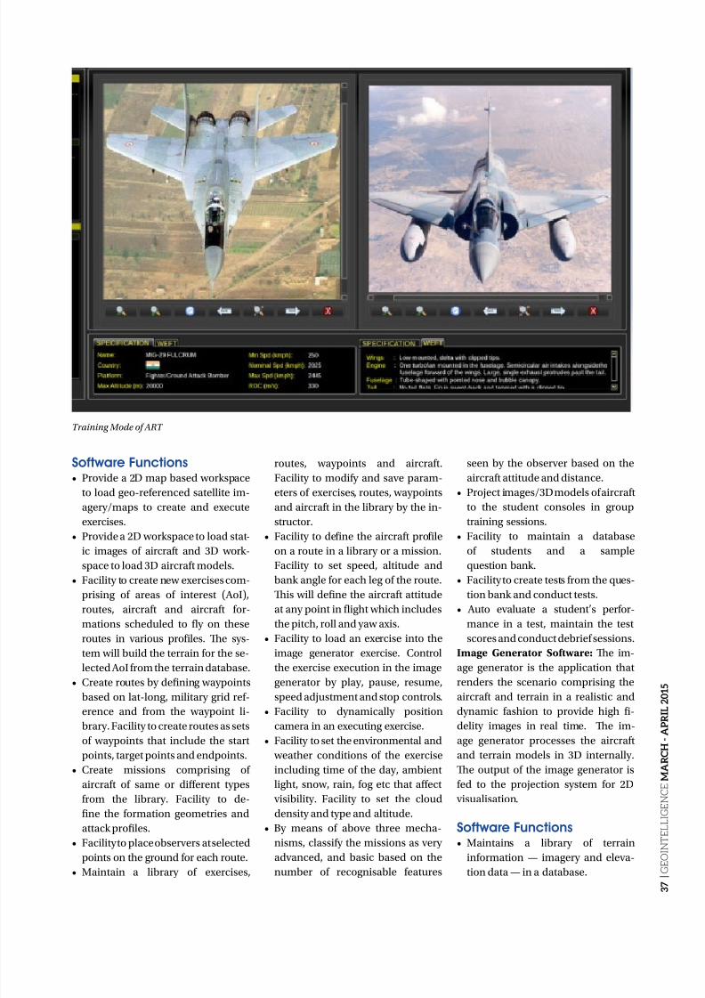
8/17/2019 GeoIntelligence March April 2015
http://slidepdf.com/reader/full/geointelligence-march-april-2015 37/44
3 7 |
G E O I N T E L L I G E N C E M A R C H - A P R I L 2 0 1 5
Software Functions• Provide a 2D map based workspace
to load geo-referenced satellite im-
agery/maps to create and execute
exercises.• Provide a 2D workspace to load stat-
ic images of aircraft and 3D work-
space to load 3D aircraft models.
• Facility to create new exercises com-
prising of areas of interest (AoI),
routes, aircraft and aircraft for-
mations scheduled to fly on these
routes in various profiles. Te sys-
tem will build the terrain for the se-
lected AoI from the terrain database.
• Create routes by defining waypoints
based on lat-long, military grid ref-erence and from the waypoint li-
brary. Facility to create routes as sets
of waypoints that include the start
points, target points and endpoints.
• Create missions comprising of
aircraft of same or different types
from the library. Facility to de-
fine the formation geometries and
attack profiles.
• Facility to place observers at selected
points on the ground for each route.
• Maintain a library of exercises,
routes, waypoints and aircraft.
Facility to modify and save param-
eters of exercises, routes, waypoints
and aircraft in the library by the in-
structor.• Facility to define the aircraft profile
on a route in a library or a mission.
Facility to set speed, altitude and
bank angle for each leg of the route.
Tis will define the aircraft attitude
at any point in flight which includes
the pitch, roll and yaw axis.
• Facility to load an exercise into the
image generator exercise. Control
the exercise execution in the image
generator by play, pause, resume,
speed adjustment and stop controls.• Facility to dynamically position
camera in an executing exercise.
• Facility to set the environmental and
weather conditions of the exercise
including time of the day, ambient
light, snow, rain, fog etc that affect
visibility. Facility to set the cloud
density and type and altitude.
• By means of above three mecha-
nisms, classify the missions as very
advanced, and basic based on the
number of recognisable features
seen by the observer based on the
aircraft attitude and distance.
• Project images/3D models of aircraft
to the student consoles in group
training sessions.• Facility to maintain a database
of students and a sample
question bank.
• Facility to create tests from the ques-
tion bank and conduct tests.
• Auto evaluate a student’s perfor-
mance in a test, maintain the test
scores and conduct debrief sessions.
Image Generator Software: Te im-
age generator is the application that
renders the scenario comprising the
aircraft and terrain in a realistic anddynamic fashion to provide high fi-
delity images in real time. Te im-
age generator processes the aircraft
and terrain models in 3D internally.
Te output of the image generator is
fed to the projection system for 2D
visualisation.
Software Functions• Maintains a library of terrain
information — imagery and eleva-
tion data — in a database.
Training Mode of ART
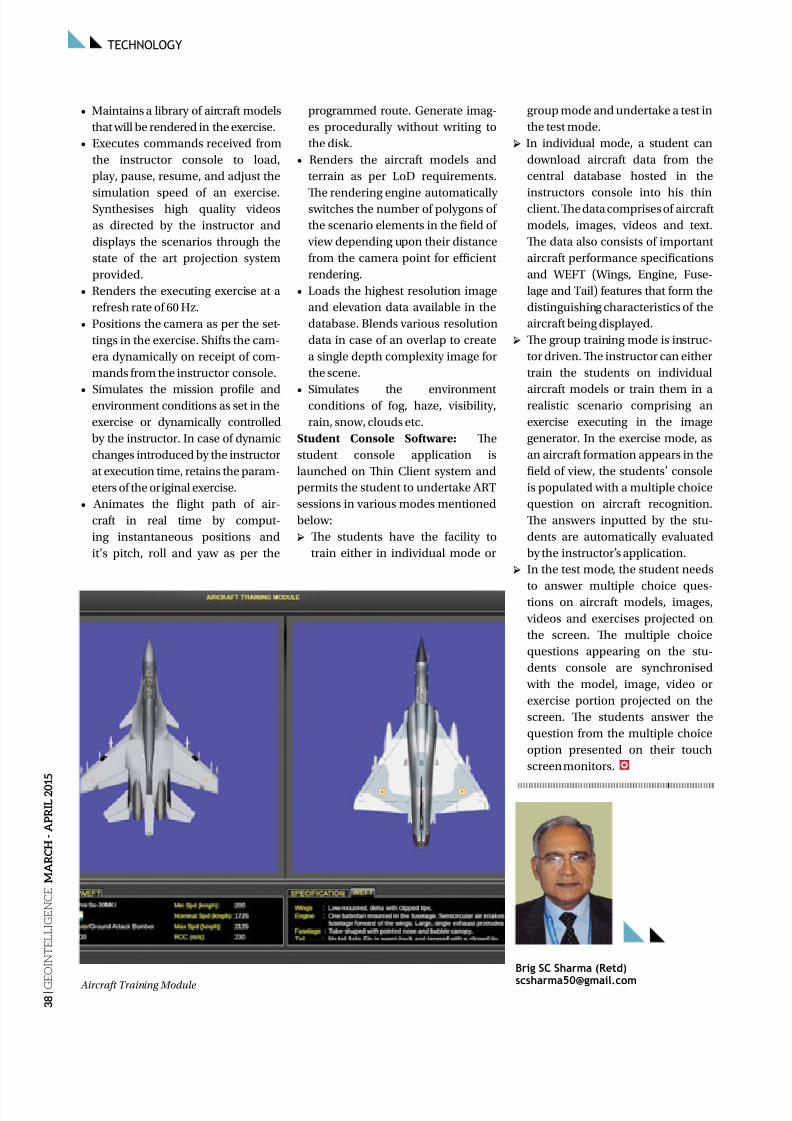
8/17/2019 GeoIntelligence March April 2015
http://slidepdf.com/reader/full/geointelligence-march-april-2015 38/44
TECHNOLOGY
3 8 |
G E O I N T E L L I G E N C E
M A R C H - A P R I L 2 0 1 5
• Maintains a library of aircraft models
that will be rendered in the exercise.
• Executes commands received from
the instructor console to load,
play, pause, resume, and adjust the
simulation speed of an exercise.Synthesises high quality videos
as directed by the instructor and
displays the scenarios through the
state of the art projection system
provided.
• Renders the executing exercise at a
refresh rate of 60 Hz.
• Positions the camera as per the set-
tings in the exercise. Shifts the cam-
era dynamically on receipt of com-
mands from the instructor console.
• Simulates the mission profile andenvironment conditions as set in the
exercise or dynamically controlled
by the instructor. In case of dynamic
changes introduced by the instructor
at execution time, retains the param-
eters of the original exercise.
• Animates the flight path of air-
craft in real time by comput-
ing instantaneous positions and
it’s pitch, roll and yaw as per the
programmed route. Generate imag-
es procedurally without writing to
the disk.
• Renders the aircraft models and
terrain as per LoD requirements.
Te rendering engine automaticallyswitches the number of polygons of
the scenario elements in the field of
view depending upon their distance
from the camera point for efficient
rendering.
• Loads the highest resolution image
and elevation data available in the
database. Blends various resolution
data in case of an overlap to create
a single depth complexity image for
the scene.
• Simulates the environmentconditions of fog, haze, visibility,
rain, snow, clouds etc.
Student Console Software: Te
student console application is
launched on Tin Client system and
permits the student to undertake AR
sessions in various modes mentioned
below:
→ Te students have the facility to
train either in individual mode or
group mode and undertake a test in
the test mode.
→ In individual mode, a student can
download aircraft data from the
central database hosted in the
instructors console into his thinclient. Te data comprises of aircraft
models, images, videos and text.
Te data also consists of important
aircraft performance specifications
and WEF (Wings, Engine, Fuse-
lage and ail) features that form the
distinguishing characteristics of the
aircraft being displayed.
→ Te group training mode is instruc-
tor driven. Te instructor can either
train the students on individual
aircraft models or train them in arealistic scenario comprising an
exercise executing in the image
generator. In the exercise mode, as
an aircraft formation appears in the
field of view, the students’ console
is populated with a multiple choice
question on aircraft recognition.
Te answers inputted by the stu-
dents are automatically evaluated
by the instructor’s application.
→ In the test mode, the student needs
to answer multiple choice ques-tions on aircraft models, images,
videos and exercises projected on
the screen. Te multiple choice
questions appearing on the stu-
dents console are synchronised
with the model, image, video or
exercise portion projected on the
screen. Te students answer the
question from the multiple choice
option presented on their touch
screen monitors.
Brig SC Sharma (Retd)
[email protected] Aircraft Training Module
8/17/2019 GeoIntelligence March April 2015
http://slidepdf.com/reader/full/geointelligence-march-april-2015 39/44
3 9 |
G E O I N T E L L I G E N C E M A R C H - A P R I L 2 0 1 5
A Continual Shift
Market forces and customer needs barely allow us to only be an imagery
provider as there is a shift in extracted information services, speaks
out David Belton, General Manager, Geospatial Services, MacDonald,
Dettwiler and Associates Ltd. (MDA)
Y ou (MDA) are largest
satellite based radar data
provider, how accordingto you did Radarsat-1
and Radarsat-2 come into picture?
wo decades ago, Canada was in the
planning phase in terms of investing in
the space scenario. At that point of time,
the need to have a better understanding
of happenings in the Arctic region was
one of the pressing demands that the
country faced. Tere were too few tech-
nologies that were actually capable of
mapping the area. Space-based radar
system was the best suited technology,so Canada made a conscious decision
to strategically invest in
that area. Tis gave birth
to the RADARSA pro-
gramme. Since then,
maritime surveillancehas become a huge
and pressing issue
for the country and
this ultimately led to
RADARSA-1 mission.
Tis brought focus to
the radar technology
which formed the basis
of the company RADAR
International, which
gave birth to MDA.
So, what’s the range
RADARSA-1 and
RADARSA-2 are
playing with?
RADARSA-1 had a
range of different im-
aging modes. Te high-
est resolution mode
was an 8m mode called ‘fine beam
resolution mode’ and was about 50km
wide as single image. Tis also has a
number of other imaging configurations— something called the ‘ScanSAR
Wide Beam mode’ which has a 100m
resolution, but a very broad swath from
8m to 100m resolution. When RADAR-
SA2 was introduced, decisions were
made to go in a number of different
directions — one was to implement
some really high resolution imaging
modes, a three 3m resolution called
the ‘ultra fine’ and 1m resolution called
‘spotlight imaging’ focussed on target
surveillance which is a very localisedimaging of target locations. In addi-
tion, RADARSA 2 added a polarisa-
tion imaging suite which is a collection
technique that allows additional infor-
mation to be extracted. Te other main
component of RADARSA-2 was that a wide collection of nodes were created
to focus on broader coverage market
where RADARSA has a niche.
Are you planning to launch more
satellites to continue with the
RADARSA-1 mission?
RADARSA-1 was launched in 1995
and had a five year design life, but
it actually ran all the way to 2013 (a
good 17 years beyond its operational
service). And RADARSA-2 waslaunched in 2007 and has a design
life of seven one quarter years. Te
satellite is in incredible health today.
With adequate fuel onboard, we
expect it to continue functioning for
another decade or so. RADARSA
constellation mission is now a fully
funded programme. Te government
entered into a contract with us for the
build phase of the mission, last year,
so we’re in the mid of the construction
process. With a design life of sevenplus years, the scheduled launch of the
programme is 2018.
Are all the missions of MDA in
partnership with private players?
Te Government of Canada invested
in setting up of the infrastructure of
the RADARSA programme. In the
RADARSA-2 era, the investment came
in the form of an effectively prepaid
purchase of imagery to MDA. Ten,
through the course of the mission, MDAdelivered on the prepaid purchase
INTERVIEW
8/17/2019 GeoIntelligence March April 2015
http://slidepdf.com/reader/full/geointelligence-march-april-2015 40/44
4 0 |
G E O I N T E L L I G E N C E
M A R C H - A P R I L 2 0 1 5
INTERVIEW
commitment. MDA also made signif-
icant investments in the construction
and operation of the mission, so the
public private partnership has taken
the form of a government pre-purchase
of data and MDA investment in manu-
facturing and operations.
In the new RCM (RADARSA
Constellation Mission) era, things are
back to a traditional model where MDAis manufacturing and constructing a
government-funded mission and the
company is also in discussions with the
government to commercialise the data.
Trow light on your business
model...
On the RADARSA-1 case, this was
an instance where there was a royal-
ty relationship with the Government
of Canada. In RADARSA-2 case, it
really is a pre-purchase of data thatthe government has made. Tere is
a contract with Canadian govern-
ment on the funds provided to MDA,
and over the course of the contract
We deliver on the products that are
purchased through those funds.
How is radar imagery being utilised
in other applications apart from
maritime surveillance?
MDA has a particular market fo-
cus in its business — defense andsecurity, particularly maritime sur-
veillance, are the top market verticals
and the company spends a lot of its
time and energy in developing that
market. Te second focus is the oil
and gas industry, and within that in-
dustry MDA provides a range of ser-
vices. Perhaps the most robust and
mature is offshore oil spill detection
and monitoring, which MDA does
for commercial oil and gas operators
and government regulators. MDA alsodoes onshore subsidence monitor-
ing, using a technique called INSAR
that measures very small changes in
surface elevation over active reser-
voirs where oil and gas extraction is
happening. Tis is done for the pur-
pose of safety and to help the industry
understand the impact their activities
are having on the environment over
those reservoirs. Te third focus is the
natural resources sector – MDA has arange of services, particularly in the
areas of ice monitoring and detection
of illegal fishing.
ell us about the value added
services you offer...
MDA’s business is going more and
more in the direction of extracted in-
formation services as opposed to im-
agery. Because of market forces and
customer needs, MDA cannot only be
an imagery provider – it needs to de-liver more information and value to its
customers.
For MDA to be successful and
for its customers to be satiated, the
company has to help customers
extract the information for radar
imagery. For example, when we talk
about surface subsidence and defor-
mation services, what MDA is pro-
viding its customers is not imagery,
but deformation maps describing
vertical motion. When we talk aboutmaritime surveillance, while image-
ry might be a component of that ser-
vice, these maps are often deliverable
as text information product with ship
location, heading, speed, etc. Tere
is a continual shift in business, more
and more towards these value added
services. Tis doesn’t mean we don’t
sell imagery – that is still at the core of
the business. It is a service as well as a
product model – there is a range of ser-
vices that are built around things likemonthly subscriptions. For example,
in maritime surveillance, the way ser-
vice is provided is that a customer who
wants monitoring of a certain area
signs up for it. In other cases, there is a
product delivery model whereby MDA
delivers products to customers in re-
sponse to an emergency event, or theyare bought and sold on the basis of a
customer order. It varies quite a lot de-
pending on the customer and the level
of service he wants.
When it comes to imagery
distribution, how do you operate
across the world?
It’s a mixture of direct selling
and selling through international
partners, distributors and resellers.
In our Vancouver office, we havea centralised direct sale customer
service group that handles individual
orders globally. We also have
comprehensive sales team that tries
to find out complex opportunities in
sales. Te team here is multilingual,
they serve users in Asia, Europe and
North America. In addition to that, we
also have a global network of partners
that are geographically focussed on a
certain market vertical, etc.
In the past, we have partnered withgeneral geospatial and remote sensing
companies. But what we find ourselves
doing today is more and more market
vertical specific partnership to access
the mining industry or oil and gas
industry or defense sector.
Is MDA catering to the emerging
markets?
Te overall MDA strategy is to become
a multinational company. In order to
address that strategy, the company islooking at finding ways to have local
presence in emerging markets and
geographies like Brazil and India.
Natural resources are driving a lot of
geospatial activities in these economies
and the company has a particular focus
on building local partnerships with
organisations that are operating in
these domains and locations. Places
like Brazil, where mining is a major
endeavor and deforestation is a major
issue, are well suited for some of MDA’stechnologies.
The future for the RADARSAT
programme is the RADARSAT
Constellation Mission, which is now
a fully-funded programme

8/17/2019 GeoIntelligence March April 2015
http://slidepdf.com/reader/full/geointelligence-march-april-2015 41/44
GEOBUIZ.COMAll the BUZZ about Geospatial BIZ

8/17/2019 GeoIntelligence March April 2015
http://slidepdf.com/reader/full/geointelligence-march-april-2015 42/44
APRIL 2015
Sea Air Space 2015April 13-15, 2015National Habour, MD, US
www.seaairspace.org
LAAD Defence & Security 2015April 21-22, 2015Olympia, Londonwww.counterterrorexpo.com
ITEC 2015April 28-30, 2015Prague, Czech Republicwww.itec.co.uk
Avalon 2015February 27-1, March 2015Victoria, Australiawww.airshow.com.
MAY 2015
IDEF’15May 5-8, 2015Istanbul, Turkeywww.idef15.com
LANPAC SymposiumMay 19-21, 2015Honolulu, Hawaii, USausameetings.org/lanpac
IMDEX Asia 2015May 19 - 21, 2015Singaporewww.imdexasia.com
JUNE 2015
UDT 2015June 3-5, 2015Rotterdam,The Netherlandswww.udt-global.com
Geoint 2015June 22-25, 2015Washington, D.C.US
geoint2013.com
JULY 2015
Land Forces Africa 2015July 5-8, 2015Midrand Gauteng,South Africawww.landforcesafrica.com
SEPTEMBER 2015
DSEI 2015
September 15-18, 2015London,UKwww.dsei.co.uk
NCT eXplosive EuropeSeptember 22 - 24, 2015Belgrade,Serbiawww.explosiveeurope.com
OCTOBER 2015NCT CBRNe Middle EastOctober 5 -7, 2015Amman, Jordanwww.cbrnemiddleeast.com
Northern Australia DefenceSummit 2015October 28 -29, 2015Darwin,
Asutraliawww.admevents.com.au
NOVEMBER 2015
Defence and Security 2015November 2-5, 2015Bangkok,Thailandwww.asiandefense.com
Milipol Paris
November 17-20, 2015Paris,Franceen.milipol.com
EVENTS
4 2 |
G E O I N T E L L I G E N C E M A R C H - A P R I L 2 0 1 5

8/17/2019 GeoIntelligence March April 2015
http://slidepdf.com/reader/full/geointelligence-march-april-2015 43/44
www.geointelligenceasia.org
11-12 JUNE 2015JW Marriott, Aerocity, New Delhi
SUBMIT ABSTRACTS ONLINE BEFORE
30TH APRIL 2015
GeoIntelligence IndiaIs Now
GeoIntelligence India
Is Now
SILVER SPONSORSTRATEGIC SPONSORS
Theme: Converging Geointelligence, Information
Technolo And En ineerin For National Securit
8/17/2019 GeoIntelligence March April 2015
http://slidepdf.com/reader/full/geointelligence-march-april-2015 44/44