EA Template ADD PROJECT NAME, FOREST NAME...
21
EA-COR-10-005 United States Department of Agriculture Forest Service Southwestern Region Environmental Assessment PROPOSED AMENDMENT OF FOREST PLAN FOR CONSISTENCY WITH TRAVEL MANAGEMENT RULE Coronado National Forest All Districts Cochise, Graham, Pima, Pinal, and Santa Cruz Counties, Arizona; Hidalgo County, New Mexico AUGUST 2010
Transcript of EA Template ADD PROJECT NAME, FOREST NAME...
EA-COR-10-005
United States Department of Agriculture
Forest Service
Southwestern Region
Environmental Assessment
PROPOSED AMENDMENT OF FOREST PLAN FOR CONSISTENCY WITH TRAVEL MANAGEMENT RULE
Coronado National Forest
All Districts
Cochise, Graham, Pima, Pinal, and Santa Cruz Counties,
Arizona; Hidalgo County, New Mexico
AUGUST 2010
Environmental Assessment
PROPOSED AMENDMENT OF FOREST PLAN FOR CONSISTENCY WITH TRAVEL MANAGEMENT RULE
Coronado National Forest
All Districts
Cochise, Graham, Pima, Pinal and Santa Cruz Counties, Arizona
Hidalgo County, New Mexico
AUGUST 2010
Information Contact:
Ms. Jennifer M. Ruyle
Forest Planner
Coronado National Forest
300 West Congress Street
Tucson, Arizona 85701
(520) 388-8351
Email: [email protected]
The U.S. Department of Agriculture (USDA) prohibits discrimination in all its programs and
activities on the basis of race, color, national origin, age, disability, and where applicable, sex,
marital status, familial status, parental status, religion, sexual orientation, genetic information,
political beliefs, reprisal, or because of all or part of an individual‟s income is derived from any
public assistance program. (Not all prohibited bases apply to all programs.) Persons with
disabilities who require alternative means of communication of program information (Braille,
large print, audiotape, etc.) should contact USDA‟s TARGET Center at (202) 720-2600 (voice and
TDD). To file a complaint of discrimination, write to USDA, Director of Civil Rights, 1400
Independence Avenue, S.W., Washington, D.C. 20250-9410, or call (800) 79503272 (voice) or
(202) 720-6382 (TDD). USDA is an equal opportunity provider and employer.
Printed on recycled paper – AUGUST 2010
i
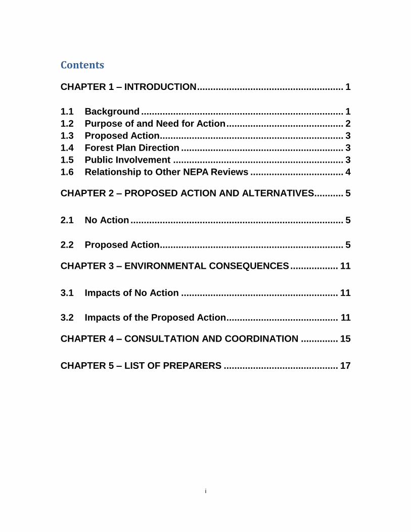
Contents
CHAPTER 1 – INTRODUCTION ....................................................... 1
1.1 Background ............................................................................ 1
1.2 Purpose of and Need for Action ............................................ 2
1.3 Proposed Action ..................................................................... 3
1.4 Forest Plan Direction ............................................................. 3
1.5 Public Involvement ................................................................ 3
1.6 Relationship to Other NEPA Reviews ................................... 4
CHAPTER 2 – PROPOSED ACTION AND ALTERNATIVES ........... 5
2.1 No Action ................................................................................ 5
2.2 Proposed Action ..................................................................... 5
CHAPTER 3 – ENVIRONMENTAL CONSEQUENCES .................. 11
3.1 Impacts of No Action ........................................................... 11
3.2 Impacts of the Proposed Action .......................................... 11
CHAPTER 4 – CONSULTATION AND COORDINATION .............. 15
CHAPTER 5 – LIST OF PREPARERS ........................................... 17

ii
1
Chapter 1 – Introduction
The U.S. Department of Agriculture, Forest Service, Coronado National Forest (NF or Forest),
prepared this environmental assessment (EA) to comply with the environmental review and
disclosure requirements of the National Environmental Policy Act (NEPA) of 1969 (Public Law
91-190). The subject of the EA is a proposal to amend the Coronado National Forest Land and
Resource Management Plan (Forest Plan; USFS, 1986, as amended) so that Forest management
direction is consistent with the recent Forest Service Travel Management Rule (TMR) (36 CFR
Parts 212, 251, 261, and 295).
The NEPA review that preceded the release of this EA followed the procedural requirements of
the President‟s Council on Environmental Quality Regulations Implementing the Procedural
Provisions of NEPA (40 CFR Parts 1500 to 1508) and Forest Service NEPA regulations at 36
CFR 220. The EA is organized into the following sections: Chapter 1. Introduction. This section discusses the background of the proposal, explains
the purpose of and need for Federal agency action, and briefly describes the action
proposed to satisfy the stated purpose and need. It summarizes public participation in the
NEPA review process and lists issues, if any, identified during the NEPA scoping period.
Chapter 2. Proposed Action and Alternatives. This section provides a detailed description
of the proposed action; no action; and mitigation, if necessary. It provides a summary
table that compares the environmental consequences of implementing each alternative.
Chapter 3. Environmental Consequences. This section provides detailed analyses of the
potential environmental impacts of implementing the proposed action and a no-action
alternative. The affected environment, which defines baseline conditions against which
changes would be measured, is described first, followed by the effects of the proposed
action and alternatives.
Chapter 4. Consultation and Coordination. This section lists parties consulted during
preparation of the EA.
Chapter 5. List of Preparers. This section acknowledges the contributions and affiliations
of those who prepared the impacts analysis reported in the EA.
The EA and administrative record of the NEPA review can be accessed at the Coronado National
Forest, Supervisor‟s Office, 300 West Congress Street, Tucson, Arizona, from Monday through
Friday between the hours of 8:00 a.m. and 4:30 p.m., excluding Federal holidays. The office
telephone number is (520) 388-8300. The EA will also be available on the internet on the Forest‟s
public website1. A copy of the EA on compact disk or in print may be obtained upon request by
contacting Ms. Laura White, Travel Management Program Leader, at (520) 388-8419 and
1.1 Background
Visitors to national forests and grasslands share a common interest in the enjoyment of outdoor
recreation in a natural setting. On National Forest System (NFS) lands, the Forest Service
manages more than 300,000 miles of roads and 35,000 miles of trails that provide visitors with
access to recreational amenities; provide motorized access to those who use the Forest or grassland
for special purposes, such as grazing management, operation and maintenance of communication
1 www.fs.fed.us/r3/coronado/forest/projects/environ/environ.shtml

2
sites, and mining; and afford agencies administrative access for fire and land management
activities.
Up until recently, accessibility to the Forest and its amenities has been the primary reason for
motor-vehicle use on national forests and grasslands. However, in the past few decades, the
popularity of motorized recreation using off-highway vehicles (OHVs) has increased
exponentially.
With the increased use of OHVs on public land, it became evident that there was a need for
Federal land management agencies to protect natural resources and safety. Executive Order (EO)
116442, issued in 1972, provided the nation‟s first guidelines for the use of OHVs on public lands.
Since then, the number of people engaging in OHV recreation has risen dramatically. In 20043,
more than 11 million people used OHVs on national forests and grasslands, more than double their
estimated use in 1972.
National forests and grasslands are used by the public for multiple purposes. When properly
managed, OHV use is a legitimate use of NFS lands. Previous Forest Service regulations were
developed before the recent increases in OHV use and advances in OHV technology. In 2009,
acknowledging these trends and the potential for OHV use to impact forest and grassland
resources, the Forest Service issued a regulation known as the travel management rule (TMR).
The TMR clarifies policy related to motor-vehicle use and provides management direction for
providing sustainable access for motor vehicles, including OHVs, on national forests. Some
national forests and grasslands already have established systems of roads, trails and areas designed
and managed for motorized use. The TMR does not require them to change existing plans.
What the TMR does require is for each national forest and grassland to have established a
designated motorized travel system and for that system to be documented on a publicly available
Motor-Vehicle Use Map (MVUM) that will be updated annually. The MVUM also documents the
specified distance along certain designated routes within which there may be limited use of motor
vehicles solely for dispersed camping or big game retrieval [36 CFR 212.51(b)]. Once an MVUM
is published, motor vehicle uses that are inconsistent with designations are prohibited (36 CFR
261.13). The TMR also considers previous travel management decisions as incorporated into the
designated system without further transportation analysis and NEPA review.
1.2 Purpose of and Need for Action
The Coronado NF already has a designated motorized travel system in place on all Districts; it is
based on direction provided in the Forest Plan. Prior to implementing the TMR, the Forest needs
to amend the Forest Plan to align its direction with TMR direction. This is because, as currently
written, Plan direction includes exceptions that contradict the TMR or specific direction regarding
off-road travel for parking and camping that must be changed. For example, while motor-vehicle
use on the District is currently limited to roads designated as “open”, the Forest Plan allows
motor-vehicle use on roads “not posted as closed” (see Sect. 1.4).
Currently, the Forest Plan allows motor-vehicle travel off all designated NFS roads across the
Forest up to a distance of 300 feet (ft) for parking and camping. This is not aligned with direction
in the TMR, which requires that off-road camping and parking be restricted in some areas of
national forests and grasslands for resource protection and administrative reasons (Project Record,
Item 1). To meet this need, Forest Plan direction regarding 300-ft off-road travel must be removed
2 http://www.archives.gov/federal-register/codification/executive-order/11644.html. EO 11644 was amended on May
24, 1977, by EO 11989, which added „Section 9‟, granting Federal agency officials the authority to close public lands to
OHV use, as necessary.
3 http://www.fs.fed.us/recreation/programs/ohv/ohv_use.pdf

3
and replaced with direction that refers motor-vehicle users to the MVUM, which will reflect site
specific decisions related to permissible distances for off-road parking and camping on each
District.
1.3 Proposed Action
To satisfy the purpose and need, the Forest proposes to amend the Forest Plan to clarify direction
about regulations on motor-vehicle use Forest-wide. Details of the proposed text changes in the
Forest Plan are provided in Table 2-1.
1.4 Forest Plan Direction
The Forest Plan provides the following direction regarding motor-vehicle use on the Forest:
Travel Designations: The standards and guidelines of the 1986 Forest Plan assign the following
three designations to motorized travel [pp. 27-1 and 28, number 19(a-c)], as depicted on the
Forest Plan Off Road Vehicle (ORV) Area Map. Designation of “areas” for motorized use, as
defined in the TMR, is not addressed in the Forest Plan.
“a”= Closed to all motorized travel.
“b”= Restricted. Generally closed to all cross-country motorized travel. Roads and trails are
open to travel except when posted closed.
“c”= Restricted. Generally closed to all cross-country motorized travel. Roads are open to
travel except when posted closed. All trails are closed to motorized travel.”
Road Density: The Forest Plan limits the density of existing and new road construction to one mile
of road or less per square mile (p. 34, d). It does not, however, define road density should be
calculated.
Off-Road Travel: In general, cross-country motorized vehicle use beyond existing roads is
prohibited. Vehicles may pull off roads up to 300 feet for parking or camping [p. 28: 19 (b)
and (c), pp.47, 50, 55, 59, 82, 71, 75, 83 and 86-1].
Motorized Dispersed Camping: Vehicles may pull off roads up to 300 feet for parking or camping
[p. 28: 19 (c)].
1.5 Public Involvement
The public was first notified about the proposal to amend the Forest Plan for consistency with the
TMR when it was listed on a Schedule of Proposed Actions on the Forest‟s public website4 in
April 2010.
On May 21, 2010, a Scoping Notice was distributed to 292 parties, providing details about the
proposed action and asking for public input to the NEPA review. Two comment letters were
received (Project Record Item 3). Their content was considered by Forest resources specialists in
modifying the proposed action and in the impacts analysis disclosed in this EA.
Public involvement in the NEPA process will continue with the publication of a Legal Notice of
Decision in the Arizona Daily Star newspaper after a decision is signed. This will officially begin
a 45-day period during which any person or any non-Federal organization or entity may appeal a
decision to approve the amendments.
4 www.fs.fed.us/r3/coronado/forest/projects/environ/environ.shtml

4
1.6 Relationship to Other NEPA Reviews
In March 2009, with the distribution of a Scoping Notice, the Forest initiated a NEPA review of
proposed changes to the motorized travel system on the Santa Catalina Ranger District. This was
followed by distribution of a Scoping Notice for a separate but related action to decommission5
14.26 miles of unauthorized roads and trails6 on the Catalina District
These related projects are planned within the same timeframe, but are independent of the proposed
action being evaluated in this EA. The decision to proceed with any of the three projects has no
bearing on the decision to proceed with the other. Therefore, the actions are not considered as
“connected” in the vernacular of NEPA, and they may be legitimately addressed in separate NEPA
reviews. Nevertheless, because these projects would be implemented within the same geographic
area and within a similar time period, the impacts of each action will be considered in the
cumulative effects analysis disclosed in their respective EAs.
A separate NEPA decision will be signed for each project.
5 These are defined in 36 CFR 212 as “activities that result in the stabilization and restoration of unneeded roads to a
more natural state”.
6 These are defined in 36 CFR 212 as “a road that is not a forest road or a temporary road and that is not included in a
forest transportation atlas”.
5
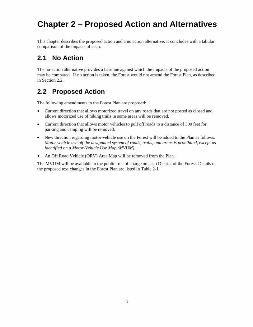
Chapter 2 – Proposed Action and Alternatives
This chapter describes the proposed action and a no action alternative. It concludes with a tabular
comparison of the impacts of each.
2.1 No Action
The no-action alternative provides a baseline against which the impacts of the proposed action
may be compared. If no action is taken, the Forest would not amend the Forest Plan, as described
in Section 2.2.
2.2 Proposed Action
The following amendments to the Forest Plan are proposed:
Current direction that allows motorized travel on any roads that are not posted as closed and
allows motorized use of hiking trails in some areas will be removed.
Current direction that allows motor vehicles to pull off roads to a distance of 300 feet for
parking and camping will be removed.
New direction regarding motor-vehicle use on the Forest will be added to the Plan as follows:
Motor vehicle use off the designated system of roads, trails, and areas is prohibited, except as
identified on a Motor-Vehicle Use Map (MVUM).
An Off Road Vehicle (ORV) Area Map will be removed from the Plan.
The MVUM will be available to the public free of charge on each District of the Forest. Details of
the proposed text changes in the Forest Plan are listed in Table 2-1.
6
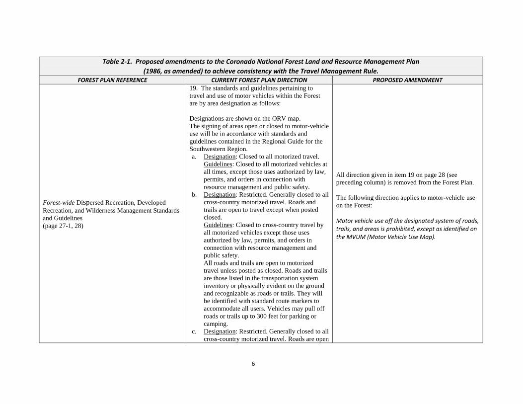
Table 2-1. Proposed amendments to the Coronado National Forest Land and Resource Management Plan
(1986, as amended) to achieve consistency with the Travel Management Rule. FOREST PLAN REFERENCE CURRENT FOREST PLAN DIRECTION PROPOSED AMENDMENT
Forest-wide Dispersed Recreation, Developed
Recreation, and Wilderness Management Standards
and Guidelines
(page 27-1, 28)
19. The standards and guidelines pertaining to
travel and use of motor vehicles within the Forest
are by area designation as follows:
Designations are shown on the ORV map.
The signing of areas open or closed to motor-vehicle
use will be in accordance with standards and
guidelines contained in the Regional Guide for the
Southwestern Region.
a. Designation: Closed to all motorized travel.
Guidelines: Closed to all motorized vehicles at
all times, except those uses authorized by law,
permits, and orders in connection with
resource management and public safety.
b. Designation: Restricted. Generally closed to all
cross-country motorized travel. Roads and
trails are open to travel except when posted
closed.
Guidelines: Closed to cross-country travel by
all motorized vehicles except those uses
authorized by law, permits, and orders in
connection with resource management and
public safety.
All roads and trails are open to motorized
travel unless posted as closed. Roads and trails
are those listed in the transportation system
inventory or physically evident on the ground
and recognizable as roads or trails. They will
be identified with standard route markers to
accommodate all users. Vehicles may pull off
roads or trails up to 300 feet for parking or
camping.
c. Designation: Restricted. Generally closed to all
cross-country motorized travel. Roads are open
All direction given in item 19 on page 28 (see
preceding column) is removed from the Forest Plan.
The following direction applies to motor-vehicle use
on the Forest:
Motor vehicle use off the designated system of roads, trails, and areas is prohibited, except as identified on the MVUM (Motor Vehicle Use Map).

7
Table 2-1. Proposed amendments to the Coronado National Forest Land and Resource Management Plan
(1986, as amended) to achieve consistency with the Travel Management Rule. to travel except when posted closed. All trails
are closed to motorized travel.
Guidelines: Closed to cross-country travel by
all motorized vehicles except those uses
authorized by law, permits, and orders in
connection with resource management and
public safety.
All roads are open to motorized travel unless
posted as closed. All trails are closed to
motorized travel. A trail is defined as “a way
for purposes of travel by foot, stock or trail
vehicles, 40 inches wide or less.”
Roads and trials are those listed in the
transportation system inventory or physically
evident on the ground and recognizable as
roads. They will be identified with standard
route markers to accommodate all users.
Vehicles may pull off roads up to 300 feet for
parking or camping.
In Sabino Canyon Recreation Area, private motor
vehicles are allowed only in the parking lot. Only
administrative, educational, emergency and shuttle
bus vehicular traffic are allowed on the canyon
roads. Limits on bicycle use may be required.
FOREST PLAN REFERENCE CURRENT FOREST PLAN DIRECTION PROPOSED AMENDMENT Management Area 1 Dispersed Recreation
Standards and Guidelines
(page 47)
2. Use of motorized vehicles is restricted to existing
trails and roads. Some trails may be closed to
motorized vehicles for safety, resource protection,
and user conflict reasons. All trails on the Santa
Catalina Ranger District are closed to motorized
vehicles.
[Remove #2 from Management Area 1 Dispersed Recreation Standards and Guidelines]

8
Table 2-1. Proposed amendments to the Coronado National Forest Land and Resource Management Plan
(1986, as amended) to achieve consistency with the Travel Management Rule. FOREST PLAN REFERENCE CURRENT FOREST PLAN DIRECTION PROPOSED AMENDMENT
Management Area 2 Dispersed Recreation
Standards and Guidelines
(page 50)
2. Use of motorized vehicles is restricted to existing
trails and roads. Some roads and trails may be
closed to motorized vehicles for safety, resource
protection, and user conflict reasons. All trails on
the Santa Catalina Ranger District are closed to
motorized vehicles.
[Remove #2 from Management Area 2 Dispersed Recreation Standards and Guidelines]
Management Area 3 Dispersed Recreation
Standards and Guidelines
(page 55)
3. Use of motorized vehicles is restricted to existing
trails and roads. Some trails may be closed to
motorized vehicles for safety, resource protection,
and user conflict reasons. All trails on the Santa
Catalina Ranger District are closed to motorized
vehicles.
[Remove #3 from Management Area 3 Dispersed Recreation Standards and Guidelines]
Management Area 3A and 3B Developed
Recreation Standards and Guidelines
(page 59)
6. Use of motorized vehicles is restricted to existing
trails and roads. Some trails may be closed to
motorized vehicles for safety, resource protection,
and user conflict reasons. All trails on the Santa
Catalina Ranger District are closed to motorized
vehicles.
[Remove #6 from Management Area 3A and 3B Developed Recreation Standards and Guidelines]
Management Area 4 Dispersed Recreation
Standards and Guidelines
(page 62)
2. Use of motorized vehicles is restricted to existing
trails and roads. Some trails may be closed to
motorized vehicles for safety, resource protection,
and user conflict reasons. All trails on the Santa
Catalina Ranger District are closed to motorized
vehicles.
[Remove #2 from Management Area 4 Dispersed Recreation Standards and Guidelines]
Management Area 7 Dispersed Recreation
Standards and Guidelines
(pp. 67 and 71)
2. Use of motorized vehicles is restricted to existing
trails and roads. Some trails may be closed to
motorized vehicles for safety, resource protection,
and user conflict reasons. All trails on the Santa
Catalina Ranger District are closed to motorized
vehicles.
[Remove #2 from Management Area 7 Dispersed Recreation Standards and Guidelines]
Management Area 8 Dispersed Recreation
Standards and Guidelines (page 75) 2. Motorized vehicles are not permitted in research
natural areas. Within the Research Ranch, use of
motorized vehicles is permitted only on designated
[Remove #2 from Management Area 8 Dispersed Recreation Standards and Guidelines]
9
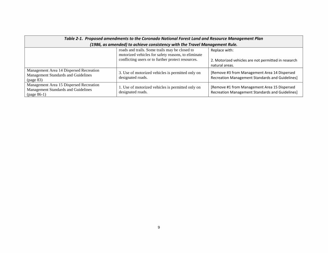
Table 2-1. Proposed amendments to the Coronado National Forest Land and Resource Management Plan
(1986, as amended) to achieve consistency with the Travel Management Rule. roads and trails. Some trails may be closed to
motorized vehicles for safety reasons, to eliminate
conflicting users or to further protect resources.
Replace with: 2. Motorized vehicles are not permitted in research natural areas.
Management Area 14 Dispersed Recreation
Management Standards and Guidelines
(page 83)
3. Use of motorized vehicles is permitted only on
designated roads. [Remove #3 from Management Area 14 Dispersed Recreation Management Standards and Guidelines]
Management Area 15 Dispersed Recreation
Management Standards and Guidelines
(page 86-1)
1. Use of motorized vehicles is permitted only on
designated roads. [Remove #1 from Management Area 15 Dispersed Recreation Management Standards and Guidelines]

10
1
11
Chapter 3 – Environmental Consequences
The following discussion discloses the impacts that would result from either taking no action or
implementing the proposed action.
3.1 Impacts of No Action
If no action is taken, the Forest would not amend the Forest Plan as noted above. Direction in the
Plan would not be changed as reported in Section 2 of this EA Motor-vehicle use on roads not
posted as closed would be continue to be permissible as would vehicles travel off each side of
Forest roads in a 300-foot corridor for camping and parking. The permissible use of hiking trails
would not be clarified.
If no action is taken, the direction in the Forest Plan would conflict with the requirements of the
TMR and would not be aligned with the road use direction of the MVUM. This would confuse
the public with regard to appropriate and legitimate motor-vehicle travel on the Forest.
Continued use of unauthorized roads by the public would be likely; this would exacerbate
resource damage that has been documented in certain areas.
3.2 Impacts of the Proposed Action
The Forest Plan is a document that provides a programmatic framework for Forest management.
It provides guidance for the planning and design of site-specific actions to be undertaken by the
Forest or other parties, as authorized by the Forest, but does not authorize, fund, or approve
implementation of any project or activity. Thus, the proposed amendments to the Plan will not
authorize or mandate any ground-disturbing actions that could impact the environment. However,
future proposed actions that follow the proposed amendments could impact the environment.
Their potential effects will be evaluated on a site-specific basis in future NEPA reviews.
Motor-vehicle travel on unauthorized Forest roads may decline as Forest users limit motor-
vehicle use to roads and trails identified as “open” on the MVUM. If so, minor positive effects
would result. These are noted under the resource subheadings below.
Air Quality
A measurable change in vehicle exhaust emissions and fugitive dust is not anticipated. Pollutant
emissions from vehicle exhaust and fugitive dust could decrease over time with decreased use of
unauthorized roads and off-road travel in certain areas of the Forest. However, this small
incremental decline would not contribute to a change in the air quality attainment status of local
airshed.
Soils
Best Management Practices (Forest Service Handbook 2509.22) for erosion and runoff control
will continue to be used during maintenance of roads identified on the MVUM as open for
motor-vehicle travel. A small incremental decrease in the degree of soil compaction and erosion
could result over time with decreased use of unauthorized roads and off-road travel in areas
where resource damage is currently evident.
12
Water Resources
Forest Service Best Management Practices for erosion control (Forest Service Handbook
2509.22) will be continue to apply to all NFS roads on which motor-vehicle travel is allowed.
Therefore, no net change in erosion and runoff to water resources is anticipated. A small
incremental decrease in runoff may result if there is decreased public use of unauthorized roads
and off-road travel in restricted areas.
Vegetation
Amendment of the Forest Plan to allow motor-vehicle use on specific roads would have no
immediate effect on existing vegetation conditions. However, in areas that have already
experienced damage and destruction of vegetation, a restriction on off-road motor-vehicle travel
would contribute to eventual ecological recovery and restoration of native vegetation.
Heritage Resources
The proposed amendments would allow motor-vehicle travel only in areas designated on the
MVUM. These areas have been selected by Forest archaeologists to avoid and/or minimize
potential vehicle access to heritage resources and sites. Therefore, adverse impacts to heritage
resources, including tribal cultural resources, are not expected.
Visual Quality
Visual quality objectives Forest-wide would continue to be met in areas where motor-vehicle
travel is permissible. Where new direction prohibits motor-vehicle travel, improvements in
Forest scenic resources is possible as vegetation recovers to a more natural state.
Recreation
Access to recreational amenities on the Forest would not be adversely affected by the proposed
amendments. While the change in Forest Plan direction regarding off-road travel in certain areas
of the Forest may limit motorized access to dispersed camping sites, these areas would still be
accessible on foot, horseback, or by other non-motorized means. In addition, the Forest has
proposed to add NFS roads in some areas where the off-road travel restriction would apply to
compensate for proposed restrictions on off-road driving for camping access.
Community Resources
The proposed action would not disproportionately affect low-income or minority populations in
adjacent communities, because the on-the-ground effects of the proposed amendments would be
confined within the Forest boundary. The Forest provides an equal opportunity for recreational
use to all citizens regardless of ethnicity and income status.
Cumulative Impacts
Because the proposed action is administrative in nature and would authorize no ground-disturbing
activities, it will have no adverse effects on Forest resources. Therefore, there is no potential for it
to have additive effects with the impacts of other past, present, and future actions that affect
Forest resources.
13
Finding of Non- Significant Amendment
The Forest Supervisor has reviewed and evaluated the proposed changes to management direction
and has come to the conclusion that they do not constitute a significant amendment to the Forest
Plan for the following reasons (Project Record Item 5):
This action does not significantly alter the multiple-use goals and objectives for long-term
land and resource management.
There are no adjustments to management area boundaries.
This is a minor change to clarify restrictions for motorized use.
This action will result in improved ability for managers to reduce resource damage from
unauthorized use of motorized vehicles.

14
15
Chapter 4 – Consultation and Coordination
The Forest Service consulted the following
Federal, state and local officials and
agencies; Tribes; and others during this
NEPA review.
Federal
U.S. Department of Defense, Ft. Huachuca
U.S. Department of Homeland Security,
Border Patrol
U.S. Department of the Interior, Bureau of
Land Management
U.S. Department of the Interior, Fish and
Wildlife Service
U.S. Department of the Interior, National
Park Service
Saguaro National Park
Chiricahua National Monument
Tumacacori National Historic Park
State of Arizona
Game and Fish Department
Department of Environmental Quality, Air
Quality Planning Section
Department of Transportation
Local
Pima County Administrator‟s Office
Pima County, Board of Supervisors
Pima Natural Resources Conservation
District
Pima County Parks and Recreation
Santa Cruz County, Board of Supervisors
Santa Cruz County Commissioner
Santa Cruz County Planning
Cochise County
Board of Supervisors
Public Lands Advisory Committee
Graham County Board of Supervisors
Hidalgo County Manager
Hidalgo County Commission
Hidalgo County Cooperative Extension
Service
Pinal County Board of Supervisors
Town of Patagonia
Tucson Metropolitan Chamber of
Commerce
University of Arizona
Laboratory of Tree Ring Research
College of Behavioral Sciences
New Mexico Department of Game and Fish
Others
Appleton-Whittell Research Ranch
Barker Management, Inc.
Coalition for Sonoran Desert Protection
EA Courier
Huachuca Hiking Club
Arizona Wildlife Federation
Mule Deer Foundation
National Wild Turkey Federation
Outdoor Adventures
Page Honda
Phoenix Zoo
Town of Patagonia
Tucson Rough Riders
Sciences
Westland Resources, Inc.
Southern Arizona Hiking Club
E Lazy H Ranch Partnership
Casa Grande Valley Newspapers
Klondyke Outfitters & Guides
Mule Mountain Caving Club
American Museum of Natural History
The Wilderness Society
Center for Biological Diversity
Arizona Wildlife Federation
Sky Island Alliance
Friends of Madera Canyon
Defenders of Wildlife
Tucson Rough Riders
Arizona Wildlife Foundation
Sierra Club
Cochise Range Riders
Tucson Electric Power Company
Pima Trails Association
Arizona Site Stewards
Arizona Trail Association
16
Sierra Vista Economic Development
American Recreation Coalition
National Off-highway Vehicle Conservation
Council
Blue Ribbon Coalition
Sahuaro Girl Scout Council
Tucson Off-Road
Huachuca Prospectors Association
Green Valley Hiking Club
Copper State Four Wheelers
Joplin and Associates
Southern Arizona Hiking Club
Krentz Ranch
Four Mile Ranch
E Lazy H Partnership
ZZ Cattle Corporation
Desert Gold Diggers
Cochise Trails Association
Trail Riders of Southern Arizona
Range Riders Four Wheelers
Turkey Flat Homeowners Association
Sabino Canyon Tours, Inc.
Friends of the Huachuca Mountains
Mt. Lemmon Water
Eastern Arizona Counties Association
Arizona State Association of 4-Wheel Drive
Clubs
Huachuca Prospectors
Rural Water Association of Arizona
Association for Preservation of Mt. Graham
National Forest Homeowners Association
Wear Ranch
Trail Riders of Southern Arizona
Association of Partners for Public Lands
Southern Arizona Motorsports Association
Wild Earth Guardians
17
Chapter 5 – List of Preparers
USDA FOREST SERVICE, CORONADO NATIONAL FOREST Erin Boyle Assistant Forest Planner
Andrea Campbell Forest NEPA Coordinator
Jennifer Ruyle Forest Planner
Laura White Forest Travel Management Program Leader