


Languages
Pages
Legal


WE
ARE
SA
ERI

2
WE A
RE SAERI | C
HA
IRMA
N
The annual report shows an Institute
growing in confidence. The foundations
and fundamentals established last year
have been built upon successfully.
The quality, dedication and talent of our
staff remain central to the achievement of
our mission. It is their research excellence
and academic rigour that ensure our work
is valued to international standards. It is
their dedication and approach that have
helped us build new partnerships and
extend our reach. It is their commitment
to delivery and customer service that
have seen income growth through our
commercial subsidiary, SAERI (Falklands)
Limited. Through our scientists’ work we
have discovered more about the the world
around us and moved the frontiers of
knowledge.
This year we have identified new species
– one of which now bears SAERI’s name -
and delivered excellent science. We have
brought more world class researchers
to the Falkland Islands, and provided
research opportunities in more Overseas
Territories and other locations. Our work
has made real impact – not only in the
Falklands but – true to our name – across
the South Atlantic and even further afield.
In the accounts for our second year as an
independent charity clearly show:
• We have achieved a near break-even
budget in year 2 in the unrestricted
funds, indicating sound financial
planning, management and tight
financial controls.
• Careful cost controls resulting in a
slight decrease in operating expenditure
(£370,000 to £360,000), which wage
and other inflationary pressures
managed by strict financial oversight.
• Greater sophistication in the delivery of
contracted activities through our trading
subsidiary resulting in increased
recharges and donations to the charity
which contribute to its core costs.
In addition, our work has repeatedly been
independently tested and both our closed
projects (Darwin Cetaceans and Natural
Capital Assessment (NCA)) and our
Group’s accounts have received
unqualified audits. Our key focus on
great science expertly delivered is
demonstrated by clean audits on closed
projects. We are getting the basics right
and I record my thanks to all staff for their
hard work and talent in achieving these
outcomes.
CHAIRMAN’S FOREWORD
All images in this report ©SAERI unless otherwise stated. Front cover: ©Kelp Limpet Nacella mytilina ©SMSG.
WE A
RE SAERI | C
HA
IRMA
N
3
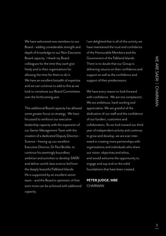
We have welcomed new members to our
Board – adding considerable strength and
depth of knowledge to our Non-Executive
Board capacity. I thank my Board
colleagues for the time they each give
freely and to their organisations for
allowing the time for them to do it.
We have an excellent breadth of expertise
and we can continue to add to this as we
look to constitute our Board Committees
over the forthcoming year.
This additional Board capacity has allowed
some greater focus on strategy. We have
focussed to reinforce our executive
leadership capacity with the expansion of
our Senior Management Team with the
creation of a dedicated Deputy Director -
Science – freeing up our excellent
Executive Director, Dr Paul Brickle, to
continue his seemingly boundless
ambition and activities to develop SAERI
and deliver world class science led from
the deeply beautiful Falkland Islands.
He is supported by an excellent senior
team – and the Board is optimistic of that
even more can be achieved with additional
capacity.
I am delighted that in all of this activity we
have maintained the trust and confidence
of the Honourable Members and the
Government of the Falkland Islands.
There is no doubt that our Group is
delivering returns on their confidence and
support as well as the confidence and
support of their predecessors.
We have every reason to look forward
with confidence. We are not complacent.
We are ambitious, hard-working and
appreciative. We are grateful of the
dedication of our staff and the confidence
of our funders, customers and
collaborators. As we look toward our third
year of independent activity and continue
to grow and develop, we are ever inter-
ested in creating more partnerships with
organisations and individuals who share
our vision, objectives and ethos,
and would welcome the opportunity to
engage and exp and on the solid
foundations that have been created.
PETER JUDGE, MBE
CHAIRMAN

4
WE A
RE SAERI | EX
ECU
TIV
E DIREC
TOR
It is my pleasure to present our annual
report for 2018/19. SAERI’s second year
as a registered charity has gone well and
the Institute continues to fulfil its role in
the South Atlantic and the Caribbean and
therefore maintains its position as credible
scientific institute that provides economic
benefit to the Falkland Islands. This year
saw the appointment of new Trustees
representing science and business.
This provides SAERI with a strong
leadership and governance force, ensuring
our science and the way we operate is to
the highest standards.
2018/19 saw the start of exciting new
projects as well as the natural end of
others. The Darwin projects Falkland
Islands / South Georgia Coastal Mapping
project, Fine scaling the design of Falkland
Islands Marine Management Areas (MMA
Project), Soil Mapping Project and the
Turks and Caicos Marine Spatial Planning
Project all started in 2018/2019.
The Darwin Dolphins of the Kelp project
finished with an excellent peer review
of the final project report. The Natural
Capital Assessment Project funded by
the CSSF through the JNCC also came to
a successful end this financial year where
notable successes included the
submission of 21 technical reports;
4 territory summary reports; 2 WebGIS
projects online; and a regional
conference on St Helena. The project
also has a number of peer reviewed papers
in preparation. SAERI has a number of
other projects ongoing and more detail
on them can be found in this report.
We also continue to maintain a healthy
project pipeline. It is really great to see
so many projects running in the Falkland
Islands and overseas. SAERI’s project staff,
research students and our collaborations
have led to an increase in the number of
scientific papers again this year, with some
in high impact journals such as Nature
and Proceedings of the National Academy
of Sciences. This is particularly pleasing
as our success as a research institute is
measured on the science we do and the
impact that it has.
EXECUTIVE DIRECTOR’S REPORT
WE A
RE SAERI | EX
ECU
TIV
E DIREC
TOR
5
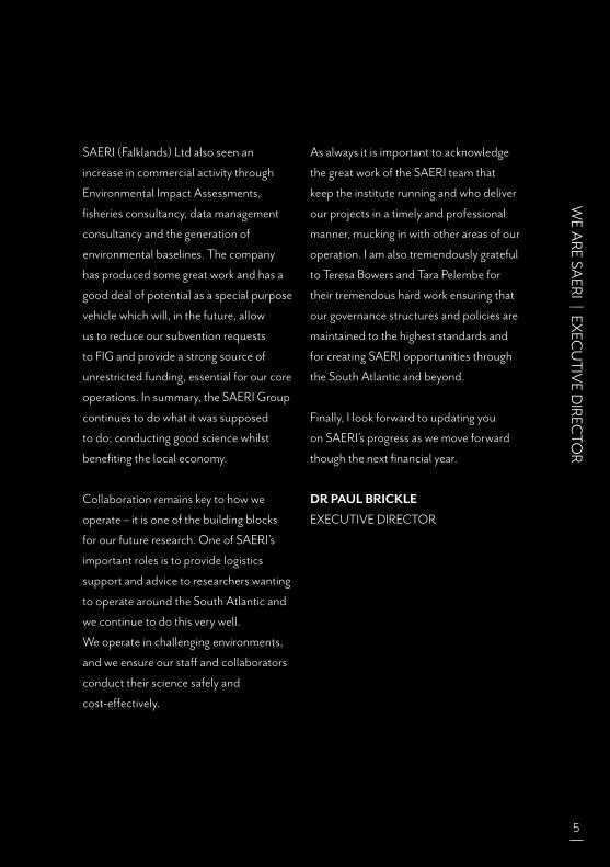
SAERI (Falklands) Ltd also seen an
increase in commercial activity through
Environmental Impact Assessments,
fisheries consultancy, data management
consultancy and the generation of
environmental baselines. The company
has produced some great work and has a
good deal of potential as a special purpose
vehicle which will, in the future, allow
us to reduce our subvention requests
to FIG and provide a strong source of
unrestricted funding, essential for our core
operations. In summary, the SAERI Group
continues to do what it was supposed
to do; conducting good science whilst
benefiting the local economy.
Collaboration remains key to how we
operate – it is one of the building blocks
for our future research. One of SAERI’s
important roles is to provide logistics
support and advice to researchers wanting
to operate around the South Atlantic and
we continue to do this very well.
We operate in challenging environments,
and we ensure our staff and collaborators
conduct their science safely and
cost-effectively.
As always it is important to acknowledge
the great work of the SAERI team that
keep the institute running and who deliver
our projects in a timely and professional
manner, mucking in with other areas of our
operation. I am also tremendously grateful
to Teresa Bowers and Tara Pelembe for
their tremendous hard work ensuring that
our governance structures and policies are
maintained to the highest standards and
for creating SAERI opportunities through
the South Atlantic and beyond.
Finally, I look forward to updating you
on SAERI’s progress as we move forward
though the next financial year.
DR PAUL BRICKLE
EXECUTIVE DIRECTOR

6
WE A
RE SAERI | W
HO
WE A
RE
SAERI is a Charitable Incorporated Organisation, registered with the Charities Commission
in England under number 1173105. SAERI is also recognised on the Register of Charities
in the Falkland Islands under number C47.
WHO WE ARE
OUR AIMS
THE SAERI CONSTITUTIONThe objects of the Charity are, for the public benefit:
1. the advancement of education and research
2. the advancement of environmental protection or improvement and
3. the promotion of sustainable development*, in particular (but not exclusively) by: (a) the advancement of environmental protection or improvement; and (b) the advancement of education and research;
particularly (but not exclusively) in relation the environment of the Falkland Islands and the South Atlantic region.
*Sustainable development means “development that meets the needs of the present without compromising the ability of future generations to meet their own needs”.
BROADEN
To broaden and developour Focal Areas (see p.10)
consolidated and heldtogether through the
IMS-GIS Data Centre.
MAINTAIN &ENHANCE
To maintain and enhance excellence through good
governance, sound financial practices, scientific assurance
and ethics and a fullyfunctioning and engaged
Board of Trustees.
BUILD
To build capacity byattracting and retaininggreat staff, by increasingour grant successes and
enhanced logisticalsupport capabilities for
visiting researchers.
REM
OT
E SE
NSI
NG
& D
ATA SCIENCE
WE A
RE SAERI | O
UR BO
ARD
7
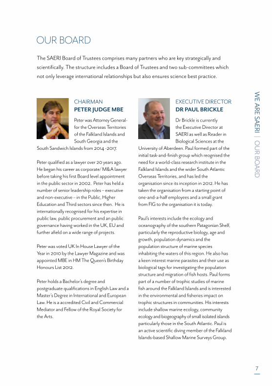
CHAIRMANPETER JUDGE MBE
Peter was Attorney General-for the Overseas Territories of the Falkland Islands and South Georgia and the
South Sandwich Islands from 2014 -2017.
Peter qualified as a lawyer over 20 years ago. He began his career as corporate/ M&A lawyer before taking his first Board level appointment in the public sector in 2002. Peter has held a number of senior leadership roles – executive and non-executive – in the Public, Higher Education and Third sectors since then. He is internationally recognised for his expertise in public law, public procurement and an public governance having worked in the UK, EU and further afield on a wide range of projects.
Peter was voted UK In House Lawyer of the Year in 2010 by the Lawyer Magazine and was appointed MBE in HM The Queen’s Birthday Honours List 2012.
Peter holds a Bachelor’s degree and postgraduate qualifications in English Law and a Master’s Degree in International and European Law. He is a accredited Civil and Commercial Mediator and Fellow of the Royal Society for the Arts.
EXECUTIVE DIRECTORDR PAUL BRICKLE
Dr Brickle is currently the Executive Director at SAERI as well as Reader in Biological Sciences at the
University of Aberdeen. Paul formed part of the initial task-and-finish group which reognised the need for a world-class research institute in the Falkland Islands and the wider South Atlantic Overseas Territories, and has led the organisation since its inception in 2012. He has taken the organisation from a starting point of one-and-a-half employees and a small grant from FIG to the organisation it is today.
Paul’s interests include the ecology and oceanography of the southern Patagonian Shelf, particularly the reproductive biology, age and growth, population dynamics and the population structure of marine species inhabiting the waters of this region. He also has a keen interest marine parasites and their use as biological tags for investigating the population structure and migration of fish hosts. Paul forms part of a number of trophic studies of marine fish around the Falkland Islands and is interested in the environmental and fisheries impact on trophic structures in communities. His interests include shallow marine ecology, community ecology and biogeography of small isolated islands particularly those in the South Atlantic. Paul is an active scientific diving member of the Falkland Islands-based Shallow Marine Surveys Group.
The SAERI Board of Trustees comprises many partners who are key strategically and
scientifically. The structure includes a Board of Trustees and two sub-committees which
not only leverage international relationships but also ensures science best practice.
OUR BOARD

8
WE A
RE SAERI | W
HO
WE A
RE
STUART PIERTNEYStuart is Professor of Molecular Ecology & Evolution and the Director of Research in the School of Biological Sciences at the University of Aberdeen.
His research interests are in using DNA variation among individuals, populations and species to gain novel insight into the behaviour, evolution, conservation and biology of a broad range of animals from both marine and terrestrial habitats. He has published over 150 articles in scientific journals as well as several book contributions.
He has been elected as Fellow of a number of learned societies, and sits on the editorial boards of several international scientific journals. He also Chairs key national and international research grant awarding bodies.
In his spare time, he enjoys diving, climbing, photography and beer.
STUART WALLACEStuart is Founder and Chairman of the Fortuna Group of companies in the Falkland Islands.
In the course of his career he has been a member of The Islands Legislative Assembly and Executive Council and for eight years was a member of the Board of the Falkland Islands Development Corporation. Stuart was Chairman of the Public Accounts Committee for two years following its establishing legislation.
He is currently also Chairman of the Falkland Islands Fishing Companies Association. His free time interests include trout fishing, gardening and South Atlantic Politics.
TEAL RILEYTeal Riley has almost 30 years’ experience in the geology and geochemistry of many aspects of continental and oceanic volcanism. He has worked for the
British Antarctic Survey for almost 25 years and has been involved in 16 Antarctic field seasons and has led two marine geology/geophysics cruises in the Scotia Sea. His recent research has investigated the origins of silicic volcanism in the Antarctic Peninsula and Patagonian South America, the geochronology and geochemistry of Gondwana break-up magmatism, and volcanism of the South Sandwich intra-oceanic island arc. He has over 70 publications since 1997 in refereed journals.
WE A
RE SAERI | O
UR BO
ARD
9
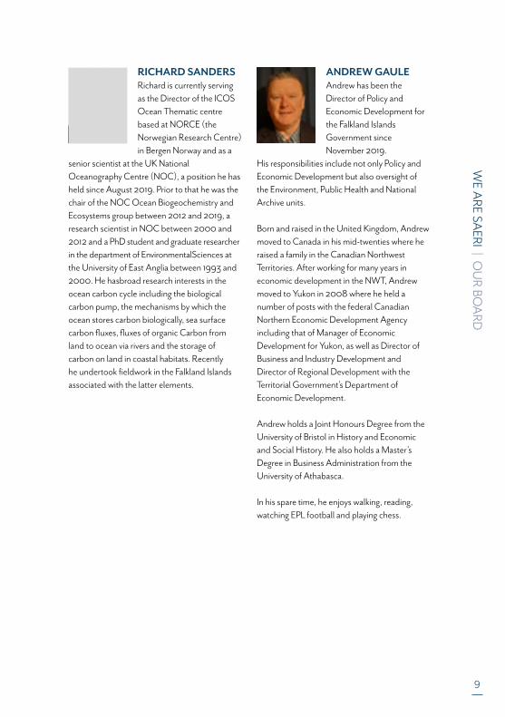
RICHARD SANDERSRichard is currently serving as the Director of the ICOS Ocean Thematic centre based at NORCE (the Norwegian Research Centre) in Bergen Norway and as a
senior scientist at the UK National Oceanography Centre (NOC), a position he has held since August 2019. Prior to that he was the chair of the NOC Ocean Biogeochemistry and Ecosystems group between 2012 and 2019, a research scientist in NOC between 2000 and 2012 and a PhD student and graduate researcher in the department of EnvironmentalSciences at the University of East Anglia between 1993 and 2000. He hasbroad research interests in the ocean carbon cycle including the biological carbon pump, the mechanisms by which the ocean stores carbon biologically, sea surface carbon fluxes, fluxes of organic Carbon from land to ocean via rivers and the storage of carbon on land in coastal habitats. Recently he undertook fieldwork in the Falkland Islands associated with the latter elements.
ANDREW GAULEAndrew has been the Director of Policy and Economic Development for the Falkland Islands Government since November 2019.
His responsibilities include not only Policy and Economic Development but also oversight of the Environment, Public Health and National Archive units.
Born and raised in the United Kingdom, Andrew moved to Canada in his mid-twenties where he raised a family in the Canadian Northwest Territories. After working for many years in economic development in the NWT, Andrew moved to Yukon in 2008 where he held a number of posts with the federal Canadian Northern Economic Development Agencyincluding that of Manager of Economic Development for Yukon, as well as Director of Business and Industry Development and Director of Regional Development with the Territorial Government’s Department of Economic Development.
Andrew holds a Joint Honours Degree from the University of Bristol in History and Economic and Social History. He also holds a Master’s Degree in Business Administration from the University of Athabasca.
In his spare time, he enjoys walking, reading, watching EPL football and playing chess.
10
WE A
RE SAERI | FO
RWA
RD LO
OK
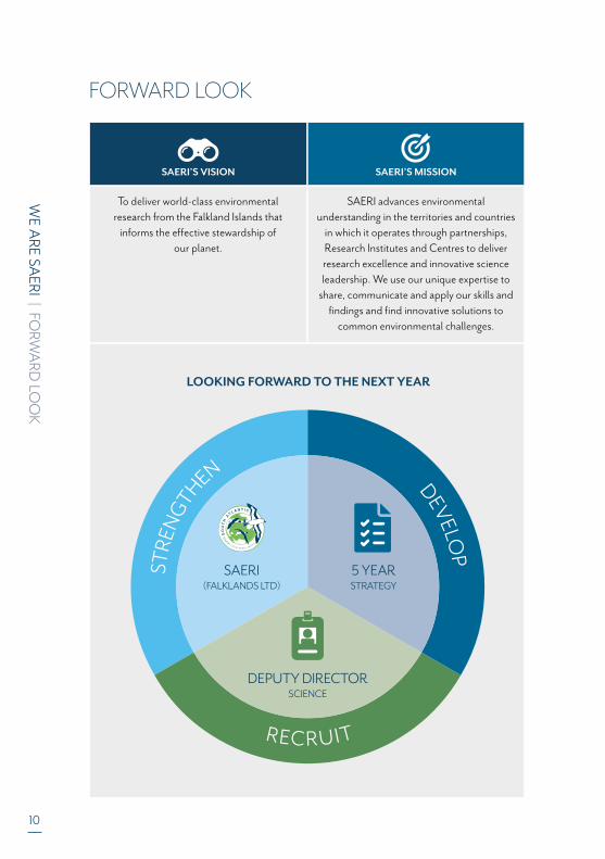
FORWARD LOOK
LOOKING FORWARD TO THE NEXT YEAR
SAERI’S VISION SAERI’S MISSION
To deliver world-class environmental research from the Falkland Islands that
informs the effective stewardship ofour planet.
SAERI advances environmentalunderstanding in the territories and countries
in which it operates through partnerships,Research Institutes and Centres to deliver research excellence and innovative scienceleadership. We use our unique expertise to
share, communicate and apply our skills and findings and find innovative solutions to
common environmental challenges.
STRE
NG
THEN
DEVELO
P
RECRUIT
SAERI(FALKLANDS LTD)
5 YEARSTRATEGY
DEPUTY DIRECTORSCIENCE
WE A
RE SAERI | FO
RWA
RD LO
OK
11
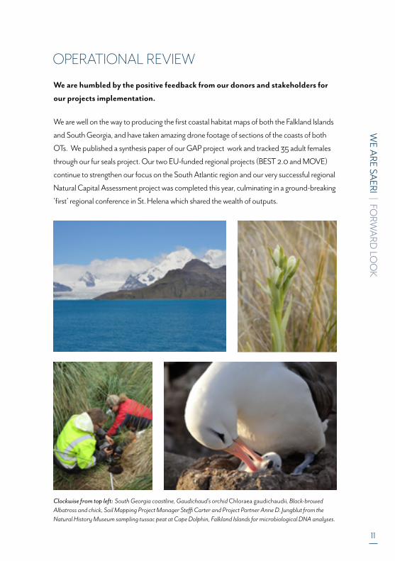
OPERATIONAL REVIEW
We are humbled by the positive feedback from our donors and stakeholders for
our projects implementation.
We are well on the way to producing the first coastal habitat maps of both the Falkland Islands
and South Georgia, and have taken amazing drone footage of sections of the coasts of both
OTs. We published a synthesis paper of our GAP project work and tracked 35 adult females
through our fur seals project. Our two EU-funded regional projects (BEST 2.0 and MOVE)
continue to strengthen our focus on the South Atlantic region and our very successful regional
Natural Capital Assessment project was completed this year, culminating in a ground-breaking
’first’ regional conference in St. Helena which shared the wealth of outputs.
Clockwise from top left: South Georgia coastline, Gaudichaud’s orchid Chloraea gaudichaudii, Black-browed Albatross and chick, Soil Mapping Project Manager Steffi Carter and Project Partner Anne D. Jungblut from the Natural History Museum sampling tussac peat at Cape Dolphin, Falkland Islands for microbiological DNA analyses.

12
WE A
RE SAERI | PAT
HW
AYS TO IM
PAC
T
SAERI continues to have a significant impact on Falkland Islands and South
Atlantic Science. It is important to highlight how our science and work help to
inform policy and decision making across the areas we work. We also highlight
some of the exciting discoveries made during this year.
OUR ACCOMPLISHMENTS THIS YEAR
In its second year of independence from its parent FIG, SAERI has sustained continued
growth in the Falkland Islands, South Atlantic and Caribbean.
SAERI continues to be an economic multiplier for the Falkland Islands.
SAERI has transformed Falkland Islands and South Atlantic research by carrying out
marine and terrestrial research across the SAOTs and, through logistics and guidance,
and by enabling science to be conducted safely and effectively by our partners and
collaborators. The areas we operate in are isolated and difficult to access and work in.
An international science demand survey conducted by SAERI and FIG resulted in
responses from 161 international scientists who confirmed the Falkland Islands as a
critical location for conducting regionally and globally important science across many
disciplines. The Falkland Islands has as many, if not more, significant unique selling
points compared with other sub-Antarctic locations, in terms of regional and globally
significant science including ‘whole earth system science’. The survey was also de
signed to understand the barriers to researchers wanting to conduct their science in the
Islands. The most important responses included laboratory facilities in Stanley, accom
modation, logistics support, internet and access to and around the islands when they
required it. This became the genesis for science component of FIG’s Antarctic Gateway
concept. The presence of a dedicated, well equipped facility would lead to economic
and reputational benefits for the Islands as a result of the enhanced service offered and
the consequent increase in the number of researchers spending money in the
community. Further work is planned to investigate the feasibility of such a science facility.
The SAERI model is seen as a success among a number of OTs and this has led to the
creation of sister institutes, the Mid-Atlantic Environmental Research Institute in
Anguilla and the St Helena Research Institute in partnership with SAERI.
PATHWAYS TO IMPACT

Sooty Shearwaters amassing off Kidney Island.

14
WE A
RE SAERI | PAT
HW
AYS TO IM
PAC
T
SAERI, in collaboration, with the JNCC, University of Dundee, University of Santa
Thomas, the University of Chile and the University of Magallanes created the Austral
Earth Observation Alliance (AEOA). This virtual centre of excellence to bring together
providers and users of EO enabling them to work together on common problems to
exploit EO in the South Atlantic and South American region. The Centre will include
researchers, government bodies, NGOs, and the private sector. The Southern Cone
and South Atlantic Islands have small populations, large land masses and/or seascapes,
are remote and therefore expensive to mobilise to and work in. Technology
developments in Earth Observation have allowed for these remote areas to be studied
and monitored
SAERI’s Defra funded Darwin Plus Coastal Mapping project has been a huge success
not only in creating much needed baseline on the coastal margins of the Falkland
Islands and South Georgia but has also been important in creating a legacy for future
monitoring, leading many positive spin offs to conservation, land use management,
agriculture and archaeology.
As new species of trematode parasite (Steringotrema) from the New Zealand sole was
described and published in Systematic Parasitology.
SAERI helped further inform the management of the Ascension Island’s MPA by
examining the residency and reproductive status of yellowfin tuna there.
Above: Diver collecting data in the kelp forest. ©SMSG
This financial year saw the graduation of PhD students Jessica Jones and Jacob
Hargreaves. Jess’s PhD and papers have shed important light onto the population
connectivity of the loliginid squid Doryteuthis gahi in the Falkland Islands and also
examined the mechanism for temporal connectivity between distinct cohorts that are
exploited by the fishery in two separate seasons. Jacob, on the other hand, examined
the fungal biodiversity and ecology of the Falkland Islands and South Georgia. Among a
number of discoveries Jacob’s work points to the importance of dark septate endophytic
(DSE) fungi in filling the role of mycorrhizal fungi in the region. This includes DSE being
important for healthy tussac.
SAERI has 23 papers published in peer reviewed publications this year including in
high impact journals such as Current Biology, Proceedings of the National Academy of
Sciences and Nature.
In addition, SAERI generated 39 notable unpublished reports on subjects varying
from the Natural Capital Assessment of tourism in South Atlantic OTs, carbon storage
sequestration by benthos in Ascension Island, Giant Kelp ‘Blue carbon’ storage and
sequestration value in the Falkland Islands, Cultural Ecosystem Services in the Island of
St. Helena, Illex value chains among many more. Published and peer reviewed papers
are listed in this annual report. Please contact [email protected] for copies if you would
like to read more.
Most of our ongoing projects will have similar impact and we will report on those in our
next annual report.
WE A
RE SAERI | PAT
HW
AYS TO IM
PAC
T
15
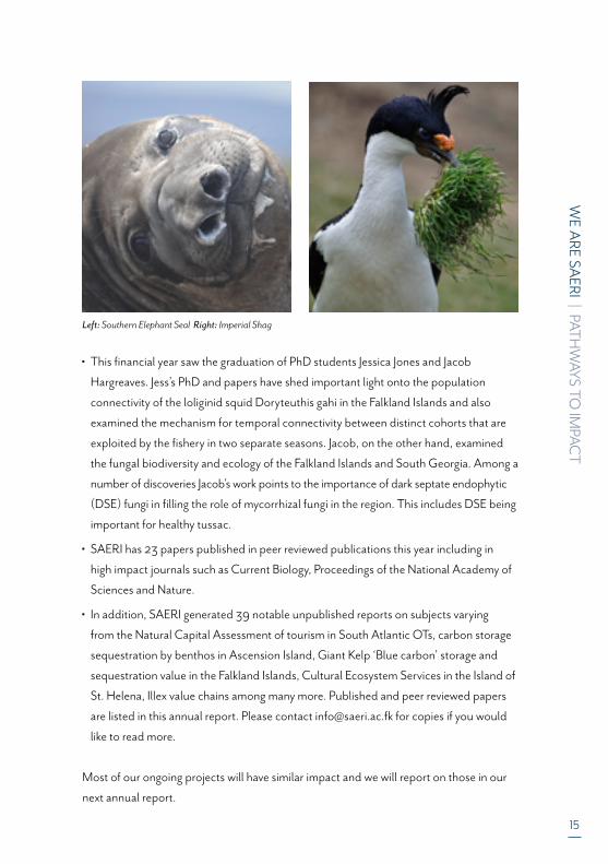
Left: Southern Elephant Seal Right: Imperial Shag

16
WE A
RE SAERI | O
UR Y
EAR IN
REVIEW
Where our first year provided a solid foundation for a year of consolidation and
bedding down of our operations, this past year saw us gain ground with our
grants, close off some large and important projects which provide a springboard
for further research and an expansion of our range of expertise, and move
forward with our environmental consultancy work: crucial to develop in order to
provide sustainable funding of our core costs. We successfully gained a grant to
look at marine spatial planning in the Caribbean – the Turks and Caicos Islands –
fulfilling our desire to expand our territory-to-territory partnerships and signed
significant MOUs with the JNCC and the NNF, providing the framework for
future partnerships.
We successfully supported the creation of a
sister institute in Anguilla, made great strides
in supporting the establishment of another
in St Helena and along with UK and Chilean
partners launched the Austral Earth
Observation Alliance (AEOA) developing a
virtual centre of excellence to bring together
providers and users of Earth Observation
(EO) enabling them to work together on
common problems to exploit EO in the
South Atlantic and South American region.
Our Data Science saw its international
relationships culminate in a year-long
secondment to the University of Dundee
where the partnership developed ideas
around the development of cross-
disciplinary data management tools
Our students did remarkably well, with
Katie Brigden and Jess Jones graduating in
this year, and we welcomed Amanda
Kuepfer and Jess Minett into the SAERI
fold, with Amanda researching the
influence of fisheries on albatross foraging
and diet and Jess looking at the population
of brown trout in the Falklands: an invasive
species that has thrived since its introduction.
OUR YEAR IN REVIEW
10 239EXTERNALLY FUNDED RESEARCH PROJECTS
PEER REVIEWED SCIENTIFIC PAPERS IN INTERNATIONAL JOURNALS
PHD STUDENTS
£ £
At Board level, we bid adieu to one of our
founding members, Michael Poole, to whom
we remain indebted for his insight and
dedication in our founding phase. In turn
we welcomed three friends to our Board,
whom we feel sure will provide us with their
scientific expertise, their guidance and their
enthusiasm so necessary for a fledgling
institute such as ours. We workshopped our
strategic forward look with the Board
Members and aim to generate our 5-year
strategy, to guide the ship annually on its
course.
Our second year has continued to be fruitful,
with significant steps taken to ensure that we
have a solid base to continue operations well
into the future.
WE A
RE SAERI | O
UR Y
EAR IN
REVIEW
17
“The Economic Development Strategy for the Islands highlights the importance of developing new economic activities to diversifythe economy and generate new income streams to reduce reliance on the core sectors of agriculture, fishing and tourism.The SAERI proposal in 2011 offered an opportunity to develop a sustainable knowledge-based activity – and one which has a clear synergy with the Islands’ strengths in the environment, sustainable use of natural resources and conservation. SAERI is doing the job it was meant to do. The organisation and its subsidiary, SAERI (Falklands) Ltd, saw its transition from a Falklands Islands Government Department to a registered Charity in England and Wales and the
Falkland Islands in July 2017. Since then the organisation has grown in both its breadth and scale at a pleasing rate. Not only have they increased the rate of discovery and science in the Falkland Islands – SAERI has also increased the credibility exposure and potential of the Falkland Islands as an important location to do science of significant regional and global importance. This has tangible benefits / impacts to the Falklands through increased economic activity and also by showcasing our unique, diverse and highly productive environments. I look forward to following SAERI’s progress over the next year.”
Barry Rowlands - Chief Executive, Falkland Islands Government
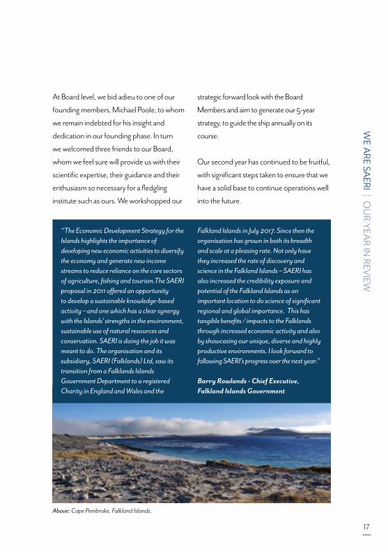
Above: Cape Pembroke, Falkland Islands.

18
WE A
RE SAERI | O
UR Y
EAR IN
REVIEW
2018-19 IS SAERI’S SECOND FULL YEAR OF OPERATION WHICH HAS ALLOWED US TO FOCUS MORE ON DEVELOPMENT AND
CONSOLIDATION AFTER HAVING SUCCESSFULLY ESTABLISHED THE INDEPENDENT ENTITY IN THE PREVIOUS YEAR.
THIS YEAR'S FIVE PRIORITY OBJECTIVES WERE:
1
4
2A FULL BOARD OF TRUSTEES
A MORE STRUCTURED APPROACHTO FUNDRAISING
STRATEGIC FORWARD VIEW
• Originating from solid partnership history with SAERI;• Associated with organisations with a strong partnership history • Able to provide valuable inputs into both SAERI’s strategy and the science it undertakes;• Able to fulfil a functional role.
Through a Board workshop aiming to:• Ensure the vision, mission and values remain relevant• Assist frame the organisation with guidance into size, performance and governance objectives; and• Ensure the structure remains appropriate to deliver the strategy.
3PERFORMANCEMANAGEMENT
A framework was agreed for performance management, to be applied consistently throughout the organisation to monitor, review and assess.
• Increased pool of high-level consultants• Closer working between SFL and SAERI• 20% increase in income to SAERI from SFL through recoveries and donations
• Search and successful recruitment of a Deputy Director – Science• Better use of market scanning tools for grants• Better structure and use of internal resources and external partnership for grant proposals
5ENHANCED FOCUS ON SAERI
(FALKLANDS) LIMITED (SFL)
Cap
tion:
Sou
ther
n El
epha
nt S
eal p
up
WE A
RE SAERI | A
CA
DEM
IC REV
IEW
19
EMMA BEATON
Examining the invertebrate community
structure of the intertidal and shallow benthic
environments around the Falkland Islands.
This PhD also aims to study the relationship
between the seaweed flora and extent of
deglaciation of regions of southern South
America. Intertidal fieldwork was completed
in April 2018, with data analysis of quadrat
photos completed by spring 2019. DNA
barcoding was employed to assess the algal
flora of the southern South Atlantic, with
molecular analyses completed in December
2018 and biogeographical analyses
beginning in June 2019. The first chapter of
this PhD, examining benthic communities,
was completed in May 2019 and submitted
for publication in June 2019.
Highlight of 2018:
During this year I have had the chance to
present posters at two national conferences;
the Marine Alliance for Science and
Technology in Scotland (MASTS) annual
science meeting in Glasgow in October 2018
and the British Phycology Society annual
science meeting in Oban in January 2019.
This year I also got the opportunity to present
my intertidal research to the public at a Pecha
Kucha pubic engagement event hosted
by the University of Aberdeen. A form of
lightning talk, limited to twenty slides and
only twenty seconds per slide, I found this
experience incredibly rewarding.
KATIE BRIGDEN
The reproductive ecology of Patagonian
toothfish (Dissostichus eleginoides, Smitt
1898) around the sub-Antarctic island of South
Georgia: Spatial and temporal patterns and
processes spanning two decades of data
Katie graduated in June 2019. Katie’s PhD
shed new light on spawning areas and
reproductive dynamics of the Patagonian
toothfish around South Georgia. Her work
has resulted in a number of high impact peer
reviewed papers.
TOM BUSBRIDGE
Understanding the decline and recovery of
one of the South Atlantic’s largest fisheries
(southern blue whiting).
Southern blue whiting (Micromesistius
australis australis) once contributed to the
largest fishery in the South Atlantic with peak
annual landings of 258.000 tonnes in 1983.
Continued levels of high intensity
exploitation resulted in a dramatic decrease
in overall abundance and subsequently in the
fishery collapsing between 2004-2007.
Tom’s project is aimed at investigating which
factors contributed to this decline in biomass
by elucidating on certain aspects of the life
history of southern blue whiting. The results
from this project should help improve future
management of this species. Tom is now in
his final year and has completed the work on
the first two research chapters of his thesis.
The first of these chapters (which is currently
ACADEMIC REVIEW: SAERI PHD STUDENTS

20
WE A
RE SAERI | A
CA
DEM
IC REV
IEW
under review for publication) determined the
timing and duration of metamorphosis in
southern blue whiting, linking their
planktonic larval phase with the mesopelagic
juvenile phase. The second research chapter
determined the contribution of the two known
spawning grounds for southern blue whiting
(one inside and one outside of Falkland
Islands waters) to the Falkland Islands fishery.
This chapter is currently being written up as a
manuscript for publication. The next chapter
will investigate the effects of high levels of long
term exploitation on the population dynamics
of the southern blue whiting fish stock in Falk-
land Islands waters. The analyses here will look
at changes in life history parameters, spawning
time and area (using hot-spot analyses), and
levels of recruitment since the inception of the
fishery in the late 1970s.
JACOB HARGREAVES
The Fungal Biodiversity of the Falkland Islands
and South Georgia
My project was centered around understanding
the fungal community diversity of various
regions in the Falkland Islands and South
Georgia. To achieve this, I carried out fungal
eDNA metabarcoding, microscopy of native
root samples and live culturing of fungal
isolates from plant material. In the end we
discovered a complex and spatially
heterogeneous communities of fungi, which
showed correlations to the above ground
populations. The importance of dark septate
endophytic (DSE) fungi was suggested in
filling the role of mycorrhizal fungi in this
region, species of Phialocephala (including P.
fortinii) were isolated from native plant roots.
In addition, fungal communities of South
Georgia, tussac roots and penguin nest
sites were also characterized using various
techniques, and finally a new rust pathogen
was discovered infecting the endangered,
endemic plant, Nastanthus falklandicus.
Some highlights of July 2018 – June 2019
were visiting the Falkland Islands for the last
time with my project to complete sampling in
February 2019 and completing all lab work
in June 2019.
EMMA HARTE
Dispersal of Patagonian toothfish (Dissos-
tichus eleginoides) eggs and larvae on the
Falkland Island Plateau
Emma is a MSc student working on model-
ling the egg and larval dispersal of toothfish
from the Drake Passage onto the Patago-
nian Shelf. Emma is also ascertaining the
buoyancy of toothfish eggs collected from
an aquaculture facility in the Falkland Islands
in order to provide input parameters for the
dispersal models. Emma is due to finish in
June 2020.
Above: Tussac grass
WE A
RE SAERI | A
CA
DEM
IC REV
IEW
21
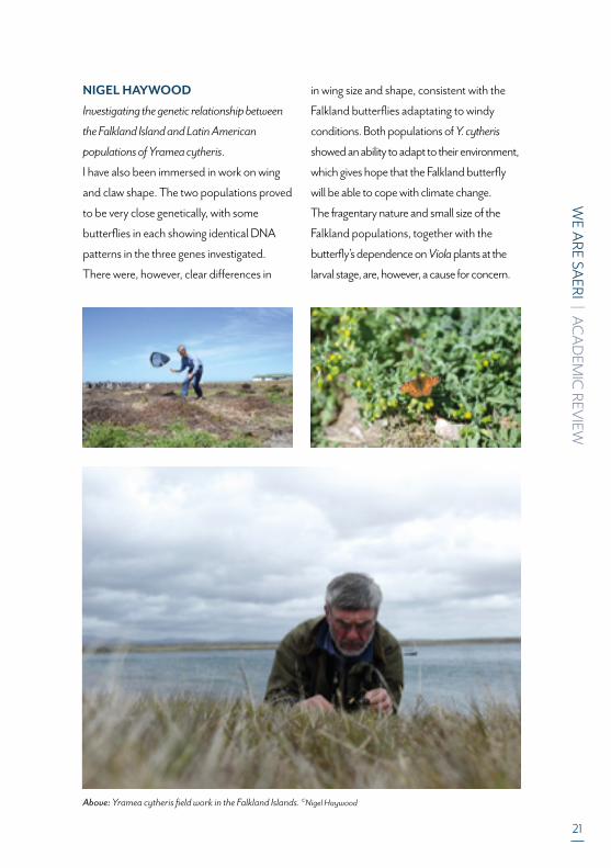
NIGEL HAYWOOD
Investigating the genetic relationship between
the Falkland Island and Latin American
populations of Yramea cytheris.
I have also been immersed in work on wing
and claw shape. The two populations proved
to be very close genetically, with some
butterflies in each showing identical DNA
patterns in the three genes investigated.
There were, however, clear differences in
in wing size and shape, consistent with the
Falkland butterflies adaptating to windy
conditions. Both populations of Y. cytheris
showed an ability to adapt to their environment,
which gives hope that the Falkland butterfly
will be able to cope with climate change.
The fragentary nature and small size of the
Falkland populations, together with the
butterfly’s dependence on Viola plants at the
larval stage, are, however, a cause for concern.
Above: Yramea cytheris field work in the Falkland Islands. ©Nigel Haywood

22
WE A
RE SAERI | A
CA
DEM
IC REV
IEW
JESSICA JONES
Population connectivity of a commercial loliginid
squid (Doryteuthis gahi)
This project aimed to better understand
population and connectivity of D. gahi.
Ontogenetic migrations of spawning cohorts
were confirmed by trace element analysis of
statoliths (LA ICP-MS). High resolution
elemental chronologies were developed
which were temporally stable over two
consecutive years. Large scale connectivity
was investigated by comparing soft body
measurements, meristic characters and
statolith outlines between populations of D.
gahi from FI waters and Peru. LDA indicated
high classification success to region and
inconsistencies were found between the
original taxonomic species description
and the Peruvian population. This aligns
with recent genetic evidence of two highly
divergent groups within the species range.
Body shape within FI waters was investigated
using geometric morphometrics, and a new
‘superbull’ morphotype was described.
The function of this morphotype was
investigated. This morphotype is thought to
temporally and spatially contribute towards
connectivity within this species.
Highlight of 2018:
On the 17th December my thesis was
submitted for consideration. In February my
second manuscript was accepted for
publication in Marine and Freshwater Research
and in March my third manuscript was accepted
to Marine Biology. My Viva was conducted in
Aberdeen on 10th April and I passed with no
corrections. I have since started a position as
Post-Doctoral researcher with the Falkland
Islands Fisheries Department on the same species.
AMANDA KUEPFER
My PhD project aims to provide an improved
understanding of the complex seabird-
fishery relationship in the Falkland Islands
and across the wider Patagonian Shelf.
Increase in the world’s most important
black-browed albatross population has been
speculated to be partly the result of easy
feeding opportunities created by discards
from trawl fisheries. However, scientific
evidence of this relationship remains limited.
Project Objectives
• Improved understanding of black-browed
albatross diet using complementary
approaches
• Improved understanding of fine-scale
foraging behaviour using novel technology
Highlights 2018-2019
• Complementary dietary samples for
conventional stomach content analysis
and stable isotope analysis were collected
on New Island and Steeple Jason Island in Above: Doryteuthis gahi statolith

WE A
RE SAERI | A
CA
DEM
IC REV
IEW
23
February and March 2019. The data adds
to a multi-year dataset, providing
information on inter-annual and inter-
colony variation.
• Following a successful application for
Analytical Support by the NERC Life
Sciences Mass Spectrometry Facility, over
600 stable isotope samples were analysed
at the facility in September.
• In December 2019, a pilot study involving
camera tracking successfully paved the way
for more comprehensive camera tracking
work in the season of 2020/2021.
• The PhD project was ring-fenced by FIG,
securing it a further 3 years of ESB funding
(until June 2022).
JESS MINETT
Brown trout in the Falkland Islands: invasion
ecology, population structure and genetic
diversity.
My project aims are (1) to determine the
abundance and distribution of the invasive
brown trout and native galaxiids (three native
species are Aplochiton zebra, Aplochiton
taeniatus and Galaxias maculatus), (2) to
assess the level of competition and impacts
of brown trout on the native galaxiids, (3) to
estimate the patterns of movement and levels
of gene flow between different rivers and
populations of brown trout in the Falklands.
To address these questions I am using state of
the art methods including SNP genotyping,
stable isotope analysis, acoustic tracking and
environmental DNA (eDNA) analysis. My
main highlights of 2018/2019 were (1) tagging
30 brown trout in October/November 2018
and deploying an array of acoustic receivers in
five estuaries around the Falklands, (2) using
newly designed primers to amplify both A.
zebra and A. taeniatus and brown trout to
assess their distribution based on DNA from
water samples and extracting DNA from
these environmental samples and determine
whether they overlap in 22 sampled rivers and
ponds around the Falklands.
Above: Taking samples from introduced trout Salmo trutta.

24
WE A
RE SAERI | PU
BLISHED
PAPERS
PUBLISHED PAPERS
1) Anglade T, Randhawa HS (2018) Gaining insights into the ecological role of the
New Zealand sole (Peltorhamphus novaezeelandiae) through parasites. Journal of
Helminthology 92: 187-196 doi 10.1017/s0022149x17000323
2) Auge AA, Dias MP, Lascelles B, Baylis AMM, Black A, Boersma PD, Catry P, Crofts
S, Galimberti F, Granadeiro JP, Hedd A, Ludynia K, Masello JF, Montevecchi W,
Phillips RA, Puetz K, Quillfeldt P, Rebstock GA, Sanvito S, Staniland IJ, Stanworth
A, Thompson D, Tierney M, Trathan PN, Croxall JP (2018a) Framework for mapping
key areas for marine megafauna to inform Marine Spatial Planning: The Falkland
Islands case study. Marine Policy 92: 61-72 doi 10.1016/j.marpol.2018.02.017
3) Auge AA, Otley H, Rendell N, Frans VF (2018b) Spatial distribution of cetacean
strandings in the Falkland Islands to define monitoring opportunities. Journal of
Cetacean Research and Management 19: 1-7
4) Barnes DKA, Morley SA, Bell J, Brewin P, Brigden K, Collins M, Glass T, Goodall
-Copestake WP, Henry L, Laptikhovsky V, Piechaud N, Richardson A, Rose P, Sands
CJ, Schofield A, Shreeve R, Small A, Stamford T, Taylor B (2018) Marine plastics
threaten giant Atlantic Marine Protected Areas. Current Biology 28: R1137-R1138
doi 10.1016/j.cub.2018.08.064
5) Baylis AMM, Tierney M, Orben RA, Staniland IJ, Brickle P (2018a) Geographic
variation in the foraging behaviour of South American fur seals. Marine Ecology
Progress Series 596: 233-245 doi 10.3354/meps12557
6) Bennett J, Randhawa HS (2019) Diet composition of New Zealand's endemic rough
skate, Zearaja nasuta. New Zealand Journal of Marine and Freshwater Research 53:
162-168 doi 10.1080/00288330.2018.1541813
7) Costa M, Fumagalli M, Cesario A (2019) Review of Cetaceans in the Red Sea. In: Rasul
NMA, Stewart ICF (eds) Oceanographic and Biological Aspects of the Red Sea, pp 281-303
8) Fumagalli M, Cesario A, Costa M (2019a) Where Dolphins Sleep: Resting Areas in
the Red Sea. In: Rasul NMA, Stewart ICF (eds) Oceanographic and Biological
Aspects of the Red Sea, pp 305-326
9) Fumagalli M, Cesario A, Costa M, di Sciara GN, Harraway J, Slooten E (2019b)
Population ecology and the management of whale watching operations on a
data-deficient dolphin population. Ecology and Evolution 9: 10442-10456 doi
10.1002/ece3.5565
WE A
RE SAERI | PU
BLISHED
PAPERS
25
10) Fumagalli M, Cesario A, Costa M, Harraway J, di Sciara GN, Slooten E (2018)
Behavioural responses of spinner dolphins to human interactions. Royal Society
Open Science 5 doi 10.1098/rsos.172044
11) Green DS, Kregting L, Boots B, Blockley DJ, Brickle P, da Costa M, Crowley Q
(2018) A comparison of sampling methods for seawater microplastics and a first re
port of the microplastic litter in coastal waters of Ascension and Falkland Islands.
Marine Pollution Bulletin 137: 695-701 doi 10.1016/j.marpolbul.2018.11.004
12) Hargreaves J, Brickle P, van West P (2018) The fungal ecology of seabird nesting
sites in the Falkland Islands indicates a niche for mycoparasites. Fungal Ecology 36:
99-108 doi 10.1016/j.funeco.2018.08.005
13) Jones JB, Pierce GJ, Brickle P, Shcherbich ZN, Arkhipkin AI (2019a) 'Superbull'
males: what role do they play and what drives their appearance within the
Doryteuthis gahi Patagonian Shelf population? Marine and Freshwater Research 70:
1805-1817 doi 10.1071/mf18285
14) Jones JB, Pierce GJ, Saborido-Rey F, Brickle P, Kuepper FC, Shcherbich ZN,
Arkhipkin AI (2019b) Size-dependent change in body shape and its possible
ecological role in the Patagonian squid (Doryteuthis gahi) in the Southwest Atlantic.
Marine Biology 166 doi 10.1007/s00227-019-3501-9
15) Knox TC, Baylis AMM, Arnould JPY (2018) Foraging site fidelity in male Australian
fur seals. Marine Biology 165 doi 10.1007/s00227-018-3368-1
16) Knox TC, Callahan DL, Kernaleguen L, Baylis AMM, Arnould JPY (2019) Blubber
fatty acids reveal variation in the diet of male Australian fur seals. Marine Biology
166 doi 10.1007/s00227-019-3552-y
17) Lee B, Brewin PE, Brickle P, Randhawa H (2018) Use of otolith shape to inform
stock structure in Patagonian toothfish (Dissostichus eleginoides) in the south-
western Atlantic. Marine and Freshwater Research 69: 1238-1247 doi 10.1071/
mf17327
18) Morato T, Pham CK, Pinto C, Golding N, Ardron JA, Duran Munoz P, Neat F (2018)
A Multi Criteria Assessment Method for Identifying Vulnerable Marine Eco
systems in the North-East Atlantic. Frontiers in Marine Science 5 doi 10.3389/
fmars.2018.00460
19) Perez-Ponce de Leon G, Anglade T, Randhawa HS (2018) A new species of
Steringotrema Odhner, 1911 (Trematoda: Fellodistomidae) from the New Zealand
sole Peltorhamphus novaezeelandiae Gunther off Kaka point in the Catlins, South
26
WE A
RE SAERI | PU
BLISHED
PAPERS
Island, New Zealand. Systematic Parasitology 95: 213-222 doi 10.1007/s11230-018-
9773-5
20) Queiroz N, Humphries NE, Couto A, Vedor M, da Costa I, Sequeira AMM,
Mucientes G, Santos AM, Abascal FJ, Abercrombie DL, Abrantes K, Acuna-
Marrero D, Afonso AS, Afonso P, Anders D, Araujo G, Arauz R, Bach P, Barnett A,
Bernal D, Berumen ML, Lion SB, Bezerra NPA, Blaison AV, Block BA, Bond ME,
Bonfil R, Bradford RW, Braun CD, Brooks EJ, Brooks A, Brown J, Bruce BD,
Byrne ME, Campana SE, Carlisle AB, Chapman DD, Chapple TK, Chisholm J,
Clarke CR, Clua EG, Cochran JEM, Crochelet EC, Dagorn L, Daly R, Cortes DD,
Doyle TK, Drew M, Duffy CAJ, Erikson T, Espinoza E, Ferreira LC, Ferretti F,
Filmalter JD, Fischer GC, Fitzpatrick R, Fontes J, Forget F, Fowler M, Francis MP,
Gallagher AJ, Gennari E, Goldsworthy SD, Gollock MJ, Green JR, Gustafson JA,
Guttridge TL, Guzman HM, Hammerschlag N, Harman L, Hazin FHV, Heard M,
Hearn AR, Holdsworth JC, Holmes BJ, Howey LA, Hoyos M, Hueter RE, Hussey NE,
Huveneers C, Irion DT, Jacoby DMP, Jewell OJD, Johnson R, Jordan LKB, Jorgensen
SJ, Joyce W, Daly CAK, Ketchum JT, Klimley AP, Kock AA, Koen P, Ladino F, Lana
FO, Lea JSE, Llewellyn F, Lyon WS, MacDonnell A, Macena BCL, Marshall H,
McAllister JD, McAuley R, Meyer MA, Morris JJ, Nelson ER, Papastamatiou YP,
Patterson TA, Penaherrera-Palma C, Pepperell JG, Pierce SJ, Poisson F, Quintero
LM, Richardson AJ, Rogers PJ, Rohner CA, Rowat DRL, Samoilys M, Semmens JM,
Sheaves M, Shillinger G, Shivji M, Singh S, Skomal GB, Smale MJ, Snyders LB, Soler
G, Soria M, Stehfest KM, Stevens JD, Thorrold SR, Tolotti MT, Towner A,
Travassos P, Tyminski JP, Vandeperre F, Vaudo JJ, Watanabe YY, Weber SB,
Wetherbee BM, White TD, Williams S, Zarate PM, Harcourt R, Hays GC,
Meekan MG, Thums M, Irigoien X, Eguiluz VM, Duarte CM, Sousa LL, Simpson SJ,
Southall EJ, Sims DW (2019) Global spatial risk assessment of sharks under the
footprint of fisheries. Nature 572: 461-+ doi 10.1038/s41586-019-1444-4
21) Rasmussen TK, Randhawa HS (2018) Host diet influences parasite diversity: a case
study looking at tapeworm diversity among sharks. Marine Ecology Progress Series
605: 1-16 doi 10.3354/meps12751
22) Richardson AJ, Downes KJ, Nolan ET, Brickle P, Brown J, Weber N, Weber SB (2018)
Residency and reproductive status of yellowfin tuna in a proposed large-scale
pelagic marine protected area. Aquatic Conservation-Marine and Freshwater
Ecosystems 28: 1308-1316 doi 10.1002/aqc.2936
WE A
RE SAERI | U
NPU
BLISHED
PAPERS
27
23) Sequeira AMM, Rodriguez JP, Eguiluz VM, Harcourt R, Hindell M, Sims DW,
Duarte CM, Costa DP, Fernandez-Gracia J, Ferreira LC, Hays GC, Heupel MR,
Meekan MG, Avenn A, Bailleul F, Baylis AMM, Berumen ML, Braun CD, Burns J,
Caley MJ, Campbell R, Carmichael RH, Clua E, Einoder LD, Friedlaender A,
Goebel ME, Goldsworthy SD, Guinet C, Gunn J, Hamer D, Hammerschlag N,
Hammill M, Huckstadt LA, Humphries NE, Lea MA, Lowther A, Mackay A,
McHuron E, McKenzie J, McLeay L, McMahond CR, Mengersenv K,
Muelbert MMC, Pagano AM, Page B, Queiroz N, Robinson PW, Shaffer SA,
Shivji M, Skomal GB, Thorrold SR, Villegas-Amtmann S, Weise M, Wells R,
Wetherbee B, Wiebkin A, Wienecke B, Thums M (2018) Convergence of marine
megafauna movement patterns in coastal and open oceans. Proceedings of the
National Academy of Sciences of the United States of America 115: 3072-3077 doi
10.1073/pnas.1716137115
UNPUBLISHED PAPERS
1) Acorn Tourism, Repetto, D., Smith, N., (2018) South Atlantic Natural Capital
Assessment Project: Tristan da Cunha Tourism Assessment. South Atlantic
Environmental Research Institute Report.
2) Acorn (2019) Tourism Potential Assessment for Ascension Island. South Atlantic
Environmental Research Institute Report. In draft
3) Barnes, D., Sands. C. Smith, N. (2019) Valuation of carbon storage sequestration
and social cost by benthos in Ascension island’s EEZ South Atlantic Environmental
Research Institute, Stanley, Falkland Islands. In draft
4) D.T.I Bayley, I. Marengo, H. Baker and T. Pelembe, (2017), Giant kelp ‘Blue carbon’
storage and sequestration value in the Falkland Islands. Joint Nature Conservation
Committee and South Atlantic Environmental Research Institute
5) Bianca, G., Tillin H., Hodgson, B., Erni-Cassola, G., Howell, K., Rees, S., (2018).
Ascension Island Natural Capital Assessment: Marine Ecosystem Services Report.
Prepared for the South Atlantic Environmental Research Institute.
6) Bormpoudakis, D., Fish, R., Smith, N., (2019) , The value of Nature in Tristan da Cunha
7) South Atlantic Environmental Research Institute, Stanley, Falklands in draft
28
WE A
RE SAERI | U
NPU
BLISHED
PAPERS
8) Bormpoudakis, D., Fish, R., Leo, D., Smith, N., (2019) , Cultural Ecosystem
Services in the Island of St. Helena South Atlantic Environmental Research Institute,
Stanley, Falklands in draft
9) Bormpoudakis, D., Fish, R., Smith, N., (2019) , Cultural Ecosystem Services in the
Falkland Islands South Atlantic Environmental Research Institute, Stanley, Falklands
in draft
10) Bormpoudakis, D., Fish, R., (2019) , Mapping cultural ecosystem and heritage
services in St. Helena Island using geo-located social media South Atlantic
Environmental Research Institute, Stanley, Falklands in draft
11) Brewin, P., (2018) Fisheries data collection and integration strategy for
underpinning sustainable fisheries management in Montserrat. SAERI Report for
the Joint Nature Conservation Committee.
12) Canelas, J., Fish, R., Smith, N., (2019) , Cultural Ecosystem Services on Ascension
island South Atlantic Environmental Research Institute, Stanley, Falklands in draft
14) Doyle, A., Edwards, D., Gregory, A., Brewin, P. & Brickle, P. (2017). T2T
Montserrat; a guide to fisheries data collection and biological sampling. JNCC.
15) Edwards, D. Doyle, A. Brickle, P. Brewin, P. (2017). T2T Montserrat Fisheries Data
Workshop report. JNCC
16) Harte, M., Watson, J., (2019) Closing the gap: Adding value to Falkland Island
Fisheries through the collective management of shared stocks. South Atlantic
Environmental Research Institute, Stanley, Falkland Islands. In draft
17) Harte M, Borberg J and Sylvia G. (2018). Argentine shortfin squid (Illex argentines)
value chain analysis with an emphasis on the Falkland Islands. South Atlantic
Environmental Research Institute, Stanley, Falkland Islands. In draft
18) Marengo, I., Cherrett, S., Smith, N., (2018) South Atlantic Natural Capital
Assessment Project: Constraints Mapping to identify suitable landfill sites on St.
Helena. South Atlantic Environmental Research Institute Report.
19) Marengo, I. (2018) Falkland Islands Broad Scale Habitat Map from Earth
Observation Techniques. South Atlantic Environmental Research Institute Report
20) McVittie, A., Conner, N., Gregory, A. and Smith, N. (2019) South Atlantic Natural
Capital Assessment: St Helena Cost Benefit Analysis, water security, Final Report
for the South Atlantic Overseas Territories Natural Capital Assessment. In draft

WE A
RE SAERI | U
NPU
BLISHED
PAPERS
29
21) McVittie, A., Durnford, M., Conner, N. Gregory, A., Morgan, V. and Smith, N.
(2019) South Atlantic Natural Capital Assessment: St Helena Cost Benefit Analysis,
waste management, Final Report for the South Atlantic Overseas Territories Natural
Capital Assessment. In draft
22) McVittie, A., Hutchison, J., Marengo, I., Smith, N. (2019) South Atlantic Natural
Capital Project: Modelling St. Helena’s Natural Capital. South Atlantic
Environmental Research Institute Report. In draft
23) Pelembe, T., Ponteen, A., RogerRyan, L., Gregory, A. (2016). T2T Montserrat report.
South Atlantic Environmental Research Institute, Stanley, Falkland Islands.
24) Pelembe T., Ryan L., Manghi G., Gregory A., (2019) Delivering QGIS training courses
(beginner and intermediate levels) in the Caribbean islands of Montserrat and Anguilla.
Project report
25) Pelembe T., I. Marengo, Ryan L., Brickle P., Gregory A., (2019) Montserrat Data
Portal. Project report. South Atlantic Environmental Research Institute. Pp 17
26) Pelembe T., I. Marengo, Ryan L., Duberry D., Brickle P., Gregory A., (2018)
Establishing a tool for providing a sound evidence base for Natural Capital
Assessment in Montserrat: The Montserrat Data Management Project. Project report
27) SAERI (2018) South Atlantic Natural Capital Assessment Project: Ascension
Workshop Report. South Atlantic Environmental Research Institute Report. In draft
28) SAERI (2018) South Atlantic Natural Capital Assessment Project: St. Helena
Process. South Atlantic Environmental Research Institute Report. In draft
29) SAERI (2018) Falkland Islands Natural Capital Assessment: Understanding the
Value of land-based tourism South Atlantic Environmental Research Institute
Report. In draft
30) Smith, N., Drew, J., and Andrews, K. (2019) St Helena Marine Tourism Values. Final
Report for the South Atlantic Overseas Territories Natural Capital Assessment in draft
31) Smith, N. (2019) Tristan da Cunha Natural Capital Assessment Waste Management
Report South Atlantic Environmental Research Institute, Stanley, Falklands in draft
32) Smith, N. 2019. Natural Capital in the UK’s Overseas Territories Report Series:
South Atlantic Region, No. 1. Falkland Islands in draft
33) Smith, N. 2019 Natural Capital in the UK’s Overseas Territories Report Series:
South Atlantic Region, No. 2. St Helena. In draft
30
WE A
RE SAERI | U
NPU
BLISHED
PAPERS
34) Smith, N. 2019. Natural Capital in the UK’s Overseas Territories Report Series:
South Atlantic Region, No. 3. Tristan da Cunha. In draft
35) Smith, N. 2019 Natural Capital in the UK’s Overseas Territories Report Series:
South Atlantic Region, No. 4. Ascension Island. In draft
36) Smith, N., (2018) South Atlantic Natural Capital Assessment Project: St. Helena
Consultation Report. South Atlantic Environmental Research Institute Report.
37) Smith, N., Drew, J., Andrews, K. (2019) South Atlantic Natural Capital Assessment
Project: St. Helena Marine Tourism Values. South Atlantic Environmental Research
Institute Report.
38) Williams, J., Medcalf, K., Ties, S., (2019) Soil Erosion Model for Tristan da Cunha.
South Atlantic Environmental Research Institute Report. In draft
39) Wolfs Company (2017) Report on workshops: Natural Capital Assessment in the
South Atlantic. Commissioned by SAERI.

WE A
RE SAERI | PA
RTN
ER ORG
AN
ISATIO
NS
31
Southern Rockhopper penguin with chicks.

32
WE A
RE SAERI | PA
RTN
ER ORG
AN
ISATIO
NS
AEOA: AUSTRAL EARTH OBSERVATION ALLIANCEPROVIDING INNOVATIVE SOLUTIONS FOR ENVIRONMENTAL SUSTAINABILITY
Earth Observation (EO) is the collection of information about the earth’s surface
(including aquatic environments) using remote sensing tools, e.g. satellite imagery, aerial
photography, drone footage, radars, sonars. Through the generation of products (e.g.
maps, data visualisation), Earth Observation data can then be used to measure and
monitor different features of the environment over time, which can feed into management
and decision-making processes from the regional to local scale. EO data has the potential
to reduce long-term costs and can be used as a tool to bridge the gaps between science
and decision-making.
The South Atlantic Environmental Research Institute (SAERI), together with its partners:
the Joint Nature Conservation Committee, the Universidad de Magalleanes (UMAG);
Universidad Santo Tomás (Santiago), Universidad de Chile and the University of
Dundee, is developing a virtual centre of excellence to bring together providers and users
of EO enabling them to work together on common problems to exploit EO in the South
Atlantic and South American region. The Centre will include researchers, government
bodies, NGOs, and the private sector.
AEOA was launched in the Falkland Islands in March 2019, when a group of Chilean Researchers
visited the islands to finalise the Alliance concept and participate in a Science Symposium.
BUILDING A NETWORK OF INSTITUTES
Right and far right: Chilean and British Academics visit the Falklands for AEOA launch.

WE A
RE SAERI | PA
RTN
ER ORG
AN
ISATIO
NS
33
"I have been fortunate to meet SAERI staff and to collaborate with them during my visit to the Falkland Islands, in whet was the early stages of creation of AEOA, an international alliance for earth observation around austral ecosystems. SAERI has been a key stakeholder in promoting and leading world-class collaborative work and research across multiple disciplines and organizations, with a regional scope across the Atlantic, and now extending their collaboration reach to my country, Chile. In addition to producing technical and scientific products of the highest level, SAERI staff hold a strong blend of skills and abilities that allow them to interact with multiple and diverse partners, both local and international, building solid collaboration networks and engaging in strong capacity building work along the way."
Dr. Fabio A. Labra, Professor, Faculty of Sciences, Universidad Santo Tomas, Chile
34
WE A
RE SAERI | PA
RTN
ER ORG
AN
ISATIO
NS
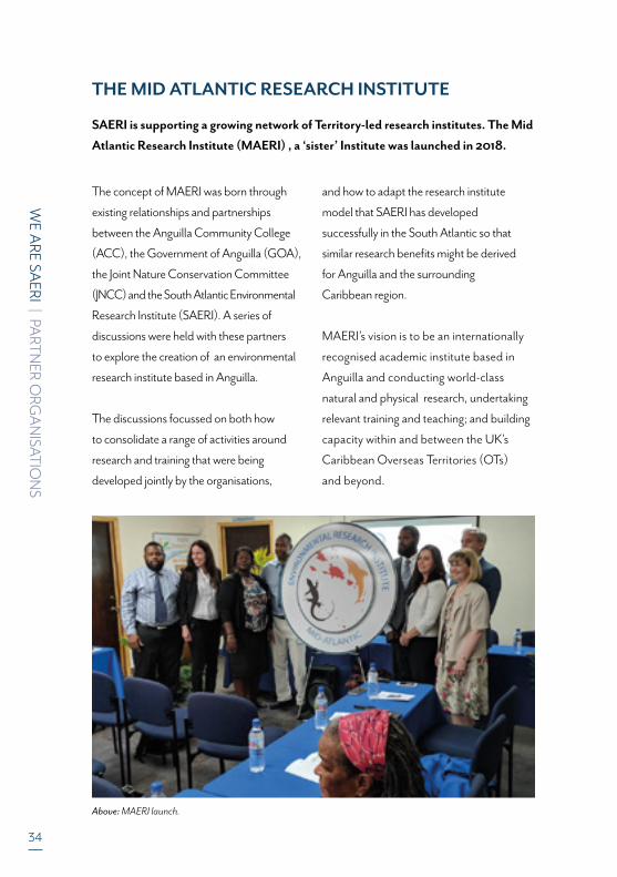
THE MID ATLANTIC RESEARCH INSTITUTE
SAERI is supporting a growing network of Territory-led research institutes. The Mid
Atlantic Research Institute (MAERI) , a ‘sister’ Institute was launched in 2018.
The concept of MAERI was born through
existing relationships and partnerships
between the Anguilla Community College
(ACC), the Government of Anguilla (GOA),
the Joint Nature Conservation Committee
(JNCC) and the South Atlantic Environmental
Research Institute (SAERI). A series of
discussions were held with these partners
to explore the creation of an environmental
research institute based in Anguilla.
The discussions focussed on both how
to consolidate a range of activities around
research and training that were being
developed jointly by the organisations,
and how to adapt the research institute
model that SAERI has developed
successfully in the South Atlantic so that
similar research benefits might be derived
for Anguilla and the surrounding
Caribbean region.
MAERI’s vision is to be an internationally
recognised academic institute based in
Anguilla and conducting world-class
natural and physical research, undertaking
relevant training and teaching; and building
capacity within and between the UK’s
Caribbean Overseas Territories (OTs)
and beyond.
Above: MAERI launch.
WE A
RE SAERI | PA
RTN
ER ORG
AN
ISATIO
NS
35
Although MAERI was created as SAERI’s
‘sister’ the concept behind MAERI is
slightly different as it has been set up as a
partnership of organisations, rather than a
single organisation.
The core group of partners (Anguilla
Community College, Government of
Anguilla Department of Environment,
Government of Anguilla Department of
Fisheries and marine resources, South
Atlantic Environmental Research Institute;
and Joint Nature Conservation Committee)
will be the driving force behind the
institute’s establishment, and will provide
the foundation for the development of
additional partnerships and networks.
SAERI, as part of the core group of partners
and as ‘sister’ institute, will work in direct
partnership with MAERI to develop research
opportunities and undertake joint research.
This will include making links between
the SAERI research network and MAERI;
collaborating on research funding bids; and
undertaking cross-territory training and skill
sharing.
The initiation of MAERI owes much to
the experience and assistance of SAERI.
The desire of local stakeholders in Anguilla
to further an environmental research and
training agenda was crystallised into a clear
vision and plan of action resulting in the
formation of MAERI. This facilitated by
our colleagues in SAERI and the Joint
Nature Conservation Committee.
KARL DAWSON, PH.DFor the MAERI Team, Anguilla
"It has been a pleasure working with SAERI since the inception of MAERI – the sharing of experiences and ideas across territories has been invaluable. We are excited to be a part of this growing network of UK Overseas Territories based Research Institutes and look future to developing our ideas, visions and collaborations further over the coming years."
Mr Karim Hodge, Permanent Secretary Government of Anguilla and MAERI Chair Anguilla

36
WE A
RE SAERI | PA
RTN
ER ORG
AN
ISATIO
NS
Above: QGIS training course participants and trainers at SHRI.
The SHRI has been established as a
collaborative organization, based on St
Helena, to support, promote and conduct
world class research on St Helena Island
across the range of natural (biological, earth
and environmental), agricultural, information,
technology, medical, humanities and social
sciences. It is made up of a core group of
founding partners (St Helena Education
& Employment Directorate, St Helena
Government Environmental Management
Division, St Helena National Trust, Enterprise
St Helena and SAERI). SAERI is a member of
the SHRI Steering Group and is an advisory
member of the St Helena Research Council.
SHRI’s mission is to grow and share
knowledge, manage data, teach, train and
build capacity to improve the quality of
people’s lives, support sustainable living
and care for our shared natural and
physical environment and cultural
heritage.
SHRI works to promote St Helena’s
research priorities locally and
internationally and to build and maintain
effective partnerships, networks and
connections, locally, regionally and
internationally to conduct and finance
research.
THE ST. HELENA RESEARCH INSTITUTE
SAERI is supporting a growing network of Territory-led research institutes.
The St. Helena Research Institute (SHRI), a ‘sister’ Institute was launched
on the 12th November 2019.

WE A
RE SAERI | PA
RTN
ER ORG
AN
ISATIO
NS
37
SHRI provides technical and administrative
support to the St Helena Research Council,
who manage and oversee research on St
Helena. SHRI supports researchers in
developing and submitting their applications
to the St Helena Research Council, ensuring
that they are meet ethical and responsible
standards for research and are equitable in
benefit sharing. With the St Helena Research
Council, other key stakeholders and the
research community, SHRI help assure the
collection, preservation, and appropriate use
and dissemination of research data and
findings from research conducted on St
Helena. SHRI also facilitates community
engagement and collaborations with local
organisations, developing learning and
training opportunities.
"The establishment of the SHRI is a significant achievement, creating an exciting opportunity for St Helena to build upon the foundations of science and Saint Science that have been established on the Island over several decades. From concept inception to establishment we have benefited from SAERI’s support, knowledge and experience sharing. We look forward to building on our relationship and collaborations with SAERI and the UK Overseas Territories network in the coming years and expanding opportunities to grow knowledge and understanding and build capacity that can bring benefits at the local, regional and international level."
Dr. Rebecca Cairns-WicksSt. Helena Research Institute Coordinator
Above: Peak Dale St Helena. ©Scott George.
CO
AST
AL
MA
PPIN
G P
ROJE
CT

39
SAERI W
ORK
| CO
ASTA
L MA
PPING
PROJEC
T
Our planet is experiencing rapid change - the burning of fossil fuels, habitat destruction and the increase in the global population threatens biodiversity and habitats important for maintaining healthy productive ecosystems. In the near pristine environments of the Falkland Islands and South Georgia, SAERI’s Coastal Mapping project set out to establish a baseline for the environmental management, protection and restoration of coastal and inshore marine ecosystems.
The Defra-funded Darwin Initiative project started in
2017 in response to the recognition that the coastal
and inshore marine ecosystems (and their constituent
habitats within) and resources of the Falklands and
South Georgia are an important ecological, social and
economic component of these islands’ natural capital.
Those around South Georgia provide an essential habitat
for globally important populations of birds and marine
mammals. Knowledge of these environments is essential
for their management, yet comprehensive island-wide
broad-scale and fine-scale coastal habitat maps have
been lacking; these could fill a critical evidence gap and
provide an important baseline from which to measure
future change, habitat restoration success or human
impact. Habitat models and their visualisation as maps
are a fundamental element for understanding the
distribution and extent of features across the landscape,
to facilitate better management practices, natural capital
accounting, ecosystem service mapping, interpreting and
targeting biodiversity monitoring and policy formulation.
This three-year project brought together experts from
SAERI, Oregon State University, Shallow Marine Surveys
Group, the Joint Nature Conservation Committee, the
Falkland Islands Government and the Government of
South Georgia and the South Sandwich Islands.
Above: Project Manager Neil Golding out in the field in South Georgia collecting ground validation points for the habitat modelling. ©Gifford Hickey.

PROJECT LOCATIONS | FALKLAND ISLANDS
SAERI W
ORK
| CO
ASTA
L MA
PPING
PROJEC
T
40
Tussac Islands
Yorke Point
Surf Bay
Walker Creek
WestFalkland
FalklandIslands
EastFalkland
Lafonia
Bertha’s Beach
Cape Pembroke
Bleaker Island
Cape Dolphin
Kidney IslandCochon Island
Gypsy Cove / Yorke Bay
Eliza Cove
Elephant Jason Island
Falkland Sound
Port Howard
Rookery Bay
Hummock Island
NewhavenPort Sussex
Hill Cove
STANLEY
“Using cutting edge satellite and drone data, we mapped
everything from kelp forests of the inshore environments,
to terrestrial intertidal and terrestrial coastal in order
to identify habitats across the Island” said Paul Brickle,
Executive Director of SAERI and lead in pulling together
this innovative project. “The Falkland Islands and South
Georgia are starkly different in terms of their physical
environment and ecosystems. They are separated by a
strong biogeographical barrier, the Polar Front that helps
to maintain these different marine and terrestrial
ecosystems. However, they share a number of important
common features; they are high productive and support
huge abundances of higher predators. Their marine
environments support highly diverse faunal and floral
communities.”
Aerial photography from of the Falkland Islands 1956
was digitised and used to compare to the recent imagery
creating a sound baseline for identifying habitat change.
“The use of remote sensing techniques to map
environments was particularly interesting for me”
said Neil Golding, Coastal Mapping project manager.
"I fell in love with the Islands and it's wildlife” he said.
“[I couldn’t wait for the chance to return, and this project
seemed like an ideal opportunity to hone my existing
skillset, develop new skills and explore the natural beauty
these territories have to offer]".
Above: A 3D rendering of Gold Head, created from a high-resolution drone mapping survey completed on the South Georgia field expedition in March 2019.

41
SAERI W
ORK
| CO
ASTA
L MA
PPING
PROJEC
T
ABOUT THE PROJECT
The coastal and inshore marine ecosystems and
resources of the Falkland Islands and South Georgia play
an important role in these two UKOTs. From their
historical role as a safe harbour, source of food, and
forage for livestock, to their present importance for
fishing and wildlife-based tourism revenues, the diverse
range of ecosystem services provided by the coast and
the sea, among other things, defines these islands.
With human activity came non-native and invasive
species which are further exacterbated by climate
change. Therefore, knowledge of these coastal
environments is essential for their effective conservation
and management, and yet they have been subject to little
in-depth study. In summary, comprehensive broad-scale
and fine-scale coastal habitat maps, which would form
an important baseline (from which to measure future
change for example), are lacking.
The challenge for this project was to fill this critical gap in
coastal knowledge. The challenge was relevant to both
FIG and the GSGSSI, demonstrated by the various plans
and policies in place to try to address this lack of coastal
environmental knowledge.
INTEGRATIONIntegrating geospatial
products with existing and emerging initiatives.
MAPPINGDigital, broad-scale and
fine-scale mapping of theFalkland Islands and
South Georgia.
PROTECTIONPlanning and monitoring ofthe coastal margins through
training and knowledgetransfer.
Above: Yorke Bay, Falkland Islands.
SAERI W
ORK
| CO
ASTA
L MA
PPING
PROJEC
T
42
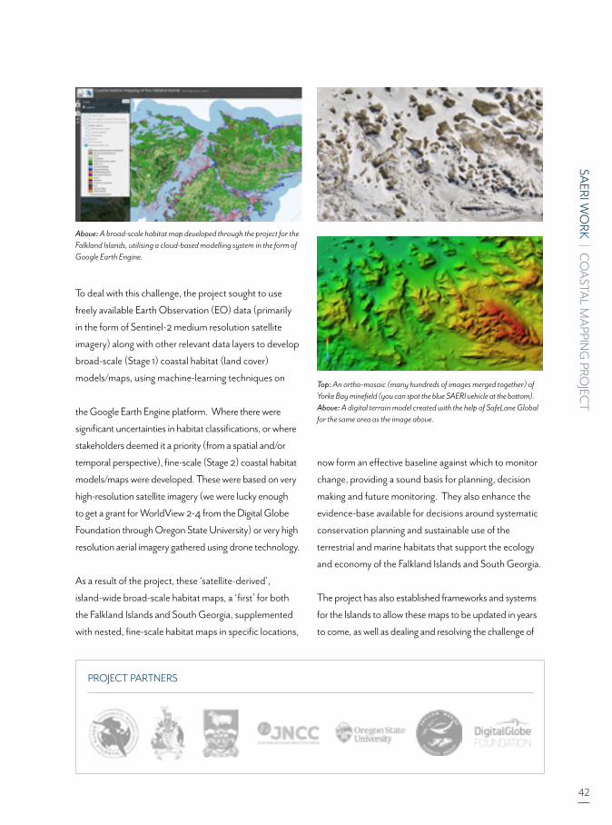
PROJECT PARTNERS
To deal with this challenge, the project sought to use
freely available Earth Observation (EO) data (primarily
in the form of Sentinel-2 medium resolution satellite
imagery) along with other relevant data layers to develop
broad-scale (Stage 1) coastal habitat (land cover)
models/maps, using machine-learning techniques on
the Google Earth Engine platform. Where there were
significant uncertainties in habitat classifications, or where
stakeholders deemed it a priority (from a spatial and/or
temporal perspective), fine-scale (Stage 2) coastal habitat
models/maps were developed. These were based on very
high-resolution satellite imagery (we were lucky enough
to get a grant for WorldView 2-4 from the Digital Globe
Foundation through Oregon State University) or very high
resolution aerial imagery gathered using drone technology.
As a result of the project, these ‘satellite-derived’,
island-wide broad-scale habitat maps, a ‘first’ for both
the Falkland Islands and South Georgia, supplemented
with nested, fine-scale habitat maps in specific locations,
now form an effective baseline against which to monitor
change, providing a sound basis for planning, decision
making and future monitoring. They also enhance the
evidence-base available for decisions around systematic
conservation planning and sustainable use of the
terrestrial and marine habitats that support the ecology
and economy of the Falkland Islands and South Georgia.
The project has also established frameworks and systems
for the Islands to allow these maps to be updated in years
to come, as well as dealing and resolving the challenge of
Above: A broad-scale habitat map developed through the project for the Falkland Islands, utilising a cloud-based modelling system in the form of Google Earth Engine.
Top: An ortho-mosaic (many hundreds of images merged together) of Yorke Bay minefield (you can spot the blue SAERI vehicle at the bottom). Above: A digital terrain model created with the help of SafeLane Global for the same area as the image above.
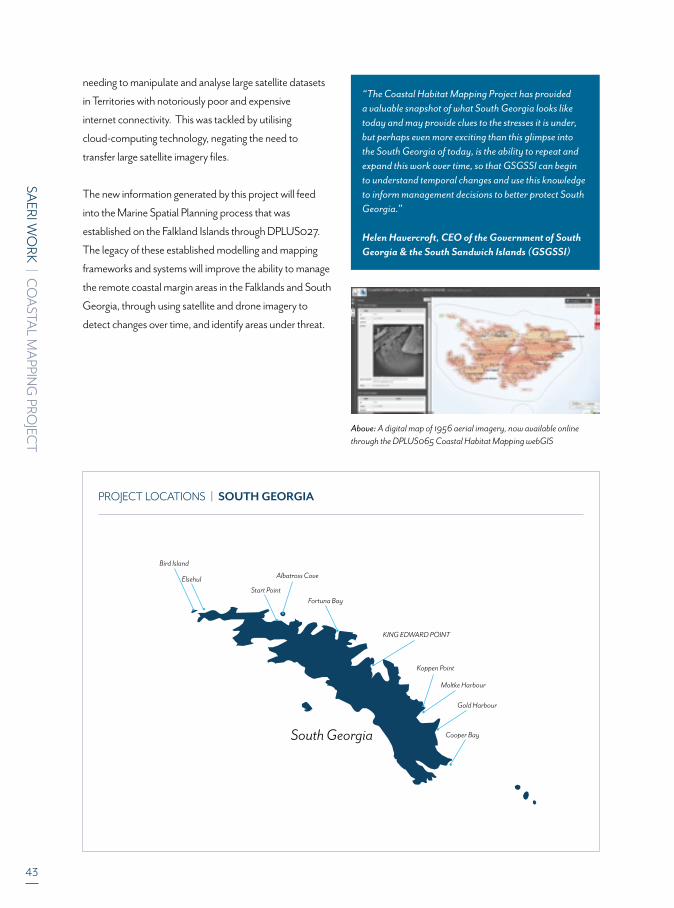
43
SAERI W
ORK
| CO
ASTA
L MA
PPING
PROJEC
T
PROJECT LOCATIONS | SOUTH GEORGIA
Above: A digital map of 1956 aerial imagery, now available online through the DPLUS065 Coastal Habitat Mapping webGIS
South Georgia
ElsehulStart Point
Bird Island
Koppen Point
Albatross Cove
Moltke Harbour
KING EDWARD POINT
Gold Harbour
Cooper Bay
Fortuna Bay
“The Coastal Habitat Mapping Project has provided a valuable snapshot of what South Georgia looks like today and may provide clues to the stresses it is under, but perhaps even more exciting than this glimpse into the South Georgia of today, is the ability to repeat and expand this work over time, so that GSGSSI can begin to understand temporal changes and use this knowledge to inform management decisions to better protect South Georgia.”
Helen Havercroft, CEO of the Government of South Georgia & the South Sandwich Islands (GSGSSI)
needing to manipulate and analyse large satellite datasets
in Territories with notoriously poor and expensive
internet connectivity. This was tackled by utilising
cloud-computing technology, negating the need to
transfer large satellite imagery files.
The new information generated by this project will feed
into the Marine Spatial Planning process that was
established on the Falkland Islands through DPLUS027.
The legacy of these established modelling and mapping
frameworks and systems will improve the ability to manage
the remote coastal margin areas in the Falklands and South
Georgia, through using satellite and drone imagery to
detect changes over time, and identify areas under threat.

SAERI W
ORK
| CO
ASTA
L MA
PPING
PROJEC
T
44
PROJECT HIGHLIGHTS
SHACKLETON SCHOLARSHIP FUND
The PM was successful in his application to the
Shackleton Scholarship Fund application to get a
drone expert down to the Falklands. The PM was
successful in securing £2,714 of grant funds.
The PM and Shackleton Scholar worked together
within the community to promote how drones, when
used safely, can really benefit science, education and
more. The resulting series of events run by Nicole
Durfee and the PM jointly was well received and well
attended by the wider public.
FALKLAND GIRL GUIDES
The PM wrote a letter of support to the Falkland
Islands Government in support of their Environmental
Studies Budget application to visit Bleaker Island to
undertake some conservation orientated activities.
As part of this visit, the Girl Guides collected ground
validation data from Bleaker Island for inclusion in the
Falklands broad-scale habitat model/map.
INFANT & JUNIOR SCHOOL (IJS), STANLEY
The PM visited IJS in July 2018 as part of their Science
Week and with his colleague, made an informative
presentation on marine forests (kelp forests) which are
a vitally important marine habitat around the Falklands
coastline, and one of the habitats being mapped as
part of DPLUS065. As part of this session, the PM
was able to provide some background to the Darwin +
Coastal Habitat Mapping project
CHAMBER OF COMMERCE PUBLIC TALK
The PM gave a public talk about the DPLUS065
project at the Chamber of Commerce on 27th
November 2018, and there was very good attendance,
despite it being a warm, sunny evening, which usually
leads to reduced participation in such events.
SOUTH GEORGIA FROM THE AIR, LAND AND SEA, HARBOUR LIGHTS CINEMA, STANLEY
On the evening of 30th September 2019, the PM gave
the inaugural public talk at the new cinema, which had
recently opened in Stanley. The presentation covered
the project’s expedition to South Georgia in February/
March 2019. The event was a resounding success,
with all 54 seats in the cinema booked. The Governor
of the Falkland Islands, and Commissioner of South
Georgia, His Excellency Nigel Phillips CBE also
attended.
FIRE RISK MAPPING AND MINEFIELD MAPPING
The project outputs have already shown themselves
to be of great benefit to the territories, for example the
use of the broad-scale habitat maps in fire-risk mapping
for the Falklands Fire & Rescue Service (identified
through discussions sparked during the Coastal Habitat
Mapping training workshop). The minefield mapping
work (which assisted both SafeLane Global and the UK
Foreign & Commonwealth Office) provided added-
value to existing work already underway by the project,
and highlighted the benefits of collaboration and
partnership working.
OTHER PROJECTS
Data and imagery from the project has been used
to validate a global giant kelp model derived from
Sentinel 2 imagery, A High-Resolution Global Map
of Giant Kelp (Macrocystis pyrifera) Forests and
Intertidal Green Algae (Ulvophyceae) with Sentinel-2
Imagery.
©SAERI, 2019. This imagery was collected by the DPLUS065 Coastal Habitat Mapping project, grant aided by the Darwin Initiative through UK Government funding.
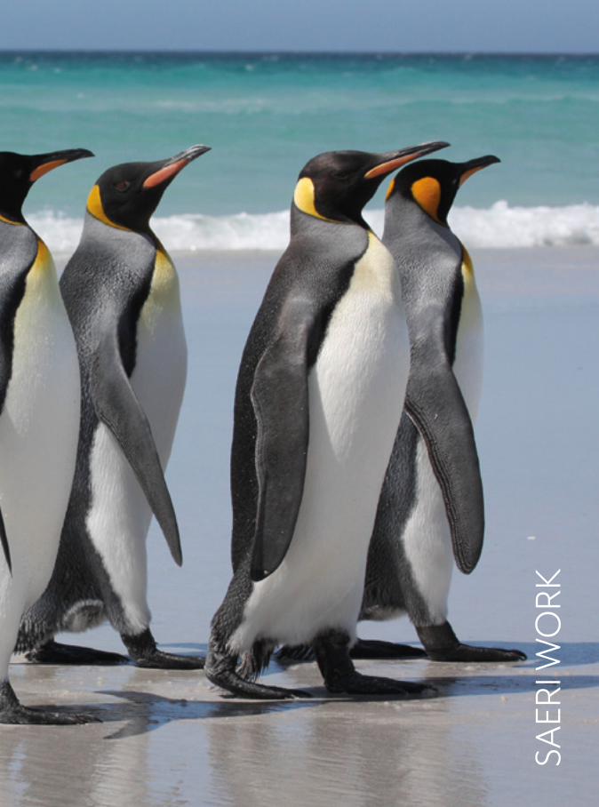
SAER
I WO
RK
46Section 3 cover image: King penguins at Volunteer Point.
FALKLAND ISLANDS
TURKS AND CAICOS ISLANDS
SOUTH SANDWICH ISLANDS
MONTSERRAT
SOUTH GEORGIA
COMPLETED
Montserrat Data Project
COMPLETED
Montserrat FisheriesData integration Project
COMPLETED
Darwin Plus:Dolphins of the Kelp
Data priorities forFalkland’s inshore
cetaceans
4
Information Management System - GIS Data Centre
(plus Scotland)
5
Darwin PlusSoil map and online
database as climate change mitigation tools project
10
Darwin PlusFine scaling the design of Falkland Islands Marine
Management Areas’project
1
Developing MarineSpatial Planning
(MSP) Toolsfor the Turks and
Caicos
7
GAP II project(General marine
science)COMPLETED
MSP Phase II project(General marine
science)
9
BEST 2.0Including other projects
supported by SAERI
2
South Atlantic UKOverseas Territories
Natural CapitalAssessment Project
SAERI W
ORK
| PROJEC
TS
Darwin PlusMapping the coastal
margins of the FalklandIslands and
South Georgia
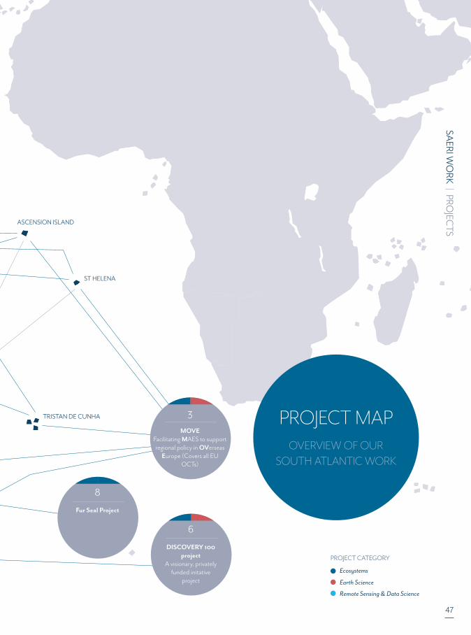
47
PROJECT MAP OVERVIEW OF OUR
SOUTH ATLANTIC WORK
TRISTAN DE CUNHA
ST HELENA
ASCENSION ISLAND
Ecosystems
Remote Sensing & Data Science
Earth Science
PROJECT CATEGORY
6
DISCOVERY 100project
A visionary, privatelyfunded initative
project
3
MOVEFacilitating MAES to support regional policy in OVerseas
Europe (Covers all EU OCTs)
8
Fur Seal Project
SAERI W
ORK
| PROJEC
TS
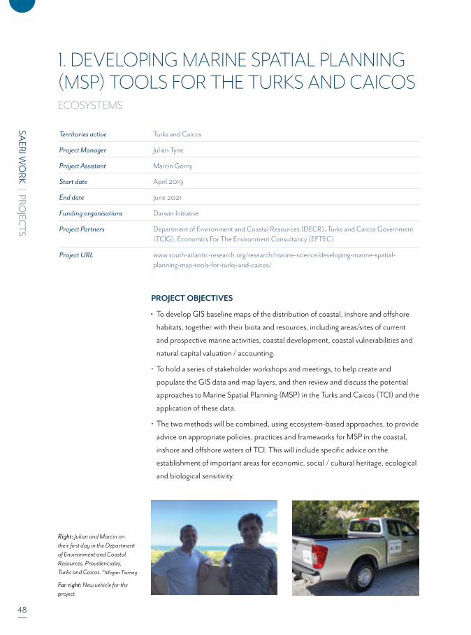
48
SAERI W
ORK
| PROJEC
TS
Territories active Turks and Caicos
Project Manager Julian Tyne
Project Assistant Marcin Gorny
Start date April 2019
End date June 2021
Funding organisations Darwin Initiative
Project Partners Department of Environment and Coastal Resources (DECR), Turks and Caicos Government (TCIG), Economics For The Environment Consultancy (EFTEC)
Project URL www.south-atlantic-research.org/research/marine-science/developing-marine-spatial- planning-msp-tools-for-turks-and-caicos/
1. DEVELOPING MARINE SPATIAL PLANNING (MSP) TOOLS FOR THE TURKS AND CAICOSECOSYSTEMS
PROJECT OBJECTIVES
To develop GIS baseline maps of the distribution of coastal, inshore and offshore
habitats, together with their biota and resources, including areas/sites of current
and prospective marine activities, coastal development, coastal vulnerabilities and
natural capital valuation / accounting.
• To hold a series of stakeholder workshops and meetings, to help create and
populate the GIS data and map layers, and then review and discuss the potential
approaches to Marine Spatial Planning (MSP) in the Turks and Caicos (TCI) and the
application of these data.
• The two methods will be combined, using ecosystem-based approaches, to provide
advice on appropriate policies, practices and frameworks for MSP in the coastal,
inshore and offshore waters of TCI. This will include specific advice on the
establishment of important areas for economic, social / cultural heritage, ecological
and biological sensitivity.
Right: Julian and Marcin on their first day in the Department of Environment and Coastal Resources, Providenciales, Turks and Caicos. ©Megan Tierney
Far right: New vehicle for the project.

SAERI W
ORK
| PROJEC
TS
49
PROJECT OVERVIEW
There are a range of stakeholders working in the Turks
and Caicos Islands (TCI) EEZ, which is rich in biodiversity,
and provides important ecosystem goods and services
including its vital disaster mitigation role. However,
there is risk to the marine environment from resource
extraction and coastal development and such pressures
are likely to intensify.
Through an innovative integrated, stakeholder-led approach
(connecting science and communities), this project builds a
Territory to Territory partnership between the South Atlantic
Environmental Research Institute (SAERI) in the Falklands
Islands and the Department of Environment and Coastal
Resources (DECR) in the Turks and Caicos Islands (TCI)
to Develop Marine Spatial Planning (MSP) Tools for TCI
to feed into long-term planning and decision-making in the
marine environment.
At present TCI has no such holistic strategic approach
to marine management. Existing management and
legislation need to be improved to ensure sustainability.
This project will create the framework and tools to bring
together these functions and uses of the marine
environment, which is essential for developing an MSP in
TCI, and includes a series of reviews, stakeholder meetings
and workshops; an all-island metadata catalogue and
GIS database for analyses and visualisation.
HIGHLIGHTS FOR 2018-19
Project Staff arrived in the Turks and Caicos Islands in
October 2019 to a very warm welcome from the
Department of Environment and Coastal Resources
(DECR) staff. A project management group meeting was
convened and the purchase of a project vehicle, potential
sources of marine data for the Turks and Caicos, data
management and potential stakeholders was discussed.
A project vehicle and a server were purchased and the
initial stage of data mining is being undertaken. At least
20 data layers have been collected and collated,
consisting of coral reefs, seagrass beds and mangrove
habitats, conch and lobster fishing areas, protected
areas, swim zones, dive sites and bathymetric data.
During a site visit to North and Middle Caicos, project
staff saw red mangroves at Mangrove Cay, a small
286-acre uninhabited island located close of the
north-eastern end of Providenciales. Mangroves play
an important environmental role in stabilising the
coastline, reducing erosion from storm surges,
currents, waves, and tides. The intricate root system of
mangroves also makes them attractive to fish and other
organisms seeking food and shelter from predators.
As a nature reserve, fishing, including conch and
lobster, is prohibited, as is the taking of any natural or
historical object from Mangrove Cay.
Above: Grand Turk Workshop.

50
SAERI W
ORK
| PROJEC
TS
North and Middle Caicos are found at the centre of the
Caicos Islands archipelago, a mile-long causeway connects
the two islands that make up most of the land mass of the
Turks and Caicos. At the northern end of Middle Caicos
there’s a beautiful three mile (4.8km) long section of
beach and coastline called Mudjin Harbour, however,
it isn’t really a good place to swim, as waves, rocks, and
sea urchins are common in places.
Left: A simple habitat map created from data provided by the Department of Environment and Coastal Resources (DECR). Right: Turks and Caicos Islands coastal landscape.
Top: Atlantic bottlenose dolphin. Left: DECR and SAERI met with the Governor of the Turks and Caicos Islands His Excellency Nigel John Dakin. Right TGIG and SAERI met with Hon. Ralph L Higgs Minister of Tourism, Environment, Heritage, Maritime, Gaming & Disaster Management .
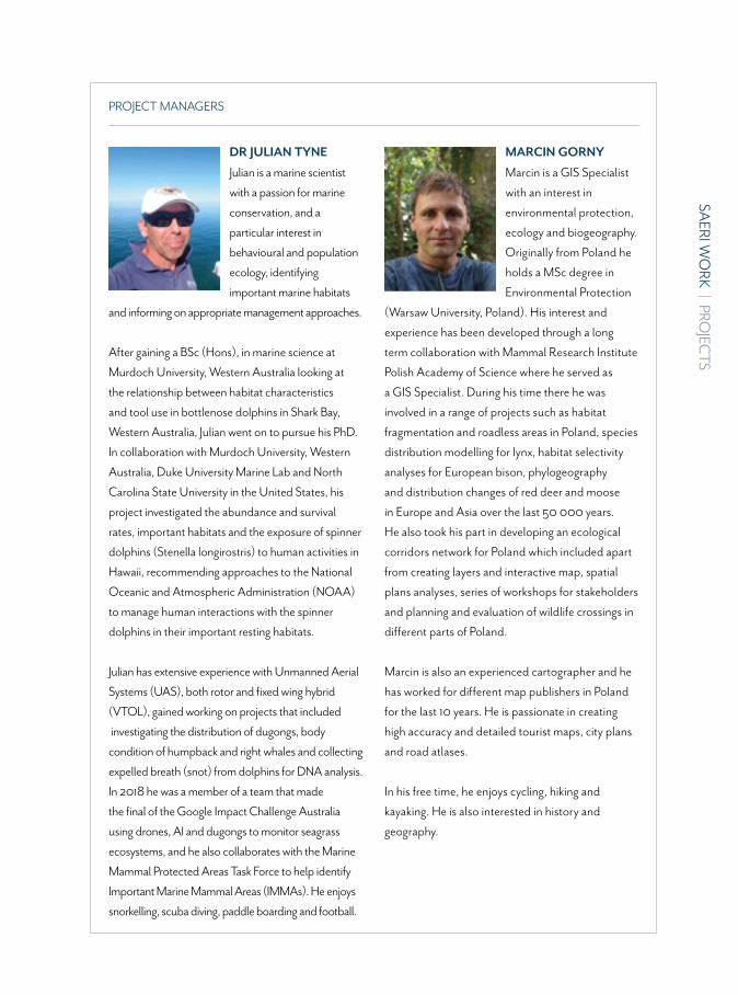
SAERI W
ORK
| PROJEC
TS
51
PROJECT MANAGERS
DR JULIAN TYNE
Julian is a marine scientist with a passion for marine conservation, and a particular interest in behavioural and population ecology, identifying important marine habitats and informing on appropriate management approaches.
After gaining a BSc (Hons), in marine science at Murdoch University, Western Australia looking at the relationship between habitat characteristics and tool use in bottlenose dolphins in Shark Bay, Western Australia, Julian went on to pursue his PhD. In collaboration with Murdoch University, Western Australia, Duke University Marine Lab and North Carolina State University in the United States, his project investigated the abundance and survival rates, important habitats and the exposure of spinner dolphins (Stenella longirostris) to human activities in Hawaii, recommending approaches to the National Oceanic and Atmospheric Administration (NOAA) to manage human interactions with the spinner dolphins in their important resting habitats.
Julian has extensive experience with Unmanned Aerial Systems (UAS), both rotor and fixed wing hybrid (VTOL), gained working on projects that included investigating the distribution of dugongs, body condition of humpback and right whales and collecting expelled breath (snot) from dolphins for DNA analysis. In 2018 he was a member of a team that made the final of the Google Impact Challenge Australia using drones, AI and dugongs to monitor seagrass ecosystems, and he also collaborates with the Marine Mammal Protected Areas Task Force to help identify Important Marine Mammal Areas (IMMAs). He enjoyssnorkelling, scuba diving, paddle boarding and football.
MARCIN GORNY
Marcin is a GIS Specialist with an interest in environmental protection, ecology and biogeography. Originally from Poland he holds a MSc degree in Environmental Protection (Warsaw University, Poland). His interest and experience has been developed through a long term collaboration with Mammal Research Institute Polish Academy of Science where he served as a GIS Specialist. During his time there he was involved in a range of projects such as habitat fragmentation and roadless areas in Poland, species distribution modelling for lynx, habitat selectivity analyses for European bison, phylogeography and distribution changes of red deer and moose in Europe and Asia over the last 50 000 years. He also took his part in developing an ecological corridors network for Poland which included apart from creating layers and interactive map, spatial plans analyses, series of workshops for stakeholders and planning and evaluation of wildlife crossings in different parts of Poland.
Marcin is also an experienced cartographer and he has worked for different map publishers in Poland for the last 10 years. He is passionate in creating high accuracy and detailed tourist maps, city plans and road atlases.
In his free time, he enjoys cycling, hiking and kayaking. He is also interested in history and geography.
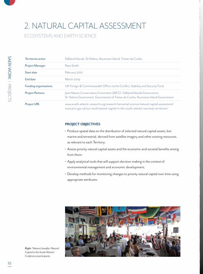
52
SAERI W
ORK
| PROJEC
TS
Territories active Falkland Islands, St Helena, Ascension Island, Tristan da Cunha
Project Manager Ness Smith
Start date February 2017
End date March 2019
Funding organisations UK Foreign & Commonwealth Office via the Conflict, Stability and Security Fund
Project Partners Joint Nature Conservation Committee (JNCC), Falkland Islands Government, St Helena Government, Government of Tristan da Cunha, Ascension Island Government
Project URL www.south-atlantic-research.org/research/terrestrial-science/natural-capital-assessment/ www.jncc.gov.uk/our-work/natural-capital-in-the-south-atlantic-overseas-territories/
2. NATURAL CAPITAL ASSESSMENT ECOSYSTEMS AND EARTH SCIENCE
PROJECT OBJECTIVES
Produce spatial data on the distribution of selected natural capital assets, bot
marine and terrestrial, derived from satellite imagery and other existing resources,
as relevant to each Territory;
Assess priority natural capital assets and the economic and societal benefits arising
from them;
Apply analytical tools that will support decision making in the context of
environmental management and economic development;
Develop methods for monitoring changes to priority natural capital over time using
appropriate attributes.
Right: ‘Nature’s benefits: Natural Capital in the South Atlantic’ Conference participants.
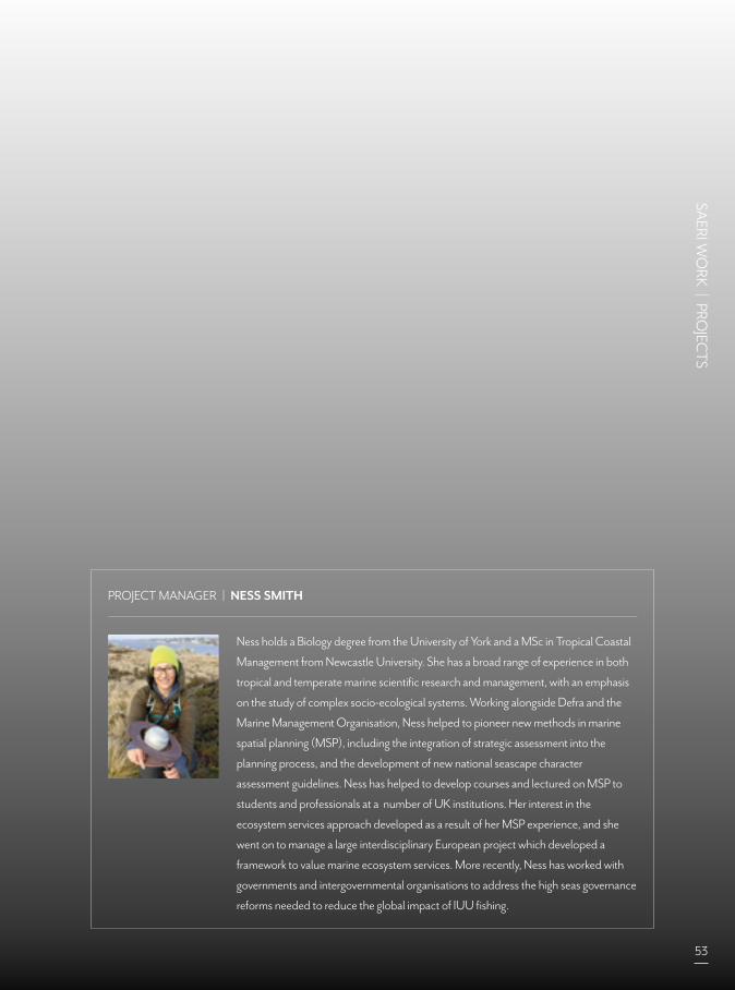
SAERI W
ORK
| PROJEC
TS
53
PROJECT MANAGER | NESS SMITH
Ness holds a Biology degree from the University of York and a MSc in Tropical Coastal
Management from Newcastle University. She has a broad range of experience in both
tropical and temperate marine scientific research and management, with an emphasis
on the study of complex socio-ecological systems. Working alongside Defra and the
Marine Management Organisation, Ness helped to pioneer new methods in marine
spatial planning (MSP), including the integration of strategic assessment into the
planning process, and the development of new national seascape character
assessment guidelines. Ness has helped to develop courses and lectured on MSP to
students and professionals at a number of UK institutions. Her interest in the
ecosystem services approach developed as a result of her MSP experience, and she
went on to manage a large interdisciplinary European project which developed a
framework to value marine ecosystem services. More recently, Ness has worked with
governments and intergovernmental organisations to address the high seas governance
reforms needed to reduce the global impact of IUU fishing.

54
SAERI W
ORK
| PROJEC
TS
PROJECT OVERVIEW
Natural Capital is a term used to describe the earth's
stocks of natural assets which include geology, soil, air,
water and all living things. From this natural capital,
humans derive a wide range of services, often called
ecosystem services, which make human life possible.
The Natural Capital Assessment (NCA) project is
funded by the FCO-managed Conflict, Stability and
Security Fund (CSSF) through the UK Government’s
Department for Environment, Food and Rural Affairs
(Defra) and implemented by the Joint Nature
Conservation Committee (JNCC). SAERI has been
tasked by JNCC to deliver the project for the South
Atlantic Overseas Territories.
The aim is to develop a framework for the South
Atlantic UK Overseas Territories to assess the value
- both monetary and non-monetary - of priority
ecosystem services, and to integrate this information
into marine and terrestrial spatial planning, economic
planning and environmental protection.
The project will assist the UK South Atlantic Overseas
Territories to assess and map natural capital, value
priority assets and deploy decision support tools to
secure long-term economic benefits from the
sustainable management of their natural assets.
This support will be provided through the development
and collation of spatial evidence, and a Territory-to-
Territory partnership for technical exchange and
capacity building within the UK's Overseas Territories
in the region.
HIGHLIGHTS FOR 2018-19
The project drew to its conclusion in March 2019.
A round-up Regional Natural Capital Conference was
hosted by St. Helena in March 2019. The conference
entitled ‘Nature’s benefits: Natural Capital in the South
Atlantic’ brought together participants from across all
UK Overseas Territories (UKOTs) in the region
consolidated the final outputs of the Natural Capital.
Assessment Project The conference was well received
on-Island with up to 120 people attending each day to
take part in political exchanges and talks on a range of
topics about nature's benefits. Around 600+ listeners
also tuned into the conference, which was broadcast
live via local radio and online over the three-day period,
showing how important the environment and the
Natural Capital approach is to all of the South Atlantic
islands.
Around 30 grey literature reports were produced by the
project that focussed on Natural Capital Assessment
priorities identified by on-island stakeholders. These
ranged from Cultural Ecosystem Services assessments
across all of the islands to understanding the value of
tourism; to producing land-use planning models.
A Land-Use Model WebGIS project was developed
which visualises a range of spatial data sets relating to
Land Use and Land Use planning on St. Helena.
This includes mapping scenarios for future
development such as increased coffee and food
production.
Above: WebGIS of Land-Use model for St. Helena

SAERI W
ORK
| PROJEC
TS
55
3. MOVEFACILITATING MAPPING AND ASSESSMENT OF ECOSYSTEM SERVICES (MAES) TO SUPPORT REGIONAL POLICY IN OVERSEAS EUROPE:MOBILIZING STAKEHOLDERS AND POOLING RESOURCES
ECOSYSTEMS AND EARTH SCIENCE
Territories active Falkland Islands, Ascension Island, St. Helena, Tristan da Cunha
Project coordinators Tara Pelembe and Teresa Bowers
Start date April 2018
End date March 2021
Funding organisation European Commission
Project Partners Fundo Regional para a Ciência e a Tecnologia (FRCT), Wolfs Company, University of La Laguna, Institut de Recherche pour Le Développement, Gottfried Wilhelm Leibniz Universität Hannover, Universidad Autónoma de Madrid, Universitá degli Studi di Trento, Université de la Réunion, Nova Blue Environment, Asociación Biodiversidad Atlántica y Sostenibilidad (ABAS) University of Portsmouth Higher Education Corporation, Centre de Coopération Internationale en Recherche Agronomique pour Le Développement, Vrije Universiteit Amsterdam Institute For Environmental Studies (IVM), Faculty of Science
Project URL www.moveproject.eu/
www.south-atlantic-research.org/research/terrestrial-science/move-mapping-and-assessing -benefits-coming-from-the-european-overseas-ecosystems/
PROJECT OBJECTIVES
The MOVE pilot project intends to involve policy makers, researchers and the civil
society in the development of methodologies for mapping and assessing the state
of ecosystems and their services in ORs and OCTs. A coordinated and synergistic
approach is advocated to turn the geographical, political and knowledge base
fragmentation of these entities into assets, pooling resources and building robust
participatory tools.
The project will start by assessing the state of the art of the MAES exercise within
the participating overseas regions, and by inventorying and motivating the human
and material capacities present in each of them. It will then choose as case studies
eight specific regions and a particular contribution on which to focus the work of a
dedicated team of local experts, policy makers and civil society members, pooled
from across the OR and OCTs.
In addition to producing a tangible contribution for the MAES exercise, this project
aims to demonstrate the possibility and the advantage of a bottom-up approach,
involving and capacitating local actors.

56
SAERI W
ORK
| PROJEC
TS
HIGHLIGHTS FOR 2018-19
SAERI presented the MOVE project in
a regional context via a poster
presentation at the South Atlantic
Regional Natural Capital Assessment
Conference hosted by St. Helena in
March 2019.
SAERI contributed to the project
discussions and decisions around the
development of case studies for the
project, one of which will be focussed
on the Falkland Islands.
Top right: A summary of the Falklands case study
Right: MOVE poster on display at the poster session during the South Atlantic Regional Conference on Natural Capital Assessment.
Opposite: Labidiaster radiosusAKA sun star. ©SMSG
In addition to producing a tangible contribution for the MAES exercise, this project
aims to demonstrate the possibility and the advantage of a bottom-up approach,
involving and capacitating local actors.
If successful, this project will allow testing and implementing the MAES methodology
in different world regions, providing methodologies and good practice guidelines,
thus contributing to a worldwide EU leadership in this field.
The project covers all of the EU ORs and OCTs. SAERI is leading on input relating to
the South Atlantic Overseas Territories.

SAERI W
ORK
| PROJEC
TS
57

58
SAERI W
ORK
| PROJEC
TS
4. INFORMATION MANAGEMENT SYSTEM (IMS)-GIS DATA CENTRE
Territories active Falkland Islands, Ascension Island, Saint Helena, Tristan da Cunha, Montserrat, Scotland
Project Manager Ilaria Marengo
Project Team Members Jorge Luis Batista Echevarria (pb) from 23rd June 2018
Start date February 2017
End date March 2019
Funding organisations SAERI, FIG, University of Dundee (Satellite Receiving Station and Centre for Remote Environments) Joint Nature Conservation Committee
Project URL www.south-atlantic-research.org/research/data-science/
PROJECT OBJECTIVES
Produce spatial data on the distribution of selected natural capital assets, bot marine and terrestrial, derived from satellite imagery and other existing resources, as relevant to each Territory;
Assess priority natural capital assets and the economic and societal benefits arising from them;
Apply analytical tools that will support decision making in the context of environmental management and economic development;
Develop methods for monitoring changes to priority natural capital over time using appropriate attributes.
PROJECT OVERVIEW
In the last 5 years, the South Atlantic Environmental Research Institute (SAERI) has
developed and implemented the Information Management System (IMS) GIS Data
Centre for the UKOTs in the South Atlantic region. Ascension Island, Falkland Islands
and Saint Helena Governments have been active participants in its set-up. The IMS-GIS
Data Centre has since expanded its geographical range and is supporting a number of
projects globally including the Caribbean.
From May 2018, the IMS-GIS Data Centre has been working in partnership with the
University of Dundee to support “Phase II” which aims to upgrade some of the current
data services offered, and expand its offering to include elements such as a more functional
data portal for an improved metadata discovery and data accessibility, and an image
catalogue for managing and analysing images which are a growing part of the type of data
collected by scientists during their research projects.

SAERI W
ORK
| PROJEC
TS
59
HIGHLIGHTS FOR 2017-18
Towards the end of 2018 SAERI was been
commissioned by the Joint Nature Conservation
Committee (JNCC) to deliver an open source based
data portal and webGIS services to the Government
of Montserrat (GOM). GOM GIS data man-ager Mrs
Lavern Ryan was the contact point of the Government
of Montserrat and the SAERI IMS-GIS data centre team
included Andrew Brooks (Software developer at the
Satellite Receiving Station of the University of Dundee).
Carl Cilenti, JNCC IT manager, provided support for
setting up the server which hosts the data services.
The preparatory work was carried out in the UK before
being transferred to Montserrat where the team worked
on island for a two week period before the official
launch of both data portal (www.gisdataportal.gov.ms)
and the webGIS (www.webgis.gov.ms) at the end of
March 2019.
In parallel to the development of the data portal for
Montserrat, time has been spent in preparing a smilar
service for the Falkland Islands as well, using the same
structure although customised to meet the
requirements of the territory in the South Atlantic
region (e.g. slightly different metadata structure, front
page, management of data requests etc). The main
draft of the portal for the Falkland Islands was delivered
at the end of March, however its publication resulted
more complex and required additional work on the
settings of the hosting server.
Above: Examples of St. Helena natural capital scenario mapping.

60
SAERI W
ORK
| PROJEC
TS
The Natural Capital Assessment (NCA) project
required the support of the data centre both for
integrating GIS to the Bayesian Network Analyses
(BN-GIS) and for the overall data management. The
goal of the exercise was to support the Natural Capital
assessment process on St. Helena using
socio-ecological models based on Bayesian Networks.
The GIS integration is to allow the results of the model
to be mapped and visualised by the stakeholders.
The bnspatial R pack-age has been a very useful tool
and it has been adapted to be functional to the
St Helena study. Outputs are maps of either expected
value or state given known and unknown conditions
specified in the network, maps of uncertainty measured
as coefficient of variation or Shannon index
(entropy), maps of probability associated to any states
of any node in the network. Additionally, the BN-GIS
integration tool visualises scenarios, which have been
developed through stakeholders input. The results from
the project are available here (www.data.jncc.gov.uk/
data/bcb4e6a3-02dc-44a6-88d1-f59be6c242a1/
ot-nca-sup-sat-32-sth-apr2019.pdf )
Through the NCA project a second GIS analysis was
carried out and focussed on identifying suitable areas
for a landfill in Saint Helena. The work entailed a
multi-criteria analysis on data provided by various
departments of Saint Helena Gov-ernment and
resulted in a publications (www.data.jncc.gov.uk/data
/34e6c807-f83b-46ef-ad40-ef93f58813b3/
ot-nca-sup-sat-08-sth-mapping-oct2018.pdf)
Above: Automating the count of albatross with ORBIT image segmentation.

iLaria joined SAERI in
September 2013 as GIS
specialist and project
manager and her task was
to set up the Information
Management System and
GIS Centre for the South
Atlantic UK Overseas
Territories (UK SAOTs). The project was funded for
two years by the Foreign Commonwealth Office (FCO)
and it was overseen by the Joint Nature Conservation
Committee (JNCC). After the first couple of years of
development, iLaria led the implementation of the
Centre, which succeeded in identifying the strengths
and weaknesses of the island-based data management
system. May 2018 saw the start of “phase 2” of the IMS-
GIS data centre in collaboration with the University of
Dundee. This phase was focused on further
development of the reach of data services for the UK
SAOT, and reflects Ilaria’s passion for new challenges
and making spatial tools open to people and facilitate
their jobs. Particular emphasis was given to creating
a data portal and to developing an image catalogue
using OMERO.
iLaria’s educational background is a degree in Geography
(Genoa, 2001), a MSc in Remote Sensing and Image
Processing (Dundee, 2006), a PhD on GIS and spatial
multivariate statistics as tool for assessing the character
of the Scottish landscape (Stirling, 2010).
Jorge a.k.a. “pb”
Echevarría graduated as
an Engineer in
Automatics from the
Universidad Central de
Las Villas UCLV, Cuba,
in 2000, and is one of
the core members of the
Open Geospatial Community in America. An active
proponent of Open Source, he is also dedicated
to the free access to data and the creation of data
communities. He was a member of the OSGeo
Spanish Local Chapter Board of Directors from
2008 to 2011, and has been an OSGeo Charter
Member since 2016. He organised the
OpenStreetMap community in Cuba from scratch,
actively contributing to open projects such as
Mapillary, Pangea and CubaConf. Working over
a decade as a systems analyst for the
multidisciplinary team at the Software
Development Group in the IT Division of the
Historians’ Office of Havana, he has gained a wide
background in Open Data management and
software development. He joined the SAERI team
for 12 months to cover a secondment, arriving in
June of 2018 to join the SAERI’s Data Centre as
IMS-GIS Data manager.
SAERI W
ORK
| PROJEC
TS
61
GIS SPECIALIST AND PROJECT MANAGERDR ILARIA MARENGO
IMS-GIS DATA MANAGER – FALKLANDS JORGE L. BATISTA

62
SAERI W
ORK
| PROJEC
TS
Territories active Falkland Islands
Project Manager Dr Stefanie Carter
Start date April 2018
End date July 2020
Funding organisations Darwin Initiative
Project Partners SAERI, Falkland Islands Government, The James Hutton Institute, Centre for Ecology & Hydrology, Natural History Museum, University of Magallanes, Falkland Islands Trust Shackelton Scholarship Fund
Project URL www.south-atlantic-research.org/research/terrestrial-science/soil-map-and-online-database- as-climate-change-mitigation-tools/
5. DARWIN PLUS SOIL MAP AND ONLINE DATABASE AS CLIMATE CHANGE MITIGATION TOOLS
EARTH SCIENCE
PROJECT OBJECTIVES
Create a national soil map for the Falkland Islands
• Provide an interactive online tool for land managers to improve farm outputs sustainably
• Establish a baseline for erosion, peatlands and carbon stock for climate change mitigation
Top: Port North
Bottom left: Field work at Goose Green
Bottom right: Soil horizons

SAERI W
ORK
| PROJEC
TS
63
PROJECT OVERVIEW
The project uses a combination of remote sensing, soil
modelling and fieldwork to create a soil map for the
Falkland Islands as well as interactive maps for the
local land managers. Climate change has created drier
conditions across the Falkland Islands and inappropriate
land management in the wrong areas may exacerbate
the effect. It is therefore important to provide detailed
information on the soil characteristics for land managers
but also to create a baseline for erosion, peat and carbon
stock. Three fieldwork periods that include chemical
and microbiological analyses of soil samples will provide
the necessary ground data upon which the maps will be
created.
HIGHLIGHTS FOR 2018-19
The arrival of the project manager Steffi Carter in August
2018 brought the project to a full swing. Steffi organised
for all the equipment to arrive on time for the start of the
field season in November and the two field campaigns
were clearly the highlight of the year. Steffi and Roberto
Jara Langhaus – a contracted soil surveyor from Chile
– were able to complete 113 soil survey points across
32 farms on East and West Falkland. They were joined
for some of the work by project partners Sergio Radic
Schilling from the Universidad de Magallanes and Anne
D. Jungblut from the Natural History Museum. Anne col-
lected soil samples at 38 sites to study the microbiology.
DNA sequencing will enable her to report on the bacteria
and microfungi present in Falkland soils.
The fieldwork team encountered a variety of soil types.
Peat depth ranged from only a few centimetres in
Leptosols (shallow soil) to a record 8 m in a Histosol
(deep peat) at Johnsons Harbour. Other soil types
encountered included periodically waterlogged soils with
strong mottling, and Podzols, which are characterised
by an eluviation horizon from which all minerals were
leached out and are then accumulated in the horizon
below, which possesses a strong reddish-brown colour.
Project partner Gordon Lennie at the Falkland Islands
Government Department of Agriculture also spent a
considerable amount of time in the lab analysing all the
soil samples. The data he provided allowed project
partner Matt Aitkenhead from The James Hutton
Institute to generate some preliminary maps which
were used to demonstrate to local stakeholders what
outcomes the project will produce.
Project partner Jim McAdam from the UK Falkland Island
Trust also visited the Falklands in order to engage with
local stakeholders on the project. Steffi and Jim organised
two workshops – one in Stanley and one at Fox Bay in
order to allow land managers to feedback into the project
and to direct the outcomes so that they are most
applicable and accessible to them. Additionally, Jim
visited many landowners directly to include as many
people as possible and spoke to local politicians as well in
order to raise awareness of the project.
PROJECT MANAGER | DR STEFANIE CARTER
Steffi gained her PhD at Aberystwyth University, studying the impact of ditch-
blocking on a blanket bog on gas, vegetation and insects. She also possesses an
MSc in Managing the Environment which focussed on habitat restoration and a
BSc in Countryside Conservation. Her previous fieldwork in remote parts of North
Wales prepared her well for the challenging environment of the Falkland Islands.
She arrived in the Falklands in August 2018 and joined SAERI to lead the two-and-
a-half year Darwin Plus Soil Mapping project.
64
SAERI W
ORK
| PROJEC
TS
6. DISCOVERY 100ECOSYSTEMS AND EARTH SCIENCE
PROJECT OBJECTIVES
Understand the propagating effects of Antarctic climate change globally by using
• South Georgia as a sentinel site.
• Establish a baseline understanding of the current environment and ecosystems on and around South Georgia
• Install the first fully integrated Subantarctic Long-Term Ecological Research station to monitor environmental and
ecosystem change
• Develop into a self-sustained long-term monitoring initiative partnered with numerous international bodies
PROJECT OVERVIEW
Discovery 100 is being designed so it can be implemented in a phased approach and be delivered over a number
of years. The aim is to install equipment and design projects in the right order to ensure that the project reaches its
proposed goals whilst maintain the science impact it was envisioned to deliver.
7. GAP PROJECTECOSYSTEMS
PROJECT OVERVIEW
This was a hugely ambitious project and had been extremely successful. All of the projects have been delivered except
for a loligo egg survey and this will take place at the end of the 2nd season. There have been many accomplishments
but one notable success this year was the publication of a synthesis of all GAP’s higher predator work. The paper is
titled ‘Important at-sea areas of colonial breeding marine predators of the southern Patagonian shelf’ published in
Nature Scientific Reports. The paper is a collaboration of many the of worlds movement ecology experts. Another
notable success is that the Loligo survey will be going ahead after the 2nd season and we’ll purchase an RoV that will
remain in the islands for future work.
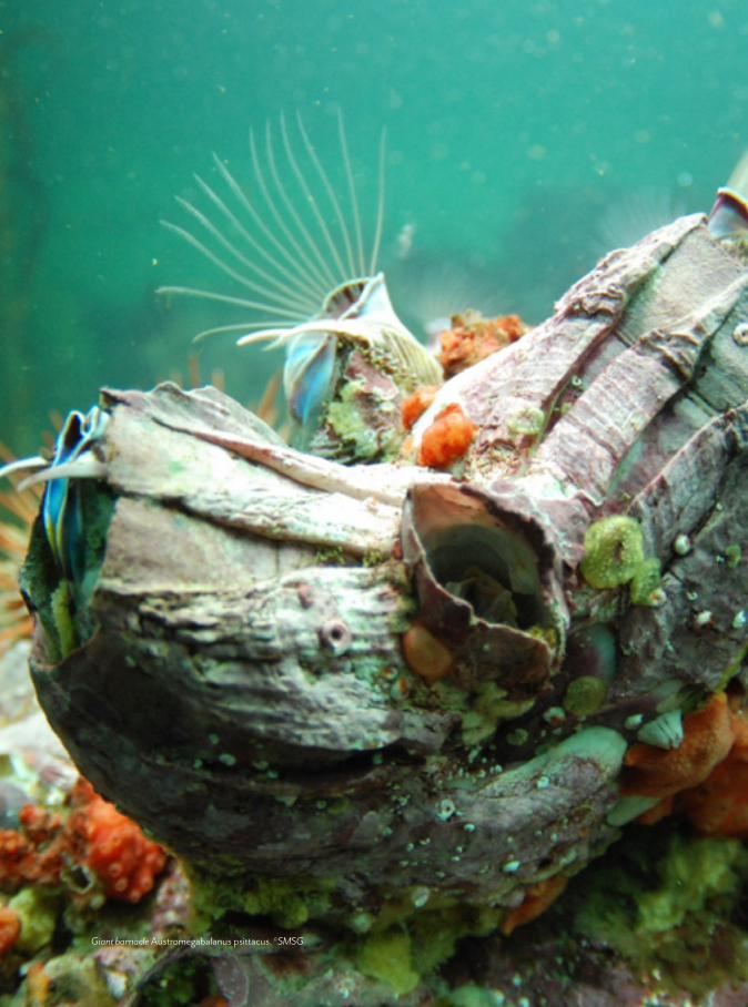
SAERI W
ORK
| PROJEC
TS
65
Giant barnacle Austromegabalanus psittacus. ©SMSG

66
SAERI W
ORK
| PROJEC
TS
Project Manager Dr Alastair Baylis
Start date Jan 2018
End date Dec 2020
Funding organisations ROC Waitt Grant, Winifred Violet Scott Fund, FIG Environmental Studies Budget, PADI, Falkland Islands Fishing Companies Association (FIFCA)
Project Partners Dr Rachael Orben (OSU), Dr Iain Staniland (BAS)
8. FUR SEAL PROJECTECOSYSTEMS
PROJECT OBJECTIVES
Determine the abundance of fur seals in the Falkland Islands and confirm the location
of breeding colonies
• Quantify seal-fishery interaction on the Patagonian Shelf
PROJECT OVERVIEW
The Fur Seal project was initiated in 2018 in response to an increase in seal-fishery
interaction and a desire by industry, government and SAERI to better understand
potential environmental impacts. Accordingly, the fur seal project is a collaborative
project with government and industry. In 2018, our achievements included a population
census, which provided the first pup abundance estimates since the 1930s and revealed
that the Falkland Islands is home to the largest South American fur seal breeding
Right: Spot the tracker. An adult female South American fur seal carry a GPS tag returns to Bird Island, winter 2019. ©Al Baylis

SAERI W
ORK
| PROJEC
TS
67
population in the world. In 2019, the project shifted
gears and focussed on quantifying the at-sea movements
of fur seals. For the first time we deployed satellite tags at
Jason West Cay, which is the largest fur seal breeding col-
ony in the Falklands with 12,000 pups born annually (or
33 % of the total pup production at the Falkland Islands).
We also repeated the deployment of GPS tags at Bird
Island, which provided fine scale data on fur seal
movement and diving behaviour. The project is now in
the final stages of analysis and reporting.
HIGHLIGHTS FOR 2018-19
In total, 35 adult female fur seals where tracked over
two seasons of field work (2018 and 2019).
This included 9 satellite tags deployed on adult female
fur seals breeding at Jason West Cay, the largest
Falklands breeding colony.
Census paper published and available on-line: Baylis
AMM et al (2019) Re-evaluating the population size of
South American fur seals in the Atlantic and
conservation implications. Aquat Conserv Mar Freshw
Ecosyst www.onlinelibrary.wiley.com/doi/abs/10.1002/
aqc.3194.
Collated available tracking data for sea lions and fur
seals and using this data to quantify seal-fishery
interactions over the entire Patagonian Shelf.
PROJECT MANAGER | DR AL BAYLIS
Al is a movement ecologist with a broad interest in the ecology and conservation
biology of marine predators. His main focus in recent years has been to develop
unique and multidisciplinary projects on little studied pinniped populations
breeding at the Falkland Islands, in collaboration with colleagues from around the
world. This research includes understanding the processes governing past changes
in population abundance, and the ecological, genetic and conservation
consequences of historical population crashes. His PhD (2004-2008) explored
seasonal and colony differences in the foraging ecology of New Zealand fur seals.
He also has a Postgraduate Certificate in Veterinary Conservation Medicine (2014),
which reflects his interest and expertise in pinniped aneasthesia.
Top: An example of the at-sea movements of female fur seals. Each colour represents the GPS track of an individual seal. The circles represent areas where seals encountered fishing vessels – that is, when seals and fishing vessels were within 1 km of one-another at the same time (i.e., temporally and spatially matched).
Above: South American fur seals are one of two Otariids (eared seals) that breed at the Falkland Islands, the other Otariid seal being Southern sea lions. ©Al Baylis
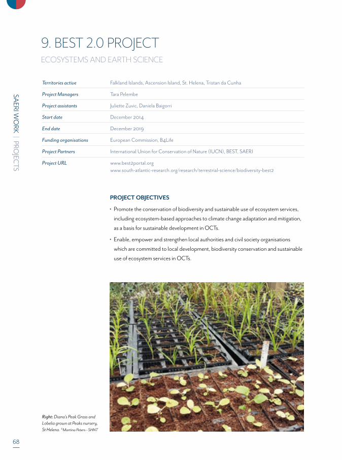
68
SAERI W
ORK
| PROJEC
TS
9. BEST 2.0 PROJECTECOSYSTEMS AND EARTH SCIENCE
PROJECT OBJECTIVES
Promote the conservation of biodiversity and sustainable use of ecosystem services,
including ecosystem-based approaches to climate change adaptation and mitigation,
as a basis for sustainable development in OCTs.
Enable, empower and strengthen local authorities and civil society organisations
which are committed to local development, biodiversity conservation and sustainable
use of ecosystem services in OCTs.
Right: Diana's Peak Grass and Lobelia grown at Peaks nursery, St Helena. ©Martina Peters - SHNT
Territories active Falkland Islands, Ascension Island, St. Helena, Tristan da Cunha
Project Managers Tara Pelembe
Project assistants Juliette Zuvic, Daniela Baigorri
Start date December 2014
End date December 2019
Funding organisations European Commission, B4Life
Project Partners International Union for Conservation of Nature (IUCN), BEST, SAERI
Project URL www.best2portal.org www.south-atlantic-research.org/research/terrestrial-science/biodiversity-best2
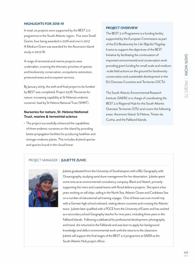
SAERI W
ORK
| PROJEC
TS
69
HIGHLIGHTS FOR 2018-19
In total, six projects were supported by the BEST 2.0
programme in the South Atlantic region. Five were Small
Grants, four being awarded in 2016 and one in 2017.
A Medium Grant was awarded for the Ascension Island
study in 2017/18.
A range of terrestrial and marine projects were
undertaken, covering the thematic priorities of species
and biodiversity conservation, ecosystems restoration,
protected areas and ecosystem services.
By January 2019, the sixth and final project to be funded
by BEST was completed: Project 2276 ‘Nurseries for
nature: increasing capability at St Helena’s endemic
nurseries’ lead by St Helena National Trust (SHNT).
Nurseries for nature, St. Helena National Trust, marine & terrestrial science
The project successfully enhanced the capabilities
of three endemic nurseries on the island by providing
better propagation facilities for producing healthier and
stronger endemic plants. This includes dryland species
and species found in the cloud forest.
PROJECT OVERVIEW
The BEST 2.0 Programme is a funding facility,
supported by the European Commission as part
of the EU Biodiversity for Life (B4Life) Flagship.
It aims to support the objectives of the BEST
Initiative by facilitating the continuation of
important environmental and conservation work
providing grant funding for small-scale and medium
-scale field actions on the ground for biodiversity
conservation and sustainable development in the
EU Overseas Countries and Territories (OCTs).
The South Atlantic Environmental Research
Institute (SAERI) is in charge of coordinating the
BEST 2.0 Regional Hub for the South Atlantic
Overseas Territories (OTs) and covers the following
areas: Ascension Island, St Helena, Tristan da
Cunha, and the Falkland Islands.
PROJECT MANAGER | JULIETTE ZUVIC
Juliette graduated from the University of Southampton with a BSc Geography with
Oceanography, studying sand dune management for her dissertation. Juliette spent
some time at an environmental consultancy company, Black and Veatch, primarily
supporting the rivers and coastal teams with flood defence projects. She spent a few
years working on tall ships, sailing in the North Sea, Atlantic Ocean and Caribbean Sea
on a number of educational sail training voyages. One of these was a six-month trip
with a German high school onboard, visiting eleven countries and crossing the Atlantic
twice. Juliette later qualified with a PGCE from the University of Exeter and has worked
as a secondary school Geography teacher for nine years, including three years in the
Falkland Islands. Following a sabbatical for professional development, photography
and travel, she returned to the Falklands and was keen to apply her background
knowledge and skills in environmental work until she returns to the classroom.
Juliette will support the final stages of the BEST 2.0 programme at SAERI as the
South Atlantic Hub project officer.

70
SAERI W
ORK
| PROJEC
TS
Above: Millenium forest and airstrip. ©Martina Peters - SHNT
Top: Teaplant next to Gumwood seedlings. ©Martina Peters - SHNT. Above: Nursery Officer with Salad Plant in nursery. ©Martina Peters - SHNT
Two nurseries increased their production area through
construction of new nursery facilities. The new shade
house was built at the Millennium Forest with benching,
irrigation and soil sterilisation systems and an open day
was hosted. At the Peaks Nursery, there was successful
construction of a new polytunnel and upgraded tools
and equipment.
Scotland nursery received a laminar flow cabinet for
fern propagation. Experimental fern propagation trials
were carried out for three species of fern (St Helena
Lobelia (Timeris scaevolifolia), St Helena Whitewood
(Petrobium arboreum) and Diana’s Peak grass (Carex
dianae). Training was given to the workers at the
nurseries and increased dialogue between staff, as well
as the physical equipment now in place, will provide
long-term sustainability.
SAERI W
ORK
| PROJEC
TS
71
Territories active Falkland Islands
Project Manager Dr Ander M. de Lecea
Project Assistants Dr Marina Costa, Lauren Shea
Start date Apr 2018
End date Dec 2020
Funding organisations Darwin Initiative, Falkland Islands Government – Environmental Studies Budget, Shackleton Scholarship Fund
Project Partners Falkland Islands Government (FIG), Shallow Marine Surveys Group (SMSG), British Antarctic Survey (BAS), Oregon State University, University of St Andrews
Project URL www.south-atlantic-research.org/research/marine-science/fine-scaling-the-design-of- falkland-islands-marine-management-areas
10. FINE SCALING THE DESIGN OF FALKLAND ISLANDS MARINE MANAGEMENT AREASECOSYSTEMS
PROJECT OBJECTIVES
Increase knowledge on the benthos of the Falkland Islands.
Improving marine conservation, protection or management including developing
integrated marine management plans.
Developing ecosystem-based initiatives for the conservation and sustainable use of
terrestrial and marine environments.
Developing data systems on biodiversity.
Right: James Clark Ross in the Antarctica prior to the commencement of the 2nd offshore work. ©Ander M. de Lecea
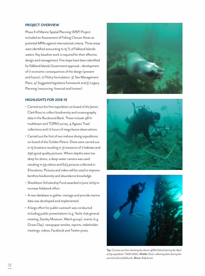
72
PROJECT OVERVIEW
Phase II of Marine Spatial Planning (MSP) Project
included an Assessment of Fishing Closure Areas as
potential MPAs against international criteria. Three areas
were identified amounting to 15 % of Falkland Islands
waters. Key baseline work is required for their effective
design and management. Five steps have been identified
for Falkland Islands Government approval – development
of 1) economic consequences of the design (present
and future), 2) Policy formulation, 3) Site Management
Plans, 4) Suggested legislative framework and 5) Legacy
Planning (resourcing, financial and human).
HIGHLIGHTS FOR 2018-19
Carried out the first expedition on board of the James
Clark Ross to collect biodiversity and oceanography
data in the Burdwood Bank. These include 48 hr
multibeam and TOPAS survey, 4 Agassiz Trawl
collections and 12 hours of mega fauna observations.
Carried out the first of two inshore diving expeditions
on board of the Golden Fleece. Dives were carried out
in 15 locations resulting in 31 transects of 7 habitats and
290 good quality pictures. Where depths were too
deep for divers, a deep-water camera was used
resulting in 59 videos and 623 pictures collected in
8 locations. Pictures and video will be used to improve
benthos biodiversity and abundance knowledge.
Shackleton Scholarship Fund awarded in June 2019 to
increase fieldwork effort.
A new database to gather, manage and provide marine
data was developed and implemented.
A large effort for public outreach was conducted
including public presentations (e.g. Yacht club general
meeting, Stanley Museum, Watch group), events (e.g.
Ocean Day), newspaper articles, reports, stakeholder
meetings, videos, Facebook and Twitter posts.
Top: Curious sea-lion checking the divers off Bird Island during the April 2019 expedition ©SAERI/SMSG. Middle: Diver collecting data during the second inshore fieldwork. Above: Kelp forest.
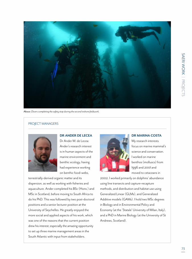
SAERI W
ORK
| PROJEC
TS
73
PROJECT MANAGERS
DR ANDER DE LECEA
Dr Ander M. de Lecea:
Ander’s research interest
is in human aspects of the
marine environment and
benthic ecology, having
had experience working
on benthic food-webs,
terrestrially-derived organic matter and its
dispersion, as well as working with fisheries and
aquaculture. Ander completed his BSc (Hons.) and
MSc in Scotland, before moving to South Africa to
do his PhD. This was followed by two post-doctoral
positions and a senior lecturer position at the
University of Seychelles. He greatly enjoyed the
more social and applied aspects of his work, which
was one of the reasons that the current position
drew his interest; especially the amazing opportunity
to set up three marine management areas in the
South Atlantic with input from stakeholders.
DR MARINA COSTA
My research interests
focus on marine mammal's
science and conservation.
I worked on marine
benthos (molluscs) from
I996 and 200I and
moved to cetaceans in
2002. I worked primarily on dolphins' abundance
using line transects and capture-recapture
methods, and distribution and habitat use using
Generalized Linear (GLMs), and Generalized
Additive models (GAMs). I hold two MSc degrees
in Biology and in Environmental Policy and
Economy (at the 'Statale' University of Milan, Italy),
and a PhD in Marine Biology (at the University of St
Andrews, Scotland).
Above: Divers completing the safety stop during the second inshore fieldwork.

74
SAERI W
ORK
| PROJEC
TS
FUNDING ORGANISATIONS
SAERI W
ORK
| PROJEC
TS
75
PROJECT PARTNERS
76
SAERI W
ORK
| PROJEC
TS
AN
NU
AL
REPO
RT 18
/19
77
AN
NU
AL REPO
RT 18
/19 | FINA
NC
ES
2018-19 is SAERI’s second full year of operation which has allowed us to focus more on development and consolidation after having success-fully established the independent entity in the previous year. SAERI continued to deliver high-level research, supervise PhD students and work closely with stakeholders – most importantly the Falkland Islands Government – to further establish the institute as a solid partner and delivery vehicle of world-class science.
FINANCIAL CONTEXT TO OUR OPERATIONSWithin SAERI, the nature of what we do brings ebbs and flows to both our income and expenditure and this is highlighted this year specifically with our Natural Capital Assessment project, which in 2017-18 received its funding up front, yet only incurred the majority of its expenditure in this 2018-19 financial year. As we continue to evolve and grow, and accumulate more years of history, the reports on operating expenditure and our trading subsidiary SAERI (Falklands) Limited will provide the key constant metrics for annual comparisons and growth figures.
KEY FINANCIAL PERFORMANCE INDICATORSAs SAERI has grown, we have been able to enhance our financial performance indicators:
1. Achievement of spend against forecast after mitigating factors within a reasonable margin to demonstrate solid financial planning.2. A reasonable success rate for the award of pipeline project proposals. 3. Maintenance of unrestricted reserves, with preferable growth, through the achievement of an annual break-even budget as a minimum requirement4. Solid and accurate management of restricted funds measured by successful audits and adherence to grant rules and financial reporting regulations5. Ensuring cash flow covers an expanding portfolio of projects through annual funding gaps; 6. Maximised recoveries of overheads from projects; 7. An unqualified audit for the Group.
This year, and against all indicators, SAERI was successful. With the financial systems firmly in place, coupled with proprietary knowledge gained in our first year of operation, we were able to run a break-even budget, with a slight improvement in unrestricted reserves, more time will be available to consolidate learnings into SAERI (Falklands) Limited and begin to develop the trading elements further.
PRINCIPAL FUNDINGFIG continues to provide core funding support to SAERI however, SAERI is also committed to reducing this dependency on the government over time – but not to its detriment. This year saw a reduction of 8% in our subvention request, providing 28% of our Main Account income (new income and project recoveries), and a 30% contribution to core costs. This is a great improvement on last year, due to factors such as: our continued commitment to FIG to reduce our dependency on Subvention over time, thereby driving increased activity in the trading subsidiary, more
efficient cost control and management and more optimised recoveries from projects.
Recoveries for overheads from grants and arms’ length transactions between SAERI and its trading subsidiary provided 40% of Main Account income, and covers 43% of core costs.
GOING CONCERN SAERI’s statutory financial statements have been consolidated and prepared by Mazars LLP under the historical cost convention in accord-ance with applicable law and the Statement of Recommended Practice: Accounting and Reporting by Charities preparing their accounts in accordance with the Financial Reporting Standard applicable in the UK and Republic of Ireland (FRS 102) and the Financial Reporting Standard applicable in the United Kingdom and Republic of Ireland (FRS 102) and Charities Act 2011.
After making appropriate enquiries, the trustees have a reasonable expectation that the Charity has adequate resources to continue in operational existence for the foreseeable future. For this reason they continue to adopt the going concern basis in preparing the financial statements. Further details regarding the adoption of the going concern basis can be found in the Accounting Policies.
TRUSTEES' RESPONSIBILITIES STATEMENTThe Trustees are responsible for preparing the Trustees' Report and the financial statements in accordance with applicable law and United Kingdom Accounting Standards (United Kingdom Generally Accepted Accounting Practice).
The law applicable to charities in England & Wales requires the Trustees to prepare financial statements for each financial year which give a true and fair view of the state of affairs of the Charity and the Group and of the incoming resources and application of resources of the Group for that period. In preparing these financial statements, the Trustees are required to:• select suitable accounting policies and then apply them consistently;• observe the methods and principles in the Charities SORP;• make judgments and accounting estimates that are reasonable and prudent;• prepare the financial statements on the going concern basis unless it is inappropriate to presume that the Group will continue in operation.
The Trustees are responsible for keeping proper accounting records that are sufficient to show and explain the Charity and the Group's trans-actions and disclose with reasonable accuracy at any time the financial position of the Group and enable them to ensure that the financial statements comply with the Charities Act 2011, the Charity (Accounts and Reports) Regulations 2008 and the provisions of the trust deed. They are also responsible for safeguarding the assets of the Charity and the Group and hence for taking reasonable steps for the prevention and detection of fraud and other irregularities.
TERESA BOWERSDEPUTY DIRECTOR – BUSINESS & PROGRAMMES
FINANCIAL REPORT
Section 4 cover image: xxxxxx
SAERI'S EXECUTIVE DIRECTOR
Dr Paul Brickle
BRITISH ANTACTIC SURVEY
Dr Teal Riley
UNIVERSITY OFABERDEENProfessor
Stuart Piertney
TREASURERTo be filled
COMPANY SECRETARYMrs Teresa Bowers*
CHAIRMANPeter Judge MBE
NATIONALOCEANOGRAPHIC CENTRE
Professor Richard Sanders
FALKLAND ISLANDSGOVERNMENT BOARD
MEMBERAndrew Gaule
CHAIRMAN, FORTUNA GROUP, FALKLAND
ISLANDSStuart Wallace
AN
NU
AL REPO
RT 18
/19 | FINA
NC
ES
78
CONSTITUTIONThe objects of the Charity remain, for the public benefit:1. the advancement of education and research; 2. the advancement of environmental protection or improvement; and3. the promotion of sustainable development, in particular (but not exclusively) by: (a) the advancement of environmental protection or improvement; and (b) the advancement of education and research;
particularly (but not exclusively) in relation the environment of the Falkland Islands and the South Atlantic region.
Sustainable development means “development that meets the needs of the present without compromising the ability of future generations to meet their own needs”.
METHOD OF APPOINTMENT OR ELECTION OF TRUSTEESThe management of the Charity and the Group is the responsibility of the Trustees who are elected and co-opted under the terms of the Charitable Incorporated Organisation. A robust process for the application, assess-ment and appointment of Trustees is in place and individuals identified to complete the full board.
POLICIES ADOPTED FOR THE INDUCTION AND TRAINING OF TRUSTEESSAERI relies on the Charity Commission guidance ‘The Essential Trustee’ as well as provides for all Trustees an information pack containing financial information, the latest business plan, the constitution of the charity and information on the Board, its structure, the organisational structure and the policies of the organisation. It has a set of Terms of Reference for the Board as well as the Audit and Remuneration committees.
PAY POLICY FOR SENIOR STAFFThe Board approved a salary scale for all staff permanent and casual. There are grades and steps within those grades. The senior staff are employed at the same levels which were applied when SAERI was part of the Falkland Islands Government. The Chairman of the Board is responsible for negotiating the salary package of the Executive Director, and the salaries of the Senior Management Team are recommended by the Executive Director to the Board and the Remuneration Committee.
An organisation-wide cost of living increase of 1% was approved by the Board, and no discretionary bonuses awarded.
ORGANISATIONAL STRUCTURE AND DECISION MAKINGIn the 2018-19 financial year, the founding Board of Trustees tasked to select and appoint a full Board, achieved this objective, and is now structured thus:
STRUCTURE, GOVERNANCE AND MANAGEMENT
REGIONAL ADVISORY COMMITTEESCIENCE ADVISORY COMMITTEE
* Mrs Teresa Bowers also fulfils the ex-officio invitation to the Board as the Deputy Director – Business & Programmes, presenting the financial position of the organisation.

79
AN
NU
AL REPO
RT 18
/19 | FINA
NC
ES
The Board has issued a Delegation of Authority which clearly lays out areas of decision-making and yet empowers the Executive Director to be flexible in his authority and nimble in his decision-making where necessary.
The structure of the organisation was reviewed at the strategic planning workshop with the Board and deemed fit-for-purpose. The next finan-cial year will see further consolidation and the completion of the Senior Management Team.
RISK MANAGEMENTSAERI has a Risk Management Policy and a Risk Matrix which is reviewed annually by the Board along with all the Institute’s Policies and Procedures.
The Trustees have assessed the major risks to which the Charity and the Group is exposed, in particular those related to the operations and finances of the Charity and the Group, and are satisfied that systems and procedures are in place to mitigate exposure to the major risks.
There have been no instances of fraud.
PLANS FOR FUTURE PERIODS
FUTURE DEVELOPMENTS1. Where SAERI has held a strategic planning session with its Board, a Strategy document will be prepared and submitted for approval to guide future business planning and operational measurements to ensure continued success.2. SAERI will look to complete the staffing of the Senior Management Team through the appointment of a Deputy Director – Science. The funding was secured this financial year, and recruitment will begin in earnest in the 2019-20 financial year.3. A 12-month secondment to University of Dundee for the development of the IMS-GIS Data Centre is outlined under Unrestricted Funds.
INFORMATION ON FUNDRAISING PRACTICESSAERI relies on relationships and market scanning to identify grant opportunities. Additionally, SAERI has successfully implemented a number of activities for fund raising – these include but not limited to:• Grant meetings between SAERI Senior Management and relevant Board Members where necessary and possible to scope out opportunity and support.• The first steps in the formulation of a Science Advisory -Committee administered by the board of trustees. Its remit will include the formulation of science strategy with staff scientists, granting opportunities and funding generally• Structured grant mapping and internal collaboration with a view to a more complete Fundraising Strategy
As SAERI continues to grow and mature as an organisation, it is cementing excellent relationships. Our track record with Defra through its Darwin Initiative, is proving a capable delivery partner who produces excellent work, on time and on budget. We do realise, however, that there is an important need to diversify funding sources and this will be a major focus for the 2019-20 financial year when the Deputy Director – Science is on board.
TRUSTEES' RESPONSIBILITIES STATEMENTThe Trustees are responsible for preparing the Trustees' Report and the financial statements in accordance with applicable law and United Kingdom Accounting Standards (United Kingdom Generally Accepted Accounting Practice).
The law applicable to charities in England & Wales requires the Trustees to prepare financial statements for each financial year which give a true and fair view of the state of affairs of the Charity and the Group and of the incoming resources and application of resources of the Group for that period. In preparing these financial statements, the Trustees are required to:• select suitable accounting policies and then apply them consistently;• observe the methods and principles in the Charities SORP;• make judgments and accounting estimates that are reasonable and prudent;• prepare the financial statements on the going concern basis unless it is inappropriate to presume that the Group will continue in operation.
The Trustees are responsible for keeping proper accounting records that are sufficient to show and explain the Charity and the Group's transactions and disclose with reasonable accuracy at any time the financial position of the Group and enable them to ensure that the financial statements comply with the Charities Act 2011, the Charity (Accounts and Reports) Regulations 2008 and the provisions of the trust deed. They are also responsible for safeguarding the assets of the Charity and the Group and hence for taking reasonable steps for the prevention and detection of fraud and other irregularities.
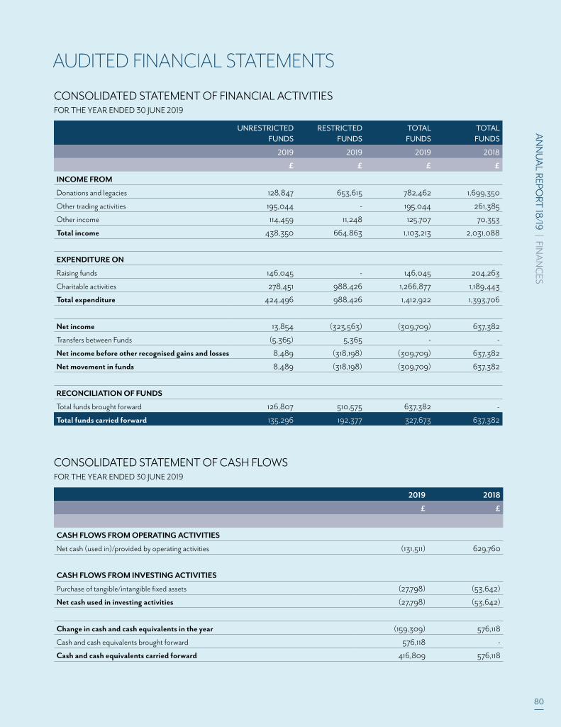
AN
NU
AL REPO
RT 18
/19 | FINA
NC
ES
80
AUDITED FINANCIAL STATEMENTS
UNRESTRICTEDFUNDS
RESTRICTEDFUNDS
TOTALFUNDS
TOTALFUNDS
2019 2019 2019 2018
£ £ £ £
INCOME FROM
Donations and legacies 128,847 653,615 782,462 1,699,350
Other trading activities 195,044 - 195,044 261,385
Other income 114,459 11,248 125,707 70,353
Total income 438,350 664,863 1,103,213 2,031,088
EXPENDITURE ON
Raising funds 146,045 - 146,045 204,263
Charitable activities 278,451 988,426 1,266,877 1,189,443
Total expenditure 424,496 988,426 1,412,922 1,393,706
Net income 13,854 (323,563) (309,709) 637,382
Transfers between Funds (5,365) 5,365 - -
Net income before other recognised gains and losses 8,489 (318,198) (309,709) 637,382
Net movement in funds 8,489 (318,198) (309,709) 637,382
RECONCILIATION OF FUNDS
Total funds brought forward 126,807 510,575 637,382 -
Total funds carried forward 135,296 192,377 327,673 637,382
CONSOLIDATED STATEMENT OF FINANCIAL ACTIVITIES FOR THE YEAR ENDED 30 JUNE 2019
2019 2018
£ £
CASH FLOWS FROM OPERATING ACTIVITIES
Net cash (used in)/provided by operating activities (131,511) 629,760
CASH FLOWS FROM INVESTING ACTIVITIES
Purchase of tangible/intangible fixed assets (27,798) (53,642)
Net cash used in investing activities (27,798) (53,642)
Change in cash and cash equivalents in the year (159,309) 576,118
Cash and cash equivalents brought forward 576,118 -
Cash and cash equivalents carried forward 416,809 576,118
CONSOLIDATED STATEMENT OF CASH FLOWS FOR THE YEAR ENDED 30 JUNE 2019
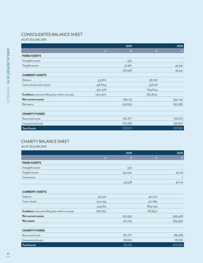
81
AN
NU
AL REPO
RT 18
/19 | FINA
NC
ES
2019 2018
£ £ £ £
FIXED ASSETS
Intangible assets 537 -
Tangible assets 57,961 45,341
58,498 45,341
CURRENT ASSETS
Debtors 53,667 98,726
Cash at bank and in hand 416,809 576,118
470,476 674,844
Creditors: amounts falling due within one year (201,301) (82,803)
Net current assets 269,175 592,041
Net assets 327,673 637,382
CHARITY FUNDS
Restricted funds 192,377 510,575
Unrestricted funds 135,296 126,807
Total funds 327,673 637,382
CONSOLIDATED BALANCE SHEET AS AT 30 JUNE 2019
2019 2018
£ £ £ £
FIXED ASSETS
Intangible assets 537 -
Tangible assets 54,040 40,113
Investments 1 1
54,578 40,114
CURRENT ASSETS
Debtors 30,522 90,202
Cash at bank 414,093 572,891
444,615 663,093
Creditors: amounts falling due within one year (187,162) (67,657)
Net current assets 257,453 595,436
Net assets 312,031 635,550
CHARITY FUNDS
Restricted funds 192,377 516,258
Unrestricted funds 119,654 119,292
Total funds 312,031 635,550
CHARITY BALANCE SHEET AS AT 30 JUNE 2019

AN
NU
AL REPO
RT 18
/19 | FINA
NC
ES
82
2019 2018
£ £ £ £
FIXED ASSETS
Intangible assets 537 -
Tangible assets 57,961 45,341
58,498 45,341
CURRENT ASSETS
Debtors 53,667 98,726
Cash at bank and in hand 416,809 576,118
470,476 674,844
Creditors: amounts falling due within one year (201,301) (82,803)
Net current assets 269,175 592,041
Net assets 327,673 637,382
CHARITY FUNDS
Restricted funds 192,377 510,575
Unrestricted funds 135,296 126,807
Total funds 327,673 637,382
2019 2018
£ £ £ £
FIXED ASSETS
Intangible assets 537 -
Tangible assets 54,040 40,113
Investments 1 1
54,578 40,114
CURRENT ASSETS
Debtors 30,522 90,202
Cash at bank 414,093 572,891
444,615 663,093
Creditors: amounts falling due within one year (187,162) (67,657)
Net current assets 257,453 595,436
Net assets 312,031 635,550
CHARITY FUNDS
Restricted funds 192,377 516,258
Unrestricted funds 119,654 119,292
Total funds 312,031 635,550
INCOME FROM DONATIONS AND LEGACIES
PRINCIPAL SUBSIDIARIES
UNRESTRICTED FUNDS RESTRICTED FUNDS TOTAL FUNDS TOTAL FUNDS
2019 2019 2019 2018
£ £ £ £
Donations 118,483 5,500 123,983 582,683
Grants 10,364 648,115 658,479 1,116,667
Total donations and legacies 128,847 653,615 782,462 1,699,350
Total 2018 1,699,350 - 1,699,350
SAERI (FALKLANDS) LIMITED
Subsidiary name SAERI (Falklands) Limited
Basis of control Shareholding
Equity shareholding % 100%
Total assets as at 30 June 2019 £29,783
Total liabilities as at 30 June 2019 £(14,140)
Total equity as at 30 June 2019 15,643
Turnover for the period ended 30 June 2019 £195,044
Expenditure for the period ended 30 June 2019 £(181,046)
Profit for the period ended 30 June 2019 £13,998
UNRESTRICTED FUNDS RESTRICTED FUNDS TOTAL FUNDS TOTAL FUNDS
2019 2019 2019 2018
£ £ £ £
SUBSIDIARY TRADING INCOME
SAERI (Falklands) Limited income 195,044 - 195,044 261,385
SUBSIDIARY TRADING EXPENSES
Cost of goods sold - - - 82,998
Advertising & marketing - - - 306
Bank fees 102 - 102 221
Consulting - - - 109,874
Charitable donations - - - 3,000
Entertainment 130 - 130 -
General expenses 1,500 - 1,500 -
Legal expenses 132 - 132 3,087
Travel - national - - - 250
Corporation tax 3,624 - 3,624 283
Accountancy 2,250 - 2,250 2,500
Specialist consultants 69,610 - 69,610 -
Project delivery cost 67,390 - 67,390 -
Depreciation of tangible fixed assets 1,307 - 1,307 1,744
146,045 - 146,045 204,263
Net income from trading activities 48,999 - 48,999 57,122
TRADING ACTIVITIES
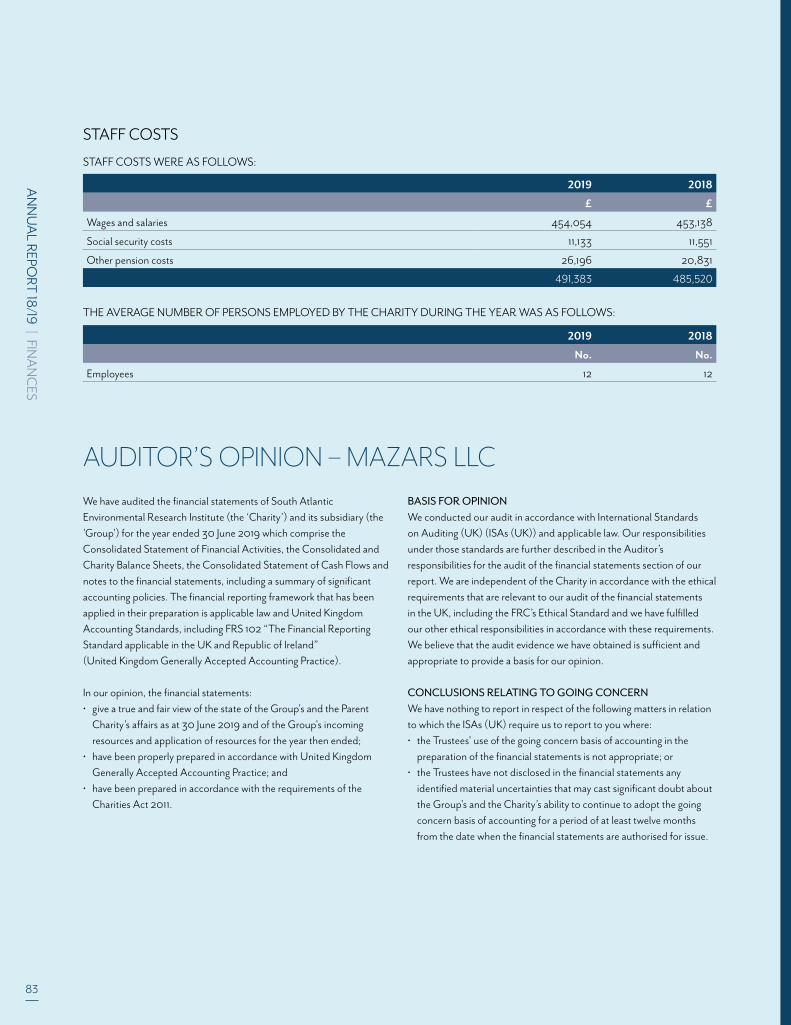
83
AN
NU
AL REPO
RT 18
/19 | FINA
NC
ES
AUDITOR’S OPINION – MAZARS LLCWe have audited the financial statements of South Atlantic Environmental Research Institute (the ‘Charity’) and its subsidiary (the 'Group') for the year ended 30 June 2019 which comprise the Consolidated Statement of Financial Activities, the Consolidated and Charity Balance Sheets, the Consolidated Statement of Cash Flows and notes to the financial statements, including a summary of significant accounting policies. The financial reporting framework that has been applied in their preparation is applicable law and United KingdomAccounting Standards, including FRS 102 “The Financial Reporting Standard applicable in the UK and Republic of Ireland” (United Kingdom Generally Accepted Accounting Practice).
In our opinion, the financial statements:• give a true and fair view of the state of the Group's and the Parent Charity’s affairs as at 30 June 2019 and of the Group's incoming resources and application of resources for the year then ended;• have been properly prepared in accordance with United Kingdom Generally Accepted Accounting Practice; and• have been prepared in accordance with the requirements of the Charities Act 2011.
BASIS FOR OPINIONWe conducted our audit in accordance with International Standards on Auditing (UK) (ISAs (UK)) and applicable law. Our responsibilities under those standards are further described in the Auditor’sresponsibilities for the audit of the financial statements section of our report. We are independent of the Charity in accordance with the ethical requirements that are relevant to our audit of the financial statements in the UK, including the FRC’s Ethical Standard and we have fulfilled our other ethical responsibilities in accordance with these requirements. We believe that the audit evidence we have obtained is sufficient and appropriate to provide a basis for our opinion.
CONCLUSIONS RELATING TO GOING CONCERNWe have nothing to report in respect of the following matters in relation to which the ISAs (UK) require us to report to you where:• the Trustees' use of the going concern basis of accounting in the preparation of the financial statements is not appropriate; or• the Trustees have not disclosed in the financial statements any identified material uncertainties that may cast significant doubt about the Group's and the Charity’s ability to continue to adopt the going concern basis of accounting for a period of at least twelve months from the date when the financial statements are authorised for issue.
2019 2018
£ £
Wages and salaries 454,054 453,138
Social security costs 11,133 11,551
Other pension costs 26,196 20,831
491,383 485,520
2019 2018
No. No.
Employees 12 12
STAFF COSTS
THE AVERAGE NUMBER OF PERSONS EMPLOYED BY THE CHARITY DURING THE YEAR WAS AS FOLLOWS:
STAFF COSTS WERE AS FOLLOWS:

2019 2018
£ £
Wages and salaries 454,054 453,138
Social security costs 11,133 11,551
Other pension costs 26,196 20,831
491,383 485,520

FALKLAND ISLANDS OFFICE Stanley Cottage, Stanley, FIQQ 1ZZ, Falkland Islands Tel. +500 27374 Email. [email protected]
UK REGISTERED OFFICE Falkland House, 14 Broadway, Westminster, London SW1H 0BH, United Kingdom Tel. +44 (0)20 3745 1731
SAERI (FALKLANDS) LIMITED Stanley Cottage, Stanley, FIQQ 1ZZ, Falkland Islands
SOUTH ATLANTIC ENVIRONMENTAL RESEARCH INSTITUTE
www.south-atlantic-research.org @SAERI_FI
Top Related