


Languages
Pages
Legal


N O T I C E
THIS DOCUMENT HAS BEEN REPRODUCED FROM MICROFICHE. ALTHOUGH IT IS RECOGNIZED THAT
CERTAIN PORTIONS ARE ILLEGIBLE, IT IS BEING RELEASED IN THE INTEREST OF MAKING AVAILABLE AS MUCH
INFORMATION AS POSSIBLE
https://ntrs.nasa.gov/search.jsp?R=19820014719 2018-07-12T06:35:34+00:00Z

E82-0101SM-L1-04118
JSC-17152
NAS A - c^
tk l5al
1G 7^ ^/^
A Joint Program forAgriculture andResources InventorySurveys ThroughAerospaceRemote SensingOctober 1981
Gv
CW co 40,
iG
^f qqalp
AgRISTARS"Made available under NASA sponsorttin the int.- . r -
-f ?3rly anrf wide dis-seminat _ n C'arth Resources SurveyProgram ; . a;, and without liabilityfor any use made tycreor."
Soil Moisture
GROUND REGISTRATION OF DATA FROM AN AIRBORNE
MULTIFREQUENCY MICROWAVE RADIOMETER (MFMR)
John C. Richter
(E82-10124) GROUND REGIS IRATICN OF DATI
FROM AN AIRBORNE MULTIFEEQUEhCk HIC6CWAVL&ADICNETEH (MME) (Lockneed Engineering andManageoeat) 0 p HC A03/HF A01 CSCL 03B
U82-22593
UnclasG3/43 00124
Lockheed Engineering and Management Services Company, Inc.1830 NASA Road 1, Houston, Texas 77058
Lyndon S. Jdwdon Spas Cwt
Houston, Texas 77058
S. „ _ -- -

1. 3. a d"It% cm" No.
JSC-17152 • SH-L1-04118l roe Wd Mo me i Mann DM
October 1981Ground Registration of Data from an AirborneMultifrequency Microwave Radiometer (WHR )
a, PW%M" p,p,iummCA&
7. AmWWW 0. ftfa onprAMeen ANN" %a
John C. RichterWwk Unie No.
ft le iw 0WAn eiw N^ w AMw
Lockheed Engineering and Management Services Company, Inc.1830 NASA Road 1
11. cwsnene W crave No.
Houston, Texas 77058 Im 9-1580013. TYp of POW Md lrtikd amer
Technical Report11 fanewis>, IV , N" ad MemoNational Aeronautics and Space AdministrationLyndon B. Johnson Space Center::;.:-stop Texas 77058 Technical Monitor: J. F. Paris
K %war" Am" ago
The ftvicuitwe ad In ow c ItrYa tory SwNqys Through Aerospace Remote Saasing is a joint prognt
ramof the I.S. Departme of Agriculture, the National Am mime ics ad Space Administration, the NationalOceanic omd Pummeric Administration (U.S. Department of Cawerce), the Avenel► for Internationalph_0mloomnx U.S. Deoarlmeat of State and the U.S. Department of the Interior.
1a Aes^me+ot
The Agricultural Soil Moisture Experiment was conducted near Colby, Xaansas, in July andAugust 1978. A portion of the data collected was taken with a fiveAband microwave radi-ometer. Thi report documents a method of locating the radiometer footprints with respectto a groundmsed coordinate system. The procedure requires that the airplane's flightparameters along with aerial photography be acquired simultaneously with the.radiometerdata. The software documented in this report will also read in data from the PrecisionRadiation Thermometer (PRT Model 5) and attach the scene temperature to the correspondingmultifrequency microwave radiometer data. Listings of the programs used in the registrationprocess are included.
17. KN WWds (&4FWW a AwdWWm u. DWribuOm swwwR
Air-ground data correlationMicrowaveRadiometer
10. tdeaier ONW. (a1 tmU lawd 21L $e itY Coo. lof taw as" 21. No. of PW 22. Prim.Unclassified Unclassified 29
'hr we M ew NWwW TMImW WwwAsW fwria. SwWWWid. VWWAS 22101ww► — ne
lg
SM-Ll-04118JSC-17152
GROUND REGISTRATION OF DATA FROM AN AIRBORNE
MULTIFREQUENCY MICROWAVE RADIOMETER (MFMR)
Job Order 71-323
This report describes activities of the Soil Moisture projectof the AgRISTARS program.
PREPARED BY
John C. Richter
APPROVED BY
J. G. Carnes, SupervisorAgricultural Technology Section
T. C. Minter, Jr., ManagerDevelopment and Evaluation Department
LOCKHEED ENGINEERING AND MANAGEMENT SERVICES COMPANY, INC.
Under Contract NAS 9-15800
For
Earth Resources Research Division
Space and Life Sciences Directorate
NATIONAL AERONAUTICS AND SPACE ADMINISTRATIONLYNDON 3. JOHNSON SPACE CENTER
HOUSTON, TEXAS
October 1981
LEMSCO-16800
v
pRECEDING PAGE BLANK NOT FILMED
PREFACE
The Agriculture and Resources Inventory Surveys Through Aerospace Remote
Sensing is a multiyear program of research, development, evaluation, and appli-
cation of aerospace remote sensing for agricultural resources, which began in
fiscal year 1980. This program is a cooperative effort of the U.S. Department
of Agriculture, the National Aeronautics and Space Administration, the National
Oceanic and Atmospheric Administration (U.S. Department of C, nerce), the
Agency for International Development (U.S. Department of State), and the
U.S. Department of the Interior.
vii
Section Page
1. INTRODUCTION ........................................................ 1-1
2. REQUIRED INPUT DATA ................................................. 2-1
3. PROGRAM EXPLANATION ................................................. 3-1
3.1 CONVERT PROGRAM ................................................ 3-1
3.2 MFMR PROGRAM ............. ...,.............,................... 3-1
3.3 MPLOT PROGRAM .................................................. 3-4
3.4 MGRID PROGRAM .................................................. 3-7
Appendix
APROGRAM AND DATA LISTINGS ........................................... A-1

PRECEDING PAGE BLANK NOT FILMED
TABLES
Table Page
3-1 MFMR SENSOR SUMMARY ............................................. 3-2
3-2 IDENTIFICATION CODES FOR THE COLBY ASME DATA .................... 3-2
FIGURES
Fi gure
1-1 Bottom view of the NASA C-130 aircraft .......................... 1-2
3-1 A sample plot illustrating how and where to measure thevariables AMISS and YUP ......................................... 3-3
3-2 A portion of the plot of tie MPLOT program ...................... 3-5
3-3 An illustration of the plot (MPLOT program) with overlaysof photographic position and field boundaries in place.......... 3-6

xi
PRECEDING PAGE BLANK NOT FILMED
ACRONYMS
ASCII American Standard 'haracter Code for Information Interchange
ASME Agricultural Soil Moisture Experiment
ADAS Auxiliary Data Annotation System
CCT computer compatible tape
EBCDIC Extended Binary-Coded Decimal Interchange Code
JSC !vndon B. Johnson Space Center
MFMR Multifrequency microwave radiometer
NASA National Aeronautics and Space Administration
NERDAS Navigational Earth Resources Data Annotation System
PCM pulse-code modulated
PRT Precision Radiation Thermometer
SAL Sensor Analysis Laboratory
SAS Statistical Analysis System

1. INTRODUCTION
Multifrequency microwave radiometer (MFMR) measurements were taken by the
National Aeronautics and Space Administration (NASA) C-130 aircraft at 1000
and 1500 feet above ground level as part of the Agricultural Soil Moisture
Experiment (ASME). This experiment was conducted near Colby, Kansas, on
July 18, 20, 21, and 22, 1978, and on August 8, 9, and 11, 1978. These data
are a measure of the natural microwave emission of the targets as seen by the
sensor. The MFMR is a group of sensors that collect data at five frequencies:
1.42, 5.0, 18.0, 22.5, and 37.0 GHz. location of these sensors on the
aircraft is shown in figure 1-1. Each sensor collected data by viewing the
ground with either a 00 or 400 incidence angle; only one incidence angle could
be used at any one time. Because of mechanical incompatibility of their
antennas, the 1.42 and 5.0 GHz frequencies could not be used simultaneously.
Soil samples from several layers were collected from preselected fields of
approximately 40 acres on each of the 7 days of flight. These samples were
weighed, oven-dried, and weighed again so that the moisture content of the
layers could be calculated. The moisture contents wi;l be used for comparison
with the MFMR data.
Simultaneously with the MFMR data collection, the Precision Radiation
Thermometer Model 5 (PRT-5) measured the infrared temperature of the emitting
surface. Knowledge of this temperature may allow the conversion of the MFMR
antenna temperatures to emissivities.
A method of converting the MFMR and oRT-5 computer compatible tape (CCT) data
Into disk files is outlined in this document. Each disk file will contain the
date, the MFMR data, the PRT-5 temperature data, and the ground reference posi-
tion of the data within the sampled field. This conversion is accomplished by
four processing programs. These are listed and each program is discussed in
this report.
3
1-1

wL
L
O or
4+N_aO
L ^^`jr
r IA N
g
J... L
a e+^
aL
r N aa c a
^ aL Li
N> cN
^ d asN
1J
1N
iN s
s aaL
L^ L
LL
r^ NaL N L^ L
41
w N
L CVNaJ
1iL
C V
1 A A
Y e
A
,9 +A
7 A N N
L
ppa
er'lwy
V
0
ipJ
1w^1w^
r
40
0wy
1-2

2-1
i
2. REQUIRED INPUT DATA
As the aircraft flew down the flight line, the WMR and PRT-5 data were
recorded on tape in an analog format. The tapes were sent to the Sensor
Analysis Laboratory (SAL) located at the Lyndon B. Johnson Space Center (JSC),
Building 15. At the SAL, the analog data were digitized and recorded on tape
along with the Auxiliary Data Annotation System (ADAS) data time of acquisi-
tion. Each record in the file also contains the roll, pitch, and drift angles
along with the altitude, ground speed, and true heading of the aircraft. The
data and flight parameters were measured approximately every 0.6 second.
A great deal of aerial photography was collected as part of the ASKS.
Photographs taken at an altitude of 8000 feet were used to construct con-
trolled strip mosaics of each flight line. Additional aerial photography was
acquired as the aircraft collected the MFMR data. The acquisition time and
frame number of every photograph were recorded on the analog data system.
This made it possible to determine the aircraft's position at the frame times.
The camera positions and frame numbers were plotted on transparent overlays by
the JSC Cartographic Technology Laboratory. Additional overlays were made
showing the location of the sampled fields in each flight line. All overlays
were made at the same scale as the controlled strip mosaics.

i
i
3. PROGRAM EXPLANATION
3.1 CONVERT PROGRAM
The MFMR data as provided by the SAL are grouped into records with a length of
160 characters. Some characters in each record are written to the American
Standard Character Code for Information Interchange (ASCII) character code. The
rest of the characters are in binary form. The computer used in this study is a
National Advanced Systems AS/3000 which uses the Extended Binary-Coded-Decimal
Interchange Code (EBCDIC) for character representation. Therefore, before the
ground registration of the data can begin, the ASCII and binary characters must
be converted to EBCDIC. This is accomplished by a FORTRAN program called
CONVERT. A listing of the program and its execute file are given in appendix A.
The program reads in the data, does the character conversion, and reformats the
data to a record length of 132 characters so that a printed copy can beobtained. The data file from the SAL can contain three types of records: cali-
bration, baseline, and data. The program CONVERT will write each to a separate
file in EBCDIC representation. A sample listing of the output data file is
shown in appendix A. The column titles are added for clarity but are not
actually written to the data file. Note that at this point all columns have
numbers in them, even if the sensor was turned off during the run. To identify
the useful data, *;he file identification code must be referenced. Only the
useful data will be placed in the file output by the final processing program.
3.2 MFMR PROGRAM
The second program used to process the MFMR and PRT-5 data is a FORTRAN program
called MFMR. A listing of the program and its execute file are given in
appendix A. This program reads in the reformatted and converted data file and
computes the location of the aircraft's negative z-axis intersection with the
ground in a scene-based coordinate system. The MFMR program refers to the
camera location but, as clearly shown in figure 1-1 of section 1, the W14R
sensors have an along-track displacement from the camera. The sensor displace-
ments and beamwldths are listed in table 3-1. To obtain the location of thesensor footprint center, the displacement must be added to the along-track
displacement.
3-1

i
TABLE 3-1.- W14R SENSOR SUMMARY
Sensor Along-trackdisplacement
Beamwidth, degrees
Band Freouency Wavelength Half-power Null to null(GHz) ^cm) (ft)
L 1.4 21.2 +25.0 16.0 40.0
C 5.0 6.0 +25.0 4.5 12.0
Ku 18.0 1.66 -42.0 5.0 14.0
K 22.0 1.36 -42.0 5.0 14.0
Ka 31.0 0.81 -42.0 4.0 12.0
Three inputs from the terminal are requested by the program. The first input,
called AMISS, is the distance (in feet) of the aircraft toward the north from
the southern field boundaries if the flight line runs east-west. If the
flight line runs north-south, then AMISS is the distance toward the west from
the eastern field boundaries. AMISS is measured at the beginning of the
flight line. The second input, called YUP, is the crosstrack distance (in
feet) that the aircraft ' s position changed between the beginning and the end
of the flight line. rigure 3-1 is a diagram of a flight line and shows the
distances represented by AMISS and YUP. Both inputs are measured with the
overlay on the strip mosa ic. The final requested input is a three - symbol
numeric identifier called Code. The Codes used for the ASME MFMR data are
shown in table 3-2.
TABLE 3-2.- IDENTIFICATION CODES FOR THE COLBY ASME DATA
Code Day, 1918 Sensor Polarization
1 199 (July 18) 13.3 GHz Scatterometer Like
2 201 (July 20) 4.15 GHz Scatterometer Cross
3 202 (July 21) 1.6 GHz Scattercr,* ter Horizontal receive
4 2C3 (July 22) 0.4 GHz Scatterometer Vertical receive
5 220 (August 8) 00 L, Ku, K, Ka MFMR Horizontal and vertical receive
6 221 (August 9) 40' L. Ku, K. Ka MFMR
1 223 (August 11) 0° C MFMR
$ 1 1 40° C MFMR
3-2

1^ yx ' ^
x 1i
v ^
r Xw^ x ^
x ^
x ^
x '
x
1x ^
ix ^
v x ^
^ X '
x '
x ^
X i
CC
X'
r Id
N♦1
NOr^
s
v
wL
iiM
^r.
O
O
r
y
3-3
Program MFMR creates an output file that contains the downtrack and crosstrack
locations of the airplane with respect to the beginning of the flight line.
This file also contains the corresponding MFMR data values for those locations
and the time that the data were acquired. Time of data acquisition is no Ion-
ger needed for MFMR data ground registration, but it will be used to register
the PRT-5 data acquired simultaneously.
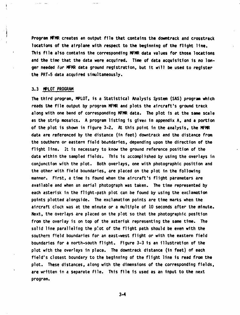
3.3 MPLOT PROGRAM
The third program, MPLOT, is a Statistical Analysis System (SAS) program which
reads the file output by program MFMR and plots the aircraft's ground track
along with one band of corresponding MFMR data. The plot is at the same scale
as the strip mosaics. A program listing is given in appendix A, and a portion
of the plot is shown in figure 3-2. At this point in the analysis, the MFMR
data are referenced by the distance (in feet) downtrack and the distance from
the southern or eastern field boundaries, depending upon the direction of the
flight line. it is necessary to know the ground reference position of the
data within the sampled fields. This is accomplished by using the overlays in
conjunction with the plot. Both overlays, one with photographic position and
the other with field boundaries, are placed on the plot in the following
manner. First, a time is found when the aircraft's flight parameters are
available and when an aerial photograph was taken. The time represented by
each asterisk in the flight-path plot can be found by using the exclamation
points plotted alongside. The exclamation points are time marks when the
aircraft clock was at the minute or a multiple of 10 seconds after the minute.
Next, the overlays are placed on the plot so that the photographic position
from the overlay is on top of the asterisk representing the same time. The
solid line paralleling the plot of the flight path should be even with the
southern field boundaries for an east-west flight or with the eastern field
boundaries for a north-south flight. Figure 3-3 is an illustration of the
plot with the overlays in place. The downtrack distance (in feet) of each
field's closest boundary to the beginning of the flight line is read from the
plot. These distances, along with the dimensions of the corresponding fields,
are written in a separate file. This file is used as an input to the next
program.
3-4
11 1 1
iI • 1 •
^i1
^ • s 1^ 11 I
• • t I • i • .NIiC
• 11 • 11•
SI
•
^i I• :1 1 1 • !!NC
• 11 • 1
• 11 i• 1• I I • 1 • N.IE
I - • L
I • it • 1 ^
I • !1 .^
O
i
^II
-•.
i-•
^^
^, s: • NEE O
i•. •. a^I ^ . • NK(I
t
^ i ^,0 4,
i °
I 11 r. • NlxE o_^. is`^ i aI LL•
• NaE• - i i - i 1•• 11
11 •• 1
1 •N
ii------ ------ ---•-------------- »1 ----------•-----------•- » (---»»---------«------_-----•• ...K ¢i
.-
1
c,.•
••iw ^
• w
! • ..N2= : :
• f1.
11 . 11
3-5

•
s •
•
3
s •a •n •
t ••
i
S
••
••
• t
••
t:
cl
• Ns'
••••
^r•••
.Nw
elm 0N
L• Nit( 10
OVa,^
a•amt
o^J
• few vI ^i ^ rI O •r
.ce !d aci !w
^aa.^h ^a^q
L
CLI^
• NNi j L
I^'LL
NMt
i
3-6
aWhen the procedure is carried out in the manner described above, a di crepancy
may become apparent. If the overlay and plot were registered at an ext %*
end of the flight line, the overlay and plot positions may not match at the
opposite end of the line. This is caused by a lack of sufficient accuracy in
the recording of the aircraft's flight parameters. Therefore, it is recom-
mended that the overlay and plot be registered near each sampled field before
the downtrack distances are read.
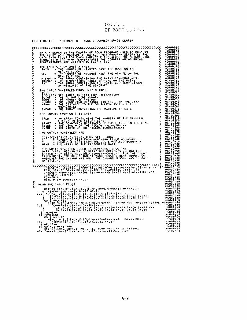
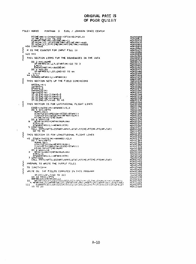
3.4 MGRID PROGRAM
The final processing program, called MGRID, reads in the boundary data file,
the file created by program WMR, and the corresponding file of PRT-5 data. A
listing of program MGRID and its execute file are given in appendix A.
Program MGRID determines which MFMR data lie within a sampled field and
calculates the location of the sensor footprints with respect to the northern
and western field boundaries. The program then searches through the PRT data
to find the infrared temperatures that correspond to the footprints. One
output file is created for each sampled field within the flight line. The
output files can then be combined in the manner which best suits the analysis
technique that will be used.
3-7

APPENDIX A
PROGRAM AND DATA LISTINGS

APPENDIX A
PROGRAM AND DATA LISTINGS
The following data are presented in this appendix.
a. CONVERT FORTRAN
b. CONVERT EXEC
c. Converted and reformatted data listing (See figure A-1.)
d. MFMR FORTRAN
e. MFMR EXEC
f. MPLOT SAS
g. MGRID FORTRAN
h. MGRID EXEC
A-1

ORIGINAL PAO& i&
OF POOR QUALITY
FTLE! CONVERT FORTRAN A EOOL / JOHNSON SPACE CENTER
CCCCCCCCCCCCCCCCCCCCCCCCCCCCCCCCCCCCCCCCCCCCCCCCCCCCCCCCCCCCCCC
Cc Be
THIS PROGRpDAM
CR ADS
C5 IN ON D S
ppKEFIL
EEOF MFMR pApTA
^^ggTCMC
C 7MREEYFjlESA6^IYRITEN ,20NEOFQp EAtHCCOLLEC IONaM00E^IC.C DATTA CAL BRA lON AND OASELNC WRI T AY! JOHN C RICHTER EBURARY.1981
CCCCCCCs;CA
`(R
C. .^[A H cccCCCCCCCCCCCCCCCCCCCCCCCCCCCCCCCCCCCCCC[
IN.^ CH 695)+CHX CHA(+/64.64.64.64.64.6496A.64.64.64.64964.649649649
1.
44964964964964964964964#64964964t290•! 7.1 3+0 • 0 +80 1 f5+779
29z 3.9 1
21 7h.107o969TS•9792l40.2419
4124.1939 949195+296:297.198.199.200+701+209-210!7j11.2j2•52 3.``14.215.216.217.22692279228.229. 30.23192329 33.1 3•627.4.189995996/DO 2 M*1.1000REAO(8.1101•EENpp•9991(AlI),I:1.108).(8(K).Kilr26)
101 FAORMA^l1AOg26A2)
10 A(Kt!OTKIDCHAR1A(K)1
4X84 08)_ 1
i, HX^(0^ 9S1 UNIT 2941 UN 11* T• ZvRI E(IUNj1910 )At19 9A(19)9A(20)oA113)oA(16).A1331oA(34)9A( 36)94( 3 )9A(39)9A140)0A14 )rA(421 66).A168)9A(6 1vA170)9A(75)oA1761rA(771•Al78).4179). Al44)oA(85)•A(86)oA(07)9A(8Q1}A(91)oA(9 )9A19 3 19A(94)9A(95)•A( 7)9A(98)9A199)0A1 00f Al )0
♦41104)•4( 0519 Ai06)9811)081219 1113198(4)98(7).8(8)98(9108 10).S81 11 lB( I I^1
1!241
102 F0^]MA^<3Aj• X0A•Al;!X•fA . • i • •2AI,;i • 94A •1x N Al9 X•
1541• x954(91x9541•}954!ox•3A1+1x+13•fxo^3olxrI4ol^lolxrI4.t3r4•# •1X•I4.1XrI4. 3•(491* •lX9 4+1*3. 4.I3 ♦ X.149139+4913)
2 ON NUE909 .TOP
A-'l

ORIGINAL PAGE IS
OF POOR QUALITY
FILF1 CONVERT EXEC A EOOL / JOHNSON SPACE CENTER
prONTROL OFF
F L 0 F S READER (PERMF ` () F 1 $IS`HkEp RUSTING A (PERMi L
LL
0 F 0 NK
55
1 AMT
``
A 0 IPERMMg EERECEFMEECF IRLELk
L
L 160
1
lL
33
KSIJJ Z60
33f L 0 F S AOATA 001PE114 RRFMMFFLRE LL 1322dLKS E
11 22OLORAl TXLilI'MIl l R FORTM002
LHAO kFA0STAPT
A-3

ORiOiNAL. F' t` ':•
OF POOR QUAUTY
00-»ooeseeoon OOOO Jeeoln ooeouY,no CDaoa^^aaaoaonaaoaaaoanooaanna0'0'0' PPTPPTOO^PTTPPPa OTTT?OOP 01r`1PMInPIPf^1nn1'fntl'In^1"1nAY'1^'11 "Inns/1n N►ar•Innnnw ►nnnnnnnnnnn+In^InnI^I+InnVl OOM fAnn..nP -+'1 J 1 enronulav+wlnnmNNNN'HfVN1MVN-dWVNf^MINNNN11fVNNN'VNfV Nn ann nnn O"1f VP anPla^I"lnnnn^0 ^ygnnn^0awooaoolnc+lnaalnaaaoaalnaaaaaulwwwwwwwwwwwwwwwwwwwwwwwwwwww Nnnn nn n nnnn n nn nnnnnnn ^+n nnwl n nn
oe-oeoe.+eoo- Ieoo..Neoo.+.+e.+. IDNooaaaaaaaaaaooa000aaaoaoa000 U-)
CV
mm^amm >D mmmm asm^ 'A>o mam >D 9 D'D>D^ amannnnnnnnnnn •+nnnn^lnnnnnnnnnnn Nnnnnnnnnn+lnnnnnnnnnwn+InnnnnnOOOOOOIfl 000000000000000000 Jl O^^NO .^.rrrr...y+ .•...^.r..r.r•rwrrO nfnnnMf^'1n1'Innr0+ngN'lnnnnn^'1 NInnnnnnr+n+I+Innnnnnn^nn^++I+x•+nnn^IOt 0000.+..e000000000000000eee000 N
mmmmmmmmmsmmmmmmxmmmmmamamm0rw^r+nnnnnnnnnnnnn^I+fnn^Innl^Innnn .^nPlPlfgnrinnnnnn^'I"fl'Innnrinrlrflr+ne•1nn Nnnnn-Inrinnnnnnnwlnnnnnnn wnnnnnta^nuloulsu+ru+u+o+l:Jranoou+eooaal —CDN000e 000000l0000el o11e1ls0001x11 +aaa11nt1ltsr+snnlnnn+ls ^nmm^rinnnnnnnalnrinnnnnnnnnnnnn ,^/'1f'II'N'N'f.'1P11'fl'InMl^l/'1nP1PInn1'InA1n e+le•InPIf'In
0000000000000000000 000000000 co
Pr+NNNnPN.+.00n+a...oalNOnPoaM^ ^ae-.oalmmaalmtaamaPam.aaa+N+N
tCdwat aw m.0^0►-w m.0 apr► r►^Ow,Ow,O awww mP m0^PPTPPPTPPTPPTPPPPJ^TPPTPPPPPP ^NNNNNNNIININNNNNNNNNNNNNNNNNNNNMNI'11Af"1111^pN+••IVm lnOn^NN O.^V t n^.t'I^^.PannPP ^rr•P t •+•+O^Nn.+t10^ NrnNlPJ1Nn1911 ti11!l1ln+l tlnln l+.^nlnt ^PPPPPPPPPPPPPPPPPTPPP?PPPPTP ^nM^1f ^MNNNNNNN 11NNf ^MM V N NNNNNMV NNNN+l+JS+laullnaas su+llawt rJSal+ull 1"'1.-1nnlnvinJntnnntnntannnnnlnnJnn!WWVNNNNNNNNNNNNNN^IMNNIVIVNNNNNN N
nn` ^^^nnw'^inn^i^+nr^innn'^'rin^nn^n r'0000000ee00000000eooeoe00000 rrJIIMNIA1AIf1UI1flIflUllMfNf11f1 1Mf11t1UMflJflfllfllfl{flIfl1A1 ^{f1 ' ^-i
aW 0000000000000000000000000000►- 0 ^000000000000000000000000000W u v+"u+0000e0000,eo ooeo°o=Cb-^o,°ooea°Oaa
0---.n^ ^+Wu< IA.OwmPPmmwmOYINN^rN VO^00d . • • • • • • • • • • • . • • . • ..• .• .• .• • • .• .^N 00000000000000o00o00000000000000000000000000000000000000• 1 • • • • • • • • • • • ♦ 1 1 • • • • • 1 1 1 1 1 1 1411 .-^f10.O^0UIP..1•1 .f X01► +el^Nnemyo fn IoMmNO.. . .... . . • .0000-000 rr. —00,000cb0caccoclo
0.4 00000000000000000000000000000
\ mmmmNaa llYltfIout OOPIma000PwwU Lnd0 +
• • • • • sIf 00000OC1,0 MMll T04Oaowww.0 0 000OAO ^COOe0000000000000t00000000000W 1'IOOyllfllllifl 11 ^.-10 ++ t Oe/►wI►PP nn t +-.-.
< somm4 ^mmmm^OlaDaapm^o%Mm LOa0000e000000000eoe0000000000OOOOe0e00oe-00000040e00eoocoof.NWV9NNnnnnllullYlwH aoamwwa llll ^t a^000^00.0aa.0aaaaao^oo^oaaaao.o^o^o^o
< M ngrIP J P W eN'....M I'Im t P Y1 0111.+0 w \\
00004f11fl^0aAmmO^PO •• •-.+^+I^MM'Ml11PIfl.0aMOOOOOpO00Y OM O---n ooee^ooeoeoee0000eooe^oo( M^ oeooieooeoeeoes0000ee000eoioioao )i
OWWWOM nnn NJ PPPPPPPPPPPPPPPPO^P O^PPPPPPPPP .4.. PO+PPP?PPOPPPPO^PPP?PPPPPPPPPPr .-I.+.rr.^.......r..r
Y Y + ^y111 Y
t
N
1
^^11YN
^
p,LC _]L
^
^
N
^
Y
Nd ac
N i[71Y N ^ 9
^NIpyI^C ^ vCC ^ ^pII ^e ^ .^CC.
p`I •T••d C
Cc
Ow O
^ C ^ 9r
O6'O O
} V N C .+q rv wNO_N N + <
N O•+
q c L. CO Lq vC
NL
Co•+
LqO^
Nq_ < q O^+
M p4 r q 4C ^+ S r G q
+ .d N r Oq G} AN L q ^ .O N S N^'qC L qq
q
S.+CN
L ieq ^Lq C L A
qS
•+CO L Aq rqO.
rS
S •J S O' q
S+ N
Cipp y4X Ld q OG ad q LO Ld q.+ G daW a cC A
^•+C G q a c ^O
+ C^+ TLTLO
COf+
C•+ OLd ++ rL
CO ^+iCO N
L
CO
C•+ OiI r+d Va NN L q a q OY` r d •+ ^ f+q ! A.q.a
L Dd
CV7
dr
d O1d.
+ya
a ra 'aY
sW
LvvL
O L97 7 L7 9
q q L ^O i q q L. L L
M Nd g g g
Mg
Ng
V N
g g F F Lq g
QVC a1 L1 G G1 1
q q q 'Q
gQ 1G 1 C d1 1I IU U OU >Y >Y J 7Y Y IY Y IY IY qY qY q qY Y
Ld.^-. CO ON r (V
N lV MN ON M1N IG nN N
CpN
Ch pN A
°cu
n a+d N 1"
iY dV
+ SV > Nyy rN
N -' ^
dLS N ^ O+ S c Y
d O Nn
v Nc L
= f 7 O q
CJfU f+C L
dN Y Vq
N
u Z Y Vfq C u i q C.-. OI S wDYIW
rN
d NL ^d4`
^
gM
^Y q
++ N
Py LNO v J/
Z.pL^
.r.,c0
6^^L vT rpC GC N CO
rv -^ v - 9 NN NN r .+ ^ .+'
L6 ^+ } d Y d {1^G1 dp
dp1^ a a
_pIC C q N M C L C dL V
w .- Y 7 LI qv ^ q c D L d P
^te}
^iIOEI q•+
ELI vq.+n1 qL Cq Z
1.
V
`
^+w• fJw{L,^
^+ yw ♦L,1 ^L.
Nwu
y..Ly
Ny ^1
M N
C^ N
d4 O UL- L u u L u c c C L a 3
qU J W 4 t t C t t 4V OU 1J 1J 1L U
Ld r N N1 O vfl - - CD P O y ^ ^ O IflrU C
Nd7
C
V
WOCO10
C
R
dxaC^o
C10
WyZO
bLOIQLQ.
W
Q.
7O
EmN
1
1dGlL7
Li
A-4

ORIGINAL PA^F laOF POOR QUALI TY
FTLF: MFMR FORTRAN A EODL / JOHNSON SPACE CENTER
CCCCCCCCCCCCCCCCCCCCCCCCCCCCCCCCC CCCCCCCCCC CCC CCCCCCCCCCCCCCCCCCCCC
6 THIS TH OF FOUR PROGRAMS uStQ TO
C MR
CTHAT FACIL TAT SFCOMPARISON NTOR TNE ASOILSMOISTURERGROUNDMTRUTH
C THE INPUT PARAMETERS FROM UNIT 10 AREt
[[``I4UNE
E ETHE NUMBER OF THE RUNGNT LINE
DAY
5i
nn A F14DAR SAY NUMBER
R pOF M N TES ON TM IRCRAFT LOCK I
C NNSDEAGD
EEEESN^HS CLOCK
N RURCOENTTH
C ALL n AiTFRSITIVE ROL IS MHEN THE RIRMI MIN IS DOWN IC R POR AVOT PITT IN AND T NTHS IC PITCH
O
n TM A CHI
DE6REEES
DRIFT n THROA RAFT I DRIFII S INHDEGREESNAND TENTHS CRT S FROM HEADINGC
( LL TA OS
AyE oRI LFT IS ECL
IOI C K M
R RAFjEC 1SpT THE A N KNOTSC
EE
''
TTT PCCcRAF
EE
TT GROUNODSPFEDFp
EE I NMIT Qp EEMT•A(P(0 TMO)ISPACPAC$OyOTAINRMETBANaNaD D NTFCCATION•
ORTHE LAST EE CON AINS A ON LETTE 001CC P AR ION
^^qqSO—
•
IAppT
EE
.gIIUp
NN FOR THE$S
OtL
I((
THE SAME TWAY AS TC TFMVEaATURESEFINEDCCC THE OUTPUT
CTCl- .I(OTT
PARAMFTFRS TO UNIT
1cc3
AWE:EWE
pp EE EETMA TMMN5RACKRORSTANEEF(INDFEET)TOFTTHE/AIRCRAFT
C FLIGHT PARAMETERS CC TOTT n
E 5 E CCFI ID1 I ROlVNCARI I S FORTTHEOfLTIEGH10PARAMETQRSTERN
TO UT T ► E MARKS ON THE PLOTV ^c TTENC TMP_
n• SAME AlTHR INPUT.
C —SO_ • SA Mf AS IN U .
Cc'CCCCcEA`Icccccx15 CppCTO EYEEIS101ApQ[TENi l01AaaAC5EC1S101.ORiFTl5101000CCCCCC
INTNEGERSOHSjjS.TMPV510ITCSDV(S10).KUTMPMI5101E R KYS^HISjO)rKUTMPV(S101rKUSDV(S10).KTMPM(S101rKSOH(50) NT V(S O1.K5
TDV1510).KATMPH(510).KASD H 15101r K A MP VI 101
NT G R KASOV(S 0).L MP(SIOI.LSD(510)rCTMPHIS101.ITIME(S10)
THESE STATEMENTSASK FOR AND READ INFORMATION FROM THE TERMINAL
1 . 1 MRF0 A?( 116jNPUT AMISS AND YUP IN F3.09F3.0'1,EAOIIS.171)AM;SS.YUP
151 W04TE
M11
16.551E220•fF7.o1 E
IK7 PFAD CT
HF THREE NUMBER CODE FOR DAY/DATA TYPE/ANGLE')
YUP:1(YUP'A"s/'As'/5
♦ 1.1000.0AMISS s 1AM15. ♦ • 000.0C MGSN•l.0YULO.0.0ICHK n nHTOT•0.0TOTY1II.0.0TOTX(II n 0.0
THESE. STATEMENTS READ IN AND MANIPULATE THE DATA
IFLA``G.0DO
REA6811
1 - S lop •ENO. 0 ] )I AY. LINE.IRUN ♦ IMIN.SEC91ALT HEAD.DMIFTII)1 ROLL • Pj Tf_H.TSPEO LI MP ( ).LSD(I).CTMPHIII.CSDHII)•7 CTMPVIO( •CTOV( ).KUTMPHI)•KUSUH(I).KUTMPV(I).7 KU$DVIII.K MPHIT). IKSOH(I.KT40 V(I).KSDV(I).KATMPHIII.KASOH(I)
CCC
CCC
7700
0NO750
17700
790
A-5
L
ORIGINPI P: `77OF POOR
w
FYtF; MFMR FORMAN A EODL / JOHNSON SPACE CENTER
♦ KATMPV(I).KASDV4I1 MFMO08001n6 fORMAT(11•lx.t Ix.F4.•Ilr4 x •[2• 4• .FS. •1x.FS.1. MFMOOe 0
1 x•FS. .jl.i2 x•((4. 3• +.
SPE ptit=^I,OArII^EE9 ►
X{ I4•^3r1• lXt 3 1 9x; i lx
.Ix..t4rt3
11X•14. 3. ♦•13. x.t4.ii• 4.171MFMOQA QMFMOQe 0MfMOOtl40
ALtT nFLJAIt(A``T) MFM008SO-[N n+LOATIIMIN) MFM008660
MFM00810A ccSEC('1 8 1 14 60 t 01 • SEC^MfM00e80OtOR=(RoLL • 141 9^1/ltltlo.o
YOFF(I)SALT•TANlDTOR) MFM00890N I IMBA n MFM00900MttNn
M I N.MI Co-o10.01MFMOQ9(OMFMQ09z0SCn F
IIIIII TIII 4f ( l) n 104N• I SSEC MFM00o30SPEEDp I )=SPEED(I) • .6878F``MEAn.LT.4II.OIHEAD nMEAO.360.0
MFMQ 940MFN0 950
C1R n 1-1 04FM00a60F( NF.1)ICHK
n;TtME(11-ITIMFIICTR)[
MFMO0970MfM q9 Q
F(C G ((ttfCMK.LT.0)) IFL AG n ? MFMOpp9^0
FI -40 g M FMS 4OFI
F`AG.E
F AG. )ACE(IIR4:•ti0^0Tj4j((j)):ITtjM^((I)) 00
) nACE,l)•3600.0 MFMQMFMQ
0 Q1 T AcKI 1 nDf'II)•HA 0
7n1 CONT NUF MFMO 040[[F( L(NF_.F9.11CMOSN n -]].0 MFMO
MFMQ05060IFI
iFILINE.En.4)CMGSNLfNE.FO.5S1 H SN n-
n-1.00
)-MFMO 010
YUP=YUP/IIACSEC(NUMBA ACSECII) ► •SPFE01111MFMQ 090NN0NUMRAC•I MFMO Q
C THFSE STATEMENTS COMPUTE THE AVERAGE FLIGHT,OIRECTION MFMO vu
11 0MFMO 0
ANN=FLOATINN) MEMODO]4 K=1 NN
14 HAT=MTOT•TRACKIKIMFMOMFNO
4050
HAVG.=HTOT/ANN MFMp 1160C NF MO !70C THTS SECTION CO MPUTES THE LOCATION OF THE AIRCRAFT MFMO 180G MFMQ 1190
1 2 010DO 1 I=1 NIIM4ACEL TKE:FLOAT(ITIME(I.11-ITIME(I))/10.0
MFMOMFMO
Z00
IFIELPTME.GT 401 O)ELP74E=ELPTME-40.0MSSECC=Ii1M(ELATMeI
"FMQMFMQ
jig
if(MSFC.9T.2)E^PTME=^LPTFtE--SEC MEMOMFMO
4050ANOLF n IIIHAVf.- PACK(
1)1 . 33.1415931/180.0
0 P=ELPTME•SPEEDII ► MFMO 60X ggP:O1SP•CpoSlAN3LEEI MFMQ
MFMQ70
280YO_
L
SPa0ISP•SINIANGLE)•CHGSNMFMO 90
YDFFII.FO.^IGO TO ^2F n IYOF III ► -YOF 1 ]- )1 • CHGSN
MFMOMFMO
OOG
TO XIL1=TOT;IL-11 •1•XQ154•YOtFF•IYUP•TOTX(L)-YUPTOTX(L-1))T IL-1))y ISP•TOTY(4)=OTY
MFMOMFM O
3 00
1? TOTXILITT=X1)RPTOTY(L)=Y0ISP•YOFF11)•AMI5S
MFMQ 350
11 CONTINUE MFMO14FMO
370380
C THIS SECTION OETFRM INES WHICH DATA IS AT 10 SECONDS MiMO 390G MFMQ 400
DO A 1 .2. N,I04RAC MFMQ 410`=I-1 MFMO 4JO
MFMQ 4400I(TE
EENII)I n
t0( .
EE0
tt ppFF=ITIME1t1^^1^CMP•1001
MFMOMfM0
4404500
F( t t TT{nIFF.L^ 3)tTjN(I)- UTY(L) • I00.o MFMQMFM01470
460
9 f NTFl10IFF,(, .9611 ENIII=TOTYILI.100.0
IIINIIE MF1401440
D 13 5 K=I.NIIMRAC MFMO 490c wR1TF113. 1041ICI• IC2.1C3•ILINE.TRUN.TOTX(K)•TOTY(K),ITEN(K)• MFMO11500
1 LTMPIKI.LSOIKI.CTMPM(K)•CSOHIK).CTMPVIKI.CSDV(K1.KUTMPHIKI. MFMO J510? KUSOM(KI•KUTMPV(K)•KUSOVIKI•KTMPMIKI•KSUMIKI.KTM 3 V(K),KSUV(K).••FMOI O3 KAY-PH(K).KASOH(K).KATMPV(K)•KASOV(K)•ITIMEIKt MFMOIS30
6114 F0QM4Tllj1•jX• l• r:• ll•1 X . F , 0• X.FS.OrIK.f S ,0.2X. j4 •IX• MFM01S404.tx.^/3.1x.I ♦.1 X .`3.?x.13.1x,14.1x.13.7X. MFMO 5501 3. zx.
7 4. 11.11.1X.11114.lx•I3.2X.114,1X•1111113.IX.14,Ix.11.3x.161 MFMO1560ST')0 MFMO 570FNn -FM0158O
A-6

ORIGINAL PA=':
OF POOR QlJAL # Y
FTLF! MFMR EMFC A EOOL / JOHNSON SPACE CENTER
rrMnTF TO HOUSTONPOOL F. NOR
IN
L nGLnRAL TRTH MSL1R FnRTHOn?FTLFnEF S AD R (PEaMFILFOEF h ER (PERMF1LFnEF 7 PUNCH (PERMr lLE O)EF 11 Qg [SK tit EDATA A (PERM pE CFM F LREE L ))22 RLK$5 jjjE ) zF1LEnEF 13
T SK &I YMFMQ A (PERM RECFM F LBECL ^12 RLKSIZE ^32
Fjjf,f) F IS RMNAL (PERMF LF r).f 4h TFRH 14AL (PERM``OAn MFMSTAOT
A-7

ORIGINAL PAGE ISOF POOR QUALITY
FTLF: MPLOT SAS A FOOL / JOHNSON SPACE CENTER
f ^5 FTLEIIEF FILE DISK MFMAI YMFN q AI'11
1TH
`PART DAR 1
(vo Uf F A9 R E h.O ar h r 5.0 •22 rTIC S.0 039 rI 1AA•Ilr[/In,O)-210.01/3.01IF YT1 • 0.0 T.+EN rTIC•.1r7=AA•300.0•3000.01nMnP AA1I
F 11 X f ?0000 TMFN OUT PUT PART21
Poor P1.0 OATA•PACTIIPjnT X*Y .. A • TTIC•^!^ x*r22 n X*v/nVFRL_ArMAXIS- -inOn Tn 900o0 Pr A00^• Ar'.: 0 TO 4n000 q r 100M$P:.i r • n VSPACEE• R
MRF`=; ; "0^ 3150 6500V1uFF•0 4 000 Rr 5000VPnS=XSn 1
Pzor PLOT OATA nPART11PI.nT X • Y • I* • X• rTIC• X T f 11•r2•'--/OVFRLAr
+AXI(S=-.3000 TO 9000 Rr 1 00VAX S • 20000 TV 0.2000 Br 1000MS P AC = ( 0 VS •n
MIFF=0 000 3150PACf
6500va cF =10000 TO 62000 Rr 5000vvn5=350 1
A-8
MG^a000r0* 00830
MGR000SOF%0400 060MGW00070MGa000130MGN Uo 90M . 00 0M(-jROO 0MGW00 0MfiR00 40MG.10 5Mw(u0MGNUO $0MGw001tl0MGNUOl90MGkoO[1010
MGP00[20MuR IM0OMGROpp4MGR00 50MC.RUO 60MORUO0[[70MGRUOZNOMGR00290
rOF F'.)~`',R
FILE: MGAID FORTRAN D EODL / !OmNSON SPACE CENTER
CCCCCcCCCCCCCCCC.CCCCCCCCCCCCCCCCCCCCCCCCCCCCCCCCCCCCCCCCCCCCCCCCCCCCIC
E(
p^ o
pp
1
AA iNt
GG
ON OMF MES FOND EACH $ AMPPwESLITIILC ALONGTHE LIGH LINE.
I
TEMpEWA^UPEI ARE WRITTEN IN EACH FILE. I
REIT' TTHINNPU
nSTHEONUMBlR bF A MINUTES PAST THE HOUR ON THE
0.N% DAS C OCKSki • T++' NVMy SECONDS PAST THE MINUTE ON THE
NE CCLOw U2CA0.PTEMP• n ARRAY C NTAINING THE PRT-5 TEMP RATyWES.P RANGE • IH TEEMPERATURE RANGE SETTT NG UN TH PW-5
TAT • TNC ARRAY CONTAINING THE it^TAL AIR EMPtMATUWEA[ MEASURED A THE AIRCRAFT
THE INPUT VAO I A HLES FRON UNIT 9 APE:
` 2.jC3 n ?E TAy1E IN T XT FOR EXPLANATIONI N . H Fi IN NUMHEW
WIINH Nn LIMM RUl((M F MMf MNX •
jjM QQWNTNA K p I
f$TANCE IIN FEETI Of TM UA1/
MFMRY n T M BISTANC TO THE SOUTHERN/EASit HN F^ELDdou AWIES
IMFMR • THE ARRAY CONTAINING THE RADIOMETER UATA
THE INPUTS FROM UNIT 10 ARE:
IFLU AN ARRAY
START n T I L DS, IN ?HECI( Aip
I 5 ,?HT 4S5NNO`Mtl^^SFOfLUSEINAT++EEl,1NEXW OEE * iTni LENGTH pF TnE f LDS IA UNGTwALK)Yr^DE n THE WIDTH Uf THE FIlLOS (CRpSSTRACK:
THE OUTPUT VARIANLES ARE:
1C1.IC2.IC3•IFL A9pjtX • NUMNLR OF ^ fRCM NOF+iHERN fItLU HOUNUARYEEET CY n NUMdLR OF FEET FwOM THE W TERN FIELO bOUNUAMT CMFMR n THE ARRAY OF THE PADIOMETEa DATA C
THEE WRIT STAT MENT USED IS DEEPENDENT UPON ThEATA TrP ME H1iNiCAL L ]MITATIONS PREVEN T S L BANU AND CRAND FwOM bE NG ACOUIRtD SIMULTANEOUSLY. FUR THE CU(bf CXPEPIM NT. THE KU. K AND KA HANO SENSORS WERE TUWNEU UN C^
WHENEVER THE L-dANO WAS ON. THE C-bANU SENSOR WAS UPLPATED C[C dY ITSELF. C
t ss C CC C cCCCCCC E4S4C1.scT
F S ( ^i ). MI(•vwlD l)SI.APNt1151.ATATIlj ),A( e('!. Y5(
Oj
R1i
NTT tE
_
I
G^E
S
R MFMWY(y O)•KT ME(151•MFMWXIS301•ITIMEISIOI•VTIhE14G01(NTEG 0 MMFMR I j )
RFMMON A MGW00yybb0AL PTEMP(400)•TAT(40U) MGQU0570
C MUROO580READ THE INPUT FILES MGw00540
MUWUOOOOREAD (9.100)1CI•IC2•IC3•]I INE.IRIIN.MFMHA(II+Mf mor(I). M(aN00h106 1IMFMR( •N).N n • 91.11 MElll MGw000110
100 FORMA 13 1• %• • %• {1+ X. x. 5.4X. %. MGR006301%• 4• l• }. X• { 4• %•I K• 4. X• 3• X•`4. %• 3.L %• MG400640z ix. 3. X. 4•X.13• X•1 4 .lx• 3 •IX+^4.`x.i3.J%•^C) N•^C)GMUOOSO
WUOb6UDO
J 3.
ADI`, • SOO11•E NO, IIMF Mwx(M)• MFmWY IM)•(I•+F.Iw IM.N). N- I. IN). I T I ME IMI MMGGW0007O101 FOR 4A^18X.15.1X•15..9x.1..IA. M(.R00660
i ((•I4•^X•(3•(X•(4.1X+13.1z•14•I%•I]•IA.^4.lA.l!•[%. NGw007904213:1A
1%. 3. X. 4• x• 3.2 X .I4 . 1X• 3.1A.14.1A 3.3X.161 MUWO0NO1 NUMB.M MGW561101muwJ0 Jt01 C UNTZZ I N^^.15 Mt,1,U0730D READIIO.lUZ.ENU • 12)IFLO(N).STAwT(NI.% w lU t (NI. Tw i U(iNM(,4UOT40
102 FOR MATII IX.F r .I.)X.F6.I.IAJ f),I 1,,WUO7SU2 NFLUS.N •4GW00 T(,O11 00 400 MK=1+400 HGa00TT0
wt AD12.404.5.
G'IU •4U1II M IN.^ , PTE.4VIMKI.IkAtjut. TAT IMKI 046.UU1130404 a owmAII?DX,j?+IK•F4.I.S3 a . 1.14..A1.4a•r^.11 !4(,kVU141)
A-9
HGR00800HGRU0810MGROO8Z0MGR00830MGRU0840MGP00d50MGRU0860MGROOd70MGR00880MGR00890
MUkUI J49Mtjko1350MGRU 360mGR0 1370MGR01380MGNU1390MGP01400MGP01410MGR01420MGW01430MGR01440MGR01450MGRU14604GRO1470MGWU1480MU401490MGW01500MuKU1510rnl,ku 5 0MGRU 530Mr,ku l5»uMc,ku1550)1Gk u M oFfl,kU1570MGRUl5d0
ORIGINAL PACE ISOF POOR QUALITY
FILET MGRID FORTRAN 0 EODL / JOHNSON SPACE CENTER
PTIME(MK)s(IMINOO1000)-IFIX(SECO10,0)IFIMK,EO.jjlGO TO 400KCHK-PIA,-PTIMEfMK-11IF(KCHK.GT .30)PTIME(MK)=PTIMEIMK)-400F(KCHK.LT .0)PTIMEIMK ► =PTIME(MK)-60000
400 CONTINUECC M IS THE COUNTER FOR INPUT FILE 10C
401 M-1CC THIS SECTION LOOKS FOR THE BOUNDARIES IN THE DATAC
DO 3 K=1.NUMBIF(MFMRX(K).LT.STARTIM)IGO TO 3=K-1NDnSTART(M)-XWIDE(M)
DO 4 N-1-20IFIMFMRX(L).GT.END)GO TO 44
4 LLL=L-11I
44 kANGE=MFMRX(L)-MFMRXIK)C
A A
C THIS SECTION SETS UP THE FIELD DIMENSIONSC
NPTS=L-K-11START=1BTWN=0.XW=XWIDE(M)YW=YwloE(M)1Fljl NE.EO.IIXW=0.0F( L NE.E0.41XW=0.0F( L NE. GE. 6)YW=0.0F(IL NE.GT.4)G0 TO 45
CC THIS SECTION IS FOR LATITUDINAL FLIGHT LINESC
EDGE=1XwIDE(M)-ARANGEI/2.0DO 5 N=I.NPTS
NUM-L-N-1X(N)=IFIX(A8S(Xw-(EDGE-BTWN)))Y(N)=IFIX(YWIDE(M)-MFMRY(NUM))KTIME(N)= lT1?lE(NUM)
00 6 NN=1.18
6 MfMR(N,NN)=IMFMR(NUM.NN)KTR=L-NBTMN=MFMRX(L)-MFMRX(KTR)
5 CONTINUECALL PRT5(NPTS,ISTART,APRT,ATAT.KTIME.PTIME,PTEMP.TAT)GO TO 55
CC THIS SECTION IS FOR LONGITUDINAL FLIGHT LINESC
45 EDGE=(YWIr)EfM ► -ARANGEl/2.000 7 N=1.NPTS
NVM=L-N-1X(N)=1FIX(Xo-MFMRY(NUM))Y(N)=IFX(ASS(YW-(EUGE-9TWN)))KTIME.(N)=IT1ME(NUM)
DO 8 NN-1.10
M MFMP(N,NN)=IMFMRINUM,NN)KTR=L-NBTWN=MFMPA(L)-MFMRX(KTR)
7 CONTINUECALL PRT5(NPTS9ISTART,APPT.ATAT.KTIME.PTIME.PTEMP.TAT)
CC PREPARL TO WPITE THE OUTPUT FILESC
55 !UNIT=10-MCC wRiTE OU. THE FIELDS COM PUTED IN THIS PROGRAMC
IF(IC^.GE.7)GO TO 333UO 22 KK=I.NPTSMMFMR(KK)=MFMR(KKr11)
22 WRITF(IWilT,111)ICI.IC2.IC3.IFLD(M),ILINL,IWUN,X(KK),Y(KK),6 MFMR(KK.I)-MFMR(KK,2),(MFMN(KK.MN)-MN=7,ld1-APRT(KK),ATAi(KKI
111 FORMAT(3ll.1Xr12.1A.I1-ILIA. 14, 1 A• 14. 11X13)rlX .2F 6.Z150 TO 2,3
A-10

.1C.0^ f`- l
J; :,`^ i i o'^'.
r lLE: MGRID FORTRAN 0 EOOL / JOHNSON SPACE CENTER
333 CONTINUE MGK0159000 6 KK=I•NPTS MGR01600M14FMR(KK)=MFMPIKK.3) MGRUIblO
2b WRITE ( I(INIT . 112)IC1 9 IC2,IC3 .IFLD ( M),ILINE . IRUN.K ( KK),Y(KK), MGKU119201 (MFMR(KR.41M).NM=3.b).APRT(KKI.ATAr(KK) MGRll1630
112 FORMAT1311.IA,I2,lc,Il,II.lA.I4.IA.I4.2(1A,14.13),1A,2Fb.[1 MGR0164028 CONTINUE MGRolb50
IFIM.EO.t^FLOS)GO TO 33 MGRU1660M=M-1 MGkG16701 YR-3 MGR01680
3MILD-IFLD(M)CONTINUE
MGR01690MGRU1700
33 CONTINUE MGRU171USTOP MIiRO l 720ENO MGR01730
MGRZ1740THIS SUBROUTINE MATCHES THE PRT-5 DATA WITH THE MG.+ u1750
r. CURRESPONDlr4G MFMR DATA MGR01760^ MGRU1770
SUBROUTINE ARTS(NPTS . I START . APRT,ATAT . KTIME , PTIME.PRT,TAT) MGRO1780REAL APkT(lti).ATAT(1S+ MURU1790INTEGER PTIME(400).KTIME(1S) MGR01800REAL PRT(400).TAT(400) MGRUld10KMIN = 100000 MGR0^820MKAX= MGKU d30UO 9 MI=I.NPTS MGR01840
MGRU 8509
IF(KTIME(MI)-LT.KMIN)KMIN=KTIME(Ml)lFIKTIME(MI).GT.KMAA)KMAA=KTIME(M) MGRO 86000 1 I=ISTART.400 MGRO 8701F(KMIN.GT.PTIME(i))GO TO 1 MGQ01880
MGRO1d90L[F_= -i
MGRO 90MGRO1910GO - 0 2
1 CONTINUE MGR0192U2 START=I
^0MGR01930
3 M=L 400IF(KMAX.GT.PTIME(M))GO TO 3
MGku1940MURO1950
LL=M MGRO1960GO TO 4 MGR01970
3 CONTINUE MGRUI9004 DO 6 I = I,NPTS MGR01990
UO 5 N=LF.LL MGR02000IF(KTIME(Ii.GT.PTIME(N))GO TO 5 MGR0200
MGRO2010M=N-1IDIFF=P1IME ( N1-PTIME ( M) MGRO2030KDIFF=KTIMt M -PTIME(M) MGR02040DIFF1=KUI FF*1.0 MGRO2050D FF2=1DICF a 1.0 MGRO2060RATIO=0IFF1 /DIFF2 MOR02070DELPRT=PRT(N)-PRT(M) MGR02080OELTAT=TAT(N)-TAT(M) MGR02090APRT ( I) =DELP R T •RATIO - PR T(M) MGRU21p0
MU^tU2110ATAT(I)=DELTAT'RATIO- TAT(M)GO TO 6 MGRO2120
5 CONTINUE MGR02130b CONTINUE MGR02140
RF_TURN MGR02150ENO, MGRO2160
A-11
L.
Top Related