Where Are We Now? GeoDesign Accomplishments through 2010 Michael F. Goodchild University of...
27
Where Are We Now? GeoDesign Accomplishments through 2010 Michael F. Goodchild University of California Santa Barbara
-
Upload
nathan-stafford -
Category
Documents
-
view
219 -
download
1
Transcript of Where Are We Now? GeoDesign Accomplishments through 2010 Michael F. Goodchild University of...

Where Are We Now? GeoDesign Accomplishments through 2010
Michael F. Goodchild
University of California
Santa Barbara

Outline• Building the foundation• The research agenda• A personal perspective

Building the foundation: definitions
• “Geodesign is a set of techniques and enabling technologies for planning built and natural environments in an integrated process, including project conceptualization, analysis, design specification, stakeholder participation and collaboration, design creation, simulation, and evaluation (among other stages).” (Wikipedia)
• “Geodesign is a design and planning method which tightly couples the creation of design proposals with impact simulations informed by geographic contexts.” (Mike Flaxman, quoted in Wikipedia entry)
• “Geodesign is geography by design.” (Carl Steinitz)• “GIS is about what is, geodesign is about what could be (Tom
Fisher)– …and science tries to predict what will be

New networks• The GeoDesign Consortium
– Karen Hanna
• SDS Consortium– Naicong Li

Online resources• Participatory GeoDesign network
– “Defining GeoDesign as it relates to public participation”
– http://participatorygeodesign.ning.com/• GIS and Science bibliography
– http://gisandscience.com/2009/08/13/geodesign-a-bibliography/
• Changing Geography by Design: Selected Readings in GeoDesign– http://www.esri.com/library/ebooks/geodesign.pdf– Matt Artz, Jack Dangermond, Matt Ball, Ahmed
Abukhater and Doug Walker

More online resources• Jack Dangermond’s talk at TED2010
– http://www.esri.com/technology-topics/geodesign/index.html
– “GeoDesign is both an old idea and a new idea”
• GeoDesignWorld.org– Jason Lally and Drew Dara-Abrams

Published literature• Tim Nyerges and Piotr Jankowski, 2010.
Regional and Urban GIS: A Decision Support Approach. Guilford– “The first book on GeoDesign” (Steinitz)

More (almost) published literature• M.F. Goodchild, 2010. Towards geodesign:
Repurposing cartography and GIS? Cartographic Perspectives 66: 55-69.– [email protected]– “the need to close what many have perceived as
the growing gap between GIS and design”– “Now more than ever we need a technology of
design that can work in tandem with human decision-making processes, bringing what we know about how the planet works to bear on the decisions that have to be made about its future.”

Big-D and small-d design• small-d:
– “design consists of the formulation of an optimization problem with objectives and constraints, the collection of data, the execution of a search for the optimum solution, and its implementation”
– “In this somewhat naïve and simplistic view, implementation is seen as inevitable, because all participants agreed on the objectives and must therefore accept the result.”

“Big-D Design sees the process as complicated by disagreements among stakeholders, difficulties in deciding what is optimal, feedback loops that modify objectives, constraints, and data as the process proceeds, and uncertainties about implementation.”

Integrating simulation tools• “Many models are difficult to integrate with
GIS…because of a lack of standards governing data formats, and there is also a need for greater standardization in the languages in which model software is written. Both of these factors impede the goals of geodesign, because they make it difficult to implement many models as simple functions of a geodesign software environment.”

Tried driving a polyline lately?

The research agenda• Six topics emerged from the 2010 Summit
Research Agenda
• 1. Social/political/ethical context of geodesign– Who is in charge?– Empowering the disadvantaged– Inclusion/exclusion– Privacy– Digital divide
• 2. Integrating GIScience and design– Defining the principles of GIScience and design
• the role of diagrams– Mapping the languages, tool sets, workflows– Building a common ontology– Identifying gaps on both sides

Research Agenda, cont.
• 3. How can geodesign be applied in a flat world?– A world without borders– In which everything is connected
• 4. Methods metric/values for design evaluation– How to evaluate a design against varied criteria
• economic• transportation• environmental• quality of life• beauty
Research Agenda, cont.
• 5. Integrating design into an integrated geomanagement– Life cycle of geodesign– Data integration– Archiving– Governance– Access– System resilience
• 6. Integrating design methods with models– Economic, hydrologic, atmospheric, human spatial behavior . . . – Using scientific knowledge– Going beyond information given

A major NSF award• OCI 1047916
CyberGIS Software Integration for Sustained Geospatial Innovation– PI: Shaowen Wang, University of Illinois at Urbana-
Champaign– partners Arizona State University, Oak Ridge
National Lab, University of Washington, UC San Diego, UC Santa Barbara, Georgia Tech, USGS
– $4.4 million over 5 years 2010-2015

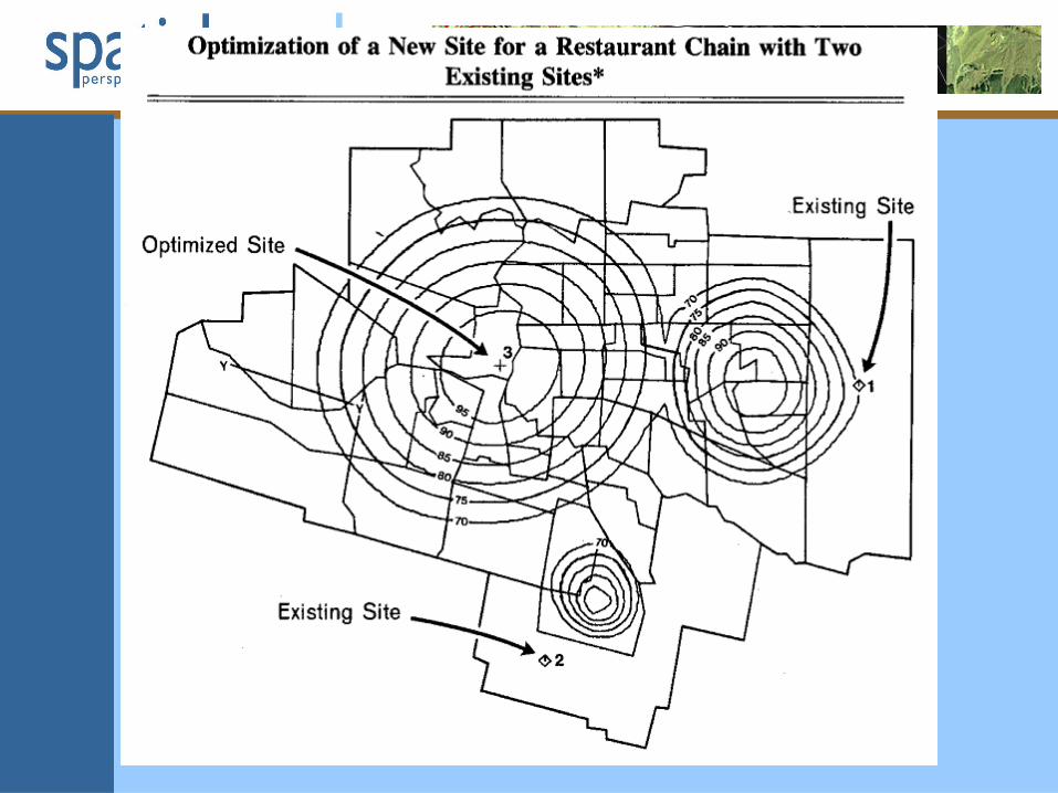
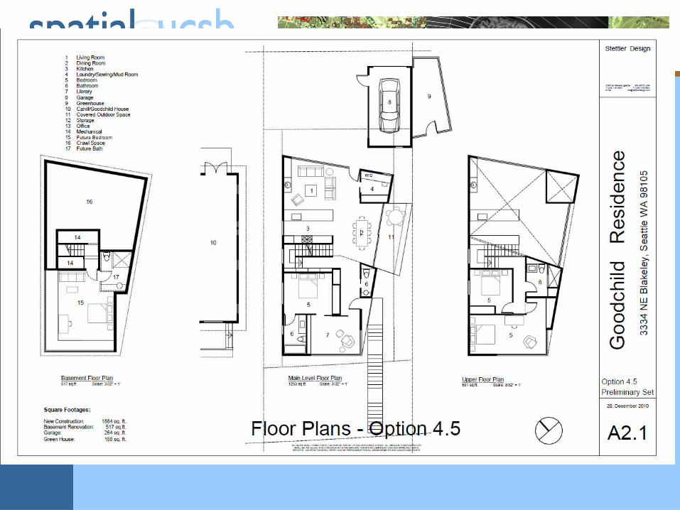
A personal perspective• small-d design
– power lines, highways across Southern Ontario– waste water disposal in the Southern Ontario
oilfield– Wendy’s restaurants in Montreal– school catchment areas in London, Ontario– gas stations in Toronto

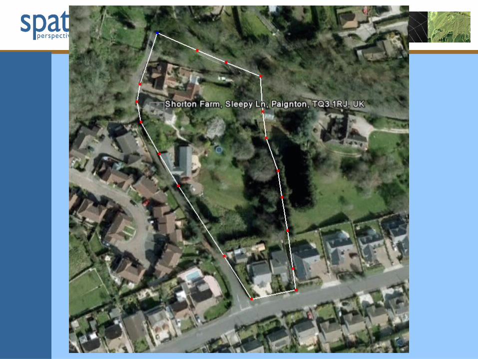
Compton Way, Compton Road, South Petherton, Somerset, UK
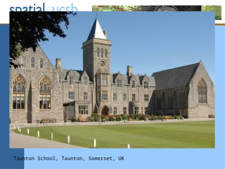
Taunton School, Taunton, Somerset, UK


Some personal questions• In my courses, how can I instill a greater sense of
the opportunities GIS gives for Design?– in addition to analysis, modeling, inventory
• How can GeoDesign become a life-long experience?• How can we do more to break down the barriers
between Design and Science?– as a geographer I have been almost exclusively
concerned with Science– to me, GIS has been a tool for Science, and
perhaps design, but almost never Design