What is Direction?
19
– WildlifeCampus Wilderness Navigation Course This course material is the copyrighted intellectual property of WildlifeCampus. It may not be copied, distributed or reproduced in any format whatsoever without the express written permission of WildlifeCampus. 1 What is Direction? Module 3 - Component 1 What is Direction?
Transcript of What is Direction?

– WildlifeCampus Wilderness Navigation Course
This course material is the copyrighted intellectual property of WildlifeCampus. It may not be copied, distributed or
reproduced in any format whatsoever without the express written permission of WildlifeCampus.
1
What is Direction?
Module 3 - Component 1
What is Direction?
– WildlifeCampus Wilderness Navigation Course
This course material is the copyrighted intellectual property of WildlifeCampus. It may not be copied, distributed or
reproduced in any format whatsoever without the express written permission of WildlifeCampus.
2
What is Direction?
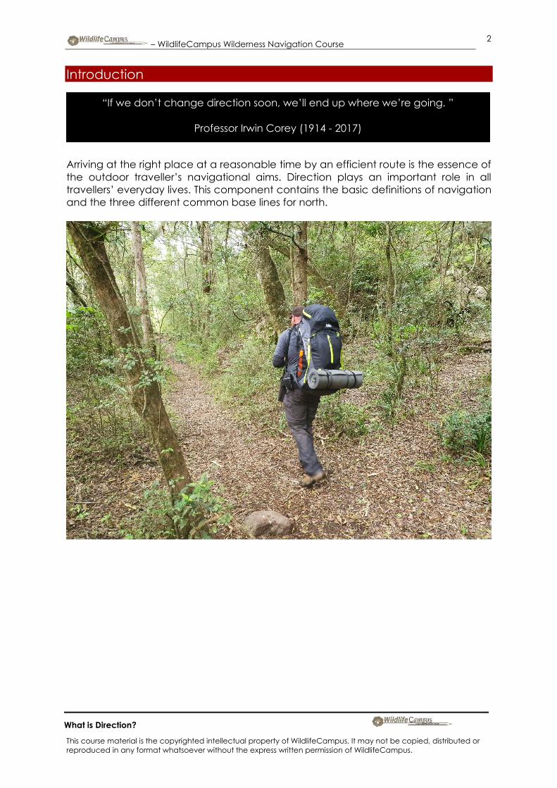
Introduction
Arriving at the right place at a reasonable time by an efficient route is the essence of
the outdoor traveller’s navigational aims. Direction plays an important role in all
travellers’ everyday lives. This component contains the basic definitions of navigation
and the three different common base lines for north.
“If we don’t change direction soon, we’ll end up where we’re going. ”
Professor Irwin Corey (1914 - 2017)

– WildlifeCampus Wilderness Navigation Course
This course material is the copyrighted intellectual property of WildlifeCampus. It may not be copied, distributed or
reproduced in any format whatsoever without the express written permission of WildlifeCampus.
3
What is Direction?
Base Lines
In order to measure something, there must always be a starting point or zero
measurement. To express direction as a unit of angular measure, which is what we
need, there must be a starting point and a point you are measuring to. The starting
point is the base or reference line. There are three common base lines: true north,
magnetic north, and grid north. The most commonly used in navigation are magnetic
and grid.

– WildlifeCampus Wilderness Navigation Course
This course material is the copyrighted intellectual property of WildlifeCampus. It may not be copied, distributed or
reproduced in any format whatsoever without the express written permission of WildlifeCampus.
4
What is Direction?
True north
True north is a straight line from any point on the Earth’s surface to the North Pole. All
lines of longitude (the ones going up and down) are true north lines and meet at the
North and South Poles. North is usually symbolised by a line ending with an arrowhead
or star. This is NOT where your compass is pointing…

– WildlifeCampus Wilderness Navigation Course
This course material is the copyrighted intellectual property of WildlifeCampus. It may not be copied, distributed or
reproduced in any format whatsoever without the express written permission of WildlifeCampus.
5
What is Direction?
Magnetic north
Magnetic north is the northern magnetic pole of the Earth. This IS where your compass
is pointing, the direction to the northern magnetic pole. Magnetic north is usually
symbolised by a line ending with a half arrowhead. It is actually not a single small place
like the true North Pole but in fact a large area of intense magnetism. This could be
either to the left (west) or right (east) of true north, depending on where on the world’s
surface you are.

– WildlifeCampus Wilderness Navigation Course
This course material is the copyrighted intellectual property of WildlifeCampus. It may not be copied, distributed or
reproduced in any format whatsoever without the express written permission of WildlifeCampus.
6
What is Direction?
Grid north
The north (base line) that is established by using the vertical grid lines on the map is
grid north. It is commonly thought of as being true north and for all intents of purpose,
this is okay when working on a single map, but in fact, due to the curvature of the Earth
and that meridians curve towards the North and South Poles, there is a very slight
difference between grid north and true north. Grid north may be symbolised by the
letters GN. Unless your map has had a custom grid drawn on it that is not based on
true north you can generally ignore the difference between grid and true north. Check
the notes on your map.
– WildlifeCampus Wilderness Navigation Course
This course material is the copyrighted intellectual property of WildlifeCampus. It may not be copied, distributed or
reproduced in any format whatsoever without the express written permission of WildlifeCampus.
7
What is Direction?
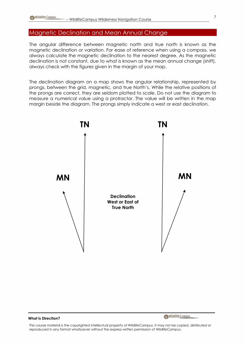
Magnetic Declination and Mean Annual Change
The angular difference between magnetic north and true north is known as the
magnetic declination or variation. For ease of reference when using a compass, we
always calculate the magnetic declination to the nearest degree. As the magnetic
declination is not constant, due to what is known as the mean annual change (shift),
always check with the figures given in the margin of your map.
The declination diagram on a map shows the angular relationship, represented by
prongs, between the grid, magnetic, and true North’s. While the relative positions of
the prongs are correct, they are seldom plotted to scale. Do not use the diagram to
measure a numerical value using a protractor. The value will be written in the map
margin beside the diagram. The prongs simply indicate a west or east declination.
TN TN
MN MN
Declination
West or East of
True North

– WildlifeCampus Wilderness Navigation Course
This course material is the copyrighted intellectual property of WildlifeCampus. It may not be copied, distributed or
reproduced in any format whatsoever without the express written permission of WildlifeCampus.
8
What is Direction?
On some older maps, the magnetic declination information was confusing because it
was represented as degrees and points of a degree. So 10º 0.5 west actually meant
10º 30’ west (10 degrees 30 minutes), and not 10º 5’ west. This caused complications
in calculating the magnetic declination as 10º 0.5º minus 3’ involved a lot of thought.
On newer maps, the declination information is given in degrees and minutes so it will
be easy to calculate 10º 30’ minus 3’ (= 10º 27’).
The symbols º,’ and ” represent degrees, minutes and seconds respectively. (we will
cover more on this when we look at grids.) It is critically important to check the notes
on your map to determine if magnetic north is west or east of true north, based on
where you are, as this makes a big difference.

– WildlifeCampus Wilderness Navigation Course
This course material is the copyrighted intellectual property of WildlifeCampus. It may not be copied, distributed or
reproduced in any format whatsoever without the express written permission of WildlifeCampus.
9
What is Direction?
Maps will also tell you what the mean annual change is. For example, the map could
state:
Declination was 19.8° west in 1987, and the mean annual change is 1’ eastwards per
year.
19.8° is the same as 19° 48’. At a 1’ easterly movement each year, and there being 23
years (till 2010) since the map was compiled means we subtract 23’ from 19° 48’,
making a present time declination of 19° 25’. So calculating to the nearest degree in
1987 the magnetic declination would have been 20° east of true north, but in 2010 it
is 19°. We always use the closest whole degree when working out declinations. Check
the map date you are using, and only do the conversion if it is really old.
Looking at another example, the map states:
Declination was 10° 5’ east in 2000, and the mean annual change is 1’ eastwards per
year.
At an 1’ east movement each year, and there being 10 years (till 2010) since the map
was created means we add 10’ to 10° 05’ (as we measure clockwise), making a
present declination of 10° 15’. So in 2000, the magnetic declination would have been
10° east of true north, and in 2010 it is still 10°. (Working to the closest degree) In some
places on Earth, magnetic and true north are aligned so no conversion is necessary.

– WildlifeCampus Wilderness Navigation Course
This course material is the copyrighted intellectual property of WildlifeCampus. It may not be copied, distributed or
reproduced in any format whatsoever without the express written permission of WildlifeCampus.
10
What is Direction?
Methods of expressing direction
Travellers need a way of expressing direction that is accurate, adaptable to any part
of the world, and has a common unit of measure. Directions referred to by the
common ‘left’ or ‘right’ are all very well but are not suitable for the outdoor
environment, so direction is rather referred to as units of angular measure which are
called ‘azimuths’, more commonly known as ‘bearings’.
“The only reason some people get lost in thought is because it’s unfamiliar
territory.”
Paul Fix

– WildlifeCampus Wilderness Navigation Course
This course material is the copyrighted intellectual property of WildlifeCampus. It may not be copied, distributed or
reproduced in any format whatsoever without the express written permission of WildlifeCampus.
11
What is Direction?
Azimuth or Bearing
The word ‘azimuth’ comes from an Arabic form of a Latin word meaning way or path.
This is the direction of an object, measured clockwise around the observer’s horizon
from a base line. The common term ‘bearing’ is in fact probably incorrect as a bearing,
or to use the correct term, ‘surveyor’s bearing’, divides a circle into four segments of
90 degrees, and to read a position using the surveyor’s bearings, you first identify the
base direction line and then record the angle east or west of that line, followed by the
direction east or west of that line. For example North 30° West (30° west of north.) A
surveyors bearing can never exceed 90°.
This is awkward for walking navigation, so we use a term called the azimuth or bearing.
An azimuth is the angle measured between you, an object and a base line, and is
measured from the true base line (north), clockwise around a circle back to the base
line. However there is little consensus worldwide on the terms ‘azimuth’ and ‘bearing’
with many differing explanations given.
North 45 degrees East
South 80 degrees East
South 22 degrees West
North 30 degrees West
North
East
South
West

– WildlifeCampus Wilderness Navigation Course
This course material is the copyrighted intellectual property of WildlifeCampus. It may not be copied, distributed or
reproduced in any format whatsoever without the express written permission of WildlifeCampus.
12
What is Direction?
Some of these include:
Azimuth refers to direction from true north clockwise. Bearing is the direction from grid
north or south also clockwise. In South Africa, bearings are measured from 0 degrees
south. Aslam Parker, Deputy Director: Professional & Scientific Services: Surveys &
Mapping South Africa’s National Mapping Organisation
Azimuth: A horizontal angle reckoned clockwise from the meridian. Bearing: in
general the horizontal angle between a line from the observer to a given point.
Geodetic Glossary of the National Oceanic and Atmospheric Administration (USA)
http://www.noaa.gov
Azimuth is particularly applied to directions determined by astronomical means and
is the clockwise angle between a line to the point in question and the direction to
the North Pole. Bearing is particularly applied when referring to an initial direction
that is related to the direction of the grid lines on the map. Jim Smith, Honorary
Secretary of the International Institution for the History of Surveying and Measurement
UK
Bearings are deemed to be true geographical angles of direction and are related
to true north or true south… the word ‘bearing’ should thus not be used when dealing
with a rectangular co-ordinate system – that is, the ellipsoidal latitude and longitude
co-ordinates projected on a plane surface {maps}. It seems to be advisable to use
the term ‘grid bearing’ when referring to a projection {map}; the term ‘true bearing’,
‘astronomical bearing’ or ‘azimuth’ when referring to true north or true south, and
‘magnetic bearing’ when referring to magnetic north. Tomasz Zakiewicz, Deputy
Chief Land Surveyor, Directorate: Surveys and Mapping
a

– WildlifeCampus Wilderness Navigation Course
This course material is the copyrighted intellectual property of WildlifeCampus. It may not be copied, distributed or
reproduced in any format whatsoever without the express written permission of WildlifeCampus.
13
What is Direction?
However for the purposes of this course, we will use the term ‘bearing’ for all references
to a direction for ease of reference, and I quote J.R. Smith in his Introduction to
Geodesy when he says,
“… while it is preferable for all nations to use the same definitions and terminology, it is
a fact of life that neither these nor some other survey terms are universally exclusive,
and so should be interpreted in the context of the publication in which they appear.”
Should you prefer to use the term ‘azimuth’, go ahead. There are three possible ways
of expressing the direction1 in which we wish to go in:
1 The term direction is also strictly incorrect, but we will not go into that here…

– WildlifeCampus Wilderness Navigation Course
This course material is the copyrighted intellectual property of WildlifeCampus. It may not be copied, distributed or
reproduced in any format whatsoever without the express written permission of WildlifeCampus.
14
What is Direction?
Azimuth
True bearing (azimuth)
The angle determined if the North Pole (Earth’s rotational pole) is used as the base line
reference point clockwise to a point.
Magnetic bearing (azimuth)
The angle measured with the magnetic North Pole as the base line and determined
by using magnetic instruments, for example, a magnetic compass.
Grid bearings (azimuth)
The angle determined if the top of the map’s grid is used as the base line reference
point clockwise to a point. There are many ways in which to measure this angle, but
the four common units used are degrees, milliradian, grad and points.

– WildlifeCampus Wilderness Navigation Course
This course material is the copyrighted intellectual property of WildlifeCampus. It may not be copied, distributed or
reproduced in any format whatsoever without the express written permission of WildlifeCampus.
15
What is Direction?
Degree
The most common unit of measure is the degree (°) subdivided into minutes of angle
(MOA) (’) and seconds of angle (SOA) (”).
1 degree = 60 minutes (1° = 60’)
1 minute = 60 seconds (1’ = 60”)
There are 360 degrees in a circle.
The degree is the preferred unit of measurement for common navigational use, but it
is interesting to know about some others.

– WildlifeCampus Wilderness Navigation Course
This course material is the copyrighted intellectual property of WildlifeCampus. It may not be copied, distributed or
reproduced in any format whatsoever without the express written permission of WildlifeCampus.
16
What is Direction?
Milliradian
Another unit of measure, the milliradian or mil, is used mainly in military gunnery but
‘mil’ does not stand for military. The mil expresses the size of an angle formed when a
circle is divided into 6,400 angles with the vertex of the angles at the centre of the
circle. If the circle has a radius of 1,000 yards, one mil would relate to one yard on the
circumference of the circle.
This allows for easy determination of range and angle for setting the sights on artillery
weapons. A relationship can be established between degrees and mils.
A circle equals 6,400 mils divided by 360 degrees, or 17.78 mils per degree.
To convert degrees to mils, multiply degrees by 17.78. Using mils for general land
navigation is difficult as most people battle to be accurate to one degree, let alone
17 times smaller. For normal compass work, the increments are simply too small.
Also 6,400 Mils 0 Milliradian
1,600 Mils
3,200 Mils
4,800 Mils

– WildlifeCampus Wilderness Navigation Course
This course material is the copyrighted intellectual property of WildlifeCampus. It may not be copied, distributed or
reproduced in any format whatsoever without the express written permission of WildlifeCampus.
17
What is Direction?
Grad
The grad is the unit of measure found on some maps (this is also known as gon, grade,
or gradian). There are 400 grads in a circle (a right angle equals 100 grads).
The grad is divided into 100 centesimal minutes (centigrade) and the minute into 100
centesimal seconds (milligrads). The metric grad system has never been popular with
walking-based navigators.
Also 400 Grad 0 Grad
100 Grad
200 Grad
300 Grad

– WildlifeCampus Wilderness Navigation Course
This course material is the copyrighted intellectual property of WildlifeCampus. It may not be copied, distributed or
reproduced in any format whatsoever without the express written permission of WildlifeCampus.
18
What is Direction?
East NE (To the East of North East)
North NE (To the North of North East)
NE (To the North East)
Points
Points or cardinal points were used to express direction before the invention of the
magnetic compass, although you will still often hear the terms used.
North
East

– WildlifeCampus Wilderness Navigation Course
This course material is the copyrighted intellectual property of WildlifeCampus. It may not be copied, distributed or
reproduced in any format whatsoever without the express written permission of WildlifeCampus.
19
What is Direction?
A ‘point’ is defined as one eighth of a right angle. Therefore, it equals exactly 11.25
degrees. For example, a bearing of northwest by north differs by one point from a
north-west bearing, and by a point from a north-northwest one.