USING GIS IN THE CLASSROOM Malcolm McInerney, Findon High School, Adelaide GeographyScience History...
25
USING GIS IN THE CLASSROOM Malcolm McInerney, Findon High School, Adelaid Geography Science History Social Studies Science Subject area applicati on is only limited by the imaginati on
-
Upload
wyatt-johnson -
Category
Documents
-
view
216 -
download
2
Transcript of USING GIS IN THE CLASSROOM Malcolm McInerney, Findon High School, Adelaide GeographyScience History...
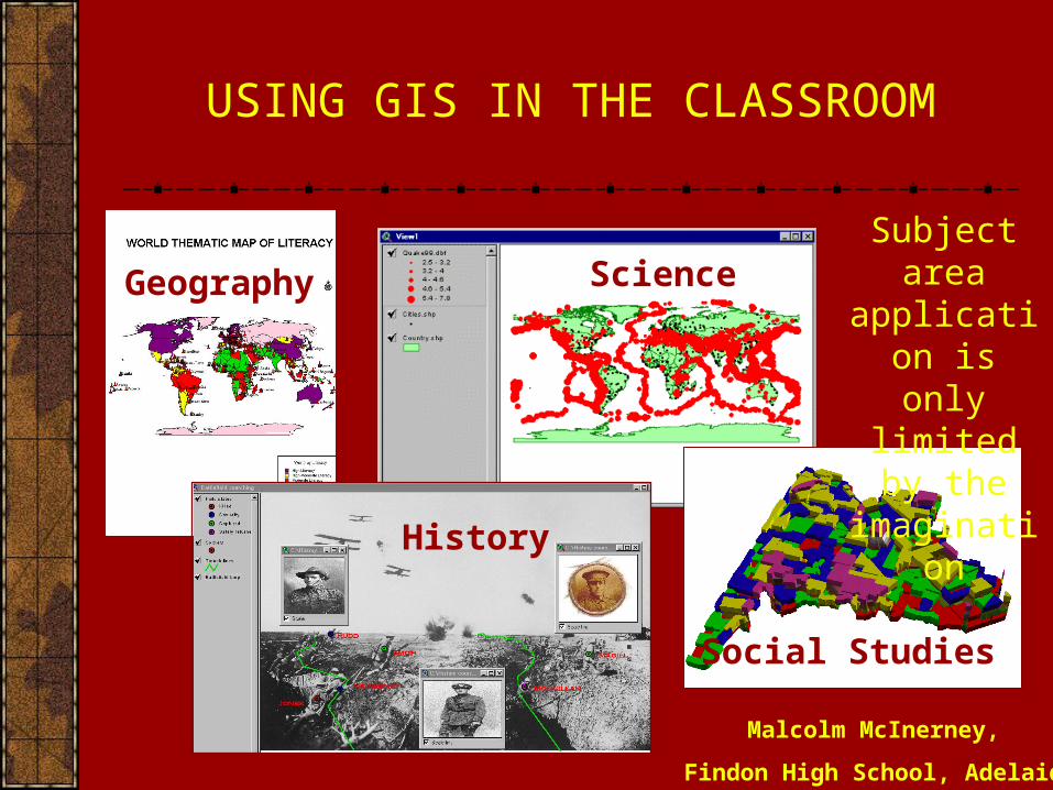
USING GIS IN THE CLASSROOM
Malcolm McInerney,
Findon High School, Adelaide
Geography Science
History
Social Studies
ScienceSubject area application is only limited
by the imagination
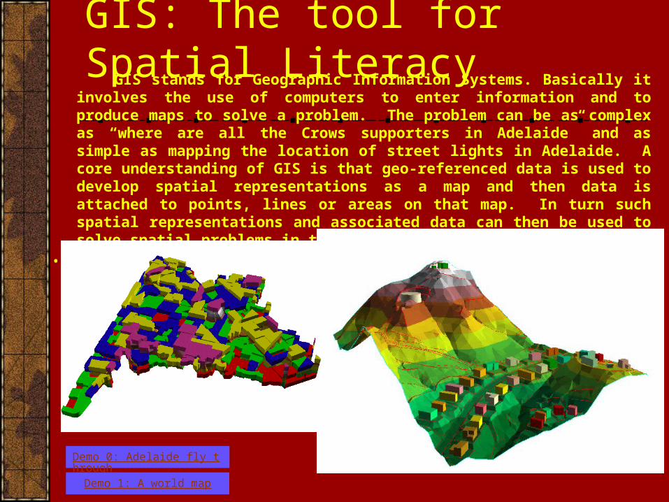
GIS: The tool for Spatial Literacy GIS stands for Geographic Information Systems. Basically it involves the use of computers
to enter information and to produce maps to solve a problem. The problem can be as complex as “where are all the Crows supporters in Adelaide” and as simple as mapping the location of street lights in Adelaide. A core understanding of GIS is that geo-referenced data is used to develop spatial representations as a map and then data is attached to points, lines or areas on that map. In turn such spatial representations and associated data can then be used to solve spatial problems in the landscape.
•
Demo 0: Adelaide fly through
Demo 1: A world map
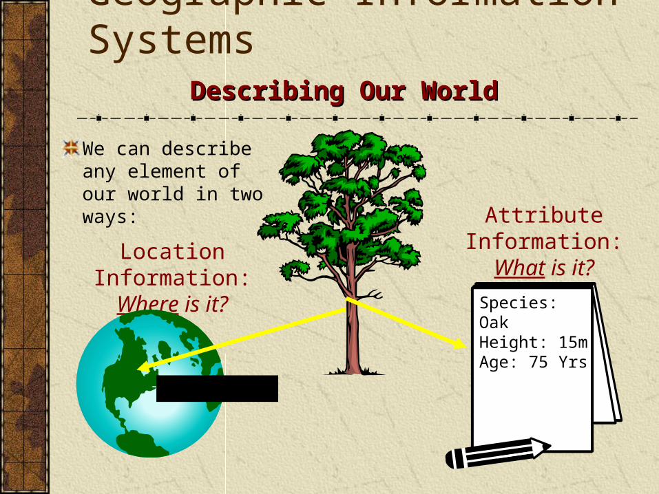
Geographic Information SystemsDescribing Our WorldDescribing Our World
We can describe any element of our world in two ways: Attribute
Information:What is it?
Species: OakHeight: 15mAge: 75 Yrs
Location Information: Where is it?
51°N, 112°W
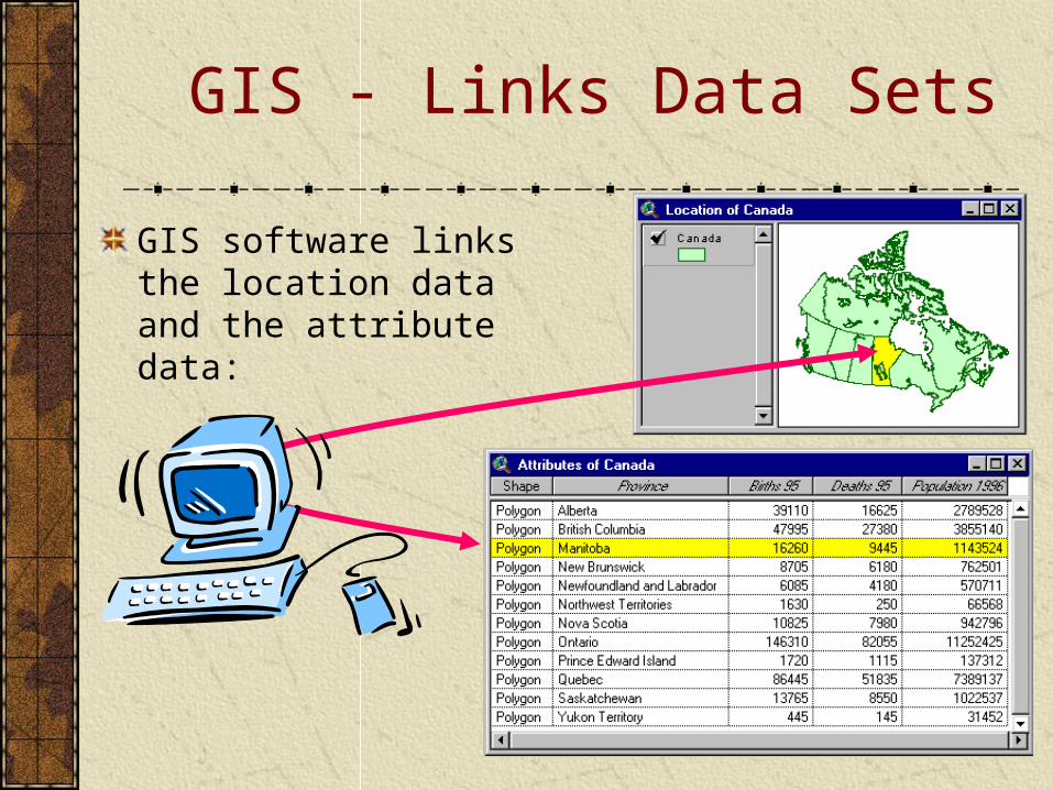
GIS - Links Data Sets
GIS software links the location data and the attribute data:
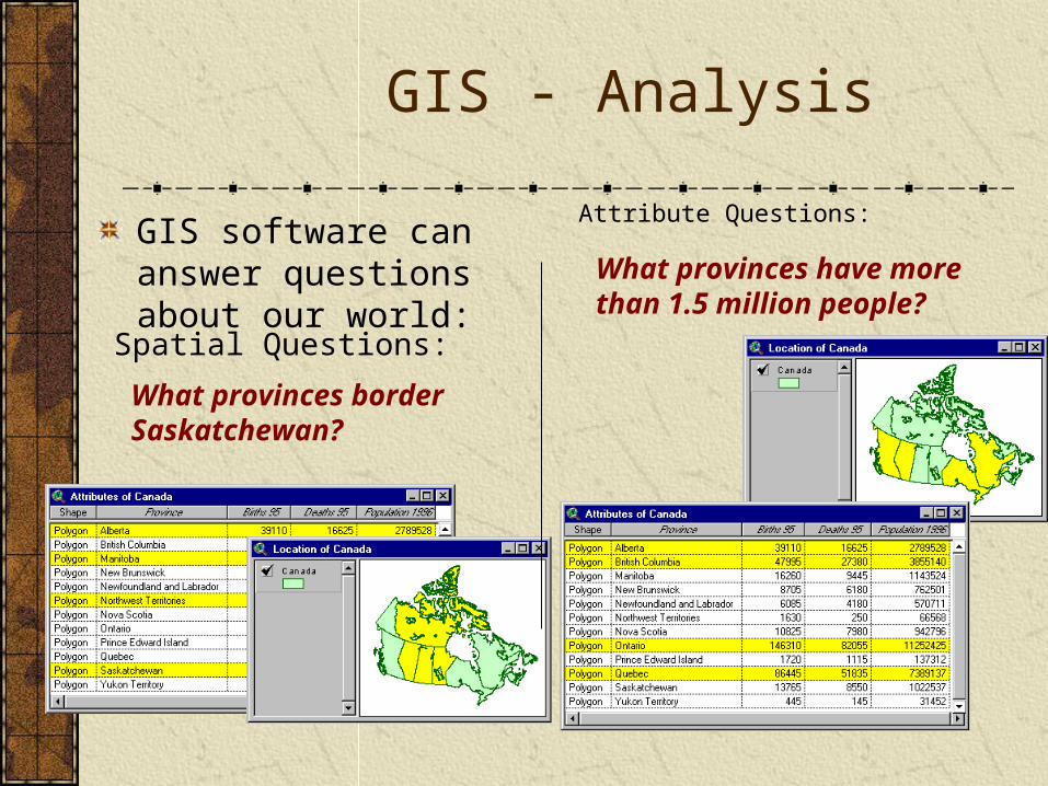
GIS - Analysis
GIS software can answer questions about our world:
What provinces border Saskatchewan?
Spatial Questions:
What provinces have more than 1.5 million people?
Attribute Questions:
Base Map Data
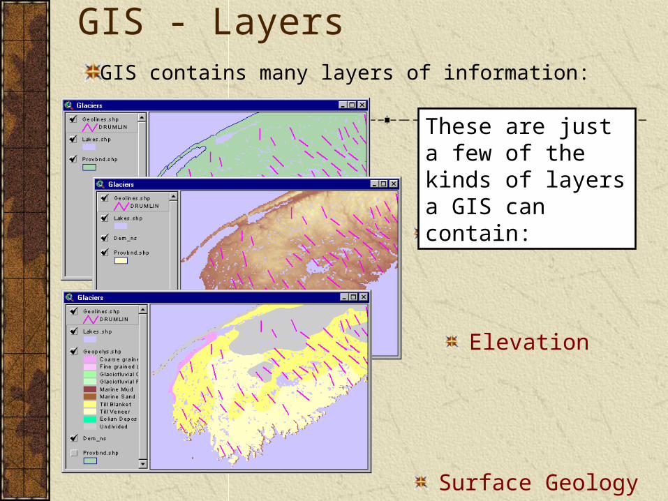
GIS - Layers
GIS contains many layers of information:
Elevation
Surface Geology
These are just a few of the kinds of layers a GIS can contain:
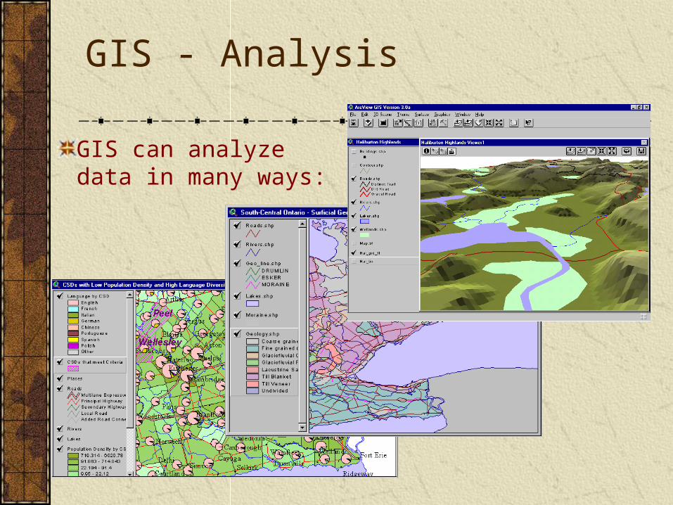
GIS - Analysis
GIS can analyze data in many ways:
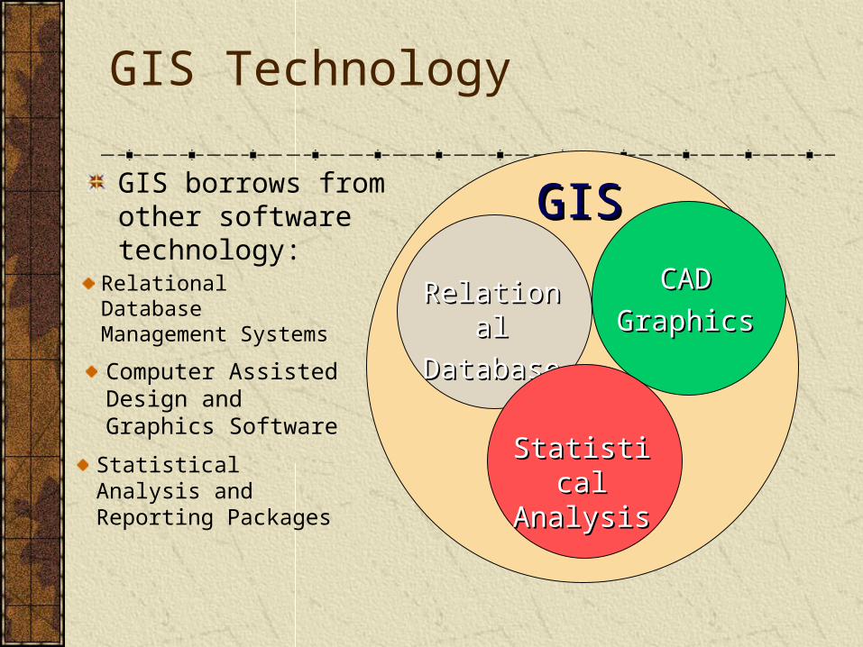
GIS Technology
GISGISGIS borrows from other software technology:
RelationalRelational
DatabaseDatabase
Relational Database Management Systems
CADCAD
GraphicsGraphics
Computer Assisted Design and Graphics Software
Statistical Statistical AnalysisAnalysis
Statistical Analysis and Reporting Packages
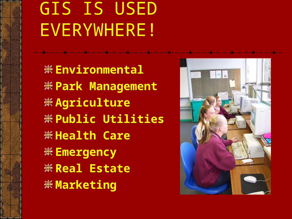
GIS IS USED EVERYWHERE!
Environmental
Park Management
Agriculture
Public Utilities
Health Care
Emergency
Real Estate
Marketing
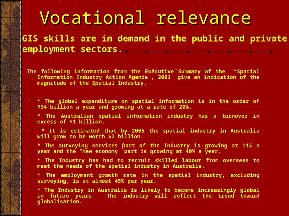
The following information from the Executive Summary of the “Spatial Information Industry Action Agenda”, 2001” give an indication of the magnitude of the Spatial Industry.
* The global expenditure on spatial information is in the order of $34 billion a year and growing at a rate of 20%.
* The Australian spatial information industry has a turnover in excess of $1 billion.
* It is estimated that by 2005 the spatial industry in Australia will grow to be worth $2 billion.
* The surveying services part of the Industry is growing at 11% a year and the “new economy” part is growing at 40% a year.
* The Industry has had to recruit skilled labour from overseas to meet the needs of the spatial industry in Australia.
* The employment growth rate in the spatial industry, excluding surveying, is at almost 45% per year.
* The Industry in Australia is likely to become increasingly global in future years. The industry will reflect the trend toward globalisation.
GIS skills are in demand in the public and private employment sectors.
Vocational relevanceVocational relevance
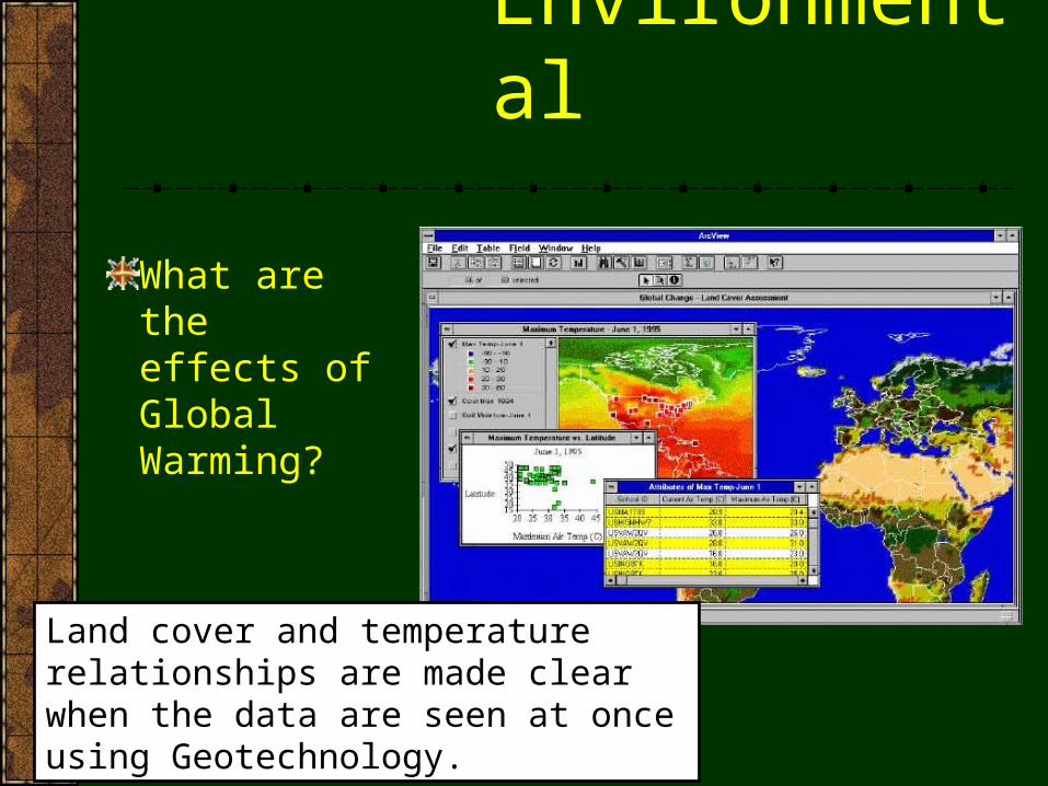
Environmental
What are the effects of Global Warming?
Land cover and temperature relationships are made clear when the data are seen at once using Geotechnology.
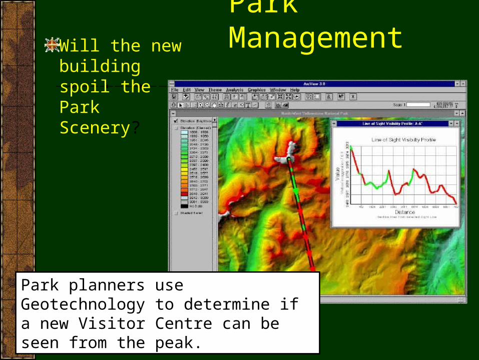
Park ManagementWill the new building spoil the Park Scenery?
Park planners use Geotechnology to determine if a new Visitor Centre can be seen from the peak.
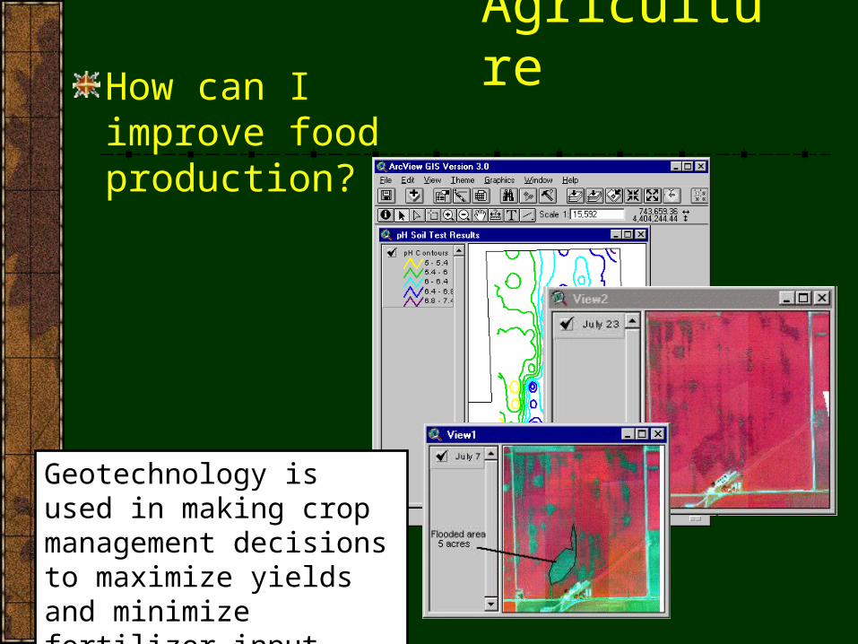
AgricultureHow can I improve food production?
Geotechnology is used in making crop management decisions to maximize yields and minimize fertilizer input.
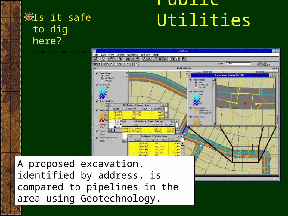
Public UtilitiesIs it safe to dig here?
A proposed excavation, identified by address, is compared to pipelines in the area using Geotechnology.
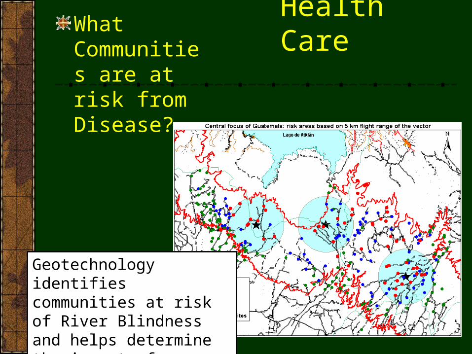
Health CareWhat Communities are at risk from Disease?
Geotechnology identifies communities at risk of River Blindness and helps determine the impact of treatment.
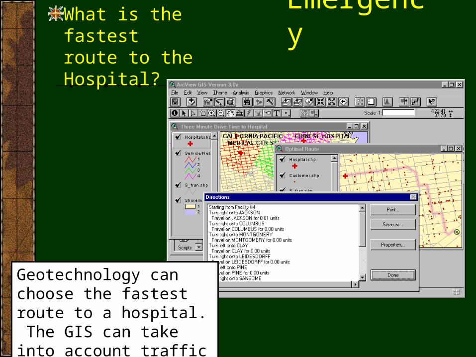
EmergencyWhat is the fastest route to the Hospital?
Geotechnology can choose the fastest route to a hospital. The GIS can take into account traffic and other impediments.
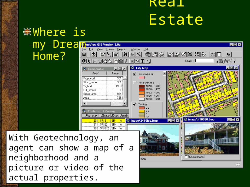
Real EstateWhere is my Dream Home?
With Geotechnology, an agent can show a map of a neighborhood and a picture or video of the actual properties.
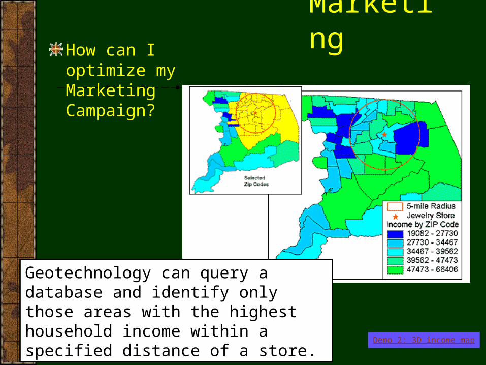
MarketingHow can I optimize my Marketing Campaign?
Geotechnology can query a database and identify only those areas with the highest household income within a specified distance of a store.
Demo 2: 3D income map
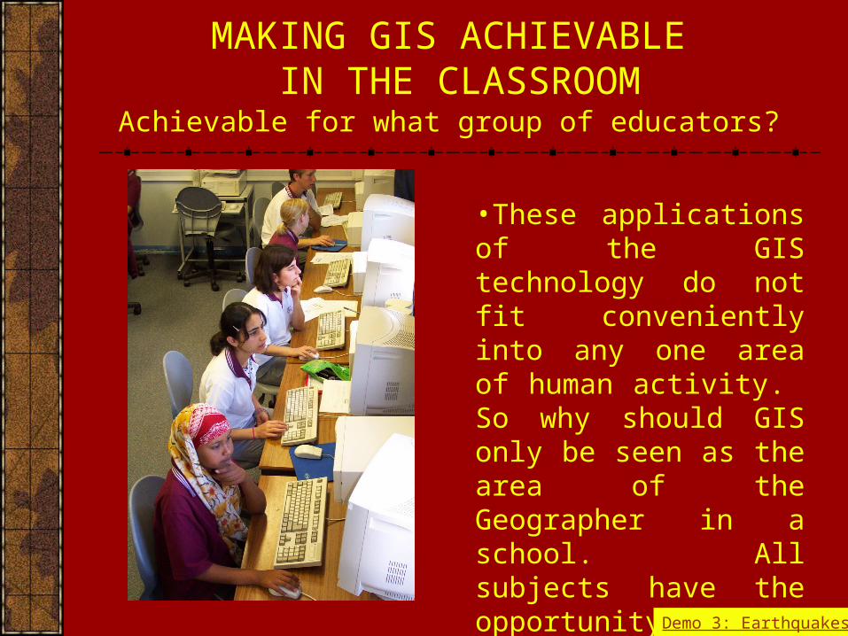
MAKING GIS ACHIEVABLE IN THE CLASSROOM
•These applications of the GIS technology do not fit conveniently into any one area of human activity. So why should GIS only be seen as the area of the Geographer in a school. All subjects have the opportunity to be involved in using GIS technology.
Achievable for what group of educators?
Demo 3: Earthquakes
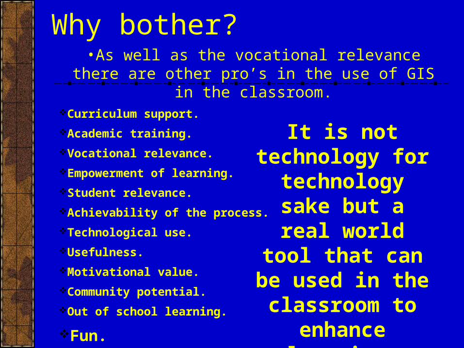
Why bother?•As well as the vocational relevance there are other pro’s in
the use of GIS in the classroom.Curriculum support.
Academic training.
Vocational relevance.
Empowerment of learning.
Student relevance.
Achievability of the process.
Technological use.
Usefulness.
Motivational value.
Community potential.
Out of school learning.
Fun.
It is not technology for
technology sake but a real world tool that can be used in the classroom
to enhance learning.
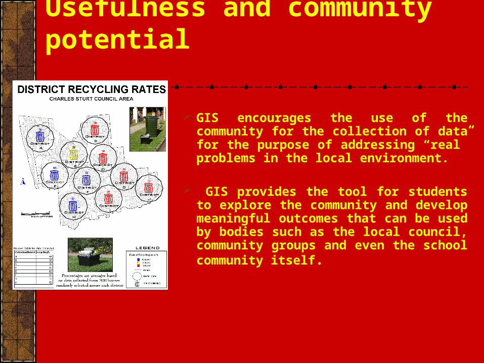
Usefulness and community potential
GIS encourages the use of the community for the collection of data for the purpose of addressing “real” problems in the local environment.
GIS provides the tool for students to explore the community and develop meaningful outcomes that can be used by bodies such as the local council, community groups and even the school community itself.
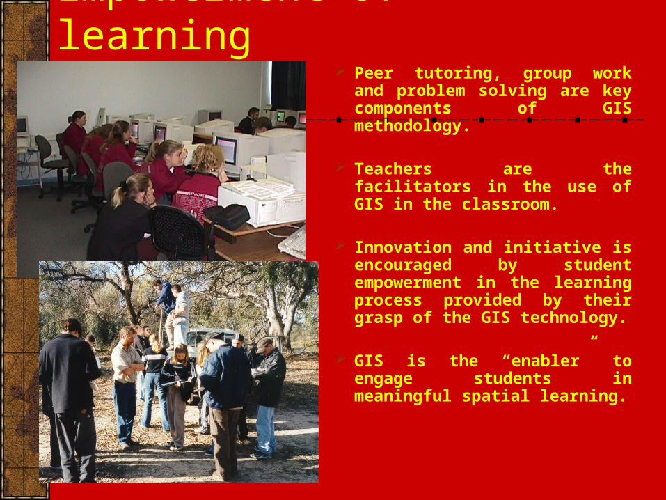
Empowerment of learning Peer tutoring, group work and
problem solving are key components of GIS methodology.
Teachers are the facilitators in the use of GIS in the classroom.
Innovation and initiative is encouraged by student empowerment in the learning process provided by their grasp of the GIS technology.
GIS is the “enabler” to engage students in meaningful spatial learning.
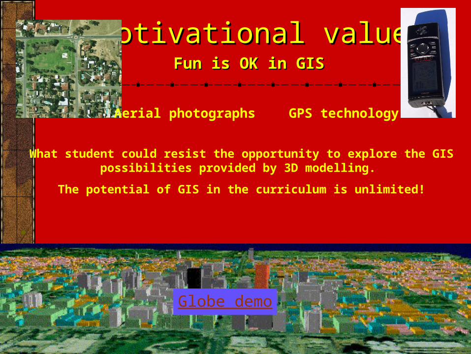
What student could resist the opportunity to explore the GIS possibilities provided by 3D modelling.
The potential of GIS in the curriculum is unlimited!
.
Fun is OK in GISFun is OK in GIS
Motivational valueMotivational value
GPS technologyAerial photographs
Globe demo
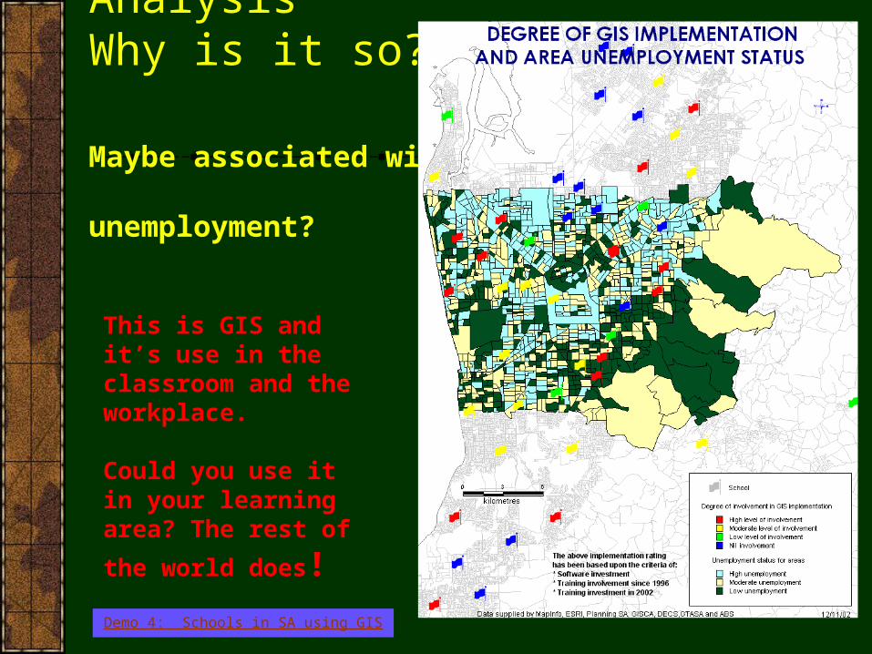
Spatial AnalysisWhy is it so?
Maybe associated with unemployment?
This is GIS and it’s use in the classroom and the workplace.
Could you use it in your learning area? The rest of
the world does!
Demo 4: Schools in SA using GIS

The “Creative Problem Solving” methodology using GIS.
By the end of such a creative process the students will have:
• Developed a problem.
• Collected primary and secondary data.
• Decided on maps to develop.
• Generated maps.
• Conducted spatial analysis, identifying trends and patterns.
• Drawn conclusions and future recommendations.
The use of GIS skills to explore and possibly solve spatial questions related to Tourism. Once students have GIS skills within a spatial context they are extremely good at developing spatial questions to investigate.