the GIS ProfeSSIonal - URISA GIS... · documents that millennial attitudes are different. One major...
22
the GIS PROFESSIONAL A publication of the Urban and Regional Information Systems Association Issue 279 • July/August 2017 IN THIS ISSUE continued on page 2 3 ArcGIS Pro 2.0 is here! 5 FOSS4G International Comes To Boston, MA 6 URISA’s GIS Management Institute 6 What Happens After the Assessment? 8 To Succeed as a Leader, Share the Big Picture 10 President’s Column 22 Mark Your Calendar! Why Training Means a Lot to Millennials By: Evan Hackel When baby boomers took their first “real” jobs upon entering the workforce, their demands and expectations were ridiculously low by today’s standards. On their first day on the job they got an employee handbook that they took home and scanned while eating dinner or watching TV. Company training, if there was any, was minimal. For the most part, they accepted the idea that it was normal to feel ignorant and unskilled in the first weeks or months on a new job. They expected to “learn the ropes” by making mistakes. When it came to promotions, most boomers were equally willing to proceed by trial and error. Nobody told them, “Here is just what you need to do to get ahead in our company . . . here is the next position we’ll be considering you for.” One day in the hazy future, they hoped that their bosses would call them in and say, “We just gave you a promotion . . . you may leave early and take the family to dinner to celebrate.” Was there feedback? Of course, there was. There were quarterly, semiannual, or yearly job reviews that usually followed the script, “Here’s what you’ve been doing wrong, here’s where you need to improve—so do it, session over.” In short, many baby boomers were happy to toil away in black boxes, learning jobs and building careers in a loose way that would seem absurd to the members of today’s younger millennial workforce. Millennials Have Far Different Expectations and Demands Boy, have things changed. Today, most millennial workers would object strenuously to the same kind of conditions that baby boomers (and members of the generation that preceded them) thought were normal. If today’s millennials start new jobs and discover conditions like those in a new workplace, they are going to start looking for new jobs in a matter of hours. Ample research documents that millennial attitudes are different. One major study from Gallup, “How Millennials Want to Work and Live,” reports these findings: 60% of millennials say that the opportunity to learn and grow on the job is extremely important. In contrast, only 40% of baby boomers feel the same way. 50% of millennials strongly agree that they plan to remain in their jobs for at least the next year. That might sound like a big percentage, but 60% of members of all other groups plan to stay in place for at least a year. Baby boomers and others are planning on sticking around, while millennials are weighing their options.
Transcript of the GIS ProfeSSIonal - URISA GIS... · documents that millennial attitudes are different. One major...
theGIS ProfeSSIonalA publication of the Urban and Regional Information Systems Association Issue 279 • July/August 2017
IN THIS ISSUE
continued on page 2
3 ArcGIS Pro 2.0 is here!
5 FOSS4G International Comes To Boston, MA
6 URISA’s GIS Management Institute
6 What Happens After the Assessment?
8 To Succeed as a Leader, Share the Big Picture
10 President’s Column
22 Mark Your Calendar!
Why Training Means a Lot to MillennialsBy: Evan Hackel
When baby boomers took
their first “real” jobs upon
entering the workforce, their
demands and expectations
were ridiculously low by
today’s standards. On their
first day on the job they got an
employee handbook that they
took home and scanned while
eating dinner or watching TV.
Company training, if there was
any, was minimal.
For the most part, they
accepted the idea that it was
normal to feel ignorant and
unskilled in the first weeks or
months on a new job. They
expected to “learn the ropes”
by making mistakes.
When it came to
promotions, most boomers
were equally willing to
proceed by trial and error.
Nobody told them, “Here is
just what you need to do to
get ahead in our company . . .
here is the next position we’ll
be considering you for.” One
day in the hazy future, they
hoped that their bosses would
call them in and say, “We just
gave you a promotion . . . you
may leave early and take the
family to dinner to celebrate.”
Was there feedback?
Of course, there was. There
were quarterly, semiannual, or
yearly job reviews that usually
followed the script, “Here’s
what you’ve been doing wrong,
here’s where you need to
improve—so do it, session over.”
In short, many baby
boomers were happy to toil
away in black boxes, learning
jobs and building careers in
a loose way that would seem
absurd to the members of
today’s younger millennial
workforce.
Millennials Have Far Different Expectations and DemandsBoy, have things changed.
Today, most millennial workers
would object strenuously to
the same kind of conditions
that baby boomers (and
members of the generation
that preceded them) thought
were normal. If today’s
millennials start new jobs and
discover conditions like those
in a new workplace, they are
going to start looking for new
jobs in a matter of hours.
Ample research
documents that millennial
attitudes are different. One
major study from Gallup, “How
Millennials Want to Work and
Live,” reports these findings:
60% of millennials say that
the opportunity to learn and
grow on the job is extremely
important. In contrast, only
40% of baby boomers feel the
same way.
50% of millennials strongly
agree that they plan to remain
in their jobs for at least the next
year. That might sound like a
big percentage, but 60% of
members of all other groups
plan to stay in place for at least
a year. Baby boomers and
others are planning on sticking
around, while millennials are
weighing their options.
Do you have millennials on your GIS team? Support their
professional development. Send them to GIS-Pro 2017 in
Jacksonville where we have focused content to support young GIS professionals. URISA understands the importance of
supporting our next generation of leaders!
“As a young professional, GIS-Pro allowed
me to network with a variety of professionals
in my field as well as creating opportunities
for me to volunteer, present, and get involved
in ways I couldn’t have imagined. I would not
be where I’m at, in my career, without GIS-
Pro and the URISA community!” - Kari Chael,
Valparaiso, IN
Also, encourage your emerging GIS superstars to apply to
URISA’s Vanguard Cabinet of young professionals and support
their participation in a URISA GIS Leadership Academy!
Learning and Training Are Key to Retaining Millennials and Maximizing their ProductivityFindings like those – and you can easily find more – document
that millennials are more likely to be engaged and to stay on
their jobs if they have opportunities to plan their career paths
and learn.
Here are the trends:
• Millennials like to feel capable and confident in their jobs. Millennials do not like to feel like rookies. Many think
of themselves as leaders – or as leaders who are waiting to
be discovered. They want to look good, and thrive on being
able to confidently contribute from the first day they arrive
on the job. The right kind of training—both for new and
current millennial employees—makes that happen.
• Millennials are usually skilled students. They like to
apply the learning skills they built while they were in school.
To them, learning feels as natural as eating three meals a
day. As the Gallup study found, they are eager to learn. In
contrast, getting baby boomers to believe in training can
be a harder sell. They tend to view training as a burden,
something they have to endure. Millennials say, “Wow, when
can I start?”
• Millennials are tech-friendly. Most of them love to be
trained on their mobile phones and tablets, which are
the most powerful training options available to many
companies today. The result is better knowledge transfer,
even to groups of employees who work in multiple or
far-flung locations. Baby boomers, in contrast, are more
tech-resistant. They are likely to freeze and resist when they
hear they are going to be taking company training on their
smartphones.
Training Is the Place to Build Millennial Productivity and RetentionA lot of training focuses on teaching needed skills. It should.
But training can accomplish a lot more than that, if you use it to
establish some of the following things that many millennials are
looking for:
Mentoring relationships with their supervisors. Gallup found
that 60% of millennials feel that the quality of the people who
manage them is extremely important. With that in mind, your
training for new employees can set up mentoring, not reporting,
relationships between them and their managers. Explain how
often check-ins and job reviews with their managers will happen,
and what they will cover. And schedule frequent check-in rather
than “on the calendar” pro-forma reviews that both managers
and the people they manage find boring, or worse.
Millennials continued from page 1 A sense of belonging on an energized and innovative team. This is a bit of a
contradiction, but at the
same time millennials think
of themselves as individualist
entrepreneurs, they also expect
to be part of an interesting team.
Letting millennials get to know their teammates during training,
and fostering a sense of team/group identity, can help convince
them that they have joined the right organization.
A well-defined career path. Consider creating a personalized
career development plan for all new employees (the exception
being seasonal or other short-term workers who will probably
not remain with your company for long). Another idea? Enroll
new employees in management training programs from their
first days on the job. In retail, for example, you can enroll them
in training that will enable them to manage their own stores in
two years, or after another stated period. Millennials like to know
their next steps as they build their careers, and training is a fine
place to explain them.
Yes, training is important to millennials. They are the
most energized, skilled and capable generation ever to enter
the workforce. Train them well and they will become your
organization’s brightest future.
About Evan Hackel. Evan Hackel is CEO of Tortal Training, a firm
that specializes in developing and implementing interactive
training solutions for companies in all sectors. Evan created the
concept of Ingaged Leadership and is Principal and Founder of
Ingage Consulting, a consulting firm headquartered in Woburn,
Massachusetts. To learn more about Ingage Consulting and
Evan’s book Ingaging Leadership, visit Ingage.net.
The GIS Professional • JULY/AUGUST 2017 • Page 2
Esri released version 2.0 of ArcGIS Pro at the end of June. For
those that might not know, ArcGIS Pro is Esri’s newest desktop
GIS application which will ultimately be replacing ArcMap®,
ArcCatalog®, ArcScene® and ArcGlobe®. ArcGIS Pro is built on
a 64-bit architecture which allows it to make use of all the
hardware you can throw at it and has a completely new modern
ribbon interface.
When will this replacement happen? That is a good
question. Sadly, I don’t have an exact answer. It seems to depend
on who you talk to at Esri. I have heard anything from 2 to 7 years.
You can see the transition is already starting by going to Esri’s
product page on their website. You will see that it lists ArcGIS Pro
as their lead desktop platform. You have to dig a bit to find any
mention of ArcMap or ArcCatalog.
What I do know is that Esri is putting almost all their desktop
development efforts into ArcGIS Pro. So, don’t expect any new
functionality of any significance to be added to the traditional
ArcGIS Desktop platform.
What’s in ArcGIS Pro 2.0What can you expect to see in this new version of ArcGIS
Pro? Esri continues to push toward parity with ArcMap. The
former version, 1.4, went a long way in this regard. It added a
lot of functionality so that if you primarily use ArcMap to create
maps, perform simple GIS analysis or edit data using basic tools
or even topologies, you may be able to switch to ArcGIS Pro now.
ArcGIS Pro 2.0 continues this trend of adding even more
functionality. Here are some capabilities and changes which are
included in ArcGIS Pro 2.0:1. Support for Geodatabase Annotation is now included.
However, it still does not support map annotation or graphics. Those can only be added directly in a layout.
2. Allows multiple Instances of ArcGIS Pro to be running at the same time on the same computer
3. The Project Pane will be renamed to the Catalog Pane4. Will remember folder and database connections between
projects through the use of favorites.
5. Adds grids for layouts6. Charts are now supported in Layouts. These will be dynamic
charts that update as your data changes
These are some pretty big improvements.
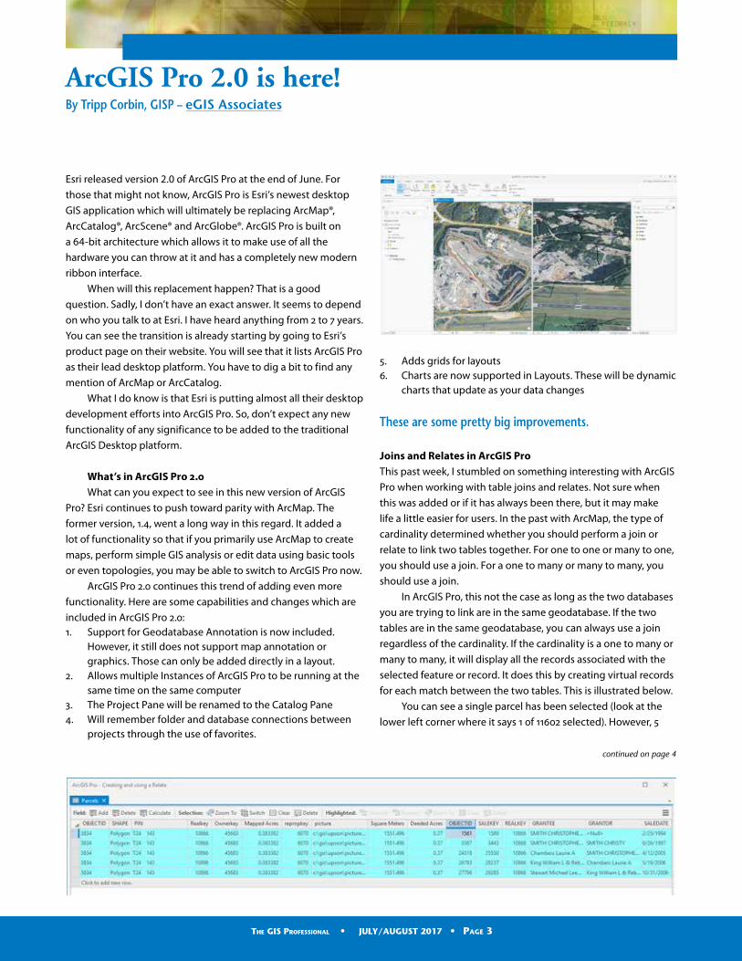
Joins and Relates in ArcGIS ProThis past week, I stumbled on something interesting with ArcGIS
Pro when working with table joins and relates. Not sure when
this was added or if it has always been there, but it may make
life a little easier for users. In the past with ArcMap, the type of
cardinality determined whether you should perform a join or
relate to link two tables together. For one to one or many to one,
you should use a join. For a one to many or many to many, you
should use a join.
In ArcGIS Pro, this not the case as long as the two databases
you are trying to link are in the same geodatabase. If the two
tables are in the same geodatabase, you can always use a join
regardless of the cardinality. If the cardinality is a one to many or
many to many, it will display all the records associated with the
selected feature or record. It does this by creating virtual records
for each match between the two tables. This is illustrated below.
You can see a single parcel has been selected (look at the
lower left corner where it says 1 0f 11602 selected). However, 5
ArcGIS Pro 2.0 is here!By Tripp Corbin, GISP – eGIS Associates
continued on page 4
The GIS Professional • JULY/AUGUST 2017 • Page 3

ArcGIS continued from page 3
records are being displayed in the table view. That is because
the parcels have been joined to a sales table which contains 5
records for sales of the selected parcel.
If I was doing this in ArcMap, I would have had to linked
the tables using a relate. In ArcGIS Pro, I can do this with a join.
This also means I can label the parcels with the sales information
which you cannot do with a relate. The join provides greater
functionality.
This does only work with tables in the same geodatabase.
If you are linking shapefiles to a table or tables in two different
databases or formats, the old rules about when to use a relate
and a join still apply to ArcGIS Pro.
What might be coming in ArcGIS Pro 2.1Of course, Esri is already planning for the next version. So, what
might be included in the version that follows 2.0? Here are a few
things we believe will be included:1. Construct Polygon tool from ArcMap Advanced Editing
Toolbar2. Copy Parallel Editing tool3. Support for the new Utility Network4. Reports5. Support for Representations6. Spatial Adjustments
For more information about what you can see in ArcGIS Pro 2.0
or later versions click on the links below:
• ArcGIS Pro: What’s new in 2.0• ArcGIS Pro Version 2.0 Release Notes• ArcGIS Pro Roadmap
Here are some links to a couple free recorded webinars I have
done on ArcGIS Pro which you might also find useful:
• Introducing ArcGIS Pro
• Managing Projects with ArcGIS Pro
• Creating 3D Maps with ArcGIS Pro
If you have not already been looking at ArcGIS Pro and evaluating
it, now is the time. As we mentioned, it will be replacing ArcMap
and ArcCatalog. It is time to start planning your migration since it
is not a matter if, but when, you will need to do so.
Represent URISA at upcoming events with some logo apparel: click on the store logo!
The GIS Professional • JULY/AUGUST 2017 • Page 4
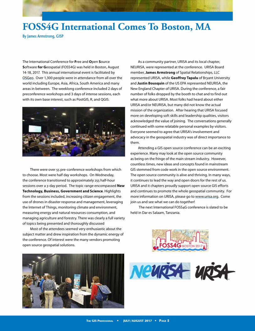
The International Conference for Free and Open Source
Software for Geospatial (FOSS4G) was held in Boston, August
14-18, 2017. This annual international event is facilitated by
OSGeo. Over 1,300 people were in attendance from all over the
world including Europe, Asia, Africa, South America and many
areas in between. The weeklong conference included 2 days of
preconference workshops and 3 days of intense sessions, each
with its own base interest, such as PostGIS, R, and QGIS.
There were over 55 pre-conference workshops from which
to choose. Most were half day workshops. On Wednesday,
the conference transitioned to approximately 255 half-hour
sessions over a 3-day period. The topic range encompassed New Technology, Business, Government and Science. Highlights
from the sessions included, increasing citizen engagement, the
use of drones in disaster response and management, leveraging
the Internet of Things, monitoring climate and environment,
measuring energy and natural resources consumption, and
managing agriculture and forestry. There was clearly a full variety
of topics being presented and thoroughly discussed
Most of the attendees seemed very enthusiastic about the
subject matter and drew inspiration from the dynamic energy of
the conference. Of interest were the many vendors promoting
open source geospatial solutions.
As a community partner, URISA and its local chapter,
NEURISA, were represented at the conference. URISA Board
member, James Armstrong of Spatial Relationships, LLC
represented URISA, while Geoffrey Tapalu of Bryant University
and Justin Bousquin of the US EPA represented NEURISA, the
New England Chapter of URISA. During the conference, a fair
number of folks dropped by the booth to chat and to find out
what more about URISA. Most folks had heard about either
URISA and/or NEURISA, but many did not know the actual
mission of the organization. After hearing that URISA focused
more on developing soft skills and leadership qualities, visitors
acknowledged the value of joining. The conversations generally
continued with some relatable personal examples by visitors.
Everyone seemed to agree that URISA’s involvement and
advocacy in the geospatial industry was of direct importance to
them.
Attending a GIS open source conference can be an exciting
experience. Many may look at the open source community
as being on the fringe of the main stream industry. However,
countless times, new ideas and concepts found in mainstream
GIS stemmed from code work in the open source environment.
The open source community is alive and thriving. In many ways,
it continues to lead the way and open doors for the rest of us.
URISA and it chapters proudly support open source GIS efforts
and continues to promote the whole geospatial community. For
more information on URISA, please go to www.urisa.org. Come
join us and see what we can do together!
The next International FOSS4G conference is slated to be
held in Dar es Salaam, Tanzania.
FOSS4G International Comes To Boston, MABy James Armstrong, GISP
The GIS Professional • JULY/AUGUST 2017 • Page 5
URISA’s GIS Management InstituteWhat Happens After the Assessment?Part Three of a Four Part Series
In the first article of this series, we discussed what the GMI can do
for your organization; in the second article, we reviewed how to
get started.
In this third article of the series, we describe what happens
after the initial assessment.
You now have some data collected about areas of your GIS
program that might not have been given proper attention in
the past. While completing the GISCMM, you may have thought
deeper about your program than before, and this could bring
realizations of how it has matured or how much work remains
for the future. Your next task is to concentrate on the benefits of
interpreting your results for yourself, taking action in weak areas,
building on strengths, and comparing your improvement over
time.
Once completed, celebrate those areas for which you
received high scores and then review lower scores to identify
areas in need of improvement. Visualize survey results using
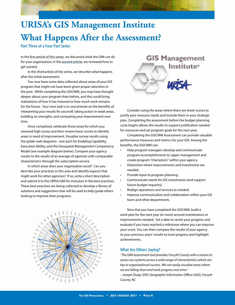
the spider web diagrams - one each for Enabling Capability,
Execution Ability, and the Geospatial Management Competency
Model (see example diagram below). Compare your agency
results to the results of an average of agencies with comparable
characteristics through the subscription service.
In which areas does your organization excel? Can you
describe your practices in this area and identify aspects that
might work for other agencies? If so, write a short description
and submit it to the URISA GMI for inclusion in the best practices.
These best practices are being collected to develop a library of
solutions and suggestions that will be used to help guide others
looking to improve their programs.
Consider using the areas where there are lower scores to
justify your resource needs and include them in your strategic
plan. Completing the assessment before the budget planning
cycle begins allows the results to support justification needed
for resources and set program goals for the next year.
Completing the GISCMM Assessment can provide valuable
performance measures and metrics for your GIS. Among the
benefits, the GISCMM can:
• Help program managers develop and communicate
program accomplishments to upper management and
create program “champions” within your agency.
• Determine where improvements and investments are
needed.
• Provide input to program planning.
• Communicate needs for GIS investments (and support
future budget requests).
• Realign operations and services as needed.
• Improve communication and collaboration within your GIS
team and other departments.
Now that you have completed the GISCMM, build a
work plan for the next year (or more) around maintenance or
improvements needed. Set a date to revisit your progress and
evaluate if you have reached a milestone where you can improve
your score. You can then compare the results of your agency
to your previous years’ results to track progress and highlight
achievements.
What Are Others Saying?“The GMI assessment tool provides Forsyth County with a means to
assess our systems across a wide range of characteristics which are
key to organizational success. We can easily visualize areas where
we are falling short and track progress over time.”
– Joseph Sloop, GISP, Geographic Information Officer (GIO), Forsyth
County, NC
The GIS Professional • JULY/AUGUST 2017 • Page 6
Call to Action!With these components in mind, we suggest a call to action
for the GIS community. Please consider carving out time in
your busy schedules to complete this program assessment
soon. There will be great value to you and your organization.
Also, the subscription option offers additional value with a
comparison of your organization to that of other peer groups
with similar characteristics. By starting now, you can be prepared
to contribute to the overall GIS community in the future when
using the subscription.
This is just the beginning of what the GISCMM and the GIS
Management Institute can do to help you and your organization
improve your GIS operations and highlight successes. Be sure to
check out the next article in this series in the next issue of The GIS
Professional!
GIS Management Institute (GMI)
GIS Capability Maturity Model (GISCMM)
If you would like to share your GMI experience, please contact
URISA at [email protected] to submit a short case study. You could be
highlighted in a future issue of The GIS Professional!
GAURISA Student Competition Winners Announced
The chair of Education and Outreach for Georgia
URISA recently announced the winners of
the 2017 Online Map Competition for Students:
• First Place: Ma Yuqi (Georgia Tech)
• Second Place: Caitlin Mildner (Georgia Tech)
• Third Place: Robert Phillips (Kennesaw State
University)
Tripp Corbin, URISA President, was at GAURISA’s monthly
luncheon on August 8, 2017 and was pleased to recognize
the participants.
The GIS Professional • JULY/AUGUST 2017 • Page 7
Mike worked for a medium-sized business and went to work
every day happy to have a job. But he wasn’t too enthused about
his work environment. Employee morale was so-so because most
long-time employees were merely going through the motions.
Greg was a friend of Mike’s from college. They both went to
work, but in different industries. They stayed in touch on social
media and decided to get together for lunch.
Mike picked Greg up at his work place. He felt inspired when
he entered Greg’s building. There was an energy that was hard
to describe. It was definitely not the same as at his company.
He was warmly greeted by the receptionist and waited in the
pristine lobby for Greg.
At lunch, Mike asked Greg about his job and what he liked
about working there. Greg mentioned that the company has
a management philosophy that every employee is important,
like the links in a chain. They believe in sharing information that
reinforces that message.
Every employee plays a role in the company’s performance.
It is important that they know their role. This gives them a sense
of purpose. It answers the question, “Why does it matter?”
Some people always take great pride in their work. They know
it reflects on them. Some people only push themselves when
others are relying on them to do their part. Sharing the big
picture helps to get the most out of these people. Getting the
small things right leads to bigger success.
Here are five different strategies a leader can use to foster
a workplace where every employee feels valued and can
contribute to the overall vision of the company.
1. Include all employees in strategy meetings To the extent possible, involve employees in strategy meetings.
When you are contemplating a change in the company’s
direction, modifying one or more processes or seeking new
methods to improve delivery, involve the people who perform
the tasks before decisions are finalized. They are liable to
push back. When they do, use your wisdom and judgement
to determine if the push back is valid. If it is valid, figure out a
better path forward. This will prevent mistakes that save time
and reduce waste. If it is the natural reaction to resist change,
deal with it now. You will avoid passive-aggressive behavior
that will sabotage the path forward. Done right, you will earn
the respect and buy-in of your team members. However, things
like impending job actions (layoffs, promotions, transfers) must
never be shared until it is time. When you are otherwise open,
the need for discretion will be respected.
2. Stress the importance of every position A good leader knows how every employee contributes to
the overall performance of the company. Some employees
interface with customers. Others provide a clean and safe
work environment. Some create the finished product. All the
employees play a part in the success of the company. Good
leaders praise the individuals and the teams, both in public and
in private, for the significant contribution they make to success of
the organization. This is important. Over time, people who don’t
deal with the finished product may forget the significance of
their role. They need to be reminded.
3. See the Big Picture There is a common fallacy in the workplace that one job
contributes more than others to the success of the project or
company. It is a great thing when employees realize that what
they do is important. It is not so good, however, when the
needs of the other employees and other affiliated organizations
are discounted. Local optimization can result in less than
optimal total performance. Explain to your teams the bigger
picture. Look at the needs of the other teams and individuals.
Understand the other’s position. Explain your organization’s role
and the roles of your internal suppliers and internal customers.
Keep focused on the end-to-end process, not only your link in
the chain.
4. Your Business Story The most powerful story for any business is the story of why the
company exists. Who founded the company? What problem
did the company originally solve? How did the company evolve
into its current state? This works for businesses of all sizes. This
is effective in external sales presentations. It is also effective in
keeping employees motivated. When that story is known and
repeated, employees will realize that they are part of growing or
preserving a legacy.
5. Maintain an open-door policy When you involve employees in strategy, communicate the
importance of the roles of each employee and see both the big
picture of the company and the reason why the company exists,
your employees will see you as someone who not only talks
communication, but communicates. You can further enhance
that relationship by having an open-door policy. Set boundaries
and let people know, but invite people to approach you with
their concerns or questions. Maybe they come to you. Maybe you
walk around and catch them doing things right.
To Succeed as a Leader, Share the Big PictureBy: Walt Grassl
The GIS Professional • JULY/AUGUST 2017 • Page 8
When you share the big picture, every employee feels
valued. They know they play a role in the success of the
company. Job satisfaction increases. It costs little to do this and
brings back big returns.
Driving back to work, Mike realized that this aspect of work
culture was missing from his company. He thought about his
role and how it fit into the bigger picture. He felt better about
his job. He vowed to look for ways to help his fellow employees
understand their roles in the bigger picture, as well.
ABOUT THE AUTHOR:Walt Grassl is a speaker, author, and performer. He hosts
the radio show, “Stand Up and Speak Up,” on the RockStar
Worldwide network. Walt has performed standup comedy at
the Hollywood Improv and the Flamingo in Las Vegas and is
studying improv at the Groundlings School in Hollywood. For
more information on bringing Walt Grassl to your next event,
please visit www.WaltGrassl.com.
We help you putGIS to work!
www.kingcounty.gov/gis/training
King County GIS Custom Classes Created and taught by working GIS professionals.
GIS Academy™ at King County, “Beyond the Basics.”
Expert ArcGIS® TrainingOur teachers are Esri Certied Desktop Associates and CompTIA Certied Technical Trainers.
URISA’s Pacic NW Education Center
GIS Certication Institute QualiedEarn GISCI points.
Veteran’s GI Bill Benets Selected programs of study at the King County GIS Center are approved for those eligible to receive benets under Title 38 and Title 10, USC.
GIS training for federal, state, local, and tribal government employees in partnership with the Washington State Department of Enterprise Services.
Professional GIS Trainingin our Seattle facility or at your site
GIS TRAINING EXPRESS™
The GIS Professional • JULY/AUGUST 2017 • Page 9
President’s ColumnEducation, Advocacy & OneURISA
Hello once again my fellow URISA Members and GIS
Professionals. This year has been flying by. School has already
started back for many of your kids which means summer is
coming to a close.
This has been a very busy year for URISA and it doesn’t look
like it is slowing down anytime soon. We have recently finished
yet another very successful Leadership Academy in Providence,
Rhode Island. This amazing program continues to exceed
attendees’ expectations and provide upcoming leaders with
the skills they need to be effective. Thanks to the New England
URISA Chapter for hosting a networking event at one of the
downtown watering holes! And thank you to our instructors who
are so dedicated to this program: Ashley Hitt, James Armstrong,
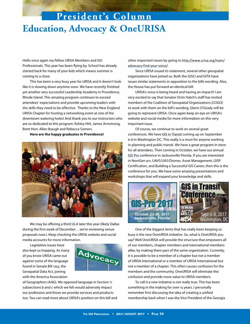
Brett Horr, Allen Ibaugh and Rebecca Somers.
Here are the happy graduates in Providence!
We may be offering a third ULA later this year (likely Dallas
during the first week of December… we’re reviewing venue
proposals now.). Keep checking the URISA website and social
media accounts for more information.
Legislative issues have
also kept us hopping. As many
of you know URISA came out
against some of the language
found in Senate Bill 1253, the
Geospatial Data Act, joining
with the America Association
of Geographers (AAG). We opposed language in Section 11
subsections b and c which we felt would adversely impact
our profession and those we provide services and products
too. You can read more about URISA’s position on this bill and
other important issues by going to http://www.urisa.org/main/advocacy-find-your-voice/.
Since URISA issued its statement, several other geospatial
organizations have joined us. Both the GISCI and GITA have
issues similar statements in opposition to the bills wording. Also,
the House has put forward an identical bill.
URISA’s voice is being heard and having an impact!! I am
very excited to say that Senator Orrin Hatch’s staff has invited
members of the Coalition of Geospatial Organizations (COGO)
to work with them on the bill’s wording. Glenn O’Grady will be
going to represent URISA. Once again keep an eye on URISA’s
website and social media for more information on this very
important issue.
Of course, we continue to work on several great
conferences. We have GIS in Transit coming up on September
6-8 in Washington DC. This really is a must for anyone working
in planning and public transit. We have a great program in store
for all attendees. Then coming in October, we have our annual
GIS Pro conference in Jacksonville Florida. If you are interested
in NextGen 911, UAVS/UAS/Drones, Asset Management, GISP
Certification, and Building a Successful GIS Career, then this is the
conference for you. We have some amazing presentations and
workshops that will expand your knowledge and skills.
One of the biggest items that has really been keeping us
busy is the new OneURISA initiative. So, what is OneURISA you
say? Well OneURISA will provide the structure that empowers all
of our members, chapter members and international members
alike, by making them part of the same organization. Currently,
it is possible to be a member of a chapter but not a member
of URISA International or a member of URISA International but
not a member of a chapter. This often causes confusion for the
members and the community. OneURISA will eliminate this
confusion and provide more value to URISA members.
To call it a new initiative is not really true. This has been
something in the making for over 15 years. I personally
remember first discussing the idea of creating a unified
membership back when I was the Vice President of the Georgia
The GIS Professional • JULY/AUGUST 2017 • Page 10
URISA Chapter in 2007 while attending meetings of the Chapter
Relations Committee which was the forerunner to the Chapter
Advisory Board (CAB). Since then it has been a topic at every
Chapter Leaders’ Forum at the GIS-Pro conference and at each
one of those meetings, all Chapters and the URISA Board have all
agreed it was a great idea if we could only make it happen.
Well thanks to the hard work of several individuals over the
last few years, it looks like it might actually happen. Four and a
half years ago the Board asked the Chapter Advisory Board to
review the current membership model, how chapters operate
and how URISA operates to develop a plan to create the unified
membership model we had all been discussing and thought
was a great idea. The Board further set a 5-year deadline for the
development of this proposed plan.
Why five years? Well that is a good question. First the board
knew this would not be an easy task. We had been talking about
it for over 10 years at that time with no forward movement even
though it was agreed that it was the direction we all wanted to
go. If it was easy we would have already done it. So the board
wanted to provide enough time to thoroughly review the current
status quo and how to best achieve a unified membership in
a way that caused the least disruption to everyone involved.
Second, since we had already been talking about for over 10
years, the Board did not want to see this important step in
URISA’s evolution to continue to go nowhere. So, some time limit
had to be set and held too if we ever hoped of achieving the
goal.
So now that initial 5-year deadline is almost upon us, where
are we now? Well we have made tremendous strides in the
right direction. The CAB developed a basic framework for what
OneURISA hopes to be. The Board took what the CAB developed
and adopted an initial Draft of the OneURISA blueprint earlier
this summer. This blueprint outlines what we hope to create
under the new OneURISA Model. It includes a list of proposed
services and benefits for members, chapters and URISA which
we hope will be provided under OneURISA.
What are next steps? Another great question. Currently the
members of the CAB and URISA Board are conducting a financial
analysis and trying to get as much information about OneURISA
out as possible. This includes:
• A review of current systems which URISA uses (member and
event management database, etc.) and how they will be
able to support OneURISA
• Possible costs for any new systems or solutions we will need
to implement to provide proposed services and benefits
• Conducting a survey of Chapter members to evaluate
proposed services and benefits to ensure they are indeed
things the members want
• Setting up an informational page, http://www.urisa.org/chapters/oneurisa/, for everyone to use to access
information about OneURISA. Currently this includes my
letter announcing OneURISA. We hope to add more very
soon such as a recorded message from myself, an FAQ,
History of OneURISA timeline, and more.
So, what does OneURISA mean for URISA members? It will
mean a stronger organization which will be able to provide
you with better tools for growing within the GIS Profession,
expanding your professional network, access to more
information on new technology, responding to challenges to
our profession and more. The entire goal of OneURISA is to
make being a member even more valuable because without
our members there is no URISA or any Chapters. Benefits and
services, we hope to offer to members under OneURISA include:
• All URISA Members will be a member of their local chapter
if one exists and all Chapter Members will become URISA
International Members. So, we will be OneURISA.
• Being able to vote in URISA International elections, run for
office, and serve on committees.
• Receiving URISA International publications such as the GIS
Professional and Digest.
• Receiving discounts on URISA events such as GIS Pro,
Leadership Academy, and specialty conferences.
• Having a voice on the international, national and local stage
through URISA International and our affiliations with groups
such as Coalition of Geospatial Organizations (COGO), the
United Nations, National States Geographic Information
Council (NSGIC), and others to address issues facing the
profession.
• Being a member of a stronger organization with a louder
voice to address issues important to the profession and
community. There is power in numbers and we are facing
many challenges to the practice of GIS on several fronts.
• Access to a larger professional network.
• More contribution opportunities to earn GISP points.
• One stop shop for membership sign-up, renewal and
information.
Please keep checking the OneURISA page on the URISA
website for more information about this big step forward for
URISA. Chapter members should expect to receive a message
from their Chapter very soon with a link to the survey we are
conducting on OneURISA benefits and services.
Well I think that about does for this column. As always,
my door is open. Please feel free to contact me at [email protected] if you have any questions or concerns about
URISA or the GIS Profession. Don’t forget to get registered for the
GIS in Transit and GIS-Pro conferences!
The GIS Professional • JULY/AUGUST 2017 • Page 11
Turn a routine data collection expedition into a data goldmine with GIS. From the very moment that your crew heads into the eld, geo-powered data guides and simpli es their tasks. Data collection is exact and instantly useful back in the of ce. A perfect suite of apps, all working together to make your eld operations smooth and ef cient.
Next time, send your eld crew out with ArcGIS, the mapping and analytics platform with a mobile strategy built in.
Learn more about building a government strategy with GIS at go.esri.com/URISA-mobile.
Mobile Government Strategy: Take GIS to the Field and Back
Copyright © 2017 Esri. All rights reserved.
g78329-Mobile-Government-ad-8-17.indd 1 8/17/17 10:42 AM
Justin Abart, GISP—SSR-Inc.—Memphis, TN
Patrick Alexander—Houston, TX
Anna Austin, GISP—EcoSouth GIS, LLC—Sylvania, GA
Matthew Betts—Walton County Board of County Commissioners—DeFuniak
Springs, FL
Harold Bigham—Walton County Board of County Commissioners— DeFuniak
Springs, FL
Kristina Bonfils—Gainesville, VA
Catherine Boush—Roanoke, VA
Ian Bruce, GISP—Haley & Aldrich, Inc.—Crockett, CA
April Cansler, GISP—First Utility District of Knox County—Knoxville, TN
Joanmy Castro—Collier County Government—Naples, FL
Jeffrey Comstock, GISP—GSI Water Solutions, Inc.—Portland, OR
Christina Culbert—Woolpert, Atlanta, GA
Eric Davis, GISP—Stantec—Raleigh, NC
Nathaniel Dede-Bamfo, GISP—Texas State University - San Marcos—San
Marcos, TX
Tara Dickerson—Sarasota County—sarasota, FL
Mark Drennan—Akimeka LLC—Maitland, FL
Amy Ferguson, GISP—University of Virginia—Charlottesville, VA
Jason Fife—Brookshire, TX
Andrew Fitch, GISP—USGS—Halethrope, MD
Sven Griffin—Pflugerville, TX
Robert Grotefend—RS&H—Menifee, CA
Jeannine Hightower—NEI Inc—Norcross, GA
Nathan Holman—Decatur, GA
Matthew Hotovec, GISP—US Air Force—JBER, AK
Jacqueline Hrncir—Austin, TX
Justin Jacobs—Southern Georgia Regional Commission—Valdosta, GA
Reina Kahn, GISP—Atkins Global—Brisbane, CA
Geoff Klein—Coeur d’Alene, ID
Leane Kmetz, GISP—City of Westfield—Westfield, IN
Kevin Laird—DeFuniak Springs, FL
Sally Lawrence—Sarasota County Government—Sarasota, FL
Keiyonna Lighten-Solomon Atlanta, GA
David Lindsey Grand Prairie, TX
David Litke, GISP—Lakewood, CO
Jared Livingston, GISP—Woolpert Inc—Daleville, IN
Amanda Long—Walton County Board of County Commissioners—DeFuniak
Springs, FL
Alex Lopez-Rogina—Madison, AL
Welcome New URISA Members
Elizabeth Lowe—City Park—New Orleans, LA
Caitlin Lucas—Manassas, VA
Kathryn Lucas—North Vancouver, BC Canada
Paul Lupo—Howard, PA
Caitlyn Meyer—GeoDecisions—Camp Hill, PA
Elizabeth Morris, GISP—Johnson Mirmiran & Thompson Inc.—Washington,
DC
Angela Norward—Charlotte, NC
Timothy Pitts—City of Las Cruces—Las Cruces, NM
Gina Price—Kootenai County Assessor—Coeur d’Alene, ID
Carla Purvis—Atlanta, GA
Vanessa Quinones—MapPlus LLC—San Juan, Puerto Rico
Allen Roberts—Marietta, GA
Shereeza Rosado—San Juan, Puerto Rico
Nikhila Rose—MetroPlan Orlando—Orlando, FL
Whitney Rountree—Southern Georgia Regional Commission—Valdosta, GA
Joshua Schwartz, GISP—Arizona Public Service—Flagstaff, AZ
Miki Shoji—North Vancouver, BC Canada
Alicia Shyu Love—Columbia County - Public Works—West Des Moines, IA
Kenneth Skrobanek, GISP—City of Buda —Buda, TX
Shaina Stacy—Pittsburgh, PA
Chad Stewart—Walton County Board of County Commissioners—DeFuniak
Springs, FL
Jessica Susich—Port St Joe, FL
Sally Tempro—Sarasota County Public Safety Communications—Sarasota, FL
Kei Chun Tse, GISP—Lexco—Kowloon, Hong Kong
Matthew Turner—City of Pflugerville—Pflugerville, TX
Girish Uprety—Dickinson, ND
Alan Venneman—Sugar Land, TX
Anna Verrill, GISP—IMSG at NOAA—Johns Island, SC
Glenn Walters—Cocoa, FL
Michael Wenzel—Atlanta, GA
Mary Whitley, GISP—Deer Creek Resources—Corvallis, OR
New URISA Government Agency
City of Largo, FL
• Paul Harkins, GISP
• Johan Hendrickson
• Eric Moos
The GIS Professional • JULY/AUGUST 2017 • Page 13
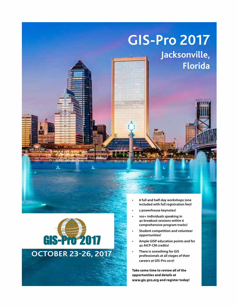
GIS-Pro 2017Jacksonville,
Florida
GIS-Pro 2017OCTOBER 23-26, 2017
• 8 full and half-day workshops (one included with full registration fee)!
• 2 powerhouse keynotes!
• 100+ individuals speaking in 40 breakout sessions within 6 comprehensive program tracks!
• Student competition and volunteer opportunities!
• Ample GISP education points and for 40 AICP-CM credits!
• There is something for GIS professionals at all stages of their
careers at GIS-Pro 2017!
Take some time to review all of the opportunities and details at www.gis-pro.org and register today!
2017 Partner Directory
Platinum CorporatePartners
Esri
380 New York St, Redlands, CA 92373 Phone: (909) 793-2853 [email protected]
Since 1969, Esri® has been helping organizations map and model our world. Esri’s GIS software tools and methodologies enable them to effectively analyze and manage their geographic information and make better decisions. They are supported by our experienced and knowledgeable staff and extensive network of business partners and international distributors.
A full-service GIS company, Esri supports the implemen-tation of GIS technology on the desktop, servers, online services, and mobile devices. These GIS solutions are flexible, customizable, and easy to use.
Esri software is used by hundreds of thousands of or-ganizations who apply GIS to solve problems and make our world a better place to live. We pay close attention to our users to ensure they have the best tools possible to accomplish their missions. A comprehensive suite of training options offered worldwide helps our users fully leverage their GIS. Esri is a socially conscious business, actively supporting organizations involved in education, conservation, sustainable development, and humanitar-ian affairs.
Hexagon Geospatial
5051 Peachtree Corners Circle Norcross, GA 30092-2500 USA Phone: +1 770 776 3400 Toll Free: + 1 877 463 7327 E-mail: [email protected]
Website: http://www.hexagongeospatial.com Hexagon Geospatial helps you make sense of the dynamically
changing world. Hexagon Geospatial provides geospatial technology products and platforms to our customers, channel partners, and Hexagon businesses.
Gold Corporate Partners
Cyclomedia Technology, Inc.
1250 I-Newell Ave., Suite 160 Walnut Creek, CA 94596 Phone: 800-790-3652 Email: [email protected] www.cyclomedia.com www.thedrivingdutchman.com
Cyclomedia is the market leader in systematic imaging of large-scale environments from cities to complete countries. Cyclomedia’s smart imagery solution creates Cycloramas – 360-degree panoramic photos – with high accuracy, providing current and clear views of street-level environments.
The Cyclomedia recording system is like no other. It uses patented technology to determine the exact position and orientation of every picture taken. By creating a dense network of geometric street images, Cycloramas are always focused on the correct address or feature from multiple vantage points.
Our solution revolutionizes the way asset and property assessment is managed and reported. It reduces field visits and provides accurate feature measurements with convenient spot-checking. It simplifies maintenance and enables automated inventory and controlled processes. It also saves valuable resources while simplifying the decision-making process, improving operations and increasing efficiency.
We provide ready-made solutions throughout Europe, North America, and Asia. Our technology is widely used in government GIS, public safety, and security markets, as
well as in construction, infrastructure management, and insurance.
We provide a full range of services related to 3D mobile mapping. Data is captured and delivered worldwide.
Our primary market segments include:• Property Taxation, Appraisal, and Building Inspection• Transportation and Infrastructure Management• Public Safety and Homeland Security• Engineering and Construction Planning
Cyclomedia offers the following licensed products:
Content• Cycloramas – Seamless, accurate 360° panos taken at
street-level with our patented recording technology.
Viewer Software• GlobeSpotter – Our feature-rich web app for view-
ing Cycloramas that runs on any browser supporting Flash.
• GlobeSpotter for ArcGIS Desktop – The power of GlobeSpotter inside Esri’s leading GIS software.
Hosting Solutions• GlobeSpotter Cloud – Secure, scalable hosting service
managed by Cyclomedia that’s free to customers.• GlobeSpotter Server – Locally hosted option support-
ing all Cyclomedia’s content and software.
Developer Tools• GlobeSpotter API – Integrate GlobeSpotter compo-
nents into your user’s existing business workflow.• Panoramic Rendering Service – Extract pictures for
reports and texture map buildings with Cycloramas.
For information about URISA Partnership, please visit:
http://www.urisa.org/about-us/become-a-urisa-partner/ or contact Wendy Nelson at URISA Headquarters.
The GIS Professional • JULY/AUGUST 2017 • Page 15
Silver Corporate Partners
Data Transfer Solutions
3680 Avalon Park Blvd East, Suite 200, Orlando, FL 32828 Phone: (407) 382-5222 [email protected]
Headquartered in Orlando, DTS is a leader in asset man-agement, geographic information systems, and transpor-tation planning. We specialize in creating solutions to help clients automate their worlds, reduce their workload and organize their data through customized technology.
DTS is comprised of seven divisions, each with its own scope of services. Often however, a single project spans several divisions before completion because we uniquely offer all the necessary cutting-edge services, integrated within one company.
EagleView Technologies
3700 Monte Villa Pkwy, Ste 200 Bothell, WA 98021 1-855-984-6590
EagleView Technologies offers Pictometry® Intelligent Images®. The high-resolution oblique and ortho images are captured and processed with patented technology and delivered through innovative analytical tools to allow for the most accurate assessment of properties.
Used daily by GIS, assessment, public safety, defense, in-surance, construction and utility professionals, Pictom-etry solutions bring field work to the desktop. Solutions are easily integrated into existing workflows through strategic partnerships and make it easy for users to make informed decisions and enhance productivity. To find out more please visit www.eagleview.com
Every day, new applications for Pictometry are realized. Discover how Pictometry can help you work better, faster, smarter and with optimal cost savings.
Michael Baker International
Since 1940, Michael Baker International has built its global legacy – and full continuum of solutions – on a diverse culture of innovation.
Solving our clients’ most complex challenges often requires new ideas, new processes, new technologies – new solutions where none existed previously. Our success always has drawn on the collaborative creativity of our dedicated employees, who leverage our diverse backgrounds, expertise, experience and can-do at-titudes to make the communities we serve safer, more accessible, more environmentally sustainable, and more livable.
The result: a growing portfolio of exclusive innovations at Michael Baker that add significant dimension and value to our ability to deliver our full continuum of solu-tions. Michael Baker innovations – and the innovators behind them – serve as game-changing differentiators in the industry and demonstrate once again how We Make a Difference for our clients and the communities we serve.• A suite of products and services to support the NG9-
1-1 call-routing environment Michael Baker International’s DataMark suite of software solutions and services support public safety answering points (PSAPs) and their GIS stakeholders in this mission critical transition. DataMark solves upgrade challenges, helps improve public-safety communications and ensures the data meets the precise NG9-1-1 requirements. The software consid-ers all aspects of the data that is provisioned to a NG9-1-1 system (data creation, clean up, quality and maintenance workflows). With extensive expertise in GIS and public safety, Michael Baker can help GIS departments determine what they need to do in order to support NG9-1-1.
• GIS-based mobile app for managing infrastructure assets Michael Baker International engineers created a mobile phone-based computer software platform, MICAP (Mobile Infraction Capture) to collect and ana-lyze data and images over broad geographic areas to help monitor utility equipment for changes and compliance problems. The GIS-based MICAP platform
provides access to licensed data, as well as the collec-tion and analysis of new data and images, delivering an improved workflow interface for managing as-sessments, repairs, and geographic changes to in-frastructure assets. It is designed for state agencies, municipalities, utility companies, land developers and other engineering firms that need to effectively monitor and manage utility poles, underground cables, utility pipelines, bridges, runway infrastruc-ture and other assets. MICAP is free and available via the App Store and Google Play.
• Local watershed assessment at the push of a button iWATR (Integrated Watershed Assessment Tool for Restoration) is a mobile app-based innovation developed by Michael Baker International’s water services team to add speed, capability – and value to provide an easy-to-use assessment tool for any city, county or state planner across the U.S. to de-velop or better manage local land. The app combines GPS features and data from the U.S. Environmental Protection Agency and other government sources, to compile local data at the push of a few buttons. It tabulates a comprehensive assessment, and provides several solution options with cost estimates to solve specific water quality-impairment problems in wa-tershed areas.
• Analyzing bridge data with ease iUSBridges, is a geographic information system (GIS)-based app that allows users to locate nearby bridges, explore details of those bridges, save information on favorite bridges, and share feedback. iUSBridges uses data retrieved from the Federal Highway Administra-tion’s (FHWA) National Bridge Inventory. State de-partments of transportation provide updated bridge information on a cyclical basis to the FHWA.
For more information, click here.
Bronze Corporate Partners
GeoDecisions
Since 1986, GeoDecisions has partnered with clients throughout the U.S. and abroad to design, develop, and deploy leading edge, disruptive GIS tools and applica-tions that improve decision-making. Backed by Gannett Fleming, our rock-solid engineering parent company established in 1915, we combine the best talent and resources from across our firm to deliver the best busi-ness solutions.
2017 Partner Directory (continued)
The GIS Professional • JULY/AUGUST 2017 • Page 16
Planning, budgeting, managing assets and data, and optimizing resources are critically important in today’s global economy. At GeoDecisions, we provide the data management and mapping technology tools and prod-ucts that help clients successfully navigate change. Our geospatial information technology (IT) offerings em-power organizations to make more informed business decisions and improve their bottom line.
Partnering with industry leaders such as Esri, our turnkey approach encompasses strategic planning and implementation design all the way through system integration and testing. Our foundation for success is based on the belief that the true power of GIS lies in the integration of diverse information technologies, data formats, and systems. From cloud computing and mobile technologies to Software-as-a-Service (SaaS) of-ferings built on the Esri® platform, our location-based IT solutions provide next-generation reporting, visibility, and analytics.
GeoDecisions believes that all IT projects require vision and considerable leadership to be completed success-fully, on time, and on budget. By championing a phi-losophy vested in partnering, collaboration, and shared goals, GeoDecisions’ staff makes every effort to work with all parties who will use a system. We strive to rec-ommend the best-fit solutions for our clients, based on the balance of available funding and personnel versus desired functionality.
GeoDecisions is ISO 9001:2008-certified and employs more than 80 IT and geographic information system (GIS) professionals operating out of 9 offices. Our
staff is engaged in IT consulting and in the design, development, and deployment of data repositories and geospatial and Web-enabled information management systems. GeoDecisions IT solutions are flexible, scalable, and resusable.
Our business specialties benefit the logistics and fleet management, insurance and financial, municipal and facility asset management, transportation, and utility markets.
Our team includes subject matter experts with advanced certifications who keep their fingers on the pulse of geo-spatial technology. Through industry leadership, ongo-ing training, and a unique blend of talent, GeoDecisions professionals work to exceed client expectations every day. Our vision identifies and mitigates risk, resulting in more effective project collaboration, on-time delivery, and success.
K2 Geospatial
Since 1995, K2 Geospatial has been committed to bringing spatial information and analysis tools within everyone’s reach by developing software solutions that provide effective visual aids to decision-makers.
K2 Geospatial’s solutions connect, consolidate, and publish data that is often managed and stored in silos throughout different systems. Employees and citizens can easily access the information and analyze it in real time to make informed decisions. Our solutions are used by municipalities, regional governments, ports, airports, road authorities, railways, public utilities, and natural resource companies.
K2’s solutions are powered by JMap, a map-based integration platform designed to connect silos and offer user-friendly interfaces destined to non-technical users. JMap is deployed and used by hundreds of organizations in North, South and Central America as well as in Europe.
Valtus Imagery
245 Aero Way NE Calgary, Alberta, Canada, T2E 6K2 Phone: (403) 295-0694 [email protected]
At Valtus, our focus - and our passion - is the storage and online distribution of large imagery and LiDAR datasets. Yes...our passion. Nowhere will you find a group of technicians more committed to (and enthusiastic about) the prompt and seamless delivery of imagery that brings value to customers’ businesses.
As pioneers of industry leading Content as a Service (CaaS) and Cloud Solutions, our passion for providing Internet access to imagery has been growing strong since 1995.
Valtus is part of Hexagon (Nordic exchange HEXA B; www.hexagon.com), a leading global provider of design, measurement and visualisation technologies that enable customers to design, measure and position objects, and process and present data.
VESTRA
5300 Aviation Drive, Redding, CA 96002 Phone: (530) 223-2585 [email protected]
As a leader in GIS/IT, Environmental Solutions, Engineer-ing, and Surveying, VESTRA has the depth of know-how and experience to help clients achieve success. VESTRA, an employee-owned corporation dating back to 1988, prides itself on our local presence and commitment to the community. Our mission is to be our clients’ most-valued consultant by providing cost-effective, innovative, and technically superior project solutions. Whatever your cur-rent or future needs, VESTRA’s full-service resources are available to support you on your next critical project.
Business Partners
Applied Ecology, Inc.
Located in Brevard County, Applied Ecology is knowl-edgeable and experienced in working with clients in the central and south Florida area. Our location has allowed us to be highly involved in the Indian River Lagoon TDML process, and preserving some of the most precious natu-ral resources of the Tampa Bay and Indian River Lagoon estuaries. We serve municipalities and other businesses that cater to public clients and are experts in their fields.
2017 Partner Directory (continued)
The GIS Professional • JULY/AUGUST 2017 • Page 17

Applied Ecology, Inc. is a small, woman-owned business with 40 years of combined specialized experience in:• GIS• Remote sensing• Project management• Complex data and database management• Statistical analyses• Software tool development
We focus on serving public clients in:• Environmental resource management• Ecological studies• Water resources• Stormwater management• Utilities
AEI has the experience and skills to plan studies that cross multiple disciplines. Please see the key staff qualifications and project examples to see the level of expertise a small team• Data management• Custom programming• Database creation• High-level spatial and statistical analyses• Report writing
We take pride in being a highly responsive business that delivers quality products on-time!
Bad Elf
AFFORDABLE GPS SOLUTIONS. COMPREHENSIVE INDUS-TRY SUPPORT. Bad Elf specializes in the design and manufacture of affordable and reliable high-performance GNSS receiv-ers for GIS mapping and field data collection. All of our products are lightweight, portable, and provide a battery life of twenty-four hours for a full day of data collection activities. Our complete product line offers a range of capabilities and accuracy (from 2.5 meters to 1 meter) to match your requirements.
Bad Elf products work seamlessly with most GIS and mapping apps in the iTunes App Store or the Google Play Store. Bad Elf also supports Android and Windows devices, providing streaming location data in standard NMEA sentences. Our Bluetooth GNSS Surveyor provides high-accuracy (~1 meter), multi-constellation support (GPS, GLONASS, QZSS), SBAS (WAAS/EGNOS/MSAS), and universal
Bluetooth connectivity (iOS, Android, Windows). The free Bad Elf Utility app for iOS includes DGPS and post-processing workflows.
We are forging strong relationships with GIS app de-velopers taking advantage of our products’ advanced hardware features thru our Bad Elf Developer program. There are no restrictions on how you use your data. We believe in open standards. Any device that can connect to a Bad Elf GNSS receiver via Bluetooth will be able to consume data directly from our GNSS accessories. Your data. Your way.
Geocove
Geocove helps agencies solve the problem of where. Geocove provides spatial technology solutions to government agencies and utilities to help them collect, manage, visualize and share information. We provide insight into problems and solutions for decision makers, users and the public. We also make seriously cool map apps. So how does your GIS program work for you? [email protected] .
GeoTechVision
With offices in Kingston, Jamaica (876-970-5686) and Georgetown, Guyana (592-227-0433) www.geotechvision.com
GeoTechVision focuses on “Delivering Value through Innovative Solutions!” We have been assisting Caribbean Businesses, Agencies and Government Ministries to
2017 Partner Directory (continued)develop and effectively use spatial intelligence in critical decision making! We are very involved with establish-ing Geographic Information Systems, GPS and Mobility products and solutions, as well as marketing our own “GeO” brand tablet. We consider Human Capacity Build-ing as very critical - right from the classroom to the work environment. Hence our Classroom Management Solu-tion and our strong focus on Training and Development in all our engagements. Our other consulting services include Project Management, Information Security Advi-sory, Process Audit and Assurance, Business Analysis and Enterprise GIS solution planning and Implementation.
Infrastructure Mapping and Autonomy
We leverage technology developed by our
autonomous vehicle mapping partner for
rapid LiDAR processing and map produc-
tion.
Infrastructure Mapping and Autonomy was created out of the Heavy Industry of Civil Maps an industry-leading artificial intelligence company, providing LiDAR process-ing and feature extraction services. Our technology was first developed to meet the high accuracy, 3D mapping needs of the autonomous vehicle industry. IMA is now bringing this technology to the engineering and infra-structure industries. Our technology allows us to scan, map and report on assets or asset areas at a rapid pace and affordable cost not possible before. Leveraging our proprietary artificial intelligence, patented cloud based processing technol-ogy, and global relationships for LiDAR collection and processing and quality control, we can generate data sets, models and change detection reports 10x faster than with traditional methods.
The GIS Professional • JULY/AUGUST 2017 • Page 18
By creating HD 3D maps in the earliest stages of projects, our clients are able to increase the NVP of projects by lowering the time to completion and reducing and deferring survey programs until the later stages of a project. Additionally, clients with existing assets to manage benefit from our centralized on-line business-to-business services to manage their rapid feature extraction and mapping programs. Eliminating the inefficient traditional person to person sales and manual data handling processes. Our al-a-carte on-line tools allow asset owners to individually direct and manage their mapping projects, resulting in quicker turnaround times and lower costs overall.
MGP
701 Lee Street Suite 1020 Des Plaines, IL 60016 Tel: (847) 656-5698 [email protected] www.mgpinc.com
MGP is an information systems services company that spe-cializes in geo-spatial solutions. Our comprehensive range of geographic, data modeling, and business process solutions provide you new opportunities to find a better way. We believe that innovation creates opportunity and collabora-tion breeds success. MGP was formed as a shared business model in which clients are partners. This philosophy enables significant cost savings and makes it possible for any client, regardless of size, to get where they need to go. MGP is the managing partner of the GIS Consortium.
2017 Partner Directory (continued)
Planning Communities, LLC
9131 Anson Way, Suite 304 Raleigh, North Carolina 27615 919-803-6862 (Office) 919-882-1206 (Fax) [email protected] [email protected]
Planning Communities, LLC provides a wide range of multi-disciplinary planning services for local, state and federal agencies, tribal nations and community organi-zations. Community, transportation, environmental and GIS services include local/regional planning, visioning/scenario planning, land use, socioeconomic, market and cost-benefit analysis, community asset mapping, tool/application support and development, process improve-ment/integration, consensus-building and facilitation.
Headquartered in Raleigh, North Carolina, Planning Communities has additional offices in Charlotte (NC) and Seattle (WA). Planning Communities is a North Carolina certified Small Professional Service Firm (SPSF) and is certified as a DBE in North Carolina, Tennessee, Florida and Delaware.
Spatial Relationships, LLC
800 Boylston St #990756 Boston MA 02199 (857) 400-8920
Contact: Kathryn Brewer James Armstrong
Spatial Relationships, LLC is a consulting firm that provides on-demand teams of expert Geospatial Professionals to ensure organizations have the capability to deliver on existing and future goals, manage business risk, and increase profitability.
Think of us as your geospatial concierge. Our “concierge services” provide resources and solutions for planned or abrupt disruptions as well as future projects. These can include:• Being a key person down – planned leave or
unexpected departure• Technical requirements – fill skills, knowledge and
training gaps
• Budget constraints – less than anticipated funds for the same scope of work
• Capacity constraints – completing urgent priorities for overbooked staff
Spatial Relationships, LLC was born out of the necessity to create new flexible and affordable ways to work that support organizations to manage ever-increasing demands as well as the need to support the community of Geospatial Professionals.
Synergy Systems & Services
Synergy is an Asian American owned MBE with an excel-lent track record of government contracting. Established 2002 and based in Maryland we have come a long way from providing data support services at Maryland State Highway Administration to providing services such as Database Management, GIS Data Creation, GIS applica-tion development and support, Software Engineering and Business Process Consulting to its distinguished clients in various Government Agencies. We take pride in all our work and take every effort to ensure the satisfac-tion of our clients.
Temporal Geo Analytics
P.O. Box 181431 Denver, CO 80218 Phone: 720-235-0390 [email protected]
Temporal Geo Analytics, Inc. (TGA) is a Land Use and Envi-ronmental Litigation consulting firm. We have expertise in using Geographic Information Systems (GIS) to develop, manage, and distribute complex spatial databases, as well as creating the presentation-quality visualizations and graphics needed for natural resource litigation and land use projects.
TGA specializes in the analysis of multifaceted land use issues and environmental impacts over time. TGA is expert at acquiring and integrating historic and current spatial data to build the critical information you need to repre-sent your case.
Using GIS, we transform complex issues into defensible, authoritative, and easily understood maps and graphics. Our clientele consists primarily of natural resource and environmental attorneys, oil and gas companies, mining companies, and land developers.
Leveraging GIS for Environmental, Natural Resource, and Land Use Planning is our core expertise. Geographic In-formation Systems (GIS) integrate and overlay unlimited
The GIS Professional • JULY/AUGUST 2017 • Page 19

layers of themed spatial and tabular data to illustrate and reveal patterns, context, and the intrinsic qualities of any location. A GIS is also a powerful analysis tool capable of querying data for location and its relationship to overall context. At TGA, we have an intimate under-standing of these tools and their capabilities.
Working with you and other experts, we build a com-pletely defensible, dynamic analysis data platform with interactive visualizations and related tables that clearly represent the qualities of your project and its relation-ship to larger political, environmental, and regional contexts.
Wellar Consulting
Ottawa, ON Canada Phone: (613) 728-3483 [email protected]
Wellar Consulting services include design and evaluation of education and training courses and currricula for GI-Systems and GIScience programs; advice and workshops on the development of quantitative measures to assess information system and transportation system perfor-mance; critical reviews of IS and GIS RFPs; seminars on the safety and security aspects of interdependent infra-structures; professional opinion on land use planning and zoning issues; and, expert opinion on liability for safety-related incidents involving pedestrians, cyclists, and motor vehicle operators.
Educational InstitutionMembers
USC Spatial Sciences Institute
Since its founding in 2010, the USC Spatial Sciences Institute has been using the power of spatial thinking and literacy – the ability to connect place and space – to help address global challenges, including those con-nected with population growth, urbanization, environ-mental sustainability, and human well-being. Through its innovative academic programs, the Spatial Sciences Institute educates and trains today’s leaders capable of deploying the “science of where” in every possible discipline and industry. Members of our internationally-recognized faculty contribute to the rapidly-evolving body of geospatial knowledge. From our home base in the USC Dornsife College of Letters, Arts and Sciences, we collaborate with faculty colleagues throughout the University of Southern California and with other presti-gious institutions around the world on funded research that links SSI faculty and students with decision makers and citizens and knowledge with action. We promote the analysis, modeling, and visualization of location-based data through interdisciplinary use-inspired and integrated research and teaching.
Roster of Academic Programs:• B.S. in GeoDesign• Spatial Studies minor • Human Security and Geospatial Intelligence minor• Online Graduate Programs in Geographic Information
Science and Technology • Graduate Certificate in Geographic Information Sci-
ence and Technology
2017 Partner Directory (continued)• Graduate Certificate in Geospatial Leadership• Graduate Certificate in Geospatial Intelligence• M.S. in Geographic Information Science and
Technology• M.S. in Spatial Informatics• Ph.D. in Population, Health and Place
Temple University, Fox School of Business - Philadelphia, PA
Increase your capabilities with the Fox Master of Science in IT Auditing and Cyber Security and gain the knowl-edge to assess and control organizational cyber risks and protect data and information assets. Learn from experts in the field through our industry-proven curriculum, featuring built-in preparation for Certified Information Systems Auditor (CISA) or Certified Information Systems Security Professional (CISSP) certification. Flexible class formats enable you to choose the option that works best for you: online, face-to-face, or a hybrid of both. • Master of Science in IT Auditing and Cyber Security• Graduate Certificate in IT Auditing and Cyber Security
North Carolina State University - Center for Geospatial Analysis• Master of Geospatial Information Science and
Technology (MGIST)• Graduate Certificate in Geospatial Information
Science (GIS)
Auburn University• Bachelor of Science in Geographic Information
Systems • Master of Science in Geographic Information Systems
Lakeland Community College —Kirtland, OH• Geography and Geospatial Technology - Associate of
Applied Science and certificate programs
RFP Distribution
URISA members, remember that URISA will distribute your RFP/RFQ announcements to our corporate and business members at no charge. Simply email your announcement to [email protected] (Subject: RFP Service) and we’ll send it right out for you!
The GIS Professional • JULY/AUGUST 2017 • Page 20
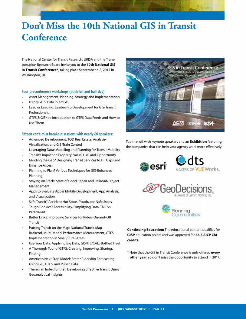
The National Center for Transit Research, URISA and the Trans-
portation Research Board invite you to the 10th National GIS in Transit Conference*, taking place September 6-8, 2017 in
Washington, DC.
Four preconference workshops (both full and half-day):• Asset Management: Planning, Strategy and Implementation
• Using GTFS Data in ArcGIS
• Lead or Leading: Leadership Development for GIS/Transit
Professionals
• GTFS & GIS 101: Introduction to GTFS Data Feeds and How to
Use Them
Fifteen can’t-miss breakout sessions with nearly 60 speakers:• Advanced Development: TOD Real Estate, Analysis-
Visualization, and GIS-Train Control
• Leveraging Data: Modeling and Planning for Transit Mobility
• Transit’s Impact on Property: Value, Use, and Opportunity
• Minding the Gap? Designing Transit Services to Fill Gaps and
Enhance Access
• Planning to Plan? Various Techniques for GIS-Enhanced
Planning
• Staying on Track? State of Good Repair and Railroad/Project
Management
• Apps to Evaluate Apps? Mobile Development, App Analysis,
and Visualization
• Safe Transit? Accident Hot Spots, Youth, and Safe Stops
• Tough Cookies? Accessibility, Simplifying Data, TNC vs
Paratransit
• Better Links: Improving Services for Riders On-and-Off
Transit
• Putting Transit on the Map: National Transit Map
Backend, Multi-Modal Performance Measurement, GTFS
Implementation in Small/Rural Areas
• Use Your Data: Applying Big Data, GIS/ITS/CAD, Bottled Fleet
• A Thorough Tour of GTFS: Creating, Improving, Sharing,
Finding
• America’s Next Stop Model: Better Ridership Forecasting
Using GIS, GTFS, and Public Data
• There’s an Index for that: Developing Effective Transit Using
Geoanalytical Insights
Don’t Miss the 10th National GIS in Transit Conference
Top that off with keynote speakers and an Exhibition featuring
the companies that can help your agency work more effectively!
Continuing Education: The educational content qualifies for
GISP education points and was approved for 46.5 AICP CM credits.
* Note that the GIS in Transit Conference is only offered everyother year, so don’t miss the opportunity to attend in 2017.
The GIS Professional • MAY/JUNE 2017 • Page 6The GIS Professional • JULY/AUGUST 2017 • Page 21

Mark Your Calendar!
September 6-8, 201710th GIS in Transit ConferenceWashington, DC
October 23-26, 2017GIS-Pro 2017: URISA’s 55th Annual ConferenceJacksonville, Florida
December 2017URISA GIS Leadership Academy in Dallas in December 2017? Stay tuned.
March 19-22, 20182018 GIS/CAMA Technologies ConferenceHouston, Texas
PRESIDENTTripp Corbin, GISP — eGIS Associates, Inc. (Dacula, GA)[email protected] PRESIDENT-ELECTTeresa Townsend, AICP— Planning Communities, LLC (Raleigh, North Carolina)[email protected] IMMEDIATE PAST-PRESIDENTRebecca Somers, GISP — Somers St Claire GIS Management Consultants (Fairfax, VA)[email protected] TREASURERMartin Roche, GISP — Avineon (Orlando, FL) [email protected] SECRETARYKeri Brennan, GISP —The Schneider Corporation (Indianapolis, IN)[email protected] James Armstrong, AICP, GISP — Spatial Relationships (Boston, MA)[email protected] Stephen Berry, GISP — Clark County GIS (Winchester, KY)[email protected] Valrie Grant, GISP — GeoTechVision (Kingston, Jamaica)[email protected] Corey Halford, GISP — City of Airdrie (Alberta Canada)[email protected] Brent Jones, PE, PLS — Esri (Vienna, VA) [email protected] Robert (Robb) Kirkman, GISP —Metro (Portland, OR)[email protected] Kevin Mickey, GISP — The Polis Center-IUPUI (Indianapolis, IN)[email protected] CHAPTER ADVISORY BOARD REPRESENTATIVE (NONVOTING): Cindy Post, GISP—City of Leduc (Alberta Canada)[email protected]
THE GIS PROFESSIONALA publication of URISA – Fostering
Excellence in GIS.
URISA is a non-profit professional
and educational association that
promotes the effective and ethical
use of spatial information and
information technologies for the
understanding and management of
urban and regional systems. It is a
multidisciplinary association where
professionals from all parts of the
spatial data community can come
together and share concerns and
ideas.
URISA Headquarters
701 Lee Street, Suite 680
Des Plaines, IL 60016
Phone (847) 824-6300
Fax (847) 824-6363
www.urisa.org
SubmissionsManaging Editor – Wendy Nelson,
Executive Director,
GIS-Pro & CalGIS 2018
October 8-11, 2018Palm Springs, California
Save the Date!