The California Integrated Seismic Network: Project Status Program Management Group Presented to CISN...
34
The California Integrated Seismic Network: Project Status Program Management Group Presented to CISN Steering and Advisory Committees at UC Berkeley, 30 August 2006
-
Upload
marian-rice -
Category
Documents
-
view
213 -
download
0
Transcript of The California Integrated Seismic Network: Project Status Program Management Group Presented to CISN...
The California Integrated Seismic Network:
Project Status
Program Management Group Presented to
CISN Steering and Advisory Committees
at UC Berkeley, 30 August 2006
Quick Review
of
Technical Status
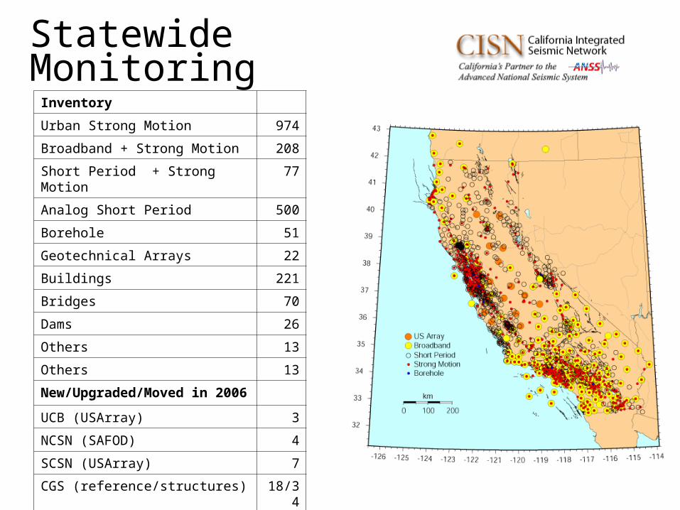
Statewide MonitoringInventory
Urban Strong Motion 974
Broadband + Strong Motion 208
Short Period + Strong Motion 77
Analog Short Period 500
Borehole 51
Geotechnical Arrays 22
Buildings 221
Bridges 70
Dams 26
Others 13
Others 13
New/Upgraded/Moved in 2006
UCB (USArray) 3
NCSN (SAFOD) 4
SCSN (USArray) 7
CGS (reference/structures) 18/34
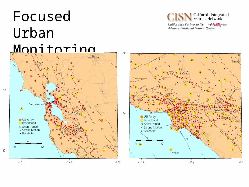
Focused UrbanMonitoring
• CGS CIT– 5 strong motion
stations in metropolitan Los Angeles region
• UCB CIT– 30 strong motion &
broadband stations statewide
– Goal to exchange 60 stations
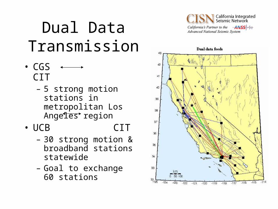
Dual Data Transmission
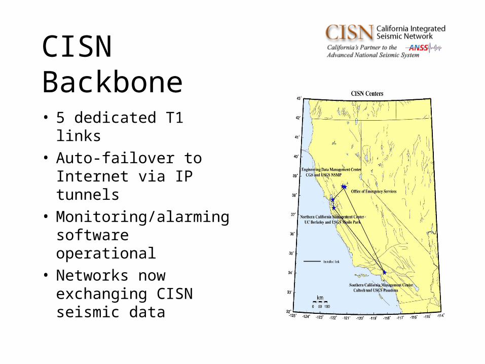
CISN Backbone
• 5 dedicated T1 links• Auto-failover to
Internet via IP tunnels• Monitoring/alarming
software operational• Networks now
exchanging CISN seismic data
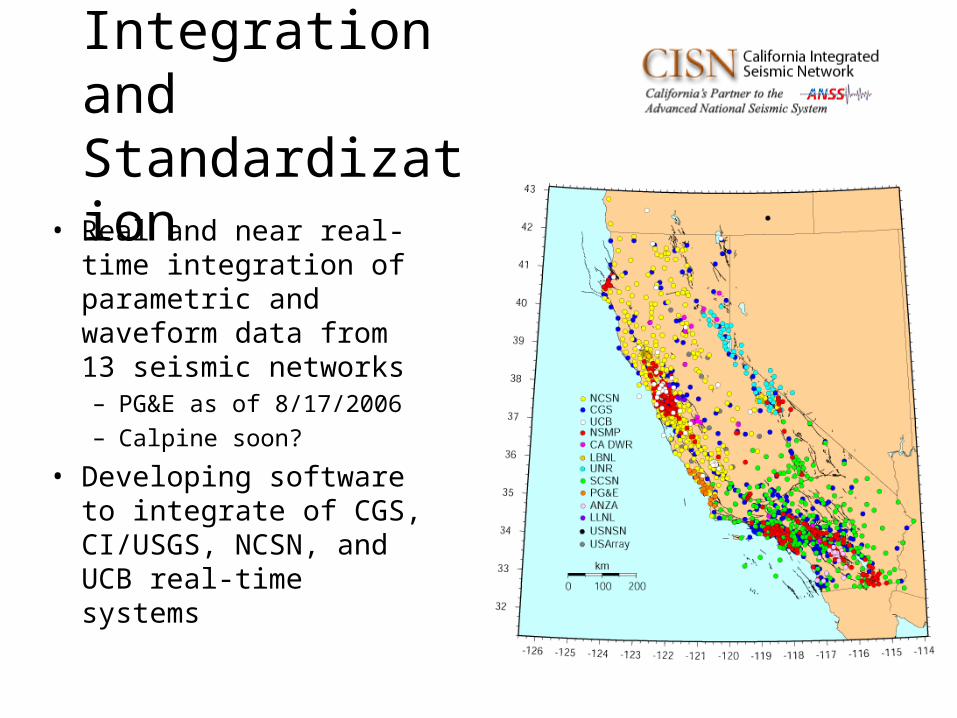
Integration and Standardization
• Real and near real-time integration of parametric and waveform data from 13 seismic networks– PG&E as of 8/17/2006
– Calpine soon?
• Developing software to integrate of CGS, CI/USGS, NCSN, and UCB real-time systems
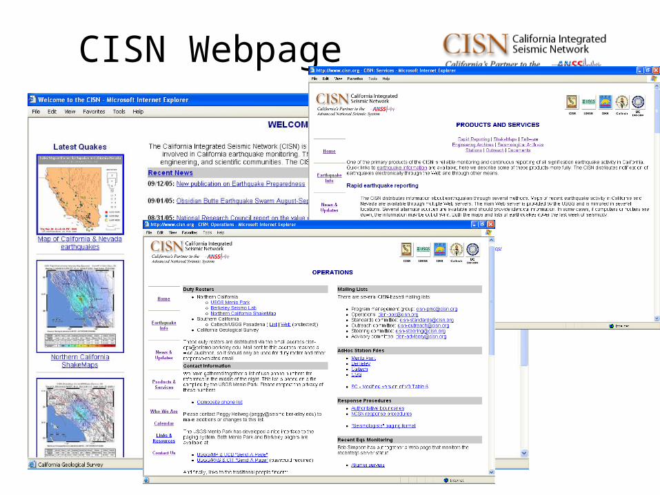
CISN Webpage
Progress toward Statewide Monitoring
through
CISN Software
• Melding of many complex systems– Earthworm front-end
– TriNet back-end
– NCEDC/SCEDC data archiving
– Java, C, C++, Perl, SQL, Fortran, Solaris, Windows, Oracle, etc..
• Same software across CISN means:– Same configurations,
same products
– Full parametric exchange
– All waveforms used (including NSMP, CGS)
– New methods easier to implement
– Failover behavior can be
modeled and understood
• Code is now developed by all partners– An example of how CISN works well
– An example of how CISN doesn’t work well
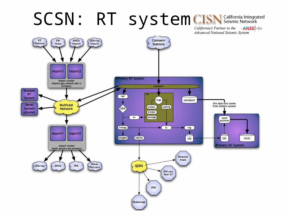
SCSN: RT system
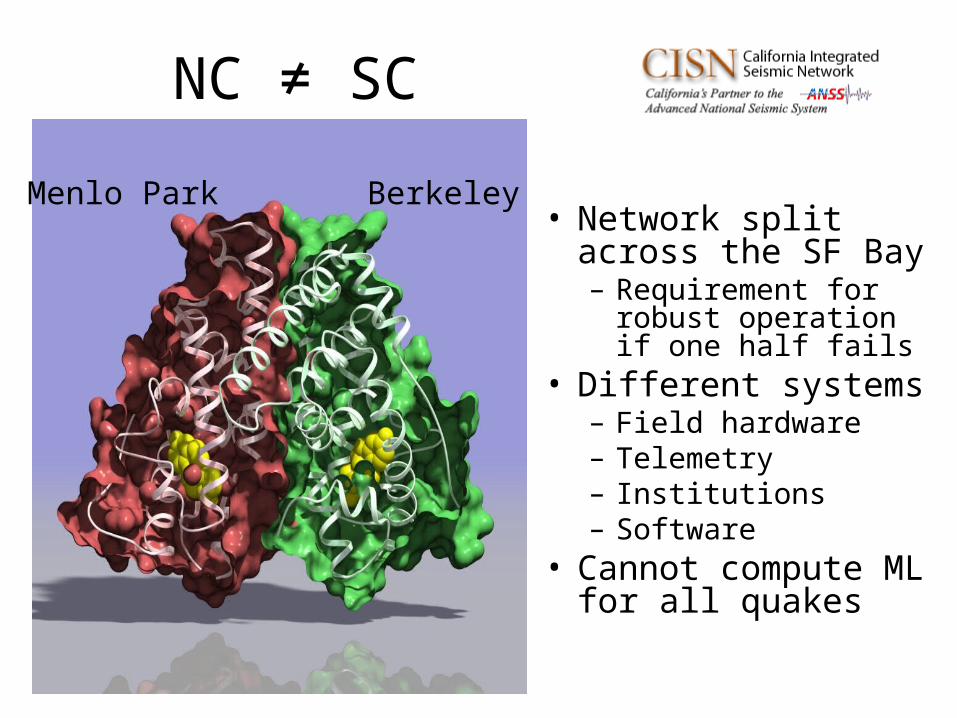
NC ≠ SC
• Network split across the SF Bay– Requirement for robust
operation if one half fails• Different systems
– Field hardware– Telemetry– Institutions– Software
• Cannot compute ML for all quakes
Menlo Park Berkeley
Required development for NC implementation
• Replaced proprietary messaging software with CMS software
• Implementation of “location” codes (statewide)
• Station metadata• Proxy waveserver• Implementation of Md in
Trinet software• ML calibration (statewide)• Testing, testing, testing
NCSS Software Transition Status
• Post-processing– Prototype functional as
of July, 2006
– Md implemented and Q/C’ed
– SNC → SNCL ready
– Testing and training
– 10/15/2006 switch
• Real-time processing– After post-processing
switch
– Conversion of alarming software
– New quick-review
– Testing
– 12/31/2006 switch
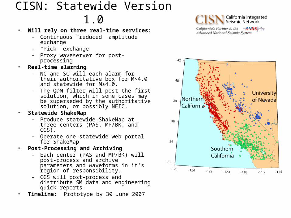
CISN: Statewide Version 1.0• Will rely on three real-time services:
– Continuous “reduced” amplitude exchange
– “Pick” exchange– Proxy waveserver for post-processing
• Real-time alarming– NC and SC will each alarm for their
authoritative box for M<4.0 and statewide for M≥4.0.
– The QDM filter will post the first solution, which in some cases may be superseded by the authoritative solution, or possibly NEIC.
• Statewide ShakeMap– Produce statewide ShakeMap at three
centers (PAS, MP/BK, and CGS). – Operate one statewide web portal for
ShakeMap• Post-Processing and Archiving
– Each center (PAS and MP/BK) will post-process and archive parameters and waveforms in it's region of responsibility.
– CGS will post-process and distribute SM data and engineering quick reports.
• Timeline: Prototype by 30 June 2007

Budget
and
Funding
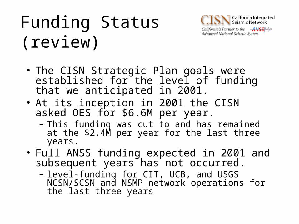
• The CISN Strategic Plan goals were established for the level of funding that we anticipated in 2001.
• At its inception in 2001 the CISN asked OES for $6.6M per year. – This funding was cut to and has remained at the $2.4M
per year for the last three years. • Full ANSS funding expected in 2001 and
subsequent years has not occurred. – level-funding for CIT, UCB, and USGS NCSN/SCSN
and NSMP network operations for the last three years
Funding Status (review)
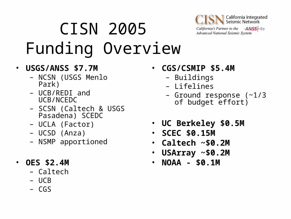
CISN 2005 Funding Overview
• USGS/ANSS $7.7M– NCSN (USGS Menlo Park)– UCB/REDI and
UCB/NCEDC– SCSN (Caltech & USGS
Pasadena) SCEDC– UCLA (Factor)– UCSD (Anza)– NSMP apportioned
• OES $2.4M– Caltech– UCB– CGS
• CGS/CSMIP $5.4M– Buildings– Lifelines– Ground response (~1/3
of budget effort)
• UC Berkeley $0.5M• SCEC $0.15M• Caltech ~$0.2M• USArray ~$0.2M• NOAA - $0.1M
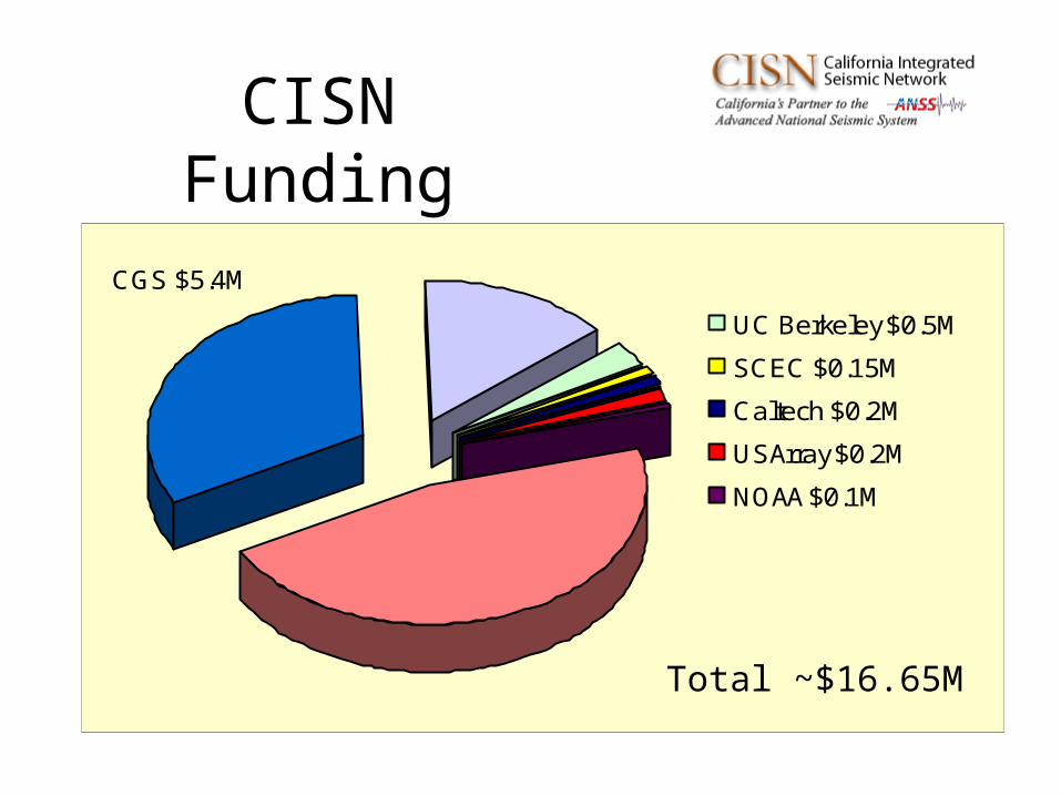
CISN Funding
UC Berkeley $0.5M
SCEC $0.15M
Caltech $0.2M
USArray $0.2M
NOAA $0.1M
CGS $5.4M OES $2.4M
USGS $7.7M
46%
32%
14%
Total ~$16.65M
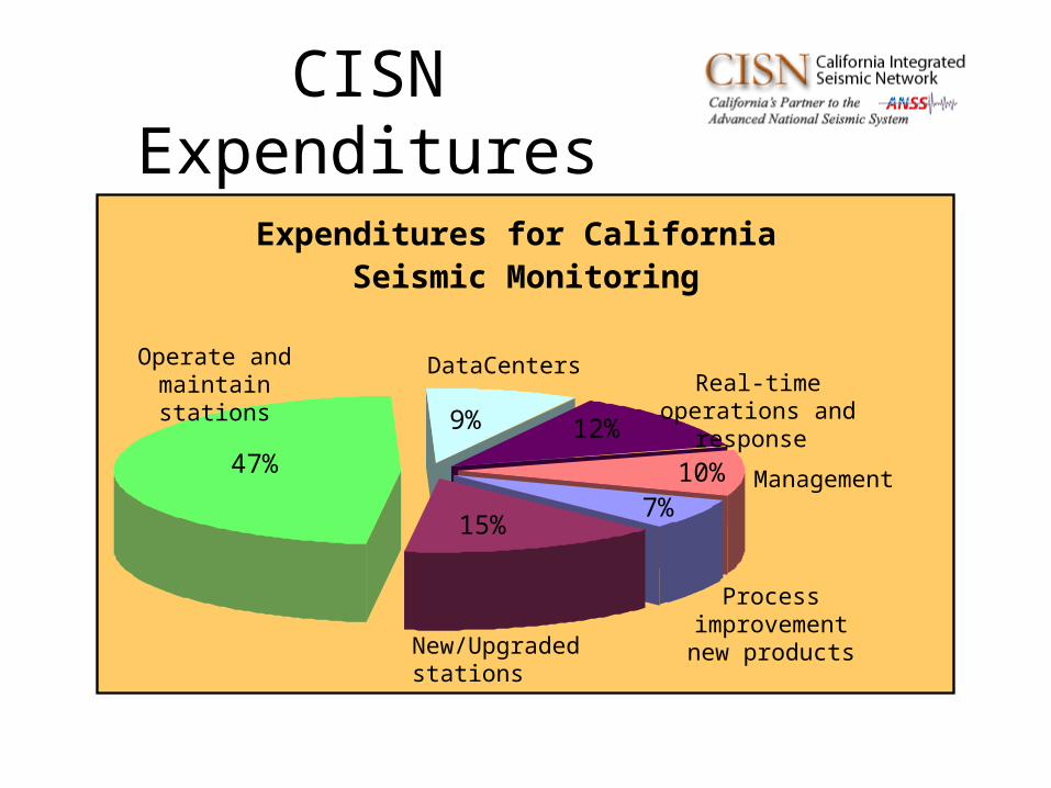
CISN Expenditures
Expenditures for California Seismic Monitoring
7%15%
47%
9% 12%
10%
Process improvementnew productsNew/Upgraded
stations
Operate and maintain stations
DataCentersReal-time operations
and response
Management
New Developments
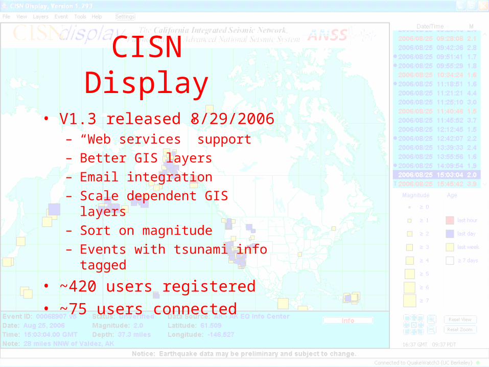
CISN Display
• V1.3 released 8/29/2006– “Web services” support
– Better GIS layers
– Email integration
– Scale dependent GIS layers
– Sort on magnitude
– Events with tsunami info tagged
• ~420 users registered
• ~75 users connected
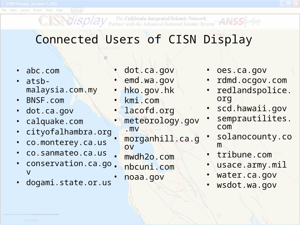
Connected Users of CISN Display
• dot.ca.gov• emd.wa.gov• hko.gov.hk• kmi.com• lacofd.org • meteorology.gov.mv• morganhill.ca.gov• mwdh2o.com• nbcuni.com• noaa.gov
• abc.com • atsb-malaysia.com.my • BNSF.com• dot.ca.gov• calquake.com • cityofalhambra.org• co.monterey.ca.us • co.sanmateo.ca.us • conservation.ca.gov • dogami.state.or.us
• oes.ca.gov• rdmd.ocgov.com• redlandspolice.org• scd.hawaii.gov• semprautilites.com• solanocounty.com• tribune.com• usace.army.mil• water.ca.gov• wsdot.wa.gov
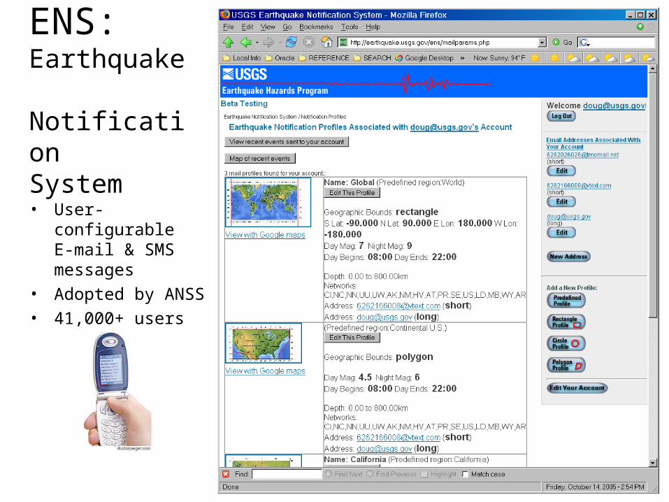
ENS:Earthquake Notification System
• User-configurable E-mail & SMS messages
• Adopted by ANSS• 41,000+ users
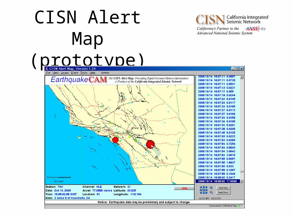
CISN Alert Map (prototype)
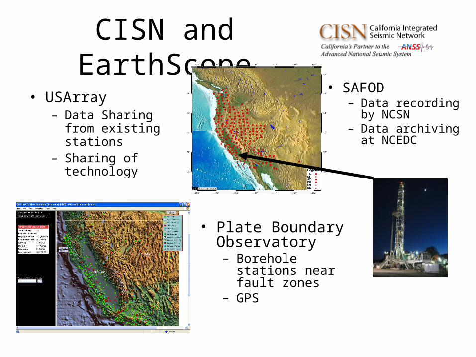
CISN and EarthScope
• USArray– Data Sharing from
existing stations– Sharing of
technology
• SAFOD– Data recording
by NCSN – Data archiving at
NCEDC
• Plate Boundary Observatory– Borehole stations
near fault zones– GPS
CISN/USGS/SCECCollaboration on Earthquake
Early Warning• CISN
– Provide waveforms and implement front end processing
• Caltech/USGS/ UC Berkeley– Development and testing of individual algorithms
• SCEC– Comparison of performance of algorithms– Testing for great earthquakes using synthetics
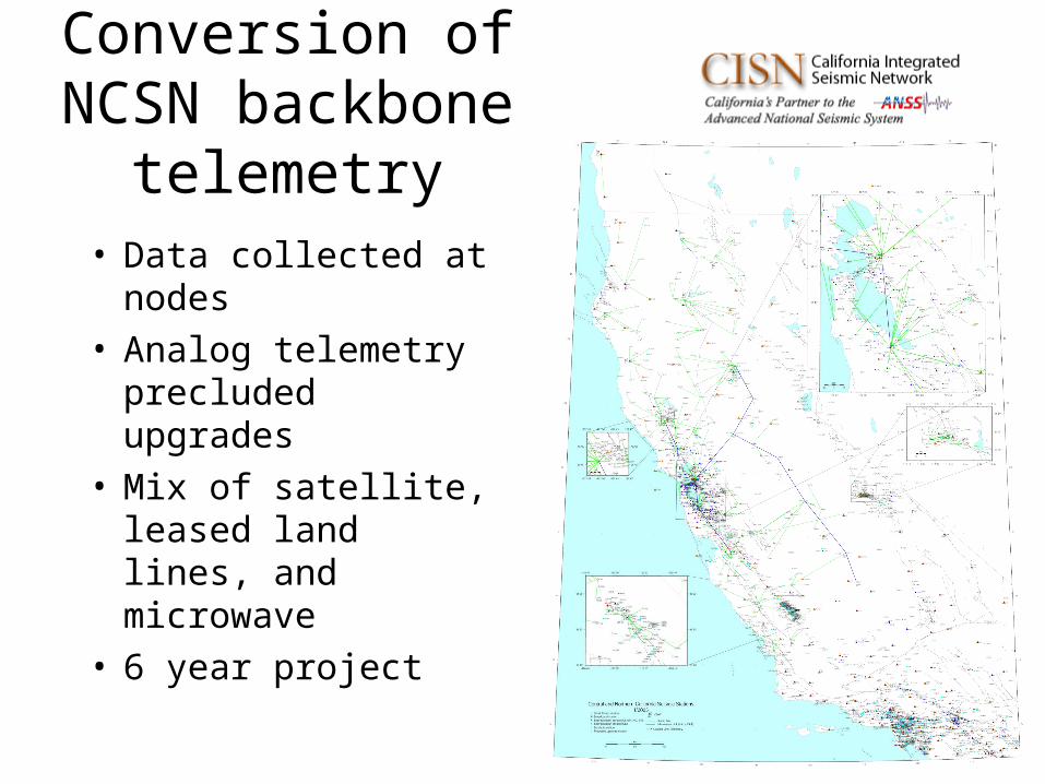
Conversion of NCSN backbone telemetry
• Data collected at nodes
• Analog telemetry precluded upgrades
• Mix of satellite, leased land lines, and microwave
• 6 year project
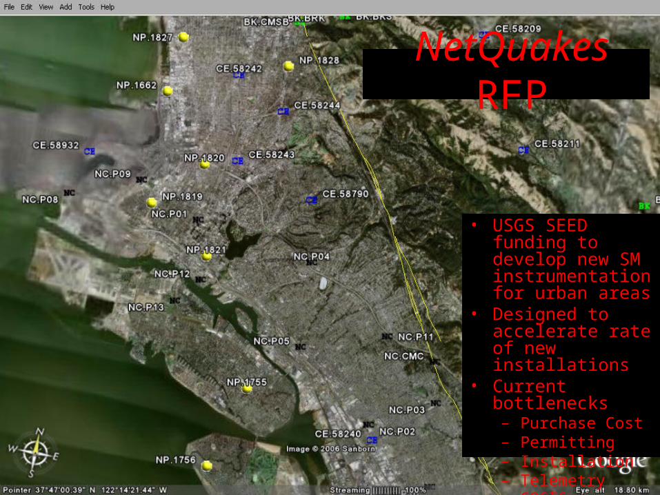
NetQuakes RFP
• USGS SEED funding to develop new SM instrumentation for urban areas
• Designed to accelerate rate of new installations
• Current bottlenecks– Purchase Cost – Permitting– Installation – Telemetry costs
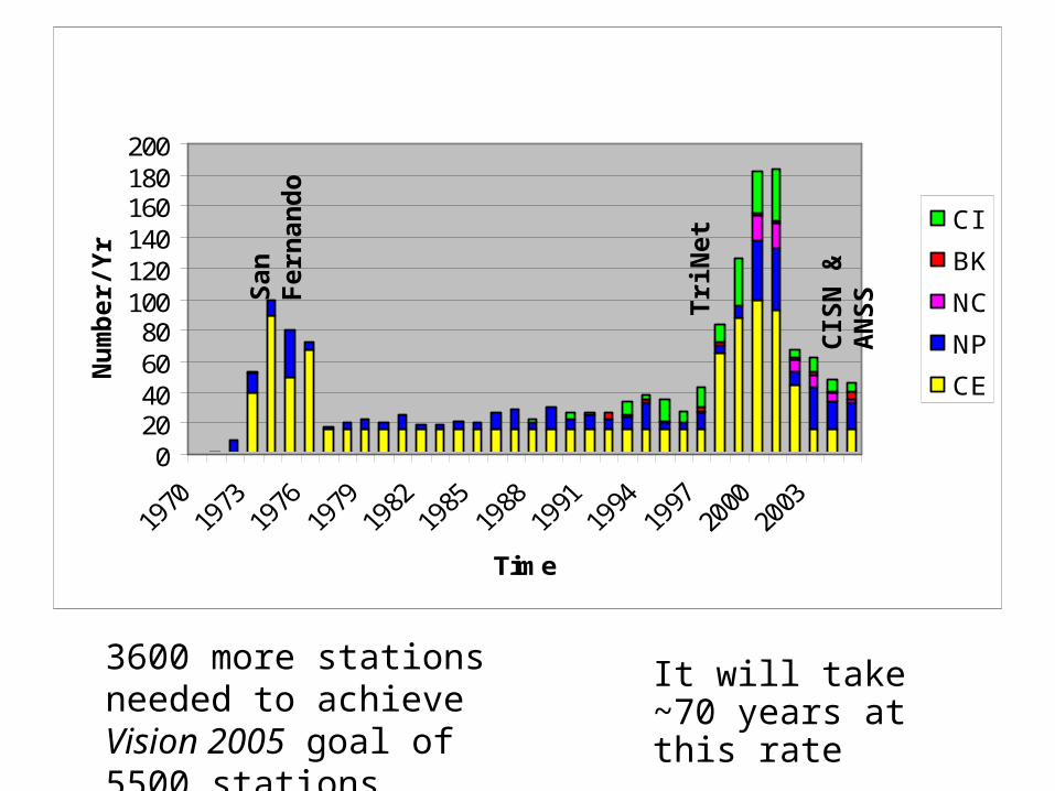
020406080
100120140160180200
Time
Nu
mb
er/Y
r CI
BK
NC
NP
CE
It will take ~70 years at this rate
3600 more stations needed to achieve Vision 2005 goal of 5500 stations
San
Fer
nan
do
Tri
Net
CIS
N &
AN
SS
Nu
mb
er/Y
r
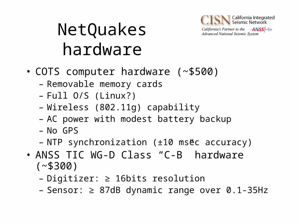
NetQuakes hardware
• COTS computer hardware (~$500)– Removable memory cards– Full O/S (Linux?)– Wireless (802.11g) capability– AC power with modest battery backup– No GPS– NTP synchronization (±10 msec accuracy)
• ANSS TIC WG-D Class “C-B” hardware (~$300)– Digitizer: ≥ 16bits resolution– Sensor: ≥ 87dB dynamic range over 0.1-35Hz
Functionality
• Triggered only• Data queued until successfully uploaded• Uploaded data used when event is detected
by regional seismic network• Periodic SOH messages issued• Periodic queries to check for new software• Periodic NTP synchronization• Ability to add new algorithms
Installation and Servicing
• Volunteer hosts solicited
• Technician installs device– Bolt cradle, orient device, configure device,
determine GPS coordinates
• Hosts swap out batteries and bad units (not technicians)
NetQuakes Status
• Proposals from vendors due 9/6/2006
• Award to be made by 9/26/2006– At least 3 prototypes– Up to 250 more units
• Prototypes due no later than 6/30/2007
• Goal is 100+ new urban SM stations/year