TcpMDTfor ZWCAD - aplitop.com · Stakeout options allow to calculate and analyze points on...
2
Solution for Surveying and Civil Engineering We announce the launch of a full and low cost solution for all Surveying and Civil Engineering projects.MDT is a modular application, powerful and easy to use, integrated seamlessly in ZWCAD. Standard Version The program starts to run from the coordinates captured by any total station or GPS, drawing the survey automatically. Using these data a surface or mesh is generated, as well as contours. Horizontal alignment can be defined from a polyline, being possible to get and draw terrain cross sections from a surface or 3D cartography or surveying drawings. Also cut and fill volumes can be computed by difference of meshes or cross sections. Professional Version MDT Professional is designed to assist users in all the phases of carrying out a project for lineal works, developments, quarries, mines, etc. Advanced surface operations allow to generate quickly earthworks by terrain or leveling heights, optimum height calculation, etc. It provides tools for the design of horizontal and vertical alignments, input by parameters or conversion from LandXML and other formats. It also lets you define and assign templates from vectorial elements. From this information we can calculate and draw the project cross-sections, generate final ground, cut and fill reports, mass diagrams, quick volume measurements, etc. TcpMDT compatible with TcpMDTfor ZWCAD
Transcript of TcpMDTfor ZWCAD - aplitop.com · Stakeout options allow to calculate and analyze points on...

Solution for Surveying and Civil Engineering
We announce the launch of a full and low cost solution for all Surveying and Civil Engineering projects.MDT is a modular application, powerful and easy to use, integrated seamlessly in ZWCAD.
Standard VersionThe program starts to run from the coordinates captured by any total station or GPS, drawing the survey automatically. Using these data a surface or mesh is generated, as well as contours.
Horizontal alignment can be defined from a polyline, being possible to get and draw terrain cross sections from a surface or 3D cartography or surveying drawings. Also cut and fill volumes can be computed by difference of meshes or cross sections.
Professional VersionMDT Professional is designed to assist users in all the phases of carrying out a project for lineal works, developments, quarries, mines, etc. Advanced surface operations allow to generate quickly earthworks by terrain or leveling heights, optimum height calculation, etc.
It provides tools for the design of horizontal and vertical alignments, input by parameters or conversion from LandXML and other formats. It also lets you define and assign templates from vectorial elements.
From this information we can calculate and draw the project cross-sections, generate final ground, cut and fill reports, mass diagrams, quick volume measurements, etc.
TcpMDT compatible with
TcpMDTfor ZWCAD
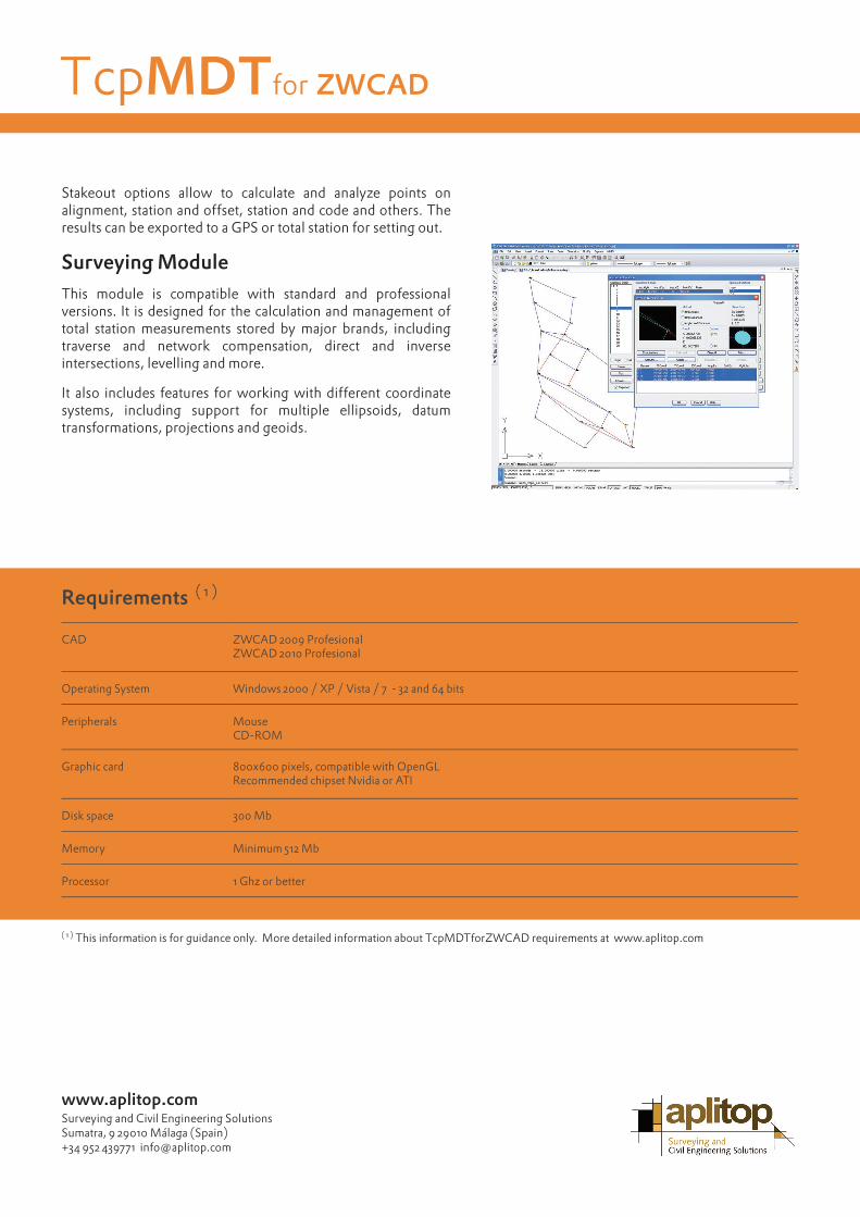
Stakeout options allow to calculate and analyze points on alignment, station and offset, station and code and others. The results can be exported to a GPS or total station for setting out.
Surveying ModuleThis module is compatible with standard and professional versions. It is designed for the calculation and management of total station measurements stored by major brands, including traverse and network compensation, direct and inverse intersections, levelling and more.
It also includes features for working with different coordinate systems, including support for multiple ellipsoids, datum transformations, projections and geoids.
( 1 ) This information is for guidance only. More detailed information about TcpMDTforZWCAD requirements at www.aplitop.com
www.aplitop.comSurveying and Civil Engineering SolutionsSumatra, 9 29010 Málaga (Spain)+34 952 439771 [email protected]
Requirements ( 1 )
CAD ZWCAD 2009 ProfesionalZWCAD 2010 Profesional
Operating System Windows 2000 / XP / Vista / 7 - 32 and 64 bits
Peripherals MouseCD-ROM
Graphic card 800x600 pixels, compatible with OpenGLRecommended chipset Nvidia or ATI
Disk space 300 Mb
Memory Minimum 512 Mb
Processor 1 Ghz or better
TcpMDTfor ZWCAD