Spatial analysis tools for biodiversity indicators on habitats and ecosystems Expert meeting on...
46
Spatial analysis tools for biodiversity indicators on habitats and ecosystems Expert meeting on multi-scales mapping and integrated analysis of landscape & green corridors Ferran Páramo European Topic Centre on Terrestrial Environment May 2005
-
Upload
elvin-home -
Category
Documents
-
view
219 -
download
2
Transcript of Spatial analysis tools for biodiversity indicators on habitats and ecosystems Expert meeting on...
Spatial analysis tools for biodiversity indicators on habitats and ecosystems
Expert meeting on multi-scales mapping and integrated analysis of landscape & green corridors
Ferran PáramoEuropean Topic Centre on Terrestrial Environment
May 2005

Structure of the presentation
• Data sources
• Corilis Methodology
• GPB: Green Potential Background
• DLT: Dominant Landscape Types

DATA SOURCES

CORINE Land Cover

CORINE Land Cover

CORINE Land Cover

European Reference Grid 1x1 Km

Discontinuous urban fabric
Industrial or commercial units
Coniferous forest
Sclerophyllous vegetation
Water courses71
142
76
K1000 E3666 N2073
Total surface: 100 Ha

CORILIS METHODOLOGY


Thresholds

Thresholds

CLC
CORILIS
EBGDLT
CRITERIA DEPENDENT LAYERS
Aggregation and/or
Dominance
STANDARD LAYERS

Green potential background map

Continuous urban fabricDiscontinuous urban fabric
Industrial or commercial unitsRoad and rail networks and associated land
Sport & leisure areasAirports
Mineral extraction sitesDump sites
Construction sitesGreen urban areas
Port and leisure facilitiesNon-irrigated arable land
Permanently irrigated landRice fieldsVineyards
Fruit trees and berry plantationsOlive groves
PasturesAnnual crops associated with permanent crops
Complex cultivation patternsLand principally occupied by agriculture, with significant areas of natural vegetation
Agro-forestry areasBroad-leaved forest
Coniferous forestMixed forest
Natural grasslandsMoors and heathland
Sclerophyllous vegetationTransitional woodland-shrub
Beaches, dunes, sandsBare rocks
Sparsely vegetated areasBurnt areas
Glaciers and perpetual snowInland marshes
Peat bogsSalt marshes
SalinesIntertidal flats
Water coursesWater bodies
Coastal lagoonsEstuaries
Sea and OceanNo data
1. Artificial surfaces
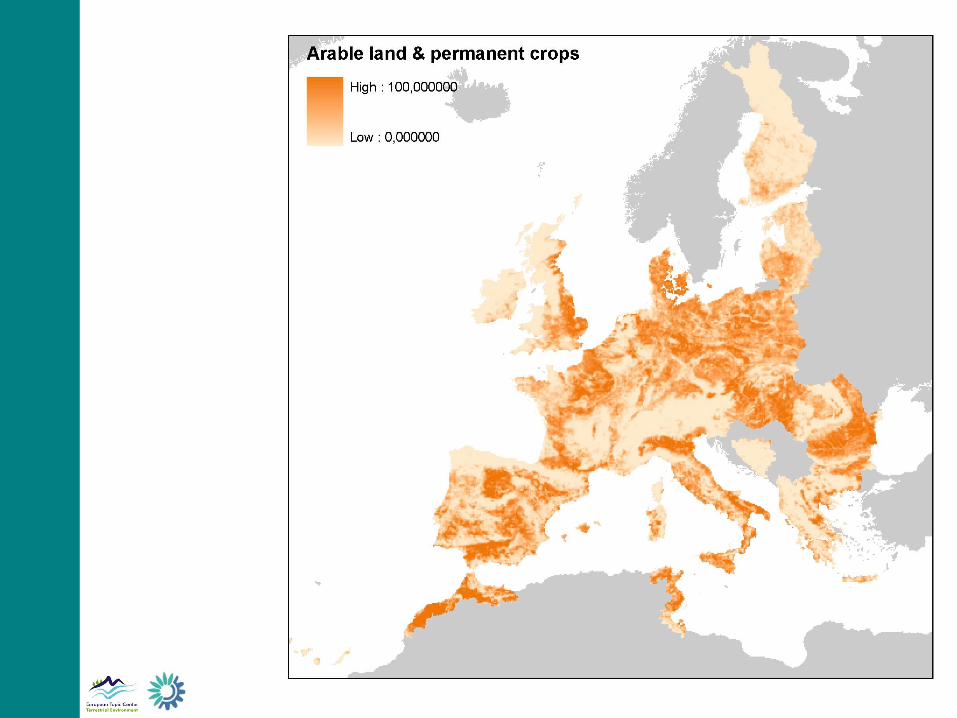
2a. Arable land & permanent crops
2b. Pastures & mixed farmland
3a. Forests and transitional woodland shrub
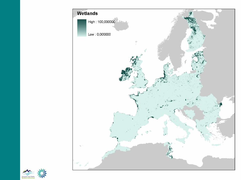
4. Wetlands
CLC Level 3 Aggregated Nomenclature
3b. Natural grassland, moors, heathland and sclerophylous vegetation
3c. Open spaces with little or no vegetation
5. Water bodies

Ecological BackgroundSmoothing radius: 5 kmGrouping of 2B, 3A, 3B, 3C, 4 and 5 classes

Ecological BackgroundSmoothing radius: 10 kmGrouping of 2B, 3A, 3B, 3C, 4 and 5 classes
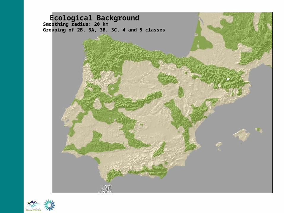
Ecological BackgroundSmoothing radius: 20 kmGrouping of 2B, 3A, 3B, 3C, 4 and 5 classes

Legend0 - 80 %
80 - 100 %
Ecological BackgroundSmoothing radius: 5 kmGrouping of 2B, 3A, 3B, 3C, 4 and 5 classes

Legend0 - 80 %
80 - 100 %
Ecological BackgroundSmoothing radius: 10 kmGrouping of 2B, 3A, 3B, 3C, 4 and 5 classes

Legend0 - 80 %
80 - 100 %
Ecological BackgroundSmoothing radius: 20 kmGrouping of 2B, 3A, 3B, 3C, 4 and 5 classes

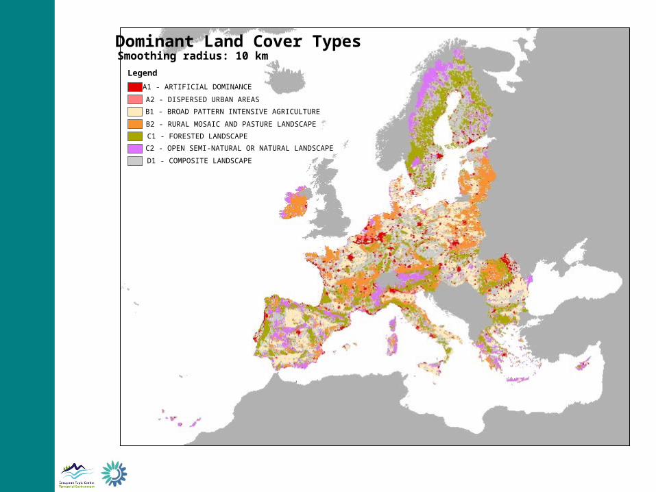
Dominant Landscape Types map

Continuous urban fabricDiscontinuous urban fabric
Industrial or commercial unitsRoad and rail networks and associated land
Sport & leisure areasAirports
Mineral extraction sitesDump sites
Construction sitesGreen urban areas
Port and leisure facilitiesNon-irrigated arable land
Permanently irrigated landRice fieldsVineyards
Fruit trees and berry plantationsOlive groves
PasturesAnnual crops associated with permanent crops
Complex cultivation patternsLand principally occupied by agriculture, with significant areas of natural vegetation
Agro-forestry areasBroad-leaved forest
Coniferous forestMixed forest
Natural grasslandsMoors and heathland
Sclerophyllous vegetationTransitional woodland-shrub
Beaches, dunes, sandsBare rocks
Sparsely vegetated areasBurnt areas
Glaciers and perpetual snowInland marshes
Peat bogsSalt marshes
SalinesIntertidal flats
Water coursesWater bodies
Coastal lagoonsEstuaries
Sea and OceanNo data
1. Artificial surfaces
2. Arable land & permanent crops
3. Pastures & mixed farmland
4. Forests and transitional woodland shrub
CLC Level 3 Aggregated Nomenclature
5. Shrubs & other semi-natural land

a) Threshold value = mean + sdev
b) Codominance criteria

A1 - ARTIFICIAL DOMINANCE
A2 - DISPERSED URBAN AREASB1 - BROAD PATTERN INTENSIVE AGRICULTURE
B2 - RURAL MOSAIC AND PASTURE LANDSCAPE
C1 - FORESTED LANDSCAPEC2 - OPEN SEMI-NATURAL OR NATURAL LANDSCAPE
D1 - COMPOSITE LANDSCAPE
Dominant Land Cover TypesSmoothing radius: 5 km

A1 - ARTIFICIAL DOMINANCE
A2 - DISPERSED URBAN AREASB1 - BROAD PATTERN INTENSIVE AGRICULTURE
B2 - RURAL MOSAIC AND PASTURE LANDSCAPE
C1 - FORESTED LANDSCAPEC2 - OPEN SEMI-NATURAL OR NATURAL LANDSCAPE
D1 - COMPOSITE LANDSCAPE
Dominant Land Cover TypesSmoothing radius: 10 km

A1 - ARTIFICIAL DOMINANCE
A2 - DISPERSED URBAN AREASB1 - BROAD PATTERN INTENSIVE AGRICULTURE
B2 - RURAL MOSAIC AND PASTURE LANDSCAPE
C1 - FORESTED LANDSCAPEC2 - OPEN SEMI-NATURAL OR NATURAL LANDSCAPE
D1 - COMPOSITE LANDSCAPE
Dominant Land Cover TypesSmoothing radius: 20 km

Legend
A1 - ARTIFICIAL DOMINANCE
A2 - DISPERSED URBAN AREAS
B1 - BROAD PATTERN INTENSIVE AGRICULTURE
B2 - RURAL MOSAIC AND PASTURE LANDSCAPE
C1 - FORESTED LANDSCAPE
C2 - OPEN SEMI-NATURAL OR NATURAL LANDSCAPE
D1 - COMPOSITE LANDSCAPE
Dominant Land Cover TypesSmoothing radius: 5 km
Legend
A1 - ARTIFICIAL DOMINANCE
A2 - DISPERSED URBAN AREAS
B1 - BROAD PATTERN INTENSIVE AGRICULTURE
B2 - RURAL MOSAIC AND PASTURE LANDSCAPE
C1 - FORESTED LANDSCAPE
C2 - OPEN SEMI-NATURAL OR NATURAL LANDSCAPE
D1 - COMPOSITE LANDSCAPE
Dominant Land Cover TypesSmoothing radius: 10 km
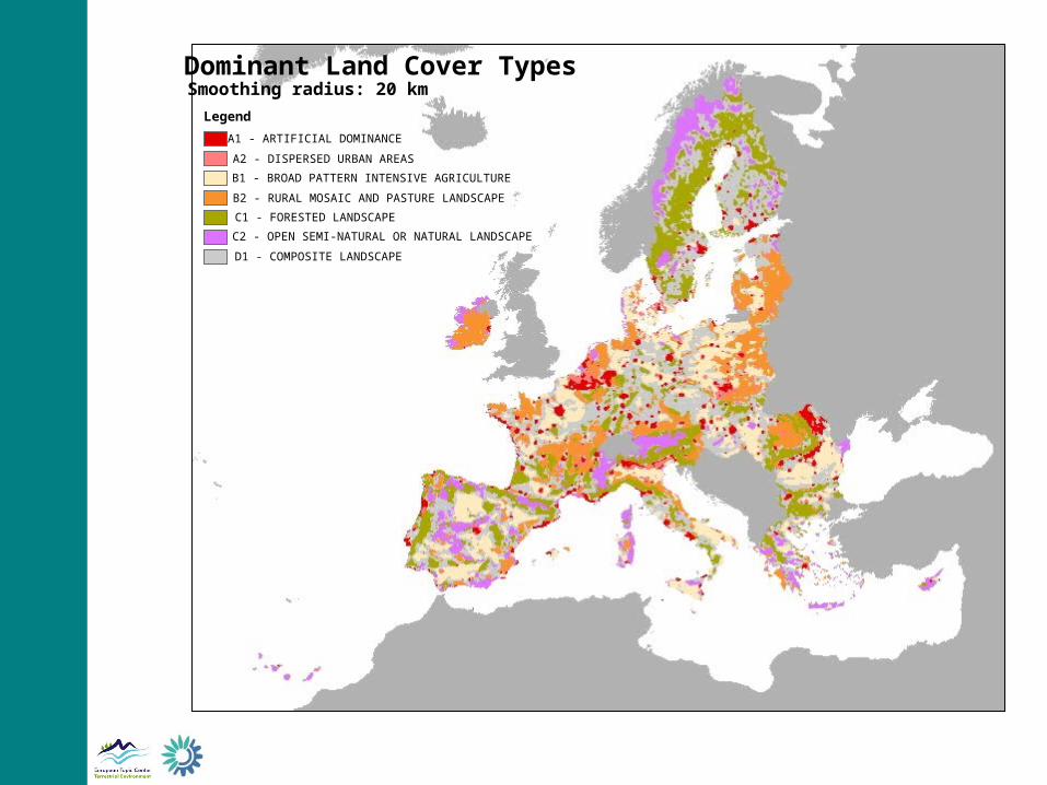
Legend
A1 - ARTIFICIAL DOMINANCE
A2 - DISPERSED URBAN AREAS
B1 - BROAD PATTERN INTENSIVE AGRICULTURE
B2 - RURAL MOSAIC AND PASTURE LANDSCAPE
C1 - FORESTED LANDSCAPE
C2 - OPEN SEMI-NATURAL OR NATURAL LANDSCAPE
D1 - COMPOSITE LANDSCAPE
Dominant Land Cover TypesSmoothing radius: 20 km

Dominant Land Cover TypesEuropean Thresholds

Dominant Land Cover TypesSea Catchment thresholds

Sea Catchments Elevation Breakdown
Analytical units

4
3
Adding the elevation breakdown

CLC
CORILIS
EBGDLT
CRITERIA DEPENDENT LAYERS
Aggregation and/or
Dominance
STANDARD LAYERS

Thanks for your attention