Smart Algorithms for Public Transport
61
Smart Route Planning for Public Transit Giuseppe F. Italiano University of Rome Tor Vergata [email protected] Joint cooperation with Luca Allulli, previously at Roma Servizi per la Mobilità Funded by MIUR, Progetto di Rilevante Interesse Nazionale “Algorithmics for MAssive and Networked DAta” (AMANDA)
-
Upload
data-driven-innovation -
Category
Technology
-
view
242 -
download
3
Transcript of Smart Algorithms for Public Transport

Smart Route Planning for Public Transit
Giuseppe F. Italiano University of Rome Tor Vergata [email protected]
Joint cooperation with Luca Allulli, previously
at Roma Servizi per la Mobilità
Funded by MIUR, Progetto di Rilevante Interesse Nazionale “Algorithmics for MAssive and Networked DAta” (AMANDA)

Public Transport & Data Public transport authorities and operators gather enormous amount of data Smart travel cards Bus GPS …

Theory

Theory is when you know something, but it doesn't work.
Theory

The real world out there…

Practice is when something works, but you don't know why.
The real world out there…

Theory is when you know
something, but it doesn't work.
Practice is when something
works, but you don't know why.
Combining Theory & Practice?

Theory is when you know
something, but it doesn't work.
Practice is when something
works, but you don't know why.
Big challenge: combine theory and practice…
…i.e., nothing works and you don't know why.
Combining Theory & Practice?

Public Transport
Theory: All transit vehicles start their trip at the planned time, no delays throughout their journey

Public Transport
Theory: All transit vehicles start their trip at the planned time, no delays throughout their journey
Practice: Buses often run behind schedule, and for many unplanned reasons, such as:
• traffic • road closures • inclement weather • sometimes even unrealistic scheduling

Outline
1. Is timetabled data good enough for public transit?
2. Is GPS (real-time) data helpful?
3. Is GPS (real-time) data enough? Do we need something else?
Outline
1. Is timetabled data good enough for public transit?
2. Is GPS (real-time) data helpful?
3. Is GPS (real-time) data enough? Do we need something else?

Timetabled Route Planners
• Are timetabling-based routing methods good enough? Able to deliver “good” solutions in practice?
• Try to measure the quality of timetabling-based solutions in the metropolitan area of a big city.

Analysis of bus trips
Bus 64, route between S. Pietro to main train station in Rome (Termini) Connects many important touristic attractions in the city center of Rome

Theory vs. Practice

Theory vs. Practice

Theory vs. Practice

Theory vs. Practice

Experiment (1/2) How does this affect a route planner? Submitted queries to Google Transit
• Origin and destination in metropolitan area of Rome
• Each query has a departure time from origin
Collected suggested journeys and their estimated (planned) travel times
• Journeys provided by Google Transit based on timetable data

Google Transit
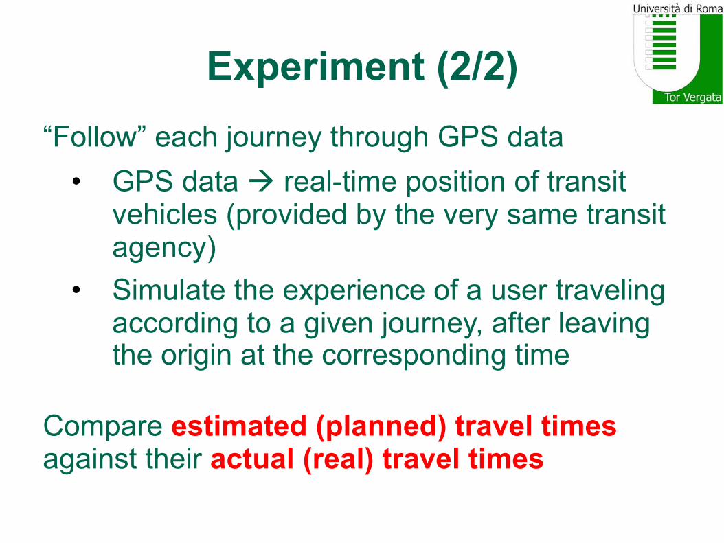
Experiment (2/2) “Follow” each journey through GPS data
• GPS data à real-time position of transit vehicles (provided by the very same transit agency)
• Simulate the experience of a user traveling according to a given journey, after leaving the origin at the corresponding time
Compare estimated (planned) travel times against their actual (real) travel times

Experimental Setup • Public Transport Network in Rome
• 309 bus lines and 2 subway lines • 7,089 stops (7,037 bus stops and 52 subway stops)
• More than 1,000 queries qi = <si, ti, τi> • si, ti uniformly at random in Rome’s metropolitan area • τi uniformly at random in [7:00am; 9:00pm] • On January 8 (just a typical week day, no major disruptions,
constructions works or extreme weather conditions)
• Collected 4,018 journeys • For each query, Google Transit returns 4 journeys
• Possibly less: e.g., one of the journeys might be footpath

Our Simulation On same day (January 8) submitted queries every minute to the Mobility Agency of Rome
• Obtained (from GPS data) the instantaneous geo-location of all transit vehicles in the network
Simulation • For each trip in the journey, pick-up and drop-off times
computed according to the position of transit vehicles • If a delayed transit vehicle misses a connection then the
next trip of the same line was chosen (similarly, could catch earlier connections)
• Footpath times computed with Google Maps • GPS data for subway lines not available

Experimental Results
For each journey j, compare ta(j) and te(j) • te(j): estimated (planned) time (timetable ß Google Transit) • ta(j): actual (real) time (vehicle real-time positions ß simulator)
Define Error Coefficient = real time / planned time [ ta(j) / te(j) ] Error coefficient:
• > 1 : Google Transit was too optimistic • = 1 : Google Transit was just right • < 1 : Google Transit was too pessimistic

Error Coefficient (1/2)

Error Coefficient (2/2)
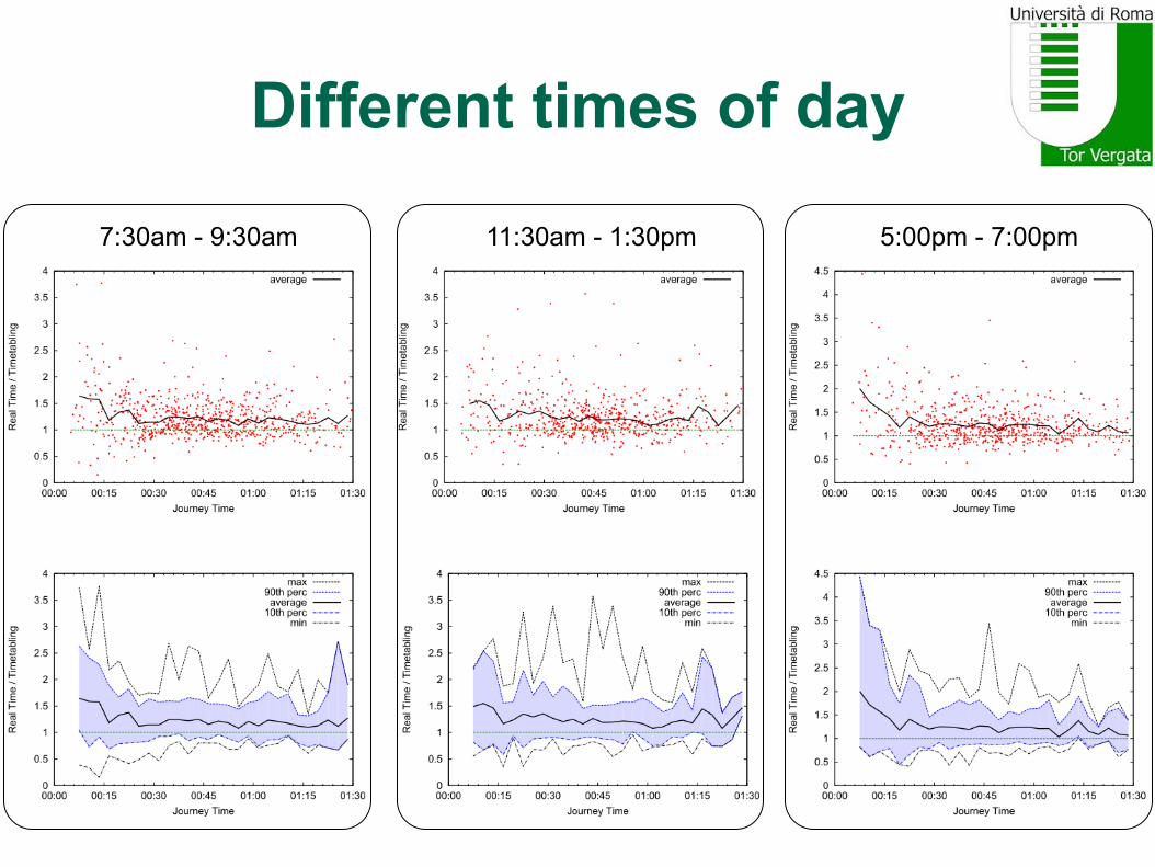
Different times of day
7:30am - 9:30am 11:30am - 1:30pm 5:00pm - 7:00pm

Correlations in ranking For each query qi, take four journeys suggested and compare:
• Relative rankings by planned times te(j) • Relative rankings by real times ta(j)
Use Kendall tau coefficient (# concordant pairs) - (# discordant pairs) ½ n (n-1) • From -1 (perfect disagreement) to +1 (perfect agreement) • 0 if independent (uncorrelation)
Actually used Kendall tau b (to adjust for ties)

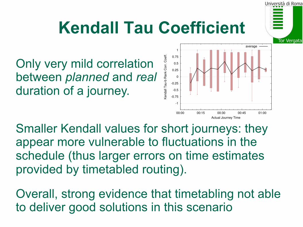
Kendall Tau Coefficient
-1
-0.75
-0.5
-0.25
0
0.25
0.5
0.75
1
00:00 00:15 00:30 00:45 01:00
Kendall
Tau-b
Rank
Corr
. C
oeff.
Actual Journey Time
average
Kendall Tau Coefficient
Only very mild correlation between planned and real duration of a journey.
Smaller Kendall values for short journeys: they appear more vulnerable to fluctuations in the schedule (thus larger errors on time estimates provided by timetabled routing).
Overall, strong evidence that timetabling not able to deliver good solutions in this scenario
-1
-0.75
-0.5
-0.25
0
0.25
0.5
0.75
1
00:00 00:15 00:30 00:45 01:00
Kendall
Tau-b
Rank
Corr
. C
oeff.
Actual Journey Time
average

Is this just for Rome?

Is this just for Rome?
“I imagine hell like this: Italian punctuality, German humour and English wine”
Peter Ustinov

Is this just for Rome?

Is this just for Rome?

Is this just for Rome?
``Firmani, Italiano, Laura & Santaroni [9] observed in an experimental study on the transportation network of Rome that the timetable information and the real movement of the vehicles (based on GPS data) are only mildly correlated.’’
Verbatim from [Böhmová, Mihalák, Neubert, Pröger, Widmayer, ATMOS 2015]:
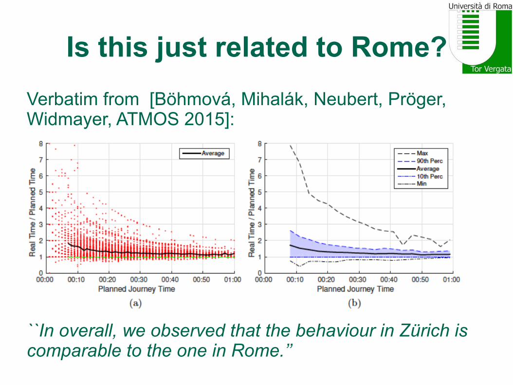
Is this just related to Rome? Verbatim from [Böhmová, Mihalák, Neubert, Pröger, Widmayer, ATMOS 2015]:
``In overall, we observed that the behaviour in Zürich is comparable to the one in Rome.’’

Takehome message
In several cases, timetable information (theory) and real movement of vehicles (practice) are only “mildly correlated” (not only in Rome but also in Zürich!) It’s not only a small input perturbation! Thus, widely used timetable-based methods suffer from many inaccuracies, independently of their own merits. Due to incorrect estimations of the waiting / transfer times at transit stops, might fail to deliver a good solution. Need to use smarter data, i.e., GPS feeds of transit vehicles

Outline
1. Is timetabled data good enough for public transit?
2. Is GPS (real-time) data helpful?
3. Is GPS (real-time) data enough? Do we need something else?

Route Planners
Several algorithms that work with timetabled data could be adapted to work with GPS data • RAPTOR [Delling, Pajor, Werneck.
Transportation Science, 2014]. • CSA [Dibbelt, Pajor, Strasser, Wagner.
SEA 2013] • …
Quality of solutions?
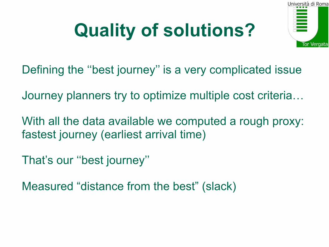
Defining the ‘‘best journey’’ is a very complicated issue Journey planners try to optimize multiple cost criteria… With all the data available we computed a rough proxy: fastest journey (earliest arrival time) That’s our ‘‘best journey’’ Measured “distance from the best” (slack)

Distance from the best (Slack)

GPS data useful in short term

Takehome message
Effective exploitation of GPS data seems important to make public transport journey planners smarter. GPS data helps in short and medium range. Not very useful in the long range. Main impact of GPS data depends on pick-up time of first bus Smart data not enough

Outline
1. Is timetabled data good enough for public transit?
2. Is GPS (real-time) data helpful?
3. Is GPS (real-time) data enough? Do we need something else?

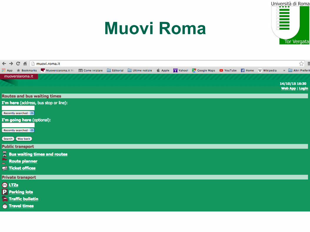
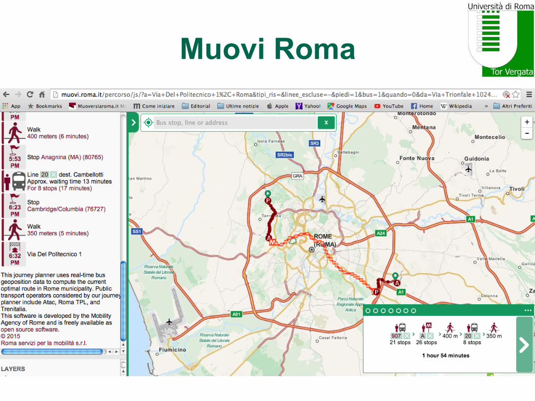
Muovi Roma http://muovi.roma.it/
Journey planner available for the metropolitan area of Rome
Uses GPS data and historical data to improve the accuracy of time estimates and to predict position of buses in the near future
Based on dynamic shortest paths on a time-dependent network
Incorporates some of our own algorithmic suggestions
Developed and maintained by Roma Servizi per la Mobilità (open source / open data)
Muovi Roma

Muovi Roma
Muovi Roma

Error Coefficient
1/51/4
1/3
1/2
2/3
1
3/2
2
3
4 5
10 20 30 40 50 60 70 80 90 100
Err
or
Coeffic
ient
Estimated Journey Time
10th to 90th percaverage
1/51/4
1/3
1/2
2/3
1
3/2
2
3
4 5
10 20 30 40 50 60 70 80 90 100
Err
or
Coeffic
ient
Estimated Journey Time
10th to 90th percaverage
Google Transit MuoviRoma
Error Coefficient = Actual (Real) Time / Estimated (Planned) Time
Short journeys affected more (MR estimates fewer short journeys)
Both err on the optimistic side (real journeys take longer on avg)
MR much better for medium range journeys
MR slightly better for long range journeys (GPS data not very useful in a hour from now?)

Morning (7:00am-1:30pm)
1/51/4
1/3
1/2
2/3
1
3/2
2
3
4 5
10 20 30 40 50 60 70 80 90 100
Erro
r Coe
ffici
ent
Estimated Journey Time
average
1/51/4
1/3
1/2
2/3
1
3/2
2
3
4 5
10 20 30 40 50 60 70 80 90 100
Erro
r Coe
ffici
ent
Estimated Journey Time
average
Google Transit MuoviRoma

Afternoon (1:30pm-8:00pm)
1/51/4
1/3
1/2
2/3
1
3/2
2
3
4 5
10 20 30 40 50 60 70 80 90 100
Erro
r Coe
ffici
ent
Estimated Journey Time
average
1/51/4
1/3
1/2
2/3
1
3/2
2
3
4 5
10 20 30 40 50 60 70 80 90 100
Erro
r Coe
ffici
ent
Estimated Journey Time
average
Google Transit MuoviRoma
Quality of solutions
From previous experiments can only conclude that GPS-aware planner (MR) estimates its journeys better than what timetabled planner (GT) does Accuracy does not say much about quality of solutions provided (fastest/best journeys) Even if MR could estimate better its journeys, it could still provide low-quality solutions (slow journeys)

Quality of solutions
Again, computed best journey for query q Distance from best (Slack) is distance (actual time) from best journey Best journey has slack equal to 0 The smaller the slacks, the better the solutions provided by the route planner

Quality of solutions (slack)
0
10
20
30
40
50
60
15 30 45 60 75 90 105 120
Sla
ck
Fast Journey
10th to 90th percaverage
0
10
20
30
40
50
60
15 30 45 60 75 90 105 120
Sla
ck
Fast Journey
10th to 90th percaverage
Google Transit MuoviRoma
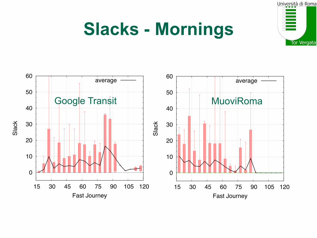
Slacks - Mornings
0
10
20
30
40
50
60
15 30 45 60 75 90 105 120
Slac
k
Fast Journey
average
0
10
20
30
40
50
60
15 30 45 60 75 90 105 120
Slac
k
Fast Journey
average
Google Transit MuoviRoma

Slacks - Afternoons
0
10
20
30
40
50
60
15 30 45 60 75 90 105 120
Slac
k
Fast Journey
average
0
10
20
30
40
50
60
15 30 45 60 75 90 105 120
Slac
k
Fast Journey
average
Google Transit MuoviRoma

Quality of solutions
GPS-aware (MR) able to achieve small slacks and fast journeys, especially for mid and long-range journeys (>60’)
How could GPS data be still useful in a hour from now?
Prediction based on historical data seems to works well
Long-range journeys likely to involve trips on (less frequent) suburban lines, where missing a connection will cause significant delays
Long-range journeys based on unreliable timetables likely to incur in discrepancies with higher impact on overall travel time.

Conclusions • Tried to assess empirically impact of GPS
data in real public transport network (Rome) • With significant fluctuations in schedule,
timetabling inherently affected. • Need for GPS data: provide better accuracy • But GPS data not enough. “Traditional”
algorithms unable to fully exploit GPS data • We have smart data. Need to work more on
smarter algorithms! • Prediction models are critical (what will be the
state of the network in 60 minutes?)

Future Work

Future Work
Future Work