Sedimentary Unit Notes Part 2
135
Sedimentary Unit Notes Part 2
Transcript of Sedimentary Unit Notes Part 2

Sedimentary Unit Notes
Part 2

#5 - Sedimentary Structures:
Sedimentary structures are features in the sediment as it accumulated or after it accumulated.
PRIMARY SECONDARY

You will be responsible for knowing the SEDIMENTARY STRUCTURES shown on Page # 169-170 (Figure 6.12) of your LAB MANUALThey Include….
1. Strata/Stratification2. Bedding/Lamination3. Varves 4. Graded Bedding5. Cross Bedding6. Ripple Marks7. Mud cracks8. Flutes / Flute Casts 9. Raindrop Impressions10. Various Plant/Animal Structures
PRIMARY
SECONDARY
Strata / Stratification

•Strata are essentially individual layers of rock.
•Each strata has individual characteristics which
distinguish it from the strata above and below.
•Laid down successively over time…the deeper
they are…the older they are…we call this the
“Law of Super Position”
•Strata are always laid down flat or
horizontal…we call this the
“Law of Original Horizontality”

Oldest
Youngest
Laid down horizontal at first!
Getting older as we get deeper!
Each Strata is distinct from the ones above and below!
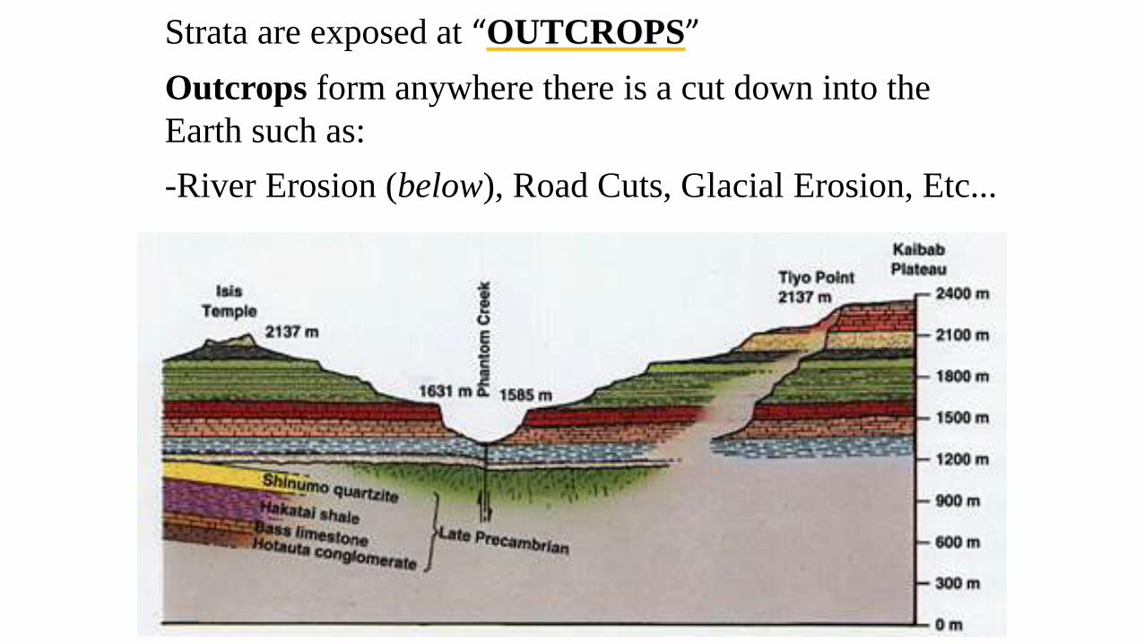
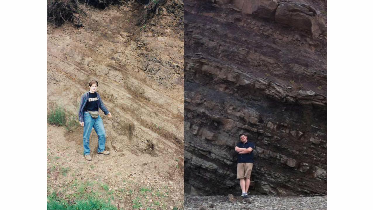
Strata are exposed at “OUTCROPS”
Outcrops form anywhere there is a cut down into the
Earth such as:
-River Erosion (below), Road Cuts, Glacial Erosion, Etc...

Bedding / Lamination:
very fine or thin layers or beds of material deposited (<1cm)
one STRATA can contain many laminations
Depositional layering of sedimentary rocks (>1cm)

Beds
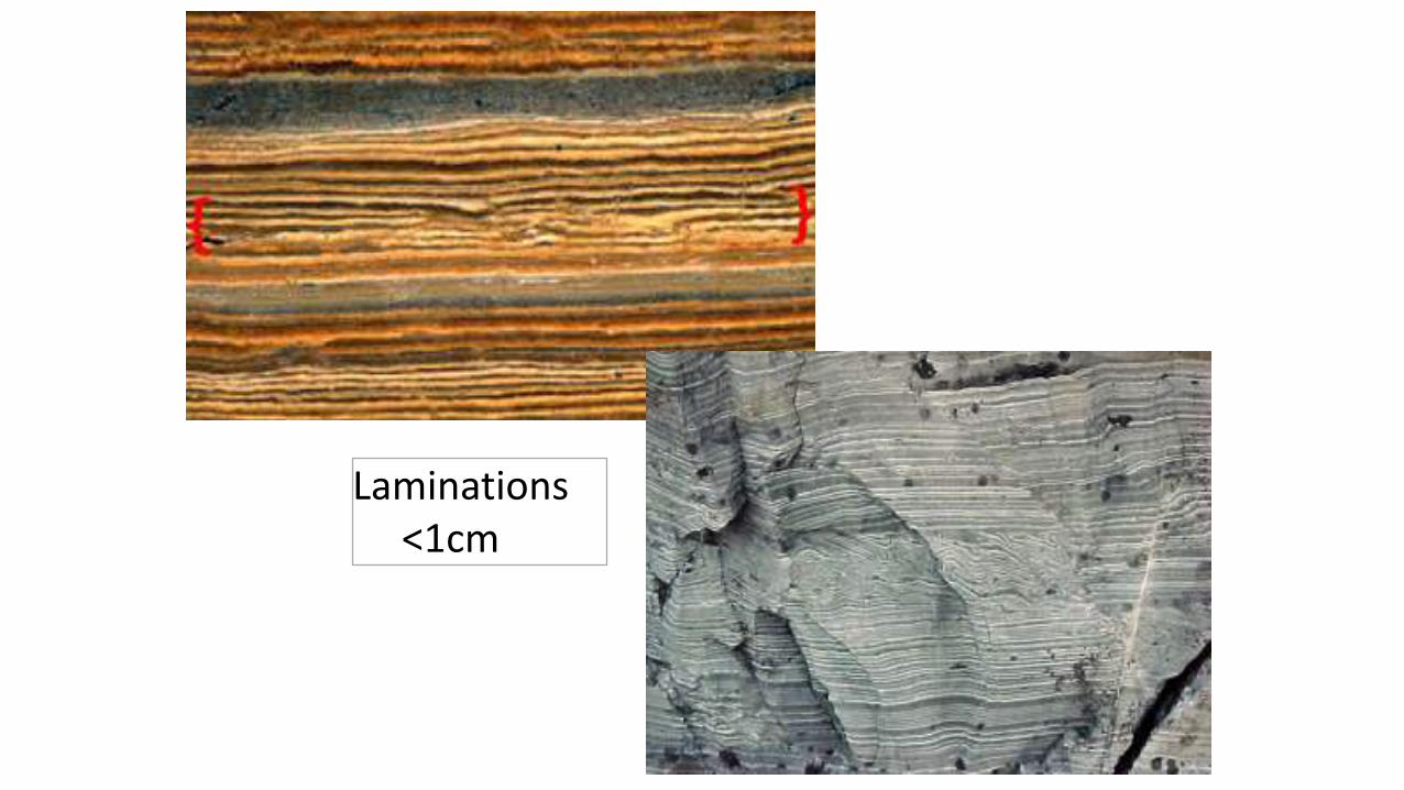
Laminations<1cm


Geologist's birthday
cake

Varves:
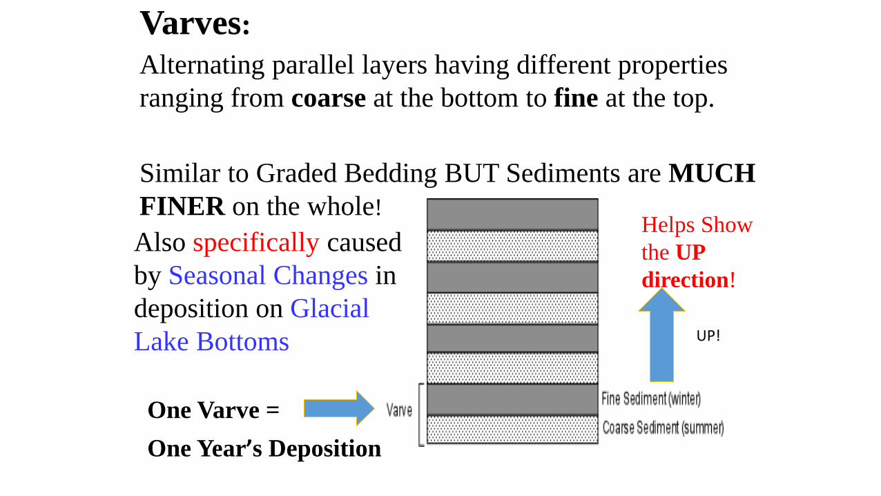
One Varve =
One Year’s Deposition
Varves:
Alternating parallel layers having different properties
ranging from coarse at the bottom to fine at the top.
Similar to Graded Bedding BUT Sediments are MUCH
FINER on the whole!
Also specifically caused
by Seasonal Changes in
deposition on Glacial
Lake Bottoms
Helps Show
the UP
direction!
UP!
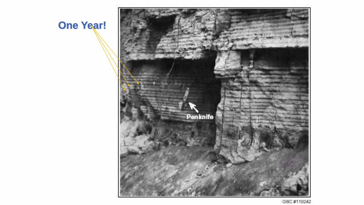
One Year!

One Year of Deposition on Glacial Lake Bottom
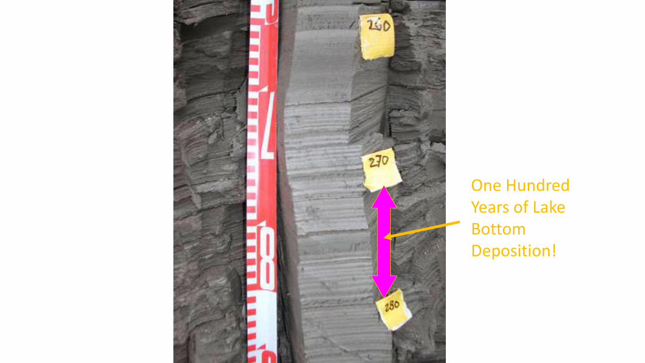
One Hundred Years of Lake Bottom Deposition!

Graded Bedding:


Graded Bedding -As current velocity decreases, first the larger or more dense
particles are deposited.
This results in bedding
showing a decrease in grain
size from the bottom of the
bed to the top of the bed.
Followed by smaller or less dense particles.
Often these represent one Stream / River Flood Cycle!


The lighter particle settle out as the flood event loses energy….
Helps Show the UP direction!
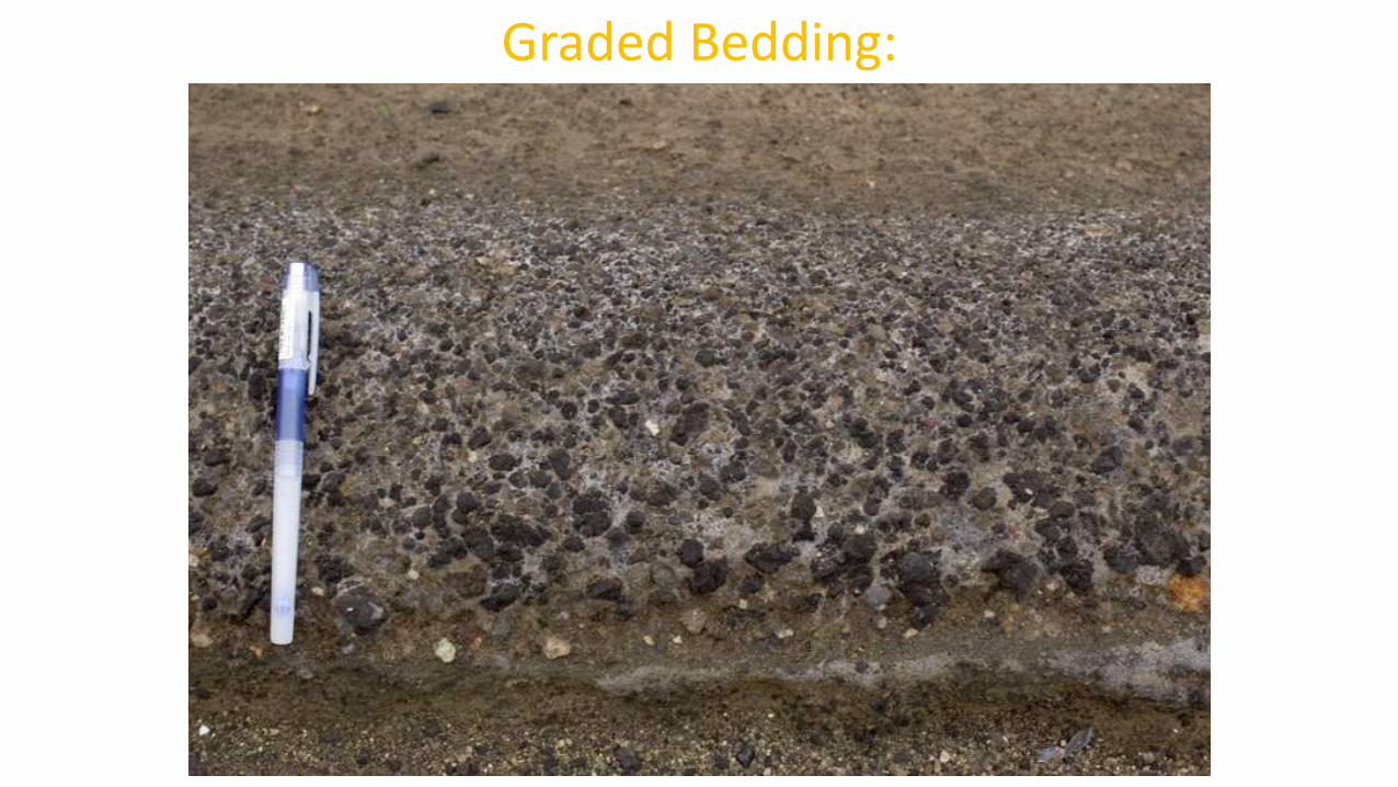
Graded Bedding:

High Energy!
Low Energy!


Cross Bedding:
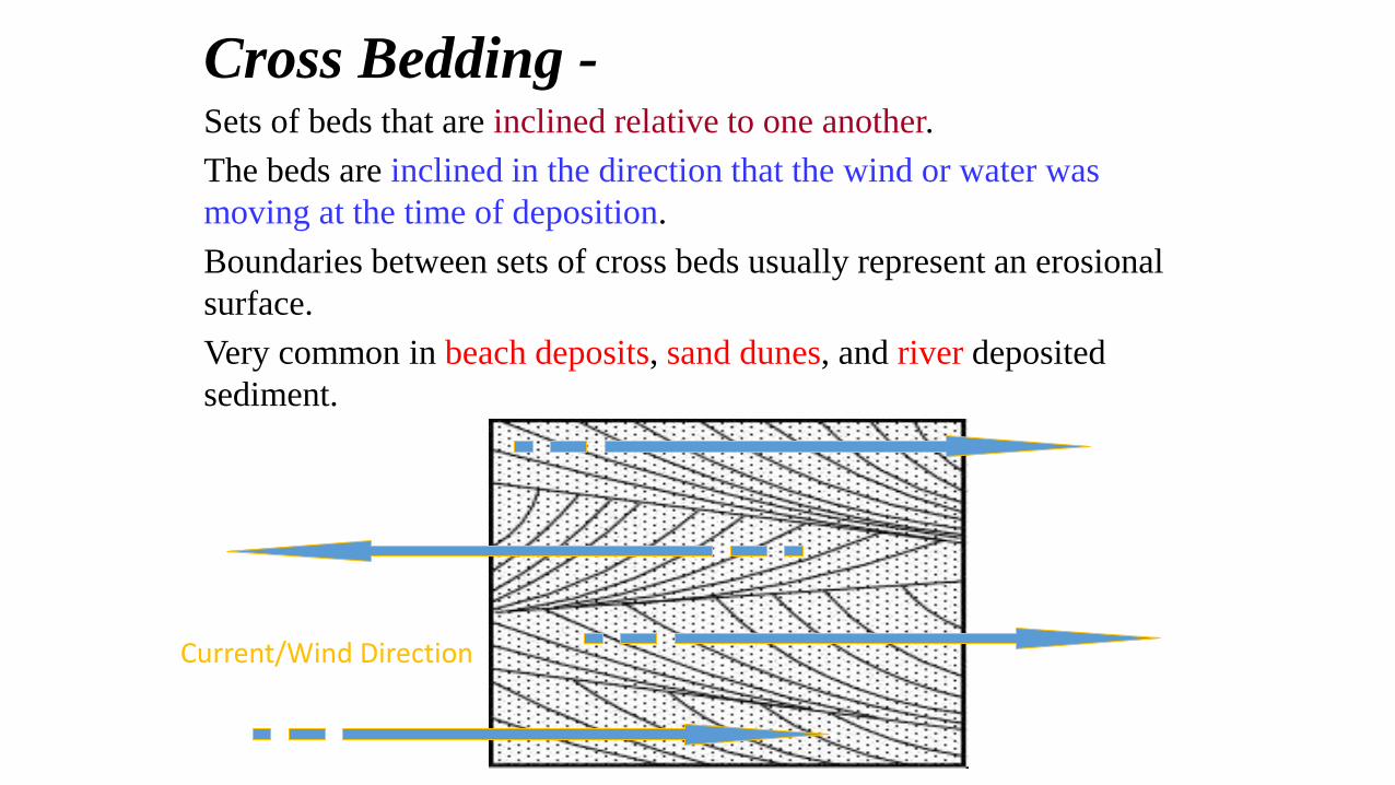
Cross Bedding -Sets of beds that are inclined relative to one another.
The beds are inclined in the direction that the wind or water was
moving at the time of deposition.
Boundaries between sets of cross beds usually represent an erosional
surface.
Very common in beach deposits, sand dunes, and river deposited
sediment.
Current/Wind Direction

Bimodal Cross-Bedding:Current changes direction over time!
Intermittent periods of erosion show as small “Unconformities”

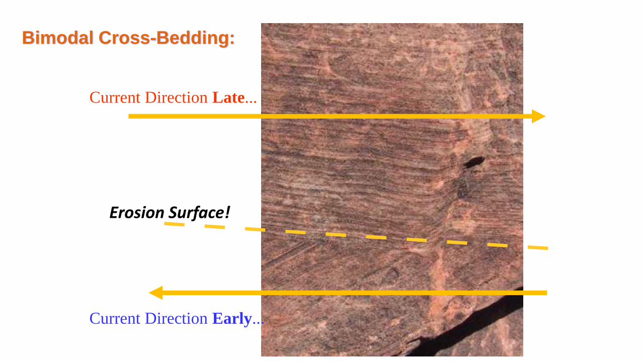
Erosion Surface!
Current Direction Late...
Current Direction Early...
Bimodal Cross-Bedding:

Can you identify
erosion surfaces &
current directions?

Large Scale Bimodal CrossBedding is usually indicative of
a desert “Sand Dune” environment…where wind direction constantly changes!
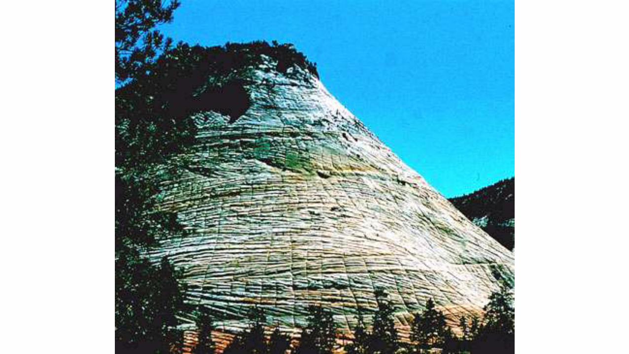


Large Scale Cross Bedding
From Ancient Sand Dunes...
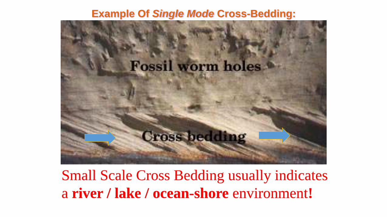
Example Of Single Mode Cross-Bedding:
Small Scale Cross Bedding usually indicates
a river / lake / ocean-shore environment!

Ripple Marks:

Ripple Marks -Characteristic of shallow water deposition.
Caused by waves or winds.
Common in bodies of
water with a steady
current such as a river
or stream!
How might oscillation/symmetrical ripple marks look?
These are current / asymmetrical ripple marks =
current always in one direction.

This type of small scale cross bedding is commonly associated
with ripple marks…gives us insight into the environment in
which the rock preserving these structures was formed!

Current (asymmetrical) Ripple Marks:
Current

These are oscillation / symmetrical ripple marks =
current changes direction.
These from in any body of water where gentle waves or weak
currents move back and forth such as at the sea or lake shore


Current
Oscillation (Symmetrical) Ripple Marks:
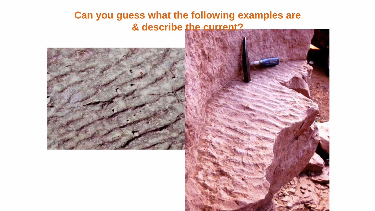
Can you guess what the following examples are
& describe the current?

These Sediments
at Wreck Beach
near UBC show ripple marks forming!

Mud Cracks:
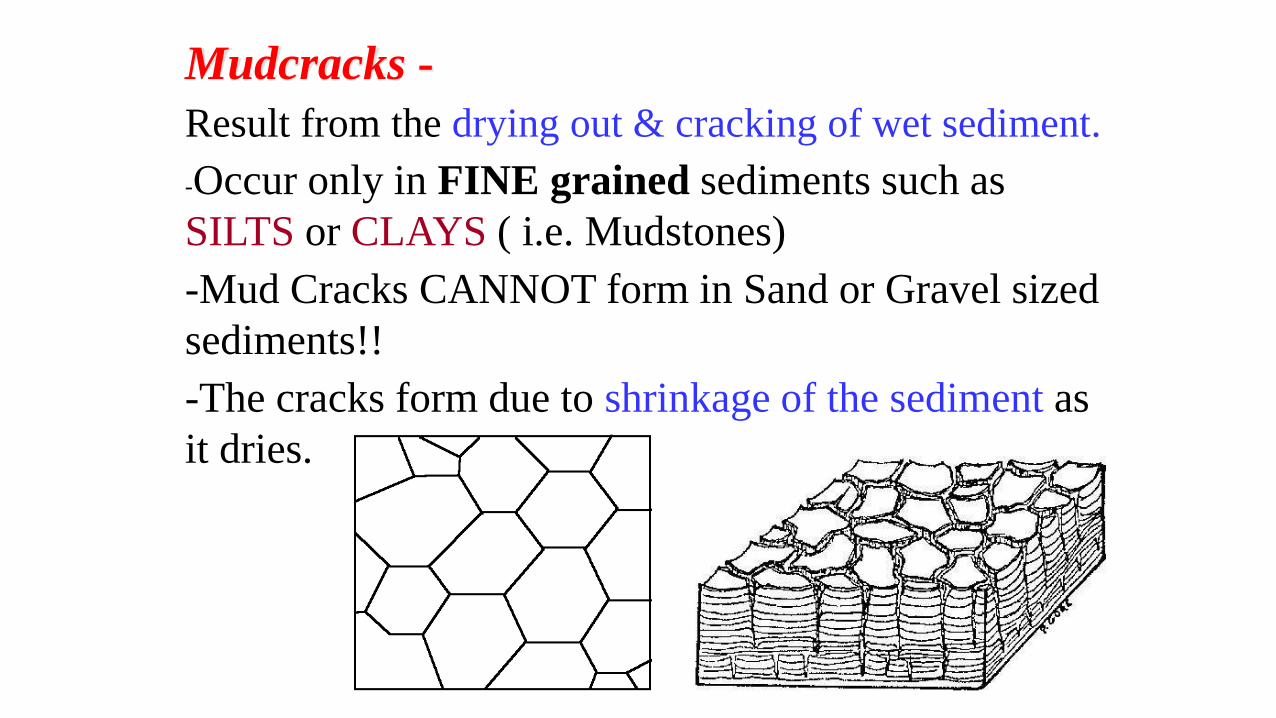
Mudcracks -
Result from the drying out & cracking of wet sediment.
-Occur only in FINE grained sediments such as
SILTS or CLAYS ( i.e. Mudstones)
-Mud Cracks CANNOT form in Sand or Gravel sized
sediments!!
-The cracks form due to shrinkage of the sediment as
it dries.

Fine Grained Sediments -
In fine strata or layers or laminations
Helps show the UP direction!


Mud Cracks forming

Mud Cracks

Mud Cracks

Mud Cracks

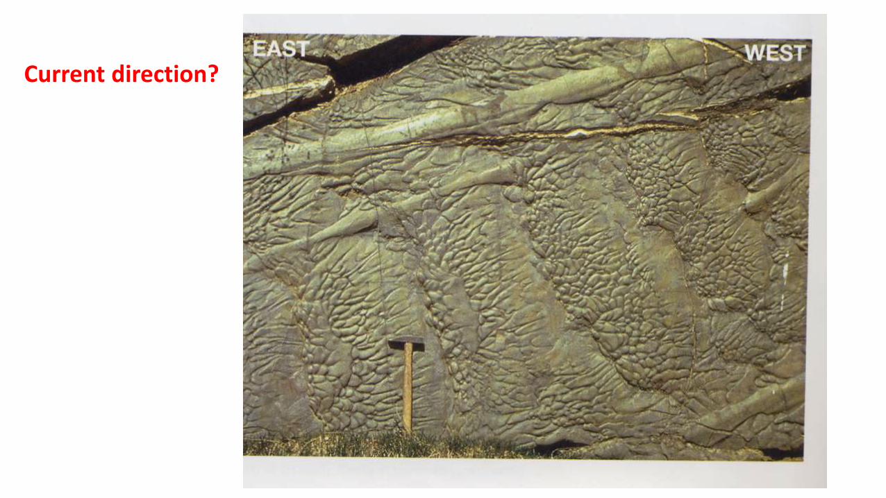
Flutes / Flute Casts

If the layer above fills the flute & preserves it the result
= FLUTE CAST Flute Casts occur at the bottom of a layer.
Grooves or Gouges that are scoured out by current
= FLUTE! Flutes occur at the top of a layer.
Helps
Show the
UP
direction!

These are Flute Casts!
Current Direction!
NOTE:
We are looking at the
BOTTOM of this structure

1. What is the current direction?
2. Is this the bottom or top? Bottom!
Such a geologist!

Current direction?
Current direction?

Rain Drop Impressions:

Raindrop Marks -
Pits (or tiny craters) created by falling rain.
If present, this suggests that the sediment was
exposed to the surface of the Earth.

Helps Show the UP direction!
UP
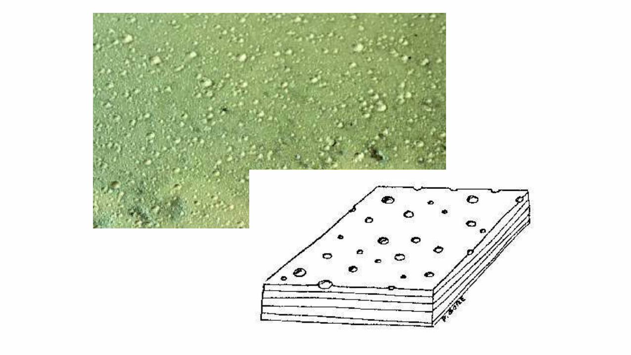

Notice also present = Ripple Marks
= Gives clues as to the environment
this rock was formed in

Various Plant / Animal Marks:

Fossils -
Remains of once living organisms.
Probably the most important indicator of the environment of
deposition:
Different species usually inhabit specific environments.
Because life has evolved - fossils give clues to relative
age of the sediment.
Can also be important indicators of past climates
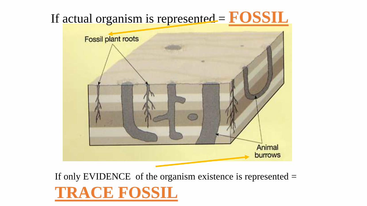
If actual organism is represented = FOSSIL
If only EVIDENCE of the organism existence is represented =
TRACE FOSSIL

If this clam’s burrow gets preserved
it will be a “Trace Fossil”
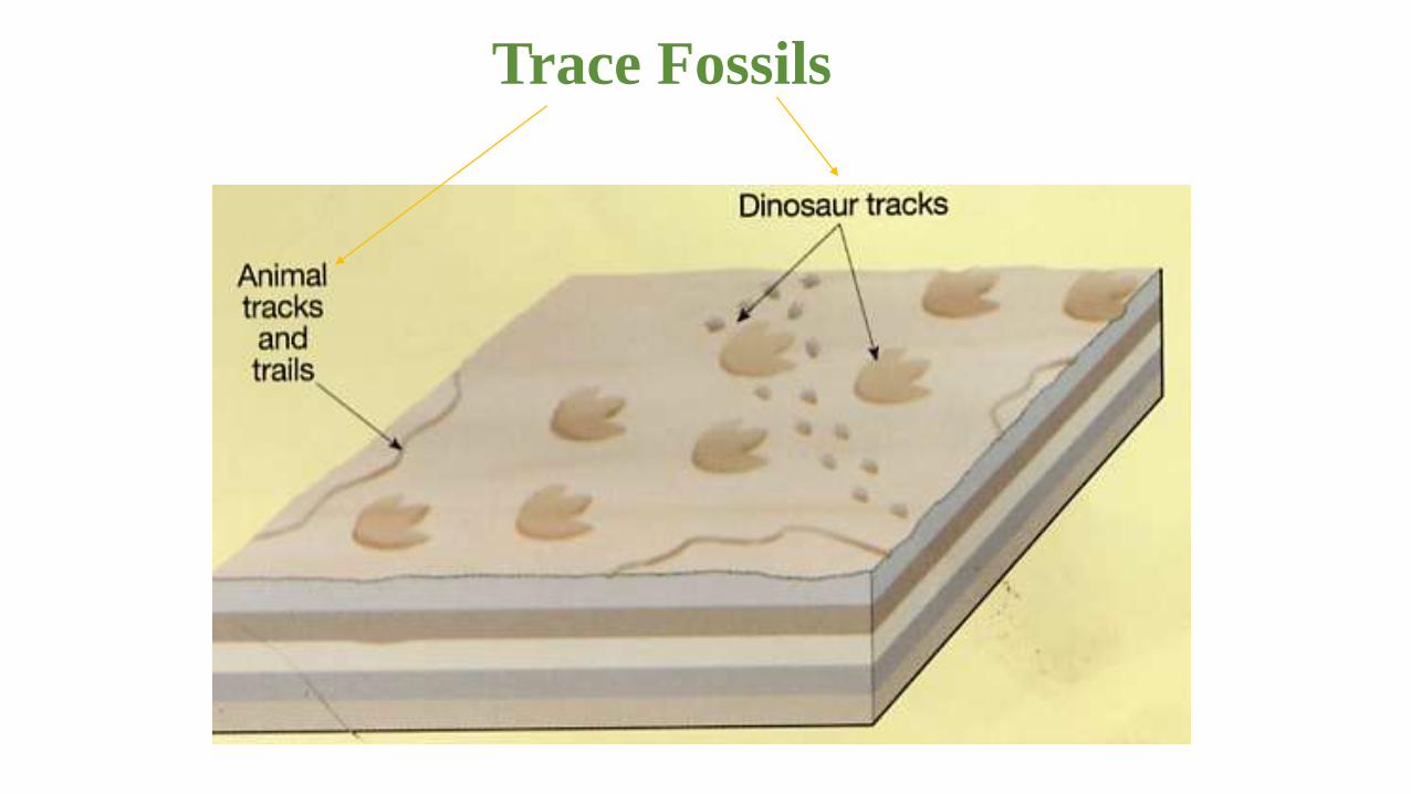
Trace Fossils

Worm burrows

Worm
burrows


Track marks ... Trilobite?
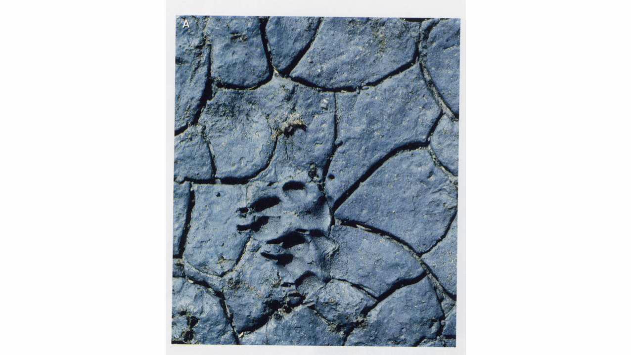

Dinosaur
footprint

Dinosaur trackways

Can you guess what happened?

Check these out!!!
5000 dinosaur footprints from the Late Cretaceous in Bolivia
Homework:Complete Awesome Sedimentary Structures Review sheet

#6 - Sedimentary Environments
&
Factors Influencing Sedimentary Character:

There are MANY different sedimentary environments
BUT basically THREE General Types:
1- Continental
2- Coastal
3- Marine
These can be broken down
into either…
a. Clastic / Detrital
or
b. Chemical / Biological

Clastic / Detrital
Clastic / Detrital
Organic Chemical
Inorganic Chemical

Some Basic Examples of Sedimentary Environments!

General Sedimentary Environments:
• Continental
• Coastal
• Marine

Continental:
• Rivers - Fluvial• Lakes - Lacustrine• Swamp - Paludal• Talus / Scree Slopes• Glaciers• Alluvial Fans• Deserts
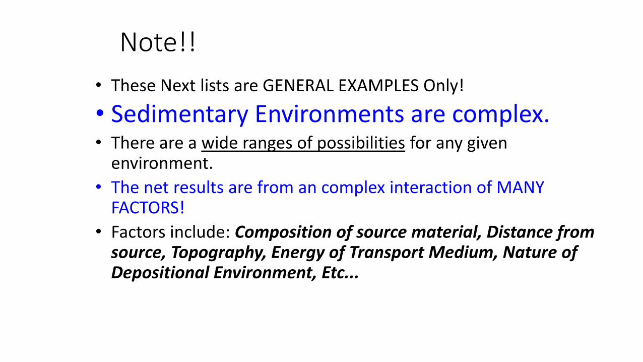
Note!!
• These Next lists are GENERAL EXAMPLES Only!
• Sedimentary Environments are complex.• There are a wide ranges of possibilities for any given
environment.
• The net results are from an complex interaction of MANY FACTORS!
• Factors include: Composition of source material, Distance from source, Topography, Energy of Transport Medium, Nature of Depositional Environment, Etc...

Rivers (Fluvial):•Energy - Ranges from: HIGH (Flood or large rivers) to
LOW (Non-Flood Season or Small streams).
•Grain Size - Get smaller as you travel away from source
•Rounding - Increases as you travel away from source or energy
increases.
•Sorting - Increases downstream
•Rock Types - CLASTIC - Conglomerate, Breccia, Sandstone, Mudstones.
•Sedimentary Structures - Ripple Marks(Asymmetrical),
Graded-Bedding, Laminations, Stratification,
Mud-Cracks (on shores), Flutes, Rain imprints,
Cross-Bedding, Plant/Animal Structures.
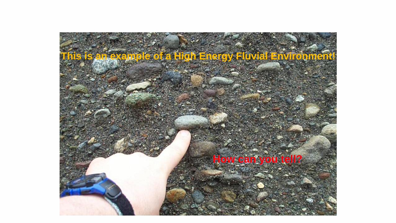
This is an example of a High Energy Fluvial Environment!
How can you tell?

What comments can you
make about this photo?

This is a medium energy
river system...distant from source!

What type of grains
would you expect here & Why?

Look how smooth Shannon Creek has made the walls of Shannon Falls!

What can you say about
grain type and location in the river?

Try to identify layers with high Energy!
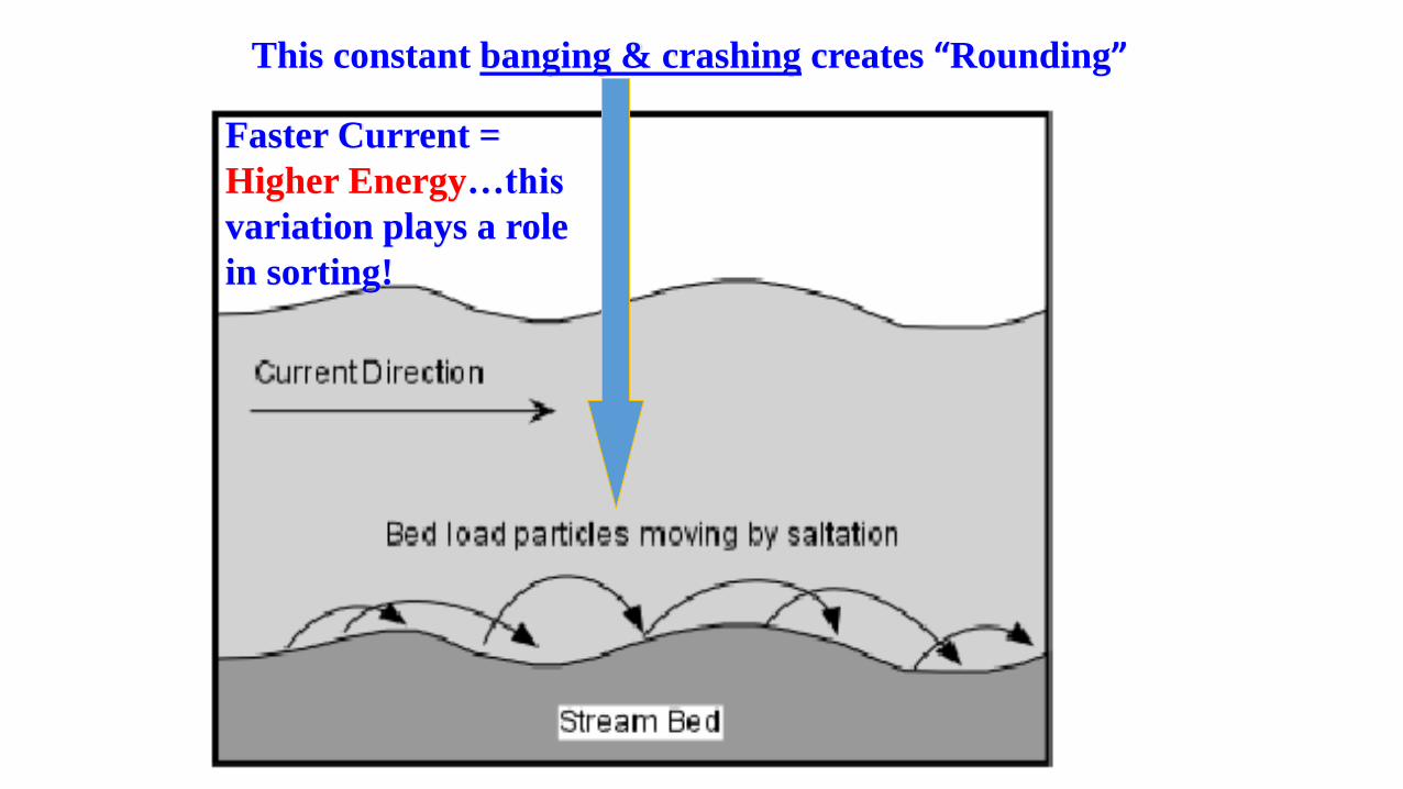
This constant banging & crashing creates “Rounding”
Faster Current =
Higher Energy…this
variation plays a role
in sorting!

Lakes (Lacustrine):
•Energy - Generally LOW
•Grain Size - Clay/Silt on bottom, Sand/Gravel on shores.
•Rounding - usually more round than rivers, esp.. lake bottom sediments
•Sorting - Intermediate on shores to excellent on bottom.
•Rock Types - CLASTIC - Various Mudstones, Limestone,
CHEMICAL - Evaporites (Halite, Gypsum)
•Sedimentary Structures -Ripple Marks (Symmetrical), Cross-Bedding,
Graded-Bedding, Laminations, Stratification,
Mud-Cracks, Varves, Rain imprints,
Plant/Animal Structures.
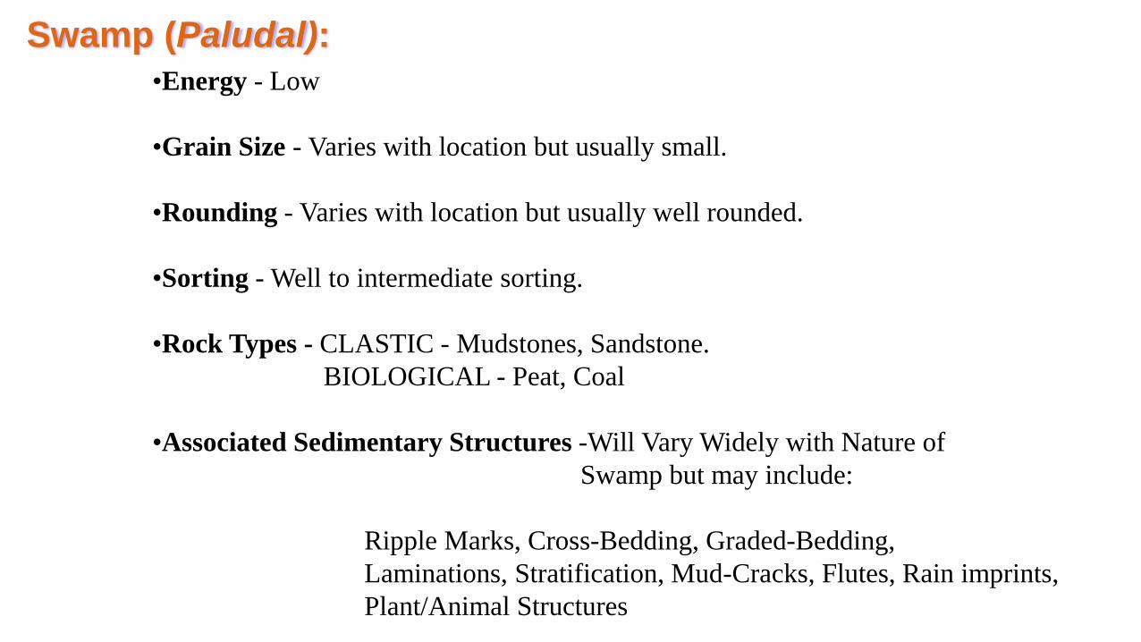
Swamp (Paludal):
•Energy - Low
•Grain Size - Varies with location but usually small.
•Rounding - Varies with location but usually well rounded.
•Sorting - Well to intermediate sorting.
•Rock Types - CLASTIC - Mudstones, Sandstone.
BIOLOGICAL - Peat, Coal
•Associated Sedimentary Structures -Will Vary Widely with Nature of
Swamp but may include:
Ripple Marks, Cross-Bedding, Graded-Bedding,
Laminations, Stratification, Mud-Cracks, Flutes, Rain imprints,
Plant/Animal Structures


Talus / Scree Slopes:
•Energy - Low at times of rest, High at times of Rock Fall/Slide.
•Grain Size - LARGE.
•Rounding - POOR
•Sorting - POOR.
•Rock Types - Broken chunks of Pre-Existing Rocks Only!!
•Associated Sedimentary Structures -None!

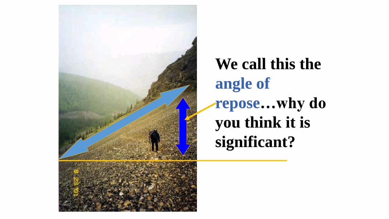
We call this the
angle of
repose…why do
you think it is
significant?

Note the angle again!

Glaciers (Glacial):
•Energy - Low & Slow!
•Grain Size - Wide Range from “Rock Flour” to Boulders = TILL!
•Rounding - POOR
•Sorting - POOR
•Rock Types - TILL Only!
•Sedimentary Structures - Usually associated with GLACIAL WATER BODIES...
Moraines = various sized & shaped piles of TILL!
Glacial Lakes = structures associated with normal lakes + VARVES!
Glacial Rivers & Streams = structures associated with normal Streams / Rivers!

Moraines!
composed of:poorly sorted, poorly rounded TILL!

Note the massive erosive power of a glacier!
Look at the size of the moraines!
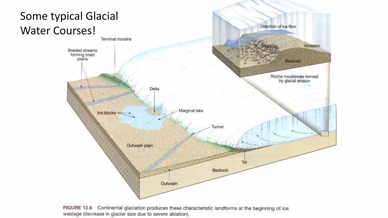
Some typical Glacial Water Courses!

Discuss how Rounding & Sorting might vary at different locations on this diagram!
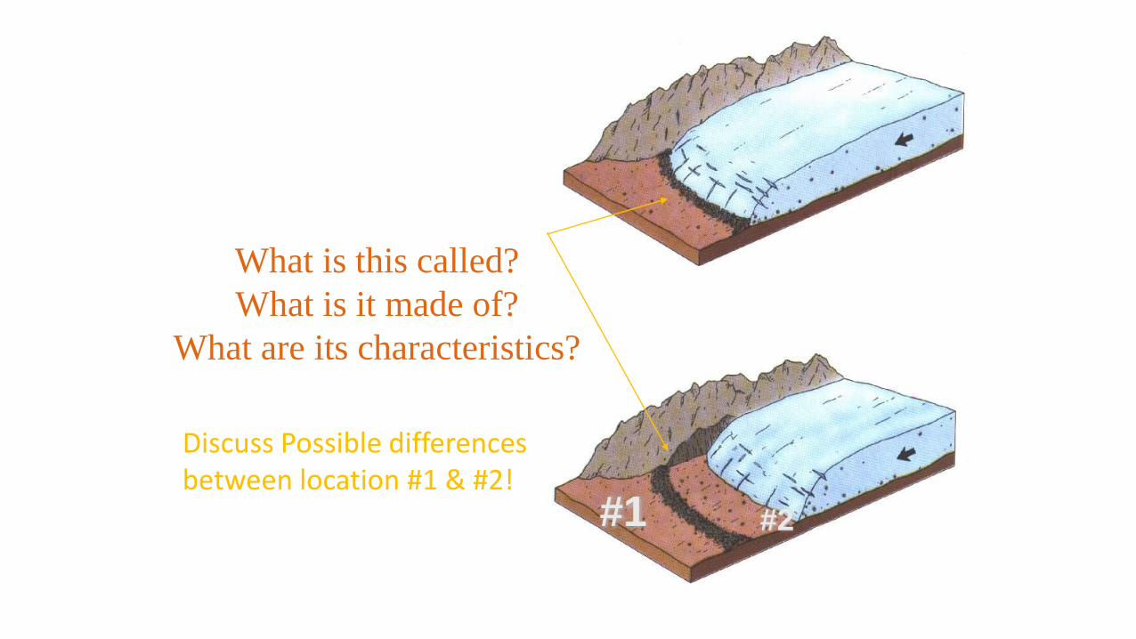
What is this called?
What is it made of?
What are its characteristics?
#1 #2
Discuss Possible differences between location #1 & #2!

Alluvial Fans:
•Energy - Varies from Low when inactive to High when active.
•Grain Size - Ranges from Clay To Gravel.
•Rounding - Poor
•Sorting - Poor
•Rock Types - CLASTIC - Conglomerate, Breccia, Sandstone, Mudstones.
•Sedimentary Structures - Cross-Bedding, Graded-Bedding,
Stratification, Plant/Animal Structures
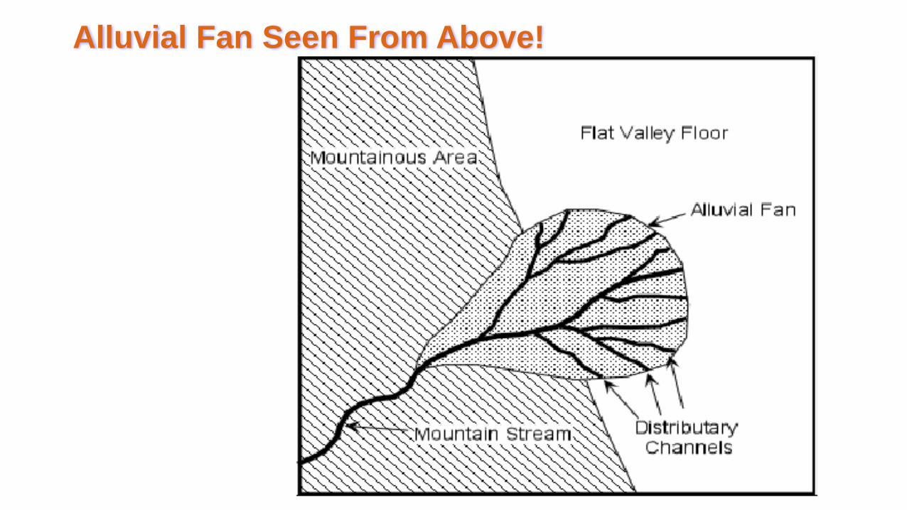
Alluvial Fan Seen From Above!

An alluvial fan:
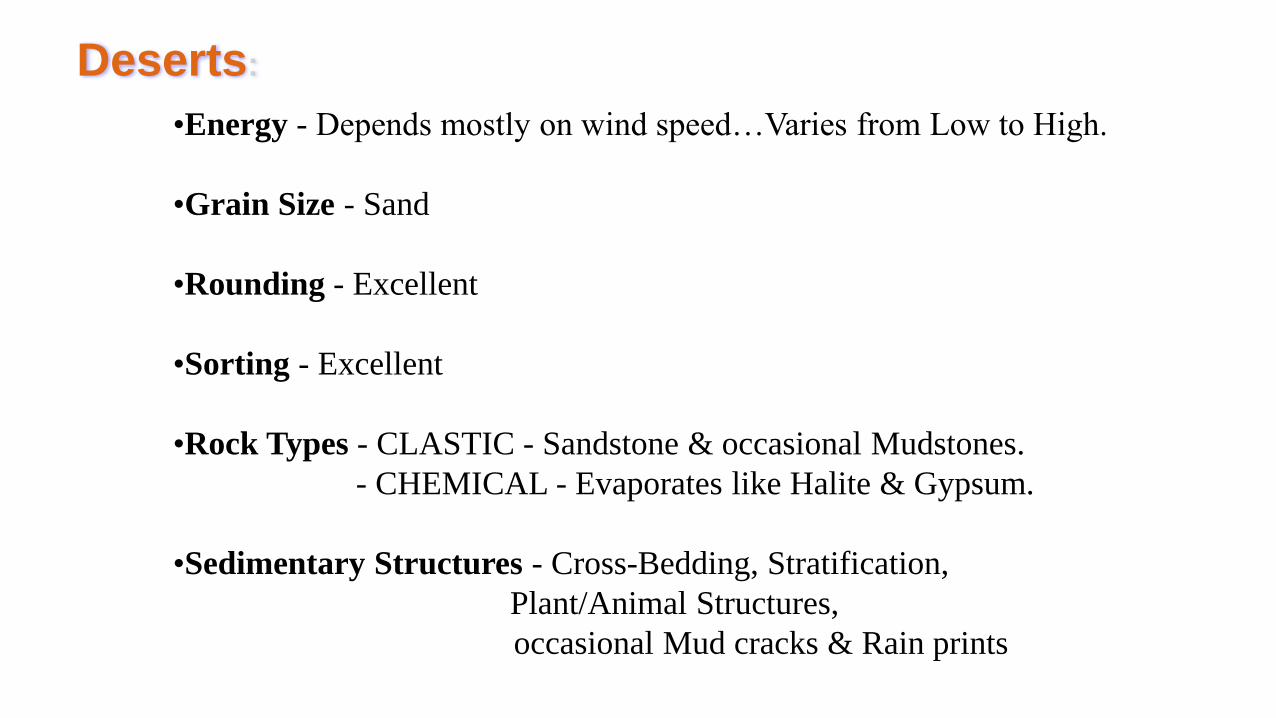
Deserts
•Energy - Depends mostly on wind speed…Varies from Low to High.
•Grain Size - Sand
•Rounding - Excellent
•Sorting - Excellent
•Rock Types - CLASTIC - Sandstone & occasional Mudstones.
- CHEMICAL - Evaporates like Halite & Gypsum.
•Sedimentary Structures - Cross-Bedding, Stratification,
Plant/Animal Structures,
occasional Mud cracks & Rain prints


Coastal:
• Beaches
• Deltas
• Estuaries
• Lagoons

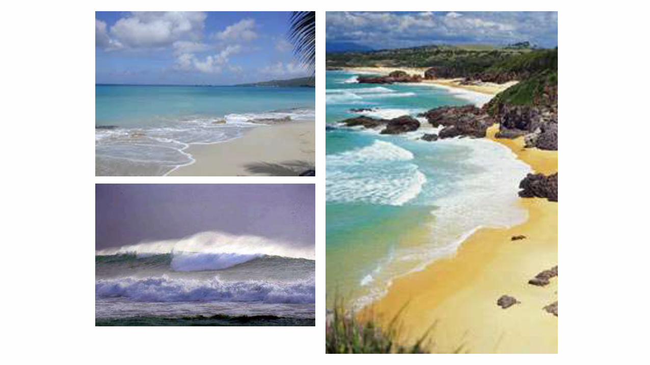
Beaches:
•Energy - Moderate to High.
•Grain Size - Sand.
•Rounding - Good to Excellent.
•Sorting - Good to Excellent.
•Rock Types - CLASTIC - Sandstone & occasional Mudstones
•Sedimentary Structures -Ripple Marks (symmetrical),
Cross-Bedding, Stratification,
Plant/Animal Structures, occasional Rainprints
Deltas (Deltaic):
•Energy - Varies over course of year from high to low depending on
river flood cycles!
•Grain Size - Clay to Sand & occasional Gravel.
•Rounding - Varies with flood cycles but tend to be rounded.
•Sorting - Generally poor.
•Rock Types - CLASTIC - Sandstone, Mudstone, Some Conglomerate & Breccia.
•Sedimentary Structures - Some Ripple Marks (both types depending on location),
Cross-Bedding, Graded-Bedding, Stratification, Flutes,
Plant/Animal Structures, occasional Rainprints

Delta

Yellow area represents Fraser River Delta Deposits!
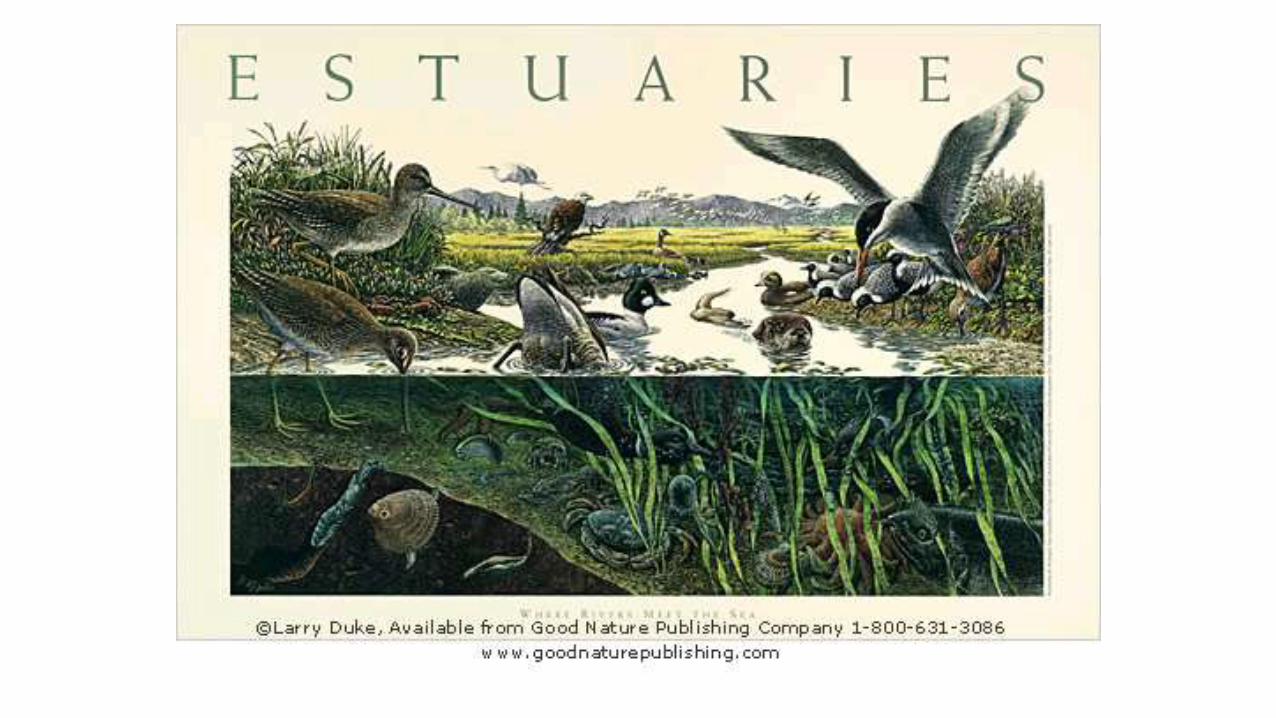
Estuaries:
•Energy - Low
•Grain Size - Clay to Sand
•Rounding - Usually far from source so usually Good to Excellent.
•Sorting - Usually far from source so usually Good to Excellent.
Rock Types - CLASTIC - Mudstones, Sandstone.
•Sedimentary Structures - Rainprints, Laminations, Stratification,
Mud-Cracks, Plant/Animal Structures


Lagoons:
•Energy - Low
•Grain Size - Clay & Silt
•Rounding - Good
•Sorting - Moderate…close to source
•Rock Types - CLASTIC - Mudstone
- CHEMICAL - Evaporates like Gypsum & Halite.
- BIOLOGICAL - Limestone from coral reefs.
•Sedimentary Structures -Ripple Marks (Symmetrical),
Cross-Bedding, Laminations, Stratification


Marine:
• Reefs
• Continental Shelf
• Continental Slope & Rise
• Abyssal Plain
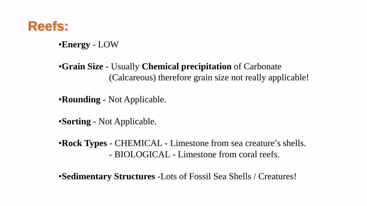
Reefs:
•Energy - LOW
•Grain Size - Usually Chemical precipitation of Carbonate
(Calcareous) therefore grain size not really applicable!
•Rounding - Not Applicable.
•Sorting - Not Applicable.
•Rock Types - CHEMICAL - Limestone from sea creature’s shells.
- BIOLOGICAL - Limestone from coral reefs.
•Sedimentary Structures -Lots of Fossil Sea Shells / Creatures!


Continental Shelf:
•Energy - Low to Moderate during flood season…lots of river outflow!
•Grain Size - Clay to Sand
•Rounding - Moderate to Excellent.
•Sorting - Intermediate to Excellent.
•Rock Types - CLASTIC - Mudstone & Sandstone.
- CHEMICAL - Limestone from sea creature’s shells.
- BIOLOGICAL - Limestone from coral reefs.
•Sedimentary Structures - Cross-Bedding, Laminations,
Plant/Animal Structures - lots of fossils!

Continental Rise & Slope:
•Energy - Low to High during underwater landslides down the rise!
•Grain Size - Clay to Sand.
•Rounding - Poor (after Slides) to Excellent.
•Sorting - Poor (after Slides) to Excellent.
•Rock Types - CLASTIC - Mainly Mudstone.
- CHEMICAL - Limestone from sea creature’s shells.
- BIOLOGICAL - Limestone from coral reefs.
•Sedimentary Structures - Laminations, Graded-Bedding &
Cross-Bedding, Flutes/Flute casts,
Plant/Animal Structures - lots of fossils!

Abyssal Plain:
•Energy - LOWEST of the LOW!
•Grain Size - Silt, Clay, Mud = Small!
•Rounding - Excellent!
•Sorting - Excellent!
•Rock Types - CLASTIC - Mudstone.
- CHEMICAL - Limestone from sea creature’s shells.
•Sedimentary Structures -Fossils of marine Micro-Organisms!