Seasonal hurricane briefing for Canada 2016
46
Bob Robichaud Warning Preparedness Meteorologist Canadian Hurricane Centre 2016 Hurricane Briefing for the Institute for Catastrophic Loss Reduction
-
Upload
glennmcgillivray -
Category
Education
-
view
215 -
download
0
Transcript of Seasonal hurricane briefing for Canada 2016

Bob Robichaud
Warning Preparedness Meteorologist
Canadian Hurricane Centre
2016 Hurricane Briefing
for the
Institute for Catastrophic
Loss Reduction

Contents
• The 5 Ws of Tropical Cyclones
• Tropical Cyclone Hazards • Review of the 2015 Hurricane Season
• Outlook for the 2016 Hurricane Season
• Operational Response to Approaching Storms: Forecasting and Communications
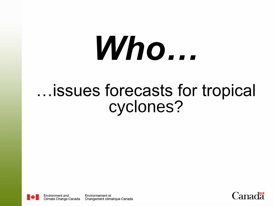
…issues forecasts for tropical cyclones?
Who…

• NHC is one of 7 RSMCs that produce and coordinate tropical cyclone forecasts for various ocean basins.
• NHC is responsible for both the Atlantic and eastern North Pacific Ocean basins.
Who issues forecasts for Tropical Cyclones?
NHC is the Regional Specialized
Meteorological Center (RSMC) for the WMO
RA-IV
CHC provides Canadians with
meteorological information on hurricanes,
tropical storms and post-tropical storms
Who issues forecasts for Tropical Cyclones?

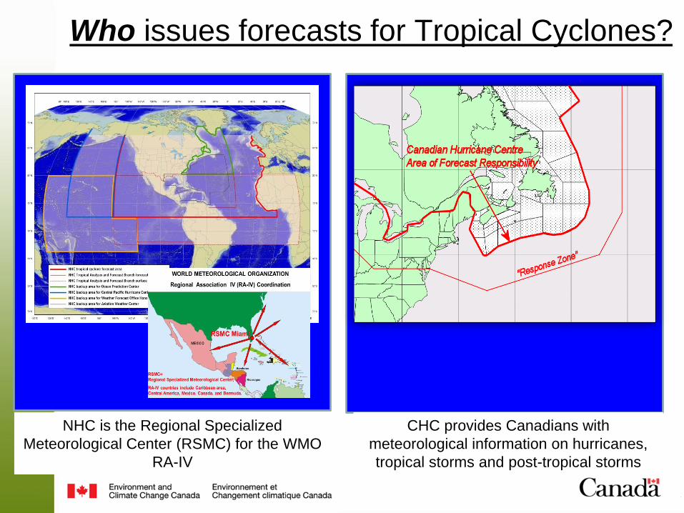
…are tropical cyclones?
What…
• Tropical cyclones are relatively large and long-lasting low pressure systems that form over warm water
• Tropical cyclones must have a closed surface wind circulation around a well-defined center
• They are classified by maximum sustained surface wind speed
Tropical Cyclones
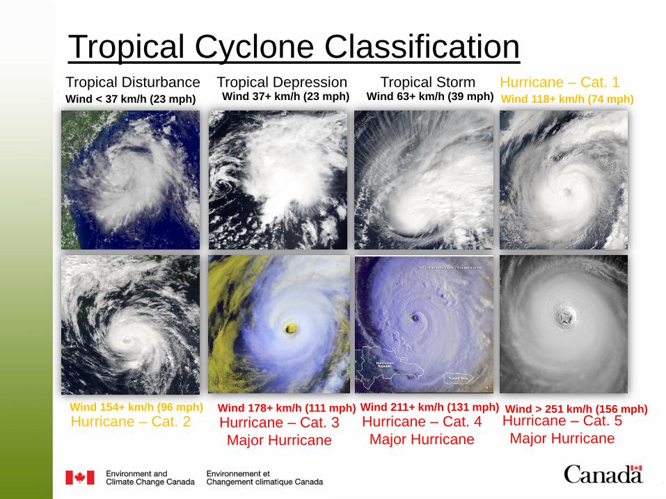
Tropical Cyclone Classification
Wind < 37 km/h (23 mph) Wind 37+ km/h (23 mph) Wind 63+ km/h (39 mph) Wind 118+ km/h (74 mph)
Wind 178+ km/h (111 mph) Wind 154+ km/h (96 mph) Wind 211+ km/h (131 mph) Wind > 251 km/h (156 mph)
Tropical Disturbance Tropical Depression Tropical Storm Hurricane – Cat. 1
Hurricane – Cat. 3
Major Hurricane
Hurricane – Cat. 2 Hurricane – Cat. 4
Major Hurricane
Hurricane – Cat. 5
Major Hurricane
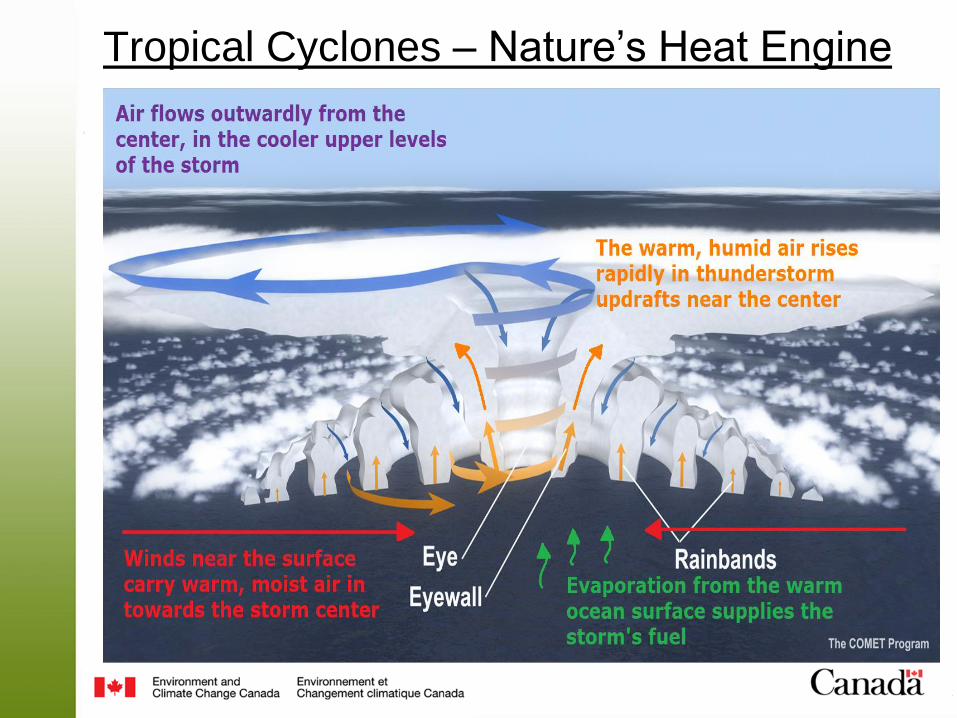
Tropical Cyclones – Nature’s Heat Engine

Tropical vs. Post-Tropical
Tropical Post-Tropical
• Stronger winds for a series of
concentric bands around the
centre of the storm
• Strongest winds are found in the
band closest to the centre – this is
called the eyewall
• Rain is heavy and fairly
symmetric around the centre of
the storm
• Size of the storm increases
• Strongest winds usually found on
the right side of the storm’s track
and some distance away from the
centre
• Heaviest rain usually found on the
left side of the storm’s track
…do tropical cyclones form?
When…
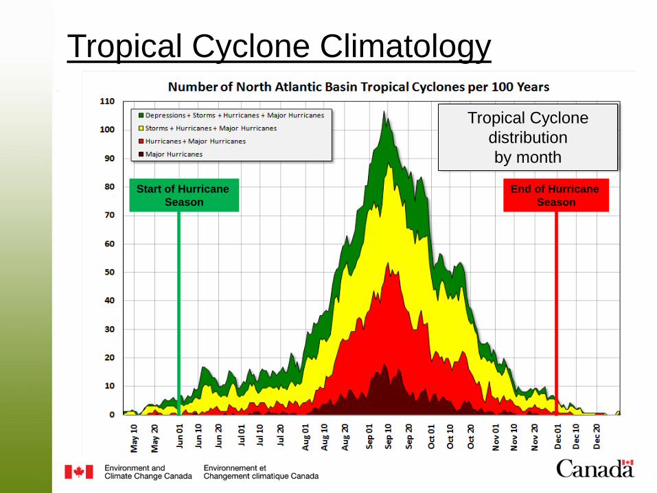
Tropical Cyclone Climatology
Tropical Cyclone
distribution
by month
Start of Hurricane
Season
End of Hurricane
Season
…do tropical cyclones form?
Where…
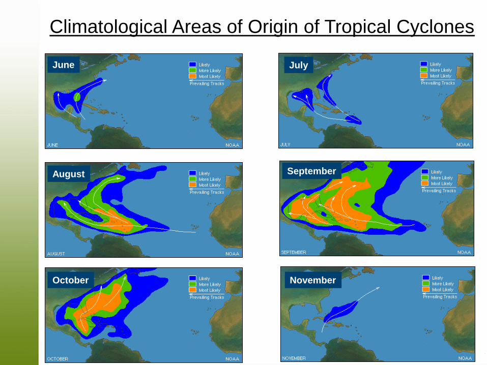
June July
August
October
September
November
Climatological Areas of Origin of Tropical Cyclones

…do tropical cyclones form?
Why…
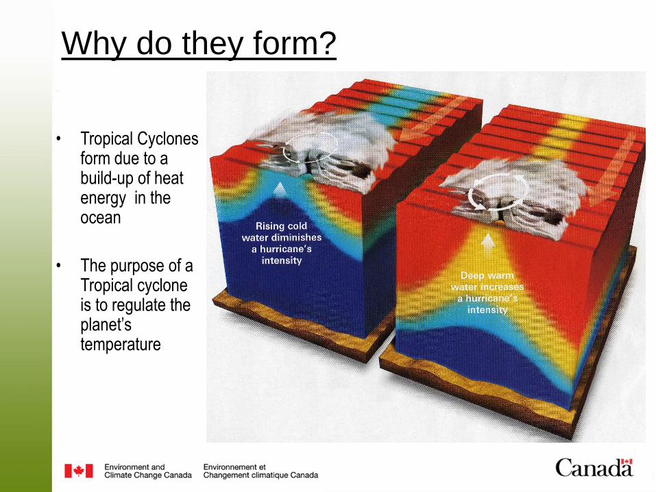
Why do they form?
• Tropical Cyclones form due to a build-up of heat energy in the ocean
• The purpose of a Tropical cyclone is to regulate the planet’s temperature

Tropical Cyclone
Hazards

Tropical Cyclone Hazards - Wind
Saffir-Simpson Scale for Hurricanes
Category
Wind Speed
(km/h) Description
1 119 - 153Very dangerous winds will produce
some damage
2 154 - 177Extremely dangerous winds will
cause extensive damage
3 178 - 208 Devastating damage will occur
4 211 - 249 Catastrophic damage will occur
5 >249 Catastrophic damage will occur
• Winds are strong on both sides of a hurricane
• When a storm becomes post-tropical:
• Storm size increases
• Speed of the storm increases
• Difference in wind speed between right and left side of the track increases
• Sometimes a post-tropical storm can interact with a trough and produce strong winds on both side

Storm maximum
wind location for
storms entering the
CHC Response Zone.
(Location by
quadrant of
occurrence)
Tropical Cyclone Hazards - Wind
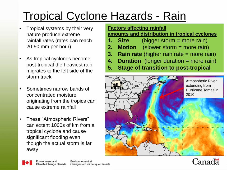
Factors affecting rainfall
amounts and distribution in tropical cyclones
1. Size (bigger storm = more rain)
2. Motion (slower storm = more rain)
3. Rain rate (higher rain rate = more rain)
4. Duration (longer duration = more rain)
5. Stage of transition to post-tropical
• Tropical systems by their very
nature produce extreme
rainfall rates (rates can reach
20-50 mm per hour)
• As tropical cyclones become
post-tropical the heaviest rain
migrates to the left side of the
storm track
• Sometimes narrow bands of
concentrated moisture
originating from the tropics can
cause extreme rainfall
• These “Atmospheric Rivers”
can extent 1000s of km from a
tropical cyclone and cause
significant flooding even
though the actual storm is far
away
Atmospheric River
extending from
Hurricane Tomas in
2010
Tropical Cyclone Hazards - Rain
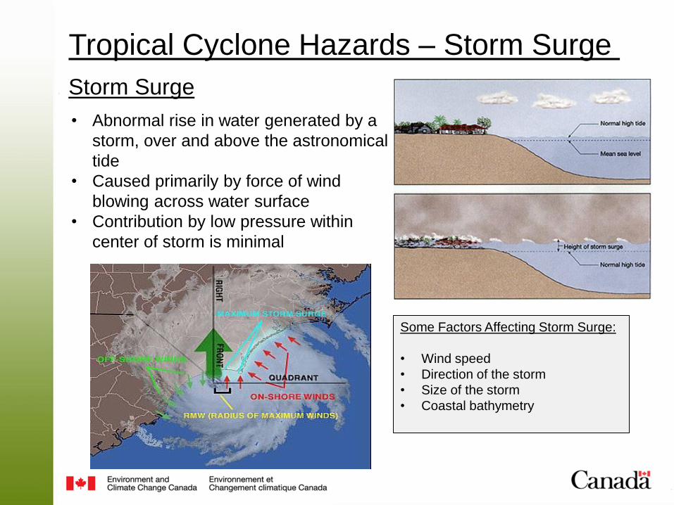
Storm Surge • Abnormal rise in water generated by a
storm, over and above the astronomical
tide
• Caused primarily by force of wind
blowing across water surface
• Contribution by low pressure within
center of storm is minimal
Some Factors Affecting Storm Surge:
• Wind speed
• Direction of the storm
• Size of the storm
• Coastal bathymetry
Tropical Cyclone Hazards – Storm Surge

Damaging Waves • On occasion a
particular phenomenon can give rise to extreme wave heights
• Waves move in harmony with a storm, allowing waves to build to enormous heights
• This threat is most significant along the Atlantic coast
Tropical Cyclone Hazards - Waves
Hurricane: Slow-moving storm, waves move out ahead of storm
Winter storm: Fast-moving storm, large waves lag behind the storm
Post-tropical storm: Accelerating storm, waves/storm in sync, waves build to extreme heights
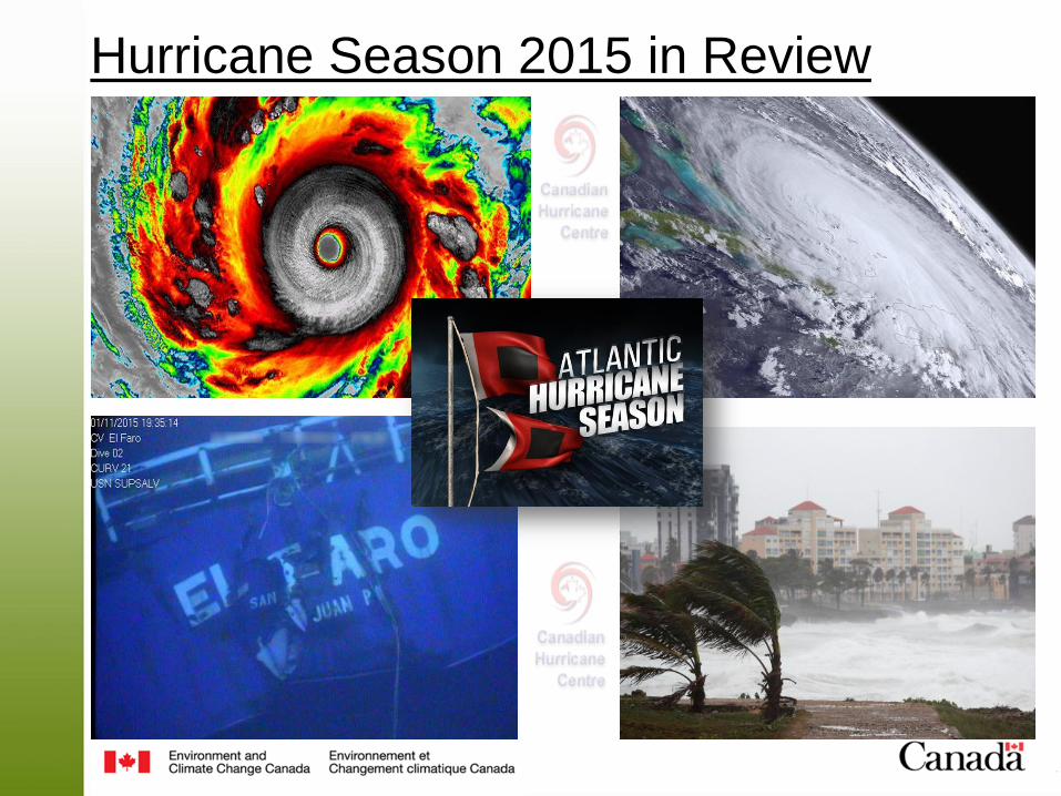
Hurricane Season 2015 in Review

What happened last year?
Named
Storms
Hurricanes
Category 1 to 5
Major
Hurricanes
Category 3-5
National Oceanic
and Atmospheric
Administration (US)
6-11
3-6
0-2
Actual storms in
2015 11 4 2
1981-2010 Average 12 6 2 or 3
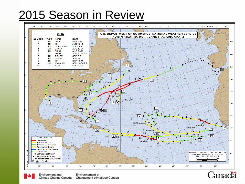
2015 Season in Review
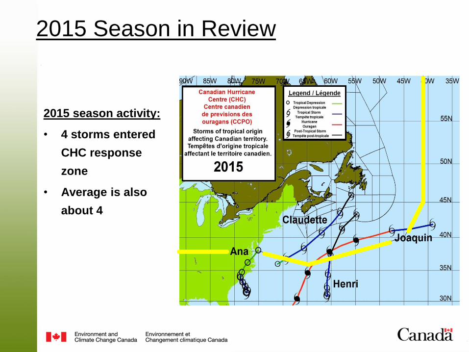
2015 season activity:
• 4 storms entered
CHC response
zone
• Average is also
about 4
2015 Season in Review
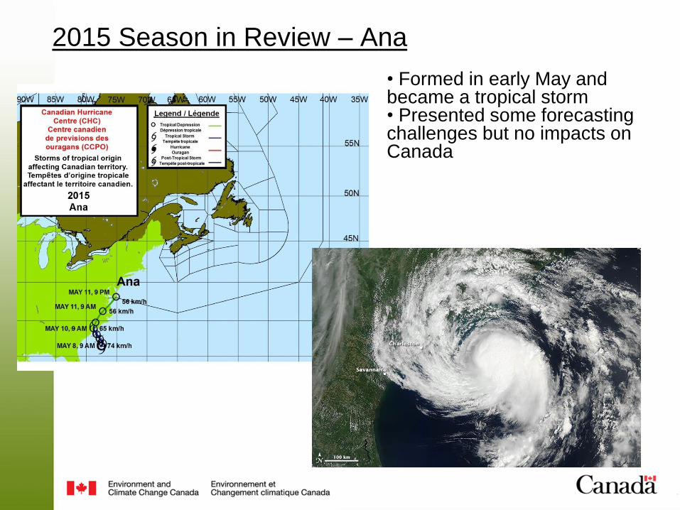
• Formed in early May and became a tropical storm • Presented some forecasting challenges but no impacts on Canada
2015 Season in Review – Ana
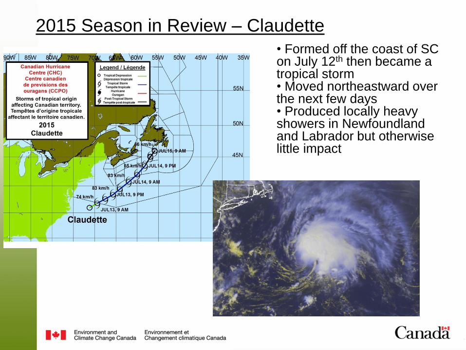
• Formed off the coast of SC on July 12th then became a tropical storm • Moved northeastward over the next few days • Produced locally heavy showers in Newfoundland and Labrador but otherwise little impact
2015 Season in Review – Claudette
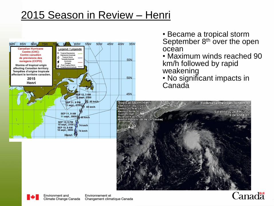
• Became a tropical storm September 8th over the open ocean • Maximum winds reached 90 km/h followed by rapid weakening • No significant impacts in Canada
2015 Season in Review – Henri

• Became a tropical storm September 28th • Reached hurricane September 30th and went from Cat 1 to Cat 3 in 12 hours • Some swell reached NS and NL but no significant impacts
2015 Season in Review – Joaquin

• Well after the threat of Joaquin making landfall in the U.S. or Canada had passed, a stalled weather system over the Southeast U.S. entrained some moisture from Joaquin
• This second system was also associated with the one that resulted in 200+ mm of rain in New Brunswick on October 1st
• The combination of these two events resulted in a very heavy rainfall over the Southeast
• South Carolina was particularly hard-hit as what occurred there has been characterized as a 1 in 1000 year rainfall event
Hurricane Joaquin – Indirect impacts
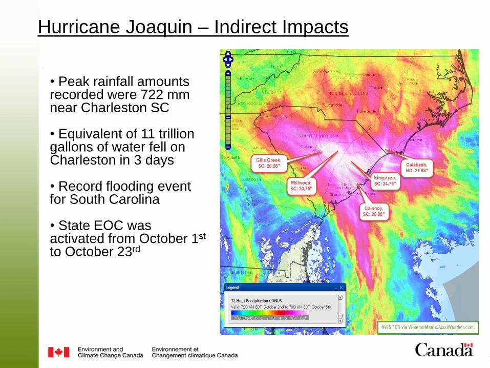
• Peak rainfall amounts recorded were 722 mm near Charleston SC
• Equivalent of 11 trillion gallons of water fell on Charleston in 3 days
• Record flooding event for South Carolina
• State EOC was activated from October 1st to October 23rd
Hurricane Joaquin – Indirect Impacts
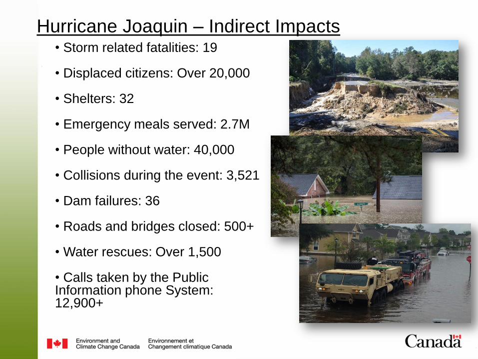
• Storm related fatalities: 19 • Displaced citizens: Over 20,000 • Shelters: 32 • Emergency meals served: 2.7M • People without water: 40,000 • Collisions during the event: 3,521 • Dam failures: 36 • Roads and bridges closed: 500+
• Water rescues: Over 1,500 • Calls taken by the Public Information phone System: 12,900+
Hurricane Joaquin – Indirect Impacts
2016 Hurricane Season Outlook
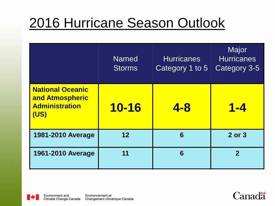
2016 Hurricane Season Outlook
Named
Storms
Hurricanes
Category 1 to 5
Major
Hurricanes
Category 3-5
National Oceanic
and Atmospheric
Administration
(US)
10-16
4-8
1-4
1981-2010 Average 12 6 2 or 3
1961-2010 Average 11 6 2

Factors Affecting the 2016 Hurricane Season
December 2015
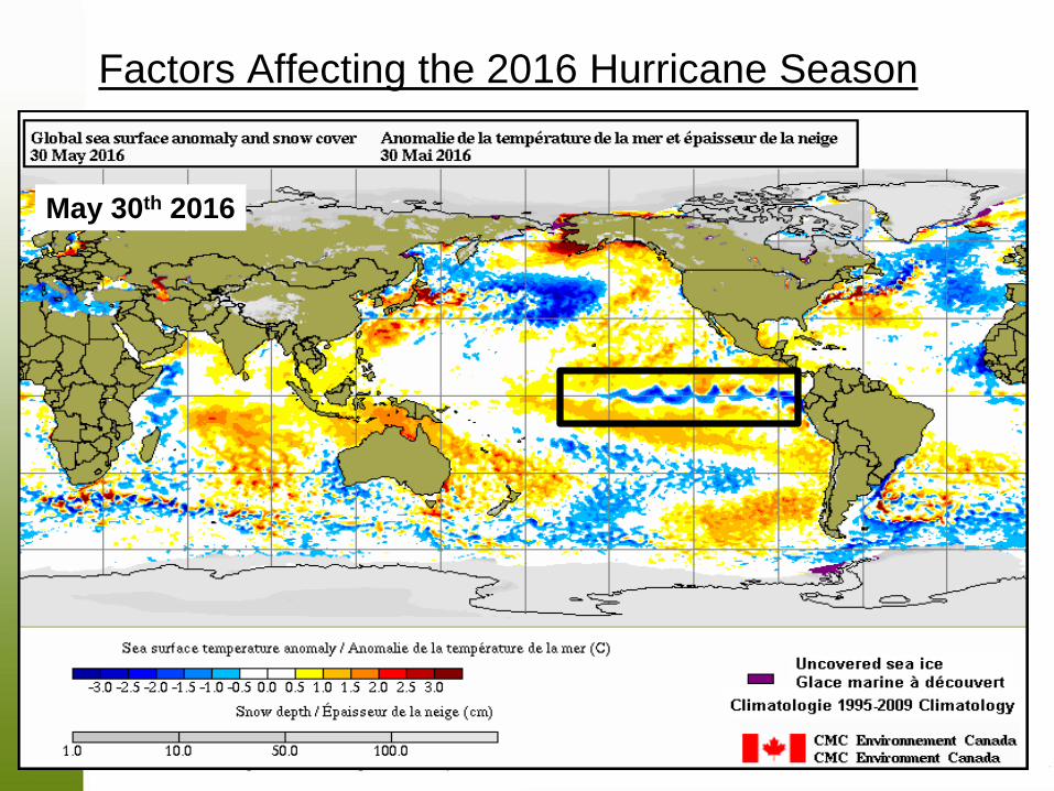
May 30th 2016
Factors Affecting the 2016 Hurricane Season

El Niño forecast through hurricane season

List of Atlantic Storm Names 2016 2017 2018 2019 2020 2021 Alex Arlene Alberto Andrea Arthur Ana
Bonnie Bret Beryl Barry Bertha Bill
Colin Cindy Chris Chantal Cristobal Claudette
Danielle Don Debby Dorian Dolly Danny
Earl Emily Ernesto Erin Edouard Elsa
Fiona Franklin Florence Fernand Fay Fred
Gaston Gert Gordon Gabrielle Gonzalo Grace
Hermine Harvey Helene Humberto Hanna Henri
Ian Irma Isaac Imelda Isaias Ida
Julia Jose Joyce Jerry Josephine Julian
Karl Katia Kirk Karen Kyle Kate
Lisa Lee Leslie Lorenzo Laura Larry
Matthew Maria Michael Melissa Marco Mindy
Nicole Nate Nadine Nestor Nana Nicholas
Otto Ophelia Oscar Olga Omar Odette
Paula Philippe Patty Pablo Paulette Peter
Richard Rina Rafael Rebekah Rene Rose
Shary Sean Sara Sebastien Sally Sam
Tobias Tammy Tony Tanya Teddy Teresa
Virginie Vince Valerie Van Vicky Victor
Walter Whitney William Wendy Wilfred Wanda

Hurricane Readiness and
Operational Response to Hurricanes
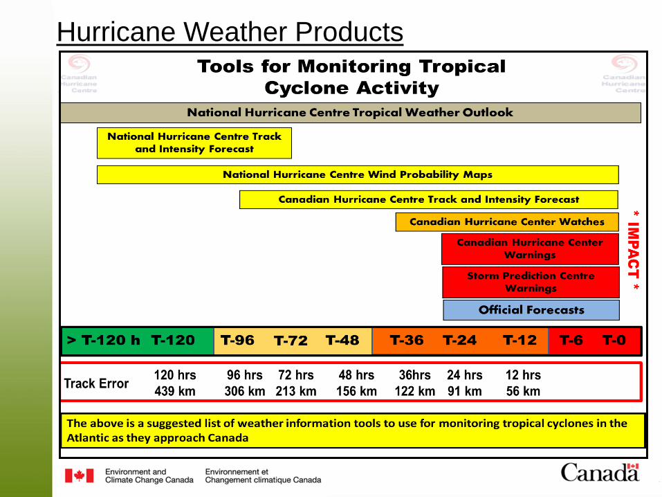
Hurricane Weather Products

Hurricane Weather Products
Monitoring Storm Formation Potential
A good tool to check overall tropical activity is
the Tropical Weather Outlook issued by the
NHC
5-day GTWO Operational in 2015
www.nhc.noaa.gov/gtwo_atl.shtml Categories
Probability of
formation
Low < 40%
Medium 40-60%
High >60%
Monitoring Individual Storms
Details on storms that are not an imminent
threat to Canada can be found on the National
Hurricane Centre Website:
Monitoring Individual Storms
Details on storms are expected to have an
impact in Canada can be found on the Canadian
Hurricane Centre Website:
www.nhc.noaa.gov
www.hurricanes.ca
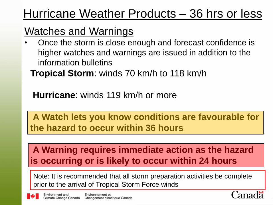
Tropical Storm: winds 70 km/h to 118 km/h
Hurricane: winds 119 km/h or more
A Watch lets you know conditions are favourable for
the hazard to occur within 36 hours
A Warning requires immediate action as the hazard
is occurring or is likely to occur within 24 hours
Watches and Warnings • Once the storm is close enough and forecast confidence is
higher watches and warnings are issued in addition to the
information bulletins
Note: It is recommended that all storm preparation activities be complete
prior to the arrival of Tropical Storm Force winds
Hurricane Weather Products – 36 hrs or less
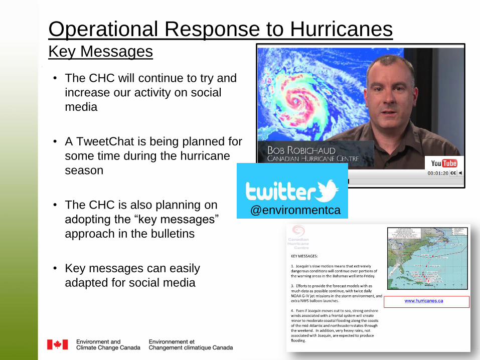
• The CHC will continue to try and
increase our activity on social
media
• A TweetChat is being planned for
some time during the hurricane
season
• The CHC is also planning on
adopting the “key messages”
approach in the bulletins
• Key messages can easily
adapted for social media
Operational Response to Hurricanes Key Messages
@environmentca
• The numbers of tropical storms and hurricanes are expected to be near or slightly above normal
• One of the key weather patterns that reduces hurricane activity in the Atlantic, El Nino, is not expected to be a factor this year
• There are some theories that would suggest more of the 2016 hurricane season storms will develop in the Caribbean or western Atlantic rather than off the coast of Africa
• If this season is near normal, it would be the 4th year in a row with near average or below average
Hurricane Season 2016 Outlook
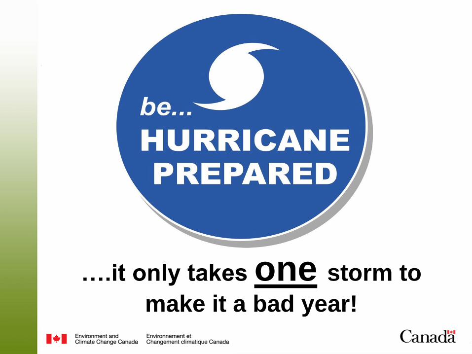
….it only takes one storm to
make it a bad year!