Sea Level Rise Adaptation and Mitigation Planning in ...
33
1 Sea Level Rise Adaptation and Mitigation Planning in Charleston, South Carolina By: Julieann Prettyman Dr. Patrick Halpin, advisor April 24, 2015 Masters project submitted in partial fulfillment of the requirements for the Master of Environmental Management degree in the Nicholas School of the Environment of Duke University
Transcript of Sea Level Rise Adaptation and Mitigation Planning in ...

1
Sea Level Rise Adaptation and Mitigation Planning in Charleston, South Carolina
By: Julieann Prettyman Dr. Patrick Halpin, advisor
April 24, 2015
Masters project submitted in partial fulfillment of the requirements for the Master of Environmental Management degree in the Nicholas School of the Environment of Duke
University

2
Executive Summary
As we progress through the 21st century, the impacts of climate change on coastal
cities are becoming increasingly obvious as increased flood events, more frequent and
more intense hurricanes, and rising sea levels continue to occur on a global scale.
Because South Carolina currently lacks a comprehensive state-wide approach, coastal
cities in the state are individually trying to determine the best way to prepare and adapt
to these climatic changes, particularly sea level rise.
Specifically, due to its low elevation, rates of land subsidence and highly developed
coastline, Charleston, South Carolina is particularly vulnerable to sea level rise. From
1957 to 2013, Charleston experienced a 409% increase in the number of flood days per
year. As such, Charleston was ranked 7th by the National Oceanic and Atmospheric
Administration (NOAA) for cities in the United States with increased nuisance flooding,
highlighting its vulnerability to sea level rise. Charleston is not alone in this fight,
however. Numerous other coastal cities in the United States, such as Baltimore and
New Orleans are also at high risk for the devastating effects of sea level rise. In order to
effectively prepare and plan for these inevitable changes, some cities have begun to
develop their own strategies for sea level rise adaptation and mitigation, while others
have organized regional collaboration to address the issue on a larger scale.
This report examines how the area of Charleston, South Carolina would potentially by
impacted by sea level rise given different sea level rise scenarios and how the
community is currently preparing for sea level rise and considering these changes in
their management plans. Additionally, this report reviews the Southeast Florida
Regional Climate Compact and the efforts of the Norfolk, Virginia area to determine
potential ways in which Charleston could better prepare and adapt to these changes.
Ultimately, through this report, the following recommendations are given:
the creation of a regional climate compact amongst the five coastal counties
within the state of South Carolina

3
increased initiative and political will at the local level with more community
engagement and educational outreach
revision of the Beachfront Management Act to no longer allow movement of the
baseline for development seaward
4
Table of Contents Introduction…………………………………………………………………….…….... 5 The History of Charleston, South Carolina……………………………….………... 5 Charleston, South Carolina Today……………………………………….……….... 7 How Sea Level Rise Currently Impacts the Area and Sea Level Rise Projections for the Future……………………………………………………….....…8 Charleston’s Current Action and Planning for Sea Level Rise.……………..…. 10 Adaptation vs. Mitigation……………………………………………………….…... 13 Examples of Successful Local and Regional Planning………………………..... 15 Recommendations for Charleston, South Carolina Moving Forward……….…. 18 Conclusion..…………………………………………………………………………... 22 Acknowledgements………………………………………………………………….. 24 References……………………………………………………………………………. 25 Appendix…………………………………………………………………………..….. 28
5
Introduction
As sea level rise continues to occur at an accelerated rate, coastal cities are
quickly trying to determine the best ways to adapt to these rapidly occurring changes
and how they can become more resilient in the future. In addition to physical
infrastructure and large percentages of their populations, the historical and cultural
significance and traditions of these cities are at risk due to sea level rise. Charleston,
South Carolina is a city rich in history, with historical significance dating as far back as
the American Revolution. Chris Carnevale with the Southern Alliance for Clean Energy
highlights this stating that, “Charleston is a place of significant cultural and historical
heritage, but the impacts of climate change – such as sea level rise and ocean
acidification – threaten our way of life and our connection to past generations”4.
According to analysis completed by Climate Central, global sea levels could rise as
many as 4 feet within the next 100 years4. With more than 800 square miles lying below
the level of the estimated 4 foot rise4, South Carolina is particularly vulnerable.
Specifically, as many as 54,000 homes and $24 billion in property values would be
influenced statewide, with the majority located in Charleston and Beaufort counties4.
Should the 4 foot rise occur, one in six homes in Charleston would be threatened by sea
level rise! With such a high amount of infrastructure, property value, and historical and
cultural significance at risk, Charleston needs to begin planning adaptation and
mitigation strategies for accelerated rates of sea level rise to ensure the city’s future in
coming centuries.
The History of Charleston, South Carolina
The city of Charleston is a unique coastal city located on a peninsula along the
coast of South Carolina where the Ashley River and Cooper River merge and meet the
Atlantic Ocean. As the oldest city in South Carolina, the city itself has strong historical
and cultural significance and value, beginning with its founding as ‘Charles Towne’ in
1670 by the British. Because of its location along waterways and its accessibility to the
Atlantic Ocean, Charleston historically was utilized as a port city, just as it is today.
Because of its location on the peninsula, however, Charleston was often subject to

6
attack from both land and sea, most notably by Edward Teach, more widely known as
Blackbeard the Pirate. By 1770, however, Charleston had developed into a flourishing
port city, ranking as the fourth largest port in the colonies22. As such, when the
American Revolution began, the British attacked the city, ultimately leading to the siege
of Charleston, one of the greatest American defeats in the war. The British occupied the
city until 1782, at which time the name of the city was officially changed to Charleston.
From then until the Civil War, the city entered ‘the Antebellum Era’ from 1785-
1861. During this time, the city truly flourished with the population exceeding 23,000
people and the creation of numerous community resources, such as the First and
Second Bank of the United States and Market Hall and Shreds25. On December 20,
1860, however, the state of South Carolina seceded from the Union and turmoil
erupted. On January 9, 1861, shots were fired on the Star of the West, a Union ship, as
it was entering the Charleston harbor. Following this, again on April 12, 1861, Fort
Sumter, being held by the Union at this time, was attacked from the harbor. After thirty-
four hours, the fort was surrendered by the Union and the Civil War officially began. As
a result of its historical relevance to the Civil War, Charleston contains numerous
historical sites that contribute to its cultural value, as well as, its booming tourism
industry. In particular, the Battery and White Point Garden, commonly referred to as
‘Battery Park’, attract thousands of people each year as a result of their historical value
and stunning views. Ironically, the Battery is actually a defensive seawall in Charleston,
named for the artillery defense battery found on the site. It is located right on the edge
of the Charleston Peninsula, where the Cooper River and Ashley River meet to flow into
the Charleston Harbor. Because of its close proximity to the water, frequent flooding
occurs here during high tides, intense rainstorms, or hurricanes10. In 2004, the city
completed an evaluation on the Battery and found serious flaws in its structural
composition. The report states that, “In its present deteriorated condition, it seems
doubtful that the concrete extension of the High Battery seawall could successfully
withstand the direct onslaught of a major hurricane without substantial damage… [if the
wall] should be significantly breached during a major hurricane, hurricane driven waves
could propel flood waters well into the southeastern portion of the peninsula” 7. As a

7
result, in 2012, the city committed to a $3.2 million project to repair and strengthen the
wall and keep such a historically significant part of the city intact7.
After the end of the Civil War in 1865, the city slowly worked to pick up the pieces
and rebuild through the 1900s. Although racial tension was certainly present and riots
undoubtedly occurred, the area transitioned into an integrated community and continued
to rebuild the city back to its former status as a flourishing port city. Unfortunately,
however, on August 31, 1886, an earthquake of a 7.3 magnitude on the Richter scale hit
Charleston, causing $6 million in damage. Although $6 million may not sound significant
by today’s standards, at this point in time, all of Charleston’s buildings’ combined valued
an estimated $24 million21. As such, this one earthquake not only ruined a vast majority
of progress towards rebuilding the city after the Civil War, but also caused damage
amounting to as much as 25% of the city’s physical worth21! Since then, however,
restoration efforts have continued to rebuild and preserve the city’s historical and
cultural focal points.
Charleston, South Carolina Today
Through the 1900s and into present day, the City has continued to flourish and
now is the second largest city in the state with an estimated 127,999 people in 20145.
The city itself covers 127.5 square miles, with 109 square miles of land and 18.5 square
miles of water. As such, the population density of Charleston averages around 1,152
people per square mile, with the highest densities found in downtown Charleston. The
Charleston area is relatively flat with elevations typically just at or under 3 meters (10
feet) above sea level. Some small areas are as high as 5.5 meters (18 feet) above sea
level though. Because of the low elevation of the city, in addition to its location on a
peninsula, storm surge, flooding and in particular, sea level rise, are collectively
important scenarios to plan for. As climate change continues to occur at an accelerated
pace, Charleston needs to begin to consider how to adapt and prepare for a potential
increase in the frequency and intensity of hurricanes, increased storm surge, more ‘rain
bomb’ events, more extreme weather events and rising sea levels.

8
How Sea Level Rise Currently Impacts the Area and Sea Level Rise
Projections for the Future
Historically, local sea level rise along the South Carolina coast averaged 1.2
inches per decade16. The area of Charleston, in particular, not only experiences sea
level rise but also land subsidence, further exacerbating the effects of sea level rise.
Eustatic changes in sea level are those that occur on the global scale and are
commonly associated with a change in the volume of water within the ocean, such as
the melting of glaciers. Land subsidence, however, refers to the physical process of
land sinking. Combined, eustatic sea level changes and land subsidence rates
determine the amount of local sea level rise in a particular area. A study completed in
1984 estimated that since 1922, the Charleston area has seen a eustatic sea level rise
of .12 cm/year (.05 inch/year) and a local land subsidence rate of .13 cm/year (.05
inch/year) to collectively result in a .25 cm/year (.1 inch/year) local sea level rise10.
According to new data and analysis completed by Climate Central, moving forward,
however, levels will rise at a much faster rate, with sea levels along the coast of South
Carolina rising as many as 13 inches by 2050 and as much as 4 feet within the next 100
years16. This is particularly concerning considering Charleston is already experiencing
negative impacts from current sea levels, particularly in terms of flooding.
In June 2014, NOAA released a technical report, Sea Level Rise and Nuisance
Flood Frequency Changes around the United States, analyzing changes in nuisance
flooding in 45 different locations throughout the country. Nuisance flooding is flooding,
generally one to two feet above local high tide, which results in frequent public
inconvenience such as road closure, overwhelmed storm drains and/or compromised
infrastructure18. The report found that nuisance flooding has increased by 300 to 925
percent since the 1960s on all three of the United States’ coasts18. Specifically, eight of
the top ten cities with increased nuisance flooding are located on the East Coast.
Charleston, South Carolina ranked 7th on NOAA’s list of top ten cities in the United
States with increased nuisance flooding18. As seen below in Figure 1, in Charleston, sea
level reaches .38 meters above the mean high water mark. Additionally, the city
experienced a 409% increase in average nuisance flood days from 1957 to 2013. From
1957 to 1963, Charleston recorded an average of 4.6 nuisance flood days per year.

9
Figure 1: The top 10 cities experiencing an increase in nuisance flooding in the United States Source: The National Oceanic and Atmospheric Administration (NOAA) 18
From 2007 to 2013, however, Charleston experienced an average of 23.3 nuisance
flood days per year.
Top 10 U.S. Areas with an Increase in Nuisance Flooding
City
"Nuisance Level":
Meters above mean
higher high water
mark
Average
Nuisance
Flood Days,
1957-1963
Average
Nuisance
Flood Days,
2007-2013
Percent
Increase
Annapolis, MD 0.29 3.8 39.3 925%
Baltimore, MD 0.41 1.3 13.1 922%
Atlantic City, NJ 0.43 3.1 24.6 682%
Philadelphia, PA 0.49 1.6 12.0 650%
Sandy Hook, NJ 0.45 3.3 23.9 626%
Port Isabel, TX 0.34 2.1 13.9 547%
Charleston, SC 0.38 4.6 23.3 409%
Washington, D.C. 0.31 6.3 29.7 373%
San Francisco, CA 0.35 2.0 9.3 364%
Norfolk, VA 0.53 1.7 7.3 325%
Holly Bamford, assistant administrator of the National Ocean Service through NOAA,
hopes that “The nuisance flood study provides the kind of actionable environmental
intelligence that can guide coastal resilience efforts” 16. Additionally, the report’s lead
author, William Sweet, highlights that flooding no longer only occurs after a strong storm
or during a hurricane. Rather, “Flooding now occurs with high tides in many locations
due to climate-related sea level rise, land subsidence, and the loss of natural
barriers. The effects of rising sea levels along most of the continental U.S. coastline are
only going to become more noticeable and much more severe in coming decades,
probably more so than any other climate-change related factor” 16. Not only are these
floods becoming more severe and reaching higher levels, they are also occurring more
frequently, reducing the time between each flood event. As a result, depending on the
10
amount of water flooding the area and the area’s response and clean up of the flooding,
flood events could occur on top of each other, further increasing the damage and
negative impacts of the water on surround infrastructure and property.
Charleston’s Current Action and Planning for Sea Level Rise
Although the effects of sea level rise are already impacting Charleston, action at
the local level is limited. Charleston is currently one of the fastest growing municipalities
in the state, highlighting the influx of people moving to the area and utilizing its
resources. As such, the area is being rapidly developed and urbanized, increasing the
demand for and value of coastal property. In light of high demand for property and
resulting high property value, decisions to limit or restrict development along shorelines
to combat sea level rise are not generally well received. Additionally, because the
Charleston coastline is quite dynamic and accretes, erodes, and shifts often, regulation
and planning efforts are more difficult. Moreover, the state of South Carolina has no
state wide plan or course of action for sea level rise mitigation or adaptation planning
and as such, offers little to no guidance to coastal cities in regards to how to prepare for,
adapt to, and manage resources in light of sea level rise. As a result, cities are left to
their own individual planning, funding, and staff to try to handle the issue. Although
Charleston may have completed little planning for sea level rise, it has developed some
initiatives to become more sustainable; some local environmental groups and
businesses are also beginning to consider how to prepare for these changes in sea
level.
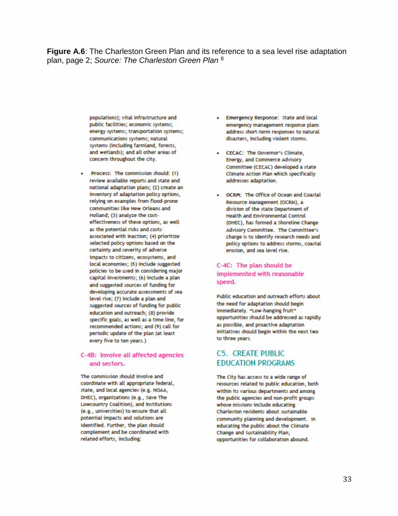
The Charleston Green Plan
In April 2007, Charleston’s City Council authorized their Green Committee to
“provide leadership and practical solutions to ensure a prosperous community that will
sustain healthy lives for our citizens and a healthy earth” 8. As part of this authorization,
the Green Committee strived to do seven things: 1) create a local action plan for climate
change 2) work with the City, and give advice when needed, on the continual
implementation of the plan 3) monitor progress throughout the implementation and
lifetime of the plan 4) identify potential grants and other available funding opportunities

11
to further enhance the implementation and goals of the plan 5) build on existing City
initiatives as a means to promote an integrated community-wide approach to
sustainability 6) sponsor, promote, and endorse education events and 7) promote
regional cooperation8. Specifically, the plan targets better, more efficiency building
design, cleaner energy use, more sustainable community development, improved
transportation, zero waste initiatives, and increased ‘green education’8. Although at first
glance the plan appears to be rather comprehensive, sea level rise, a devastating
consequence of climate change that is already impacting the community, is hardly
mentioned. Found under the ‘Sustainable Communities’ section, ‘creating a seal level
rise adaptation plan’ is a proposed action (See Figure A.5 and A.6 in Appendix).
However, of the 187 pages of the document, only about 1 ½ are dedicated to discussing
the implementation and creation of a sea level rise adaptation plan. Additionally,
although the City Council received the plan on February 23, 2010, it was never fully
implemented or developed into a law and as such, few, if any, of its original goals have
been met, including the development of a sea level rise adaptation plan8.
South Carolina Businesses Against Rising Seas
The South Carolina Businesses Against Rising Seas (SCBARS) is a local
interest group consisting of businesses that will be affected by sea level rise and
support sea level rise adaptation and mitigation planning by the government. The group
is part of a project developed by the South Carolina Small Business Chamber of
Commerce, the American Sustainable Business Council and the Southern Alliance for
Clean Energy13. The group originally began as part of an educational effort in May 2013.
In order to demonstrate to people how much sea level rise would impact their
community, members used blue tape to mark the projected high tide levels for 2100 on
the interior and exterior of participating buildings. Accompanying the tape were signs
and directions, directing onlookers to a website with more information concerning exact
predictions, impacts of sea level rise, information regarding why it is happening, and
even a sample letter which businesses could print off and send to their member of
Congress, asking for a reduction in carbon pollution. Additionally, afterward,
participating businesses displayed blue tape with ‘SCBARS.org’ printed on it in their

12
windows to encourage customers to go to the website, learn more about sea level rise,
and reach out to their government to take action. Although the group is no longer active,
it was quite successful in educating people about sea level rise, as well as,
demonstrating that sea level rise does matter to local citizens and small businesses in
the area and people do support government action against sea level rise13.
State-wide Management Plans and Reports
Although not focused solely on Charleston or sea level rise, statewide
management plans and technical reports address the adverse effects of climate change
and potential management strategies in light of these changes. In 2013, the Blue
Ribbon Committee released its report on recommendations for improved shoreline
management23. Although the document only mentions sea level rise once, it lists
numerous recommendations on how to increase the resiliency of the shoreline,
ultimately helping mitigate the effects of sea level rise. Additionally, the South Carolina
Department of Natural Resources recently released “Climate Change Impacts to Natural
Resources in South Carolina” 6. Section 3.1 of this document is dedicated solely to sea
level rise and the concerns that the Department of Natural Resources have in relation to
management strategies and the livelihood of the area’s natural resources6. However,
the report lacks quantitative data to support its claims and recommendations;
additionally, it is focused solely on the state level, assuming a higher amount of
resources than the city of Charleston most likely has.
Environmental Advocacy Groups
Numerous environmental groups within the area are also beginning to look at sea
level rise and consider its effects on Charleston within their own organization. Some of
these organizations include the Cape Romain National Wildlife Refuge, the Coastal
Conversation League, the Southern Alliance for Clean Energy, NOAA, the South
Carolina Sea Grant Consortium, and the Nature Conservancy. At this time, their efforts
typically remain within their own organization; however, it is encouraging to see so
many organizations beginning to consider the issue.

13
Adaptation vs. Mitigation
As we progress through the 21st century, the impacts of climate change are
becoming glaringly obvious as increased flood events, more frequent and more intense
hurricanes, and rising sea levels continue to occur on a global scale. In relation to
preparing for these climatic changes, two terms are commonly used: adaptation and
mitigation. The Intergovernmental Panel on Climate Change (IPCC) defines climate
change adaptation as, “adjustments in natural or human systems in response to actual
or expected climatic stimuli or their effects, which moderates harm or exploits beneficial
opportunities” 19. Adaptation and adaptive strategies seek to reduce exposure or
susceptibility to climate changes and its repercussions. Adaption strategies include (but
are not limited to) building seawalls, river embankments, reservoirs etc. as well as
infrastructure enhancements and the relocations of people, buildings, cities, etc. to safer
grounds. Mitigation, however, in some ways can be viewed as a subset of adaptation.
Mark Pelling, author of Adaptation to Climate Change: From Resilience to
Transformation, describes mitigation as, “an adaptive act aimed at ameliorating or
reversing the root causes of the anthropocentric forcing processes behind climate
change” 20. Mitigation more commonly refers to policy initiatives and legal stimulations
supporting adaptive changes. For example, mitigation efforts could include legislation
mandating specific carbon reductions or a renewable portfolio standard (RPS) to help
reduce our impact on Earth and the potential effects of climate change. Additionally,
mitigation measures commonly occur on a national or global scale, whereas, adaptation
and adaptive strategies are more commonly found on local agendas. Furthermore,
mitigation techniques commonly deal with the present and future (ie: what can we do
now to reduce the effects of climate change from here on) whereas adaptation
strategies commonly work retroactively, working to move forward in light of whatever
has already happened (ie: strategies on how to move forward in light of an occurrence).
For the past few decades, the primary response to climate change in the United
States has focused on mitigation strategies to reduce greenhouse gas emissions3.
Although mitigation efforts, specifically in relation to greenhouse gas reduction, are a
great start to coping with climate change, these efforts are not enough to prepare us for
the inevitable change resulting from already existing emissions and atmospheric

14
conditions. Mitigation efforts work proactively and affect the present and future in terms
of emissions rates, atmospheric concentrations of carbon dioxide, and the rate at which
our atmosphere is changing, primarily as a result of anthropogenic causes. However,
Alice Kaswan, a University of San Francisco School of Law professor focused on
climate change, states that “even if stringent global emissions reductions and mitigation
efforts over the next decades prove to be successful, further climate change seems to
be inevitable” 11 as a result of previous emissions already present in the atmosphere. As
a result, “reducing greenhouse gas (GHG) emissions is necessary but not sufficient to
address the potential damage”11 and adaptation strategies must be considered to fully
address all the effects of climate change.
The implementation of adaptation strategies occurs through political will,
compatibility with other current policies, suitable timing and sufficient human resources
(active, knowledgeable people taking a leading role). An ideal adaptation strategy will
consider these key motivating and implementing factors, as well as, frame climate
change in a positive light to transform “barriers to enablers and… [enhance] public and
political action” 3. Currently, the United States’ adaptation policy focuses on the
reduction of greenhouse gases, with hopes of one day reversing the effects our
greenhouse gas emissions have already had on our environment15. As heroic as it
would be to reverse the effects of climate change, the reality of that happening is very
slim considering current projections for future emissions and carbon dioxide levels. As
such, the United States has two options: treat adaptation as a societal challenge and let
the market dictate decisions or develop policies which integrate more realistic
adaptation strategies into our own climate change agenda. As Alice Kaswan highlights,
“relying on “market forces” to adequately prepare for disasters and other climate change
impacts will fail to provide an adequate adaptation response because reliance on
private action fails to protect those without the knowledge or means to act”11.
Furthermore, the lack of knowledge, lack of capacity (for timely adaptation), lack of self-
interest, and lack of cohesion (multiple actors, multiple opinions) present in the free
market approach destine it for failure in terms of a successfully serving as a solution for
adaptation to climate change3. Instead, federal, state, and local governments need to

15
take initiative and develop effective adaptation and mitigation strategies to prepare for
the accelerated rate of climate change.
Examples of Successful Regional and Local Planning
Regional Planning: Southeast Florida Regional Climate Compact
At the regional level, the Southeast Florida Regional Climate Compact provides
an excellent example of how regional cooperation can successfully lead to proactive
climate adaptation planning and more resilient cities. The Southeast Florida Regional
Climate Compact was created in January 2010 and consists of four southeast Florida
counties: Miami-Dade, Broward, Monroe, and Palm Beach1. The Compact was created
as a means to “coordinate mitigation and adaptation activities across country lines” 1 as
well as “to allow local governments to set the agenda for adaptation while providing an
efficient means for state and federal agencies to engage with technical assistances and
support” 1. Overarching plans of the Compact also include the development of annual
legislative programs that would advocate for joint state and federal policies and funding,
dedicated staff and resources for the creation of a climate action plan including both
mitigation and adaptation strategies, and an annual meeting at the Regional Climate
Summits in order to discuss progress towards intermediate goals and identify various
emerging issues1. Perhaps most importantly, however, the Compact has encouraged
collaboration and established a uniform methodology for assessing vulnerability of
specific areas to climate change impacts, as well as, mapping sea level rise and its
impacts1. Essentially, it has served as a unifying mechanism, ensuring that all counties
are looking at these issues in the same way and considering the effects in similar
manners.
Since its creation in 2010, the Compact has been very successful in collecting
data, raising awareness, educating the public, gathering resources, and organizing
planning efforts and documents in light of climate change. Specifically, in October 2012,
the Compact released its regional climate action plan, A Region Responds to a
Changing Climate. The plan lists 110 action items that are to be completed within five
years from the release of the document (2017) with yearly progress reports1. The action
items are divided amongst seven different goal areas: 1) sustainable communities and

16
transportation planning 2) water supply, management and infrastructure 3) natural
systems 4) agriculture 5) energy and fuel 6) risk reduction and emergency management
and 7) outreach and public policy1. This document, in particular, is significant because it
provided a working model for how the state and federal governments can become
involved with local action and concerns surrounding climate change. Additionally, the
Compact has been very active releasing numerous implementation guides and scientific
documents such as A Unified Sea Level Rise Projection for Southeast Florida, Regional
Greenhouse Gas Emissions Inventory: Baseline Period 2005-2009, Policy and
Advocacy Implementation Report, Analysis of the Vulnerability of Southeast Florida to
Sea Level and Adaptation Action Area Pilot Research Report.
At both the State and Federal level, the success of the unique regional compact
has not gone unnoticed. Specifically, as a result of the Compact’s work, the state
legislature created an Adaptation Action Area (AAA) designation for areas that are
particularly vulnerable to climate impacts, specifically sea level rise1. These Adaptation
Actions Areas are commonly areas just at or below mean higher high water levels,
areas that are designated evacuation zones due to storm surge, and areas which have
some type of hydrological relationship to coastal waters. Areas with the AAA
designation are prioritized above areas without the designation in terms of funding for
infrastructure needs and/or adaptation planning in regards to climate change.
Additionally, the White House has recognized the Compact, choosing the region for a
White House Council on Environmental Quality listening session in June 20101. The
Compact has also been recognized in the Progress Report of the Interagency Climate
Change Adaptation Task Force on Climate Preparedness and Resilience1. Additionally,
in 2012, the Senate highlighted the Compact as an excellent example of local response
to climate change. Margaret Davidson, the Director of the National Oceanic and
Atmospheric Administration Coast Science Center also recognized the Compact for its
excellence stating, “This is a great model of a partnership and there will be a lot of us
looking to promulgate this as a model” 1. As demonstrated, the Southeast Florida
Regional Climate Compact presents a thorough and successful example of regional
planning for coastal resilience. The city of Charleston and surrounding region should
17
look to the Compact as an example of how to utilize regional resources to develop local
planning and adaptation strategies.
Local Planning: Norfolk, Virginia and Hampton Roads Area
At the local level, the planning efforts, educational outreach, and coordinated
work of the Norfolk, Virginia and Hampton Roads area demonstrates how adaptation
and mitigation planning can also be successful on a smaller scale at the local level.
Similar to Charleston, Norfolk, Virginia and the Hampton Roads area is not only
experiencing eustatic sea level rise but also land subsidence, further impacting the
area. According to NOAA tidal gauge stations, local sea levels have risen more than 18
inches since the 1930s. In fact, the city of Norfolk is considered the second-largest
population center at risk due to sea level rise, with the city needing an estimated $1
billion to keep water out of coastal homes and businesses, as well as, to replace
damaged infrastructure due to sea level rise14. Additionally, Norfolk is home to the
United States’ Naval Base, the largest naval operation in the world. As such, the Norfolk
area in particular is concerned about sea level rise and very interested in adaptation
and mitigation planning for their area.
Although at this time, the Norfolk, Virginia area is not as developed in their sea
level rise adaptation and mitigation planning as the four counties in Florida, the area is
headed in the right direction by acknowledging that sea level rise is impacting their area
at an accelerated rate and beginning to organize efforts and discussions to enable
further planning in the near future. Specifically, as a means to promote federal, state,
and local action on sea level rise, Congress members, Virginia mayors, state and local
officials and concerned citizens came together to discuss the issue at the ‘Rising to the
Challenge’ conference in June 2014. The conference was held at Old Dominion
University, which is also striving to increase knowledge and planning efforts surrounding
this topic through their Climate change and Sea Level Rise Initiative beginning in 2010.
As a result of the discussions and presentations at the conference, it was generally
agreed that “coordination with all levels of government to move from technical
discussion of sea-level rise to working policies” 9 was needed. Words such as

18
“resilience”, “risk mitigation” and “public engagement” were often used throughout the
discussion and appear to be priorities in the planning process.
Unfortunately, however, making these changes requires large amounts of money
that currently are not budgeted for. Moreover, aside from Federal Emergency
Management Act (FEMA) monies, obtaining federal funds is difficult as there is no
federal program set up to offer cities/states proactive ways to mitigate the effects of
climate change and sea level rise. As for now, Norfolk and the Hampton Roads area is
doing the best that they can with their resources. Specifically, an ordinance was recently
passed requiring that new buildings or any major renovations be elevated three feet
above the flood plain (previously it was only required to be one foot above) 14.
Additionally, numerous outside organizations are coming to Norfolk to conduct analyses
and studies on various mitigation and adaptation strategies and tools. For example, in
December of 2013, Norfolk was chosen for the 100 Resilient Cities Network to later be
equipped with planning tools in light of climate change. With so many resources and
people at risk, it is clear that Virginia needs some sort of local, or even regional, plan in
place to effectively combat these issues. Although they may not have a structured,
concrete plan yet, hopefully as Norfolk continues to raise awareness, gain factual
evidence, and garner even more political support, the Norfolk area will be able to
effectively mitigate for the effects of climate change and rising sea levels.
Recommendations for Charleston, South Carolina Moving Forward
Create a regional climate compact with the four other coastal counties
As Charleston works to gain momentum in their own local agenda against sea
level rise, we recommend efforts on the larger scale with the creation of a regional
climate compact similar to the Southeast Florida Regional Climate Compact. The
Compact would ideally consist of the five coastal counties in South Carolina: Horry
County, Georgetown County, Charleston County, Beaufort County, and Jasper County.
At times, resources can be inadequate at the local level, with limited available funding
and staff to properly address environmental issues such as sea level rise. For example,
currently, the city of Charleston does not have one sole person dedicated to addressing
and coordinating efforts associated with sea level rise and the inevitable impacts of

19
climate change. While it may be a part of someone’s job responsibilities, it is not the
sole focus of any one person’s day-to-day workload. At the regional level, however,
perhaps with the resources of five counties, more funding and staff could be hired with
the sole responsibility and focus on sea level rise and adaptation and mitigation
planning along the coast. Furthermore, sea level rise is not just a localized issue unique
to Charleston. The entire coast is experiencing sea level rise and as such, perhaps
utilizing more resources and developing a strategy for the entire coast would be more
effective overall.
Additionally, should the five counties come together to form a climate compact,
perhaps the state of South Carolina will realize the importance of the issue and take an
initiative towards action at the state level. These five coastal counties of South Carolina
contain numerous profitable, tourism-centered beach towns such as Myrtle Beach in
Horry County, Georgetown in Georgetown County, Charleston and the surrounding
areas of Mount Pleasant, Isle of Palms and Folly Beach in Charleston County, and
Hilton Head in Beaufort County. Combined, these beach towns bring in significant
revenue for the State; should their tourism industries or seafood industries be impacted
due to sea level rise or other climatic changes, the state of South Carolina would
certainly feel its effects. Additionally, at the State level, perhaps even more funding or
resources would be available to enable these coastal cities to prepare and adapt to sea
level rise more adequately.
Increase initiative and political will at the local level with more community engagement
and educational outreach
While an overarching regional climate compact or State involvement in the
adaptation and mitigation planning would be ideal, initiative and political will to address
the issue at the City and local level are still needed. Currently, the City commonly cites
their ‘Green Plan’ and storm water management improvements as their initial
preparations for sea level rise and climate change. However, this is not enough and
does not address the full scope of the issue. The City has yet to even formally address
sea level rise and as stated earlier, does not have even one dedicated person working
and considering the issue specifically. This is rather shocking considering the results of
20
a recent Winthrop Poll of South Carolinians completed in November 2014. According to
this poll, 68% of people living in one of the five coastal counties of the state are ‘very
sure’ or ‘somewhat sure’ that sea level rise is happening or will be happening12.
Statewide, the poll found that 57.3% of South Carolinians believe that levels will rise
while only 8% did not believe they would rise at all12. Residents of South Carolina also
seem to understand that this problem is not going away in the near future: 9% of
respondents believe that the impacts of sea level rise are currently substantial, 18.7%
believe that they will be substantial within the next 10 years, 18.9% anticipate they will
be significant within the next 25 years and as many as 46% believe that the impacts of
sea level rise will be felt within the lives of most state residents12. While this data clearly
demonstrates some acknowledgement that sea level rise is happening and that its
impacts will affect the livelihoods of many South Carolinians, especially those living on
the coast, the poll also found that 73.3% of those polled said they supported state
and/or local government action to make the coastal communities of South Carolina
more resilient to sea level rise12! As such, while resources and political will at the local
level appear limited, we suggest an increase in community engagement and education
to continue to raise awareness on the issue and begin to strategize what planning
mechanisms and options would work best for the citizens in Charleston. The
organization of more conferences and discussions involving a myriad of stakeholders
such as local scientists, concerned community members, legal professionals, business
owners, and other environmental advocates (similar to the efforts of Norfolk, Virginia)
could facilitate the sea level rise adaptation and mitigation planning which people are
asking for, or at the very least, demonstrate how concerned the people of Charleston
are regarding this issue.
Additionally, research at the local level, including changes in sea level, financial
impacts of sea level rise, amount of infrastructure impacted, etc. could further support
funding requests or resources from the State, should it decide to get involved in coastal
resiliency efforts. For example, if the State decides it is going to grant a certain amount
of money or resources to specific cities, depending on the financial impact of sea level
rise or the amount of people suffering adverse effects, it is important that Charleston
already have or be working towards obtaining that information.
21
Revise the Beachfront Management Act (1988) to no longer allow movement of the
development baseline seaward
In 1988, South Carolina’s Beachfront Management Act authorized a statewide
beachfront management program with the overarching goal of protecting, preserving,
and enhancing the beach and dune systems. Specifically, as a means to further
regulate the new construction, repairs to or reconstruction of existing buildings and
erosion control structures, this statewide management act created jurisdictional
baselines and setback lines for permanent structures2. If a building or structure is
located within a ‘setback area’, it is subject to regulation under the S.C. Code of
Regulations 30-13 and 30-2122. As such, South Carolina’s Department of Health and
Environmental Control (DHEC) reviews the baseline every 8-10 years, with the option to
move it landward or seaward22.
Currently, the baseline is located “at the crest of the primary oceanfront sand
dune in standard zones of the beachfront and at the most landward point of erosion
over the last 40 years in unstabilized inlet zones” 22. Under S.C. Code Ann. Regs. 30-1
D (43), the ‘primary dune’ must be at least 500 feet long and 3 feet high22. Movement of
this baseline can occur depending on long-term erosion and accretion patterns, survey
data, as well as, the historical position of the shoreline. For example, the baseline can
move landward if persistent erosion occurs, whereas, the baseline can move seaward if
chronic accretion occurs. Landowners may also seek to move the baseline on their
specific property following beach renourishment by submitting a petition to the local
government22.
The jurisdictional setback line is then established at a minimum of 20 feet
landward of the baseline or as much as forty times the average annual erosion rate22. If
new construction is built within this setback area, it can be no bigger than 5,000 square
fee22t. However, if a building is already located within the setback area and is destroyed
for whatever reason, it can be restored or rebuilt to original dimensions. Similarly, new
erosion control devices (seawalls, bulkheads, etc) cannot be built in the setback area22.
However, if an erosion control device already exists within the setback area, it can be
repaired according to specific guidelines22.

22
Although under state legislation DHEC may review and move the baseline
landward or seaward every 8-10 years, some cities and local municipalities such as
Pawleys Island have developed stricter regulations which surpass the state regulation
and strive to keep development further away from the dynamic coastline22. In order to
better protect its beach system and shoreline, Charleston should implement stricter
development regulations along the coast, specifically by prohibiting any seaward
movement of the baseline in the future. While some may feel this could lead to a
‘regulatory taking’, it does not; property owners cannot assume that their property will
accrete, providing additional land for private use and therefore cannot argue that
something of economic value was ‘taken’ from them. Additionally, beach accretion
should be considered as further protection from coastal erosion, not room for further
development. As such, Charleston should implement stricter regulations surrounding
development on the shoreline by prohibiting any seaward movement of the baseline in
the future.
Conclusion
As sea level rise continues to occur on a global scale, coastal cities need to be
evaluating the risk and potential impacts it will have on their communities and
developing adaptation and mitigation strategies to effectively handle these changes.
With projections anticipating a sea level rise as high as four feet within the next 100
years, Charleston needs to be considering strategies to preserve and protect its
coastlines, historical and cultural assets, natural resources, and its infrastructure.
Currently, the City has taken little initiative to proactively plan and adapt for the
impending effects of sea level rise. Although the Charleston Green Plan demonstrates
an interest in the resiliency and sustainability of the City, it is not a sufficient or
comprehensive response to sea level rise. As such, we recommend that Charleston
seek regional support through the creation of a regional climate compact between the
five coastal counties in South Carolina. By collaborating in a regional compact, more
resources, staff, and funding will be available to work on strategic planning than would
otherwise be available at the local level. Additionally, regional collaboration will
demonstrate to the State that sea level rise is an important issue to these coastal

23
counties and support at the state level is needed. Secondly, more initiative and political
will is needed at the local level to promote more sustainable practices and encourage
collaboration between local scientists, residents, policy makers, business owners, etc. in
order to create a plan of action for sea level rise. Ideally, the City would hire a dedicated
staff member to serve as the primary contact for planning, as well as, lead community
engagement, education, and outreach programs. However, if that is not an option, local
government should provide platforms (conferences, meetings, educational
opportunities, etc.) for the community to begin discussing the ways in which they would
like to see the city take action against sea level rise. Thirdly, while beachfront
development may be profitable for the region, it further erodes the beach and is at high
risk of being destroyed in light of sea level rise. As such, Charleston should revise the
Beachfront Management Act of 1988 to no longer allow DHEC to move the baseline
seaward, regardless of accretion processes. Although Charleston’s sea level rise
adaptation and mitigation strategy may still be unclear, with sea level rise predictions as
high as 4 feet within the next 100 years, it is clear action is needed to preserve and
protect the city for generations to come.
24
Acknowledgements
First and foremost, I would like to thank my advisor, Dr. Patrick Halpin, for
serving as the advising faculty member on this masters project. I would also like to
sincerely thank Chris DeScherer with the Southern Environmental Law Center for his
guidance and support with the foundation of this project. Chris was instrumental in
arranging interviews and speaking with local environmental groups and experts and
without him, I wouldn’t have been able to complete this project. I would also like to thank
the numerous professionals and environmental experts that I spoke with throughout this
project, even if it was just to casually learn more about their organization or talk about
sea level rise. These people include Hamilton Davis, Chris Carnevale, Raye Nilius,
Sarah Dawsey, Mary Conley, Joy Brown, and Frank Knapp. Speaking to these people
about sea level rise in the area and hearing about the work they do was very thought
provoking and inspiring. I hope one day to be able to make a difference and contribute
to environmental advocacy like each of these people have. Lastly, I would like to thank
my parents, Hal and Ruthann Prettyman, for their unwavering support and
encouragement of my academic pursuits and passions. I will eternally be grateful for
having parents who not only encourage me to pursue my dreams but also provide the
means to do so.

25
References
1 A Region Responds to a Changing Climate: Regional Climate Action Plan. Southeast Florida Regional Climate Compact, Oct. 2012. Web. 11 Apr. 2015. <http://www.southeastfloridaclimatecompact.org//wp-content/uploads/2014/09/regional-climate-action-plan-final-ada-compliant.pdf>.
2 "Beachfront Management." South Carolina Department of Health and Environmental Control, 2014. Web. 4 Apr. 2015. <http://www.scdhec.gov/beach/BeachfrontManagement/>. 3 Biesbroek, Robbert G., Rob J. Swart, Timothy R. Carter, Caroline Cowan, Thomas Henrichs, Hanna Mela, Michael D. Morecroft, and Daniela Rey. "Europe Adapts to Climate Change: Comparing National Adaptation Strategies." Global Environmental Change 20.3 (2010): 440-450. 4 Bowers, Paul. "New Interactive Map Shows Effects of Sea Level Rise on Charleston." Charleston City Paper. 13 Aug. 2014. Web. 24 Mar. 2015. <http://www.charlestoncitypaper.com/charleston/new-interactive-map-shows- effects-of-sea-level-rise-on-charleston/Content?oid=4972978>. 5 "Charleston (city) QuickFacts from the US Census Bureau." United States Census Bureau, 31 Mar. 2015. Web. 11 Apr. 2015. <http://quickfacts.census.gov/qfd/states/45/4513330.html>. 6 Climate Change Impacts to Natural Resources in South Carolina. Rep. South Carolina
Department of Natural Resources, n.d. Web. 10 Apr. 2015. <http://www.dnr.sc.gov/pubs/CCINatResReport.pdf>.
7 "Finally a Fix for the Battery." Post and Courier, 26 Dec. 2012. Web. 2 Apr. 2015. <http://www.postandcourier.com/article/20121226/PC1002/121229579/1021/finall y-a-fix-for-the-battery>. 8 Charleston Green Committee. "Charleston green plan: A roadmap to
sustainability." City of Charleston, SC (2009). 9 DeConcini, Christina, and C.Forbes Thompkins. "Sea Level Rise Cuts Across Political
Divide in Norfolk, Virginia." World Resources Institute, 2 July 2012. Web. 5 Apr. 2015. <http://www.wri.org/blog/2014/07/sea-level-rise-cuts-across-political-divide-norfolk-virginia>.
10 Kana, Timothy W., et al. "The physical impact of sea level rise in the area of
Charleston, South Carolina." Greenhouse Effect and Sea Level Rise: A Challenge for This Generation. New York: Van Nostrand Reinhold Company(1984): 105-150.

26
11 Kaswan, Alice. "Seven Principles for Equitable Adaptation." University of San Francisco School of Law, 2013. 12 Knapp, Frank. "New SC Poll: Sea Levels Will Rise, Start Planning." SC Small
Business Chamber of Commerce. South Carolina Small Business Chamber of Commerce, 19 Nov. 2014. Web. 13 Apr. 2015. <https://scsbc.org/new-sc-poll-sea-levels-will-rise-start-planning/>.
13 Knapp, Frank. Personal Interview. 1 April 2015. 14 Koch, Wendy. "Rising Sea Levels Torment Norfolk, Va., and Coastal U.S." USA
Today. 18 Dec. 2013. Web. 1 Apr. 2015. <http://www.usatoday.com/story/news/nation/2013/12/17/sea-level-rise-swamps-
norfolk-us-coasts/3893825/>. 15 Leonard, Damien. "Raising the Levee: Dutch Land Use Law as a Model for U.S. Adaptation to Climate Change." Georgetown International Law Review 21.3 (2009): 541-563 16 Magill, Bobby. "The Front Lines of Climate Change: Charleston's Struggle." Climate Central, 9 Jan. 2014. Web. 14 Apr. 2015. <http://www.climatecentral.org/news/the-front-lines-of-climate-change- charlestons-struggle-16934>. 17 "NOAA Establishes ‘tipping Points’ for Sea Level Rise Related Flooding." National Oceanic and Atmospheric Administration, 18 Dec. 2014. Web. 24 Apr. 2015. <http://www.noaanews.noaa.gov/stories2014/20141218_sealevelrise.html>. 18 "‘Nuisance Flooding’ an Increasing Problem as Coastal Sea Levels Rise." National Oceanic and Atmospheric Administration, 31 Oct. 2014. Web. 24 Apr. 2015. <http://www.noaanews.noaa.gov/stories2014/20140728_nuisanceflooding.html>. 19 Parry, Martin L., ed. Climate Change 2007: impacts, adaptation and vulnerability: contribution of Working Group II to the fourth assessment report of the Intergovernmental Panel on Climate Change. Vol. 4. Cambridge University Press, 2007. 20 Pelling, Mark. Adaptation to climate change: from resilience to transformation. Routledge, 2010. 21 Pinckney, Paul. "Lessons Learned from the 1886 Charleston Earthquake." Virtual Museum of the City of San Franciso. The San Francisco Chronicle, 6 Mar. 1906. Web. 2 Apr. 2015. <http://www.sfmuseum.org/1906.2/charleston.html>. 22 "Port Charleston." World Port Source, 2015. Web. 12 Mar. 2015. <http://www.worldportsource.com/ports/review/USA_Port_Charleston_248.php>.

27
23 Shoreline Management: Recommendations for Improved Beachfront Management in
South Carolina. Blue Ribbon Committee, 2013. Web. 14 Mar. 2015.<http://www.scdhec.gov/HomeAndEnvironment/Water/CoastalManagement/BeachManagement/ShorelineChangeInitiative/>.
24 Sweet, William VanderVeer, et al. Sea level rise and nuisance flood frequency
changes around the United States. June 2014. 25 United States. National Park Service. "Community History." National Parks Service. U.S. Department of the Interior. Web. 2 Apr. 2015. <http://www.nps.gov/nr/travel/charleston/community.htm>.
28
Appendix
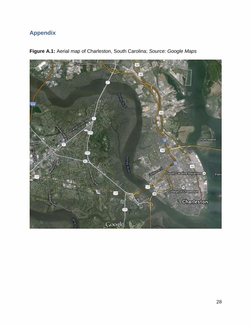
Figure A.1: Aerial map of Charleston, South Carolina; Source: Google Maps

29
Figure A.2: Aerial map of downtown Charleston showing the high development along the shoreline; Source: Google Maps
30
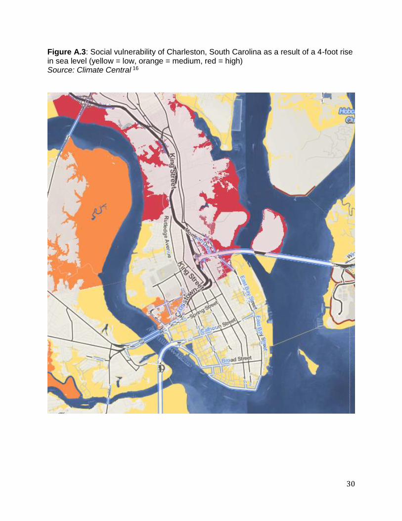
Figure A.3: Social vulnerability of Charleston, South Carolina as a result of a 4-foot rise in sea level (yellow = low, orange = medium, red = high) Source: Climate Central 16
31
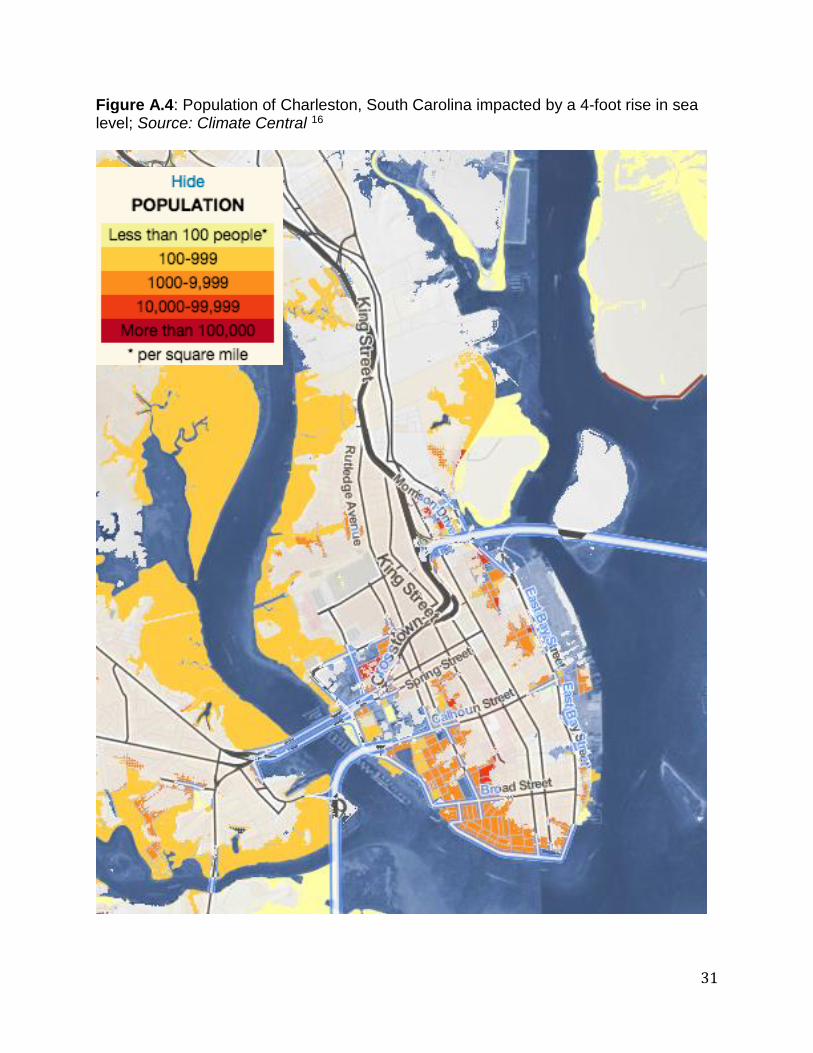
Figure A.4: Population of Charleston, South Carolina impacted by a 4-foot rise in sea level; Source: Climate Central 16

32
Figure A.5: The Charleston Green Plan and its reference to a sea level rise adaptation plan; Source: The Charleston Green Plan 8
33
Figure A.6: The Charleston Green Plan and its reference to a sea level rise adaptation plan, page 2; Source: The Charleston Green Plan 8