SAILING DIRECTIONS: CARIBBEAN PASSAGE...
1
40 ALLATSEA.NET OCTOBER 2010 OCTOBER 2010 ALLATSEA.NET 41 www.zf.com Wherever your travels in the Caribbean take you, we’re already there. ZF Marine Parts and Service. Driveline and Chassis Technology Caribbean Marine & Diesel Providenciales, Turks & Caicos Islands 649-941-5903 DES Marine & Industrial Engines Panama City, Panama, Rep. of Panama +507 236 6500 / 5818, www.desmarine.com LJPROPCenter Cartagena, Colombia (57) 5 - 657 10 65, [email protected] Marlin comercializadora SA de CV Cancun, Quintana ROO, Mexico 011 52 998 8488331 Megamak Merida, Yucatan, Mexico 011 52 999 930 1340, [email protected], www.megamak.com.mx Parts & Power Road Town, Tortola, British Virgin Islands 284-494-2830, [email protected], www.partsandpower.com Performance Engines & Propellers Fajardo, Fajardo, Puerto Rico 787-863-9786 RAL Line SA de CV Acalpulco, Guerrero Mexico, Mexico 011 52 744 100 7924 Sistemas de Propulsion Municipio San Francisco, Zulia, Venezuela 58 +261 7362575, [email protected] ZF Marine LLC, 15351 SW 29th St., Suite 300, Miramar, FL 33827, 954-441-4067 Seamanship & Voyaging D onald Street wrote: From my earliest days, in the earliest days, in 1956, I had the exploratory interest. The quote is from his website, and he was talking about his pioneer- ing sailing aboard his wooden yawl Iolaire. Does the name sound familiar? It should because Street’s influence on Caribbean cruising is evident in the Imray-Iolaire charts most modern Caribbean sailors have come to depend on. Street’s understated “exploratory interest” made them possible. Last summer, my fiancée Mia Karlsson and I led a teenage live- aboard sail-training program for the adventure travel outfit Broa- dreach. Aboard a 50-foot Beneteau named Arwen, which we boarded in Anse Marcel, St. Martin, we covered the 600 or so miles from St. Martin to Trinidad in a leisurely 32 days, retracing Street’s exploration and utilizing his knowledge as we made our way south. Though Street’s efforts occurred nearly half a century ago, rocks don’t move, and the waterproof charts he had a hand in creating are invalu- able to the modern Caribbean sailor. I was determined to teach the kids real sailing, and we burned through less than half a tank of diesel on the entire voyage—often anchoring and mooring under sail—the kids learning seamanship the right way. Street, in his engineless Iolaire, would have approved. Sailing the chain of Carib- bean islands rather than cruis- ing it, requires more than just the knowledge gleaned from glancing at the chart. The Im- ray charts are typical in that they provide great detail of the dangers that lurk beneath the water’s surface. Yet they don’t offer much in the way of details when it comes to the water it- self and the wind that affects it. Spend a few days in the Carib- bean, and it becomes obvious that it’s windy and that it often blows from the same direction, the east, varying only slight north and south depending on the season. These are the Trade Winds, that glorious band of latitude in which the islands reside, where it’s al- ways sunny and usually windy, indeed sometimes too windy, come hurricane season. By phase II of our ‘Arc of the Caribbean’ voyage, the kids would begin relying heavily not on the front of the Iolaire charts, which by now they’d mastered, but on the backs of them, where the real value is hidden. Street hadn’t simply charted the rocks and reefs and outlined the inlets and anchorages, but also documented his experiences in his sailing directions. These directions give life to the islands represented on the front of the chart, describing typical wind strengths, expected currents, and compass anomalies. They even offer the best course-to-steer on the more popular routes, and include tips on anchoring techniques, tide information and buoy data. New at navigating, I coaxed my students into figuring out Street’s directions on their own, rather than outright telling them. One morn- ing I laid the passage chart upside down on the table and simply asked our navigator for the day to start reading. It slowly dawned on every- one that while the directions sounded like an adventure narrative, they were in fact providing the clues the novice navigators needed to get us safely to Nevis. They no longer needed me to teach them, as they were teaching themselves. SAILING DIRECTIONS: CARIBBEAN PASSAGE PLANNING A HANDS-ON APPROACH TO SEAMANSHIP AND NAVIGATION ARTICLE BY ANDY SCHELL, PHOTOS BY MIA KARLSSON Gradually our kids became good sailors and better navigators, sailing us onto the hook in the Iles des Saintes after a successful over- night passage from Montserrat. With Street’s help, they learned of the wind shadow created by the high islands like Guadeloupe and St. Lucia. They anticipated the blustery winds we encountered near the northern and southern tips of Dominica, where the wind often blows fierce and from odd directions as it rounds the rocky headlands. They learned to steer a more easterly course through the inter-island chan- nels, as the trades force water between the islands, sometimes creating ripping currents and bigger than normal waves that conspired to push us west and off course. Our final overnight passage was our lon- gest yet, from Grenada south to Trinidad, where we’d be dodging oilrigs and fighting the North Equatorial Current, all explained in detail on the chart. We made our landfall, Street’s advice on the current and his recom- mended course-to-steer proving spot on. Thanks to Street’s ambitions as an explor- er, his precise directions and my kids trust in them, we were able to sail the chain of islands and experience them in a way most modern cruisers do not. For more information about Broa- dreach and the ‘ARC of the Caribbean’ sail-training program for teenagers go to www.gobroadreach.com Andy Schell is a professional captain and free- lance writer, based in the Caribbean, Annapo- lis and Stockholm, depending on the season. He lives aboard his yawl Arcturus with Mia, his fiancée. www.fathersonsailing.com DJ at the helm of Arwen off the coast of Montserrat Mike Brew practicing sun sights en route to St. Lucia
Transcript of SAILING DIRECTIONS: CARIBBEAN PASSAGE...
40 ALLATSEA.NET OCTOBER 2010 OCTOBER 2010 ALLATSEA.NET 41
www.zf.com
Wherever your travels in the Caribbean take you, we’re already there. ZF Marine Parts and Service.
Driveline and Chassis Technology
Caribbean Marine & Diesel Providenciales, Turks & Caicos Islands649-941-5903
DES Marine & Industrial Engines Panama City, Panama, Rep. of Panama+507 236 6500 / 5818, www.desmarine.com
LJPROPCenter Cartagena, Colombia(57) 5 - 657 10 65, [email protected]
Marlin comercializadora SA de CV Cancun, Quintana ROO, Mexico011 52 998 8488331
Megamak Merida, Yucatan, Mexico011 52 999 930 1340, [email protected], www.megamak.com.mx
Parts & Power Road Town, Tortola, British Virgin Islands284-494-2830, [email protected], www.partsandpower.com
Performance Engines & Propellers Fajardo, Fajardo, Puerto Rico787-863-9786
RAL Line SA de CV Acalpulco, Guerrero Mexico, Mexico011 52 744 100 7924
Sistemas de Propulsion Municipio San Francisco, Zulia, Venezuela58 +261 7362575, [email protected]
ZF Marine LLC, 15351 SW 29th St., Suite 300, Miramar, FL 33827, 954-441-4067
Seamanship & Voyaging
Donald Street wrote: From my earliest days, in the earliest days, in 1956, I had the exploratory interest. The quote is from his website, and he was talking about his pioneer-ing sailing aboard his wooden yawl Iolaire. Does the name
sound familiar? It should because Street’s influence on Caribbean cruising is evident in the Imray-Iolaire charts most modern Caribbean sailors have come to depend on. Street’s understated “exploratory interest” made them possible.
Last summer, my fiancée Mia Karlsson and I led a teenage live-aboard sail-training program for the adventure travel outfit Broa-dreach. Aboard a 50-foot Beneteau named Arwen, which we boarded in Anse Marcel, St. Martin, we covered the 600 or so miles from St. Martin to Trinidad in a leisurely 32 days, retracing Street’s exploration and utilizing his knowledge as we made our way south.
Though Street’s efforts occurred nearly half a century ago, rocks don’t move, and the waterproof charts he had a hand in creating are invalu-able to the modern Caribbean sailor. I was determined to teach the kids real sailing, and we burned through less than half a tank of diesel on the entire voyage—often anchoring and mooring under sail—the kids learning seamanship the right way. Street, in his engineless Iolaire, would have approved.
Sailing the chain of Carib-bean islands rather than cruis-ing it, requires more than just the knowledge gleaned from glancing at the chart. The Im-ray charts are typical in that they provide great detail of the dangers that lurk beneath the water’s surface. Yet they don’t offer much in the way of details when it comes to the water it-self and the wind that affects it. Spend a few days in the Carib-bean, and it becomes obvious that it’s windy and that it often blows from the same direction, the east, varying only slight north and south depending on the season. These are the Trade Winds, that glorious band of latitude in which the islands reside, where it’s al-ways sunny and usually windy, indeed sometimes too windy, come hurricane season.
By phase II of our ‘Arc of the Caribbean’ voyage, the kids would begin relying heavily not on the front of the Iolaire charts, which by now they’d mastered, but on the backs of them, where the real value is hidden. Street hadn’t simply charted the rocks and reefs and outlined the inlets and anchorages, but also documented his experiences in his sailing directions. These directions give life to the islands represented on the front of the chart, describing typical wind strengths, expected currents, and compass anomalies. They even offer the best course-to-steer on the more popular routes, and include tips on anchoring techniques, tide information and buoy data.
New at navigating, I coaxed my students into figuring out Street’s directions on their own, rather than outright telling them. One morn-ing I laid the passage chart upside down on the table and simply asked our navigator for the day to start reading. It slowly dawned on every-one that while the directions sounded like an adventure narrative, they were in fact providing the clues the novice navigators needed to get us safely to Nevis. They no longer needed me to teach them, as they were teaching themselves.
SAILING DIRECTIONS: CARIBBEAN PASSAGE PLANNINGA HANDS-ON APPROACH TO SEAMANSHIP AND NAVIGATIONARTICLE BY ANDY SCHELL, PHOTOS BY MIA KARLSSON
Gradually our kids became good sailors and better navigators, sailing us onto the hook in the Iles des Saintes after a successful over-night passage from Montserrat. With Street’s help, they learned of the wind shadow created by the high islands like Guadeloupe and St. Lucia. They anticipated the blustery winds we encountered near the northern and southern tips of Dominica, where the wind often blows fierce and from odd directions as it rounds the rocky headlands. They learned to steer a more easterly course through the inter-island chan-nels, as the trades force water between the islands, sometimes creating ripping currents and bigger than normal waves that conspired to push us west and off course.
Our final overnight passage was our lon-gest yet, from Grenada south to Trinidad, where we’d be dodging oilrigs and fighting the North Equatorial Current, all explained in detail on the chart. We made our landfall, Street’s advice on the current and his recom-mended course-to-steer proving spot on.
Thanks to Street’s ambitions as an explor-er, his precise directions and my kids trust in them, we were able to sail the chain of islands and experience them in a way most modern cruisers do not.
For more information about Broa-dreach and the ‘ARC of the Caribbean’ sail-training program for teenagers go to
www.gobroadreach.com
Andy Schell is a professional captain and free-lance writer, based in the Caribbean, Annapo-lis and Stockholm, depending on the season. He lives aboard his yawl Arcturus with Mia, his fiancée. www.fathersonsailing.com
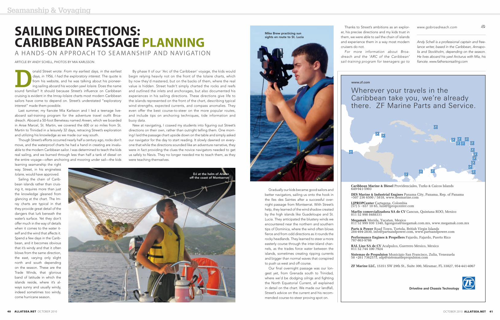
DJ at the helm of Arwen off the coast of Montserrat
Mike Brew practicing sun sights en route to St. Lucia