s JAMAICA - BirdLife International
15
205 INTRODUCTION Jamaica is the third largest island in the Greater Antilles lying 145 km south of eastern Cuba and 161 km west of Haiti. It is 235 km long (east to west) and 35–82 km wide (north to south). Administratively, Jamaica is divided into 14 parishes, and the territory includes the Morant Cays (off the eastern end of the island) and Pedro Cays (off the south-west coast). The island is rugged with mountains and plateaus: much of the land is above 300 m. The highest point is Blue Mountain Peak in the Blue Mountains, a dramatically uplifted ridge-block of Cretaceous metamorphic rock which rises sharply from the coast. The eastern end of this block is capped in limestone, which forms the steep and extremely rugged John Crow Mountains. The Rio Grande, Jamaica’s largest river (by surface-water runoff), separates the Blue and John Crow Mountains. The centre and centre-west of the island is composed of a massive limestone block with well-defined features of a karst landscape, including doline, polygonal (cockpit), and tower karst, large alluvial poljes (valleys), and many sinkholes and caves. The best-developed polygonal karst is found in Cockpit Country (the “type area” for cockpit karst). A portion of the Cockpit Country aquifer drains to the south- west, forming the Black River and Great Morass, the largest swampland ecosystem on Jamaica. In extreme western Jamaica, alluvial plains and rolling karst limestone are punctuated by a Cretaceous igneous outcrop capped in limestone, and known as Dolphin Head. Due to the island’s geologic history of volcanic extrusion, subsidence, and tectonic uplift, the Blue and John Crow Mountains, Cockpit Country, and Dolphin Head are recognised as three “hotspots” of adaptive radiation and endemism. The island’s forested mountains and hilly interior are incised by steep valleys, particularly in the east where erosion is now prevalent due to the removal of forest cover. In the centre and west, the limestone formations provide little surface water, and removal of vegetation exposes a thin red soil. Jamaica has a tropical maritime climate. In the lowlands, the mean annual temperature is 26ºC, but just 13ºC at Blue Mountain Peak. Rainfall varies across the island with average annual precipitation greater than 500 cm in John Crow Mountains, 250 cm in the highest parts of Cockpit Country, and less than 75 cm in the Hellshire Hills—the driest part of the country. Although it rains in every month, the heaviest rains are from September to November, and again (but less heavily) in May and June. The driest months are January through March. Natural vegetation corresponds to geology, elevation and precipitation, and ranges from very wet and wet tropical forest, particularly on the north side of the Blue ■ JAMAICA LAND AREA 10,829 km 2 ALTITUDE 0–2,258 m HUMAN POPULATION 2,780,132 CAPITAL Kingston IMPORTANT BIRD AREAS 15, totalling 3,113 km 2 IMPORTANT BIRD AREA PROTECTION 44% BIRD SPECIES 300 THREATENED BIRDS 16 RESTRICTED-RANGE BIRDS 36 CATHERINE LEVY AND SUSAN KOENIG (WINDSOR RESEARCH CENTRE) Karst limestone “cockpits” in Cockpit Country IBA. (PHOTO: GEOEYE/JAMAICA FORESTRY DEPARTMENT, FROM IKONOS IMAGES)
Transcript of s JAMAICA - BirdLife International

205
Important Bird Areas in the Caribbean – Jamaica
INTRODUCTION
Jamaica is the third largest island in the Greater Antilles lying145 km south of eastern Cuba and 161 km west of Haiti. It is235 km long (east to west) and 35–82 km wide (north to south).Administratively, Jamaica is divided into 14 parishes, and theterritory includes the Morant Cays (off the eastern end of theisland) and Pedro Cays (off the south-west coast). The islandis rugged with mountains and plateaus: much of the land isabove 300 m. The highest point is Blue Mountain Peak in theBlue Mountains, a dramatically uplifted ridge-block ofCretaceous metamorphic rock which rises sharply from thecoast. The eastern end of this block is capped in limestone,which forms the steep and extremely rugged John CrowMountains. The Rio Grande, Jamaica’s largest river (bysurface-water runoff), separates the Blue and John CrowMountains. The centre and centre-west of the island iscomposed of a massive limestone block with well-definedfeatures of a karst landscape, including doline, polygonal(cockpit), and tower karst, large alluvial poljes (valleys), andmany sinkholes and caves. The best-developed polygonal karstis found in Cockpit Country (the “type area” for cockpit karst).A portion of the Cockpit Country aquifer drains to the south-west, forming the Black River and Great Morass, the largest
swampland ecosystem on Jamaica. In extreme western Jamaica,alluvial plains and rolling karst limestone are punctuated by aCretaceous igneous outcrop capped in limestone, and knownas Dolphin Head. Due to the island’s geologic history ofvolcanic extrusion, subsidence, and tectonic uplift, the Blue andJohn Crow Mountains, Cockpit Country, and Dolphin Headare recognised as three “hotspots” of adaptive radiation andendemism. The island’s forested mountains and hilly interiorare incised by steep valleys, particularly in the east where erosionis now prevalent due to the removal of forest cover. In thecentre and west, the limestone formations provide little surfacewater, and removal of vegetation exposes a thin red soil.
Jamaica has a tropical maritime climate. In the lowlands,the mean annual temperature is 26ºC, but just 13ºC at BlueMountain Peak. Rainfall varies across the island with averageannual precipitation greater than 500 cm in John CrowMountains, 250 cm in the highest parts of Cockpit Country,and less than 75 cm in the Hellshire Hills—the driest part ofthe country. Although it rains in every month, the heaviestrains are from September to November, and again (but lessheavily) in May and June. The driest months are Januarythrough March. Natural vegetation corresponds to geology,elevation and precipitation, and ranges from very wet andwet tropical forest, particularly on the north side of the Blue
■■■■■ JAMAICALAND AREA 10,829 km2 ALTITUDE 0–2,258 mHUMAN POPULATION 2,780,132 CAPITAL KingstonIMPORTANT BIRD AREAS 15, totalling 3,113 km2
IMPORTANT BIRD AREA PROTECTION 44%BIRD SPECIES 300THREATENED BIRDS 16 RESTRICTED-RANGE BIRDS 36
CATHERINE LEVY AND SUSAN KOENIG(WINDSOR RESEARCH CENTRE)
Karst limestone “cockpits” in Cockpit Country IBA.(PHOTO: GEOEYE/JAMAICA FORESTRY DEPARTMENT, FROM IKONOS IMAGES)

206
Important Bird Areas in the Caribbean – Jamaica
Bauxite mining is driving habitat destruction across the centre of the island including Mount Diablo IBA.(PHOTO: SUSAN KOENIG/WINDSOR RESEARCH CENTRE)
Mountains (where a remnant of elfin forest remains), and onlimestone (especially the John Crow Mountains and CockpitCountry), to dry scrub forest, and dry woodland along incoastal areas. The Forestry Department’s land-use figures (upto 1998) broadly classify Jamaica as: c.30% forest (only 8%of which is minimally disturbed or “closed broadleaf” forest);30% mixed land-use (including plantations and fields); and39% non-forest land-use (buildings/infrastructure, wetlands,and bauxite and limestone-aggregates mining). Between 1989and 1998, the greatest loss of forest land was in “disturbedbroadleaf”, and the greatest gain (44%) in “mixed land-use/cover” (including “partly forested and partly bauxite lands”).The expansion of bauxite mining accounts for much of thislatter change in land-use.
■■■■■ ConservationNational laws for biodiversity conservation in Jamaica havelagged behind other legislation, but are now under scrutiny aspart of the process to update the Protected Areas Systems Plan.The Wildlife Protection Act, originally passed in 1945 toregulate sports-hunting and fishing, has been enhanced by manyregulations that attempt to address gaps, particularly in relationto protection of animals. However, this act does not addresshabitat protection or the conservation of flora. Habitatprotection comes under the Natural Resources ConservationAuthority Act (1991) which provides the legislative frameworkfor a system of protected areas and paved the way for theestablishment of marine parks and the Blue and John CrowMountains National Park. The island also has over 150 forestreserves designated under the Forest Act (1996, and subsequentregulations) which provides for the preservation of forests,watershed protection, and ecotourism. Private lands declaredas forest reserves can be entitled to property tax exemptions.Jamaica’s protected areas portfolio is biased towards theforested mountains of the interior, leaving lowland and coastalecosystems under-represented. Most of the remaining forestedcoastal areas are privately owned.
Recognition of Jamaica’s unique biodiversity has comeabout slowly over the past 30 years despite an encouragingstart when, after the first United Nations Conference on theEnvironment (Stockholm 1972), it was decided to amalgamatethe various national environmental commissions into oneagency—the Natural Resources Conservation Department(NRCD). This agency was felt to have only advisorycapabilities, so it was expanded in 1991 to become the Natural
Resources Conservation Authority (NRCA). NRCA isresponsible for declaring and managing national parks, andenforces the requirement for project-related environmentalimpact assessments. The Forestry Department manages theisland’s forest estate. In 1988, Hurricane Gilbert’s devastatingeffects revealed problems in natural forest management; thisprompted the preparation of a National Forestry Action Plan(1990), followed by a new Forest Act (1996). The latter explicitlyincludes “conservation and sustainable management of forest”,thus covering activities such as the protection of forestresources for ecosystem services and biodiversity.Conservation remains a challenge due to limited financialresources. Partly because of insufficient capacity withinForestry Department and NRCA and partly because of policychanges in the governance of natural resources, managementof Jamaica’s first national park (declared in 1990) was delegatedto the NGO Jamaica Conservation and Development Trust(JCDT). Other NGOs to be mandated with protected areamanagement are: the Caribbean Coastal Area Management(CCAM) Foundation with responsibility for the Portland BightProtected Area; and the Montego Bay Marine Park Trust whichhas been given the mandate to manage the Montego BayMarine Park. Elsewhere, the Jamaican iguana Cyclura colleiproject, lead by Dr Byron Wilson (University of the WestIndies), provides a focus for research and conservation activitieswithin the dry forest habitat (including a small forest reserve)of Hellshire. In Cockpit Country, the Forestry Departmentand Windsor Research Centre (Trelawny) are working togetherto facilitate the work of three Local Forest ManagementCommittees—encouraging local community engagement insustainable forest resource use and management.
Even though an attempt was made to set up one agency to“provide for the management, conservation, and protection ofthe natural resources of Jamaica”, there are at least 34 piecesof legislation that refer to the environment, e.g. LandAcquisition Act (1947), Urban Development Act (1968),Maritime Areas Act (1996)—not all of which are administeredby NRCA, but by other government agencies as well. Problemsassociated with conservation in Jamaica include poorcoordination between the plethora of government institutionsresponsible for the various laws and regulations insufficientrecognition of the value of biological diversity, insufficientfunding, poor enforcement, incomplete or improperenvironmental impact assessments, and incomplete island-wideevaluation of landscape and biodiversity values. While these

207
Important Bird Areas in the Caribbean – Jamaica
issues are inhibiting effective conservation action, there are anumber of significant threats that are directly impactingJamaica’s unique biodiversity. Habitat loss and fragmentationare the greatest threats. With primary forest reduced to just8% of the land area, multiple factors (e.g. increased predation,increased competition from invasive species, reduction ofgenetic variability etc.) impinge on the long-term survivalprospects of the species populations that remain. Driving thishabitat loss, degradation and fragmentation is the expansionof bauxite mining and limestone quarrying; residential, hoteland resort developments (particularly along the coasts);highways and roads; and, to a lesser extent, agriculture.Annual dry season (or drought period) fires (startedintentionally) have a significant impact on woodlands andforests. Climate change models are predicting significantlydrier summers in the Caribbean suggesting that fire risk willbe of increasing concern. Another consequence of increasinghabitat loss, degradation and fragmentation is the reducedresilience of the remaining forests to stochastic events such ashurricanes (or indeed the forecasted effects of global climatechange). The last serious hurricane to hit almost the entireisland was Hurricane Gilbert in 1988. More recently thetrajectories of hurricanes Allan and Charley (2004), Emily(2005) and Dean (2007) carried them near or over Jamaica’ssouth coast. It would be prudent for future protected areaplanning to consider coastal vulnerability to hurricanes.
Alien invasive species impacting Jamaica’s nativebiodiversity include small Indian mongoose Herpestesauropunctatus, black and brown rat (Rattus spp.), dogs, cats,and feral pigs. The impact of these species has not beenquantified although the mongoose has been identified as acausal factor in the possible extinction of the (CriticallyEndangered) ground-nesting Jamaican Petrel Pterodromacaribbaea and Jamaican Pauraque Siphonorhis americana. Itwas also thought to have contributed to the extinction of theendemic Jamaican iguana Cyclura collei until a smallpopulation was rediscovered in Hellshire Hills in 1990.Between 1996 and 2008, the Jamaican Iguana Recovery Groupremoved c.1,000 mongoose from the core iguana conservationzone and operates a trapping grid every day. Snares are usedto trap and remove pigs from the core iguana area and fromthe adjacent coastal fringe. Recent research has indicated thatpigs may be responsible for the loss of nearly all sea-turtlenests in a given season. Non-native psittacines imported forthe pet trade pose a high threat to the endemic Amazonaparrots and the native Aratinga parakeet through theintroduction of disease, the potential for hybridisation, andcompetitive exclusion of nesting cavities. A temporary ban
on their importation, grounded in concerns for theintroduction of highly pathogenic strains of avian influenza,remains in effect as of 2008, and efforts are being directed tosupport the Veterinary Services Division in making the banpermanent. Invasive plants are also a threat. Where naturalvegetation has been cleared, exotic species frequently out-compete native species, and forest fragmentation facilitatestheir colonisation of new areas. Aggressively invasive specieswhich create biologically sterile monocultures in Jamaicainclude Bambusa vulgaris, Asian ferns Nephrolepis spp.,Pittosporum undulatum, and Alpinia allughas (contributing toloss of native species in the swamp forest of the Black RiverGreat Morass).
■■■■■ BirdsOf Jamaica’s c.300 recorded bird species, 124 breed (including12 that are introduced) and over 170 species occur as winteringNeotropical migrants, transients or vagrants. The Jamaicanavifauna exhibits exceptional levels of endemism, with 36restricted-range species defining the Jamaica Endemic Bird
Orangequit, a species and genus endemic to Jamaica.(PHOTO: HUGH VAUGHAN)
Black River lower morass. (PHOTO: VAUGHAN TURLAND)

208
Important Bird Areas in the Caribbean – Jamaica
Table 1. Key bird species at Important Bird Areas in Jamaica.
Crite
ria
JM001■
■
Key bird species Criteria National population ■
West Indian Whistling-duck Dendrocygna arborea VU ■ ■ 250–999 50–249
Jamaica Petrel Pterodroma caribbaea CR ■ ■ <50
Pied-billed Grebe Podilymbus podiceps ■ 2,500
Magnificent Frigatebird Fregata magnificens ■ 4,500
Brown Pelican Pelecanus occidentalis ■ 250
Masked Booby Sula dactylatra ■ 2,400–3,000
Brown Booby Sula leucogaster ■ 6,000
Caribbean Coot Fulica caribaea NT ■ 50–100
Laughing Gull Larus atricilla ■ 800
Royal Tern Sterna maxima ■ 350
Sandwich Tern Sterna sandvicensis ■ 350
Least Tern Sterna antillarum ■ 250–600
Bridled Tern Sterna anaethetus ■ 2,500–3,000
Sooty Tern Sterna fuscata ■ 75,000–95,000
Brown Noddy Anous stolidus ■ 10,000
White-crowned Pigeon Patagioenas leucocephala NT ■ ✓
Ring-tailed Pigeon Patagioenas caribaea VU ■ ■ 2,500–9,999
Plain Pigeon Patagioenas inornata NT ■
Crested Quail-dove Geotrygon versicolor NT ■ ■
Yellow-billed Amazon Amazona collaria VU ■ ■ 10,000–19,999
Black-billed Amazon Amazona agilis VU ■ ■ 15,000–19,999
Jamaican Lizard-cuckoo Saurothera vetula ■
Chestnut-bellied Cuckoo Hyetornis pluvialis ■
Jamaican Owl Pseudoscops grammicus ■
Jamaican Pauraque Siphonorhis americana CR ■ ■ <50
Jamaican Mango Anthracothorax mango ■ ✓
Red-billed Streamertail Trochilus polytmus ■ 60,000–120,000 ✓
Black-billed Streamertail Trochilus scitulus ■ 60,000–120,000
Vervain Hummingbird Mellisuga minima ■ ✓
Jamaican Tody Todus todus ■ ✓
Jamaican Woodpecker Melanerpes radiolatus ■ ✓
Jamaican Becard Pachyramphus niger ■ ✓
Jamaican Elaenia Myiopagis cotta ■ ✓
Greater Antillean Elaenia Elaenia fallax ■
Jamaican Pewee Contopus pallidus ■ ✓
Sad Flycatcher Myiarchus barbirostris ■ ✓
Rufous-tailed Flycatcher Myiarchus validus ■ ✓
Stolid Flycatcher Myiarchus stolidus ■ ✓
Jamaican Vireo Vireo modestus ■ ✓
Blue Mountain Vireo Vireo osburni NT ■ ■
Jamaican Crow Corvus jamaicensis ■
Golden Swallow Tachycineta euchrysea VU ■ ■
Bahama Mockingbird Mimus gundlachii ■
Rufous-throated Solitaire Myadestes genibarbis ■
Bicknell’s Thrush Catharus bicknelli VU ■ 90
White-chinned Thrush Turdus aurantius ■ ✓
White-eyed Thrush Turdus jamaicensis ■
Arrowhead Warbler Dendroica pharetra ■ ✓
Jamaican Oriole Icterus leucopteryx ■ ✓
Jamaican Blackbird Nesopsar nigerrimus EN ■ ■ 2,500–9,999
Yellow-shouldered Grassquit Loxipasser anoxanthus ■ ✓
Orangequit Euneornis campestris ■ ✓
Jamaican Spindalis Spindalis nigricephala ■ ✓
Jamaican Euphonia Euphonia jamaica ■ ✓
All population figures = numbers of individuals.Threatened birds: Critically Endangered ■; Endangered ■; Vulnerable ■; Near Threatened ■.Restricted-range birds ■. Congregatory birds ■.
The Endangered Jamaican Blackbird or “Wildpine Sergeant”,one of Jamaica’s four endemic genera.
(PHOTO: HUGH VAUGHAN)
Area, and 30 breeding species confined to the island (andprimarily to natural forest and woodlands). A number of therestricted-range species are shared with neighbouring islands(e.g. Vervain Hummingbird Mellisuga minima, StolidFlycatcher Myiarchus stolidus, Greater Antillean ElaeniaElaenia fallax and Golden Swallow Tachycineta euchrysea areall shared with Hispaniola). Five of the species endemic toJamaica represent four endemic genera: two Trochilus spp.(streamertails), Euneornis campestris (Orangequit), Loxipasseranoxanthus (Yellow-shouldered Grassquit) and Nesopsarnigerrimus (Jamaican Blackbird). In fact 48 species areendemic to the island at the genus, species or subspecies level.Black-billed Streamertail Trochilus scitulus has the narrowestrange of all the island endemics, being confined (but abundant)in the John Crow Mountains IBA (JM014).
The threat category and national population sizes of theglobally threatened birds are listed in Table 1. Although 16globally threatened species occur on Jamaica, two of these,Golden-winged Warbler Vermivora chrysoptera and CeruleanWarbler Dendroica cerulea, are only known as vagrants andhave not been considered in the IBA analysis. The JamaicaPetrel Pterodroma caribbaea and Jamaican PauraqueSiphonorhis americana are classified as Critically Endangered,and neither has been seen with certainty for 130 years althoughthere are possibilities that the pauraque persists in HellshireHills IBA (JM011) and the petrel could survive in John CrowMountains IBA (JM014). The Jamaican Blackbird N.nigerrimus is considered Endangered as it occurs in smallnumbers and only inhabits moist forest with numerousbromeliads such as is found in the Blue and John CrowMountains, Mount Diablo, and the larger IBAs of the CockpitCountry Conservation Area.

209
Important Bird Areas in the Caribbean – Jamaica
The endemic St Lucia Warbler.(PHOTO: GREGORY GUIDA)
Jamaica IBAsJM002 JM003 JM004 JM005 JM006 JM007 JM008 JM009 JM010 JM011 JM012 JM013 JM014 JM015
■ ■ ■ ■ ■ ■ ■ ■ ■ ■ ■ ■
■ ■ ■ ■ ■ ■ ■ ■ ■ ■ ■ ■
■ ■ ■ ■ ■
100–300 50–249 ✓
✓
1,000–2,499
100 4,000 300
250
2,400–3,000
6,000
50
500 223
250 25 30–60
250
250 50
1,500–2,000 1,000
4,000–5,000 70,000–90,000
4,500 600 4,500
✓ ✓ ✓ ✓ ✓ 500 ✓ ✓ ✓ ✓ ✓
✓ ✓ ✓ 50–100 ✓ 300–700 100–300
✓ ✓ ✓ ✓
✓ ✓ ✓ ✓ ✓ ✓ ✓
✓ ✓ 10,000–16,000 ✓ ✓ ✓ ✓
✓ 15,000–19,000 ✓ ✓ ✓
✓ ✓ ✓ ✓ ✓ ✓ ✓ ✓ ✓ ✓
✓ ✓ ✓ ✓ ✓ ✓ ✓
✓ ✓ ✓ ✓ ✓ ✓ ✓ ✓ ✓
✓
✓ ✓ ✓ ✓ ✓ ✓ ✓ ✓ ✓ ✓ ✓ ✓
✓ ✓ ✓ ✓ ✓ ✓ ✓ ✓ ✓ ✓ ✓
60,000–120,000
✓ ✓ ✓ ✓ ✓ ✓ ✓ ✓ ✓ ✓ ✓ ✓
✓ ✓ ✓ ✓ ✓ ✓ ✓ ✓ ✓ ✓ ✓
✓ ✓ ✓ ✓ ✓ ✓ ✓ ✓ ✓ ✓ ✓ ✓
✓ ✓ ✓ ✓ ✓ ✓ ✓ ✓ ✓
✓ ✓ ✓ ✓ ✓ ✓ ✓ ✓ ✓ ✓ ✓
✓ ✓ ✓ ✓ ✓ ✓ ✓
✓ ✓ ✓ ✓ ✓ ✓ ✓ ✓ ✓ ✓
✓ ✓ ✓ ✓ ✓ ✓ ✓ ✓ ✓ ✓ ✓ ✓
✓ ✓ ✓ ✓ ✓ ✓ ✓ ✓ ✓ ✓ ✓ ✓
✓ ✓ ✓ ✓ ✓ ✓ ✓ ✓ ✓ ✓
✓ ✓ ✓ ✓ ✓ ✓ ✓ ✓ ✓ ✓ ✓ ✓
✓ ✓ ✓ ✓ ✓ ✓
✓ ✓ ✓ ✓ ✓ ✓
✓ ✓
3,000–5,000 5,000
✓ ✓ ✓ ✓ ✓ ✓ ✓ ✓ ✓
90
✓ ✓ ✓ ✓ ✓ ✓ ✓ ✓ ✓ ✓
✓ ✓ ✓ ✓ ✓ ✓ ✓ ✓ ✓
✓ ✓ ✓ ✓ ✓ ✓ ✓ ✓ ✓
✓ ✓ ✓ ✓ ✓ ✓ ✓ ✓ ✓ ✓ ✓ ✓
✓ ✓ ✓ ✓ ✓
✓ ✓ ✓ ✓ ✓ ✓ ✓ ✓ ✓ ✓ ✓ ✓
✓ ✓ ✓ ✓ ✓ ✓ ✓ ✓ ✓ ✓
✓ ✓ ✓ ✓ ✓ ✓ ✓ ✓ ✓ ✓
✓ ✓ ✓ ✓ ✓ ✓ ✓ ✓ ✓ ✓ ✓ ✓

210
Important Bird Areas in the Caribbean – Jamaica
Thirteen seabird species nest on Jamaica and its offshorecays, and the island is regionally important for four of these,namely Masked Booby Sula dactylatra (over 50% of theCaribbean’s nesting birds), Sooty Tern Sterna fuscata (c.30%)and Brown Noddy Anous stolidus (c.30%) and Brown BoobySula leucogaster (c.20%). Given the serious decline in Jamaicanseabird numbers, their nesting sites (which includes coastalareas and the offshore cays such as Morant and Pedro Cays)urgently need active conservation management, research andespecially monitoring.
IMPORTANT BIRD AREAS
Jamaica’s 15 IBAs—the island’s international site prioritiesfor bird conservation—cover 3,113 km², about 25% ofJamaica’s land area. Many of the terrestrial IBAs overlap withforest reserves or crown lands to some extent, thus some formof protection is in place. However, only 44% of the areacovered by the IBAs is under formal protection, and activemanagement is minimal in many areas.
The IBAs have been identified on the basis of 53 key birdspecies (listed in Table 1) that variously meet the IBA criteria.These 53 species include 13 (of the 16) globally threatenedbirds, all 36 restricted-range species, and 14 congregatorywaterbirds/seabirds. It was not possible to identify IBAs forsignificant (qualifying) populations of two of Jamaica’sglobally threatened birds, namely Piping Plover Charadriusmelodus and Black Rail Laterallus jamaicensis. However,C. melodus is known to occur (although not in significantnumbers) in Black River Great Morass IBA (JM007), PortlandRidge and Bight IBA (JM010) and Yallahs IBA (JM012),and L. jamaicensis has been recorded in Black River GreatMorass IBA.
A significant percentage of the Caribbean’s Brown Boobys nest in Jamaica.(PHOTO: BRANDON HAY)
Significant populations of the majority of Jamaica’s keybird species are found in two or more IBAs. However, formany of the congregatory species, significant (i.e. >1% of theglobal or Caribbean population of the species) populationsare only found in one IBA (see Table 1). The Black RiverGreat Morass IBA (JM007) and Pedro Cays and Bank IBA(JM009) support most of these populations, emphasising howcritically important they are for the maintenance of Jamaica’swaterbird and seabird populations.
At least 47 terrestrial areas have been identified as“potential Important Bird Areas” and the boundaries formany of these have been used in the preparation of theProtected Areas Master Plan. However, at present there is
Middle Cay, Pedro Cays and Bank IBA.(PHOTO: BRANDON HAY)

211
Important Bird Areas in the Caribbean – Jamaica
Figure 1. Location of Important Bird Areas in Jamaica.
insufficient information concerning the occurrence ofpopulations of key bird species at these sites for them to qualifyas IBAs. This clearly presents field research objectives for theacademic and conservation communities within Jamaica,namely to clarify (based on quantitative data) the internationalimportance of Jamaica’s 47 “potential” IBAs.
State, pressure and response variables have been collatedfor some of Jamaica’s IBAs, but should be monitoredannually at all IBAs to provide an objective status assessmentand highlight management interventions that might berequired to maintain these internationally importantbiodiversity sites.
KEY REFERENCES
AZAN, S. AND WEBBER, D. (2007) The characterization andclassification of the Black River Upper Morass, Jamaica, usingthe three-parameter test of vegetation, soils and hydrology.Aquatic Conservation: Marine and Freshwater Ecosystems 17:5–23.
BEARD, J. S. (1955) The classification of tropical American vegetationtypes. Ecology 36: 89–100.
BOURNE, W. R. P. (1965) The missing petrels. Bull. Brit. Orn. Club85: 6.
DOUGLAS, L. AND LEVY, C. (2002) An estimate of the number ofMasked and Brown Boobies (Sula dactylatra and S. leucogaster)breeding on Southwest Cay, Pedro Cays, Jamaica. (Unpublishedreport).
DOUGLAS, L. AND ZONFRILLO, B. (1997) First record of Audubon’sShearwater and Black-capped Petrel from Jamaica. Gosse BirdClub Broadsheet 69: 4–6.
DOWNER, A. AND SUTTON, R. (1990) Birds of Jamaica: a photographicfield guide. Cambridge, U.K.: Cambridge University Press.
DUNKLEY, C. S. AND BARRETT, S. (2001) Case study of the Blueand John Crow Mountain National Park. Trinidad:Caribbean Natural Resources Institute. (CANARI TechnicalReport 282).
FINCHAM, A. G. (1997) Jamaica underground: the caves, sinkholesand underground rivers of the island. Kingston: University of theWest Indies Press.
GONSISKA, P. AND KOENIG, S. E. (2007) Epiphyte surveys in BarrettHut: Litchfield—Matteson’s Run Forest Reserve. (Unpublishedreport).
HAYNES-SUTTON, A, AND HAY, D. B. (2002) Survey of migratory ducksin Jamaican wetlands. Phase one: January–April 2001.Mandeville, Jamaica. (Unpublished report for Natural ResourcesConservation Authority, National Environment and PlanningAgency and Ducks Unlimited).
GOSSE, P. H. (1848) The birds of Jamaica. London: John van Voorst.GOSSE, P. H. (1851) A naturalist’s sojourn in Jamaica. London:
Longmans.HEDGES, S. B. (1999) Distribution patterns of amphibians in the West
Indies. Pp 211–254 in W. E. Duellman ed. Regional patterns ofamphibian distribution: a global perspective. Baltimore: JohnsHopkins University Press.
JAMAICA CONSERVATION AND DEVELOPMENT TRUST (2005) Blue andJohn Crow Mountains National Park: management plan (2005–2010). Kingston: Jamaica Conservation and Development Trust.(Unpublished report).
KOENIG, S. E. (2008) Black-billed Parrot (Amazona agilis) populationviability assessment (PVA): a science-based prediction for policymakers. Orn. Neotrop. 19 (suppl.): 135–149.
KOENIG, S. E. (2008) Status and threat-risks to Jamaica’s two endemicAmazon parrots. (Unpublished manuscript).
KOENIG, S. E., WUNDERLE, J. M. AND ENKERLIN-HOEFFLICH, E. (2007)Vines and canopy contact: a route for snake predation on parrotnests. Bird Conserv. Internatn. 17: 79–91.

212
Important Bird Areas in the Caribbean – Jamaica
LACK, D. (1976) Island biology: illustrated by the land birds ofJamaica. Oxford: Blackwell Scientific Publications (Studies inEcology 3).
LAWRENCE, V. M. (2005) Urban Development Corporation annualreport 2004–2005. Kingston: Urban Development Corporation.(Unpublished report).
LEHNERT, M. S. (2008) The population biology and ecology of thehomerus swallowtail Papilio (Pterourus) homerus, in the CockpitCountry, Jamaica. J. Insect Conserv. 12: 179–188.
MCCALLA, W. (2004) Protected Area Systems Plan: legal framework.Kingston. (Unpublished final report).
MCFARLANE, D. A., LUNDBERG, J. AND FINCHAM, A. G. (2002) Alate Quaternary paleoecological record from caves of southernJamaica, West Indies. J. Cave and Karst Studies 64: 117–125.
MINISTRY OF AGRICULTURE (2001) National forest management andconservation plan. Kingston: Forestry Department.(Unpublished report).
MORRISEY, M. (1989) Our island, Jamaica. London: Collins.QUAMMEN, D. (1996) The song of the Dodo. New York: Scribner.RAFFAELE, H. WILEY J., GARRIDO, O., KEITH, A. AND RAFFAELE, J.
(1998) A guide to the birds of the West Indies. Princeton, NewJersey: Princeton University Press.
ROSENBERG, G. AND MURATOV, I. V. (2005) Status report on theterrestrial Mollusca of Jamaica. Proc. Acad. Nat. Sci.Philadelphia 155: 117–161.
SCHREIBER, E. A. AND LEE, D. S. EDS. (2000) Status and conservationof West Indian seabirds. Ruston, USA: Society of CaribbeanOrnithology (Spec. Publ. 1).
STATISTICAL INSTITUTE OF JAMAICA (2007) Environmental statisticsdownloaded from: www.statinja.com/env_stats.html.
STRONG, A. M. AND JOHNSON, M. D. (2001) Exploitation of a seasonalresource by non-breeding Plain and White-crowned Pigeons:implications for conservation of tropical dry forests. Wilson Bull.113: 73–77.
SVENSSON, S. (1983) Ornithological survey of the Negril and BlackRiver Morasses, Jamaica. Appendix VI to Environmentalfeasibility study of peat mining in Jamaica. Kingston, Jamaica.(Unpublished report).
TUBERVILLE, T. D. AND BUHLMANN, K. A. (2005) Ecology of theJamaican slider turtle (Trachemys terrapen), with implicationsfor conservation and management. Chelonian Conserv. and Biol.4: 908–915.
WILLIAMS, S. A. (2007) Strategic management plan for the RoyalPalm reserve and the Negril Great Morass. Negril, Jamaica:Negril Area Environmental Protection Trust. (Unpublishedreport for BirdLife International and UNEP-GEF).
WILSON, B. (2008) Battling invasive predators to save the JamaicanIguana. Aliens of Xamayca 1(2).
WILSON, B. S. AND VOGEL, P. (2000) A survey of the herpetofauna ofthe Hellshire Hills, Jamaica, including the rediscovery of the Blue-tailed Galliwasp (Celestus duquesneyi Grant). Carib. J. Sci. 36:244–249.
ACKNOWLEDGEMENTS
The authors would like to thank Garfield “Jimmy” Basant, MarlonBeale (BirdLife Jamaica), Herlitz Davis (BirdLife Jamaica), ChandraDegia, Owen Evelyn (Forestry Department), John Fletcher (BirdLifeJamaica), Gary Graves (National Museum of Natural History,Smithsonian Institute), Brandon Hay, Ricardo Miller (NEPA),Michael Schwartz (Windsor Research Centre), Ann Sutton, CharlesSwaby, Vaughan Turland (BirdLife Jamaica), and Byron Wilson(Jamaica Iguana Project, University of the West Indies) for theirhelp in preparing and commenting on this chapter.
■■■■■ Site descriptionNegril IBA is situated at the westernmost end of Jamaica. Itfollows the boundary of the Environmental Protection Areaand embraces the entire Negril watershed including ecosystemsin the Negril Great Morass (Jamaica’s second largest wetland),the Royal Palm Reserve, and the (limestone) Fish River andNegril hills. The morass is bounded by the Fish River Hills tothe east, the Negril Hills to the south, and Long Bay beach tothe west. The Royal Palm Reserve is in the southern part ofthe morass with its southern boundary being the South NegrilRiver which enters the Caribbean sea at Negril, Jamaica’s thirdlargest tourist resort. Private residential and commercialdevelopments (including tourist developments) are foundthroughout the area.
■■■■■ BirdsThis IBA is significant for 19 (of the 36) Jamaica EBArestricted-range birds. More than 90 Vulnerable West IndianWhistling-ducks Dendrocygna arborea now occur in the morass(especially the Royal Palm Reserve), and there is a notablepopulation of Near Threatened White-crowned PigeonPatagieonas leucocephala. Yellow-breasted Crake Porzanaflaviventer is present and at least 17 species of Neotropicalmigratory birds use the IBA in winter.
JM001 Negril
COORDINATES 18°19’N 78°19’WADMIN REGION Hanover, WestmorelandAREA 27,740 haALTITUDE 0–280 mHABITAT Forest, inland wetland, coastline,
mangrove, caves
Environmental Protection Area/Nature Reserve
■■■■■ Other biodiversityThe Vulnerable Macleay’s mustached bat Pteronotus macleayi,Jamaican boa Epicrates subflavus, Jamaican slider Trachemysterrapen (an endemic freshwater turtle) and Jamaican kiteswallowtail Protographium marcellinus occur. The NearThreatened (and endemic) morass royal palm Roystoneaprinceps and Caribbean endemic anchovy pear Grias caulifloradominate the Royal Palm Reserve.
■■■■■ ConservationNegril IBA is primarily state-owned land designated as anEnvironmental Protection Area under the jurisdiction of theUrban Development Corporation, the Petroleum Corporationof Jamaica and Ministry of Agriculture. The Negril Royal PalmReserve covers c.121 ha, and is managed by Negril AreaEnvironmental Protection Trust (NEPT). A strategicmanagement plan has been developed by NEPT as part ofregional BirdLife/UNEP-GEF project, and they coordinateawareness efforts in the Negril area. The IBA faces multiple,inter-related threats including: massive population growthlinked to an expanding tourism industry; unregulated (andencroaching) development; wetlands drying out (as a result ofriver canalisation); fires; invasive plants and animals; cattlegrazing; garbage dumping; flash flooding; and inappropriateagricultural practices.
THREATENED BIRDS
RESTRICTED-RANGE BIRDS
BIOME-RESTRICTED BIRDS
CONGREGATORY BIRDSWest Indian
Whistling-duck
2
19
✔
213
Important Bird Areas in the Caribbean – Jamaica
THREATENED BIRDS
RESTRICTED-RANGE BIRDS
BIOME-RESTRICTED BIRDS
CONGREGATORY BIRDS
■■■■■ Site descriptionDolphin Head IBA is an isolated mountainous area inwesternmost Jamaica. It includes the forested Dolphin Head,Raglan and Bath mountains. These limestone mountains wereone of three “emerging islands” separated by seawater 10–15million years ago, but now fully exposed to create the present-day island. The IBA supports well developed wet limestoneforest (evergreen seasonal and closed broadleaf forest). Atthe heart of the IBA is natural, closed and disturbed forestand forestry plantations, and these are surrounded by a mosaicof mixed- and non-forest land-use, including bamboo,sugarcane, pasture, small family farms and rural communities.
■■■■■ BirdsThis IBA is significant for 25 (of the 36) Jamaica EBArestricted-range birds, including the Vulnerable Ring-tailedPigeon Patagioenas caribaea. At least 11 Neotropicalmigratory birds occur in the IBA, and seasonal altitudinalmigration is pronounced among some of the resident speciessuch as the Rufous-throated Solitaire Myadestes genibarbis.
■■■■■ Other biodiversityDolphin Head supports the highest density of endemic plantspecies in Jamaica. At least four animals (a freshwater crab, two
JM002 Dolphin Head
COORDINATES 18°23’N 78°10’WADMIN REGION Hanover, WestmorelandAREA 5,370 haALTITUDE 100–544 mHABITAT Forest, caves
Forest Reserve/Unprotected
fireflies and a snail) are endemic to the IBA. Globally threatenedspecies include: earspot eleuth Eleutherodactylus fuscus (CriticallyEndangered), pallid eleuth E. grabhami (Endangered), Jamaicanmasked eleuth E. luteolus (Endangered), Jamaican bromeliadeleuth E. jamaicensis (Endangered), green bromeliad frogOsteopilus wilderi (Endangered) and the tree-roosting Jamaicanfig-eating bat Ariteus flavescens (Vulnerable).
■■■■■ ConservationThis small, isolated IBA is a mix of private and state lands. Acore forest area comprises three Forestry Department-managedreserves—Raglan Mountain (101 ha), Bath Mountain (121 ha)and Burnt Savanna (c.80 ha). Dolphin Head has been proposedfor national park status. Efforts towards conservation andpublic education within the area are being undertaken by thelocal NGO Dolphin Head Trust. The forests have been depletedfor over 300 years by the harvesting of fuelwood associatedwith sugarcane and slaked lime production. Illegal timberharvesting and clearance of hilltops for marijuana Cannabissativa cultivation occurs within both the forest reserves and onprivate lands. Hilltop forest clearance has a profound negativeimpact on the avifauna. The alien invasive (and predatory)mongoose Herpestes auropunctatus and cane toad Bufo marinusoccur throughout this IBA.
JamaicanSpindalis
THREATENED BIRDS
RESTRICTED-RANGE BIRDS
BIOME-RESTRICTED BIRDS
CONGREGATORY BIRDS
JM003 Bluefields
COORDINATES 18°10’N 78°02’WADMIN REGION WestmorelandAREA 4,660 haALTITUDE 0–801 mHABITAT Forest, coastline, mangrove, shrubland
Unprotected
ArrowheadWarbler
■■■■■ Site descriptionBluefields IBA is a spectacularly scenic, rural area on thesouth-west coast of Jamaica. It comprises the large naturalharbour of Bluefields Bay (visited by pirate and Governor ofJamaica Henry Morgan in 1670, and Captain Bligh in 1793)and Bluefields beach (a popular bathing area) behind whichis a small wetland through which streams and the BluefieldsRiver percolate. A limestone mountain-range rises steeplyfrom the narrow coastal plain. There are remnants of pimento(Jamaican allspice) plantations throughout the hilly areas.Along the coast are narrow stands of mangrove. Wet forest isconfined to the deep, humid gullies on the mountainsides, whilethe rest of the area supports dry forest and shrubland.
■■■■■ BirdsThis IBA is significant for supporting 25 (of the 36) JamaicaEBA restricted-range birds (particularly in the forested gulliesin the mountains), with densities of Jamaican Tody Todustodus, Arrowhead Warbler Dendroica pharetra and JamaicanBecard Pachyramphus niger being particularly high. TheVulnerable Yellow-billed Amazon Amazona collaria has beenrecorded, but the population is unknown. Brown PelicansPelecanus occidentalis roost in the area at night but appear tobreed on small mangrove islands to the west of the IBA.
■■■■■ Other biodiversityA small population of the Vulnerable Jamaican kiteswallowtail Protographium marcellinus survives on the coastalplain and a number of other less common endemic butterfliesoccur, including Jamaican admiral Adelpha abyla,Shoumatoff’s hairstreak Nesiostrymon shoumatoffi, Thersitesswallowtail Papilio thersites, Hewiston’s silver-spotted skipperEpargyreus antaeus and Butler’s skipper Astraptes jaira. TheVulnerable Jamaican boa Epicrates subflavus is thought to bein the limestone areas.
■■■■■ ConservationBluefields IBA is an unprotected mix of private and state-owned lands. The local farming and fishing communities havebeen sensitised of the need for conservation through theBluefields Peoples’ Community Association, and fishermenhave started to impose controls on illegal and poor fishingpractices. On land, the main threat is illegal timber felling,slash-and-burn agriculture and uncontrolled housingdevelopment (mostly confined to the coastal plain and themain road that leads from Cave along the ridge of themountains). The naturalist Philip Henry Gosse spent from1844–1846 at Bluefields Great House studying the flora andfauna of the area, resulting in his two books “A Naturalist’sSojourn in Jamaica” and “The Birds of Jamaica”.
2
25
2
25

214
Important Bird Areas in the Caribbean – Jamaica
■■■■■ Site descriptionCatadupa IBA is located in west-central Jamaica andcomprises highly karstified (white limestone formation)mountains supporting good secondary forest, albeit withdisturbed areas of cultivation and bamboo. The IBA includes(on its south side) the Lacovia Mountains. It forms part ofthe Cockpit Country Conservation Area and is just to thewest of Cockpit Country IBA (JM005), from which it isseparated by rural communities, agriculture, and Class B roadnetworks. Several rivers (including the Great River) flowthrough the area giving rise to small pockets of alluvium. Themountain range is steep in places and supports disturbedbroadleaf forest. Agriculture and small rural settlements occurin the less steep areas and alongside the rivers.
■■■■■ BirdsThis IBA is significant for populations of 31 (of the 36)Jamaica EBA restricted-range birds, and seven globallythreatened (Vulnerable and Near Threatened) species. Itappears to be particularly notable for the Vulnerable Ring-tailed Pigeon Patagioenas caribaea and Yellow-billed AmazonAmazona collaria. Due to the relatively undisturbed natureof the forest in some sections of the IBA, the site is probablyimportant for many wintering Neotropical migratory birds.
JM004 Catapuda
COORDINATES 18°06’N 77°08’WADMIN REGION St Elizabeth, St JamesAREA 15,735 haALTITUDE 150–620 mHABITAT Forest, caves
Forest Reserve/Unprotected
■■■■■ Other biodiversityA small population of the Endangered Jamaican giantswallowtail Papilio homerus occurs in Elderslie (in the south-east part of the IBA): it is unknown whether gene flow ismaintained between this population and the larger populationfound in Cockpit Country IBA. Snail diversity is high, and arecently recognised species, Pleurodonte catadupae, is endemicto the IBA. Ipswich is the type locality for the endemic plantGesnaria jamaicensis.
■■■■■ ConservationCatadupa IBA is a mix of private and state ownership. Includedwithin it are a number of forest reserves, namely: Fyffe andRankine, Mocho (a number of blocks) and Garlands (twoblocks), as well as the Croydon Plantation—a privateproperty—which has been accorded reserve status by theForestry Department. The area is relatively poorly knownbiologically and targeted fieldwork is a priority. Threats includeillegal cutting of trees and saplings, clearance for agriculture,and hunting. Importantly, Catadupa embraces three watersheds(Great River, Martha Brae and Black River) and providesconnectivity with the main Cockpit Country IBA to the east.The railway station at the town of Catadupa has been declareda National Heritage Site.
Ring-tailedPigeon
THREATENED BIRDS
RESTRICTED-RANGE BIRDS
BIOME-RESTRICTED BIRDS
CONGREGATORY BIRDS
JM005 Cockpit Country
COORDINATES 18°16’N 77°40’WADMIN REGION St Elizabeth, St James, TrelawnyAREA 63,935 haALTITUDE 100–700 mHABITAT Forest, caves
Forest Reserve/Unprotected
■■■■■ Site descriptionCockpit Country IBA is in west-central Jamaica within theCockpit Country Conservation Area which includes LitchfieldMountain–Matheson’s Run IBA (JM006) to the east, andCatadupa IBA (JM004) to the west, each separated byagricultural communities and roads. Cockpit Country comprises“cockpit karst limestone” and supports the largest contiguousblock of wet limestone forest on Jamaica. Surface water isrestricted to low-lying areas because of the limestone geology.However, the IBA includes the upper reaches of five majorwatersheds. The origins of Jamaica’s two longest rivers—theBlack River (which runs into Black River Great Morass IBA,JM007) and Great River—are in Cockpit Country.
■■■■■ BirdsThis IBA supports populations of 33 (of the 36) Jamaica EBArestricted-range birds. It is the stronghold for Black-billedAmazon Amazona agilis (Vulnerable), with 90–95% of the globalpopulation in the IBA, and is particularly important for Ring-tailed Pigeon Patagioenas caribaea (Vulnerable). TheEndangered Jamaican Blackbird Nesopsar nigerrimus occursin isolated pockets of humid forest. Golden Swallow Tachycinetaeuchrysea (Vulnerable) was last reported in this IBA in 1982.This IBA supports populations of Jamaica’s 67 resident breedinglandbirds and 34 species of wintering Neotropical migrants.
■■■■■ Other biodiversityOver 66 plant species are endemic to Cockpit Country. Globallythreatened species include: Jamaican giant swallowtail Papiliohomerus (Endangered), Jamaican kite swallowtailProtographium marcellinus (Vulnerable); Critically EndangeredCockpit eleuth Eleutherodactylus griphus and leaf mimic eleuthE. sisyphodemus, Vulnerable Jamaican boa Epicrates subflavus,Macleay’s mustached bat Pteronotus macleayi and Jamaicanslider Trachemys terrapen, and Jamaican flower batPhyllonycteris aphylla (Endangered).
■■■■■ ConservationCockpit Country is a mix of private and state-owned lands.Seven forest reserves encompass c.29,000 ha within the IBA,the largest being Cockpit Country Forest Reserve (22,327 ha).Under guidance from the Forestry Department, three LocalForest Management Committees have been established tofacilitate co-management for biodiversity conservation andwatershed management. Cockpit Country is threatened bybauxite mining (prospecting licenses—now suspended—cover75% of the area) and limestone quarrying. Conservationistsare lobbying the government to declare the IBA “closed tomining”. Secondary threats include clearing for agricultureand the encroachment of non-native plants. Illegal huntingoccurs along access roads and trails.
THREATENED BIRDS
RESTRICTED-RANGE BIRDS
BIOME-RESTRICTED BIRDS
CONGREGATORY BIRDS
Black-billedAmazon
7
31
9
33
215
Important Bird Areas in the Caribbean – Jamaica
■■■■■ Site descriptionLitchfield Mountain–Matheson’s Run IBA is in west-centralJamaica. It forms the eastern flank of the Cockpit CountryConservation Area, with Cockpit Country IBA (JM005)situated to the west separated by rural communities,agriculture, and roads. The IBA is the source of two majorrivers—the Lowe River and Cave River. It is an area oflimestone karst supporting moist forest and a rich communityof terrestrial and arboreal epiphytes. The forest is moderatelydisturbed, resulting from a long history of selective logging,plantations and continued extraction of saplings for yamsupport stakes. Communities (involved in large scale yamcultivation) have established around the periphery of the well-developed cockpit karst.
■■■■■ BirdsThis IBA supports populations of 30 (of the 36) Jamaica EBArestricted-range birds. Of particular importance is the presenceof the Endangered Jamaican Blackbird Nesopsar nigerrimus.Large numbers (c.50–100) of the Vulnerable Ring-tailedPigeon Patagioenas caribaea congregate in yam fields adjacentto the closed-canopy forest in order to feed on the immatureyam leaves.
■■■■■ Other biodiversityUp to six globally threatened Eleutherodactylus and Osteopilusfrogs and the Endangered Jamaican giant swallowtail Papiliohomerus are presumed to occur in the IBA although surveyshave not been conducted to confirm this. The south-easterncorner of this IBA supports some of the highest densities (>100species/ha) of endemic snails anywhere in the world. It is likelythat the limestone cliffs support site-endemic plant species.
■■■■■ ConservationThis IBA is a mix of private and state ownership. At the coreof the IBA are two forest reserves—Litchfield–Matheson’s Run(4,485 ha) and Hyde Hall Mountain (662 ha), both managedby the Forestry Department—and Brislington Crown Land(232 ha). Partly because of its proximity to the larger, well-known Cockpit Country IBA, the area has not been wellsurveyed for biodiversity. Bauxite mining is encroaching fromthe east and is the single most important threat. A prospectinglicense covering the whole IBA was suspended in 2007 followingstrong public and community opposition. Other threats includealien invasive plants which prevent natural forest regeneration;the large-scale harvesting of saplings for yam sticks; andinvasion of Shiny Cowbirds Molothrus bonariensis (a probablebrood parasite of N. nigerrimus) along corridor gaps.
THREATENED BIRDS
RESTRICTED-RANGE BIRDS
BIOME-RESTRICTED BIRDS
CONGREGATORY BIRDS
JM007 Black River Great Morass
COORDINATES 18°04’N 77°48’WADMIN REGION St ElizabethAREA 17,770 haALTITUDE 0–5 mHABITAT Forest, inland wetland, coast,
mangrove
Ramsar Site/Game Reserve/Unprotected
■■■■■ Site descriptionBlack River Great Morass IBA is the island’s largestfreshwater wetland and lies on the coastal flood plain of theBlack River in south-west Jamaica. It consists of lowmarshland with limestone islands, and supports humanhabitation, grazing of livestock and cultivation. The lowermorass comprises the 5,700-ha Ramsar site and is boundedon the west and north by roads linking the towns of BlackRiver (St Elizabeth’s capital), Middle Quarters and Lacovia,on the east by Santa Cruz Mountains, and on the south bythe coast. The integrally-linked upper morass wetland ofstreams, ponds and dykes (from rice cultivation abandonedin the 1970s) is bordered by roads linking Lacovia, Santa Cruz,Braes River, Elim and Newton.
■■■■■ BirdsThis IBA is significant as a stronghold for the Vulnerable WestIndian Whistling-duck Dendrocygna arborea in Jamaica, andfor important numbers of the Near Threatened CaribbeanCoot Fulica caribaea and White-crowned Pigeon Patagioenasleucocephala. It also supports populations of 15 (of the 36)Jamaica EBA restricted-range birds. Large numbers of Pied-billed Grebe Podilymbus podiceps have been recorded, andregionally important populations of gulls and terns are foundon the coast. There are records from this IBA of the rarely
seen Spotted Rail Pardirallus maculates, and the NearThreatened Black Rail Laterallus jamaicensis and PipingPlover Charadrius melodus.
■■■■■ Other biodiversityThe morass supports important populations of theEndangered frog Eleutherodactylus luteolus, the VulnerableAmerican crocodile Crocodylus acutus, the endemic ticki tickifish Gambusia melapleura and the endemic freshwater turtlePseudemys terrapen. Of 92 species of flowering plants in themorass, 8% are endemic to Jamaica.
■■■■■ ConservationThe Great Morass is a mix of private and state ownership.The area is a game reserve, with the lower morass designated aRamsar site (for which a management plan was prepared butnever implemented). The IBA and its species face many threatsincluding: illegal hunting; invasive mammalian predators;introduced tilapia, catfish and lobsters; large scale illegalcultivation of Cannabis sativa (with associated use of pesticides);industrial and agricultural pollution; invasive plants, e.g. Alpiniaallughas; removal of trees for timber and fuel; fires in the reed-beds; over-harvesting of palm fronds and reeds; and infill fordevelopment at Parottee. Guided boat tours in the southernsection of the wetland have exceeded carrying capacity.
West IndianWhistling-duck
THREATENED BIRDS
RESTRICTED-RANGE BIRDS
BIOME-RESTRICTED BIRDS
CONGREGATORY BIRDS
JM006 Litchfield Mountain–Matheson’s Run
COORDINATES 18°18’N 77°27’WADMIN REGION St Ann, TrelawnyAREA 15,745 haALTITUDE 400–930 mHABITAT Forest, caves
Yellow-billedAmazon
Forest Reserve/Unprotected
8
30
3
15
✔

216
Important Bird Areas in the Caribbean – Jamaica
■■■■■ Site descriptionMount Diablo IBA is located in the centre of the island, nearthe community of Moneague and at the eastern end of a centrallimestone ridge that traverses east-central to western Jamaica.The doline and cockpit karst landscape once supported a “spinalforest” that blanketed over 60% of the island. The originalnative forest of Mount Diablo was dominated by the Jamaicanendemic Podocarpus purdieannus (a large gymnospermous tree).During the early twentieth century, the area was loggedintensively and large areas converted to blue mahoe Hibiscuselatus plantations. The Podocarpus is now very rare.
■■■■■ BirdsThis IBA supports populations of 31 (of the 36) Jamaica EBArestricted-range birds. Importantly, the Endangered JamaicanBlackbird Nesopsar nigerrimus still occurs in the area (in spiteof the decline in epiphytes associated with the loss of largetrees), as do the Vulnerable Black-billed Amazon Amazonaagilis (at low densities) and Yellow-billed Amazon A. collaria.
■■■■■ Other biodiversityFour vascular plant species are endemic to Mount Diablo:Dipazium montediabloense, Polystichum ambiguum, Lepanthestubuliflora and Psychotria coeloneura, none of which are on
JM008 Mount Diablo
COORDINATES 18°15’N 77°10’WADMIN REGION St Ann, St CatherineAREA 7,150 haALTITUDE 200–900 mHABITAT Forest, shrubland
Forest Reserve/Unprotected
the 2004 IUCN Red List. However, based on the extremehabitat destruction occurring in this IBA, the population statusfor each should be evaluated immediately. The Jamaican giantswallowtail Papilio homerus (Endangered) has been extirpatedfrom Mount Diablo within the past 80 years.
■■■■■ ConservationApproximately 2,250 ha of the 7,150-ha Mount Diablo IBA isa state-owned forest reserve. The rest is held by privatecompanies (e.g. bauxite companies) and individuals(<1,000 ha). Conversion of the forest for agriculture, forestryplantations, rural settlement and, within the past 50 years, open-pit bauxite mining, has left the forest severely fragmented andsecondary in nature. The populations of forest-dependentspecies are presumed declining because of mining-associatedhabitat loss, but the forest reserves do serve as vital refugia.The severity and irreversibility of the bauxite mining requiresimmediate conservation attention to protect the remnant forestareas. Pits where mining was completed >10–15 years ago aretypically vegetated with herbaceous plants or non-native ferns,but no regeneration of native woody tree species. Other threatsinclude small-scale farming, cattle grazing, illegal timberextraction and illegal poaching of Amazona collaria, all of whichare facilitated by the extensive network of mining roads.
CrestedQuail-dove
THREATENED BIRDS
RESTRICTED-RANGE BIRDS
BIOME-RESTRICTED BIRDS
CONGREGATORY BIRDS
JM009 Pedro Cays and Bank
COORDINATES 17°08’N 78°33’WADMIN REGION KingstonAREA 23,345 haALTITUDE 0–5 mHABITAT Coral islands, reef, coast, shrubland
Wildlife Sanctuary/Bird Sanctuary
■■■■■ Site descriptionPedro Cays and Bank IBA lies c.97 km south-west of PortlandPoint on the south coast of Jamaica (and 161 km fromKingston). It comprises a group of small isolated corallineislands emerging from the south-eastern edge of the PedroBanks. There are four cays—North-East Cay, Middle Cay,South-West Cay and South Cay (now just an over-washedsandy beach)—and associated shallow reefs, rocks and shoals.South-West Cay is the largest. It is flat with a coast ofcalcareous sand, gravel or hurricane boulder beach. Thevegetation comprises low bushes, shrubs and grass. PedroBank is Jamaica’s main commercial and artisanal fishingground.
■■■■■ BirdsThis IBA is significant for globally and regionally importantpopulations of seabirds. At least 25,000 birds breed on thecays, with the colonies of Magnificent Frigatebird Fregatamagnificens, Masked Booby Sula dactylatra, Brown BoobyS. leucogaster, Brown Noddy Anous stolidus and Bridled TernSterna anaethetus being particularly notable. Roseate TernS. dougallii also nests on the cays, but not in significantnumbers. The cays are used by Neotropical migrants as a stop-over site.
■■■■■ Other biodiversityThis IBA represents one of Jamaica’s last remaining healthymarine ecosystems, supporting coral reefs, deep reefs, sea grassbeds, and coral cays. Both the Critically Endangered hawksbillEretmochelys imbricata and the Endangered loggerheadCaretta caretta turtles nest on the cays in this IBA. The areais the primary harvesting area for the largest export of queenconch Strombus gigas from the Caribbean region.
■■■■■ ConservationPedro Cays are state owned. The IBA is designated the GreatPedro Banks Wildlife Sanctuary, with South-West Cay adesignated bird sanctuary. In 2004, the Pedro Bank wasdeclared an underwater cultural heritage sit. The Morant andPedro Cays Act makes provision for licensing of all fishingand the taking of turtles, turtle eggs, birds and bird eggs forthe cays. However, intensive fishing and high human densitiesare endangering the survival of the bank as a viable andfunctioning ecosystem. Fishermen occupy North-East andMiddle Cays, and the cays are regularly visited by fishermenfrom neighbouring countries. The Jamaica Defence Forceoperates a security post on Middle Cay, and The NatureConservancy’s Pedro Bank Management Project aims tomanage some of the negative impacts. Mice Mus musculusare present and could be impacting the seabird populations.
THREATENED BIRDS
RESTRICTED-RANGE BIRDS
BIOME-RESTRICTED BIRDS
CONGREGATORY BIRDS
Masked Booby
6
31
✔

217
Important Bird Areas in the Caribbean – Jamaica
■■■■■ Site descriptionPortland Ridge and Bight IBA is mid-way along the southcoast of Jamaica and forms the most southerly point on theisland. Along with Hellshire Hills IBA (JM011) and BrazillettoMountain to the east, the area is contained within the PortlandBight Protected Area. Portland Ridge is an area of relativelyintact (but secondary) dry limestone forest on a peninsula thatprojects into the Caribbean Sea and protects the waters ofPortland Bight. Portland Bight is a shallow marine andwetland area with well developed mangrove woodlands, saltflats, sandy beaches and offshore cays.
■■■■■ BirdsThis IBA supports populations of 17 (of the 36) Jamaica EBArestricted-range birds, including a sizeable population theendemic subspecies of Bahama Mockingbird Mimus gundlachihillii. Significant populations of the Vulnerable West IndianWhistling-duck Dendrocygna arborea and Near ThreatenedPlain Pigeon Patagioenas inornata and White-crowned PigeonP. leucocephala occur although precise numbers are unknown.Regionally important numbers of Magnificent FrigatebirdFregata magnificens and Brown Noddy Anous stolidus neston the Portland Bight cays. Shorebirds are reported as being“numerous” in this IBA.
■■■■■ Other biodiversityThe Critically Endangered frog Eleutherodactylus cavernicolais known only from two caves in Portland Ridge. TheVulnerable Jamaican boa Epicrates subflavus and Jamaicanfruit-eating bat Ariteus flavescens occur, as do two thundersnakes Trophidophis stullae and T. jamaicencis—both PortlandRidge endemics. The “data deficient” blue-tailed galliwaspCelestus duquesneyi may still survive.
■■■■■ ConservationThis IBA is a mix of state and private land ownership. It ispart of the 87,615-ha Portland Bight Protected Area.Conservation management is minimal, with hunting clubsproviding some unofficial conservation. However, they arealso responsible for replanting dry forest with “bird feedingtrees”, creating a semi-monoculture in some areas. Pigeonsare hunted in August and September. Unplanned urban sprawlis occurring within the protected area (involving 30 towns orsettlements) and natural resources (such as timber/charcoal,and marine products) are significantly exploited by theresidents, including over 4,000 fishermen. Port Esquivel andRocky Point port are within Portland Bight and handlealumina, oil and other bulk cargos. Recent fires and hurricaneshave significantly impacted the dry forest.
THREATENED BIRDS
RESTRICTED-RANGE BIRDS
BIOME-RESTRICTED BIRDS
CONGREGATORY BIRDS
JM011 Hellshire Hills
COORDINATES 17°53’N 76°57’WADMIN REGION St CatherineAREA 9,400 haALTITUDE 0–200 mHABITAT Dry forest, shrubland, mangrove, caves
Protected Area/Forest Reserve
■■■■■ Site descriptionHellshire Hills IBA is on the south coast of eastern Jamaica.The hills project into the Caribbean Sea, forming the north-east side of the Portland Bight bay, and supporting drylimestone forest and scrub. Portland Ridge and Bight IBA(JM010) is south-west of Hellshire, and together with BrazillettoMountain these areas form the Portland Bight Protected Area(Jamaica’s largest protected area). The IBA includes GreatGoat Island, an uninhabited 1-km2 limestone cay c.1 kmoffshore from the Hellshire Hills. Little Goat Island (which isflat, sandy and heavily impacted by man and animals) is“joined” to it by an impenetrable morass of mangrove swamp.
■■■■■ BirdsThis IBA supports populations of 17 (of the 36) Jamaica EBArestricted-range birds, including the endemic subspecies ofBahama Mockingbird Mimus gundlachi hillii. The NearThreatened Plain Pigeon Patagioenas inornata occurs althoughnumbers are unknown. The Critically Endangered JamaicanPauraque Siphonorhis americana, last seen in 1860, isrumoured to persist in the Hellshire Hills. The mangrovesprovide nesting, roosting and feeding areas for sea andshorebirds.
■■■■■ Other biodiversityThe Vulnerable Jamaican hutia Geocapromys brownii andJamaican fig-eating bat Ariteus flavescens occur. Hellshire isexceptionally important for reptiles: the Critically EndangeredJamaican iguana Cyclura collei was rediscovered in Hellshirein 1990, as was the “data deficient” blue-tailed galliwaspCelestus duquesneyi in 1997. The Vulnerable Jamaican boaEpicrates subflavus occurs, and a potentially new species ofTropidophis snake was recently found.
■■■■■ ConservationThis IBA is part of the much larger Portland Bight ProtectedArea. Management of the protected area was first delegatedto a local NGO, the Caribbean Coastal Areas ManagementFoundation, and then (in 2006) to the Urban DevelopmentCorporation (UDC). UDC has undertaken significantplanning, but continued implementation of work on housingdevelopments/solutions in Caymanas and Hellshire isseemingly in conflict with the protected area designation.Conservation management is in its infancy in the area withalmost no enforcement of environmental laws. The area isimpacted by pig-hunters and people extracting logs, timberand poles. The dry forests are now mostly secondary in nature.The Iguana Recovery Project is working to conserve Cycluracollei, and inventory the area’s herpetofauna.
JamaicanPauraque
THREATENED BIRDS
RESTRICTED-RANGE BIRDS
BIOME-RESTRICTED BIRDS
CONGREGATORY BIRDS
JM010 Portland Ridge and Bight
COORDINATES 17°44’N 77°10’WADMIN REGION ClarendonAREA 4,200 haALTITUDE 0–150 mHABITAT Forest, shrubland, coast, mangrove, caves Bahama
Mockingbird
Protected Area/Forest Reserve
3
17
✔
3
17
218
Important Bird Areas in the Caribbean – Jamaica
■■■■■ Site descriptionYallahs IBA embraces an area along the south-east coast ofJamaica in the rain-shadow of the Blue Mountains IBA (JM013).It forms part of the watershed basins for the Yallahs and Morantrivers, both of which have wide, rocky channels in their lowerreaches with deep deposits of alluvium. These rivers may becomeintermittent in dry months, but then have torrential flows aftermoderate rains. The IBA includes two natural salt ponds andsurrounding mangroves. The larger pond (up to 1.5 m deep)covers 80 ha and is 10 times saltier than the ocean. The smallerpond is less saline. Vegetation is characterised by (degraded)xeric scrub and small patches of moister forest near to rivers orin the higher elevations on Yallahs Hill.
■■■■■ BirdsThis IBA supports populations of 27 (of the 36) Jamaica EBArestricted-range birds, including the Vulnerable Ring-tailedPigeon Patagioenas caribaea and Near Threatened CrestedQuail-dove Geotrygon versicolor. The salt ponds are home to aregionally important breeding colony of Least Tern Sternaantillarum. The Near Threatened Plain Pigeon Patagioenasinornata and Piping Plover Charadrius melodus have been seenin the IBA, but not in significant numbers. The salt ponds supporta wide diversity of migratory shorebirds and waterbirds.
JM012 Yallahs
COORDINATES 17°01’N 76°56’WADMIN REGION St ThomasAREA 8,080 haALTITUDE 0–730 mHABITAT Coastal wetland, shrubland, forest,
mangrove
Forest Reserve/Protected Area/Unprotected
■■■■■ Other biodiversityGlobally threatened species found within this IBA include theVulnerable Jamaican kite swallowtail Protographiummarcellinus, Jamaican fig-eating bat Ariteus flavescens andJamaican boa Epicrates subflavus.
■■■■■ ConservationYallahs IBA is state owned, and includes the c.60-ha LloydsForest Reserve (thus also a Game Reserve). The ponds aredesignated as a protected area in the parish of St Thomas.However, illegal hunting occurs in and around the pondsregularly, and also along access roads and trails of the forestreserve. The major threat to the Yallahs is residentialdevelopment and limestone and sand/gravel quarrying. Thereare also deposits of high-grade gypsum and marble in the area.Other threats include clearance for agriculture and theencroachment of non-native plant species. Artemia (brineshrimp) farming is being considered for the ponds, and waterextraction (for Kingston) reduces the Yallahs and Negro riversto intermittent streams in the dry season. Some conservation(e.g. mangrove and tree planting) and public awareness effortsare currently underway through NGOs (e.g. the YallahsDevelopment Area Committee) which may be the genesis ofa Site Support Group for the IBA.
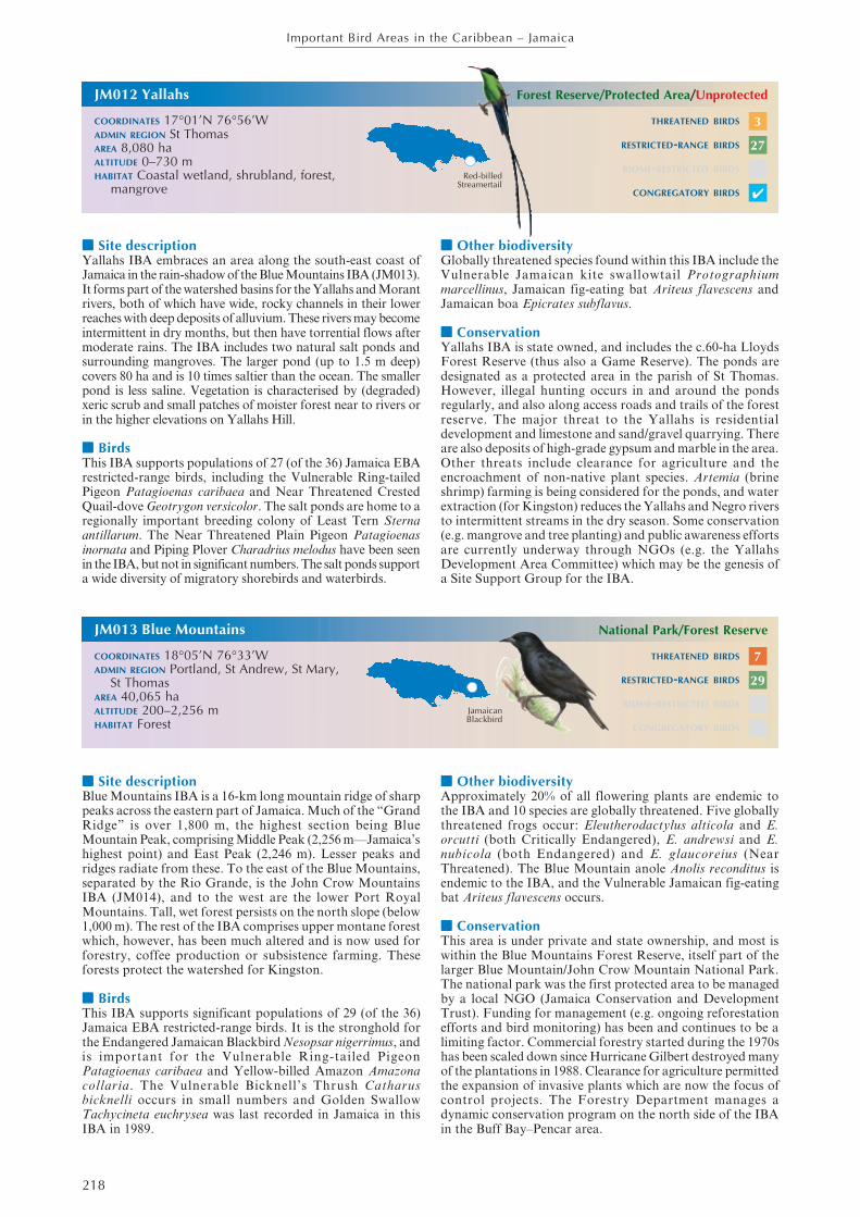
Red-billedStreamertail
THREATENED BIRDS
RESTRICTED-RANGE BIRDS
BIOME-RESTRICTED BIRDS
CONGREGATORY BIRDS
JM013 Blue Mountains
COORDINATES 18°05’N 76°33’WADMIN REGION Portland, St Andrew, St Mary,
St ThomasAREA 40,065 haALTITUDE 200–2,256 mHABITAT Forest
National Park/Forest Reserve
■■■■■ Site descriptionBlue Mountains IBA is a 16-km long mountain ridge of sharppeaks across the eastern part of Jamaica. Much of the “GrandRidge” is over 1,800 m, the highest section being BlueMountain Peak, comprising Middle Peak (2,256 m—Jamaica’shighest point) and East Peak (2,246 m). Lesser peaks andridges radiate from these. To the east of the Blue Mountains,separated by the Rio Grande, is the John Crow MountainsIBA (JM014), and to the west are the lower Port RoyalMountains. Tall, wet forest persists on the north slope (below1,000 m). The rest of the IBA comprises upper montane forestwhich, however, has been much altered and is now used forforestry, coffee production or subsistence farming. Theseforests protect the watershed for Kingston.
■■■■■ BirdsThis IBA supports significant populations of 29 (of the 36)Jamaica EBA restricted-range birds. It is the stronghold forthe Endangered Jamaican Blackbird Nesopsar nigerrimus, andis important for the Vulnerable Ring-tailed PigeonPatagioenas caribaea and Yellow-billed Amazon Amazonacollaria. The Vulnerable Bicknell’s Thrush Catharusbicknelli occurs in small numbers and Golden SwallowTachycineta euchrysea was last recorded in Jamaica in thisIBA in 1989.
■■■■■ Other biodiversityApproximately 20% of all flowering plants are endemic tothe IBA and 10 species are globally threatened. Five globallythreatened frogs occur: Eleutherodactylus alticola and E.orcutti (both Critically Endangered), E. andrewsi and E.nubicola (both Endangered) and E. glaucoreius (NearThreatened). The Blue Mountain anole Anolis reconditus isendemic to the IBA, and the Vulnerable Jamaican fig-eatingbat Ariteus flavescens occurs.
■■■■■ ConservationThis area is under private and state ownership, and most iswithin the Blue Mountains Forest Reserve, itself part of thelarger Blue Mountain/John Crow Mountain National Park.The national park was the first protected area to be managedby a local NGO (Jamaica Conservation and DevelopmentTrust). Funding for management (e.g. ongoing reforestationefforts and bird monitoring) has been and continues to be alimiting factor. Commercial forestry started during the 1970shas been scaled down since Hurricane Gilbert destroyed manyof the plantations in 1988. Clearance for agriculture permittedthe expansion of invasive plants which are now the focus ofcontrol projects. The Forestry Department manages adynamic conservation program on the north side of the IBAin the Buff Bay–Pencar area.
THREATENED BIRDS
RESTRICTED-RANGE BIRDS
BIOME-RESTRICTED BIRDS
CONGREGATORY BIRDS
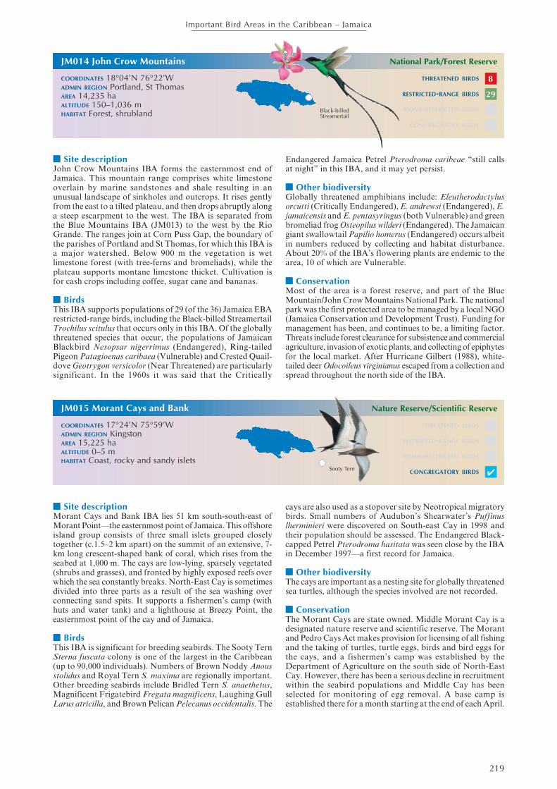
JamaicanBlackbird
3
27
✔
7
29
219
Important Bird Areas in the Caribbean – Jamaica
■■■■■ Site descriptionJohn Crow Mountains IBA forms the easternmost end ofJamaica. This mountain range comprises white limestoneoverlain by marine sandstones and shale resulting in anunusual landscape of sinkholes and outcrops. It rises gentlyfrom the east to a tilted plateau, and then drops abruptly alonga steep escarpment to the west. The IBA is separated fromthe Blue Mountains IBA (JM013) to the west by the RioGrande. The ranges join at Corn Puss Gap, the boundary ofthe parishes of Portland and St Thomas, for which this IBA isa major watershed. Below 900 m the vegetation is wetlimestone forest (with tree-ferns and bromeliads), while theplateau supports montane limestone thicket. Cultivation isfor cash crops including coffee, sugar cane and bananas.
■■■■■ BirdsThis IBA supports populations of 29 (of the 36) Jamaica EBArestricted-range birds, including the Black-billed StreamertailTrochilus scitulus that occurs only in this IBA. Of the globallythreatened species that occur, the populations of JamaicanBlackbird Nesopsar nigerrimus (Endangered), Ring-tailedPigeon Patagioenas caribaea (Vulnerable) and Crested Quail-dove Geotrygon versicolor (Near Threatened) are particularlysignificant. In the 1960s it was said that the Critically
Endangered Jamaica Petrel Pterodroma caribeae “still callsat night” in this IBA, and it may yet persist.
■■■■■ Other biodiversityGlobally threatened amphibians include: Eleutherodactylusorcutti (Critically Endangered), E. andrewsi (Endangered), E.jamaicensis and E. pentasyringus (both Vulnerable) and greenbromeliad frog Osteopilus wilderi (Endangered). The Jamaicangiant swallowtail Papilio homerus (Endangered) occurs albeitin numbers reduced by collecting and habitat disturbance.About 20% of the IBA’s flowering plants are endemic to thearea, 10 of which are Vulnerable.
■■■■■ ConservationMost of the area is a forest reserve, and part of the BlueMountain/John Crow Mountains National Park. The nationalpark was the first protected area to be managed by a local NGO(Jamaica Conservation and Development Trust). Funding formanagement has been, and continues to be, a limiting factor.Threats include forest clearance for subsistence and commercialagriculture, invasion of exotic plants, and collecting of epiphytesfor the local market. After Hurricane Gilbert (1988), white-tailed deer Odocoileus virginianus escaped from a collection andspread throughout the north side of the IBA.
THREATENED BIRDS
RESTRICTED-RANGE BIRDS
BIOME-RESTRICTED BIRDS
CONGREGATORY BIRDS
JM015 Morant Cays and Bank
COORDINATES 17°24’N 75°59’WADMIN REGION KingstonAREA 15,225 haALTITUDE 0–5 mHABITAT Coast, rocky and sandy islets
Nature Reserve/Scientific Reserve
■■■■■ Site descriptionMorant Cays and Bank IBA lies 51 km south-south-east ofMorant Point—the easternmost point of Jamaica. This offshoreisland group consists of three small islets grouped closelytogether (c.1.5–2 km apart) on the summit of an extensive, 7-km long crescent-shaped bank of coral, which rises from theseabed at 1,000 m. The cays are low-lying, sparsely vegetated(shrubs and grasses), and fronted by highly exposed reefs overwhich the sea constantly breaks. North-East Cay is sometimesdivided into three parts as a result of the sea washing overconnecting sand spits. It supports a fishermen’s camp (withhuts and water tank) and a lighthouse at Breezy Point, theeasternmost point of the cay and of Jamaica.
■■■■■ BirdsThis IBA is significant for breeding seabirds. The Sooty TernSterna fuscata colony is one of the largest in the Caribbean(up to 90,000 individuals). Numbers of Brown Noddy Anousstolidus and Royal Tern S. maxima are regionally important.Other breeding seabirds include Bridled Tern S. anaethetus,Magnificent Frigatebird Fregata magnificens, Laughing GullLarus atricilla, and Brown Pelican Pelecanus occidentalis. The
cays are also used as a stopover site by Neotropical migratorybirds. Small numbers of Audubon’s Shearwater’s Puffinuslherminieri were discovered on South-east Cay in 1998 andtheir population should be assessed. The Endangered Black-capped Petrel Pterodroma hasitata was seen close by the IBAin December 1997—a first record for Jamaica.
■■■■■ Other biodiversityThe cays are important as a nesting site for globally threatenedsea turtles, although the species involved are not recorded.
■■■■■ ConservationThe Morant Cays are state owned. Middle Morant Cay is adesignated nature reserve and scientific reserve. The Morantand Pedro Cays Act makes provision for licensing of all fishingand the taking of turtles, turtle eggs, birds and bird eggs forthe cays, and a fishermen’s camp was established by theDepartment of Agriculture on the south side of North-EastCay. However, there has been a serious decline in recruitmentwithin the seabird populations and Middle Cay has beenselected for monitoring of egg removal. A base camp isestablished there for a month starting at the end of each April.
Sooty Tern
THREATENED BIRDS
RESTRICTED-RANGE BIRDS
BIOME-RESTRICTED BIRDS
CONGREGATORY BIRDS
JM014 John Crow Mountains
COORDINATES 18°04’N 76°22’WADMIN REGION Portland, St ThomasAREA 14,235 haALTITUDE 150–1,036 mHABITAT Forest, shrubland
National Park/Forest Reserve
✔
8
29
Black-billedStreamertail