Romanian - German The influence of German words in Romanian and Romanian words in German.
Upload
douglas-banksCategory
view
224download
1
Romania


Palace of the Parliament

Romanian Atheneum

Union Square

SPHINX of Bucegi

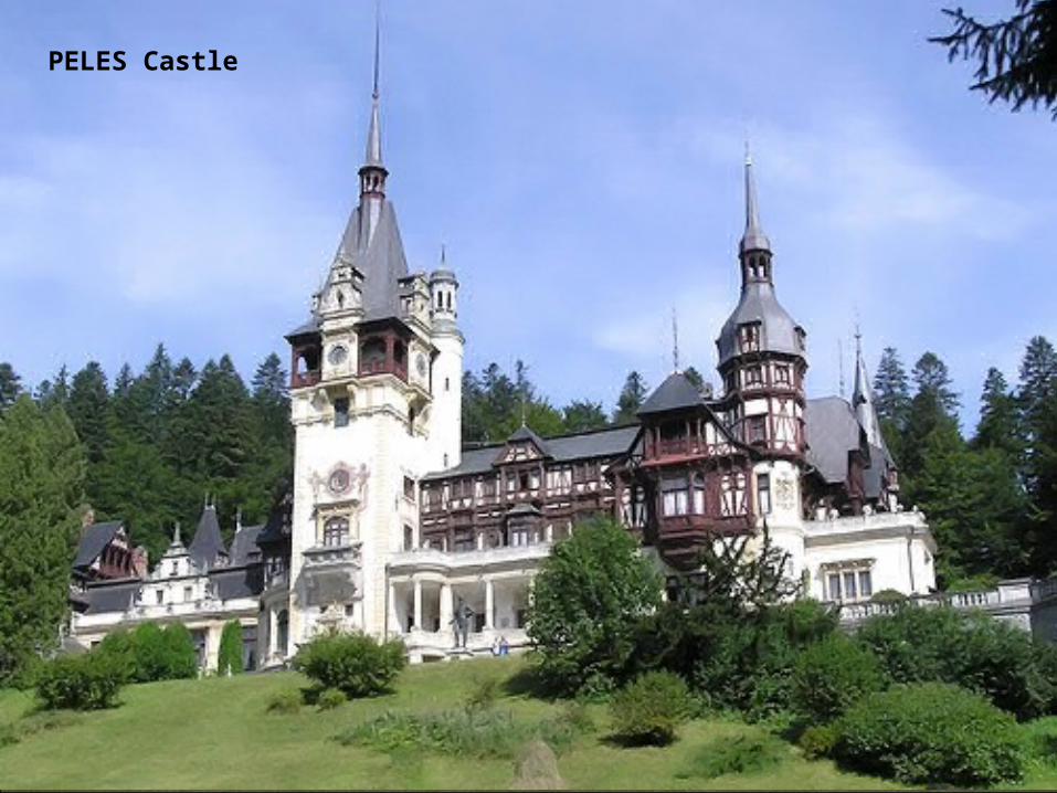
PELES Castle


Location: Southeastern Europe. Border countries: Ukraine (N and E), Moldova (N-E and E), Bulgaria (South), Serbia (S-W), and Hungary (W and N-W)Climate: temperate; cold, cloudy winters with frequent snow and fog; sunny summers with frequent showers and thunderstorms Elevation extremes: lowest point: Black Sea 0 m highest point: Moldoveanu 2,544 m Natural resources: petroleum, timber, natural gas, coal, iron ore, salt, arable land, hydropower Land use: arable land: 41%, permanent crops: 3%, permanent pastures: 21%, forests and woodland: 29%, other: 6% (1993 est.)
Natural hazards: earthquakes most severe in south and southwest; geologic structure and climate promote landslides Environment - current issues: soil erosion and degradation; water pollution; air pollution in south from industrial effluents; contamination of Danube delta wetlands Environment - international agreements: party to: Air Pollution, Antarctic Treaty, Biodiversity, Climate Change, Desertification, Endangered Species, Environmental Modification, Hazardous Wastes, Law of the Sea, Nuclear Test Ban, Ozone Layer Protection, Ship Pollution, Wetlands signed, but not ratified: Air Pollution-Persistent Organic Pollutants, Antarctic-Environmental Protocol, Climate Change-Kyoto Protocol
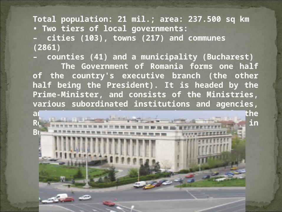
Total population: 21 mil.; area: 237.500 sq km• Two tiers of local governments:– cities (103), towns (217) and communes (2861)– counties (41) and a municipality (Bucharest)
The Government of Romania forms one half of the country's executive branch (the other half being the President). It is headed by the Prime-Minister, and consists of the Ministries, various subordinated institutions and agencies, and the 42 Prefectures. The seat of the Romanian Government is at Victoria Palace in Bucharest.

Prime MinisterMinistry of Public FinanceMinistry of Foreign AffairsMinistry of Agriculture and Rural DevelopmentMinistry of Economy, Commerce and Business EnvironmentMinistry of Administration and InteriorMinistry of National DefenseMinistry of JusticeMinistry of Labor, Family and Social ProtectionMinistry of Education, Research, Innovation, Youth and SportMinistry of Transport and InfrastructureMinistry of HealthMinistry of Regional Development and TourismMinistry of Environment and ForestsMinistry of Culture and National PatrimonyMinistry of Communications and Information SocietyMinistry of European Affairs


Gorj county has a total area of 5,602 km². The North side of the county consists of various mountains from the Southern Carpathians group. In the West there are the Vulcanului Mountains, and in the East there are the Parâng Mountains and the Negoveanu Mountains. The two groups are split by the Jiu River.
Neighbours: Vâlcea County in the East, Mehedinţi County and Caraş-Severin County in the West, Hunedoara County in the North and Dolj County in the South.
The predominant industries in the county are:Mining equipment industry.Food and beverages industryTextile industry.Mechanical components industry.Glass industry.Wood industry.

The coal is extracted in the North of the county, near Motru and Rovinari. There are two big thermo electrical power plants at Rovinari and Turceni, and some hydro-electrical power plants. The county is the biggest electricity producer in Romania with 36% of the country's electricity. Due to the decrease in mining activity, the county has one of the highest unemployment levels in the country.
The main touristic destinations are:Brancusi monuments from Tg Jiu, Tismana Monastery, Parâng MountainsPolovragi Monastery.

Ţicleni town is situated on the valley of Cioiana brook, surrounded by the sub-Carpathian hills between Jiu and Gilort ( Bran’s Hills), in the northern part and the Getic Plateau in the southern part of the settlement.
From the geographical point of view, Ticleni is situated in the south-western part of Romania and belongs to the hilly region Oltenia. Ticleni town is situated at the half of the distance between Jiu and Gilort, in a cultural interference area.

The town is made up of the old villages: Ţicleni, Tunşi and Răşina, each with its own history. The town has an area of 7894 ha and a population of 5280 inhabitants. Ticleni is situated along CR 675, crossed by CR 674A and 5 km far from the ER 79. Distances: Tg-Jiu;/23 km; Tg-Cărbuneşti – 15 km; Craiova airport: 82 km Pitesti highway: 170 km .

There are pieces of evidence regarding the history of Ticleni locality: the fossil maxillary of mammoth and other pre-historical animals discovered on Valley of Morii and Valley of Cioiana. The fragments of ceramics, the carved stone tools found on these places attest the presence of the primitive man, who “practiced” activities, such as: pottery, weaving, wood processing. There is also the site 30 A 039 – Ţicleni town, fortress from the Geto-Dacian period. The oldest written document dates from September 17th 1612, issued in Targoviste citadel in which there are mentioned the borders of Tunsi village.The climate is temperate-continental, with slight Mediterranean influences, proved by fig, lily, ivy, hornbeam, marten, turtle, secular oak etc.

TICLENI TOWN HALL

Welcome to Ticleni!