
Remote sensing and insular environments : the use of...
18
"PIX' ILES 90" Nc:n.unéa - Tahiti. 19 - 24 no'Vernbre 1990 Pl REMOTE SENSING AND INSULAR ENVIRONMENTS ; THE USE OF REMOTE SENSING IN FRENCH POLYNESIA : STATUS AND TRENDS TELEDETECTION ET MILIEUX INSULAIRES: L'UTILISATION DE LA TELEDETECTION EN POLYNESIE FRANCAISE, BILAN ET PERSPECTIVES L. LOUBERSAC station Polynésienne de Télédétection BP 601 Tahiti - POLYNESIE FRANCAISE. ABSTRACT Once the geographic context specifie to the French Polynesia archipelago has been presented the necessitees and interest in delivering a standardized geographic information to serve management and economic development tools are underligned. For such goals the strategy set up in French Polynesia in partnership beetween the State and the Territory is depicted. This strategy aims at identifying human ressources, spreading the required information, launching demonstration projects, involving the final user in the definition of the product and facilitating the transfers of know-how. Sorne of the realization achieved and in progress are presented : atolls maping, GIS elaboration for adminitrative and technical management of pearl cul ture activities, three dimension representations of relief, cartography of meteo oceanic parameters and assistance to fisheries. It is concluded on the basis of the resul ts achieved in French Polynesia, that there is a great interest in launching a wide programme including the supply of the basic geographic information which is generally poor in the South Pacifie and the elaboration of derived tools to help managing the activities, resources and environment. ,9 FEV. 1996 111111111111 010003869 O. R.S. T. O. M. Fonds Documentaire N°: y30 6 4 r.ntp 2 A 297
-
Upload
phungkhanh -
Category
Documents
-
view
214 -
download
1
Transcript of Remote sensing and insular environments : the use of...

"PIX' ILES 90" Nc:n.unéa - Tahiti. 19 - 24 no'Vernbre 1990
Pl
REMOTE SENSING AND INSULAR ENVIRONMENTS ; THE USE OF REMOTESENSING IN FRENCH POLYNESIA : STATUS AND TRENDS
TELEDETECTION ET MILIEUX INSULAIRES: L'UTILISATION DE LATELEDETECTION EN POLYNESIE FRANCAISE, BILAN ET PERSPECTIVES
L. LOUBERSAC
station Polynésienne de TélédétectionBP 601 Tahiti - POLYNESIE FRANCAISE.
ABSTRACT
Once the geographic context specifie to the FrenchPolynesia archipelago has been presented the necessitees andinterest in delivering a standardized geographic informationto serve management and economic development tools areunderligned. For such goals the strategy set up in FrenchPolynesia in partnership beetween the State and the Territoryis depicted. This strategy aims at identifying humanressources, spreading the required information, launchingdemonstration projects, involving the final user in thedefinition of the product and facilitating the transfers ofknow-how. Sorne of the realization achieved and in progress arepresented : atolls maping, GIS elaboration for adminitrativeand technical management of pearl cul ture activities, threedimension representations of relief, cartography of meteooceanic parameters and assistance to fisheries.
It is concluded on the basis of the resul ts achieved inFrench Polynesia, that there is a great interest in launchinga wide programme including the supply of the basic geographicinformation which is generally poor in the South Pacifie andthe elaboration of derived tools to help managing theactivities, resources and environment.
, 9 FEV. 1996
111111111111010003869
O. R.S. T. O. M. Fonds Documentaire
N°: y3064r.ntp 2 A
297

RESUME
Après une présentation succinte du contexte géographiquespécifique aux archipels tropicaux du type de celui représentépar la Polynésie française, on argumente l'intérêt de la miseà disposition d'une information géographique standardisée àl'origine de la mise en forme d'outils de planification desactivités et de décision en matière de développementéconomique. A cette fin on explicite la stratégie mise enplace en Polynésie française dans le cadre d'un partenariatétabli entre l'Etat et le Territoire. Cette stratégie vise àcréer les ressources humaines nécessaires, à transmettre leplus largement possible les informations requises, à lancerdes projets de démonstration, à impliquer directementl'utilisateur dans la conception du produit qu'il requiert etfaciliter ainsi les transferts. On présente ensuitesuccintement plusieurs réalisations effectuées : cartographiedes atolls, élaboration d'un GIS d'aide à la gestionadministrative et technique de la perliculture, représentationtridimensionnelle du relief, cartographie des paramètresmétéo-océaniques et aide à la pêche.
On conclue, sur la base des résultats acquis en Polynésiefrançaise, sur l'intérêt du lancement d'un vaste programme demise à disposition de l'information géographique de base lepl us souvent déficiente dans le Pacifique et d'élaborationd'outils de planification des activités qui en seraientdérivés.
INTRODUCTION
French Polynesia as most of insular States and Territoriesof South Pacifie has a specifie geography. It is made of 118islands and three main types of domains can be noticed :
- An emerged part (approximatively 4 000 s.q. km).- Lagoons and reefs (more than la 000 s.q. km).- An open sea (EEZ of 4 500 000 s.q. km).
The first domain: lands consists of new or more or lessvolcanic structures (high islands) or old and submergedvolcanic ones (atolls).
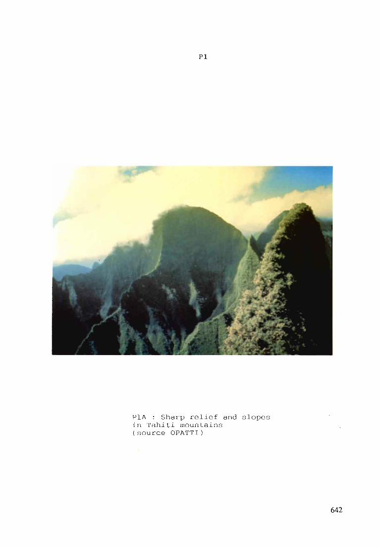
- In the first case, high islands, the relief is weIl-eut(al ti tudes are often over l OOOm) and slopes are generallysharp (colour fig. PIA). The living space is poor and thedensity of the population is high. For these reasons, the useof this rare living space generates opposition between townplanning, agriculture, environmental protection, road network,industrial and energy developments, etc.).
- In the second case, atoll, the areas at stake are poor,relief is rather nonexistent or trivial (colour fig. P1B).
298

These areas are divided into islets varying of size more orless accessible where there are villages and plantations ofcoconut-tree, the only traditional resource.
The second domain, lagoon and reef, corresponds to eitherhigh islands lagoons or atolls lagoons.
- In the first case, high islands, the lagons are narrowand generally of small size, colour fig. PIC. Because of thehigh density of permanent population which settled in the fIatpart of the coast then on the next high plains and because ofthe seasonal touristic population also settled near thecoasts, these lagoons are areas subj ect to an over-exploi teduse (traditional fish activities, exploitation of coral sand,tourism, boating, coastal development, ... ) aggravated, in someareas, by a constant degradation of the environment due to theconcentration of urban and industrial effluents, sewage,suspended sediments from the erosion of high plains underconstruction ...
In the second case, atoll, the lagoons have largesurfaces, colour fig. PID (more than I 000 s.q.km inRangiroa). They communicate or not wi th the open sea throughpasses or hoa. These large lagoons are often characterized bythe presence of numerous coral pinacles where marine lifeconcentrates. The local population finds in them two types ofresources :
- Fish which is sold and exported to the consumers centers(Tahiti).
- Mothers of pearl and black pearls which represent thefirst exportation in value of the territory.
A potential resource which is not exploited at the presentmoment (phosphates) is interesting for some inhabitants of thelagoons. On the other hand, the recent developement of pearlfarming activities, which proved to be profitable, leads to arush for virgin lagoonal areas (more than 600 applications formaritime concessions within the nine first months of 1990, SMAsources) which raised the question of administration andtechnical management of these area in more than thirty atolls.
The third domain finally open-sea corresponds to thevastness of the sea that surrounds the five archipelagoes ofFrench Polynesia and while the variable depths are generallyvery important. The potential resources of the ExclusiveEconomical Zone either mineraI or living, are apparentlyimportant but generally scattered.
In addition to these three speci fic geographical areas,the distance between each island and group of islands needs tobe noticed. This remoteness, in addition to the difficulty ofcommunication, cornplicates a L'l efforts of planning andrational management of areas and resources.
The vision of the geographical conditions that haveprecedently studied and the difficul t task of applying
beenthe
299

means of conventional observation, in si tu measures, aerialsurveys, sea campains, render the map-making base of the threegeographical zones studied before incomplete and out of date.This penalized the emerged islands and lagoons areas fromwhich the essential of the Territory wealth is presentelyextracted. This is the case of several islands like Marquezasand Australes and almost of aIl atolls of Tuamotu-Gambier.
Consequently, it appears that :
In French Polynesia, there is no standard geographicdata base with easy manipulation (digital data).
There is no integrated tools that deal with thegeographic information studied before which will allow thepeople who care about development, planning and exploiters andmanagers of the resource to take decisions on objective basesand criteria.
the various scales concerning the three domainsemerged islands, lagoons and open-sea are
as the means of investigation that deal with theseare.
Besides,studieddifferent :three zones
Emerged landsLagoonsZEE
from 1/1 000 - 1/5 000 to 1/250 000from 1/10 000 - 1/25 000 to 1/250 000from 1/100 000 to 1/1 000 000 and less
However, i t appears that a geographic information aboutthe three fields should be associated. This is particularlynecessary for example at scale 1/50 000 for the two groups ofemerged islands and lagoons which cannot be disassociatedbecause the compulsory measures about planning and managementcannot be taken into account for lands or lagoons withoutconsidering the points that apply to the other.
The aerospace Remote Sensing of high and low resolutionseems to be able to provide at large and medium scales aboutthe emerged parts and lagoons and at small scales for the opensea, in addition to the conventional methods of investigation,a standard geographic information, which is reproducible, upto date, digital, easy to handle and repeti tive and would beused for :
- The creation of cartographie models (image-maps),- The setting-up of essential data bases,- creation of Geographie Information Systems use fuI for
management of natural areas and its resources.
That is the reason why, in addition and in complement tothe projects already established or on projects in FrenchPolynesia (topographie, hydrographie maps, cadastral data,evaluations of resources of the EEZ, etc.) a program ofelaboration of handy geographycal information from RemoteSensing origine to be set up has been decided in accordancewith the strategy hereafter mentioned.
300
A STRATEGY FOR THE DEVELOPMENT/REMOTE SENSING APPLICATIONSAND GEOGRAPHIC INFORMATION SYSTEMS USED
IN FRENCH POLYNESIA
The strategy consists of four main steps
Step 1 : Ta create in French Po1ynesia a too1 and a necessarycritica1 human resource
To this purpose and from the beginning, the Territory ofFrench Polynesia (Ministry of the Sea, of Energy, Equipment,the Post Office and Telecommunications) has associated itselfwith IFREMER which had a long-lasted experience about researchand development in Space Remote Sensing and production offinal resul ts. This association allowed in 1988 the creationof the Polynesian Remote Sensing Station equipped withcomputing system, digi tal image processing, digi talcartography, restitution and necessary softwares means( LOUBERSAC , 1990). Within the framework of this partnership,the financial means are in joint ownership wi th IFREMER andthe Terri tory of French Polynesia. The local staff has beentrained in Universi ties and technical colleges in France andit has learned the complementary necessary technical trainingthrough IFREMER.
Step 2 To get tuned in, to analyse and to manage theproblems that have not been resolved in the Territory and inthe South Pacifie.
In order to facilitate contacts between the potentialdemand and the answers to be proposed, the Polynesian RemoteSensing Station is ruled by two committees :
A Technical Commi ttee, which meets about every threemonths and is open to any representative of a technical oradministrative service or of private interests. It assessesthe demands and completions in progress and proposes projectsand programs.
- An IFREMER-Territory Sterring Committee which submits tothe political authorities the project and programme appraisalsand proposes action schemes in the frame of middle term plans.
In addition ta these committees, promotion and informationoperations have been enforced in the Territory
Wri tting of an quarterly informationactivities of the Polynesian Remote Sensingthe brochure "SPT Infos" ;
note about theStation through
- Making of posters destined ta the general public andpresenting the islands of French Polynesia photographed fromspace, of book lets , some of them translated into tahi tian,etc.
301

Publication of articles in the media (newspaper,television) .
As well as overseas :
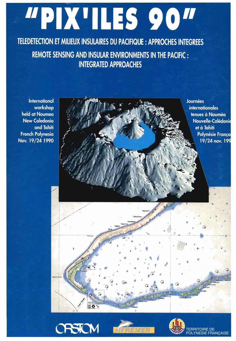
- Organization in late 1990, in collaboration with ORSTOMand the Territories of French Polynesia and New Caledonia, ofinternational days devoted to the workshop "PIX'ILES 90",remote sensing and island environments in the Pacificintegrated approaches.
Step 3 : To launch pilot and demonstration projects
In compliance with the analysis of the priority needs inFrench Polynesia, many pilot proj ects have been launched indirect association with the organisms in need :
- Basic map-making ("image-maps" or "spacemaps").- Digital elevation models.- Availability of digital geographic data.- Development of specific tools (GIS).
Besides, considering that many countries in South Pacific,just as French Polynesia, experiment problems in similarfields, sorne pilot projects have been initiated overseas (Cookislands, Fidji, Tonga, SOPAC, etc.).
Step 4 : To facilitate the access of the needing bodies to theknow-how, the data and the systems so that the final user isdirectly involved and therefore, to bring about transfers.
This stage of the work is, to us , vital. In effect, i tappears too often that the utilization of remote sensing orthe handling of geographic data are mostly done by specialistsand that the transfer of know-how is not performed. Ourphilisophy consits in wanting both to let the final user(administrative or technical service or private body)determine with the SPT the list of this needs, and to initiatehim to the tool, the methods and techniques so that he cantake care of them entirely. This phase therefore requires manytravels between our agents and the final user service'semployees, all of them working together in spite of thepotential institutional barriers (different organisms oradministrations) in a real project structure.
EXAMPLES OF ACHIEVEMENTS AND PROJECTS UNDER WAY
Cartography of atolls (Tuamotu archipelago)
As we already mentioned it, this map-making is veryincomplete. The implementation of the previous strategy hasgenerated the first association between the Hydrographic and
302

Oceanographie Service of the French Navy (MOPMission in the Pacifie) and the SPT, enabling :
Oceanographie
To set up files forcampains, (see the posterSHOMjMOP - SPT 1990).
the preparation of hydrographiededicated to these activities
- To develop interactive application program (softwares)which can be directly used by the agents of the MOP at theSPT.
To conceive then create image-maps said of "Pacifie"standard (FOURGASSIE, 1990) which correspond to standardsadapted to the needs, environments and economic context of theislands. Effectively, i t would not be realist to undertakecostly cartography on this region following the conventionalhydrographie and topographie standards.
The training effect generated by the dynamic required forthis achievement has made that, presently, other partenersinvolved by the same type of product participate in itscreation by bringing their own set of themes for instance,the Technical Service of Town Planing, (CHAMPOMIER, 1990) forthe making of village maps and the toponymy survey theTourism office the Rural Economy Service the Sea andAquafarming Office, etc.
Working out a Geographie Information System (SIGMA Poe Rava)of assistance for the administrative and technical managementof pearl-farming
Given the needs caused by the disorderly occupancy of theatoll lagoons and their aquafarming, the Sea and AquafarmingService (SMA) (HAUTI, 1990) which, in collaboration with theState Property Service, is responsible for controlling thepearl-farming activities and managing the maritimeconcessions, has joined wi th the SPT to firstly make imagemaps of assistance for the ground inventory work. As theircollaboration developped they created the methods, softwareand systems which presently form a Geographie InformationSystem which would be presented during this workshop (CHENONand al., 1990), a decision tool available for both territorialtechnical services and pearl aquaculture farmers, allowing animproved management of the lagoon spaces now based onobj ective cri teria. l t appears extremely important to us toemphasize the fact that the Geographie Information Systemelaborated presently causes a calling into question of theactual legislation in French Polynesia about the maritimeconcession management which is not weIl adapted to thesituation because it is not based on administrative andtechnical documents that are reliable, reproductible andhardly questionable such as those provided by the GIS SIGMAPoe Rava.
303

Digital Elevation models
Firstly, we studied the problems of planning and managingthe land spaces in the islands. Many users have requiredDigital Elevation Models (Environment Commission, TownPlanning Service, Plan Office, Equipment Service, RuralEconomy Office) on two scale levels :
- At 1/50 000 or equivalent for the creation of globalplanning schemes.
- At 1/5 000 or equivalent for cadatral survey works.
As a first stage, the SPT joined with ORSTOM Montpellier(DEPRAETERE, 1990) to participate in the development and theintegration into these micro-computer devices of softwares forthe making of Digital Elevation Models and by-products (slope,orientation, draining off and other maps).
As a second stage, the SPT ini tiated the creation of athree dimensional model-making of the island of Aitutaki (CookIslands) and i ts lagoon which will be presented during theworkshop (ANDREFOUET and al., 1990) , and then of the bay ofTaiohae, Nuku Hiva, in the Marquesas archipelago, in theframework of the General Scheme of Planning of FrenchPolynesia (SAGE).
Cartography of meteo-oceanic parameters and development ofopen-sea fishing flotilla :
Presently in French Polynesia, the developping localindustrial tuna fishery is responsible for the exploitation offishing zones located in the South of the Austral islands andin the North of the Marquesas. There is a conjunction betweenthe development of a flotilla (18 tuna boats anticipated), thesetting up of a satellite reception station (GOES) in theMeteorological Service at the Airport of Faaa, project to bepresented during the workshop (BOSSARON, 1990), theintegration of softwares allowing to map the sea surfacethermal fields from space data at the SPT, also presentedduring this PIX' ILES workshop, (GOHIN, 1990), the creation ofan halieutic research group combined between ORSTOM andIFREMER and the existence of two territorial services incharge of the management and development of fisheries that arethe Sea and Aquafarming Service (SMA) and the Corporation forthe Development of Aquafarming and Marine Activities (EVAAM).It has generated a debate about a survey programme for themeteo-oceanic environment parameters in relation with thepelagic resources so as to undertake fundamental research asfishing assistance and management of the exploitablepotential. Such a program would be integrated into the globalevaluation undertaking of the Exclusive Economic Zone ofFrench Polynesia which presently is under study and could beused, in the frame of a regional cooperation, to help SouthPacific countries (willing to do so) to start an exploitationof the pelagic resources of their own economic zone and tohave better management of that potential.
304

they resul tas from the
cope without by the
CONCLUSION
We have presented the basis of the strategy implemented inFrench Polynesia in the frame of a partnership between theTerritory and IFREMER, so as to develop a rational utilizationof the remote sensing tool an so that the authori ties incharge notably of the planning and management of the resourcesand environment can have the use of optimized decision tools.This strategy aims at bringing the resul ts and findings ofhigh technology (satellite observation, image processing,data-bases and Geographic Information Systems) to the moreusers possible in the Territory with their own participation,both to lower the costs and for the advantage of the wholePolynesian community.
The achievement of such obj ectives, wetherfrom the research findings and their applicationsimplementation of advanced technologies, has tovarious difficulties which are progressively ironedstrategy herein exposed. Those difficulties are :
- An information problem. The tool and its potential arepoorly known is this area because of a prior scientific andtechnical education such as that acquired by sorne otherasiatic, african and latino-american tropical countries thanksto the experiments lead on the basis of LANDSAT data in the70's and SO's.
- A communication problem. This affects the communicationtoward the decision-makers who are to be persuaded to use anadvanced technology and maintain a high level of research asweIl as that destined to the final users who want to have aproduct directly an easily digestible and applicable to theirsituation.
- A training problem, notably from the local technicianwho want to understand but are somehow affraid of the tool' shigh technical level.
- An adaptation problem of the products to the concretedifficul ties met in the islands for example, the problem ofthe management of marine concession which are somehow similarin nature to those encountered in the coastal and sea space ofdeveloped countries but which expression is different and hardto obtain.
- A problem in the implementation of the tool within thelocal conditions where the fragili ty of the computer systemsand the maintenance are issues which may be crippling.
If in one hand it has been essential to ensure the neededtechnological boom which is on going here to bring thepotential users to the tool together right at the beginning.On the other hand we also whish in French Polynesia we wouldactively participate in the necessary global effort, mostly incoastal zones, lagoons and reefs, to set up a completestandardized and up to date geographic information available
305
and usable in the South Pacific. This part of the worldremains one of the last region where the information at thedawn of the 21 th century is still disparate, uncomplete andoften expired. It is vital and urgent to do something incompliance for example wi th the ideas underlined by Dr. H. L.THUNG (THUNG, 1990) who unfortunately had to cancell hisparticipation to this meeting, and it seems necessary tolaunch a wide range programme of cartography and disposaI ofdigital geographic information, notably resulting fromaerospace data, about the reefs, lagoons and coasts of theSouth Pacific countries.
At last, we would like to take an active part in theattempt of making this geographic information as compatible aspossible from island to island, State to Territory andTerri tory to State. We deeply believe that this informationwhich relates to a common inheritance can be gradually put atthe disposaI of everyone in the region so that we can aIl talkabout the same thing.
REFERENCES
ANDREFOUET S., F. CHENON, L. LOUBERSAC, H. VARET, B.WIBAUX, 1990. Modélisation bathymétrique d'un lagon d'atoll,application à la modélisation tridimensionnelle d'une île etde son lagon. Actes du Colloque "PIX' ILES 90", Remote Sensingand t neul.er Environments in the Pacifie IntegratedApproaçhes. Nouméa - Tahiti, 19 - 24 nov. 1990.
BOSSARON G., R. LASBLEIZ, 1990. Projet SIRUSImplantation d'une station de réception GOES à l'aéroport deFaaa. Actes du Colloque "PIX' ILES 90", Remote Sensing andInsular Environments in the Pacifie Integrated Approaches.Nouméa - Tahiti, 19 - 24 nov. 1990.
CHAMPOMIER R, 1990. Une méthode simple d'élaboration demosaïques photographiques MTU des îles basses à partir d' unfond SPOT panchromatique de niveau 2A. Poster presented at theinternational workshop "PIX'ILES 90", Remote Sensing andInsular Environments in the Pacifie : Integrated Approaches.Nouméa - Tahiti 19 - 24 Novembre 1990.
CHENON F., H. VARET, L. LOUBERSAC, S. GRAND, A. HAUTI,1990. "SIGMA POE RAVA : système d'information géographique duService de la Mer et de l'Aquaculture. Un outil de gestion dudomaine public maritime pour la perliculture. In Actes duColloque "PIX'ILES 90", Remote Sensing and InsularEnvironments in the Pacifie : Integrated Approaches. Nouméa Tahiti, 19 - 24 nov. 1990.
DEPRAETERE C., 1990. Notices OVNIH, méthode et guide desutilisateurs vol. 4, 5, 6. Laboratoire d'Hydrologie del'ORSTOM Montpellier.
306

FOURGASSIE A., 1990. La spatiocarte marine: une solutionpour la cartographie des atolls polynésiens. In Actes duColloque "PIX'ILES 90", Remote Sensing and InsularEnvironments in the Pacifie : Integrated Approaches. Nouméa Tahiti, 19 - 24 nov. 1990.
GOHIN F., 1990. Synthèse d'images du satellite NOAA pourla cartographide des champs thermiques de surface de la mer.Actes de Colloque "PIX' ILES 90", Remote Sensing and InsularEnvironments in the Pacifie : Integrated Approaches. NouméaTahiti, 19 - 24 nov. 1990.
HAUTI A., 1990. Gestion des concessions maritimes vouées àla perliculture. Problématique et premleres solutions. InActes du Colloque "PIX' ILES 90", Remote Sensing and InsularEnvironments in the Pacifie : Integrated Approaches. NouméaTahiti 19 - 24 nov. 1990.
LOUBERSAC L., 1990. La Station Polynésienne deTélédétection statuts et moyens. In Actes du Colloque"PIX' ILES 90, Remote Sensing and Insu1ar Environments in thePacifie : Integrated Approaches. Nouméa- Tahiti 19 - 24 nov.1990.
8HOM/MOP 8PT, 1990. Les dossiers de préparation decampagnes hydrographiques aux Tuamotu-Gambier. In Actes duColloque "PIX'ILES 90", Remote Sensing and Insu1arEnvironments in the Pacifie : Integrated Approaches. Nouméa Tahiti 19 - 24 nov. 1990.
307
Pl
PlA : Sh a r p relief and slopesin Tahiti moun tains(sourc e OPATT I )
642

Pl
PiS : Flat is lets Manihi i salnds , Tuamotu
(source OPATTI )
643

Pl
PI C : Nar row l ag o on i nTah iti island( sou rce OPATTI)
644

P l
Pl O : Wide l a g o o n in aTuamo t u atol l(sou r c e S. P. T.)
645
1 •
1
1
1
+ '
"PIX'ILE 90"
Journées internationales tenues à Nouméa· Nouvelle-calédonieetà Tahiti· Polynésie Française
19/24 novembre 1990
International workshop held at Noumea • New caledoniaand Tahiti French· Polynesia
November19/241990
ilt:EAfER

© ORSTOM, Nouméa. 1992
Irnprimo par le Centre ORSl DMde Nouméa
Septembre 1992
'"IORSTOU Hou.....~.-:EPROGRAPHIE


