Recent Developments of the NinJo Workstation · Recent Developments of the NinJo Workstation...
40
Recent Developments of the NinJo Workstation Gerhard Eymann, DWD, FEZE [email protected] 13 th Workshop on Meteorological Operational Systems ECMWF Reading, UK Oct. 31 - Nov. 4, 2011
Transcript of Recent Developments of the NinJo Workstation · Recent Developments of the NinJo Workstation...

Recent Developments of the NinJo
Workstation
Gerhard Eymann, DWD, FEZE
13th Workshop on Meteorological Operational Systems
ECMWF Reading, UK
Oct. 31 - Nov. 4, 2011

WKS MOS 13 Nov. 2011 ECMWF
Selected Recent Developments at DWD:
Improvement of Nowcasting Capabilities
New meteorological data
Additional layers, e.g.
NowcastGrid
G-SCIT
Ensembles
WMS
Additional & enhanced functionality, GUI improvements
WKS MOS 13 Nov. 2011 ECMWF
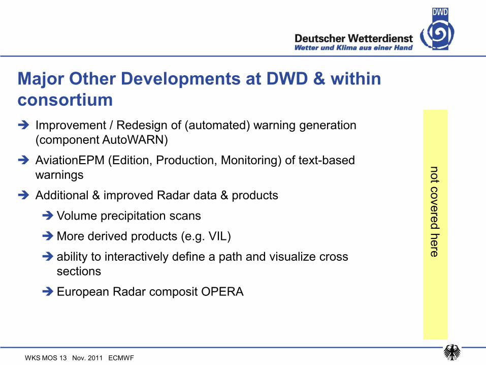
Major Other Developments at DWD & within
consortium
Improvement / Redesign of (automated) warning generation
(component AutoWARN)
AviationEPM (Edition, Production, Monitoring) of text-based
warnings
Additional & improved Radar data & products
Volume precipitation scans
More derived products (e.g. VIL)
ability to interactively define a path and visualize cross
sections
European Radar composit OPERA
not c
overe
d h
ere
WKS MOS 13 Nov. 2011 ECMWF
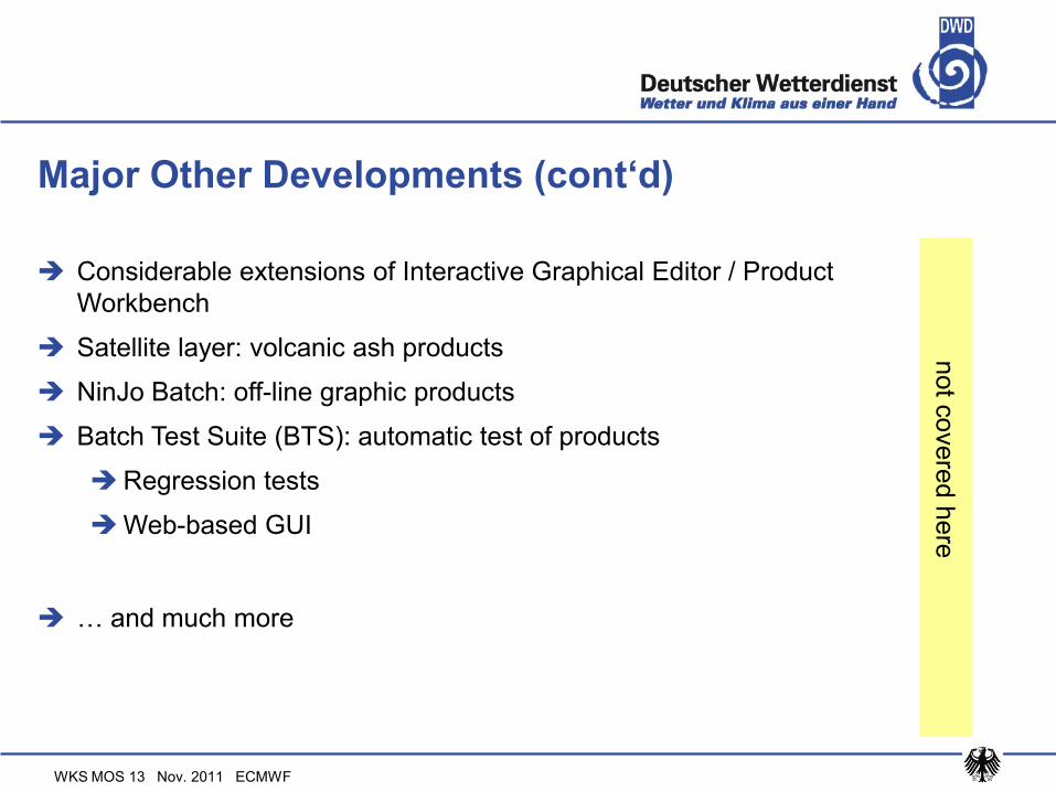
Major Other Developments (cont‘d)
Considerable extensions of Interactive Graphical Editor / Product
Workbench
Satellite layer: volcanic ash products
NinJo Batch: off-line graphic products
Batch Test Suite (BTS): automatic test of products
Regression tests
Web-based GUI
… and much more
not c
overe
d h
ere

WKS MOS 13 Nov. 2011 ECMWF
References, Acknowledgements
EGOWS conferences:http://www.knmi.nl/samenw/egows
http://www.meteo.fr/cic/meetings/2011/EGOWS/presentations.html
See e.g. presentation from Sibylle Haucke http://www.meteo.fr/cic/meetings/2011/EGOWS/EGOWS_2011_presentations/NinJo-Recent-developments-EGOWS2011.pdf
General publications:http://www.meteo.fr/cic/wsn05/resumes_longs/7.13-502.pdf
web site of commercial development & marketing partner (EuMetSys):http://www.ninjo-workstation.com
Background information(Techn. reports from FEZE members, given at DWD workshop May 2011)
S. Trepte: CellMOS, Ein GewitternowcastingS. Trepte: CellMOS, Ein Gewitternowcasting-- und Unwetterwarnsystem und Unwetterwarnsystem
P. James: NowCastMIX - Vorverarbeitung von Nowcasting-Daten für AutoWARN
T. Hengstebeck: Mesocyclone Detection Algorithm and VIL
Thanks to the NinJo team !

WKS MOS 13 Nov. 2011 ECMWF
Technical Developmets: GUI layout
Multi-map layout
Earlier 1 main scene + 0…3 secondary scenes
Now 2 / 4 / 8 … 12 equal-sized scenes
Synchronized in time (optional)
Full functionality for each scene (sep. GUI)
CellView layout
Clients: move to 64 Bit systems (incl. JVM)
OS Win XP-64, Win 7, Linux

WKS MOS 13 Nov. 2011 ECMWF
GUI layout : multiple scenes
Top left: main scene
GUI for each scene(exchange, fullscreen, load/store scenefavorit etc.)

WKS MOS 13 Nov. 2011 ECMWF
GUI layout: CellView for nowcasting
Top left:
main map window
with locator
Bottom left:
cross section
window (active)
Right side:
12 sub-windows
with various Radar
[+ Satellite] data
(same location)

WKS MOS 13 Nov. 2011 ECMWF
Technical issues : GeoTIFF & GML export
Current scene may be exported as GeoTIFF or GML
(certain projections only) and results used / displayed
e.g. in GIS

WKS MOS 13 Nov. 2011 ECMWF
GML export example (visualized by WMS client)

WKS MOS 13 Nov. 2011 ECMWF
Recent Developments: Nowcasting Layer
Data types:
NowcastMIX
CellMOS
RADVOR-OP (earlier in NWP layer)
automatic update of model run
also (as available earlier) automatic update of time
model-run frequency 5 min … 15 min
all visualization methods of grid data possible
Isoline, isoarea, pixel-related, filtering methods

WKS MOS 13 Nov. 2011 ECMWF
Nowcasting Layer : NowcastMix data
Simulteaneous monitoring & analysis of several important types of
input data in order to produce a unique value indicating the kind and
severity of an expected weather event, depending on location
Auto WARN: monitor several data types individually
NowcastMIX: only one (per location) parameter is output
Combined evaluation of relevant data
Has meteorological „intelligence“ through filtering and weighting
Serves as AutoWARN input
WKS MOS 13 Nov. 2011 ECMWF
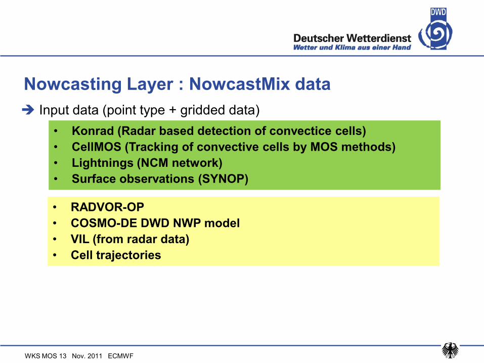
Nowcasting Layer : NowcastMix data
Input data (point type + gridded data)
• Konrad (Radar based detection of convectice cells)
• CellMOS (Tracking of convective cells by MOS methods)
• Lightnings (NCM network)
• Surface observations (SYNOP)
• RADVOR-OP
• COSMO-DE DWD NWP model
• VIL (from radar data)
• Cell trajectories

NowCastMIX
KONRAD
CellMOS
NCM-Blitze
VIL
RadVor-OP
Attributes (e.g. gusts, hail, heavy rain) from… Fuzzy-Logic Rules
(gusts, hail, heavy rain)
=> Warn event
projection to grid Spatial filter
warning areas
Synops COSMO-DE
Calculation frequency : 5 min

WKS MOS 13 Nov. 2011 ECMWF
NowcastMix data
example from 2011-09-11 15h UTC
with lightnings
WKS MOS 13 Nov. 2011 ECMWF
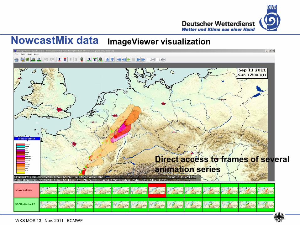
NowcastMix data ImageViewer visualization
Direct access to frames of several
animation series

WKS MOS 13 Nov. 2011 ECMWF
Nowcasting Layer : CellMOS data
CellMOS : a new system to forecast thunderstorms and heavy
precipitation
„MOS“: Model Output Statistics
aktuelle Modellvorhersagen aktuelle Beobachtungen

WKS MOS 13 Nov. 2011 ECMWF
Nowcasting Layer : CellMOS
Input data:
Image / pattern analysis of radar data
Certain criteria to identify a cell
Forecast of cell tracks (various probabilities)
Elements forcasted:
• Radar reflectivities (RX-product/composit, 1x1 km², every 5 min)
• Lightnings (NCM-Netz, every min)
• DWD GME-NWP model (00, 12 UTC)
• Precipitation (using Z-R relation)
• Hail (grain size) (empirically)
• (convective) Wind gusts (empirically)
• Lightning frequerncy

WKS MOS 13 Nov. 2011 ECMWF
CellMOS precipitation forecast (next hour)
With Radar precipitation data, product RH, precipitation in mm/h (transparent)

WKS MOS 13 Nov. 2011 ECMWF
CellMOS wind gust probability

WKS MOS 13 Nov. 2011 ECMWF
Nowcasting Layer : RADVOR-OP data
Data provided by climatological / hydrological dept.
project Radolan
in NWP layer earlier
Radar based forecast and analysis of precipitations
Various products, also calibrated
Forecast for ½ and 1 hour, available in steps of 5 & 15 min.

WKS MOS 13 Nov. 2011 ECMWF
Nowcast-(Grid-)Layer showing
DWD‘s RADVOR-OP product
for „precipitation of the next
hour“
RADVOR-OP data

WKS MOS 13 Nov. 2011 ECMWF
SCIT & RADVOR-OP data
SCIT Konrad data +
RADVOR-OP
(exp. 1hr precipitation)
near Berlin
(May 31, 2011)

WKS MOS 13 Nov. 2011 ECMWF
Ensemble Layer
Models
COSMOS_DE_EPS
COSMO-LEPS
ECMWF_EPS
PEPS
More visualization types for meteograms

WKS MOS 13 Nov. 2011 ECMWF25
High probability of YARSA („Yet Another Rainy Sunday Afternoon“ ;-), correctly predicted by the Cosmo-DE-Ensemble
Ensemble Layer
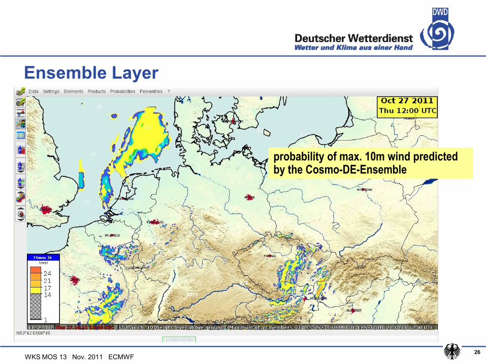
WKS MOS 13 Nov. 2011 ECMWF26
probability of max. 10m wind predicted by the Cosmo-DE-Ensemble
Ensemble Layer

WKS MOS 13 Nov. 2011 ECMWF
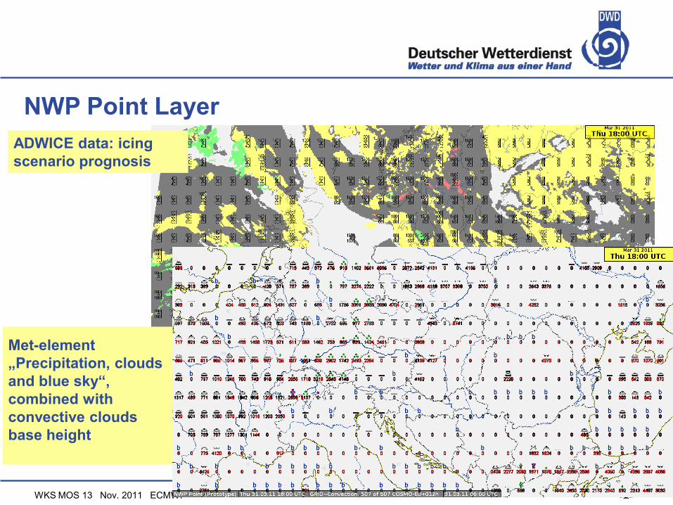
Numerical Weather Forecast Point Layer
Specialized combi plots for gridded model data
Visualization methods taken from point data layer
Maps for aviation & maritime purposes
WAFC data
ADWICE data
Wave height models
Used also for batch products
WKS MOS 13 Nov. 2011 ECMWF
ADWICE data: icing
scenario prognosis
NWP Point Layer
Met-element
„Precipitation, clouds
and blue sky“,
combined with
convective clouds
base height

WKS MOS 13 Nov. 2011 ECMWF
NWP Point Layer - arrow visualistion of windwave and with size of arrow
defined by wave height
- if an arrow is large enough the wave period is shown as
number inside the arrow
- dynamic thin out depending on the available space

WKS MOS 13 Nov. 2011 ECMWF
Generic-SCIT layer: Integration of Cb-TRAM and Rad-
TRAM data
Data types:
Konrad (no. of radar echo area above ~ 56 dB > area)
PU (radial velocity / wind derived from Radar data)
CellMOS cells
Mesocyclon cells
TRAM = “Tracking and Monitoring” of severe convection events
Cb-TRAM – using MeteoSat-8 data
Rad-TRAM – using Radar data
Algorithms of DLR implemented

WKS MOS 13 Nov. 2011 ECMWF
Generic-SCIT layer: Integration of Cb-TRAM & Rad-
TRAM

WKS MOS 13 Nov. 2011 ECMWF
GSCIT layer : Konrad + CellMOS + Mesocylone cells
Above: table with
Konrad / Mesocyclone /
CellMOS / PU cells
Below: map display of
Radar reflectivity (PM) +
GSCIT (4 cell types)

WKS MOS 13 Nov. 2011 ECMWF
GSCIT layer + CellMOS (grid) data
SCIT Konrad + lightning +
CellMOS (gridded) data
~100 km east of Cologne,
May 25, 2009

WKS MOS 13 Nov. 2011 ECMWF
Web Map Service (WMS) Layer
Legends available
Selection of time-step and other feature via GUI
Participation at ECMWF interoperabilty experiment
see egows presentation

WKS MOS 13 Nov. 2011 ECMWF
Example from WMS layer: ECMWF EFI products
(precipitation, windgust, 2m temperature)
Web Map Service (WMS) Layer
WKS MOS 13 Nov. 2011 ECMWF
Amber (Agricultural data) Layer
Various data
Observations
Phenological data
Forecasts
More climatological data to come
WKS MOS 13 Nov. 2011 ECMWF37
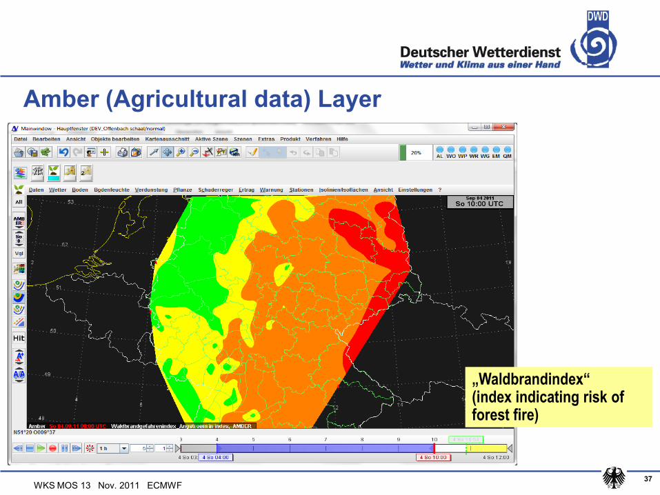
„Waldbrandindex“ (index indicating risk of forest fire)
Amber (Agricultural data) Layer

WKS MOS 13 Nov. 2011 ECMWF
SigWX mid / high level map production Under final
acceptance tests

WKS MOS 13 Nov. 2011 ECMWF39
Night Vision Forecast Layer with forecast dialog (left) and operational areas (right, see areas on the map)
Night Vision Forecast layer (under development)

WKS MOS 13 Nov. 2011 ECMWF
Thank you for your attention!
See a presentation of NinJo at Thursday afternoon