
NinJo - Frameworks, Applications and Release Distributions - Development and Software Process
Upload
amelia-quinnCategory
view
217download
0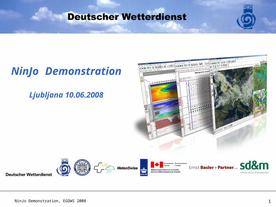
NinJo Demonstration, EGOWS 2008 1
NinJo Demonstration
Ljubljana 10.06.2008
NinJo Demonstration, EGOWS 2008 2
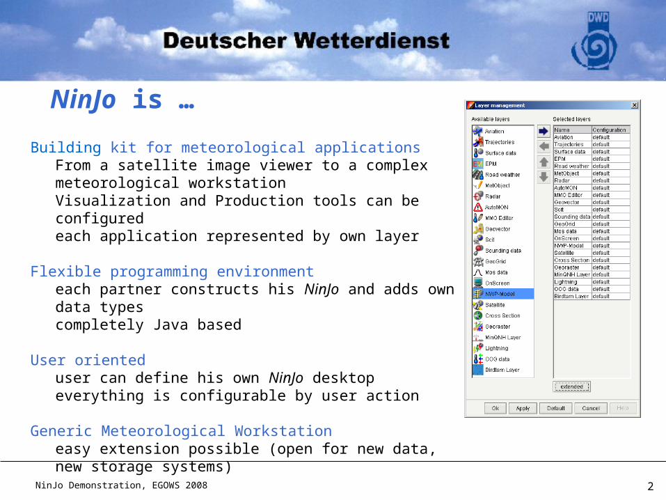
Building kit for meteorological applicationsFrom a satellite image viewer to a complex meteorological workstationVisualization and Production tools can be configuredeach application represented by own layer
Flexible programming environmenteach partner constructs his NinJo and adds own data typescompletely Java based
User orienteduser can define his own NinJo desktopeverything is configurable by user action
Generic Meteorological Workstationeasy extension possible (open for new data, new storage systems)
NinJo is …
NinJo Demonstration, EGOWS 2008 3
NinJo: Overview
Visualisation
Product generation
NinJo Demonstration, EGOWS 2008 4
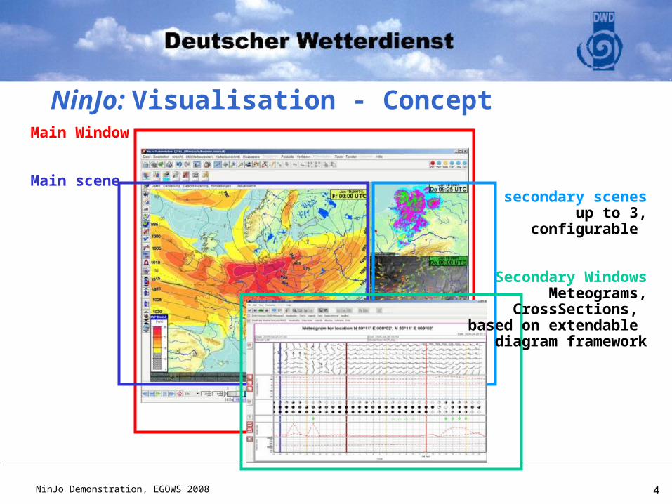
NinJo: Visualisation - ConceptMain Window
Main scene secondary scenes
up to 3,configurable
Secondary WindowsMeteograms,
CrossSections, based on extendable
diagram framework
NinJo Demonstration, EGOWS 2008 5
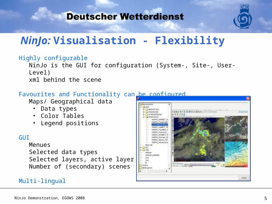
Highly configurable NinJo is the GUI for configuration (System-, Site-, User-Level)xml behind the scene
Favourites and Functionality can be configured Maps/ Geographical data
• Data types• Color Tables• Legend positions
GUIMenuesSelected data typesSelected layers, active layerNumber of (secondary) scenes
Multi-lingual
NinJo: Visualisation - Flexibility
NinJo Demonstration, EGOWS 2008 6
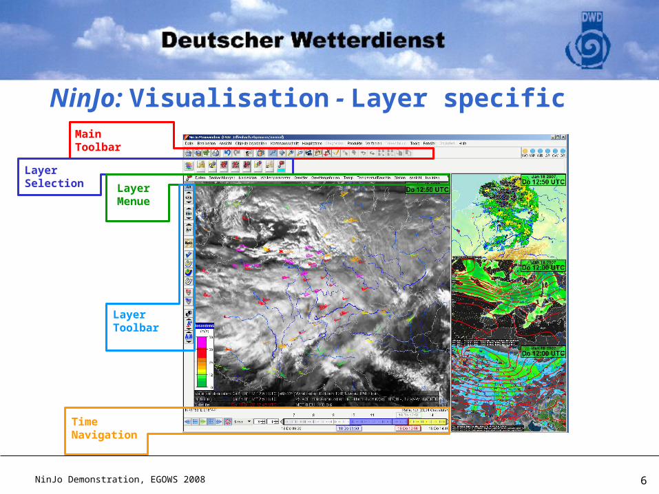
NinJo: Visualisation - Layer specific MainToolbar
LayerSelection Layer
Menue
LayerToolbar
TimeNavigation
NinJo Demonstration, EGOWS 2008 7
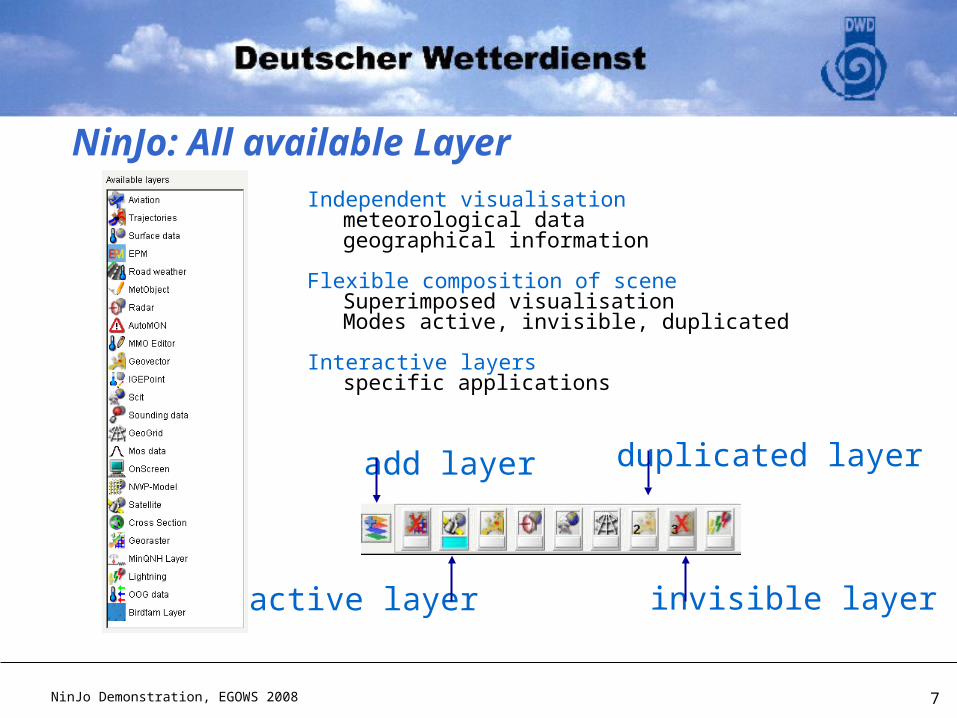
Independent visualisationmeteorological datageographical information
Flexible composition of sceneSuperimposed visualisationModes active, invisible, duplicated
Interactive layersspecific applications
duplicated layer
active layer invisible layer
add layer
NinJo: All available Layer
NinJo Demonstration, EGOWS 2008 8
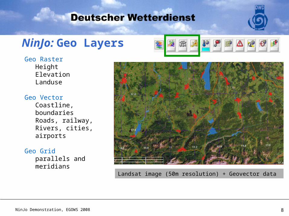
Geo RasterHeightElevationLanduse
Geo Vector Coastline, boundariesRoads, railway,Rivers, cities, airports
Geo Gridparallels and meridians
Landsat image (50m resolution) + Geovector data
NinJo: Geo Layers
NinJo Demonstration, EGOWS 2008 9
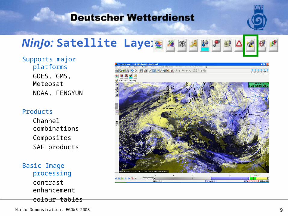
Supports major platforms
GOES, GMS, Meteosat
NOAA, FENGYUN
Products
Channel combinations
Composites
SAF products
Basic Image processing
contrast enhancement
colour tables
NinJo: Satellite Layer
NinJo Demonstration, EGOWS 2008 10
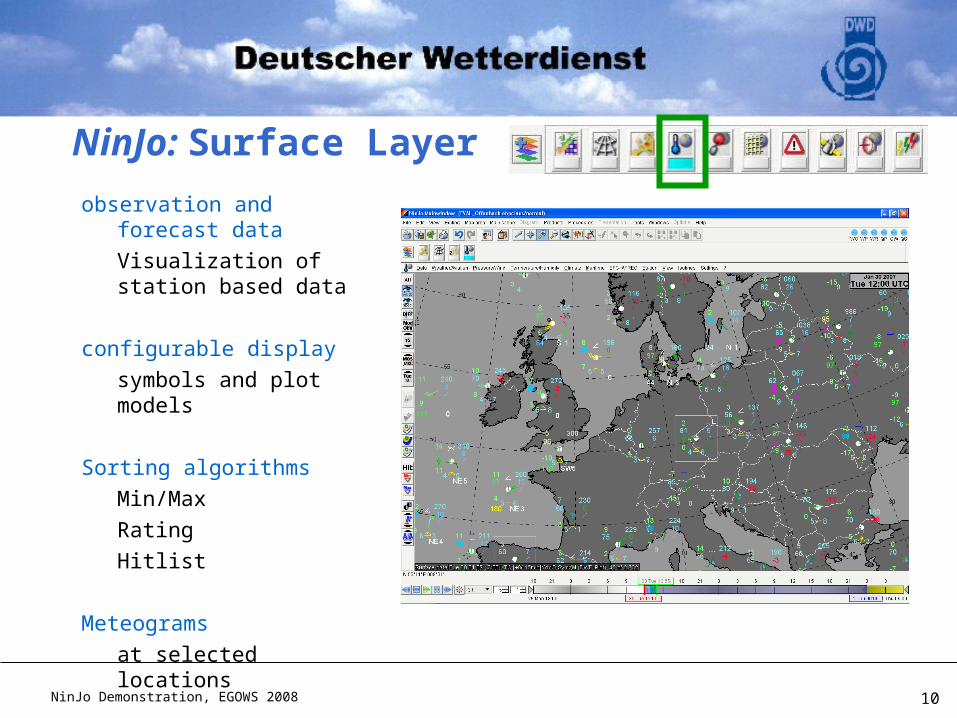
observation and forecast data
Visualization of station based data
configurable display
symbols and plot models
Sorting algorithms
Min/Max
Rating
Hitlist
Meteograms
at selected locations
NinJo: Surface Layer
NinJo Demonstration, EGOWS 2008 11
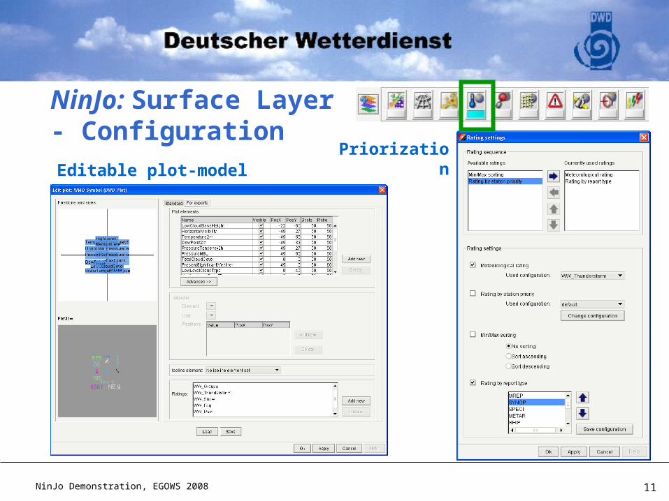
Editable plot-model
NinJo: Surface Layer- Configuration
Priorization
NinJo Demonstration, EGOWS 2008 12
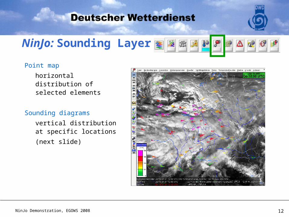
Point map
horizontal distribution of selected elements
Sounding diagrams
vertical distribution at specific locations
(next slide)
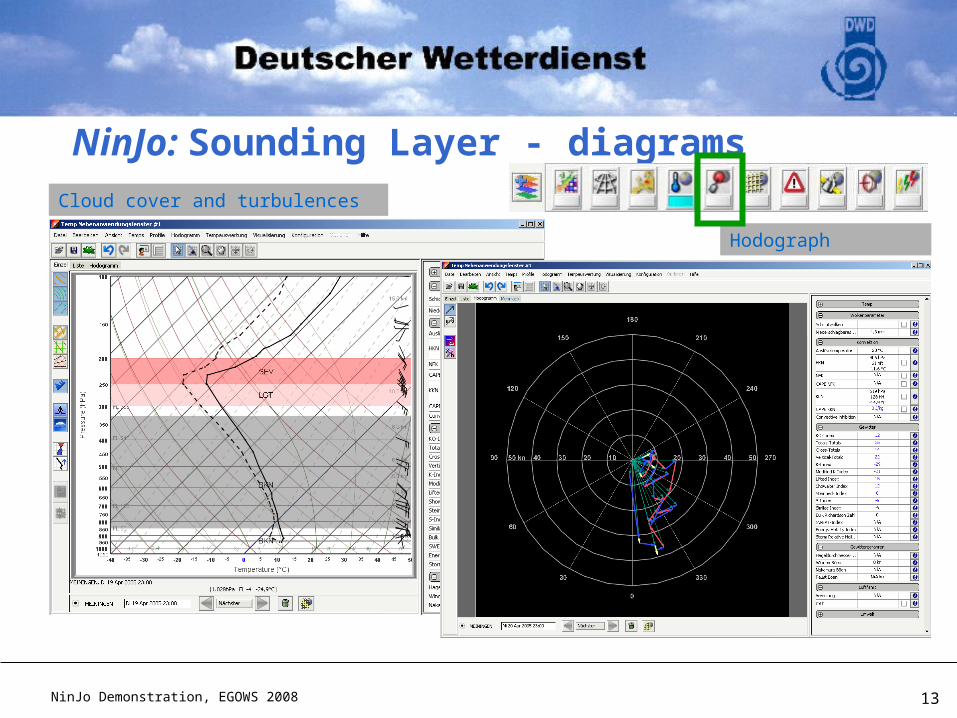
NinJo: Sounding Layer
NinJo Demonstration, EGOWS 2008 13
NinJo: Sounding Layer - diagramsCloud cover and turbulences
Hodograph
NinJo Demonstration, EGOWS 2008 14
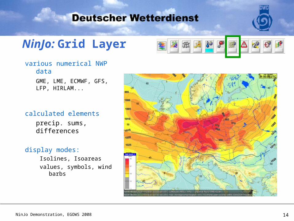
various numerical NWP data
GME, LME, ECMWF, GFS, LFP, HIRLAM...
calculated elements
precip. sums, differences
display modes:Isolines, Isoareas
values, symbols, wind barbs
NinJo: Grid Layer
NinJo Demonstration, EGOWS 2008 15
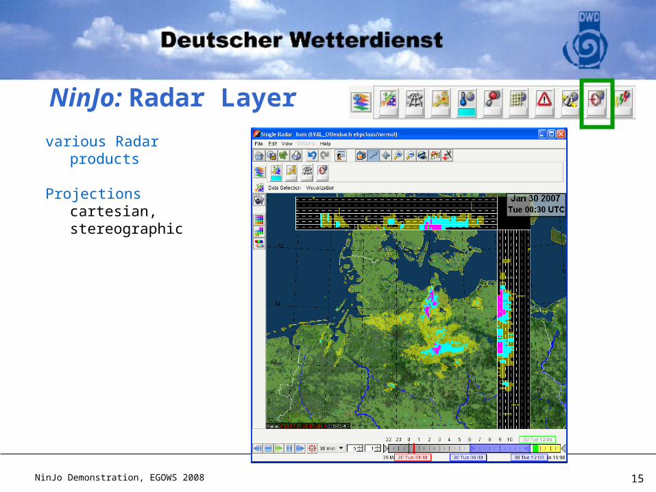
various Radar products
Projectionscartesian, stereographic
NinJo: Radar Layer
NinJo Demonstration, EGOWS 2008 16
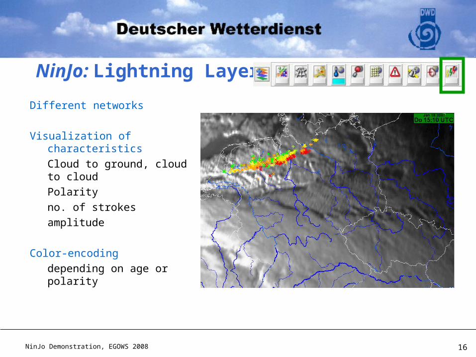
Different networks
Visualization of characteristics
Cloud to ground, cloud to cloud
Polarity
no. of strokes
amplitude
Color-encoding
depending on age or polarity
NinJo: Lightning Layer
NinJo Demonstration, EGOWS 2008 17
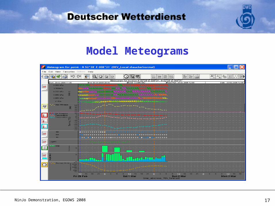
Model Meteograms
NinJo Demonstration, EGOWS 2008 18
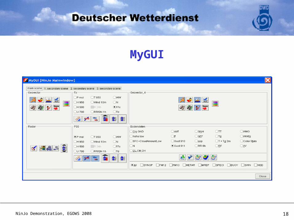
MyGUI
NinJo Demonstration, EGOWS 2008 19
NinJo: Overview
Visualisation
Product generation
Automatisation with NinJoScience
Status and Outlook
NinJo Demonstration, EGOWS 2008 20
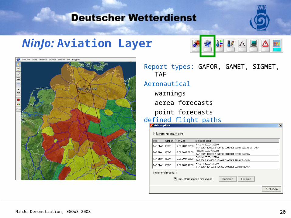
Report types: GAFOR, GAMET, SIGMET, TAF
Aeronautical
warnings
aerea forecasts
point forecastsdefined flight paths
NinJo: Aviation Layer
NinJo Demonstration, EGOWS 2008 21
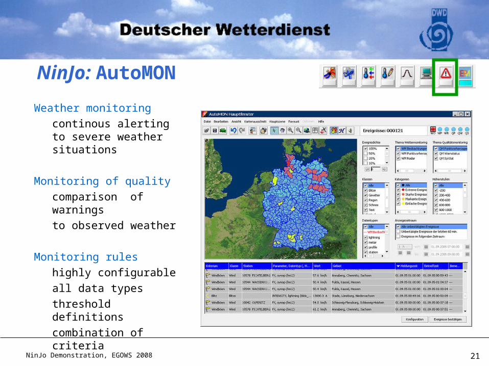
Weather monitoring
continous alerting to severe weather situations
Monitoring of quality
comparison of warnings
to observed weather
Monitoring rules
highly configurable
all data types
threshold definitions
combination of criteria
NinJo: AutoMON
NinJo Demonstration, EGOWS 2008 22
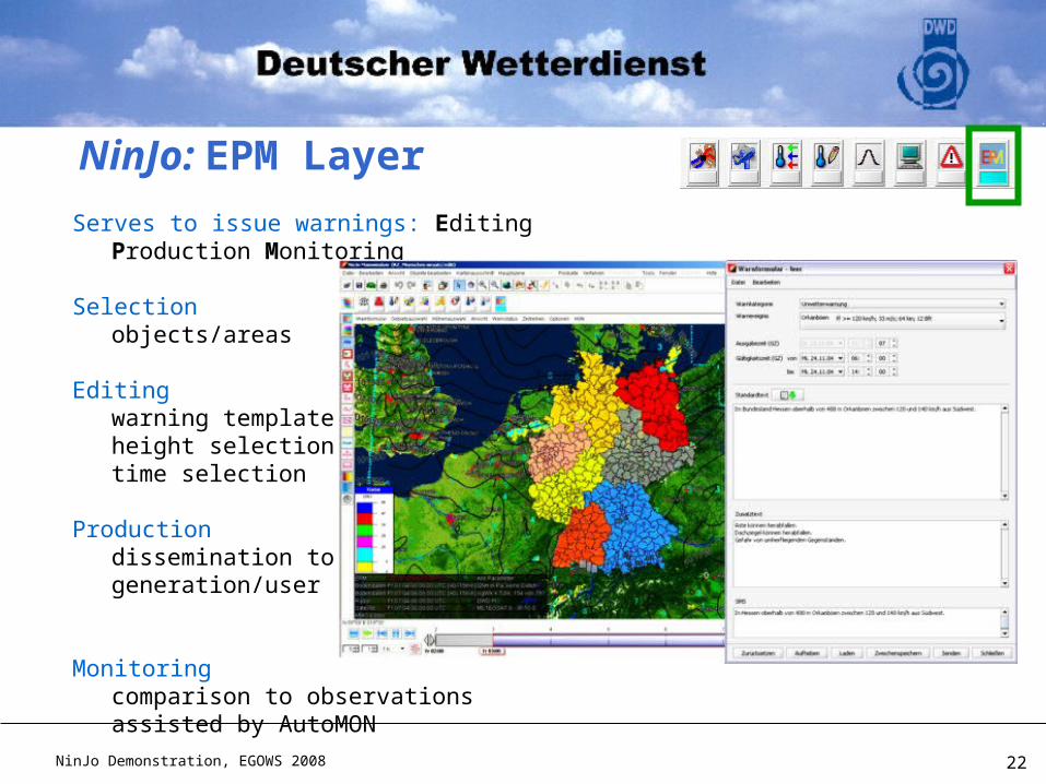
Serves to issue warnings: Editing Production Monitoring
Selectionobjects/areas
Editingwarning templateheight selectiontime selection
Productiondissemination to textgeneration/user
Monitoringcomparison to observations assisted by AutoMON
NinJo: EPM Layer
NinJo Demonstration, EGOWS 2008 23
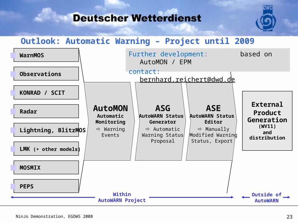
Outlook: Automatic Warning – Project until 2009
WithinAutoWARN Project
Outside ofAutoWARN
Observations
KONRAD / SCIT
Radar
Lightning, BlitzMOS
LMK (+ other models)
WarnMOS
PEPS
MOSMIX
ASGAutoWARN Status
Generator
AutomaticWarning Status
Proposal
ASEAutoWARN Status
Editor
ManuallyModified Warning
Status, Export
ExternalProduct
Generation (WV11)
and distribution
AutoMONAutomaticMonitoring
WarningEvents
Further development: based on AutoMON / EPM
contact: [email protected]
NinJo Demonstration, EGOWS 2008 24
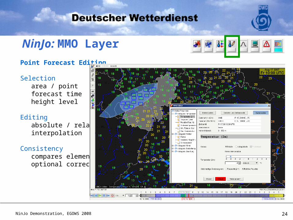
Point Forecast Editing
Selectionarea / pointforecast timeheight level
Editingabsolute / relativeinterpolation
Consistencycompares elementsoptional corrections
NinJo: MMO Layer
NinJo Demonstration, EGOWS 2008 25
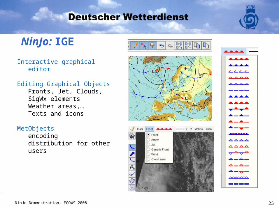
Interactive graphical editor
Editing Graphical ObjectsFronts, Jet, Clouds, SigWx elementsWeather areas,…Texts and icons
MetObjectsencodingdistribution for other users
NinJo: IGE
NinJo Demonstration, EGOWS 2008 26
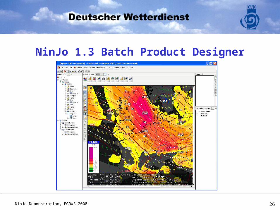
NinJo 1.3 Batch Product Designer
NinJo Demonstration, EGOWS 2008 27
NinJo 1.3 Batch Service
A webservice
NinJo client architecture behind
„normal“ NinJo favourites may become a batch product
NinJo Demonstration, EGOWS 2008 28
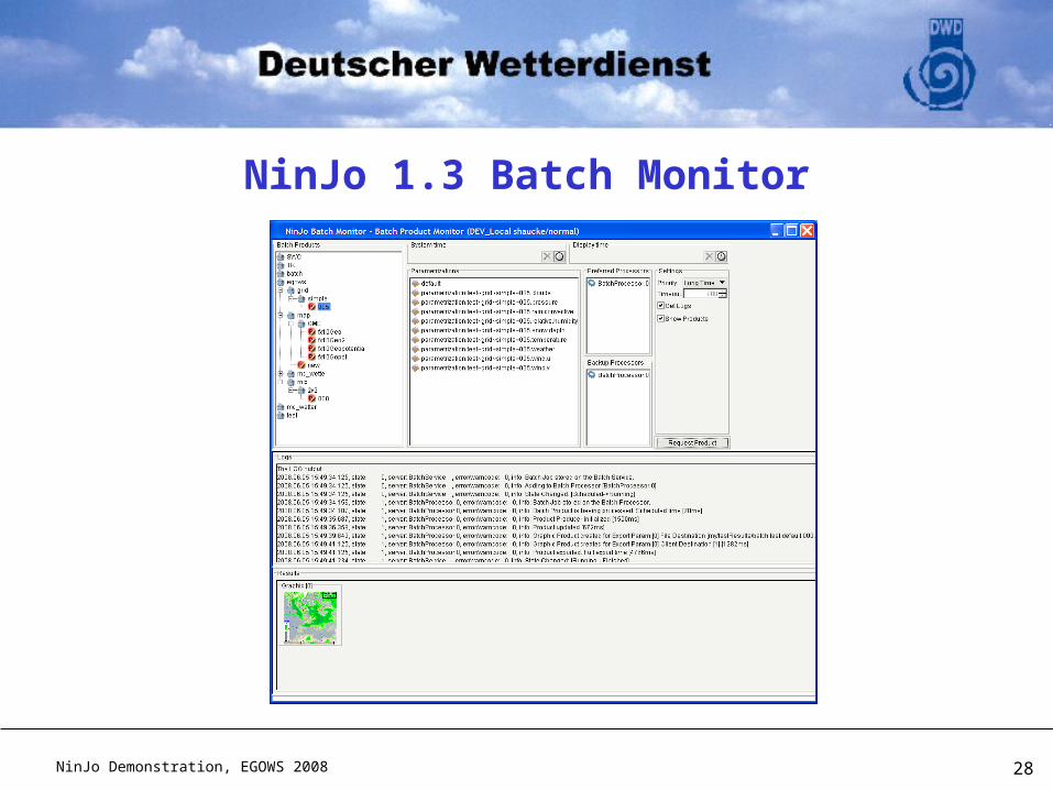
NinJo 1.3 Batch Monitor
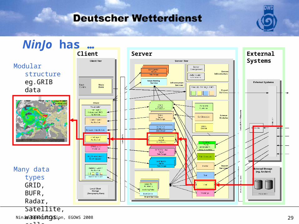
NinJo Demonstration, EGOWS 2008 29
Modular structureeg.GRIB data
GridLayer
Many data typesGRID, BUFR, Radar, Satellite, warnings, cells, points, areas, …
ServerClient ExternalSystems
NinJo has …