RCMRD Landsat BKO 2006 - lca.usgs.gov · PDF fileLandsat Program U.S. Geological Survey Center...
12
Landsat Landsat Program Program U.S. Geological Survey U.S. Geological Survey Center for Earth Resources Center for Earth Resources Observation and Science (EROS) Observation and Science (EROS) Sioux Falls, South Dakota, USA Sioux Falls, South Dakota, USA Training Center Training Center Regional Centre for Mapping of Regional Centre for Mapping of Resources for Development Resources for Development (RCMRD) (RCMRD) Nairobi, Kenya Nairobi, Kenya
Transcript of RCMRD Landsat BKO 2006 - lca.usgs.gov · PDF fileLandsat Program U.S. Geological Survey Center...

LandsatLandsat ProgramProgram
U.S. Geological SurveyU.S. Geological SurveyCenter for Earth Resources Center for Earth Resources Observation and Science (EROS)Observation and Science (EROS)Sioux Falls, South Dakota, USASioux Falls, South Dakota, USA
Training CenterTraining CenterRegional Centre for Mapping of Regional Centre for Mapping of Resources for Development Resources for Development (RCMRD)(RCMRD)Nairobi, KenyaNairobi, Kenya
RCMRDRCMRD
App
licat
ions
of C
oars
e to
Hig
h R
esol
utio
n Sa
telli
te Im
ager
y fo
r L
and
Prod
uctiv
ity A
sses
smen
t & M
anag
emen
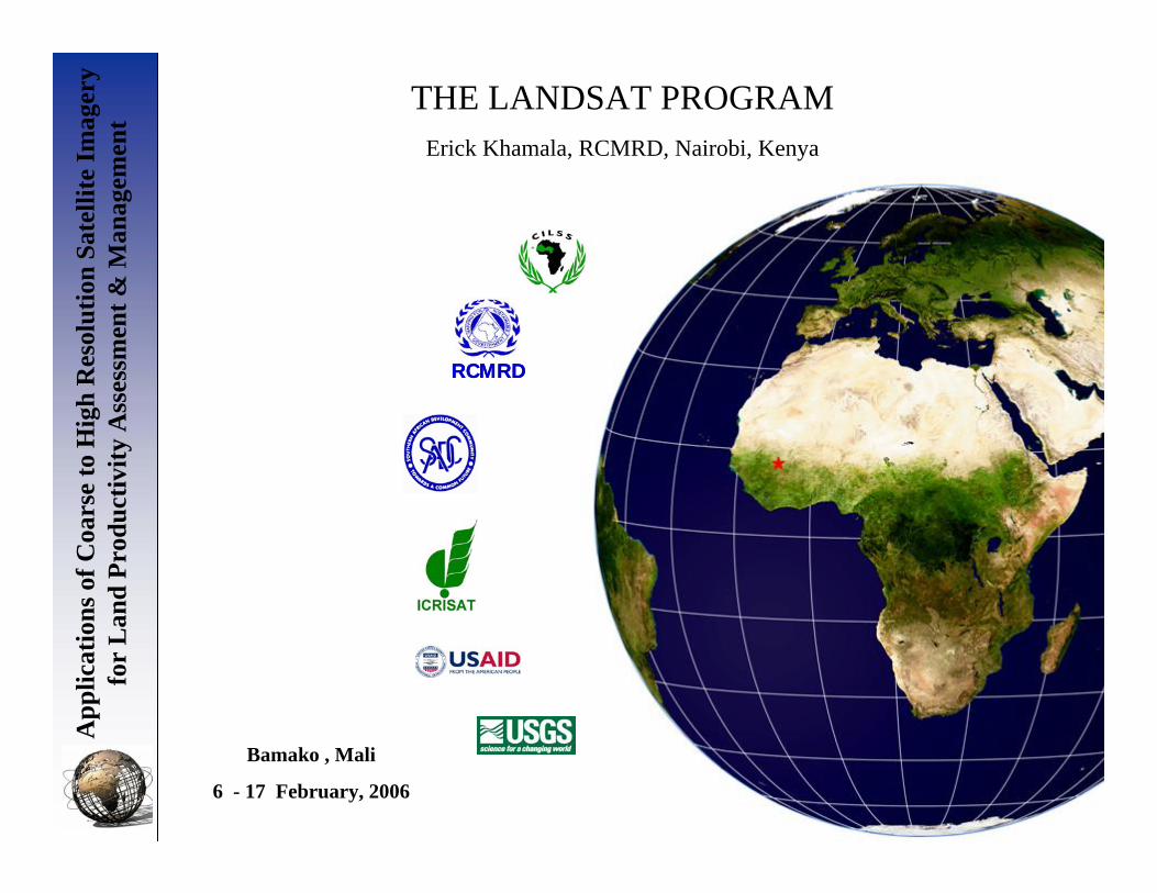
tTHE LANDSAT PROGRAM
Bamako , Mali
6 - 17 February, 2006
Erick Khamala, RCMRD, Nairobi, Kenya

• Started as Earth Resource Technology SatelliteProgram (ERTS) in early 1970’s
• Prior to the launch of ERTS-2, NASA changedthe name of the program to Landsat
• First satellite (ERTS-1) was launched in 1972
App
licat
ions
of C
oars
e to
Hig
h R
esol
utio
n Sa
telli
te Im
ager
y fo
r L
and
Prod
uctiv
ity A
sses
smen
t & M
anag
emen
t
Background

App
licat
ions
of C
oars
e to
Hig
h R
esol
utio
n Sa
telli
te Im
ager
y fo
r L
and
Prod
uctiv
ity A
sses
smen
t & M
anag
emen
t LANDSAT-1, 2, AND 3ORBITAL CHARACTERISTICS
• Cross the Equator at 9o from normal
• Circular orbits at a nominal altitude of 900 km
• Sun-synchronous (same local time)
• The satellite yields about 14 orbits per day
• Swath width is 185 km
• The satellite covers the Globe once every 18 days

App
licat
ions
of C
oars
e to
Hig
h R
esol
utio
n Sa
telli
te Im
ager
y fo
r L
and
Prod
uctiv
ity A
sses
smen
t & M
anag
emen
t
LANDSAT-1,2, & 3 ORBIT PATTERN
Courtesy of NASA and US Geological Survey

App
licat
ions
of C
oars
e to
Hig
h R
esol
utio
n Sa
telli
te Im
ager
y fo
r L
and
Prod
uctiv
ity A
sses
smen
t & M
anag
emen
t LANDSAT-1, 2, AND 3 SENSORS
• 3-TV like cameras aimed to view the same ground area simultaneously (185X185 km)
Return Beam Vidicon (RBV) System:
• 80 m nominal ground resolution (30 m in Landsat-3)
• Spectral sensitivity: green, red, & near infrared
• No film. Images were exposed by a shutter deviceon a photosensitive surface which is later scanned by an internal electronic beam to produce a video signal
App
licat
ions
of C
oars
e to
Hig
h R
esol
utio
n Sa
telli
te Im
ager
y fo
r L
and
Prod
uctiv
ity A
sses
smen
t & M
anag
emen
t
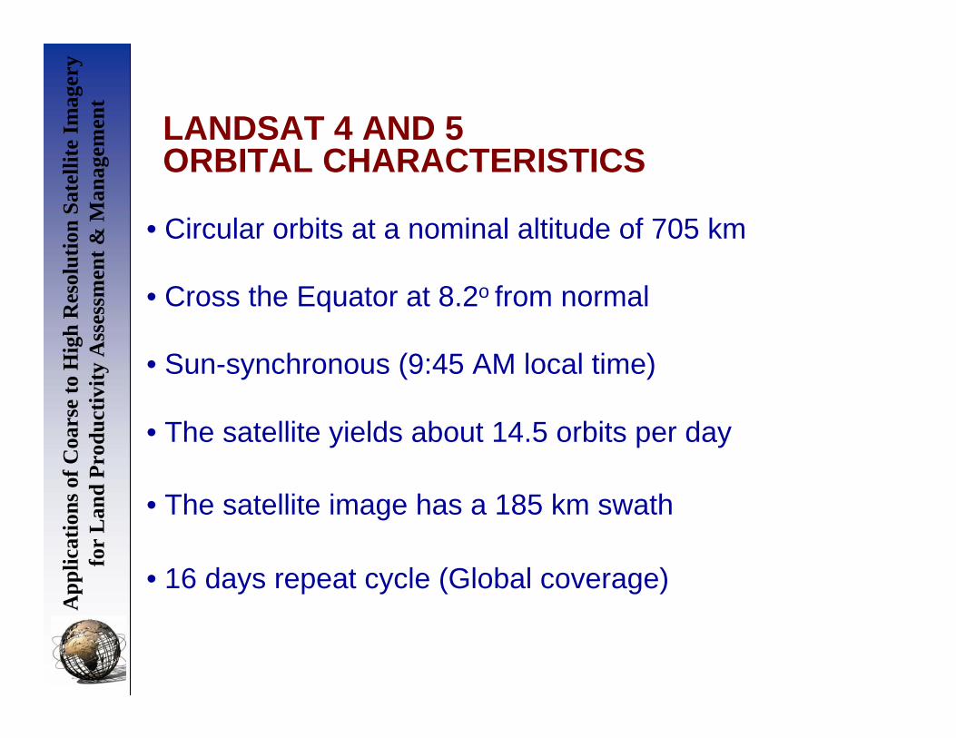
LANDSAT 4 AND 5ORBITAL CHARACTERISTICS
• Cross the Equator at 8.2o from normal
• Circular orbits at a nominal altitude of 705 km
• Sun-synchronous (9:45 AM local time)
• The satellite yields about 14.5 orbits per day
• The satellite image has a 185 km swath
• 16 days repeat cycle (Global coverage)

App
licat
ions
of C
oars
e to
Hig
h R
esol
utio
n Sa
telli
te Im
ager
y fo
r L
and
Prod
uctiv
ity A
sses
smen
t & M
anag
emen
t LANDSAT-4, AND 5 SENSORS
• Same sensor, but bands named 1, 2, & 3
Multispectral Scanner (MSS) System:
• 30 m nominal ground resolution. Thermal is 120 m• Seven spectral bands: blue, green, red, near infrared,
mid infrared, thermal infrared, and mid infrared
• Improved geometry over the MSS sensor and better signal-to-noise ratio
• Uses 16 detectors for each of the non-thermal bandsand 4 detectors for the thermal
Thematic Mapper (TM)

App
licat
ions
of C
oars
e to
Hig
h R
esol
utio
n Sa
telli
te Im
ager
y fo
r L
and
Prod
uctiv
ity A
sses
smen
t & M
anag
emen
t LANDSAT-7ORBITAL CHARACTERISTICS
• Cross the Equator at 8.2o from normal
• Circular orbits at a nominal altitude of 705 km
• Sun-synchronous (10:00 - 10:15 AM local time)
• The satellite yields about 14 orbits per day
• The satellite image a 185 km swath
• 16 days repeat cycle (Global coverage)
App
licat
ions
of C
oars
e to
Hig
h R
esol
utio
n Sa
telli
te Im
ager
y fo
r L
and
Prod
uctiv
ity A
sses
smen
t & M
anag
emen
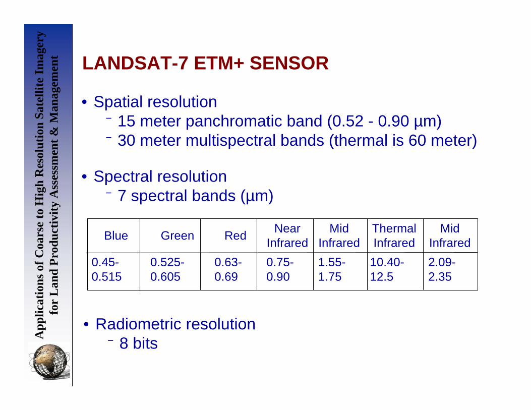
t LANDSAT-7 ETM+ SENSOR
• Spatial resolution⁻ 15 meter panchromatic band (0.52 - 0.90 µm)⁻ 30 meter multispectral bands (thermal is 60 meter)
• Spectral resolution⁻ 7 spectral bands (µm)
2.09-2.35
10.40-12.5
1.55-1.75
0.75-0.90
0.63-0.69
0.525-0.605
0.45-0.515
Mid Infrared
Thermal Infrared
Mid Infrared
Near InfraredRedGreenBlue
• Radiometric resolution⁻ 8 bits

App
licat
ions
of C
oars
e to
Hig
h R
esol
utio
n Sa
telli
te Im
ager
y fo
r L
and
Prod
uctiv
ity A
sses
smen
t & M
anag
emen
t
Landsat images of Bamako
Nov. 1986
Oct. 1999

App
licat
ions
of C
oars
e to
Hig
h R
esol
utio
n Sa
telli
te Im
ager
y fo
r L
and
Prod
uctiv
ity A
sses
smen
t & M
anag
emen
t
Contacts
Erick KhamalaRemote Sensing Officer
Regional Centre for Mapping of Resources for Development (RCMRD)
P.O Box 632 – 00618, Ruaraka, Nairobi, KenyaTel: 254-20-8561448 (DL) 8560227, 8561775
Fax: 254-20-8561673, 8563767Email: [email protected], [email protected]
Web: www.rcmrd.org