Protocol For Burn Dump Site Investigation and Characterization ...
71
Protocol For Burn Dump Site Investigation and Characterization June 30, 2003 State of California Environmental Protection Agency
Transcript of Protocol For Burn Dump Site Investigation and Characterization ...

Protocol For Burn Dump Site Investigation and Characterization June 30, 2003
State of California Environmental Protection Agency


i 6/30/2003
Table of Contents
Part I—GENERAL INFORMATION............................................................................ 1 Chapter 1.0—Introduction .................................................................................................. 1
Chapter 1.1—Background .......................................................................................... 4 Chapter 1.2—Organization of Guidance Document................................................... 5 Chapter 1.3—Definition - Burn Dump ....................................................................... 5 Chapter 1.4—Potential Hazards Associated with Burn Dumps ................................. 5 Chapter 1.5—Regulatory Authority and Jurisdiction ................................................. 6
PART II—THE PRELIMINARY WASTE CHARACTERIZATION STUDY (PWCS) FOR EVALUATION OF BURN DUMP SITES......................... 9
Chapter 2.0—Historical Records Review, On-site Inspection, and Site Evaluation for the Preliminary Waste Characterization Study............................................... 10
Chapter 2.1—Records Review.................................................................................. 10 Chapter 2.2—Preparing for an On-Site Inspection................................................... 11 Chapter 2.3—On-Site Inspection.............................................................................. 11 Chapter 2.4—Evaluating the Historical Records Review and On-Site Inspection... 12
Chapter 3.0—Work Plan Preparation, Sampling and Evaluation Protocol, and Data Validation for the Preliminary Waste Characterization Study ................. 14
Chapter 3.1—Work Plan Preparation ....................................................................... 14 Chapter 3.2—Sampling Protocols and Evaluation ................................................... 17 Chapter 3.3—Data Validation .................................................................................. 19 Chapter 3.4—Comparison of Site Specific Analytical Data to Regulatory Criteria for
Hazardous Waste Classifications ...................................................... 20
Chapter 4.0—Human Health Risk Screening Evaluation................................................. 22 Chapter 4.1—Risk Screening Assumptions and Exposure Factors .......................... 22 Chapter 4.2—U.S. EPA Preliminary Remediation Goals......................................... 23 Chapter 4.3—DTSC Preliminary Endangerment Assessment.................................. 24
Chapter 5.0—Ecological Screening Assessment.............................................................. 25 Chapter 5.1—Introduction ........................................................................................ 25 Chapter 5.2—Identification of Environmentally-Sensitive Locations ..................... 25
Chapter 6.0—Preliminary Waste Characterization Study Report Format........................ 27
Chapter 7.0—Consultation Process for Selection of a Lead Regulatory Agency ............ 28
References ....................................................................................................................... 30
Appendix A—Example Work Plan Former Burn Site................................................ 32 List of Figures and Tables Figure 1—Process for Identification of Lead Remedial Oversight Agency at
California Burn Dump Sites...............................................................................3 Table 1—Criteria for Evaluating Analytical Results for Metals in Soil............................21

ii 6/30/2003
List of Acronyms Agency Cal/EPA - California Environmental Protection Agency CIWMB - California Integrated Waste Management Board DTSC - Department of Toxic Substances Control DWR - Department of Water Resources DFG - Department of Fish and Game LEA - Local Enforcement Agencies RWCQB - Regional Water Quality Control Board SWRCB - State Water Resources Control Board U.S. EPA - United States Environmental Protection Agency Regulatory ARARs - Applicable or Relevant and Appropriate Requirements CFR - Code of Federal Regulations CCR - California Code of Regulations NCP - National Contingency Plan PRC - Public Resources Code RCRA - Resource Conservation and Recovery Act WDR - Waste Discharge Requirement Program-Based CAP - Corrective Action Plan CIA - Closed Illegal and Abandoned COC - Chain of Custody CSM - Conceptual Site Model DI-WET - De-ionized Water Waste Extraction Test DQO - Data Quality Objectives GPA - Global Positioning System PWCS - Preliminary Waste Characterization Study PCB - Polychlorinated Biphenyls QAPP - Quality Assurance Project Plan QA/QC - Quality Assurance/Quality Control RAP - Remedial Action Plan RAW - Removal Action Work Plan SAF - Site Assessment Form SIF - Site Identification Form SIP - Site Identification Process SSP - Site Safety Plan STLC - Soluble Threshold Limit Concentration SWIS - Solid Waste Information System SWAT - Solid Waste Assessment Test TPH - Total Petroleum Hydrocarbon

iii 6/30/2003
TRPH - Total Recoverable Petroleum Hydrocarbon TTLC - Total Threshold Limit Concentration PEA - Preliminary Endangerment Assessment PRG - Preliminary Remediation Goal RP - Responsible Party SVOC - Semi-Volatile Organic Compound VOC - Volatile Organic Compound WET - Waste Extraction Test WQO - Water Quality Objectives

iv 6/30/2003
Acknowledgements This document was developed by the Department of Toxic Substances Control under the direction of Ms. Dorothy Rice, Deputy Director, Site Mitigation and Brownfields Reuse Program and Ms. Caren Trgovcich, Division Chief, Emergency Response and Statewide Operations. Technical support for preparation of this document was provided by:
Mr. Stewart Black, RG, Senior Engineering Geologist (principal author, co-editor) Mr. Michael Finch, RG, Senior Engineering Geologist (co-author) Mr. Mike Kenning, RG, Engineering Geologist (co-author) Mr. Peter Collier, Engineering Geologist, (co-author, co-editor) Ms. Carole Sinsko, (formatting and word processing) Ms. Emily Barbosa, (formatting and word processing)
Project scope and technical guidance were also provided by the members of the Burn Dump Guidance Subcommittee including:
Mr. James Hemminger, P.E., Rural Counties Environmental Services Joint Powers Authority Mr. Wes Mindermann, P.E., California Integrated Waste Management Board Mr. Glenn Young, P.E., California Integrated Waste Management Board Mr. Dennis Ferrier, City of San Jose, Local Enforcement Agency Mr. Joe Mello, R.G., State Water Resources Control Board Ms. Joan Mulcare, Environmental Health Division, County Health Department, San Bernardino Mr. Paul Manasjian, City of San Diego, Solid Waste Local Enforcement Agency Ms Rebecca LaFreniere, City of San Diego, Solid Waste Local Enforcement Agency Mr. Carl Palmer, California Environmental Protection Agency, Department Toxic Substances Control
We would also like to thank Ms. Silvia Castillo with the City of San Diego Environmental Services Department and Mr. Robert Scott, R.G. with URS Corporation for their assistance with providing the base document for the Example Work Plan Former Burn Site found in Appendix A.

Page 1 6/30/2003
Part I—GENERAL INFORMATION
Chapter 1.0—Introduction The protocols contained in this document were developed to fulfill the requirements set forth in Assembly Bill 709 (AB709) as they pertain to burn dump sites in California. The document is intended to provide assistance to responsible parties, responsible party contractors and subcontractors, Solid Waste Local Enforcement Agencies (LEAs), and California state regulatory agencies. AB709 states that, “On or before June 30, 2003, the Department in consultation with the Board and the State Water Resources Control Board shall develop protocols to be utilized by the board and local enforcement agencies for site investigation and site characterization of hazardous substances at burn dump sites.” AB709 also stipulates that for sites which exhibit sensitive land use, a site consultation meeting shall be held to determine a lead agency for remediation oversight. “If, following a review of site information the department or a regional board requests to provide remediation oversight that request shall be granted.” This document references other guidance documents developed by state, federal and local agencies where appropriate. It is not intended to be the sole guidance for characterization of burn dump sites in California. The procedures within this document are recommendations only. Other technically equivalent procedures may exist which can be utilized at burn dump sites with prior lead regulatory oversight agency approval. It is not the intent of this guidance to exclude alternate approaches for investigating and characterizing burn dump sites. The purpose of this Guidance Document is to: Provide guidance on appropriate screening procedures for waste and site
characterization; Provide appropriate options which may be used for screening of potential risk to
public health, safety, and the environment; Describe the roles of regulatory agencies and specify regulatory authority; and
Fulfill the requirements set forth in AB709
It is not the intent of this protocol to mandate that the Preliminary Waste Characterization Study (PWCS) described in this document be implemented at every burn dump site in California. If the LEA, in conjunction with the California Integrated Waste Management Board (CIWMB), has completed the Site Identification Process (SIP) and determined that the site is stable (through ongoing LEA inspection), there is no threat to human health or the environment, that the site is not currently or proposed for “sensitive land use” as defined in AB709, and there is no application for Assembly Bill 2136 (Loans to Local Government Program for Site Cleanup) funding, a PWCS need not be completed.

Page 2 6/30/2003
Consistent with the intent of AB709, the investigative and analytical processes described herein for burn dump sites should be followed whenever the CIWMB receives a request for AB2136 funding and when there are insufficient data available to designate a lead oversight agency with primary responsibility to ensure that remediation activities are in compliance with applicable regulatory requirements. These protocols should also be followed whenever a burn dump site poses a potential threat to public health, safety and the environment by virtue of its location to “sensitive land use”. The methods and procedures described herein may also be appropriate for other types of situations and should be followed at the discretion of responsible regulatory agencies based on site-specific considerations. In general, regulatory agencies should use flexibility when following the AB 709 protocols to ensure that required material sampling, analysis, and other investigative techniques are reflective of individual site characteristics and their associated threat to public health and the environment. Figure 1, Process for Identification of Lead Remediation Oversight Agency at California Burn Dump Sites, depicts the overall process for burn dump site evaluation and determination of lead agency for remediation oversight. The figure is intended as a general summary to show where AB709 protocols for burn dump investigations may be included in the burn dump evaluation process. The PWCS, described in this document, may be initiated subsequent to the SIP, when and application is made to the CIWMB for Assembly Bill 2136 (AB2136) funding or when site specific conditions compel the lead regulatory agency to further investigate the site. As the protocols in this document are implemented, issues may be identified which warrant document revision. DTSC will continue to solicit comments from interested parties for a period of one year. At that time, DTSC in conjunction with the CIWMB, and the SWRCB will review and incorporate changes as needed.

Pag
Site identification process (SIP)
Existing or proposed sensitive land-use
AB 2136 funding
application submitted
Implement AB 709 Protocol for Burn Dum Investigation inclu ng completion of hi orical records revie and/or PWCS
No
No
Yes
Yes
LEA/CIWMB SIP process completed by LEA.
Process for Identification of Lead Remediation Oversight Agency At
California Burn Dump Sites Figure 1
♦♦
“Sensitive land-use” projects may involve AB 2136 funding and/or other revenue sources, but lead agency determination must be ultimately based on public health and environmental protection.
CIWMB staff will make this determination.
p distw
e 3 6/30/2003
Site consultation
process DTSC/RWQCB
Notification
Request site
consultation
CIWMB site characterization and remediation oversight
DTSC/RWQCB request site
characterization oversight
Is threat predominately
to water quality
DTSC site characterization and remediation oversight
RWQCB site characterization and remediation oversight
Yes
No No
Yes
Yes
No
CIWMB, DTSC, SWRCB & RWQCB meet to determine appropriate regulatory lead
♦ PEA ♦ RAW♦ RAP
♦ CAP ♦ WDRs
LEA Advisory AB 2136 program
Sufficient data
available
Yes
No
Implement AB 709 Protocol for Burn Dump Investigation including completion of historical records review and/or PWCS
The “sensitive land-use” project proponent may submit an application to CIWMB for AB 2136 funding and/or any other type of funding as soon as sufficient data is available to complete the application.

Page 4 6/30/2003
Chapter 1.1—Background As the United States moved into the 20th century, very few regulations existed governing the management of solid waste. Urban expansion also made waste dumping in landfills less economically feasible. A common method for municipalities to manage waste was to landfill and burn solid waste to minimize organic material that harbored disease-carrying vectors and other unsanitary conditions. Although, waste burning eliminated the threat of disease and reduced waste mass and volume, secondary effects of low temperature burning concentrated metals in the ash products and generated some carcinogenic organic compounds in the process. It should be noted, based on recent field investigations conducted by the CIWMB, that complete waste burning does not always occur and that mixed unburned refuse is common at burn dump sites. Previous investigations at burn dump sites throughout California indicate that elevated or hazardous levels of arsenic (As), beryllium (Be), cadmium (Cd), chromium (Cr), copper (Cu), lead (Pb), mercury (Hg), nickel (Ni), and zinc (Zn) may be present in residual waste left from the burn dumping process (burn ash). Low levels of total recoverable petroleum hydrocarbons (TRPH) and semi-volatile organic compounds (SVOC), such as polychlorinated biphenyls (PCB), dioxins, furans and polyaromatic hydrocarbons PAHs, may also be present at low concentrations in the burn ash. In rare cases, trace amounts of low level radioactive waste have been noted. If burn products included explosive waste, ordnance, or pyrotechnics, compounds such as perchlorate and explosive products may also be present. In the early 1970s, the burn dumping process was phased out in response to the Clean Air Act Amendments. Today most burn dumps are considered closed sites as their operations ceased prior to the development of specific regulations addressing the closure of disposal facilities. Burn dump sites not operated under applicable permits at that time are considered illegal disposal sites. Currently, there have been approximately 500 burn sites identified within the 2,500 solid waste sites identified in the Closed Illegal and Abandoned (CIA) Site Program of the CIWMB. These sites are listed in the Solid Waste Information System (SWIS) database compiled by CIWMB. Fifty burn dump sites are considered Priority A or B respectively (confirmed or suspect exposures with significant threat of pollution or nuisance or public health threat) by CIWMB through the CIA Site Program, SIP. Four of these sites are currently undergoing cleanup in projects under the CIWMB Solid Waste Management Cleanup Program and an additional 26 formerly Priority A burn dump sites have been remediated since 1994. Burn sites identified in the SWIS and under the CIA Site Program undergo continued monitoring and inspection. Additional sites not included in SWIS are continually identified; many of these sites include burn dump sites. In the past, active burn dump sites were usually located as far from urban central business districts as was economically feasible. Gullies and ravines were often selected for burn dump locations because their low topography made controlled burning easier. Today, former burn dump locations often display nearly flat or gently rolling topography with steep, often gullied sides. These old sites are often targets for development as larger urban areas encroach on these previously rural locations.

Page 5 6/30/2003
Burn dump sites with existing or proposed sensitive land use represent a concern for regulatory agencies, developers and responsible parties (RP) with respect to public health and safety, and the environment. This protocol has been developed to address these concerns and to provide a coordinated approach to address burn dump sites in California.
Chapter 1.2—Organization of Guidance Document This guidance document is organized into two parts and seven chapters as shown below:
PART I GENERAL INFORMATION
Chapter 1. Introduction PART II THE PRELIMINARY WASTE CHARACTERIZATION STUDY
FOR EVALUATION OF BURN DUMP SITES
Chapter 2. Historical Records Review, On-site Inspection, and Site Evaluation for the Preliminary Waste Characterization Study
Chapter 3. Work Plan Preparation, Sampling and Evaluation Protocol, and Data Validation for the Preliminary Waste Characterization Study
Chapter 4. Human Health Risk Screening Evaluation Chapter 5. Ecological Screening Assessment Chapter 6. Preliminary Waste Characterization Study Report Format Chapter 7. Consultation Process for Selection of a Lead Regulatory Agency
Chapter 1.3—Definition - Burn Dump For the purposes of this document and as stated in AB709, a “burn dump site” shall be defined as a closed, solid waste disposal site, where open burning was conducted prior to 1972. A “closed” site shall be defined as a non-active solid waste disposal facility or site which operated and ceased accepting waste prior to implementation of environmental regulatory closure requirements or standards (1972) and does not include illegal or abandoned sites. The site boundary for a burn dump site shall be defined as the extent of contamination generated by burning and disposal activities or by subsequent spreading of contamination by natural processes (such as wind, rain, flooding and erosion) or human activities (such as grading and trenching). A burn dump site boundary is not limited to the assessors parcel boundary on which the burning activities occurred or to the property owned by the entity which operated the burn dump.
Chapter 1.4—Potential Hazards Associated with Burn Dumps With increased land development of these previously rural areas on or near burn dump sites, there is the potential for human exposure to waste and/or burn ash. Waste or
Page 6 6/30/2003
contaminant substances in the burn ash may pose a human health or ecological risk. Elevated or hazardous levels of As, Be, Cd, Cr, Cu, Pb, Hg, Ni, and Zn have been reported in soil/ash samples from burn dump sites. Burn ash constituents of concern are typically not readily soluble in water and represent a low probability of leaching to groundwater (e.g., lead). However, migration of metals may occur depending on site-specific conditions (e.g., soil acidity). Shallow groundwater (less than 20-feet below ground surface) may present an increased potential for heavy metals to leach to groundwater. Burn ash constituents can also pose a health risk if they become airborne, become suspended in surface water runoff, or come in contact with the skin surface. Human exposure to burn ash constituents may occur through inhalation if allowed to become airborne, and ingestion or direct skin contact through wind and surface erosion. Because the waste burning process has destroyed most of the biodegradable organic material, little landfill gas is produced at burn dump sites and methane does not typically represent a risk. Burn dump problems and potential hazards result primarily from improper surface cover, poor surface erosion and drainage control, and/or lack of adequate site security. However, in some cases, soluble contaminants, such as TRPH and SVOCs, including dioxins, furans, and PAHs, are present in the soil ash and may represent a threat or impact to groundwater.
Chapter 1.5—Regulatory Authority and Jurisdiction Burn dump sites are typically classified as solid waste disposal sites. Depending on the environmental characteristics found at a particular burn dump site, the site may fall under the regulatory jurisdiction of the CIWMB (including LEAs), DTSC and/or the SWRCB (including the RWQCBs). California law does not specify that any one agency has jurisdiction over solid waste sites. However, the law is clear that only DTSC and the RWQCBs have authority over hazardous substance releases and can “certify” a hazardous substance cleanup as having met state standards and/or requiring no further action. To date, most of the burn dump sites that have been identified in California have fallen under the regulatory jurisdiction of the CIWMB and LEAs for the purpose of permitting, inspection, abatement of nuisance and immediate contact issues. While CIWMB and LEA authority does not extend to final remediation and “certification” of site clean up, these agencies have been looked to for guidance and assistance for characterization and remediation of burn dump sites to meet state minimum standards. Brief discussions of the select programs that each agency has in place to address burn dump issues, their relationships and jurisdictional boundaries, and regulatory authorities are presented below: Chapter 1.5.1—Department of Toxic Substances Control DTSC’s authority to regulate, investigate and inspect burn dumps is found in California Code of Regulations, Title 22 (22 CCR). DTSC also has authority under the California Health and Safety Code to abate releases that may be imminent or present substantial

Page 7 6/30/2003
endangerment to the public health or welfare [Health and Safety Code Sections 25359.3(a), 25355.5(b)(3), 58009, and 58010]. DTSC involvement at burn dump sites has been relatively limited until recently. The key factors that have determined DTSC involvement include: Characterization of burn ash as a hazardous substance based on Title 22 criteria;
Necessity for a hazardous waste permit and/or compliance with hazardous waste
handling requirements; Burn ash posing a potential threat to human health and the environment; and
Classification of post closure land use as sensitive or uncertain.
Since burn dump sites generally contain hazardous substances, DTSC should be consulted to evaluate post closure land use (other than non-irrigated open space) and to determine the potential impact on human health and the environment. DTSC programs that are currently involved with burn dump sites include their emergency response program and voluntary cleanup program. DTSC is also involved with characterization of burn dump sites through a preliminary assessment/site inspection (PA/SI) grant from the U.S. Environmental Protection Agency. DTSC also supports remediation and closure efforts at burn dumps under RCRA land disposal regulations such as military bases and special burn areas (e.g., Yosemite National Park). The protocol described in this document may be appropriate for use at burn dump sites located on military bases and other federal facilities throughout California. However, due to the unique nature of activities that may have occurred at these facilities additional sampling protocol may be required. If the historical records review indicates that explosive waste, pyrotechnics, radioactive waste or ordnance were disposed at the site additional sampling will be required. Chapter 1.5.2—California Integrated Waste Management Board CIWMB’s and the LEAs’ authority to inspect and investigate burn dumps is contained in Public Resources Code (PRC) Sections 44100, 40122 and 40191. CIWMB involvement in burn dump regulation has primarily been by: Providing assistance to LEAs in investigation, evaluation and remediation of burn
dump sites. LEAs are agencies primarily responsible for regulating and enforcing state minimum standards, remedial investigation oversight, regular inspection and review of post closure land use; and
Participating in remediation and/or abatement of high priority burn dump sites
where the responsible parties are unable or unwilling to perform timely cleanup and where there is a threat to public health and safety or the environment. CIWMB may provide technical support and grant money through the Solid Waste Site Cleanup Program and/or the Closed Illegal and Abandoned Site Program.
Page 8 6/30/2003
Chapter 1.5.3—State Water Resources Control Board and Regional Water Quality Control Boards The SWRCB and the nine RWQCBs have the regulatory authority to require cleanup at burn dump sites where there is a threat or impact to surface or groundwater quality. SWRCB regulatory authority is derived from Division 7 of the Water Code and water quality requirements contained in the California Code of Regulations, Title 27. The SWRCB regulates all waste discharges except those that are primarily radioactive and, therefore, is not limited in authority based on hazardous or nonhazardous waste discharge at a burn dump site. SWRCB programs that are currently involved with burn dump sites include the Land Disposal Program and general cleanup program – “Spills, Leaks, Investigation and Cleanup” Program.
Page 9 6/30/2003
PART II—THE PRELIMINARY WASTE CHARACTERIZATION STUDY (PWCS) FOR
EVALUATION OF BURN DUMP SITES As with any site regulated by the State, the burn dump site mitigation process begins with site identification. Most burn dump sites are identified through historical discovery, referrals from other agencies or inquiries/complaints from the public. In order to document burn dump site conditions, sufficient reliable data and information must be collected and appropriately evaluated. The PWCS is an approach which contains specific screening protocols for obtaining and evaluating the information needed for preliminary characterization of a burn dump site and for selection of a lead regulatory oversight agency. A PWCS is the initial (screening level) compilation of site information from various sources and a collection of sampling and analysis data. The objectives of the PWCS include:
Confirming that a burn dump site exists; Determining the extent of burn ash and associated constituents or
contaminants of concern; Evaluating the hazardous nature of those constituents or contaminants; Identifying the physical hazards associated with the burn dump site; Determining if there is a potential risk to public health, safety, or the
environment; Determining if additional site investigation is needed; and Providing adequate information to select an appropriate lead regulatory
agency. A PWCS must be completed to respond to agency referrals or to investigate public inquiries/complaints or to select or approve any post closure land use on or adjacent to a burn dump site. A PWCS should be performed at burn dump sites:
When the CIWMB receives a request for AB2136 funding; When there is a proposed change in land use; When a burn dump site poses a potential threat to public health, safety or the
environment; When a burn dump site poses a potential threat to water quality; and When a burn dump site encompasses or is adjacent to “sensitive land use”
areas. The PWCS includes the specific protocols required when state AB2136 funding and support are applied for (see Figure 1, Process for Identification of Lead Remediation Oversight Agency at California Burn Dump Sites). The PWCS can also be initiated subsequent to a site consultation to determine the appropriate lead agency when insufficient data are available to make that determination.

Page 10 6/30/2003
Chapter 2.0—Historical Records Review, On-site Inspection, and Site Evaluation for the Preliminary Waste Characterization Study At most burn dump sites in California the initial phase of investigation has been and will be completed by a responsible party (land owner or facility operator), local agency or LEA. The CIWMB is often involved with these sites in two ways: 1) by providing assistance in characterization and remediation through guidance and oversight to responsible parties, local agencies and LEAs, and 2) by active inclusion of those sites in the Closed Illegal and Abandoned Site Program (CIA) of the Solid Waste Site Cleanup Program, through implementing the SIP. The tasks required to start a PWCS for a burn dump site after it has been identified include: 1) completion of a historical records review, 2) conducting an on-site inspection, and 3) evaluating the records review and on-site inspection to determine if further action is necessary. Information from the CIWMB CIA SIP should be incorporated when available.
Chapter 2.1—Records Review Complete and accurate historical site information is essential to identify potential site risks, exposure pathways, receptors and sampling needs to complete the investigation. The purpose of the historical records review is to collect pertinent information on the following:
Setting; Past and current owners and operators; Physical and environmental characteristics; Previous site investigations; Facility status (active or closed); Years of operation; General facility operations and processes used on site; Hazardous substances and waste management practices; Volume of waste burned; Type of waste burned; Regulatory status (permits); Current or historical agency involvement (enforcement activities, violations,
environmental assessments and/or sampling reports if available); Current land use and proposed future land use (including zoning requirements
and sensitive areas); Citizen complaints; and Historical and antiquity status and archeological site locations.
A large body of information on solid waste and hazardous waste sites is currently available for public review. The following agencies have useful information that should be accessed when gathering historical site information:

Page 11 6/30/2003
City and County Offices (environmental health, planning, public works, air
pollution control, agricultural commissioner and the county tax assessor); California Integrated Waste Management Board (SWIS database, etc.); The California Department of Toxic Substances Control (CalSites database,
RCRA database, etc.); The State Water Resources Control Board and Regional Water Quality
Control Boards (SWAT, and Geotracker database); The Department of Water Resources (DWR); The U.S. Environmental Protection Agency; The U.S. Department of Defense (where the site was previously owned or
operated by a branch of the military and/or a military contractor). Background research should include review of reports, records and interviews (if available) to prepare for the on-site inspection and to start development of a conceptual site model. Aerial photographs and insurance maps should also be reviewed when available.
Chapter 2.2—Preparing for an On-Site Inspection It is important to be prepared when conducting the on-site inspection. Prior to the on-site inspection the inspector should:
Review all available information; Develop a health and safety plan; Determine equipment needs (protective clothing, camera, maps,
first aid kit, etc.); Contact local agencies that are involved with the site; Determine access routes; Acquire access permission from the appropriate parties; and Determine if site has any potential CEQA-related impacts
(e.g., biological, cultural, archaeological, water resource).
Chapter 2.3—On-Site Inspection An on-site inspection is essential to document current site conditions and to verify information discovered during the records review. The on-site inspection will also allow for acquisition of additional site information. Documentation of information developed during the on-site visit may be the only available data and the sole basis for determining if additional work is required. For this reason it is imperative that the data collected are accurate and representative of true site conditions. The initial on-site inspection consists of a walk through of the site. Observations during the inspection should focus on identifying, locating and describing features on the site. Notation should be made in a field notebook and on scaled site maps. Photos should be taken to document the inspection and to help locate important features for future site

Page 12 6/30/2003
visit. If burn ash (or suspected burn ash) is observed during the initial site inspection, select samples should be collected and analyzed in accordance with the procedures contained in Chapter 3.0 of this document. At a minimum, the important site conditions to identify include:
Structures and current land use on the site; Extent of burn ash (if observed); Potential physical and chemical hazards; Surrounding land use (open space, commercial etc.); Potentially exposed populations and exposure pathways; Nearest sensitive land use (residential, schools, wetlands etc.); Site accessibility and topography; Drainage pathways to surface water bodies; Nearest affected (or potentially affected) surface water and its uses; Soil type, soil permeability, depth to groundwater, uses of groundwater
and nearest well(s); Surface condition (vegetative cover, observable cover, standing water,
rubble, etc.); and Site location via Global Positioning System (GPS).
The recommended forms for documentation of a records review and field reconnaissance for a burn dump site are Attachment 1A, Site Identification Form (SIF), and Attachment 1B, Site Assessment Form (SAF), contained in LEA Advisory No.3. The burn dump site history and field reconnaissance information will provide a basis for determining future actions. For this reason the site history must be organized into a clear and concise format and both the SIF and the SAF should be filled out completely if possible.
Chapter 2.4—Evaluating the Historical Records Review and On-Site Inspection Once the background research and on-site inspection have been completed, the information must be evaluated to determine the final scope of the PWCS or conclusions and recommendations. There are three possible conclusions that can be made at this stage of investigation. They are: 1) No further action is required, 2) Only a physical hazard exists, and 3) Further assessment is required. The remainder of this Chapter will explain these conditions. Chapter 2.4.1—No Further Action A “no further action” conclusion is only possible if:
There is enough information to determine that the site contains no hazardous substances exceeding levels acceptable for unrestricted land use;
Burn ash and any other waste suspected at the site are fully characterized (see Chapter 3.3 below for site data validation requirements) and are not classified as hazardous or harmful to human health or the environment;

Page 13 6/30/2003
There are no physical hazards present and the site meets state minimum standards for human health and environmental safety;
There is no reasonable expectation that there is a potential for impacts to surface water or groundwater quality; and
No environmental degradation has occurred. Chapter 2.4.2—Physical Hazards Only If the site meets all of the criteria set fourth in Chapter 2.4.1, No Further Action, but physical hazards (broken glass, sharp metal objects, pits in the ground, etc.) have been observed at the site then the “physical hazards only” conclusion may apply. Under this scenario the landowner, responsible party (RP) or LEA may use CIWMB guidance for compliance with state minimum standards to mitigate the hazards (See LEA Advisories at www.ciwmb.ca.gov/LEAAdvisory/). Chapter 2.4.3—Further Assessment Is Required If the background information and site inspection observations cannot support a “no further action” or “physical hazards only” conclusion, then further investigation is required. Details for implementation of this investigation and completion of the PWCS are included in Chapter 3.0 through Chapter 7.0 of this document.

Page 14 6/30/2003
Chapter 3.0—Work Plan Preparation, Sampling and Evaluation Protocol, and Data Validation for the Preliminary Waste Characterization Study If it is determined that the site requires further investigation (see Chapter 2.0, Historical Records Review, On-site Inspection, and Site Inspection for the Preliminary Waste Characterization Study), a work plan must be developed that provides the plan of action for characterizing the burn dump site. The work plan must be submitted to the LEA or lead state regulatory agency for review and approval prior to implementation. Results, conclusions and recommendations derived from implementation of the work plan will be presented in the PWCS report. The following chapter provides simplified procedures for developing a site-specific work plan for a burn dump site. The work plan for a burn dump site will typically include:
An introduction; A discussion of site and general site background; An initial site evaluation which is called a Conceptual Site Model (CSM); The rationale and general approach that will be used for sampling at the site; A Sampling and Analysis Plan (SAP) which also includes Data Quality
Objectives (DQO) and a Quality Assurance Project Plan (QAPP); and A Site health and Safety Plan (SSP).
Chapter 3.1—Work Plan Preparation The work plan is a document that contains step-by-step procedures for implementing the PWCS. The work plan for the PWCS must include: 1) a CSM discussion; 2) a SAP (proposed DQOs, data quality requirements, sampling strategy and rationale, field procedures, analytical methods, and documentation procedures); and 3) a SSP. An example of a typical work plan that may be used at a burn dump site has been included in Appendix A, (Example Work Plan for a Burn Dump Site). Chapter 3.1.1—Conceptual Site Model (CSM) The first step in preparation of the work plan is to develop a CSM. The model is intended to summarize all currently available information about the site, develop a preliminary understanding of the site, and identify informational data gaps. An example of a CSM is contained in Appendix A. These gaps are resolved through implementing the work plan based on the SAP. The model also identifies known and potential release mechanisms and exposure pathways to delineate current and future health or environmental risks from the burn dump site and surrounding area. By understanding exposure pathways, data gaps can be identified for subsequent field sampling.
Page 15 6/30/2003
Chapter 3.1.2—Sampling and Analysis Plan Once the CSM has been developed for the site, a sampling and analysis plan can be prepared to characterize waste at the burn site. The first step in preparing the sampling plan is to define site specific Data Quality Objectives (DQOs). DQOs must define the intended use of the data that will be collected. It is important to know how the data will be used prior to completion of the sampling plan to ensure that samples are collected from correct locations and at sufficient frequencies. Proper DQOs will also insure that sample methods are able to achieve detection levels that are low enough to meet regulatory standards or risk assessment criteria for the contaminants of concern. Once DQOs have been established, a sampling program can be prepared. The sampling plan may be written as one chapter in the SAP or as a separate “stand alone” document. The sampling plan should be written to clearly describe the specific steps needed to obtain representative samples and meet the DQOs. The SAP must contain sufficient detail to guide technicians with limited experience to perform the proposed field sampling tasks. At a minimum the SAP should include the following elements as listed in order below:
1. Site location and background - Provides information on burn dump location and physical description including topography, hydrology, climate (rainfall and duration), boundary and features. Background site history should be presented which includes past activities that could have led to contamination and adjacent land use. Scaled maps should be used where appropriate. Information derived in the historical review (Chapter 2, Historical Records Review, On-site Inspection, and Site Evaluation for the Preliminary Waste Characterization Study) should be summarized and included.
2. Sampling program - The sampling program must identify the number and
location of proposed samples and the rationale for selecting those samples. The objectives of the sampling program should be presented with respect to the site-specific DQOs previously identified. The objective of the sampling program for burn dump sites in the PWCS is to fill any informational data gaps identified through comparing the CSM and known site data, screen and evaluate the hazardous waste characteristics of soil/ash for heavy metals and organic constituents, and to delineate both the vertical and horizontal extent of possible contamination (i.e., to satisfy DQO’s.) Sample locations can be based on a random grid placement system and/or by systematic testing of suspected contaminated areas as identified by staining, odors, or sediment transport. The density of samples should be adequate to characterize the extent of contaminants of concern (COCs) and screen the soil/ash for potential hazardous wastes. As a general rule of thumb, burn ash, soil/ash, and/or soil samples should be collected from a minimum of five separate locations per acre. Generally, samples should be collected at three depths (surface, intermediate, and deep) relative to the observed vertical extent of ash or soil/ash.

Page 16 6/30/2003
3. Sampling methods - The sampling plan must detail the complete sampling procedures used and/or standard operating procedures for obtaining or collecting representative samples from all potentially impacted media (soil, groundwater, surface water and air). For soil, trenching with side-wall sampling has generally provided a rapid cost-effective means for collecting representative samples and characterizing the extent of burn ash. However, to minimize site impact soil samples may also be collected using hand augur, hollow stem auger or hydraulic push drilling techniques.
4. Field documentation procedures - All appropriate field documentation
procedures must be presented in the sampling plan. These procedures should include formats and forms for boring descriptions and well logging, trench logs, geophysical logs, water well sampling, field notebook protocols, reference maps, photo documentation and other activities. The procedures must include a chain of custody form, protocols to document sample security and proper sample holding times, and procedures for sample numbering, labeling, packaging and shipping.
5. Equipment and equipment calibration - Field equipment must be fully
described including type, number of units, maintenance, and calibration. The equipment must be capable of obtaining representative samples of the media under investigation.
6. Analytical procedures - Laboratory analyses procedures must be specified and
listed for each sample or group of samples. Analytical methods used by the laboratory must be capable of low enough detection limits to insure meeting regulatory or risk screening levels of concern. The maximum holding times for analytes should be specified. Additional information on sampling procedures and protocol is contained in Chapter 3.2, Sampling Protocols and Evaluations, below.
7. Decontamination and waste disposal procedures - The sampling plan must
document field decontamination procedures, including any disposable personal protective equipment; and disposal of investigation-derived waste.
8. Sample containers and preservation - The types and sizes of sample containers
and preservation methods must be specified for sample media and analysis groups in the sampling plan.
9. Quality assurance and quality control measures - The sampling plan must
contain or reference a Quality Assurance Project Plan (QAPP). The goal QAPP is to insure that accurate and repeatable sampling results of a known quality are produced that meet site-specific DQOs. The QAPP describes accuracy and precision requirements. The QAPP also, discusses acceptance criteria for analytical data, and required reporting formats. The use of duplicate samples, trip blanks, field blanks, and equipment rinsate blanks is addressed in the QAPP. Sampling procedures, sample custody, calibration procedures, analytical methods, can be addressed in the QAPP if not already independently addressed in the sampling plan. Typically, internal quality control, performance and system audits, corrective actions, and preventative maintenance are addressed in the QAPP.

Page 17 6/30/2003
Chapter 3.1.3—Site Safety Plan A Site Safety Plan (SSP) may be written as one chapter in the work plan or as a separate “stand alone” document. The SSP identifies the potential physical and chemical hazards to field personal. Protocols and procedures in that plan are designed to protect field personnel and the general public during implementation of field activities. The plan should be based upon State, Federal and local requirements for employee safety. A reference to the SSP is included in Chapter 3.1 of the work plan contained in Appendix A. A community health and safety plan may also be prepared for the site if necessary. An example of a community health and safety plan is included in Appendix A.
Chapter 3.2—Sampling Protocols and Evaluation To complete the PWCS, burn dump soil, ash and at some sites, groundwater and surface water samples must be collected and analyzed using specified sampling and analysis procedures. This chapter will discuss the recommended minimum sampling requirements to complete a PWCS at a burn dump site. Chapter 3.2.1—Heavy Metal Constituents Four types of extraction procedures for heavy metals are used for testing and screening whether the soil/ash represents a hazardous waste, or screening whether the metal constituents represent a potential risk at burn dump sites in the PWCS: Analysis for Total Metals - A chemical digestion test where both soluble and
insoluble heavy metal constituent fractions are extracted from soils and analytical results compared to the Total Threshold Limit Concentration (TTLC) criteria (codified within Title 22) to determine if it is a California only hazardous waste (non-RCRA waste);
Waste Extraction Test (WET) (codified within Title 22) - A leaching test where
landfill leaching from a soil is simulated and leachate constituent concentrations compared to the Soluble Threshold Limit Concentrations (STLC) criteria to determine if it is a California only hazardous waste (non-RCRA waste);
Toxicity Characteristic Leaching Procedure (TCLP) (codified within federal
regulations, Appendix II, 40 CFR Part 261) (developed by U.S. EPA) - A leaching test where leaching from a waste is simulated and leachate constituent concentrations are compared against RCRA toxicity characteristics criteria to determine if it is a RCRA hazardous waste; and
Page 18 6/30/2003
Deionized Water Waste Extraction Test (DI WET) (developed by SWRCB) - A
leaching test where landfill leaching by rain water (most likely to occur at a burn dump site) is simulated and leachate constituents are compared against DI WET criteria to determine if there is a potential for leaching to groundwater.
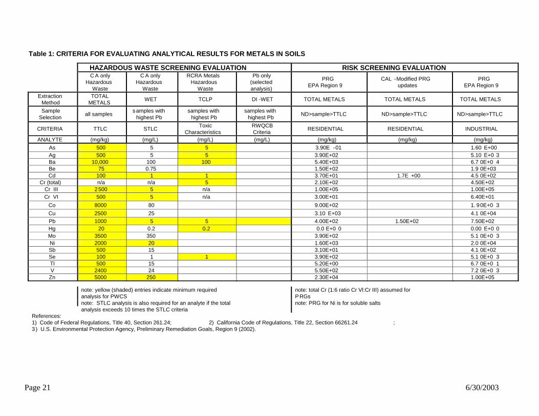
In accordance with CIWMB, LEA Advisory #56, Attachment 1, Characterizing Burn Dumps in California, DTSC recommends that soil/ash samples be collected and analyzed to meet the site specific DQOs, and the analytical results compared to the specified hazardous waste classification criteria for the selected extraction procedures as listed below and presented in Table 1, Criteria for Evaluating Analytical Results for Metals in Soil:
1. All samples should be analyzed using the Total Metals Analysis procedure for metals (Sb, As, Ba, Be, Cd , Cr (III), Cr (VI) Co, Cu, Pb, Hg, Mo, Ni, Se, Ag, Tl, V, Zn) (former CAM-17 metals); and the analytical results compared to TTLC criteria. Concurrently, all samples should be analyzed for soil acidity.
2. The three samples which exhibit the highest total lead concentrations, should
undergo additional analysis using the WET procedure for Cd, Cr (III), Cr (VI), Ni, Pb, and Zn (former CAM-5 metals); and the analytical results compared to STLC criteria.
3. Based on the Total Metals Analysis, samples that demonstrate a metal that
exceeds ten times the STLC criteria should also be analyzed for that metal using the WET method; and the analytical results compared to STLC criteria.
4. Additionally, the three samples that exhibit the highest lead concentration should
be analyzed using the TCLP procedure for RCRA metals [Ag, As, Ba, Cd, Cr (total), Hg, Pb, and Se]; and the analytical results compared to Characteristics of Toxicity criteria.
5. In addition to the analysis described above, samples that demonstrate the highest
concentrations for lead should be analyzed using the DI WET method for lead; and the analytical results compared to DI-WET criteria or evaluated for the potential to migrate to groundwater.
Appropriate analytical methods must meet site-specific DQOs and may include the following methods:
Metals, by EPA Methods 6010 or 6020 or 7000 series Soil (pH), EPA Method 9045
The hazardous waste character of heavy metal constituents found in soil at the site is screened and evaluated by comparing the analytical data results against the appropriate Federal and State regulatory criteria for the test protocol cited to determine if the site contains material that could be classified as a hazardous waste representing a threat to human health or the environment (Table 1: Criteria for Evaluating Analytical Results for

Page 19 6/30/2003
Metals in Soil). If the waste is found to contain constituents at levels above method detection limits but below the hazardous levels defined above, it may still present a threat to human health or the environment. When this occurs, a human health risk screening evaluation must be performed (see Chapter 4.0, Human Health Risk Screening Evaluation). Chapter 3.2.2—Organic Constituents Analysis for non-metals such as dioxins, furans, total recoverable petroleum hydrocarbons (TRPH), PCBs, and semi-volatile organic compounds (SVOCs) are often warranted at burn dump sites. Site-specific scenarios such as adjacently located sensitive or urban receptors, visual observation stained soil, and records review indicating contamination or spillage warrant testing for organic constituents. To evaluate the site for the presence (or absence) of these waste constituents, the following procedures should be performed on select samples collected from the site: PCBs, EPA Method 8082 or 8081; Total Recoverable Petroleum Hydrocarbons, EPA Method 418.1 or 8015M Semi-Volatile Organic Compounds, EPA Method 8270; and Dioxin/furans, EPA Method 8290 or 8280.
At a minimum, DTSC recommends that a minimum of 5 samples or a statistically valid data set that meets the site-specific DQOs for the burn site (whichever number is larger) be analyzed for TRPH, PCBS and dioxin/furans. Sampling locations may include several depth discrete sampling intervals based on site conditions (e.g., surface, intermediate; and deep); but will, at a minimum, include a surface sample. If burn ash is present, at least two of the samples should be collected from that matrix.
Chapter 3.3—Data Validation Before sampling data can be used for soil/ash characterization it must be validated and evaluated. Data validation checks laboratory paperwork including:
Sample holding times; Sampling methods; Analytical methods; Proper sample preservation; Chain of Custody records; Adequate detection limits; Transcription errors; Surrogate recoveries; Matrix spike recoveries and matrix spike duplicate recoveries; Trip blanks and equipment blanks; Calibration checks; and California Certification for the analytical laboratory.
Page 20 6/30/2003
Procedures contained in the QAPP can be used to evaluate both laboratory and sampling quality assurance and quality control. All data to be used in the PWCS must also undergo data validation with particular attention paid to previous data where sampling and analytical methods may have changed with the state of the art.
Chapter 3.4—Comparison of Site Specific Analytical Data to Regulatory Criteria for Hazardous Waste Classifications Once enough data has been gathered to characterize waste for a former burn dump site the analytical results may be compared against hazardous waste regulatory criteria for hazardous waste screening evaluation. At this phase of the investigation the comparison is strictly for screening evaluation purposes. Both Federal and State criteria for hazardous waste may be used in this protocol (see Table 1, Criteria for Evaluating Analytical Results for Metals in Soil). For the screening purposes of the PWCS, a waste can be either a RCRA hazardous waste as defined in title 40 of the Code of Federal Regulations, Section 261.24; a non-RCRA (California only) hazardous waste as defined in Title 22 of the California Code of Regulations, Section 66261.10 et. seq.; or a non-hazardous solid waste.
Page 21 6/30/2003
Table 1: CRITERIA FOR EVALUATING ANALYTICAL RESULTS FOR METALS IN SOILS HAZARDOUS WASTE SCREENING EVALUATION RISK SCREENING EVALUATION
C A only
Hazardous Waste
C A only Hazardous
Waste
RCRA Metals Hazardous
Waste
Pb only (selected analysis)
PRG EPA Region 9
CAL -Modified PRG updates
PRG EPA Region 9
Extraction Method
TOTAL METALS
WET TCLP DI -WET TOTAL METALS TOTAL METALS TOTAL METALS Sample
Selection all samples
s amples with highest Pb
samples with highest Pb
samples with highest Pb
ND>sample>TTLC ND>sample>TTLC ND>sample>TTLC
CRITERIA TTLC STLC Toxic
Characteristics RWQCB
Criteria RESIDENTIAL RESIDENTIAL INDUSTRIAL
ANALYTE (mg/kg) (mg/L) (mg/L) (mg/L) (mg/kg) (mg/kg) (mg/kg) As 500 5 5 3.90E -01 1.60 E+00 Ag 500 5 5 3.90E+02 5.10 E+0 3 Ba 10,000 100 100 5.40E+03 6.7 0E+0 4 Be 75 0.75 1.50E+02 1.9 0E+03 Cd 100 1 1 3.70E+01 1.7E +00 4.5 0E+02
Cr (total) n/a n/a 5 2.10E+02 4.50E+02 Cr III 2 500 5 n/a 1.00E+05 1.00E+05 Cr VI 500 5 n/a 3.00E+01 6.40E+01
Co 8000 80 9.00E+02 1. 90E+0 3 Cu 2500 25 3.10 E+03 4.1 0E+04 Pb 1000 5 5 4.00E+02 1.50E+02 7.50E+02 Hg 20 0.2 0.2 0.0 E+0 0 0.00 E+0 0 Mo 3500 350 3.90E+02 5.1 0E+0 3 Ni 2000 20 1.60E+03 2.0 0E+04 Sb 500 15 3.10E+01 4.1 0E+02 Se 100 1 1 3.90E+02 5.1 0E+0 3 Tl 500 15 5.20E+00 6.7 0E+0 1 V 2400 24 5.50E+02 7.2 0E+0 3
Zn 5000 250 2.30E+04 1.00E+05
note: yellow (shaded) entries indicate minimum requiredanalysis for PWCS
note: total Cr (1:6 ratio Cr Vl:Cr III) assumed for P RGs
note: PRG for Ni is for soluble salts
note: STLC analysis is also required for an analyte if the total analysis exceeds 10 times the STLC criteria
References: 1) Code of Federal Regulations, Title 40, Section 261.24; 2) California Code of Regulations, Title 22, Section 66261.24 ; 3 ) U.S. Environmental Protection Agency, Preliminary Remediation Goals, Region 9 (2002).

Page 22 6/30/2003
Chapter 4.0—Human Health Risk Screening Evaluation If the waste is found to contain metal contaminants of concern (COC) (see Chapter 4.1.1, Contaminants of Concern) at levels above method detection limits established by the DQOs, but below the hazardous waste criteria defined above (Table 1), it may still present a threat to human health or the environment. When this occurs, a risk screening evaluation must be performed. To complete human health risk screening for the PWCS, the cumulative risk of COCs found at the site may be identified using methods defined in U. S. EPA, Region 9, PRGs, for residential land use. This approach should be used for screening purposes only (see Chapter 4.2, U.S. EPA Preliminary Remediation Goal). Site-specific risk can also be evaluated using DTSC’s Preliminary Endangerment Assessment (PEA) Guidance Manual (see Chapter 4.3, DTSC Preliminary Endangerment Assessment) method for human health risk screening and may be requested by an agency. The PWCS human health risk screening evaluation is not an absolute estimate of risk or hazard at a specific site. The PWCS human health screening is intended to determine whether further site characterization, risk assessment and remediation are necessary. This approach allows for rapid data evaluation to determine if a health threat exists. If an alternative land use is desired (e.g., commercial use with deed restrictions) then modified clean up levels can be developed as part of the final site characterization or the cleanup plan. If the burn dump wastes are not found to pose an unacceptable human or ecological risk, the Regional Water Quality Control Board (RWQCB) may also evaluate whether the solid waste pose a threat to ground or surface water quality. The RWQCB uses information contained in its Basin Plan as the basis for identifying a threat to water quality.
Chapter 4.1—Risk Screening Assumptions and Exposure Factors There are several assumptions and exposure factors that are used when conducting a risk screening including; COCs, land use, exposure pathways, acute and chronic exposure characterization, and exposure point concentration. Each of these items should be addressed in the PWCS. Chapter 4.1.1—Contaminants of Concern The most prevalent COCs found at burn dump sites are heavy metals (As, Be, Cd, Cd, Cr (III), Cr (VI), Cu, Pb, Hg, Ni, and Zn). Additional metals which may also be present include [Silver (Ag), Barium (Ba), Cobalt (Co), Molybdenum (Mo), Antimony (Sb), Selenium (Se), Thallium (Tl), and Vanadium (V)]; and are also considered COCs for the purpose of this document. In addition to heavy metals and organic constituents (such as dioxins, furans, TRPH, PCBs, and SVOCs), other constituents (such as perchlorate and explosive compounds) may also be present. Refer to DTSC’s PEA Guidance Manual for information on chemical groups and human health risk screening procedures.

Page 23 6/30/2003
Chapter 4.1.2—Land Use For the purpose of the human health screening evaluation the proposed land use for the site is assumed to be residential, regardless of current use or zoning for the site. While this assumption is conservative, it provides a starting point for risk evaluation of the site. It is beyond the scope of this document to provide alternative human health screening because of the many possible land use scenarios. Chapter 4.1.3—Exposure Pathways It is assumed that the following exposure routes and media of exposure are applicable:
Inhalation—Airborne dust; Ingestion—Surface water, groundwater and ingestion of soil; and Dermal absorption—Direct contact with soil, surface water and groundwater.
Other pathways are possible but for this risk screening only these major pathways should be evaluated. Chapter 4.1.4—Acute/Chronic Exposure Human exposure occurs when people have direct contact with a COC. Generally two types of exposure are considered in a risk screening. They are; acute exposure which is defined as short term exposure to high concentrations of a COC and chronic exposure which is defined as long term exposure to low concentrations of a COC. Chapter 4.1.5—Exposure Point Concentrations to Identify Chemicals of Concern The maximum contaminant value found from sampling should be used as the exposure point concentration. In cases where adequate characterization has occurred, it may be appropriate to use the 95 percent upper confidence limit (UCL) of the arithmetic mean as the exposure point concentration if the data are normally or log-normally distributed. Otherwise, non-parametric techniques should be used to approximate exposure endpoints.
Chapter 4.2—U.S. EPA Preliminary Remediation Goals The U.S. EPA PRGs combine current U.S. EPA toxicity values with “standard” exposure factors to estimate contaminant concentrations in environmental media (soil, air, water) that are protective of humans, including sensitive groups, over a lifetime. PRG may be used to screen pollutants in the environmental media, trigger additional investigation and provide cleanup goals if applicable. Chemical concentrations above these levels would not automatically designate the site as “contaminated” or trigger a response action. However, exceeding the PRG suggests that further evaluation of the potential risk posed by site contamination would be appropriate. This may include additional sampling, consideration of ambient background levels or reassessment of the assumptions used to develop the screening-level risk numbers.
Page 24 6/30/2003
When utilizing PRGs, the residential concentration should be used for maximum beneficial use of a property. Industrial concentrations are included in the U.S. EPA’s PRG table as an alternative. However, for the purposes of risk screening during the PWCS phase of investigation, only the residential values should be used. U.S. EPA, Region 9, PRG concentrations are based on exposure pathways for which generally accepted methods, models and assumptions have been developed i.e., ingestion, dermal contact and inhalation) for specific land use conditions. It should be noted that PRG’s do not consider impact to groundwater or ecological receptors. It should also be noted that EPA provides a method for evaluation of cumulative risk in the PRG guidance. When evaluating risk at a burn dump site using PRGs the cumulative risk must be evaluated. The PRGs are updated annually and can be obtained by contacting:
The United States Environmental Protection Agency Region 9 75 Hawthorne Street San Francisco, California 94105 (415) 744-2419
PRGs are also available on the World Wide Web at:
www.epa.gov/region9/waste/sfund/prg/index.html
Chapter 4.3—DTSC Preliminary Endangerment Assessment DTSC publication Preliminary Endangerment Assessment Guidance Manual is available on the DTSC web site at:
www.dtsc.ca.gov/PublicationsForms/index.html.

Page 25 6/30/2003
Chapter 5.0—Ecological Screening Assessment
Chapter 5.1—Introduction This Chapter outlines the requirements for conducting an ecological screening assessment during the PWCS phase of investigation. The purpose this screening assessment is to identify environmentally sensitive locations in the site area that may be affected by field activities. Once a lead agency has been selected, complete ecological risk evaluations will likely be necessary.
Chapter 5.2—Identification of Environmentally-Sensitive Locations During the PWCS process for a burn dump, a reasonable effort must be made to determine if the site is located in an area which has been designated as environmentally sensitive [and worthy of special consideration]. Environmentally sensitive locations may include wetland areas, wildlife refuges or areas that are designated as endangered species habitat. This phase of the investigation is not intended to serve as a complete ecological risk screening. The purpose for this research is to identify listed environmentally sensitive locations on or adjacent to the site so that field investigation activities (drilling, trenching, etc) will not disturb or destroy designated environmentally sensitive areas. Since the SIP and PWCS process are not considered a project under CEQA, there is no formal mechanism to require the mitigation of activities associated with field investigations. However appropriate measures should be taken to protect environmentally sensitive locations. To assist (and expedite) this research, the CIWMB maintains a website on conducting office and field investigations for designation of environmentally sensitive areas. The webpage can be found at www.ciwmb.ca.gov/LEACentral/CIA/ and provides access to documents and Internet-based resources to check a location for the presence of designated environmentally sensitive areas. Additional documents which are currently available on the internet to assist in determining if a site or the surrounding area is designated as an environmentally sensitive location include the following: California Department of Fish and Game’s Endangered Plant List at
www.dfg.ca.gov/whdab/TEPlants.pdf; California Department of Fish and Game’s Endangered Animal List at
www.dfg.ca.gov/whdab/TEAnimals.pdf;
Page 26 6/30/2003
United States Fish & Wildlife Services Endangered Species List at http://ecos.fws.gov/webpage/webpage_region_lists.html?lead_region=1#CA;
United States Army Corp of Engineers, 404 Permit requirements at
www.usace.army.mil/public.html#Regulatory; and United States Army Corp of Engineers Wetlands Delineation Manual at
www.saj.usace.army.mil/permit/documents/87manual.pdf. Particular emphasis should be placed on identification of “special species” and habitat which occur on or within a one-mile radius of the site. These may include: California species of special concern; State and federally listed rare, threatened or endangered species; and Species which are proposed or recommended for state or federal listing.
The California Department of Fish and Game’s (DFG) Natural Heritage Division should be contacted for the current special animal and special plant lists. The DFG’s Natural Diversity Data Base (NDDB) can be a starting point for locating information about special species which have been found near the site, although the NDDB is not an all-inclusive listing. For more information on special plant and animal lists, and the NDDB, contact: Information Services Coordinator Information Services Natural Heritage Division California Dept. of Fish and Game 1416 9th St., 12th Floor Sacramento, CA 95814 (916) 324-3812 or (916) 327-5960 Further information on ecological assessment can also be found in DTSC’s “Guidance for Ecological Risk Assessment at Hazardous Waste Sites and Permitted Facilities, Part A: Overview,” July 1996, (DTSC, 1996a), and in the U.S. EPA’s “Risk Assessment Guidance for Superfund, Volume II, Environmental Evaluation Manual, Interim Final,” March 1989 (U.S. EPA, 1989b).

Page 27 6/30/2003
Chapter 6.0—Preliminary Waste Characterization Study Report Format Upon completion of the PWCS, the results should be compiled into a clear and concise report that documents the process undertaken and results found. Appropriate maps, figures, tables, and appendices should be included as needed. The recommended format is listed in order below:
1. Executive Summary - provides a summary of the Investigative Report. 2. Introduction - states the purpose of the report and provides background
information. 3. Site Description - describes the location, topography, site geology and setting. 4. Burn Dump History - provides a brief history of the site with operational history
and time of closure. 5. Previous Investigations (if any) - outline previous environmental work on the
former burn dump site with all sampling results and locations. 6. Scope of Field Work Performed - provide a synopsis of the investigation and any
variation from the SAP. 7. Investigation Results - provide investigation results including all sample
measurement with sample locations, tables summarizing the data, maps, cross-sections, photographs and any other figures that may support your findings.
8. Human Health Risk Screening Evaluation and Ecological Risk Screening Evaluation.
9. Boring / trench logs. 10. Conclusion and Recommendations. 11. Laboratory analytical reports, including laboratory narrative and Chain of
Custody (COC) forms.
Page 28 6/30/2003
Chapter 7.0—Consultation Process for Selection of a Lead Regulatory Agency The protocol contained in this document provides one option for collecting information for the site consultation process, described in AB709, to identify and select a lead agency for remedial oversight. It is DTSCs preferred option because it was developed in consultation with CIWMB, RWQCB, LEA representatives, Rural County Representatives and DTSC staff. However, the project proponent may have other options for selection of a lead agency. If certain criteria are met local agencies and RP’s may choose to select a lead agency using the process set fourth in AB2061. It is likely that a LEA or the CIWMB will act as the lead regulatory agency through completion of the PWCS. However, there may be circumstances in which DTSC or one of the RWQCBs may take the lead. No matter which agency has provided regulatory oversight during the initial phase of investigation, communication with all interested regulatory agencies is recommended when the PWCS report is complete. For compliance with AB709, the following guidelines should be followed: Sensitive land uses include residential areas, schools, day care facilities, hospitals
and hospices and other facilities or structures that have a high density of occupation on a daily basis. Also included as sensitive land use are parks, golf courses or any other similar open-space area made available for public use.
For a non-sensitive land use of a former burn dump site, the CIWMB will provide
DTSC, SWRCB and the appropriate RWCQB notification of the CIWMB’s interest in providing funding and remediation oversight for a specific site under AB 2136 funding. Within 30 days of notification DTSC, SWRCB or the appropriate RWQCB may request a site consultation meeting where lead remediation agency status may be requested.
During the SIP phase of investigation it will be up to the local regulatory agencies
(LEA’s, CUPA and Planning Department) to determine if there is current or proposed sensitive land use (as defined by AB709) at a burn dump site. Once a lead agency is selected that agency will work with local regulatory agencies to make those determinations.
For sites with existing or proposed sensitive land uses or water quality impacts, or
where otherwise requested by DTSC, SWRCB or the appropriate RWQCB, the CIWMB, DTSC, SWRCB, and the appropriate regional board shall hold a site consultation meeting to determine which agency will provide remediation oversight. If, following a review of the site information, DTSC, SWRCB or the appropriate RWQCB requests to provide remediation oversight, that request shall be granted. If DTSC, SWRCB or the appropriate RWQCB does not request to provide remediation oversight, remediation oversight of the site shall remain with the CIWMB. In cases where the CIWMB requested the meeting, the

Page 29 6/30/2003
determination of remediation oversight agency shall be made within 30 days of the CIWMB’s request for the meeting. If there are not enough data for DTSC, SWRCB, or the RWQCB to make a lead agency determination, the consultation process will be continued pending completion of a PWCS by the CIWMB (or designee). At completion of the PWCS, notification will again be provided to DTSC, SWRCB and the appropriate RWQCB and the consultation process will be restarted to determine the remediation oversight agency.
A graphical representation of the consultation process and how it fits into the entire burn dump site investigation and characterization process is contained in Figure 1 (Process for Identification of Lead Remediation Oversight Agency at California Burn Dump Sites). Project proponents may select to use data collected during the SIP or SWAT; or choose to complete the PWCS. Whichever approach is used, completion of the site-specific investigation and characterization is the first step in selection of appropriate abatement measures for a specific burn dump site. The CIWMB, SWRCB and DTSC each have very clear guidance on implementing abatement measures at waste sites. Once a lead regulatory oversight agency has been selected the project proponent should work with that agency to identify and implement abatement measures consistent with approved lead agency. For nonsensitive land uses, without water quality impacts, the lead agency will likely be the CIWMB. In LEA advisory #56 (Attachment 3) the CIWMB has provided four scenarios that discuss appropriate abatement measures for a burn dump site. The project proponent should work closely with the lead regulatory oversight agency to select an abatement measure that will meet all regulatory requirements for the site-specific waste as well as meet state minimum standards.
Page 30 6/30/2003
References California Environmental Protection Agency, Department of Toxic Substances Control. 1994. Preliminary Endangerment Assessment Guidance Manual. January 1994. California Environmental Protection Agency, Department of Toxic Substances Control. 1996a. Guidance for Ecological Risk Assessment at hazardous Waste Sites and Permitted Facilities, A: Overview. January 1996. California Environmental Protection Agency, Department of Toxic Substances Control. 1996b. Guidance for Ecological Risk Assessment at hazardous Waste Sites and Permitted Facilities, B: Scoping Assessment. July 1996. California Environmental Protection Agency, Department of Toxic Substances Control. 1998. Abandoned Mine Lands Preliminary Assessment Handbook. January 1998. California Integrated Waste Management Board. 1998a. Local Enforcement Advisory # 3, Revised, “Site Investigation Process for Closed, Illegal, and Abandoned Disposal Sites”. October 27, 1998. California Integrated Waste Management Board. 1998b. Local Enforcement Advisory #56, “Process for Evaluating and Remediating Burn Dump Sites” and “Attachment 1 through Attachment 4”. November 4, 1998. California Code of Regulations. 2003. Title 22, Division 4.5 Environmental Health Standards for the Management of Hazardous Waste, Chapter 11, Identification and Listing of Hazardous Waste, §66261.1 et seq. 2003. Code of Federal Regulations. 1998. 40, Protection of the Environment, Parts 260 to 299. Office of the Federal Register, National Archives and Records Administration. Revised, July 1998. State of California Assembly Bill 709. 2002. An act to add Sections 48022 and 48022.5 to the Public Resources Code, relating to solid waste, and making an appropriation thereafter. August 19, 2002. United States Environmental Protection Agency. 1986. Test Methods of Evaluating Solid Waste, Physical/Chemical Methods (SW-846), Third Edition. Office of Solid Waste and Emergency Response. Washington D.C. 1986. United States Environmental Protection Agency. 1987a. Data Quality Objectives for Remedial Response Activities. OWSER Directive 9335.075. U.S. EPA, Washington D.C., 1987.

Page 31 6/30/2003
United States Environmental Protection Agency. 1989a. “Human Health Evaluation Manual (Part A).” Volume I. Risk Assessment Guidance for Superfund, Interim Final. Office of Emergency and Remedial Response. Washington, D.C., July 1989. EPA-540/1-89/043. United States Environmental Protection Agency, 1989b, “Environmental Evaluation Manual.” Volume II. Risk Assessment Guidance for Superfund, Interim Final. Office of Emergency and Remedial Response. March 1989. EPA-540/1-89/001.
Page 32 6/30/2003
Appendix A—Example Work Plan Former Burn Site The Example Work Plan presented in Appendix A has been modified and adapted from a document prepared for the City of San Diego, Environmental Services Department, by URS Corporation. It is included in this report with permission for which DTSC is grateful. The work plan contained in this Appendix is to be viewed as an example only and not to be taken as a “boiler plate” for use at all sites. A site-specific work plan should be prepared for each facility that is going to be investigated.

P L A N
EXAMPLE WORK PLAN FORMER BURN SITE CITY OF _____, CALIFORNIA
Prepared for
City of ___________ Environmental Services Department 2701 _______ Street City of ______, CA 9111-1111
Date
Prepared by:

Tables of Contents
i
Section 1 Introduction..................................................................................................................... 1-1 1.1 Site Location and Description.................................................................. 1-1 1.2 Project Background.................................................................................. 1-1
1.2.1 Site History .................................................................................. 1-1 1.2.2 Preliminary Surface Soil Sampling.............................................. 1-2 1.2.3 Site Reconnaissance..................................................................... 1-3
1.3 Responsible Agency ................................................................................ 1-4 1.4 Project Organization ................................................................................ 1-4
Section 2 Project Objectives/Data Quality Objectives and Approach ........................................ 2-1 2.1 Project Objectives and Data Quality Objectives ..................................... 2-1 2.2 Project Approach, Conceptual Site Model and Data Gaps ..................... 2-1
Section 3 Sampling Program.......................................................................................................... 3-1 3.1 Project Mobilization ................................................................................ 3-1 3.2 Materials and Equipment ......................................................................... 3-1 3.3 Radiation Monitoring............................................................................... 3-1 3.4 Sampling Procedures ............................................................................... 3-2
3.4.1 Phase I: Surface Soil and Storm Water Sampling ...................... 3-2 3.4.2 Phase II: Test Pits/Exploratory Trenches.................................... 3-4 3.4.3 Phase III: Soil Borings................................................................ 3-4
3.5 Decontamination Procedures ................................................................... 3-5 3.6 Disposal of Investigation-Derived Wastes .............................................. 3-6
Section 4 Analysis Plan .................................................................................................................. 4-1 4.1 Laboratory Analyses ................................................................................ 4-1
4.1.1 Metals........................................................................................... 4-1 4.1.2 Organics ....................................................................................... 4-1 4.1.3 Waste Characterization Analyses ................................................ 4-2 4.1.4 Background Sample Analyses ..................................................... 4-2
4.2 Field Quality Control ............................................................................... 4-2 4.3 Laboratory Quality Control ..................................................................... 4-2
Section 5 Documentation and Reporting ...................................................................................... 5-1 5.1 Field Notes ............................................................................................... 5-1 5.2 Boring Logs ............................................................................................. 5-2 5.3 Photographs ............................................................................................. 5-2 5.4 Sample Identification and Labeling......................................................... 5-2
5.4.1 Sample Identification................................................................... 5-2 5.4.2 Sample Labeling .......................................................................... 5-3
5.5 Chain-of-Custody Records ...................................................................... 5-3 5.6 Sample Packaging and Shipment............................................................. 5-4 5.7 Reporting ................................................................................................. 5-4
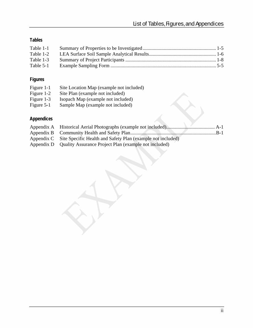
List of Tables, Figures, and Appendices
ii
Tables Table 1-1 Summary of Properties to be Investigated ........................................................... 1-5 Table 1-2 LEA Surface Soil Sample Analytical Results...................................................... 1-6 Table 1-3 Summary of Project Participants ......................................................................... 1-8 Table 5-1 Example Sampling Form ..................................................................................... 5-5 Figures Figure 1-1 Site Location Map (example not included) Figure 1-2 Site Plan (example not included) Figure 1-3 Isopach Map (example not included) Figure 5-1 Sample Map (example not included) Appendices Appendix A Historical Aerial Photographs (example not included)....................................... A-1 Appendix B Community Health and Safety Plan.....................................................................B-1 Appendix C Site Specific Health and Safety Plan (example not included) Appendix D Quality Assurance Project Plan (example not included)

SECTIONONE Introduction
1-1
This document serves as the work plan, Sampling and Analysis Plan (SAP) and Site Safety Plan (SSP) for an investigation to be conducted by _____ Environmental Consulting Corporation (EC Corp) on behalf of the City of ____, (the City) in the vicinity of a former burn site, located at ______, _____, California (site). The work plan outlines the first phase of investigation (Phase I) that will be conducted to identify the lateral extent of burn ash-containing materials present on the ground surface at the Burn Site. The results of and observations made during surface sampling in addition to our knowledge of historical operations at the Burn Site will provide a basis for any subsequent phases of investigation (Phase II and III) that may be required to delineate the vertical extent of burn ash-containing materials.
1.1 SITE LOCATION AND DESCRIPTION Based on field observations of burn ash-containing material, available historical information and interviews of long-time residents of the neighborhood, the site that will be investigated consists of approximately ___ residential properties. These properties are located in the vicinity of Downtown, ___California (Figures 1-1 and 1-2). The area to be investigated also includes…
Table 1-1 summarizes the addresses of and assessors parcel numbers (APNs) for the residential properties that may be included in this investigation. The table also lists the approximate size (in square feet) of each property and dates of construction. Because the investigation of burn sites is an iterative process, the extent of the area to be included in our investigation of the burn site will be contingent on the findings of previous phases. Elevations at the site generally range from approximately 200 to 300 feet above Mean Sea level datum (MSL). The site slopes to the…Insert site-specific data here. Access to each of the properties is generally limited to some degree by private fencing, landscaping and other onsite development. The surface on many of the properties consists of bare ground or sparse lawns with paved walkways; patios and driveways. The residential neighborhood is separated from the adjacent, Caltrans right-of-way by a chain-link fence. The Caltrans right-of-way is heavily vegetated along the western margin of the investigation area.
1.2 PROJECT BACKGROUND
1.2.1 Site History An extensive review of readily available documents and information was conducted to develop an understanding of the history of the area formerly occupied by the burn site. Historical aerial photographs of the site vicinity for the years 1928, 1945, 1953, 1964, 1971 and 2000 are provided in Appendix A. To prepare this work plan, EC CORP relied on information provided by residents during public meetings held by the City, interviews of long-time residents and site walks with City personnel and residents in the proposed investigation area to observe the presence of burn ash-containing materials on the ground surface. The results of these information-gathering efforts are described herein. Documentation regarding the location and operation of the burn site is referenced in a City Planning Commission Report titled, “Report on Refuse Dumps” (Document No. 10001), filed. The report identifies refuse dumps either owned/operated or used for dumping by the City.

SECTIONONE Introduction
1-2
Information related to several former refuse dumps, including site is summarized in interim report prepared for the City Solid Waste Local Enforcement Agency (LEA), titled… According to information appearing in the Report obtained from the 1941 Report on Refuse Dumps, the burn site operated southeast of the intersection of __ and __Street on approximately 2 acres. The information implies that the dump began operating in 1928; however, it may have been used by the public prior to that date, possibly as early as 1922. All types of materials were disposed and burned regularly. The 1941 Report also indicates that residents at properties northwest of the site salvaged materials from the burn dump. These materials included auto bodies and parts, scrap iron and lumber. It was reported that no burning occurred in this approximately 0.25-acre area. The burn site may have operated until about 1942. Other than a 1927 aerial photograph, there are no available photographs during the period of operation. In addition, the 1927 aerial photograph does not clearly identify dump operations. Property use at that time in the site vicinity was primarily rural. Homes were sparsely located within the site area and streets were unpaved and unimproved. According to an interview of a long-time resident of the area, a dairy was located near the current location. Based on discussions with long-time residents, dumping began sometime prior to 1929. Although evidence of burning and dumping of rubbish are not clearly visible in the 1928 aerial photograph of the site vicinity, there are bare areas on the ground surface near the site. In April 1929 there was a plane that crashed in the lower portion of the canyon near the parcel occupied by 2713, 2717 and 2719 ____ Street. Some long-time residents confirmed the crash, and one indicated that the plane crashed beyond (south of) the dump. The long-time resident also indicated that the wreckage was removed from this property sometime after the crash. City personnel reviewed records at the City Historical Society to identify photographs that might show where the dump was located; however, none of the photos indicated its location. The 1945 aerial photograph indicates that additional residences had been constructed in the neighborhood, by that time but streets remained unpaved and unimproved…Insert site-specific history here. Topographic maps available for the site were used to identify areas that had been filled or cut. A topographic map for the period before 1952 during the time the burn site operated was not available. The fill/cut isopach map provided as Figure 1-3 shows that the southwestern portion of the canyon was filled to construct roads. Approximately 5 feet of fill was placed during this period. The fill may also have been placed to construct a building pad for homes. The isopach suggests that some areas of the site were cut approximately 5 to 10 feet. It should be noted that the cut materials were not necessarily native soil only, but may have also included fill and burn ash-containing soil placed before 1952.
1.2.2 Preliminary Surface Soil Sampling In May 2002, the LEA conducted limited surface sampling on the site. Two surface soil samples were collected from each property. Materials typically associated with burn ash were observed by the LEA on these properties. Debris such as fused glass, blue, green and milk glass, ceramics/porcelain and metal were observed on the ground surface. The soil is also dark colored.

SECTIONONE Introduction
1-3
Analytical results for the surface soil samples are summarized in Table 1-2. These results indicate that lead was present in surface soil samples that the LEA collected from these properties. Lead concentrations ranged from 41 to 1,880 mg/kg. All but one of the 17 samples analyzed contained lead at a concentration exceeding the California Department of Toxic Substances Control’s (DTSC’s) residential Preliminary Remediation Goal [PRG (99th percentile) of 146 mg/kg]. This is a screening level for lead in soil that is calculated using default values in the LeadSpread7 model. The model calculates an exposure concentration that could result in a blood lead level of 10 µg/dl in a child. It is believed that blood lead levels above this concentration could potentially pose a health risk in children. Elevated concentrations of other metals were also present in the samples analyzed, including arsenic, cadmium, nickel and zinc; however, only arsenic and cadmium were present at concentrations exceeding their respective residential PRGs. The detection limit for thallium was elevated, therefore, it is not known whether this metal is present in surface soil at elevated concentrations. LEA also analyzed the samples for total recoverable petroleum hydrocarbons (TRPH) to identify samples that should be considered for polynuclear aromatic hydrocarbon (PAH) analyses. TRPH concentrations ranged from <10 to 824 mg/kg. TRPH is not a discriminating analysis, because in addition to PAHs, TRPH analyses could be an indicator of other long-chained hydrocarbons, such as motor oil, waste oil, tars, asphalt and even naturally occurring organic materials unrelated to the former burn site. LEA analyzed the sample with the highest TRPH concentration (sample no. 2919-1 from 2919 ___ Street) for semivolatile organic compounds (SVOCs) which include PAHs. No PAHs were detected; however, the detection limits for specific PAHs exceeded their respective residential PRGs. Further analyses will be necessary at lower detection limits to identify whether PAHs are constituents of potential concern (COPCs).
1.2.3 Site Reconnaissance On _______, Mr. Frank Smith of EC CORP and Mr. John James of the City walked the neighborhood to observe the surficial extent of burn ash following the interview of a long-time resident at her home. On________, the City held a site walk with interested residents of the neighborhood to obtain information on the former extent of the burn dump and observe surface soil conditions. Findings during each site walk are summarized below. During the _______ site walk, burn ash-containing materials were observed on the properties and the surface soil on the majority of the site appears to contain burn ash. In addition, some burn ash is present on the ground surface on the western side (back yards) of the properties located east of the site. During the site walk on the following day with City and EC CORP representatives and neighborhood residents, the resident at ______ indicated that glass-containing material was encountered when planting a lemon tree on his property. Based on these comments, the burn ash-containing soil is at least 2 to 3 feet thick on this property. Debris including glass, ceramics and porcelain were observed on the ground surface that may be representative of burn ash-containing materials. Therefore, all of the properties on the west side site have been included in the investigation area. Debris was observed on the properties located on the east side of the site. These properties have also been included in the investigation area for the burn site. However, based on
SECTIONONE Introduction
1-4
historical information, there is no evidence that the former burn site extended south. of the Baptist Church on ___ Street.
1.3 RESPONSIBLE AGENCY The LEA and CIWMB will be reviewing documents during this phase of investigation once the PWCS is complete A lead agency will be chosen. EC CORP and its subcontractors will implement the work plan by performing the phases of investigation and preparing a report summarizing the results.
1.4 PROJECT ORGANIZATION Table 1-3 outlines the various entities involved in the site investigations and their respective responsibilities.

SECTIONONE Introduction
1-5
Table 1-1 SUMMARY OF PROPERTIES TO BE INVESTIGATED
FORMER _______ STREET BURN SITE
Address APN Date of Original Construction 2
Approximate Property Size (sq.ft.)
Notes: APN: Assessor’s Parcel Number 1 Address obtained from City Building Department Records; may not match addresses indicated on residences. 2 Obtained from City Building Department Records 3 New Bethel Baptist Church NA: Not Available * Based on available historical information, these properties are believed to have a low probability of containing burn ash.

SECTIONONE Introduction
1-6
Table 1-2 LEA SURFACE SOIL SAMPLE ANALYTICAL RESULTS
________ STREET BURN SITE (concentrations reported in mg/kg unless noted otherwise)
Sample ID Sample
Date SVOCs (ug/kg) TRPH Sb As Ba Be Cd Cr Co Cu Pb Hg Mo Ni Se Ag Tl V Zn
Location 1 2919-1 5/1/00 ND 824 <10 6.5 372 <1 <5 16 <10 72 322 0.24 <10 24 <1 <0.5 <100 26 558 2919-2 5/1/00 NA 15 <10 2.8 256 <1 <5 15 <10 37 519 0.77 <10 <10 <1 0.7 <100 24 545 2919-2 (DUP.) 5/1/00 NA NS <10 2.8 256 <1 <5 15 <10 37 519 0.77 <10 <10 <1 0.7 <10 24 545 Location 2 2933-1 5/1/00 NA 23 <10 4.6 262 <1 <5 18 <10 169 313 0.08 <10 <10 <1 0.6 <100 39 407 2933-2 5/1/00 NA 21 <10 7.7 1040 <1 <5 21 <10 156 722 0.31 <10 12 <1 0.8 <100 25 1210 Location 3 2953-1 5/1/00 NA 14 <10 1.6 62 <1 <5 <10 <10 <10 41 0.07 <10 <10 <1 <0.5 <100 23 55 2953-2 5/1/00 NA 44 <10 1.2 106 <1 <5 10 <10 48 190 <0.05 <10 <10 <1 <0.5 <100 21 163 Location 4 2959-1 5/1/00 NA 23 <10 10 926 <1 6 34 <10 280 1020 0.13 <10 35 <1 1.6 <100 28 1610 2959-2 5/1/00 NA 44 <10 8.2 1970 <1 18 26 <10 191 1880 0.12 <10 43 <1 2 <100 27 9110 Location 5 2963-1 5/1/00 NA 83 <10 3.8 145 <1 <5 21 <10 128 233 0.12 <10 15 <1 <0.5 <100 20 327 2963-2 5/1/00 NA 25 <10 6.9 382 <1 <5 19 <10 95 485 <0.05 <10 11 <1 0.7 <100 23 609 Location 6 2967-1 5/1/00 NA <10 <10 8.7 1180 <1 7 39 12 529 1650 0.09 <10 40 <1 2.3 <100 27 1960 2967-2 5/1/00 NA 78 <10 4.8 398 <1 <5 20 10 162 400 0.07 <10 45 <1 0.6 <100 22 573 Location 7 ___ Street CALTRANS-1
6/12/00 NS 35 <10 3.7 235 <1 <5 15 <10 43 417 0.2 <10 <10 <1 <0.5 <100 29 466
___ Street CALTRANS-2
6/12/00 NS 22 <10 6.4 670 <1 <5 29 <10 226 784 0.22 <10 26 <1 1.6 <100 33 1510

SECTIONONE Introduction
1-7
Table 1-2 LEA SURFACE SOIL SAMPLE ANALYTICAL RESULTS
________ STREET BURN SITE (concentrations reported in mg/kg unless noted otherwise)
Sample ID Sample
Date SVOCs (ug/kg) TRPH Sb As Ba Be Cd Cr Co Cu Pb Hg Mo Ni Se Ag Tl V Zn
___ Street CALTRANS-3
6/12/00 NS 14 <10 22.2 531 <1 <5 21 <10 229 583 0.11 <10 117 <1 1.2 <10 34 851
___ Street CALTRANS-3D
6/12/00 NS <10 17.7 591 <1 <5 23 <10 150 569 0.1 <10 15 <1 1.1 <100 32 1570
___ Street CALTRANS-4
6/12/00 NS 28 <10 10.8 572 <1 <5 22 <10 156 636 <0.05 <10 15 <1 0.8 <10 25 870
Notes:
Sb: Antimony As: Arsenic Ba: Barium Be: Beryllium Cd: Cadmium Cr: Chromium Co: Cobalt Cu: Copper
Hg: Mercury Mo: Molybdenum Ni: Nickel Se: Selenium Ag: Silver Tl: Thallium V: Vanadium Zn: Zinc
TRPH: Total recoverable petroleum hydrocarbons by EPA Method 418.1 SVOCs: Semivolatile organic compounds (including polynuclear aromatic hydrocarbons) by EPA Method 8270. NA: Not Analyzed ND: None Detected The symbol "<" (less than) indicates the metal was not detected above this laboratory detection limit specified.

SECTIONONE Introduction
1-8
Table 1-3 SUMMARY OF PROJECT PARTICIPANTS
________ STREET BURN SITE
Entity Contact Responsibility
City Environmental Services Department
Name Sr. Project Engineer Name Project Engineer
Local Project Oversight Interagency Review Property access and encroachment permitting with Caltrans Public Outreach and Involvement
EC CORP Corporation Name Site Assessment & Remediation Group Name Manager Name Senior Project Manager Name Field Geologist/Engineer
Health and Safety Planning Site Sampling Laboratory and Field Activity Coordination Report Preparation
MASSI Construction, Inc. (MCI) Name President
Heavy Equipment Operation/Trenching
Big Rig Drilling Name Operations Manager
Subsurface Drilling
Maximum Analytical, Inc. (MA) Name Laboratory Project Manager Soil Analyses and Reporting
Caltrans Name Environmental Manager
Authorization for Right-of-way Access Caltrans project manager
City of ______ Solid Waste, Local Enforcement Agency
Name Program Manager Name Project Manager
Local Regulatory Oversight of Solid Waste Issues
Regional Water Quality Control Board (RWQCB)
Name Geologists
Regulatory Oversight of Water Quality Issues

SECTIONTWO Project Objectives
2-1
2.1 PROJECT OBJECTIVES/DATA QUALITY OBJECTIVES Project Objectives The objective of this work plan will be to implement an investigation program that addresses LEA, RWQCB and DTSC requirements and protocols so that a plan can be developed to mitigate potential human exposure to burn ash and possible water quality issues related to the site. Both CIWMB, LEA Advisory No. 56, Process for Evaluation and Remediating Burn Dump Sites (dated November 1998) with attachments and DTSC Protocol for Burn Dump Site Evaluation and Characterization (dated April 2003) outline procedures for investigating and characterizing burn ash sites with the objective of identifying whether there is an imminent threat to the environment and/or public health and safety. Additionally, this work plan addresses water quality issues that are of concern to the RWQCB.
Data Quality Objectives The sampling and analytical activities described in this document will be implemented to:
• Identify the extent of burn ash-containing materials at the site both laterally and vertically
• Characterize the composition of the burn ash materials by identifying COPCs
• Conduct analyses to identify whether the burn ash can be considered a possible hazardous waste based on California and Federal regulations
• Conduct storm water and sediment sampling to address RWQCB concerns concerning burn ash solubility and mobility
• Collect the information necessary to identify potential human health risks for the affected properties
• Collect the information necessary to develop a plan to mitigate potential human health risks and possible water quality issues through removal or capping of burn ash-containing materials
• Provide the information necessary for the City to offer assistance to the affected residents. The information collected must satisfy the City’s needs to make complicated risk management decisions on a property-by property basis. Collect the information necessary to develop a plan to mitigate potential human health risks and possible water quality issues through removal or capping of burn ash-containing materials
• Complete an investigation that fulfills the recommendations outlined in the DTSC Protocol for Burn Dump Site Investigation and Characterization.
2.2 PROJECT APPROACH, CONCEPTUAL SITE MODEL AND DATA GAPS Information collected to prepare this work plan indicates that the extent of the burn site may be much larger than initially believed. In order to conduct a timely, cost-effective investigation, EC CORP proposes to conduct it in three phases. Investigating burn sites is an iterative process, and by conducting the investigation in phases, it will enable us to focus on those areas that pose the greatest potential health risk to the community first. Surface soil (0-6 inches below the ground

SECTIONTWO Project Objectives
2-2
surface) poses the greatest potential human health and safety risk; therefore this work plan focuses our strategy on delineating the presence of burn ash on the ground surface. Phases II and III of the proposed investigation will include trenching and drilling borings, as necessary to complete the vertical delineation of burn ash at the site. Field procedures for Phases II and III are described herein; however, locations of test pits/trenches and soil borings will be identified following surface sampling. Based on the findings during the subsequent phases, some additional surface sampling may be needed to fully delineate burn ash at the site. Based on our experience, it is quite possible that a minor amount of burn ash delineation may even be conducted during the mitigation phase.
The primary contaminants of concern (COC) at the site include... (INSERT SITE SPECIFIC COCs) ... Although particular COCs are collocated with lead in burn ash, burn ash is a heterogeneous material and the concentrations of different COCs may not be related linearly (i.e. higher lead concentrations may not correlate with higher concentrations of the other COCs). Therefore, our analysis strategy will focus on these additional constituents in addition to lead for the entire range of lead concentrations detected.
The cost associated with sampling a site as large as this one can be substantial. Based on lead sample results, analyses for other COPCs will be strategically selected for those sites where ash is identified. Following surface sampling, subsurface sampling can focus on those areas where burn ash was identified on the ground surface and where historical evidence suggests it may be present.
In developing a sampling strategy, there are a number of questions that should be answered through completion of the investigation. These questions are:
• On what properties in the investigation area is burn ash present on the ground surface?
• Where is burn ash present where an individual could commonly come in contact with it?
• Does the burn ash extend beneath existing homes/buildings?
• Do children live or play on the properties where exposed burn ash is identified?
• What is the lateral and vertical extent of burn ash in the investigation area?
• At what concentrations are COPCs present in the burn ash?
• Has burn ash been carried off site by storm water flow?
• To what degree are COPCs in exposed burn ash soluble in storm water?
• If the burn ash were to be removed, could these materials be considered a hazardous waste based on California and Federal regulations?
The responses to these questions will enable us to delineate the extent of ash, evaluate current and future human health risk, and allow the City to make decisions with respect to cleanup. This work plan has been developed so that the City can address the issues specific to each property on a case-by-case basis. By implementing the work plan in this manner, remobilizing to collect data to fill gaps can be done less frequently, resulting in a savings with respect to time and cost.
SECTIONTHREE Sampling Program
3-1
3.1 PROJECT MOBILIZATION The surface sampling proposed as Phase I of our investigation will not encounter subsurface utilities. However, for subsequent phases involving trenches or borings, EC CORP will notify Underground Service Alert (USA) of our intent to advance soil borings and excavate trenches prior to the start of this work as is required by law. In addition, we will schedule a commercial underground utility locator to identify subsurface utilities on private properties and confirm those identified by the utility companies notified by USA. EC CORP will also schedule drilling and excavation subcontractors and mobilize sampling equipment. A concrete coring contractor will be retained as needed to core concrete present at proposed sampling locations. In accordance with OSHA requirements, we will prepare a site-specific health and safety plan for use by EC CORP and subcontractor personnel. A copy of the site-specific health and safety plan is provided in Appendix C. A community health and safety plan will also be prepared by EC CORP that will be implemented during the field program. A copy of the community health and safety plan is provided in Appendix B.
In addition, a boring permit application and the necessary fees will be provided to the City and or County Department of Environmental Health (DEH) to advance soil borings in accordance with local regulatory requirements. Borings drilled to a depth greater than 20 feet require permits in ____ County. Approval of the permit typically takes 10 working days. The City will also coordinate access issues related to private properties. EC CORP will obtain necessary traffic control equipment to conduct sampling in the public right of ways.
3.2 MATERIALS AND EQUIPMENT Materials and equipment that may be needed to implement the work plan include:
• Monitoring equipment and personal protective equipment (PPE) as outlined in the site-specific health and safety plan and community health and safety plan.
• Sampling equipment including but not limited to stainless steel sampling tubes, Teflon sheets, polyethylene end caps, modified California samplers, stainless steel mixing bowls, spoons and trowels, hand augers and extensions, sample containers, waterproof markers, sample labels, insulated coolers and ice.
• Decontamination equipment and supplies (i.e. wash and rinse buckets, brushes, non-phosphate detergent, plastic sheeting, paper towels, sponges, baby wipes, garden–type sprayers, large plastic bags, re-sealable plastic bags, potable water, and distilled or de-ionized water.
• Field logbook, chain-of-custody and other forms necessary for documentation.
3.3 RADIATION MONITORING Sources of radiation were identified at a nearby site. Because this site is of the same age and may have had similar sources of waste, EC CORP personnel will conduct radiation monitoring during each of the phases of investigation. The monitoring will be conducted to protect the health and
SECTIONTHREE Sampling Program
3-2
safety of EC CORP field staff and subcontractors. Monitoring will be conducted prior to surface sampling on each property using a portable Ludlum Micro R Scintillator that monitors Gamma radiation. Field personnel will conduct parallel transects across each property and locations where elevated readings are measured will be noted on a field map for that property and placed in a logbook. Soil samples and their locations will also be monitored for the presence of radiation. The City will be notified immediately of any anomalous radiation measurement, exceeding three times background. Personnel will leave the immediate area until a response team arrives at the site to further investigate the radioactive source. Additionally, the City will notify County Hazardous Materials Division, State Radiation and/or U.S. EPA Region IX Emergency Response Program in the event that radioactive materials are encountered.
3.4 SAMPLING PROGRAM PROCEDURES The sampling program procedures to be conducted during the three phases of investigation are described in the following sections. Phase I of our investigation will include surface soil (0 to 1 foot bgs) only. Subsequent phases will include test pit/trenches and soil borings. Procedures for excavating test pits and drilling soil borings are described herein. However, the location and number of test pits and soil borings will be contingent upon the findings of the surface sampling conducted during Phase I. The procedures described below include surface soil (grab) sampling, exploratory trenching/test pits using a backhoe, hand auger borings (where backhoe access is limited) and auger drilling for soil borings. Proposed sampling methods may be modified, based on the field conditions encountered. For instance, if test pits/trenches proposed do not encounter the fill-native soil contact within the maximum depth that can be feasibly excavated with a backhoe, the locations will be drilled in a subsequent phase using an auger rig.
3.4.1 Phase I: Surface Soil and Storm Water Sampling
3.4.1.1 Soil Discrete soil sampling will be conducted on each residential property identified on Figure 1-2, including the Caltrans right-of-way. We propose that up to six samples will be collected from each residential property for lead analyses. The number of samples collected may vary based on the degree to which a parcel may be paved with asphalt or concrete. The number of samples collected on properties that are significantly larger or smaller than the average parcel (approximately 6,000 square feet) may be more or less and adjusted accordingly. Fewer samples will be collected for analysis on the low-probability burn ash properties. Each residential property will be divided into six cells of approximately equal area (approximately 1,000 square feet), and sample locations will be selected for front, back, side yards and within crawl spaces beneath residences, (if present), as feasible. Sampling frequency on the Caltrans right-of-way will be due to its non-residential property use status. We estimate up to 12 samples may be collected for analyses on the Caltrans right-of-way. Samples collected will be both random and authoritative (selected based on observations of burn ash and/or property use in a particular area) for each property. Coordinates for proposed random
SECTIONTHREE Sampling Program
3-3
sample locations will be generated for each cell randomly using a random number generator associated with ExcelTM software or a hand-held calculator. Random samples will be collected from a cell if:
• There are no surface indications of the presence of burn ash and/or
• The area does not appear to be specifically used as a play area for children
• All areas appear to indicate the presence of burn ash on the ground surface Authoritative samples will be collected from a cell if:
• A specific area has evidence that burn ash is present
• The sample location is to be used to delineate the presence of burn ash on the ground surface Recent discussions with residents have identified several homes with crawl spaces beneath the structures. Prior to the field investigation, other homes with crawl spaces will be identified and a surface soil sampling plan will be developed for each, based on size, potential for use, and condition of the ground surface. Samples in crawl spaces will be collected for earthen ground surfaces only. Of the six samples to be collected for the average property, at least one will be located within a crawl space, if present. During the last rain event (date), it was observed that burn ash-containing materials are readily eroded from parts of the site. EC CORP will additionally sample sediment accumulated within the storm water catch basins on the site and adjacent Caltrans right-of-way. The linear extent to which EC CORP conducts sampling along these drainage courses will depend on field observations of the presence of burn ash-containing materials. Based on the findings, hand sampling at greater depths and distances may be necessary during Phase II. The samples at each location will be collected using disposal equipment (if possible) to a depth of approximately 6 to 12 inches. Turf will be removed prior to obtaining the samples. The characteristics of the soil sample will be described in accordance with ASTM D 2488. Soil samples will be placed into a stainless-steel bowl, where the sample will be homogenized. The sample will be placed in laboratory-supplied glass-jars, sealed with a Teflon-lined lid. The sample jars will be labeled and placed into an insulated cooler with ice (maintained at 4º C) for transport under chain-of-custody procedures to a state-certified laboratory for analysis following lead analyses using XRF.
The area where the sample was obtained will be backfilled with topsoil, and the turf initially removed will be placed on the topsoil to return the area to its preexisting condition. The location will be measured with respect to property boundaries and/or other landmarks and recorded on a field map for that property.
3.4.1.2 Storm Water The LEA advisory and the RWQCB recommend conducting a DI Waste Extraction Test (WET) analysis on burn ash to evaluate the potential solubility of these materials. This test has been developed to estimate potential solubility of burn ash when subjected to precipitation. Since burn ash is exposed on the ground surface, we propose to collect storm water samples from portions of the site to evaluate the actual solubility of metals in these materials. We believe that actual storm water

SECTIONTHREE Sampling Program
3-4
samples area more accurate method to evaluate metals solubility due to the heterogeneous nature of burn ash. Storm water samples may be collected at any time during the investigation, provided that there is sufficient runoff. We will attempt to collect the storm water samples within two hours following runoff during a storm event that is preceded by 72 hours of dry weather.
3.4.2 Phase II: Test Pits/Exploratory Trenches Test pits/exploratory trenches will be excavated to identify whether:
• Burn ash is present within a depth interval that may be readily accessible to residents under typical property use scenarios
• Burn ash may extend beneath a residence
Test pits/exploratory test pits will also be used to delineate the vertical extent of burn ash in some portions of the site, including along streets and alleys. There are limitations as to the reach (depth excavated) of different types of excavating equipment, and locations where the vertical extent of ash cannot be identified will require soil borings during the Phase III investigation. Where access via backhoe is limited, test pits may be excavated by hand to obtain samples for analysis and observe subsurface conditions. Hand excavation may be conducted using hand augers, post-hole diggers, and shovels or digging bars to facilitate the collection of soil samples for laboratory analyses. Some sampling may be necessary with hand-operated equipment along drainage courses downgradient of the site.
Up to 3 soil samples per location will be selected for lead analysis based on field observations of the presence of burn ash. These samples may represent surface (if necessary), burn ash, and native soil. Grab samples of soil/ash material will be collected out of the backhoe bucket, or directly from the trench walls or floor, if conditions safely permit. The trenches will be logged and photographed by a EC CORP engineer or geologist to document the extent of the burn-ash material.
The test pits/trenches will be logged in the field by a EC CORP engineer or geologist in accordance with ASTM D 2488. Soil samples will be placed into a stainless steel bowl where it will be disaggregated and homogenized. The sample will then be placed into a laboratory-supplied glass-jars, sealed with a Teflon-lined lid. The sample jars will be labeled and placed into an insulated cooler with ice (maintained at 4º C) for transport under chain-of-custody procedures to a state-certified laboratory for analysis following lead analyses using XRF. Soil cuttings generated during test pit and trench excavation will be placed back into their respective excavations. Materials removed last will be returned to the excavation first, so that burn ash that may be present at depth is not placed on the ground surface. Dust control measures for soil excavation activities will be described in the site and community Health and Safety Plans.
3.4.3 Phase III: Soil Borings EC CORP will contract with a licensed drilling company to advance borings to further evaluate the presence and vertical extent of burn-ash containing material in areas where test pits/trenches did not encounter the fill-native soil contact. Preliminary locations of these borings may be within streets and alleys in the investigation area. The number and location of the borings will be identified following Phase II.

SECTIONTHREE Sampling Program
3-5
The soil borings will be advanced to an approximate depth of the fill-native soil contact (up to approximately 20 to 30 feet) or refusal, whichever occurs first. Refusal does not necessarily indicate that native soil has been encountered. If refusal is encountered, a boring may be redrilled at an alternative location, if the anticipated thickness of fill at that location is believed to be greater. At the site, we observed layers of what appeared to be native soil which were locally derived materials used as fill that were interbedded with burn ash.
Soil sampling will be attempted continuously from the ground surface to the bottom of each boring, with a California modified split-spoon sampler, if hollow-stem auger drilling is successful. Past drilling at the site indicates that successful hollow-stem auger drilling is likely. If solid-stem auger is needed to complete the drilling, samples will be collected from the auger flights or within the boring, if the boring remains open upon auger removal. Up to five soil samples per boring may be analyzed for lead. Samples will be selected for analysis based on field observations (the presence of burn ash containing materials) and depth. Two of the samples submitted for analysis will include burn ash containing material immediately above the fill-native soil contact, and native soil immediately below the contact (if possible). EC CORP will archive a portion of the samples representing each 1-foot interval in each boring.
An EC CORP engineer or geologist will log the borings in the field in accordance with ASTM D 2488 under the supervision of a California Registered Geologist. Soil samples will be extruded from the stainless-steel sampling tubes and placed in a stainless steel mixing bowl. The sample will be disaggregated and homogenized using a stainless steel sampling spoon or by hand (using rubber gloves) and then placed in a laboratory-prepared glass sample jar. The jar will be labeled and placed into an insulated cooler with ice (maintained at 4º C) for transport under chain-of-custody procedures to a state-certified laboratory for analysis. Based on our understanding of site conditions, it is unlikely that groundwater will be encountered during drilling.
Upon completion of sampling, the borings will be abandoned by backfilling with the materials removed. Materials will be returned to the borings in the approximate order that they were drilled. Each boring will be capped with asphalt, concrete or clean soil to match the existing, surrounding surface.
3.5 DECONTAMINATION PROCEDURES Disposable soil sampling equipment will be used for each sample location. Therefore, the need to decontaminate re-useable equipment will not be necessary. Drilling equipment will be dry brushed to remove any adhered soil.

SECTIONTHREE Sampling Program
3-6
3.6 DISPOSAL OF INVESTIGATION-DERIVED WASTES In the process of conducting the supplemental investigation at the site, potentially contaminated IDWs will be generated that include the following:
• Used personal protective equipment (PPE) • Disposable sampling equipment
The following procedures listed below will be implemented for handling specific IDWs:
• Used PPE and disposable equipment will be double bagged and placed in a municipal refuse dumpster. These wastes are not considered hazardous and can be sent to a municipal landfill. Used PPE and equipment to be disposed will be rendered inoperable or unusable before disposal in a refuse dumpster.
SECTIONFOUR Analysis Plan
4-1
4.1 LABORATORY ANALYSES This analysis plan has been developed based on our past experience with burn ash sites, DTSC’s Protocol for Burn Dump Investigation and Characterization, LEA Advisory No. 56, discussions with LEA personnel and RWQCB requirements. For sampling purposes, the site has been subdivided into two groups of properties: high- and low-probability for the presence of burn ash. The low probability properties will include all those identified in the investigation area located south of the site. These properties are indicated with an asterisk in Table 1-1. The number of samples and suite of analyses for the low-probability area will be less than the high-probability properties (2 to 4 samples analyzed for lead), unless results indicate the presence of lead at concentrations that exceed the California modified PRG.
Laboratory analyses, with the exception of dioxins and furans, will be performed by _____ Analytical Laboratories, Inc., a state-certified laboratory, located in ______, California. Dioxins and furans analyses will be conducted by ______ Laboratories Inc. located in _______, California. The laboratory analyses will be completed on a standard turnaround basis (approximately five working days for each analysis, with the exception of dioxins and furans which is 21 days). EC CORP will request the laboratory to archive samples for up to six months [the holding time for metals analyses, with the exception of mercury (28 days)], so that other analyses could be conducted as needed.
4.1.1 Metals Based on our past experience with burn ash sites, lead is the constituent that results in the greatest health risk and has the greatest potential to characterize the materials as hazardous based on toxicity. Therefore, surface soil samples collected on each property will be initially analyzed for lead by EPA Method 6010B.
Up to half of surface samples analyzed by the laboratory for lead on each property within the high-probability area will be analyzed for metals that have been typically identified as COCs at other burn ash sites. The DTSC recommended analysis for…(INSERT THE ANALYTICAL PROGRAM THAT MEETS THE REQUIREMENTS OUTLINED IN THE PROTOCOL FOR BURN DUMP SITE INVESTIGATION AND CHARACTERIZATION HERE)…
Storm water samples will be analyzed for Title 22 metals by various EPA methods. The detection limits for metals will be low enough to compare the results to the RWQCB’s Basin Plan standards for metals present in surface waters.
4.1.2 Organics Of the samples collected from each property (both low- and high-probability properties and Caltrans’ rights-of-way) for lead analyses, one sample will be analyzed for PAHs by EPA Method 8270 and TRPH by EPA Method 418.1. The sample analyzed for PAHs and TRPH will be statistically selected at random from those samples in which burn ash is observed in the field. If samples collected from a property show no evidence of the presence of burn ash, one of the six (or more) samples will be statistically selected for these analyses. A correlation coefficient will be calculated for the total PAH and TRPH results.

SECTIONFOUR Analysis Plan
4-2
The individual PAH species will be summed. The range of total PAH results will be divided into three groups: low, medium and high concentrations, based on the distribution of the results. Two samples from each of the three groups (six total) will be selected statistically at random for additional analyses including PCBs by EPA Method 8081 and dioxins and furans by EPA Method 8290. In addition to these six samples, the sample containing the highest total PAH concentration site-wide will also be analyzed for PCBs and dioxins and furans. A total of seven samples will be analyzed for PCBs and dioxins and furans at the site.
4.1.3 Waste Characterization Analyses Based on TTLC metals results, surface soil samples may be analyzed for Soluble Threshold Limit Concentration (STLC) metals by the Waste Extraction Test (WET) procedure and metals by the Toxicity Characteristic Leaching Procedure (TCLP) to evaluate the hazardous waste characteristics of the materials. Samples with TTLC metals results that exceed 10 times the STLC or 20 times the TCLP for a particular metal will be subjected to these extraction procedures.
4.1.4 Background Sample Analyses Background soil sampling was conducted on unaffected properties within the investigation area at a location, approximately one block north of the site. The background data will be supplemented with some additional background data collected to evaluate background concentrations of the constituents that are being analyzed in the investigation area. We estimate that up to five additional background samples will be analyzed for Title 22 metals, PCBs, PAHs, and dioxins and furans. We propose that these background samples be analyzed from those low-probability properties, following receipt of lead results. If it is believed that none of the low-probability properties represent background, samples for evaluating background will be collected outside of the investigation area for the site. Additionally, background storm water samples will be collected upgradient of the investigation area, if possible to identify metals that may be present before runoff enters the site. The background storm water samples will be analyzed for Title 22 metals.
4.2 FIELD QUALITY CONTROL Field duplicate samples are typically collected and analyzed to evaluate sampling and analytical precision. Field duplicates will be collected once per day or one per every 20 field samples collected. Field equipment rinsate samples will be collected once per day as needed. Field Blanks will not be required for this sampling event. Documentation of field sampling accuracy and precision requirements to satisfy DQO requirements are fully described in Appendix D, Quality Assurance Project Plan (QAPP).
4.3 LABORATORY QUALITY CONTROL The analytical laboratory will perform Quality Control (QC). The QC will include method blank results, laboratory control spike, and matrix spike results.
SECTIONFOUR Analysis Plan
4-3
• Method Blank Results: A method blank is a laboratory-generated sample that assesses the degree to which laboratory operations and procedures cause false-positive analytical results for the samples. The method blank results associated with the samples will be included with the analytical results.
• Laboratory Control Spike: A Laboratory Control Spike (LCS) is a sample that is spiked with known analyte concentrations, and analyzed at approximately 10 percent of the sample load in order to establish method-specific control limits. The LCS results associated with the samples will be attached on the LCS and LCS Duplicate Analysis Report.
• Matrix Spike Results: A matrix spike is a sample that is spiked with known analyte concentrations and analyzed at approximately 10 percent of the sample load in order to establish method-specific control limits. The matrix spike results associated with the samples will be attached on the Matrix Spike and Matrix Spike Duplicate Analysis Report.
• Accuracy: Accuracy will be measured by percent recovery as defined by:
% recovery = (measured concentration) x 100 (actual concentration)
Documentation of laboratory sampling accuracy and precision requirements to satisfy DQO requirements are fully described in Appendix D, Quality Assurance Project Plan (QAPP).

SECTIONFIVE Documentation and Reporting
5-1
5.1 FIELD NOTES Field logbooks will be used to document vital project and sample information. Logbook entries will be complete and accurate enough to permit reconstruction of field activities. Logbooks will be bound with consecutively numbered pages and each page will be dated and the time of entry noted in military time. At a minimum, daily entries in the field logbook will include the following:
• Site name and address • Recorder’s name • Team members and their responsibilities • Time of site arrival/entry on site and time of site departure • Other personnel onsite • A summary of any onsite meetings • Deviations from sampling plans and site safety plans, if any • Levels of safety protection • Calibration readings for any equipment used At a minimum, the following information will be recorded during the collection of each sample:
• Sample identification number
• Sample location and description
• Sampler’s name(s)
• Date and time of sample collection
• Designation of sample as composite, grab, drive, etc.
• Type of sample (i.e., matrix)
• Type of preservation
• Type of sampling equipment used
• Field observations and details important to analysis or integrity of samples (e.g., heavy rains, odors, colors, etc.)
• Instrument readings (e.g., radiation monitor, dust monitor, etc.)
• Recipient laboratory(ies) A form showing sample information will be completed for each property. An example of the surface sampling form is provided as Table 5-1. A map will be developed for each residential property. An example map for one of the residential properties is provided as Figure 5-1. There will be two copies of each map used in the field. One map will show surface sample, trench/test pit, and boring locations to scale. The lateral extent of burn ash on the ground surface will also be noted on the maps based on visual observations of surface conditions on each property. Results of radiation monitoring during surface sampling will be recorded on the other copy of the map of each property.

SECTIONFIVE Documentation and Reporting
5-2
5.2 BORING LOGS A lithologic description of the materials encountered and collected will be maintained on boring logs compiled by the field geologist. Soils will be classified in accordance with ASTM D 2488, and descriptions will include soil type, particle size and distribution, color (using the Munsell soil color chart), moisture content, and evidence of burn ash and/or contamination (discoloration, unusual odors, debris, glass, etc.).
5.3 PHOTOGRAPHS Photographs will be taken at sample locations and at other areas of interest onsite. The photographs will serve to verify information entered in the field logbook. When a photograph is taken, the following information will be written in the logbook or will be recorded in a separate field photography log:
• Time, date, location, and, if appropriate, weather conditions • Description of the subject photographed • Name of person taking the photograph
5.4 SAMPLE IDENTIFICATION AND LABELING
5.4.1 Sample Identification
5.4.1.1 Surface Samples Each surface sample identification number will reference the property from which it was collected. Because the properties are located along ____ and _____ Streets, the name will begin with that number followed by the house number, so that confusion is avoided with respect to location. Each surface location on a property will be indicated with and “S” and numbered consecutively using two digits. For example, the first surface sample from 3005 ____ Street will be labeled “8.3005-S01). Sample locations on the Caltrans right-of-way will be given the identifier “Caltrans-“ followed by an ”S” and numbered consecutively with two digits, such as “Caltrans-S01”. Surface samples collected on any property or Caltrans right-of-way that represent surface water drainage or the SWCS will be designated with a “D”’ rather than an “S” (i.e. Caltrans-D01) All sample depths will be assumed to be from 0–1 foot bgs; therefore there will be no indicator for depth in the sample ID.
5.4.1.2 Storm Water Samples Storm water sample locations will be assigned consecutive station numbers. Because the locations will be within the public right-of-way, the sample ID will not refer to a particular property. Storm water sampling stations will be designated “SW-__” and numbered consecutively beginning with “01-__”. The suffix following the sample number will include a six-digit date (i.e., “021001”), indicating the date sampled.

SECTIONFIVE Documentation and Reporting
5-3
5.4.1.3 Subsurface Samples A street and address convention similar to that described for surface samples will be employed. However, subsurface samples may be collected through various investigation techniques. These techniques may include, test pits/trenches or borings. Rather than using an “S’ as indicated for surface samples, test pits/trenches will be identified with a “T” and borings will be identified with a “B”. Test pits/trenches and borings will then be numbered consecutively for each property. Unlike surface sampling, multiple samples will be collected at each test pit/trench or boring location. A depth indicated with two digits will follow the test pit/trench or boring number. For example, a soil sample collected from the first test pit at 3002 9th Street at a depth of 2 to 3 feet will be designated sample no. “9.3002-T01-02”. The depth indicated will correspond with the top of the sample interval. If a surface sample were collected, the suffix to the sample ID would be “-00”.
5.4.2 Sample Labeling To identify and manage samples obtained in the field, a sample label will be affixed to each sample container. At a minimum, the sample labels will include the following information:
• Project number and/or project name • Boring or trench number • Sample identification number • Sampler’s initials • Date and time of collection • Preservative, if any
5.5 CHAIN-OF-CUSTODY RECORDS Chain-of-custody (COC) records are used to document sample collection and shipment to laboratory for analysis. A COC record will accompany all sample shipments to the laboratory. Form(s) will be completed and sent with each shipment of samples to the laboratory. If multiple coolers are sent to the laboratory on a single day, COC form(s) will be completed and sent with the samples for each cooler. The COC record will identify the contents of each shipment and maintain the custodial integrity of the samples. A COC form will be completed for each property. Generally, a sample is considered to be in someone’s custody if it is either in someone’s physical possession, in someone’s view, locked up, or kept in a secured area that is restricted to authorized personnel. Until receipt by the laboratory, the custody of the samples will be the responsibility of the sample collector.
If samples are shipped or are not in the custody of the sample collector or laboratory, a self-adhesive custody seal will be placed across the lid of each sample. The shipping containers in which samples are stored (usually sturdy picnic cooler or ice chest) will also be sealed with self-adhesive custody seals any time they are not in the sample collector’s possession or view before delivery to the laboratory. All custody seals will be signed and dated.
SECTIONFIVE Documentation and Reporting
5-4
5.6 SAMPLE PACKAGING AND SHIPMENT Following collection and labeling, samples will immediately be placed in a sample cooler for temporary storage. The following protocol will be followed for sample packaging:
1. Sample containers will be placed in clear, plastic, leak-resistant bags prior to placement in the ice chest. Screw caps will be checked for tightness prior to placing the sample in the bag.
2. Ice or “Blue Ice” packs will be placed in leak-resistant plastic bags and included in the coolers to keep samples at a chilled temperature during transport to the analytical laboratory.
3. The COC form will be placed in a water-resistant plastic bag and taped on the inside of the lid of the cooler.
4. Samples that are shipped, if any, will be placed in the cooler and packed with packaging materials to minimize the potential for disturbance and/or breakage of the sample containers.
5. Samples that are shipped, if any, will have a self-adhesive custody seal across the lid of each sample container and the lid of the cooler.
Every effort will be made to transport the samples to the analytical laboratory at the end of each sampling day. However, if the sampling runs late and the laboratory is closed, the samples will be stored overnight in a secured location under appropriate chain-of-custody procedures, and the samples will be shipped to the laboratory the next day. Prior to overnight storage, the cooler(s) will be restocked with new ice or blue ice to maintain the samples in a chilled state.
5.7 REPORTING Following receipt and evaluation of the laboratory analytical results, EC CORP will tabulate surface sample results and prepare a map showing the extent of burn ash on the ground surface. Concentrations will be reported on the map for each surface sample location. The data will be shared with the City and LEA prior to initiating the next phase of the investigation. Data will be tabulated and plotted on maps as it becomes available during subsequent phases. EC CORP will prepare and submit a draft report to the City, LEA and RWQCB for review. Our report will include a description of sampling procedures, boring logs describing materials encountered during drilling and sampling, figures with boring and trench locations, cross sections or isopach maps showing the thickness of the burn ash containing materials and the contact with native soil, tabulated laboratory data, and discussion, evaluation, and conclusions of field and laboratory results. Modifications to the work plan that were implemented during the field phases will also be documented. Based on the existing data for the site, the volume of burn ash containing materials will be estimated for each property. The data collected will serve as a basis for human health risk assessment and development of a burn ash mitigation plan.
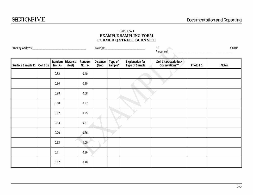
SECTIONFIVE Documentation and Reporting
5-5
Table 5-1 EXAMPLE SAMPLING FORM
FORMER Q STREET BURN SITE
Property Address:_____________________________________ Date(s):____________________________ EC CORP Personnel:___________________________________________
Surface Sample ID Cell Size Random No. X-
Distance (feet)
Random No. Y-
Distance (feet)
Type of Sample*
Explanation for Type of Sample
Soil Characteristics/ Observations** Photo I.D. Notes
0.52 0.40
0.80 0.90
0.98 0.08
0.68 0.97
0.02 0.95
0.93 0.21
0.70 0.76
0.93 1.00
0.71 0.36
0.87 0.10

APPENDIX A Historical Aerial Photographs
A-1
INSERT AERIAL PHOTOGRAHS HERE

APPENDIX B Community Health and Safety Plan
B-1
B.1 Site Identification and Location Based on field observations of burn ash-containing material, available historical information and interviews of long-time residents of the neighborhood, the site that will be investigated consists of approximately 30 to 35 residential properties. These properties are located in the vicinity of ___ and ___ Streets both north and south of ___Street in the Heights area of City, California (Figures 1-1 and 1-2). The area to be investigated also includes a portion of the Caltrans right-of-way on the east side of an access ramp that connects westbound I-89 with northbound I-27.
Table 1-1 summarizes the addresses of and assessors parcel numbers (APNs) for the residential properties that may be included in this investigation. The table also lists the approximate size (in square feet) of each property. Because the investigation of burn sites is an iterative process, the extent of the area to be included in our investigation of the burn site will be contingent on the findings of previous phases.
Elevations at the site generally range from approximately 200 to 300 feet above Mean Sea level datum (MSL). The site slopes to the south toward the central area, occupied by an alley that is currently referred to as ___ Street south of ___ Street. This alley traverses approximately 275 feet to the south of ___ Street and bends toward the west, where it terminates at the Caltrans right-of-way. Properties on the west side of ___ Street within the area to be investigated slopes to the west and south. Each residential lot ranges in size from approximately 3,200 square feet (0.07 acres) to 17,000 square feet (0.39 acres). Although most properties are single-family residential, multi-family residential units occupy several of the properties. The New Abraham Revival Church occupies a parcel on the west side of ___ Street south of ___ Street. The Caltrans right-of-way slopes toward the west toward the access ramp. Elevations along the I-27 access ramp range from approximately 200 to 260 feet MSL from south to north.
Access to each of the properties is generally limited to some degree by private fencing, landscaping and other onsite development. The surface on many of the properties consists of bare ground or sparse lawns. The residential neighborhood is separated from the adjacent, Caltrans right-of-way for I-27 by a chain-link fence that delineates the western boundary of the investigation area. The Caltrans right-of-way is heavily vegetated along the western margin of the investigation area.
B.2 Evaluation of Potential Public Exposure to Hazards The most significant anticipated hazard at the site will be burn ash-containing dust, since these materials contain elevated levels of lead and other metals. The main exposure pathway of concern is inhalation. Additionally, burn ash-containing materials encountered at the site may be classified as hazardous materials. Dust emissions during our investigation will be controlled by the application of water during drilling and trenching at the site. Predominant winds in the site vicinity are expected to be out of the west, blowing toward the east. Residential housing is located in the immediate vicinity of the areas to be investigated. Since our investigation involves relatively small areas, and will not involve loading or transportation of burn ash-containing materials, the anticipated impact to the general public outside the residences to be investigated is minimal. Furthermore, areas to be investigated by trenching (which has the greatest likelihood

APPENDIX B Community Health and Safety Plan
B-2
to generate fugitive dust) are in areas away from general public access. As outlined in Section A.6 of this Community Health and Safety Plan, dust will be strictly controlled so as not to present a nuisance or a public health hazard.
B.3 Monitoring Equipment Trenching and excavation of soil on site has the greatest likelihood to generate fugitive dust during field investigation activities. Therefore, dust monitoring will be conducted during trenching by the EC CORP Site Safety Officer.
Dust monitoring stations will be established at the upwind (west) and downwind (east) property boundaries during trenching. Airborne dust will be monitored utilizing Miniram Aerosol Monitors (or equivalent) to measure the concentrations of airborne particulates. Miniram action levels are based on the EPA National Ambient Air Quality Standard for lead (40 CFR 763) of 1.5 µg/m3 . If dust concentrations exceed 50 µg/m3 over a 5-minute period, then additional dust control measures will be implemented. If dust concentrations exceed 150 µg/m3 at any time, operations at the site shall be halted until dust can be adequately controlled. The upwind and downwind dust monitoring stations will be checked hourly, and readings will be recorded in a logbook.
Personal dust monitoring will be conducted as deemed necessary by the EC CORP Site Safety Officer for personnel working in or around the trenches/test pits area. Personal protective equipment (such as respirators) and personal dust monitoring procedures are described in the site-specific health and safety plan.
B.4 Site Security Access to areas to be investigated will be limited to project personnel authorized to enter the exclusion zone. Exclusion zones will be established around work areas prior to work each day to prevent unauthorized access to potentially hazardous areas. Open boreholes and trenches will be backfilled at the conclusion of sampling activities and no boreholes, trenches or test pits will remain open following the conclusion of daily work activities. Field equipment and monitoring devices will be secured overnight as necessary in the field trailer located on the Vacant Lot located at the intersection of ___ Street and ___ Street. Heavy equipment such as backhoes and drilling rigs can be stored overnight on the Vacant Lot if the subcontractor so chooses. The Vacant Lot is secured with a fence and locked gate.
B.5 Vapors Based on the results of previous investigations conducted at the site, organic vapor emissions are not anticipated. However, dust control measures to be implemented during drilling and trenching should minimize vapor emissions. Because residents have indicated that a subterranean fire burned east of the ___ Street alley and north of ___ Street, there is the potential of encountering landfill gas. Borings and trenches drilled northeast of Q Street in the investigation will be monitored for methane using a combustible gas indicator (CGI). Under
APPENDIX B Community Health and Safety Plan
B-3
such circumstances, a photoionization detector (PID) will be used to monitor the presence of organic vapors. Readings will be recorded on a field log.
B.6 Dust Subsurface investigation activities will be conducted in such a manner as to minimize fugitive dust emissions. Based upon prior field investigation experience related to burn ash, the use of water to abate dust has proven to be the most effective measure. Water hoses equipped with spray nozzles will be onsite to continually moisten the soil generated during drilling and trenching. Water shall be applied to sufficiently reduce the potential for dust emissions, but shall not be applied to the point that saturation, ponding or runoff occurs. If visible dust emissions cannot be controlled by the application of water, operations at the site shall be halted until the excavation contractor can adequately control dust emissions. In addition, should excessively windy conditions exist at the site to the point where, in the opinion of the onsite EC CORP representative, the application of water is unable to control dust emissions, then operations at the site shall be halted until less windy conditions prevail.
B.7 Noise Noise will be generated from the heavy equipment and drill rigs operating at the site. Since the site is located in a residential area, scheduled work hours at the site will be between 8:00 a.m. and 5:00 p.m., Monday through Friday. In addition, no weekend hours are anticipated. It is anticipated that the proposed scope of work will take approximately 10 to 15 workdays to complete the proposed work at the site.
B.8 Open Excavations Trenches will be backfilled following sampling.
B.9 Stockpiled Soil Stockpiling of soil during site investigation activities is not anticipated. Soil cuttings generated during drilling will be placed back into the borehole. Upon completion of sampling, materials will be returned to the borings in the approximate order in which they were removed.
B.10 Radiation Monitoring Monitoring will be conducted for gamma radiation using a Ludlum Model 19 Micro R Meter. Because all radioactive decay releases gamma radiation, this approach will screen for the presence of radiation but not identify the specific type of radiation. Prior to surface sampling on a property, traverses will be conducted, and readings will be noted on a field log and the field map for the property. Surface soil samples, trenches and borings will be monitored for radiation during each of the phases of investigation.
If anomalous radiation readings (three times background) are measured during any of the investigation phases, the City will be notified immediately and fieldwork will be terminated on

APPENDIX B Community Health and Safety Plan
B-4
that property. Any open borings or trenches where radiation measurements exceed three times background will also be backfilled immediately. Additionally, the County Hazardous Materials Division (HMD), State Radiation and/or the U.S. EPA Region IX Emergency Response Team will be contacted to report the radiation findings. If anomalous radiation is detected, speciation of the radiation can be conducted by these agencies to identify whether the source of radiation is alpha, beta or gamma. City personnel will report the findings soon thereafter to the appropriate property owners and residents. Our contact at the HMD is:
Mr. ___________, Senior Health Physicist ____________ County Department of Environmental Health, Hazardous Materials Division 2701 ___________ (111) 111-1111
B.11 Site Safety Manager The Site Safety Officer will be: ______________
B.12 Emergency Planning Based on analytical laboratory results and the extensive subsurface investigation conducted at the site, we do not anticipate encountering flammable or combustible substances, or vapors. Furthermore, our scope of work is investigative, and does not involve remediation, removal or transportation of potentially hazardous materials at this time. If a medical emergency situation arises during sampling activities, “911” notification will be utilized. Under these circumstances, the person(s) will be transported to the nearest hospital that is specified in the EC CORP Site-Specific Health and Safety Plan. The nearest hospital is ____ Hospital, located at ___ Road (phone: (111) 111-1111). Directions to the hospital are as follows:
• North on __ Street, right (east) on ____________
• Left (north) on __ Street to traffic light
• Left (west) on ____ Ave.
• Hospital approximately ½ mile on left after traffic light at ____ Road.
B.13 Public Notification The City’s public notification program will include distribution of notices to all properties prior to the initiation of field activities. The notices have been hand-delivered or mailed. The public notification will include the following:
• 24-Hour emergency contact names and phone numbers • Description of onsite activities to be conducted including dates and times • Anticipated duration of onsite activities • Proposition 65 warnings

APPENDIX B Community Health and Safety Plan
B-5
B.14 Agency Notification The City Environmental Services Department and the City Solid Waste Local Enforcement Agency (LEA) will be notified immediately if any unexpected situation with respect to community health and safety is encountered during the sampling program.