PROGRAM - VULNERABILITIES OF THE QUÉBEC’S … · The project entitled Détermination et analyse...
8
VULNERABILITIES OF THE QUÉBEC’S ARCTIC TERRITORY IN THE CONTEXT OF CLIMATE CHANGE April 19, 2018, Kuujjuaq, Nunavik Official program
-
Upload
nguyentuyen -
Category
Documents
-
view
216 -
download
0
Transcript of PROGRAM - VULNERABILITIES OF THE QUÉBEC’S … · The project entitled Détermination et analyse...
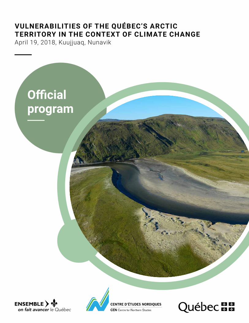
VULNERABILITIES OF THE QUÉBEC’S ARCTIC TERRITORY IN THE CONTEXT OF CLIMATE CHANGE April 19, 2018, Kuujjuaq, Nunavik
Official program

Program
Place: Makivik Corporation office
Arrival 8 a.m.
Introductory Address 8:30 a.m.Representatives of the Makivik Corporation, the Kativik Regional Government (KRG), and the Gouvernement du Québec
Presentations from 8:45 a.m. to 12 p.m.
Objectives of projects focusing on the vulnerabilities of Québec’s arctic territory in the context of climate changeJean-François Bergeron, M. Sc., M.A.P., ministère des Forêts, de la Faune et des Parcs [email protected]
As part of the Gouvernement du Québec’s 2013-2020 Climate Change Action Plan, in 2014, the Ministère des Forêts, de la Faune et des Parcs kicked off an ambitious plan to synthesize and map the vulnerabilities of Québec’s arctic territory, drawing on the expertise of universities and Ouranos.
Over the 2014-2017 period, the studies focussed on the physical environment and climate. Analyses of natural hazards, geomorphological processes and the distribution of permafrost established a direct link between the impact of temperature and precipitation regime changes and the vulnerabilities of the physical environments that support wildlife habitats and human settlements. Using climate modeling data, work from 2018 to 2021 will evaluate the impact of anticipated climate changes on terrestrial and aquatic species, ecosystems. We will be looking the relationships between Nunavik residents and its bioresources.
Recent and future Nunavik climatesPatrick Grenier, Ph. D., Ouranos [email protected]
This presentation concerns recent work at Ouranos and INRS for characterizing recent-past Nunavik climate and developing an ensemble of plausible future climate scenarios for this region. The emphasis will notably be on the alternative datasets used to compensate the paucity of observations in the North, as well as on maps of future changes in temperature, rain and snow indicators.
Phot
o: M
FFP
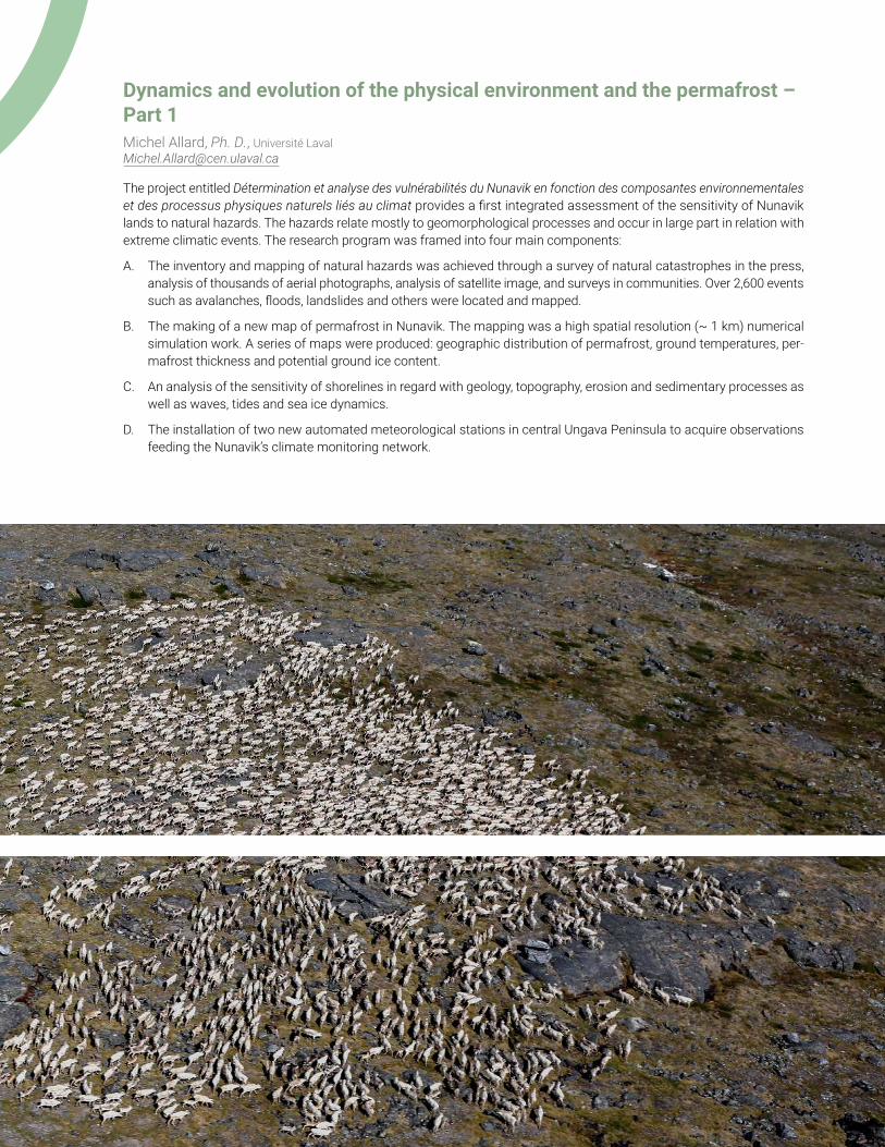
Dynamics and evolution of the physical environment and the permafrost – Part 1Michel Allard, Ph. D., Université Laval [email protected]
The project entitled Détermination et analyse des vulnérabilités du Nunavik en fonction des composantes environnementales et des processus physiques naturels liés au climat provides a first integrated assessment of the sensitivity of Nunavik lands to natural hazards. The hazards relate mostly to geomorphological processes and occur in large part in relation with extreme climatic events. The research program was framed into four main components:
A. The inventory and mapping of natural hazards was achieved through a survey of natural catastrophes in the press, analysis of thousands of aerial photographs, analysis of satellite image, and surveys in communities. Over 2,600 events such as avalanches, floods, landslides and others were located and mapped.
B. The making of a new map of permafrost in Nunavik. The mapping was a high spatial resolution (~ 1 km) numerical simulation work. A series of maps were produced: geographic distribution of permafrost, ground temperatures, per-mafrost thickness and potential ground ice content.
C. An analysis of the sensitivity of shorelines in regard with geology, topography, erosion and sedimentary processes as well as waves, tides and sea ice dynamics.
D. The installation of two new automated meteorological stations in central Ungava Peninsula to acquire observations feeding the Nunavik’s climate monitoring network.
Dynamics and evolution of the physical environment and the permafrost – Part 2Emmanuel L’Hérault, M. Sc., Université Laval [email protected]
Permafrost depends on climate. The work done on the characteristics, behaviour and distribution of permafrost aimed at updating the map of permafrost distribution initially produced by Allard and Seguin in 1987. Recent warming made it necessary to produce updated permafrost maps. The new maps show, at a high spatial resolution (250 m2), the extent and distribution of the permafrost zones as well as the spatial variability of the temperature at the top of the permafrost, its thickness and its ice content for the whole of Nunavik. The new maps provide an information base of this key land parameter that comes in support to professionals involved in the sustainable development of the territory, who must deal with the severe geotechnical, environmental and financial constraints associated with permafrost.
Coastal classification of NunavikAntoine Boisson, M. Sc., Université Laval [email protected]
Antoine Boisson will present his work on the coastal classification of Nunavik. The methodological aspects will be explained in details: geotagged shoreline videography and photography, collaboration with the Environment Canada eSPACE project, the different types of coast, the coastline segmentation work. Several maps, detailed statistics and some evolutionary models will be presented to draw a general picture of the coasts of Nunavik.
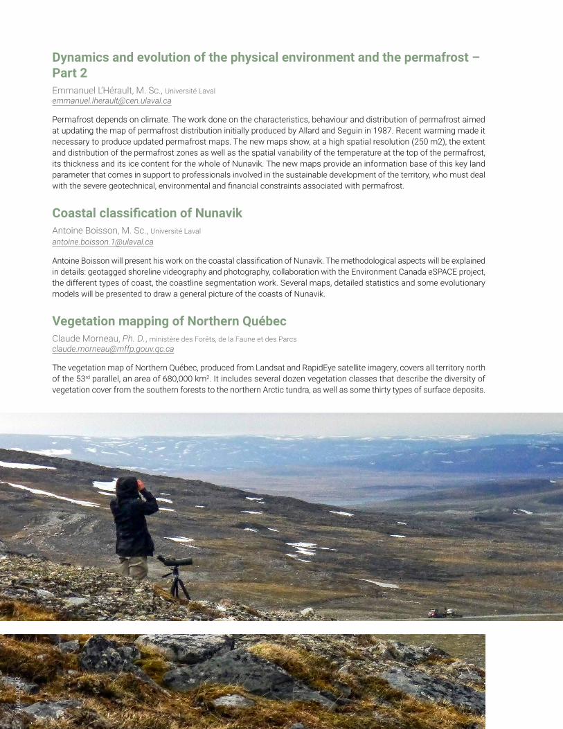
Vegetation mapping of Northern QuébecClaude Morneau, Ph. D., ministère des Forêts, de la Faune et des Parcs [email protected]
The vegetation map of Northern Québec, produced from Landsat and RapidEye satellite imagery, covers all territory north of the 53rd parallel, an area of 680,000 km2. It includes several dozen vegetation classes that describe the diversity of vegetation cover from the southern forests to the northern Arctic tundra, as well as some thirty types of surface deposits.
Phot
o: U
QAR
Surface deposit mapping of Northern QuébecElisabeth Dufour, M. Env., ministère des Forêts, de la Faune et des Parcs [email protected]
Presentation of a new approach for mapping surface deposits using technology based on medium-resolution satellite imagery (RapidEye 5m). The method, tools and results of the surface deposit mapping of Northern Québec are presented, as well as the freely-accessible nature of the data.
Nunavik’s flora and vegetation in a changing climate: Perspectives on their evolutionBenoît Tremblay, M. Sc., ministère du Développement durable, de l’Environnement et de la Lutte contre les changements climatiques [email protected]
How is Nunavik’s vegetation expected to evolve in the upcoming decades in a context of climate change? Which factors are involved and what role do each play in this evolution at the local and global scales? The following presentation will strive to bring some answers to these questions.
Lunch from 12 p.m. to 12:45 pm
Presentations from 12:45 p.m. to 5 p.m.
Testimonial regarding climate change observations in the fieldKuujjuaq Elder
Perceptions of climate change by Nunavik’s huntersJimmy Johannes, RNUK
The role of the Nunavimmi Umajullirijiit Katujiqatiginninga, the Nunavik Hunting Fishing Trapping Association (NHFTA) is to protect the interest of the Inuit hunters whom are also beneficiaries to the James Bay Northern Québec Agreement. Our role includes co-management of land based wildlife, offshore and waterfowl. We also treat various wildlife issues in collaboration with Makivik Corporation, Québec government, federal government including nunavut inuit agencies.
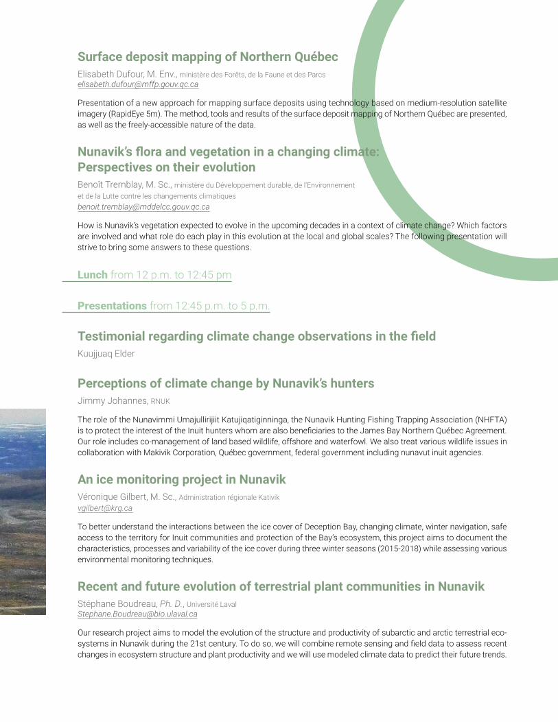
An ice monitoring project in NunavikVéronique Gilbert, M. Sc., Administration régionale Kativik [email protected]
To better understand the interactions between the ice cover of Deception Bay, changing climate, winter navigation, safe access to the territory for Inuit communities and protection of the Bay’s ecosystem, this project aims to document the characteristics, processes and variability of the ice cover during three winter seasons (2015-2018) while assessing various environmental monitoring techniques.
Recent and future evolution of terrestrial plant communities in NunavikStéphane Boudreau, Ph. D., Université Laval [email protected]
Our research project aims to model the evolution of the structure and productivity of subarctic and arctic terrestrial eco-systems in Nunavik during the 21st century. To do so, we will combine remote sensing and field data to assess recent changes in ecosystem structure and plant productivity and we will use modeled climate data to predict their future trends.
Evolution of lake and river thermal habitatsYves Gratton, Ph. D., and André St-Hilaire, Ph. D., INRS [email protected] and [email protected]
In the framework of the studies on the lakes physical environment, we are using a simple lake model, MyLake, to firstly reproduce current temperature and dissolved oxygen in salmonid habitats and, secondly to generate plausible habitat scenarios in the near (2041-2070) and more distant (2071-2100) futures over Québec and Nunavik.
The objectives of the river portion of the project studying the impact of climate change on the salmonid thermal habitats in Northern Québec are:
A. Acquisition of water temperature and weather data for salmonid rivers.
B. Calibration of an artificial neural network model at each site for which more than two years of water temperature data are available.
C. Selection of a limited number of climate change scenarios (e.g. RCP 8.5).
D. Generation of future temperature scenarios using the calibrated models.
Examples of the same type of modeling used in Southern Québec rivers, including Rivière Ouelle, will be given. For the latter river, based on the climate change scenarios studied, Jeong et al. (2013) project that by 2100, the number of days with water temperature higher than 21°C will increase to up to 30 days.
Population dynamics of salmonids in the context of climate changeLaurie Beaupré, M. Sc., ministère des Forêts, de la Faune et des Parcs and Lilian Tran, M. Sc., Centre de recherche du Nunavik - Makivik Corporation [email protected] and [email protected]
Environmental changes caused by climate change point to a decline in the quality and quantity of available aquatic habitats. The expected increase in water temperature may conduct to less favorable conditions for metabolism, growth and survival of salmonids. The Ministère des Forêts, de la Faune et des Parc is also working on the implementation of a biodiversity monitoring network through the province of Québec, with special regards to nordicity.
The Nunavik Research Centre is currently conducting two projects related to climate change impacts on Arctic charr: (1) The Nepihjee River Arctic Charr Monitoring Program and (2) A Study of the Physical Condition of Arctic Charr in the Deception Bay Region. The first is a multifaceted long-term Inuit-led initiative and second is a recent multi-stakeholder collaborative project. Both projects are innovative in that they combine Inuit knowledge and western science.
Modelling Nunavik’s terrestrial ecosystems in the 2100 horizonPascale Ropars, Ph. D., Université du Québec à Rimouski [email protected]
A first study aimed to better understand the potential changes in the migratory caribou dynamic during the 21th century. Distribution and abundance scenarios, as well as an exhaustive summary on the biology and ecology of the species were produced. In the context of the Northern territory of Québec conservation goals, we propose to model the potential impacts of projected climate change during the 21th century on Nunavik’s terrestrial ecosystems.
Wildlife resource harvesting, wild food consumption, and climate change impactsMurray Humphries, Ph. D., McGill University [email protected]
Using a value chain approach, we propose a synthesis of recent and ongoing research in Nunavik related to wildlife harvest, wild food consumption, and climate change impacts on key wild food species and their ecosystems. We also describe potential new research projects intended to address Nunavik-prioritized knowledge gaps.

Ouranos Northern Environment Program to support climate change adaptation in the NorthRobert Siron, Ph. D., Ouranos [email protected]
An outline of Ouranos’ Northern Environment program and its priorities is presented. The program’s objectives are to promote the acquisition of knowledge about adaptation and transfer it to the appropriate authorities. This is achieved by encouraging innovative research and supporting regional authorities and communities in the integration of climate risks and adaptation to climate change for sustainable development in the North. An overview of ongoing research projects is carried out. These projects contribute to improving the understanding of impacts, the identification of vulnerabilities, and the analysis and implementation of adaptation measures, with focus on Nunavik.
Plenary Session
Reception at Nuna Golf country club from 5 p.m. to 7:30 p.m.Talks by representatives of the Makivik Corporation, the Kativik Regional Government (KRG), and the Gouvernement du Québec.
Showdown on the permafrost, surface deposits, and vegetation maps with the experts who participated in their realization.
-
Phot
o: C
entre
d’é
tude
s no
rdiq
ues,
Uni
vers
ité L
aval

Cove
rs p
hoto
s: B
enoî
t Tre
mbl
ay, M
DDEL
CC