Planning Commission Motion No. 19459 CEQA Findings · requirements of Section 21094 of CEQA and...
49
www.sfplanning.org Subject to: (Select only if applicable) ; Inclusionary Housing ; Childcare Requirement ; Jobs Housing Linkage Program ; Downtown Park Fee ; Public Art ; Public Open Space ; First Source Hiring (Admin. Code) ; Transit Impact Development Fee ; Other – Per Development Agreement Planning Commission Motion No. 19459 CEQA Findings HEARING DATE: SEPTEMBER 17, 2015 Date: September 3, 2015 Case No.: 2011.0409ENV/CUA/DVA/OFA/MAP/PCA/SHD Project Address: 925 Mission Street and various parcels (aka "5M") Project Sponsor: Audrey Tendell 5M Project, LLC 875 Howard Street, Suite 330 San Francisco, CA 94103 Staff Contact: Kevin Guy – (415) 558-6163 [email protected] ADOPTING FINDINGS UNDER THE CALIFORNIA ENVIRONMENTAL QUALITY ACT, INCLUDING FINDINGS REJECTING ALTERNATIVES AS INFEASIBLE, A STATEMENT OF OVERRIDING CONSIDERATIONS, AND A MITIGATION MONITORING, AND REPORTING PROGRAM, RELATING TO THE APPROVAL OF THE 5M PROJECT (“PROJECT”), AT 925 MISSION STREET (ASSESSOR’S BLOCKS-LOTS: 3725/ 005, 006, 008, 009, 012, 042-047, 076, 077, 089- 091, 093, 094, 097-100). PREAMBLE 1. On August 19, 2014, May 15, 2015, and August 7, 2015, 5M Project, LLC (“Project Sponsor”) filed entitlement applications with the San Francisco Planning Department for the development of a mixed-use commercial, residential and retail/educational/cultural development project (“5M Project”). 2. The 5M Project is located on approximately four acres of land under single ownership, bounded by Mission, Fifth and Howard Streets. The site is generally bounded by Mission Street to the north, Fifth Street to the east, Howard Street to the south, and Mary Street to the west, along with several additional parcels further to the west along Mary Street. It is currently occupied by eight buildings
Transcript of Planning Commission Motion No. 19459 CEQA Findings · requirements of Section 21094 of CEQA and...

www.sfplanning.org
Subject to: (Select only if applicable) Inclusionary Housing Childcare Requirement Jobs Housing Linkage Program Downtown Park Fee Public Art
Public Open Space First Source Hiring (Admin. Code) Transit Impact Development Fee Other – Per Development Agreement
Planning Commission Motion No. 19459CEQA Findings
HEARING DATE: SEPTEMBER 17, 2015
Date: September 3, 2015 Case No.: 2011.0409ENV/CUA/DVA/OFA/MAP/PCA/SHD Project Address: 925 Mission Street and various parcels (aka "5M") Project Sponsor: Audrey Tendell 5M Project, LLC 875 Howard Street, Suite 330 San Francisco, CA 94103 Staff Contact: Kevin Guy – (415) 558-6163 [email protected]
ADOPTING FINDINGS UNDER THE CALIFORNIA ENVIRONMENTAL QUALITY ACT, INCLUDING FINDINGS REJECTING ALTERNATIVES AS INFEASIBLE, A STATEMENT OF OVERRIDING CONSIDERATIONS, AND A MITIGATION MONITORING, AND REPORTING PROGRAM, RELATING TO THE APPROVAL OF THE 5M PROJECT (“PROJECT”), AT 925 MISSION STREET (ASSESSOR’S BLOCKS-LOTS: 3725/ 005, 006, 008, 009, 012, 042-047, 076, 077, 089-091, 093, 094, 097-100).
PREAMBLE
1. On August 19, 2014, May 15, 2015, and August 7, 2015, 5M Project, LLC (“Project Sponsor”) filed entitlement applications with the San Francisco Planning Department for the development of a mixed-use commercial, residential and retail/educational/cultural development project (“5M Project”).
2. The 5M Project is located on approximately four acres of land under single ownership, bounded by
Mission, Fifth and Howard Streets. The site is generally bounded by Mission Street to the north, Fifth Street to the east, Howard Street to the south, and Mary Street to the west, along with several additional parcels further to the west along Mary Street. It is currently occupied by eight buildings

Motion No. 19459 September 17, 2015
2
CASE NO. 2011.0409ENV/CUA/DVA/OFA/MAP/PCA/SHD 5M Project – CEQA Findings
with approximately 318,000 square feet of office and cultural uses, and several surface parking lots. Buildings on the site include the San Francisco Chronicle Building, Dempster Printing Building and Camelline Building, as well as five low-rise office/warehouse/commercial workshop buildings and several surface parking lots. The site consists of Assessor's Block 3725, Lots 005, 006, 008, 009, 012, 042-047, 076, 077, 089-091, 093, 094, and 097-100.
3. The 5M Project proposes to demolish surface parking lots and several existing buildings (926 Howard Street, 912 Howard Street, 409-411 Natoma Street, and 190 Fifth Street), retain the Dempster, Camelline, Chronicle, and Examiner (portion) buildings, and construct three new towers on the 5M Project site, with occupied building heights ranging from approximately 200 feet to 450 feet. The 5M Project includes approximately 821,300 square feet of residential uses (approximately 690 units), 807,600 square feet of office uses (including active office uses at or below the ground floor), and 68,700 square feet of other active ground floor uses (a mix of retail establishments, recreational and arts facilities, restaurants, workshops, and educational uses). The Project is more particularly described in Attachment A.
4. The project sponsor, Forest City Residential Development, Inc., applied for environmental review of the originally proposed project on February 2, 2012. Pursuant to and in accordance with the requirements of Section 21094 of CEQA and Sections 15063 and 15082 of the CEQA Guidelines, the San Francisco Planning Department, as lead agency, published and circulated a Notice of Preparation ("NOP") on January 30, 2013, that solicited comments regarding the scope of the environmental impact report ("EIR") for the proposed project. The NOP and its 30-day public review comment period were advertised in a newspaper of general circulation in San Francisco and mailed to governmental agencies, organizations and persons interested in the potential impacts of the proposed project. The Planning Department also published an Initial Study on January 30, 2013 (Appendix A to the Draft EIR), which concluded that many of the physical environmental effects of the proposed project would be less than significant, or that mitigation measures, agreed to by the project sponsor and required as a condition of project approval, would reduce significant impacts to a less-than-significant level. The Initial Study concluded that CEQA does not require further assessment of the originally proposed project's less-than-significant impacts which fall into the following topical areas: Biological Resources; Geology and Soils; Greenhouse Gas Emissions; Hydrology and Water Quality; Hazards/Hazardous Materials; Minerals/Energy Resources; and Agriculture and Forest Resources. The Planning Department held a public scoping meeting on February 20, 2013, at 925 Mission Street.
5. During the approximately 30-day public scoping period that ended on March 1, 2013, the Planning Department accepted comments from agencies and interested parties who identified environmental issues that should be addressed in the EIR. On the basis of public comments submitted in response to the NOP and at the public scoping meeting, the Planning Department found that potential areas of controversy and unresolved issues for the proposed project included: provision of affordable housing; increases in traffic congestion and changes to circulation patterns; pedestrian safety; provision of parks and open space; conflicts with existing land uses; and construction period impacts related to transportation, noise, and vibration. Comments received during the scoping process also were considered in preparation of the Draft EIR.

Motion No. 19459 September 17, 2015
3
CASE NO. 2011.0409ENV/CUA/DVA/OFA/MAP/PCA/SHD 5M Project – CEQA Findings
6. Preliminary analysis included in the Initial Study indicated the project site and vicinity are prone to strong winds and that the project as described in the Initial Study could potentially generate hazardous wind conditions. Between March 2013 and July 2013, the proposed project was revised and its design modified (as part of an iterative process involving real-time wind tunnel analysis) to reduce and avoid potential wind exceedances. In addition, to allow for flexibility to respond to market demands and conditions, the project sponsor identified two potential options for development of the proposed project which that considered a varying mix of residential and office uses (the Office Scheme and the Residential Scheme). These revisions were incorporated into the proposed project as described and evaluated in the Draft EIR (the "Draft EIR Project").
7. The San Francisco Planning Department then prepared the Draft EIR, which describes the Draft EIR Project and the environmental setting, analyzes potential impacts, identifies mitigation measures for impacts found to be significant or potentially significant, and evaluates alternatives to the Draft EIR Project. The Draft EIR assesses the potential construction and operational impacts of the Draft EIR Project on the environment, and the potential cumulative impacts associated with the Draft EIR Project in combination with other past, present, and future actions with potential for impacts on the same resources. The analysis of potential environmental impacts in the Draft EIR utilizes significance criteria that are based on the San Francisco Planning Department Environmental Planning Division guidance regarding the environmental effects to be considered significant. The Environmental Planning Division's guidance is, in turn, based on CEQA Guidelines Appendix G, with some modifications.
8. The Planning Department published a Draft EIR for the project on October 15, 2014, and circulated the Draft EIR to local, state, and federal agencies and to interested organizations and individuals for public review. On October 15, 2014, the Planning Department also distributed notices of availability of the Draft EIR; published notification of its availability in a newspaper of general circulation in San Francisco; posted the notice of availability at the San Francisco County Clerk’s office; and posted notices at locations within the project area. The Planning Commission held a public hearing on November 20, 2014, to solicit testimony on the Draft EIR during the public review period. After the Draft EIR hearing, the City's Environmental Review Officer extended the Draft EIR public review period from 45 days to 83 days, ending on January 7, 2015. The public was notified of this extension on the Planning Department's website and through communications to the Planning Commission. A court reporter, present at the public hearing, transcribed the oral comments verbatim, and prepared written transcripts. The Planning Department also received written comments on the Draft EIR, which were sent through mail, fax, hand delivery, or email.
9. The San Francisco Planning Department then prepared the Comments and Responses to Comments on DEIR document (“RTC”). The RTC document was published on August 13, 2015, and includes copies of all of the comments received on the Draft EIR and written responses to each comment.
10. During the period between publication of the Draft EIR and the RTC document, the Project was revised in a manner that is substantially similar to the Preservation Alternative identified and analyzed in the Draft EIR, with the exception that the total square footage would be reduced and the mix of uses would be slightly different. Among other changes, the Revised Project would preserve

Motion No. 19459 September 17, 2015
4
CASE NO. 2011.0409ENV/CUA/DVA/OFA/MAP/PCA/SHD 5M Project – CEQA Findings
the Camelline Building, a historical resource that had previously been proposed to be demolished, thereby eliminating the Draft EIR Project's significant and unavoidable impacts related to historical resources. The total size of the buildings under the Revised Project are less than either the Office or Residential Schemes analyzed in the Draft EIR, although the proposed mix of residential and office uses would be more similar to the Office Scheme. These revisions to the Draft EIR Project are described and evaluated in the RTC document. The Revised Project, as described in the RTC document, and as further refined as described in the various proposed approvals described below, is the Project described in these findings.
11. In addition to describing and analyzing the physical, environmental impacts of the revisions to the Project, the RTC document provided additional, updated information, clarification and modifications on issues raised by commenters, as well as Planning Department staff-initiated text changes to the Draft EIR. The Final EIR, which includes the Draft EIR, the RTC document, the Appendices to the Draft EIR and RTC document, and all of the supporting information, has been reviewed and considered. The RTC documents and appendices and all supporting information do not add significant new information to the Draft EIR that would individually or collectively constitute significant new information within the meaning of Public Resources Code Section 21092.1 or CEQA Guidelines Section 15088.5 so as to require recirculation of the Final EIR (or any portion thereof) under CEQA. The RTC documents and appendices and all supporting information contain no information revealing (1) any new significant environmental impact that would result from the Project or from a new mitigation measure proposed to be implemented, (2) any substantial increase in the severity of a previously identified environmental impact, (3) any feasible project alternative or mitigation measure considerably different from others previously analyzed that would clearly lessen the environmental impacts of the Project, but that was rejected by the project sponsor, or (4) that the Draft EIR was so fundamentally and basically inadequate and conclusory in nature that meaningful public review and comment were precluded.
12. On September 17, 2015, at a duly noticed public hearing at a regularly scheduled meeting, by this Motion No. 19459, the Commission adopted these findings, including a statement of overriding considerations and a Mitigation Monitoring and Reporting Program, pursuant to CEQA, the CEQA Guidelines and Chapter 31.
13. Also on September 17, 2015, the Planning Commission recommended that the Board of Supervisors adopt General Plan Amendments, Planning Code Text and Zoning Map Amendments and a Development Agreement. The Planning Commission also approved Conditional Use Authorizations, the Fifth and Mission Design for Development ("D4D") document, raised the absolute cumulative shadow limits for Boeddeker Park in a joint action with the Recreation and Park Commission, allocated net new shadow within Boeddeker Park, granted Office Allocations, and made findings of General Plan consistency. (See Planning Commission Resolution and Motion numbers 19460 through 19473. The Planning Commission makes these findings and adopts the MMRP as part of each and all of these approval actions. MOVED that the Planning Commission has reviewed and considered the Final EIR and the record associated therewith, including but not limited to the comments and submissions made to this

Motion No. 19459 September 17, 2015
5
CASE NO. 2011.0409ENV/CUA/DVA/OFA/MAP/PCA/SHD 5M Project – CEQA Findings
Planning Commission and the Planning Department’s responses to those comments and submissions, and based thereon, hereby adopts the Project Findings required by CEQA attached hereto as Attachment A including a statement of overriding considerations, and adopts the MMRP, included as Exhibit 1 to Attachment A, as a condition of approval for each and all of the approval actions set forth in the Resolutions and Motions described above.
I hereby certify that the Planning Commission ADOPTED the foregoing Motion on September 17, 2015.
Jonas P. Ionin Commission Secretary AYES: Antonini, Fong, Hillis, Johnson, Moore, Richards, Wu NOES: None ABSENT: None ADOPTED: September 17, 2015

Motion No. 19459 September 17, 2015
6
CASE NO. 2011.0409ENV/CUA/DVA/OFA/MAP/PCA/SHD 5M Project – CEQA Findings
ATTACHMENT A
5M PROJECT
CALIFORNIA ENVIRONMENTAL QUALITY ACT FINDINGS:
FINDINGS OF FACT, EVALUATION OF MITIGATION MEASURES AND ALTERNATIVES, AND
STATEMENT OF OVERRIDING CONSIDERATIONS
SAN FRANCISCO PLANNING COMMISSION
September 17, 2015
In determining to approve the 5M Project ("Project"), as described in Section I.A, Project Description, below, the following findings of fact and decisions regarding mitigation measures and alternatives are made and adopted, and the statement of overriding considerations is made and adopted, based on substantial evidence in the whole record of this proceeding and under the California Environmental Quality Act, California Public Resources Code Sections 21000-21189.3 ("CEQA"), particularly Sections 21081 and 21081.5, the Guidelines for implementation of CEQA, California Code of Regulations, Title 14, Sections 15000-15387 ("CEQA Guidelines"), particularly Sections 15091 through 15093, and Chapter 31 of the San Francisco Administrative Code.
This document is organized as follows:
Section I provides a description of the project proposed for adoption, project objectives, the
environmental review process for the project, the approval actions to be taken and the location of records;
Section II identifies the impacts found not to be significant that do not require mitigation;
Section III identifies potentially significant impacts that can be avoided or reduced to less-than-
significant levels through mitigation and describes the disposition of the mitigation measures;
Section IV identifies significant impacts that cannot be avoided or reduced to less-than-significant levels
and describes any applicable mitigation measures as well as the disposition of the mitigation measures;
Section V evaluates the different project alternatives and the economic, legal, social, technological, and
other considerations that support approval of the project and the rejection as infeasible of alternatives, or elements thereof, analyzed; and

Motion No. 19459 September 17, 2015
7
CASE NO. 2011.0409ENV/CUA/DVA/OFA/MAP/PCA/SHD 5M Project – CEQA Findings
Section VI presents a statement of overriding considerations setting forth specific reasons in support of
the actions for the project and the rejection as infeasible of the alternatives not incorporated into the project.
The Mitigation Monitoring and Reporting Program (“MMRP”) for the mitigation measures that have
been proposed for adoption is attached with these findings as Exhibit 1 to Attachment A to Motion No.
19459. The MMRP is required by CEQA Section 21081.6 and CEQA Guidelines Section 15091. The MMRP provides a table setting forth each mitigation measure listed in the Final Environmental Impact Report for the Project (“Final EIR”) that is required to reduce or avoid a significant adverse impact. The MMRP also specifies the agency responsible for implementation of each measure and establishes monitoring actions and a monitoring schedule. The full text of the mitigation measures is set forth in the MMRP.
These findings are based upon substantial evidence in the entire record before the San Francisco Planning Commission (the "Commission"). The references set forth in these findings to certain pages or sections of the Draft Environmental Impact Report (“Draft EIR” or “DEIR”) or the Responses to Comments document (“RTC”) in the Final EIR are for ease of reference and are not intended to provide an exhaustive list of the evidence relied upon for these findings.
I. PROJECT DESCRIPTION, OBJECTIVES, ENVIRONMENTAL REVIEW PROCESS,
APPROVAL ACTIONS, AND RECORDS
The Project is a mixed-use development containing approximately 1,697,600 gross square feet ("gsf") of new, renovated and rehabilitated office, residential, retail, cultural, educational uses and 59,500 square feet of open space uses on an approximately four-acre site bounded by Fifth, Mission and Howard Streets and including parcels on both sides of Mary Street to the west. Overall, the Project is proposed to include up to 807,600 gsf of office uses (including active office uses at or below the ground floor), 68,700 gsf of other active ground floor uses (including mezzanine and basement spaces), and 821,300 gsf of residential uses (approximately 690 dwelling units).
During the period between publication of the Draft EIR and the RTC document, the Project was revised in a manner that is substantially similar to the Preservation Alternative identified and analyzed in the Draft EIR, with the exception that the total square footage is reduced and the mix of uses is slightly different. Among other changes, the Project would preserve the Camelline Building, a historical resource that had previously been proposed to be demolished. The total size of the buildings under the Project is less than either the Office or Residential Schemes analyzed in the Draft EIR, although the proposed mix of residential and office uses is more similar to the Office Scheme.

Motion No. 19459 September 17, 2015
8
CASE NO. 2011.0409ENV/CUA/DVA/OFA/MAP/PCA/SHD 5M Project – CEQA Findings
The Project, which is described and analyzed in the RTC document as the "Revised Project", and as further refined as described in the various proposed approvals set forth below in Section I(B), is defined and more particularly described below in Section I.A.
A. Project Description
1. Project Location and Site Characteristics
The Project is proposed on an approximately 4-acre site, which is located at the nexus of the SoMa, Downtown and Mid-Market Street neighborhoods, is roughly bounded by Mission Street to the north, Fifth Street to the east, Howard Street to the south, and Mary Street and adjacent properties to the west (the "Project site"). The Project site consists of 22 parcels and extends from the southwest quadrant of Fifth and Mission Streets south along Fifth Street to Howard Street, and west along Mission and Howard Streets to approximately the middle of the block. Mary, Minna and Natoma Streets are streets internal to the site.
The Project site is within the vicinity of numerous public transit routes, including Bay Area Rapid Transit ("BART"), San Francisco Municipal Railway ("MUNI"), Golden Gate Transit, and SamTrans routes. Major transit hubs in the vicinity include the Powell Street BART Station, located approximately 750 feet north of the Project site, and the MUNI Central Subway Project, which would extend along the Fourth Street corridor approximately 750 feet east of the Project site. The Central Subway Project is currently under construction and anticipated for completion in 2019.
Currently, the Project site contains eight buildings and seven surface parking lots with a total of approximately 256 parking spaces. The existing buildings on the site provide a total of approximately 317,700 gsf of building space containing office and commercial uses. No housing is located on the site. Office, cultural, and workshop uses are currently accommodated within the existing buildings on the Project site. Current tenants and organizations on the Project site include the San Francisco Chronicle,, Impact Hub, TechShop, SFMade, and Intersection for the Arts, as well as the San Francisco School of Digital Filmmaking ("SFSDF"), Off the Grid (which hosts twice-a-week events on the site), Best Buddies, and Yahoo!.
2. Project Characteristics
The Project is a mixed-use development of new construction, rehabilitated and renovated existing buildings, and open space, constituting up to: 1,697,600 gross square feet (gsf) of building space, including up to: 807,600 gsf of office uses (including active office uses at or below the ground floor), 821,300 gsf of residential uses (approximately 690 dwelling units), 68,700 gsf of other active ground floor uses (including mezzanine and basement spaces), and 59,500 square feet of open space. Associated

Motion No. 19459 September 17, 2015
9
CASE NO. 2011.0409ENV/CUA/DVA/OFA/MAP/PCA/SHD 5M Project – CEQA Findings
infrastructure and accessory vehicle and bicycle parking would also be developed to support these uses. The Project contains seven buildings (three new buildings with heights ranging from 220 to 470 feet, and four retained existing buildings), and two major open space areas, each as described further below. The Project will merge existing parcels on the Project site and re-subdivide the property to accommodate the proposed development program.
Approximately 463 vehicle parking spaces would be provided in up to three subterranean levels. The Project would also change the existing vehicular and pedestrian circulation pattern to enhance pedestrian comfort within the internal streets while facilitating through-movement of vehicular or bicycle traffic to arterial streets.
The Project includes programming elements that are anticipated to include art and cultural events, other public events, and collaborations among businesses and organizations that use the commercial space. Typical events, occurring up to an estimated three times a month, could have attendance of approximately 500 to 750 people, while larger-scale events, occurring approximately twice per year, could have attendance of up to 5,000 people.
Amendments to the San Francisco Planning Code and the San Francisco General Plan are also proposed as part of the Proposed Project. The Planning Code amendments would include amendments to the Zoning Map and would add a Special Use District (“SUD”) applicable to the entire Project Site, which would include an overlay of density and uses within the SUD. A Development Agreement is also proposed as part of the Project, as well as adoption of the 5M Design for Development (“D4D”), which contain specific development standards and guidelines.
a. Proposed Buildings
The Project contains seven buildings (three new buildings with heights ranging from 220 to 470 feet, and four retained buildings), each as described below.
i. Building M-1 (Chronicle Building)
The existing 3-story, 50-foot-tall Chronicle Building (901-933 Mission Street) would be renovated including: addition of rooftop open space interior structural and circulation alterations necessitated by the addition of the rooftop open space area and the demolition of a portion of the existing two-story above-ground connector between the Chronicle Building and the San Francisco Examiner Building; and other interior and exterior alterations.
The renovated Chronicle Building include up to approximately 170,700 gsf of office space, 1,100 gsf of ground floor retail use and 3,400 gsf of lobby/core space. A rooftop area would provide approximately

Motion No. 19459 September 17, 2015
10
CASE NO. 2011.0409ENV/CUA/DVA/OFA/MAP/PCA/SHD 5M Project – CEQA Findings
23,000 square feet of privately -owned publicly- accessible open space (provided to meet, in part, open space requirements for proposed residential buildings)
ii. Building M-2
Building M-2, located west of Building M-1 (Chronicle Building) along Mission Street, is an approximately 20-story, 220-foot-tall, 264,300 gsf building with approximately 250,800 gsf of residential space (288 units) above approximately 13,500 gsf of active ground floor uses composed of 6,800 gsf of active retail space and 6,700 square feet of lobby/core and building services. Three existing surface parking lots would be removed for construction of this building.
iii. Building N-1
Building N-1 is located south of Building M-1 (Chronicle Building) and east of the existing Examiner and Camelline Buildings. It is a 45-story, approximately 470-foot-tall, 583,700 gsf building. The ground floor would contain approximately 13,200 gsf of active ground floor uses (composed of 7,300 gsf of active ground floor retail space and 5,900 gsf of lobby/core and building services space). The remaining floors would contain 570,500 gsf of residential uses (up to 400 units).
iv. Examiner Building
The eastern approximately two-thirds of the existing 92,100-square-foot Examiner Building (110 Fifth Street) and of the approximately 14,800-square-foot above-ground connector over Minna Street between the Examiner Building and Building M-1 would be demolished, with the remainder of the Examiner Building and above-ground connector retained. The exterior and interior of the remaining, post-demolition Examiner Building would be renovated.
After partial demolition and renovation, the Examiner Building would be three stories and 50 feet tall, and include 34,900-gsf building with 21,800 gsf of office use above the ground floor (including 7,000 gsf of office use within the remaining portion of the above-ground connector), 11,800 gsf of active ground floor and basement retail space, and 1,300 gsf of lobby/core space.
v. Camelline Building
The existing Camelline Building, located at 430 Natoma Street, would be retained for continued use as a 9,600-gsf office building.
vi. Dempster Printing Building
The existing four-story, 12,000 gsf Dempster Printing Building, located at 447 Minna Street would be rehabilitated for office uses. Renovation would include alterations to the interior of the structure, removal

Motion No. 19459 September 17, 2015
11
CASE NO. 2011.0409ENV/CUA/DVA/OFA/MAP/PCA/SHD 5M Project – CEQA Findings
of a non-historic bathroom addition on the south elevation of the building, and potentially an exterior envelope seismic retrofit. No vertical addition to the structure is proposed.
vii. Building H-1
Building H-1, located south of Building N-1 and the Examiner Building on the northwest quadrant of Fifth and Howard Streets, is an approximately 25-story, 395-foot-tall, 617,900 gsf building with 584,900 gsf of office space above the ground floor, 33,000 gsf of active ground floor and mezzanine space (including 7,100 gsf of retail and 8,600 gsf of office uses, and 17,300 gsf of lobby/core and building services space). Construction of Building H-1 would require the demolition of a surface parking lot and the Zihn Building (190 Fifth Street).
b. Publicly Accessible Open Space and Public Realm Improvements
The Project would provide privately-owned publicly-accessible open space as part of the larger program of public realm improvements that would occur throughout the Project site. The public realm includes traditional publicly accessible spaces that, together, meet Planning Code requirements for commercial open space and residential open space.
i. Project Open Space
The Project includes a total of approximately 59,500 gsf of open space and landscaped areas, including 49,100 gsf of privately owned publicly accessible open space, an additional 3,200 gsf of landscaped areas consisting of pedestrian improvements to North Mary Street and South Mary Street, and 7,200 gsf of private residential open space. Open space on the site is allocated as follows:
Chronicle Rooftop: 23,000 gsf of privately owned, publicly accessible open space;
Mary Court West: 14,600 gsf of privately owned, publicly accessible open space;
Mary Court East: 11,500 gsf of privately owned, publicly accessible open space;
Building M-2 Terrace: 3,600 gsf of private open space for Project residents;
Building N-1 Terrace: 3,600 gsf of private open space for Project residents; and
3,200 gsf of landscaped areas consisting of pedestrian improvements to North Mary Street and South Mary Street.
These spaces are included in the above total open space calculation.

Motion No. 19459 September 17, 2015
12
CASE NO. 2011.0409ENV/CUA/DVA/OFA/MAP/PCA/SHD 5M Project – CEQA Findings
ii. Public Rights of Way/Open Space Connections
The Project would modify the on-site circulation pattern. Mary Street, between Mission and Minna Streets, would be converted to a pedestrian-only alley (referred to as the North Mary Pedestrian Alley) that would be closed to vehicle and bicycle traffic. Mary Street, between Minna and Howard Streets would be converted to a shared public way.
Building H-1 would also contain an approximately 11,000 square foot private terrace at the transition from the base to the tower (approximately the 10th floor) that is not included in the above total open space calculation.
c. Access, Circulation and Parking
i. Vehicular Access, Circulation and Parking
Primary changes to the site’s vehicular circulation patterns would occur on Mary Street. The northern segment of existing Mary Street, between Mission and Minna Streets, would be closed to vehicular traffic and converted to a pedestrian alleyway. The central and southern segments of Mary Street, between Minna and Howard Streets, would be converted to shared public ways (public rights-of-way designed for pedestrian use that also permit vehicles and bicycles to share the space).
The Project site currently contains seven surface parking lots with a total of approximately 219 parking spaces accessed from Mission, Minna, Mary, Natoma, Howard, and Fifth Streets. The existing surface parking lots would be eliminated and the space would be developed with the Project. The Project would provide a maximum of 463 vehicle parking spaces in subterranean parking garages.
ii. Bicycle Parking
The Project would provide 429 Class 1 bicycle parking facilities and 66 Class 2 bicycle racks. Class 1 bike parking facilities could be located on the ground floor or first basement level of Project buildings, and Class 2 bike parking facilities would be located throughout the Project site.
d. Transportation Demand Management Plan
The Project includes a transportation demand management ("TDM") plan, which is described in Exhibit G, Transportation Program, to the Development Agreement for the Project. The TDM Plan identifies TDM measures for reducing estimated one-way vehicle trips, and establishes numeric goals associated therewith. Exhibit G to the Development Agreement establishes monitoring and reporting requirements for compliance with the proposed TDM measures.
e. Construction

Motion No. 19459 September 17, 2015
13
CASE NO. 2011.0409ENV/CUA/DVA/OFA/MAP/PCA/SHD 5M Project – CEQA Findings
Project timing would be dictated by the market and demand for space, and may consist of concurrent construction of multiple buildings, with initial construction commencing at approximately the end of 2016. Although no specific construction schedule is required or currently proposed, for purposes of environmental review, the timing of Project construction is analyzed as follows:
Demolition of four existing buildings located at 910, 912, and 924–926 Howard Street, and 190 Fifth Street; Construction of Building M-2; Construction of Building H-1; Renovation and rehabilitation of Building N-3 (Dempster Printing Building). Demolition of the eastern two-thirds (approximately) of the existing Examiner Building at 110 Fifth Street, and concomitant partial demolition of the existing two-story pedestrian connector between the Chronicle and Examiner Buildings; Renovation of the interior layout of Building M-1 (Chronicle Building); and Construction of modifications to Examiner building and connector, and Building N-1;
Project construction is expected to entail the use of a mix of construction equipment typical of large development projects, including bulldozers, jackhammers, and graders. To the extent that pile driving would otherwise be required, anticipated alternative methods include drilled steel piles or auger-cast piles.
B. Project Objectives
According to the project sponsor, the proposed project is intended to provide a distinct mixed-use development with office, retail, residential, cultural, educational, and open space uses focused on supporting and retaining the next generation of the region’s knowledge-based technology industry in San Francisco, and on providing a shared district for uses such as co-working, media, arts, and smallscale urban manufacturing. The project sponsor’s key objectives are to:
Develop a mixed-use project containing residential, commercial, and flexible retail/office/cultural/educational space in Downtown San Francisco. Leverage the site’s central location and close proximity to major regional and local public transit by building a dense mixed-use project that allows people to work and live close to transit. Develop buildings in a manner that reflects the project’s location at the intersection of the Downtown core and South of Market Area (SoMa) through urban design features such as incorporating heights and massing at varying scales; orienting tall buildings toward the Downtown core; maintaining a strong streetwall along exterior streets; and utilizing midrise buildings to provide appropriate transitions to larger buildings.
Motion No. 19459 September 17, 2015
14
CASE NO. 2011.0409ENV/CUA/DVA/OFA/MAP/PCA/SHD 5M Project – CEQA Findings
Create a dense commercial center that includes floorplates large enough to provide the flexible and horizontally-connected workplaces through a continuum of floorplate sizes for a range of users; substantial new on-site open space; and sufficient density to support and activate the new ground floor uses and open space in the project. Help meet the job creation goals established in the City’s Economic Strategy1 by generating new employment opportunities in the knowledge economy and stimulating job creation across all sectors. Construct high-quality housing with sufficient density to contribute to 24-hour activity on the project site while offering a mix of unit types, sizes, and levels of affordability to accommodate a range of potential residents. Facilitate a vibrant, interactive ground plane for project and neighborhood residents, commercial users, and the public, with public spaces that can accommodate a variety of events and programs, and adjacent ground floor building spaces that include elements such as transparent building frontages and large, direct access points to maximize circulation between and cross-activation of interior and exterior spaces. Establish a pedestrian-oriented project with well-designed streets, alleys, and public spaces generally in accordance with the City’s Better Streets Plan. Retain the Chronicle Building (901-933 Mission Street) and Dempster Printing Building (447–449 Minna Street) as cultural markers on the site. Promote sustainability at the site, building, and user level by incorporating Leadership in Energy and Environmental Design (LEED) or equivalent sustainability strategies.
C. Environmental Review
The environmental review for the Project is described in Planning Commission Motion 19459, to which this Attachment A is attached.
D. Approval Actions
The Project requires the following approvals:
1. Planning Commission Approvals
Certification of the EIR. Recommendations to the Board of Supervisors to approve General Plan Amendments. Recommendations to the Board of Supervisors to approve Zoning Map and Planning Code text amendments, including create an SUD for the Project site, reclassifying parcels with existing RSD zoning to the C-3-S District, amending height and bulk classifications, as well as other proposed amendments.

Motion No. 19459 September 17, 2015
15
CASE NO. 2011.0409ENV/CUA/DVA/OFA/MAP/PCA/SHD 5M Project – CEQA Findings
Approval of the Fifth and Mission Design for Development ("D4D") document. Conditional Use Authorization(s) for compliance with SUD/D4D (in place of Planning Code Section 309 Determination of Compliance), for buildings (and related improvements) within the Project site. Raising of the absolute cumulative shadow limits for Boeddeker Park pursuant to Planning Code Section 295 (joint action with the Recreation and Park Commission).
Approval of Allocation of net new shadow on Boeddeker Park. Authorization of office space under Proposition M of the Planning Code. Recommendation to approve a Development Agreement under Administrative Code Chapter 56, addressing issues such as project vesting, fees and exactions and other public benefits.
2. Historic Preservation Commission Actions
Permit to Alter (Planning Code Article 11), as needed, for potential exterior seismic retrofit/rehabilitation of the Dempster Printing Building.
3. Arts Commission Actions
Consent to Arts Program of Development Agreement (for use of fees for capital improvements and programming).
4. Board of Supervisors Actions
Affirm EIR certification (if necessary on appeal). Approval of General Plan, Zoning Map, and Planning Code text amendments. Approval of development agreement. Approval of sidewalk widening legislation. Approval of Major Encroachment Permit(s).
5. Other – Local Agencies or Departments
Implementation of the proposed Project will require consultation with or approvals by various City agencies or departments, including, but not limited to, the following:
a. San Francisco Planning Department
Approval of General Plan referral(s) associated with the subdivision maps and other street improvement approvals where required under Charter Section 4.105.

Motion No. 19459 September 17, 2015
16
CASE NO. 2011.0409ENV/CUA/DVA/OFA/MAP/PCA/SHD 5M Project – CEQA Findings
b. San Francisco Department of Public Works.
Approval of parcel mergers and new subdivision maps. Recommendation of approval of Major Encroachment Permits. Recommendation of approval of sidewalk widening legislation. Authorization of street tree removal.
c. San Francisco Department of Building Inspection
Approval of site/building permits and demolition permits.
d. San Francisco Municipal Transportation Agency
Approval of pedestrian-only segments of Mary Street. Approval of left turn restriction from Fifth Street (northbound) onto Minna Street (westbound). Consent to Transportation Program of Development Agreement.
E. Findings About Significant Environmental Impacts and Mitigation Measures
The following Sections II, III and IV set forth the findings about the determinations of the Final EIR regarding significant environmental impacts and the mitigation measures proposed to address them. These findings provide written analysis and conclusions regarding the environmental impacts of the Project and the mitigation measures included as part of the Final EIR and adopted as part of the Project.
In making these findings, the opinions of the Planning Department and other City staff and experts, other agencies and members of the public have been considered. These findings recognize that the determination of significance thresholds is a judgment within the discretion of the City and County of San Francisco; the significance thresholds used in the Final EIR are supported by substantial evidence in the record, including the expert opinion of the Final EIR preparers and City staff; and the significance thresholds used in the Final EIR provide reasonable and appropriate means of assessing the significance of the adverse environmental effects of the Project.
These findings do not attempt to describe the full analysis of each environmental impact contained in the Final EIR. Instead, a full explanation of these environmental findings and conclusions can be found in the Final EIR and these findings hereby incorporate by reference the discussion and analysis in the Final EIR supporting the determination regarding the Project impacts and mitigation measures designed to address those impacts. In making these findings, the determinations and conclusions of the Final EIR relating to environmental impacts and mitigation measures, are hereby ratified, adopted and incorporated in these
Motion No. 19459 September 17, 2015
17
CASE NO. 2011.0409ENV/CUA/DVA/OFA/MAP/PCA/SHD 5M Project – CEQA Findings
findings, except to the extent any such determinations and conclusions are specifically and expressly modified by these findings.
As set forth below, the mitigation measures set forth in the Final EIR and the attached MMRP are hereby adopted and incorporated to substantially lessen or avoid the potentially significant impacts of the Project. Accordingly, in the event a mitigation measure recommended in the Final EIR has inadvertently been omitted in these findings or the MMRP, such mitigation measure is nevertheless hereby adopted and incorporated in the findings below by reference. In addition, in the event the language describing a mitigation measure set forth in these findings or the MMRP fails to accurately reflect the mitigation measure in the Final EIR due to a clerical error, the language of the mitigation measure as set forth in the Final EIR shall control. The impact numbers and mitigation measure numbers used in these findings reflect the numbers contained in the Final EIR.
In Sections II, III and IV below, the same findings are made for a category of environmental impacts and mitigation measures. Rather than repeat the identical finding to address each and every significant effect and mitigation measure, the initial finding obviates the need for such repetition because in no instance are the conclusions of the Final EIR, or the mitigation measures recommended in the Final EIR for the Project being rejected.
F. Location and Custodian of Records.
The public hearing transcripts and audio files, a copy of all letters regarding the Final EIR received during the public review period, the administrative record, and background documentation for the Final EIR are located at the Planning Department, 1650 Mission Street, San Francisco. The Planning Commission Secretary, Jonas P. Ionin, is the custodian of records for the Planning Department and the Planning Commission.
II. IMPACTS FOUND NOT TO BE SIGNIFICANT AND THUS DO NOT REQUIRE
MITIGATION
Under CEQA, no mitigation measures are required for impacts that are less than significant (Pub. Res. Code § 21002; CEQA Guidelines §§ 15126.4, subd. (a)(3), 15091). As more fully described in the Final EIR and based on the evidence in the whole record of this proceeding, it is hereby found that implementation of the Project would not result in any significant impacts in the following areas and that these impact areas therefore do not require mitigation:
Land Use
Impacts LU-1a and LU-1b: The Project would not physically divide an existing community.

Motion No. 19459 September 17, 2015
18
CASE NO. 2011.0409ENV/CUA/DVA/OFA/MAP/PCA/SHD 5M Project – CEQA Findings
Impacts LU-2a and LU-2b: The Project would not conflict with applicable land use plans, policies or regulations adopted for the purpose of avoiding or mitigating an environmental effect. Impacts LU-3a and LU-3b: The Project would not have a substantial impact on the existing character of the site's vicinity. Impact C-LU-1: The Project, in combination with past, present and reasonably foreseeable future projects in the vicinity of the site, would not contribute to a considerable cumulative land use impact.
Population, Employment and Housing
Impacts PH-1a and PH-1b: The Project would not substantially induce population growth, either directly or indirectly. Impacts PH-2a and PH-2b: The Project would not displace substantial numbers of existing housing units or create demand for additional housing, necessitating the construction of replacement housing. Impact C-PH-1: The Project, in combination with past, present, and reasonably foreseeable future projects, would not induce substantial population growth either directly or indirectly, displace substantial numbers of exiting units, or create demand for additional housing, necessitating the construction of replacement housing.
Cultural Resources
Impact CP-1: The Project would not cause a substantial adverse change in the significance of a historical resource due to: 1) the demolition of a total of four buildings at 190 Fifth Street, 910 Howard Street, 912 Howard Street, and 924-926 Howard Street, as well as approximately two-thirds of the Examiner Building (110 Fifth Street) and partial demolition of the two-story pedestrian connector between the Chronicle and Examiner Buildings, which are not considered historical resources. Impact CP-6: The Project would not cause a substantial adverse change in the significance of historical resources through use of building materials or wall treatments that are incompatible with adjacent historical resources, including the Chronicle Building, and 194-198 Fifth Street and 934 Howard Street, Category B potential historical resources that are adjacent to the proposed Project. Impact C-CP-1: The Project would not demolish the Camelline Building at 430 Natoma Street, a historical resource under CEQA and thus will not make a cumulatively considerable contribution to a significant impact.
Transportation and Circulation
Motion No. 19459 September 17, 2015
19
CASE NO. 2011.0409ENV/CUA/DVA/OFA/MAP/PCA/SHD 5M Project – CEQA Findings
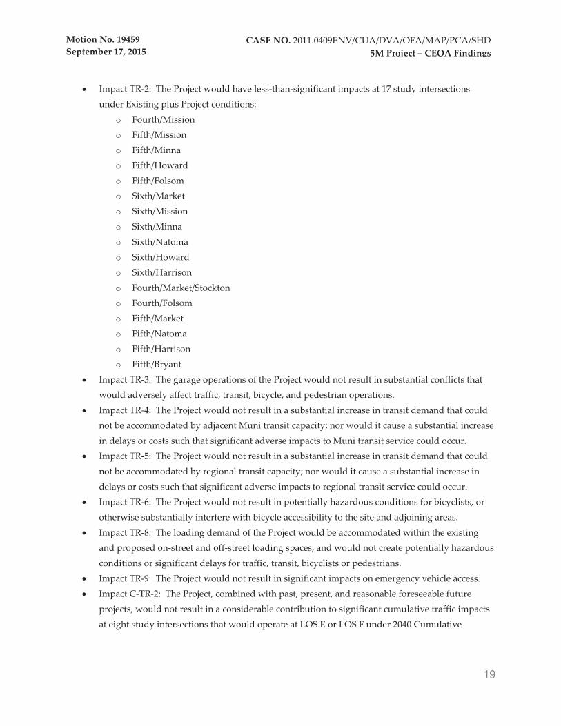
Impact TR-2: The Project would have less-than-significant impacts at 17 study intersections under Existing plus Project conditions:
o Fourth/Mission o Fifth/Mission o Fifth/Minna o Fifth/Howard o Fifth/Folsom o Sixth/Market o Sixth/Mission o Sixth/Minna o Sixth/Natoma o Sixth/Howard o Sixth/Harrison o Fourth/Market/Stockton o Fourth/Folsom o Fifth/Market o Fifth/Natoma o Fifth/Harrison o Fifth/Bryant
Impact TR-3: The garage operations of the Project would not result in substantial conflicts that would adversely affect traffic, transit, bicycle, and pedestrian operations. Impact TR-4: The Project would not result in a substantial increase in transit demand that could not be accommodated by adjacent Muni transit capacity; nor would it cause a substantial increase in delays or costs such that significant adverse impacts to Muni transit service could occur. Impact TR-5: The Project would not result in a substantial increase in transit demand that could not be accommodated by regional transit capacity; nor would it cause a substantial increase in delays or costs such that significant adverse impacts to regional transit service could occur. Impact TR-6: The Project would not result in potentially hazardous conditions for bicyclists, or otherwise substantially interfere with bicycle accessibility to the site and adjoining areas. Impact TR-8: The loading demand of the Project would be accommodated within the existing and proposed on-street and off-street loading spaces, and would not create potentially hazardous conditions or significant delays for traffic, transit, bicyclists or pedestrians. Impact TR-9: The Project would not result in significant impacts on emergency vehicle access. Impact C-TR-2: The Project, combined with past, present, and reasonable foreseeable future projects, would not result in a considerable contribution to significant cumulative traffic impacts at eight study intersections that would operate at LOS E or LOS F under 2040 Cumulative

Motion No. 19459 September 17, 2015
20
CASE NO. 2011.0409ENV/CUA/DVA/OFA/MAP/PCA/SHD 5M Project – CEQA Findings
conditions, and would result in less-than-significant cumulative impacts at four study intersections that would operate at LOS D or better under 2040 Cumulative conditions. Impact C-TR-3: The Project, combined with past, present, and reasonable foreseeable future projects, would not result in a considerable contribution to significant 2040 Cumulative transit impacts at Muni screenlines. Impact C-TR-4: The Project, combined with past, present, and reasonable foreseeable future projects, would result in less-than-significant regional transit impacts on AC Transit, Caltrain, Golden Gate Transit, SamTrans and other regional ferry service under 2040 Cumulative conditions. Impact C-TR-5: The Project, combined with past, present, and reasonable foreseeable future projects, would result in less-than-significant cumulative bicycle impacts. Impact C-TR-6: The Project, combined with past, present, and reasonable foreseeable future projects, would result in less-than-significant cumulative pedestrian impacts. Impact C-TR-7: The Project, combined with past, present, and reasonable foreseeable future projects, would result in less-than-significant cumulative loading impacts. Impact C-TR-8: The Project, combined with past, present, and reasonable foreseeable future projects, would result in less-than-significant cumulative emergency vehicle access impacts.
Noise
Impact M-NO-5: The Project would not expose people to excessive groundborne vibration or groundborne noise levels and the Project’s new residential uses would not be substantially affected by existing vibration levels. Impact C-NO-2: Operation of the Project in combination with other past, present, and reasonably foreseeable future projects in the vicinity would not result in a significant cumulative permanent increase in ambient noise levels in the project vicinity above levels without the project.
Air Quality
Impact AQ-1: Construction of the Project would generate fugitive dust and criteria air pollutants, but would not violate an air quality standard, contribute substantially to an existing or projected air quality violation, or result in a cumulatively considerable net increase in criteria air pollutants. Impact AQ-2: During Project operations, the Project would not result in emissions of criteria air pollutants at levels that would violate an air quality standard, contribute to an existing or projected air quality violation, or result in a cumulatively considerable net increase in criteria air pollutants. Impact AQ-5: The Project would not conflict with implementation of the Bay Area 2010 Clear Air Plan.
Motion No. 19459 September 17, 2015
21
CASE NO. 2011.0409ENV/CUA/DVA/OFA/MAP/PCA/SHD 5M Project – CEQA Findings
Impact AQ-6: The Project would not create objectionable odors that would affect a substantial number of people. Impact C-AQ-1: The Project, in combination with past, present, and reasonably foreseeable future development in the project area would not contribute to cumulative regional air quality impacts.
Wind and Shadow
Impacts WS-1a and WS-1b: The Project would not alter wind in a manner that substantially affects public areas within the vicinity of the Project site. Impact WS-2a and WS-2b: The Project would create new shadow that would not adversely affect outdoor recreation facilities or other public areas within the project site vicinity. Impact C-WS-1: The Project, in combination with past, present, and reasonably foreseeable future projects, would not alter wind in a manner that substantially affects public areas within the vicinity of the project site. Impact C-WS-2: The Project, in combination with past, present, and reasonably foreseeable future projects, would not create new shadow that could adversely affect outdoor recreation facilities or other public areas within the project site vicinity.
Public Services and Recreation
Impacts PS-1a and PS-1b: The increased employed and residential population associated with the Project would not increase demand for fire services to an extent that would result in substantial adverse impacts associated with the construction or alteration of facilities to provide such services. Impacts PS-2a and PS-2b: The increased employed and residential population associated with the Project would not increase demand for police services to an extent that would result in substantial adverse impacts associated with the construction or alteration of facilities to provide such services. Impacts PS-3a and PS-3b: The increased employed and residential population associated with the Project would not increase demand for park and open space service to an extent that would result in substantial adverse impacts associated with the construction or alteration of facilities to provide such services. Impacts PS-4a and PS-4b: The increased employed and residential population associated with the Project would not increase the use of existing neighborhood parks or other recreational facilities, such that substantial physical deterioration of the facilities would occur or be accelerated. Impacts PS-5a and PS-5b: Construction of open space and recreational facilities associated with the Project would not result in a significant effect on the environment.

Motion No. 19459 September 17, 2015
22
CASE NO. 2011.0409ENV/CUA/DVA/OFA/MAP/PCA/SHD 5M Project – CEQA Findings
Impacts PS-6a and PS-6b: The Project would not physically degrade existing recreational facilities. Impacts PS-7a and PS-7b: The Project would not increase demand for library services to an extent that would result in substantial adverse impacts associated with the construction or alteration of facilities to provide such services. Impact C-PS-1: The Project, combined with past, present, and reasonable foreseeable future projects, would not result in adverse physical impacts associated with the provision of, or need for, new or physically altered governmental facilities, the construction of which could cause significant environmental effects, in order to maintain acceptable service ratios, response times, or other performance objectives for fire protection, police protection, parks, and library services. Impact C-PS-2: The Project, combined with past, present, and reasonable foreseeable future projects, would not contribute to cumulative effects related to recreational resources.
Utilities and Service Systems
Impacts UT-1a and UT-1b: Implementation of the Project would not require new or expanded water supply resources or entitlements or require construction of new water treatment facilities. Impacts UT-2a and UT-2b: Implementation of the Project would not require the construction of new water delivery infrastructure to serve the Project, the construction of which could cause significant environmental effects. Impacts UT-3a and UT-3b: Implementation of the Project would not exceed treatment requirements of the Regional Water Quality Control Board and would not require or result in the construction of new stormwater or wastewater facilities or expansion of existing facilities, the construction of which could cause significant environmental effects. Impacts UT-4a and UT-4b: Implementation of the Project would not increase demand for electricity and natural gas to an extent that the demand for these resources would substantially increase, requiring the construction of new facilities. Impact C-UT-1: The Project, combined with past, present, and reasonable foreseeable future projects, would not result in adverse physical impacts associated with utilities and service systems.
Growth Inducement
The Project would not result in adverse growth inducement.
Light and Glare (Initial Study analysis as updated in DEIR)
The Project would have a less-than-significant impact related to light and glare.

Motion No. 19459 September 17, 2015
23
CASE NO. 2011.0409ENV/CUA/DVA/OFA/MAP/PCA/SHD 5M Project – CEQA Findings
Agricultural and Forest Resources (Initial Study)
The Project site and vicinity are located within an urban area in the City of San Francisco, and there would be no impacts to agricultural and forestry resources.
Biological Resources (Initial Study)
The Project would not result in any significant effect with regard to biological resources.
Geology and Soils (Initial Study)
The Project would not result in any significant effects with regard to geology and soils.
Greenhouse Gas Emissions (Initial Study)
The Project would not result in any significant impacts with respect to greenhouse gas emissions.
Hazards and Hazardous Materials (Initial Study)
The Project site is not located within an airport land use plan, or within 2 miles of a public or private airport. Concentrations of residual contaminants in the area do not pose a risk to human health or the environment, and that no hazardous materials incidents or violations occurred at the Chronicle or Examiner Buildings. The potential for releasing asbestos and lead into the air during renovation and demolition would be reduced to a less-than-significant level by compliance with applicable regulations and procedures in the San Francisco Building Code. No schools are located within 0.25 mile of the project site. The Project would not impair implementation of, or physically interfere with an adopted emergency response plan or emergency evacuation plan. The Project would comply with all applicable Building and Fire Code standards. The Project is not expected to contribute to the cumulative release of hazardous materials.
Hydrology and Water Quality (Initial Study)
The Project would not result in any significant impacts to hydrology or water quality.
Mineral and Energy Resources (Initial Study)
The Project would not result in any significant impacts related to mineral and energy resources.

Motion No. 19459 September 17, 2015
24
CASE NO. 2011.0409ENV/CUA/DVA/OFA/MAP/PCA/SHD 5M Project – CEQA Findings
III. FINDINGS OF POTENTIALLY SIGNIFICANT IMPACTS THAT CAN BE AVOIDED OR
REDUCED TO A LESS-THAN-SIGNIFICANT LEVEL THROUGH MITIGATION AND THE
DISPOSITION OF THE MITIGATION MEASURES
CEQA requires agencies to adopt mitigation measures that would avoid or substantially lessen a project’s identified significant impacts or potential significant impacts if such measures are feasible (unless mitigation to such levels is achieved through adoption of a project alternative). The findings in this Section III and in Section IV concern mitigation measures set forth in the Final EIR. These findings discuss mitigation measures as identified in the Final EIR for the Project. The full text of the mitigation measures is contained in the Final EIR and in Exhibit 1, the Mitigation Monitoring and Reporting Program. The impacts identified in this Section III would be reduced to a less-than-significant level through implementation of the mitigation measures contained in the Final EIR, included in the Project, or imposed as conditions of approval and set forth in Exhibit 1.
This Commission recognizes that some of the mitigation measures are partially within the jurisdiction of other agencies. The Commission urges these agencies to assist in implementing these mitigation measures, and finds that these agencies can and should participate in implementing these mitigation measures.
Cultural Resources
Impact CP-2: The Project could cause a substantial adverse change in the significance of a historical
resource (including three historical resources within the Project site (Chronicle Building, Dempster
Printing Building, and Camelline Building) and six historical resources in the immediate vicinity of
the project area (936 Mission Street, 951-957 Mission Street, 194-198 Fifth Street, 88 Fifth Street, 66
Mint Street and 959-965 Mission Street) due to below-grade excavation and foundation work, the
demolition of four buildings, new building framing, and associated ground borne vibrations.
Construction of subterranean parking and foundations would be undertaken as part of the Project and would require below-ground excavation. In addition, removal of existing buildings and pavement could produce intermittent, substantial vibration over the course of several weeks. Additional impacts depend on the method of construction employed, such as mat slab construction, which would not generate excessive vibration levels, or impact pile driving, which could produce considerable vibration.
Given their proximity to proposed new construction, the following buildings may be susceptible to significant ground vibration generated by construction of the proposed Project: the Chronicle Building (901-933 Mission Street), the Dempster Printing Building (447-449 Minna Street), the Camelline Building (430 Natoma Street), the Land Hotel/Chronicle Hotel building (936 Mission Street), the Ford Apartments/Mint Mall building (951-957 Mission Street), the Chieftain or McVeigh building (194-198

Motion No. 19459 September 17, 2015
25
CASE NO. 2011.0409ENV/CUA/DVA/OFA/MAP/PCA/SHD 5M Project – CEQA Findings
Fifth Street), the Old Mint building (88 Fifth Street), the Provident Loan Association building (66 Mint Street), and the California Casket Co. building (959-965 Mission Street).
Mitigation Measure M-CP-2a: Existing Conditions Study, Monitoring, and Repair
Mitigation Measure M-CP-2b: Groundbourne Vibration Monitoring and Compliance with Threshold Levels
Mitigation Measure M-CP-2c: Shoring and Underpining
Mitigation Measure M-CP-2d: Historic Resources Construction, Demolition, Monitoring, and Reporting Training
With implementation of Mitigation Measures M-CP-2a through M-CP-2d, the Commission finds that, for the reasons set forth in the FEIR, this impact will be reduced to a less-than-significant level.
Impact CP-3: The Project [could] cause a substantial adverse change in the significance of a historical
resource due to potential exterior modifications to the Camelline Building (430 Natoma Street), a
historical resource under CEQA.
Unlike the Office and Residential Schemes analyzed in the Draft EIR, the Project would not demolish the Camelline Building (430 Natoma Street), which is a historical resource under CEQA. Instead, the existing Camelline Building would be retained and continue to be used as a 9,600 square foot office building.
No renovation of the Camelline Building is proposed as part of the Project. However, in the event modification of the Camelline Building exterior is proposed in the future, inappropriate renovation would have the potential to cause a substantial adverse change in the building’s historical significance by materially altering in an adverse manner those character-defining features that convey its historical significance.
Mitigation Measure M-CP-3: Compliance with the Secretary of the Interior's Standards for Rehabilitation
With implementation of Mitigation Measure M-CP-3, the Commission finds that, for the reasons set forth in the FEIR, Impact CP-3 will be reduced to a less-than-significant level.
Impact CP-4: The Project would result in actions that could cause a substantial adverse change in the
significance of the Chronicle Building (901-933 Mission Street), a historical resource under CEQA.
These actions would (1) partially demolish the non-historic two-story above-grade pedestrian
connector between the Chronicle and Examiner Buildings; 2) develop open space on the rooftop of the
Motion No. 19459 September 17, 2015
26
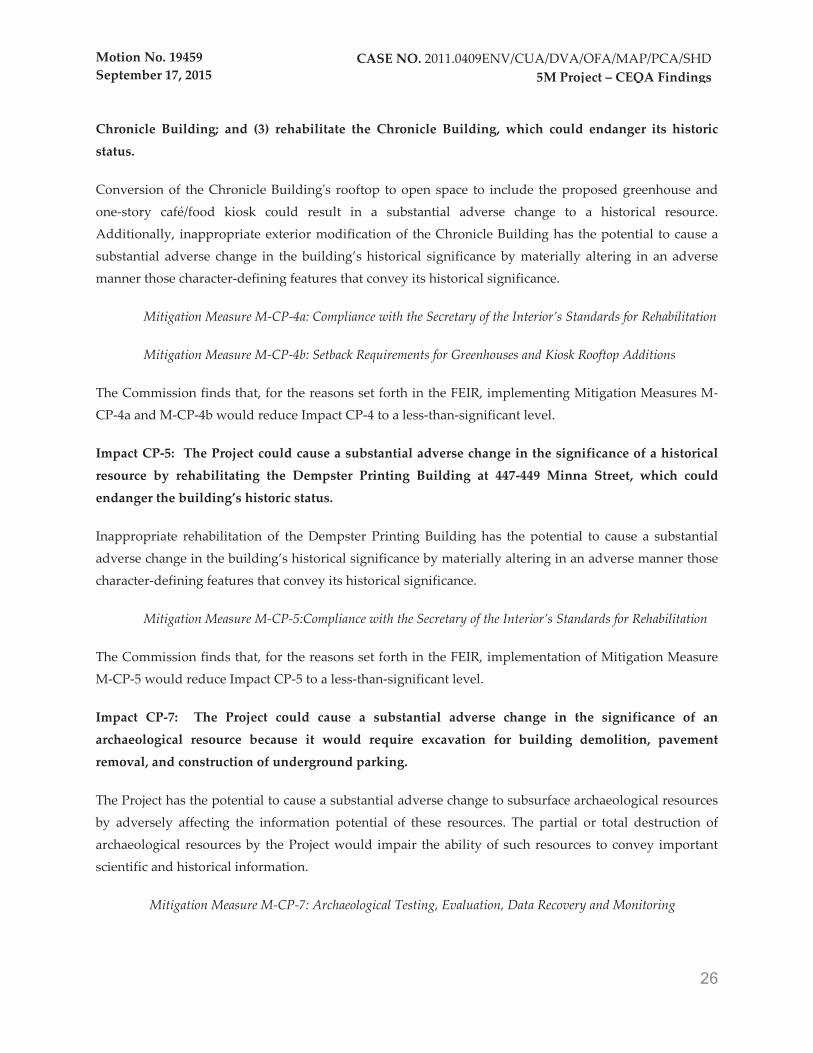
CASE NO. 2011.0409ENV/CUA/DVA/OFA/MAP/PCA/SHD 5M Project – CEQA Findings
Chronicle Building; and (3) rehabilitate the Chronicle Building, which could endanger its historic
status.
Conversion of the Chronicle Building's rooftop to open space to include the proposed greenhouse and one-story café/food kiosk could result in a substantial adverse change to a historical resource. Additionally, inappropriate exterior modification of the Chronicle Building has the potential to cause a substantial adverse change in the building’s historical significance by materially altering in an adverse manner those character-defining features that convey its historical significance.
Mitigation Measure M-CP-4a: Compliance with the Secretary of the Interior’s Standards for Rehabilitation
Mitigation Measure M-CP-4b: Setback Requirements for Greenhouses and Kiosk Rooftop Additions
The Commission finds that, for the reasons set forth in the FEIR, implementing Mitigation Measures M-CP-4a and M-CP-4b would reduce Impact CP-4 to a less-than-significant level.
Impact CP-5: The Project could cause a substantial adverse change in the significance of a historical
resource by rehabilitating the Dempster Printing Building at 447-449 Minna Street, which could
endanger the building’s historic status.
Inappropriate rehabilitation of the Dempster Printing Building has the potential to cause a substantial adverse change in the building’s historical significance by materially altering in an adverse manner those character-defining features that convey its historical significance.
Mitigation Measure M-CP-5:Compliance with the Secretary of the Interior’s Standards for Rehabilitation
The Commission finds that, for the reasons set forth in the FEIR, implementation of Mitigation Measure M-CP-5 would reduce Impact CP-5 to a less-than-significant level.
Impact CP-7: The Project could cause a substantial adverse change in the significance of an
archaeological resource because it would require excavation for building demolition, pavement
removal, and construction of underground parking.
The Project has the potential to cause a substantial adverse change to subsurface archaeological resources by adversely affecting the information potential of these resources. The partial or total destruction of archaeological resources by the Project would impair the ability of such resources to convey important scientific and historical information.
Mitigation Measure M-CP-7: Archaeological Testing, Evaluation, Data Recovery and Monitoring

Motion No. 19459 September 17, 2015
27
CASE NO. 2011.0409ENV/CUA/DVA/OFA/MAP/PCA/SHD 5M Project – CEQA Findings
The Commission finds that, for the reasons set forth in the EIR, implementing Mitigation Measure M-CP-7 would reduce Impact CP-7 to a less-than-significant level.
Impact CP-8: The Project could indirectly destroy a unique paleontological resource due to excavation
activities.
Project ground-disturbing activities would require excavation to a maximum depth of approximately 45 feet below the existing ground surface to allow for construction of subterranean parking. The Colma Formation, which underlines the project site at an approximate depth of 30+ feet, is known to contain significant vertebrate fossils of extinct species. Disturbance of these fossils could impair their ability to yield important scientific information, a potentially significant impact.
Mitigation Measure M-CP-8: Paleontological Resources Monitoring and Mitigation Program
The Commission finds that, for the reasons set forth in the FEIR, that implementing Mitigation Measure M-CP-8 would reduce Impact CP-8 to a less-than-significant level.
Impact CP-9: The Project could disturb human remains, due to excavation activities.
Project ground-disturbing activities could encounter significant prehistoric archaeological deposits on the surface of the Colma Formation, which is estimated to underlie the project at approximately 30 feet below the existing ground surface. Prehistoric archaeological deposits, particularly residential sites and shell mounds, may contain human remains interred outside of formal cemeteries. Disturbance of such remains would result in a significant impact.
Mitigation Measure M-CP-9: Treatment of Human Remains
The Commission finds that, for the reasons set forth in the FEIR, implementing Mitigation Measure M-CP-9 would reduce Impact CP-9 to a less-than-significant level.
Impact C-CP-2: The Project could disturb archaeological resources, paleontological resources, and
human remains. Disturbance of these resources and remains, in combination with past, present, and
reasonably foreseeable future projects, would make a cumulatively considerable contribution to a
significant impact.
The potential disturbance of subsurface cultural resources that may underlie the project site, including archaeological resources, paleontological resources, and human remains, could have a cumulatively significant impact when considered with other past, present, or reasonably foreseeable projects in San Francisco and the Bay Area.
Mitigation Measures M-CP-7, M-CP-8, and M-CP-9

Motion No. 19459 September 17, 2015
28
CASE NO. 2011.0409ENV/CUA/DVA/OFA/MAP/PCA/SHD 5M Project – CEQA Findings
The Commission finds that, for the reasons set forth in the FEIR, implementation of Mitigation Measures M-CP-7, M-CP-8, and M-CP-9 would mitigate this impact to a less-than-significant level.
Transportation and Circulation
Impact TR-7: The Project would result in a significant impact at the east crosswalk and southeast
corner of the intersection of Fifth/Mission Streets, but otherwise would not result in substantial
overcrowding on public sidewalks, nor create potentially hazardous conditions for pedestrians, or
otherwise substantially interfere with pedestrian accessibility to the site and adjoining areas.
During the midday and PM peak hours, the addition of new pedestrian trips to the crosswalk and corners at the adjacent intersections of Fifth/Mission and Fifth/Howard Streets would increase pedestrian crowding at the study locations (e.g., resulting in level of service ("LOS") operating conditions worsening from LOS A to LOS C); however, at most study locations pedestrian conditions would continue to be acceptable, with pedestrian operating conditions at LOS D or better. The exceptions would be at the east crosswalk at the intersection of Fifth/Mission Streets (PM peak hour), and the southeast corner at the intersection of Fifth/Mission Streets (midday and PM peak hours), which would operate at LOS E or LOS F under Existing plus Project conditions.
With the addition of Project-generated pedestrian trips to the sidewalks in the project vicinity, the existing LOS E conditions during the midday and PM peak hours at the southeast corner of the intersection of Fifth/Mission Streets (i.e., the corner adjacent to the Fifth & Mission Garage) would worsen to LOS F conditions during both the midday and PM peak hours, and conditions at the east crosswalk would worsen from LOS C to LOS E during the PM peak hour (during the midday peak hour the east crosswalk would operate at LOS D conditions), and would be considered a significant pedestrian impact.
Mitigation Measure M-TR-7: Sidewalk and Crosswalk Widening
The Commission finds that, for the reasons set forth in the FEIR, implementation of Mitigation Measure M-TR-7 would reduce Impact TR-7 to a less-than-significant level.
Noise
Impact M-NO-1: Construction of the Project would generate noise levels in excess of standards
established in the San Francisco General Plan or Noise Ordinance and would result in a substantial
temporary or periodic increase in ambient noise levels in the project vicinity above levels existing
without the Project.
The closest off-site sensitive receptors are those land uses located immediately adjacent to the Project boundaries. During demolition and construction activities, if multiple pieces of heavy construction

Motion No. 19459 September 17, 2015
29
CASE NO. 2011.0409ENV/CUA/DVA/OFA/MAP/PCA/SHD 5M Project – CEQA Findings
equipment operate simultaneously within 5 feet of off-site structures, these façades could be exposed to noise levels ranging up to 105 dBA Lmax.Because of the close proximity of nearby off-site sensitive receptors and because residential units may be occupied prior to completion of all phases of construction, general construction noise control measures must be implemented to reduce potential construction noise impacts to a less-than-significant level.
Mitigation Measure M-NO-1: Noise Reduction Program
The Commission finds that, for the reasons set forth in the FEIR, implementing Mitigation Measure M-NO-1 would reduce construction noise impacts at sensitive receptor locations to a less-than-significant level.
Impact M-NO-2: Construction of the Project would result in exposure of persons to or generation of
excessive groundborne vibration or groundborne noise levels.
The proposed Project could require methods such as drilled steel piles or auger-cast piles to support the building foundation. Other Project construction activities, including demolition and excavation, would also temporarily generate groundborne vibration in the project vicinity. Construction-related vibration over 0.25 inches/second PPV would trigger a potential structural impact for older or historically significant buildings, and over 80 VdB would be a level where a significant vibration impact could be considered to occur due to human annoyance. The potential for human annoyance would occur over a greater area of impact than the potential for structural damage. Due to the scope of construction and the proximity of the five historical resources, there is a potentially significant impact due to ground borne vibrations from construction.
Mitigation Measure M-NO-2: Implement Mitigation Measures M-NO-1, M-CP-2a, and M-CP-2b.
The Commission finds that, for the reasons set forth in the EIR, implementing Mitigation Measure M-NO-2 would reduce impacts with respect to the generation of excessive groundborne vibration during construction to a less-than-significant level.
Impact M-NO-3: Operation of the Project would generate noise levels in excess of standards
established in the San Francisco General Plan or Noise Ordinance and would result in a substantial
permanent increase in ambient noise levels in the project vicinity above levels existing without the
Project.
The Project would introduce additional noise sources to the area, including stationary noise sources such as mechanical equipment (e.g., emergency generators, building heating, ventilation, and air conditioning (HVAC) systems, backup generators, and fire pumps), parking lot activities, roadway traffic noise, and special events.

Motion No. 19459 September 17, 2015
30
CASE NO. 2011.0409ENV/CUA/DVA/OFA/MAP/PCA/SHD 5M Project – CEQA Findings
Mitigation Measure M-NO-3: Noise Control Measures for Stationary Equipment
The Commission finds that, for the reasons set forth in the FEIR, implementing Mitigation Measure M-NO-3 would reduce noise impacts associated with new mechanical devices to a less-than-significant level.
Impact M-NO-4: New residential uses and open space uses developed under the Project may be
affected by substantial existing noise levels.
The Project would introduce new noise-sensitive residential uses to a densely developed urban neighborhood with elevated ambient noise levels. Since ambient noise measurements indicate that exterior noise levels on the boundaries of the Project site are up to 70 dBA, the proposed new residential uses adjacent to Mission and Fifth Streets could be substantially adversely affected by existing noise levels.
Mitigation Measure M-NO-4: Interior Noise Standards and Acoustical Report
The Commission finds that, for the reasons set forth in the FEIR, implementing Mitigation Measure M-NO-4 would reduce noise impacts associated with existing outdoor noise levels to a less-than-significant level.
Impact C-NO-1: Construction of the Project, in combination with other past, present, and reasonably
foreseeable future projects in the project vicinity, would result in significant temporary or periodic
cumulative increases in ambient noise or vibration levels in the project vicinity above levels existing
without the Project.
Construction activity in the vicinity of the Project, including demolition, excavation, and building construction activities, could occur in conjunction with other planned and foreseeable projects.
Mitigation Measure M-NO-1
The Commission finds that, for the reasons set forth in the FEIR, implementing Mitigation Measure M-NO-1 would reduce the contribution of the Project to cumulative construction noise impacts to a less-than-significant level.
Air Quality
Impact AQ-3: Construction and operation of the Project would generate toxic air contaminants,
including diesel particulate matter, which would expose sensitive receptors to substantial pollutant
concentrations.
Motion No. 19459 September 17, 2015
31
CASE NO. 2011.0409ENV/CUA/DVA/OFA/MAP/PCA/SHD 5M Project – CEQA Findings
Site preparation activities, such as demolition, excavation, grading, foundation construction, and other ground-disturbing construction activity would affect localized air quality during the construction phases of the Project. Short-term emissions from construction equipment during these site preparation activities would include directly emitted particulate matter (PM2.5 and PM10) and toxic air contaminants such as diesel particulate matter ("DPM"). Additionally, the long-term emissions from the Project’s mobile and stationary sources would include particulate matter (PM2.5 and PM10) and toxic air contaminants such as DPM, and reactive organic gases ("ROGs"). The generation of these short- and long-term emissions could expose sensitive receptors to substantial pollutant concentrations of toxic air contaminants, resulting in a localized health risk.
Mitigation Measure M-AQ-3a: Construction Emissions Minimization, Reporting, Certification Statement and On-site Requirements
Mitigation Measure M-AQ-3b: Diesel Backup Generator and Fire Pump Specifications
The Commission finds that, for the reasons set forth in the FEIR, implementing Mitigation Measures M-AQ-3a and M-AQ-3b would reduce this impact to a less-than-significant level.
Impact AQ-4: The Project could expose onsite sensitive receptors to substantial air pollutant
concentrations through generation of and by locating sensitive receptors near sources of toxic air
contaminants.
The Project would include development of residential units, which is considered a sensitive land use for purposes of air quality evaluation. The Project site is located in an area that experiences higher levels of air pollution and is within the Air Pollutant Exposure Zone. The Project therefore would have the potential to expose sensitive receptors to substantial concentrations of air pollutants.
Mitigation Measure M-AQ-4: Enhanced Ventilation Measures
The Commission finds that for the reasons set forth in the FEIR, implementing Mitigation Measure M-AQ-4 would reduce this impact to a less-than-significant level.
Impact C-AQ-2: The Project, in combination with past, present, and reasonably foreseeable future
development in the project area would contribute to cumulative health risk impacts on sensitive
receptors.
The Commission finds that, for the reasons set forth in the EIR, implementation of Mitigation Measures M-AQ-3a , which would reduce construction-period emissions, Mitigation Measure M-AQ-3b, which would limit diesel generator and fire pump emissions, and Mitigation Measure M-AQ-4, which would require that buildings be designed to reduce outdoor filtration of fine particulate matter indoors by 80 percent,
Motion No. 19459 September 17, 2015
32
CASE NO. 2011.0409ENV/CUA/DVA/OFA/MAP/PCA/SHD 5M Project – CEQA Findings
the Project's contribution to cumulative health risk impacts on sensitive receptors would be reduced to a less-than-significant level.
Hazards and Hazardous Materials
Impact HZ-1 (Initial Study): The proposed project could create a significant hazard to the public or the
environment through the routine transport, use, or disposal of hazardous materials, or reasonably
foreseeable accident conditions involving the release of materials into the environment.
The Phase I ESA identified the Dempster Printing Building (447–449 Minna Street) as uninhabitable due to water intrusion and significant mold impact. Therefore, renovation of the Dempster Printing Building could cause mold to be released into the environment, resulting in potential health risks to construction workers.
Mitigation Measure M-HZ-1: Evaluation of Subsurface Conditions. Evaluation of Mold in Dempster Printing Building.
The Commission finds that, for the reasons set forth in the Initial Study included in the FEIR, implementing Mitigation Measure M-HZ-1 would reduce this impact to a less-than-significant level.
IV. SIGNIFICANT IMPACTS THAT CANNOT BE AVOIDED OR MITIGATED TO A LESS-
THAN-SIGNIFICANT LEVEL
Based on substantial evidence in the whole record of these proceedings, the Planning Commission finds that, where feasible, changes or alterations have been required, or incorporated into, the Project to reduce the significant environmental impacts as identified in the Final EIR. The Commission finds that the mitigation measures in the Final EIR and described below are appropriate, and that changes have been required in, or incorporated into, the Project, pursuant to Public Resources Code Section 21002 and CEQA Guidelines Section 15091, that may lessen, but do not avoid (i.e., reduce to less-than-significant levels), the potentially significant environmental effects associated with implementation of the Project that are described below. Although all of the mitigation measures set forth in the MMRP, attached as Exhibit 1, are hereby adopted, for some of the impacts listed below, despite the implementation of feasible mitigation measures, the effects remain significant and unavoidable.
The Commission further finds based on the analysis contained within the Final EIR, other considerations in the record, and the significance criteria identified in the Final EIR, that feasible mitigation measures are not available to reduce the some of the significant Project impacts to less-than-significant levels, and thus those impacts remain significant and unavoidable. The Commission also finds that, although mitigation measures are identified in the Final EIR that would reduce some significant impacts, certain measures, as

Motion No. 19459 September 17, 2015
33
CASE NO. 2011.0409ENV/CUA/DVA/OFA/MAP/PCA/SHD 5M Project – CEQA Findings
described in this Section IV below, are uncertain or infeasible for reasons set forth below, and therefore those impacts remain significant and unavoidable or potentially significant and unavoidable.
Thus, the following significant impacts on the environment, as reflected in the Final EIR, are unavoidable. But, as more fully explained in Section VIII, below, under Public Resources Code Section 21081(a)(3) and (b), and CEQA Guidelines 15091(a)(3), 15092(b)(2)(B), and 15093, the Planning Commission finds that these impacts are acceptable for the legal, environmental, economic, social, technological and other benefits of the Project. This finding is supported by substantial evidence in the record of this proceeding.
Transportation and Circulation
Impact TR-1: The Project would result in a significant impact at four study intersections that would
operate at LOS E or LOS F (including contributing considerably to existing LOS E or LOS F conditions
at one intersection) under Existing plus Project conditions.
In general, the addition of Project vehicle trips during the weekday PM peak hour would result in increases in the average delay per vehicle at the study intersections. At the study intersections of Fourth/Howard, Sixth/Folsom and Sixth/Brannan Streets, the worsening of intersection LOS conditions from LOS D to LOS E or LOS F, and from LOS E to LOS F would be considered a significant impact at these intersections.
Of the eight intersections currently operating at LOS E or LOS F under Existing conditions and that would continue to operate at the same LOS under Existing plus Project conditions, the Project’s contributions to the poorly operating critical movements (i.e., the critical movements operating at LOS E or LOS F) would be more than 5 percent at the intersection of Sixth/Bryant Streets, and therefore the contribution of the Project to the overall intersection LOS F conditions at this intersection would be considered considerable, and the Project’s impact at this intersection would be considered a significant impact.
Each of the four intersections where the Project would result in significant impacts (i.e., at the intersections of Fourth/Howard, Sixth/Folsom, Sixth/Brannan, and Sixth/Bryant Streets) were reviewed to determine if mitigation measures could reduce the impact to less-than-significant levels or lessen the severity of the Project’s contribution to significant impacts. Overall, no feasible mitigation measures were found to mitigate significant impacts for the affected intersections. Generally, additional travel lane capacity would be needed on one or more approaches to the intersection in order to mitigate the LOS E or LOS F intersection operating conditions. The provision of additional travel lane capacity would typically require narrowing of the sidewalks to substandard widths and/or removal of bicycle lanes. These actions would be inconsistent with the transit, bicycle, and pedestrian environment encouraged by the City’s Transit First Policy because they would remove space dedicated to pedestrians and bicyclists. Additional

Motion No. 19459 September 17, 2015
34
CASE NO. 2011.0409ENV/CUA/DVA/OFA/MAP/PCA/SHD 5M Project – CEQA Findings
improvements, such as changes to the signal timing cycle length and/or green time allocations would not reduce significant impacts to less-than-significant levels. Thus, the identified significant impacts at the intersections of Fourth/Howard, Sixth/Folsom, Sixth/Brannan, and Sixth/Bryant Streets under Existing plus Project conditions would remain significant and unavoidable.
Impact TR-10: Construction of the Project would result in disruption of nearby streets, transit service,
and pedestrian and bicycle circulation.
Concurrent construction of multiple buildings at the Project site over the eight-year buildout period would likely overlap with the construction activity of other projects in the area. The construction activities associated with overlapping projects, and particularly the construction of the Central Subway Moscone Station, would affect access, traffic operations and pedestrian movements. It is anticipated that the construction manager for each project would be required to work with the various departments of the City to develop a detailed and coordinated plan that would address construction vehicle routing, traffic control and pedestrian movement adjacent to the construction area for the duration of the overlap in construction activity. Therefore, given the concurrent construction of multiple buildings on the Project site, expected intensity, and the prolonged construction period, and likely impacts to traffic, transit, and pedestrian and bicycle circulation, construction of the proposed Project would result in significant construction-related transportation impacts.
Mitigation Measure M-TR-10: Construction Measures: Carpool and Transit Access for Construction Workers, Construction Truck Traffic Management, and Project Construction Updates for Adjacent Businesses and Residents
Implementation of Mitigation Measure M-TR-10 would minimize the Project's construction-related transportation impacts, and would not result in any secondary transportation-related impacts. However, construction activities would likely result in disruption to traffic, transit, pedestrians and bicyclists for a prolonged period, and, despite implementation of M-TR-10, the Project’s construction-related impact would not be reduced to a less-than-significant level. No other feasible mitigation measures that would reduce this impact to a less-than-significant level have been identified. Therefore, this impact would remain significant and unavoidable.
Impact C-TR-1: The Project, combined with past, present, and reasonable foreseeable future projects,
would result in a considerable contribution to significant cumulative traffic impacts at six study
intersections that would operate at LOS E or LOS F under 2040 Cumulative conditions.
Under 2040 Cumulative conditions for the weekday PM peak hour, 17 of the 21 study intersections are projected to operate at LOS E or LOS F conditions. The four study intersections of Fifth/Mission, Fifth/Minna, Sixth/Mission, and Sixth/Minna Streets are projected to operate at LOS D or better under 2040

Motion No. 19459 September 17, 2015
35
CASE NO. 2011.0409ENV/CUA/DVA/OFA/MAP/PCA/SHD 5M Project – CEQA Findings
Cumulative conditions. The Project would contribute considerably to significant cumulative traffic impacts at six study intersections (Fourth/Howard, Fourth/Folsom, Fifth/Howard, Sixth/Folsom, Sixth/Bryant and Sixth/Brannan), and therefore, would also result in a considerable contribution to significant cumulative impacts at these intersections.
Each of the six study intersections where the Project would contribute considerably to the significant cumulative impacts was reviewed to determine if mitigation measures could reduce the impact to less-than-significant levels or lessen the severity of the Project’s considerable contribution to significant cumulative impacts. No feasible mitigation measures were found to mitigate significant cumulative impacts for the affected intersections. The cumulative traffic impacts would generally be due not just to the Project, but also to increases in traffic in the region caused by long-term anticipated growth and reduction in travel lane capacity proposed by the Central SoMa Plan. Generally, additional travel lane capacity would be needed on one or more approaches to the intersection in order to mitigate LOS E or LOS F intersection operating conditions. The provision of additional travel lane capacity would typically require the narrowing of sidewalks, removal of bicycle lanes, and/or the conversion of existing transit-only lanes to mixed-flow lanes. These actions would be inconsistent with the transit, bicycle, and pedestrian environment encouraged by the City’s Transit First Policy because they would remove space dedicated to pedestrians, bicycles, and/or transit and increase the distances required for pedestrians to cross streets. Additional improvements, such as changes to the signal timing cycle length and/or green time allocations, may improve conditions slightly but generally would not reduce significant cumulative impacts to less-than-significant levels. No other feasible mitigation measures that would reduce this impact to a less-than-significant level have been identified. Thus, the Project’s identified considerable contribution to significant cumulative traffic impacts at the six study intersections would remain, and the 2040 Cumulative traffic impacts at these intersections would remain significant and unavoidable.
For the above reasons, the Project, in combination with past, present and reasonably foreseeable development in San Francisco, would contribute considerably to significant cumulative traffic impacts at the six study intersections of Fourth/Howard, Fourth/Folsom, Fifth/Howard, Sixth/Folsom, Sixth/Bryant and Sixth/Brannan, and the significant cumulative impacts would be significant and unavoidable.
Impact C-TR-9: Construction of the Project, combined with past, present, and reasonable foreseeable
future projects, would result in disruption of nearby streets, transit service, and pedestrian and bicycle
circulation.
Localized cumulative construction-related transportation impacts could occur as a result of cumulative projects that generate increased traffic at the same time and on the same roads as the Project. The construction manager for each project would work with the various departments of the City to develop a detailed and coordinated plan that would address construction vehicle routing, traffic control, and pedestrian movement adjacent to the construction area for the duration of any overlap in construction
Motion No. 19459 September 17, 2015
36
CASE NO. 2011.0409ENV/CUA/DVA/OFA/MAP/PCA/SHD 5M Project – CEQA Findings
activity. Mitigation Measure M-TR-10 would minimize, but not eliminate, the Project’s significant impacts related to conflicts between construction activities and pedestrians, transit, and autos, and would include measures such as construction coordination, construction truck traffic management, project construction updates for adjacent businesses and residents, and carpool and transit access for construction workers.
No other feasible mitigation measures that would reduce this impact to a less-than-significant level have been identified. In addition, given the number of projects proposed in the vicinity and the uncertainty concerning construction schedules, cumulative construction activities could potentially result in disruptions to traffic, transit, pedestrians, and/or bicycles that could be significant, and despite the best efforts of the project sponsor and project construction contractor(s), it is possible that simultaneous construction of the Project and other nearby projects could result in substantial disruption to traffic and transit operations, as well as pedestrian and bicycle circulation. Therefore, for the above reasons, the Project, in combination with past, present and reasonably foreseeable development in San Francisco, would result in significant and unavoidable cumulative construction-related transportation impacts.
V. EVALUATION OF PROJECT ALTERNATIVES
This Section describes the reasons for approving the Project and the reasons for rejecting the alternatives as infeasible. CEQA requires that an EIR evaluate a reasonable range of alternatives to the proposed project or the project location that substantially reduce or avoid significant impacts of the proposed project. CEQA requires that every EIR also evaluate a “No Project” alternative. Alternatives provide the decision maker with a basis of comparison to the proposed Project in terms of their significant impacts and their ability to meet project objectives. This comparative analysis is used to consider reasonable, potentially feasible options for minimizing environmental consequences of the proposed Project.
A. Preservation Alternative (Now Proposed, with Modifications, as the Project)
The Project as described in Section I above is referred to the "Revised Project" and described and analyzed in Section II of the RTC document. During the period between publication of the Draft EIR and the RTC document, the Project was revised in a manner that is substantially similar to the Preservation Alternative identified and analyzed in the Draft EIR, with the exception that the total square footage would be reduced and the mix of uses would be slightly different. Among other changes, the revised Project, as described and analyzed in Section II of the RTC document, would preserve the Camelline Building, a historical resource that had previously been proposed to be demolished.
The total size of the buildings under the revised Project would be less than either the Office or Residential Schemes analyzed in the Draft EIR, although the proposed mix of residential and office uses would be more similar to the Office Scheme. Overall, the revised Project would represent an approximately six percent decrease in overall square footage compared to the Office Scheme and a five percent decrease
Motion No. 19459 September 17, 2015
37
CASE NO. 2011.0409ENV/CUA/DVA/OFA/MAP/PCA/SHD 5M Project – CEQA Findings
compared to the Residential Scheme analyzed in the Draft EIR. The Project, as described and analyzed as the "Revised Project" in the RTC document, would result in development of approximately 7,700 gsf more total building area than the Preservation Alternative because it would include slightly more space for office uses and slightly more overall residential space, although the Project's total unit count would be less than assumed for the Preservation Alternative (690 units, as compared to 750 under the Preservation Alternative), due to the inclusion of slightly larger residential units.
Because the Preservation Alternative would retain the Camelline Building, it would avoid the project-level historic resource impacts that would result from the Office and Residential Schemes analyzed in the Draft EIR. Under the Preservation Alternative, the project site would also be developed with a mix of office, retail, residential, cultural, educational, and open space uses in general accordance with the height and bulk controls that are proposed as part of the Project’s SUD. After implementation of the Preservation Alternative, there would be a total of 1,714,400 gsf of building space on the site, including 812,700 gsf of office uses, 81,900 gsf of active ground floor uses, and 819,800 gsf of residential uses (750 dwelling units). The specific elements of the alternative are described below.
Buildings. The Preservation Alternative would result in the retention of three historic buildings on the site: the Chronicle, Dempster Printing, and Camelline Buildings. In addition, a portion of the existing Examiner Building and a portion of the connector between the Examiner Building and the Chronicle Building would be retained. This alternative would entail the demolition of the four other existing buildings on the site, and the construction of three new buildings. After implementation of the alternative there would be a total of six buildings on the site that range in height from 50 to 470 feet. No new building connectors would be developed. Building massing would be concentrated around the southern portion of the site, and Buildings H-1 and N-1 would extend to heights of 420 feet and 470 feet, respectively. The buildings would be designed in accordance with an SUD and detailed design guidelines and standards in an accompanying D4D document that would resemble those proposed as part of the Project.
Open Space. The Preservation Alternative would include a total of 40,400 square feet of open space, which would be provided on-site. Approximately 36,600 square feet of open space would be provided for the residential uses (including private residential balconies) and 12,550 square feet of open space would be provided for a mixture of residential and commercial uses. Shared open space would include a 14,000-square-foot open space west of the Camelline Building across Mary Street, a 19,300-square-foot deck on the rooftop of the Chronicle Building, and a 3,600-square-foot open space adjacent on the west side of Building M-2. In addition, approximately 3,500 square feet of residential balcony space would be provided. All ground-level open spaces and the Chronicle Building rooftop deck would be accessible to the public; other open spaces would be private.
Motion No. 19459 September 17, 2015
38
CASE NO. 2011.0409ENV/CUA/DVA/OFA/MAP/PCA/SHD 5M Project – CEQA Findings
Parking and Circulation. The existing system of public streets within and in the immediate vicinity of the site would generally remain unchanged, although driveways would be developed to provide access to parking areas. However, like the Project, the segment of Mary Street between Mission and Minna Streets would be converted to a pedestrian-only alley that would be closed to vehicle traffic. The alternative would contain 554 motor vehicle parking spaces (not including car share spaces), all of which would be provided in sub-grade parking structures. In addition, the alternative would include 485 Class 1 and 64 Class 2 bicycle parking spaces, respectively.
Residents and Employees. The Preservation Alternative would contain approximately 1,710 residents and 4,260 employees.
Approvals/Entitlements. Similar to the Project, the Preservation Alternative would require changes to existing development controls for the site (including increases in permitted height and bulk) through General Plan, Planning Code, and Zoning Map amendments, including an SUD and conditional use permits, together with detailed design standards and guidelines for project development established through a D4D document.
The environmental effects of the Preservation Alternative would be substantially similar to those identified for the Project, as described in Sections II through IV above. Similar to the Project, the Preservation Alternative would reduce certain impacts of the Office Scheme and Residential Scheme analyzed in the Draft EIR, and would eliminate the significant and unavoidable air quality impacts and cultural resources impacts related to the demolition of the Camelline Building that would occur under the Office and Residential Schemes.
The Draft EIR identified the Preservation Alternative as the environmentally superior alternative because it would retain the Camelline Building. This would avoid direct historic resources impacts from demolition of the structure which would result from the Office or Residential Schemes analyzed in the Draft EIR; such an impact would be significant and irreversible. In addition, as a result of the slightly lower trip generation and reduced residential uses of the Preservation Alternative, as compared to the Office and Residential Schemes analyzed in the Draft EIR, it would not result in the significant and unavoidable air quality impacts identified for the Office and Residential Schemes, as it would not generate reactive organic gasses, a regional pollutant, at levels in excess of established thresholds.
As explained above, the Project now proposed is substantially similar to the Preservation Alternative, eliminates the significant cultural resources and air quality impacts of, and reduces certain other impacts of, the Office and Residential Schemes analyzed in the Draft EIR in the same manner as the Preservation Alternative. Therefore, the Project is substantially similar to the environmentally superior alternative (i.e., the Preservation Alternative), with minor modifications.
Motion No. 19459 September 17, 2015
39
CASE NO. 2011.0409ENV/CUA/DVA/OFA/MAP/PCA/SHD 5M Project – CEQA Findings
B. Alternatives Considered, Rejected and Reasons for Rejection
The Planning Commission rejects the Alternatives set forth in the Final EIR and listed below based upon substantial evidence in the record, including evidence of economic, legal, social, technological, and other considerations described in this Section, in addition to those described in Section VI below, which are hereby incorporated by reference, that make these alternatives infeasible. In making these determinations, the Commission is aware that CEQA defines “feasibility” to mean “capable of being accomplished in a successful manner within a reasonable period of time, taking into account economic, environmental, legal, social, and technological factors.” (CEQA Guidelines § 15364.) Under CEQA case law, the concept of “feasibility” encompasses (i) the question of whether a particular alternative promotes the underlying goals and objectives of a project; and (ii) the question of whether an alternative is “desirable” from a policy standpoint to the extent that desirability is based on a reasonable balancing of the relevant economic, environmental, social, legal, and technological factors.
1. No Project Alternative
Under the No Project Alternative, the Project site would generally remain in its existing condition and would not be redeveloped with a mix of office, retail, residential, cultural, educational, and open space uses. This alternative would reduce or avoid impacts associated with building demolition, construction activities, and effects associated with the operation of more intense uses on the site. All structures on the site would be retained, including the four buildings that would be demolished, and the two-story above-ground connector that would be partially demolished, as part of the Project. Under this alternative, the site would continue to contain eight buildings ranging from 15 to 65 feet in height that comprise a total of approximately 317,700 gsf of office and light industrial building space. In addition, the site would continue to include approximately 256 parking spaces (including 36 parking spaces located outside the Project site that are accessory to the Chronicle Building) in surface parking lots. The existing circulation system of the site and its immediate surroundings would also remain under the No Project Alternative, with Natoma and Minna Streets providing eastbound and westbound access through the site, respectively, and Mary Street providing northbound access. No segments of roadways within the site would be converted to pedestrian-only alleys. Furthermore, no additional open space would be developed within the Project site.
The existing development controls on the Project site would continue to govern site development and would not be changed by General Plan, Planning Code, and Zoning Map amendments. The site would remain under existing density and height and bulk standards defined for the C-3-S and Residential Services (RSD) districts, and the 160-F/90-X, 160-F, 40-X/85-B height and bulk districts, and no new development would occur.

Motion No. 19459 September 17, 2015
40
CASE NO. 2011.0409ENV/CUA/DVA/OFA/MAP/PCA/SHD 5M Project – CEQA Findings
The No Project Alternative would reduce the impacts of the Project because no new development would occur. The significant and unavoidable transportation and circulation impacts of the Project would not occur. However, changes to the circulation system within the site that would occur as part of the Project and could result in beneficial impacts to the pedestrian environment, such as the conversion of Mary Street between Mission and Minna Streets to a pedestrian-only alley, would also not occur under the No Project Alternative.
The No Project Alternative is hereby rejected as infeasible because, although it would eliminate the significant and unavoidable transportation and circulation impacts of the Project, it would fail to meet most of the basic objectives of the project. Because the physical environment of the project site would be unchanged, the No Project Alternative would not achieve all but one of the project sponsor’s objectives for the Project (the alternative would achieve the objective of retaining the Chronicle Building and Dempster Printing Building). In particular, objectives regarding the development of a dense, mixed-use project in proximity to transit, high-quality housing, substantial new-on site open space, and the creation of a new ground plane on the site would not be achieved. Some of the existing site tenants, including those engaged in technology, arts, and educational endeavors, may continue to occupy the site, but the intensity of such uses on the site would not increase under the No Project Alternative.
For these reasons, it is hereby found that the No Project Alternative is rejected because it would not meet the basic objectives of the Project and, therefore, is not a feasible alternative.
2. Code Compliant Alternative
Under the Code Compliant Alternative the site would be developed with a mix of office, residential, retail, cultural, educational, and open space uses in accordance with the existing development controls on the Project site. These development controls are the existing density and height and bulk standards defined for the C-3-S and RSD districts, and the 90-X, 160-F, and 40-X/85-B height and bulk districts. After implementation of the alternative, there would be a total of 634,600 gsf of building space on the site, including 341,600 gsf of office uses, 78,500 gsf of other active ground floor uses (i.e., retail, cultural, and educational uses), 142,000 gsf of residential uses (188 dwelling units), and 72,500 gsf of educational uses. The specific elements of the alternative are described below:
Buildings. The Code Compliant Alternative would result in the retention of two buildings (the Chronicle Building and the Dempster Printing Building), the demolition of six existing buildings (plus a two-story above-ground connector between 901 Mission and 110 Fifth Streets), and the construction of four new buildings on the site. After implementation of the alternative there would be a total of six buildings on the site that range in height from 40 to 114 feet. Buildings constructed under this alternative would be less dense than those constructed as part of the Project. The tallest building, N-1, would be 114 feet in height and would consist of eight stories, the top three of which would be set back in the center of the building.
Motion No. 19459 September 17, 2015
41
CASE NO. 2011.0409ENV/CUA/DVA/OFA/MAP/PCA/SHD 5M Project – CEQA Findings
The buildings would be designed in accordance with applicable City design requirements, including those in the Planning Code.
Open Space. The alternative would contain a total of 14,100 square feet of open space, including 8,200 square feet of open space for the residential uses (including private residential balconies) and 5,900 square feet of space for the commercial uses. Shared open space would include a 5,900-square-foot open space located to the west of Building N-1, a 3,600-square-foot open space located to the west of Building M-2, and a 2,010-square-foot deck located on the roof of Building N-2. The remaining open space would be provided in the form of private residential balconies. All ground-level open spaces would be accessible to the public; other open spaces would be private.
Parking and Circulation. The existing system of public streets within the site and its immediate surroundings would remain unchanged under the Code Compliant Alternative, with Natoma and Minna Streets providing eastbound and westbound access through the site, respectively, and Mary Street providing northbound access. Driveways would be developed to provide access to parking areas. No roadways within the Project site would be converted to pedestrian-only alleys. The alternative would contain 170 motor vehicle parking spaces (not including car share spaces) in a surface “Community Commercial Lot” and sub-grade parking structures, not including spaces in the surface lot that could serve off-site uses in the vicinity of the lot. In addition, the alternative would include Class 1 and Class 2 bicycle parking spaces in accordance with Planning Code Section 155.2.
Residents and Employees. The Code Compliant Alternative would contain approximately 432 residents and 2,346 employees.
Approvals/Entitlements. No General Plan, Planning Code, or Zoning Map amendments would be required to implement the Code Compliant Alternative because the alternative would comply with existing development controls for the site. However, an exception to Planning Code Section 134 would be required related to the provision of rear yards, and a variance to Planning Code Section 140 would be required related to exposure of residential units to open space.
The Code Compliant Alternative would reduce the Project's less-than-significant wind and shadow impacts. Similar to the Project, the Code Compliant Alternative would result in significant and unavoidable impacts at the study intersections of Fourth/Howard, Sixth/Folsom, and Sixth/Brannan, although these impacts would be less than under the Project. However, the Code Compliant Alternative would reduce the Project's significant and unavoidable traffic impact at the intersection of Sixth/Bryant Streets to a less-than-significant level. The Code Compliant Alternative would result in significant and unavoidable cumulative impacts at three study intersections (Fourth/Howard, Sixth/Folsom, and Sixth/Brannan), compared to six study intersections (Fourth/Howard, Fourth/Folsom, Fifth/Howard, Sixth/Folsom, Sixth/Bryant and Sixth/Brannan) under the Project. Under the Code Compliant Alternative,

Motion No. 19459 September 17, 2015
42
CASE NO. 2011.0409ENV/CUA/DVA/OFA/MAP/PCA/SHD 5M Project – CEQA Findings
with mitigation, the significant and unavoidable construction-related and cumulative construction-related transportation impacts would be reduced to a less-than-significant level. Unlike the Project, but similar to the Office and Residential Schemes that were analyzed in the Draft EIR, the Code Compliant Alternative would result in a significant and unavoidable impact to cultural resources due to the demolition of the Camelline Building, which is a historic resource.
The Code Compliant Alternative is rejected as infeasible because, although it would eliminate significant and unavoidable impacts identified for the Project, it would result in the additional new significant and unavoidable cultural resources impact described above, and because it would not meet several of the project objectives. The Code Compliant Alternative would allow for redevelopment of the site with a mix of land uses, and would therefore meet some of the overarching objectives for the Project regarding the development of a mixed-use, transit-oriented, job-and project development, albeit with land uses not contemplated as part of the Project due to the continued split zoning (i.e., RSD and C-3-5) of the Project site under the alternative. Because the intensity and variation of proposed uses would be less than that of the Project, there would be less variation in terms of building height and mass, less opportunity to develop buildings in a manner that reflects the Project site's location at the intersection of the Downtown core and SoMa, and limited opportunity to develop buildings that meet market demand by including larger floor plates. Several objectives relating to creating residential/employment density, including meeting job creation goals, creating a mix of residential unit types, contributing to 24-hour activity, and facilitating vibrant ground plane activity, would also not be achieved to the extent as under the Project.
For these reasons, it is hereby found that the Code Compliant Alternative is rejected because, although it would eliminate significant and unavoidable impacts identified for the Project, it would result in one additional new significant and unavoidable cultural resources impact, and because it would not meet several of the project objectives to the extent as under the Project. It is, therefore, not a feasible alternative.
3. Unified Zoning Alternative
Under the Unified Zoning Alternative, the portion of the Project site zoned RSD (i.e., the H-1 parcel located at the northwest quadrant of Fifth and Howard Streets) would be rezoned to C-3-S, such that the zoning on the Project site would be unified, and the site would be developed with a mix of office, residential, retail, cultural, educational, and open space uses. This alternative would result in fewer changes to the overall Project program than would occur under the Code Compliant Alternative. After implementation of the Unified Zoning Alternative, there would be a total of 1,023,000 gsf of building space on the site, including 709,900 gsf of office uses, 86,200 gsf of active ground floor uses, and 226,900 gsf of residential uses (275 dwelling units). The specific elements of the alternative are described below.
Buildings. Similar to the Code Compliant Alternative, the Unified Zoning Alternative would result in the retention of the Chronicle and Dempster Printing Buildings, the demolition of six existing buildings (plus

Motion No. 19459 September 17, 2015
43
CASE NO. 2011.0409ENV/CUA/DVA/OFA/MAP/PCA/SHD 5M Project – CEQA Findings
a two-story above-ground connector between 901 Mission and 110 Fifth Streets), and the construction of four new buildings on the site. After implementation of the alternative there would be a total of six buildings on the site that would range in height from 50 to 160 feet. Building mass under this alternative would be intermediate between that of the Code Compliant Alternative and the Project. Buildings N-1 and H-1 would be the tallest buildings on the site and would consist of 11 stories, with the top six stories stepped back from the podium. The buildings would be designed in accordance with applicable City design requirements, including those in the Planning Code.
Open Space. The alternative would contain a total of 27,500 square feet of open space, all of which would be provided on-site, including 11,900 square feet of open space for the residential uses (including private residential balconies) and 15,600 square feet of open space for the commercial uses. Shared open space would include a 10,080-square-foot open space located west of Building N-1, a 5,490-square-foot open space located west of Building H-1, a 3,600-square-foot open space located to the west of Building M-2, and a 3,040-square-foot deck located on the roof of Building N-2. The remaining open space would be provided in the form of private residential balconies. All ground-level open spaces would be accessible to the public; other open spaces would be private.
Parking and Circulation. Similar to the Code Compliant Alternative, the existing system of public streets within and in the immediate vicinity of the site would remain unchanged under the Unified Zoning Alternative. Driveways would similarly be developed to provide access to parking areas. No roadways within the Project site would be converted to pedestrian-only alleys. The alternative would contain 228 motor vehicle parking spaces (not including car share spaces), all of which would be provided in sub-grade parking structures. In addition, the alternative would include Class 1 and Class 2 bicycle parking spaces in accordance with Planning Code Section 155.2.
Residents and Employees. The Unified Zoning Alternative would contain approximately 633 residents and 3,791 employees.
Approvals/Entitlements. The Unified Zoning Alternative would require a Zoning Map amendment under which the H-1 parcel would be rezoned from RSD to C-3-S. A General Plan Amendment would also be required to incorporate the H-1 parcel into the Downtown Plan. However, no other General Plan or Planning Code amendments would be required. Exceptions to the following sections of the Planning Code would be required: Section 134 (rear yards); Section 140 (exposure of residential units to open space); and Section 270 (bulk limits for Buildings H-1 and N-1). The exceptions to bulk limits would be in accordance with Section 272, which allows for bulk limits to be exceeded provided “there are adequate compensating factors.” The alternative also assumes that there were be a Transfer of Development Rights ("TDR") from the parcels occupied by the retained Chronicle and Dempster Printing Buildings to other parcels on the project site. The resulting increases in building mass would comply with Planning Code FAR limitations except for Buildings H-1 and N-1, as described above.

Motion No. 19459 September 17, 2015
44
CASE NO. 2011.0409ENV/CUA/DVA/OFA/MAP/PCA/SHD 5M Project – CEQA Findings
The Unified Zoning Alternative would reduce the Project's less-than-significant wind and shadow impacts. Similar to the Project, the Unified Zoning Alternative would result in significant and unavoidable impacts at the study intersections of Fourth/Howard, Sixth/Folsom, and Sixth/Brannan, although these impacts would be less than under the Project. However, the Unified Zoning Alternative would reduce the Project's significant and unavoidable traffic impact at the intersection of Sixth/Bryant Streets to a less-than-significant level. The Unified Zoning Alternative would reduce the Project's significant and unavoidable cumulative traffic impacts at one intersection (Sixth/Bryant) to a less-than-significant level, but would also result in an additional significant and unavoidable impact at another intersection (Fifth/Folsom) that would be less-than-significant under the Project. The Unified Zoning Alternative also would result in significant and unavoidable cumulative impacts at five additional study intersections (Fourth/Howard, Fourth/Folsom, Fifth/Howard, Sixth/Folsom, and Sixth/Brannan), that would also result in significant and unavoidable impacts under the Project, although these impacts would be less than under the Project. Therefore, as under the Project, the Unified Zoning Alternative would result in significant and unavoidable cumulative impacts at a total of six study intersections, although one of the six would be a different intersection. Under the Unified Zoning Alternative, as under the Project, significant and unavoidable construction-related and cumulative construction-related transportation impacts would remain significant and unavoidable with mitigation. Unlike the Project, but similar to the Office and Residential Schemes that were analyzed in the Draft EIR, the Unified Zoning Alternative would result in a significant and unavoidable impact to cultural resources due to the demolition of the Camelline Building, which is a historic resource.
The Unified Zoning Alternative is rejected as infeasible because, although it would eliminate significant and unavoidable impacts identified for the Project, it would result in the additional new significant and unavoidable cultural resources impact described above, and because it would not meet several of the project objectives. The Unified Zoning Alternative would meet some of the overarching project objectives regarding development of a mixed-use, transit-oriented, job creating project because it would allow for the development of new buildings containing a mix of uses on the site. However, because the intensity and variation of uses would be reduced compared to the Project (although not to the degree of the Code Compliant Alternative), there would be less variation in terms of building height and mass and less opportunity to develop buildings in a manner that reflects the Project site's location at the intersection of the Downtown core and SoMa. Several objectives relating to the creating residential/employment density, including meeting job creation goals, creating a mix of residential unit types, contributing to 24-hour activity, facilitating vibrant ground plane activity, and supporting a mix of uses and activities, would also not be achieved to the extent as under the Project.
For these reasons, it is hereby found that the Unified Zoning Alternative is rejected because, although it would eliminate significant and unavoidable impacts identified for the Project, it would result in one

Motion No. 19459 September 17, 2015
45
CASE NO. 2011.0409ENV/CUA/DVA/OFA/MAP/PCA/SHD 5M Project – CEQA Findings
additional new significant and unavoidable cultural resources impact, and because it would not meet several of the project objectives to the extent as under the Project. It is, therefore, not a feasible alternative.
C. Alternatives Considered and Rejected in the EIR
1. Off-Site Alternative
This alternative was rejected because the Project is the result of a partnership between the owner of the property and Forest City. There are few to no other sites in the Downtown area in proximity to a BART station that would be of sufficient size to develop a mixed-use project with the intensities and mix of old and new buildings that would be necessary to achieve the project objectives.
These findings in the Final EIR are hereby concurred with, and this alternative is rejected as infeasible because it would not meet the basic objectives of the Project, including objectives regarding the development of a mixed-use project containing residential, commercial, and flexible retail/office/ cultural/educational space in Downtown San Francisco; development of a dense, mixed-use project in close proximity to transit; construction of high-quality housing; creation of a dense commercial center with substantial new on-site open space, helping meet the job creation goals established in the City's Economic Strategy by generating new employment opportunities in the knowledge economy and stimulating job creation across all sectors; and the creation of a new ground plane on the Project site.
2. Chronicle Tower Alternative
This alternative would involve the demolition of the southwest portion of the Chronicle Building and the construction of a 370-foot tower in its place. The facades of the building along Mission and Fifth Streets would be retained, along with a portion of the office space in the structure. As part of the alternative, the following buildings would be developed on the site:
Building M-2: 310-foot, 25-story residential tower on a three-story podium containing office uses; Building N-1: 300-foot, 18-story office tower on a three-story podium containing office uses; Building N-2: 260-foot, 20-story residential tower on a three-story podium containing office uses; and Building H-1: 170-foot, 8-story office tower on a three-story podium containing office uses.
A central open space would be developed near the center of the site, south of the Chronicle Building and west of Building N-1. This alternative was rejected for two key reasons: 1) the alternative would result in significant adverse effects to the Chronicle Building, which is considered a historic resource pursuant to CEQA; and 2) the 310-foot Building M-2 could adversely affect views from Powell Street, which is an important view corridor in the City.

Motion No. 19459 September 17, 2015
46
CASE NO. 2011.0409ENV/CUA/DVA/OFA/MAP/PCA/SHD 5M Project – CEQA Findings
These findings in the Final EIR are hereby concurred with, and this alternative is rejected as infeasible because it would result in significant and unavoidable cultural resource impact to the Chronicle Building and adverse effects on the view along Powell that would not occur under the Project, and because it would not meet one of the basic objectives of the Project to retain the Chronicle Building as a cultural marker on the site.
3. Building M-2 High-Rise Alternative
Similar to the Chronicle Tower Alternative, the Building M-2 High-Rise Alternative would also involve the demolition of the southwest portion of the Chronicle Building. An L-shaped connector approximately the same height as the Chronicle Building, extending from the Chronicle Building and continuing between Buildings N-1 and M-2 would be developed. The facades of the Chronicle Building along Mission and Fifth Streets would be retained, as well as some of the existing office space in the building. As part of the alternative, the following buildings would be developed on the site:
Building M-2: 420-foot building containing residential uses; Building N-1: 360-foot building containing residential and office uses; Building N-2: 70-foot building containing office uses; and Building H-1: 220-foot building containing office uses.
Open space would be developed near the center of the site, south of the Chronicle Building and west of Building N-1. Similar to the Chronicle Tower Alternative, this alternative was rejected because it would result in significant adverse effects to the historic integrity of the Chronicle Building and could adversely affect views along Powell Street.
These findings in the Final EIR are hereby concurred with, and this alternative is rejected as infeasible because it would result in significant and unavoidable cultural resource impact to the Chronicle Building and adverse effects on the view along Powell that would not occur under the Project, and because it would not meet one of the basic objectives of the Project to retain the Chronicle Building as a cultural marker on the site to the same extent as the Project, which would not involve the demolition of the southwest portion of the Chronicle Building.
4. Initial Study Alternative
An application was filed for the originally proposed project on February 2, 2012. The originally proposed project described in the application would have resulted in the retention and renovation of the Chronicle Building and rehabilitation of the Dempster Printing Building, the demolition of six existing buildings (including the Camelline Building) and the construction of five new buildings on the site. Buildings would have ranged up to 400 feet in height and contained approximately 1,850,100 gsf of new and

Motion No. 19459 September 17, 2015
47
CASE NO. 2011.0409ENV/CUA/DVA/OFA/MAP/PCA/SHD 5M Project – CEQA Findings
existing active ground floor uses (arts/cultural/educational), office, and residential uses. An Initial Study and Notice of Preparation were published for the project in January 2013.
Preliminary analysis indicated the Project site and vicinity are prone to strong winds (primarily due to the preponderance of lower-scale buildings to the north and west of the site) and that the originally proposed project as described in the Initial Study would likely generate hazardous wind conditions. Between March 2013 and July 2013, the project was revised (as part of an iterative process involving real-time wind tunnel analysis) to reduce potential wind exceedances. Approximately 20 discrete design alternatives were modeled to arrive at a design that would not result in hazardous wind conditions. Due to the resulting hazardous wind conditions, the originally proposed project analyzed in the Initial Study was ultimately rejected.
These findings in the Final EIR are hereby concurred with, and this alternative is rejected as infeasible because it would result in significant and unavoidable wind impacts related to hazardous wind conditions and demolition of the Camelline Building, a historical resource, that would not occur under the project.
5. Taller Buildings M-2 and N-2 Alternative
The Taller Buildings M-2 and N-2 Alternative would be similar to the Office Scheme analyzed in the Draft EIR in terms of the configuration of buildings and land uses on the Project site, but Buildings M-2 and N-2 would each be two stories taller than under the Office Scheme. Other changes from the Office Scheme would include: the provision of rounded corners on Buildings N-1, N-2, and H-1; the location of Building H-1’s taller tower along Fifth Street instead of Mary Street; and the slight shortening of Building N-1. This alternative was rejected because it would generate hazardous wind conditions and would adversely affect the view along Powell Street.
These findings in the Final EIR are hereby concurred with, and this alternative is rejected as infeasible because it would result in significant and unavoidable wind impacts related to hazardous wind conditions, a significant and unavoidable cultural resources impact due to the demolition of the Camelline Building, a historical resource, and adverse effects on the view along Powell that would not occur under the project.
VI. STATEMENT OF OVERRIDING CONSIDERATIONS
Pursuant to Public Resources Section 21081 and CEQA Guidelines Section 15093, is the Commission hereby finds, after consideration of the Final EIR and the evidence in the record, that each of the specific overriding economic, legal, social, technological and other benefits of the Project as set forth below independently and collectively outweighs the significant and unavoidable impacts and is an overriding

Motion No. 19459 September 17, 2015
48
CASE NO. 2011.0409ENV/CUA/DVA/OFA/MAP/PCA/SHD 5M Project – CEQA Findings
consideration warranting approval of the Project. Any one of the reasons for approval cited below is sufficient to justify approval of the Project. Thus, even if a court were to conclude that not every reason is supported by substantial evidence, this determination is that each individual reason is sufficient. The substantial evidence supporting the various benefits can be found in the Final EIR and the preceding findings, which are incorporated by reference into this Section, and in the documents found in the administrative record, as described in Section I.
On the basis of the above findings and the substantial evidence in the whole record of this proceeding, is the Commission specifically finds that there are significant benefits of the Project in spite of the unavoidable significant impacts. The Commission further finds that, as part of the process of obtaining Project approval, all significant effects on the environment from implementation of the Project have been eliminated or substantially lessened where feasible. Any remaining significant effects on the environment found to be unavoidable are found to be acceptable due to the following specific overriding economic, technical, legal, social and other considerations:
Consistent with the vision, objectives and goals of the Downtown Area Plan, the Project would involve the development of a mixed use development containing residential, commercial, and flexible retail/office/cultural/educational space in Downtown San Francisco. The Project would leverage the project site's central location and proximity to major regional and local public transit by building a dense mixed-use project that allows people to work and live close to transit. The Project would develop buildings in a manner that reflects the project site's location at the intersection of the Downtown core and SoMa through urban design features such as incorporating heights and massing at varying scales; orienting tall buildings toward the Downtown core; maintaining a strong streetwall along exterior streets; and utilizing mid-rise buildings to provide appropriate transitions to larger buildings. The Project would create a dense commercial center that includes floorplates large enough to provide the flexible and horizontally connected workplaces through a continuum of floorplate sizes for a range of users; substantial new on-site open space; and sufficient density to support and activate the new ground floor uses and open space in the Project. The Project would help meet the job-creation goals established in the City's Economic Strategy by generating new employment opportunities in the knowledge economy and stimulating job creation across all sectors. The Project would construct high-quality housing with sufficient density to contribute to 24-hour activity on the project site, while offering a mix of unit types, sizes, and levels of affordability to accommodate a range of potential residents and assist the City in meeting its affordable housing needs.
Motion No. 19459 September 17, 2015
49
CASE NO. 2011.0409ENV/CUA/DVA/OFA/MAP/PCA/SHD 5M Project – CEQA Findings
The Project would facilitate a vibrant, interactive ground plane for Project and neighborhood residents, commercial users, and the public, with public spaces that can accommodate a variety of events and programs, and adjacent ground floor building spaces that include elements such as transparent building frontages and large, direct access points to maximize circulation between and cross-activation of interior and exterior spaces. The Project would establish a pedestrian-oriented development governed by a Design for Development that establishes a comprehensive, detailed and site-specific set of standards and guidelines for well-designed streets, alleys, and public spaces. The Project would retain the Camelline Building (430 Natoma Street) and retain and rehabilitate and/or renovate the Chronicle Building (901-933 Mission Street) and the Dempster Printing Building (447-449 Minna Street), all of which are historical resources, as cultural markers on the site. The Project would promote sustainability at the site, building, and user level by incorporating Leadership in Energy and Environmental Design ("LEED") or equivalent sustainability strategies. Under the terms of the Development Agreement, the project sponsor would provide a host of additional assurances and benefits that would accrue to the public and the City, including, but not limited to, contributions to assist the City and surrounding community in meeting affordable housing, work-force development, youth development, transit, pedestrian safety, and public art goals. The Project will be constructed at no cost to the City, and will provide substantial direct and indirect economic benefits to the City.