Paris- town planning
9
1. The first medieval town wall, built around 1200. 2. The second medieval wall from the end of the fourteenth century, which under Louis XIV made way for the promenades which would become the grands boulevards of today. 3. The tariff wall of 1780, demolished in the 1860s and replaced by the boulevards extérieurs. 4. The ring of fortifications of the 1840s, later in 1860 to become the municipal and tariff border. Today roughly the site of the boulevards périphériques just outside the present municipal border. Paris. Apart from some of the churches there were practically no monumental accents. The old, spontaneously evolving network of narrow and twisty streets, most of which ran parallel or away from the bank of the river, was already inadequate. Over- population and the absence of open public spaces added to the unhealthy character of
-
Upload
dhanya-pravin -
Category
Design
-
view
316 -
download
5
Transcript of Paris- town planning
1. The first medieval town wall, built around 1200.
2. The second medieval wall from the end of the fourteenth century, which under Louis XIV made way for the promenades which would become the grands boulevards of today.
3. The tariff wall of 1780, demolished in the 1860s and replaced by the boulevards extérieurs.
4. The ring of fortifications of the 1840s, later in 1860 to become the municipal and tariff border. Today roughly the site of the boulevards périphériques just outside the present municipal border.
Paris.
Apart from some of the churches there were practically no monumental accents. The old, spontaneously evolving network of narrow and twisty streets, most of which ran parallel or away from the bank of the river, was already inadequate. Over- population and the absence of open public spaces added to the unhealthy character of the town and must have made it a pretty unpleasant place in which to live
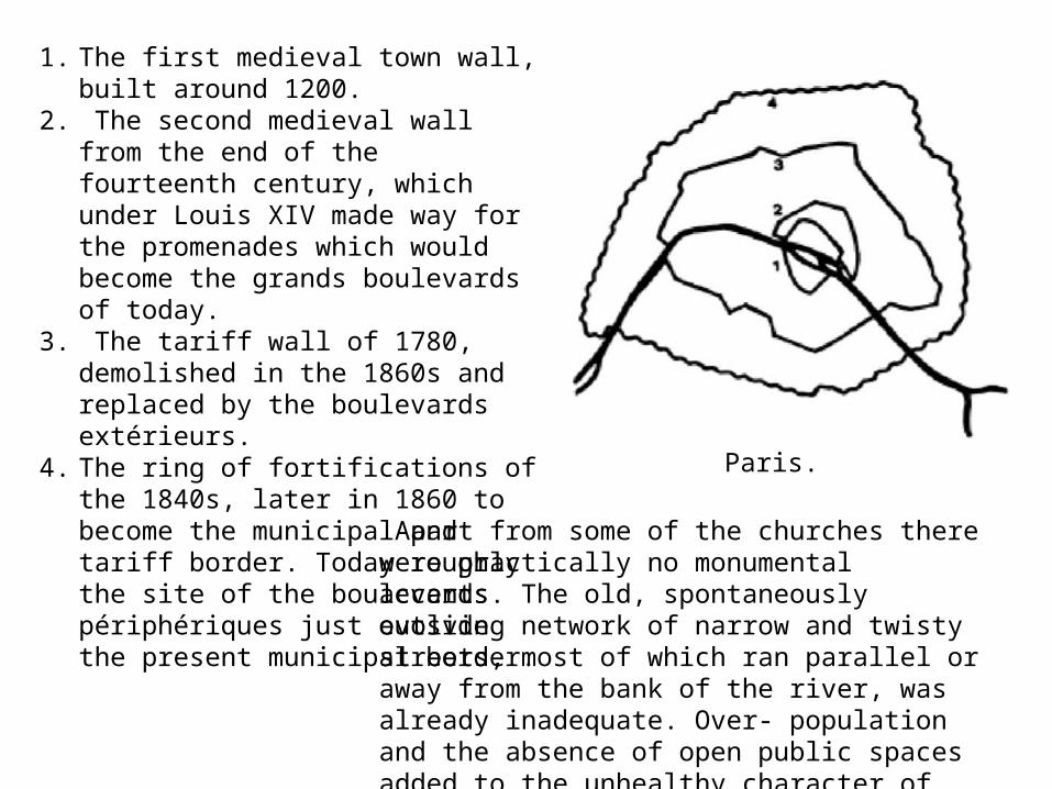
• Under Haussmann the centre proper consisted, roughly speaking, of the Île de la Cité and the area around Les Halles and the Hotel de Ville.
• Round this core there was an inner zone, bordered on the north side by the grand boulevards.
• Then came an intermediate zone extending to the tariff wall and the outer ring of boulevards; most of this area had been built up during the first half of the nineteenth century.
• The adjoining outer zone was defined by the fortifications erected in the 1840s. In 1860 the city and the tariff boundary were moved out to this defence ring.
• The central zone was heavily developed• vacant land for housing construction, industrial establishments etc. was to be found
above all in the outer zone. • As a result of the wretched conditions in the urban core and its lack of good
communications with the surrounding districts, the functional city centre was beginning to shift westwards.
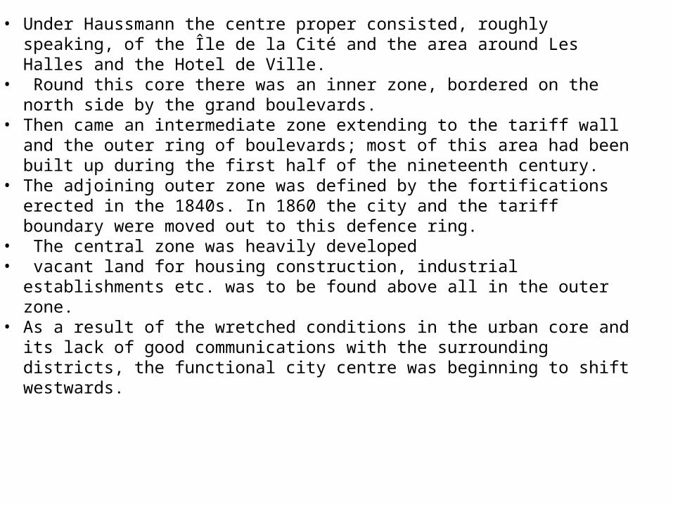
Above: Île de la Cité, 1754. Below: after Haussmann’s regulations. 1. Sainte Chapelle. 2. Notre-Dame. 3. Hôtel-Dieu. 4. Palais de Justice. 5. Place Dauphine. 6. Tribunal de Commerce. 7. Caserne de la Cité (now Préfecture de Police). The letters designate bridges. [From Lameyre (1958)]
• Buildings, politics, and aesthetics: Haussmann envisioned a city focused visually and functionally on major institutions like RR stations; the opera house, the town hall, the cathedral, etc; major architectural units linked by great avenues; also monuments like Notre Dame isolated and turned into museum pieces
• During a time of industrial change and cultural advancement, Paris became the new home for many, overcrowding the ancient districts and spreading disease. The city, which had been untouched since the Middle Ages, was in dire need of reflecting the new modern ways and putting an end to the spreading medical epidemics. The tight confines of Medieval Paris were hindering the city’s potential for growth and desire to transform into a well-organized urban center. Napoleon III set about bringing order and structure to the chaotic, cramped city and putting an end to its' identity crisis
• Baron Georges-Eugene Haussmann, chosen by Napoleon III to lead the project, created new roads, public parks, public monuments, as well as installing new sewers and changing the architectural façade of the city. With the aid of the public, Modernist Napoleon III set out to undertake one of the largest urban transformations since the burning of London in 1666.
• In 1853, Haussman had outlined and began construction on a series of basic projects that had been planned since the decision had been made to modernize the city. The projects included creating a north-south axis in the city, developing the quarters around the Opéra, as well as “the annexation of the suburbs to make them outer arrondissements, the sewer system, and the water supply
• The next step in Haussmann’s plan for the new Paris was to divide the city into arrondissements, or districts. The decision to divide Paris into these new districts came about in 1853, at the same time as the decision to modernize the city completely. The plan “implied the destruction of the old, heterogenous quarters in the city center and the creation of large new quarters implicitly dividing the population by economic status.
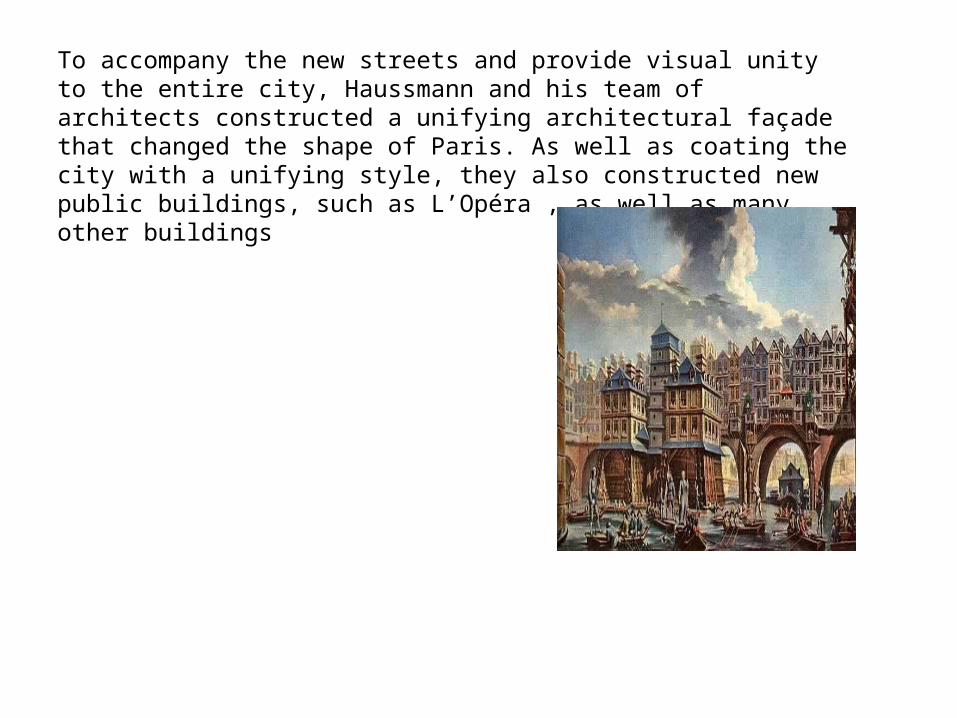
To accompany the new streets and provide visual unity to the entire city, Haussmann and his team of architects constructed a unifying architectural façade that changed the shape of Paris. As well as coating the city with a unifying style, they also constructed new public buildings, such as L’Opéra , as well as many other buildings
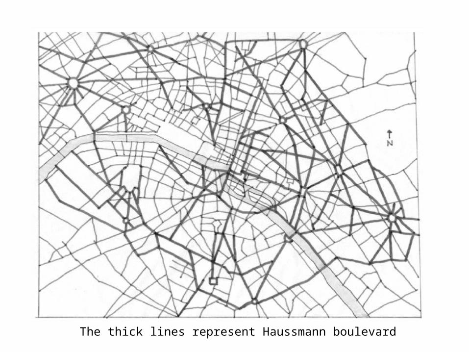
The thick lines represent Haussmann boulevard
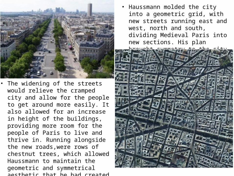
• Haussmann molded the city into a geometric grid, with new streets running east and west, north and south, dividing Medieval Paris into new sections. His plan brought symmetry to the city
• The widening of the streets would relieve the cramped city and allow for the people to get around more easily. It also allowed for an increase in height of the buildings, providing more room for the people of Paris to live and thrive in. Running alongside the new roads,were rows of chestnut trees, which allowed Haussmann to maintain the geometric and symmetrical aesthetic that he had created with the new roads. And where he struggled to maintain his visual order, new public spaces and monuments were erected.
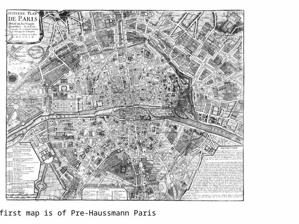
The first map is of Pre-Haussmann Paris
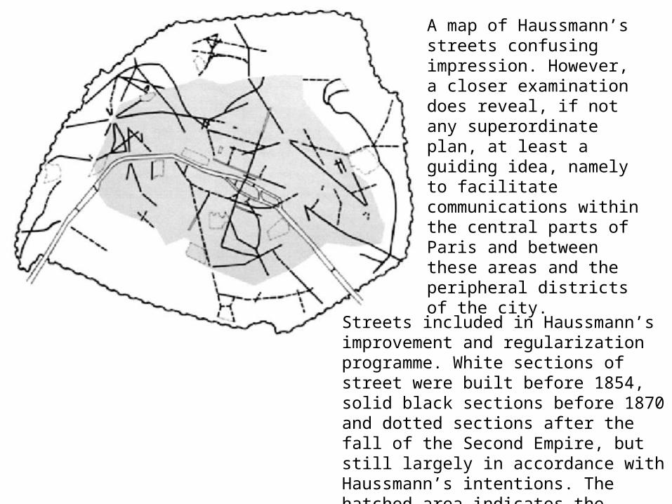
Streets included in Haussmann’s improvement and regularization programme. White sections of street were built before 1854, solid black sections before 1870 and dotted sections after the fall of the Second Empire, but still largely in accordance with Haussmann’s intentions. The hatched area indicates the municipality of Paris up to 1860, when the municipal boundary was extended to the outer fortification ring.
A map of Haussmann’s streets confusing impression. However, a closer examination does reveal, if not any superordinate plan, at least a guiding idea, namely to facilitate communications within the central parts of Paris and between these areas and the peripheral districts of the city.