Oregon Coast Windsurfing Guide -...
28
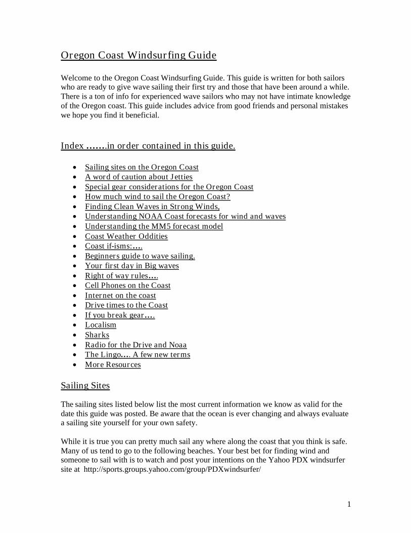
1 Oregon Coast Windsurfing Guide Welcome to the Oregon Coast Windsurfing Guide. This guide is written for both sailors who are ready to give wave sailing their first try and those that have been around a while. There is a ton of info for experienced wave sailors who may not have intimate knowledge of the Oregon coast. This guide includes advice from good friends and personal mistakes we hope you find it beneficial. Index …….in order contained in this guide. Sailing sites on the Oregon Coast A word of caution about Jetties Special gear considerations for the Oregon Coast How much wind to sail the Oregon Coast? Finding Clean Waves in Strong Winds, Understanding NOAA Coast forecasts for wind and waves Understanding the MM5 forecast model Coast Weather Oddities Coast if-isms:…. Beginners guide to wave sailing. Your first day in Big waves Right of way rules …. Cell Phones on the Coast Internet on the coast Drive times to the Coast If you break gear…. Localism Sharks Radio for the Drive and Noaa The Lingo …. A few new terms More Resources Sailing Sites The sailing sites listed below list the most current information we know as valid for the date this guide was posted. Be aware that the ocean is ever changing and always evaluate a sailing site yourself for your own safety. While it is true you can pretty much sail any where along the coast that you think is safe. Many of us tend to go to the following beaches. Your best bet for finding wind and someone to sail with is to watch and post your intentions on the Yahoo PDX windsurfer site at http://sports.groups.yahoo.com/group/PDXwindsurfer/
Transcript of Oregon Coast Windsurfing Guide -...
1
Oregon Coast Windsurfing Guide Welcome to the Oregon Coast Windsurfing Guide. This guide is written for both sailors who are ready to give wave sailing their first try and those that have been around a while. There is a ton of info for experienced wave sailors who may not have intimate knowledge of the Oregon coast. This guide includes advice from good friends and personal mistakes we hope you find it beneficial. Index …….in order contained in this guide.
Sailing sites on the Oregon Coast A word of caution about Jetties Special gear considerations for the Oregon Coast How much wind to sail the Oregon Coast? Finding Clean Waves in Strong Winds, Understanding NOAA Coast forecasts for wind and waves Understanding the MM5 forecast model Coast Weather Oddities Coast if-isms:…. Beginners guide to wave sailing. Your first day in Big waves Right of way rules…. Cell Phones on the Coast Internet on the coast Drive times to the Coast If you break gear…. Localism Sharks Radio for the Drive and Noaa The Lingo…. A few new terms More Resources
Sailing Sites The sailing sites listed below list the most current information we know as valid for the date this guide was posted. Be aware that the ocean is ever changing and always evaluate a sailing site yourself for your own safety. While it is true you can pretty much sail any where along the coast that you think is safe. Many of us tend to go to the following beaches. Your best bet for finding wind and someone to sail with is to watch and post your intentions on the Yahoo PDX windsurfer site at http://sports.groups.yahoo.com/group/PDXwindsurfer/

2
Web cam master page. If a camera link listed in the individual sailing sites below falls dead this link offers a one page setup to most of the coast cams. http://www.northwestwebcams.com/oregon-web-cams.shtm#coast These sites are listed from north to south. Manzanita Drive thru the center of town until you hit the beach, you can launch anywhere. The wind is often very “on shore” here good for jumping when the inside actually has wind in it. Look for Portland to be Hot. This sailing site will go off when all other north locations are shut down due to the heat in Portland; down the line wave sailing here is near non-existent. Many Gorge sailors make this their first ocean experience. Which is sad as this may be many sailors only impression of the coast. Manzanita is far from what many of the coast sailors find desirable for sailing conditions. In fact regular coast sailors will not sail here unless desperate. The on shore wind and the dynamics of the beach usually make it less then desirable for wave riding. There are 2 locals here please be respectful. The beach cam link is below: http://neahkahnie.net/realestate/webcam/netcam.jpg Oceanside You can park anywhere along the beach, but not in front of the power station. This spot can often have some very nice waves. Often gusty but the waves are worth it. Be ready to move up or down the beach a bit to get the best set up for waves and/or wind. The wind here is often very up and down with lulls so it is a site for the sailor who really is focused on the wave. This spot is horrible for kiting due to the land interference making the wind gusty with big lulls. This is hard to forecast, needs to be a strong north forecast for this site to actually blow. I like to think of Oceanside as a slog out to the line up in 5.8 with great waves. When its better then that consider it a added bonus. The closest wind sensor is Garibaldi; this is under the Marine Page under Buoys & Coastal Winds. At http://raws.wrh.noaa.gov/cgi-bin/roman/meso_base.cgi?stn=GARO3&time=PST The beach cam link is at http://www.oceansideoregon.com/surf_cam.asp Lincoln City Roads End Park. (Kiters and Windsurfers) The launch is at the Roads End Park just a short drive north of the casino. Turn off 101 like you were going to the casino on NW Logan Road and keep driving until you see a public beach park. This place is often the best when the wind first comes up and there is
3
less cross chop. If you see waves breaking on the outer sand bars be aware that they are a lot bigger then they look like from the beach!!! At High tide closer to the park there can be a nasty reformed beach break that takes a bit of timing to get through safely. The wind gets weaker the farther south you are from the park. A good choice for sailor unfamiliar with the break is to walk upwind from the park about 200 yards. The wind sensor used to be located on top of the Dory Cove restaurant next to Roads End Park but with the fire that destroyed the restaurant last year we are waiting for a new sensor from IWindsurf. Many times when South Beach is shut down Roads End will be blowing. Due to the disruption of the wind windsurfers have a tough time south of the park but the kiters are free to roam this area. If you are kiting it is best if every one can spread out just a bit along this section of beach. There are 4 locals here please be respectful. Live Cam is at http://www.lcsurfshop.com/webcam.htm. This is great for checking real time wave size and setup. Nelscott Reef south end of Lincoln City This has NEVER been windsurfed, however we think it can be in the right conditions. We are looking for a gale force wind (rumors that regular north small craft advisory wind does not get to Nelscott) and waves that are manageable. Dave, Trudy and Scott have studied the tow-in competition (after more than a few beers) and we think this reef can be sailed. A few nuts from this site are keeping an eye on the conditions and hope to sail that wave before the decade is over. I will post when we go try it, I will bring some friends with video and camera and we can document the first attempt at Nelscott, the Jaws of Oregon. Newport, Agate Beach, Grass rigging and showers are here but a long walk to beach. This site can be fun and there is surfing just north of this location at the north end of this beach if the wind doesn’t blow. This site is known for strong and gusty winds. Ex: It can be 7.0 at South Beach and 4.5 at Agate Beach. This link is an overheard view of Agate Beach from the north. Note the pictures are only taken at one hour intervals. For the most part the waves are a typical sand beach break. http://cil-www.oce.orst.edu/yhead/latest.c0.snap.html Newport South Jetty You can park right on the Jetty but it is a bit of a walk from the parking to the beach. Some days it is set up very nice here. I have seen side off wind here and waves that would make a Maui sailor jealous. Many sailors prefer to park at the South Beach Park and walk up to the Jetty. The sensor at the jetty is at http://www.ndbc.noaa.gov/station_page.php?station=nwpo3

4
Newport, South Beach This is a state park a short drive south past the Newport bridge. Follow the state park signs. Nice grass rigging area and outside shower. On big days with north or Northwest swell you can sometimes play “dial a wave size” by sailing closer or further from the Jetty. This place is really good for north clearing winds in the Fall. Here is the Yaquina Bay Bridge cam view with weather. This is a good way to check how far the fog has moved in. http://www.tripcheck.com/RoadCams/cams/YaquinaBayJetty_pid645.jpg The jetty sensor is at http://www.ndbc.noaa.gov/station_page.php?station=nwpo3 Another good sensor is the Hatfield Marine Center about a half mile east of the Newport South Jetty. This is also good for see there the wind strong wind will set with the fog. http://weather.hmsc.oregonstate.edu/ The jetty sensor is at http://www.ndbc.noaa.gov/station_page.php?station=nwpo3 Neptune One of the most beautiful sailing sites in Oregon, You should park in the north parking lot and launch from there. There can be really, really big waves here. The nickname for this site is bone-crushers. It also tends to blow early. You can catch a session here in the morning and hit Florence in the afternoon. A few pictures are posted on this site. At high tide there are rocks to the south so becareful!!!!!! At low tide there is sand to the south be sure to keep an eye on what your options are if you end up floating south of this launch. Stone Field North of Ocean Beach, really short walk to launch, might be windy and sunny when Florence is foggy. Again you will be sailing alone, unless you bring someone, however tourist will likely save you if you get hurt. Scott has sailed here a few times. Ocean Beach North of the Sea Lion Caves, really short walk to launch. Ocean Beach might be windy and sunny when Florence is foggy. Trudy had a great session (alone) here. Kenny has sailed here a few times. One benefit to this site is there is a very short walk to the launch. You have all the waves to your self, since you will be the only one sailing here. However tourist abound in case you get hurt. You can see highway 101 from the beach, lots of tourist stop to watch you sail. Muriel Ponslers Memorial Beach Brian P. reports this is often a windy spot with an easy launch and should be looked at if Newport is not sailable on your way to Florence. Florence South Jetty (Kiters and Windsurfers)

5
This is one of my personal favorites!! The entrance is about a thousand yards south of the Florence bridge off of 101 there is a pay station here but the parking on the south jetty belongs to the Army Corps of Engineers, so you do not need to pay the fee that the ATV riders pay to ride in the park. If the rangers are at the pay booth simply tell them you are going surfing on the south Jetty they will let you pass for free. The road out to the Jetty seems to go on for a good 10 minutes so just keep driving. The jetty can be a NASTY place for non sailors when it is blowing! Conditions on the beach can be miserable. There is good reason this is the northern most section of the Oregon dunes. It would be very bad for most relationships to bring non sailors here when it is blowing! I can’t say this strong enough if its blowing anyone you bring will be stuck in the vehicle do to the harshness of the conditions on the beach. Florence is also one of the most reliable places for wind on the Oregon coast. However it can often be a late start. It is not uncommon to wait till 3 or 5 pm for the wind to start at Florence. Depending how far out on the Jetty you park it can be a bit of a walk to the water. The jetty cam is at http://www.co.lane.or.us/webcams/harborvista/HarborVista.aspx and the free wind sensor is at http://www.wrh.noaa.gov/mesonet/getobext.php?wfo=pqr&sid=fcg&num=60&raw=0&banner=off Also there is a great steak night at the Beachcomber in town, just ask one of the local windsurfers about this. Slingers Bar This is a sand bar break about a ¼ mile south of the Florence South Jetty. When the waves are from the North the area next to the Jetty can be very flat. Simply sail down wind from the Jetty to this spot and you should be able to enjoy the full size effects of the waves. One other option instead of parking on the jetty is to park at the last turn off on the jetty road where it still runs parallel with the beach it looks l ike the parking site is called site #3 and hike over the dune. At this turn off you would still be in the park and have to pay the park fee. North Bend South Jetty I have looked at this location but have not sailed here. It doesn’t look very inviting. The Jetty is short in length and there are rocks south. The North Bend area kiters usually drive up to Florence so they too must think it’s not very good. Whiskey Run (for Kiters) Just North of Bandon off Hwy. 101 turn west on Seven Devils Road follow it to and turn left on Whiskey Run Road. This is mostly a kite beach but I have sailed here by staying
6
north of where the kiters launch to be respectful of there site. This site works when the thermal low has Pistol shut down and the waves are too small to have fun at Face Rock. Bandon, Face Rock When Pistol is shut down with a thermal low this place can often be outstanding with great waves with very side shore winds sometimes even a bit side off. This is also the place to go if there are Gale force winds along the south coast. It can be 3.2 every where around the South coast with white water out a mile and it will be 4.7 with beautiful mast high sets at Face Rock. There are two places to park. The Face Rock park which is on the “scenic beach loop drive” or there is a vacant lot just a short distance south of the park (better choice). If it is windy you may see other windsurfers here. Across the street is a shared driveway that you can walk your gear down to the beach. There is a danger here. About mid way down the beach there are two smaller rocks. The first one is pretty easy to see from the beach. From the rock you can easily see from the beach there is an additional submerged rock that is about 40 yards out from that rock.. This outer rock will suck dry in front of bigger waves. Make sure you know where you are in relation to these rocks! If the wind is too fluky north of these rocks it can be better a bit further down the beach. I like to use the rocks to get lined up for the sets. When you are further out you will see what looks like 3 attached condos on the beach. The northern most condo lines up with the mid-beach rocks to help you with your position. Face Rock is also a good place to go when NOAA is calling for a gale as Face Rock and the overlook point can block some of the stronger winds. The waves here can get poundy!!! Devil's Kitchen Bandon If you come from the south turn west on Beach Loop Rd. It is the road a mile or so south of town (not the one that comes out next to the Face Rock N. parking area). Beach Loop goes west until it gets close to the ocean then curves and heads north. It's the third picnic area on the left. Nice little park with rest rooms. It has a big area protected from wind for non-windsurf people to hang out by the creek. As you face the ocean there is a big island near shore to the right. This is a very good surf spot (a right that wraps on the island in a W through N swells direction) and protected from the wind. You can launch a hundred yards south of here but the wind is very gusty and crosses off. It's hard to sail the surfers break due to the gusty winds (worse than Cape S.) The best sailing is further south past the last rocks. It is true side shore and slightly off shore. The rocks form a triangle like point kind of like Rhetts for an Oregon style point break. It is all sand bottom and the few rocks there are big and stick out of the water so you can see them easy. We used to sail here a lot but then a few years ago Face rock got good again after some time of being marginal and I kind of forgot about it. In small stuff it is a real easy forgiving wave that just feathers DTL. With size it kicks back like Face Rock in that way. You never know what you'll get so it's worth checking out. Floras Lake (Kiters and winter windsurfing) This is a fresh water lake with only a sand dune separating it from the ocean.

7
About 15 miles south of BANDON, you'll go through little town of Langlois. *Go 1/4 mile past Langlois and turn RIGHT at small brown metal sign that reads Floras Lake - Boice Cope Park (this road is Floras Lake Loop) *Go about 1 mile and take RIGHT on Floras Lake Road, *Go about 1-1/2 miles ~after road bends sharply to the left~ take first RIGHT at Boice Cope Road. Head into Boice Cope Park (entrance on left just past the Bed and Breakfest) and park at the south end of the campground in the "Day Use" area. Follow trail down to the lake's edge and follow it around to the left through the fence to Floras Lake Windsurfing (you'll see the buildings and all of Will's windsurfing equipment). Cape Blanco Five miles to camp ground, then take one lane road to the beach, looks fun, haven't sailed here before, however Brian P. sailed here before and said the wind was “kinda of strange and always changing directions”. This is really a beautiful place on the Oregon coast. Paradise Point Massive shore pound, Nasty spot to sail. If you have done the 6-7 hour drive from the Gorge or Portland and are really, really desperate to sail this place is for you (if NO other place within 500 miles is blowing, i.e. go to Cape Mendocino before resorting to this sorry place). It blows here when no place else on the south coast is blowing. However get ready for all your gear to get stuck together, enjoy going through the rinse cycle 1 foot from shore, get ready for major grit in all the pieces of your windsurfer gear. You have been warned in advance. Some hints, run out with your gear past the shore pound, usually 5-6 feet from shore, immediately launch or you will be eaten by the shore pound,. stay outside until you want to come in. When you do decide to come in, sail right up and into the sand. lift your gear and run as fast as you can to shore before the wave behind you eats you…… Then go to town and have a beer and give up a prayer in thanks that you have survived. Rhett's Sail at high tide or say goodbye to your fin, many rocks in shallow water. However Rhett is really great waves on high tide in the right conditions. Cole Point “Jeff reported this spot on PDXwindsurfer” This is a spot for advanced sailors only. It is the point half way between Humbug and Retz. Best approached from the South at Humbug in case wind dies or something breaks then it's all downwind home. Technically it is not really Cole Point but that is what everyone calls it. Cole is the point immediately to the right as you look west from Humbug. It too can have a long right hander but it needs to be bigger as it's deeper there. Humbug is a huge cliff faced point and floating south for any reason will see you in the water for a long time until you see a sand beach to land on again.
8
Humbug Don't break down and get down wind here. As you can see it is all cliffs and rocks south of here. Roger and Jeff are two of the few sailors that have actually sailed here. Humbug is a huge cliff faced point and floating south for any reason will see you in the water for a long time until you see a sand beach to land on again. Gold Beach South Jetty As a thermal low first starts to creep in to the south coast this spot can sometimes be sailable. It is also a place to get a morning session on the south Coast. The Gold Beach South Jetty often has a nasty beach break so timing is critical to get out. The waves here often set up very nicely. This place is also known to be sharky during the salmon runs the local fishermen say there is a local great white shark here. However this local Great White has been nearly daily exposed to surfers and hasn’t proved to be an issue as of lately. Cape Sebastian (Not safe for Kiters) The sailing site is located on the South side of the cape and is the first turn off at the bottom of the hill. This is a south west and west swells sailing location. If the swell is northwest some times some refracted waves get in here but it will usually be much smaller then Pistol River. Also at a very high tide a tiny bit of northwest swell can get in here. When the swell is Southwest it can be some of the best wave sailing you will get on the Oregon coast or anywhere for that matter! It is often extremely gusty here with rocks to the south of the launch. The outside turn can be 2 meters stronger wind then what you need in the line up. A large rock blocks most of the northwest wind waves and can set up some side off conditions. It is often gusty here. And there are rocks south of your launch which I have seen gear and people get washed up on. Be careful. Last but not least there are locals here so please be respectful. Pistol River a.k.a. “The Rock” (Not for kiters!!!!!!) Just south of Cape Sebastian. You will see some of the best local sailors here. This is also a turn off right on 101. Just south of Cape Sebastian you will cross Meyers creek up on your right about 1000 yards there is a large rock on the beach that looks like a big loaf of bread. This is the launch. There will be sailors here if it is sailable. This is not a good place to Kite but just south of here is a launch called Boss Land and it is a better choice for kiting. For 2007 a nasty beach break has formed and will take a bit of timing to get thru if there are any waves to be had. The waves here can get poundy!!!! If it is a bigger day do not let this place be your first experience on the coast. Please be respectful to the Locals here.

9
Boss Land (For Kiters) There is a mile and a half of sand beach south of the Pistol River launch at “The Rock” There is a nice parking spot with fresh water from the Pistol River to rinse gear in. The turn off is right after you cross the Pistol River bridge on the south side.
A word of caution about Jetties
There are 3 main jetties that are wave sailed most often on the Oregon coast. They are located at Newport, Florence, and Gold Beach. The sailing is almost exclusively done on the south side of each jetty. The Jetties are very sensitive to swell direction. When the swell is out of the North there will be an area next to the jetty with relatively flat water with little to no current. When the swell direction comes from the south, southwest and west direction waves can be found all the way up to the jetty. When waves are up near the jetty you can count on a rip current near the rocks. This is good if you are surfing as that rip will help take you out the back. The safety thing to remember is on a big day if the waves are really big and the swell direction has them all the way up to the rocks you can often find a crescent shaped rip current. First the water next to the beach near the jetty will be running parallel with the beach as it gets closer to the rocks it runs straight out to sea, near the end of the jetty it usually arcs south and there is a sand bar from the river outlet there waiting to jack up the incoming waves. I mention this as it is possible to end up on a merry go round ride on a big day if you get stuck in this setup. The only escape is when you get to the outside is to swim down the beach at least 100 yards then body surf back to the beach.
Special gear considerations for the Oregon Coast What to wear…. The first day of wind will see the Oregon coast water temp “around” 55*F. The longer it blows the more upwelling of deeper colder water will happen. The Most popular suit is a 5/4 mm surfing suit. I personally favor a surfing suit over a windsurfing suit as it has an attached hood, the nylon 2 seems to last longer and you are warmer to surf in it if the wind shuts down.. Many Gorge sailors will wear their 4/3mm suit and add a thermal rash guard to warm it up a bit. The Prolimit 2mm winter rash guard works well. Scuba shops also sell a neoprene undergarment that works exceptionally well. Some wear medium weight polypropylene long underwear under their suit at the coast. Either way plan on being in the water a lot more then you would be in the Gorge. Air Temps… At the Florence south Jetty can often seem like winter even in August. Most other sites stay comfortably cool. In general ranges for summer expect days in the low 70’s F. and nights in the 50’s F You want the wind where you are at to be cold. Warm wind is a bad sign for coast winds.

10
For newcomers to wave sailing, (at least for the first few times out) bring a floaty board around 83 liters or more. The lulls around the impact zone (where the waves are breaking) can sometimes leave you standing on your board in zero wind. As soon as your skills in slogging around in the white water are up to the task then go back to your regular size board. Second… Don’t use any mast but a SKINNY, unless you want to break your mast and swim back to shore. Yes skinnys still break but they hold up to a lot more punishment then their fatter brothers. Third….Bring a couple of gallons of water to rinse off your gear as sand seems to get everywhere. Forth…. Very Important…If you use a two piece mast put a piece of duct tape around the joint where the two sections come together this will keep the sand out and let you take the mast back apart when you are done sailing. Fifth… If you set your sails up so there is about 4 inches of mast sticking out the top it will give you a better hand hold when you are down in the impact zone on bigger days. Sixth… Bring as many spares as you can there is not much available out on the coast as far is windsurfing shops go.
How much wind to sail the Oregon Coast? Unlike the Gorge a lot of wind tends to mess up the waves. Leaving them with a lot of cross chop. This is like driving your car down a pot holed dirt road. Places like Roads End that are not protected by a Jetty or headland rocks are extra sensitive to wind and the cross chop can get so bad on the wave face that riding the outside sand bar breaks becomes very difficult. If the wind is really strong be sure to read the article Finding Clean Waves in Strong Winds in this guide. Some of your better sessions will be in 5.8 to 4.7 conditions. When the waves are really good you do not even need planning winds to have a lot of fun at some locations. Wave sailing differs the most along this aspect from Gorge sailing as the idea is to ride waves from ground swell rather then local wind swell. That said with lighter winds leaving better waves I have found it difficult to clear a sail any bigger then 5.8 in the impact zone. However there are times, When the ground swell is small then a bunch of wind can be a good thing as the local wind swell can bring in some nice ramps to jump. And a bit of local windswell riding action. The more side-shore the wind (wind blowing down the beach or even slightly off) the better for riding waves. The more on-shore the wind (wind blowing more in the direction of the shore) the focus turns more to jumping and backside riding similar to the Gorge. Wind on the Oregon coast is usually an afternoon occurrence. The exception to this rule is Cape Sebastian, Roads End, gold Beach South jetty and Neptune which can blow in the morning starting as early as 10am. On the other end of start times Florence often blows very late sometimes not starting till 5 pm.

11
Finding Clean Waves in Strong Winds,
After you hit the rewind button on your favorite windsurf video have you wondered wouldn’t it be great to have those glassy side off conditions here on the good ole Oregon coast?. Yes there are those special days at Cape Sabastion , Newport South Jetty and Bandon’s Face Rock where side off conditions serve up tasty feasts but what are some of the tricks to simply finding clean waves in side and side on conditions? On the surface it would seem that wind and clean waves would go together as well as oil and water. The trick is how to get the two separated and still be able to sail even when Noaa is calling for Gale force winds.
1, The first trick is almost a no brainier with a west or south swell you can sail
right next to a Jetty. Even in gale force winds the water next to the jetty should be glassy smooth.
2, The second trick is to use the waves up wind as a wind block. This tactic would
work at places that have a bit of curve back inland or point to the beach. Simply sail down wind a bit and look for the sections where there is still enough wind to power the sail but the wind has separated a bit from the water and the chop is removed.
3, The Third trick is to use the bulldozer method. Simply let the first wave or two of a set pass and then attach yourself to the next wave and let the breaking waves before you bulldoze down the chop to leave you with glassy bottom turns.
4, The forth trick is face Rock in Bandon The entire section of coast around Face
Rock can be in gale conditions with white water out a mile and face Rock will 4.7 with wonderful sets. Be sure to check out the south half of the beach and be aware of the two mid beach rocks off shore about 80 to 150 yards.
Understanding NOAA Coast forecasts for wind and waves NOAA offers fair to good forecasts. Also the MM5 forecast models can be pretty reliable. You want North or Northwest winds. Most of us agree that south winds are not very sailable. They are usually storm based with a huge lull to gusts pattern. Any other direction other then North to Northwest should be avoided. The interval between (waves) swell as reported by NOAA (time in seconds between peeks) can sometimes revel how poundy the surf is. An interval of 13 seconds instead of 7 seconds sometimes means a thicker piece of ground swell and a lot poundier wave when it breaks. On the flip side a longer interval can often mean a wave that holds it shape longer before it closes out which is better for riding. A simple forecast one might think on the surface but there is a lot of valuable information here to had courtesy of Noaa and the MM5.
12
First the Noaa website. http://www.wrh.noaa.gov/ At this site you will see a map of the region with two rows of boxes along the coast. The first row of boxes represent links to the forecasts from shore out 20 nautical miles. The second row of boxes to the left of the first row link to the forecast from 20 to 60 nautical miles offshore. The first box next to Astoria is the forecast for coastal waters from Cape Shoalwater Washington (which is just south of Westport Washington) to Cascade Head Oregon (which is located on the north end of Lincoln City) The next Box South is the link to the forecast for Cascade Head (Lincoln City) to Florence The next box south of that is the link to the forecast from Florence to Cape Blanco (which is just North of Port Orford) The next box south of that is the link to the forecast from Cape Blanco (Port Orford) to Point Saint George California (which is located on the north end of Crescent City) When you click on one of these boxes you will see a forecast that looks similar to this…. PZZ350-356-032230- /O.ROU.KMFR.MA.F.0000.000000T0000Z-000000T0000Z/ COASTAL WATERS FROM FLORENCE TO CAPE BLANCO OR OUT 20 NM- COASTAL WATERS FROM CAPE BLANCO OR TO PT. ST. GEORGE CA OUT 20 NM- 832 AM PDT SUN JUN 3 2007 (This is the time the forecast was posted) .TODAY...N WIND 15 TO 20 KT. WIND WAVES 4 FT OR LESS... BECOMING 5 FT IN THE AFTERNOON . SWELL S 5 FT AT 15 SECONDS PATCHY FOG IN THE MORNING. The Noaa folks are saying North wind which along Northwest wind is what you want any other wind direction is not good for the Oregon coast. 15 to 20. as you see is the predicted wind speed in knots. At most sites along the coast wind is an afternoon activity usually not filling in until 1 to 3 pm. Florence is often a late fill in sometimes not starting until 5pm. The exceptions for early wind fill in are Cape Sabastian, Gold Beach south Jetty, and Neptune. Next Noaa gives the wind waves. Wind waves are caused by the local winds. They also come from the direction of the local wind. Wind waves are the same as Gorge swell/waves except they will jack up and break with more energy then Gorge swell as they reach the beach. The wind waves seem as though they are connected with the face of
13
one right behind the back side of the other with about 3 to 5 seconds or so between peaks.. For the most part it is the ground swell that you want to ride. How these two types of waves break in the impact zone is important to understand and I strongly recommend if you are new to wave sailing that you down load a copy of the Oregon Coast windsurfing guide for more information. Now Noaa gives you the swell data. . “SWELL S 5 FT AT 15 SECONDS “ Swell, better known as ground swell are waves coming in from a distant weather system. Ground swell can be recognized by its appearance as a wide line when you are sailing on the outside of the impact zone. It is the longer better formed and thicker waves among the wind waves. When the ground swell is from a different direction then the wind it is easy to see it among the local wind waves. They are often grouped together in sets of about 3 or 4 waves. The peaks of ground swell are usually set apart by a period of time. This range of time is “typically” around 7 to 16 seconds. The size wave that NOAA gives in a forecast is based on the average size of the 1/3 larger ground swell being measured or predicted. So if NOAA says the swell is running 8 feet realize that some of the swell will be bigger sometimes MUCH bigger then that. How the swell jacks up to become rideable faces depends a lot on the sea floor shape, how fast the wave is traveling and how thick it is. A 5 foot piece of Ground swell can jack up another couple of feet depending on these variables. I have often seen Noaa calling 10 foot swell and seen wave faces over mast high as the result. Learn in smaller conditions first and work up to the bigger stuff. At first don’t go out in waves bigger then head high. Your body and wallet will thank you. Swell direction and time. In the forecast “SWELL S 5 FT AT 15 SECONDS “ This is a swell coming in from the South averaging 5 feet in open water with 15 seconds passing between peaks. The interval of time between (waves) swell can sometimes revel how poundy and meaty the surf is. An interval of 15 seconds instead of 7 seconds sometimes means a thicker piece of ground swell and a lot poundier wave when it breaks and a wave that holds it shape longer before it closes out which is better for riding. Swell Direction and sailing sites The direction swell is coming is important to know for it affects different beaches in different ways. When the swell direction is from the north there will be protected areas on the south side of Jettys, rock outcroppings, Capes, and any beach that has a bit of a south west angle to it. That can be as flat as a lake. These sites would include Oceanside, Cape Sebastian, and the Newport and Florence Jettys. The Jettys are unique as a sailor can often play dial a wave size on North swell days by sailing closer or further from the Jetty. This is desirable when we want to get out in bigger waves or sail on our days off and the waves are larger then we would like.
14
When the swell direction is from the west you will see the full size ground swell all the way up to the Jettys this is also a desirable swell direction as the Jettys protect the swell from being chopped up by the wind.. When the swell direction is from the south coast sailors are drooling. Places like Cape Sebastian become epic. And most sailing spots along the coast move into a more true side shore to side off shore wave riding experience. Which is very desirable for down the line wave riding. This is what you see when you watch the Maui wave sailing videos.
That concludes the Noaa section this next section covers what is known as the MM5 forecast model. This model has proven very reliable as a guide for finding wind and should be used to get a better idea of what is waiting on the
coast for you.
Understanding the MM5 forecast model First the MM5 links. The 4 kilometer link is at …. http://www.atmos.washington.edu/~ovens/loops/wxloop.cgi?mm5d3_slp+///3 The 36 kilometer link is at… http://www.atmos.washington.edu/~ovens/loops/wxloop.cgi?mm5d1_slp+//72/3 So what am I seeing on this 4 kilometer page?
You will see the outline of Washington, Oregon and Idaho. The colors you see are forecasted air temps in degrees Celsius. A bar graph at the
bottom of the page will give you the reference to what color is what temperature. The white box at the top gives the time and date of the forecast map you are
currently looking at. On the left side of the page are control buttons to control the sequence on the
maps you are viewing. If the map controls don’t work for you turn down the

15
security controls of your browser to medium. If you still can not control the map with these buttons check to see if you have downloaded the Goggle tool bar. The map controls didn’t work with the Goggle toolbar last time I tried it as the map uses Java script. If the controls still don’t work switch your browser from Internet Explorer to Firefox.
Each long wavy black line you see represents 1 millibar (mb) of pressure
(converted to inches of mercury that you are used to seeing on the Iwindsurf pager each line would represent .03”hg.)
The box directly on some of the black lines is the pressure in millibars (mb) these
lines are also called “isobars”. The Box on the red lines gives you a temperature in degrees Celsius and the red
lines show temperature transitions. The little black arrows with hash marks that kind of look like a feather are known
as wind Barbs sometimes called Barb vectors. The wind barb long end points in the direction of the forecasted wind will blow
to. Each full length hash mark or feather on a barb represents 10 knots of wind. So a
barb with 3 full length hash marks would equal 30 knots of wind Each half length hash mark or feather on a barb represents 5 knots. So a barb with
2 long hash marks and a half length hash mark would equal 25 knots of wind A barb with no hash marks on it equals 3 knots. A triangle instead of a wind barb equals 50 knots
Now that I know what the images are how do I find wind by looking at them?
The wind barbs need to be pointing their long ends south to represent North winds.
First you can look at the wind barbs and see where 15 knots or better is
represented and that it is shown in the afternoon when wind is usually sailable on the Oregon coast.
Look at the colors of the temperature chart. When you see warmer air temps
represented like Orange or warmer plotted out into the ocean this may mean a thermal low that might push winds a mile or so off the beach. If you see this you might want to think about sailing sites further north then where this heat is

16
represented. This part is not a 100 percent sure thing and I have seen sailable wind where MM5 said it was going to get warm.
Also with the colors remember that wind likes to flow from colder areas to
warmer areas. You want to see a minimum pressure of 1020 millibars in the early afternoon at
Astoria for wind at Central and North coast sites. You want to see the Black isobar/millibar lines closer together. I like to see 3 or
more lines within about 70 miles of the first and the third line to be a minimum for sailable wind. To give you an idea what 70 miles looks like on the map the distance between Florence and Lincoln City is about 70 miles.
You also want to see these black isobar/ millibar lines running more or less
parallel with the coast. If they are more perpendicular to the coast then be on the look out for North east winds which is usually a bad sign for wind.
For Manzanita only look for Portland to be hot. (The down the line sailing here
isn’t very good but it is close if one is desperate.) Ok so what am I looking at when I view the MM5 at 36 kilometers?
What you are looking for on this page is the “big picture.” High pressure systems for us spin in a clockwise pattern and low pressure systems
spin in a counter clockwise pattern. High pressure means sailable wind from the north and Low pressure means storms from the south.
A big low spinning in the Gulf of Alaska can often mean the winds on the North and Central coasts won’t be good even though a high pressure system is trying to push into place here in Oregon. If this is the case plan your weekend further south. Like Florence or Pistol.
Well that is the basics so far. Look back here at this file often for revisions. Please feel free to write and share your observations and additions to this guide That concludes the MM5 portion and here are some weather oddities that the PDX group has observed. If you get the page and it shows 0 of 0 images that is the students at Washington.edu reloading the next forecast model simply check back in a half hour or so. As they reload pages some times there will be only 1 or 2 pages to view again you will need to wait just a bit for the pages to be loaded. If it seems they are taking too long to load up the forecast try holding the "Ctrl" key and click the refresh button on the page that will over ride and refresh the page you have cached in your computer. Sometimes a computers cache can lock up a page.
17
One last note, Noaa and the MM5 help a lot in finding wind but there are two professional forecasters which are exceedingly skilled in forecasting wind on the Oregon Coast. Their names are George McLean and Stuart Hill. They both work for IWindsurf . If you have IWindsurf be sure to read the author of the forecast. These two professionals will add more days per year to the days you choose to make the drive and actually get wind.
Coast Weather Oddities 1. For North / Central Coast sites atmospheric pressure in Astoria above 30.10 hg - 1020 mb is a very good indicator of a proper wind set up. I can’t say I ever saw sailable wind with Astoria less then 30.00” hg -1016 mb 2. For the North coast try to catch the first day it blows; generally for Newport and sites north of there I found that many times I can't rely on good North coast wind two days in a row. Sites south of Newport can blow for days at a time. 3. For the south coast look for a .08”hg (3mb) or better pressure gradient between The Port Orford and the St Georges bouys. 4. East winds out of the Gorge generally mean bad wind on North and Central coasts. But note if Portland has really high temps then Manzanta will likely blow with on shore winds. 5 Be sure to look at the Astoria North Bend pressure gradient we can actually have a 12 to 14 mph north winds at the surface at Newport and Florence and the gradient be around .06”hg South biased. If you see this think about driving to Pistol or don’t go. 6. Check the buoys for wind, water temp, atmospheric press, and swell data. N wind brings up cold water from the bottom along the coast; and cold water temp around 48-50 deg F can sometimes mean morning fog. 9. Dew on your car when you wake up on the coast often is a good sign for wind. Perhaps a meteorologist will explain this one day.
Coast if-isms:….
If it's an iffy wind decision (15 to 20) and the swell isn't good, (less then 3 feet) don't go. If you are new to wave sailing and swell is bigger then 5 feet don’t go. If it's an iffy wind decision (15 to 20) & the swell looks good (4 to 8 feet) but not really big, go.

18
If it's an iffy wind decision (15 to 20) & the swell is bigger (8 to 10 feet), take your helmet :-) If it's an iffy wind decision (15 to 20) and the swell is really-really big, (Greater then 10 feet) don't go -save your gear and your body. If it's a good wind decision, (20 to 25) on any swell greater then 3 feet, but not bigger then you feel safe in don't miss it! If it’s a really windy forecast (25 to 30) you get to jump wind waves regardless of swell being too small. If you are new to wave sailing don’t go out if the waves are over head high. Again you can save your gear and your body If it’s warm on the beach think about sites north of where you are. If you went and it wasn’t there bring a surf board or kayak so if all else fails you still get some. If the wind blows from the NW /N all night then most of the time it's not going to be that good the next day. If it looked good and you went and it wasn't, treat yourself to a good sea food dinner!
Beginners guide to wave sailing First A word about safety... Wave sailing qualifies as an extreme sport. Minor injuries are common although deaths are rare. There was a death in the summer of 2005 in Florence. Be wise about your safety decisions. 1. Being aware of the conditions you are in can increase the margin of safety. Before going out watch the waves for a couple of minutes. You should be looking for logs in the surf, rocks being exposed, and hazardous marine life. Also watch how the wave sets are coming ashore, how tall they are and where the rips are. 2. Its important to remember that for most of the Oregon coast the “along shore” current runs from north to south when it is sailable so if you are floating rather then sailing you need to be aware of what hazards are south of where you are sailing. You do not want to be washed up on rocks. 3. Smaller waves break in shallow water so if you fall on smaller waves you could hit bottom. Try to fall flat when possible do not dive in because you could break your neck.

19
4. If you get in really bad trouble on the outside ditch your sail, turn your harness or toss it and paddle in like a surfer. Please, don’t be afraid to ask for help, other sailors will let you hang on to the back foot strap and get you in. Jerry at Pistol has done this for a few folks. 5. If you get in really bad trouble on the inside forget your entire rig board and sail and body surf in. Your suit should provide you with plenty of flotation to simply lay in the water and rest if you need to but not so much flotation that way you can escape a breaking wave by diving under it just like surfers and sea lions do. You do not want to get tumbled with your gear if at all possible. And do not sail alone! Last of all I can’t say this enough stay away from big waves until your skills are ready. Let head high waves be the biggest you sail in at first. The Rips on a big day can be strong making it very hard to get to shore. A thought about anxiety ….. When you are standing next to your board getting ready to launch do you feel a bit of dread thinking about trying to slog out thru the impact zone? Well that dread is a common feeling especially when we are first learning to wave sail. Yes you could go out only on small wave days where the ocean looks like a lake but that really isn’t the point of wave sailing. It is a bit difficult to get much of a ride out of anything smaller then 5 feet. That leaves us right back in the anxiety zone again. I have to assure you right now that in smaller waves this portion of stress will pass the more time you spend on and in the water. It is a bit like a gold fish that only grows as big as the aquarium you keep him in. If you sailed lakes you get good at lake sailing. If you sailed the Gorge you get good at Gorge sailing. As you start sailing the coast you will get good and comfortable there too. It is simply time on the water. Our skills rise to the environment we submit ourselves to. The most frequently used form of therapy for the treatment of fear is a type of cognitive behavioral therapy called systematic desensitization or exposure therapy. The more one is exposed to the feared situation The more comfortable one becomes. When I first started sailing the coast I was often frustrated on how hard it was to get going again in the impact zone while being washed, having the board flipped upside down and dealing with the fluky wind. This brought on a fear of getting knocked down in the impact zone. But as time has passed those skills get better by simple repetition and now I really don't think about it to much. The Pdxwindsurfer yahoo group site has an article called “Fear and the Ocean” in the files section which may help with some of your anxiety. Ok….. back to your first day in real waves…. Find a safe and easy day north or north west winds 20 to 25 swell running 3 to 5 feet or so and an interval of around 7 to 9 seconds. Pick a spot with a long stretch of sand to the south of where you are launching with NO ROCKS. Do not go out your first few times if the waves are bigger then head high. Do not go out in big surf while learning the pain is not worth it. A small three foot breaking ground swell wave has more power to it then any piece of Gorge swell!!!! Many sailors make Manzanita their first Oregon coast site but I would personally say that it is a bad choice. The wind at Manzanita is very on shore and it is not that fun of a place to sail.

20
There are four new skills you will want to work on during your first few trips to the coast that you can not learn in the Gorge. The first is getting through a beach break. The second is building skills in the impact zone. The third is picking out the ground swell to ride. The forth maintaining your position on the beach, Your first new skill is dealing with a beach break. At many locations after a wave has broken the first time some of that energy will reform another wave that will break right on the beach. What makes this a safety issue is it can sometimes drop on very shallow water or even bare beach. Damaging your rig or even your body if you are in the way. You will also need to be careful about getting pinned under your sail here. Generally speaking on a steep beach the beach break to be aware of usually happens at high tide. On a gently sloping beach a beach break is more likely at low tide. But on some beaches there may always be a beach break. Either way to be safe you need to cross this section of beach quickly between the waves. If there is a nasty beach break coming back to shore I will try to stay right behind the reformed wave and let it break right in front of me then ride up to the beach and jump off and push my board through the sand until I am past the break. Going out I simply time it and rush through and quickly get going. Your second new skill is building experience in the impact zone. To get thru the impact zone (where the waves are breaking) can be a bit like a chess match there are strategies to work through. The impact zone consists of; for the most part ground swell and local wind waves breaking along with rip currents. Ground swell can be recognized by its appearance as a wide line when you are sailing on the outside of the impact zone. When the ground swell is from a different direction then the wind it is easy to see it among the local wind waves. They are often grouped together in sets of 3 or 4 waves. The peaks of ground swell are usually set apart by a period of time. This range of time is “typically” around 7 to 14 seconds. Size Matters!!!! The size wave that NOAA gives in a forecast is based on the average size of the 1/3 larger ground swell being measured or predicted. So if NOAA says the swell is running 8 feet realize that some of the swell will be bigger sometimes MUCH bigger then that. How the swell jacks up to become rideable faces depends a lot on the sea floor shape, how fast the wave is traveling and how thick it is. A 5 foot piece of Ground swell can jack up another 1 to 3 feet depending on these variables. I have often seen Noaa calling 10 foot swell and seen wave faces over mast high as the result. Learn in smaller conditions first and work up to the bigger stuff. At first don’t go out in waves bigger then head high. Your body and wallet will thank you. Wind waves. Wind waves are caused by the local winds and are the same as gorge swell except they will jack up and break with more energy then Gorge swell as they reach the beach. The wind waves seem as though they are connected with the face of one right behind the back side of the other with maybe 3 to 5 seconds or so between peeks. They also come from

21
the direction of the local wind For the most part it is the ground swell that you want to ride. How these two types of waves break in the impact zone is important to understand especially when you are trying to sail out. In most conditions the ground swell carriers the most power and has the greater ability to knock you down, damage your gear or even injure you. Impact Zone tactics Generally speaking you want to be going out between the swell sets. Especially on bigger wave days I will wait until the second or third wave of a set starts to break then I will start sailing off the beach that way by the time I get to the impact zone the last wave of the set is reduced to white water. While it may be nice to sail fast thru the impact zone and be able to out run most breaking waves that isn’t always possible due to the fluky wind. Two popular techniques that most coast sailors share to get out through the impact zone is the art of stalling and the chicken gybe. If you are slogging out thru the impact zone and see you won’t get past the next wave before it breaks on you if you were to keep going simply stall your forward progress let the wave break then proceed over the white water. The chicken gybe works well if you actually have the time to pull it off. It is a simple manner of deciding early enough to gybe your board back to the beach before you get munched. Rip Currents…most of the time they are your best friend but on a big day they can be your worst nightmare. Rips as they are called is the movement of water as it tries to return to deeper water after being delivered toward the beach by the action of the breaking waves. The early stages of a rip is actually parallel to the beach before it finds a path back out to deeper water by running perpendicular to the beach. Rips are easy to see if you can view them from higher ground but to pick them out on the beach takes a bit of practice. Be sure to ask experienced sailors with you to show you where the rips are. If the waves are smaller (less then head high) the rips are usually gentle. In bigger surf the rips can keep you from shore as the water rushing parallel to the beach can be swift and occur in deeper water then you can touch bottom which will then drag you out to the perpendicular flow and deposit you on the outside of the impact zone. Rips can often be your best friend when you are down in the impact zone and still with your gear they usually will drag you into deeper water and give you a better chance to get your sail cleared and get going again. Down in the impact zone… When you are down in the impact zone try to get going as soon as possible but if you need to stay there for a bit to catch your breath or just to wait for a lag of time between sets. There are two ways to keep your gear safe and each is used depending how big the waves are. When the waves are smaller then mast high but big enough to work you. Then swim to your mast tip and hold on to it. Keep it pointed out to sea and in the direction of the incoming waves. Also keep your body facing the waves with your feet pointed at the beach and your head towards the incoming wave. As the wave is about to break dive your mast tip down in the same manner a surfer duck dives a short board. This method works really good!!! If the waves are bigger then mast high or are curling and trying to suck you up the face stay away from your gear. The hard part about the Oregon coast is that you are wearing a thick wet suit that makes it hard to dive

22
under the waves to escape a lot of the energy. But if you can bend at the waist and get a bit under you will be better off. A word of warning if your feet are out to sea and your head is toward the beach you will likely get summer-salted and rolled or worse yet thrown on top of your gear and rolled. One more note at all costs do not let your gear get between you and a breaking wave. This is a bad place to become one with your gear! The second method to keep your gear safe is used ONLY when the waves are small. Less then head high and are crumbling and not curling. Simply place yourself in the water start position with your mast tip pointed out to sea in the direction of the on coming waves. And your board pointed to the beach. Put one hand on your boom and the other on the mast to keep it at arms length from you. The hand on the boom will be to keep your gear with you and the hand on the mast is to keep you from being hit by your rig. This method does not work in bigger waves and I have shed my own blood to confirm it! Your third new skill is picking out the ground swell to ride. Ok you have just made it past the last breaking wave and you are looking for the ground swell. If there is a ton of wind it can be a challenge at first to pick out the ground swell. Look for the longer better formed and thicker waves among the wind waves. When you have spotted one prepare for your outside gybe. Let your current skill level be your guide. If you have a fast planning gybe then gybe on the ground swell.. If not gybe before the ground swell and be ready to match its speed as it catches up with you. At first stay just in front of it until it is of a shape you are ready to start surfing it. The reason you want to stay just in front of it is because a wave of any length will better guide the wind in front of it as it approaches the beach making it better for sail power. Picking out land marks on the beach can also help you be in the correct position to get the best ride. Your Forth new skill is maintaining your position on the beach, One of the best parts of riding waves is riding front side down the line. This is with the front of your body facing the wave and you are headed downwind. But before you can do this you need to learn how a wave in any form such as ground swell or broken white water provides an escalator effect upwind. After you have picked out a wave you want to ride. Ride this wave backside just like you do Gorge swell all the way to the beach to get a feel for how much upwind ground you can make up in one reach. When you feel comfortable with holding your position on the beach then start your down the line rides. That is about it for your first time out in real waves. contact anyone from the PDXwindsurfer group especially Trudy, Dave or John one of us will be happy to go with you. Be sure you go with someone that actually sails the Oregon coast a lot. (most people in the group would be happy to take you out). Video to learn with…. “Serious about Waves” Volume #1 by Peter Hart. Which is a “how to” video for new wave sailors is worth every penny you would spend on it.. (Available at Windance)

23
Your first day in Big waves
Well its time… your starting to build the confidence in head high waves and you are ready to try some logo to mast high waves. What makes this a big step during the learning process is the power of the waves is exponentially increased. The rips are much stronger and mistakes can be painful. Keeping you and your gear safe …The most important thing to remember is equipment can be replaced, however your body takes a long time to heal. If you are really going to eat it BIG time, ditch your gear, down wave, I have seen this technique done by the best of all sailors. The one most important thing to do when you are down in the water in the impact zone is to keep your mast tip pointing out towards the waves until you have the time to clear the rig from the water. If a big wave is about to crash down on you while you are holding your mast tip out towards the waves dive it and you to the bottom like a surfer performs a duck dive and your pain will be much less and your rig will likely survive. This trick is void if you are in stupid big waves as gear and bodies can get sucked up the face of really big waves. Another is if you are standing in a lull in the impact zone and you know you are about to get worked catapult your rig towards the wave and if you have time swim up to the mast tip and bury it deep if you do not have time get away from your gear! You do not want to get rolled with your gear. Long Swims…. Sometimes your gear gets away from you and it is a swim after it. The main thing to remember if you get disconnected from your gear is to NOT PANIC. This one concept is very important, take a few deep breaths. Just relax and bob up and down until you get your breath back, Try to get a shore reference in case you have to deal with a rip. Trust that your thick wet suit is going to provide all the flotation you need to simply lay in the water and catch your breath. Then body surf back to shore, don’t be afraid to wave another sailor down for help. Try to pace your self as you can expend a lot of energy swimming after your gear. Try to body surf each wave as it comes to you unless it is really big or is going to break directly on you then dive down as deep as you can to escape getting worked. When you catch up with your gear get the mast tip pointed back out to sea and the approaching waves and water start as soon as you have the energy. If exhausted just hold on to your mast tip tight and be ready to dive it to the bottom if you are going to get worked. Once again to make the point. Your thick wetsuit provides a lot of flotation (close to 20 pounds of positive buoyancy) you can always just lay in the water till you get your strength back. Peel off early one trick in big waves is to leave the wave early. By doing this it will keep you from having to fight thru the impact zone to get back out. Enjoy the big wave riding it just until it starts to feather out then blast over the back of it and head for the outside with out wasting any time that might let you get caught by an even bigger wave breaking behind the one you are ridding.

24
Now for some odd tid-bits of information
Right of way rules…. When you come to the coast the other sailors there are going to expect you to know the right of way and surf etiquette rules. 1. Sailors going out from the beach have the right of way. That said there are so few of us on the coast try not to mess up anyone’s wave ride just to claim the right of way. When the waves are big you are not likely to make it out when the sailors are lined up and coming in anyway. So it is better to wait for a gap in the big sets. 2. When the group is out whale watching and loitering way out side to find the wave they are going to ride it is the upwind sailor first on the wave who has that wave. 3. When the group is gybeing onto the waves just outside the impact zone the first sailor to gybe on the wave has claim to it. If two people gybe on to a wave at the same time the upwind sailor has it. 4. In a group setting it is really bad manners to chase down a wave and come over the backside of it to start riding it. This is especially true if any one is coming out who might have been able to gybe on to it.
Cell Phones on the Coast There are four popular sailing sites that do not have Cingular /ATT cell phone coverage. They are Pistol River and Cape Sebastian, Neptune and Oceanside. Coverage with other providers is sketchy along the coast with the exception of Verizon which as of recently is getting better coverage on the Oregon coast then Cingular/ ATT.
Internet on the coast The Portland coast sailors can be found at http://sports.groups.yahoo.com/group/PDXwindsurfer/ The people in this group tend to be Oregon coast sailors and winter east wind (Rooster Rock and Stevenson) sailors, we sail year round we will always post when there is a slight chance that it will blow at the Oregon Coast Everyone is welcome, that loves the Oregon coast and east winds. Looking forward to seeing you on the water. Membership is free!!!! Libraries… Free internet is available to check the forecast at libraries. In Florence Located one block north and 1 block west of the Safeway on 9th street opens at 10 am. (1 pm Sunday) In Gold Beach it is located behind the Court House and a half a block south. In Lincoln City it is located on the second floor next to the Visitors center and across from the Burger King. It opens at 10 am also.

25
The other option is to break down and buy a laptop, Many of these places have free internet access in the coffee shops.
Drive times to the Coast PDX airport to Roads End Lincoln City 2 hours and 5 minutes. Approximately 97 miles PDX airport to Florence 3 and ½ hours. PDX airport to Gold Beach 5 hours and 40 minutes. PDX airport to Newport via Albany 3 hours 10 minutes PDX airport to Newport via Hwy. 18 2 hours 50 minutes Traffic can often be bad on this route. Oceanside to Lincoln City is approximately 45 miles Lincoln City to Newport is approximately 25 miles Newport to Florence is approximately 49miles For the North coast hwy 101 covering 40 miles takes about an hour. Yes you get used to the drive. Audio books from the library help. Staying overnight is the norm. If you have a passion for real waves the drive will not be an issue. One word on drive times, anytime during the weekend in August look for extremely long drive times to North coast sites due to everyone in Portland heading to the beach, this is especially true when Portland is really hot.
If you break gear…. For the southern Oregon coast, contact Big Air Windsurf & Surf Mike & Rose Blair Phone 541-347-2692 Or Windance can ship you gear if you are spending your vacation on the coast. If you can bring two of everything. Especially if you go down to Pistol, it is a long way from anywhere. Minor sail repairs can be had at Pistol by contacting Rob at 541-469-5131. Also at Pistol you can have one of the finest custom wave boards built for you. Contact Brian Peters at the beach.
Localism Think what you want about localism but it is a very real part of human nature and you will find it around the globe. The Oregon coast has a tiny bit of it but not in the way you

26
might see in some of the dedicated surfing spots. When it comes time to sail a spot with locals the very best one can do is remember the golden rule. How would you like to be treated? For the most part if you give respect you will get respect. But how does one give respect? It really is in the little things. Items like not taking the very best parking spots, picking up the poop from your dog, waving a local on to a wave that there might have been a possible conflict on who might have had the right of way. Following the flow in the line up especially if the group is out whale watching to find ground swell, keeping your dog on a leash, and knowing and following the right of way rules and surf etiquette . Last but not least simply being modest and friendly go a long way to making you a welcome addition to a localized spot.
Sharks
There has NEVER been a shark attack on a windsurfer on the Oregon coast This is yet another myth that gorge sailors love to talk about. I get asked often about sharks. Yes there are sharks there. That’s where they live. They usually eat fish and dead things floating around. Some bigger sharks have been known to eat seals and sea lions. While scuba diving I have been able to spend time with sharks once I was able to spend 40 minutes with a large adult black tip. Also I have lost count how many nurse sharks I have seen. The reason for this mention is you can be around sharks with out them eating you. Common knowledge is sharks are more likely to be around salmon runs, River mouths, Jetties and loan rock out croppings, That said those are the exact places you would want to wave ride and of coarse swim after your gear. So basically there are four options when dealing with sharks if you want real waves. One,…You can sail scared ready to soil your wet suit every time you see something in the water. Two,… you can buy a product from SeaCharge called the shark shield http://www.sharkshield.com/index.php Three… you can play the probabilities and realize you are more likely to be hit by lightning, be in a car accident driving out to the coast, winning the lottery, being hit by space debris, etc… then be killed by a shark. Forth…you can deal with your own mortality and make peace with God. For more on the eternal perspective of fear be sure to read the article on “Fear and the Ocean” in the files section of the yahoo PDXwindsurfer group.
Radio for the Drive and Noaa
The Noaa weather radio is pretty handy to plan your day. At Florence you need to walk pretty far out on the jetty to get the weather radio reception.

27
If you are inclined to the shark option #4 the following radio stations will be a joy to your drive. PDX to Salem 104.1 FM Salem to Albany / Eugene 107.1 FM Eugene 96.9 FM Florence 89.3 FM Newport 89.9 FM Gold beach 88.1 FM
The Lingo…. A few new terms 1, (Inside) this is the area between the furthest out breaking wave and the beach. 2, (Outside) this is the area past the furthest breaking wave. 3, (Whale watching) this is when you go far off shore looking for swell or to get up wind 4, (Beach break) sometimes called shore pound this is usually a reformed wave that is dropping right on the beach in shallow water or even bare beach. 5, (Rips) This is how the water that comes ashore gets back out to sea. They can be your best friend most of the time except on a big wave day they can turn into a nightmare. If you don’t know what they look like be sure to ask and don’t miss the rip current section in the “Beginners Guide” article in this guide. 6, (Down the Line) “DTL” this is riding the wave while facing it down wind. 7, (Backside) This is riding the wave up wind with your back to the wave. 8, (Pearling) when the nose of your board goes under water and you get thrown over the front of your board. 9, (Snakeing) This is when some one breaks the right of way rules and takes the wave from someone properly in position for it. Not a good way to make friends. 10, (A Left) is a wave when viewed from the beach starts breaking from the left to the right. 11, (A Right) is a wave when viewed from the beach starts breaking from the right to the left. 12, (A Closeout) is when the wave has finished breaking along its length or at least the section you are surfing in.
Wind descriptions
Onshore, side-onshore, side-shore, side-offshore and offshore all refer to wind direction relative to whatever beach you're at... doesn't have anything to do with literal compass direction in general.. on-shore - wind coming straight off the ocean at the beach = backside wave riding... Such as Manzanetia side-on - wind from one side or the other, but still with an onshore component = easy backside riding and decent, but sometimes difficult down the line riding... like The Rock at Pistol side-Shore perfect 90 degree direction (either direction) = excellent down

28
the line riding... like Face Rock in Bandon side-off - a bit more offshore than true side shore = the perfect down the line riding direction... Cape Sebastian and sometimes Newport south Jetty off shore - wind straight off the beach, the opposite of onshore Some say cross-off instead of side-off, Cross-on etc. etc... “Cross” means the same thing as “Side”.
More Resources The PDX Windsurfer group can be found at http://sports.groups.yahoo.com/group/PDXwindsurfer/ A weather decision calculator in Microsoft Excel format exists in the Files section of the PDX windsurfer group. We also pick fun at Noaa and you can see the Noaa songs in the Files section of the PDX windsurfer group. I hope this guide helps if you have more info to add to this please write me thru the Yahoo pdxwindsurfer group. Many people have contributed to this guide and to their long swims and bruises I am thankful.