New England Antiquities Research Association · 2020-03-07 · New England Antiquities Research...
13
New England Antiquities Research Association A Photo Tour of New England Lithic Structures Featuring the Photos of Edward Bochnak Edited by Daniel V. Boudillion Editor's Note: I received a number of photos recently from NEARA member Edward Bochnak. Usually these are posted by state in the Photo Gallery . However, I was so impressed by the subject matter, quality, and artistic composition of the photos, that I decided to highlight them here. The text are quotes from various respected writers and NEARA members. Enjoy! Burnt Hill, Massachusetts Quote from Standing Stones on Wild Hill Remain a Puzzle, Rutland Herald, by Trudy Tynon [AP] Feb 3, 2002: "As cold and lonely as the winter sky, the standing stones atop Burnt Hill have snagged the imagination of fiction writers and generations of blueberry pickers. But who erected them, and why, remains a mystery. Photo by Edward Bochnak
Transcript of New England Antiquities Research Association · 2020-03-07 · New England Antiquities Research...
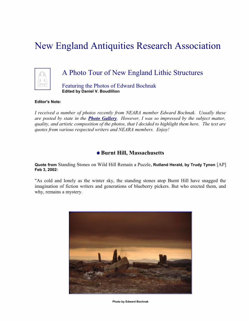
New England Antiquities Research Association
A Photo Tour of New England Lithic Structures
Featuring the Photos of Edward BochnakEdited by Daniel V. Boudillion
Editor's Note:
I received a number of photos recently from NEARA member Edward Bochnak. Usually these are posted by state in the Photo Gallery. However, I was so impressed by the subject matter, quality, and artistic composition of the photos, that I decided to highlight them here. The text are quotes from various respected writers and NEARA members. Enjoy!
Burnt Hill, Massachusetts
Quote from Standing Stones on Wild Hill Remain a Puzzle, Rutland Herald, by Trudy Tynon [AP] Feb 3, 2002:
"As cold and lonely as the winter sky, the standing stones atop Burnt Hill have snagged the imagination of fiction writers and generations of blueberry pickers. But who erected them, and why, remains a mystery.
Photo by Edward Bochnak
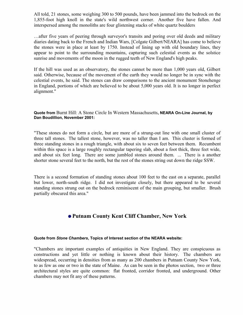
All told, 21 stones, some weighing 300 to 500 pounds, have been jammed into the bedrock on the 1,855-foot high knoll in the state's wild northwest corner. Another five have fallen. And interspersed among the monoliths are four glistening stacks of white quartz boulders
…after five years of peering through surveyor's transits and poring over old deeds and military diaries dating back to the French and Indian Wars, [Colgate Gilbert/NEARA] has come to believe the stones were in place at least by 1750. Instead of lining up with old boundary lines, they appear to point to the surrounding mountains, capturing such celestial events as the solstice sunrise and movements of the moon in the rugged teeth of New England's high peaks.
If the hill was used as an observatory, the stones cannot be more than 1,000 years old, Gilbert said. Otherwise, because of the movement of the earth they would no longer be in sync with the celestial events, he said. The stones can draw comparisons to the ancient monument Stonehenge in England, portions of which are believed to be about 5,000 years old. It is no longer in perfect alignment."
Quote from Burnt Hill: A Stone Circle In Western Massachusetts, NEARA On-Line Journal, by Dan Boudillion, November 2001:
"These stones do not form a circle, but are more of a strung-out line with one small cluster of three tall stones. The tallest stone, however, was no taller than I am. This cluster is formed of three standing stones in a rough triangle, with about six to seven feet between them. Recumbent within this space is a large roughly rectangular tapering slab, about a foot thick, three feet wide, and about six feet long. There are some jumbled stones around them. ... There is a another shorter stone several feet to the north, but the rest of the stones string out down the ridge SSW.
There is a second formation of standing stones about 100 feet to the east on a separate, parallel but lower, north-south ridge. I did not investigate closely, but there appeared to be several standing stones strung out on the bedrock reminiscent of the main grouping, but smaller. Brush partially obscured this area."
Putnam County Kent Cliff Chamber, New York
Quote from Stone Chambers, Topics of Interest section of the NEARA website:
"Chambers are important examples of antiquities in New England. They are conspicuous as constructions and yet little or nothing is known about their history. The chambers are widespread, occurring in densities from as many as 200 chambers in Putnam County New York, to as few as one or two in the state of Maine. As can be seen in the photos section, two or three architectural styles are quite common: flat fronted, corridor fronted, and underground. Other chambers may not fit any of these patterns.
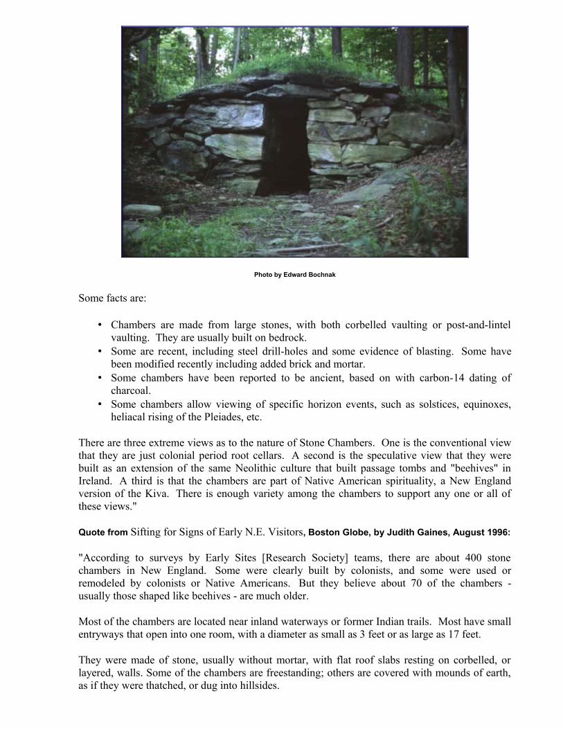
Photo by Edward Bochnak
Some facts are:
• Chambers are made from large stones, with both corbelled vaulting or post-and-lintel vaulting. They are usually built on bedrock.
• Some are recent, including steel drill-holes and some evidence of blasting. Some have been modified recently including added brick and mortar.
• Some chambers have been reported to be ancient, based on with carbon-14 dating of charcoal.
• Some chambers allow viewing of specific horizon events, such as solstices, equinoxes, heliacal rising of the Pleiades, etc.
There are three extreme views as to the nature of Stone Chambers. One is the conventional view that they are just colonial period root cellars. A second is the speculative view that they were built as an extension of the same Neolithic culture that built passage tombs and "beehives" in Ireland. A third is that the chambers are part of Native American spirituality, a New England version of the Kiva. There is enough variety among the chambers to support any one or all of these views."
Quote from Sifting for Signs of Early N.E. Visitors, Boston Globe, by Judith Gaines, August 1996:
"According to surveys by Early Sites [Research Society] teams, there are about 400 stone chambers in New England. Some were clearly built by colonists, and some were used or remodeled by colonists or Native Americans. But they believe about 70 of the chambers - usually those shaped like beehives - are much older.
Most of the chambers are located near inland waterways or former Indian trails. Most have small entryways that open into one room, with a diameter as small as 3 feet or as large as 17 feet.
They were made of stone, usually without mortar, with flat roof slabs resting on corbelled, or layered, walls. Some of the chambers are freestanding; others are covered with mounds of earth, as if they were thatched, or dug into hillsides.
What the beehive-shaped chambers were used for is as controversial as the identity of their makers. No definitive artifacts have been found that would provide substantial clues."
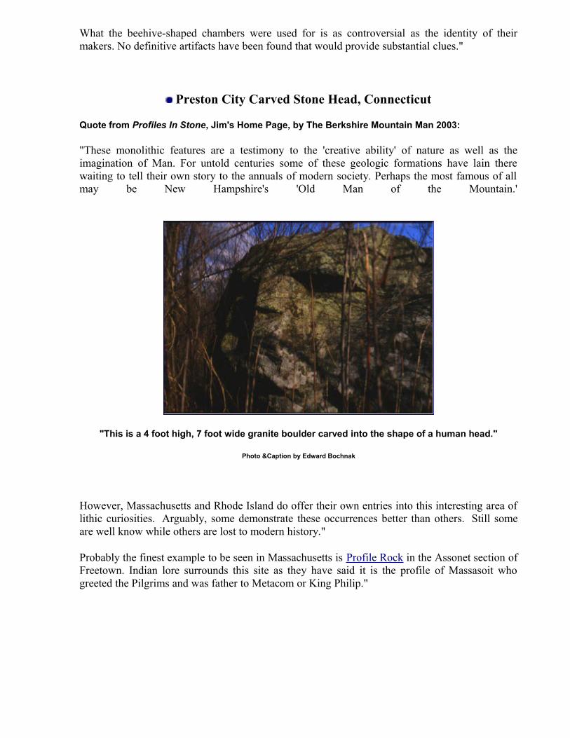
Preston City Carved Stone Head, Connecticut
Quote from Profiles In Stone, Jim's Home Page, by The Berkshire Mountain Man 2003:
"These monolithic features are a testimony to the 'creative ability' of nature as well as the imagination of Man. For untold centuries some of these geologic formations have lain there waiting to tell their own story to the annuals of modern society. Perhaps the most famous of all may be New Hampshire's 'Old Man of the Mountain.'
"This is a 4 foot high, 7 foot wide granite boulder carved into the shape of a human head."
Photo &Caption by Edward Bochnak
However, Massachusetts and Rhode Island do offer their own entries into this interesting area of lithic curiosities. Arguably, some demonstrate these occurrences better than others. Still some are well know while others are lost to modern history."
Probably the finest example to be seen in Massachusetts is Profile Rock in the Assonet section of Freetown. Indian lore surrounds this site as they have said it is the profile of Massasoit who greeted the Pilgrims and was father to Metacom or King Philip."
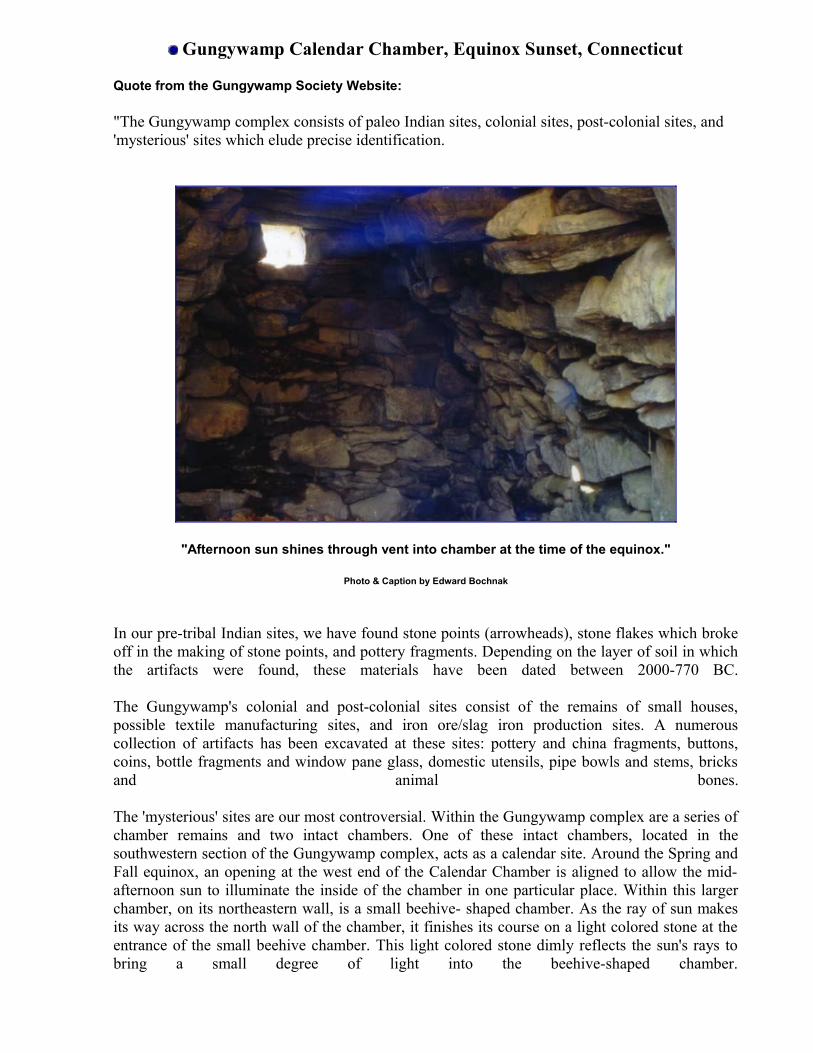
Gungywamp Calendar Chamber, Equinox Sunset, Connecticut
Quote from the Gungywamp Society Website:
"The Gungywamp complex consists of paleo Indian sites, colonial sites, post-colonial sites, and 'mysterious' sites which elude precise identification.
"Afternoon sun shines through vent into chamber at the time of the equinox."
Photo & Caption by Edward Bochnak
In our pre-tribal Indian sites, we have found stone points (arrowheads), stone flakes which broke off in the making of stone points, and pottery fragments. Depending on the layer of soil in which the artifacts were found, these materials have been dated between 2000-770 BC.
The Gungywamp's colonial and post-colonial sites consist of the remains of small houses, possible textile manufacturing sites, and iron ore/slag iron production sites. A numerous collection of artifacts has been excavated at these sites: pottery and china fragments, buttons, coins, bottle fragments and window pane glass, domestic utensils, pipe bowls and stems, bricks and animal bones.
The 'mysterious' sites are our most controversial. Within the Gungywamp complex are a series of chamber remains and two intact chambers. One of these intact chambers, located in the southwestern section of the Gungywamp complex, acts as a calendar site. Around the Spring and Fall equinox, an opening at the west end of the Calendar Chamber is aligned to allow the mid-afternoon sun to illuminate the inside of the chamber in one particular place. Within this larger chamber, on its northeastern wall, is a small beehive- shaped chamber. As the ray of sun makes its way across the north wall of the chamber, it finishes its course on a light colored stone at the entrance of the small beehive chamber. This light colored stone dimly reflects the sun's rays to bring a small degree of light into the beehive-shaped chamber.
Since no artifacts have been found in this chamber, an array of theories has produced a degree of controversy as to who built the chamber, when, and for what purpose.
One theory is that this chamber, and other chambers evident in the Gungywamp, were built by early colonial inhabitants, and that the chambers served as root cellars. The calendar feature of our one chamber has been explained as a necessary feature to help discern planting and harvest times. Another theory is that the chambers may have been built by African, Indian or Afro-Indian slaves who were owned by colonial settlers in the Gungywamp area. This theory is a relatively new idea, based in part on some research done on a colonial slave settlement in Salem, Connecticut. [Norman Muller comments: This theory was first raised in an article by Alfred M. Bingham titled "Squatter Settlements of Freed Slaves in New England" The Connecticut Historical Society Bulletin, Vol. 41, No. 3 (July 1976), pp. 65-80). The author discusses the structures at the Gungywamp site and also their similarities to some in Salem, CT.]
Others believe the chambers were built by native Indian tribes at unknown times. Both Mohegan and Pequot Indians in the region claim that their ancestors built the chambers. Some attach ritual meanings to the chambers, whereas others believe the chambers were constructed by native Indians for a more utilitarian purpose.
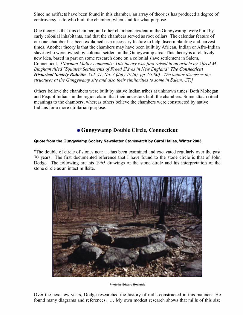
Gungywamp Double Circle, Connecticut
Quote from the Gungywamp Society Newsletter Stonewatch by Carol Hallas, Winter 2003:
"The double of circle of stones near … has been examined and excavated regularly over the past 70 years. The first documented reference that I have found to the stone circle is that of John Dodge. The following are his 1965 drawings of the stone circle and his interpretation of the stone circle as an intact millsite.
Photo by Edward Bochnak
Over the next few years, Dodge researched the history of mills constructed in this manner. He found many diagrams and references. … My own modest research shows that mills of this size

and shape were used for many things: as cider mills; for crushing seashells for mortar, and mixing mortar; for crushing bark for leather tanning; for producing gunpowder; for crushing quartz in pottery making.
In the mid 1960s the center of the stone circle was supposedly excavated by Frank Glynn. … Glynn, a Connecticut archaeologist, going on the theory that the double ring was a tan bark mill, excavated the center area of the rings, looking for any sign of a cutout for a center-post to support an axle arm for a pivoting crushing wheel. There was nothing.
The last documented excavation conducted at the stone circle took place in the summer of 1990. This was directed by Early Sites Research Society's Jim Whittall. … Whittall also found some charcoal scatter adjacent to
the outside rim of the stone circle. He had this carbon dated and was given a date of approximately 455 A.D."
North Salem Dolmen, New York
Quote from Manitou by James W. Mavor Jr. and Byron E. Dix, 1989:
"Pedestaled boulders supported by quarried pedestals, clearly erected by man, have been identified in New England. It is most likely that they were erected by historic or prehistoric Native Americans for ritual use, but we cannot eliminate an intercontinental influence of several thousand years antiquity. Even if some pedestaled boulders are glacial creations, which could be the case if they are supported entirely by natural boulders, they could have figured in ancient ritual among prehistoric people. In fact, if they are entirely natural, they were present when the first post-glacial people arrived in New England and could have been part of ritual from that time.
Photo by Edward Bochnak
A particularly spectacular specimen of pedestaled boulder is a massive boulder of ninety tones supported by five standing stones, located by the roadside in North Salem, New York. It is not on a hilltop but beside a stream in a valley....
....In North Salem, New York, in the southern reaches of the Mahican territory, there is a monstrous pedestalled boulder of 90 tons, supported on the points of five standing stones set deep into the soil. It is clearly similar to many structures, usually called dolmens, found all over the world, which are thought to have been places of ceremony and sometimes burial of ancient people. That this boulder could be solely the result of glacial forces is a notion with extremely low probability, ...."
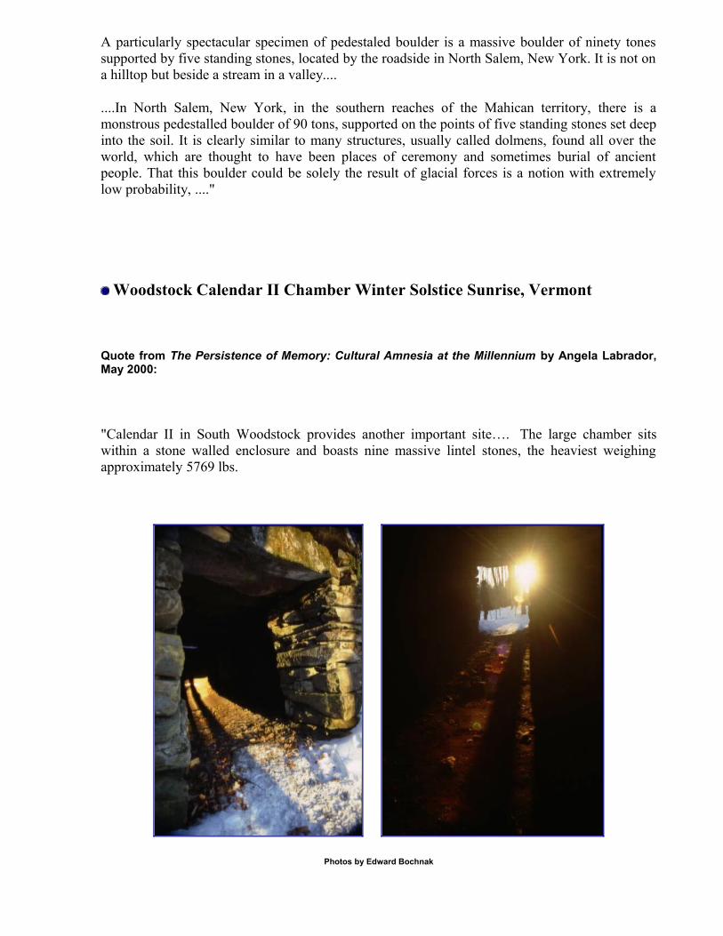
Woodstock Calendar II Chamber Winter Solstice Sunrise, Vermont
Quote from The Persistence of Memory: Cultural Amnesia at the Millennium by Angela Labrador, May 2000:
"Calendar II in South Woodstock provides another important site…. The large chamber sits within a stone walled enclosure and boasts nine massive lintel stones, the heaviest weighing approximately 5769 lbs.
Photos by Edward Bochnak

Three major archaeoastronomical alignments can be documented on site. The major alignment concerns the chamber entryway that is in line with a notch in two distant hills which the sun rises between only on the morning of the winter solstice. The second alignment is a summer solstice alignment which can be viewed from a large (28’ x 38’) stone "platform" and sighted over a triangular stone in the northwesterly stone wall. Finally, the south and north corners of the lot, marked by prominent standing stones, form a true north-south alignment."
Frost Valley Petroglyph Boulder, Catskill Mountains, New York
Quote from The Frost Valley Petroglyph: A Catskill Mountains Enigma, NEARA Journal Summer 1999, by Edward J. Lenik & Nancy L. Gibbs:
"The Frost Valley Petroglyph is located on the north bank of the West Branch of the Neversink River in the Town of Denning, Ulster county, New York. A large boulder containing a spiral carving lies immediately adjacent to the river and is situated within the Catskill Forest Preserve of New York State. The local area is known as Frost Valley, and the name has been applied to the petroglyph site.
Photo by Edward Bochnak
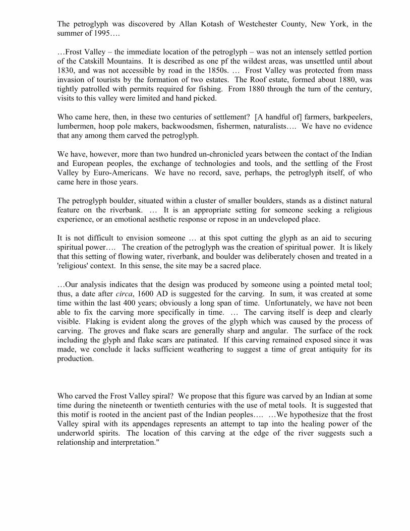
The petroglyph was discovered by Allan Kotash of Westchester County, New York, in the summer of 1995….
…Frost Valley – the immediate location of the petroglyph – was not an intensely settled portion of the Catskill Mountains. It is described as one pf the wildest areas, was unsettled until about 1830, and was not accessible by road in the 1850s. … Frost Valley was protected from mass invasion of tourists by the formation of two estates. The Roof estate, formed about 1880, was tightly patrolled with permits required for fishing. From 1880 through the turn of the century, visits to this valley were limited and hand picked.
Who came here, then, in these two centuries of settlement? [A handful of] farmers, barkpeelers, lumbermen, hoop pole makers, backwoodsmen, fishermen, naturalists…. We have no evidence that any among them carved the petroglyph.
We have, however, more than two hundred un-chronicled years between the contact of the Indian and European peoples, the exchange of technologies and tools, and the settling of the Frost Valley by Euro-Americans. We have no record, save, perhaps, the petroglyph itself, of who came here in those years.
The petroglyph boulder, situated within a cluster of smaller boulders, stands as a distinct natural feature on the riverbank. … It is an appropriate setting for someone seeking a religious experience, or an emotional aesthetic response or repose in an undeveloped place.
It is not difficult to envision someone … at this spot cutting the glyph as an aid to securing spiritual power…. The creation of the petroglyph was the creation of spiritual power. It is likely that this setting of flowing water, riverbank, and boulder was deliberately chosen and treated in a 'religious' context. In this sense, the site may be a sacred place.
…Our analysis indicates that the design was produced by someone using a pointed metal tool; thus, a date after circa, 1600 AD is suggested for the carving. In sum, it was created at some time within the last 400 years; obviously a long span of time. Unfortunately, we have not been able to fix the carving more specifically in time. … The carving itself is deep and clearly visible. Flaking is evident along the groves of the glyph which was caused by the process of carving. The groves and flake scars are generally sharp and angular. The surface of the rock including the glyph and flake scars are patinated. If this carving remained exposed since it was made, we conclude it lacks sufficient weathering to suggest a time of great antiquity for its production.
Who carved the Frost Valley spiral? We propose that this figure was carved by an Indian at some time during the nineteenth or twentieth centuries with the use of metal tools. It is suggested that this motif is rooted in the ancient past of the Indian peoples…. …We hypothesize that the frost Valley spiral with its appendages represents an attempt to tap into the healing power of the underworld spirits. The location of this carving at the edge of the river suggests such a relationship and interpretation."
Dutchess County Rolling Rock, New York
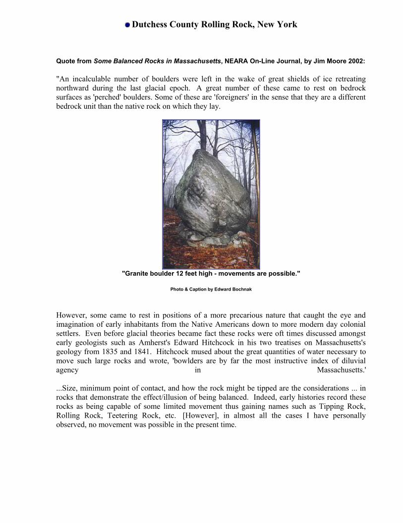
Quote from Some Balanced Rocks in Massachusetts, NEARA On-Line Journal, by Jim Moore 2002:
"An incalculable number of boulders were left in the wake of great shields of ice retreating northward during the last glacial epoch. A great number of these came to rest on bedrock surfaces as 'perched' boulders. Some of these are 'foreigners' in the sense that they are a different bedrock unit than the native rock on which they lay.
"Granite boulder 12 feet high - movements are possible."
Photo & Caption by Edward Bochnak
However, some came to rest in positions of a more precarious nature that caught the eye and imagination of early inhabitants from the Native Americans down to more modern day colonial settlers. Even before glacial theories became fact these rocks were oft times discussed amongst early geologists such as Amherst's Edward Hitchcock in his two treatises on Massachusetts's geology from 1835 and 1841. Hitchcock mused about the great quantities of water necessary to move such large rocks and wrote, 'bowlders are by far the most instructive index of diluvial agency in Massachusetts.'
...Size, minimum point of contact, and how the rock might be tipped are the considerations ... in rocks that demonstrate the effect/illusion of being balanced. Indeed, early histories record these rocks as being capable of some limited movement thus gaining names such as Tipping Rock, Rolling Rock, Teetering Rock, etc. [However], in almost all the cases I have personally observed, no movement was possible in the present time.

North Kingstown Runestone, Rhode Island
Quote from The Narragansett Stone Reconsidered, NEARA Journal Winter/Spring 1991, by Suzanne Carlson:
"In the Summer/Fall 1985 issue of the NEARA Journal, Charles Devine, Tom Hardie, and Jon Woodson reported on 'A Newly Located Inscription From Narragansett Bay, Rhode Island.'
"Fifty feet out in the water is a large boulder which contains an eroded
Norse rune inscription possibly reading: 'Four victorious near the river'"Photo & Caption by Edward Bochnak
To recap, in December 1984 a quahogger digging in the mud flats along Narragansett Bay, noticed a series of incised marks on a large sandstone boulder and presented a sketch to Woodson.
In April 1985 Devine and Hardie located the landowner, and with his help located the stone. Subsequently, they returned and made photographs before the stone was engulfed by the incoming tide.
Photos were sent to several authorities soliciting comments. O.G. Landsverk, author of Runic Records of the Norsemen in North America, and promoter of cryptographic messages concealed in Runic carvings, suggested that the inscription 'appears to be a genuine Norse Runic Carving.' He noted however: 'I have been unable to find a hidden date in your inscription. It is my belief that it was carved by someone who tried to imitate similar runic inscriptions which do have concealed dates.'
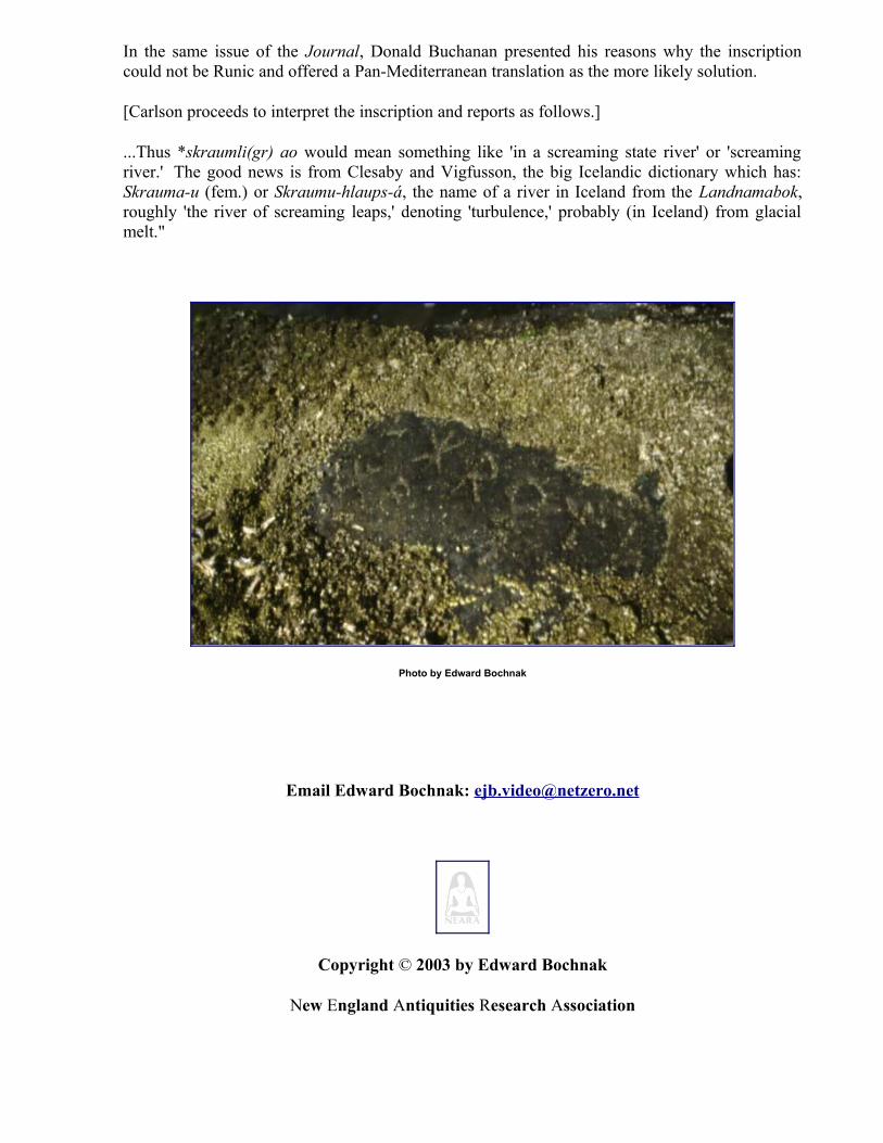
In the same issue of the Journal, Donald Buchanan presented his reasons why the inscription could not be Runic and offered a Pan-Mediterranean translation as the more likely solution.
[Carlson proceeds to interpret the inscription and reports as follows.]
...Thus *skraumli(gr) ao would mean something like 'in a screaming state river' or 'screaming river.' The good news is from Clesaby and Vigfusson, the big Icelandic dictionary which has: Skrauma-u (fem.) or Skraumu-hlaups-á, the name of a river in Iceland from the Landnamabok, roughly 'the river of screaming leaps,' denoting 'turbulence,' probably (in Iceland) from glacial melt."
Photo by Edward Bochnak
Email Edward Bochnak: [email protected]
Copyright © 2003 by Edward Bochnak
New England Antiquities Research Association