Neart na Gaoithe O˜ shore Wind Farm · Neart na Gaoithe Off shore Wind Farm In February 2009,...
24
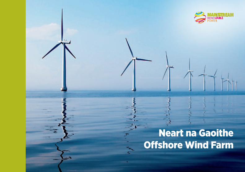
Neart na Gaoithe Offshore Wind Farm
Transcript of Neart na Gaoithe O˜ shore Wind Farm · Neart na Gaoithe Off shore Wind Farm In February 2009,...
Neart na GaoitheO� shore Wind Farm
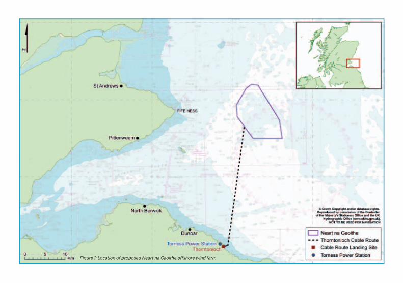
Figure 1: Location of proposed Neart na Gaoithe offshore wind farm
Neart na Gaoithe Off shore Wind Farm In February 2009, Mainstream Renewable Power was awarded a licence to develop the Neart na Gaoithe
off shore wind farm. The proposed wind farm will be located approximately 15.5km from Fife Ness and 28km from
Thorntonloch Beach in East Lothian (Figure 1). The wind farm will be made up of 75 turbines rated at 6MW each.
Neart na Gaoithe will generate enough electricity to power more than 325,000 homes – equivalent to the number
of homes in Edinburgh.
Key facts
• Capacity: 450 megawatt (MW)
• Number of turbines: 75
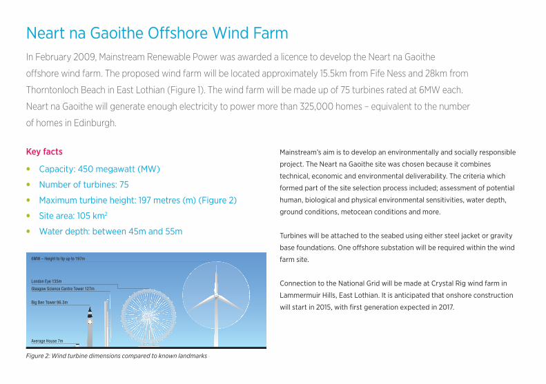
• Maximum turbine height: 197 metres (m) (Figure 2)
• Site area: 105 km2
• Water depth: between 45m and 55m
Mainstream’s aim is to develop an environmentally and socially responsible
project. The Neart na Gaoithe site was chosen because it combines
technical, economic and environmental deliverability. The criteria which
formed part of the site selection process included; assessment of potential
human, biological and physical environmental sensitivities, water depth,
ground conditions, metocean conditions and more.
Turbines will be attached to the seabed using either steel jacket or gravity
base foundations. One off shore substation will be required within the wind
farm site.
Connection to the National Grid will be made at Crystal Rig wind farm in
Lammermuir Hills, East Lothian. It is anticipated that onshore construction
will start in 2015, with fi rst generation expected in 2017.
Glasgow Science Centre Tower 127m
London Eye 135m
6MW – Height to tip up to 197m
Average House 7m
Big Ben Tower 96.3m
Figure 2: Wind turbine dimensions compared to known landmarks
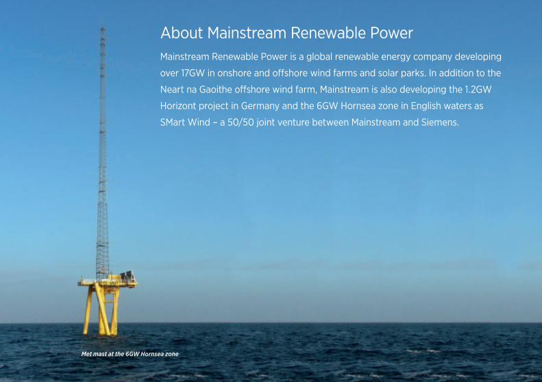
About Mainstream Renewable PowerMainstream Renewable Power is a global renewable energy company developing
over 17GW in onshore and offshore wind farms and solar parks. In addition to the
Neart na Gaoithe offshore wind farm, Mainstream is also developing the 1.2GW
Horizont project in Germany and the 6GW Hornsea zone in English waters as
SMart Wind – a 50/50 joint venture between Mainstream and Siemens.
Met mast at the 6GW Hornsea zone
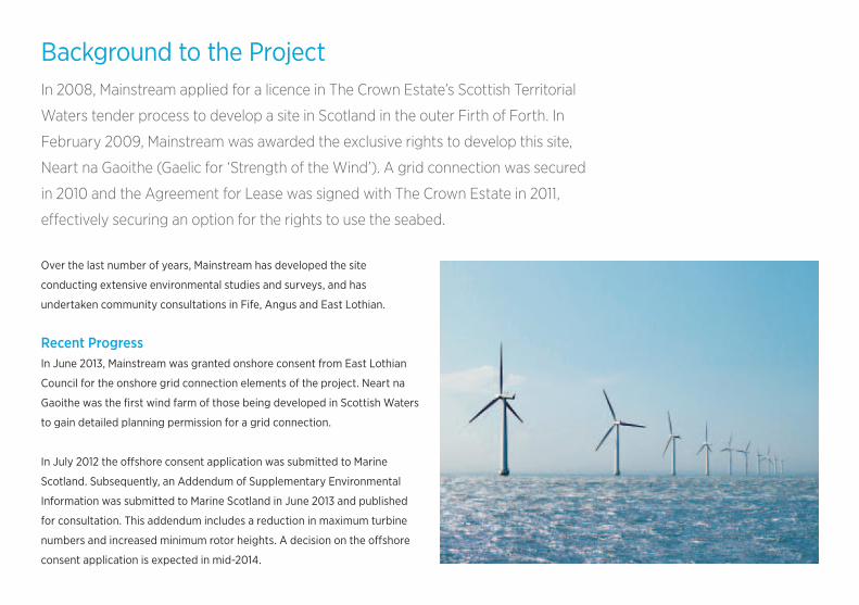
Background to the ProjectIn 2008, Mainstream applied for a licence in The Crown Estate’s Scottish Territorial
Waters tender process to develop a site in Scotland in the outer Firth of Forth. In
February 2009, Mainstream was awarded the exclusive rights to develop this site,
Neart na Gaoithe (Gaelic for ‘Strength of the Wind’). A grid connection was secured
in 2010 and the Agreement for Lease was signed with The Crown Estate in 2011,
effectively securing an option for the rights to use the seabed.
Over the last number of years, Mainstream has developed the site
conducting extensive environmental studies and surveys, and has
undertaken community consultations in Fife, Angus and East Lothian.
Recent ProgressIn June 2013, Mainstream was granted onshore consent from East Lothian
Council for the onshore grid connection elements of the project. Neart na
Gaoithe was the first wind farm of those being developed in Scottish Waters
to gain detailed planning permission for a grid connection.
In July 2012 the offshore consent application was submitted to Marine
Scotland. Subsequently, an Addendum of Supplementary Environmental
Information was submitted to Marine Scotland in June 2013 and published
for consultation. This addendum includes a reduction in maximum turbine
numbers and increased minimum rotor heights. A decision on the offshore
consent application is expected in mid-2014.
About Mainstream Renewable PowerMainstream Renewable Power is a global renewable energy company developing
over 17GW in onshore and offshore wind farms and solar parks. In addition to the
Neart na Gaoithe offshore wind farm, Mainstream is also developing the 1.2GW
Horizont project in Germany and the 6GW Hornsea zone in English waters as
SMart Wind – a 50/50 joint venture between Mainstream and Siemens.
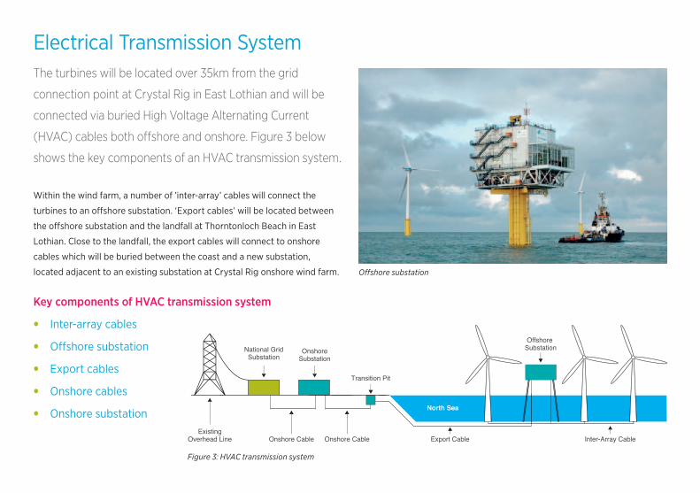
Electrical Transmission SystemThe turbines will be located over 35km from the grid
connection point at Crystal Rig in East Lothian and will be
connected via buried High Voltage Alternating Current
(HVAC) cables both offshore and onshore. Figure 3 below
shows the key components of an HVAC transmission system.
Within the wind farm, a number of ’inter-array’ cables will connect the
turbines to an offshore substation. ‘Export cables’ will be located between
the offshore substation and the landfall at Thorntonloch Beach in East
Lothian. Close to the landfall, the export cables will connect to onshore
cables which will be buried between the coast and a new substation,
located adjacent to an existing substation at Crystal Rig onshore wind farm.
Key components of HVAC transmission system
• Inter-array cables
• Offshore substation
• Export cables
• Onshore cables
• Onshore substation
Offshore substation
Figure 3: HVAC transmission system
Offshore Substation
Inter-Array CableExport Cable
Transition Pit
Onshore CableOnshore Cable
National GridSubstation
ExistingOverhead Line
OnshoreSubstation
North Sea
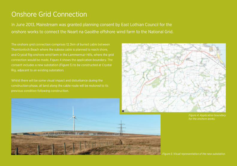
Onshore Grid ConnectionIn June 2013, Mainstream was granted planning consent by East Lothian Council for the
onshore works to connect the Neart na Gaoithe offshore wind farm to the National Grid.
The onshore grid connection comprises 12.3km of buried cable between
Thorntonloch Beach where the subsea cable is planned to reach shore,
and Crystal Rig onshore wind farm in the Lammermuir Hills, where the grid
connection would be made, Figure 4 shows the application boundary. The
consent includes a new substation (Figure 5) to be constructed at Crystal
Rig, adjacent to an existing substation.
Whilst there will be some visual impact and disturbance during the
construction phase, all land along the cable route will be restored to its
previous condition following construction.
Figure 5: Visual representation of the new substation.
Figure 4: Application boundary for the onshore works.
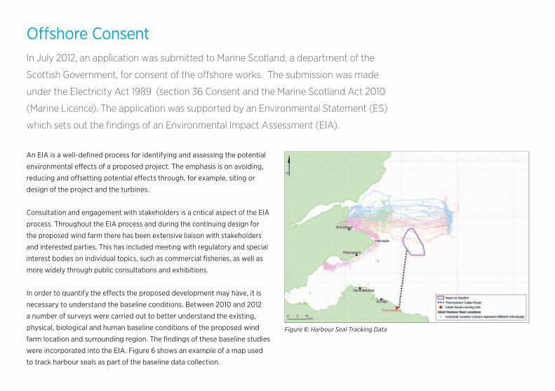
Offshore ConsentIn July 2012, an application was submitted to Marine Scotland, a department of the
Scottish Government, for consent of the offshore works. The submission was made
under the Electricity Act 1989 (section 36 Consent and the Marine Scotland Act 2010
(Marine Licence). The application was supported by an Environmental Statement (ES)
which sets out the findings of an Environmental Impact Assessment (EIA).
An EIA is a well-defined process for identifying and assessing the potential
environmental effects of a proposed project. The emphasis is on avoiding,
reducing and offsetting potential effects through, for example, siting or
design of the project and the turbines.
Consultation and engagement with stakeholders is a critical aspect of the EIA
process. Throughout the EIA process and during the continuing design for
the proposed wind farm there has been extensive liaison with stakeholders
and interested parties. This has included meeting with regulatory and special
interest bodies on individual topics, such as commercial fisheries, as well as
more widely through public consultations and exhibitions.
In order to quantify the effects the proposed development may have, it is
necessary to understand the baseline conditions. Between 2010 and 2012
a number of surveys were carried out to better understand the existing,
physical, biological and human baseline conditions of the proposed wind
farm location and surrounding region. The findings of these baseline studies
were incorporated into the EIA. Figure 6 shows an example of a map used
to track harbour seals as part of the baseline data collection.
Figure 6: Harbour Seal Tracking Data
Offshore Physical Environment and ResourceTo understand the attributes of the offshore physical environment, Mainstream commissioned
both desk and field based studies to assess the wind resource, sea and weather conditions and
the seabed type and substrate.
Studies investigating the seabed ground conditions of the site were
undertaken; a geophysical assessment was carried out in August 2009 and
more in-depth geotechnical studies were undertaken in 2010, 2012 and 2013.
Further in-depth geotechnical and geophysical surveys are taking place in 2014.
‘Metocean’ (meteorological and oceanographic) data was collected using a
number of metocean buoys deployed on and near the site. This informed
the physical processes modelling for the Environmental Statement.
The information gathered had specific reference to potential changes
to seabed forms and coastal processes.
The geology and sediments will not be changed by the proposed
development, so the assessment for the EIA concentrated on potential
impacts on the coastline, sandbanks and water quality. The modelling within
the physical processes study showed that the offshore infrastructure and
construction works would not cause any effects that reached the coastline.
Changes to the metocean conditions (water levels, currents and waves) due
to the presence of structures on the seabed may have the potential to alter
the sediment regime although modelling has suggested that such changes
would not be significant.
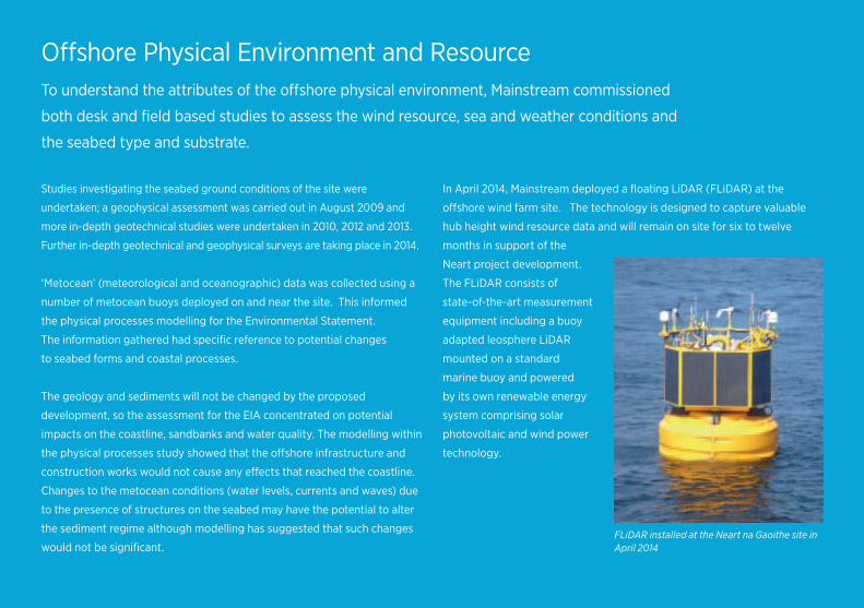
In April 2014, Mainstream deployed a floating LiDAR (FLiDAR) at the
offshore wind farm site. The technology is designed to capture valuable
hub height wind resource data and will remain on site for six to twelve
months in support of the
Neart project development.
The FLiDAR consists of
state-of-the-art measurement
equipment including a buoy
adapted leosphere LiDAR
mounted on a standard
marine buoy and powered
by its own renewable energy
system comprising solar
photovoltaic and wind power
technology.
FLiDAR installed at the Neart na Gaoithe site in April 2014
Offshore Biological EnvironmentThe proposed wind farm site does not overlap with any sites designated for their
nature conservation interest. Nevertheless, it is crucial to understand the biological
environment both within and surrounding the site and the potential impacts the
development may have on this and wider habitats and species.
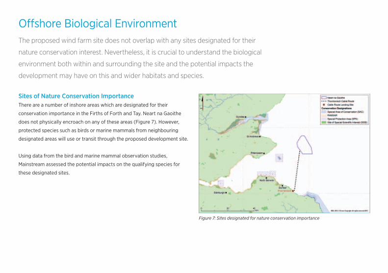
Sites of Nature Conservation ImportanceThere are a number of inshore areas which are designated for their
conservation importance in the Firths of Forth and Tay. Neart na Gaoithe
does not physically encroach on any of these areas (Figure 7). However,
protected species such as birds or marine mammals from neighbouring
designated areas will use or transit through the proposed development site.
Using data from the bird and marine mammal observation studies,
Mainstream assessed the potential impacts on the qualifying species for
these designated sites.
Figure 7: Sites designated for nature conservation importance
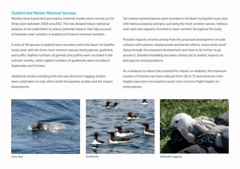
Seabird and Marine Mammal SurveysMonthly boat-based bird and marine mammal studies were carried out for
three years between 2009 and 2012. This has allowed robust statistical
analyses to be undertaken to assess potential impacts that take account
of between–year variation in seabird and marine mammal numbers.
A total of 38 species of seabird were recorded within the Neart na Gaoithe
study area, with the three most common species being gannet, guillemot
and puffin. Highest numbers of gannets and puffins were recorded in the
summer months, while highest numbers of guillemots were recorded in
September and October.
Additional studies including bird and seal electronic tagging studies
were undertaken to help inform both the baseline studies and the impact
assessments.
Ten marine mammal species were recorded in the Neart na Gaoithe study area,
with harbour porpoise and grey seal being the most common species. Harbour
seals were also regularly recorded in lower numbers throughout the study.
Possible impacts on birds arising from the proposed development include
collision with turbines, displacement and barrier effects, where birds avoid
flying through the proposed development and have to fly further to go
around it. Detailed modelling has been carried out to predict impacts on
bird species and populations.
As a measure to reduce the potential for impact on seabirds, the maximum
number of turbines has been reduced from 125 to 75 and minimum rotor
heights have been increased to avoid more common flight heights for
some species.
Grey Seal Guillemots Kittiwake tagging
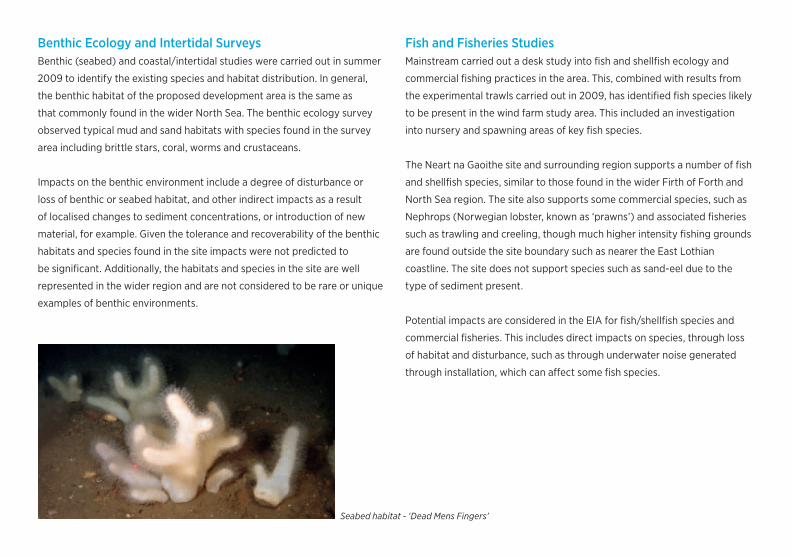
Benthic Ecology and Intertidal SurveysBenthic (seabed) and coastal/intertidal studies were carried out in summer
2009 to identify the existing species and habitat distribution. In general,
the benthic habitat of the proposed development area is the same as
that commonly found in the wider North Sea. The benthic ecology survey
observed typical mud and sand habitats with species found in the survey
area including brittle stars, coral, worms and crustaceans.
Impacts on the benthic environment include a degree of disturbance or
loss of benthic or seabed habitat, and other indirect impacts as a result
of localised changes to sediment concentrations, or introduction of new
material, for example. Given the tolerance and recoverability of the benthic
habitats and species found in the site impacts were not predicted to
be significant. Additionally, the habitats and species in the site are well
represented in the wider region and are not considered to be rare or unique
examples of benthic environments.
Fish and Fisheries StudiesMainstream carried out a desk study into fish and shellfish ecology and
commercial fishing practices in the area. This, combined with results from
the experimental trawls carried out in 2009, has identified fish species likely
to be present in the wind farm study area. This included an investigation
into nursery and spawning areas of key fish species.
The Neart na Gaoithe site and surrounding region supports a number of fish
and shellfish species, similar to those found in the wider Firth of Forth and
North Sea region. The site also supports some commercial species, such as
Nephrops (Norwegian lobster, known as ‘prawns’) and associated fisheries
such as trawling and creeling, though much higher intensity fishing grounds
are found outside the site boundary such as nearer the East Lothian
coastline. The site does not support species such as sand-eel due to the
type of sediment present.
Potential impacts are considered in the EIA for fish/shellfish species and
commercial fisheries. This includes direct impacts on species, through loss
of habitat and disturbance, such as through underwater noise generated
through installation, which can affect some fish species.
Seabed habitat - ‘Dead Mens Fingers’ Fishing Vessel
Offshore Human EnvironmentShipping and Commercial FishingConsidered in the broadest terms, the human environment encompasses
the visual, recreational and commercial amenity of the site. Both field and
desk based studies and an extensive consultation programme have been
undertaken with the shipping and fishing industries to determine favoured
shipping routes and the level of fishing activity and methods used within
and around the site and wider region.
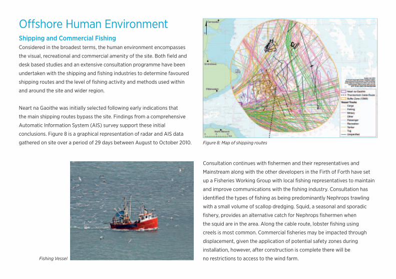
Neart na Gaoithe was initially selected following early indications that
the main shipping routes bypass the site. Findings from a comprehensive
Automatic Information System (AIS) survey support these initial
conclusions. Figure 8 is a graphical representation of radar and AIS data
gathered on site over a period of 29 days between August to October 2010.
Consultation continues with fishermen and their representatives and Mainstream along with the other developers in the Firth of Forth have set
up a Fisheries Working Group with local fishing representatives to maintain
and improve communications with the fishing industry. Consultation has
identified the types of fishing as being predominantly Nephrops trawling
with a small volume of scallop dredging. Squid, a seasonal and sporadic
fishery, provides an alternative catch for Nephrops fishermen when
the squid are in the area. Along the cable route, lobster fishing using
creels is most common. Commercial fisheries may be impacted through
displacement, given the application of potential safety zones during
installation, however, after construction is complete there will be
no restrictions to access to the wind farm.Fishing Vessel
Figure 8: Map of shipping routes
Seascape, Visual, Archaelogy and Cultural HeritageA series of photomontages have been created to give an indication of
how the wind farm will look from a number of viewpoints along the east
coast (Figure 9 below). Consultation was undertaken with the local councils
and Scottish Natural Heritage (SNH) to develop a comprehensive list with
appropriate viewpoint locations.
The archaeology considered within the Neart na Gaoithe offshore site
is broadly divided into two main areas: maritime archaeology such as
shipwrecks, and submerged prehistoric archaeology, which considers the
potential inhabitation of humans on land which is now submerged. Survey
data collected over the Neart na Gaoithe site provided a detailed picture of
the seabed topography, allowing archaeologists to better understand the
landscape below the sea.
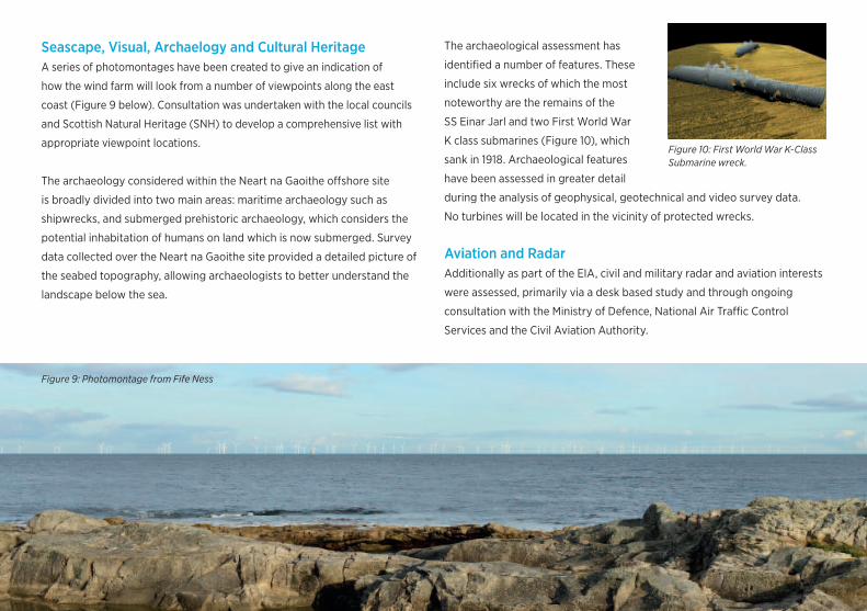
The archaeological assessment has
identified a number of features. These include six wrecks of which the most
noteworthy are the remains of the
SS Einar Jarl and two First World War
K class submarines (Figure 10), which
sank in 1918. Archaeological features
have been assessed in greater detail
during the analysis of geophysical, geotechnical and video survey data.
No turbines will be located in the vicinity of protected wrecks.
Aviation and RadarAdditionally as part of the EIA, civil and military radar and aviation interests
were assessed, primarily via a desk based study and through ongoing
consultation with the Ministry of Defence, National Air Traffic Control
Services and the Civil Aviation Authority.
Figure 9: Photomontage from Fife Ness
Figure 10: First World War K-Class Submarine wreck.
Onshore EnvironmentAn application for planning permission to construct the onshore works between Thorntonloch
Beach and Crystal Rig was submitted to East Lothian Council in November 2012. As with
the offshore application it was accompanied by an Environmental Statement setting out the
findings of an EIA, which was carried out under The Town and Country Planning (Environmental
Impact Assessment) (Scotland) Regulations 2011. Planning permssion was granted in June 2013.
Prior to commencing the EIA, consideration was given to a number of
options for the grid connection. Overhead lines were discounted due to
landscape and visual impacts. Following this, an extensive route selection
process was undertaken.
A summary of key aspects of the onshore EIA is as follows:
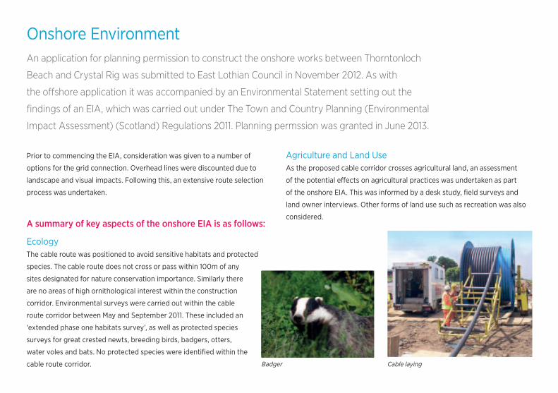
EcologyThe cable route was positioned to avoid sensitive habitats and protected
species. The cable route does not cross or pass within 100m of any
sites designated for nature conservation importance. Similarly there
are no areas of high ornithological interest within the construction
corridor. Environmental surveys were carried out within the cable
route corridor between May and September 2011. These included an
‘extended phase one habitats survey’, as well as protected species
surveys for great crested newts, breeding birds, badgers, otters,
water voles and bats. No protected species were identified within the
cable route corridor.
Agriculture and Land UseAs the proposed cable corridor crosses agricultural land, an assessment
of the potential effects on agricultural practices was undertaken as part
of the onshore EIA. This was informed by a desk study, field surveys and
land owner interviews. Other forms of land use such as recreation was also
considered.
Badger Cable laying

Construction NoiseAn assessment of potential noise impacts from construction was
undertaken, with particular consideration of potential impacts on nearby
residences. Noise monitoring locations were selected in agreement with
East Lothian Council to identify existing noise levels.
Cultural HeritageSeveral designated cultural heritage assets are present close to the
proposed cable route however none are located within the application
boundary therefore no impacts will occur in the long term. Trial trenching
will be undertaken prior to construction to determine whether any local
archaeology is present.
Landscape and VisualA full landscape and visual assessment was undertaken to identify how
views from residential properties and other viewpoints may be impacted
upon by the onshore works. As the cable will be positioned underground,
visual impacts will be limited once constructed. In order to minimise the
landscape and visual impact
during construction, sensitive
features such as trees and
hedgerows will be avoided where
possible. Whilst the substation
(Figure 11) will be visible from
surrounding viewpoints, no
properties overlook the site,
which is located adjacent
to existing wind farm and
transmission infrastructure.
Other topicsAdditional surveys and assessments have considered the potential
for impacts on water courses, flooding, geology, air quality, traffic and
socio-economic interests.
The Neart na Gaoithe offshore wind farm is the first project of those being
developed in Scottish Waters to gain detailed planning permission for a
grid connection
Cable Trench WorksFigure 11: Visual representation of the new substation.
ConstructionThe Neart na Gaoithe offshore wind farm will be built out in a number of stages. Construction of onshore
works will commence in 2015 while offshore works will commence in 2016.
1. Installation of turbine foundationThe final design for foundations is under discussion and will either be jackets
or gravity base.
If jackets are chosen then construction will start with the installation of four
jacket piles at each of the turbine locations. If gravity base are chosen then
the first step will be seabed preparation which includes the removal of all
soft sediment and seabed levelling.
Jacket foundation pile: large steel tube between 2.5m and 3.5m diameter,
up to 50m long.
Gravity base foundation pile: 25m – 45m in diameter.
2. Lifting of turbine foundationSteel jacket foundation: lattice support structure.
A large jack-up vessel will lift each of the foundations into place over the
pre-installed piles.
Gravity base foundation: will be floated out on special vessels and lowered
onto prepared seabed.
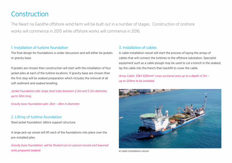
3. Installation of cablesA cable installation vessel will start the process of laying the arrays of
cables that will connect the turbines to the offshore substation. Specialist
equipment such as a cable plough may be used to cut a trench in the seabed,
lay the cable into the trench then backfill to cover the cable.
Array Cable: 33kV 630mm2 cross sectional area up to a depth of 3m –
up to 120km to be installed.
A cable installation vessel
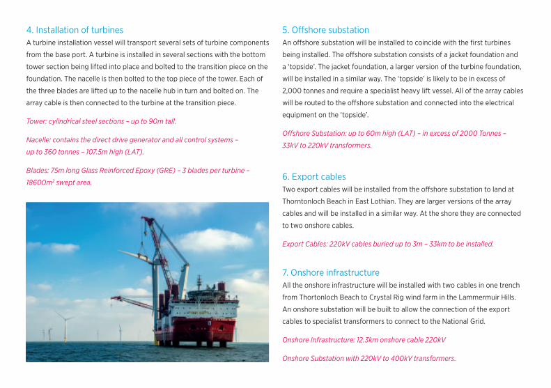
4. Installation of turbinesA turbine installation vessel will transport several sets of turbine components
from the base port. A turbine is installed in several sections with the bottom
tower section being lifted into place and bolted to the transition piece on the
foundation. The nacelle is then bolted to the top piece of the tower. Each of
the three blades are lifted up to the nacelle hub in turn and bolted on. The
array cable is then connected to the turbine at the transition piece.
Tower: cylindrical steel sections – up to 90m tall.
Nacelle: contains the direct drive generator and all control systems –
up to 360 tonnes – 107.5m high (LAT).
Blades: 75m long Glass Reinforced Epoxy (GRE) – 3 blades per turbine –
18600m2 swept area.
5. Offshore substationAn offshore substation will be installed to coincide with the first turbines
being installed. The offshore substation consists of a jacket foundation and
a ‘topside’. The jacket foundation, a larger version of the turbine foundation,
will be installed in a similar way. The ‘topside’ is likely to be in excess of
2,000 tonnes and require a specialist heavy lift vessel. All of the array cables
will be routed to the offshore substation and connected into the electrical
equipment on the ‘topside’.
Offshore Substation: up to 60m high (LAT) – in excess of 2000 Tonnes –
33kV to 220kV transformers.
6. Export cablesTwo export cables will be installed from the offshore substation to land at
Thorntonloch Beach in East Lothian. They are larger versions of the array
cables and will be installed in a similar way. At the shore they are connected
to two onshore cables.
Export Cables: 220kV cables buried up to 3m – 33km to be installed.
7. Onshore infrastructureAll the onshore infrastructure will be installed with two cables in one trench
from Thortonloch Beach to Crystal Rig wind farm in the Lammermuir Hills.
An onshore substation will be built to allow the connection of the export
cables to specialist transformers to connect to the National Grid.
Onshore Infrastructure: 12.3km onshore cable 220kV
Onshore Substation with 220kV to 400kV transformers.
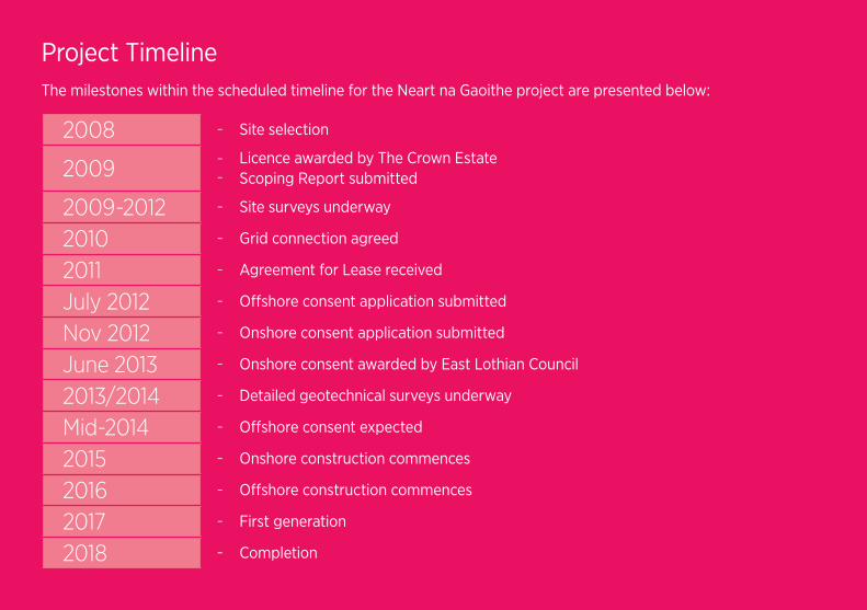
Project TimelineThe milestones within the scheduled timeline for the Neart na Gaoithe project are presented below:
2008 – Site selection
2009–
–
Licence awarded by The Crown EstateScoping Report submitted
2009-2012 – Site surveys underway
2010 – Grid connection agreed
2011 – Agreement for Lease received
July 2012 – Offshore consent application submitted
Nov 2012 – Onshore consent application submitted
June 2013 – Onshore consent awarded by East Lothian Council
2013/2014 – Detailed geotechnical surveys underway
Mid-2014 – Offshore consent expected
2015 – Onshore construction commences
2016 – Offshore construction commences
2017 – First generation
2018 – Completion
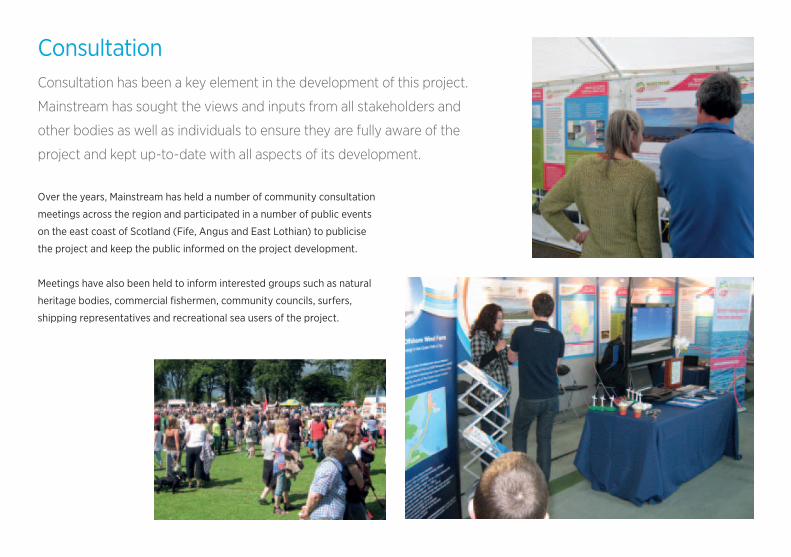
ConsultationConsultation has been a key element in the development of this project.
Mainstream has sought the views and inputs from all stakeholders and
other bodies as well as individuals to ensure they are fully aware of the
project and kept up-to-date with all aspects of its development.
Over the years, Mainstream has held a number of community consultation
meetings across the region and participated in a number of public events
on the east coast of Scotland (Fife, Angus and East Lothian) to publicise
the project and keep the public informed on the project development.
Meetings have also been held to inform interested groups such as natural
heritage bodies, commercial fishermen, community councils, surfers,
shipping representatives and recreational sea users of the project.

Economic OpportunitiesAs a project of national importance to Scotland, Neart na
Gaoithe has the power to create hundreds of jobs during
the construction phase and throughout the operation
of the wind farm.
Given the strong base of high quality engineering and related jobs already
clustered along the east coast of Scotland, Neart na Gaoithe is expected
to not only create new
opportunities but help sustain
and underpin a high quality
skills base in the east
of Scotland.
A number of large ports and
harbours on the east coast
of Scotland are well placed
to become a base for
construction activities.
There are also opportunities
for these ports or other
smaller harbours on the
east coast to locate bases
for ongoing operation and
maintenance services.
Scotland has world class expertise in offshore engineering through 40
years of oil and gas extraction. This experience makes Scotland’s workforce
ideally placed to develop a highly skilled offshore renewable energy
industry. In addition to Neart na Gaoithe, a number of offshore renewable
wind projects are proposed for the outer Firths of Forth, Tay and further
north in the Moray Firth. With the further potential for floating wind
technologies in deeper waters further offshore, this represents a major
opportunity for long term supply chain opportunities.
Register your interest as a supplier on the Neart na Gaoithe website at
www.nngsupplierdatabase.comTurbine installation
Turbine nacelle workers
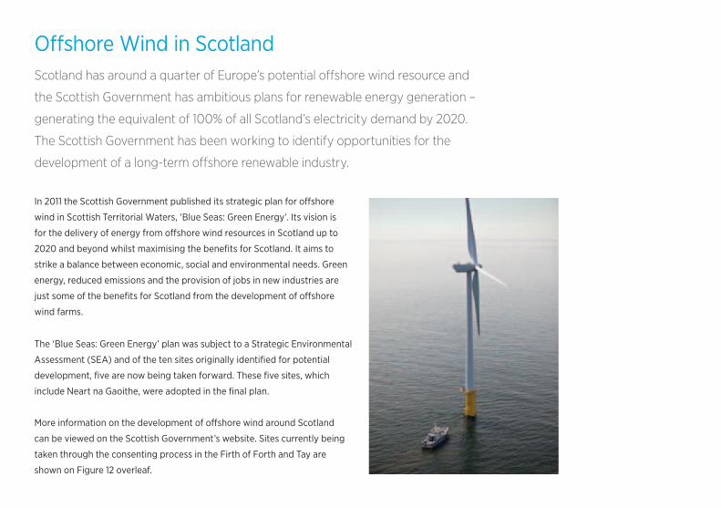
Offshore Wind in ScotlandScotland has around a quarter of Europe’s potential offshore wind resource and
the Scottish Government has ambitious plans for renewable energy generation –
generating the equivalent of 100% of all Scotland’s electricity demand by 2020.
The Scottish Government has been working to identify opportunities for the
development of a long-term offshore renewable industry.
In 2011 the Scottish Government published its strategic plan for offshore
wind in Scottish Territorial Waters, ‘Blue Seas: Green Energy’. Its vision is
for the delivery of energy from offshore wind resources in Scotland up to
2020 and beyond whilst maximising the benefits for Scotland. It aims to
strike a balance between economic, social and environmental needs. Green
energy, reduced emissions and the provision of jobs in new industries are
just some of the benefits for Scotland from the development of offshore
wind farms.
The ‘Blue Seas: Green Energy’ plan was subject to a Strategic Environmental
Assessment (SEA) and of the ten sites originally identified for potential
development, five are now being taken forward. These five sites, which
include Neart na Gaoithe, were adopted in the final plan.
More information on the development of offshore wind around Scotland
can be viewed on the Scottish Government’s website. Sites currently being
taken through the consenting process in the Firth of Forth and Tay are
shown on Figure 12 overleaf.
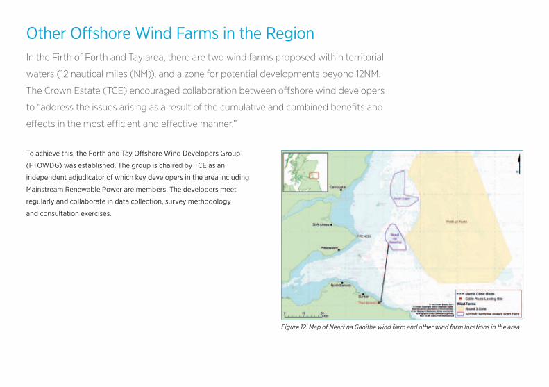
Other Offshore Wind Farms in the RegionIn the Firth of Forth and Tay area, there are two wind farms proposed within territorial
waters (12 nautical miles (NM)), and a zone for potential developments beyond 12NM.
The Crown Estate (TCE) encouraged collaboration between offshore wind developers
to “address the issues arising as a result of the cumulative and combined benefits and
effects in the most efficient and effective manner.”
To achieve this, the Forth and Tay Offshore Wind Developers Group
(FTOWDG) was established. The group is chaired by TCE as an
independent adjudicator of which key developers in the area including
Mainstream Renewable Power are members. The developers meet
regularly and collaborate in data collection, survey methodology
and consultation exercises.
Figure 12: Map of Neart na Gaoithe wind farm and other wind farm locations in the area

Mainstream Renewable Power
3rd Floor, 2 West Regent Street,
Glasgow G2 1RW
Tel: +44 (0)141 206 3860
Email: [email protected]
www.neartnagaoithe.com
By registering on the Neart na Gaoithe website,
you can select to receive project updates by email.