National Conference · Atal Bihari Vajpayee Hindi Vishwavidyalaya (State University) Bhopal, Madhya...
31
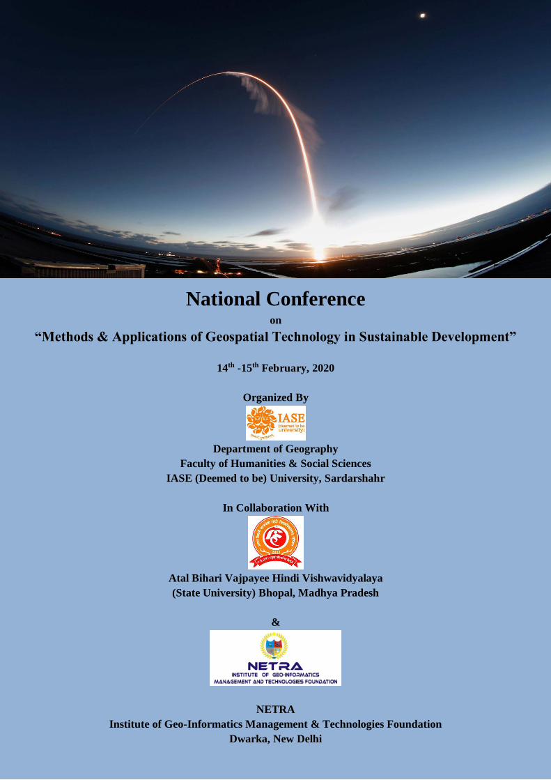
National Conference on “Methods & Applications of Geospatial Technology in Sustainable Development” 14 th -15 th February, 2020 Organized By Department of Geography Faculty of Humanities & Social Sciences IASE (Deemed to be) University, Sardarshahr In Collaboration With Atal Bihari Vajpayee Hindi Vishwavidyalaya (State University) Bhopal, Madhya Pradesh & NETRA Institute of Geo-Informatics Management & Technologies Foundation Dwarka, New Delhi
Transcript of National Conference · Atal Bihari Vajpayee Hindi Vishwavidyalaya (State University) Bhopal, Madhya...
National Conference on
ldquoMethods amp Applications of Geospatial Technology in Sustainable Developmentrdquo
14th -15th February 2020
Organized By
Department of Geography
Faculty of Humanities amp Social Sciences
IASE (Deemed to be) University Sardarshahr
In Collaboration With
Atal Bihari Vajpayee Hindi Vishwavidyalaya
(State University) Bhopal Madhya Pradesh
amp
NETRA
Institute of Geo-Informatics Management amp Technologies Foundation
Dwarka New Delhi
National Conference on
ldquoMethods amp Applications of Geospatial Technology in Sustainable
Developmentrdquo
14th -15th February 2020
Organized By
Department of Geography
Faculty of Humanities amp Social Sciences
IASE (Deemed to be) University Sardarshahr
In Collaboration With
Atal Bihari Vajpayee Hindi Vishwavidyalaya
(State University) Bhopal Madhya Pradesh
amp
NETRA
Institute of Geo-Informatics Management amp Technologies Foundation
Dwarka New Delhi
National Conference on ldquoMethods amp Applications of Geospatial Technology in Sustainable Developmentrdquo
Souvenir 2020 Page 1
Presidentrsquos Message
National Conference on ldquoMethods amp Applications of Geospatial Technology in Sustainable Developmentrdquo
Souvenir 2020 Page 2
Vice-Chancellorrsquos Message
National Conference on ldquoMethods amp Applications of Geospatial Technology in Sustainable Developmentrdquo
Souvenir 2020 Page 3
ABOUT GANDHI VIDYA MANDIR (GVM)
Gandhi Vidya Mandir (GVM) was founded by Late Shri Kanhaiyalal Dugar later known as Swami Shri
Ramsharanji after embracing sanyas in 1950 GVM was founded by him on the principle of universal
humanism The GVM was established with the goal ndash to uplift the exploited and downtrodden sections of
society through education
GVM is a conglomerate of various public welfare activities rural development and educational programs
The services of GVM in the field of education were honored by several National titles and awards such as
the lsquoPC Sen National Centennial Awardrsquo lsquoFiroz Gandhi Saadgi Sammaanrsquo and lsquoDistinguished Educational
Awardrsquo
At present under GVM there are 5 schools (primary and secondary) 5 colleges 1 Agriculture Research
Centre and College 1 Ayurved Medical Centre and College 1 orphanage and 1 Gaushala The GVM is
well-spread in an area of 1200 acres of land having 2 million sq ft of constructed area
Extensive Activities of GVM
GVM works not only in the field of education but also in the field of social development The social welfare programs run by GVM aimed to serve primarily the three sections of society ndash differently- abled underprivileged and senior citizens Glimpses of Activity
Education
Established primary schools in 12 villages Set up non-formal education centers for children between the age group of 6-14 years in 37 villages Successfully implemented the Total Literacy Programme in about 45 villages Set up libraries in 12 villages under Post-Literacy Programme Run 45 adult education centers in several villages for females Have mobile libraries for new literates
Health
Provided disaster relief facilities in earthquake-affected areas of Bhuj (Gujarat) Tsunami-affected areas in South India and flood-affected areas near Barmer (Rajasthan)
Organize free medical and health check-up camps in surrounding villages at frequent intervals Have mobile dispensary and ambulance services to serve the socially and economically backward sections of
the society
National Conference on ldquoMethods amp Applications of Geospatial Technology in Sustainable Developmentrdquo
Souvenir 2020 Page 4
Run vaccination programmes Provide free medical services in Shri BLD Ayurved Vishwa Bharati (Ayurvedic hospital) and ayurvedic
medicines in Rasayanshala (Ayurvedic Pharmacy) Rural Welfare
Build wells with motorized pumps in 10 villages Constructed rainwater harvesting structures and promoting water conservation activities in rural areas Constructed dwelling houses for the scheduled caste families in villages Conducted training programs for Panchas and Sarpanchas on Panchayati Raj system Successfully implemented the measures of integrated drinking water sanitation and health education in
more than 500 villages of Churu as a constituent in the Community Participation Unit of Apani Yojna 20 deep tube-wells run within the premise of GVM and supply drinking water to Sardarshahr town and
nearby villages
Economic Development
Established cottage industries in Bardasar village Produce and distribute high-quality seeds to the farmers KVK provide various training programs to the farmers for the development of their agricultural practices Vocational and professional training programs are arranged to develop skills among the deprived sections of
society Formed 275 Self Help Groups (SHGs) under Apani Yojna
Social Welfare
Run destitute homes ndash Bal Griha Janhit Seva Ashram (home for physically challenged) and Shubh Seva Ashram (old age home)
One Student One Tree program is ongoing to preserve the environment
National Conference on ldquoMethods amp Applications of Geospatial Technology in Sustainable Developmentrdquo
Souvenir 2020 Page 5
About The Hosting College
In 2002 the Institute of Advanced Studies in Education (IASE) was formally declared as lsquoDeemed
To Be Universityrsquo by Government of India under Section 3 of the UGC Act 1956 vide notification F9-
292000-U3 of 25th June 2002 and UGC notification F6252001 (CPP-I) of 17th July 2002
As a unit of GVM IASE is a veritable amalgam of students and faculty which is an eminent representative
of Indian diversity It has robust infrastructure experienced faculty from nationwide and programming
facilities to accommodate and maximize the educational advantages of the campusrsquos rich tradition of access
equity and excellence
The institution has hostel facilities Information Technology (IT) Lab smart classrooms computerized
library training and placement cells mentor cell language lab sports ground co-operative stores and
canteen
For comprehensive development of the students the institution conduct personality and communication skill
development programmes health services sports clubs (both indoor and outdoor) seminars and workshops
National Conference on ldquoMethods amp Applications of Geospatial Technology in Sustainable Developmentrdquo
Souvenir 2020 Page 6
Abstracts
------------------- lsquolsquoउ0पर0 म गिरत भजल क सतर और िणवतता की समसााः एक भौिोगलक अधययन
डा 0 बजगकशोर भिोल पराधयापक अगभनव परजञा पी0जी0 कालज गनवादा हमीरपर (उ0पर0
जल मानव जीवन क ललए महतवपरण घटक ह जल का जीवन स वही समबनध म ह जो शरीर का आतमा स ह यही कारर ह लक अनक मानव सभयताऐ नलियो क लकनार
जनमी और लवकलसत हई तथा कालानतर म जल सकट उतपनन होन पर समापत भी हो गयी
लवगत वरषो म हणड पमप सखन कओ का जलसतर लगरन स अलिक गहराई तक बोररग करन व जल गरवतता म हयसपन क कारर हमारा धयान भजल सतर लगरन की
समसया की ओर आकषट हआ ह िश क सामन पानी की िोहरी समसया ह लक एक तरफ पानी की कमी ह िसरी तरफ सवचछ जल की अनपलबधता ह नीलत आयोग क अनसार वरषण
2030 तक िश म पानी की माग आज की तलना म िोगनी हो जाएगी एव 40 परलतशत भारतीयो क पास पीन योगय सवचछ पानी नही होगा
िश क 70 परलतशत जल भणडार परिलरषत हो चक ह लजसक कारर िलरषत पानी की आपलतण हो रही ह 10 करोड़ लोग ऐस कषतरो म लनवास करत ह जहा पानी की गरवतता
खराब ह 21 परलतशत सकरामक बीमाररया इस असरलकषत एव िलरषत पयजल क कारर हो रही ह 377 करोड़ लोग परतयक वरषण िलरषत पानी क कारर बीमार पड़ जात ह 15 लाख बचच
िसत स अकाल मौत मरत ह भजल सतर म लगतार लगरावट और बढ़ती माग क चलत पानी का सकट बढ़ता जा रहा ह पलिम उततर परिश पजाब हररयारा लिलली राजसथान
गजरात आधरपरिश कनाणटक तलागना तलमलनाड म भजल सकट और अलिक गहरा गया ह वतणमान म सबस अलिक पजाब राजसथान हररयारा लिलली आलि म भजल सतर
लचनताजनक ससथलत म ह
शोिाथी दवारा अपन शोि पतर का लवरषय lsquolsquo उ0पर0 म लगरत भजल क सतर और गरवतता की समसयााः एक भौगोललक अधययनrsquorsquo म उपरोकत िशाओ को आकन का परयास
लकया गया ह परिश की 80 परलतशत जनता अपनी िलनक आवशयकताओ की पलतण हत भजल ससािनो पर लनभणर ह
उ0पर0 क 820 लवकास खणडो म स 60 लवकास खणडो म 70 समी0 परलत वरषण स अलिक भजल की लगरावट िजण की गयी ह उ0पर0 क झासी आगरा लफरोजाबाि और
मनपरी म भजल क हालात लबगड़ चक ह झासी क अलग-अलग भागो म 6 मीटर स अलिक लगरावट पाई गयी ह कल 820 लवकास खणडो म स 718 ऐस ह लजनका जलसतर म
लनरनतर लगरावट आ रही ह 217 लवकास खणड डाकण जा न घोलरषत लकय जा चक ह 113 लवकास खणड ऐस ह जहा सवाणलिक भजल िोहन हआ ह यहा 100 परलतशत स अलिक
भजल का िोहन हआ ह 59 लवकास खणड लकरलटकल की शररी म ह जबलक 45 लवकास खणड समी लकरलटकल की शररी म िजण ह मरठ म 91 समी परलतवरषण गालजयाबाि-79
गौतमबदधनगर-76 लखनऊ-70 वारारसी-68 कानप-65 इलाहाबाि-62 मजफफरनगर-49 आगरा-45 जौनपर-37 समी0 परलतवरषण आलि शहरो म भजल लगरावट िजण की गयी ह
जल की वासतलवकता को समझत हए इसका उपयोग एक कीमती वसत क रप म सखफायत क साथ लकया जाना चालहए समगर आलथणक लवकास तथा जीवन रकषक ततव क
रप म जल क महतव को समझत हए ही परयोग करना चालहए जल की अहलमयत लकतनी ह यह मानव ही जान सकता ह जल पररष राजनदर लसह कहत ह lsquolsquoयलि हमन जल सगरहर क
परलत उिासीनता लिखाई तो िश को जल सकट क महापरलय क लिन िखन पड़ सकत ह इसक सरकार का मह ताक न स अचछा ह लक लोग खि आग आयrsquorsquo अताः हम पानी क
सरकषर स जड़ी पराचीन परमपराओ और तकनीको को आिलनक समय म अपनाना होगा तभी वतणमान समय की पानी स जड़ी समसयाओ स छटकारा पाया जा सकता ह हम सब
लमलकर समाज सिार क ललए पानी को बचाय और उसका आिर कर ------------------
National Conference on ldquoMethods amp Applications of Geospatial Technology in Sustainable Developmentrdquo
Souvenir 2020 Page 7
आधगनक भारत म पयाावरण एव सतत गवकास हत भावी ऊजाा सरोतो क गवकलप की तलाष एक भौिोगलक अधययन
डा सतीष चनदर (एमए पी-एचडी)ए अगससटट परोफसर भिोल गवभािए जनता (पीजी) कालज परसोन एटा (उ0पर0)
मनषय और पयाणवरर का समबनध लचरकाल स चला आ रहा ह इसी करम म मनषय आखट यग स लकर वतणमान अतररकष यग तक क लवकास परलकरया म पथवी क ससािनो यथा-खलनज
पिाथो भलम एव लमलियो वनसपलतयो जनतओ जल इतयालि का अनधािनध लविोयहन एव उपयोग कर रहा ह लजसस एक तरफ ससािनो की मातरातमक एव गरातमक कमी हो रही ह
तो वही िसरी ओर उनक उपयोग एव उपभोग परलकरयाओ क पररराम सवरप पयाणवररीय गरवतता म कमी एव अवनयन हो रहा ह इसका सवरप एक परिरषर क रप उभर रहा ह
लजसका परभाव मनषय स लकर सभी जीवीय एव अजीवीय वगो पर ततकालीन क साथ-साथ िरगामी भी पररललकषत हो रहा ह लजसस इनकी सखयातमक मातरातमक एव गरातमक कमी
क साथ-साथ लवलपतीकरर का िौर परारमभ हो चका ह यलि इसका सवरप यही रहा तो लनकट भलवषय म इसका परभाव भयावह होगा इसललए आवषयक ह लक हम ससािनो का
लविोहन सरकषातमक एव लववकातमक क साथ-साथ परबनधनातमक तरीक स करना अपलकषत ही नही अलपत आवषयक भी ह लजसस उनका मानवीय अनपात िीघणकाललक एव गतयातमक
बना रह इसक ललए हम आवषयक ह लक लवलभलरषकाओ स बचन क ललए तीवर लवकास की मानलसकता अपनानी होगी तालक भावी पीलढ़यो की आवषयकताओ को परी करन की कषमता
को खतर म डाल लबना हमारी वतणमान आवषयकताय परी हो सक इसक ललए हम अपनी सथानीय आवषयकताओ क अनकल कम ऊजाण पर आिाररत नवीनीकरर ससािनो वाली
साथ ही साथ परिरषरहीन अथवा नयनतम परिरषर उतसलजणत करन वाली परौदयोलगकी अपनानी होगी लजसम अपकषाकत छोटी और मधयम आकार की मरषीनो का उपयोग हो ओर उतपािन
क ऐस तरीक उपयोग म लाय जाय लजनम सही एव उपयकत मातरा म ऊजाण और अनय सामगरी परयकत हो तथा परिरषक कम स कम उतसलजणतलनससत हो सक इसक ललए आवषयक एव
अपलकषक होगा लक मनषय जनय ससािनो का लवकास लवसतार एव उपयोग व उपभोग लकया जाय लजसस पयाणवरर सतलन एव सतत लवकास की साथणकता लनबाणि गलत स चलती रह
पटर ोललयम उतपािो क आयात स भारत की अथण वयवसथा पर परलतवरषण लगभग 90 हजार करोड़ रपय का अलतररकत भार पड़ रहा ह लनयाणतक िरषा दवारा कचच तल की
कीमतो म अलिक वसदध (80 स 100 डालर परलत बरल) स भारत जस लवकासरषील िरष की अथणवयवसथा परभालवत हो रही ह वरषण 2012-13 म भारत न कचच तल क आयात पर 673
लबललयन डालर खचण लकया कोलक भारत की 70ाः तल की आपलतण आयात स होती ह -------------
अमजन म वनागनगन व पयाावरण अवनयन
सया परकाश सनातकोततर पवाादध ( भिोल डा भीमराव अमबडकर राजकीय महागवदयालय शरीििानिर
वन मानव क जीवन का आिार ह कोलक इनस मानव को शवसन लकरया हत आकसीजन ईिन क ललए लकड़ी और अनको उतपािो की परासपत होती ह िलकषरी अमररका म
अमजन बलसन म ससथत वन लवशव क सवाणलिक कषतर म फल वन ह जहाा अनक परकार की वनसपलत जीव-जनत और जव लवलविता पाई जाती ह अमजन क वनो को उनकी पयाणवररीय व
मानवीय उपयोलगता क आिार पर पथवी क फफड़ो की सजञा परिान की गई ह अमजन क जगल समपरण पथवी पर सवाणलिक मातरा म (20ाः) आ कसीजन उतपािन का कायण करती ह
इस कषतर म सिाबहार वनो की अलिकता पाई जाती ह और िलनया का सवाणलिक जव लवलविता (10ाः) वाला कषतर भी माना जाता ह इन जगलो को बचान क ललए लवलकसत िशो क दवारा
समय-समय पर सममलन आयोलजत लकए जात ह लजसस इन वनो का सरकषर लकया जा सक कछ समय पवण जी-7 क सममलन म लवकलसत व लवकासशील िशो क दवारा 157 करोड़
रपय की लवततीय सहायता अमजन वनो क सरकषर हत एकलतरत की गई ललकन वचाररत मतभिो क कारर बराजील सरकार न लवततीय सहायता लन स मना कर लिया बराजील सरकार
का उददशय जगलो का िोहन करक पशपालन कलरष व औदयोलगकरर को बढ़ावा िना ह हाल ही म अमजन जगल म आग लगन क िौरान बराजील सरकार न सथानीय लोगो को जगलो
म लकड़ी कटाई क आिश लिए गए लजसस सथानीय ठकिारो व लोगो दवारा सवाणलिक मातरा म पड़ो की कटाई की गई इसक पररराम सवरप सवाणलिक मातरा म जव-लवलविता नषट हई
व जगलो म लनवास करन वाल आलिवालसयो व वनय जीवो को आवास सबिी समसया उतपनन हई --------------
जलवाय पररवतान क कारण बदलता कगष परगतरप (भारत क गवशष सदभा म
िजनदर गसह राठौड़ सहायक परोफसर (भिोल मानगवकी एव सामागजक गवजञान सकाय उचच अधययन गशकषा ससथान (मागनत गवशवगवदयालय
कलरष परिान परमपरागत राषटर ो म लवशरषकर भारत म कलरष एक आजीलवका ह एक वयवसाय ह एक लकरया उिम ह एक वयवसथा ह कलरष एक परमपरा ह जीवन परदधलत ह
एक समाज सभयता एव एक ससकलत ह यह बह-आयामी रप ललए वह लकरया ह जो पथवी पर वहतत रप स की जाती ह िसर अथो म यह एक वहतत अविाररा ह जो लवलभनन रपो म
परचललत ह लजसका सीिा समबनध भौगोललक सनदभो स ह इस परकार भारत म कलरष एक वयवसाय ही नही वरन एक जीवन पदधलत ह यह एक सासकलतक लवरासत ह जो भारत को
सलियो स जीवत रख हए ह इस सिभण म यह एक मानव जालत क सामालजक सासकलतक एव आलथणक लवकास क इलतहास का वह तथय ह जो मानव सभयताओ क लवकास करम क
साथ-साथ िरोहर क रप म पीढ़ी िर पीढ़ी हम परापत हआ हआिलनकता न पराकलतक ससािनो का अिािि िोहन जव तकनीकी एव वजञालनक अनवरषरो न कलरष क परारप उतपाि
कषमता लवतरर वयवसथा आलि को एक और नवीन रप लिय ह वही इनम जलवकीय ततवो को बिल कर फसलो की पाररससथलतकी को ही बिल डाला ह एक और बढती जनसखया क
कारर खािाननो की बढती माग तो िसरी तरफ लमलियो की घटती कषमता हम सभी क ललए लचता का लवरषय ह --------------
वतामान जीवन की आधारशीला-सदीराजीगवता
1 डा मनोज दीगकषत परोफसर सनराईज गवशवगवदयालय अलवर
2 डा नरनदर सीमतवाल एसोगसएट परोफसर सनराईज गवशवगवदयालय अलवर
3 पतती राम अगससटनट परोफसर सनराईज गवशवगवदयालय अलवर
पराचीनकाल म मानव का जीवन लजतना कठोर था वतणमान म भी मानव अपन जीवन को उतना ही कठोर बनाता जा रहा ह मानव की जयािा स जयािा परापत करन की
लालसा एव उचच आवशयकता ससािनो क अलतिोहन एव तकलनकी जञान क िरपयोग को बढ़ा रही ह फलसवरप सीलमत ससािन समापत हो रह ह पयाणवरर का सतर लगरता जा रहा
ह और मानव का जीवन चकर छोटा होता जा रहा ह वतणमान म मानव को लवकास करन क ललए नवीन लवचार की आवशयकता ह जो मानव का लवकास तो कर साथ ही िषपरभावो को
सीलमत कर इसी परकार की लवचारिारा का नाम - सिीघणजीलवता ह ------------
सरदाराशहर म गसचाई वयवसथा
लगलता शमाा सहा आचाया मानगवकी एव सामागजक गवजञान सकाय उचच अधययन गशकषा ससथान (मागनत गवशवगवदयालय
भारत एक कलरष परिान राषटर ह जहाा अलिकाश लोग कलरष कषतर सतत कायणरत ह कलरष भारतीय गरामीर जीवन का रकत ह लजसक लबना जीवन की कलपना भी नही की जा
सकती ह भारत का राजसथान राजय भी एक कलरष परिान अथणवयवसथा वाला परिश ह यहाा कलरष एव पश पालन ही जीलवकोपाजणन का मखय सािन ह कलरष लबना जल क समभव नही ह
यहाा वरषाण पयाणपत मातरा व ठीक समय पर नही होती ह वरषाण की अलनलितता एव अलनयलमतता क कारर सख एव अकाल की ससथलत सिव बनी रहती ह कलरष क ललए लसचाई एक
अपररहायण एव अलनवायण ततव ह राजय म लसचाई की सलविाओ की समलचत लवकास क दवारा ही कलरष का लवकास हो सकता ह राजय क उततरी एव पलिमी भागो म वरषाण का औसत 10
समी स 50 समी तक ह इन कषतरो म खती क ललए लसचाई की लनतात आवशयक ह
National Conference on ldquoMethods amp Applications of Geospatial Technology in Sustainable Developmentrdquo
Souvenir 2020 Page 8
------------
वतामान म जल सकटऔर जल परबधनकी ससथगत तथाजल सरकषणएव परबधन की परणागलया
डा ण भपनदर कमार जाागिड अगससटट परोफसरए भिोल गवभाि नवजीवन पीण जीण महागवदयालयए कावट सीकर राजसथान
जल मानव अससततव को बनाए रखन क ललय एक परमख पराकलतक ससािन ह यह न कवल गरामीर और शहरी समिायो की सवचछता म महततवपरण भलमका लनभाता ह
बसि कलरष क सभी रपो और अलिकाश औदयोलगक उतपािन परलकरयाओ क ललय भी आवशयक ह परत लवशरषजञो न सिव ही जल को उन परमख ससािनो म शालमल लकया ह
लजनह भलवषय म परबलित करना सबस चनौतीपरण कायण होगा यह कहना अलतशयोसकत नही होगा लक भारत एक गभीर जल सकट क कगार पर ह मौजिा जल ससािन सकट म
हए िश की नलियाा परिलरषत हो रही हए जल सचयन ततर लबगड़ रह ह और भजल सतर लगातार घट रहा ह इन सभी क बावजि जल सकट और उसक परबिन का लवरषय भारत म
आम जनता की चचाणओ म सथान नही पा सका ह
----------
भ-सथागनक परोदयोगिकी क उपयोि क तरीको और अनपरयोिो क माधयम स जल ससाधनो का अनपरयोि
शरी गहमााश गररोवर सहायक परोफसरए मानगवकी एव सामागजक गवजञान सकायए उचच अधययन गशकषा ससथान (मागनत गवशवगवदयालय
जल मानव जीवन क ललए परकलत दवारा लिया हआ एक अनमोल उपहार ह जल मानव जीवन का आिार ह पराररपी वाय क बाि जल ही जीवन ह जल
मनषय क रोजमराण क कायो कलरष तथा लवत पररयोजनाओ क ललए आवशयक ससािन ह वरषाण क जल का असमान लवतरर बाढ़ एव सखा आलि समसयाओ का
परमख कारर ह जल की माग लनरतर बढती जा रही ह जल की इन मागो की पलतण हत तथा बाढ़ एव सखा जसी गभीर समसयाओ क समािान हत जल ससािनो का
उलचत उपयोग तथा परबिन अलत आवशयक ह जल ससािनो का सवकषर करना व उसका मानलचतर बनाना जल परबिन क ललए बहत आवशयक कायण ह इस कायण
क ललए सथलाकलत मानलचतरर हवाई छायाकन जसी परमपरागत लवलिओ का परयोग काफी समय तक होता रहा ह परयोग की यह लवलिया काफी समय लती ह इसक
साथ-साथ इसकी कझ सीमाए भी होती ह इसक ललय सिर सविन एव भौगोललक सचना ततर परराली का उपयोग लपछल कछ वरषो म एक आिलनक पधिलत क रप
म लकया जा रहा ह जो की उपयोगी भी सालबत हो रही ह सिर सविन लवलि दवारा अतयलिक बड़ कषतर का भौगोललक अधयन व मापन कम समय म लकया जा सकता ह
सिर सविन स परापत आकडो का जीआईएस सॉफटवयर दवारा लवशलरषर करक भलम स सबलित अनक मानलचतर बनाय जा सकत ह इस शोि पतर का मखय उिशय
भ-सथालनक परोोलगकी क उपयोग क तरीको और अनपरयोगो क माधयम स जल ससािनो क अनपरयोग पर परकाश डालना ह ---------
lsquolsquoभरतपर जनपद म पयाटन सवरपाः भौिोगलक अधययनrsquorsquo
डा कोमल गसहए पराचायागवभािाधयकषए शरी िर माधवाननद पीजी का लज रपवासए भरतपर (राज)
पयणटन एक ऐसी यातरा ह जो मनारजन या फरसत क कषरो का आनि उठान क उददशयो स की जाती ह लवशव पयणटन सगठन क अनसार lsquolsquoपयणटक व लोग ह जो यातरा करक अपन
सामानय वातावरर स बाहर क सथानो म रहन जात ह यहा िौरा जयािा स जयािा छाः माह क ललए होता हrsquorsquo इसका उददशय विालनक अपरवासी मनोरजन नसलगणक आननद खलकल
सवासथय अधययन िालमणक यातरा वयापार कायाणलय कायण सममलन अलभयान लमशन फोटोगराफी शलटग लफलम शलटग पाररवाररक कायण आलि की पलतण क ललए की गई यातरा पयणटन
कहलाती ह मानव सभयता क लवकास का इलतहास हम इस बात की जानकारी िता ह लक मानव सवाभालवक रप स पयणटनशील (घमककड़) रहा ह भारत का इलतहास इस बात का
साकषी ह लक लविशी भारत भरमर हत पराचीन काल स आत रह ह -----------
जनपद गटहरी िढ़वाल क अनतिात पराकगतक वनसपगत एव जव ससाधन
डा0 गवजय कमार मयालए रा0इ0का0 कठली पौड़ी िढ़वाल उततराखणड
पयाणवरर क व सभी ततव जो परतयकष या अपरतयकष रप स वयसकत या समाज क लवकास म अपना योगिान ित ह ससािन कहलात ह लकसी भी परिश या कषतर का आलथणक
लवकास उस परिश या कषतर क ससािनो पर लनभणर करता ह कोई भी परिश ससािनो क लबना अलवकलसत रह जाता ह कोई भी ततव या पिाथण तब तक ससािन नही बन सकता जब
तक मनषय सवय अपन जञान व तकनीलक क आिार पर उकत पिाथण को अपन लकरयाकलापो क दवारा मानवोपयोगी नही बनाता कोलक लकसी भी परिश या कषतर क समसत भौलतक व
सासकलतक ततवो को मानव अपन जञान दवारा ससािनो म पररवलतणत करता ह आलथणक भ-दशय स तातपयण लकसी कषतर म लभनन-लभनन भौलतक एव सासकलतक पररवश क अनतगणत की जान
वाली उन समसत आलथणक लकरयाओ लजनका उददशय मानव की आलथणक सामालजक एव भौलतक आवशयकताओ की पलतण करता ह लवलभनन आलथणक लकरयाओ क कारर आलथणक भ-दशय
म लवलभननताए पायी जाती ह लजसम सयकत रप स मानव जीवन अलिक सखी और समदध हो सक लटहरी जनपि म आलथणक लवकास क ततव एव कलरष कषतर िोनो अलग-अलग न होकर
एक िसर क अनपरक ह अताः लकसी भी कषतर का आलथणक लवकास हत मानव ससािन का लवशलरषर लकया जाना लनतानत आवशयक ह -----------
भारत एक उभरती हयी गरामीण पयाटन रोजिार की महाशसि एक शोध परक अगथाक गवशलषण
1 परो0 परमनारायन यादवए गवभािाधयकष अथाशासतर गवभािए राजकीय सनातकोततर महागवदयालय ए कोटदवार
2 डा 0 गवदयाननद पाणडयए अथाशासतर गवभािए राजकीय सनातकोततर महागवदयालयए कोटदवार
3 कौशल कमार पाठकए प0 हररसहाय पी0 का लज जती बलराट
भारत जस सासकलतक भौगोललक आलथणक राजनीलतक लवलविता वाल िश म गरामीर पयणटन क कषतर म असीम समभावनाए मौजि ह परनत इस रासत म सभी rsquorsquoफलो का सज नही
बसि अनक समसयाय माह बाय खड़ी हई ह rsquorsquo ललकन ईमानिार परयास करन क साथ भारत की आिी आबािी को रोजगार िन की हलसयत रखन वाला यह गरामीर पयणटन उदयोग
अनक अवसरो को अपन गभण म समट हय ह लफलहाल वकत क इस नाजक िौर म जब कनदर म मजबत सतता लनवाणलचत हई तब स गरामीर पयटणन क लवलभनन कषतरो म आशा और
रोजगार क अवसरो म वसदध क सकत लमलन शर हो गय ह कारपोरट स लकर जन भागीिारी क सहयोग न उममीिो क पखो को नयी रोशनी पिा की ह इस अधययन का उददशय यह
लनिाणररत करना ह लक गरामीर पयणटन की भलमका आलथणक लवकास म का महतव लनभात ह सथानीय कषतर म गरामीर पयणटन लवशव सतर पर सवणमानय ओर सबस तजी स बढ़न वाला उदयोग
उभर चका ह लजसम कम कौशल कम लशकषा और जञान की जररत होन क साथ उचच लाभाश लिलान क ललए तयार होता ह भारत लवशव की िसरी आबािी वाला िश 125 करोड़ की
ओर उनमख पहला सथान चीन जो 1948 तक पछाड़कर पहला सथान बनन जा रहा ह उसक पास लवशव की कल भौगोललक भलम का 24 परलतशत और कल लवशव जनसखया का 18
परलतशत क साथ लवशव की सबस नवोलित आबािी 61 परलतशत जो 18-35 वरषण क यवा लोग को शालमल करता ह तब उसक रोजगार अवसरो की समसया का होगी एक बहत बड़ा यकष
परशन आज नीलत लनमाणताओ क ललए माह बाय खड़ा ह लजसम आिी आबािी (महीलाओ की भलमका) अपररहार ह गरामीर पयणटन का लवकास इस समसया क समािान म आसानी स
National Conference on ldquoMethods amp Applications of Geospatial Technology in Sustainable Developmentrdquo
Souvenir 2020 Page 9
अपनी भलमका लनभा सकता ह गरीबी उनमलन सशकतीकरर कम िकषता और अथणशासतर क ललहाज स परचर ससािनो का परण परयोग क साथ इस (वहाइट टर ड इनडसटर ी) क नाम स
पयणटन जी0डी0पी0 क लवशाल सतर को बढ़ान क ललए तयार ह आज 12 लटर ललयन डालर लवशव पयणटन (2013) अश को भारत आसानी स आिा भाग अपनी ओर समालहत कर सकता
ह जो उसक जी0डी0पी0 का एक बहत बड़ा लहससा होगा ---------
गरामीण गवकास
समन शोधाथी जयोगत गवदयापीठ मगहला गवशवगवदयालय जयपर
भारत की अलिकाश आबािी गावो म लनवास करती ह भारत एक कलरष परिान िश ह और कल आबािी का लगभग 70 परलतशत लहससा गावो म रहता ह कलरष परिान भारत
िश की अथणवयवसथा कलरष पर आिाररत ह कलरष कायण गावो म होता ह और कलरष म कम आय व अलिक लागत क कारर गाव अलिक लवकलसत नही हो पात ह गावो क लवकास को
बढावा िन क ललए सरकार न समय समय पर अनक योजनाए शर की व गरीबी उनमलन व गरामीर लवकास कायणकरम शर लकय गरामीर लवकास कायणकरम का उददशय गरीबी िर
करना ह इन कायणकरमो व योजनाओ क बहतर पररराम क ललए बलनयािी सतर पर कछ पररवतणन लाना आवशयक ह और पररवतणन लान क ललए इन कायणकरमो व योजनाओ का लाभ
उन चलनिा वयसकतयो का लिया जाना आवशयक ह जो इसक हकिार ह आजािी क 70 सालो बाि भी महातमा गािी क गरामीर लवकास का आहवान आज भी बरकरार ह सालो स
गरीब हटाओ क नार लिए जा रह ह पर इस पर अलिक अमल नही हआ िश क आलथणक व सामालजक लवकास क ललए गरामीर कषतरो का लवकास जररी होताह व गरामीर कषतरो की
गरीबीको लनयलतरत कर समापत करना आवशयक ह इसनदराआवास योजना परिानमतरी गरामीर सड़क योजना परिानमतरी गरामोिय योजना पशन योजना गराम सवरोजगार अलभयान
आलि अनक परकार की योजनाओ स गरामीर लवकास को समय समय पर गलत लमली ह गरामीर लवकास को कवल कलरष लवकास क साथ न जोड़कर लवलभनन सरकारी योजनाओ उचच
लशकषा वयवसथा लबजली लचलकतसा सचार व पररवहन आलि अनक परकार की आवशयकताओ की पलतण करना व एक लनलित लकषय लनिाणररत कर उस लिशा िना गरामीर लवकास को
मजबती परिान करता ह ---------
जल सरोत परबनधन
राजपाल गसह यादवए सहायक परोफसर गशकषा सकाय आईएएसई मागनत गवगव सरदारशहर (चर
दश की महततवपणा समपदाओ म जल ससाधन एक परमख रटक ह दश क सतही जल एव भजल ससाधन कगष जलगवदयत उतपादन पशधन
उतपादन औदयोगिक िगतगवगधयो वन मतसयपालन नौकायान मनोरजक िगतगवगधयो इतयागद क कषतर म मखय भगमका गनभात ह जनसखया म तीवर वसदध एव रहन-सहन
क सतर म सधार क कारण हमार जल ससाधनो पर दबाव बढ़ रहा ह तथा परगत वयसि जल ससाधनो की उपलबधता म गदन-परगतगदन कमी आ रही ह ---------
भरतपर गजल म जल जगनत रोिो म मलररया का भौिोगलक अधययन
दवनदर कमार शमाा शोधाथी भिोल गवभाि राज ऋगष भताहरर मतसय गवशवगवदयालय अलवर
परसतत शोि पतर ldquo भरतपर लजल म जल जलनत रोगो म मलररया क भौगोललक अधययन rsquorsquo स समबलित ह राजसथान म भरतपर लजला राजय क पवी भाग म 26
लडगरी 22 लमनट स 27 लडगरी 53 लमनट उततरी अकषाश तथा 76 लडगरी 53 लमनट स 78 लडगरी 17 लमनट पवी िशानतर पर ससथत ह भरतपर लजला राजसथान क पवी कषतर म ससथत ह इसको
पवण (राजसथान) का लसहदवार भी कहा जाता ह भौगोललक दलषट स भरतपर लजला अपनी एक लवलशषट ससथलत बनाय हऐ ह मलररया रोग क अधययन म वातावररीय कारक जल की
शदधताअशदधता महतवपरण ह - पीन क पानी क दवारा य लवरषार वायरस मानव शरीर म पहाच जाता ह और लीवर को सकरलमत कर िता ह लजसस मलररया रोग उतपनन हो जाता ह
पयाणवररीय अथवा वातावररीय ततवो म सयणताप एव परकाश आदररता वाय जल मिा वायिाब वरषाण पड़-पौि जीव-जनत परमख पकष ह भरतपर लजल क 112 गाव मलररया क अलत
जोल खम कषतर म शालमल ह ऐस म लचलकतसा लवभाग को आशका ह लक इन गाव क करीब एक लाख 66 हजार लोगो पर मलररया हो सकता ह यही नही इस साल 2019 म अब तक
लजल म 133 डग क मरीज लमल ह जबलक वरषण 2017 म 12 डग क रोगी ही लमल थ यही नही लपछल अनय सालो म भी 50 रोलगयो स अलिक का आकड़ा पार नही हआ ऐस म
लचलकतसा लवभाग घर-घर सव करक रोगो की रोकथाम म जटा ह जल म अनक अवाछनीय ततव लमलकर जल की गरवतता को कम करत ह लजसस जल क भौलतक और रासायलनक
गरो म पररवतणन आ जाता ह लजसस लवलभनन परकार क रोग फल जात ह जो मानव सवासथय पर हालनकारक परभाव डालत ह इन रोगो म मलररया बखार भी परमख ह वतणमान म हमारा
शोि का पतर पयाणवरर परिरषर और परिलरषत जल जलनत रोगो म मलररया स समबसनधत ह इस शोि पतर म मलररया रोग पर भौगोललक पररससथलतयो म अधययन लकया गया ह ---------
भारतीय सदभा म पयाावरणीय और सामागजक आगथाक दगिकोण
Dr Ajay Krishna Tiwari SrLecturer CTE Department of Education IASE Deemed to be University
बरमाणड म लाखो करोड़ो अरबो की सखया म खगोललय लपणड ह और इन सभी म मातर पथवी ही एक ऐसा गह ह लजसम जीवन सभव ह जानत ह इसक ललए सबस महततवपरण
(पउचवतजिज) कारर का ह पयाणवरर जी हाा पयाणवरर ही वह कारर ह लजसकी वजह स पथवी पर जीवन समभव हआ ह और आज का मानव अपन लोभ-लालच स अलभभत
कतयो स इस पयाणवरर का शतर बना हआ ह
भावी पीढ़ी की अपनी आवशयकताओ को परा करन की कषमता म कमी लकए लबना वतणमान पीढ़ी की आवशयकताओ को पराकलतक ससािनो का लमतवयता क साथ परयोग
करना ही सघत लवकास ह कछ अथणशासतरीयो का तकण ह लक ससािनो का परण िोहन तथा उपयोग स शोि एव लवकास को बढ़ावा लमलता ह तथा ससािनो क बार म खोज की ओर
अगरसर होत ह लजसस सामालजक उतथान व आलथणक लवकास सभव होता ह वतणमान एव भलवषय की आवशयकताओ को परण करन वाली पयाणवरीय कषमता पर परासलगक होगा लक
परोियोलगकी आलथणक व सामालजक सगठनो दवारा लनिाणररत सीमाओ पर लवचार मथन लकया जाय तथा जनसखया म लतवर वसदध स पराकलतक ससािनो म मातरातमक एव गरातमक कमी
आन स पयाणवरीय सकट उपससथत हो गया ह
आज का यग भौलतकवािी यग ह ससािन एक ऐसी पराकलतक और मानवीय समपिा ह लजसका उपयोग हम अपनी आवशयकताओ की पलतण म करत ह िसर शबो म
मानवीय-जीवन क ललय उपयोगी ह लकत उसका उपयोग उपयकत तकनीकी लवकास दवारा ही सभव ह भलम सयणतप पवन जल वन एव वनय परारी मानव-जीवन की उतपलतत स पवण
लवदमान थ इनका करलमक लवकास तकनीकी क लवकास क साथ ही हआ इस परकार मनषय न अपनी आवशयकतानसार ससािनो का लवकास कर ललया ह सपषट ह लक पथवी पर
लवदमान ततवो को जो मानव दवारा गरहर लकय जान योगय हो ससािन कहत ह
सवचछ वातावरर लकसी भी समिाय क समलचत लवकास क ललय अतयत जररी ह पलिलमी िलनया म औदयोगीकरर क पिात आई तीवर समसदध क बाि स पयाणवररीय
समसयाओ का शरी गरश हआ समपननता की होड़ म पराकलतक ससािना का अिािि िोहन लकया गया और उसका पररराम आज हमार सामन पयाणवररीय समसयाओ क रप म
परकट हो रहा ह बढ़त शहरीकरर स कसब म बतहाशा भीड़ ह वन लवनाश स मौसमी चकर म पररवतणन हआ ह और भ-जल सतह स लनच हो गया ह मनषय न अपन लनजी सवाथण क
ललय समदरो नलियो तथा अनय जलसरोतो को परिलरषत कर लिया ह लजसस जल की परयाणपत मातरा होत हए भी उसक गरातमक हास स जल सकट उतपनन हआ ह तीवर औदयोलगक
लकरयाओ क कारर ओजोन परत क लवनाश स वातावरर को गभीर समसयाओ का सामना करना पड़ रहा ह लवलभनन पराकलतक ससािनो क अलववकपरण तथा अलतिोहन स पयाणवरर
लवलभनन रप स असतललत हो गया ह ---------
भारत म बढ़ता रगिसतान एक िभीर समसा
National Conference on ldquoMethods amp Applications of Geospatial Technology in Sustainable Developmentrdquo
Souvenir 2020 Page 10
डा कलराज वयासए सहायक परोफसरए गशकषा गवभाि आइएएसई मागनत गवगवएसरदारशहर
मरसथलीकरर व सख की बढ़ती भयावहता को िखत हए इसस मकाबला करन क ललए वलशवक सतर पर जागरकता क परसार की आवशयकता महसस की
गई अताः इसक ललए एक लवशरष लिन लनलित लकया गया
उललखनीय ह लक सयकत राषटर सघ की आम सभा म 1994 म मरसथलीकरर रोकथाम का परसताव रखा गया लजसका अनमोिन लिसमबर 1996 म लकया गया वही 14
अकटबर 1994 को भारत न यएनसीसीडी पर हसताकषर लकया लजसक पिात वरषण 1995 स मरसथलीकरर का मकाबला करन क ललए यह लिवस मनाया जान लगा
जञातवय ह लक लवशव मरसथलीकरर लिवस क अवसर पर तीन मखय बातो क दवारा मरसथलीकरर को रोकन क परयासो को परसाररत लकया जाता ह इनम स
पहला ह- भलम क अपरिन को रोकना इसक अनतगणत जनमानस को जल सरकषा खादयानन सरकषा क साथ ही पाररससथलतकी ततर क परलत जागरक लकया जाता ह
िसरा महतवपरण किम सख क परभाव को परतयक सतर पर कम करन क ललए कायण करना ह इसक तहत राहत कायण क साथ-साथ भावी ररनीलत बनाकर उस
पर कायण लकया जाता ह अलतम महतवपरण लवरषय नीलत लनिाणरको पर मरसथलीकरर सबिी नीलतयो क लनमाणर क साथ ही इसस लनपटन क ललए कायण योजना बनान का िबाव बनाना
ह
---------
भगम ससाधन सरकषण एव सदयत गवकास गफरोजाबाद जनपद ( उ पर )क गवशष सनदभा म
डा नतरपाल गसह सहायक परोफसर एव अधयकष भिोल गवभाि ज एस गवषवगवदयायल गषकोहाबाद
ससािन शब का अथण वयतपलतत लवजञान क मजलउवसवहल क अनसार ससािन शब का अगरजी पयाणय षततमवनतबमरष िो शबो तम वनतबम दध स लमलकर बना ह
षततमरष का अलभपराय िीघण अवलि स ह तथा रषवनतबमरष का अथण सािन इस परकार ससािन व सरोत ह लजन पर िीघण अवलि तक मानव समाज लनभणर रहता ह लजममर मन क अनसार
ससािन कोई वसत या पिाथण नही ह बसि वह कायण ह लजस कोई वसत या पिाथण मानवीय आवशयकताओ की पलतण क गर को ससािन की परमख लवशरषता मानकर ससािन की
पररभारषा म ललखा ह लक ससािन व ततव या गर होत ह जो मानव को सतषट करत ह और अपनी आलथणक एव सासकलतक उपलसबधयो तथा अपनी ससािन लविोहन की कषमता क
अनसार लोगो क उददशय परलतभाओ तथा परयतो क साथ-साथ बढ़त जात ह गरग महोिय क अनसार ससािन को जो अपनात ह वही बन जात ह अथाणत मानवीय जञान ही सबस बड़ा
ससािन ह
मिा एक आिारभत ससािन ह लजस पर कलरष एव मानव क लवलवि आलथणक लकरयाकलाप लनभणर ह जवीय सची सतमभ म मिा सबस नीच और मानव सबस ऊपर आता
ह इसस सपषट ह लक मिा सभी जीविाररयो का परमख आिार ह मानव की महतवपरण आलथणक लकरयाय जस- कलरष पशपालन एव उिोग आलि सभी मिा पर ही आिाररत ह
लवलका कस न कहा ह मानव सभयता का इलतहास लमिी का इलतहास ह और परतयक वयसकत की लशकषा लमिी स ही परारमभ होती ह लमिी मानव एव राषटर की जीवन िालयनी होती ह
मिा क लवनषट होन स मानव सभयता समसदध एव ससकलत सभी लवनषट हो जाती ह ---------
मनरिा क माधयम स मगहला सशसिकरण
एकता सहायक आचायाा गहदी गवभाि मानगवकी एव सामागजक गवजञान सकाय उचच अधययन गशकषा ससथान
25 अगसत 2005 को कानन दवारा अलिलनयलमत राषटर ीय गरामीर रोजगार गारटी अलिलनयम (नरगा) और इस 2 अकटबर 2009 को महातमा गािी राषटर ीय गरामीर
रोजगार गारटी अलिलनयम (मनरगा) का नाम लिया गया था इस अलिलनयम का सवततरता और लनरणय लन की शसकत का बहत परभाव पड़ता ह गरीब मलहलाए इसस उनह सरकषा महया
होती ह और शोरषर स उनकी रकषा होती ह इस अधययन म मनरगा क अतर परभाव का मलाकन रोजगार मजिरी और आय क लिनो और िललतो आलिवालसयो और मलहलाओ जस
सामालजक समहो क कवरज की सीमा और गरीबी उनमलन जस आिार हकिाररयो को परा करन की सीमा पर लकया गया ह अधययन का उददशय 2005 स 2015 तक भारत म
मलहला सशसकतकरर मददो और चनौलतयो और भारत म मनरगा योजना पर पड़न वाल परभाव की जाच करना ह यह पतर भी उचच परकाश अत म कछ मददो को जो इस अलिलनयम को
मलहला समाज क ललए और अलिक शसकतशाली बनान क ललए सबोलित करन की जररत ह ---------
पथवी की पयाावरणीय पीड़ा
डा रमा षमाा परविा बगनयादी गषकषक परगषकषण महागवदयालय (सीटीई) आईएएसई मागनत गवषवगवदयालय
यजवि म पथवी को ऊजाण िन वाली तपतायनी तथा िन समपिा िन वाली कहकर पराथणना की गई ह वह हम सािन हीनता तथा िीनता की वयथा पीड़ा स बचाऐ
पथवी न हम लबना िन शरम खचण लकए बहत कछ लिया ह परत हम उसक साथ सखलवाड़ करत जा रह ह तथा उसकी सरकषा की ओर धयान नही ि रह ह मानव अपन सवाथण क वशीभत
होकर सािन समपननता क परयास म पथवी का शोरषर करन म लगा हआ ह दय लवकास और पराकलतक पयाणवरर क बीच लवरोि की ससथलत हो यह आवशयक नही ह ना लक लवकास क
कारर पयाणवरर और ससािन हमशा क ललए नषट लकए जाए दयपथवी को लवकत करन का िोरष हमारी अलत भौलतकतावािी व अिरिशी सभयता को हदय गािीजी न कहा था लक शहमार
पास हर वयसकत की आवशयकता की पलतण क ललए बहत कछ ह ललकन लकसी एक क लालच की पलतण क ललए अपयाणपत हश वयसकत अपन भौलतक उननलत करत हए अपन पराकलतकए
सासकलतकए सामालजक व नलतक लजममिाररयो को भल गया हदयवह यह भी भल गया ह लक इस पथवी माता पर सलषट क अनय परालरयो का उतना ही अलिकार ह लजतना लक उसका चारो
विो म मनषय दवारा परकलत स की गई छड़छाड़ क कारर लबगड़त हए चकर का वरणन हदयमाता भलमाः पतरो ऽह पलथवयााः अथाणत म पथवी माता का पतर ह और समसत वन और वनसपलत
माता का उपहार हदय नभचर थलचर जलचर सभी जीविारी पयाणवरर क कपरभाव व परिरषर स परभालवत हए हदय पयाणवरर की रकषा हमार समकष गभीर मददा हदय पयाणवरर की समसया
लवकासशील राषटर ो की ही नही अलपत पर लवशव की समसया बन गई ह ---------
पराचीन भारतीय ससकगत म जल परबनधन
गनगध सोनी सहायक परोफसर मानगवकी एव सामागजक गवजञान सकाय आई ए एस ई मागनत गवषवगवदयालय
पराचीन समय स भारतीय सनातन लहनि ससकलत म पयाणवरर को िवतल सथान लिया गया ह यही कारर ह लक पयाणवरर क सभी अगो को जस जल वाय
भलम को िवताओ स जोड़ा गया ह िवता ही माना गया ह ऋगवि म पथवी को िवी मानकर उसकी सतलत की गई ह इसकी अलिकारष ऋचाओ षतलोको म आकारष को लपता और पथवी
को माता क रप म सतलतगान लकया गया ह इनह सलषट क तमाम जीवा क सजन और पालन-पोरषरकरŸाा क रप म माना गया ह व मनषय म पच ततवो का समावरष माना गया ह ---------
आगथाक पररपरकषय स परभागवत ममता कागलया की कहागनयो म नारी असिता
डा0 राजश कमार सोनी परविा गहनदी डा0 वी0पी0एस0 गडगरी कालज िढी उदी जलसर रोड गफरोजाबाद
National Conference on ldquoMethods amp Applications of Geospatial Technology in Sustainable Developmentrdquo
Souvenir 2020 Page 11
भारत िश एक सोन की लचलड़या कहा जाता था ललकन भारत िश की नाररयाा आलथणक समसयाओ स पराचीन काल स लघरी हई ह कोलक भारत िश एक पररष
परिान िश ह यहाा पर पररष जालत क हाथो म आलथणक सतता रही ह नाररयो को पाररवाररक व घरल कायो तक सीलमत रखा था लजसक कारर वह घर की चारिीवारी म कि होकर
जीवन यापन करती रही पराचीन काल म नारी को एक िासी क रप म परयोग लकया जाता था लजसक बिल उनक कायण का कोई मल नही लिया जाता था लजसस नाररयाा पररषो पर
लनभणर थी ऐसी ससथलत म नाररयो की ससथलत और ियनीय होती चली गयी समय म िीर-िीर पररवतणन आया लजसस ससतरयो को लशकषा िी जान लगी उस समय परतयक वगण की नारी को
लशकषा नही िी जाती थी कवल उचचवगण की नाररयो को लशकषा लन का अलिकार था वलिक काल म नाररयो की आलथणक ससथलत म सिार आया ललकन न क बराबर था समाज म उनको
सथान लमलन लगा जस समय म पररवतणन हो रहा था नाररयो को सममान लमलन लगा इस यग को नारी सवततरता का सवरण यग कहा जाता ह
उपलनरषि तथा सतर काल म नारी को बह पती तथा परथा क कारर पररवारो म लवलभनन वरो की नाररयाा एक ही पररष की पती बनकर रहती थी लजसक
कारर नाररयो की आलथणक ससथलत म लगरावट आयी समलतकाल म नारी की आलथणक कषतर म और लगरावट पिा हई बाल लववाह परचललत होन स नाररयो की लशकषा न मातर की रह गयी
इस यग म नाररया क सार अलिकार छीन ललय गय जन और बौदध काल म नाररयो को माता क रप म माना गया मधयकाल आत ही नाररयो की ससथलत म बहत ही बिलाव आया
भारत िश पर मसलमानो क आकरमर और बाि म मगलो क शासन स भारत म नाररयो की आलथणक ससथलत म और लगरावट आयी नाररयो क सार अलिकार सरकषा क नाम पर छीन
ललय गय लजसस नाररयो को घर स बाहर जान को कोई अलिकार परापत नही था
सवततर भारत आलथणक िशा म सिार लान ओर गरामो तथा नगरो म सनतलन सथालपत करन क ललए पचवरषीय योजानाएा चलायी गई परनत इसका पररराम भी
बहत लाभपरि नही रहा भारत की आलथणक ससथलत राजनीलतक भरषटाचार स जयािा परभालवत हई ह सवाथी भरषट नता अवसरवािी परवलतत न सारी योजनाओ को लवफल कर डाला ह
ममता जी का सालहतय मलताः नारी अससमता स जड़ सरोकार तलाशता ह लसखका न अपन सालहतय म भी जगह-जगह नारी सवततरता को आलथणक ससथलत स
जोड़कर िखा ह
पराचीन काल स ही पाजी पर पररष आलिपतय रहा ह नारी परतनतरता को व नारी को कमजोर आलथणक ससथलत स समबदध करती ह आलथणक असमानता न ही
समाज म शोरषर और शोलरषत वगो म जनम लिया यही स आलथणक व सासकलतक करासनत का जनम हआ उस समय िश क परलत भी जागरकता बढ़न लगी थी परनत य बिलाव कवल
शहरी जनजीवन तक ही सीलमत था गााव अभी भी इस जागरकता स िर ही थ ममता जी क सालहतय म इस परकार क भारत की झलक िखी जा सकती ह उनक सालहतय म नगरीय
व गरामीर िोनो ही आचलो की झााकी लिखाई पड़ती ह अगर व नगरीय वयसत नारी की छलव को लचलतरत करती ह तो उतनी ही तनमयता स गरामीर अनपढ़ नारी की ससथलत पर परकाश
डालती ह
उस समय िश म औदयोलगक लवकास की लहर परारमभ हई हररत करासनत व षवत करासनत भी आरमभ हो चकी थी उनक पचवरषीय योजनाआ क आरमभ होन पर
भी नारी की ससथलत म कोई लवशरष बिलाव तो नही आया परनत बसदधजीलवयो क वगण का लनमाणर अवशय हआ जो नारी को समाज म महतव स पररलचत होन लगा था ममता जी क
सालहतय म हम ऐसी नारी क िशणन भी होत ह जो लक सवय आलथणक रप स आतमलनभणर ह उनकी कहालनयो की पातर आतमनीया जसी पढी ललखी एकाकी जीवन लबताती नाररयाा ह व
पाठको को हर परकार की नारी की ससथलत स अवगत कराना नही भलती यही उनक सालहतय की लवशरषता ह
उस समय िश आलथणक लवकास की ओर अगरज अवशय हो चका था व अनक राषटर ो स वयापाररक भी सथालपत हो चक थ जो लक भारतीय जनमानस की आलथणक
परगलत को माप जान क पमान थ बहत कम नारीवािी लसखकाय लखक ऐस ह जो लक सभी सामालजक ससथलतयो पर पयाणपत धयान ि पाय ह परनत ममता जी क सालहतय म हम हर
परकार की सामालजक आलथणक ससथलत स पररलचत होन का अवसर लमलता ह उनक सालहतय क अधययन स हम ततकालीन आलथणक ससथलत क बार म सहज ही जानकारी परापत कर सकत
ह उनक सालहतय क दवारा परापत जानकारी ही उनक सालहतय को अनय स अलग ससथलत परिान करती ह व हर परकार की जानकारी स पाठको को अवगत कराती ह
---------
गसयोनी उचचभगम क ढाल गवषलषण
डा0 िोगवनद नारायण भिोल गवभाि लोकनाथ पी0जी0 कालज रामिढ चनदौली
लसयोनी उचचभलम क भौलमकीय लवशलरषर क लवलभनन पहलओ क साथ कषतरीय ढ़ाल का समपरण लवशलरषर लकया गया ह लसयोनी उचचभलम 21 33rsquo उततरी अकषाश स 22 25rsquo
उततरी अकषाश तथा 79 13rsquo पवी िशानतर स 80 03rsquo पवी िशानतर क मधय अवससथत ह इसक पलिम म लछनदवाड़ा िलकषर-पवण म बालाघाट एव िलकषर म महाराषटर राजय का भणडारा
लजला ससथत ह लसयोनी उचच भलम का अलिकाश भाग लसयोनी लजल म पाया गया ह इस कषतर का कषतरफल 538624 वगण लक0मी0 ह यह कषतर 360मी0 स 881मी0 की ऊचाई मखला म
ससथत ह अधययन कषतर क भपतरक 1र50000 को गरीड वगो म लवभकत लकया गया ह तथा परतयक गरीड वगण का मान 1024 वगण लक0मी0 ह कषतरीय ढाला को सासखयकीय लवशलरषर हत
माधयमासधयका एव बहलक का मान जञात कर ढाल एव लनरपकष उचचावच क मधय सहसमबि जञात लकया गया जो िनातमक ह ---------
पयाावरणीय मदद एव आपदा परबनधन
Pradyumn Kumar Asst Prof Geography VRAL Rajkiya Mahila Mahavidyalaya Bareilly
आज लवशव क समकष पयाणवररीय सकट लवकराल रप ललए खड़ा ह यलि जलद ही इस ओर वलशवक सतर पर परयास नही लकए गए तो समपरण मानव सभयता ही खतर म पड़
जाएगी मानव की बढ़ती भोगवालिता न परकलत क अिािि शोरषर को बढ़ावा लिया लजसक फलसवरप परकलत का सनतलन लबगड़ रहा ह परकलत क लबगड़त सनतलन को लवलभनन
पयाणवररीय समसयाओ जस- वलशवक तापन िावानल बाढ़ सखा तफान ओजोन कषरर पयाणवररीय परिरषर आलि क रप म िखा जा सकता ह
पयाणवररीय समसयाओ क िषपरभाव स लवशव क सभी िश पीलड़त ह यही कारर ह लक वतणमान म वलशवक सतर पर पयाणवरर लचनतन का परमख लवरषय बना हआ ह इस
राषटर ीय-अनतराणषटर ीय सतर पर पयाणवररीय मददो पर आयोलजत होन वाल लवलभनन सममलनो सगोलियो आलि क रप म िखा जा सकता ह पयाणवरर को सरलकषत रखन क ललए राषटर ीय एव
अनतराणषटर ीय सतर पर लवलभनन लनयम व काननो का बनाया जाना पयाणवररीय लशकषा को अलनवायण करना जन जागरकता अलभयान चलाना बड़ पमान पर वकषारोपर कायणकरमो को
लकरयासनवत करना आलि स सपषट होता ह लक पयाणवरर क महतव को वलशवक सतर पर सवीकार लकया जा चका ह लकनत पयाणवरर म लनरनतर बढ़ता अवनयन इस बात का दयोतक ह लक
इस ओर लकए जा रह परयास वासतलवक िरातल पर मतण रप नही ल पा रह पयाणवरर सरकषर क ललए आवशयक ह लक परकलत क परलत हम सबको और अलिक सविनशील होना पड़गा
तथा सबको अपनी-अपनी लजममिारी उठानी होगी
---------
खतड़ी तहसील क पारमपररक जल सरोतो का भौिोगलक अधययन
डा सनील कमार सहायक परोफसर भिोल गवभाि आईएएसई (मानय) गवशवगवदयालय सरदारशहर चर (राजसथान)
मकश कमार वमाा शोधाथी भिोल गवभाि आईएएसई (मानय) गवशवगवदयालय सरदारशहर चर (राजसथान)
परमपरागत जल ससािन परबनधन का इलतहास मानव सभयता स जड़ा ह सथाई बसन पर मनषय को जल की सथाई वयवसथा अनभव हई और उसक समािान क ललए
लवलभनन परकार क उपाय आरमभ लकए गए आलिवासी सभयता का लवकास पहाड़ो क सघन कषतरो म हआ जहा पानी सगरलहत करना बहत आवशयक होता ह कोलक नीच स पानी लाना
बहत िषकर कायण था मरसथलीय कषतर म परमपरागत जल परबनधन कायण सलियो पराना ह परमपरागत जल सगरहर परायाः वरषाण पर आिाररत होता ह इसक दवारा लवलभनन मानवीय
आवशयकताओ क ललए पथक पथक तरीक स जल सगरह लकया जाता रहा ह कठोर िरातलीय कषतरो म पानी एकलतरत होना एक सामानय ससथलत ह परनत रतील कषतरो म पानी एकतर करन
व सगरह करन क ललए लवलभनन परराललया परयोग म लाई जाती रही ह
National Conference on ldquoMethods amp Applications of Geospatial Technology in Sustainable Developmentrdquo
Souvenir 2020 Page 12
वरषाण जल सगरह करन क ललए िरातलीय ससथलत का आकलन करना आवशयक होता ह पहाड़ी व चिानी कषतरो म जहा कछ लनचल कषतर पराकलतक होत थ उनम वरषाण जल
सवताः एकलतरत हो जाता ह और पहाड़ो को काटकर गडढ़ा बनाना इसी परमपरा का भाग रहा ऐस सथल तालाब कहलात ह ओर छोट ढ़ाचो को कड या टाका कहा जाता था
मरसथलीय कषतर म वरषाण जल सगरहर क तरीक भी मानव न खोज ललए थ लजसम सतह पर ऐसी लमिी लबछाना लजसम ररसाव बहत कम होता ह इस शररी म मोररणडा का उललख लकया
जाना उपयकत ह कालक यह परराली मरसथलीय परिशो क टाको या तालाबो म अभी तक जारी ह
सभयता स मकान बनान की जो परराललया उपयोग म लाई जाती थी उनही म कछ बिलाव करक वरषाण जल सगरहर की परराललया भी लवकलसत की गई सीमनट क आलवषकार स पहल
चन क लवलभनन परकार क लमशरर कशलता पवणक तयार लकए जात थ जो आज भी पराचीन हवललयो लकलो मसनदरो आलि म ह और आज भी इनक अवशरष दलषटगत होत ह सभयता क
साथ पीन क पानी को सगरलहत करन की उननत परराललया उपयोग म ली जा रही ह जो अनय मरसथलीय आवशयकताओ क ललए जल सगरहर स पथक रही ह
परमपरागत जल सगरहर परराललयो म कलातमक परवलतत भी िखन को लमलती ह मरसथलीय कषतर क लनवासी पानी का महतव सलियो स जानत ह और पानी को बचाकर
रखना भी एक महतवपरण भाग रहा कोलक वरषाण की अलनलित रहन की परवलतत सथालनय लोग भली भालत जानत ह रतील कषतरो म बनाए जान वाल कए पतथरो स लनलमणत लकए जात थ
कोलक रत म ठोस परवलतत नही होती और कओ को सरलकषत रख पाना कलठन होता ह इस परकार पररससथलतया क आिार पर ही जल सगरहर वयवसथा करना एक सथाई परलकरया का भाग
रहा लजसस पानी की सलनलित उपलसबध बनाई रखी जा सक
परमपरागत जल सगरहर परराललया महगी होती थी लजनम िनी लोग सहयोग परिान करत थ जल की सथायी वयवसथा करना एक नलतक उततरिालयतव भी माना जाता था
लजसक कारर बहत स सामालजक व सामिालयक वयवसथाए की जाती थी पानी की वयवसथा करना और इसस जनता को लाभ पहचाना एक परशसनीय कायण समझा जाता था लजसस
लनलमणत करन वाल वयसकत का नाम बहत समय तक परलसदध रहता था कछ िनी वयसकत अपन पवणजो की यािगार कायण करात थ इसक अलतररकत लोग इसम शरम सामगरी व िन म भी
योगिान करत थ खतडी जल सगरहर परराललयो क ललए लवखयात ह और इन सथलो क लनमाणर म िनी समाज का योगिान भी समररीय ह
परमपरागत जल सगरहर एक आवशयक कायण था जो समसत मानवीय आवशयकताओ की वरषण भर की सलनलित उपलसबध को दलषटगत रखकर लकया जाता था इसक
अलतररकत वरषाण की अलनलिता का भी सामना करना आवशयक होता था परमपरागत जल सगरहर की परराललया पयजल व मानवीय आवशयकताओ को दलषटगत रखकर की जाती थी
इसम कलरष कायण क ललए भी जल उपलबधता एक आवशयक कायण था लसचाई दवारा कलरष करना भी मरसथलीय कषतरो म काफी लोकलपरय था जहा जल उपलबधकता स नमी वाल लनचल
कषतरो म वरषाण क बाि भी फसल उगाई जाती थी
परमपरागत जल सगरहर सथल वरषाण जल एकलतरत करन क ललए तथा भजल सतरोतो स जल लनकालन क ललए बनाए जान की परलकरया थी जो ससथलतयो को दलषटगत रखकर
बनाए जात थ पहाड़ी व चिानी कषतरो स बहकर आन वाल जल सगरहर कनदर वरषाण जल को सलचत रखन क ललए बनाए जात थ तथा समतल कषतरो पर जहा भलम म बहत कम ढ़लान होता
ह लनचल सथलो म जल सगरह लकया जाता था भजल सतरोतो स जल लनकालन की पराचीन परमपरा ह जहा सतरोत तक कआ खोिकर पानी लनकाला जाता था
परमपरागत जल सगरहर की परराली आज भी बहत कषतरो म लवदयमान ह जहा राजकीय वयवसथा क अनतगणत जल परिाय की परराली अभी लवकलसत नही हई ह ऐस गाव कम
जनसखया वाल होत ह परमपरागत जल सगरहर परराललया समय स लवकलसत भी हई ह लजसम तकनीकी जञान का बहत योगिान रहा ह पराचीन परमपरागत जल सगरहर परराललया भी
ततकालीन अवलि म तकनीकी जञान क आिार पर लनलमणत की जाती थी तथा पीन क ललए सकरमर रलहत जल सगरह लकया जाता था जो वरषण भर उपयोगी ससथलत म रहता था
परमपरागत जल सगरहर परराललया समसत मानवीय उपयोग क ललए बनाई जाती थी लजसम लवलभनन सतरोतो स जल उपलबधता भी सलनलित की जाती थी लवजञान व तकनीकी
स परमपरागत जल सगरहर परराललया लवलभनन तरीको स लवकलसत हई ह लजसक कारर अब परमपरागत जल परबिन परराली एक समरर मातर रह गई ह लवलभनन परकार क परमपरागत
जल सगरहर कनदर आज उपलकषत ससथलत म दलषटगत होत ह कालक मानव समाज न इनक महतव को भला लिया ह परमपरागत सतरोतो का महतव पनाः याि आन लगा ह इनको
पनजीलवत करन का मानस भी बन रहा ह ---------
पयाावरण-परदषण वतामान अवसथा और सभावनाए
डा कलपना मौया गवभािाधयकष गहनदी गवभािए आई ए एस ई मागनत गवषवगवदयालय
lsquoपयाणवररrsquo शब परर एव आवरर िो शबो क सयोग स बना ह लजसका आशय ह- (हमार) चारो तरफ वयापत आवरर वासतव म पयाणवरर-वायजल लमिी पड़-पौिो
जीव-जतओ मानव और उसकी लवलवि गलतलवलियो क पररराम का लमला-जला सवरप ह पयाणवरर को लनलमणत करन म वाय जल और थल का तो महतवपरण सथान होता ही ह इसक
साथ ही साथ मानव की लवलवि गलतलवलियो स परभालवत होन वाल सभी भौलतक ततव एव जीव-जनत भी इसम ससममललत होत ह इन सभी का समनवय सभी सथानो पर एक-सा नही रहता
और इनकी मातरा गरो आलि म समयानसार पररवतणन होता रहता ह इस बिल हए पररवश (पयाणवरर-पररवतणन) का परभाव सथानीय जीविाररयो और भौलतक पिाथो पर पड़ता ह
उललखनीय ह लक जलवक एव भौलतक पयाणवरर क सभी लहसस क उलचत मातरा म रहन स परकलत अपना कायण उलचत ढग स करती ह लकनत जस ही इनका सतलन लबगड़ता
ह पयाणवरर-परिरषर की ससथलत उतपनन होती ह सतललत ससथलत सचच पयाणवरर की सचक होती ह जबलक असतललत ससथलत पयाणवरर-परिरषर की अताः पयाणवरर-परिरषर को
पाररभालरषत करत हए हम कह सकत ह lsquoपरिरषर वाय जल एव सथल की भौलतक रासायलनक और जलवक लवशरषता का वह अवाछनीय पररवतणन ह जो मनषय और उसक ललए
लाभिायक िसर जतओ पौिो औदयोलगक ससथानो तथा िसर कचच माल को लकसी भी रप म हालन पह चाता हrsquorsquo
पयाणवरर परिरषर न हमार सवासथय पर परशन लचनह लगा लिया ह वजञालनक परगलत जहा एक ओर लवशव को अलिकालिक समसदध एव लवकास की ओर अगरसर कर रही ह वही िसरी ओर
वह मानव क ललए अलभशाप भी बनती जा रही ह शहरीकरर तथा औदयोगीकरर की िरत गलत मानव जीवन क ललए घातक लसदध हो रही ह उसन पयाणवरर परिरषर की समसया
उतपनन कर िी ह उसन वाय एव जल क नसलगिक भणडारो को यहा तक परिलरषत कर लिया ह लक अब मानव जीवन सकटगरसत हो गया ह नगरीय लवसतार क ललए वनो की अनधािनध
कटाई हो रही ह लजसस पराकलतक सनतलन लबगड़ गया ह और परिरषर की समसया उठ खड़ी हई हndash
---------
Municipal Solid Waste Management System in Chandigarh City A Review
National Conference on ldquoMethods amp Applications of Geospatial Technology in Sustainable Developmentrdquo
Souvenir 2020 Page 13
1 Dr Phool Kumar Associate Professor Dept of Geography Govt College for Women Rohtak
2 Dr Ashwani Kumar Assistant Professor Dept of Geography PG Govt Girlsrsquo College Chandigarh
Urban Solid Waste Management (USWM) is most problematic and neglected aspect of Indian Cities The
high population growth and industrialization put strain on the basic infrastructural and municipal services The
Government local self governments make their best efforts to provide all basic amenities and services for meet the
demand of poses challenge before the administration for managing the huge quantity of waste generated by this large
size of population The solid waste generation is a continually growing problem at global regional and local levels
The solid waste is those organic and inorganic waste materials which are produced by various activities of the society
As a result there is considerable increase in MSW (municipal solid waste) generation in India during last few decades
In urban areas particularly in highly urbanized areas of the developing world problems and issues of municipal solid
waste management (MSWM) deserve immediate attention The present study aims at providing an overview of the
existing solid waste management practices in Chandigarh a top tier II city in India and suggests solutions to some of
the major problems being faced by the existing system An average of 400-500 tonsday of solid waste is generated in
Chandigarh municipal corporation area Chandigarh is the first city in India developed in a planned manner which has
helped in developing a comparatively better solid waste management in comparison to other Indian cities The present
study focus on existing waste management practices and it will recommend some suggestions for better management
-------
Rural Development
Ms Priyanka Saini Jayoti Vidyapeeth Womenrsquos University Jaipur
Rural development can be defined as ldquoan integrated development of the area and the people through optimum
development and utilization of local resources-physical biological and human and by bringing about necessary
institutional structural and attitudinal changes of rural publicrdquoRural development means noticeable changes in all
these components But such changes should take place in a mutually supporting relationship so as to generate organic
and optimum development Organic development is one which maintains a healthy relationship among the various
elements or components of a system The concept of rural development was born in the context of agriculture and for
a long time it encompassed agricultural development Since 1970rsquos the concept has become more definite in its
interpretation and it is being regarded as a design to improve the economic and social life especially by extending
benefits of development to the poorest small farmers tenants and landless
Now rural development is not exclusively restricted to any single activity or area it travels many or all areas
which anyway affect upgrading enlisting and petrifying improvement of transformation in socio-economic lives of
rural 51 people Rural development means overall improvement of die quality of life for rural people It is about
reduction of poverty increasing productivity providing basic services like health education drinking water
sanitation extending infrastructure attempt to reverse distorted land distribution and ownership and host of other
aspects redressing inequality exploitation and deprivation in any conceivable sense Rural development as a concept
for planning and executing changes in rural areas is based on the assumption that production increases and social
improvements are not mutually exclusive but on the contrary are mutually strengthening The relation between the
two is complemented so heavily that development on one front cannot proceed beyond a point without a simultaneous
or prior change in the other Another trend in rural development is the special emphasis on the weaker sections of the
society ie the rural poor not merely for improving their level of living but also to bring about a greater degree of
their involvement in the development process Rural development is the ultimate analysis which involves the
provision of opportunities for optimum utilization of human resources in rural areas Human resource development in
its turn can take place only if there is adequate nutrition and working opportunities available for the rural masses
--------------
A Geo-Spatial Study of Urban Environment with special reference to Land Surface Temperature and
Normalized Difference Vegetation Index in Delhi India
National Conference on ldquoMethods amp Applications of Geospatial Technology in Sustainable Developmentrdquo
Souvenir 2020 Page 14
Dr Sandesh Yadav Freelance Researcher and Alumni Dept of Geography Jamia Millia Islamia New Delhi
Cities are characterized by the rapid urban growth and regeneration process Consequently the land use and
land cover have been altered considerably which in lieu affected the urban environment Urban environment is a
complex entity and any sort of alteration in the urban environment makes the modern urban life unsustainable These
alterations in urban environment require changes both in lifestyle and infrastructure The expansion of Grey
infrastructure and shrinking vegetation cover have induced micro-climatic changes such as heat wave intensification
intensified urban heat island effect and winter warming effect in the study area The dominance of Grey infrastructure
means impermeable surface which affected local heat budget through increased land surface temperature Further less
vegetation cover failed to regulate temperature through cooling effect of evapo-transpiration The present research
study carries out the Geo-spatial analysis of land surface temperature and normalized difference vegetation index for
the period 1990-2015 in the study area The present research is an attempt to trace out reduction in cropland during the
period 1990-2015 in Delhi The satellite data used include Landsat- 45 (TM) Landsat -7 (ETM+) and Landsat ndash 8
(OLI) for three different time periods 1990 2000 and 2015 respectively Moreover suitable statistical techniques have
been used to conduct the present research study
-------
Climate Change and its present day scenario
Rajwinder Singh Assistant Professor Isharjyot Degree College Pehowa
Climate change is an ever going process of nature nothing remained stable in the history of the earth weather
it is its landforms oceans and nor does its climate remained stable at all the time Today the major concern is about
the climate change that we are facing the rate of change has been accelerated in the past few decades Today
Anthropogenic factors are the biggest contributors for the emission of greenhouse gases globally July 2019 was the
hottest month ever recorded on the earth which clearly indicates how worse the situation is This changing scenario
will have its adverse effect For example the rate of forest fires will increase availability and quality of water will also
deteriorate in future On the whole climate change will have an adverse effect on every sphere of life like Agriculture
Forestry Biodiversity water as well as health
---------
Air Pollution By Stubble Burning and Its Impact
Basant Singh
The paper presents the major environment issue regarding air pollution due to stubble burning in Haryana
Haryana lies in indo Gangetic plain The fertile land is good for extensive farming In Haryana paddy and wheat
production is higher than other farming These farming generate a huge amount of agricultural wastes in the form of
stubble The farmer is using fire to remove the stubble Burning of stubble released various Gaseous in the atmosphere
such as Carbon dioxside (co2) carbon monoxide(co)Methane (CH4) Nitrogen oxide(No) and sulphur oxside (sox) as
well as huge quantity of particulate Matter (PM10) and 25 microns or less (PM25) These gaseous causing negative
impact on human health and Global warming The management of crop residue is much important to reduce air
pollution The government takes action to solve the problem of stubble burning or make policies
-------
Land Use Patterns in Rajasthan 1970-71 to 2016-17
Alka Rani Research Scholar Department of Geography Punjabi University Patiala
The major objective of the present paper is to explain the land use pattern and factors responsible for this in
Rajasthan during the study period For achieving the aim the present study is divided into four parts At the end
conclusions are drawn on the basis of observations Land use may be defined as the major indicator of change in the
field of agriculture It is responsible for the diversification in the agricultural development The study had noted that
National Conference on ldquoMethods amp Applications of Geospatial Technology in Sustainable Developmentrdquo
Souvenir 2020 Page 15
there is a fluctuation in the land use pattern of the state It further analysed that the advent of modern means of
technology influenced the behaviour and thinking ability of farmers towards the use of land It is observed that
western part of the study region share the more land under the category of barren land culturable wasteland and
fallow land as compare to northern and eastern region throughout the study period It is also found that developed
irrigation facilities development of infrastructure etc are responsible for the modification in the physical
environment and this leads to change in the overall land use pattern The present study is based on secondary sources
of data Twenty years averages are drawn from 1970-71 to 2016-17 Simple statistical methods are used for deriving
the results and cartographic techniques are applied for mapping the results
---------
Conservation of Traditional Drinking Water Resources in Himachal Pradesh ndash with special reference to district
Kangra
Anchal Vashisth
Water is very useful for sustaining life on Earth Water is regarded as a precious resource Many ancient
civilizations settled and developed on the bank of water resources But as time passes the increase in modern
technologies human population and untenable lifestyle have invented water scarcity In this paper we study about
conservation of traditional water resource of district Kangra of the Indian state of Himachal Pradesh The district is
blessed with abundant natural water resources for example Baories Wells Khads Nalas Nawns Naddu etc in this
paper study reveals that there is an urgent need to develop policies and programmes for renewal of the traditional
water resources so as to deal with the problems of increasing water scarcity
--------
Disaster Management Plan and Administrative Crisis in Mitigation of Flood as Disaster in the Kosi-
Mahananda Doab Region of Bihar
1 Dr Shams Perwaiz Teacher +2 High School Jokihat Araria District Araria Bihar
2 Dr Sandesh Yadav Alumni Department of Geography Jamia Millia Islamia Delhi
Flood as disaster results in large scale loss of life and property in the Kosi-Mahananda Doab region of Bihar
Though frequent flood events in Kosi-river have made it lsquoSorrow of Biharrsquo but administrative machinery worked
inefficiently and proved failure in mitigation of flood as disaster in the study area The poor implementation of
management policy poor involvement of local bodies and community-based organizations (CBOs) and weak
participation of local government and unsustainable and uneconomic mobilization of resource are major key issues
resulting in improper and inefficient management plan to mitigate flood as disaster Administrative machinery and
prevailing red tapism results in discrimination in survey delay in relief poor monitoring and evaluation poor
representation lackadaisical attitude of concerned departments The present research article investigates various
factors responsible for administrative crisis and inefficient disaster management plan related to floods in Kosi-
Mahananda doab region Further recommendations and suggestions have been made to improve mitigation measures
of flood in the study area
--------
A Geographical Study of Water Problems and Management in Bundelkand Of MP
1 Manoj Kumar Research Scholar Govt Madhav Arts and Commerce College Vikram University Ujjain
2 Prof (Dr) Prabhakar Mishra Govt College Mahidpur Vikram University Ujjain
Earth is the only planet in the solar system where life is possible due to water due to water the earth
is called the blue planet without which the life of the creatures on the entire site is like hell for a moment two thirds
of the earth Part is water which is found as solid liquid gas 97 of the total water is secreted in the great seas which
is stored as alkaline water 26 is in the form of snow and soft water as water Human Security is useful for all
organisms as a result of Bdten daily Avashyktaon of days with the growing population Format Today is that face of
the worlds population water crisis more than 60 million In which 18 lakh children in the world are dying every year
due to water problem If we look at all the countries of the world then all the Gulf countries (Iraq Iran Kuwait Saudi
Arabia Israel) Cape Town province of South Africa Himachal Pradesh (Shimla) of Hindustan Latur district of
Maharashtra Karnataka in South India and some of Tamil Nadu City Uttar Pradeshs Maurani Tehsil of Jhansi district
and Chhattarpur Tikamgarh Datia Panna Damoh Sagar Vidisha etc districts of Bundel division of Madhya
National Conference on ldquoMethods amp Applications of Geospatial Technology in Sustainable Developmentrdquo
Souvenir 2020 Page 16
Pradesh Finance Water availability is significantly less than 1000 cubic Kyuvik The fact is that this fact indicates the
arrival of water crisis To solve this every person in the government and society has an urgent need to take immediate
effective steps so if this problem takes place out of our hands then we will only get our hands out of it except that we
will not be able to do anything Therefore it is Necessary to get out of this darkness and develop far-reaching
thinking otherwise the results will be different
------------
Origin and History of Women Self Help Groups in India on Rural Development
Dr K Rani Lakshmi Professor amp Dean FHSS IASE Deemed To Be University
In 1976 Prof Mohammed Yunus of Bangladesh started womenrsquos groups in Bangladesh and developed
thrift and savings among the poorest Self Help Group is a novel mechanism and the brainchild of Mohd Yunus a
Noble Prize Winner of 2006 in Bangladesh Now it has developed into a bank named Bangladesh Grameen Bank Its
report in February 1998 states that the bank has 1138 branches and covers 39572 villages It has 2367503 members of
which only 124571 are men With the success of BGB and similar organisations elsewhere the concept of Micro
credit has gained momentum in India Based on this success many Non-Governmental Organisations (NGOs) in our
country are involved in organising Self Help Groups and they serve as an agent between the bank and the poor Self
Help Groups play today a major role in poverty alleviation in rural India A growing number of poor people (mostly
women) in various parts of India are members of Self Help Groups and actively engage in savings and credit as well
as in other activities like income generation natural resources management literacy child care and nutrition etc The
Self Help Group system has proven to be very relevant and effective in offering women the possibility to break
gradually away from exploitation and isolation
---------
Tourism as a Tool of Rural Development a case study of Mizoram Tourism
Dr Ashutosh Singh Assistant Professor Department of Geography Pachhunga University College Mizoram
Dr Ghanashyam Deka Assistant Professor Department of Geography Pachhunga University Mizoram
Tourism is considered as one of the largest service industry in the world In Indian economy tourism is
playing significant role to upgrade the development and raising the gross domestic product The tourism sector
becomes increasingly important in national development North-Eastern state are very fortunate and one of the most
potential region in India to attract tourists Uniqueness of the region physical and cultural diversities can attract huge
numbers of visitors and ultimately generate income from them Though this region is counted as one of the backward
regions it has potentialities for future development Tourism sector will be the suitable for that However this sector
necessitates formulation of sustainable tourism strategy so that it can be utilized as a tool for regional development
Being a hilly state Mizoram is always attracting tourists from different parts of the country The state has potential of
adventure and rural tourism Apart from that with its cultural and ethnic uniqueness the state can attract a lot of
tourists to each of the isolated village situated in the hilltop Already the state government declared tourism as an
industry under its development policies Festivals like Anthurium Chapchar Kut are now well know and attracting
few thousands of tourists every year Anthurium festival is becoming the good earning source for the villagers in
Reiek This paper is an attempt to study the role of tourism in rural development in light of Anthurium
----------------
Water Resources Of Sangrur District Of Punjab
Harpiyar Singh
Water is primary part of life and essential for human life It is play a major role in human being even we can
say in biotic organism life Human body made with the help of 60 water It can be said water is life itself Without
water no field of human activity is complete Today human is using water resources very badly for own benefit The
ground water decline continuously is a very thinking and understandable an issue There is not state government
responsible but local people also As like people blame on government the decline of ground water is result of
agriculture model and polices of government The ground water level of district Sangrur is continuously decline
Which is a very serious issue This issue can be seen in association with climate chance If this continues the day is
not far when District of Sangrur will be completely transformed into a desert
National Conference on ldquoMethods amp Applications of Geospatial Technology in Sustainable Developmentrdquo
Souvenir 2020 Page 17
---------
MGNREGA and Rural Development case study of Panchayat Ghulei
Kamal Thakur Independent Researcher Chamba
Present research paper discusses MGNREGA as an important tool for the development of rural areas This paper
focus on the panchayat ghulei as basic study area which is situated in the chamba district of Himachal pradesh
The study evaluated the influence of MGNREGA on the social life and development of the rural area
MGNREGA fulfils the basic entitlements such as days of employment wages and earning in the near area to
village Without any discrimination on any ground like adivasi Dalits womens Or poor all people do work
MGNREGA and get their wages accordingly Besides employment to the native people they are independent to
do work for the betterment of their place or surroundings and people do work collectively MGNREGA plays an
important role in out migration upliftment of poor people womens and underprivileged It strengthen the social
harmony creates new ideas for develop a village In ghulei panchayat so many work has been done like land
reforms tree plantation land sliding prevention link roads or streets in the village These are some major works
are all done under MGNREGA
--------------
Soil Erosion Modelling Using MMF Model amp Degradation Mitigation Strategy for Rural Development of
Badlands Area of Etawah UP
Hemant Kumar Assistant Professor Department of Geography RPS Degree College Mahendergarh Haryana
Yamuna Chambal badlands are located at margin of south-west Gangetic plain in India It is known for
horrible land degradation by water driven erosion The expansion of gully and ravine networks on arable land is
possessing serious socio-economic challenges to the society of this region In this study an estimation of soil erosion
has been made by using Morgan-Morgan Finney Model It has been found that the average annual soil loss rate is 760
tons hactaer2 year Due to undulating surface and high intensity of rainfall in a short spell of time transport capacity
of running water is too high in this region Although seasonal vegetation cover is a dominant protection from erosion
still erosive nature of soils and steep slope makes available big amount for erosion material here The model is used to
evaluate and identify the major zone of erosion Several schemes are applied to counter the land degradation process
here An evaluation of conservation and mitigation schemes has been done
-------
Study of Social Scenario of Guda Bisnoi Village of Jodhpur Rajasthan
Vinita Lamba Savita amp Madhu M Sc Geography Students R P S Degree College Mahendergarh Haryana
Social scenario of a society is very much affects by its social customs status of economic well being and the
work nature of the society Study area is known for its conserve the environment Society means the group of people
In this study village Guda Bishnoi of Jodhpur district has been selected as study area The main objectives of this
study are too analyzing the socio conditions of surveyed village Preparation and filling of schedules Tabulation
Method Cartographic Techniques Dependency Ratio and Sopherrsquos Disparity Index has been used for this task
Highest gender disparity ratio in literacy is found among Scheduled Caste community [0337] followed by Scheduled
Tribes [023] Total dependency population is 139 (both male and female) which depend on working age population
is 269 and their dependency ratio is 5167
-------
Economic Scenario of Guda Bishnoi Jodhpur Rajasthan
Sonu Kumari Kavita amp Arti Verma M Sc Geography Students R P S Degree College Mahendergarh
The study of Economic Scenario of a society includes the investigation of occupational structure of the people
of that society their Income Level Wage distribution Disparity Measurement infrastructure and investment etc The
economic factor depends on social and environmental factors of the region Available physical and human resources
provides the base for economic activities of that region For fulfillment of needs of a society people engage with
National Conference on ldquoMethods amp Applications of Geospatial Technology in Sustainable Developmentrdquo
Souvenir 2020 Page 18
different societies their land and environment in form of various economic activities Gudda Bishnoi of Jodhpur
district has been selected for this study Task of this paper is to find out the possible association between economic
factors and other social environmental factors Average income calculation Pearsonrsquos correlation method and some
cartographic methodologies are used for this work It has been found that education level and income level is
positively associated in this village There is a negative correlation between family size and income level here
-------
Analyzing Changes in Spatial Pattern of Temperature of Hisar City and Surrounding Area in Hottest Month
Using Thermal Imagery
1 Kiran Assistant Professor DN College Hisar
2 Pardeep Assistant Professor DN College Hisar
3 Vikramjeet Assistant Professor DN College Hisar
Urban areas are suffering from excess hotness in summer mainly due to congested built-up structures The
problem became peculiar for cities located in hot arid conditions such as Hisar in Haryana (India) A continuous
surface of Land Surface Temperature (LST) can be extracted from Landsat thermal bands Similarly different band
combinations and ratios give a spatial pattern of land cover categories Spatiotemporal pattern of temperature in and
around the Hisar city was analyzed in the present study to assess the spatial variation in temperature in the area
Landsat TM images of May 2000 and 2016 were utilized to study the spatial-temporal thermal variations and their
relationships with land cover changes in Hisar city and surrounding area which experienced rapid urbanization in past
decades Land cover classifications were derived to quantify area-specific variations and brightness temperatures were
computed from the TM thermal data to express the urban thermal environment The spatial distributions of surface
temperature indicated that thermal variations had been largely broadened and showed good agreements with a change
in land use and land cover Temperature statistics of main land cover types indicated that built-up and bare land had
higher surface temperatures than natural land covers The findings indicated that the warming effect caused by
urbanization ie mainly where the natural landscape was replaced by urban areas
-------
Land Use Land Cover (Lulc) Mapping and Change Detection in Upper Narmada Basin Using Geospatial
Technology
Vinay Raikwar Research Scholar Dept of Geography Govt MGM PG College Itarsi (MP)
The area under ldquoUpper Narmada Basinrsquorsquo comprises of a fairly large tract lying between 21041 north to 23046
north latitude and from 79017 east to 81046 East longitude The area comes under the tropical belt and location of the
area is itself significant Land is the most significant natural resource whereas land use and land cover is important
constituent to analyses land status Land use land cover plays a significant role in the ideal planning and management
of land resources Geospatial technology becomes an effective geographical tool for analysis land use land cover
changes of any region It provides land resource data in digital form in different bands of electromagnetic spectrum
and such data is very useful for determination of land use and land cover mapping The main aim of this paper is to
analyze the changes over a period of 2008-2018 Land use land cover (LULC) in upper Narmada basin of Madhya
Pradesh was mapped through Landsat 7 ETM + 2008 and Landsat 8 OLI 2018 Images are broadly classified in five
categories namely Agriculturalcultivated land Built-up area Vegetation cover bare soil and Water bodies The Study
area covers 23089 kms2 and it is observed that the agriculture built up water bodies shows upward trend whereas
bare soil vegetation has shown declining trend caused by increasing population and urbanization
-------
Application of Remote Sensing in Sustainable Development
Dr KR Koshe Asst Professor Dept Of Geography Govt MGM PG College Itarsi (MP)
Over exploitation of available natural resources for meeting the growing demand for food fuel and fiber of an
ever-increasing population has led to serious environmental degradation Globally 19644x106 ha lands are affected
by human induced degradation Of this 1903x106 ha are subject to soil erosion by water 5483x106 ha to wind
erosion 2391x106 ha to chemical deterioration 682x106 ha to compaction and 105 x 10 ha to water logging
(UNEP 1993) Furthermore rapid industrialization coupled with the deforestation has led to building up of green
National Conference on ldquoMethods amp Applications of Geospatial Technology in Sustainable Developmentrdquo
Souvenir 2020 Page 19
house gases in the atmosphere resulting in global warming Thus it is obvious that the environmental degradation
process unless detected early and action taken to arrest or mitigate may lead to further deterioration and may affect
sustainable development efforts which is key concern in Agenda 21 Sustainable development of natural resources
refers to maintaining a fragile balance between productivity functions and conservation practices through
identification and monitoring of problem areas and calls for optimal utilization of available natural resources based on
their potentials and limitations while maintaining a good harmony with the environment Information on the nature
extent spatial distribution along with the potentials and limitations of natural resources is a pre-requisite to achieve
the goals of sustainable development By virtue of providing synoptic view of fairly large area at a regular interval
spaceborne multispectral measurements hold great promise in generating reliable information on various natural
resources namely soils mineral surface and ground water forest cover marine resources in a timely and cost-
effective manner Geographic Information System (GIS) offers an ideal environment for integrating spatial and
attribute data on natural resources and environment and for subsequent generation of optimal land use plan on a
micro-watershed basis Furthermore Global Positioning System (GPS) enables making precise in situ measurements
on various terrain parameters which are used for both generating baseline as well as derivative information on natural
resources for various developmental activities Advancements in weather forecasting and tele-communication further
help in effective implementation of optimal land use plansaction plans An attempt has been made in this article to
provide an overview of the magnitude of the land degradation problem concepts of sustainable development based on
conservation of land and water resources and to identify sustainability indicators and to illustrate the role of remote
sensing GIS GPS and digital photogrammetry A few case studies are cited on the success stories on sustainable
development of land and water resources Furthermore the article also identifies gap areas and projects future
scenario vis-agrave-vis likely developments in sensor technology data processing and interpretationanalysis and
integration
-------
The Role of social media for Development of Vocabulary in English language at Junior College Level
Shri Hegade Navnath Dharmaji Assistant Professor New English School amp Junior College of Science
Bhalawani Pandharpur Solapur
Internet has affected the preferred learning styles of young people wanting to learn English around the world
Teachers to remain relevant and effective need to use learning technologies to help students reach the world outside
the classroom Teachers now adhere to innovative practices in teaching- learning process and have changed their roles
into lsquofacilitatorsrsquo The role of teacher demands to promote more group tasks and stress- free learning environments
Social media is emerging in various forms to bring people together as communities It is not denied that there is also a
controversy on using new Social Media such as Face book whats up or Web Chat But in the present global scenario
when millions live and breathe on social media teachers are learning how to incorporate the medium into the
classroom successfully The social media tools help the language teachers to stay connected with their peers around
the world and stay updated about their fields Moreover these online buttons give the language teachers the chance to
help others in their fields find solutions to their problems and improve their teaching language careers This paper
focuses on the influence of social media in teaching and learning English language
------
Impact of Disasters on Environment and Their Management amp Reduction
1 Sonika Assistant Professor Dept of Genetics amp Plant Breeding COA Kaul CCS HAU Hisar Haryana
2 Vijay Kumar Assistant Scientist Dept of Agricultural Economics CCS HAU Hisar Haryana
Disasters are not random and do not occur by accident They are the convergence of hazards and vulnerable
conditions ie disasters take place when hazards meet vulnerable situations Natural hazards such as fires floods
earthquakes and drought are part of the natural cycles of the earth When such hazards impact on vulnerable societies-
whether it is an earthquake that collapses buildings or a drought that kills crops-that society may face a catastrophic
situation requiring emergency relief and assistance to save lives and to protect the environment Natural disasters can
have a life-altering impact on the individuals families and society and at the same time the effect of natural disasters
can be felt at the community city and state level or many times these may have an impact on entire country The
impact of disasters whether it is natural or man-made not only have human dimensions but environmental ones as
well Deforestation forest management practices agriculture systems etc can exacerbate the negative environmental
National Conference on ldquoMethods amp Applications of Geospatial Technology in Sustainable Developmentrdquo
Souvenir 2020 Page 20
impacts of a storm leading to landslides flooding silting and groundsurface water contamination Disasters create
substantial environmental degradation and ecological imbalance hinder socio-economic development and retard the
process of improving the quality of the life of people The interaction of disasters and environment has both short-term
and long-term effects These interaction and interdependencies work in a complicated way and in turn affect people
ecosystem and bio-diversity Environmental vulnerability includes the extent of natural resource depletion reduced
access to clean air safe water sanitation and inappropriate forms of waste management especially in heavily
populated and urban environments that can aggravate socio economic vulnerability Poor environmental conditions
such as diminished biodiversity soil degradation or growing food scarcity can easily threaten food security for people
dependent on the products of land forests pastures and marine environment for their livelihoods Around the globe
land use and land cover changes are eroding the natural buffers that protect communities from hazard risk These same
changes often erode capacity of people to recover from disaster However there are several opportunities to reduce
disaster risk and enhance community resilience A comprehensive understanding of natural systems coupled with the
application of management tools such as environmental evaluation and risk assessment can make a major contribution
to the reduction of risks and mitigation of any impacts There is also a need to explore the link between environmental
systems amp disasters and also the synergies between man-made and natural disasters Changing ecological conditions
can provoke emergencies by placing concurrent stresses on the environment Mitigating the effects of disasters are
primary components in global efforts to ensure environmental security It is clear that further co-ordination and co-
operation on environmental matters depends on the ability of global community to set an environmental agenda for
disaster management and in particular to pay attention to the environmental conditions that lead to disasters and to
natural resource management for disaster prevention and reduction
-------
Eco- Friendly System of Cropping
1 Dr Vijay Kumar Asstt Scientist COA CCS Haryana Agricultural University Hisar (Haryana)
2 Dr Sonika Asstt Professor COA Kaul CCS Haryana Agricultural University Hisar (Haryana)
Eco-friendly means not harmful to our system of environment ie not harmful to land air etc Presently due
to agriculture mainly a lot of pollutants are added day by day in our environment Because of these pollutants the soil
fertility is decreasing the fear of disease in living beings are increasing a lot of poisons chemicals and gases prevails
in the environment There is a great need to the use such a cropping system which is suitable to environment ie Eco-
friendly system of cropping The Eco-friendless of cropping system may be viewed from two different angles ie
systems which help in soil and water conservation and system which reduce the use of pesticides insecticides
herbicides organic fertilizers As far as the pesticides use is concerned at national level it is a still for below the
alarming proportions Inclusion of such crops in the cropping systems in problem areas can play a significant role in
minimizing the use of agro-chemicals in the crop production
In Haryana the use of fertilizer is increasing at a very high rate The use of fertilizers (N P K) has increased
1963 times in 2017-18 from 1970-71 The use of pesticides was also increased from 976 times in 2017-18 from
1970-71 ie from 013 tonne to 057 tonnes per hectare in 2017-18 from 1970-71 But the production of food-grain in
the year 2016-17 increases only 379 times of production in 1970-71 Similarly the average yield of important crops
in Haryana shows a little increase It may be concluded that the consumption of fertilizer and pesticides are increasing
at very high rate as compared to the production of the crops
-------
Climate Change and Its Impact on Agriculture Growth of India
Shikha Singh Research Scholar MSBU University Bharatpur
Agriculture has an important role to play in the economic growth of an agrarian economy of IndiaWe can say
that it is backbone of our economyAgriculture contributes a large share of national income agriculture through the
provision of raw materialinfluences industrial structuretransport and other servicesAgriculture is most dominant and
important sector of Indian Economy that plays a vital role in the overall economic development of the countryThis
sector is heavily weather dependent world over more in the tropical monsoon type of climate Agriculture crops are
extremely susceptible to fluctuation in climate factors such as rainfall and temperature conditions specially there
seasonality and unpredictability Climate chage has significant effects on agriculture including changes in farm
productivity cropping pattern profitability price supply and tradeIntergovernmental panel on climate change (IPCC)
published on 31st March 2014 stresses the risk of global warming and tries to make a stronger case for governments to
adopt policy on adaption and cut greenhouse gas emissionsThe agriculture sector has low production due to a number
National Conference on ldquoMethods amp Applications of Geospatial Technology in Sustainable Developmentrdquo
Souvenir 2020 Page 21
of factors but nowdays a leading problem for Indian Agriculture growth seems to be Climate Change because
Indian Agriculture is associated with the monsoon patterns CO2 level in atmosphere soil condition etc Due to
changing climate there are certain problems those are variations in rainfall patterns Stream flows of rivers which are
leading to floodsExtra tropical cyclones Intense rainfall Increasing of temperature Desertification AridityClimate
change is an important area of research for many disciplines including economy especially in India where economy is
highly contributed by agriculture
-------
Earthquakes in Northwestern Himalayan Region in India 1984 To 2019
Indora Suraj Rajkumar Deepak Saini amp Nachita Kumari Research Scholar Dept of Geography
Kurukshetra University
Earthquake is a tectonic event which is causedthrough the internal pressure released by the earth in the form
of seismic waves Earthquake reveals all other catastrophic events that pose threat to human life and property It is the
most hazardous phenomenon on the earth which has an impact on a very large area leading to deaths injuries and
other socio-economic and physical damage The influence of the earthquake depends mainly on its magnitude place
and time of occurrence Earthquakes can also create other hazards like volcanoes landslides and tsunamis
Approximately 30000 seismic tremors transpire each year in the world Out of these few earthquakes are of so low
magnitude that we cannot feel them while some are of high magnitude thereby causing lots of deaths and damages
The damage caused by the earthquakes depends on the three factors ie depth of the seismic focus the intensity of the
earthquake and itrsquos time of occurrenceNorthwestern Himalayan region lies in the subduction zone between the
Eurasian and Indian plate margins therefore it becomes more vulnerable to the earthquake hazard The region lies in
IV and V seismic zones which is very active In the present study an attempt has been made to analyze the spatial
pattern of earthquakes occurrence in northwest Himalayan region of India
-------
Media and Environment
Sangeeta Mahana Research scholar Jayoti Vidyapeeth Womenrsquos University Jaipur
Mass media is one of the most important factors underlying the knowledge of environment problem This can
only be true on the condition that first mass media are accessible to large proportion of the population second are
spending some time on environment issues and third people are interested in information on ecological issues
provided by media so that they view or listen to the corresponding program as well as read newspaper articles or other
written publications dealing with environmental issues Television print news radio broadcast and the internet are
enlisted to help promote a ldquogreen ldquoethic and raise environmental awareness
Mass media play an important role for creating environment awareness among people These daysrsquo climate
change issues are getting the highest priority and making the headlines in print and electronic media Government and
the people depend on communication and mass Media not only for disseminating information but also in setting
agenda for the development and other allied activities
Media has the power of focusing the factor that causes environmental problems as well as adverse impacts on
people Media acts as a catalyst in enlightening the masses on issues related to climate change A section of the media
has drawn our attention on several environmental issues like Ganga River action plan chipko movement Narmada
Bachavo Andolan and Appiko movement were kept alive mainly by the coverage in various media
Media can play a great role in communication of the natural disaster of region media certain characteristics that make
them powerful instruments of disaster Communication as they provide quick and easy access to large numbers of
people located at different places It helps in highlighting the problem and difficulties faced by the people affected by
disaster
Through communication members of society share their experiences and knowledge understands each other
and generates collective wisdom Today various types of mass media enable people all over the world to interact and
learn from each other at a tremendous pace Communication with the help of mass media not only brings people but
also communities together Thus contracting the globe into the village The environment and media research
programs are made up of researchers from across film and screen studies media and communications and journalism
-------
GIS and Remote Sensing based Accuracy Assessment of Land UseLand Cover Classification of Almora
District Uttrakhand India
National Conference on ldquoMethods amp Applications of Geospatial Technology in Sustainable Developmentrdquo
Souvenir 2020 Page 22
1 Shuaib Ahmad Research Scholar Department of Geography Jamia Millia Islamia Delhi
2 Dr Sandesh Yadav Alumni Department of Geography Jamia Millia Islamia Delhi
3 Prof Mary Tahir Professor Department of Geography Jamia Millia Islamia Delhi
Accuracy assessment is one of the most important tools in production of Land use and land cover maps
through the process of image classification Land use land cover information is spatial details of particular landscape
which recorded in satellite image through the remote sensing initial step for policy making business and
administrative purposes Land use land cover classification play a vital role because it provide data which can be used
as input for modeling especially the one dealing with environment for instance models dealing with climate change
and policy developments by the process of image classification with the help of geographic information system (GIS)
and remote sensing techniques The present study aims to analyze the accuracy assessment of land use land cover
classification of Almora District of Uttarakhand State of India and to identify the land use land cover classes through
the Andersonrsquo s satellite image classification within the district
In this study the Landsat 8oli image will be used to process of image classification by supervised
classification technique with the help of Erdas imagine 2015 software The study will be evaluated by level of overall
classification accuracy and kappa coefficient which prove the very efficient in the calculation of accuracy assessment
-------
Application of Remote Sensing In Geography
Dr Pratap Singh Rajput Guest Lecturer Govt College Sarni Betul MP
Remote sensing in geology is remote sensing used in the geological sciences as a data acquisition method
complementary to field observation because it allows mapping of geological characteristics of regions without
physical contact with the areas being explored About one-fourth of the Earths total surface area is exposed land
where information is ready to be extracted from detailed earth observation via remote sensing Remote sensing is
conducted via detection of electromagnetic radiation by sensors The radiation can be naturally sourced (passive
remote sensing) or produced by machines (active remote sensing) and reflected off of the Earth surface The
electromagnetic radiation acts as an information carrier for two main variables First the intensities of reflectance at
different wavelengths are detected and plotted on a spectral reflectance curve This spectral fingerprint is governed by
the physio-chemical properties of the surface of the target object and therefore helps mineral identification and hence
geological mapping for example by hyper spectral Second the two-way travel time of radiation from and back to the
sensor can calculate the distance in active remote sensing systems for example Interferometric synthetic-aperture
radar This helps geomorphologic studies of ground motion and thus can illuminate deformations associated
with landslides earthquakes etc Remote sensing data can help studies involving geological mapping geological
hazards and economic geology (ie exploration for minerals petroleum etc) These geological studies commonly
employ a multitude of tools classified according to short to long wavelengths of the electromagnetic radiation which
various instruments are sensitive to Shorter wavelengths are generally useful for site characterization up to
mineralogical scale while longer wavelengths reveal larger scale surface information eg regional thermal anomalies
surface roughness etc Such techniques are particularly beneficial for exploration of inaccessible areas and planets
other than Earth
-------
The Study of Sex Ratio of Singhani and kherki Village of District Mahendergarh Harynaya
Neetu Sharma RPSDegree College Balana Mahendergarh Haryana
Sex ratio of two villages (Kherki and Singhani) has been calculated in this paper The scenario of gender ratio
of these two hamlets has been compared Data has been collected through primary survey Population of surveyed
household is divided in various age groups and their sex ratio has been compared in this study It has been found that
sex ratio is high in Khrki village than in Singhani
-------
The Education Level of Bucholi and Charkhi villages of Haryana
Deepika Sangwan MSc Student Dept of Geography RPS Degree College Balana Mahendergarh Haryana
National Conference on ldquoMethods amp Applications of Geospatial Technology in Sustainable Developmentrdquo
Souvenir 2020 Page 23
Education level of a society is very important for its socio-economic development A study has been carried
out of Charkhi village of Charkhi-Dadri district and a village of Bucholi of Mahendergarh A primary survey of
sampled households has been done for the same Education level of various age groups has also been studied in this
paper It has been found that ratio of people educated at primary level is high in age group 1 to8 years of Charkhi
Village While Bucholi is having better education level in group of middle and higher class (9 to 12th) than Charkhi
village
-------
The Demographic Study of Bucholi and Charkhi Village of Haryana
Aman MSc Student Dept of Geography RPS Degree College Balana Mahendergarh Haryana
The demography of a society tells us about the working population share Literacy level and Age composition
etc of a society These parameters are very important for understanding the various socio-economic condition of
studies society A demographic study of Bucholi and Charkhi villages has been done in this paper It has been found
that population of Charkhi is high than Bucholi Literacy level is also high in Charkhi village Dependency ration of
Charkhi is high than Bucholi village Several geographic factors like location of the villages availability of
infrastructure etc are major factors that affecting the demographic composition of the studied villages
-------
Socio-Economic Scenario of Kherki and Singhani Village of Mahendergarh Haryana
Saurabh MSc Student Dept of Geography RPS Degree College Balana Mahendergarh Haryana
The socio-economic study of two villages of Mahendergh has been done It has been observed that income
status of people of Singhani village is better than Kherki Family size and income level is adversely associated with
each other While the sex ratio scenario of Kherki is better than Singhani village Although environmental and cultural
condition of these two hamlets are not very different the diverse scenario of socio and economic parameters are
supposed to affected by social composition geographic setting and development level of these villages
-------
Application of Geospatial Technology in Monitoring Forest Cover Change An Indian Perspective
Dr Shweta Rani Assistant Professor Department of Geography Dyal Singh College DU New Delhi
A rapidly emerging menace ie deforestation is a big concern and challenge not only before India but across
the world and poses a threat to the sustainable development of mankind Forest resource is renewable resources and is
prominent geographic feature at the global level supporting living organisms of various forms Forest is defined as a
community of living trees and associated organisms which covers a considerable area It usually refers to all lands
more than one hectare in area with a tree canopy density of more than 10 percent irrespective of ownership and legal
status India is one of the ten most forest-rich countries of the world Forestry in India is a significant rural industry
and a major environmental resource But ironically the rate of deforestation in India is alarmingly high to suit a
variety of needs especially to fulfill the agricultural pursuits
In light of preceding discussion the present study will examine and unravel the regional patterns of
deforestation in India In particular the study intends to analyze and explore the extent trends magnitude and
distributional pattern of deforestation across various regions and states and their accuracy assessments for two
different time periods ie 2015 and 2017 The Forest Survey of India and the National Remote Sensing Agency
(NRSA) are two major source providing data for forest cover in India based on interpretation of satellite data The
changes in area under forest have depicted through a change matrix and accuracy assessments of classification of
forest cover have been attempted through Kappa Co-efficient It is a multi-variate technique providing a statistic
known as KHAT
-------
Role of Media in Creating Environmental Awareness
Mr Manish Kumar Assistant Professor of Geography GDC Memorial College Bahal Bhiwani
National Conference on ldquoMethods amp Applications of Geospatial Technology in Sustainable Developmentrdquo
Souvenir 2020 Page 24
The environment is something we are very familiar with Its everything that makes up our surroundings and
affects our ability to live on the earth-the air we breathe the water that covers most of the earths surface The
Environment that consists of everything surrounding us is becoming a major problem day by day This paper attempts
to highlight the role that Media has played in setting perceptions and creating awareness on environmental issues In
the past decades sustainability and environmental awareness have gained media attention Due to increasing media
coverage our society is becoming more aware of the effects that our activities put on the health of the environment In
this regard the media has a big role to play in making people aware of environment issues Most recent steps by the
Government of India for promoting sanitation lsquoSwachchha Bharat Abhiyanrsquo has got success by the united efforts of
the Government and media Media has always covered social and environmental issues thus it is the most
revolutionary device for spreading consciousness towards environment protection
-------
Global Environmental Issues and Its Causes
1 Mr Pankaj Kumar Assistant Professor of Geography GDC Memorial College Bahal Bhiwani
2 Mr Sukhdev Assistant Professor of Geography Vivekanand College Bhadra Rajasthan
Environmental science plays an important part in our daily life It helps in solving the various issues which
are arising in the environment very rapidly and without the checks It is a burning topic at present The objectives of
the study are to know the global warming climate change ozone-hole environmental pollutions and solid waste
management This research is fully based on the secondary data In this research I analyses the causes and their effects
of environmental issues on human beings as well as on plants I relies that these environmental issues has become a
threat to everything and everyone on earth In environmental issues each countryrsquos own contribution to worldwide
emissions is small so that to solve global environmental problem one needs coordinated actions between countries
-------
Water Resources Issues and Management in India
Naresh Kumar Assit Professor CRM Jat College Hisar
Water is one of the most essential natural resources for sustaining life Its development and
management play a vital role in agriculture production Integrated water management is vital for poverty
reduction environmental sustenance and sustainable economic development In view of the rapid increase
in population urbanization and industrialization the demand for water for meeting various requirements is
continuously increasing Therefore we are facing numerous challenges in the water sector which include
reducing per capita water availability the decline in groundwater table in many areas and saltwater
intrusion in coastal aquifers The quality of surface water and groundwater is also deteriorating because of
increasing pollutant loads from various sources Climate change may also adversely affect the availability
and distribution of water resources This article presents an overview of relevant issues pertaining to
development and management of water resources in India
-------
Environmental Impacts of Natural Disasters
Tek Chand Student of PU Patiala
It is recognized that many significant nonmarket effects result from natural disasters including environmental
impacts Though our committee had a keen interest in these topics it became clear that these impactsmdashthough often
significantmdashdid not fit easily with this studys main report and conclusions for the following reasons (1) not all
disasters result in significant ecosystem impacts (eg many earthquakes have but minor impacts on ecosystems) (2)
some extreme events have positive impacts on ecosystems (eg floods can help rejuvenate floodplain vegetation and
are important drivers of many ecological processes in floodplains) and (3) these impacts are mainly nonmarket and
are exceptionally difficult to quantify andor monetize Though there are emerging efforts in quantifying and
monetizing ecosystem services (Costanza 1997) they are in their infancy and are not yet widely accepted
Nonetheless the magnitude of the environmental impacts of many disasters compelled the committee to discuss them
and we do so in this Appendix Though no specific recommendations regarding how environmental costs should be
incorporated in loss estimates we provide here we encourage policymakers in the relevant executive branch agencies
National Conference on ldquoMethods amp Applications of Geospatial Technology in Sustainable Developmentrdquo
Souvenir 2020 Page 25
to devote more attention and perhaps research to these issues It is important in assessing environmental impacts to
distinguish between impacts of disasters on the natural environment from those on the human-made landscape
environment As mentioned events that societies label as natural disasters may also have beneficial ecological
consequences However these benefits tend to only manifest themselves months or years after an extreme event (eg
rejuvenation of a coniferous forest months andor years after fires) or are often not readily apparent (eg recharging
of groundwater stocks after a flood) These benefits to ecological systems are of course typically overshadowed by
immediate negative impacts on societies and structures hence the use of the term natural disasters
-------
Renewable Energy Resources amp Its Environmental Impacts
Ms Sneh Assistant Professor Department of Geography CRM Jat PG College Hisar
Useful energy which is desired from natural resources is known as renewable Energy The source of renewable energy is wind rain sunlight tide wave and geothermal heat Renewable energy contributions are approx 20 of Global energy consumption They are also fulfilling approx 25 electricity generation Renewable energy resources provide substantial benefits for our climate our health and our economy
-------
Soils and Their Problems in Hisar District of Haryana
1 Jyoti Research Scholar Singhania University Rajasthan
2 Dr Phool Kumar Associate Professor in Geography Govt PGCollege for Women Rohtak
Soils are derived from parent rock material through the process of break-up wear and tear Soil is our prime
natural and economic resource because we derive everything that we need in our life from the soil It is the soil that
provides food both for humans and animals Soil is the most valuable wealth of the country on which the prosperity
and total agricultural products is based There are various factors such as parent material vegetation climate and slope
which affect the formation of soil The change in any one of these factors cause a change in soil types and soil
character
An intimate knowledge of soil is a prerequisite for all agricultural operations and planning The role of soil is
of paramount importance in Hisar district where it provides livelihood to 70 of the total population The Hisar
district soils have developed under the arid and humid climate over the bedrocks of complex nature predominantly
under the process of laterization The present paper deals with the various types of soil of Hisar district It also
investigates the major soil problems in the study area
-------
Disaster Prevention and Management in India
Om Prakash Choyal Kuchaman PG College Rajasthan
India is one of the hazard prone countries in South Asia Floods droughts landslides snowstorms hurricanes
and cyclones occur regularly Among these earthquakes floods and drought risk are extremely high These hazards
threaten millions of lives and cause large scale financial infrastructure agriculture and productivity losses that
seriously hinder Indiarsquos overall development In India the primary responsibility for responding to disaster lies at the
state and the central level The GOI have a national emergency plan for disaster management some of the state also
has a disaster management plan It can be and is called upon to assist when necessary but there is a lack of awareness
in the public Many Indian States have limited resources and lack their own disaster management plans Considering
these problems this paper attempts to throw light on a more integrated and responsive disaster management system in
India This paper will provide important information in three mutually reinforcing areas viz disaster preparedness
response and rehabilitation management The various case studies for disaster management will be discussed
-------
Role of GIS (Geo Information Technology) in Development of Tourism Industry
National Conference on ldquoMethods amp Applications of Geospatial Technology in Sustainable Developmentrdquo
Souvenir 2020 Page 26
1 Dr Manisha Sharma Department of Geography SBD Todi PG College Laxmangarh Sikar
2 Madhav Gopal Sharma Department of CSE SET Mody University Laxmangarh Sikar
Tourism is one of the rapid growing industries as compared with the other segments of the business sectors The
success of tourism as a business is depending on nation to nation guidelines sufficient infrastructural growth and
capacity to create market and manage existing ones global promotion Many countriesrsquo economic growth is still very
much depending upon the tourism sector in their country
In present era we must working with the modern technologies to enhance in this field such as by the help of
geo information technologies to enhance possibilities in Tourism sector Very good opportunities offered by GIS
technologies for the expansion of contemporary mapping of tourism application The geo-referenced data of
geographic location are used to bring desired one GIS is an analytical tool organized to support to generate maps and
different scales in different projections with database to generate new information and present it in different formats
-------
Use of Geospatial Technology in Combating Deforestation Case Study of Mahore Reasi Forest Area JampK
Yograj Singh Independent Researcher Jammu
Deforestation persists as a main environmental issuein majorityof districts of Jammu and Kashmir Many
species of plants and animals have become threatened due to loss and fragmentation of habitats To know how this
happened this research paper studies the perception of villagers About 150 respondents were interviewed from five
villages in Mahore JampK The respondents perceived that fuel wood collection cutting of trees for income poverty
population pressure political involvement corruption and mismanagement were the key causes of deforestation The
major effects of deforestation as per the respondents were increase in temperature errant rainfall decreasing wildlife
species and man-animal conflict This paper presents the role of geospatial technology (Remote sensing Geographic
Information system) in addressing the issue of deforestation
-------
Water Resources Issues and Management in India
Naresh Kumar Assit Professor CRM Jat College Hisar
Water is one of the most essential natural resources for sustaining life Its development and management play
a vital role in agriculture production Integrated water management is vital for poverty reduction environmental
sustenance and sustainable economic development In view of the rapid increase in population urbanization and
industrialization the demand for water for meeting various requirements is continuously increasing Therefore we are
facing numerous challenges in the water sector which include reducing per capita water availability the decline in
groundwater table in many areas and saltwater intrusion in coastal aquifers The quality of surface water and
groundwater is also deteriorating because of increasing pollutant loads from various sources Climate change may also
adversely affect the availability and distribution of water resources This article presents an overview of relevant
issues pertaining to development and management of water resources in India
-------
Water resource Management and Landform Anomalies in Foothills of Siwaliks
Dr Arti Singh Researcher Society for Application Research and Consultancy (SC) New Delhi
The learning present an perceptive of landforms and its characteristics for water resource management in the
Foothills of siwaliks the study area forming a mountain ecosystem of the lesser Himalayas represents a part of the
Siwaliks extending between 30deg 19rsquo N and 77deg 35rsquo E from the Badshahibagh Rao and 30deg 11rsquo N and 77deg 55rsquo E the
Mohand Rao rivers The study focuses on various landforms found in the study area and its relation with the water
resource It is well known that the Practical and philosophical impediments are upsetting modern attempts to achieve a
satisfying understanding of landforms and their genesis In recent years spatial application has made this study a much
interesting and knowledgeable The present paper focuses the water Resource study of Mohand area in Lower siwaliks
with the application of remote sensing and GIS as a tool It is found the piedmont zone is a good recharge zone for
water The scarcity of water is mainly with the streams along all the major rivers especially in the areas of structural
and denudo structural hills of the upper and middle portion of the study area The barkala fan area can play a vital role
as a main source of water recharge with the rain water harvesting techniques Different thematic layers are prepared
using remote sensing and GIS for the assessment of water resources status The union coverage of land use land
National Conference on ldquoMethods amp Applications of Geospatial Technology in Sustainable Developmentrdquo
Souvenir 2020 Page 27
cover geology geomorphology soil and slope status maps have been incorporated in the Arc GIS environment as
input coverage The existing water resource classes have been reclassified according to the criterion statement five
classes of water resources can be regrouped into three classes such as good moderate and poor status of water
resources in the study area Overall results show that nearly 60 of the geographical area has good and moderate
resources Another major part of poor resource areas need to be reclaimed to restore and improve its resource status
The method used is incorporation of DEM of study area to see the major anomalies of study area and its role in overall
water resource management in the piedmont Some dugwells of the area is estimated with measurements (in mts) for
the better results Finally the conclusion shows that there is a comparative role of geomorphology and landform for
water resource management in the area therefore Resource management planning strategy has been suggested
-------
Application of Geospatial Analysis in the Study of Water Borne Disease
1 Amritpal Singh Research Scholar Dept of Geography Central University of Punjab Bathinda
2 Dr LT Sasang Guite Assistant Professor Dept of Geography Central University of Punjab
Geographic Information System (GIS) is considered as ldquoautomated systems used for capturing store retrieve
analyze and to display spatial datardquo (Clarke etal 1996) This tool is helpful in analyzing relationships between
location environment and incidences When looking into applicability of GIS both water-borne diseases and vector-
borne diseases are widely investigated topics at global level In the present scenario GIS has an ability to identify
location of specific diseases and their spatial unusual aggregation which can help different health agencies so that they
can provide facilities and prevent further growth of incidents1
The health geography is concerned with two fundamental questions that are revolves around (i) when and
where specific disease tend to occur and why specific pattern of incidence do occur In these directions substantial
growth has been found during the last decade whereas concept of ldquoplacerdquo plays a very significant role in determining
health of people It is regarded as new perspective to look into how ldquohealthrdquo of people is influence from ldquospacerdquo
(Kwan 2012) In the recent period due to development of modern tools such as Geographic Information System
(GIS) which makes it easier to conduct spatial analysis and modeling at different levels Now with these tools modern
epidemiologist and geographers can do analysis of health both spatially and temporally (Cromley and McLafferty
2011)
Water borne diseases are considered as diseases those emerge due to consumption and ingestion of
contaminated water that may contain pathogenic viruses bacteria protozoa and other chemical substances (UNO
Health Report 2003) These pathogens are transmitted into human body through using contaminated water when
utilize for domestic purposes that may responsible for viral bacteria and parasite related diseases A report by World
Health Organization (2016) on ldquoThe situation of water-related infectious diseases in the pan-European regionrdquo define
water related diseases asany substantial effect on human health such as illness disability disorders and sometime
death due to direct or indirect alteration in the quantity or quality of water2
-------
Environmental Pollution and Its Impact on Human Health
Dr Sunil Kumar Assistant Professor Department of Geography FHSS IASE Deemed University
Environmental pollution is a common problem in both developed and developing countries Environmental
pollution is a byproduct of economic activity Urban Environmental pollution is a matter of concern because of
exposure of large number of people to it This paper assesses the ambient air quality status in Firozabad city One site
under residential area one industrial and one commercial area were selected purposively to spotlight an overview of
the total Environmental of this region Firozabad is an industrial city with its supremacy in bangles and glass wares
manufacturing
EDITORIAL BOARD
National Conference on ldquoMethods amp Applications of Geospatial Technology in Sustainable Developmentrdquo
Souvenir 2020 Page 28
Name Designation Organization
Dr Sunil Kumar
(Co-Editor amp Convener)
HoD amp Assistant
Professor
Department of Geography
Faculty Of Humanities And Social Sciences
IASE (Deemed To Be) University
Mr Himanshu Grover
(Sub- Editor amp Co-
Ordinator)
Assistant Professor Department of Geography
Faculty Of Humanities And Social Sciences
IASE (Deemed To Be) University
Ms Deepika Singh
(Chief Editor)
Assistant Professor Department of Sociology
Faculty Of Humanities And Social Sciences
IASE (Deemed To Be) University
SPECIAL THANKS
Dr Devendra Mohan
Pro- Vice-Chancellor
IASE (Deemed to be) University
Dr K Rani Lakshmi
Dean Faculty of Humanities and Social Sciences
IASE (Deemed to be) University
SOME GLIMPSES OF OUR ACTIVITIES
National Conference on ldquoMethods amp Applications of Geospatial Technology in Sustainable Developmentrdquo
Souvenir 2020 Page 29
ldquoWe are exploring the Earth by our children to set them on plight of freedom and
experiencerdquo
- Dr Sunil Kumar HoD Dept of Geography
ldquoEvery year I came to know new things from exploration of vivid geographical
locations in India I believe our students will explore the Earth from new dimensionsrdquo
- Himanshu Grover Assistant Professor Dept of Geography
ldquoAs a newcomer I am exploring my thoughts while visiting with my studentsrdquo
- Gajendra Singh Rathore Assistant Professor Dept of Geography

National Conference on ldquoMethods amp Applications of Geospatial Technology in Sustainable Developmentrdquo
Souvenir 2020 Page 25
to devote more attention and perhaps research to these issues It is important in assessing environmental impacts to
distinguish between impacts of disasters on the natural environment from those on the human-made landscape
environment As mentioned events that societies label as natural disasters may also have beneficial ecological
consequences However these benefits tend to only manifest themselves months or years after an extreme event (eg
rejuvenation of a coniferous forest months andor years after fires) or are often not readily apparent (eg recharging
of groundwater stocks after a flood) These benefits to ecological systems are of course typically overshadowed by
immediate negative impacts on societies and structures hence the use of the term natural disasters
-------
Renewable Energy Resources amp Its Environmental Impacts
Ms Sneh Assistant Professor Department of Geography CRM Jat PG College Hisar
Useful energy which is desired from natural resources is known as renewable Energy The source of renewable energy is wind rain sunlight tide wave and geothermal heat Renewable energy contributions are approx 20 of Global energy consumption They are also fulfilling approx 25 electricity generation Renewable energy resources provide substantial benefits for our climate our health and our economy
-------
Soils and Their Problems in Hisar District of Haryana
1 Jyoti Research Scholar Singhania University Rajasthan
2 Dr Phool Kumar Associate Professor in Geography Govt PGCollege for Women Rohtak
Soils are derived from parent rock material through the process of break-up wear and tear Soil is our prime
natural and economic resource because we derive everything that we need in our life from the soil It is the soil that
provides food both for humans and animals Soil is the most valuable wealth of the country on which the prosperity
and total agricultural products is based There are various factors such as parent material vegetation climate and slope
which affect the formation of soil The change in any one of these factors cause a change in soil types and soil
character
An intimate knowledge of soil is a prerequisite for all agricultural operations and planning The role of soil is
of paramount importance in Hisar district where it provides livelihood to 70 of the total population The Hisar
district soils have developed under the arid and humid climate over the bedrocks of complex nature predominantly
under the process of laterization The present paper deals with the various types of soil of Hisar district It also
investigates the major soil problems in the study area
-------
Disaster Prevention and Management in India
Om Prakash Choyal Kuchaman PG College Rajasthan
India is one of the hazard prone countries in South Asia Floods droughts landslides snowstorms hurricanes
and cyclones occur regularly Among these earthquakes floods and drought risk are extremely high These hazards
threaten millions of lives and cause large scale financial infrastructure agriculture and productivity losses that
seriously hinder Indiarsquos overall development In India the primary responsibility for responding to disaster lies at the
state and the central level The GOI have a national emergency plan for disaster management some of the state also
has a disaster management plan It can be and is called upon to assist when necessary but there is a lack of awareness
in the public Many Indian States have limited resources and lack their own disaster management plans Considering
these problems this paper attempts to throw light on a more integrated and responsive disaster management system in
India This paper will provide important information in three mutually reinforcing areas viz disaster preparedness
response and rehabilitation management The various case studies for disaster management will be discussed
-------
Role of GIS (Geo Information Technology) in Development of Tourism Industry
National Conference on ldquoMethods amp Applications of Geospatial Technology in Sustainable Developmentrdquo
Souvenir 2020 Page 26
1 Dr Manisha Sharma Department of Geography SBD Todi PG College Laxmangarh Sikar
2 Madhav Gopal Sharma Department of CSE SET Mody University Laxmangarh Sikar
Tourism is one of the rapid growing industries as compared with the other segments of the business sectors The
success of tourism as a business is depending on nation to nation guidelines sufficient infrastructural growth and
capacity to create market and manage existing ones global promotion Many countriesrsquo economic growth is still very
much depending upon the tourism sector in their country
In present era we must working with the modern technologies to enhance in this field such as by the help of
geo information technologies to enhance possibilities in Tourism sector Very good opportunities offered by GIS
technologies for the expansion of contemporary mapping of tourism application The geo-referenced data of
geographic location are used to bring desired one GIS is an analytical tool organized to support to generate maps and
different scales in different projections with database to generate new information and present it in different formats
-------
Use of Geospatial Technology in Combating Deforestation Case Study of Mahore Reasi Forest Area JampK
Yograj Singh Independent Researcher Jammu
Deforestation persists as a main environmental issuein majorityof districts of Jammu and Kashmir Many
species of plants and animals have become threatened due to loss and fragmentation of habitats To know how this
happened this research paper studies the perception of villagers About 150 respondents were interviewed from five
villages in Mahore JampK The respondents perceived that fuel wood collection cutting of trees for income poverty
population pressure political involvement corruption and mismanagement were the key causes of deforestation The
major effects of deforestation as per the respondents were increase in temperature errant rainfall decreasing wildlife
species and man-animal conflict This paper presents the role of geospatial technology (Remote sensing Geographic
Information system) in addressing the issue of deforestation
-------
Water Resources Issues and Management in India
Naresh Kumar Assit Professor CRM Jat College Hisar
Water is one of the most essential natural resources for sustaining life Its development and management play
a vital role in agriculture production Integrated water management is vital for poverty reduction environmental
sustenance and sustainable economic development In view of the rapid increase in population urbanization and
industrialization the demand for water for meeting various requirements is continuously increasing Therefore we are
facing numerous challenges in the water sector which include reducing per capita water availability the decline in
groundwater table in many areas and saltwater intrusion in coastal aquifers The quality of surface water and
groundwater is also deteriorating because of increasing pollutant loads from various sources Climate change may also
adversely affect the availability and distribution of water resources This article presents an overview of relevant
issues pertaining to development and management of water resources in India
-------
Water resource Management and Landform Anomalies in Foothills of Siwaliks
Dr Arti Singh Researcher Society for Application Research and Consultancy (SC) New Delhi
The learning present an perceptive of landforms and its characteristics for water resource management in the
Foothills of siwaliks the study area forming a mountain ecosystem of the lesser Himalayas represents a part of the
Siwaliks extending between 30deg 19rsquo N and 77deg 35rsquo E from the Badshahibagh Rao and 30deg 11rsquo N and 77deg 55rsquo E the
Mohand Rao rivers The study focuses on various landforms found in the study area and its relation with the water
resource It is well known that the Practical and philosophical impediments are upsetting modern attempts to achieve a
satisfying understanding of landforms and their genesis In recent years spatial application has made this study a much
interesting and knowledgeable The present paper focuses the water Resource study of Mohand area in Lower siwaliks
with the application of remote sensing and GIS as a tool It is found the piedmont zone is a good recharge zone for
water The scarcity of water is mainly with the streams along all the major rivers especially in the areas of structural
and denudo structural hills of the upper and middle portion of the study area The barkala fan area can play a vital role
as a main source of water recharge with the rain water harvesting techniques Different thematic layers are prepared
using remote sensing and GIS for the assessment of water resources status The union coverage of land use land
National Conference on ldquoMethods amp Applications of Geospatial Technology in Sustainable Developmentrdquo
Souvenir 2020 Page 27
cover geology geomorphology soil and slope status maps have been incorporated in the Arc GIS environment as
input coverage The existing water resource classes have been reclassified according to the criterion statement five
classes of water resources can be regrouped into three classes such as good moderate and poor status of water
resources in the study area Overall results show that nearly 60 of the geographical area has good and moderate
resources Another major part of poor resource areas need to be reclaimed to restore and improve its resource status
The method used is incorporation of DEM of study area to see the major anomalies of study area and its role in overall
water resource management in the piedmont Some dugwells of the area is estimated with measurements (in mts) for
the better results Finally the conclusion shows that there is a comparative role of geomorphology and landform for
water resource management in the area therefore Resource management planning strategy has been suggested
-------
Application of Geospatial Analysis in the Study of Water Borne Disease
1 Amritpal Singh Research Scholar Dept of Geography Central University of Punjab Bathinda
2 Dr LT Sasang Guite Assistant Professor Dept of Geography Central University of Punjab
Geographic Information System (GIS) is considered as ldquoautomated systems used for capturing store retrieve
analyze and to display spatial datardquo (Clarke etal 1996) This tool is helpful in analyzing relationships between
location environment and incidences When looking into applicability of GIS both water-borne diseases and vector-
borne diseases are widely investigated topics at global level In the present scenario GIS has an ability to identify
location of specific diseases and their spatial unusual aggregation which can help different health agencies so that they
can provide facilities and prevent further growth of incidents1
The health geography is concerned with two fundamental questions that are revolves around (i) when and
where specific disease tend to occur and why specific pattern of incidence do occur In these directions substantial
growth has been found during the last decade whereas concept of ldquoplacerdquo plays a very significant role in determining
health of people It is regarded as new perspective to look into how ldquohealthrdquo of people is influence from ldquospacerdquo
(Kwan 2012) In the recent period due to development of modern tools such as Geographic Information System
(GIS) which makes it easier to conduct spatial analysis and modeling at different levels Now with these tools modern
epidemiologist and geographers can do analysis of health both spatially and temporally (Cromley and McLafferty
2011)
Water borne diseases are considered as diseases those emerge due to consumption and ingestion of
contaminated water that may contain pathogenic viruses bacteria protozoa and other chemical substances (UNO
Health Report 2003) These pathogens are transmitted into human body through using contaminated water when
utilize for domestic purposes that may responsible for viral bacteria and parasite related diseases A report by World
Health Organization (2016) on ldquoThe situation of water-related infectious diseases in the pan-European regionrdquo define
water related diseases asany substantial effect on human health such as illness disability disorders and sometime
death due to direct or indirect alteration in the quantity or quality of water2
-------
Environmental Pollution and Its Impact on Human Health
Dr Sunil Kumar Assistant Professor Department of Geography FHSS IASE Deemed University
Environmental pollution is a common problem in both developed and developing countries Environmental
pollution is a byproduct of economic activity Urban Environmental pollution is a matter of concern because of
exposure of large number of people to it This paper assesses the ambient air quality status in Firozabad city One site
under residential area one industrial and one commercial area were selected purposively to spotlight an overview of
the total Environmental of this region Firozabad is an industrial city with its supremacy in bangles and glass wares
manufacturing
EDITORIAL BOARD
National Conference on ldquoMethods amp Applications of Geospatial Technology in Sustainable Developmentrdquo
Souvenir 2020 Page 28
Name Designation Organization
Dr Sunil Kumar
(Co-Editor amp Convener)
HoD amp Assistant
Professor
Department of Geography
Faculty Of Humanities And Social Sciences
IASE (Deemed To Be) University
Mr Himanshu Grover
(Sub- Editor amp Co-
Ordinator)
Assistant Professor Department of Geography
Faculty Of Humanities And Social Sciences
IASE (Deemed To Be) University
Ms Deepika Singh
(Chief Editor)
Assistant Professor Department of Sociology
Faculty Of Humanities And Social Sciences
IASE (Deemed To Be) University
SPECIAL THANKS
Dr Devendra Mohan
Pro- Vice-Chancellor
IASE (Deemed to be) University
Dr K Rani Lakshmi
Dean Faculty of Humanities and Social Sciences
IASE (Deemed to be) University
SOME GLIMPSES OF OUR ACTIVITIES
National Conference on ldquoMethods amp Applications of Geospatial Technology in Sustainable Developmentrdquo
Souvenir 2020 Page 29
ldquoWe are exploring the Earth by our children to set them on plight of freedom and
experiencerdquo
- Dr Sunil Kumar HoD Dept of Geography
ldquoEvery year I came to know new things from exploration of vivid geographical
locations in India I believe our students will explore the Earth from new dimensionsrdquo
- Himanshu Grover Assistant Professor Dept of Geography
ldquoAs a newcomer I am exploring my thoughts while visiting with my studentsrdquo
- Gajendra Singh Rathore Assistant Professor Dept of Geography
National Conference on ldquoMethods amp Applications of Geospatial Technology in Sustainable Developmentrdquo
Souvenir 2020 Page 26
1 Dr Manisha Sharma Department of Geography SBD Todi PG College Laxmangarh Sikar
2 Madhav Gopal Sharma Department of CSE SET Mody University Laxmangarh Sikar
Tourism is one of the rapid growing industries as compared with the other segments of the business sectors The
success of tourism as a business is depending on nation to nation guidelines sufficient infrastructural growth and
capacity to create market and manage existing ones global promotion Many countriesrsquo economic growth is still very
much depending upon the tourism sector in their country
In present era we must working with the modern technologies to enhance in this field such as by the help of
geo information technologies to enhance possibilities in Tourism sector Very good opportunities offered by GIS
technologies for the expansion of contemporary mapping of tourism application The geo-referenced data of
geographic location are used to bring desired one GIS is an analytical tool organized to support to generate maps and
different scales in different projections with database to generate new information and present it in different formats
-------
Use of Geospatial Technology in Combating Deforestation Case Study of Mahore Reasi Forest Area JampK
Yograj Singh Independent Researcher Jammu
Deforestation persists as a main environmental issuein majorityof districts of Jammu and Kashmir Many
species of plants and animals have become threatened due to loss and fragmentation of habitats To know how this
happened this research paper studies the perception of villagers About 150 respondents were interviewed from five
villages in Mahore JampK The respondents perceived that fuel wood collection cutting of trees for income poverty
population pressure political involvement corruption and mismanagement were the key causes of deforestation The
major effects of deforestation as per the respondents were increase in temperature errant rainfall decreasing wildlife
species and man-animal conflict This paper presents the role of geospatial technology (Remote sensing Geographic
Information system) in addressing the issue of deforestation
-------
Water Resources Issues and Management in India
Naresh Kumar Assit Professor CRM Jat College Hisar
Water is one of the most essential natural resources for sustaining life Its development and management play
a vital role in agriculture production Integrated water management is vital for poverty reduction environmental
sustenance and sustainable economic development In view of the rapid increase in population urbanization and
industrialization the demand for water for meeting various requirements is continuously increasing Therefore we are
facing numerous challenges in the water sector which include reducing per capita water availability the decline in
groundwater table in many areas and saltwater intrusion in coastal aquifers The quality of surface water and
groundwater is also deteriorating because of increasing pollutant loads from various sources Climate change may also
adversely affect the availability and distribution of water resources This article presents an overview of relevant
issues pertaining to development and management of water resources in India
-------
Water resource Management and Landform Anomalies in Foothills of Siwaliks
Dr Arti Singh Researcher Society for Application Research and Consultancy (SC) New Delhi
The learning present an perceptive of landforms and its characteristics for water resource management in the
Foothills of siwaliks the study area forming a mountain ecosystem of the lesser Himalayas represents a part of the
Siwaliks extending between 30deg 19rsquo N and 77deg 35rsquo E from the Badshahibagh Rao and 30deg 11rsquo N and 77deg 55rsquo E the
Mohand Rao rivers The study focuses on various landforms found in the study area and its relation with the water
resource It is well known that the Practical and philosophical impediments are upsetting modern attempts to achieve a
satisfying understanding of landforms and their genesis In recent years spatial application has made this study a much
interesting and knowledgeable The present paper focuses the water Resource study of Mohand area in Lower siwaliks
with the application of remote sensing and GIS as a tool It is found the piedmont zone is a good recharge zone for
water The scarcity of water is mainly with the streams along all the major rivers especially in the areas of structural
and denudo structural hills of the upper and middle portion of the study area The barkala fan area can play a vital role
as a main source of water recharge with the rain water harvesting techniques Different thematic layers are prepared
using remote sensing and GIS for the assessment of water resources status The union coverage of land use land
National Conference on ldquoMethods amp Applications of Geospatial Technology in Sustainable Developmentrdquo
Souvenir 2020 Page 27
cover geology geomorphology soil and slope status maps have been incorporated in the Arc GIS environment as
input coverage The existing water resource classes have been reclassified according to the criterion statement five
classes of water resources can be regrouped into three classes such as good moderate and poor status of water
resources in the study area Overall results show that nearly 60 of the geographical area has good and moderate
resources Another major part of poor resource areas need to be reclaimed to restore and improve its resource status
The method used is incorporation of DEM of study area to see the major anomalies of study area and its role in overall
water resource management in the piedmont Some dugwells of the area is estimated with measurements (in mts) for
the better results Finally the conclusion shows that there is a comparative role of geomorphology and landform for
water resource management in the area therefore Resource management planning strategy has been suggested
-------
Application of Geospatial Analysis in the Study of Water Borne Disease
1 Amritpal Singh Research Scholar Dept of Geography Central University of Punjab Bathinda
2 Dr LT Sasang Guite Assistant Professor Dept of Geography Central University of Punjab
Geographic Information System (GIS) is considered as ldquoautomated systems used for capturing store retrieve
analyze and to display spatial datardquo (Clarke etal 1996) This tool is helpful in analyzing relationships between
location environment and incidences When looking into applicability of GIS both water-borne diseases and vector-
borne diseases are widely investigated topics at global level In the present scenario GIS has an ability to identify
location of specific diseases and their spatial unusual aggregation which can help different health agencies so that they
can provide facilities and prevent further growth of incidents1
The health geography is concerned with two fundamental questions that are revolves around (i) when and
where specific disease tend to occur and why specific pattern of incidence do occur In these directions substantial
growth has been found during the last decade whereas concept of ldquoplacerdquo plays a very significant role in determining
health of people It is regarded as new perspective to look into how ldquohealthrdquo of people is influence from ldquospacerdquo
(Kwan 2012) In the recent period due to development of modern tools such as Geographic Information System
(GIS) which makes it easier to conduct spatial analysis and modeling at different levels Now with these tools modern
epidemiologist and geographers can do analysis of health both spatially and temporally (Cromley and McLafferty
2011)
Water borne diseases are considered as diseases those emerge due to consumption and ingestion of
contaminated water that may contain pathogenic viruses bacteria protozoa and other chemical substances (UNO
Health Report 2003) These pathogens are transmitted into human body through using contaminated water when
utilize for domestic purposes that may responsible for viral bacteria and parasite related diseases A report by World
Health Organization (2016) on ldquoThe situation of water-related infectious diseases in the pan-European regionrdquo define
water related diseases asany substantial effect on human health such as illness disability disorders and sometime
death due to direct or indirect alteration in the quantity or quality of water2
-------
Environmental Pollution and Its Impact on Human Health
Dr Sunil Kumar Assistant Professor Department of Geography FHSS IASE Deemed University
Environmental pollution is a common problem in both developed and developing countries Environmental
pollution is a byproduct of economic activity Urban Environmental pollution is a matter of concern because of
exposure of large number of people to it This paper assesses the ambient air quality status in Firozabad city One site
under residential area one industrial and one commercial area were selected purposively to spotlight an overview of
the total Environmental of this region Firozabad is an industrial city with its supremacy in bangles and glass wares
manufacturing
EDITORIAL BOARD
National Conference on ldquoMethods amp Applications of Geospatial Technology in Sustainable Developmentrdquo
Souvenir 2020 Page 28
Name Designation Organization
Dr Sunil Kumar
(Co-Editor amp Convener)
HoD amp Assistant
Professor
Department of Geography
Faculty Of Humanities And Social Sciences
IASE (Deemed To Be) University
Mr Himanshu Grover
(Sub- Editor amp Co-
Ordinator)
Assistant Professor Department of Geography
Faculty Of Humanities And Social Sciences
IASE (Deemed To Be) University
Ms Deepika Singh
(Chief Editor)
Assistant Professor Department of Sociology
Faculty Of Humanities And Social Sciences
IASE (Deemed To Be) University
SPECIAL THANKS
Dr Devendra Mohan
Pro- Vice-Chancellor
IASE (Deemed to be) University
Dr K Rani Lakshmi
Dean Faculty of Humanities and Social Sciences
IASE (Deemed to be) University
SOME GLIMPSES OF OUR ACTIVITIES
National Conference on ldquoMethods amp Applications of Geospatial Technology in Sustainable Developmentrdquo
Souvenir 2020 Page 29
ldquoWe are exploring the Earth by our children to set them on plight of freedom and
experiencerdquo
- Dr Sunil Kumar HoD Dept of Geography
ldquoEvery year I came to know new things from exploration of vivid geographical
locations in India I believe our students will explore the Earth from new dimensionsrdquo
- Himanshu Grover Assistant Professor Dept of Geography
ldquoAs a newcomer I am exploring my thoughts while visiting with my studentsrdquo
- Gajendra Singh Rathore Assistant Professor Dept of Geography

National Conference on ldquoMethods amp Applications of Geospatial Technology in Sustainable Developmentrdquo
Souvenir 2020 Page 29
ldquoWe are exploring the Earth by our children to set them on plight of freedom and
experiencerdquo
- Dr Sunil Kumar HoD Dept of Geography
ldquoEvery year I came to know new things from exploration of vivid geographical
locations in India I believe our students will explore the Earth from new dimensionsrdquo
- Himanshu Grover Assistant Professor Dept of Geography
ldquoAs a newcomer I am exploring my thoughts while visiting with my studentsrdquo
- Gajendra Singh Rathore Assistant Professor Dept of Geography