Nashville SAFE Protecting Lives and Property · Nashville SAFE Protecting Lives and Property ......
44
Nashville SAFE Protecting Lives and Property Dana Waits & Whitney Fuquay, Amec Foster Wheeler KSA Conference July 21, 2017
Transcript of Nashville SAFE Protecting Lives and Property · Nashville SAFE Protecting Lives and Property ......

Nashville SAFEProtecting Lives and Property
Dana Waits & Whitney Fuquay, Amec Foster Wheeler
KSA Conference
July 21, 2017
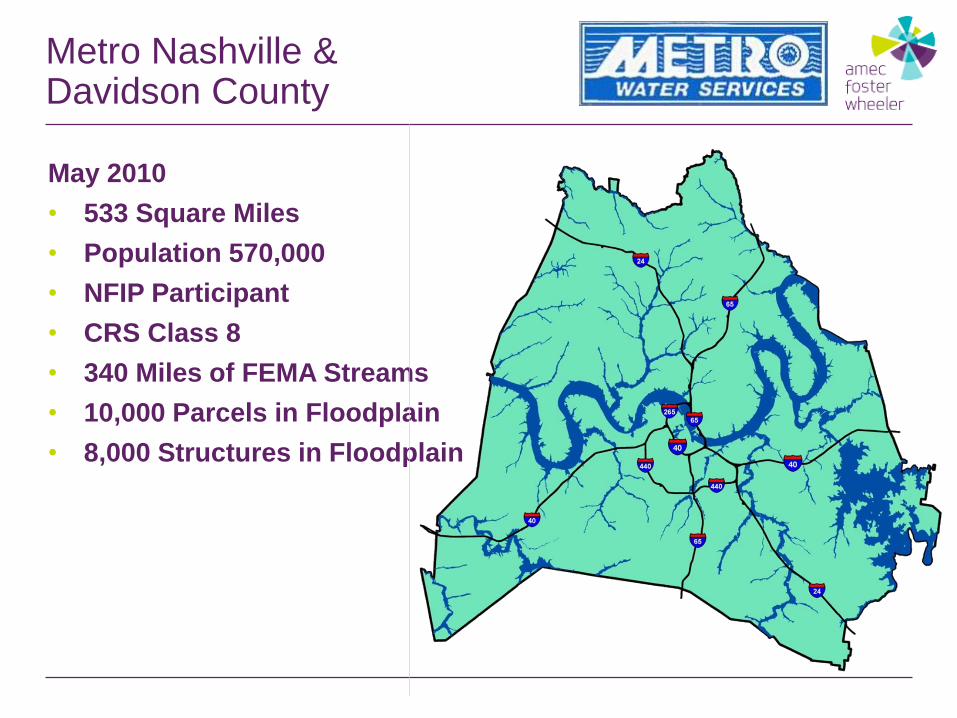
Metro Nashville & Davidson County
May 2010
• 533 Square Miles
• Population 570,000
• NFIP Participant
• CRS Class 8
• 340 Miles of FEMA Streams
• 10,000 Parcels in Floodplain
• 8,000 Structures in Floodplain
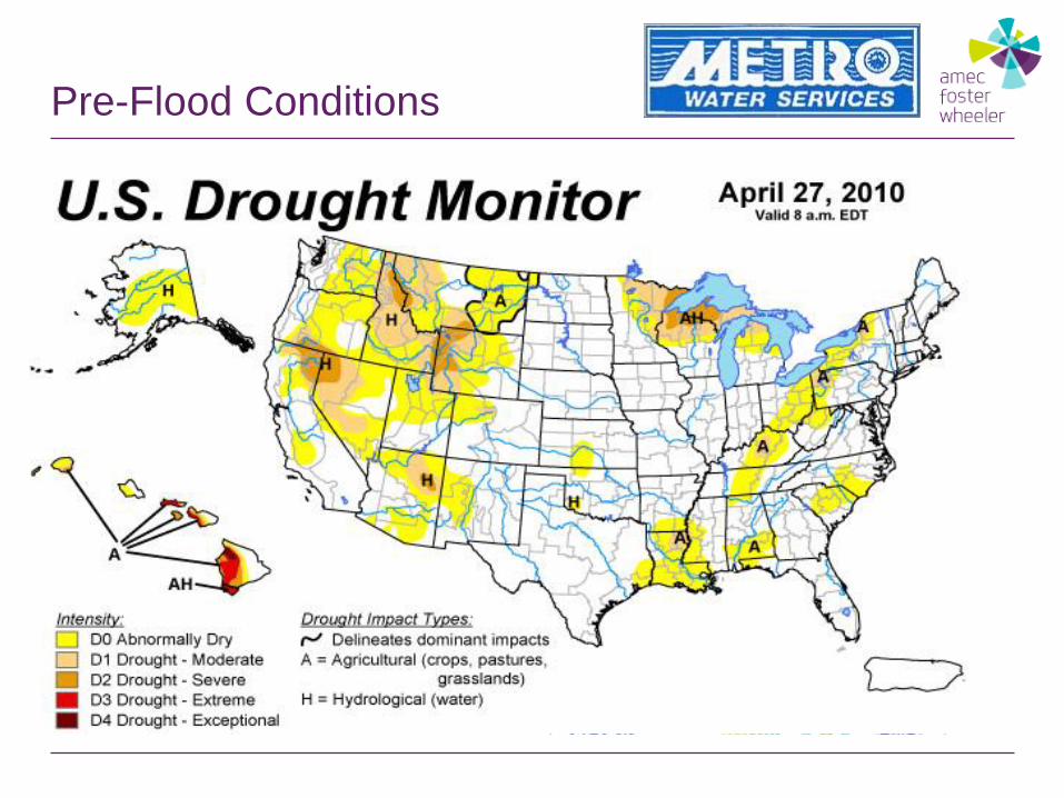
Pre-Flood Conditions

Rainfall Forecast (3-day total)
Friday Night April 30 Saturday Morning May 1

Two Day Rainfall Pattern
0.01
2.79
3.34
0.180.01
5.57
1.63
0.040.0
1.0
2.0
3.0
4.0
5.0
6.0
6:00 AM 12:00 PM 6:00 PM Midnight 6:00 AM 12:00 PM 6:00 PM Midnight
Ra
infa
ll (
inc
he
s)
Saturday, May 1 Sunday, May 2
6 Hour Rainfall Totals
> 6 inches > 7 inches

Rainfall Records Shattered
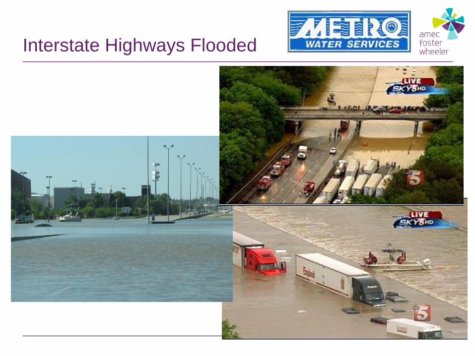
Interstate Highways Flooded

Opryland Hotel and Grand Ole Opry House
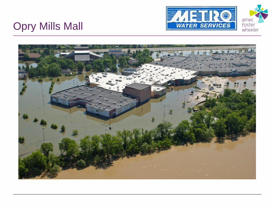
Opry Mills Mall

Nissan Stadium

Downtown Nashville

KR Harrington Water Treatment Plant
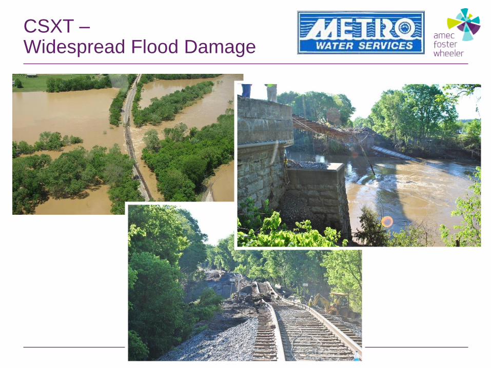
CSXT –Widespread Flood Damage
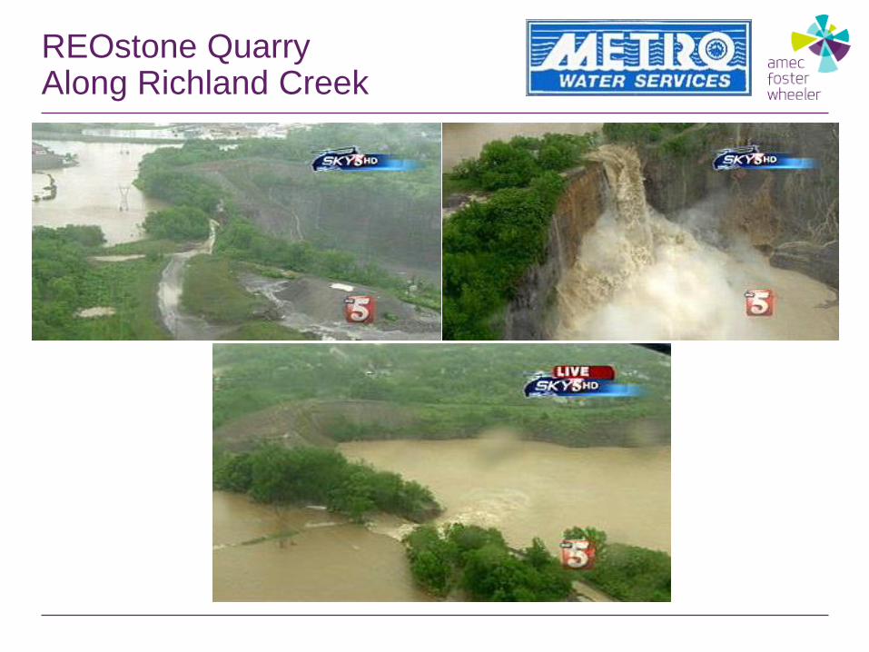
REOstone Quarry Along Richland Creek
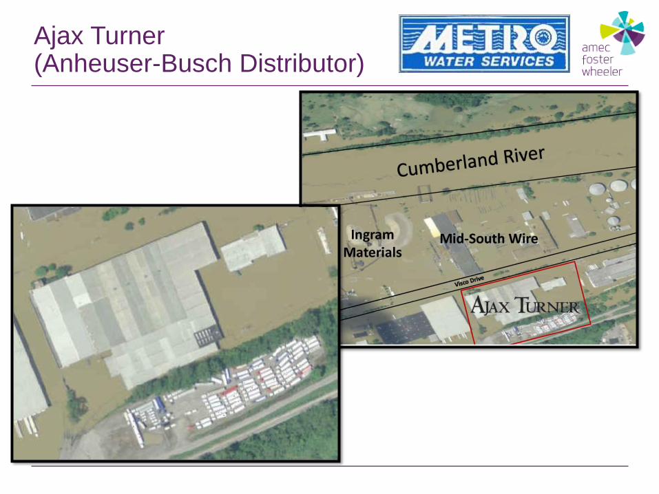
Ajax Turner(Anheuser-Busch Distributor)
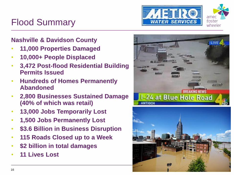
Flood Summary
Nashville & Davidson County
• 11,000 Properties Damaged
• 10,000+ People Displaced
• 3,472 Post-flood Residential Building Permits Issued
• Hundreds of Homes Permanently Abandoned
• 2,800 Businesses Sustained Damage (40% of which was retail)
• 13,000 Jobs Temporarily Lost
• 1,500 Jobs Permanently Lost
• $3.6 Billion in Business Disruption
• 115 Roads Closed up to a Week
• $2 billion in total damages
• 11 Lives Lost
16

Building Partnerships
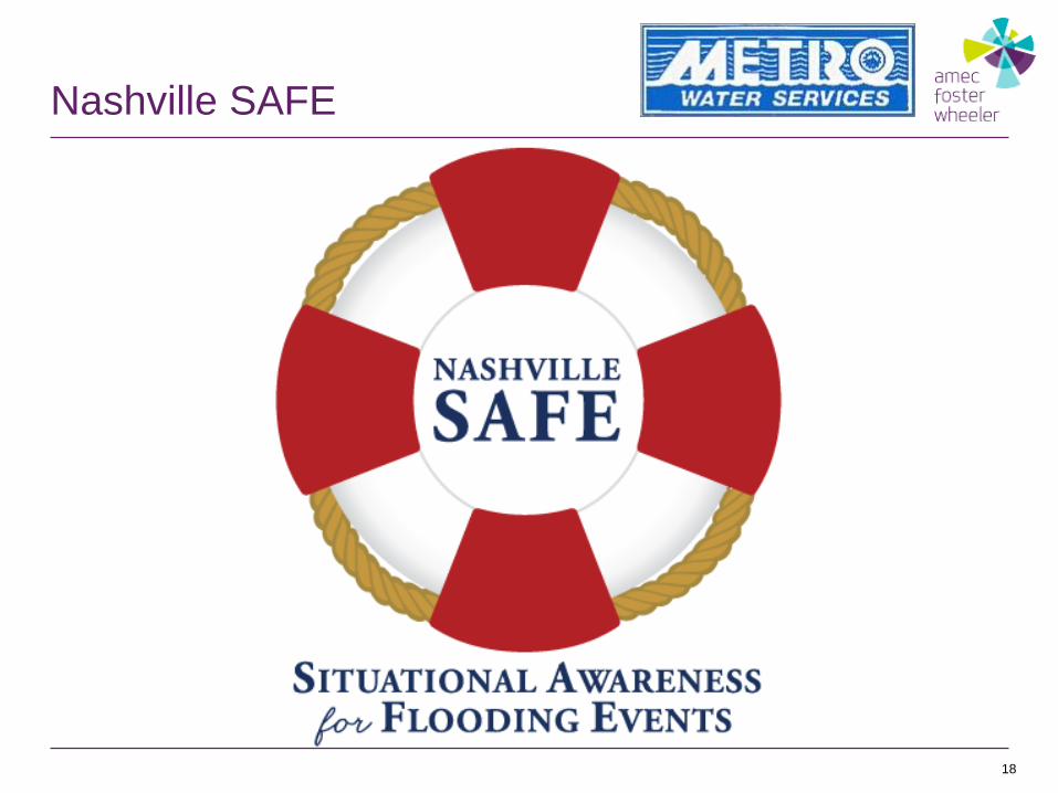
Nashville SAFE
18
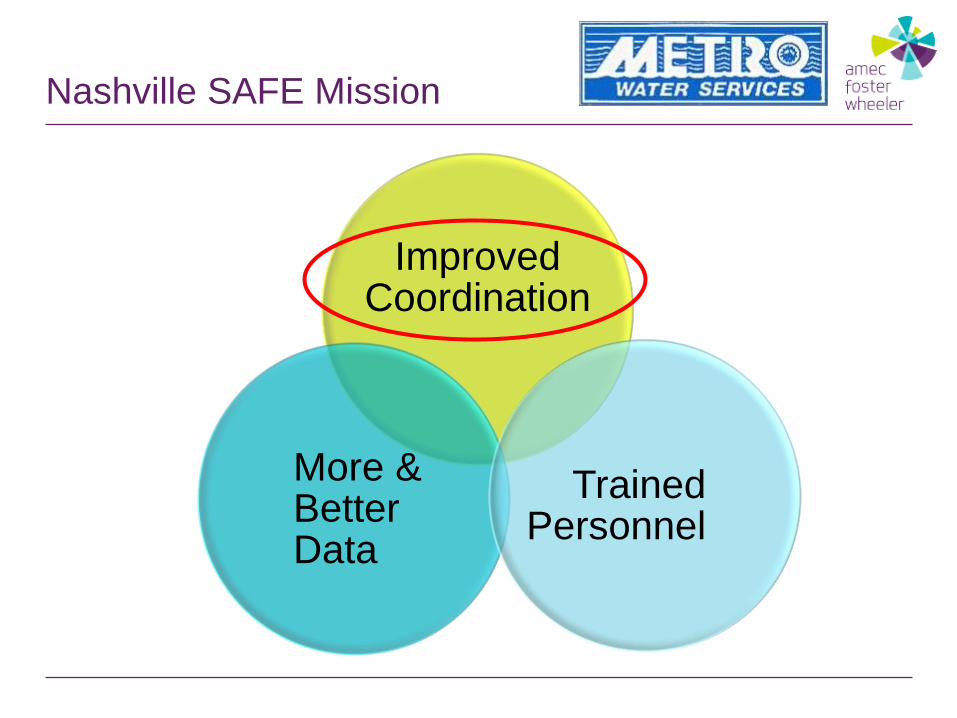
Nashville SAFE Mission
Improved Coordination
More & Better Data
Trained Personnel

Improved Coordination
20

Improved Coordination
21
Data Assessment Response Actions

Improved Coordination
22

23
Improved Coordination

Nashville SAFE Mission
Improved Coordination
Trained Personnel
More & Better Data

25
Data Available
May 1, 2010
More & Better Data

26
▪ New LiDAR
▪ New Modeling
▪ New USGS Gages
▪ MWS Rainfall Gages
▪ Webcams
More & Better Data
Data Available Today:
More & Better Data
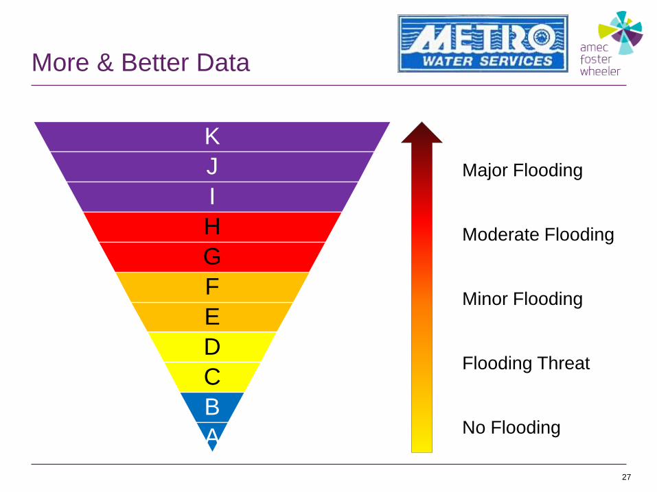
27
K
J
I
H
G
F
E
D
C
B
A
Major Flooding
No Flooding
Moderate Flooding
Minor Flooding
Flooding Threat

More & Better Data
28
Mill Creek Near Nolensville
River Mile 19.447 SAFE National Weather Service Flood Categories
Datum El. 527.3 (ft) Action Stage (ft) Elev (ft) Flood Categories
Flow (cfs) Elev (ft) Stage (ft) Level 20.0 547.3 Major Flood Stage
556.7 29.4 K 17.0 544.3 Moderate Flood Stage
555.1 27.8 J 13.0 540.3 Flood Stage
553.9 26.6 I 11.0 538.3 Action Stage
551.7 24.3 H
550.5 23.2 G
549.4 22.0 F Historical Crests
548.2 20.8 E 17.9 545.2 5/25/2000
546.8 19.5 D 17.8 545.2 6/7/2003
545.1 17.8 C 17.3 544.6 10/5/1995
542.9 15.6 B 17.1 544.4 5/14/1995
539.4 12.0 A 16.5 543.9 3/3/1997
Action Levels

New Modeling
29

More & Better Data
30
Data
Enhanced Digital Mapping
Paper Products
Training
Required
Emergency
Usefulness
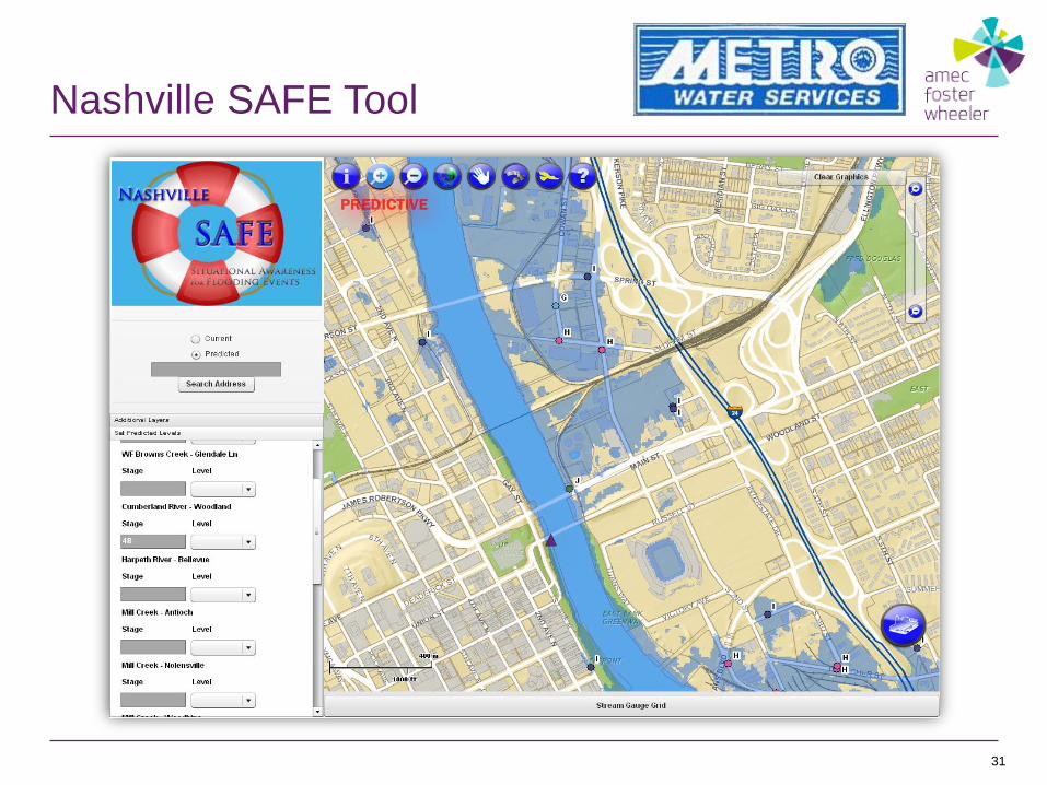
Nashville SAFE Tool
31
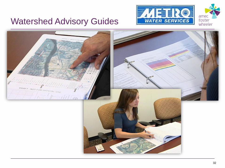
Watershed Advisory Guides
32

MNPD Action Level Maps
33

HEC-RTS Modeling
34

Decision Support Tool
35

Nashville SAFE Mission
Improved Coordination
Trained Personnel
More & Better Data

Trained Personnel
37
Watershed
Advisors

Does it Work?
38
We now have the ability to understand and predict
what is happening…we can advise the police
department on what to do, whether notification
or evacuation is necessary…last night and the
night before, we were perfect. I think it adds a
great level of comfort to our citizens…
Scott Potter
Director, Metro Water Services
Address to Cumberland River Compact on April 28, 2011
““

Accolades
• Nashville Planning Dept. Special
Achievement Award
• 2011 Esri International User Conference –
• ACEC Grand Award
• 2013 Engineering Excellence Award
Studies, Research, & Consulting Category
• Featured in….
• The Tennessean
• Municipal Sewer & Water Magazine
• WSMV
• Numerous Online Publications

Takeaway

Takeaway – Team Up!
41

Takeaway – End User Focus
42
I think the most impressive thing AMEC has done
is take the science and engineering…and turn
it into a user friendly product (the Watershed
Advisory Guide, for example) that decision
makers can use effectively.
James LaRosa
Service Hydrologist, National Weather Service
“ “


Thank you!
Whitney Fuquay
(615) 333-0630
Dana Waits
(615) 333-0630
44 © Amec Foster Wheeler 2015.


![Nashville Union and American. (Nashville, TN) 1861-04-13 [p ].](https://static.fdocuments.us/doc/165x107/624dc8cfb8ac3c699a0c6dbb/nashville-union-and-american-nashville-tn-1861-04-13-p-.jpg)