![lanzamientos.files.wordpress.comNASA - NSSDC - Spacecraft - Query Results 14/08/2010 23:19:08] Saturday, 14 August 2010. …](https://static.fdocuments.us/doc/165x107/5ecf904a61da2f5cd579cf65/nasa-nssdc-spacecraft-query-results-14082010-231908-saturday-14-august.jpg)
NASA - NSSDC - Master Catalog - Spacecraft Query · Facts in Brief Launch Date: 1984-06-25. Launch...
229
Cronología de Lanzamientos Espaciales Año 1984 Recopilación de datos Ing. Eladio Miranda Batlle. Los textos, imágenes y tablas fueron obtenidos de la National Space Science. Data Center. NASA
Transcript of NASA - NSSDC - Master Catalog - Spacecraft Query · Facts in Brief Launch Date: 1984-06-25. Launch...

Cronología de Lanzamientos Espaciales
Año 1984 Recopilación de datos Ing. Eladio Miranda Batlle. Los textos, imágenes y tablas fueron obtenidos de la National Space Science. Data Center. NASA

NASA - NSSDC - Spacecraft - Query Results
http://nssdc.gsfc.nasa.gov/nmc/spacecraftSearch.do[20/11/2010 23:53:57]
Sunday, 21 November 2010
Spacecraft Query Results
There were 170 spacecraft returned.
Spacecraft Name NSSDC ID Launch Date
1984-009A 1984-009A 1984-01-31
1984-065A 1984-065A 1984-06-25
1984-065C 1984-065C 1984-06-25
AMPTE/CCE 1984-088A 1984-08-16
AMPTE/IRM 1984-088B 1984-08-16
AMPTE/UKS 1984-088C 1984-08-16
Anik D2 1984-113B 1984-11-09
BS-2A 1984-005A 1984-01-23
Cosmos 1522 1984-001A 1984-01-05
Cosmos 1523 1984-001B 1984-01-05
Cosmos 1524 1984-001C 1984-01-05
Cosmos 1525 1984-001D 1984-01-05
Cosmos 1526 1984-001E 1984-01-05
Cosmos 1527 1984-001F 1984-01-05
Cosmos 1528 1984-001G 1984-01-05
Cosmos 1529 1984-001H 1984-01-05
Cosmos 1530 1984-002A 1984-01-11
Cosmos 1531 1984-003A 1984-01-11
Cosmos 1532 1984-004A 1984-01-13
Cosmos 1533 1984-006A 1984-01-26
Cosmos 1534 1984-007A 1984-01-26
Cosmos 1535 1984-010A 1984-02-02
Cosmos 1536 1984-013A 1984-02-08
Cosmos 1537 1984-017A 1984-02-16
Cosmos 1538 1984-019A 1984-02-21
Cosmos 1539 1984-020A 1984-02-28
Cosmos 1540 1984-022A 1984-03-02
Cosmos 1541 1984-024A 1984-03-06
Cosmos 1542 1984-025A 1984-03-07
Cosmos 1543 1984-026A 1984-03-10
Cosmos 1544 1984-027A 1984-03-15
Cosmos 1545 1984-030A 1984-03-21
Cosmos 1546 1984-031A 1984-03-29
Cosmos 1547 1984-033A 1984-04-05
Cosmos 1548 1984-036A 1984-04-10
Cosmos 1549 1984-040A 1984-04-19
NSSDC MasterCatalog Search
Spacecraft
Experiments
Data Collections
Personnel
Publications
Maps
New/Updated Data
Lunar/Planetary Events

NASA - NSSDC - Spacecraft - Query Results
http://nssdc.gsfc.nasa.gov/nmc/spacecraftSearch.do[20/11/2010 23:53:57]
Cosmos 1550 1984-043A 1984-05-11
Cosmos 1551 1984-044A 1984-05-11
Cosmos 1552 1984-045A 1984-05-14
Cosmos 1553 1984-046A 1984-05-17
Cosmos 1554 1984-047A 1984-05-19
Cosmos 1555 1984-047B 1984-05-19
Cosmos 1556 1984-047C 1984-05-19
Cosmos 1557 1984-048A 1984-05-22
Cosmos 1558 1984-050A 1984-05-25
Cosmos 1559 1984-052A 1984-05-28
Cosmos 1560 1984-052B 1984-05-28
Cosmos 1561 1984-052C 1984-05-28
Cosmos 1562 1984-052D 1984-05-28
Cosmos 1563 1984-052E 1984-05-28
Cosmos 1564 1984-052F 1984-05-28
Cosmos 1565 1984-052G 1984-05-28
Cosmos 1566 1984-052H 1984-05-28
Cosmos 1567 1984-053A 1984-05-30
Cosmos 1568 1984-054A 1984-06-01
Cosmos 1569 1984-055A 1984-06-06
Cosmos 1570 1984-056A 1984-06-08
Cosmos 1571 1984-058A 1984-06-11
Cosmos 1572 1984-060A 1984-06-15
Cosmos 1573 1984-061A 1984-06-19
Cosmos 1574 1984-062A 1984-06-21
Cosmos 1575 1984-064A 1984-06-22
Cosmos 1576 1984-066A 1984-06-26
Cosmos 1577 1984-067A 1984-06-27
Cosmos 1578 1984-068A 1984-06-28
Cosmos 1579 1984-069A 1984-06-29
Cosmos 1580 1984-070A 1984-06-30
Cosmos 1581 1984-071A 1984-07-03
Cosmos 1582 1984-074A 1984-07-19
Cosmos 1583 1984-075A 1984-07-24
Cosmos 1584 1984-076A 1984-07-27
Cosmos 1585 1984-077A 1984-07-31
Cosmos 1586 1984-079A 1984-08-02
Cosmos 1587 1984-082A 1984-08-06
Cosmos 1588 1984-083A 1984-08-07
Cosmos 1589 1984-084A 1984-08-08
Cosmos 1590 1984-087A 1984-08-16
Cosmos 1591 1984-092A 1984-08-30
Cosmos 1592 1984-094A 1984-09-04
Cosmos 1593 1984-095A 1984-09-04
Cosmos 1594 1984-095B 1984-09-04
Cosmos 1595 1984-095C 1984-09-04
Cosmos 1596 1984-096A 1984-09-07
Cosmos 1597 1984-099A 1984-09-13
Cosmos 1598 1984-100A 1984-09-13

NASA - NSSDC - Spacecraft - Query Results
http://nssdc.gsfc.nasa.gov/nmc/spacecraftSearch.do[20/11/2010 23:53:57]
Cosmos 1599 1984-102A 1984-09-25
Cosmos 1600 1984-103A 1984-09-27
Cosmos 1601 1984-104A 1984-09-27
Cosmos 1602 1984-105A 1984-09-28
Cosmos 1603 1984-106A 1984-09-28
Cosmos 1604 1984-107A 1984-10-04
Cosmos 1605 1984-109A 1984-10-11
Cosmos 1606 1984-111A 1984-10-11
Cosmos 1607 1984-112A 1984-10-31
Cosmos 1608 1984-116A 1984-11-14
Cosmos 1609 1984-117A 1984-11-14
Cosmos 1610 1984-118A 1984-11-15
Cosmos 1611 1984-119A 1984-11-21
Cosmos 1612 1984-120A 1984-11-27
Cosmos 1613 1984-121A 1984-11-29
Cosmos 1614 1984-126A 1984-12-19
Cosmos 1615 1984-127A 1984-12-20
DSP F11 1984-037A 1984-04-14
Ekran 12 1984-028A 1984-03-16
Ekran 13 1984-090A 1984-08-24
ERBS 1984-108B 1984-10-05
EUTELSAT 2 1984-081A 1984-08-04
Galaxy-C 1984-101A 1984-09-21
GMS 3 1984-080A 1984-08-02
Gorizont 9 1984-041A 1984-04-22
Gorizont 10 1984-078A 1984-08-02
INTELSAT 5 F-8 1984-023A 1984-03-05
INTELSAT 5 F-9 1984-057A 1984-06-09
IRT 1984-011C 1984-02-03
JD1 1984-012C 1984-02-05
JD2 1984-012D 1984-02-05
JD3 1984-012F 1984-02-05
KH 11-6 1984-122A 1984-12-04
KH 8-54 1984-039A 1984-04-17
Landsat 5 1984-021A 1984-03-01
LDEF 1 1984-034B 1984-04-06
Leasat F1 1984-093C 1984-08-31
Leasat F2 1984-113C 1984-11-10
Marecs-B2 1984-114B 1984-11-10
Meteor 2-11 1984-072A 1984-07-05
Molniya 1-60 1984-029A 1984-03-16
Molniya 1-61 1984-085A 1984-08-10
Molniya 1-62 1984-089A 1984-08-24
Molniya 1-63 1984-124A 1984-12-14
NATO 3-D 1984-115A 1984-11-14
Navstar 9 1984-059A 1984-06-13
Navstar 10 1984-097A 1984-09-08
NOAA 9 1984-123A 1984-12-12
NOSS 6 1984-012A 1984-02-05

NASA - NSSDC - Spacecraft - Query Results
http://nssdc.gsfc.nasa.gov/nmc/spacecraftSearch.do[20/11/2010 23:53:57]
NOVA III 1984-110A 1984-10-12
Ohzora 1984-015A 1984-02-14
Palapa-B2 1984-011D 1984-02-03
PRC 14 1984-008A 1984-01-29
PRC 15 1984-035A 1984-04-08
PRC 16 1984-098A 1984-09-12
Progress 19 1984-018A 1984-02-21
Progress 20 1984-038A 1984-04-15
Progress 21 1984-042A 1984-05-07
Progress 22 1984-051A 1984-05-28
Progress 23 1984-086A 1984-08-14
Raduga 14 1984-016A 1984-02-15
Raduga 15 1984-063A 1984-06-22
SBS 4 1984-093B 1984-08-30
SDS F-5A 1984-091A 1984-08-28
Soyuz T-10 1984-014A 1984-02-08
Soyuz T-11 1984-032A 1984-04-03
Soyuz T-12 1984-073A 1984-07-17
Spacenet 1 1984-049A 1984-05-23
Spacenet 2 1984-114A 1984-11-10
STS 41B 1984-011A 1984-02-03
STS 41C 1984-034A 1984-04-06
STS 41D 1984-093A 1984-08-30
STS 41G 1984-108A 1984-10-05
STS 51A 1984-113A 1984-11-08
TELECOM 1A 1984-081B 1984-08-04
Telstar 3C 1984-093D 1984-09-01
UOSAT 2 1984-021B 1984-03-01
USA 7 1984-129A 1984-12-22
Vega 1 1984-125A 1984-12-15
Vega 1 Balloon 1984-125F 1984-12-15
Vega 1 Descent Craft 1984-125E 1984-12-15
Vega 2 1984-128A 1984-12-21
Vega 2 Balloon 1984-128F 1984-12-21
Vega 2 Descent Craft 1984-128E 1984-12-21
Westar 6 1984-011B 1984-02-03
+ Privacy Policy and Important Notices NASA Official: Dr. Ed GrayzeckCurator: E. Bell, IIVersion 4.0.14, 08 October 2010
NASA - NSSDC - Spacecraft - Details
http://nssdc.gsfc.nasa.gov/nmc/spacecraftDisplay.do?id=1984-009A[24/11/2010 23:02:02]
Thursday, 25 November 2010
Description
1984-009A
NSSDC ID: 1984-009A
Alternate Names
14675
Facts in Brief
Launch Date: 1984-01-31Launch Vehicle: Titan34DLaunch Site: CapeCanaveral, United StatesMass: 1043.0 kg
Funding Agency
Unknown (United States)
Discipline
Surveillance and OtherMilitary
AdditionalInformation
Launch/Orbitalinformation for 1984-009A
Experiments on 1984-009A
Data collections from 1984-009A
Questions or commentsabout this spacecraft canbe directed to: CoordinatedRequest and User SupportOffice.
NSSDC MasterCatalog Search
Spacecraft
Experiments
Data Collections
Personnel
Publications
Maps
New/Updated Data
Lunar/Planetary Events
+ Privacy Policy and Important Notices NASA Official: Dr. Ed GrayzeckCurator: E. Bell, IIVersion 4.0.14, 08 October 2010

NASA - NSSDC - Spacecraft - Details
http://nssdc.gsfc.nasa.gov/nmc/spacecraftDisplay.do?id=1984-065A[24/11/2010 23:02:53]
Thursday, 25 November 2010
Description
1984-065A
NSSDC ID: 1984-065A
Alternate Names
15063
Facts in Brief
Launch Date: 1984-06-25Launch Vehicle: Titan34DLaunchSite: Vandenberg AFB,United StatesMass: 13300.0 kg
Funding Agency
Unknown (United States)
Discipline
Surveillance and OtherMilitary
AdditionalInformation
Launch/Orbitalinformation for 1984-065A
Experiments on 1984-065A
Data collections from 1984-065A
Questions or commentsabout this spacecraft canbe directed to: CoordinatedRequest and User SupportOffice.
NSSDC MasterCatalog Search
Spacecraft
Experiments
Data Collections
Personnel
Publications
Maps
New/Updated Data
Lunar/Planetary Events
+ Privacy Policy and Important Notices NASA Official: Dr. Ed GrayzeckCurator: E. Bell, IIVersion 4.0.14, 08 October 2010

NASA - NSSDC - Spacecraft - Details
http://nssdc.gsfc.nasa.gov/nmc/spacecraftDisplay.do?id=1984-065C[24/11/2010 23:04:44]
Thursday, 25 November 2010
Description
1984-065C
NSSDC ID: 1984-065C
Alternate Names
15071
Facts in Brief
Launch Date: 1984-06-25Launch Vehicle: Titan34DLaunchSite: Vandenberg AFB,United StatesMass: 60.0 kg
Funding Agency
Unknown (United States)
Discipline
Surveillance and OtherMilitary
AdditionalInformation
Launch/Orbitalinformation for 1984-065C
Experiments on 1984-065C
Data collections from 1984-065C
Questions or commentsabout this spacecraft canbe directed to: CoordinatedRequest and User SupportOffice.
NSSDC MasterCatalog Search
Spacecraft
Experiments
Data Collections
Personnel
Publications
Maps
New/Updated Data
Lunar/Planetary Events
+ Privacy Policy and Important Notices NASA Official: Dr. Ed GrayzeckCurator: E. Bell, IIVersion 4.0.14, 08 October 2010

NASA - NSSDC - Spacecraft - Details
http://nssdc.gsfc.nasa.gov/nmc/spacecraftDisplay.do?id=1984-088A[24/11/2010 23:05:49]
Thursday, 25 November 2010
Description
The AMPTE (Active Magnetospheric Particle Tracer Explorers)mission was designed to study the access of solar-wind ions tothe magnetosphere, the convective-diffusive transport andenergization of magnetospheric particles, and the interactionsof plasmas in space. The mission consisted of threespacecraft: the CCE; the IRM, which provided multiple ionreleases in the solar wind, the magnetosheath, and themagnetotail, with in situ diagnostics of each; and the UKS,which uses thrusters to keep station near the IRM to providetwo-point local measurements. The CCE (Charge CompositionExplorer) spacecraft was instrumented to detect those lithiumand barium tracer ions from the IRM releases that weretransported into the magnetosphere within the CCE orbit. Thespacecraft was spin-stabilized at 10 rpm, with its spin axis inthe equatorial plane, and offset from the earth-sun line byabout 20 deg. It could adjust attitude with both magnetictorquing and cold gas thrusters. The CCE used a 2.E8-bit taperecorder and redundant 2.5-W S-band transponders. Thespacecraft battery was charged by a 140-W solar array. The PIfor the U.S. AMPTE Program and for the CCE was S. M.Krimigis (now Richard McEntire of JHU/APL); each instrumentwas managed by a lead investigator. The CCE encounteredcommand module/power supply problems since the beginningof 1989, and failed as of 12 July 89. For more details, see J.Dassoulas et al., IEEE Transactions on Geoscience andRemote Sensing, Vol. GE-23, p. 182, 1985.
AMPTE/CCE
NSSDC ID: 1984-088A
Alternate Names
AMPTE/ChargeComposition Explorer
CCE
Charge CompositionExplorer
Explorer 65
15199
Facts in Brief
Launch Date: 1984-08-16Launch Vehicle: DeltaLaunch Site: CapeCanaveral, United StatesMass: 242.0 kgNominalPower: 140.0 W
Funding Agency
NASA-Office of SpaceScience Applications(United States)
Discipline
Space Physics
AdditionalInformation
Launch/Orbitalinformation forAMPTE/CCE
PDMP information forAMPTE/CCE
Telecommunicationsinformation forAMPTE/CCE
Experiments onAMPTE/CCE
Data collections from
NSSDC MasterCatalog Search
Spacecraft
Experiments
Data Collections
Personnel
Publications
Maps
New/Updated Data
Lunar/Planetary Events

NASA - NSSDC - Spacecraft - Details
http://nssdc.gsfc.nasa.gov/nmc/spacecraftDisplay.do?id=1984-088A[24/11/2010 23:05:49]
AMPTE/CCE
Questions or commentsabout this spacecraft canbe directed to: Dr. TimothyE. Eastman.
Personnel
Name Role Original Affiliation E-mail
Dr. Steven A.Curtis
Project Scientist NASA Goddard SpaceFlight Center
Dr. RichardW. McEntire
Mission PrincipalInvestigator
Applied PhysicsLaboratory
Mr. Gilbert W.Ousley, Sr.
Project Manager NASA Goddard SpaceFlight Center
Dr. Charles P.Holmes
ProgramScientist
NASA Headquarters [email protected]
Other AMPTE Data/Information at NSSDC
AMPTE CCEAMPTE IRMAMPTE UKS
Other Sources of AMPTE Data/Information
AMPTE Science Data CenterAMPTE/IRM Data Center
+ Privacy Policy and Important Notices NASA Official: Dr. Ed GrayzeckCurator: E. Bell, IIVersion 4.0.14, 08 October 2010

NASA - NSSDC - Spacecraft - Details
http://nssdc.gsfc.nasa.gov/nmc/spacecraftDisplay.do?id=1984-088B[24/11/2010 23:06:47]
Thursday, 25 November 2010
Description
The AMPTE (Active Magnetospheric Particle Tracer Explorers)mission was designed to study the access of solar-wind ions tothe magnetosphere, the convective-diffusive transport andenergization of magnetospheric particles, and the interactionsof plasmas in space.
The program consisted of three spacecraft: the CCE, whichmeasured in the magnetosphere the ions released by the IRM;the IRM; and the UKS, which used thrusters to keep stationnear the IRM to provide two-point local measurements. TheIRM provided multiple ion releases in the solar wind, themagnetosheath, and the magnetotail, with in situ diagnostics ofeach.
The IRM spacecraft was spin-stabilized at 15 rpm. Its spin axiswas initially in the ecliptic plane, but later it was adjusted withmagnetic torqueing to be at right angles to the ecliptic. Thepower system was a 60 W solar array with redundantbatteries. There was a redundant S-band telemetry andtelecommand system. Telemetry rates could be chosenbetween 1 and 8 kbps. For injection into the final orbit, the IRMcarried its own kick stage. In addition to the ion releases, theinstruments on board the spacecraft monitored the ambient,magnetosphere, but with the data acquisition confined to thepasses that could be tracked in real time from Germany.
The spacecraft became inoperational as of 14 August 86. ThePI for the German AMPTE Program was G. Haerendel. Therelease experiment and the diagnostic instruments were eachprovided by a lead investigator (LI). For more details, see B.Hausler et al., IEEE Transactions on Geoscience and RemoteSensing, v. GE-23, p. 192, 1985.
AMPTE/IRM
NSSDC ID: 1984-088B
Alternate Names
IRM
AMPTE/Ion ReleaseModule
Ion Release Module
15200
Facts in Brief
Launch Date: 1984-08-16Launch Vehicle: Delta3924Launch Site: CapeCanaveral, United StatesMass: 705.0 kgNominal Power: 60.0 W
Funding Agency
Bundesministerium fuerForschung undTecnnologie (FederalRepublic of Germany)
Discipline
Space Physics
AdditionalInformation
Launch/Orbitalinformation forAMPTE/IRM
PDMP information forAMPTE/IRM
Telecommunicationsinformation forAMPTE/IRM
Experiments onAMPTE/IRM
Data collections fromAMPTE/IRM
NSSDC MasterCatalog Search
Spacecraft
Experiments
Data Collections
Personnel
Publications
Maps
New/Updated Data
Lunar/Planetary Events

NASA - NSSDC - Spacecraft - Details
http://nssdc.gsfc.nasa.gov/nmc/spacecraftDisplay.do?id=1984-088B[24/11/2010 23:06:47]
Questions or commentsabout this spacecraft canbe directed to: Dr. TimothyE. Eastman.
Personnel
Name Role Original Affiliation E-mail
Dr. M.Otterbein
ProgramManager
Bundesministerium fuer Forschungund Technologie
Mr. V.Joneleit
ProjectManager
Deutsche Forschungs-undVersuchsenstalt fuer Luft-undRaumfahrt
Dr. GerhardHaerendel
MissionPrincipalInvestigator
Max-Planck-Institut furExtraterrestrische Physik
Dr. BerndHausler
ProjectManager
Max-Planck-Institut furExtraterrestrische Physik
Dr. GoetzPaschmann
ProjectScientist
Max-Planck-Institut furExtraterrestrische Physik
Other AMPTE Data/Information at NSSDC
AMPTE CCEAMPTE IRMAMPTE UKS
Other Sources of AMPTE Data/Information
AMPTE Science Data CenterAMPTE/IRM Data Center
+ Privacy Policy and Important Notices NASA Official: Dr. Ed GrayzeckCurator: E. Bell, IIVersion 4.0.14, 08 October 2010

NASA - NSSDC - Spacecraft - Details
http://nssdc.gsfc.nasa.gov/nmc/spacecraftDisplay.do?id=1984-088C[24/11/2010 23:07:37]
Thursday, 25 November 2010
Description
The AMPTE (Active Magnetospheric Particle Tracer Explorers)mission was designed to study the access of solar-wind ions tothe magnetosphere, the convective-diffusive transport andenergization of magnetospheric particles, and the interactionsof plasmas in space. The program consisted of threespacecraft: the CCE, which measured in the magnetospherethe ions released by the IRM; the IRM, which provided multipleion releases in the solar wind, the magnetosheath, and themagnetotail, with in situ diagnostics of each; and the UKS. TheUKS was one spacecraft of the AMPTE (ActiveMagnetosphere Particle Tracer Experiment) program (alongwith CCE and IRM) and served as a subsatellite of the IRMspacecraft. Its purpose was to help distinguish between spatialstructure and temporal changes in the plasma phenomenainitiated by ion releases from the IRM and in the naturalmagnetospheric environment. Measured quantitie were similarto those of the IRM and include magnetic fields, positive ions,electrons, plasma waves, and modulations in ions andelectrons. The spacecraft was spin-stabilized at 12 rpm andemployed S-band communications. It carried a cold gaspropulsion system and a VHF radar system for station keepingwith the IRM normally at a distance of a few hundredkilometers. The lead investigator for the UKS spacecraft wasD. A. Bryant. The spacecraft power supply failed on January15, 1985. For more details, see A.K. Ward, et al., IEEETransaction on Geoscience and Remote Sensing, Vol. GE-23,p 202, 1985.
AMPTE/UKS
NSSDC ID: 1984-088C
Alternate Names
UKS
AMPTE/United KingdomSubsatellite
United KingdomSubsatellite
15201
Facts in Brief
Launch Date: 1984-08-16Launch Vehicle: DeltaLaunch Site: CapeCanaveral, United StatesMass: 77.0 kg
Funding Agency
Science and EngineeringResearch Council, UK(United Kingdom)
Discipline
Space Physics
AdditionalInformation
Launch/Orbitalinformation forAMPTE/UKS
Experiments onAMPTE/UKS
Data collections fromAMPTE/UKS
Questions or commentsabout this spacecraft canbe directed to: Dr. TimothyE. Eastman.
NSSDC MasterCatalog Search
Spacecraft
Experiments
Data Collections
Personnel
Publications
Maps
New/Updated Data
Lunar/Planetary Events

NASA - NSSDC - Spacecraft - Details
http://nssdc.gsfc.nasa.gov/nmc/spacecraftDisplay.do?id=1984-088C[24/11/2010 23:07:37]
Personnel
Name Role Original Affiliation E-mail
Dr. A. K. Ward ProjectManager
Rutherford AppletonLaboratory
Dr. Trefor Edwards ProjectEngineer
Rutherford AppletonLaboratory
Dr. Duncan A.Bryant
ProjectScientist
Rutherford AppletonLaboratory
Other AMPTE Data/Information at NSSDC
AMPTE CCEAMPTE IRMAMPTE UKS
Other Sources of AMPTE Data/Information
AMPTE Science Data CenterAMPTE/IRM Data Center
+ Privacy Policy and Important Notices NASA Official: Dr. Ed GrayzeckCurator: E. Bell, IIVersion 4.0.14, 08 October 2010
NASA - NSSDC - Spacecraft - Details
http://nssdc.gsfc.nasa.gov/nmc/spacecraftDisplay.do?id=1984-113B[24/11/2010 23:08:03]
Thursday, 25 November 2010
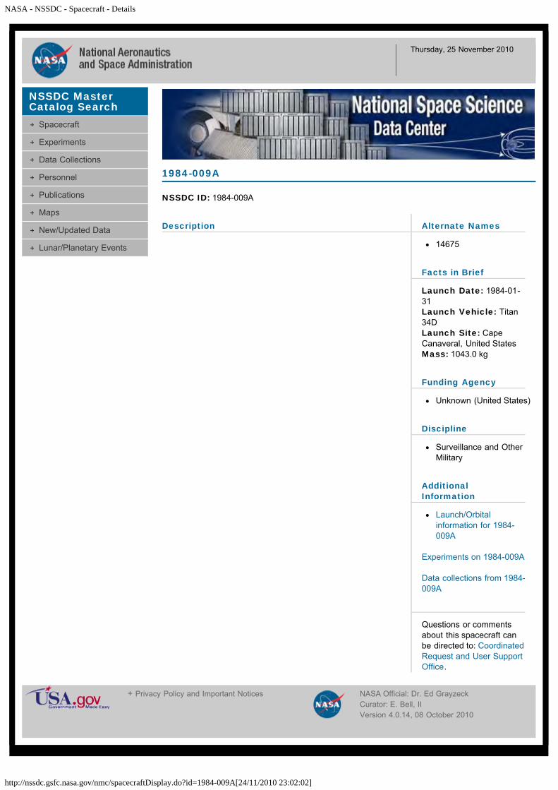
Description
Telesat-H (Anik D2) was a Canadian communications satellitedeployed by the STS 51-A shuttle mission.
Anik D2
NSSDC ID: 1984-113B
Alternate Names
TELESAT-H
15383
Facts in Brief
Launch Date: 1984-11-09LaunchVehicle: ShuttleLaunch Site: CapeCanaveral, United StatesMass: 1100.0 kg
Funding Agencies
National Aeronautics andSpace Administration(United States)
Telesat Canada Ltd.,Ottawa (Canada)
Discipline
Communications
AdditionalInformation
Launch/Orbitalinformation for Anik D2
Experiments on Anik D2
Data collections from AnikD2
Questions or commentsabout this spacecraft canbe directed to: CoordinatedRequest and User SupportOffice.
NSSDC MasterCatalog Search
Spacecraft
Experiments
Data Collections
Personnel
Publications
Maps
New/Updated Data
Lunar/Planetary Events
+ Privacy Policy and Important Notices NASA Official: Dr. Ed GrayzeckCurator: E. Bell, II
NASA - NSSDC - Spacecraft - Details
http://nssdc.gsfc.nasa.gov/nmc/spacecraftDisplay.do?id=1984-005A[24/11/2010 23:08:59]
Thursday, 25 November 2010
Description
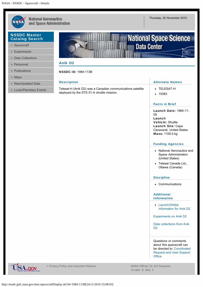
BS-2A (Broadcasting Satellite-2A) was launched by theNational Space Development Agency of Japan (NASDA) fromthe Tanegashima Space Center. It was designed to eliminatepoor television reception areas and develop the technologyconcerning broadcasting satellites. Transmitting frequenciesand output powers were 11.91928 GHz at 100 W, 11.99600GHz at 100 W, 11.70299 GHz and 0.1 W, and 2276.99 MHz at1.3 W.
BS-2A
NSSDC ID: 1984-005A
Alternate Names
Broadcasting Sat-2A
Yuri 2A
14659
Facts in Brief
Launch Date: 1984-01-23Launch Vehicle: N-2LaunchSite: Tanegashima, JapanMass: 670.0 kg
Funding Agency
National SpaceDevelopment Agency(NASDA) (Japan)
Discipline
Communications
AdditionalInformation
Launch/Orbitalinformation for BS-2A
Experiments on BS-2A
Data collections from BS-2A
Questions or commentsabout this spacecraft canbe directed to: CoordinatedRequest and User SupportOffice.
NSSDC MasterCatalog Search
Spacecraft
Experiments
Data Collections
Personnel
Publications
Maps
New/Updated Data
Lunar/Planetary Events
+ Privacy Policy and Important Notices NASA Official: Dr. Ed GrayzeckCurator: E. Bell, IIVersion 4.0.14, 08 October 2010

NASA - NSSDC - Spacecraft - Details
http://nssdc.gsfc.nasa.gov/nmc/spacecraftDisplay.do?id=1984-001A[24/11/2010 23:11:59]
Thursday, 25 November 2010
Description
The lowest level of the three-tier communications satelliteconstellation was populated with two distinct systems devotedto military and government communications. Both systemswere assessed to be simple store-dump repeaters which wereparticularly useful in relaying traffic between the RussianFederation and overseas stations or forces. These Strela(which means "Arrow" in Russian) satellites recorded radiomessages transmitted by Russian intelligence agentsworldwide and relayed them when flying over Moscow.Debuting in 1970 was a system of small (61 kg, 0.80 m by0.75 m) relay satellites launched from Plesetsk by the Kosmosbooster in groups of eight. Although the mean altitude of thisconstellation was near 1500 km, each set of eight Strela 1satellites was normally dispersed into slightly elliptical orbitswith mean altitudes between 1430 and 1490 km. Theintentional orbital period differences of about 0.15 min ensuredthat the satellites would become randomly spaced about theorbital plane shortly after launch. Unlike the lower altitudeconstellation, this network relied on a single orbital plane withan inclination of 74 deg which was replenished on the averageof once each year. The last mission in this network was inJune 1992, and the network has now been superseded by themore modern and capable Strela 3 system.
Cosmos 1522
NSSDC ID: 1984-001A
Alternate Names
14611
Facts in Brief
Launch Date: 1984-01-05LaunchVehicle: CosmosLaunch Site: Plesetsk,U.S.S.RMass: 40.0 kg
Funding Agency
Unknown (U.S.S.R)
Discipline
Communications
AdditionalInformation
Launch/Orbitalinformation for Cosmos1522
Experiments on Cosmos1522
Data collections fromCosmos 1522
Questions or commentsabout this spacecraft canbe directed to: CoordinatedRequest and User SupportOffice.
NSSDC MasterCatalog Search
Spacecraft
Experiments
Data Collections
Personnel
Publications
Maps
New/Updated Data
Lunar/Planetary Events
+ Privacy Policy and Important Notices NASA Official: Dr. Ed GrayzeckCurator: E. Bell, IIVersion 4.0.14, 08 October 2010

NASA - NSSDC - Spacecraft - Details
http://nssdc.gsfc.nasa.gov/nmc/spacecraftDisplay.do?id=1984-001B[24/11/2010 23:13:29]
Thursday, 25 November 2010
Description
The lowest level of the three-tier communications satelliteconstellation was populated with two distinct systems devotedto military and government communications. Both systemswere assessed to be simple store-dump repeaters which wereparticularly useful in relaying traffic between the RussianFederation and overseas stations or forces. These Strela(which means "Arrow" in Russian) satellites recorded radiomessages transmitted by Russian intelligence agentsworldwide and relayed them when flying over Moscow.Debuting in 1970 was a system of small (61 kg, 0.80 m by0.75 m) relay satellites launched from Plesetsk by the Kosmosbooster in groups of eight. Although the mean altitude of thisconstellation was near 1500 km, each set of eight Strela 1satellites was normally dispersed into slightly elliptical orbitswith mean altitudes between 1430 and 1490 km. Theintentional orbital period differences of about 0.15 min ensuredthat the satellites would become randomly spaced about theorbital plane shortly after launch. Unlike the lower altitudeconstellation, this network relied on a single orbital plane withan inclination of 74 deg which was replenished on the averageof once each year. The last mission in this network was inJune 1992, and the network has now been superseded by themore modern and capable Strela 3 system.
Cosmos 1523
NSSDC ID: 1984-001B
Alternate Names
14612
Facts in Brief
Launch Date: 1984-01-05LaunchVehicle: CosmosLaunch Site: Plesetsk,U.S.S.RMass: 40.0 kg
Funding Agency
Unknown (U.S.S.R)
Discipline
Communications
AdditionalInformation
Launch/Orbitalinformation for Cosmos1523
Experiments on Cosmos1523
Data collections fromCosmos 1523
Questions or commentsabout this spacecraft canbe directed to: CoordinatedRequest and User SupportOffice.
NSSDC MasterCatalog Search
Spacecraft
Experiments
Data Collections
Personnel
Publications
Maps
New/Updated Data
Lunar/Planetary Events
+ Privacy Policy and Important Notices NASA Official: Dr. Ed GrayzeckCurator: E. Bell, IIVersion 4.0.14, 08 October 2010

NASA - NSSDC - Spacecraft - Details
http://nssdc.gsfc.nasa.gov/nmc/spacecraftDisplay.do?id=1984-001C[24/11/2010 23:14:36]
Thursday, 25 November 2010
Description
The lowest level of the three-tier communications satelliteconstellation was populated with two distinct systems devotedto military and government communications. Both systemswere assessed to be simple store-dump repeaters which wereparticularly useful in relaying traffic between the RussianFederation and overseas stations or forces. These Strela(which means "Arrow" in Russian) satellites recorded radiomessages transmitted by Russian intelligence agentsworldwide and relayed them when flying over Moscow.Debuting in 1970 was a system of small (61 kg, 0.80 m by0.75 m) relay satellites launched from Plesetsk by the Kosmosbooster in groups of eight. Although the mean altitude of thisconstellation was near 1500 km, each set of eight Strela 1satellites was normally dispersed into slightly elliptical orbitswith mean altitudes between 1430 and 1490 km. Theintentional orbital period differences of about 0.15 min ensuredthat the satellites would become randomly spaced about theorbital plane shortly after launch. Unlike the lower altitudeconstellation, this network relied on a single orbital plane withan inclination of 74 deg which was replenished on the averageof once each year. The last mission in this network was inJune 1992, and the network has now been superseded by themore modern and capable Strela 3 system.
Cosmos 1524
NSSDC ID: 1984-001C
Alternate Names
14613
Facts in Brief
Launch Date: 1984-01-05LaunchVehicle: CosmosLaunch Site: Plesetsk,U.S.S.RMass: 40.0 kg
Funding Agency
Unknown (U.S.S.R)
Discipline
Communications
AdditionalInformation
Launch/Orbitalinformation for Cosmos1524
Experiments on Cosmos1524
Data collections fromCosmos 1524
Questions or commentsabout this spacecraft canbe directed to: CoordinatedRequest and User SupportOffice.
NSSDC MasterCatalog Search
Spacecraft
Experiments
Data Collections
Personnel
Publications
Maps
New/Updated Data
Lunar/Planetary Events
+ Privacy Policy and Important Notices NASA Official: Dr. Ed GrayzeckCurator: E. Bell, IIVersion 4.0.14, 08 October 2010

NASA - NSSDC - Spacecraft - Details
http://nssdc.gsfc.nasa.gov/nmc/spacecraftDisplay.do?id=1984-001D[24/11/2010 23:15:35]
Thursday, 25 November 2010
Description
The lowest level of the three-tier communications satelliteconstellation was populated with two distinct systems devotedto military and government communications. Both systemswere assessed to be simple store-dump repeaters which wereparticularly useful in relaying traffic between the RussianFederation and overseas stations or forces. These Strela(which means "Arrow" in Russian) satellites recorded radiomessages transmitted by Russian intelligence agentsworldwide and relayed them when flying over Moscow.Debuting in 1970 was a system of small (61 kg, 0.80 m by0.75 m) relay satellites launched from Plesetsk by the Kosmosbooster in groups of eight. Although the mean altitude of thisconstellation was near 1500 km, each set of eight Strela 1satellites was normally dispersed into slightly elliptical orbitswith mean altitudes between 1430 and 1490 km. Theintentional orbital period differences of about 0.15 min ensuredthat the satellites would become randomly spaced about theorbital plane shortly after launch. Unlike the lower altitudeconstellation, this network relied on a single orbital plane withan inclination of 74 deg which was replenished on the averageof once each year. The last mission in this network was inJune 1992, and the network has now been superseded by themore modern and capable Strela 3 system.
Cosmos 1525
NSSDC ID: 1984-001D
Alternate Names
14614
Facts in Brief
Launch Date: 1984-01-05LaunchVehicle: CosmosLaunch Site: Plesetsk,U.S.S.RMass: 40.0 kg
Funding Agency
Unknown (U.S.S.R)
Discipline
Communications
AdditionalInformation
Launch/Orbitalinformation for Cosmos1525
Experiments on Cosmos1525
Data collections fromCosmos 1525
Questions or commentsabout this spacecraft canbe directed to: CoordinatedRequest and User SupportOffice.
NSSDC MasterCatalog Search
Spacecraft
Experiments
Data Collections
Personnel
Publications
Maps
New/Updated Data
Lunar/Planetary Events
+ Privacy Policy and Important Notices NASA Official: Dr. Ed GrayzeckCurator: E. Bell, IIVersion 4.0.14, 08 October 2010

NASA - NSSDC - Spacecraft - Details
http://nssdc.gsfc.nasa.gov/nmc/spacecraftDisplay.do?id=1984-001E[24/11/2010 23:16:33]
Thursday, 25 November 2010
Description
The lowest level of the three-tier communications satelliteconstellation was populated with two distinct systems devotedto military and government communications. Both systemswere assessed to be simple store-dump repeaters which wereparticularly useful in relaying traffic between the RussianFederation and overseas stations or forces. These Strela(which means "Arrow" in Russian) satellites recorded radiomessages transmitted by Russian intelligence agentsworldwide and relayed them when flying over Moscow.Debuting in 1970 was a system of small (61 kg, 0.80 m by0.75 m) relay satellites launched from Plesetsk by the Kosmosbooster in groups of eight. Although the mean altitude of thisconstellation was near 1500 km, each set of eight Strela 1satellites was normally dispersed into slightly elliptical orbitswith mean altitudes between 1430 and 1490 km. Theintentional orbital period differences of about 0.15 min ensuredthat the satellites would become randomly spaced about theorbital plane shortly after launch. Unlike the lower altitudeconstellation, this network relied on a single orbital plane withan inclination of 74 deg which was replenished on the averageof once each year. The last mission in this network was inJune 1992, and the network has now been superseded by themore modern and capable Strela 3 system.
Cosmos 1526
NSSDC ID: 1984-001E
Alternate Names
14615
Facts in Brief
Launch Date: 1984-01-05LaunchVehicle: CosmosLaunch Site: Plesetsk,U.S.S.RMass: 40.0 kg
Funding Agency
Unknown (U.S.S.R)
Discipline
Communications
AdditionalInformation
Launch/Orbitalinformation for Cosmos1526
Experiments on Cosmos1526
Data collections fromCosmos 1526
Questions or commentsabout this spacecraft canbe directed to: CoordinatedRequest and User SupportOffice.
NSSDC MasterCatalog Search
Spacecraft
Experiments
Data Collections
Personnel
Publications
Maps
New/Updated Data
Lunar/Planetary Events
+ Privacy Policy and Important Notices NASA Official: Dr. Ed GrayzeckCurator: E. Bell, IIVersion 4.0.14, 08 October 2010

NASA - NSSDC - Spacecraft - Details
http://nssdc.gsfc.nasa.gov/nmc/spacecraftDisplay.do?id=1984-001F[24/11/2010 23:17:47]
Thursday, 25 November 2010
Description
The lowest level of the three-tier communications satelliteconstellation was populated with two distinct systems devotedto military and government communications. Both systemswere assessed to be simple store-dump repeaters which wereparticularly useful in relaying traffic between the RussianFederation and overseas stations or forces. These Strela(which means "Arrow" in Russian) satellites recorded radiomessages transmitted by Russian intelligence agentsworldwide and relayed them when flying over Moscow.Debuting in 1970 was a system of small (61 kg, 0.80 m by0.75 m) relay satellites launched from Plesetsk by the Kosmosbooster in groups of eight. Although the mean altitude of thisconstellation was near 1500 km, each set of eight Strela 1satellites was normally dispersed into slightly elliptical orbitswith mean altitudes between 1430 and 1490 km. Theintentional orbital period differences of about 0.15 min ensuredthat the satellites would become randomly spaced about theorbital plane shortly after launch. Unlike the lower altitudeconstellation, this network relied on a single orbital plane withan inclination of 74 deg which was replenished on the averageof once each year. The last mission in this network was inJune 1992, and the network has now been superseded by themore modern and capable Strela 3 system.
Cosmos 1527
NSSDC ID: 1984-001F
Alternate Names
14616
Facts in Brief
Launch Date: 1984-01-05LaunchVehicle: CosmosLaunch Site: Plesetsk,U.S.S.RMass: 40.0 kg
Funding Agency
Unknown (U.S.S.R)
Discipline
Communications
AdditionalInformation
Launch/Orbitalinformation for Cosmos1527
Experiments on Cosmos1527
Data collections fromCosmos 1527
Questions or commentsabout this spacecraft canbe directed to: CoordinatedRequest and User SupportOffice.
NSSDC MasterCatalog Search
Spacecraft
Experiments
Data Collections
Personnel
Publications
Maps
New/Updated Data
Lunar/Planetary Events
+ Privacy Policy and Important Notices NASA Official: Dr. Ed GrayzeckCurator: E. Bell, IIVersion 4.0.14, 08 October 2010

NASA - NSSDC - Spacecraft - Details
http://nssdc.gsfc.nasa.gov/nmc/spacecraftDisplay.do?id=1984-001G[24/11/2010 23:18:57]
Thursday, 25 November 2010
Description
The lowest level of the three-tier communications satelliteconstellation was populated with two distinct systems devotedto military and government communications. Both systemswere assessed to be simple store-dump repeaters which wereparticularly useful in relaying traffic between the RussianFederation and overseas stations or forces. These Strela(which means "Arrow" in Russian) satellites recorded radiomessages transmitted by Russian intelligence agentsworldwide and relayed them when flying over Moscow.Debuting in 1970 was a system of small (61 kg, 0.80 m by0.75 m) relay satellites launched from Plesetsk by the Kosmosbooster in groups of eight. Although the mean altitude of thisconstellation was near 1500 km, each set of eight Strela 1satellites was normally dispersed into slightly elliptical orbitswith mean altitudes between 1430 and 1490 km. Theintentional orbital period differences of about 0.15 min ensuredthat the satellites would become randomly spaced about theorbital plane shortly after launch. Unlike the lower altitudeconstellation, this network relied on a single orbital plane withan inclination of 74 deg which was replenished on the averageof once each year. The last mission in this network was inJune 1992, and the network has now been superseded by themore modern and capable Strela 3 system.
Cosmos 1528
NSSDC ID: 1984-001G
Alternate Names
14617
Facts in Brief
Launch Date: 1984-01-05LaunchVehicle: CosmosLaunch Site: Plesetsk,U.S.S.RMass: 40.0 kg
Funding Agency
Unknown (U.S.S.R)
Discipline
Communications
AdditionalInformation
Launch/Orbitalinformation for Cosmos1528
Experiments on Cosmos1528
Data collections fromCosmos 1528
Questions or commentsabout this spacecraft canbe directed to: CoordinatedRequest and User SupportOffice.
NSSDC MasterCatalog Search
Spacecraft
Experiments
Data Collections
Personnel
Publications
Maps
New/Updated Data
Lunar/Planetary Events
+ Privacy Policy and Important Notices NASA Official: Dr. Ed GrayzeckCurator: E. Bell, IIVersion 4.0.14, 08 October 2010

NASA - NSSDC - Spacecraft - Details
http://nssdc.gsfc.nasa.gov/nmc/spacecraftDisplay.do?id=1984-001H[24/11/2010 23:19:41]
Thursday, 25 November 2010
Description
The lowest level of the three-tier communications satelliteconstellation was populated with two distinct systems devotedto military and government communications. Both systemswere assessed to be simple store-dump repeaters which wereparticularly useful in relaying traffic between the RussianFederation and overseas stations or forces. These Strela(which means "Arrow" in Russian) satellites recorded radiomessages transmitted by Russian intelligence agentsworldwide and relayed them when flying over Moscow.Debuting in 1970 was a system of small (61 kg, 0.80 m by0.75 m) relay satellites launched from Plesetsk by the Kosmosbooster in groups of eight. Although the mean altitude of thisconstellation was near 1500 km, each set of eight Strela 1satellites was normally dispersed into slightly elliptical orbitswith mean altitudes between 1430 and 1490 km. Theintentional orbital period differences of about 0.15 min ensuredthat the satellites would become randomly spaced about theorbital plane shortly after launch. Unlike the lower altitudeconstellation, this network relied on a single orbital plane withan inclination of 74 deg which was replenished on the averageof once each year. The last mission in this network was inJune 1992, and the network has now been superseded by themore modern and capable Strela 3 system.
Cosmos 1529
NSSDC ID: 1984-001H
Alternate Names
14618
Facts in Brief
Launch Date: 1984-01-05LaunchVehicle: CosmosLaunch Site: Plesetsk,U.S.S.RMass: 40.0 kg
Funding Agency
Unknown (U.S.S.R)
Discipline
Communications
AdditionalInformation
Launch/Orbitalinformation for Cosmos1529
Experiments on Cosmos1529
Data collections fromCosmos 1529
Questions or commentsabout this spacecraft canbe directed to: CoordinatedRequest and User SupportOffice.
NSSDC MasterCatalog Search
Spacecraft
Experiments
Data Collections
Personnel
Publications
Maps
New/Updated Data
Lunar/Planetary Events
+ Privacy Policy and Important Notices NASA Official: Dr. Ed GrayzeckCurator: E. Bell, IIVersion 4.0.14, 08 October 2010

NASA - NSSDC - Spacecraft - Details
http://nssdc.gsfc.nasa.gov/nmc/spacecraftDisplay.do?id=1984-002A[24/11/2010 23:21:34]
Thursday, 25 November 2010
Description
Cosmos 1530 was a Soviet military satellite launched from thePlesetsk Cosmodrome aboard a Soyuz rocket. It was a photosurveillance satellite containing a film capsule.
Cosmos 1530
NSSDC ID: 1984-002A
Alternate Names
14622
Facts in Brief
Launch Date: 1984-01-11Launch Vehicle: SoyuzLaunch Site: Plesetsk,U.S.S.RMass: 6300.0 kg
Funding Agency
Unknown (U.S.S.R)
Discipline
Surveillance and OtherMilitary
AdditionalInformation
Launch/Orbitalinformation for Cosmos1530
Experiments on Cosmos1530
Data collections fromCosmos 1530
Questions or commentsabout this spacecraft canbe directed to: CoordinatedRequest and User SupportOffice.
NSSDC MasterCatalog Search
Spacecraft
Experiments
Data Collections
Personnel
Publications
Maps
New/Updated Data
Lunar/Planetary Events
+ Privacy Policy and Important Notices NASA Official: Dr. Ed GrayzeckCurator: E. Bell, IIVersion 4.0.14, 08 October 2010

NASA - NSSDC - Spacecraft - Details
http://nssdc.gsfc.nasa.gov/nmc/spacecraftDisplay.do?id=1984-003A[24/11/2010 23:22:27]
Thursday, 25 November 2010
Description
Cosmos 1531 was part of a 6-satellite Soviet militarynavigation system distributed in orbital planes spaced 30degrees apart, and launched from the Plesetsk cosmodromeaboard a Cosmos rocket. Navigation information was derivedfrom Doppler-shifted VHF transmissions (approximately 150and 400 MHz) of the satellite position and orbital data. Byacquiring fixes from several satellite, a user's location could becalculated with an accuracy of 100 m. The time needed toascertain a position was dependent upon the user's latitudeand the number of operational spacecraft in orbit. Normally,accurate location determination could be made within 1-2hours.
Cosmos 1531
NSSDC ID: 1984-003A
Alternate Names
14624
Facts in Brief
Launch Date: 1984-01-11LaunchVehicle: CosmosLaunch Site: Plesetsk,U.S.S.RMass: 810.0 kg
Funding Agency
Unknown (U.S.S.R)
Discipline
Navigation & GlobalPositioning
AdditionalInformation
Launch/Orbitalinformation for Cosmos1531
Experiments on Cosmos1531
Data collections fromCosmos 1531
Questions or commentsabout this spacecraft canbe directed to: CoordinatedRequest and User SupportOffice.
NSSDC MasterCatalog Search
Spacecraft
Experiments
Data Collections
Personnel
Publications
Maps
New/Updated Data
Lunar/Planetary Events
+ Privacy Policy and Important Notices NASA Official: Dr. Ed GrayzeckCurator: E. Bell, IIVersion 4.0.14, 08 October 2010
NASA - NSSDC - Spacecraft - Details
http://nssdc.gsfc.nasa.gov/nmc/spacecraftDisplay.do?id=1984-004A[24/11/2010 23:23:34]
Thursday, 25 November 2010
Description
Cosmos 1532 was a Soviet photo surveillance satellitelaunched from the Baikonur cosmodrome aboard a Soyuzrocket. Two small film capsules were recovered in flight andthe main reentry capsule with remaining film, camera, andcomputer systems at end of flight.
Cosmos 1532
NSSDC ID: 1984-004A
Alternate Names
14634
Facts in Brief
Launch Date: 1984-01-13Launch Vehicle: SoyuzLaunch Site: Plesetsk,U.S.S.RMass: 6700.0 kg
Funding Agency
Unknown (U.S.S.R)
Discipline
Surveillance and OtherMilitary
AdditionalInformation
Launch/Orbitalinformation for Cosmos1532
Experiments on Cosmos1532
Data collections fromCosmos 1532
Questions or commentsabout this spacecraft canbe directed to: CoordinatedRequest and User SupportOffice.
NSSDC MasterCatalog Search
Spacecraft
Experiments
Data Collections
Personnel
Publications
Maps
New/Updated Data
Lunar/Planetary Events
+ Privacy Policy and Important Notices NASA Official: Dr. Ed GrayzeckCurator: E. Bell, IIVersion 4.0.14, 08 October 2010

NASA - NSSDC - Spacecraft - Details
http://nssdc.gsfc.nasa.gov/nmc/spacecraftDisplay.do?id=1984-006A[24/11/2010 23:24:21]
Thursday, 25 November 2010
Description
Cosmos 1533 was a Soviet military satellite launched from theBaikonur Cosmodrome aboard a Soyuz rocket. It was a photosurveillance satellite containing a film capsule.
Cosmos 1533
NSSDC ID: 1984-006A
Alternate Names
14666
Facts in Brief
Launch Date: 1984-01-26Launch Vehicle: SoyuzLaunch Site: Tyuratam(Baikonur Cosmodrome),U.S.S.RMass: 6300.0 kg
Funding Agency
Unknown (U.S.S.R)
Discipline
Surveillance and OtherMilitary
AdditionalInformation
Launch/Orbitalinformation for Cosmos1533
Experiments on Cosmos1533
Data collections fromCosmos 1533
Questions or commentsabout this spacecraft canbe directed to: CoordinatedRequest and User SupportOffice.
NSSDC MasterCatalog Search
Spacecraft
Experiments
Data Collections
Personnel
Publications
Maps
New/Updated Data
Lunar/Planetary Events
+ Privacy Policy and Important Notices NASA Official: Dr. Ed GrayzeckCurator: E. Bell, IIVersion 4.0.14, 08 October 2010

NASA - NSSDC - Spacecraft - Details
http://nssdc.gsfc.nasa.gov/nmc/spacecraftDisplay.do?id=1984-007A[24/11/2010 23:25:26]
Thursday, 25 November 2010
Description
Cosmos 1534 was a Soviet atmospheric research satellitelaunched from the Plesetsk cosmodrome aboard a Kosmos 11rocket. It was part of a series of Vektor spacecraft.
Cosmos 1534
NSSDC ID: 1984-007A
Alternate Names
14668
Facts in Brief
Launch Date: 1984-01-26LaunchVehicle: CosmosLaunch Site: Plesetsk,U.S.S.R
Funding Agency
Unknown (U.S.S.R)
Discipline
Earth Science
AdditionalInformation
Launch/Orbitalinformation for Cosmos1534
Experiments on Cosmos1534
Data collections fromCosmos 1534
Questions or commentsabout this spacecraft canbe directed to: CoordinatedRequest and User SupportOffice.
NSSDC MasterCatalog Search
Spacecraft
Experiments
Data Collections
Personnel
Publications
Maps
New/Updated Data
Lunar/Planetary Events
+ Privacy Policy and Important Notices NASA Official: Dr. Ed GrayzeckCurator: E. Bell, IIVersion 4.0.14, 08 October 2010

NASA - NSSDC - Spacecraft - Details
http://nssdc.gsfc.nasa.gov/nmc/spacecraftDisplay.do?id=1984-010A[24/11/2010 23:26:36]
Thursday, 25 November 2010
Description
Cosmos 1535 was part of a 6-satellite Soviet militarynavigation system distributed in orbital planes spaced 30degrees apart, and launched from the Plesetsk cosmodromeaboard a Cosmos rocket. Navigation information was derivedfrom Doppler-shifted VHF transmissions (approximately 150and 400 MHz) of the satellite position and orbital data. Byacquiring fixes from several satellite, a user's location could becalculated with an accuracy of 100 m. The time needed toascertain a position was dependent upon the user's latitudeand the number of operational spacecraft in orbit. Normally,accurate location determination could be made within 1-2hours. It replaced Cosmos 1428.
Cosmos 1535
NSSDC ID: 1984-010A
Alternate Names
14679
Facts in Brief
Launch Date: 1984-02-02LaunchVehicle: CosmosLaunch Site: Plesetsk,U.S.S.RMass: 810.0 kg
Funding Agency
Unknown (U.S.S.R)
Discipline
Navigation & GlobalPositioning
AdditionalInformation
Launch/Orbitalinformation for Cosmos1535
Experiments on Cosmos1535
Data collections fromCosmos 1535
Questions or commentsabout this spacecraft canbe directed to: CoordinatedRequest and User SupportOffice.
NSSDC MasterCatalog Search
Spacecraft
Experiments
Data Collections
Personnel
Publications
Maps
New/Updated Data
Lunar/Planetary Events
+ Privacy Policy and Important Notices NASA Official: Dr. Ed GrayzeckCurator: E. Bell, IIVersion 4.0.14, 08 October 2010

NASA - NSSDC - Spacecraft - Details
http://nssdc.gsfc.nasa.gov/nmc/spacecraftDisplay.do?id=1984-013A[24/11/2010 23:28:11]
Thursday, 25 November 2010
Description
Cosmos 1536 was a Soviet ELINT (Electronic and SignalsIntelligence) satellite launched from the Plesetsk cosmodrome.
From 1965 to 1967 two dedicated ELINT systems were tested:the Tselina and the Navy's US. Both reached service, since theMinistry of Defence could not force a single system on themilitary services.
Tselina was developed by Yuzhnoye and consisted of twosatellites: Tselina-O for general observations and Tselina-D fordetailed observations. ELINT systems for Tselina were firsttested under the Cosmos designation in 1962 to 1965. The firstTselina-O was launched in 1970. The Tselina-D took a longtime to enter service due to delays in payload developmentand weight growth. The whole Tselina system was notoperational until 1976. Constant improvement resulted inTselina-O being abandoned in 1984 and all systems being puton Tselina-D.
Cosmos 1536
NSSDC ID: 1984-013A
Alternate Names
14699
Facts in Brief
Launch Date: 1984-02-08LaunchVehicle: Tsiklon-3Launch Site: Plesetsk,U.S.S.RMass: 2200.0 kg
Funding Agency
Unknown (U.S.S.R)
Discipline
Surveillance and OtherMilitary
AdditionalInformation
Launch/Orbitalinformation for Cosmos1536
Experiments on Cosmos1536
Data collections fromCosmos 1536
Questions or commentsabout this spacecraft canbe directed to: CoordinatedRequest and User SupportOffice.
NSSDC MasterCatalog Search
Spacecraft
Experiments
Data Collections
Personnel
Publications
Maps
New/Updated Data
Lunar/Planetary Events
+ Privacy Policy and Important Notices NASA Official: Dr. Ed GrayzeckCurator: E. Bell, IIVersion 4.0.14, 08 October 2010

NASA - NSSDC - Spacecraft - Details
http://nssdc.gsfc.nasa.gov/nmc/spacecraftDisplay.do?id=1984-017A[24/11/2010 23:30:01]
Thursday, 25 November 2010
Description
Cosmos 1537 was a third generation, high resolution Sovietphoto surveillance satellite launched from the Plesetskcosmodrome aboard a Soyuz rocket. The spacecraft wasmaneuverable and also performed earth resources tasks.Investigation of the natural resources of the earth in theinterests of various branches of the national economy of theUSSR and international cooperation.
Cosmos 1537
NSSDC ID: 1984-017A
Alternate Names
14737
Facts in Brief
Launch Date: 1984-02-16Launch Vehicle: SoyuzLaunch Site: Plesetsk,U.S.S.RMass: 6300.0 kg
Funding Agency
Unknown (U.S.S.R)
Discipline
Surveillance and OtherMilitary
AdditionalInformation
Launch/Orbitalinformation for Cosmos1537
Experiments on Cosmos1537
Data collections fromCosmos 1537
Questions or commentsabout this spacecraft canbe directed to: CoordinatedRequest and User SupportOffice.
NSSDC MasterCatalog Search
Spacecraft
Experiments
Data Collections
Personnel
Publications
Maps
New/Updated Data
Lunar/Planetary Events
+ Privacy Policy and Important Notices NASA Official: Dr. Ed GrayzeckCurator: E. Bell, IIVersion 4.0.14, 08 October 2010

NASA - NSSDC - Spacecraft - Details
http://nssdc.gsfc.nasa.gov/nmc/spacecraftDisplay.do?id=1984-019A[24/11/2010 23:32:07]
Thursday, 25 November 2010
Description
The lowest level of the three-tier communications satelliteconstellation is now populated with two distinct systemsdevoted to military and government communications. Bothsystems are assessed to be simple store-dump repeaterswhich were particularly useful in relaying non-essential trafficbetween the Russian Federation and overseas stations offorces. The first Strela (which means "Arrow" in Russian)system debuted in 1970 and consisted of 750 - 1000 kgsatellites deployed at mean altitudes of 800 km in three orbitalplanes inclined 74 degrees to the equator and spaced 120degrees apart. These Strela 2 spacecraft were launchedseparately by the Kosmos launch vehicle from the Plesetskcosmodrome into each orbital plane at intervals of 24-36months. The activity of these satellites could be monitored viaa characteristic CW beacon emitted on a frequency of 153.660MHz. Cosmos 1538 replace Cosmos 1420.
Cosmos 1538
NSSDC ID: 1984-019A
Alternate Names
14759
Facts in Brief
Launch Date: 1984-02-21LaunchVehicle: CosmosLaunch Site: Plesetsk,U.S.S.RMass: 700.0 kg
Funding Agency
Unknown (U.S.S.R)
Discipline
Communications
AdditionalInformation
Launch/Orbitalinformation for Cosmos1538
Experiments on Cosmos1538
Data collections fromCosmos 1538
Questions or commentsabout this spacecraft canbe directed to: CoordinatedRequest and User SupportOffice.
NSSDC MasterCatalog Search
Spacecraft
Experiments
Data Collections
Personnel
Publications
Maps
New/Updated Data
Lunar/Planetary Events
+ Privacy Policy and Important Notices NASA Official: Dr. Ed GrayzeckCurator: E. Bell, IIVersion 4.0.14, 08 October 2010

NASA - NSSDC - Spacecraft - Details
http://nssdc.gsfc.nasa.gov/nmc/spacecraftDisplay.do?id=1984-020A[24/11/2010 23:33:37]
Thursday, 25 November 2010
Description
Cosmos 1539 was a Soviet photo surveillance satellitelaunched from the Baikonur cosmodrome aboard a Soyuzrocket. Two small film capsules were recovered in flight andthe main reentry capsule with remaining film, camera, andcomputer systems at end of flight.
Cosmos 1539
NSSDC ID: 1984-020A
Alternate Names
14763
Facts in Brief
Launch Date: 1984-02-28Launch Vehicle: SoyuzLaunch Site: Plesetsk,U.S.S.RMass: 6700.0 kg
Funding Agency
Unknown (U.S.S.R)
Discipline
Surveillance and OtherMilitary
AdditionalInformation
Launch/Orbitalinformation for Cosmos1539
Experiments on Cosmos1539
Data collections fromCosmos 1539
Questions or commentsabout this spacecraft canbe directed to: CoordinatedRequest and User SupportOffice.
NSSDC MasterCatalog Search
Spacecraft
Experiments
Data Collections
Personnel
Publications
Maps
New/Updated Data
Lunar/Planetary Events
+ Privacy Policy and Important Notices NASA Official: Dr. Ed GrayzeckCurator: E. Bell, IIVersion 4.0.14, 08 October 2010

NASA - NSSDC - Spacecraft - Details
http://nssdc.gsfc.nasa.gov/nmc/spacecraftDisplay.do?id=1984-022A[24/11/2010 23:34:17]
Thursday, 25 November 2010
Description
Cosmos 1540 was a Soviet military second generation globalcommand and control system (GKKRS) satellite launched fromthe Baiknour cosmodrome aboard a Proton K rocket. Thesesatellites were integrated with the Luch geostationary systemand featured retransmission of high rate data retransmission inthe centimetre wavelength range. While Luch handledcommunications between spacecraft and ground stations,Potok handled communications between fixed points anddigital data from the Yantar-4KS1 electroptical reconnaissancesatellite. Potok was the first communications spacecraft built bythe Lavochkin design bureau and used the Splav-2transponder by NPO Elas.
Potok is said by one account to have utilized the KAUR-4spacecraft bus. This had an active 3-axis orientation system,with a single central body from which extended 40 squaremetres of solar panels. Its basic structure was that of theKAUR-3, but it was equipped with completely new systems: adigital computer, plasma station-keeping engines, hydrazinemonopropellant orientation engines, and actively-scannedantennae arrays with 0.5 degrees antenna and 0.1 degreespacecraft pointing accuracy. Cosmos 1540 was stationed at79 deg E.
Cosmos 1540
NSSDC ID: 1984-022A
Alternate Names
14783
Facts in Brief
Launch Date: 1984-03-02LaunchVehicle: Proton-KLaunch Site: Tyuratam(Baikonur Cosmodrome),U.S.S.RMass: 2000.0 kg
Funding Agency
Unknown (U.S.S.R)
Discipline
Communications
AdditionalInformation
Launch/Orbitalinformation for Cosmos1540
Experiments on Cosmos1540
Data collections fromCosmos 1540
Questions or commentsabout this spacecraft canbe directed to: CoordinatedRequest and User SupportOffice.
NSSDC MasterCatalog Search
Spacecraft
Experiments
Data Collections
Personnel
Publications
Maps
New/Updated Data
Lunar/Planetary Events
+ Privacy Policy and Important Notices NASA Official: Dr. Ed GrayzeckCurator: E. Bell, IIVersion 4.0.14, 08 October 2010

NASA - NSSDC - Spacecraft - Details
http://nssdc.gsfc.nasa.gov/nmc/spacecraftDisplay.do?id=1984-024A[24/11/2010 23:34:54]
Thursday, 25 November 2010
Description
Cosmos 1541 was a Soviet missile early warning satellitelaunched from the Plesetsk cosmodrome aboard a Molniyarocket. It replaced Cosmos 1278 as part of the Okoconstellation of satellites and covered the plane 3 - 355 degreelongitude of ascending node.
Cosmos 1541
NSSDC ID: 1984-024A
Alternate Names
14790
Facts in Brief
Launch Date: 1984-03-06LaunchVehicle: Molniya-MLaunch Site: Plesetsk,U.S.S.RMass: 1250.0 kg
Funding Agency
Unknown (U.S.S.R)
Discipline
Surveillance and OtherMilitary
AdditionalInformation
Launch/Orbitalinformation for Cosmos1541
Experiments on Cosmos1541
Data collections fromCosmos 1541
Questions or commentsabout this spacecraft canbe directed to: CoordinatedRequest and User SupportOffice.
NSSDC MasterCatalog Search
Spacecraft
Experiments
Data Collections
Personnel
Publications
Maps
New/Updated Data
Lunar/Planetary Events
+ Privacy Policy and Important Notices NASA Official: Dr. Ed GrayzeckCurator: E. Bell, IIVersion 4.0.14, 08 October 2010

NASA - NSSDC - Spacecraft - Details
http://nssdc.gsfc.nasa.gov/nmc/spacecraftDisplay.do?id=1984-025A[24/11/2010 23:35:43]
Thursday, 25 November 2010
Description
Cosmos 1542 was a Soviet military satellite launched from theBaikonur Cosmodrome aboard a Soyuz rocket. It was a photosurveillance satellite containing a film capsule.
Cosmos 1542
NSSDC ID: 1984-025A
Alternate Names
14793
Facts in Brief
Launch Date: 1984-03-07Launch Vehicle: SoyuzLaunch Site: Tyuratam(Baikonur Cosmodrome),U.S.S.RMass: 6300.0 kg
Funding Agency
Unknown (U.S.S.R)
Discipline
Surveillance and OtherMilitary
AdditionalInformation
Launch/Orbitalinformation for Cosmos1542
Experiments on Cosmos1542
Data collections fromCosmos 1542
Questions or commentsabout this spacecraft canbe directed to: CoordinatedRequest and User SupportOffice.
NSSDC MasterCatalog Search
Spacecraft
Experiments
Data Collections
Personnel
Publications
Maps
New/Updated Data
Lunar/Planetary Events
+ Privacy Policy and Important Notices NASA Official: Dr. Ed GrayzeckCurator: E. Bell, IIVersion 4.0.14, 08 October 2010

NASA - NSSDC - Spacecraft - Details
http://nssdc.gsfc.nasa.gov/nmc/spacecraftDisplay.do?id=1984-026A[24/11/2010 23:36:19]
Thursday, 25 November 2010
Description
Cosmos 1543
NSSDC ID: 1984-026A
Alternate Names
14797
Facts in Brief
Launch Date: 1984-03-10Launch Vehicle: SoyuzLaunch Site: Plesetsk,U.S.S.RMass: 5700.0 kg
Funding Agency
Unknown (U.S.S.R)
Discipline
Surveillance and OtherMilitary
AdditionalInformation
Launch/Orbitalinformation for Cosmos1543
Experiments on Cosmos1543
Data collections fromCosmos 1543
Questions or commentsabout this spacecraft canbe directed to: CoordinatedRequest and User SupportOffice.
NSSDC MasterCatalog Search
Spacecraft
Experiments
Data Collections
Personnel
Publications
Maps
New/Updated Data
Lunar/Planetary Events
+ Privacy Policy and Important Notices NASA Official: Dr. Ed GrayzeckCurator: E. Bell, IIVersion 4.0.14, 08 October 2010

NASA - NSSDC - Spacecraft - Details
http://nssdc.gsfc.nasa.gov/nmc/spacecraftDisplay.do?id=1984-027A[24/11/2010 23:37:32]
Thursday, 25 November 2010
Description
Cosmos 1544 was a Soviet ELINT (Electronic and SignalsIntelligence) satellite launched from the Plesetsk cosmodrome.
From 1965 to 1967 two dedicated ELINT systems were tested:the Tselina and the Navy's US. Both reached service, since theMinistry of Defence could not force a single system on themilitary services.
Tselina was developed by Yuzhnoye and consisted of twosatellites: Tselina-O for general observations and Tselina-D fordetailed observations. ELINT systems for Tselina were firsttested under the Cosmos designation in 1962 to 1965. The firstTselina-O was launched in 1970. The Tselina-D took a longtime to enter service due to delays in payload developmentand weight growth. The whole Tselina system was notoperational until 1976. Constant improvement resulted inTselina-O being abandoned in 1984 and all systems being puton Tselina-D.
Cosmos 1544
NSSDC ID: 1984-027A
Alternate Names
14819
Facts in Brief
Launch Date: 1984-03-15LaunchVehicle: Tsiklon-3Launch Site: Plesetsk,U.S.S.R
Funding Agency
Unknown (U.S.S.R)
Discipline
Surveillance and OtherMilitary
AdditionalInformation
Launch/Orbitalinformation for Cosmos1544
Experiments on Cosmos1544
Data collections fromCosmos 1544
Questions or commentsabout this spacecraft canbe directed to: CoordinatedRequest and User SupportOffice.
NSSDC MasterCatalog Search
Spacecraft
Experiments
Data Collections
Personnel
Publications
Maps
New/Updated Data
Lunar/Planetary Events
+ Privacy Policy and Important Notices NASA Official: Dr. Ed GrayzeckCurator: E. Bell, IIVersion 4.0.14, 08 October 2010

NASA - NSSDC - Spacecraft - Details
http://nssdc.gsfc.nasa.gov/nmc/spacecraftDisplay.do?id=1984-030A[24/11/2010 23:38:43]
Thursday, 25 November 2010
Description
Cosmos 1545 was a Soviet military satellite launched from thePlesetsk Cosmodrome aboard a Soyuz rocket. It was a photosurveillance satellite containing a film capsule.
Cosmos 1545
NSSDC ID: 1984-030A
Alternate Names
14849
Facts in Brief
Launch Date: 1984-03-21Launch Vehicle: SoyuzLaunch Site: Plesetsk,U.S.S.RMass: 6300.0 kg
Funding Agency
Unknown (U.S.S.R)
Discipline
Surveillance and OtherMilitary
AdditionalInformation
Launch/Orbitalinformation for Cosmos1545
Experiments on Cosmos1545
Data collections fromCosmos 1545
Questions or commentsabout this spacecraft canbe directed to: CoordinatedRequest and User SupportOffice.
NSSDC MasterCatalog Search
Spacecraft
Experiments
Data Collections
Personnel
Publications
Maps
New/Updated Data
Lunar/Planetary Events
+ Privacy Policy and Important Notices NASA Official: Dr. Ed GrayzeckCurator: E. Bell, IIVersion 4.0.14, 08 October 2010
NASA - NSSDC - Spacecraft - Details
http://nssdc.gsfc.nasa.gov/nmc/spacecraftDisplay.do?id=1984-031A[24/11/2010 23:40:45]
Thursday, 25 November 2010
Description
Cosmos 1546 was part of a Soviet constellation of satellitescomprised of the first echelon of the Missile Attack WarningSystem (SPRN), which was operated by the Air DefenseForces of the Ministry of Defense. According to Soviet officials,the early warning satellites could detect missile launches within20 seconds of lift-off.
Each satellite possessed a perigee of about 600 km, anapogee of nearly 40,000 km, and an inclination of 63 degrees.This orbit was superfically similar to that employed by theMolniya communications satellites but was distinguished byinitial argument of perigee 316-319 degrees, including to theMolniya 280-288 degree arguments of perigee. The seeminglyminor difference significantly affected the shape of thesatellite's groundtrack in the Northern Hemisphere.
Russian early warning spacecraft were more affected bygravitational perturbations due to their higher argument ofperigee and, therefore, performed periodic station-keepingmaneuvers to maintain an acceptable groundtrack. In addition,the argument of perigee migrated slightly over time (due toinclination variations), causing an alteration in the shape of thegroundtrack. Instead of expending additional propellant toprevent the argument of perigee shift, Russian spacecraftcontrollers altered the satellite's ascending node. This had theeffect of "stabilizing" the apogee point about which surveillanceoperations were performed.
Cosmos 1546
NSSDC ID: 1984-031A
Alternate Names
14867
Facts in Brief
Launch Date: 1984-03-29LaunchVehicle: Proton-KLaunch Site: Tyuratam(Baikonur Cosmodrome),U.S.S.RMass: 2000.0 kg
Funding Agency
Unknown (U.S.S.R)
Discipline
Surveillance and OtherMilitary
AdditionalInformation
Launch/Orbitalinformation for Cosmos1546
Experiments on Cosmos1546
Data collections fromCosmos 1546
Questions or commentsabout this spacecraft canbe directed to: CoordinatedRequest and User SupportOffice.
NSSDC MasterCatalog Search
Spacecraft
Experiments
Data Collections
Personnel
Publications
Maps
New/Updated Data
Lunar/Planetary Events
+ Privacy Policy and Important Notices NASA Official: Dr. Ed GrayzeckCurator: E. Bell, IIVersion 4.0.14, 08 October 2010

NASA - NSSDC - Spacecraft - Details
http://nssdc.gsfc.nasa.gov/nmc/spacecraftDisplay.do?id=1984-033A[24/11/2010 23:42:06]
Thursday, 25 November 2010
Description
Cosmos 1547 was a Soviet missile early warning satellitelaunched from the Plesetsk cosmodrome aboard a Molniyarocket. It replaced Cosmos 1382 in the Oko constellation ofsatellites and covered the plane 7 - 154 degree longitude planeof ascending node.
Cosmos 1547
NSSDC ID: 1984-033A
Alternate Names
14884
Facts in Brief
Launch Date: 1984-04-05LaunchVehicle: Molniya-MLaunch Site: Plesetsk,U.S.S.RMass: 1250.0 kg
Funding Agency
Unknown (U.S.S.R)
Discipline
Surveillance and OtherMilitary
AdditionalInformation
Launch/Orbitalinformation for Cosmos1547
Experiments on Cosmos1547
Data collections fromCosmos 1547
Questions or commentsabout this spacecraft canbe directed to: CoordinatedRequest and User SupportOffice.
NSSDC MasterCatalog Search
Spacecraft
Experiments
Data Collections
Personnel
Publications
Maps
New/Updated Data
Lunar/Planetary Events
+ Privacy Policy and Important Notices NASA Official: Dr. Ed GrayzeckCurator: E. Bell, IIVersion 4.0.14, 08 October 2010

NASA - NSSDC - Spacecraft - Details
http://nssdc.gsfc.nasa.gov/nmc/spacecraftDisplay.do?id=1984-036A[24/11/2010 23:43:03]
Thursday, 25 November 2010
Description
Cosmos 1548 was a Soviet photo surveillance satellitelaunched from the Baikonur cosmodrome aboard a Soyuzrocket. Two small film capsules were recovered in flight andthe main reentry capsule with remaining film, camera, andcomputer systems at end of flight.
Cosmos 1548
NSSDC ID: 1984-036A
Alternate Names
14902
Facts in Brief
Launch Date: 1984-04-10Launch Vehicle: SoyuzLaunch Site: Plesetsk,U.S.S.RMass: 6700.0 kg
Funding Agency
Unknown (U.S.S.R)
Discipline
Surveillance and OtherMilitary
AdditionalInformation
Launch/Orbitalinformation for Cosmos1548
Experiments on Cosmos1548
Data collections fromCosmos 1548
Questions or commentsabout this spacecraft canbe directed to: CoordinatedRequest and User SupportOffice.
NSSDC MasterCatalog Search
Spacecraft
Experiments
Data Collections
Personnel
Publications
Maps
New/Updated Data
Lunar/Planetary Events
+ Privacy Policy and Important Notices NASA Official: Dr. Ed GrayzeckCurator: E. Bell, IIVersion 4.0.14, 08 October 2010

NASA - NSSDC - Spacecraft - Details
http://nssdc.gsfc.nasa.gov/nmc/spacecraftDisplay.do?id=1984-040A[24/11/2010 23:43:23]
Thursday, 25 November 2010
Description
Cosmos 1549 was a Soviet military satellite launched from thePlesetsk Cosmodrome aboard a Soyuz rocket. It was a photosurveillance satellite containing a film capsule.
Cosmos 1549
NSSDC ID: 1984-040A
Alternate Names
14938
Facts in Brief
Launch Date: 1984-04-19Launch Vehicle: SoyuzLaunch Site: Plesetsk,U.S.S.RMass: 6300.0 kg
Funding Agency
Unknown (U.S.S.R)
Discipline
Surveillance and OtherMilitary
AdditionalInformation
Launch/Orbitalinformation for Cosmos1549
Experiments on Cosmos1549
Data collections fromCosmos 1549
Questions or commentsabout this spacecraft canbe directed to: CoordinatedRequest and User SupportOffice.
NSSDC MasterCatalog Search
Spacecraft
Experiments
Data Collections
Personnel
Publications
Maps
New/Updated Data
Lunar/Planetary Events
+ Privacy Policy and Important Notices NASA Official: Dr. Ed GrayzeckCurator: E. Bell, IIVersion 4.0.14, 08 October 2010

NASA - NSSDC - Spacecraft - Details
http://nssdc.gsfc.nasa.gov/nmc/spacecraftDisplay.do?id=1984-043A[25/11/2010 0:01:58]
Thursday, 25 November 2010
Description
Cosmos 1550 was part of a 6-satellite Soviet militarynavigation system distributed in orbital planes spaced 30degrees apart, and launched from the Plesetsk cosmodromeaboard a Cosmos rocket. Navigation information was derivedfrom Doppler-shifted VHF transmissions (approximately 150and 400 MHz) of the satellite position and orbital data. Byacquiring fixes from several satellite, a user's location could becalculated with an accuracy of 100 m. The time needed toascertain a position was dependent upon the user's latitudeand the number of operational spacecraft in orbit. Normally,accurate location determination could be made within 1-2hours. It replaced Cosmos 1535.
Cosmos 1550
NSSDC ID: 1984-043A
Alternate Names
14965
Facts in Brief
Launch Date: 1984-05-11LaunchVehicle: CosmosLaunch Site: Plesetsk,U.S.S.RMass: 810.0 kg
Funding Agency
Unknown (U.S.S.R)
Discipline
Navigation & GlobalPositioning
AdditionalInformation
Launch/Orbitalinformation for Cosmos1550
Experiments on Cosmos1550
Data collections fromCosmos 1550
Questions or commentsabout this spacecraft canbe directed to: CoordinatedRequest and User SupportOffice.
NSSDC MasterCatalog Search
Spacecraft
Experiments
Data Collections
Personnel
Publications
Maps
New/Updated Data
Lunar/Planetary Events
+ Privacy Policy and Important Notices NASA Official: Dr. Ed GrayzeckCurator: E. Bell, IIVersion 4.0.14, 08 October 2010

NASA - NSSDC - Spacecraft - Details
http://nssdc.gsfc.nasa.gov/nmc/spacecraftDisplay.do?id=1984-044A[25/11/2010 0:02:22]
Thursday, 25 November 2010
Description
Cosmos 1551 was a Soviet military satellite launched from thePlesetsk Cosmodrome aboard a Soyuz rocket. It was a photosurveillance satellite containing a film capsule.
Cosmos 1551
NSSDC ID: 1984-044A
Alternate Names
14967
Facts in Brief
Launch Date: 1984-05-11Launch Vehicle: SoyuzLaunch Site: Plesetsk,U.S.S.RMass: 6300.0 kg
Funding Agency
Unknown (U.S.S.R)
Discipline
Surveillance and OtherMilitary
AdditionalInformation
Launch/Orbitalinformation for Cosmos1551
Experiments on Cosmos1551
Data collections fromCosmos 1551
Questions or commentsabout this spacecraft canbe directed to: CoordinatedRequest and User SupportOffice.
NSSDC MasterCatalog Search
Spacecraft
Experiments
Data Collections
Personnel
Publications
Maps
New/Updated Data
Lunar/Planetary Events
+ Privacy Policy and Important Notices NASA Official: Dr. Ed GrayzeckCurator: E. Bell, IIVersion 4.0.14, 08 October 2010

NASA - NSSDC - Spacecraft - Details
http://nssdc.gsfc.nasa.gov/nmc/spacecraftDisplay.do?id=1984-045A[25/11/2010 0:02:43]
Thursday, 25 November 2010
Description
Cosmos 1553 was a Soviet digital photo surveillance satellitelaunched from the Baikonur cosmodrome aboard a Soyuz 11rocket.
Cosmos 1552
NSSDC ID: 1984-045A
Alternate Names
14971
Facts in Brief
Launch Date: 1984-05-14Launch Vehicle: SoyuzLaunch Site: Tyuratam(Baikonur Cosmodrome),U.S.S.RMass: 6700.0 kg
Funding Agency
Unknown (U.S.S.R)
Discipline
Surveillance and OtherMilitary
AdditionalInformation
Launch/Orbitalinformation for Cosmos1552
Experiments on Cosmos1552
Data collections fromCosmos 1552
Questions or commentsabout this spacecraft canbe directed to: CoordinatedRequest and User SupportOffice.
NSSDC MasterCatalog Search
Spacecraft
Experiments
Data Collections
Personnel
Publications
Maps
New/Updated Data
Lunar/Planetary Events
+ Privacy Policy and Important Notices NASA Official: Dr. Ed GrayzeckCurator: E. Bell, IIVersion 4.0.14, 08 October 2010

NASA - NSSDC - Spacecraft - Details
http://nssdc.gsfc.nasa.gov/nmc/spacecraftDisplay.do?id=1984-046A[25/11/2010 0:03:09]
Thursday, 25 November 2010
Description
Cosmos 1553 was part of a 6-satellite Soviet militarynavigation system distributed in orbital planes spaced 30degrees apart, and launched from the Plesetsk cosmodromeaboard a Cosmos rocket. Navigation information was derivedfrom Doppler-shifted VHF transmissions (approximately 150and 400 MHz) of the satellite position and orbital data. Byacquiring fixes from several satellite, a user's location could becalculated with an accuracy of 100 m. The time needed toascertain a position was dependent upon the user's latitudeand the number of operational spacecraft in orbit. Normally,accurate location determination could be made within 1-2hours. It replaced Cosmos 1383.
Cosmos 1553
NSSDC ID: 1984-046A
Alternate Names
14973
Facts in Brief
Launch Date: 1984-05-17LaunchVehicle: CosmosLaunch Site: Plesetsk,U.S.S.RMass: 810.0 kg
Funding Agency
Unknown (U.S.S.R)
Discipline
Navigation & GlobalPositioning
AdditionalInformation
Launch/Orbitalinformation for Cosmos1553
Experiments on Cosmos1553
Data collections fromCosmos 1553
Questions or commentsabout this spacecraft canbe directed to: CoordinatedRequest and User SupportOffice.
NSSDC MasterCatalog Search
Spacecraft
Experiments
Data Collections
Personnel
Publications
Maps
New/Updated Data
Lunar/Planetary Events
+ Privacy Policy and Important Notices NASA Official: Dr. Ed GrayzeckCurator: E. Bell, IIVersion 4.0.14, 08 October 2010

NASA - NSSDC - Spacecraft - Details
http://nssdc.gsfc.nasa.gov/nmc/spacecraftDisplay.do?id=1984-046A[25/11/2010 0:03:09]

NASA - NSSDC - Spacecraft - Details
http://nssdc.gsfc.nasa.gov/nmc/spacecraftDisplay.do?id=1984-047A[25/11/2010 0:03:30]
Thursday, 25 November 2010
Description
Cosmos 1554 was a Soviet navigation satellite launched fromthe Baikonur cosmodrome aboard a Proton rocket. It was atest flight of the Glonass system, to test the components andequipment of the space navigation system established in orderto locate the Soviet Union's civil aircraft and its merchant andfishing vessels. Three satellites were launched by a singlecarrier rocket. Glonass was the equivalent of the US GPS(Global Positioning System).
Cosmos 1554
NSSDC ID: 1984-047A
Alternate Names
14977
Facts in Brief
Launch Date: 1984-05-19Launch Vehicle: ProtonLaunch Site: Tyuratam(Baikonur Cosmodrome),U.S.S.RMass: 700.0 kgNominalPower: 1600.0 W
Funding Agency
Scientific ProductionAssociation(Russia)(U.S.S.R)
Discipline
Navigation & GlobalPositioning
AdditionalInformation
Launch/Orbitalinformation for Cosmos1554
Experiments on Cosmos1554
Data collections fromCosmos 1554
Questions or commentsabout this spacecraft canbe directed to: CoordinatedRequest and User SupportOffice.
NSSDC MasterCatalog Search
Spacecraft
Experiments
Data Collections
Personnel
Publications
Maps
New/Updated Data
Lunar/Planetary Events
+ Privacy Policy and Important Notices NASA Official: Dr. Ed Grayzeck

NASA - NSSDC - Spacecraft - Details
http://nssdc.gsfc.nasa.gov/nmc/spacecraftDisplay.do?id=1984-047B[25/11/2010 0:03:51]
Thursday, 25 November 2010
Description
Cosmos 1555 was a Soviet navigation satellite launched fromthe Baikonur cosmodrome aboard a Proton rocket. It was atest flight of the Glonass system, flown to test the componentsand equipment of the space navigation system established inorder to locate the Soviet Union's civil aircraft and its merchantand fishing vessels. Three satellites were launched by a singlecarrier rocket. Glonass was the equivalent of the US GPS(Global Positioning System).
Cosmos 1555
NSSDC ID: 1984-047B
Alternate Names
14978
Facts in Brief
Launch Date: 1984-05-19Launch Vehicle: ProtonLaunch Site: Tyuratam(Baikonur Cosmodrome),U.S.S.RMass: 700.0 kgNominalPower: 1600.0 W
Funding Agency
Scientific ProductionAssociation(Russia)(U.S.S.R)
Discipline
Navigation & GlobalPositioning
AdditionalInformation
Launch/Orbitalinformation for Cosmos1555
Experiments on Cosmos1555
Data collections fromCosmos 1555
Questions or commentsabout this spacecraft canbe directed to: CoordinatedRequest and User SupportOffice.
NSSDC MasterCatalog Search
Spacecraft
Experiments
Data Collections
Personnel
Publications
Maps
New/Updated Data
Lunar/Planetary Events
+ Privacy Policy and Important Notices NASA Official: Dr. Ed Grayzeck

NASA - NSSDC - Spacecraft - Details
http://nssdc.gsfc.nasa.gov/nmc/spacecraftDisplay.do?id=1984-047C[25/11/2010 0:04:16]
Thursday, 25 November 2010
Description
Cosmos 1556 was a Soviet navigation satellites launched fromthe Baikonor cosmodrome aboard a Proton rocket. It was atest flight of the Glonass syste, flown to test the componentsand equipment of the space navigation system established inorder to locate the Soviet Union's civil aircraft and its merchantand fishing vessels. Three satellite were launched by a singlecarrier rocket. Glonass was the equivalent of the US GPS(Global Positioning System).
Cosmos 1556
NSSDC ID: 1984-047C
Alternate Names
14979
Facts in Brief
Launch Date: 1984-05-19Launch Vehicle: ProtonLaunch Site: Tyuratam(Baikonur Cosmodrome),U.S.S.RMass: 700.0 kgNominalPower: 1600.0 W
Funding Agency
Scientific ProductionAssociation(Russia)(U.S.S.R)
Discipline
Navigation & GlobalPositioning
AdditionalInformation
Launch/Orbitalinformation for Cosmos1556
Experiments on Cosmos1556
Data collections fromCosmos 1556
Questions or commentsabout this spacecraft canbe directed to: CoordinatedRequest and User SupportOffice.
NSSDC MasterCatalog Search
Spacecraft
Experiments
Data Collections
Personnel
Publications
Maps
New/Updated Data
Lunar/Planetary Events
+ Privacy Policy and Important Notices NASA Official: Dr. Ed Grayzeck
NASA - NSSDC - Spacecraft - Details
http://nssdc.gsfc.nasa.gov/nmc/spacecraftDisplay.do?id=1984-048A[25/11/2010 0:04:53]
Thursday, 25 November 2010
Description
Cosmos 1557 was a third generation, high resolution Sovietphoto surveillance satellite launched from the Plesetskcosmodrome aboard a Soyuz rocket. The spacecraft wasmaneuverable and also performed earth resources tasks.Investigation of the natural resources of the earth in theinterests of various branches of the national economy of theUSSR and international cooperation.
Cosmos 1557
NSSDC ID: 1984-048A
Alternate Names
14982
Facts in Brief
Launch Date: 1984-05-22Launch Vehicle: SoyuzLaunch Site: Plesetsk,U.S.S.RMass: 6300.0 kg
Funding Agency
Unknown (U.S.S.R)
Discipline
Surveillance and OtherMilitary
AdditionalInformation
Launch/Orbitalinformation for Cosmos1557
Experiments on Cosmos1557
Data collections fromCosmos 1557
Questions or commentsabout this spacecraft canbe directed to: CoordinatedRequest and User SupportOffice.
NSSDC MasterCatalog Search
Spacecraft
Experiments
Data Collections
Personnel
Publications
Maps
New/Updated Data
Lunar/Planetary Events
+ Privacy Policy and Important Notices NASA Official: Dr. Ed GrayzeckCurator: E. Bell, IIVersion 4.0.14, 08 October 2010

NASA - NSSDC - Spacecraft - Details
http://nssdc.gsfc.nasa.gov/nmc/spacecraftDisplay.do?id=1984-050A[25/11/2010 0:05:20]
Thursday, 25 November 2010
Description
Cosmos 1558 was a Soviet photo surveillance satellitelaunched from the Baikonur cosmodrome aboard a Soyuzrocket. Two small film capsules were recovered in flight andthe main reentry capsule with remaining film, camera, andcomputer systems at end of flight.
Cosmos 1558
NSSDC ID: 1984-050A
Alternate Names
14993
Facts in Brief
Launch Date: 1984-05-25Launch Vehicle: SoyuzLaunch Site: Plesetsk,U.S.S.RMass: 6700.0 kg
Funding Agency
Unknown (U.S.S.R)
Discipline
Surveillance and OtherMilitary
AdditionalInformation
Launch/Orbitalinformation for Cosmos1558
Experiments on Cosmos1558
Data collections fromCosmos 1558
Questions or commentsabout this spacecraft canbe directed to: CoordinatedRequest and User SupportOffice.
NSSDC MasterCatalog Search
Spacecraft
Experiments
Data Collections
Personnel
Publications
Maps
New/Updated Data
Lunar/Planetary Events
+ Privacy Policy and Important Notices NASA Official: Dr. Ed GrayzeckCurator: E. Bell, IIVersion 4.0.14, 08 October 2010
NASA - NSSDC - Spacecraft - Details
http://nssdc.gsfc.nasa.gov/nmc/spacecraftDisplay.do?id=1984-052A[25/11/2010 0:05:53]
Thursday, 25 November 2010
Description
The lowest level of the three-tier communications satelliteconstellation was populated with two distinct systems devotedto military and government communications. Both systemswere assessed to be simple store-dump repeaters which wereparticularly useful in relaying traffic between the RussianFederation and overseas stations or forces. These Strela(which means "Arrow" in Russian) satellites recorded radiomessages transmitted by Russian intelligence agentsworldwide and relayed them when flying over Moscow.Debuting in 1970 was a system of small (61 kg, 0.80 m by0.75 m) relay satellites launched from Plesetsk by the Kosmosbooster in groups of eight. Although the mean altitude of thisconstellation was near 1500 km, each set of eight Strela 1satellites was normally dispersed into slightly elliptical orbitswith mean altitudes between 1430 and 1490 km. Theintentional orbital period differences of about 0.15 min ensuredthat the satellites would become randomly spaced about theorbital plane shortly after launch. Unlike the lower altitudeconstellation, this network relied on a single orbital plane withan inclination of 74 deg which was replenished on the averageof once each year. The last mission in this network was inJune 1992, and the network has now been superseded by themore modern and capable Strela 3 system.
Cosmos 1559
NSSDC ID: 1984-052A
Alternate Names
14998
Facts in Brief
Launch Date: 1984-05-28LaunchVehicle: CosmosLaunch Site: Plesetsk,U.S.S.RMass: 40.0 kg
Funding Agency
Unknown (U.S.S.R)
Discipline
Communications
AdditionalInformation
Launch/Orbitalinformation for Cosmos1559
Experiments on Cosmos1559
Data collections fromCosmos 1559
Questions or commentsabout this spacecraft canbe directed to: CoordinatedRequest and User SupportOffice.
NSSDC MasterCatalog Search
Spacecraft
Experiments
Data Collections
Personnel
Publications
Maps
New/Updated Data
Lunar/Planetary Events
+ Privacy Policy and Important Notices NASA Official: Dr. Ed GrayzeckCurator: E. Bell, IIVersion 4.0.14, 08 October 2010

NASA - NSSDC - Spacecraft - Details
http://nssdc.gsfc.nasa.gov/nmc/spacecraftDisplay.do?id=1984-052B[25/11/2010 0:06:23]
Thursday, 25 November 2010
Description
The lowest level of the three-tier communications satelliteconstellation was populated with two distinct systems devotedto military and government communications. Both systemswere assessed to be simple store-dump repeaters which wereparticularly useful in relaying traffic between the RussianFederation and overseas stations or forces. These Strela(which means "Arrow" in Russian) satellites recorded radiomessages transmitted by Russian intelligence agentsworldwide and relayed them when flying over Moscow.Debuting in 1970 was a system of small (61 kg, 0.80 m by0.75 m) relay satellites launched from Plesetsk by the Kosmosbooster in groups of eight. Although the mean altitude of thisconstellation was near 1500 km, each set of eight Strela 1satellites was normally dispersed into slightly elliptical orbitswith mean altitudes between 1430 and 1490 km. Theintentional orbital period differences of about 0.15 min ensuredthat the satellites would become randomly spaced about theorbital plane shortly after launch. Unlike the lower altitudeconstellation, this network relied on a single orbital plane withan inclination of 74 deg which was replenished on the averageof once each year. The last mission in this network was inJune 1992, and the network has now been superseded by themore modern and capable Strela 3 system.
Cosmos 1560
NSSDC ID: 1984-052B
Alternate Names
14999
Facts in Brief
Launch Date: 1984-05-28LaunchVehicle: CosmosLaunch Site: Plesetsk,U.S.S.RMass: 40.0 kg
Funding Agency
Unknown (U.S.S.R)
Discipline
Communications
AdditionalInformation
Launch/Orbitalinformation for Cosmos1560
Experiments on Cosmos1560
Data collections fromCosmos 1560
Questions or commentsabout this spacecraft canbe directed to: CoordinatedRequest and User SupportOffice.
NSSDC MasterCatalog Search
Spacecraft
Experiments
Data Collections
Personnel
Publications
Maps
New/Updated Data
Lunar/Planetary Events
+ Privacy Policy and Important Notices NASA Official: Dr. Ed GrayzeckCurator: E. Bell, IIVersion 4.0.14, 08 October 2010

NASA - NSSDC - Spacecraft - Details
http://nssdc.gsfc.nasa.gov/nmc/spacecraftDisplay.do?id=1984-052C[25/11/2010 0:06:43]
Thursday, 25 November 2010
Description
The lowest level of the three-tier communications satelliteconstellation was populated with two distinct systems devotedto military and government communications. Both systemswere assessed to be simple store-dump repeaters which wereparticularly useful in relaying traffic between the RussianFederation and overseas stations or forces. These Strela(which means "Arrow" in Russian) satellites recorded radiomessages transmitted by Russian intelligence agentsworldwide and relayed them when flying over Moscow.Debuting in 1970 was a system of small (61 kg, 0.80 m by0.75 m) relay satellites launched from Plesetsk by the Kosmosbooster in groups of eight. Although the mean altitude of thisconstellation was near 1500 km, each set of eight Strela 1satellites was normally dispersed into slightly elliptical orbitswith mean altitudes between 1430 and 1490 km. Theintentional orbital period differences of about 0.15 min ensuredthat the satellites would become randomly spaced about theorbital plane shortly after launch. Unlike the lower altitudeconstellation, this network relied on a single orbital plane withan inclination of 74 deg which was replenished on the averageof once each year. The last mission in this network was inJune 1992, and the network has now been superseded by themore modern and capable Strela 3 system.
Cosmos 1561
NSSDC ID: 1984-052C
Alternate Names
15000
Facts in Brief
Launch Date: 1984-05-28LaunchVehicle: CosmosLaunch Site: Plesetsk,U.S.S.RMass: 40.0 kg
Funding Agency
Unknown (U.S.S.R)
Discipline
Communications
AdditionalInformation
Launch/Orbitalinformation for Cosmos1561
Experiments on Cosmos1561
Data collections fromCosmos 1561
Questions or commentsabout this spacecraft canbe directed to: CoordinatedRequest and User SupportOffice.
NSSDC MasterCatalog Search
Spacecraft
Experiments
Data Collections
Personnel
Publications
Maps
New/Updated Data
Lunar/Planetary Events
+ Privacy Policy and Important Notices NASA Official: Dr. Ed GrayzeckCurator: E. Bell, IIVersion 4.0.14, 08 October 2010

NASA - NSSDC - Spacecraft - Details
http://nssdc.gsfc.nasa.gov/nmc/spacecraftDisplay.do?id=1984-052D[25/11/2010 0:07:05]
Thursday, 25 November 2010
Description
The lowest level of the three-tier communications satelliteconstellation was populated with two distinct systems devotedto military and government communications. Both systemswere assessed to be simple store-dump repeaters which wereparticularly useful in relaying traffic between the RussianFederation and overseas stations or forces. These Strela(which means "Arrow" in Russian) satellites recorded radiomessages transmitted by Russian intelligence agentsworldwide and relayed them when flying over Moscow.Debuting in 1970 was a system of small (61 kg, 0.80 m by0.75 m) relay satellites launched from Plesetsk by the Kosmosbooster in groups of eight. Although the mean altitude of thisconstellation was near 1500 km, each set of eight Strela 1satellites was normally dispersed into slightly elliptical orbitswith mean altitudes between 1430 and 1490 km. Theintentional orbital period differences of about 0.15 min ensuredthat the satellites would become randomly spaced about theorbital plane shortly after launch. Unlike the lower altitudeconstellation, this network relied on a single orbital plane withan inclination of 74 deg which was replenished on the averageof once each year. The last mission in this network was inJune 1992, and the network has now been superseded by themore modern and capable Strela 3 system.
Cosmos 1562
NSSDC ID: 1984-052D
Alternate Names
15001
Facts in Brief
Launch Date: 1984-05-28LaunchVehicle: CosmosLaunch Site: Plesetsk,U.S.S.RMass: 40.0 kg
Funding Agency
Unknown (U.S.S.R)
Discipline
Communications
AdditionalInformation
Launch/Orbitalinformation for Cosmos1562
Experiments on Cosmos1562
Data collections fromCosmos 1562
Questions or commentsabout this spacecraft canbe directed to: CoordinatedRequest and User SupportOffice.
NSSDC MasterCatalog Search
Spacecraft
Experiments
Data Collections
Personnel
Publications
Maps
New/Updated Data
Lunar/Planetary Events
+ Privacy Policy and Important Notices NASA Official: Dr. Ed GrayzeckCurator: E. Bell, IIVersion 4.0.14, 08 October 2010

NASA - NSSDC - Spacecraft - Details
http://nssdc.gsfc.nasa.gov/nmc/spacecraftDisplay.do?id=1984-052E[25/11/2010 0:07:40]
Thursday, 25 November 2010
Description
The lowest level of the three-tier communications satelliteconstellation was populated with two distinct systems devotedto military and government communications. Both systemswere assessed to be simple store-dump repeaters which wereparticularly useful in relaying traffic between the RussianFederation and overseas stations or forces. These Strela(which means "Arrow" in Russian) satellites recorded radiomessages transmitted by Russian intelligence agentsworldwide and relayed them when flying over Moscow.Debuting in 1970 was a system of small (61 kg, 0.80 m by0.75 m) relay satellites launched from Plesetsk by the Kosmosbooster in groups of eight. Although the mean altitude of thisconstellation was near 1500 km, each set of eight Strela 1satellites was normally dispersed into slightly elliptical orbitswith mean altitudes between 1430 and 1490 km. Theintentional orbital period differences of about 0.15 min ensuredthat the satellites would become randomly spaced about theorbital plane shortly after launch. Unlike the lower altitudeconstellation, this network relied on a single orbital plane withan inclination of 74 deg which was replenished on the averageof once each year. The last mission in this network was inJune 1992, and the network has now been superseded by themore modern and capable Strela 3 system.
Cosmos 1563
NSSDC ID: 1984-052E
Alternate Names
15002
Facts in Brief
Launch Date: 1984-05-28LaunchVehicle: CosmosLaunch Site: Plesetsk,U.S.S.RMass: 40.0 kg
Funding Agency
Unknown (U.S.S.R)
Discipline
Communications
AdditionalInformation
Launch/Orbitalinformation for Cosmos1563
Experiments on Cosmos1563
Data collections fromCosmos 1563
Questions or commentsabout this spacecraft canbe directed to: CoordinatedRequest and User SupportOffice.
NSSDC MasterCatalog Search
Spacecraft
Experiments
Data Collections
Personnel
Publications
Maps
New/Updated Data
Lunar/Planetary Events
+ Privacy Policy and Important Notices NASA Official: Dr. Ed GrayzeckCurator: E. Bell, IIVersion 4.0.14, 08 October 2010

NASA - NSSDC - Spacecraft - Details
http://nssdc.gsfc.nasa.gov/nmc/spacecraftDisplay.do?id=1984-052F[25/11/2010 0:08:18]
Thursday, 25 November 2010
Description
The lowest level of the three-tier communications satelliteconstellation was populated with two distinct systems devotedto military and government communications. Both systemswere assessed to be simple store-dump repeaters which wereparticularly useful in relaying traffic between the RussianFederation and overseas stations or forces. These Strela(which means "Arrow" in Russian) satellites recorded radiomessages transmitted by Russian intelligence agentsworldwide and relayed them when flying over Moscow.Debuting in 1970 was a system of small (61 kg, 0.80 m by0.75 m) relay satellites launched from Plesetsk by the Kosmosbooster in groups of eight. Although the mean altitude of thisconstellation was near 1500 km, each set of eight Strela 1satellites was normally dispersed into slightly elliptical orbitswith mean altitudes between 1430 and 1490 km. Theintentional orbital period differences of about 0.15 min ensuredthat the satellites would become randomly spaced about theorbital plane shortly after launch. Unlike the lower altitudeconstellation, this network relied on a single orbital plane withan inclination of 74 deg which was replenished on the averageof once each year. The last mission in this network was inJune 1992, and the network has now been superseded by themore modern and capable Strela 3 system.
Cosmos 1564
NSSDC ID: 1984-052F
Alternate Names
15003
Facts in Brief
Launch Date: 1984-05-28LaunchVehicle: CosmosLaunch Site: Plesetsk,U.S.S.RMass: 40.0 kg
Funding Agency
Unknown (U.S.S.R)
Discipline
Communications
AdditionalInformation
Launch/Orbitalinformation for Cosmos1564
Experiments on Cosmos1564
Data collections fromCosmos 1564
Questions or commentsabout this spacecraft canbe directed to: CoordinatedRequest and User SupportOffice.
NSSDC MasterCatalog Search
Spacecraft
Experiments
Data Collections
Personnel
Publications
Maps
New/Updated Data
Lunar/Planetary Events
+ Privacy Policy and Important Notices NASA Official: Dr. Ed GrayzeckCurator: E. Bell, IIVersion 4.0.14, 08 October 2010

NASA - NSSDC - Spacecraft - Details
http://nssdc.gsfc.nasa.gov/nmc/spacecraftDisplay.do?id=1984-052G[25/11/2010 0:08:41]
Thursday, 25 November 2010
Description
The lowest level of the three-tier communications satelliteconstellation was populated with two distinct systems devotedto military and government communications. Both systemswere assessed to be simple store-dump repeaters which wereparticularly useful in relaying traffic between the RussianFederation and overseas stations or forces. These Strela(which means "Arrow" in Russian) satellites recorded radiomessages transmitted by Russian intelligence agentsworldwide and relayed them when flying over Moscow.Debuting in 1970 was a system of small (61 kg, 0.80 m by0.75 m) relay satellites launched from Plesetsk by the Kosmosbooster in groups of eight. Although the mean altitude of thisconstellation was near 1500 km, each set of eight Strela 1satellites was normally dispersed into slightly elliptical orbitswith mean altitudes between 1430 and 1490 km. Theintentional orbital period differences of about 0.15 min ensuredthat the satellites would become randomly spaced about theorbital plane shortly after launch. Unlike the lower altitudeconstellation, this network relied on a single orbital plane withan inclination of 74 deg which was replenished on the averageof once each year. The last mission in this network was inJune 1992, and the network has now been superseded by themore modern and capable Strela 3 system.
Cosmos 1565
NSSDC ID: 1984-052G
Alternate Names
15004
Facts in Brief
Launch Date: 1984-05-28LaunchVehicle: CosmosLaunch Site: Plesetsk,U.S.S.RMass: 40.0 kg
Funding Agency
Unknown (U.S.S.R)
Discipline
Communications
AdditionalInformation
Launch/Orbitalinformation for Cosmos1565
Experiments on Cosmos1565
Data collections fromCosmos 1565
Questions or commentsabout this spacecraft canbe directed to: CoordinatedRequest and User SupportOffice.
NSSDC MasterCatalog Search
Spacecraft
Experiments
Data Collections
Personnel
Publications
Maps
New/Updated Data
Lunar/Planetary Events
+ Privacy Policy and Important Notices NASA Official: Dr. Ed GrayzeckCurator: E. Bell, IIVersion 4.0.14, 08 October 2010

NASA - NSSDC - Spacecraft - Details
http://nssdc.gsfc.nasa.gov/nmc/spacecraftDisplay.do?id=1984-052H[25/11/2010 0:09:08]
Thursday, 25 November 2010
Description
The lowest level of the three-tier communications satelliteconstellation was populated with two distinct systems devotedto military and government communications. Both systemswere assessed to be simple store-dump repeaters which wereparticularly useful in relaying traffic between the RussianFederation and overseas stations or forces. These Strela(which means "Arrow" in Russian) satellites recorded radiomessages transmitted by Russian intelligence agentsworldwide and relayed them when flying over Moscow.Debuting in 1970 was a system of small (61 kg, 0.80 m by0.75 m) relay satellites launched from Plesetsk by the Kosmosbooster in groups of eight. Although the mean altitude of thisconstellation was near 1500 km, each set of eight Strela 1satellites was normally dispersed into slightly elliptical orbitswith mean altitudes between 1430 and 1490 km. Theintentional orbital period differences of about 0.15 min ensuredthat the satellites would become randomly spaced about theorbital plane shortly after launch. Unlike the lower altitudeconstellation, this network relied on a single orbital plane withan inclination of 74 deg which was replenished on the averageof once each year. The last mission in this network was inJune 1992, and the network has now been superseded by themore modern and capable Strela 3 system.
Cosmos 1566
NSSDC ID: 1984-052H
Alternate Names
15005
Facts in Brief
Launch Date: 1984-05-28LaunchVehicle: CosmosLaunch Site: Plesetsk,U.S.S.RMass: 40.0 kg
Funding Agency
Unknown (U.S.S.R)
Discipline
Communications
AdditionalInformation
Launch/Orbitalinformation for Cosmos1566
Experiments on Cosmos1566
Data collections fromCosmos 1566
Questions or commentsabout this spacecraft canbe directed to: CoordinatedRequest and User SupportOffice.
NSSDC MasterCatalog Search
Spacecraft
Experiments
Data Collections
Personnel
Publications
Maps
New/Updated Data
Lunar/Planetary Events
+ Privacy Policy and Important Notices NASA Official: Dr. Ed GrayzeckCurator: E. Bell, IIVersion 4.0.14, 08 October 2010

NASA - NSSDC - Spacecraft - Details
http://nssdc.gsfc.nasa.gov/nmc/spacecraftDisplay.do?id=1984-053A[25/11/2010 0:09:46]
Thursday, 25 November 2010
Description
Cosmos 1567 was a Soviet naval reconnaisance satellitelaunched from the Baikonur cosmodrome aboard a Tsyklon 2rocket. This naval forces monitoring spacecraft was used todetermine the position of enemy naval forces through detectionand triangulation of their electromagnetic emissions (radio,radar, etc).
Cosmos 1567
NSSDC ID: 1984-053A
Alternate Names
15009
Facts in Brief
Launch Date: 1984-05-30LaunchVehicle: Tsiklon-2Launch Site: Tyuratam(Baikonur Cosmodrome),U.S.S.RMass: 3000.0 kg
Funding Agency
Unknown (U.S.S.R)
Discipline
Surveillance and OtherMilitary
AdditionalInformation
Launch/Orbitalinformation for Cosmos1567
Experiments on Cosmos1567
Data collections fromCosmos 1567
Questions or commentsabout this spacecraft canbe directed to: CoordinatedRequest and User SupportOffice.
NSSDC MasterCatalog Search
Spacecraft
Experiments
Data Collections
Personnel
Publications
Maps
New/Updated Data
Lunar/Planetary Events
+ Privacy Policy and Important Notices NASA Official: Dr. Ed GrayzeckCurator: E. Bell, IIVersion 4.0.14, 08 October 2010
NASA - NSSDC - Spacecraft - Details
http://nssdc.gsfc.nasa.gov/nmc/spacecraftDisplay.do?id=1984-054A[25/11/2010 0:10:38]
Thursday, 25 November 2010
Description
Cosmos 1568 was a Soviet military satellite launched from thePlesetsk Cosmodrome aboard a Soyuz rocket. It was a photosurveillance satellite containing a film capsule.
Cosmos 1568
NSSDC ID: 1984-054A
Alternate Names
15011
Facts in Brief
Launch Date: 1984-06-01Launch Vehicle: SoyuzLaunch Site: Plesetsk,U.S.S.RMass: 6300.0 kg
Funding Agency
Unknown (U.S.S.R)
Discipline
Surveillance and OtherMilitary
AdditionalInformation
Launch/Orbitalinformation for Cosmos1568
Experiments on Cosmos1568
Data collections fromCosmos 1568
Questions or commentsabout this spacecraft canbe directed to: CoordinatedRequest and User SupportOffice.
NSSDC MasterCatalog Search
Spacecraft
Experiments
Data Collections
Personnel
Publications
Maps
New/Updated Data
Lunar/Planetary Events
+ Privacy Policy and Important Notices NASA Official: Dr. Ed GrayzeckCurator: E. Bell, IIVersion 4.0.14, 08 October 2010

NASA - NSSDC - Spacecraft - Details
http://nssdc.gsfc.nasa.gov/nmc/spacecraftDisplay.do?id=1984-055A[25/11/2010 0:11:29]
Thursday, 25 November 2010
Description
Cosmos 1569 was a Soviet missile early warning satellitelaunched from the Plesetsk cosmodrome aboard a Molniyarocket. It replaced Cosmos 1518 as part of the Okoconstellation of satellites and covered the plane 5 - 74 degreelongitude of ascending node.
Cosmos 1569
NSSDC ID: 1984-055A
Alternate Names
15027
Facts in Brief
Launch Date: 1984-06-06LaunchVehicle: Molniya-MLaunch Site: Plesetsk,U.S.S.RMass: 1250.0 kg
Funding Agency
Unknown (U.S.S.R)
Discipline
Surveillance and OtherMilitary
AdditionalInformation
Launch/Orbitalinformation for Cosmos1569
Experiments on Cosmos1569
Data collections fromCosmos 1569
Questions or commentsabout this spacecraft canbe directed to: CoordinatedRequest and User SupportOffice.
NSSDC MasterCatalog Search
Spacecraft
Experiments
Data Collections
Personnel
Publications
Maps
New/Updated Data
Lunar/Planetary Events
+ Privacy Policy and Important Notices NASA Official: Dr. Ed GrayzeckCurator: E. Bell, IIVersion 4.0.14, 08 October 2010

NASA - NSSDC - Spacecraft - Details
http://nssdc.gsfc.nasa.gov/nmc/spacecraftDisplay.do?id=1984-056A[25/11/2010 0:12:07]
Thursday, 25 November 2010
Description
The lowest level of the three-tier communications satelliteconstellation is now populated with two distinct systemsdevoted to military and government communications. Bothsystems are assessed to be simple store-dump repeaterswhich were particularly useful in relaying non-essential trafficbetween the Russian Federation and overseas stations offorces. The first Strela (which means "Arrow" in Russian)system debuted in 1970 and consisted of 750 - 1000 kgsatellites deployed at mean altitudes of 800 km in three orbitalplanes inclined 74 degrees to the equator and spaced 120degrees apart. These Strela 2 spacecraft were launchedseparately by the Kosmos launch vehicle from the Plesetskcosmodrome into each orbital plane at intervals of 24-36months. The activity of these satellites could be monitored viaa characteristic CW beacon emitted on a frequency of 153.660MHz. Cosmos 1570 replaced Cosmos 1452.
Cosmos 1570
NSSDC ID: 1984-056A
Alternate Names
15031
Facts in Brief
Launch Date: 1984-06-08LaunchVehicle: CosmosLaunch Site: Plesetsk,U.S.S.RMass: 750.0 kg
Funding Agency
Unknown (U.S.S.R)
Discipline
Communications
AdditionalInformation
Launch/Orbitalinformation for Cosmos1570
Experiments on Cosmos1570
Data collections fromCosmos 1570
Questions or commentsabout this spacecraft canbe directed to: CoordinatedRequest and User SupportOffice.
NSSDC MasterCatalog Search
Spacecraft
Experiments
Data Collections
Personnel
Publications
Maps
New/Updated Data
Lunar/Planetary Events
+ Privacy Policy and Important Notices NASA Official: Dr. Ed GrayzeckCurator: E. Bell, IIVersion 4.0.14, 08 October 2010

NASA - NSSDC - Spacecraft - Details
http://nssdc.gsfc.nasa.gov/nmc/spacecraftDisplay.do?id=1984-058A[25/11/2010 0:12:49]
Thursday, 25 November 2010
Description
Cosmos 1571 was a Soviet military cartographic photo-surveillance satellite launched from the Baikonur Cosmodromeaboard a Soyuz 11 rocket. It conducted an investigation of thenatural resources of the earth in the interests of variousbranches of the national economy of the USSR andinternational cooperation. Typical orbital profile: inclination 70degrees with altitude of 350-420 km. Designed duration: 15days. Transmission frequencies observed in West: 19.989FSK; 39.978 FSK; 232.0 PPM-AM.
Cosmos 1571
NSSDC ID: 1984-058A
Alternate Names
15039
Facts in Brief
Launch Date: 1984-06-11Launch Vehicle: SoyuzLaunch Site: Tyuratam(Baikonur Cosmodrome),U.S.S.RMass: 6300.0 kg
Funding Agency
Unknown (U.S.S.R)
Discipline
Surveillance and OtherMilitary
AdditionalInformation
Launch/Orbitalinformation for Cosmos1571
Experiments on Cosmos1571
Data collections fromCosmos 1571
Questions or commentsabout this spacecraft canbe directed to: CoordinatedRequest and User SupportOffice.
NSSDC MasterCatalog Search
Spacecraft
Experiments
Data Collections
Personnel
Publications
Maps
New/Updated Data
Lunar/Planetary Events
+ Privacy Policy and Important Notices NASA Official: Dr. Ed GrayzeckCurator: E. Bell, IIVersion 4.0.14, 08 October 2010

NASA - NSSDC - Spacecraft - Details
http://nssdc.gsfc.nasa.gov/nmc/spacecraftDisplay.do?id=1984-060A[25/11/2010 0:13:27]
Thursday, 25 November 2010
Description
Cosmos 1572 was a third generation, high resolution Sovietphoto surveillance satellite launched from the Plesetskcosmodrome aboard a Soyuz rocket. The spacecraft wasmaneuverable and also performed earth resources tasks.Investigation of the natural resources of the earth in theinterests of various branches of the national economy of theUSSR and international cooperation.
Cosmos 1572
NSSDC ID: 1984-060A
Alternate Names
15046
Facts in Brief
Launch Date: 1984-06-15Launch Vehicle: SoyuzLaunch Site: Plesetsk,U.S.S.RMass: 6300.0 kg
Funding Agency
Unknown (U.S.S.R)
Discipline
Surveillance and OtherMilitary
AdditionalInformation
Launch/Orbitalinformation for Cosmos1572
Experiments on Cosmos1572
Data collections fromCosmos 1572
Questions or commentsabout this spacecraft canbe directed to: CoordinatedRequest and User SupportOffice.
NSSDC MasterCatalog Search
Spacecraft
Experiments
Data Collections
Personnel
Publications
Maps
New/Updated Data
Lunar/Planetary Events
+ Privacy Policy and Important Notices NASA Official: Dr. Ed GrayzeckCurator: E. Bell, IIVersion 4.0.14, 08 October 2010

NASA - NSSDC - Spacecraft - Details
http://nssdc.gsfc.nasa.gov/nmc/spacecraftDisplay.do?id=1984-061A[25/11/2010 0:13:53]
Thursday, 25 November 2010
Description
Cosmos 1573 was a Soviet military satellite launched from thePlesetsk Cosmodrome aboard a Soyuz rocket. It was a photosurveillance satellite containing a film capsule.
Cosmos 1573
NSSDC ID: 1984-061A
Alternate Names
15051
Facts in Brief
Launch Date: 1984-06-19Launch Vehicle: SoyuzLaunch Site: Plesetsk,U.S.S.RMass: 6300.0 kg
Funding Agency
Unknown (U.S.S.R)
Discipline
Surveillance and OtherMilitary
AdditionalInformation
Launch/Orbitalinformation for Cosmos1573
Experiments on Cosmos1573
Data collections fromCosmos 1573
Questions or commentsabout this spacecraft canbe directed to: CoordinatedRequest and User SupportOffice.
NSSDC MasterCatalog Search
Spacecraft
Experiments
Data Collections
Personnel
Publications
Maps
New/Updated Data
Lunar/Planetary Events
+ Privacy Policy and Important Notices NASA Official: Dr. Ed GrayzeckCurator: E. Bell, IIVersion 4.0.14, 08 October 2010
NASA - NSSDC - Spacecraft - Details
http://nssdc.gsfc.nasa.gov/nmc/spacecraftDisplay.do?id=1984-062A[25/11/2010 0:14:20]
Thursday, 25 November 2010
Description
Cosmos 1574 was part of a 6-satellite Soviet militarynavigation system distributed in orbital planes spaced 30degrees apart, and launched from the Plesetsk cosmodromeaboard a Cosmos rocket. Navigation information was derivedfrom Doppler-shifted VHF transmissions (approximately 150and 400 MHz) of the satellite position and orbital data. Byacquiring fixes from several satellite, a user's location could becalculated with an accuracy of 100 m. The time needed toascertain a position was dependent upon the user's latitudeand the number of operational spacecraft in orbit. Normally,accurate location determination could be made within 1-2hours. It replaced Cosmos 1339.
From 1982 several Tsikada maritime navigation satellites wereequipped with the supplemental COSPAS / SARSATinternational space search and rescue system for locatingvessels and aircraft in distress search and rescue package.These were designated 'Nadezhda'. From 1995 these satelliteswere equipped with the Kurs system for better location of air,sea, and ground craft in distress and for transmittal of digitaldata to the Kurs Centre. These were designated Nadezhda-M.Signals at 150,00 MHz and 400.00 MHz. The spacecraftprovided dual use - location of vessels in the Soviet merchantmarine and fishing fleet; and work within the internationalspace search and rescue system for locating vessels andaircraft in distress (COSPAS-SARSAT).
Cosmos 1574
NSSDC ID: 1984-062A
Alternate Names
15055
Facts in Brief
Launch Date: 1984-06-21LaunchVehicle: CosmosLaunch Site: Plesetsk,U.S.S.RMass: 810.0 kg
Funding Agency
Unknown (U.S.S.R)
Discipline
Navigation & GlobalPositioning
AdditionalInformation
Launch/Orbitalinformation for Cosmos1574
Experiments on Cosmos1574
Data collections fromCosmos 1574
Questions or commentsabout this spacecraft canbe directed to: CoordinatedRequest and User SupportOffice.
NSSDC MasterCatalog Search
Spacecraft
Experiments
Data Collections
Personnel
Publications
Maps
New/Updated Data
Lunar/Planetary Events
+ Privacy Policy and Important Notices NASA Official: Dr. Ed GrayzeckCurator: E. Bell, IIVersion 4.0.14, 08 October 2010

NASA - NSSDC - Spacecraft - Details
http://nssdc.gsfc.nasa.gov/nmc/spacecraftDisplay.do?id=1984-064A[25/11/2010 0:14:42]
Thursday, 25 November 2010
Description
Cosmos 1575 was a third generation, high resolution Sovietphoto surveillance satellite launched from the Plesetskcosmodrome aboard a Soyuz rocket. The spacecraft wasmaneuverable and also performed earth resources tasks.Investigation of the natural resources of the earth in theinterests of various branches of the national economy of theUSSR and international cooperation.
Cosmos 1575
NSSDC ID: 1984-064A
Alternate Names
15060
Facts in Brief
Launch Date: 1984-06-22LaunchVehicle: Modified SS-6(Sapwood) with 2ndGeneration (Longer) UpperStageLaunch Site: Plesetsk,U.S.S.RMass: 6300.0 kg
Funding Agency
Unknown (U.S.S.R)
Discipline
Surveillance and OtherMilitary
AdditionalInformation
Launch/Orbitalinformation for Cosmos1575
Experiments on Cosmos1575
Data collections fromCosmos 1575
Questions or commentsabout this spacecraft canbe directed to: CoordinatedRequest and User SupportOffice.
NSSDC MasterCatalog Search
Spacecraft
Experiments
Data Collections
Personnel
Publications
Maps
New/Updated Data
Lunar/Planetary Events
+ Privacy Policy and Important Notices NASA Official: Dr. Ed GrayzeckCurator: E. Bell, II

NASA - NSSDC - Spacecraft - Details
http://nssdc.gsfc.nasa.gov/nmc/spacecraftDisplay.do?id=1984-066A[25/11/2010 0:15:16]
Thursday, 25 November 2010
Description
Cosmos 1576 was a Soviet photo surveillance satellitelaunched from the Baikonur cosmodrome aboard a Soyuzrocket. Two small film capsules were recovered in flight andthe main reentry capsule with remaining film, camera, andcomputer systems at end of flight.
Cosmos 1576
NSSDC ID: 1984-066A
Alternate Names
15070
Facts in Brief
Launch Date: 1984-06-26LaunchVehicle: Modified SS-6(Sapwood) with 2ndGeneration (Longer) UpperStageLaunch Site: Plesetsk,U.S.S.RMass: 6700.0 kg
Funding Agency
Unknown (U.S.S.R)
Discipline
Surveillance and OtherMilitary
AdditionalInformation
Launch/Orbitalinformation for Cosmos1576
Experiments on Cosmos1576
Data collections fromCosmos 1576
Questions or commentsabout this spacecraft canbe directed to: CoordinatedRequest and User SupportOffice.
NSSDC MasterCatalog Search
Spacecraft
Experiments
Data Collections
Personnel
Publications
Maps
New/Updated Data
Lunar/Planetary Events
+ Privacy Policy and Important Notices NASA Official: Dr. Ed GrayzeckCurator: E. Bell, II

NASA - NSSDC - Spacecraft - Details
http://nssdc.gsfc.nasa.gov/nmc/spacecraftDisplay.do?id=1984-067A[25/11/2010 0:15:43]
Thursday, 25 November 2010
Description
Cosmos 1577 was part of a 6-satellite Soviet militarynavigation system distributed in orbital planes spaced 30degrees apart, and launched from the Plesetsk cosmodromeaboard a Cosmos rocket. Navigation information was derivedfrom Doppler-shifted VHF transmissions (approximately 150and 400 MHz) of the satellite position and orbital data. Byacquiring fixes from several satellite, a user's location could becalculated with an accuracy of 100 m. The time needed toascertain a position was dependent upon the user's latitudeand the number of operational spacecraft in orbit. Normally,accurate location determination could be made within 1-2hours. It replaced Cosmos 1464.
Cosmos 1577
NSSDC ID: 1984-067A
Alternate Names
15077
Facts in Brief
Launch Date: 1984-06-27LaunchVehicle: Modified SS-5(SKean IRBM) plus UpperStageLaunch Site: Plesetsk,U.S.S.RMass: 810.0 kg
Funding Agency
Unknown (U.S.S.R)
Discipline
Navigation & GlobalPositioning
AdditionalInformation
Launch/Orbitalinformation for Cosmos1577
Experiments on Cosmos1577
Data collections fromCosmos 1577
Questions or commentsabout this spacecraft canbe directed to: CoordinatedRequest and User SupportOffice.
NSSDC MasterCatalog Search
Spacecraft
Experiments
Data Collections
Personnel
Publications
Maps
New/Updated Data
Lunar/Planetary Events
+ Privacy Policy and Important Notices NASA Official: Dr. Ed GrayzeckCurator: E. Bell, IIVersion 4.0.14, 08 October 2010

NASA - NSSDC - Spacecraft - Details
http://nssdc.gsfc.nasa.gov/nmc/spacecraftDisplay.do?id=1984-068A[25/11/2010 0:16:08]
Thursday, 25 November 2010
Description
In 1969 KB Yuzhnoye introduced targets for exercise and testof PVO air defence and space tracking systems. The secondgeneration consisted of Taifun-1 and Taifun-2 satellites, whichdiffered in the type of equipment installed. In 1972 KB-3 underB E Khimrov, with the co-operation of assisting organisationsand the Ministry of Defence, completed the draft project. Thefirst Taifun-2 was completed in 1976. Flight trials wereconducted in the second half of the 1970's using Kosmos-3Mlaunch vehicles from Plesetsk and Kapustin Yar. The heads ofthe State Trials Commission were B N Karpov, N N Zhukov,and B G Zudin. Taifun-2 satellites were spherical in shape, 2m in diameter, with no external solar cells or antennae.
Cosmos 1578
NSSDC ID: 1984-068A
Alternate Names
15080
Facts in Brief
Launch Date: 1984-06-28LaunchVehicle: Modified SS-5(SKean IRBM) plus UpperStageLaunch Site: KapustinYar, U.S.S.RMass: 550.0 kg
Funding Agency
Unknown (U.S.S.R)
Discipline
Surveillance and OtherMilitary
AdditionalInformation
Launch/Orbitalinformation for Cosmos1578
Experiments on Cosmos1578
Data collections fromCosmos 1578
Questions or commentsabout this spacecraft canbe directed to: CoordinatedRequest and User SupportOffice.
NSSDC MasterCatalog Search
Spacecraft
Experiments
Data Collections
Personnel
Publications
Maps
New/Updated Data
Lunar/Planetary Events
+ Privacy Policy and Important Notices NASA Official: Dr. Ed GrayzeckCurator: E. Bell, IIVersion 4.0.14, 08 October 2010

NASA - NSSDC - Spacecraft - Details
http://nssdc.gsfc.nasa.gov/nmc/spacecraftDisplay.do?id=1984-069A[25/11/2010 0:16:44]
Thursday, 25 November 2010
Description
Cosmos 1579 was a Soviet nuclear powered Radar OceanReconnaissance Satellite (RORSAT) launched from theBaikonur cosmodrome aboard a Tsyklon 2 rocket. TheRORSATs were designed to search the oceans for US Navytask forces and other shipping.
Cosmos 1579
NSSDC ID: 1984-069A
Alternate Names
15085
Facts in Brief
Launch Date: 1984-06-29LaunchVehicle: Tsiklon-2Launch Site: Tyuratam(Baikonur Cosmodrome),U.S.S.RMass: 1500.0 kg
Funding Agency
Unknown (U.S.S.R)
Discipline
Surveillance and OtherMilitary
AdditionalInformation
Launch/Orbitalinformation for Cosmos1579
Experiments on Cosmos1579
Data collections fromCosmos 1579
Questions or commentsabout this spacecraft canbe directed to: CoordinatedRequest and User SupportOffice.
NSSDC MasterCatalog Search
Spacecraft
Experiments
Data Collections
Personnel
Publications
Maps
New/Updated Data
Lunar/Planetary Events
+ Privacy Policy and Important Notices NASA Official: Dr. Ed GrayzeckCurator: E. Bell, IIVersion 4.0.14, 08 October 2010

NASA - NSSDC - Spacecraft - Details
http://nssdc.gsfc.nasa.gov/nmc/spacecraftDisplay.do?id=1984-070A[25/11/2010 0:17:23]
Thursday, 25 November 2010
Description
Cosmos 1580 was a Soviet military cartographic photo-surveillance satellite launched from the Plesetsk Cosmodromeaboard a Soyuz 11 rocket. It conducted an investigation of thenatural resources of the earth in the interests of variousbranches of the national economy of the USSR andinternational cooperation. Typical orbital profile: inclination 70degrees with altitude of 350-420 km. Designed duration: 15days. Transmission frequencies observed in West: 19.989FSK; 39.978 FSK; 232.0 PPM-AM.
Cosmos 1580
NSSDC ID: 1984-070A
Alternate Names
15090
Facts in Brief
Launch Date: 1984-06-30LaunchVehicle: Modified SS-6(Sapwood) with 2ndGeneration (Longer) UpperStageLaunch Site: Plesetsk,U.S.S.RMass: 6300.0 kg
Funding Agency
Unknown (U.S.S.R)
Discipline
Surveillance and OtherMilitary
AdditionalInformation
Launch/Orbitalinformation for Cosmos1580
Experiments on Cosmos1580
Data collections fromCosmos 1580
Questions or commentsabout this spacecraft canbe directed to: CoordinatedRequest and User SupportOffice.
NSSDC MasterCatalog Search
Spacecraft
Experiments
Data Collections
Personnel
Publications
Maps
New/Updated Data
Lunar/Planetary Events
+ Privacy Policy and Important Notices NASA Official: Dr. Ed GrayzeckCurator: E. Bell, II

NASA - NSSDC - Spacecraft - Details
http://nssdc.gsfc.nasa.gov/nmc/spacecraftDisplay.do?id=1984-071A[25/11/2010 0:18:01]
Thursday, 25 November 2010
Description
Cosmos 1581 was a Soviet missile early warning satellitelaunched from the Plesetsk cosmodrome aboard a Molniyarocket. It replaced Cosmos 1317 in the Oko constellation ofsatellites and covered the plane 8 - 194 degree longitude ofascending node.
Cosmos 1581
NSSDC ID: 1984-071A
Alternate Names
15095
Facts in Brief
Launch Date: 1984-07-03LaunchVehicle: Modified SS-6(Sapwood) with 2ndGeneration Upper Stage +Escape StageLaunch Site: Plesetsk,U.S.S.RMass: 1250.0 kg
Funding Agency
Unknown (U.S.S.R)
Discipline
Surveillance and OtherMilitary
AdditionalInformation
Launch/Orbitalinformation for Cosmos1581
Experiments on Cosmos1581
Data collections fromCosmos 1581
Questions or commentsabout this spacecraft canbe directed to: CoordinatedRequest and User SupportOffice.
NSSDC MasterCatalog Search
Spacecraft
Experiments
Data Collections
Personnel
Publications
Maps
New/Updated Data
Lunar/Planetary Events
+ Privacy Policy and Important Notices NASA Official: Dr. Ed GrayzeckCurator: E. Bell, II

NASA - NSSDC - Spacecraft - Details
http://nssdc.gsfc.nasa.gov/nmc/spacecraftDisplay.do?id=1984-074A[25/11/2010 0:18:28]
Thursday, 25 November 2010
Description
Cosmos 1582 was a third generation, high resolution Sovietphoto surveillance satellite launched from the Plesetskcosmodrome aboard a Soyuz rocket. The spacecraft wasmaneuverable and also performed earth resources tasks.Investigation of the natural resources of the earth in theinterests of various branches of the national economy of theUSSR and international cooperation.
Cosmos 1582
NSSDC ID: 1984-074A
Alternate Names
15121
Facts in Brief
Launch Date: 1984-07-19LaunchVehicle: Modified SS-6(Sapwood) with 2ndGeneration (Longer) UpperStageLaunch Site: Plesetsk,U.S.S.RMass: 6300.0 kg
Funding Agency
Unknown (U.S.S.R)
Discipline
Surveillance and OtherMilitary
AdditionalInformation
Launch/Orbitalinformation for Cosmos1582
Experiments on Cosmos1582
Data collections fromCosmos 1582
Questions or commentsabout this spacecraft canbe directed to: CoordinatedRequest and User SupportOffice.
NSSDC MasterCatalog Search
Spacecraft
Experiments
Data Collections
Personnel
Publications
Maps
New/Updated Data
Lunar/Planetary Events
+ Privacy Policy and Important Notices NASA Official: Dr. Ed GrayzeckCurator: E. Bell, II

NASA - NSSDC - Spacecraft - Details
http://nssdc.gsfc.nasa.gov/nmc/spacecraftDisplay.do?id=1984-075A[25/11/2010 0:18:54]
Thursday, 25 November 2010
Description
Cosmos 1583 was a Soviet military cartographic photo-surveillance satellite launched from the Plesetsk Cosmodromeaboard a Soyuz 11 rocket. It conducted an investigation of thenatural resources of the earth in the interests of variousbranches of the national economy of the USSR andinternational cooperation. Typical orbital profile: inclination 70degrees with altitude of 350-420 km. Designed duration: 15days. Transmission frequencies observed in West: 19.989FSK; 39.978 FSK; 232.0 PPM-AM.
Cosmos 1583
NSSDC ID: 1984-075A
Alternate Names
15123
Facts in Brief
Launch Date: 1984-07-24LaunchVehicle: Modified SS-6(Sapwood) with 2ndGeneration (Longer) UpperStageLaunch Site: Plesetsk,U.S.S.RMass: 6300.0 kg
Funding Agency
Unknown (U.S.S.R)
Discipline
Surveillance and OtherMilitary
AdditionalInformation
Launch/Orbitalinformation for Cosmos1583
Experiments on Cosmos1583
Data collections fromCosmos 1583
Questions or commentsabout this spacecraft canbe directed to: CoordinatedRequest and User SupportOffice.
NSSDC MasterCatalog Search
Spacecraft
Experiments
Data Collections
Personnel
Publications
Maps
New/Updated Data
Lunar/Planetary Events
+ Privacy Policy and Important Notices NASA Official: Dr. Ed GrayzeckCurator: E. Bell, II

NASA - NSSDC - Spacecraft - Details
http://nssdc.gsfc.nasa.gov/nmc/spacecraftDisplay.do?id=1984-076A[25/11/2010 0:19:54]
Thursday, 25 November 2010
Description
Cosmos 1584 was a Soviet military cartographic photo-surveillance satellite launched from the Plesetsk Cosmodromeaboard a Soyuz 11 rocket. It conducted an investigation of thenatural resources of the earth in the interests of variousbranches of the national economy of the USSR andinternational cooperation. Typical orbital profile: inclination 70degrees with altitude of 350-420 km. Designed duration: 15days. Transmission frequencies observed in West: 19.989FSK; 39.978 FSK; 232.0 PPM-AM.
Cosmos 1584
NSSDC ID: 1984-076A
Alternate Names
15131
Facts in Brief
Launch Date: 1984-07-27LaunchVehicle: Modified SS-6(Sapwood) with 2ndGeneration (Longer) UpperStageLaunch Site: Plesetsk,U.S.S.RMass: 6300.0 kg
Funding Agency
Unknown (U.S.S.R)
Disciplines
Earth Science
Surveillance and OtherMilitary
AdditionalInformation
Launch/Orbitalinformation for Cosmos1584
Experiments on Cosmos1584
Data collections fromCosmos 1584
Questions or commentsabout this spacecraft canbe directed to: CoordinatedRequest and User SupportOffice.
NSSDC MasterCatalog Search
Spacecraft
Experiments
Data Collections
Personnel
Publications
Maps
New/Updated Data
Lunar/Planetary Events
+ Privacy Policy and Important Notices NASA Official: Dr. Ed Grayzeck

NASA - NSSDC - Spacecraft - Details
http://nssdc.gsfc.nasa.gov/nmc/spacecraftDisplay.do?id=1984-077A[25/11/2010 0:20:49]
Thursday, 25 November 2010
Description
Cosmos 1585 was a Soviet photo surveillance satellitelaunched from the Baikonur cosmodrome aboard a Soyuzrocket. Two small film capsules were recovered in flight andthe main reentry capsule with remaining film, camera, andcomputer systems at end of flight.
Cosmos 1585
NSSDC ID: 1984-077A
Alternate Names
15142
Facts in Brief
Launch Date: 1984-07-31LaunchVehicle: Modified SS-6(Sapwood) with 2ndGeneration (Longer) UpperStageLaunch Site: Tyuratam(Baikonur Cosmodrome),U.S.S.RMass: 6700.0 kg
Funding Agency
Unknown (U.S.S.R)
Discipline
Surveillance and OtherMilitary
AdditionalInformation
Launch/Orbitalinformation for Cosmos1585
Experiments on Cosmos1585
Data collections fromCosmos 1585
Questions or commentsabout this spacecraft canbe directed to: CoordinatedRequest and User SupportOffice.
NSSDC MasterCatalog Search
Spacecraft
Experiments
Data Collections
Personnel
Publications
Maps
New/Updated Data
Lunar/Planetary Events
+ Privacy Policy and Important Notices NASA Official: Dr. Ed Grayzeck

NASA - NSSDC - Spacecraft - Details
http://nssdc.gsfc.nasa.gov/nmc/spacecraftDisplay.do?id=1984-079A[25/11/2010 0:21:12]
Thursday, 25 November 2010
Description
Cosmos 1586 was a Soviet missile early warning satellitelaunched from the Plesetsk cosmodrome aboard a Molniyarocket. It replace Cosmos 1456 as part of the Oko constellationof satellites and covered the plane 4 - 35 degree longitude ofascending node.
Cosmos 1586
NSSDC ID: 1984-079A
Alternate Names
15147
Facts in Brief
Launch Date: 1984-08-02LaunchVehicle: Modified SS-6(Sapwood) with 2ndGeneration Upper Stage +Escape StageLaunch Site: Plesetsk,U.S.S.RMass: 2000.0 kg
Funding Agency
Unknown (U.S.S.R)
Discipline
Surveillance and OtherMilitary
AdditionalInformation
Launch/Orbitalinformation for Cosmos1586
Experiments on Cosmos1586
Data collections fromCosmos 1586
Questions or commentsabout this spacecraft canbe directed to: CoordinatedRequest and User SupportOffice.
NSSDC MasterCatalog Search
Spacecraft
Experiments
Data Collections
Personnel
Publications
Maps
New/Updated Data
Lunar/Planetary Events
+ Privacy Policy and Important Notices NASA Official: Dr. Ed GrayzeckCurator: E. Bell, II
NASA - NSSDC - Spacecraft - Details
http://nssdc.gsfc.nasa.gov/nmc/spacecraftDisplay.do?id=1984-082A[25/11/2010 0:21:33]
Thursday, 25 November 2010
Description
Cosmos 1587 was a Soviet military cartographic photo-surveillance satellite launched from the Plesetsk Cosmodromeaboard a Soyuz 11 rocket. It conducted an investigation of thenatural resources of the earth in the interests of variousbranches of the national economy of the USSR andinternational cooperation. Typical orbital profile: inclination 70degrees with altitude of 350-420 km. Designed duration: 15days. Transmission frequencies observed in West: 19.989FSK; 39.978 FSK; 232.0 PPM-AM.
Cosmos 1587
NSSDC ID: 1984-082A
Alternate Names
15163
Facts in Brief
Launch Date: 1984-08-06LaunchVehicle: Modified SS-6(Sapwood) with 2ndGeneration (Longer) UpperStageLaunch Site: Plesetsk,U.S.S.RMass: 6300.0 kg
Funding Agency
Unknown (U.S.S.R)
Discipline
Surveillance and OtherMilitary
AdditionalInformation
Launch/Orbitalinformation for Cosmos1587
Experiments on Cosmos1587
Data collections fromCosmos 1587
Questions or commentsabout this spacecraft canbe directed to: CoordinatedRequest and User SupportOffice.
NSSDC MasterCatalog Search
Spacecraft
Experiments
Data Collections
Personnel
Publications
Maps
New/Updated Data
Lunar/Planetary Events
+ Privacy Policy and Important Notices NASA Official: Dr. Ed GrayzeckCurator: E. Bell, II

NASA - NSSDC - Spacecraft - Details
http://nssdc.gsfc.nasa.gov/nmc/spacecraftDisplay.do?id=1984-083A[25/11/2010 0:21:58]
Thursday, 25 November 2010
Description
Cosmos 1588 was a Soviet naval reconnaisance satellitelaunched from the Baikonur cosmodrome aboard a Tsyklon 2rocket. This naval forces monitoring spacecraft was used todetermine the position of enemy naval forces through detectionand triangulation of their electromagnetic emissions (radio,radar, etc).
Cosmos 1588
NSSDC ID: 1984-083A
Alternate Names
15167
Facts in Brief
Launch Date: 1984-08-07LaunchVehicle: Tsiklon-2Launch Site: Tyuratam(Baikonur Cosmodrome),U.S.S.RMass: 3000.0 kg
Funding Agency
Unknown (U.S.S.R)
Discipline
Surveillance and OtherMilitary
AdditionalInformation
Launch/Orbitalinformation for Cosmos1588
Experiments on Cosmos1588
Data collections fromCosmos 1588
Questions or commentsabout this spacecraft canbe directed to: CoordinatedRequest and User SupportOffice.
NSSDC MasterCatalog Search
Spacecraft
Experiments
Data Collections
Personnel
Publications
Maps
New/Updated Data
Lunar/Planetary Events
+ Privacy Policy and Important Notices NASA Official: Dr. Ed GrayzeckCurator: E. Bell, IIVersion 4.0.14, 08 October 2010

NASA - NSSDC - Spacecraft - Details
http://nssdc.gsfc.nasa.gov/nmc/spacecraftDisplay.do?id=1984-084A[25/11/2010 0:22:26]
Thursday, 25 November 2010
Description
Cosmos 1589 was a Soviet geodetic satellite launched fromthe Plesetsk cosmodrome aboard a Tsyklon 3 rocket. Itprovided five ways for determining satellite position:
1. Doppler system working at 150 and 400 MHz and providing3 cm accuracy 2. High intensity lights flashing 3 times persecond, allowing precise location by ground observatories 3.Radio transponder working at 5.7/3.4 GHz and providing 5 maccuracy 4. Laser reflector providing 1.5 m accuracy 5. Radarreflector working at 9.4 GHz providing 5 m altitude accuracy.
Cosmos 1589
NSSDC ID: 1984-084A
Alternate Names
15171
Facts in Brief
Launch Date: 1984-08-08LaunchVehicle: Tsiklon-3Launch Site: Plesetsk,U.S.S.RMass: 1500.0 kg
Funding Agency
Unknown (U.S.S.R)
Discipline
Earth Science
AdditionalInformation
Launch/Orbitalinformation for Cosmos1589
Experiments on Cosmos1589
Data collections fromCosmos 1589
Questions or commentsabout this spacecraft canbe directed to: CoordinatedRequest and User SupportOffice.
NSSDC MasterCatalog Search
Spacecraft
Experiments
Data Collections
Personnel
Publications
Maps
New/Updated Data
Lunar/Planetary Events
+ Privacy Policy and Important Notices NASA Official: Dr. Ed GrayzeckCurator: E. Bell, IIVersion 4.0.14, 08 October 2010

NASA - NSSDC - Spacecraft - Details
http://nssdc.gsfc.nasa.gov/nmc/spacecraftDisplay.do?id=1984-087A[25/11/2010 0:22:58]
Thursday, 25 November 2010
Description
Cosmos 1590 was a third generation, high resolution Sovietphoto surveillance satellite launched from the Plesetskcosmodrome aboard a Soyuz rocket. The spacecraft wasmaneuverable and also performed earth resources tasks.Investigation of the natural resources of the earth in theinterests of various branches of the national economy of theUSSR and international cooperation.
Cosmos 1590
NSSDC ID: 1984-087A
Alternate Names
15197
Facts in Brief
Launch Date: 1984-08-16LaunchVehicle: Modified SS-6(Sapwood) with 2ndGeneration (Longer) UpperStageLaunch Site: Plesetsk,U.S.S.RMass: 6300.0 kg
Funding Agency
Unknown (U.S.S.R)
Discipline
Surveillance and OtherMilitary
AdditionalInformation
Launch/Orbitalinformation for Cosmos1590
Experiments on Cosmos1590
Data collections fromCosmos 1590
Questions or commentsabout this spacecraft canbe directed to: CoordinatedRequest and User SupportOffice.
NSSDC MasterCatalog Search
Spacecraft
Experiments
Data Collections
Personnel
Publications
Maps
New/Updated Data
Lunar/Planetary Events
+ Privacy Policy and Important Notices NASA Official: Dr. Ed GrayzeckCurator: E. Bell, II

NASA - NSSDC - Spacecraft - Details
http://nssdc.gsfc.nasa.gov/nmc/spacecraftDisplay.do?id=1984-092A[25/11/2010 0:23:32]
Thursday, 25 November 2010
Description
Cosmos 1591 was a third generation, high resolution Sovietphoto surveillance satellite launched from the Plesetskcosmodrome aboard a Soyuz rocket. The spacecraft wasmaneuverable and also performed earth resources tasks.Investigation of the natural resources of the earth in theinterests of various branches of the national economy of theUSSR and international cooperation.
Cosmos 1591
NSSDC ID: 1984-092A
Alternate Names
15232
Facts in Brief
Launch Date: 1984-08-30LaunchVehicle: Modified SS-6(Sapwood) with 2ndGeneration (Longer) UpperStageLaunch Site: Plesetsk,U.S.S.RMass: 6300.0 kg
Funding Agency
Unknown (U.S.S.R)
Discipline
Surveillance and OtherMilitary
AdditionalInformation
Launch/Orbitalinformation for Cosmos1591
Experiments on Cosmos1591
Data collections fromCosmos 1591
Questions or commentsabout this spacecraft canbe directed to: CoordinatedRequest and User SupportOffice.
NSSDC MasterCatalog Search
Spacecraft
Experiments
Data Collections
Personnel
Publications
Maps
New/Updated Data
Lunar/Planetary Events
+ Privacy Policy and Important Notices NASA Official: Dr. Ed GrayzeckCurator: E. Bell, II

NASA - NSSDC - Spacecraft - Details
http://nssdc.gsfc.nasa.gov/nmc/spacecraftDisplay.do?id=1984-092A[25/11/2010 0:23:32]
Version 4.0.14, 08 October 2010

NASA - NSSDC - Spacecraft - Details
http://nssdc.gsfc.nasa.gov/nmc/spacecraftDisplay.do?id=1984-094A[25/11/2010 0:24:01]
Thursday, 25 November 2010
Description
Cosmos 1592 was a Soviet military cartographic photo-surveillance satellite launched from the Plesetsk Cosmodromeaboard a Soyuz 11 rocket. It conducted an investigation of thenatural resources of the earth in the interests of variousbranches of the national economy of the USSR andinternational cooperation. Typical orbital profile: inclination 70degrees with altitude of 350-420 km. Designed duration: 15days. Transmission frequencies observed in West: 19.989FSK; 39.978 FSK; 232.0 PPM-AM.
Cosmos 1592
NSSDC ID: 1984-094A
Alternate Names
15257
Facts in Brief
Launch Date: 1984-09-04LaunchVehicle: Modified SS-6(Sapwood) with 2ndGeneration (Longer) UpperStageLaunch Site: Plesetsk,U.S.S.RMass: 6000.0 kg
Funding Agency
Unknown (U.S.S.R)
Discipline
Surveillance and OtherMilitary
AdditionalInformation
Launch/Orbitalinformation for Cosmos1592
Experiments on Cosmos1592
Data collections fromCosmos 1592
Questions or commentsabout this spacecraft canbe directed to: CoordinatedRequest and User SupportOffice.
NSSDC MasterCatalog Search
Spacecraft
Experiments
Data Collections
Personnel
Publications
Maps
New/Updated Data
Lunar/Planetary Events
+ Privacy Policy and Important Notices NASA Official: Dr. Ed GrayzeckCurator: E. Bell, II
NASA - NSSDC - Spacecraft - Details
http://nssdc.gsfc.nasa.gov/nmc/spacecraftDisplay.do?id=1984-095A[25/11/2010 0:24:34]
Thursday, 25 November 2010
Description
Cosmos 1593 was a Soviet navigation satellite launched fromthe Baikonur cosmodrome aboard a Proton rocket. It was atest flight of the Glonass system, to test the components andequipment of the space navigation system established in orderto locate the Soviet Union's civil aircraft and its merchant andfishing vessels. Three satellites were launched by a singlecarrier rocket. Glonass was the equivalent of the US GPS(Global Positioning System).
Cosmos 1593
NSSDC ID: 1984-095A
Alternate Names
15259
Facts in Brief
Launch Date: 1984-09-04Launch Vehicle: ProtonBooster Plus Upper Stageand Escape StagesLaunch Site: Tyuratam(Baikonur Cosmodrome),U.S.S.RMass: 700.0 kgNominalPower: 1600.0 W
Funding Agency
Scientific ProductionAssociation(Russia)(U.S.S.R)
Discipline
Navigation & GlobalPositioning
AdditionalInformation
Launch/Orbitalinformation for Cosmos1593
Experiments on Cosmos1593
Data collections fromCosmos 1593
Questions or commentsabout this spacecraft canbe directed to: CoordinatedRequest and User SupportOffice.
NSSDC MasterCatalog Search
Spacecraft
Experiments
Data Collections
Personnel
Publications
Maps
New/Updated Data
Lunar/Planetary Events

NASA - NSSDC - Spacecraft - Details
http://nssdc.gsfc.nasa.gov/nmc/spacecraftDisplay.do?id=1984-095B[25/11/2010 0:25:12]
Thursday, 25 November 2010
Description
Cosmos 1594 was a Soviet navigation satellite launched fromthe Baikonur cosmodrome aboard a Proton rocket. It was atest flight of the Glonass system, flown to test the componentsand equipment of the space navigation system established inorder to locate the Soviet Union's civil aircraft and its merchantand fishing vessels. Three satellites were launched by a singlecarrier rocket. Glonass was the equivalent of the US GPS(Global Positioning System).
Cosmos 1594
NSSDC ID: 1984-095B
Alternate Names
15260
Facts in Brief
Launch Date: 1984-09-04Launch Vehicle: ProtonBooster Plus Upper Stageand Escape StagesLaunch Site: Tyuratam(Baikonur Cosmodrome),U.S.S.RMass: 700.0 kgNominalPower: 1600.0 W
Funding Agency
Scientific ProductionAssociation(Russia)(U.S.S.R)
Discipline
Navigation & GlobalPositioning
AdditionalInformation
Launch/Orbitalinformation for Cosmos1594
Experiments on Cosmos1594
Data collections fromCosmos 1594
Questions or commentsabout this spacecraft canbe directed to: CoordinatedRequest and User SupportOffice.
NSSDC MasterCatalog Search
Spacecraft
Experiments
Data Collections
Personnel
Publications
Maps
New/Updated Data
Lunar/Planetary Events

NASA - NSSDC - Spacecraft - Details
http://nssdc.gsfc.nasa.gov/nmc/spacecraftDisplay.do?id=1984-095C[25/11/2010 0:26:35]
Thursday, 25 November 2010
Description
Cosmos 1595 was a Soviet navigation satellites launched fromthe Baikonor cosmodrome aboard a Proton rocket. It was atest flight of the Glonass system, flown to test the componentsand equipment of the space navigation system established inorder to locate the Soviet Union's civil aircraft and its merchantand fishing vessels. Three satellite were launched by a singlecarrier rocket. Glonass was the equivalent of the US GPS(Global Positioning System).
Cosmos 1595
NSSDC ID: 1984-095C
Alternate Names
15261
Facts in Brief
Launch Date: 1984-09-04Launch Vehicle: ProtonBooster Plus Upper Stageand Escape StagesLaunch Site: Tyuratam(Baikonur Cosmodrome),U.S.S.RMass: 700.0 kgNominalPower: 1600.0 W
Funding Agency
Scientific ProductionAssociation(Russia)(U.S.S.R)
Discipline
Navigation & GlobalPositioning
AdditionalInformation
Launch/Orbitalinformation for Cosmos1595
Experiments on Cosmos1595
Data collections fromCosmos 1595
Questions or commentsabout this spacecraft canbe directed to: CoordinatedRequest and User SupportOffice.
NSSDC MasterCatalog Search
Spacecraft
Experiments
Data Collections
Personnel
Publications
Maps
New/Updated Data
Lunar/Planetary Events

NASA - NSSDC - Spacecraft - Details
http://nssdc.gsfc.nasa.gov/nmc/spacecraftDisplay.do?id=1984-095C[25/11/2010 0:26:35]
+ Privacy Policy and Important Notices NASA Official: Dr. Ed GrayzeckCurator: E. Bell, IIVersion 4.0.14, 08 October 2010

NASA - NSSDC - Spacecraft - Details
http://nssdc.gsfc.nasa.gov/nmc/spacecraftDisplay.do?id=1984-096A[25/11/2010 0:27:26]
Thursday, 25 November 2010
Description
Cosmos 1596 was a Soviet missile early warning satellitelaunched from the Plesetsk cosmodrome aboard a Molniyarocket. It replaced Cosmos 1348 as part of the Okoconstellation of satellites and covered the plane 9 - 238 degreelongitude of ascending node.
Cosmos 1596
NSSDC ID: 1984-096A
Alternate Names
15267
Facts in Brief
Launch Date: 1984-09-07LaunchVehicle: Modified SS-6(Sapwood) with 2ndGeneration Upper Stage +Escape StageLaunch Site: Plesetsk,U.S.S.RMass: 2000.0 kg
Funding Agency
Unknown (U.S.S.R)
Discipline
Surveillance and OtherMilitary
AdditionalInformation
Launch/Orbitalinformation for Cosmos1596
Experiments on Cosmos1596
Data collections fromCosmos 1596
Questions or commentsabout this spacecraft canbe directed to: CoordinatedRequest and User SupportOffice.
NSSDC MasterCatalog Search
Spacecraft
Experiments
Data Collections
Personnel
Publications
Maps
New/Updated Data
Lunar/Planetary Events
+ Privacy Policy and Important Notices NASA Official: Dr. Ed GrayzeckCurator: E. Bell, II

NASA - NSSDC - Spacecraft - Details
http://nssdc.gsfc.nasa.gov/nmc/spacecraftDisplay.do?id=1984-099A[25/11/2010 0:28:17]
Thursday, 25 November 2010
Description
Cosmos 1597 was a third generation, high resolution Sovietphoto surveillance satellite launched from the Plesetskcosmodrome aboard a Soyuz rocket. The spacecraft wasmaneuverable and also performed earth resources tasks.Investigation of the natural resources of the earth in theinterests of various branches of the national economy of theUSSR and international cooperation.
Cosmos 1597
NSSDC ID: 1984-099A
Alternate Names
15287
Facts in Brief
Launch Date: 1984-09-13LaunchVehicle: Modified SS-6(Sapwood) with 2ndGeneration (Longer) UpperStageLaunch Site: Plesetsk,U.S.S.RMass: 5900.0 kg
Funding Agency
Unknown (U.S.S.R)
Discipline
Surveillance and OtherMilitary
AdditionalInformation
Launch/Orbitalinformation for Cosmos1597
Experiments on Cosmos1597
Data collections fromCosmos 1597
Questions or commentsabout this spacecraft canbe directed to: CoordinatedRequest and User SupportOffice.
NSSDC MasterCatalog Search
Spacecraft
Experiments
Data Collections
Personnel
Publications
Maps
New/Updated Data
Lunar/Planetary Events
+ Privacy Policy and Important Notices NASA Official: Dr. Ed GrayzeckCurator: E. Bell, II

NASA - NSSDC - Spacecraft - Details
http://nssdc.gsfc.nasa.gov/nmc/spacecraftDisplay.do?id=1984-100A[25/11/2010 0:28:54]
Thursday, 25 November 2010
Description
Cosmos 1598 was part of a 6-satellite Soviet militarynavigation system distributed in orbital planes spaced 30degrees apart, and launched from the Plesetsk cosmodromeaboard a Cosmos rocket. Navigation information was derivedfrom Doppler-shifted VHF transmissions (approximately 150and 400 MHz) of the satellite position and orbital data. Byacquiring fixes from several satellite, a user's location could becalculated with an accuracy of 100 m. The time needed toascertain a position was dependent upon the user's latitudeand the number of operational spacecraft in orbit. Normally,accurate location determination could be made within 1-2hours. It replaced Cosmos 1550.
Cosmos 1598
NSSDC ID: 1984-100A
Alternate Names
15292
Facts in Brief
Launch Date: 1984-09-13LaunchVehicle: Modified SS-5(SKean IRBM) plus UpperStageLaunch Site: Plesetsk,U.S.S.RMass: 810.0 kg
Funding Agency
Unknown (U.S.S.R)
Discipline
Navigation & GlobalPositioning
AdditionalInformation
Launch/Orbitalinformation for Cosmos1598
Experiments on Cosmos1598
Data collections fromCosmos 1598
Questions or commentsabout this spacecraft canbe directed to: CoordinatedRequest and User SupportOffice.
NSSDC MasterCatalog Search
Spacecraft
Experiments
Data Collections
Personnel
Publications
Maps
New/Updated Data
Lunar/Planetary Events
+ Privacy Policy and Important Notices NASA Official: Dr. Ed GrayzeckCurator: E. Bell, IIVersion 4.0.14, 08 October 2010

NASA - NSSDC - Spacecraft - Details
http://nssdc.gsfc.nasa.gov/nmc/spacecraftDisplay.do?id=1984-102A[25/11/2010 0:29:38]
Thursday, 25 November 2010
Description
Cosmos 1599 was a Soviet photo surveillance satellitelaunched from the Baikonur cosmodrome aboard a Soyuzrocket. Two small film capsules were recovered in flight andthe main reentry capsule with remaining film, camera, andcomputer systems at end of flight.
Cosmos 1599
NSSDC ID: 1984-102A
Alternate Names
15318
Facts in Brief
Launch Date: 1984-09-25LaunchVehicle: Modified SS-6(Sapwood) with 2ndGeneration (Longer) UpperStageLaunch Site: Plesetsk,U.S.S.RMass: 6700.0 kg
Funding Agency
Unknown (U.S.S.R)
Discipline
Surveillance and OtherMilitary
AdditionalInformation
Launch/Orbitalinformation for Cosmos1599
Experiments on Cosmos1599
Data collections fromCosmos 1599
Questions or commentsabout this spacecraft canbe directed to: CoordinatedRequest and User SupportOffice.
NSSDC MasterCatalog Search
Spacecraft
Experiments
Data Collections
Personnel
Publications
Maps
New/Updated Data
Lunar/Planetary Events
+ Privacy Policy and Important Notices NASA Official: Dr. Ed GrayzeckCurator: E. Bell, II
NASA - NSSDC - Spacecraft - Details
http://nssdc.gsfc.nasa.gov/nmc/spacecraftDisplay.do?id=1984-103A[25/11/2010 0:30:16]
Thursday, 25 November 2010
Description
Cosmos 1600 was a Soviet military cartographic photo-surveillance satellite launched from the Baikonur Cosmodromeaboard a Soyuz 11 rocket. It conducted an investigation of thenatural resources of the earth in the interests of variousbranches of the national economy of the USSR andinternational cooperation. Typical orbital profile: inclination 70degrees with altitude of 350-420 km. Designed duration: 15days. Transmission frequencies observed in West: 19.989FSK; 39.978 FSK; 232.0 PPM-AM.
Cosmos 1600
NSSDC ID: 1984-103A
Alternate Names
15324
Facts in Brief
Launch Date: 1984-09-27LaunchVehicle: Modified SS-6(Sapwood) with 2ndGeneration (Longer) UpperStageLaunch Site: Tyuratam(Baikonur Cosmodrome),U.S.S.RMass: 6300.0 kg
Funding Agency
Unknown (U.S.S.R)
Discipline
Surveillance and OtherMilitary
AdditionalInformation
Launch/Orbitalinformation for Cosmos1600
Experiments on Cosmos1600
Data collections fromCosmos 1600
Questions or commentsabout this spacecraft canbe directed to: CoordinatedRequest and User SupportOffice.
NSSDC MasterCatalog Search
Spacecraft
Experiments
Data Collections
Personnel
Publications
Maps
New/Updated Data
Lunar/Planetary Events
+ Privacy Policy and Important Notices NASA Official: Dr. Ed Grayzeck

NASA - NSSDC - Spacecraft - Details
http://nssdc.gsfc.nasa.gov/nmc/spacecraftDisplay.do?id=1984-104A[25/11/2010 0:31:00]
Thursday, 25 November 2010
Description
From 1969 KB Yuzhnoye built the Lira targets for exercise andtest of PVO air defence and space tracking systems. Thesecond generation consisted of Taifun-1 and Taifun-2satellites, which differed in the type of equipment installed.Taifun-1 would release up to 25 Romb sub-satellites, whileTaifun-2 did not. In 1972 KB-3 under B E Khimrov, with the co-operation of assisting organisations and the Ministry ofDefence, completed the draft project. The first Taifun-1 wascompleted in 1974, and flight trials were conducted in thesecond half of the 1970's using Kosmos-3M launch vehiclesfrom Plesetsk and Kapustin Yar. The heads of the State TrialsCommission were B N Karpov, N N Zhukov, and B G Zudin.Taifun-1 normally released 25 Romb subsatellites into an orbitof 300 to 500 km altitude, at inclinations of 50.7 degrees (fromKapustin Yar) and 65.9 74, or 82.9 degrees (from Plesetsk).Two unique missions in 1989-1990 were put into 180 km x1550 km orbits at 65.8 degrees. With this higher apogee thepayload was reduced to 10 Romb subsatellites. Vektorsatellites were spherical in shape, about 2 m in diameter, thesurface covered with solar cells and equipped with fourantennae.
Cosmos 1601
NSSDC ID: 1984-104A
Alternate Names
15326
Facts in Brief
Launch Date: 1984-09-27LaunchVehicle: Modified SS-5(SKean IRBM) plus UpperStageLaunch Site: Tyuratam(Baikonur Cosmodrome),U.S.S.R
Funding Agency
Unknown (U.S.S.R)
Discipline
Surveillance and OtherMilitary
AdditionalInformation
Launch/Orbitalinformation for Cosmos1601
Experiments on Cosmos1601
Data collections fromCosmos 1601
Questions or commentsabout this spacecraft canbe directed to: CoordinatedRequest and User SupportOffice.
NSSDC MasterCatalog Search
Spacecraft
Experiments
Data Collections
Personnel
Publications
Maps
New/Updated Data
Lunar/Planetary Events
+ Privacy Policy and Important Notices NASA Official: Dr. Ed GrayzeckCurator: E. Bell, IIVersion 4.0.14, 08 October 2010

NASA - NSSDC - Spacecraft - Details
http://nssdc.gsfc.nasa.gov/nmc/spacecraftDisplay.do?id=1984-105A[25/11/2010 0:32:11]
Thursday, 25 November 2010
Description
Cosmos 1602 was a Soviet test satellite launched from thePlesetsk cosmodrome aboard a Tsyklon rocket. It gatheredoperational information and continued trials of new kinds ofinformation and measurement apparatus and methods ofremote investigation of the seas and oceans and the earth'ssurface in the interests of science and of various branches ofthe national economy of the USSR.
Cosmos 1602
NSSDC ID: 1984-105A
Alternate Names
15331
Facts in Brief
Launch Date: 1984-09-28Launch Vehicle: F-2Launch Site: Plesetsk,U.S.S.RMass: 1950.0 kg
Funding Agency
Unknown (U.S.S.R)
Disciplines
Earth Science
Surveillance and OtherMilitary
AdditionalInformation
Launch/Orbitalinformation for Cosmos1602
Experiments on Cosmos1602
Data collections fromCosmos 1602
Questions or commentsabout this spacecraft canbe directed to: CoordinatedRequest and User SupportOffice.
NSSDC MasterCatalog Search
Spacecraft
Experiments
Data Collections
Personnel
Publications
Maps
New/Updated Data
Lunar/Planetary Events
+ Privacy Policy and Important Notices NASA Official: Dr. Ed GrayzeckCurator: E. Bell, IIVersion 4.0.14, 08 October 2010

NASA - NSSDC - Spacecraft - Details
http://nssdc.gsfc.nasa.gov/nmc/spacecraftDisplay.do?id=1984-106A[25/11/2010 0:34:15]
Thursday, 25 November 2010
Description
Cosmos 1603 was a Soviet ELINT (Electronic and SignalsIntelligence) satellite launched from the Baikonur cosmodromeaboard a Proton rocket.
Based on the first generation Tselina ELINT, TSNII-KS at thebeginning of the 1970's developed the specifications for animproved model with increased frequency range and on-boardmethod of determining the position of fixed transmitters. TheTselina-2 was authorised in March 1973 and handled by primecontractor TsNIRTI Minradioprom (M E Zaslovskiy) for theELINT equipment and KB Yuzhnoye (KB-3, B S Khimrov) forthe spacecraft bus. The launch vehicle was by OKB MEIMinvuza (A F Bogomolov) and the encrypted communicationssystem by 0-TsNII KS MO. The draft project was drawn up inthe first quarter of 1974 and the MO approved the TTZ in May1974. After a long review process the VPK issued the projectplan for development of the system in December 1976. Itwould now use the new Zenit launch vehicle. The first flighttrials system was completed in December 1980, but delays inthe development of the Zenit launch vehicle meant that the firsttwo trials flights had to be aboard Proton boosters in 1984 and1985. Zenit-boosted flights began in 1985 and the system wasaccepted into service in 1987.
Cosmos 1603
NSSDC ID: 1984-106A
Alternate Names
15333
Facts in Brief
Launch Date: 1984-09-28Launch Vehicle: ProtonBooster Plus Upper Stageand Escape StagesLaunch Site: Tyuratam(Baikonur Cosmodrome),U.S.S.RMass: 6000.0 kg
Funding Agency
Unknown (U.S.S.R)
Discipline
Surveillance and OtherMilitary
AdditionalInformation
Launch/Orbitalinformation for Cosmos1603
Experiments on Cosmos1603
Data collections fromCosmos 1603
Questions or commentsabout this spacecraft canbe directed to: CoordinatedRequest and User SupportOffice.
NSSDC MasterCatalog Search
Spacecraft
Experiments
Data Collections
Personnel
Publications
Maps
New/Updated Data
Lunar/Planetary Events
+ Privacy Policy and Important Notices NASA Official: Dr. Ed GrayzeckCurator: E. Bell, IIVersion 4.0.14, 08 October 2010

NASA - NSSDC - Spacecraft - Details
http://nssdc.gsfc.nasa.gov/nmc/spacecraftDisplay.do?id=1984-107A[25/11/2010 0:35:17]
Thursday, 25 November 2010
Description
Cosmos 1604 was a Soviet missile early warning satellitelaunched from the Plesetsk cosmodrome aboard a Molniyarocket. It replaced Cosmos 1367 as part of the Okoconstellation of satellites and covered the plane 1 - 274 degreelongitude of ascending node.
Cosmos 1604
NSSDC ID: 1984-107A
Alternate Names
15350
Facts in Brief
Launch Date: 1984-10-04LaunchVehicle: Modified SS-6(Sapwood) with 2ndGeneration Upper Stage +Escape StageLaunch Site: Plesetsk,U.S.S.RMass: 1800.0 kg
Funding Agency
Unknown (U.S.S.R)
Discipline
Surveillance and OtherMilitary
AdditionalInformation
Launch/Orbitalinformation for Cosmos1604
Experiments on Cosmos1604
Data collections fromCosmos 1604
Questions or commentsabout this spacecraft canbe directed to: CoordinatedRequest and User SupportOffice.
NSSDC MasterCatalog Search
Spacecraft
Experiments
Data Collections
Personnel
Publications
Maps
New/Updated Data
Lunar/Planetary Events
+ Privacy Policy and Important Notices NASA Official: Dr. Ed GrayzeckCurator: E. Bell, II
NASA - NSSDC - Spacecraft - Details
http://nssdc.gsfc.nasa.gov/nmc/spacecraftDisplay.do?id=1984-109A[25/11/2010 0:36:09]
Thursday, 25 November 2010
Description
Cosmos 1605 was part of a 6-satellite Soviet militarynavigation system distributed in orbital planes spaced 30degrees apart, and launched from the Plesetsk cosmodromeaboard a Cosmos rocket. Navigation information was derivedfrom Doppler-shifted VHF transmissions (approximately 150and 400 MHz) of the satellite position and orbital data. Byacquiring fixes from several satellite, a user's location could becalculated with an accuracy of 100 m. The time needed toascertain a position was dependent upon the user's latitudeand the number of operational spacecraft in orbit. Normally,accurate location determination could be made within 1-2hours. It replaced Cosmos 1459.
Cosmos 1605
NSSDC ID: 1984-109A
Alternate Names
15359
Facts in Brief
Launch Date: 1984-10-11LaunchVehicle: Modified SS-5(SKean IRBM) plus UpperStageLaunch Site: Plesetsk,U.S.S.RMass: 810.0 kg
Funding Agency
Unknown (U.S.S.R)
Discipline
Navigation & GlobalPositioning
AdditionalInformation
Launch/Orbitalinformation for Cosmos1605
Experiments on Cosmos1605
Data collections fromCosmos 1605
Questions or commentsabout this spacecraft canbe directed to: CoordinatedRequest and User SupportOffice.
NSSDC MasterCatalog Search
Spacecraft
Experiments
Data Collections
Personnel
Publications
Maps
New/Updated Data
Lunar/Planetary Events
+ Privacy Policy and Important Notices NASA Official: Dr. Ed GrayzeckCurator: E. Bell, IIVersion 4.0.14, 08 October 2010

NASA - NSSDC - Spacecraft - Details
http://nssdc.gsfc.nasa.gov/nmc/spacecraftDisplay.do?id=1984-111A[25/11/2010 0:36:45]
Thursday, 25 November 2010
Description
Cosmos 1606 was a Soviet ELINT (Electronic and SignalsIntelligence) satellite launched from the Plesetsk cosmodrome.It replaced Cosmos 1455.
From 1965 to 1967 two dedicated ELINT systems were tested:the Tselina and the Navy's US. Both reached service, since theMinistry of Defence could not force a single system on themilitary services.
Tselina was developed by Yuzhnoye and consisted of twosatellites: Tselina-O for general observations and Tselina-D fordetailed observations. ELINT systems for Tselina were firsttested under the Cosmos designation in 1962 to 1965. The firstTselina-O was launched in 1970. The Tselina-D took a longtime to enter service due to delays in payload developmentand weight growth. The whole Tselina system was notoperational until 1976. Constant improvement resulted inTselina-O being abandoned in 1984 and all systems being puton Tselina-D.
Cosmos 1606
NSSDC ID: 1984-111A
Alternate Names
15369
Facts in Brief
Launch Date: 1984-10-11Launch Vehicle: F-2Launch Site: Plesetsk,U.S.S.RMass: 2000.0 kg
Funding Agency
Unknown (U.S.S.R)
Discipline
Surveillance and OtherMilitary
AdditionalInformation
Launch/Orbitalinformation for Cosmos1606
Experiments on Cosmos1606
Data collections fromCosmos 1606
Questions or commentsabout this spacecraft canbe directed to: CoordinatedRequest and User SupportOffice.
NSSDC MasterCatalog Search
Spacecraft
Experiments
Data Collections
Personnel
Publications
Maps
New/Updated Data
Lunar/Planetary Events
+ Privacy Policy and Important Notices NASA Official: Dr. Ed GrayzeckCurator: E. Bell, IIVersion 4.0.14, 08 October 2010

NASA - NSSDC - Spacecraft - Details
http://nssdc.gsfc.nasa.gov/nmc/spacecraftDisplay.do?id=1984-112A[25/11/2010 0:37:10]
Thursday, 25 November 2010
Description
Cosmos 1607 was a Soviet nuclear powered Radar OceanReconnaissance Satellite (RORSAT) launched from theBaikonur cosmodrome aboard a Tsyklon 2 rocket. TheRORSATs were designed to search the oceans for US Navytask forces and other shipping.
Cosmos 1607
NSSDC ID: 1984-112A
Alternate Names
15378
Facts in Brief
Launch Date: 1984-10-31LaunchVehicle: Tsiklon-2Launch Site: Tyuratam(Baikonur Cosmodrome),U.S.S.RMass: 1500.0 kg
Funding Agency
Unknown (U.S.S.R)
Discipline
Surveillance and OtherMilitary
AdditionalInformation
Launch/Orbitalinformation for Cosmos1607
Experiments on Cosmos1607
Data collections fromCosmos 1607
Questions or commentsabout this spacecraft canbe directed to: CoordinatedRequest and User SupportOffice.
NSSDC MasterCatalog Search
Spacecraft
Experiments
Data Collections
Personnel
Publications
Maps
New/Updated Data
Lunar/Planetary Events
+ Privacy Policy and Important Notices NASA Official: Dr. Ed GrayzeckCurator: E. Bell, IIVersion 4.0.14, 08 October 2010

NASA - NSSDC - Spacecraft - Details
http://nssdc.gsfc.nasa.gov/nmc/spacecraftDisplay.do?id=1984-116A[25/11/2010 0:37:45]
Thursday, 25 November 2010
Description
Cosmos 1608 was a variation of the Yantar-class spacecraftused to conduct high-precision topographic surveys. Thesespacecraft, now referred to as Kometa, typically remained inorbit for 44-45 days and were distinguished by their relativelycircular orbits between 210 and 280 km. These missions werealways launched from the Baikonur cosmodrome intoinclinations of 65 degrees or 70 degrees at the rate of one ortwo per ye
Cosmos 1608
NSSDC ID: 1984-116A
Alternate Names
15393
Facts in Brief
Launch Date: 1984-11-14LaunchVehicle: Modified SS-6(Sapwood) with 2ndGeneration (Longer) UpperStageLaunch Site: Tyuratam(Baikonur Cosmodrome),U.S.S.RMass: 6700.0 kg
Funding Agency
Unknown (U.S.S.R)
Discipline
Surveillance and OtherMilitary
AdditionalInformation
Launch/Orbitalinformation for Cosmos1608
Experiments on Cosmos1608
Data collections fromCosmos 1608
Questions or commentsabout this spacecraft canbe directed to: CoordinatedRequest and User SupportOffice.
NSSDC MasterCatalog Search
Spacecraft
Experiments
Data Collections
Personnel
Publications
Maps
New/Updated Data
Lunar/Planetary Events
+ Privacy Policy and Important Notices NASA Official: Dr. Ed Grayzeck

NASA - NSSDC - Spacecraft - Details
http://nssdc.gsfc.nasa.gov/nmc/spacecraftDisplay.do?id=1984-117A[25/11/2010 0:38:21]
Thursday, 25 November 2010
Description
Cosmos 1609 was a Soviet military cartographic photo-surveillance satellite launched from the Plesetsk Cosmodromeaboard a Soyuz 11 rocket. It conducted an investigation of thenatural resources of the earth in the interests of variousbranches of the national economy of the USSR andinternational cooperation. Typical orbital profile: inclination 70degrees with altitude of 350-420 km. Designed duration: 15days. Transmission frequencies observed in West: 19.989FSK; 39.978 FSK; 232.0 PPM-AM.
Cosmos 1609
NSSDC ID: 1984-117A
Alternate Names
15395
Facts in Brief
Launch Date: 1984-11-14LaunchVehicle: Modified SS-6(Sapwood) with 2ndGeneration (Longer) UpperStageLaunch Site: Plesetsk,U.S.S.RMass: 6300.0 kg
Funding Agency
Unknown (U.S.S.R)
Discipline
Surveillance and OtherMilitary
AdditionalInformation
Launch/Orbitalinformation for Cosmos1609
Experiments on Cosmos1609
Data collections fromCosmos 1609
Questions or commentsabout this spacecraft canbe directed to: CoordinatedRequest and User SupportOffice.
NSSDC MasterCatalog Search
Spacecraft
Experiments
Data Collections
Personnel
Publications
Maps
New/Updated Data
Lunar/Planetary Events
+ Privacy Policy and Important Notices NASA Official: Dr. Ed GrayzeckCurator: E. Bell, II

NASA - NSSDC - Spacecraft - Details
http://nssdc.gsfc.nasa.gov/nmc/spacecraftDisplay.do?id=1984-118A[25/11/2010 0:38:58]
Thursday, 25 November 2010
Description
Cosmos 1610 was part of a 6-satellite Soviet militarynavigation system distributed in orbital planes spaced 30degrees apart, and launched from the Plesetsk cosmodromeaboard a Cosmos rocket. Navigation information was derivedfrom Doppler-shifted VHF transmissions (approximately 150and 400 MHz) of the satellite position and orbital data. Byacquiring fixes from several satellite, a user's location could becalculated with an accuracy of 100 m. The time needed toascertain a position was dependent upon the user's latitudeand the number of operational spacecraft in orbit. Normally,accurate location determination could be made within 1-2hours. It replaced Cosmos 1531.
Cosmos 1610
NSSDC ID: 1984-118A
Alternate Names
15398
Facts in Brief
Launch Date: 1984-11-15LaunchVehicle: Modified SS-5(SKean IRBM) plus UpperStageLaunch Site: Plesetsk,U.S.S.RMass: 810.0 kg
Funding Agency
Unknown (U.S.S.R)
Discipline
Navigation & GlobalPositioning
AdditionalInformation
Launch/Orbitalinformation for Cosmos1610
Experiments on Cosmos1610
Data collections fromCosmos 1610
Questions or commentsabout this spacecraft canbe directed to: CoordinatedRequest and User SupportOffice.
NSSDC MasterCatalog Search
Spacecraft
Experiments
Data Collections
Personnel
Publications
Maps
New/Updated Data
Lunar/Planetary Events
+ Privacy Policy and Important Notices NASA Official: Dr. Ed GrayzeckCurator: E. Bell, IIVersion 4.0.14, 08 October 2010

NASA - NSSDC - Spacecraft - Details
http://nssdc.gsfc.nasa.gov/nmc/spacecraftDisplay.do?id=1984-119A[25/11/2010 0:39:23]
Thursday, 25 November 2010
Description
Cosmos 1611 was a Soviet photo surveillance satellitelaunched from the Baikonur cosmodrome aboard a Soyuzrocket. Two small film capsules were recovered in flight andthe main reentry capsule with remaining film, camera, andcomputer systems at end of flight.
Cosmos 1611
NSSDC ID: 1984-119A
Alternate Names
15403
Facts in Brief
Launch Date: 1984-11-21LaunchVehicle: Modified SS-6(Sapwood) with 2ndGeneration (Longer) UpperStageLaunch Site: Tyuratam(Baikonur Cosmodrome),U.S.S.RMass: 6700.0 kg
Funding Agency
Unknown (U.S.S.R)
Discipline
Surveillance and OtherMilitary
AdditionalInformation
Launch/Orbitalinformation for Cosmos1611
Experiments on Cosmos1611
Data collections fromCosmos 1611
Questions or commentsabout this spacecraft canbe directed to: CoordinatedRequest and User SupportOffice.
NSSDC MasterCatalog Search
Spacecraft
Experiments
Data Collections
Personnel
Publications
Maps
New/Updated Data
Lunar/Planetary Events
+ Privacy Policy and Important Notices NASA Official: Dr. Ed Grayzeck

NASA - NSSDC - Spacecraft - Details
http://nssdc.gsfc.nasa.gov/nmc/spacecraftDisplay.do?id=1984-120A[25/11/2010 0:39:53]
Thursday, 25 November 2010
Description
Cosmos 1612 was a Soviet meteorological satelllite launchedfrom the Plesetsk cosmdrome aboard a Tsyklon 3 rocket. Itwas the first launch of new Meteor-3 spacecraft. It was placedin an unusable orbit when the rocket's third stage failed toreignite.
Cosmos 1612
NSSDC ID: 1984-120A
Alternate Names
15406
Facts in Brief
Launch Date: 1984-11-27LaunchVehicle: Tsiklon-2Launch Site: Plesetsk,U.S.S.RMass: 2200.0 kg
Funding Agency
Unknown (U.S.S.R)
Discipline
Earth Science
AdditionalInformation
Launch/Orbitalinformation for Cosmos1612
Experiments on Cosmos1612
Data collections fromCosmos 1612
Questions or commentsabout this spacecraft canbe directed to: CoordinatedRequest and User SupportOffice.
NSSDC MasterCatalog Search
Spacecraft
Experiments
Data Collections
Personnel
Publications
Maps
New/Updated Data
Lunar/Planetary Events
+ Privacy Policy and Important Notices NASA Official: Dr. Ed GrayzeckCurator: E. Bell, IIVersion 4.0.14, 08 October 2010

NASA - NSSDC - Spacecraft - Details
http://nssdc.gsfc.nasa.gov/nmc/spacecraftDisplay.do?id=1984-121A[25/11/2010 0:40:14]
Thursday, 25 November 2010
Description
Cosmos 1613 was a Soviet military cartographic photo-surveillance satellite launched from the Plesetsk Cosmodromeaboard a Soyuz 11 rocket. It conducted an investigation of thenatural resources of the earth in the interests of variousbranches of the national economy of the USSR andinternational cooperation. Typical orbital profile: inclination 70degrees with altitude of 350-420 km. Designed duration: 15days. Transmission frequencies observed in West: 19.989FSK; 39.978 FSK; 232.0 PPM-AM.
Cosmos 1613
NSSDC ID: 1984-121A
Alternate Names
15414
Facts in Brief
Launch Date: 1984-11-29LaunchVehicle: Modified SS-6(Sapwood) with 2ndGeneration (Longer) UpperStageLaunch Site: Plesetsk,U.S.S.RMass: 6300.0 kg
Funding Agency
Unknown (U.S.S.R)
Discipline
Surveillance and OtherMilitary
AdditionalInformation
Launch/Orbitalinformation for Cosmos1613
Experiments on Cosmos1613
Data collections fromCosmos 1613
Questions or commentsabout this spacecraft canbe directed to: CoordinatedRequest and User SupportOffice.
NSSDC MasterCatalog Search
Spacecraft
Experiments
Data Collections
Personnel
Publications
Maps
New/Updated Data
Lunar/Planetary Events
+ Privacy Policy and Important Notices NASA Official: Dr. Ed GrayzeckCurator: E. Bell, II

NASA - NSSDC - Spacecraft - Details
http://nssdc.gsfc.nasa.gov/nmc/spacecraftDisplay.do?id=1984-126A[25/11/2010 0:40:39]
Thursday, 25 November 2010
Description
Cosmos 1614 was a Soviet subscale spiral spaceplanelaunched from Kapustin Yar. It was the last flight of thesubscale Spiral spaceplane, recovered December 19, 19845:26 GMT, in the Black sea after one orbit of the Earth.
This spacecraft was used to investigate the hypersonicaerodynamic characteristics and heat shield materials of themanned Spiral OS lifting body, 1:3 and 1:2 scale models of theOS were to be built. Unlike the full-scale model, these werehad fixed wings and were designated BOR (unpiloted orbitalrocketplane). BOR-1, -2, and -3 were increasinglysophisticated models of the configuration, flown on suborbitaltrajectories. After the cancellation of Spiral in favour of theBuran, BOR-4 subscale spaceplanes were used to test heatshield materials developed for Buran. Certain essential tests ofthese heat shield materials could not be done in the lab. Theseincluded interaction with the plasma sheath during re-entry,chemical disassociation effects, etc. The BOR-4 was clad in118 tiles of the type developed for Buran as well as carbon-carbon nose cap and leading edge. These BOR-4 unmannedorbiters were equipped with braking engines. After a circuit ofthe earth, the spacecraft would deorbit, perform a gliding re-entry, followed by parachute deployment, splashdown in theocean, and recovery by Soviet naval forces. BOR-4 flew foursuccessful test flights at speeds of from Mach 3 to 25 andaltitudes of 30 to 100 km. These test flights confirmed thephysical, chemical, and catalytic processes that operated onthe selected heat shield materials in the re-entry plasma. BOR-4 also provided important data on the acoustic environmentduring launch and re-entry. Compared to the Spiral MiG 105-11 EPOS configuration, the BOR-4 had a flattened, wider bodywith a much smaller vertical stabilizer.
Cosmos 1614
NSSDC ID: 1984-126A
Alternate Names
15442
Facts in Brief
Launch Date: 1984-12-19LaunchVehicle: Modified SS-5(SKean IRBM) plus UpperStageLaunch Site: KapustinYar, U.S.S.RMass: 1000.0 kg
Funding Agency
Unknown (U.S.S.R)
Discipline
Engineering
AdditionalInformation
Launch/Orbitalinformation for Cosmos1614
Experiments on Cosmos1614
Data collections fromCosmos 1614
Questions or commentsabout this spacecraft canbe directed to: CoordinatedRequest and User SupportOffice.
NSSDC MasterCatalog Search
Spacecraft
Experiments
Data Collections
Personnel
Publications
Maps
New/Updated Data
Lunar/Planetary Events
+ Privacy Policy and Important Notices NASA Official: Dr. Ed GrayzeckCurator: E. Bell, IIVersion 4.0.14, 08 October 2010

NASA - NSSDC - Spacecraft - Details
http://nssdc.gsfc.nasa.gov/nmc/spacecraftDisplay.do?id=1984-127A[25/11/2010 0:41:14]
Thursday, 25 November 2010
Description
In 1969 KB Yuzhnoye introduced targets for exercise and testof PVO air defence and space tracking systems. The secondgeneration consisted of Taifun-1 and Taifun-2 satellites, whichdiffered in the type of equipment installed. In 1972 KB-3 underB E Khimrov, with the co-operation of assisting organisationsand the Ministry of Defence, completed the draft project. Thefirst Taifun-2 was completed in 1976. Flight trials wereconducted in the second half of the 1970's using Kosmos-3Mlaunch vehicles from Plesetsk and Kapustin Yar. The heads ofthe State Trials Commission were B N Karpov, N N Zhukov,and B G Zudin. Taifun-2 satellites were spherical in shape, 2m in diameter, with no external solar cells or antennae.
Cosmos 1615
NSSDC ID: 1984-127A
Alternate Names
15446
Facts in Brief
Launch Date: 1984-12-20LaunchVehicle: Modified SS-5(SKean IRBM) plus UpperStageLaunch Site: Plesetsk,U.S.S.R
Funding Agency
Unknown (U.S.S.R)
Discipline
Surveillance and OtherMilitary
AdditionalInformation
Launch/Orbitalinformation for Cosmos1615
Experiments on Cosmos1615
Data collections fromCosmos 1615
Questions or commentsabout this spacecraft canbe directed to: CoordinatedRequest and User SupportOffice.
NSSDC MasterCatalog Search
Spacecraft
Experiments
Data Collections
Personnel
Publications
Maps
New/Updated Data
Lunar/Planetary Events
+ Privacy Policy and Important Notices NASA Official: Dr. Ed GrayzeckCurator: E. Bell, IIVersion 4.0.14, 08 October 2010
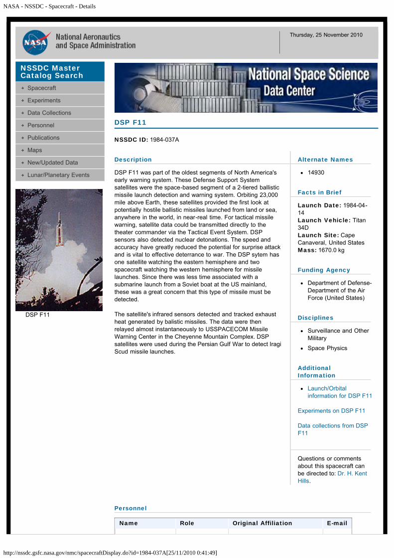
NASA - NSSDC - Spacecraft - Details
http://nssdc.gsfc.nasa.gov/nmc/spacecraftDisplay.do?id=1984-037A[25/11/2010 0:41:49]
Thursday, 25 November 2010
Description
DSP F11 was part of the oldest segments of North America'searly warning system. These Defense Support Systemsatellites were the space-based segment of a 2-tiered ballisticmissile launch detection and warning system. Orbiting 23,000mile above Earth, these satellites provided the first look atpotentially hostile ballistic missiles launched from land or sea,anywhere in the world, in near-real time. For tactical missilewarning, satellite data could be transmitted directly to thetheater commander via the Tactical Event System. DSPsensors also detected nuclear detonations. The speed andaccuracy have greatly reduced the potential for surprise attackand is vital to effective deterrance to war. The DSP sytem hasone satellite watching the eastern hemisphere and twospacecraft watching the western hemisphere for missilelaunches. Since there was less time associated with asubmarine launch from a Soviet boat at the US mainland,these was a great concern that this type of missile must bedetected.
The satellite's infrared sensors detected and tracked exhaustheat generated by balistic missiles. The data were thenrelayed almost instantaneously to USSPACECOM MissileWarning Center in the Cheyenne Mountain Complex. DSPsatellites were used during the Persian Gulf War to detect IragiScud missile launches.
DSP F11
NSSDC ID: 1984-037A
Alternate Names
14930
Facts in Brief
Launch Date: 1984-04-14Launch Vehicle: Titan34DLaunch Site: CapeCanaveral, United StatesMass: 1670.0 kg
Funding Agency
Department of Defense-Department of the AirForce (United States)
Disciplines
Surveillance and OtherMilitary
Space Physics
AdditionalInformation
Launch/Orbitalinformation for DSP F11
Experiments on DSP F11
Data collections from DSPF11
Questions or commentsabout this spacecraft canbe directed to: Dr. H. KentHills.
Personnel
Name Role Original Affiliation E-mail
NSSDC MasterCatalog Search
Spacecraft
Experiments
Data Collections
Personnel
Publications
Maps
New/Updated Data
Lunar/Planetary Events
DSP F11

NASA - NSSDC - Spacecraft - Details
http://nssdc.gsfc.nasa.gov/nmc/spacecraftDisplay.do?id=1984-037A[25/11/2010 0:41:49]
Dr. W. Doyle Evans Project Scientist Los Alamos National Laboratory
Project Manager US Air Force Space Division
Image courtesy of the USAF Defense Support Program.
+ Privacy Policy and Important Notices NASA Official: Dr. Ed GrayzeckCurator: E. Bell, IIVersion 4.0.14, 08 October 2010
NASA - NSSDC - Spacecraft - Details
http://nssdc.gsfc.nasa.gov/nmc/spacecraftDisplay.do?id=1984-028A[25/11/2010 0:42:22]
Thursday, 25 November 2010
Description
Ekran 12 was a Soviet communications satellite launched fromthe Baikonur Cosmodrome aboard a Proton 8K82K/Block DMrocket. It transmitted color and black-and-white USSR centraltelevision programs to the network of public receiving unitslocated in population centers in Siberia and the Far North. Thesingle-unit body was equipped with solar panels, and activeliquid-gas phase-change thermoregulation system, and acorrective engine unit for making orbital adjustments. Twenty-five square metres of solar panels provided 1280 W of power.
Ekran 12
NSSDC ID: 1984-028A
Alternate Names
14821
Facts in Brief
Launch Date: 1984-03-16LaunchVehicle: Proton-KLaunch Site: Tyuratam(Baikonur Cosmodrome),U.S.S.RMass: 1970.0 kg
Funding Agency
Unknown (U.S.S.R)
Discipline
Communications
AdditionalInformation
Launch/Orbitalinformation for Ekran 12
Experiments on Ekran 12
Data collections fromEkran 12
Questions or commentsabout this spacecraft canbe directed to: CoordinatedRequest and User SupportOffice.
NSSDC MasterCatalog Search
Spacecraft
Experiments
Data Collections
Personnel
Publications
Maps
New/Updated Data
Lunar/Planetary Events
+ Privacy Policy and Important Notices NASA Official: Dr. Ed GrayzeckCurator: E. Bell, IIVersion 4.0.14, 08 October 2010
NASA - NSSDC - Spacecraft - Details
http://nssdc.gsfc.nasa.gov/nmc/spacecraftDisplay.do?id=1984-090A[25/11/2010 0:42:52]
Thursday, 25 November 2010
Description
Ekran 13 was a Soviet communications satellite launched fromthe Baikonur Cosmodrome aboard a Proton 8K82K/Block DMrocket. It transmitted color and black-and-white USSR centraltelevision programs to the network of public receiving unitslocated in population centers in Siberia and the Far North. Thesingle-unit body was equipped with solar panels, and activeliquid-gas phase-change thermoregulation system, and acorrective engine unit for making orbital adjustments. Twenty-five square metres of solar panels provided 1280 W of power.
Ekran 13
NSSDC ID: 1984-090A
Alternate Names
15219
Facts in Brief
Launch Date: 1984-08-24Launch Vehicle: ProtonBooster Plus Upper Stageand Escape StagesLaunch Site: Tyuratam(Baikonur Cosmodrome),U.S.S.RMass: 1970.0 kg
Funding Agency
Unknown (U.S.S.R)
Discipline
Communications
AdditionalInformation
Launch/Orbitalinformation for Ekran 13
Experiments on Ekran 13
Data collections fromEkran 13
Questions or commentsabout this spacecraft canbe directed to: CoordinatedRequest and User SupportOffice.
NSSDC MasterCatalog Search
Spacecraft
Experiments
Data Collections
Personnel
Publications
Maps
New/Updated Data
Lunar/Planetary Events
+ Privacy Policy and Important Notices NASA Official: Dr. Ed GrayzeckCurator: E. Bell, IIVersion 4.0.14, 08 October 2010

NASA - NSSDC - Spacecraft - Details
http://nssdc.gsfc.nasa.gov/nmc/spacecraftDisplay.do?id=1984-108B[25/11/2010 0:43:20]
Thursday, 25 November 2010
Description
The Earth Radiation Budget Satellite (ERBS) was designed tobe a 2-year mission to gather required radiation budget data,aerosol data, and ozone data to assess climate change andozone depletion. The two experiments conducted were theEarth Radiation Budget Experiment (ERBE) and theStratospheric Aerosol and Gas Experiment II (SAGE II). TheERBS spacecraft structure was composed of three basicmodules: the keel module, the base module, and theinstrument module. The keel module was a torque-boxstructure providing structural support for the propulsion system,the solar array panels, and the antennas. The base modulewas a torque-box structure that provided a direct interface tothe Shuttle. The ERBE-nonscanning instrument andelectronics was attached to the base module. The instrumentmodule was mounted directly to the base module and housedthe ERBE-scanner and the SAGE II instrument. Other ERBSsubsystems included the Thermal Control Subsystem (TCS) forregulating heat dissipitation; the Electrical Power Subsystem(EPS) which consisted of two 50-amp-hour, 22-cell nickelcadmium batteries; the Power Unit (PCU) for regulatingelectrical power; the Command and Data Handling Subsystem(C&DH) for collection of instrument and spacecraft data forreal-time transmission; the Communications Subsystem (CS),which included NASA TDRSS transponders and antennas; theAttitude Control and Determination Subsystem (AC&DS), athree-axis, momentum system for attitude pointing,maneuvers, and thruster control; and the Orbit AdjustPropulsion System (OAPS), a nonpropellent hydrazinepropulsion system used for raising the ERBS to its operatingorbit after launch from the Shuttle. The ERBS was heldprimarily in the Earth-pointing mode for most of the mission.
ERBS
NSSDC ID: 1984-108B
Alternate Names
Earth Rad Budget Sat
15354
Facts in Brief
Launch Date: 1984-10-05LaunchVehicle: ShuttleLaunch Site: CapeCanaveral, United StatesMass: 2449.0 kgNominalPower: 470.0 W
Funding Agency
NASA-Office of SpaceScience Applications(United States)
Disciplines
Earth Science
Solar Physics
AdditionalInformation
Launch/Orbitalinformation for ERBS
PDMP information forERBS
Telecommunicationsinformation for ERBS
Experiments on ERBS
Data collections fromERBS
Questions or commentsabout this spacecraft canbe directed to: Coordinated
NSSDC MasterCatalog Search
Spacecraft
Experiments
Data Collections
Personnel
Publications
Maps
New/Updated Data
Lunar/Planetary Events
NASA - NSSDC - Spacecraft - Details
http://nssdc.gsfc.nasa.gov/nmc/spacecraftDisplay.do?id=1984-108B[25/11/2010 0:43:20]
Request and User SupportOffice.
Personnel
Name Role Original Affiliation E-mail
Dr. Michael D.King
ProjectScientist
NASA Goddard SpaceFlight Center
Mr. Dick S.Diller
ProgramManager
NASA Headquarters
Mr. Carl L.Wagner, Jr.
ProjectManager
NASA Goddard SpaceFlight Center
Dr. Robert A.Schiffer
ProgramScientist
NASA Headquarters
Selected References
Earth radiation budget experiment program, NASA-GSFC, NSSDC, Greenbelt, MD, 1984.
+ Privacy Policy and Important Notices NASA Official: Dr. Ed GrayzeckCurator: E. Bell, IIVersion 4.0.14, 08 October 2010
NASA - NSSDC - Spacecraft - Details
http://nssdc.gsfc.nasa.gov/nmc/spacecraftDisplay.do?id=1984-081A[25/11/2010 0:43:49]
Thursday, 25 November 2010
Description
The EUTELSAT I series of satellites was developed by theEuropean Space Agency (ESA) as part of the EuropeanCommunications Satellite (ECS) program. Once launched andchecked out in a geostationary orbit over Europe, each satellitewas handed to EUTELSAT for commercial operations. FourEUTELSAT I satellites were successfully launched between1983-1988. They served both public and private traffic,including telephone services, fax, data, land mobile service,and television and radio programming. Each had a design lifeof 7 years and a bandwidth of 72 MHz.
EUTELSAT 2
NSSDC ID: 1984-081A
Alternate Names
ECS 2
15158
Facts in Brief
Launch Date: 1984-08-04Launch Vehicle: Ariane3Launch Site: Kourou,French GuianaMass: 700.0 kg
Funding Agency
EuropeanTelecommunicationsSatellite Consortium(International)
Discipline
Communications
AdditionalInformation
Launch/Orbitalinformation forEUTELSAT 2
Experiments onEUTELSAT 2
Data collections fromEUTELSAT 2
Questions or commentsabout this spacecraft canbe directed to: CoordinatedRequest and User SupportOffice.
NSSDC MasterCatalog Search
Spacecraft
Experiments
Data Collections
Personnel
Publications
Maps
New/Updated Data
Lunar/Planetary Events
+ Privacy Policy and Important Notices NASA Official: Dr. Ed GrayzeckCurator: E. Bell, II

NASA - NSSDC - Spacecraft - Details
http://nssdc.gsfc.nasa.gov/nmc/spacecraftDisplay.do?id=1984-101A[25/11/2010 0:44:18]
Thursday, 25 November 2010
Description
Galaxy-C was a Hughes Corporation communications satellitelaunched by NASA with a Delta rocket.
Galaxy-C
NSSDC ID: 1984-101A
Alternate Names
15308
Facts in Brief
Launch Date: 1984-09-21Launch Vehicle: DeltaLaunch Site: CapeCanaveral, United StatesMass: 1218.0 kg
Funding Agency
Pan American Satellite(United States)
Discipline
Communications
AdditionalInformation
Launch/Orbitalinformation for Galaxy-C
Experiments on Galaxy-C
Data collections fromGalaxy-C
Questions or commentsabout this spacecraft canbe directed to: CoordinatedRequest and User SupportOffice.
NSSDC MasterCatalog Search
Spacecraft
Experiments
Data Collections
Personnel
Publications
Maps
New/Updated Data
Lunar/Planetary Events
+ Privacy Policy and Important Notices NASA Official: Dr. Ed GrayzeckCurator: E. Bell, IIVersion 4.0.14, 08 October 2010

NASA - NSSDC - Spacecraft - Details
http://nssdc.gsfc.nasa.gov/nmc/spacecraftDisplay.do?id=1984-080A[25/11/2010 0:44:58]
Thursday, 25 November 2010
Description
The Geostationary Meteorological Satellites (GMS) wereJapan's contribution to the international Global AtmosphericResearch Program (GARP). The spacecraft was roughlycylindrical with a height of 345 cm and a diameter of 216 cm.The cylindrical surface was covered with solar cells whichprovide 263 W. The satellite was spin-stabilized with a despunearth-pointing antenna. The satellite was positioned near 140deg E and was designed to operate for 5 years. This was afollow-on GMS type spacecraft launched and controlled byNASDA of Japan.
GMS 3
NSSDC ID: 1984-080A
Alternate Names
Himawari 3
15152
Facts in Brief
Launch Date: 1984-08-02Launch Vehicle: N-2LaunchSite: Tanegashima, JapanMass: 681.0 kg
Funding Agency
National SpaceDevelopment Agency(NASDA) (Japan)
Disciplines
Earth Science
Space Physics
AdditionalInformation
Launch/Orbitalinformation for GMS 3
Experiments on GMS 3
Data collections from GMS3
Questions or commentsabout this spacecraft canbe directed to: CoordinatedRequest and User SupportOffice.
Personnel
Name Role Original Affiliation E-mail
NSSDC MasterCatalog Search
Spacecraft
Experiments
Data Collections
Personnel
Publications
Maps
New/Updated Data
Lunar/Planetary Events
NASA - NSSDC - Spacecraft - Details
http://nssdc.gsfc.nasa.gov/nmc/spacecraftDisplay.do?id=1984-080A[25/11/2010 0:44:58]
Project Scientist Japanese Meteorological Agency
Dr. Y.Ichikawa
Project Manager National Space Development Agency of Japan
+ Privacy Policy and Important Notices NASA Official: Dr. Ed GrayzeckCurator: E. Bell, IIVersion 4.0.14, 08 October 2010
NASA - NSSDC - Spacecraft - Details
http://nssdc.gsfc.nasa.gov/nmc/spacecraftDisplay.do?id=1984-041A[25/11/2010 0:45:38]
Thursday, 25 November 2010
Description
Gorizont 9 was a Soviet geosynchronous communicationssatellite. It was launched to provide telephone, telegraph andfax communications services, in addition to relaying TV andradio broadcasts. It was stationed at 53 deg E.
The Gorizont spacecraft possessed an initial mass in excess of2.1 metric tons and have demonstrated a lifetime of nearly 10years, although a 5-year service life was more common. The3-axis stabilized satellite was approximately 2 m in diameterand 5 m long with two large solar arrays capable of generating1.3 kW of electrical power for the first 3 years. Seven separatetransmission antennas allowed a variety of reception patternsfor both broad and localized terrestrial regions.
A typical Gorizont communications payload included sixgeneral purpose (TV, audio, facsimile) 6/4 GHz transponders(five 12.5 W and one 60 W), one Luch 14/11 GHz transponder(15 W), and one Volna 1.6/1.5 GHz transponder (20 W). TheVolna transponders were INMARSAT-compatible and wereextensively used by the Russian merchant marine fleet via theprimary GEO television rebroadcasting system, supporting allfive Federation time zones: Zone 1 from 140 deg E, Zone 2from 90 deg E, Zone 3 from 80 deg E, Zone 4 from 53 deg E,and Zone 5 from 14 deg W. These transmissions were handledby Orbita (12-m receiving antenna) and Moskva (2.5-mreceiving antenna) ground stations in the 6/4 GHz band. TheMoskva Globalnaya system was inaugurated in 1989 using 4-m receiving antennas and serviced by Gorizonts at 96.5 deg Eand 11 deg W.
Gorizont 9
NSSDC ID: 1984-041A
Alternate Names
14940
Facts in Brief
Launch Date: 1984-04-22LaunchVehicle: Proton-KLaunch Site: Tyuratam(Baikonur Cosmodrome),U.S.S.RMass: 2000.0 kg
Funding Agency
Unknown (U.S.S.R)
Discipline
Communications
AdditionalInformation
Launch/Orbitalinformation for Gorizont 9
Experiments on Gorizont 9
Data collections fromGorizont 9
Questions or commentsabout this spacecraft canbe directed to: CoordinatedRequest and User SupportOffice.
NSSDC MasterCatalog Search
Spacecraft
Experiments
Data Collections
Personnel
Publications
Maps
New/Updated Data
Lunar/Planetary Events
+ Privacy Policy and Important Notices NASA Official: Dr. Ed GrayzeckCurator: E. Bell, IIVersion 4.0.14, 08 October 2010

NASA - NSSDC - Spacecraft - Details
http://nssdc.gsfc.nasa.gov/nmc/spacecraftDisplay.do?id=1984-078A[25/11/2010 0:46:38]
Thursday, 25 November 2010
Description
Gorizont 10 was a Soviet geosynchronous communicationssatellite. It was launched to provide telephone, telegraph andfax communications services, in addition to relaying TV andradio broadcasts. It was stationed at 80 deg E.
The Gorizont spacecraft possessed an initial mass in excess of2.1 metric tons and have demonstrated a lifetime of nearly 10years, although a 5-year service life was more common. The3-axis stabilized satellite was approximately 2 m in diameterand 5 m long with two large solar arrays capable of generating1.3 kW of electrical power for the first 3 years. Seven separatetransmission antennas allowed a variety of reception patternsfor both broad and localized terrestrial regions.
A typical Gorizont communications payload included sixgeneral purpose (TV, audio, facsimile) 6/4 GHz transponders(five 12.5 W and one 60 W), one Luch 14/11 GHz transponder(15 W), and one Volna 1.6/1.5 GHz transponder (20 W). TheVolna transponders were INMARSAT-compatible and wereextensively used by the Russian merchant marine fleet via theprimary GEO television rebroadcasting system, supporting allfive Federation time zones: Zone 1 from 140 deg E, Zone 2from 90 deg E, Zone 3 from 80 deg E, Zone 4 from 53 deg E,and Zone 5 from 14 deg W. These transmissions were handledby Orbita (12-m receiving antenna) and Moskva (2.5-mreceiving antenna) ground stations in the 6/4 GHz band. TheMoskva Globalnaya system was inaugurated in 1989 using 4-m receiving antennas and serviced by Gorizonts at 96.5 deg Eand 11 deg W.
Gorizont 10
NSSDC ID: 1984-078A
Alternate Names
15144
Facts in Brief
Launch Date: 1984-08-02LaunchVehicle: Proton-KLaunch Site: Tyuratam(Baikonur Cosmodrome),U.S.S.RMass: 2000.0 kg
Funding Agency
Unknown (U.S.S.R)
Discipline
Communications
AdditionalInformation
Launch/Orbitalinformation for Gorizont10
Experiments on Gorizont10
Data collections fromGorizont 10
Questions or commentsabout this spacecraft canbe directed to: CoordinatedRequest and User SupportOffice.
NSSDC MasterCatalog Search
Spacecraft
Experiments
Data Collections
Personnel
Publications
Maps
New/Updated Data
Lunar/Planetary Events
+ Privacy Policy and Important Notices NASA Official: Dr. Ed GrayzeckCurator: E. Bell, IIVersion 4.0.14, 08 October 2010
NASA - NSSDC - Spacecraft - Details
http://nssdc.gsfc.nasa.gov/nmc/spacecraftDisplay.do?id=1984-023A[25/11/2010 0:47:29]
Thursday, 25 November 2010
Description
INTELSAT 5 F-8
NSSDC ID: 1984-023A
Alternate Names
14786
Facts in Brief
Launch Date: 1984-03-05Launch Vehicle: ArianeLaunch Site: Kourou,French GuianaMass: 1928.0 kg
Funding Agency
InternationalTelecommunicationsSatellite Corporation(International)
Discipline
Communications
AdditionalInformation
Launch/Orbitalinformation for INTELSAT5 F-8
Experiments on INTELSAT5 F-8
Data collections fromINTELSAT 5 F-8
Questions or commentsabout this spacecraft canbe directed to: CoordinatedRequest and User SupportOffice.
NSSDC MasterCatalog Search
Spacecraft
Experiments
Data Collections
Personnel
Publications
Maps
New/Updated Data
Lunar/Planetary Events
+ Privacy Policy and Important Notices NASA Official: Dr. Ed GrayzeckCurator: E. Bell, IIVersion 4.0.14, 08 October 2010

NASA - NSSDC - Spacecraft - Details
http://nssdc.gsfc.nasa.gov/nmc/spacecraftDisplay.do?id=1984-057A[25/11/2010 0:48:01]
Thursday, 25 November 2010
Description
Intelsat 5G F-9 was a COMSAT Corporation commercialcommunications satellite. It was part of an advanced series ofspacecraft used to provide increased telecommunicationscapacity for Intelsat's global network. It carried a MaritimeCommunications Services (MCS) package for INMARSAT,however, the launch vehicle failed to place the satellite into auseful orbit.
INTELSAT 5 F-9
NSSDC ID: 1984-057A
Alternate Names
15034
Facts in Brief
Launch Date: 1984-06-09Launch Vehicle: AtlasLaunch Site: CapeCanaveral, United StatesMass: 1091.0 kg
Funding Agency
InternationalTelecommunicationsSatellite Corporation(United States)
Discipline
Communications
AdditionalInformation
Launch/Orbitalinformation for INTELSAT5 F-9
Experiments on INTELSAT5 F-9
Data collections fromINTELSAT 5 F-9
Questions or commentsabout this spacecraft canbe directed to: CoordinatedRequest and User SupportOffice.
NSSDC MasterCatalog Search
Spacecraft
Experiments
Data Collections
Personnel
Publications
Maps
New/Updated Data
Lunar/Planetary Events
+ Privacy Policy and Important Notices NASA Official: Dr. Ed GrayzeckCurator: E. Bell, IIVersion 4.0.14, 08 October 2010
NASA - NSSDC - Spacecraft - Details
http://nssdc.gsfc.nasa.gov/nmc/spacecraftDisplay.do?id=1984-011C[25/11/2010 0:48:22]
Thursday, 25 November 2010
Description
This was designed as an inflatable rendezvous target, to beejected in a canister from STS 41B, then inflated with nitrogen.However, the mechanism to open the canister was notactivated, because the lanyards pulled loose from the orbiterinstead of pulling out of the canister. The nitrogen inflationcartridge did fire as scheduled, and the balloon burst as itbegan to inflate inside its canister. The remaining pieces of theballoon provided enough of a target for three rendezvousinstruments to provide data important in verifying theircapabilities.
IRT
NSSDC ID: 1984-011C
Alternate Names
14689
Facts in Brief
Launch Date: 1984-02-03LaunchVehicle: ShuttleLaunch Site: CapeCanaveral, United StatesMass: 91.0 kg
Funding Agency
Unknown (United States)
Discipline
Engineering
AdditionalInformation
Launch/Orbitalinformation for IRT
Experiments on IRT
Data collections from IRT
Questions or commentsabout this spacecraft canbe directed to: CoordinatedRequest and User SupportOffice.
NSSDC MasterCatalog Search
Spacecraft
Experiments
Data Collections
Personnel
Publications
Maps
New/Updated Data
Lunar/Planetary Events
+ Privacy Policy and Important Notices NASA Official: Dr. Ed GrayzeckCurator: E. Bell, IIVersion 4.0.14, 08 October 2010

NASA - NSSDC - Spacecraft - Details
http://nssdc.gsfc.nasa.gov/nmc/spacecraftDisplay.do?id=1984-012C[25/11/2010 0:48:47]
Thursday, 25 November 2010
Description
This US Navy Ocean Surveillance Satellite (NOSS) waslaunched from Vandenberg AFB aboard an Atlas E/F rocket. Itplaced a cluster of one primary satellite and three smaller sub-satellites (that trailed along at distances of several hundredkilometers) into low polar orbit. This satellite array determinedthe location of radio and radars transmitters, usingtriangulation, and the identity of naval units, by analysis of theoperating frequencies and transmission patterns.
In external appearance, the sub-satellites were reminiscent ofthe Navy's Transit navigational satellites. The had gravitygradient orientation booms 10-15 meters long. These ensuredthat the side of the satellite body where the signal antennaswere mounted was constantly oriented toward the Earth. Thesatellites maintained an assigned position in a group atdistances of 30 to 240 km one from the other by using on-board low-thrust engines. As a result of ground processing ofdirection-finding data on the signals from target emittersprovided by a group of satellites, and also sequentially byseveral groups of satellites, the coordinates, direction andspeed of travel were obtained.
JD1
NSSDC ID: 1984-012C
Alternate Names
14728
Facts in Brief
Launch Date: 1984-02-05Launch Vehicle: AtlasLaunchSite: Vandenberg AFB,United States
Funding Agency
Department of Defense-Department of the Navy(United States)
Discipline
Surveillance and OtherMilitary
AdditionalInformation
Launch/Orbitalinformation for JD1
Experiments on JD1
Data collections from JD1
Questions or commentsabout this spacecraft canbe directed to: CoordinatedRequest and User SupportOffice.
NSSDC MasterCatalog Search
Spacecraft
Experiments
Data Collections
Personnel
Publications
Maps
New/Updated Data
Lunar/Planetary Events
+ Privacy Policy and Important Notices NASA Official: Dr. Ed GrayzeckCurator: E. Bell, IIVersion 4.0.14, 08 October 2010

NASA - NSSDC - Spacecraft - Details
http://nssdc.gsfc.nasa.gov/nmc/spacecraftDisplay.do?id=1984-012D[25/11/2010 0:49:13]
Thursday, 25 November 2010
Description
This US Navy Ocean Surveillance Satellite (NOSS) waslaunched from Vandenberg AFB aboard an Atlas E/F rocket. Itplaced a cluster of one primary satellite and three smaller sub-satellites (that trailed along at distances of several hundredkilometers) into low polar orbit. This satellite array determinedthe location of radio and radars transmitters, usingtriangulation, and the identity of naval units, by analysis of theoperating frequencies and transmission patterns.
In external appearance, the sub-satellites were reminiscent ofthe Navy's Transit navigational satellites. The had gravitygradient orientation booms 10-15 meters long. These ensuredthat the side of the satellite body where the signal antennaswere mounted was constantly oriented toward the Earth. Thesatellites maintained an assigned position in a group atdistances of 30 to 240 km one from the other by using on-board low-thrust engines. As a result of ground processing ofdirection-finding data on the signals from target emittersprovided by a group of satellites, and also sequentially byseveral groups of satellites, the coordinates, direction andspeed of travel were obtained.
JD2
NSSDC ID: 1984-012D
Alternate Names
14729
Facts in Brief
Launch Date: 1984-02-05Launch Vehicle: AtlasLaunchSite: Vandenberg AFB,United States
Funding Agency
Department of Defense-Department of the Navy(United States)
Discipline
Surveillance and OtherMilitary
AdditionalInformation
Launch/Orbitalinformation for JD2
Experiments on JD2
Data collections from JD2
Questions or commentsabout this spacecraft canbe directed to: CoordinatedRequest and User SupportOffice.
NSSDC MasterCatalog Search
Spacecraft
Experiments
Data Collections
Personnel
Publications
Maps
New/Updated Data
Lunar/Planetary Events
+ Privacy Policy and Important Notices NASA Official: Dr. Ed GrayzeckCurator: E. Bell, IIVersion 4.0.14, 08 October 2010

NASA - NSSDC - Spacecraft - Details
http://nssdc.gsfc.nasa.gov/nmc/spacecraftDisplay.do?id=1984-012F[25/11/2010 0:49:33]
Thursday, 25 November 2010
Description
This US Navy Ocean Surveillance Satellite (NOSS) waslaunched from Vandenberg AFB aboard an Atlas E/F rocket. Itplaced a cluster of one primary satellite and three smaller sub-satellites (that trailed along at distances of several hundredkilometers) into low polar orbit. This satellite array determinedthe location of radio and radars transmitters, usingtriangulation, and the identity of naval units, by analysis of theoperating frequencies and transmission patterns.
In external appearance, the sub-satellites were reminiscent ofthe Navy's Transit navigational satellites. The had gravitygradient orientation booms 10-15 meters long. These ensuredthat the side of the satellite body where the signal antennaswere mounted was constantly oriented toward the Earth. Thesatellites maintained an assigned position in a group atdistances of 30 to 240 km one from the other by using on-board low-thrust engines. As a result of ground processing ofdirection-finding data on the signals from target emittersprovided by a group of satellites, and also sequentially byseveral groups of satellites, the coordinates, direction andspeed of travel were obtained.
JD3
NSSDC ID: 1984-012F
Alternate Names
14795
Facts in Brief
Launch Date: 1984-02-05Launch Vehicle: AtlasLaunchSite: Vandenberg AFB,United States
Funding Agency
Department of Defense-Department of the Navy(United States)
Discipline
Surveillance and OtherMilitary
AdditionalInformation
Launch/Orbitalinformation for JD3
Experiments on JD3
Data collections from JD3
Questions or commentsabout this spacecraft canbe directed to: CoordinatedRequest and User SupportOffice.
NSSDC MasterCatalog Search
Spacecraft
Experiments
Data Collections
Personnel
Publications
Maps
New/Updated Data
Lunar/Planetary Events
+ Privacy Policy and Important Notices NASA Official: Dr. Ed GrayzeckCurator: E. Bell, IIVersion 4.0.14, 08 October 2010

NASA - NSSDC - Spacecraft - Details
http://nssdc.gsfc.nasa.gov/nmc/spacecraftDisplay.do?id=1984-122A[25/11/2010 0:50:02]
Thursday, 25 November 2010
Description
KH 11-6
NSSDC ID: 1984-122A
Alternate Names
USA 6
15423
Facts in Brief
Launch Date: 1984-12-04Launch Vehicle: Titan34DLaunchSite: Vandenberg AFB,United StatesMass: 13000.0 kg
Funding Agency
Department of Defense-Department of the AirForce (United States)
Discipline
Surveillance and OtherMilitary
AdditionalInformation
Launch/Orbitalinformation for KH 11-6
Experiments on KH 11-6
Data collections from KH11-6
Questions or commentsabout this spacecraft canbe directed to: CoordinatedRequest and User SupportOffice.
NSSDC MasterCatalog Search
Spacecraft
Experiments
Data Collections
Personnel
Publications
Maps
New/Updated Data
Lunar/Planetary Events
+ Privacy Policy and Important Notices NASA Official: Dr. Ed GrayzeckCurator: E. Bell, IIVersion 4.0.14, 08 October 2010

NASA - NSSDC - Spacecraft - Details
http://nssdc.gsfc.nasa.gov/nmc/spacecraftDisplay.do?id=1984-039A[25/11/2010 0:50:29]
Thursday, 25 November 2010
Description
This US Air Force photo surveillance satellite was launchedfrom Vandenberg AFB aboard a Titan rocket. It was the last inthe series of KH-8 (KeyHole-8) type spacecraft.
KH 8-54
NSSDC ID: 1984-039A
Alternate Names
14935
Facts in Brief
Launch Date: 1984-04-17Launch Vehicle: TitanIII-BLaunchSite: Vandenberg AFB,United StatesMass: 3000.0 kg
Funding Agency
Department of Defense-Department of the AirForce (United States)
Discipline
Surveillance and OtherMilitary
AdditionalInformation
Launch/Orbitalinformation for KH 8-54
Experiments on KH 8-54
Data collections from KH 8-54
Questions or commentsabout this spacecraft canbe directed to: CoordinatedRequest and User SupportOffice.
NSSDC MasterCatalog Search
Spacecraft
Experiments
Data Collections
Personnel
Publications
Maps
New/Updated Data
Lunar/Planetary Events
+ Privacy Policy and Important Notices NASA Official: Dr. Ed GrayzeckCurator: E. Bell, IIVersion 4.0.14, 08 October 2010

NASA - NSSDC - Spacecraft - Details
http://nssdc.gsfc.nasa.gov/nmc/spacecraftDisplay.do?id=1984-021A[25/11/2010 0:50:55]
Thursday, 25 November 2010
Description
The Landsat 5 system was an experimental earth resourcesmonitoring system with the new powerful remote-sensingcapabilities of the thematic mapper (TM), and it provides atransition for both foreign and domestic users from themultispectral scanner (MSS) data (which are also part of theinstrument package) to the higher resolution and data rate ofthe TM. It had a complete end-to-end highly automated datasystem, which was designed to be a new generation system,and was a major step forward in global remote-sensingapplications. The Landsat 5 mission consisted of an orbitingsatellite (space segment) with the necessary wideband datalinks and support systems, and a ground segment. TheLandsat 5 was an identical back-up for Landsat 4 (NSSDC ID82-072A). The Landsat 5 space segment consisted of twomajor systems: (1) the instrument module, containing theinstruments together with the mission unique subsystems,such as the solar array and drive, the TDRS antenna, the wide-band module (WBM), and the global positioning system (GPS),and (2) the multimission modular spacecraft (MMS) thatcontained the modularized and standardized power,propulsion, attitude control, and communications and datahandling subsystems. When the Landsat 5 satellite waslaunched, it was deployed at an orbital altitude of 705.3 km,with inclination of 98.2 deg, and with a descending nodeequatorial crossing at 9:30 a.m. local time. This orbit had afrequency of 19-9/16 orbits per day and covers the earth in 16days. The distance between ground tracks was 172 km, which,when used in conjunction with the 185-km TM and MSS swathwidth, provided an overlap of 7.6%. The space segment wasdesigned with 3 years nominal lifetime in orbit and can beextended through in-orbit replacement capability by the SpaceShuttle. The spacecraft and attendant sensors were operatedthrough the Tracking And Data Relay Satellite System(TDRSS).
Landsat 5
NSSDC ID: 1984-021A
Alternate Names
Landsat-D1
14780
Facts in Brief
Launch Date: 1984-03-01Launch Vehicle: DeltaLaunchSite: Vandenberg AFB,United StatesMass: 1407.0 kg
Funding Agencies
NASA-Office of SpaceScience Applications(United States)
NOAA NationalEnvironmental SatelliteService (United States)
Disciplines
Engineering
Earth Science
AdditionalInformation
Launch/Orbitalinformation for Landsat 5
Experiments on Landsat 5
Data collections fromLandsat 5
Questions or commentsabout this spacecraft canbe directed to: CoordinatedRequest and User SupportOffice.
NSSDC MasterCatalog Search
Spacecraft
Experiments
Data Collections
Personnel
Publications
Maps
New/Updated Data
Lunar/Planetary Events

NASA - NSSDC - Spacecraft - Details
http://nssdc.gsfc.nasa.gov/nmc/spacecraftDisplay.do?id=1984-021A[25/11/2010 0:50:55]
Personnel
Name Role Original Affiliation E-mail
Mr. E. Moule Project Manager Earth Observation Satellite
Dr. David Fischel Project Scientist Earth Observation Satellite
+ Privacy Policy and Important Notices NASA Official: Dr. Ed GrayzeckCurator: E. Bell, IIVersion 4.0.14, 08 October 2010

NASA - NSSDC - Spacecraft - Details
http://nssdc.gsfc.nasa.gov/nmc/spacecraftDisplay.do?id=1984-034B[25/11/2010 0:51:37]
Thursday, 25 November 2010
Description
The Long Duration Exposure Facility (LDEF) was developed bythe NASA Office of Aeronautics and Space Technology andthe NASA/Langley Research Center. The purpose of the LDEFwas to accommodate, using the Shuttle, a class of technology,science, and applications experiments that require a free-flyingexposure in space. These experiments benefit from postflightlaboratory studies with the retrieved experiment hardware. TheLDEF was a simple reusable structure approximately 4.3 m indiameter and 9.1 m in length. The experiments were containedin trays mounted to the structure. While the LDEF had nocentral power or data system, it did, however, provide initiationand termination signals at the start and end of the mission.Any required power and/or data systems were included by theexperimenter in his respective tray. Standard ExperimentPower and Data Systems were designed for use in LDEF traysand these could be procured by the experimenters. The LDEFhad a gravity-gradient stabilized orbit orientation. In January1990, during the flight of STS-32, (1990-002A), the LDEF wasretrieved and returned to Earth. It is being examined byinvestigation groups composed of specialists in meteoroidsand space debris, materials, spacecraft systems, andradiation. Following the examinations, it is planned to removethe experiment trays from the LDEF structure and to distributethem to the investigators for data analysis.
LDEF 1
NSSDC ID: 1984-034B
Alternate Names
Long Duration ExposureFacility
LDEF-A
LDEF 1/STS 41C
LDEF
14898
Facts in Brief
Launch Date: 1984-04-06LaunchVehicle: ShuttleLaunch Site: CapeCanaveral, United StatesMass: 9710.0 kg
Funding Agency
NASA-Office of SpaceScience Applications(United States)
Disciplines
Life Science
Space Physics
AdditionalInformation
Launch/Orbitalinformation for LDEF 1
Experiments on LDEF 1
Data collections from LDEF1
Questions or commentsabout this spacecraft canbe directed to: CoordinatedRequest and User SupportOffice.
NSSDC MasterCatalog Search
Spacecraft
Experiments
Data Collections
Personnel
Publications
Maps
New/Updated Data
Lunar/Planetary Events
LDEF 1

NASA - NSSDC - Spacecraft - Details
http://nssdc.gsfc.nasa.gov/nmc/spacecraftDisplay.do?id=1984-034B[25/11/2010 0:51:37]
Personnel
Name Role Original Affiliation E-mail
Dr. Leo P. Daspit,Jr.
ProjectManager
NASA Langley ResearchCenter
Dr. William H.Kinard
ProjectScientist
NASA Langley ResearchCenter
Dr. Richard A.Gualdoni
ProgramManager
NASA Headquarters
Related Information/Data at NSSDC
STS 41C (LDEF Deployment Mission)STS 32 (LDEF Retrieval Mission)
Other Sources of LDEF Information/Data
Long Duration Exposure Facility Archive System (NASA LaRC)
+ Privacy Policy and Important Notices NASA Official: Dr. Ed GrayzeckCurator: E. Bell, IIVersion 4.0.14, 08 October 2010
NASA - NSSDC - Spacecraft - Details
http://nssdc.gsfc.nasa.gov/nmc/spacecraftDisplay.do?id=1984-093C[25/11/2010 0:52:18]
Thursday, 25 November 2010
Description
Leasat F1 was part of a series of five satellites developed as acommercial venture to provide dedicated communicationsservices to the US military. The program was initiated as aresult of Congressional reviews in 1976 and 1997 whichadvised increased use of leased commercial facilities. Ownedby Hughes Communications, the satellites were designed toprovide global UHF communications to military air, sea, andground forces. The system's primary user was the US Navy,with some support also provided to the Air Force and groundmobile forces. At the end of each satellite's designed 7 yearlife, the Navy had the option of purchasing the satellite for$15M. These satellites, along with the Navy's FLTSATCOMspacecraft, were replaced by the UFO (UHF Follow-On)spacecraft. Launched from the Space Shuttle, Leasat wasplaced in a circular parking orbit at approximately 180 miles(296 km) altitude with 28.6 degrees inclination.
The satellites were spin-stabilized, with the spun portioncontaining the solar array and sun and Earth sensors forattitude determination and Earth pointing reference, batteriesfor eclipse operation, and all propulsion and attitude controlhardware. The despun platform contained Earth-pointingreference, batteries for eclipse operation, and all propulsionand attitude control hardward. The despun platform containedEarth-pointing communcation antennas, communicationsrepeaters, and the majority of the telemetry, tracking, andcommand (TT&C) equipment.
Two large helical UHF antennas provided receive and transmitcapability in the UHF band (240 to 400 MHz). Telemetry,command, and the Fleet Broadcast uplink and beacon were inthe "exclusive" portions of the SHF band (7250 to 7500 MHz,and 7975 and 8025 MHz). Twelve UHF repeaters provided themain communications capability.
The principal Navy Fleet Broadcast function included an SHFuplink, and both SHF and UHF downlinks. The additionalantennas for this channel were the SHF uplink and downlinkearth coverage horns, which supported the uplink andacquisition/timing function, respectively. The UHF downlink forFleet broadcast was multiplexed onto the UHF transmit helix.
National Space Science Data Center Header
Leasat F1
NSSDC ID: 1984-093C
Alternate Names
Leased Satellite F1
Syncom IV-2
15236
Facts in Brief
Launch Date: 1984-08-31LaunchVehicle: ShuttleLaunch Site: CapeCanaveral, United StatesMass: 1315.0 kg
Funding Agencies
Department of Defense-Department of the Navy(United States)
Department of Defense-Department of the AirForce (United States)
Discipline
Communications
AdditionalInformation
Launch/Orbitalinformation for Leasat F1
Experiments on Leasat F1
Data collections fromLeasat F1
Questions or commentsabout this spacecraft canbe directed to: CoordinatedRequest and User SupportOffice.
NSSDC MasterCatalog Search
Spacecraft
Experiments
Data Collections
Personnel
Publications
Maps
New/Updated Data
Lunar/Planetary Events

NASA - NSSDC - Spacecraft - Details
http://nssdc.gsfc.nasa.gov/nmc/spacecraftDisplay.do?id=1984-093C[25/11/2010 0:52:18]
+ Privacy Policy and Important Notices NASA Official: Dr. Ed GrayzeckCurator: E. Bell, IIVersion 4.0.14, 08 October 2010

NASA - NSSDC - Spacecraft - Details
http://nssdc.gsfc.nasa.gov/nmc/spacecraftDisplay.do?id=1984-113C[25/11/2010 0:54:07]
Thursday, 25 November 2010
Description
Leasat F2 was part of a series of five satellites developed as acommercial venture to provide dedicated communicationsservices to the US military. The program was initiated as aresult of Congressional reviews in 1976 and 1997 whichadvised increased use of leased commercial facilities. Ownedby Hughes Communications, the satellites were designed toprovide global UHF communications to military air, sea, andground forces. The system's primary user was the US Navy,with some support also provided to the Air Force and groundmobile forces. At the end of each satellite's designed 7 yearlife, the Navy had the option of purchasing the satellite for$15M. These satellites, along with the Navy's FLTSATCOMspacecraft, were replaced by the UFO (UHF Follow-On)spacecraft. Launched from the Space Shuttle, Leasat wasplaced in a circular parking orbit at approximately 180 miles(296 km) altitude with 28.6 degrees inclination.
The satellites were spin-stabilized, with the spun portioncontaining the solar array and sun and Earth sensors forattitude determination and Earth pointing reference, batteriesfor eclipse operation, and all propulsion and attitude controlhardware. The despun platform contained Earth-pointingreference, batteries for eclipse operation, and all propulsionand attitude control hardward. The despun platform containedEarth-pointing communcation antennas, communicationsrepeaters, and the majority of the telemetry, tracking, andcommand (TT&C) equipment.
Two large helical UHF antennas provided receive and transmitcapability in the UHF band (240 to 400 MHz). Telemetry,command, and the Fleet Broadcast uplink and beacon were inthe "exclusive" portions of the SHF band (7250 to 7500 MHz,and 7975 and 8025 MHz). Twelve UHF repeaters provided themain communications capability.
The principal Navy Fleet Broadcast function included an SHFuplink, and both SHF and UHF downlinks. The additionalantennas for this channel were the SHF uplink and downlinkearth coverage horns, which supported the uplink andacquisition/timing function, respectively. The UHF downlink forFleet broadcast was multiplexed onto the UHF transmit helix.
Leasat F2
NSSDC ID: 1984-113C
Alternate Names
Leased Satellite F2
Syncom IV-1
15384
Facts in Brief
Launch Date: 1984-11-10LaunchVehicle: ShuttleLaunch Site: CapeCanaveral, United StatesMass: 1315.0 kg
Funding Agency
Department of Defense-Department of the Navy(United States)
Discipline
Communications
AdditionalInformation
Launch/Orbitalinformation for Leasat F2
Experiments on Leasat F2
Data collections fromLeasat F2
Questions or commentsabout this spacecraft canbe directed to: CoordinatedRequest and User SupportOffice.
NSSDC MasterCatalog Search
Spacecraft
Experiments
Data Collections
Personnel
Publications
Maps
New/Updated Data
Lunar/Planetary Events
+ Privacy Policy and Important Notices NASA Official: Dr. Ed GrayzeckCurator: E. Bell, IIVersion 4.0.14, 08 October 2010

NASA - NSSDC - Spacecraft - Details
http://nssdc.gsfc.nasa.gov/nmc/spacecraftDisplay.do?id=1984-114B[25/11/2010 0:54:56]
Thursday, 25 November 2010
Description
MARECS B2 was a geostationary maritime communicationssatellite launched from the Kourou Space Center in FrenchGuiana aboard an Ariane rocket. It was placed ingeosynchronous orbit at 345 deg E. It was part of theINMARSAT world-wide maritime communications satellitenetwork.
Marecs-B2
NSSDC ID: 1984-114B
Alternate Names
Marecs PAC 1
15386
Facts in Brief
Launch Date: 1984-11-10Launch Vehicle: Ariane3Launch Site: Kourou,French GuianaMass: 563.0 kg
Funding Agency
European Space Agency(International)
Discipline
Communications
AdditionalInformation
Launch/Orbitalinformation for Marecs-B2
Experiments on Marecs-B2
Data collections fromMarecs-B2
Questions or commentsabout this spacecraft canbe directed to: CoordinatedRequest and User SupportOffice.
NSSDC MasterCatalog Search
Spacecraft
Experiments
Data Collections
Personnel
Publications
Maps
New/Updated Data
Lunar/Planetary Events
+ Privacy Policy and Important Notices NASA Official: Dr. Ed GrayzeckCurator: E. Bell, IIVersion 4.0.14, 08 October 2010

NASA - NSSDC - Spacecraft - Details
http://nssdc.gsfc.nasa.gov/nmc/spacecraftDisplay.do?id=1984-072A[25/11/2010 0:56:30]
Thursday, 25 November 2010
Description
Meteor 2 was launched by the USSR. It carried scientific andmeteorological instruments, and service systems.
Meteor 2-11
NSSDC ID: 1984-072A
Alternate Names
15099
Facts in Brief
Launch Date: 1984-07-05Launch Vehicle: F-2Launch Site: Plesetsk,U.S.S.RMass: 2750.0 kg
Funding Agency
Unknown (U.S.S.R)
Discipline
Earth Science
AdditionalInformation
Launch/Orbitalinformation for Meteor 2-11
Experiments on Meteor 2-11
Data collections fromMeteor 2-11
Questions or commentsabout this spacecraft canbe directed to: CoordinatedRequest and User SupportOffice.
NSSDC MasterCatalog Search
Spacecraft
Experiments
Data Collections
Personnel
Publications
Maps
New/Updated Data
Lunar/Planetary Events
+ Privacy Policy and Important Notices NASA Official: Dr. Ed GrayzeckCurator: E. Bell, IIVersion 4.0.14, 08 October 2010
NASA - NSSDC - Spacecraft - Details
http://nssdc.gsfc.nasa.gov/nmc/spacecraftDisplay.do?id=1984-029A[25/11/2010 0:57:27]
Thursday, 25 November 2010
Description
Molniya 1/60 was a first-generation Russian communicationssatellite (COMSAT) orbited to test and perfect a system ofradio communications and television broadcasting using earthsatellites as active transponders and to experiment with thesystem in practical use. The basic function of the satellite wasto relay television programs and long-distance two-waymultichannel telephone, phototelephone, and telegraph linksfrom Moscow to the various standard ground receiving stationsin the 'Orbita' system. The satellite was in the form of ahermetically sealed cylinder with conical ends -- one endcontained the orbital correcting engine and a system ofmicrojets, and the other end contained externally mountedsolar and earth sensors. Inside the cylinder were (1) a high-sensitivity receiver and three 800-MHz 40-w transmitters (oneoperational and two in reserve), (2) telemetering devices thatmonitored equipment operation, (3) chemical batteries thatwere constantly recharged by solar cells, and (4) an electroniccomputer that controlled all equipment on board. Mountedaround the central cylinder were six large solar battery panelsand two directional, high-gain parabolic aerials, 180 deg apart.One of the aerials was directed continually toward the earth bythe highly sensitive earth sensors. The second aerial was heldin reserve. Signals were transmitted in a fairly narrow beamensuring a strong reception at the earth's surface. The satellitereceived telemetry at 1000 MHz. Television service wasprovided in a frequency range of 3.4 to 4.1 GHz at 40 w.Molniya 1/60, whose cylindrical body was 3.4 m long and 1.6 min diameter, was much heavier than corresponding U.S.COMSATs, and it had about 10 times the power output of theEarly Bird COMSAT. In addition, it did not employ ageosynchronous equatorial orbit as have most U.S. COMSATsbecause such an orbit would not provide coverage for areasnorth of 70 deg n latitude. Instead, the satellite was boostedfrom a low-altitude parking orbit into a highly elliptical orbit withtwo high apogees daily over the northern hemisphere -- oneover Russia and one over North America -- and relatively lowperigees over the southern hemisphere. During its apogee,Molniya 1/60 remained relatively stationary with respect to theearth below for nearly 8 of every 12 hr. By placing three ofmore Molniya 1 satellites in this type of orbit, spacing themsuitably, and shifting their orbital planes relative to each otherby 120 deg, a 24-hr/day communication system could beobtained.
Molniya 1-60
NSSDC ID: 1984-029A
Alternate Names
14825
Facts in Brief
Launch Date: 1984-03-16LaunchVehicle: MolniyaLaunch Site: Plesetsk,U.S.S.RMass: 1800.0 kg
Funding Agency
Unknown (U.S.S.R)
Discipline
Communications
AdditionalInformation
Launch/Orbitalinformation for Molniya 1-60
Experiments on Molniya 1-60
Data collections fromMolniya 1-60
Questions or commentsabout this spacecraft canbe directed to: CoordinatedRequest and User SupportOffice.
NSSDC MasterCatalog Search
Spacecraft
Experiments
Data Collections
Personnel
Publications
Maps
New/Updated Data
Lunar/Planetary Events
+ Privacy Policy and Important Notices NASA Official: Dr. Ed GrayzeckCurator: E. Bell, IIVersion 4.0.14, 08 October 2010

NASA - NSSDC - Spacecraft - Details
http://nssdc.gsfc.nasa.gov/nmc/spacecraftDisplay.do?id=1984-085A[25/11/2010 0:57:59]
Thursday, 25 November 2010
Description
Molniya 1/61 was a first-generation Russian communicationssatellite (COMSAT) orbited to test and perfect a system ofradio communications and television broadcasting using earthsatellites as active transponders and to experiment with thesystem in practical use. The basic function of the satellite wasto relay television programs and long-distance two-waymultichannel telephone, phototelephone, and telegraph linksfrom Moscow to the various standard ground receiving stationsin the 'Orbita' system. The satellite was in the form of ahermetically sealed cylinder with conical ends -- one endcontained the orbital correcting engine and a system ofmicrojets, and the other end contained externally mountedsolar and earth sensors. Inside the cylinder were (1) a high-sensitivity receiver and three 800-MHz 40-w transmitters (oneoperational and two in reserve), (2) telemetering devices thatmonitored equipment operation, (3) chemical batteries thatwere constantly recharged by solar cells, and (4) an electroniccomputer that contorlled all equipment on board. Mountedaround the central cylinder were six large solar battery panelsand two directional, high-gain parabolic aerials, 180 deg apart.One of the aerials was directed continually toward the earth bythe highly sensitive earth sensors. The second aerial was heldin reserve. Signals were transmitted in a fairly narrow beamensuring a strong reception at the earth's surface. The satellitereceived telemetry at 1000 MHz. Television service wasprovided in a frequency range of 3.4 to 4.1 GHz at 40 w.Molniya 1/61, whose cylindrical body was 3.4 m long and 1.6 min diameter, was much heavier than corresponding U.S.COMSATS, and it had about 10 times the power output of theEarly Bird COMSAT. In addition, it did not employ ageosynchronous equatorial orbit as have most U.S. COMSATsbecause such an orbit would not provide coverage for areasnorth of 70 deg n latitude. Instead, the satellite was boostedfrom a low-altitude parking orbit into a highly elliptical orbit withtwo high apogees daily over the northern hemisphere -- oneover Russia and one over North America -- and relatively lowperigees over the southern hemisphere. During its apogee,Molniya 1/61 remained relatively staionary with respect to theearth below for nearly 8 of every 12 hr. By placing three ormore Molniya 1 satellites in this type of orbit, spacing themsuitably, and shifting their orbital planes relative to each otherby 120 deg, a 24-hr/day communication system could beobtained.
Molniya 1-61
NSSDC ID: 1984-085A
Alternate Names
15182
Facts in Brief
Launch Date: 1984-08-10LaunchVehicle: Modified SS-6(Sapwood) with 2ndGeneration Upper Stage +Escape StageLaunch Site: Plesetsk,U.S.S.RMass: 1800.0 kg
Funding Agency
Unknown (U.S.S.R)
Discipline
Communications
AdditionalInformation
Launch/Orbitalinformation for Molniya 1-61
Experiments on Molniya 1-61
Data collections fromMolniya 1-61
Questions or commentsabout this spacecraft canbe directed to: CoordinatedRequest and User SupportOffice.
NSSDC MasterCatalog Search
Spacecraft
Experiments
Data Collections
Personnel
Publications
Maps
New/Updated Data
Lunar/Planetary Events
+ Privacy Policy and Important Notices NASA Official: Dr. Ed GrayzeckCurator: E. Bell, IIVersion 4.0.14, 08 October 2010
NASA - NSSDC - Spacecraft - Details
http://nssdc.gsfc.nasa.gov/nmc/spacecraftDisplay.do?id=1984-089A[25/11/2010 0:58:37]
Thursday, 25 November 2010
Description
Molniya 1/62 was a first-generation Russian communicationssatellite (COMSAT) orbited to test and perfect a system ofradio communications and television broadcasting using earthsatellites as active transponders and to experiment with thesystem in practical use. The basic function of the satellite wasto relay television programs and long-distance two-waymultichannel telephone, phototelephone, and telegraph linksfrom Moscow to the various standard ground receiving stationsin the 'Orbita' system. The satellite was in the form of ahermetically sealed cylinder with conical ends -- one endcontained the orbital correcting engine and a system ofmicrojets, and the other end contained externally mountedsolar and earth sensors. Inside the cylinder were (1) a high-sensitivity receiver and three 800-MHz 40-w transmitters (oneoperational and two in reserve), (2) telemetering devices thatmonitored equipment operation, (3) chemical batteries thatwere constantly recharged by solar cells, and (4) an electroniccomputer that controlled all equipment on board. Mountedaround the central cylinder were six large solar battery panelsand two directional, high-gain parabolic aerials, 180 deg apart.One of the aerials was directed continually toward the earth bythe highly sensitive earth sensors. The second aerial was heldin reserve. Signals were transmitted in a fairly narrow beamensuring a strong reception at the earth's surface. The satellitereceived telemetry at 1000 MHz. Television service wasprovided in a frequency range of 3.4 to 4.1 GHz at 40 w.Molniya 1/62, whose cylindrical body was 3.4 m long and 1.6 min diameter, was much heavier than corresponding U.S.COMSATs, and it had about 10 times the power output of theEarly Bird COMSAT. In addition, it did not employ ageosynchronous equatorial orbit as have most U.S. COMSATsbecause such an orbit would not provide coverage for areasnorth of 70 deg n latitude. Instead, the satellite was boostedfrom a low-altitude parking orbit into a highly elliptical orbit withtwo high apogees daily over the northern hemisphere -- oneover Russia and one over North America -- and relatively lowperigees over the southern hemisphere. During its apogee,Molniya 1/62 remained relatively stationary with respect to theearth below for nearly 8 of every 12 hr. By placing three ormore Molniya 1 satellites in this type of orbit, spacing themsuitably, and shifting their orbital planes relative to each otherby 120 deg, a 24-hr/day communication system could beobtained.
Molniya 1-62
NSSDC ID: 1984-089A
Alternate Names
15215
Facts in Brief
Launch Date: 1984-08-24LaunchVehicle: Modified SS-6(Sapwood) with 2ndGeneration Upper Stage +Escape StageLaunch Site: Plesetsk,U.S.S.RMass: 1800.0 kg
Funding Agency
Unknown (U.S.S.R)
Discipline
Communications
AdditionalInformation
Launch/Orbitalinformation for Molniya 1-62
Experiments on Molniya 1-62
Data collections fromMolniya 1-62
Questions or commentsabout this spacecraft canbe directed to: CoordinatedRequest and User SupportOffice.
NSSDC MasterCatalog Search
Spacecraft
Experiments
Data Collections
Personnel
Publications
Maps
New/Updated Data
Lunar/Planetary Events
+ Privacy Policy and Important Notices NASA Official: Dr. Ed GrayzeckCurator: E. Bell, IIVersion 4.0.14, 08 October 2010

NASA - NSSDC - Spacecraft - Details
http://nssdc.gsfc.nasa.gov/nmc/spacecraftDisplay.do?id=1984-124A[25/11/2010 0:59:07]
Thursday, 25 November 2010
Description
Molniya 1/63 was a first-generation Russian communicationssatellite (COMSAT) orbited to test and perfect a system ofradio communications and television broadcasting using earthsatellites as active transponders and to experiment with thesystem in practical use. The basic function of the satellite wasto relay television programs and long-distance two-waymultichannel telephone, phototelephone, and telegraph linksfrom Moscow to the various standard ground receiving stationsin the 'Orbita' system. The satellite was in the form of ahermetically sealed cylinder with conical ends -- one endcontained the orbital correcting engine and a system ofmicrojets, and the other end contained externally mountedsolar and earth sensors. Inside the cylinder were (1) a high-sensitivity receiver and three 800-MHz 40-w transmitters (oneoperational and two in reserve), (2) telemetering devices thatmonitored equipment operation, (3) chemical batteries thatwere constantly recharged by solar cells, and (4) an electroniccomputer that controlled all equipment on board. Mountedaround the central cylinder were six large solar battery panelsand two directional, high-gain parabolic aerials, 180 deg apart.One of the aerials was directed continually toward the earth bythe highly sensitive earth sensors. The second aerial was heldin reserve. Signals were transmitted in a fairly narrow beamensuring a strong reception at the earth's surface. The satellitereceived telemetry at 1000 MHz. Television service wasprovided in a frequency range of 3.4 to 4.1 GHz at 40 w.Molniya 1/63, whose cylindrical body was 3.4 m long and 1.6 min diameter, was much heavier than corresponding U.S.COMSATs, and it had about 10 times the power output of theEarly Bird COMSAT. In addition, it did not employ ageosynchronous equatorial orbit as have most U.S. COMSATsbecause such an orbit would not provide coverage for areasnorth of 70 deg n latitude. Instead, the satellite was boostedfrom a low-altitude parking orbit into a highly elliptical orbit withtwo high apogees daily over the northern hemisphere -- oneover Russia and one over North America -- and relatively lowperigees over the southern hemisphere. During its apogee,Molniya 1/63 remained relatively stationary with respect to theearth below for nearly 8 of every 12 hr. By placing three ormore Molniya 1 satellites in this type of orbit, spacing themsuitably, and shifting their orbital planes relative to each otherby 120 deg, a 24-hr/day communication system could beobtained.
Molniya 1-63
NSSDC ID: 1984-124A
Alternate Names
15429
Facts in Brief
Launch Date: 1984-12-14LaunchVehicle: Modified SS-6(Sapwood) with 2ndGeneration Upper Stage +Escape StageLaunch Site: Plesetsk,U.S.S.RMass: 1800.0 kg
Funding Agency
Unknown (U.S.S.R)
Discipline
Communications
AdditionalInformation
Launch/Orbitalinformation for Molniya 1-63
Experiments on Molniya 1-63
Data collections fromMolniya 1-63
Questions or commentsabout this spacecraft canbe directed to: CoordinatedRequest and User SupportOffice.
NSSDC MasterCatalog Search
Spacecraft
Experiments
Data Collections
Personnel
Publications
Maps
New/Updated Data
Lunar/Planetary Events
+ Privacy Policy and Important Notices NASA Official: Dr. Ed GrayzeckCurator: E. Bell, IIVersion 4.0.14, 08 October 2010

NASA - NSSDC - Spacecraft - Details
http://nssdc.gsfc.nasa.gov/nmc/spacecraftDisplay.do?id=1984-115A[25/11/2010 0:59:59]
Thursday, 25 November 2010
Description
NATO 3-D was the fourth in a series of communicationssatellites launched by NASA for NATO. The NATO SatelliteCommunications System provided immediate communicationslinks between officials of the various NATO nations. As of1998, one NATO 3 and two NATO 4 satellites were still inearth orbit at an altitude of more than 23,000 miles. Thesatellites were ultra-high, super- high and extremely-highfrequency systems capable of providing secure voice and faxservices to hundreds of NATO users simultaneously. Membersof an Air Force Space Command unit provided command andcontrol for the NATO system.
NATO 3-D
NSSDC ID: 1984-115A
Alternate Names
15391
Facts in Brief
Launch Date: 1984-11-14Launch Vehicle: DeltaLaunch Site: CapeCanaveral, United StatesMass: 320.0 kg
Funding Agencies
Department of Defense(United States)
North Atlantic TreatyOrganization(International)
Discipline
Communications
AdditionalInformation
Launch/Orbitalinformation for NATO 3-D
Experiments on NATO 3-D
Data collections fromNATO 3-D
Questions or commentsabout this spacecraft canbe directed to: CoordinatedRequest and User SupportOffice.
NSSDC MasterCatalog Search
Spacecraft
Experiments
Data Collections
Personnel
Publications
Maps
New/Updated Data
Lunar/Planetary Events
+ Privacy Policy and Important Notices NASA Official: Dr. Ed GrayzeckCurator: E. Bell, IIVersion 4.0.14, 08 October 2010

NASA - NSSDC - Spacecraft - Details
http://nssdc.gsfc.nasa.gov/nmc/spacecraftDisplay.do?id=1984-059A[25/11/2010 1:01:27]
Thursday, 25 November 2010
Description
Global Positioning System (GPS) was developed by the USDepartment of Defense to provide all-weather round-the-clocknavigation capabilities for military ground, sea, and air forces.Since its implementation, GPS has also become an integralasset in numerous civilian applications and industries aroundthe globe, including recreational used (e.g., boating, aircraft,hiking), corporate vehicle fleet tracking, and surveying. GPSemploys 24 spacecraft in 20,200 km circular orbits inclined at55 degrees. These vehicles are placed in 6 orbit planes withfour operational satellites in each plane.
The first eleven spacecraft (GPS Block 1) were used todemonstrate the feasibility of the GPS system. They were 3-axis stabilized, nadir pointing using reaction wheels. Dual solararrays supplied over 400 W. They had S-band (SGLS)communications for control and telemetry and UHF cross-linkbetween spacecraft. They were manufactured by RockwellSpace Systems, were 5.3 m across with solar panelsdeployed, and had a design life expectancy of 5 years. Unlikethe later operational satellites, GPS Block 1 spacecraft wereinclined at 63 degrees.
Navstar 9
NSSDC ID: 1984-059A
Alternate Names
GPS 1-9
15039
Facts in Brief
Launch Date: 1984-06-13Launch Vehicle: AtlasELaunchSite: Vandenberg AFB,United StatesMass: 433.0 kgNominalPower: 400.0 W
Funding Agency
Department of Defense-Department of the AirForce (United States)
Discipline
Navigation & GlobalPositioning
AdditionalInformation
Launch/Orbitalinformation for Navstar 9
Experiments on Navstar 9
Data collections fromNavstar 9
Questions or commentsabout this spacecraft canbe directed to: CoordinatedRequest and User SupportOffice.
NSSDC MasterCatalog Search
Spacecraft
Experiments
Data Collections
Personnel
Publications
Maps
New/Updated Data
Lunar/Planetary Events
+ Privacy Policy and Important Notices NASA Official: Dr. Ed Grayzeck
NASA - NSSDC - Spacecraft - Details
http://nssdc.gsfc.nasa.gov/nmc/spacecraftDisplay.do?id=1984-059A[25/11/2010 1:01:27]
Curator: E. Bell, IIVersion 4.0.14, 08 October 2010
NASA - NSSDC - Spacecraft - Details
http://nssdc.gsfc.nasa.gov/nmc/spacecraftDisplay.do?id=1984-097A[25/11/2010 1:02:37]
Thursday, 25 November 2010
Description
Global Positioning System (GPS) was developed by the USDepartment of Defense to provide all-weather round-the-clocknavigation capabilities for military ground, sea, and air forces.Since its implementation, GPS has also become an integralasset in numerous civilian applications and industries aroundthe globe, including recreational used (e.g., boating, aircraft,hiking), corporate vehicle fleet tracking, and surveying. GPSemploys 24 spacecraft in 20,200 km circular orbits inclined at55 degrees. These vehicles are placed in 6 orbit planes withfour operational satellites in each plane.
The first eleven spacecraft (GPS Block 1) were used todemonstrate the feasibility of the GPS system. They were 3-axis stabilized, nadir pointing using reaction wheels. Dual solararrays supplied over 400 W. They had S-band (SGLS)communications for control and telemetry and UHF cross-linkbetween spacecraft. They were manufactured by RockwellSpace Systems, were 5.3 m across with solar panelsdeployed, and had a design life expectancy of 5 years. Unlikethe later operational satellites, GPS Block 1 spacecraft wereinclined at 63 degrees.
Navstar 10
NSSDC ID: 1984-097A
Alternate Names
GPS 1-10
15271
Facts in Brief
Launch Date: 1984-09-08Launch Vehicle: AtlasFLaunchSite: Vandenberg AFB,United StatesMass: 770.0 kgNominalPower: 400.0 W
Funding Agency
Department of Defense-Department of the AirForce (United States)
Discipline
Navigation & GlobalPositioning
AdditionalInformation
Launch/Orbitalinformation for Navstar 10
Experiments on Navstar 10
Data collections fromNavstar 10
Questions or commentsabout this spacecraft canbe directed to: CoordinatedRequest and User SupportOffice.
NSSDC MasterCatalog Search
Spacecraft
Experiments
Data Collections
Personnel
Publications
Maps
New/Updated Data
Lunar/Planetary Events
+ Privacy Policy and Important Notices NASA Official: Dr. Ed Grayzeck

NASA - NSSDC - Spacecraft - Details
http://nssdc.gsfc.nasa.gov/nmc/spacecraftDisplay.do?id=1984-123A[25/11/2010 1:04:19]
Thursday, 25 November 2010
Description
NOAA 9 was a third-generation operational meteorologicalsatellite. The satellite design provided an economical andstable sun-synchronous platform for advanced operationalinstruments to measure the earth's atmosphere, its surface andcloud cover, and the near-space environment. Primary sensorsincluded (1) an advanced very high resolution radiometer(AVHRR), (2) a TIROS operational vertical sounder (TOVS),(3) an earth radiation budget experiment (ERBE), and (4) asolar backscattered ultraviolet radiometer (SBUV/2). Thesecondary experiment was a data collection and platformlocation system (DCPLS). A search and rescue satellite aidedtracking (SARSAT) system was also carried on NOAA 9. Thesatellite was based upon the Block 5D spacecraft busdeveloped for the U.S. Air Force, and was capable ofmaintaining an earth-pointing accuracy of better than plus orminus 0.1 deg with a motion rate of less than 0.035 deg/s.
NOAA 9
NSSDC ID: 1984-123A
Alternate Names
NOAA-F
15427
Facts in Brief
Launch Date: 1984-12-12Launch Vehicle: AtlasELaunchSite: Vandenberg AFB,United StatesMass: 1030.0 kg
Funding Agencies
NOAA NationalEnvironmental SatelliteService (United States)
NASA-Office of SpaceScience Applications(United States)
Disciplines
Communications
Earth Science
AdditionalInformation
Launch/Orbitalinformation for NOAA 9
Experiments on NOAA 9
Data collections fromNOAA 9
Questions or commentsabout this spacecraft canbe directed to: CoordinatedRequest and User SupportOffice.
NSSDC MasterCatalog Search
Spacecraft
Experiments
Data Collections
Personnel
Publications
Maps
New/Updated Data
Lunar/Planetary Events

NASA - NSSDC - Spacecraft - Details
http://nssdc.gsfc.nasa.gov/nmc/spacecraftDisplay.do?id=1984-123A[25/11/2010 1:04:19]
Personnel
Name Role Original Affiliation E-mail
Dr. Joel Susskind ProjectScientist
NASA Goddard SpaceFlight Center
Mr. Gerald W.Longanecker
ProjectManager
NASA Goddard SpaceFlight Center
Mr. James R.Greaves
ProgramManager
NASA Headquarters [email protected]
+ Privacy Policy and Important Notices NASA Official: Dr. Ed GrayzeckCurator: E. Bell, IIVersion 4.0.14, 08 October 2010
NASA - NSSDC - Spacecraft - Details
http://nssdc.gsfc.nasa.gov/nmc/spacecraftDisplay.do?id=1984-012A[25/11/2010 1:06:16]
Thursday, 25 November 2010
Description
This US Navy Ocean Surveillance Satellite (NOSS) waslaunched from Vandenberg AFB aboard an Atlas E/F rocket. Itplaced a cluster of one primary satellite and three smaller sub-satellites (that trailed along at distances of several hundredkilometers) into low polar orbit. This satellite array determinedthe location of radio and radars transmitters, usingtriangulation, and the identity of naval units, by analysis of theoperating frequencies and transmission patterns.
In external appearance, the sub-satellites were reminiscent ofthe Navy's Transit navigational satellites. The had gravitygradient orientation booms 10-15 meters long. These ensuredthat the side of the satellite body where the signal antennaswere mounted was constantly oriented toward the Earth. Thesatellites maintained an assigned position in a group atdistances of 30 to 240 km one from the other by using on-board low-thrust engines. As a result of ground processing ofdirection-finding data on the signals from target emittersprovided by a group of satellites, and also sequentially byseveral groups of satellites, the coordinates, direction andspeed of travel were obtained.
NOSS 6
NSSDC ID: 1984-012A
Alternate Names
Naval Ocean SurveillanceSatellite 6
14690
Facts in Brief
Launch Date: 1984-02-05Launch Vehicle: AtlasLaunchSite: Vandenberg AFB,United States
Funding Agency
Department of Defense-Department of the Navy(United States)
Discipline
Surveillance and OtherMilitary
AdditionalInformation
Launch/Orbitalinformation for NOSS 6
Experiments on NOSS 6
Data collections fromNOSS 6
Questions or commentsabout this spacecraft canbe directed to: CoordinatedRequest and User SupportOffice.
NSSDC MasterCatalog Search
Spacecraft
Experiments
Data Collections
Personnel
Publications
Maps
New/Updated Data
Lunar/Planetary Events
+ Privacy Policy and Important Notices NASA Official: Dr. Ed GrayzeckCurator: E. Bell, IIVersion 4.0.14, 08 October 2010

NASA - NSSDC - Spacecraft - Details
http://nssdc.gsfc.nasa.gov/nmc/spacecraftDisplay.do?id=1984-110A[25/11/2010 1:07:30]
Thursday, 25 November 2010
Description
NOVA III was an improved Transit Navigation Satellitedeployed by NASA for the US Navy.
NOVA III
NSSDC ID: 1984-110A
Alternate Names
NNSS 30500
15362
Facts in Brief
Launch Date: 1984-10-12Launch Vehicle: ScoutLaunchSite: Vandenberg AFB,United StatesMass: 165.0 kg
Funding Agency
Department of Defense-Department of the Navy(United States)
Discipline
Navigation & GlobalPositioning
AdditionalInformation
Launch/Orbitalinformation for NOVA III
Experiments on NOVA III
Data collections fromNOVA III
Questions or commentsabout this spacecraft canbe directed to: CoordinatedRequest and User SupportOffice.
NSSDC MasterCatalog Search
Spacecraft
Experiments
Data Collections
Personnel
Publications
Maps
New/Updated Data
Lunar/Planetary Events
NOVA III
+ Privacy Policy and Important Notices NASA Official: Dr. Ed GrayzeckCurator: E. Bell, IIVersion 4.0.14, 08 October 2010

NASA - NSSDC - Spacecraft - Details
http://nssdc.gsfc.nasa.gov/nmc/spacecraftDisplay.do?id=1984-015A[25/11/2010 1:08:20]
Thursday, 25 November 2010
Description
The purpose of this mission was to perform remote sensing ofthe minor constituents of the middle atmosphere and to studythe wave-particle interactions in the ionospheric plasma in theSouth American anomaly and the auroral zones. This missionis part of the Middle Atmosphere Program (MAP).
Ohzora
NSSDC ID: 1984-015A
Alternate Names
Exospheric Sat. C
EXOS-C
14722
Facts in Brief
Launch Date: 1984-02-14Launch Vehicle: M-3SLaunch Site: UchinouraSpace Center, JapanMass: 210.0 kg
Funding Agency
Institute of Space andAeronautical Science, Uof Tokyo (Japan)
Disciplines
Earth Science
Space Physics
AdditionalInformation
Launch/Orbitalinformation for Ohzora
Experiments on Ohzora
Data collections fromOhzora
Questions or commentsabout this spacecraft canbe directed to: Dr. H. KentHills.
Personnel
Name Role Original Affiliation E-mail
NSSDC MasterCatalog Search
Spacecraft
Experiments
Data Collections
Personnel
Publications
Maps
New/Updated Data
Lunar/Planetary Events
NASA - NSSDC - Spacecraft - Details
http://nssdc.gsfc.nasa.gov/nmc/spacecraftDisplay.do?id=1984-015A[25/11/2010 1:08:20]
Prof. HiroshiOya
ProjectScientist
University of Tohoku [email protected]
Dr. ToshihiroOgawa
ProjectScientist
Institute of Space and AeronauticalScience
Prof. TomizoItoh
ProjectManager
Institute of Space and AeronauticalScience
+ Privacy Policy and Important Notices NASA Official: Dr. Ed GrayzeckCurator: E. Bell, IIVersion 4.0.14, 08 October 2010

NASA - NSSDC - Spacecraft - Details
http://nssdc.gsfc.nasa.gov/nmc/spacecraftDisplay.do?id=1984-011D[25/11/2010 1:08:44]
Thursday, 25 November 2010
Description
Palapa-B2, a communications satellite launched from STS-41Bfor the government of Indonesia, was deployed from theShuttle on orbit 19. It did not achieve the desired orbit.
Palapa-B2
NSSDC ID: 1984-011D
Alternate Names
14692
Facts in Brief
Launch Date: 1984-02-03LaunchVehicle: ShuttleLaunch Site: CapeCanaveral, United StatesMass: 1200.0 kg
Funding Agencies
Unknown (Indonesia)
Unknown (United States)
Discipline
Communications
AdditionalInformation
Launch/Orbitalinformation for Palapa-B2
Experiments on Palapa-B2
Data collections fromPalapa-B2
Questions or commentsabout this spacecraft canbe directed to: CoordinatedRequest and User SupportOffice.
NSSDC MasterCatalog Search
Spacecraft
Experiments
Data Collections
Personnel
Publications
Maps
New/Updated Data
Lunar/Planetary Events
+ Privacy Policy and Important Notices NASA Official: Dr. Ed GrayzeckCurator: E. Bell, IIVersion 4.0.14, 08 October 2010

NASA - NSSDC - Spacecraft - Details
http://nssdc.gsfc.nasa.gov/nmc/spacecraftDisplay.do?id=1984-008A[25/11/2010 1:09:18]
Thursday, 25 November 2010
Description
PRC 14 was a technology satellite launched from the Xichangspace center aboard a CZ-3 rocket. It was an experimentalGEO telecommunications satellite that was left in a lower thanplanned orbit after a 3rd stage failure.
PRC 14
NSSDC ID: 1984-008A
Alternate Names
STTW-T1
14670
Facts in Brief
Launch Date: 1984-01-29Launch Vehicle: LongMarch 3Launch Site: Xichang,Peoples Republic of ChinaMass: 900.0 kg
Funding Agency
Unknown (PeoplesRepublic of China)
Discipline
Communications
AdditionalInformation
Launch/Orbitalinformation for PRC 14
Experiments on PRC 14
Data collections from PRC14
Questions or commentsabout this spacecraft canbe directed to: CoordinatedRequest and User SupportOffice.
NSSDC MasterCatalog Search
Spacecraft
Experiments
Data Collections
Personnel
Publications
Maps
New/Updated Data
Lunar/Planetary Events
+ Privacy Policy and Important Notices NASA Official: Dr. Ed GrayzeckCurator: E. Bell, IIVersion 4.0.14, 08 October 2010

NASA - NSSDC - Spacecraft - Details
http://nssdc.gsfc.nasa.gov/nmc/spacecraftDisplay.do?id=1984-035A[25/11/2010 1:10:05]
Thursday, 25 November 2010
Description
PRC 15 was a Chinese experimental communications satellitelaunched from the Xichang space center aboard a CZ-3 rocket.It was placed in a geosynchronous orbit at 125 deg E.
PRC 15
NSSDC ID: 1984-035A
Alternate Names
STTW-T2
14899
Facts in Brief
Launch Date: 1984-04-08Launch Vehicle: LongMarch 3Launch Site: Xichang,Peoples Republic of ChinaMass: 900.0 kg
Funding Agency
Unknown (PeoplesRepublic of China)
Disciplines
Communications
Engineering
AdditionalInformation
Launch/Orbitalinformation for PRC 15
Experiments on PRC 15
Data collections from PRC15
Questions or commentsabout this spacecraft canbe directed to: CoordinatedRequest and User SupportOffice.
NSSDC MasterCatalog Search
Spacecraft
Experiments
Data Collections
Personnel
Publications
Maps
New/Updated Data
Lunar/Planetary Events
+ Privacy Policy and Important Notices NASA Official: Dr. Ed GrayzeckCurator: E. Bell, IIVersion 4.0.14, 08 October 2010

NASA - NSSDC - Spacecraft - Details
http://nssdc.gsfc.nasa.gov/nmc/spacecraftDisplay.do?id=1984-098A[25/11/2010 1:11:30]
Thursday, 25 November 2010
Description
PRC 16 was a military photo surveillance satellite launched bythe People's Republic of China from the Shaung Cheng Tzulaunch site aboard a CZ-2C rocket.
PRC 16
NSSDC ID: 1984-098A
Alternate Names
FSW-0 6
15279
Facts in Brief
Launch Date: 1984-09-12Launch Vehicle: LongMarch 2CLaunch Site: Jiuquan,Peoples Republic of ChinaMass: 2500.0 kg
Funding Agency
Unknown (PeoplesRepublic of China)
Discipline
Surveillance and OtherMilitary
AdditionalInformation
Launch/Orbitalinformation for PRC 16
Experiments on PRC 16
Data collections from PRC16
Questions or commentsabout this spacecraft canbe directed to: CoordinatedRequest and User SupportOffice.
NSSDC MasterCatalog Search
Spacecraft
Experiments
Data Collections
Personnel
Publications
Maps
New/Updated Data
Lunar/Planetary Events
+ Privacy Policy and Important Notices NASA Official: Dr. Ed GrayzeckCurator: E. Bell, IIVersion 4.0.14, 08 October 2010

NASA - NSSDC - Spacecraft - Details
http://nssdc.gsfc.nasa.gov/nmc/spacecraftDisplay.do?id=1984-038A[29/11/2010 23:02:08]
Tuesday, 30 November 2010
Description
Automatic cargo ship Progress 20 was launched from theBaikonur cosmodrome aboard a Soyuz rocket. It carriedvarious cargos to the Salyut 7 space station. It deorbited onMay 7, 1984.
Progress 20
NSSDC ID: 1984-038A
Alternate Names
14932
Facts in Brief
Launch Date: 1984-04-15Launch Vehicle: SoyuzLaunch Site: Tyuratam(Baikonur Cosmodrome),U.S.S.RMass: 7020.0 kg
Funding Agency
Unknown (U.S.S.R)
Discipline
Resupply/Refurbishment/Repair
AdditionalInformation
Launch/Orbitalinformation for Progress20
Experiments on Progress20
Data collections fromProgress 20
Questions or commentsabout this spacecraft canbe directed to: CoordinatedRequest and User SupportOffice.
NSSDC MasterCatalog Search
Spacecraft
Experiments
Data Collections
Personnel
Publications
Maps
New/Updated Data
Lunar/Planetary Events
+ Privacy Policy and Important Notices NASA Official: Dr. Ed GrayzeckCurator: E. Bell, IIVersion 4.0.14, 08 October 2010

NASA - Home
http://www.nasa.gov/[03/12/2010 23:17:32]
For Public | For Educators | For Students | For Media | For Policymakers | For Employees | MyNASA Send Share
› Log In To MyNASA | › Sign Up
NASA Events: SpaceX Falcon 9 Demonstration Flight for NASA’s Commercial Orbital Transportation Services, Tues., Dec. 7
01 02 03 04 05 06 07 08
Image of the Day nasaimages.org
NASA Images
A Wandering PathOriginally released Aug. 1, 2007, this Mars ReconnaissanceOrbiter image shows an ridge in Mars' Terra Meridiani that ismost likely a former streambed,...
View Image Gallery
Latest NASA Blog Updates
A Lab Aloft (International Space ... 7 hours agoThe Importance of the Recent MAXI X-ray Nova Discovery
Dryden Flight Research Center 1 day agoWorkin' for a Livin'
NES Teachers Corner 1 day agoNASA Now: A-Train: Monitoring the Earth System
View All NASA Blogs
Explore More
NASA Multimedia
> More Videos
VideosExpedition 25 Crew LandsSafely in Kazakhstan
> View TV Schedule
Watch NASA TVSelect a Channel:Public | Education | Media |Station
> More Interactive Features
Interactive FeaturesSend Holiday Greetings to theSpace Station
> More Podcasts & Vodcasts
Podcasts & VodcastsBlacker Than Black
NASA Calendar
01 02 03 0405 06 07 08 09 10 1112 13 14 15 16 17 1819 20 21 22 23 24 2526 27 28 29 30 31
December 2010
View Full NASA Calendar
NASA Leadership
@NASA Twitter Updates
Smoke & heat from huge forest firein Israel captured by NASA's Aquasatellite today. (link)about 9 hours ago
Much more to clouds than meets theeye and that's a problem for someaircraft. Test Your Knowledge (link)about 11 hours ago
NASA managers will continue testing& analysis for space shuttleDiscovery. Launch now no earlierthan Feb. 3 at 1:34 a.m. EST.about 11 hours ago
Get NASA Updates By Email
Powered by Gov Delivery
What are people interested in?
Most Viewed Top Rated Quick Links
Stories Images Videos Interactive
NASA-FundedResearch DiscoversLife Built With ToxicChemical
NASA Aids inCharacterizing Super-Earth Atmosphere
NASA's Fermi
NASA-Funded Research Discovers Life Built With Toxic ChemicalResearchers working in the harsh environment of Mono Lake, Calif. have discovered microorganisms able to thrive andreproduce using arsenic, changing the fundamental knowledge about what comprises all known life on Earth.
› Learn More
NASA - Home
http://www.nasa.gov/[03/12/2010 23:17:32]
› Explore the Kids Club› Students | › Educators › Summer of Innovation
Where Over the World isAstronaut Scott Kelly?Geography Trivia from Space:Tweet to Test Your Global IQ› Learn More
NASA Edge Nominated for'Best Video Podcast' in the6th Annual Podcast Awards› Learn More› Vote Now→
Administrator Charles F. Bolden,Jr.› Bio › Speeches and Testimony› Leadership GalleryDeputy Administrator Lori BethGarver› Bio › Speeches and Testimony› Leadership Gallery
Watch NASA's Next MarsRover Being Built Via Live'Curiosity Cam'› Learn More› Watch Now→
Space Rock!The Space Shuttle Programinvites you to vote on the wakeup song for the last twoscheduled missions.› Vote Now→
Telescope Finds GiantStructure in our Galaxy
Thin Air - Cassini FindsEthereal Atmosphere atRhea
Careers @ NASA
NASA Centers
NASA Directorates and Offices
Page Last Updated: December 3, 2010 Page Editor: Jim Wilson NASA Official: Brian Dunbar
Budgets, Strategic Plans andAccountability ReportsEqual Employment Opportunity DataPosted Pursuant to the No Fear ActInformation-Dissemination Policiesand Inventories
Freedom of Information ActPrivacy Policy & Important NoticesNASA Advisory CouncilInspector General HotlineOffice of the Inspector GeneralNASA Communications Policy
Contact NASASite MapUSA.govExpectMore.govOpen Government at NASAHelp and Preferences

NASA - NSSDC - Master Catalog - Spacecraft Query
http://nssdc.gsfc.nasa.gov/nmc/SpacecraftQuery.jsp[03/12/2010 23:18:59]
Saturday, 04 December 2010
Spacecraft Query
Spacecraft Name
Discipline
AllAstronomyEarth SciencePlanetary ScienceSolar PhysicsSpace PhysicsHuman Crew
Launch Date
(YYYY-MM-DD; MM, DD optional)
NSSDC MasterCatalog Search
Spacecraft
Experiments
Data Collections
Personnel
Publications
Maps
New/Updated Data
Lunar/Planetary Events
+ Privacy Policy and Important Notices NASA Official: Dr. Ed GrayzeckCurator: E. Bell, IIVersion 4.0.14, 08 October 2010

NASA - NSSDC - Master Catalog - Experiment Query
http://nssdc.gsfc.nasa.gov/nmc/ExperimentQuery.jsp[03/12/2010 23:19:53]
Saturday, 04 December 2010
Experiment Query
Experiment Name
Spacecraft Name
Principal Investigator
(last name only)
NSSDC MasterCatalog Search
Spacecraft
Experiments
Data Collections
Personnel
Publications
Maps
New/Updated Data
Lunar/Planetary Events
+ Privacy Policy and Important Notices NASA Official: Dr. Ed GrayzeckCurator: E. Bell, IIVersion 4.0.14, 08 October 2010

NASA - NSSDC - Master Catalog - Data Collection Query
http://nssdc.gsfc.nasa.gov/nmc/DatasetQuery.jsp[03/12/2010 23:20:43]
Saturday, 04 December 2010
Data Collection Query
Data Collection Name
Start Date (YYYY-MM-DD)
Stop Date (YYYY-MM-DD)
Spacecraft Name
Experiment Name
Experiment Principal Investigator
(last name only)
NSSDC MasterCatalog Search
Spacecraft
Experiments
Data Collections
Personnel
Publications
Maps
New/Updated Data
Lunar/Planetary Events
+ Privacy Policy and Important Notices NASA Official: Dr. Ed GrayzeckCurator: E. Bell, IIVersion 4.0.14, 08 October 2010

NASA - NSSDC - Master Catalog - Person Query
http://nssdc.gsfc.nasa.gov/nmc/PersonQuery.jsp[03/12/2010 23:21:26]
Saturday, 04 December 2010
Person Query
Last Name
First Name
NSSDC MasterCatalog Search
Spacecraft
Experiments
Data Collections
Personnel
Publications
Maps
New/Updated Data
Lunar/Planetary Events
+ Privacy Policy and Important Notices NASA Official: Dr. Ed GrayzeckCurator: E. Bell, IIVersion 4.0.14, 08 October 2010

NASA - NSSDC - Master Catalog - Publication Query
http://nssdc.gsfc.nasa.gov/nmc/PublicationQuery.jsp[03/12/2010 23:22:35]
Saturday, 04 December 2010
Publication Query
NSSDC Reference ID
Title
Author (Last, F. M.)
Spacecraft Name
Experiment Name
NSSDC MasterCatalog Search
Spacecraft
Experiments
Data Collections
Personnel
Publications
Maps
New/Updated Data
Lunar/Planetary Events
+ Privacy Policy and Important Notices NASA Official: Dr. Ed GrayzeckCurator: E. Bell, IIVersion 4.0.14, 08 October 2010
NASA - NSSDC - Master Catalog - Maps Query
http://nssdc.gsfc.nasa.gov/nmc/MapQuery.jsp[03/12/2010 23:23:27]
Saturday, 04 December 2010
Lunar and Planetary Maps Query
Use the form below to query NSSDC for maps that are in stock. When specifying latitudevalues, enter sourthern latitudes as a negative number.
Planet Moon
Latitude (degrees)
Longitude (degrees)
NSSDC MasterCatalog Search
Spacecraft
Experiments
Data Collections
Personnel
Publications
Maps
New/Updated Data
Lunar/Planetary Events
+ Privacy Policy and Important Notices NASA Official: Dr. Ed GrayzeckCurator: E. Bell, IIVersion 4.0.14, 08 October 2010

NASA - NSSDC - Master Catalog - New/Updated Data Query
http://nssdc.gsfc.nasa.gov/nmc/NewDataQuery.jsp[03/12/2010 23:24:38]
Saturday, 04 December 2010
New and Updated Data Collection Query
Note: Only the start date needs to be specified. If a stop date is not specified, the querydefaults to using today's date.
Start Date
(YYYY-MM-DD)
Stop Date
(YYYY-MM-DD)
New data sets only?
NSSDC MasterCatalog Search
Spacecraft
Experiments
Data Collections
Personnel
Publications
Maps
New/Updated Data
Lunar/Planetary Events
+ Privacy Policy and Important Notices NASA Official: Dr. Ed GrayzeckCurator: E. Bell, IIVersion 4.0.14, 08 October 2010

NASA - NSSDC - Master Catalog - Event Query
http://nssdc.gsfc.nasa.gov/nmc/EventQuery.jsp[03/12/2010 23:25:28]
Saturday, 04 December 2010
Event Query
This form can be used to query for planetary and lunar exploration events. Please note:Months and days of less than two digits must be entered with a leading zero (i.e., 03 for Marchrather than just 3).
Year- Month- Day - -
Description
NSSDC MasterCatalog Search
Spacecraft
Experiments
Data Collections
Personnel
Publications
Maps
New/Updated Data
Lunar/Planetary Events
+ Privacy Policy and Important Notices NASA Official: Dr. Ed GrayzeckCurator: E. Bell, IIVersion 4.0.14, 08 October 2010
NASA - NSSDC - Spacecraft - Details
http://nssdc.gsfc.nasa.gov/nmc/spacecraftDisplay.do?id=1984-018A[03/12/2010 23:26:05]
Saturday, 04 December 2010
Description
Automatic cargo ship Progress 19 was launched from theBaikonur cosmodrome aboard a Soyuz rocket. It docked withthe Salyut 7 space station and provided various cargos. Itdeorbited on April 1, 1984 at 18:18 GMT.
Progress 19
NSSDC ID: 1984-018A
Alternate Names
14757
Facts in Brief
Launch Date: 1984-02-21Launch Vehicle: SoyuzLaunch Site: Tyuratam(Baikonur Cosmodrome),U.S.S.RMass: 7020.0 kg
Funding Agency
Unknown (U.S.S.R)
Discipline
Resupply/Refurbishment/Repair
AdditionalInformation
Launch/Orbitalinformation for Progress19
Experiments on Progress19
Data collections fromProgress 19
Questions or commentsabout this spacecraft canbe directed to: CoordinatedRequest and User SupportOffice.
NSSDC MasterCatalog Search
Spacecraft
Experiments
Data Collections
Personnel
Publications
Maps
New/Updated Data
Lunar/Planetary Events
+ Privacy Policy and Important Notices NASA Official: Dr. Ed GrayzeckCurator: E. Bell, IIVersion 4.0.14, 08 October 2010

NASA - NSSDC - Spacecraft - Details
http://nssdc.gsfc.nasa.gov/nmc/spacecraftDisplay.do?id=1984-042A[03/12/2010 23:26:32]
Saturday, 04 December 2010
Description
Automatic cargo ship Progress 21 was launched from theBaikonur cosmodrome aboard a Soyuz rocket. It carriedvarious cargos to the Salyut 7 space station and deborbited onMay 26, 1984.
Progress 21
NSSDC ID: 1984-042A
Alternate Names
14961
Facts in Brief
Launch Date: 1984-05-07Launch Vehicle: SoyuzLaunch Site: Tyuratam(Baikonur Cosmodrome),U.S.S.RMass: 7020.0 kg
Funding Agency
Unknown (U.S.S.R)
Discipline
Resupply/Refurbishment/Repair
AdditionalInformation
Launch/Orbitalinformation for Progress21
Experiments on Progress21
Data collections fromProgress 21
Questions or commentsabout this spacecraft canbe directed to: CoordinatedRequest and User SupportOffice.
NSSDC MasterCatalog Search
Spacecraft
Experiments
Data Collections
Personnel
Publications
Maps
New/Updated Data
Lunar/Planetary Events
+ Privacy Policy and Important Notices NASA Official: Dr. Ed GrayzeckCurator: E. Bell, IIVersion 4.0.14, 08 October 2010

NASA - NSSDC - Spacecraft - Details
http://nssdc.gsfc.nasa.gov/nmc/spacecraftDisplay.do?id=1984-051A[03/12/2010 23:26:55]
Saturday, 04 December 2010
Description
Automatic cargo ship Progress 22 was launched from theBaikonur cosmodrome aboard a Soyuz rocket. It docked withthe Salyut 7 space station and deorbited on July 15, 1984.
Progress 22
NSSDC ID: 1984-051A
Alternate Names
14996
Facts in Brief
Launch Date: 1984-05-28Launch Vehicle: SoyuzLaunch Site: Tyuratam(Baikonur Cosmodrome),U.S.S.RMass: 7020.0 kg
Funding Agency
Unknown (U.S.S.R)
Discipline
Resupply/Refurbishment/Repair
AdditionalInformation
Launch/Orbitalinformation for Progress22
Experiments on Progress22
Data collections fromProgress 22
Questions or commentsabout this spacecraft canbe directed to: CoordinatedRequest and User SupportOffice.
NSSDC MasterCatalog Search
Spacecraft
Experiments
Data Collections
Personnel
Publications
Maps
New/Updated Data
Lunar/Planetary Events
+ Privacy Policy and Important Notices NASA Official: Dr. Ed GrayzeckCurator: E. Bell, IIVersion 4.0.14, 08 October 2010
NASA - NSSDC - Spacecraft - Details
http://nssdc.gsfc.nasa.gov/nmc/spacecraftDisplay.do?id=1984-086A[03/12/2010 23:27:30]
Saturday, 04 December 2010
Description
Automatic cargo ship Progress 23 was launched from theBaikonur cosmodrome aboard a Soyuz rocket. It docked withthe Salyut 7 space station and deorbited on August 28, 1984at 1:28 GMT.
Progress 23
NSSDC ID: 1984-086A
Alternate Names
15193
Facts in Brief
Launch Date: 1984-08-14LaunchVehicle: Modified SS-6(Sapwood) with 2ndGeneration (Longer) UpperStageLaunch Site: Tyuratam(Baikonur Cosmodrome),U.S.S.RMass: 7020.0 kg
Funding Agency
Unknown (U.S.S.R)
Discipline
Resupply/Refurbishment/Repair
AdditionalInformation
Launch/Orbitalinformation for Progress23
Experiments on Progress23
Data collections fromProgress 23
Questions or commentsabout this spacecraft canbe directed to: CoordinatedRequest and User SupportOffice.
NSSDC MasterCatalog Search
Spacecraft
Experiments
Data Collections
Personnel
Publications
Maps
New/Updated Data
Lunar/Planetary Events
+ Privacy Policy and Important Notices NASA Official: Dr. Ed GrayzeckCurator: E. Bell, IIVersion 4.0.14, 08 October 2010
NASA - NSSDC - Spacecraft - Details
http://nssdc.gsfc.nasa.gov/nmc/spacecraftDisplay.do?id=1984-016A[03/12/2010 23:27:58]
Saturday, 04 December 2010
Description
Raduga 14 was a Soviet communications satellite launchedfrom the Baikonur cosmodrome aboard a Proton 8K82K/BlockDM rocket. It provided uninterupted round the clock telephoneand telegraph radio communications in the USSR andsimultaneous transmission of color and black and white USSRcentral television programs to stations in the Orbita network.
Raduga 14
NSSDC ID: 1984-016A
Alternate Names
14725
Facts in Brief
Launch Date: 1984-02-15Launch Vehicle: ProtonLaunch Site: Tyuratam(Baikonur Cosmodrome),U.S.S.RMass: 2000.0 kg
Funding Agency
Unknown (U.S.S.R)
Discipline
Communications
AdditionalInformation
Launch/Orbitalinformation for Raduga14
Experiments on Raduga 14
Data collections fromRaduga 14
Questions or commentsabout this spacecraft canbe directed to: CoordinatedRequest and User SupportOffice.
NSSDC MasterCatalog Search
Spacecraft
Experiments
Data Collections
Personnel
Publications
Maps
New/Updated Data
Lunar/Planetary Events
+ Privacy Policy and Important Notices NASA Official: Dr. Ed GrayzeckCurator: E. Bell, IIVersion 4.0.14, 08 October 2010

NASA - NSSDC - Spacecraft - Details
http://nssdc.gsfc.nasa.gov/nmc/spacecraftDisplay.do?id=1984-063A[03/12/2010 23:28:21]
Saturday, 04 December 2010
Description
Raduga 15 was a Soviet communications satellite launchedfrom the Baikonur cosmodrome aboard a Proton 8K82K/BlockDM rocket. It provided uninterrupted round the clock telephoneand telegraph radio communications in the USSR andsimultaneous transmission of color and black and white USSRcentral television programs to stations in the Orbita network.
Raduga 15
NSSDC ID: 1984-063A
Alternate Names
15057
Facts in Brief
Launch Date: 1984-06-22Launch Vehicle: ProtonLaunch Site: Tyuratam(Baikonur Cosmodrome),U.S.S.R
Funding Agency
Unknown (U.S.S.R)
Discipline
Communications
AdditionalInformation
Launch/Orbitalinformation for Raduga15
Experiments on Raduga 15
Data collections fromRaduga 15
Questions or commentsabout this spacecraft canbe directed to: CoordinatedRequest and User SupportOffice.
NSSDC MasterCatalog Search
Spacecraft
Experiments
Data Collections
Personnel
Publications
Maps
New/Updated Data
Lunar/Planetary Events
+ Privacy Policy and Important Notices NASA Official: Dr. Ed GrayzeckCurator: E. Bell, IIVersion 4.0.14, 08 October 2010

NASA - NSSDC - Spacecraft - Details
http://nssdc.gsfc.nasa.gov/nmc/spacecraftDisplay.do?id=1984-093B[03/12/2010 23:28:43]
Saturday, 04 December 2010
Description
SBS 4 was a Satellite Business Systems communicationssatellite deployed by the shuttle Discovery during the STS-41Dmission.
SBS 4
NSSDC ID: 1984-093B
Alternate Names
Satellite BusinessSystems 4
15235
Facts in Brief
Launch Date: 1984-08-30LaunchVehicle: ShuttleLaunch Site: CapeCanaveral, United StatesMass: 1117.0 kg
Funding Agency
Pan American Satellite(United States)
Discipline
Communications
AdditionalInformation
Launch/Orbitalinformation for SBS 4
Experiments on SBS 4
Data collections from SBS4
Questions or commentsabout this spacecraft canbe directed to: CoordinatedRequest and User SupportOffice.
NSSDC MasterCatalog Search
Spacecraft
Experiments
Data Collections
Personnel
Publications
Maps
New/Updated Data
Lunar/Planetary Events
+ Privacy Policy and Important Notices NASA Official: Dr. Ed GrayzeckCurator: E. Bell, IIVersion 4.0.14, 08 October 2010

NASA - NSSDC - Spacecraft - Details
http://nssdc.gsfc.nasa.gov/nmc/spacecraftDisplay.do?id=1984-093B[03/12/2010 23:28:43]

NASA - NSSDC - Spacecraft - Details
http://nssdc.gsfc.nasa.gov/nmc/spacecraftDisplay.do?id=1984-091A[03/12/2010 23:29:11]
Saturday, 04 December 2010
Description
The Satellite Data System (SDS-1) was composed of twooperational satellites that had supported near-real timecommunications between low altitude photographic intelligencesatellites and ground control stations, making it a critical part ofthe US Air Force Satellite Communications (AFSATCOM)System. In particular, SDS-1 served as a communications linkbetween the Air Force Satellite Control Facility at Sunnyvale,CA, and 7 remote tracking stations located at VandenbergAFB, Hawaii, Guam, Nahe Island, Greenland, the UK, andBoston. Furthermore, the SDS-1 enabled almost two-way real-time command, control, and UHF communications in the polarregion for Strategic Air Command (SAC) forces. The Northpolar region was not covered by communications satellites ingeostationary orbit, and therefore the SDS-1 filled the gap. Athird and unacknowledged function was to provide a relay forinformation from the KH-11 photo reconnaisance satellite to aground station, which was probably the Defense SpecialMissile and Astronautics Center at Fort Meade, MD. It flew in63 deg orbits, having high apogees over the North Pole andlow perigees. This gave it a long stay time over the polarregion, enabling it to relay communications to aircraft in thoseareas. Two of the SDS-1 satellites had to be in orbit for thecommunications to be constant. Each had 12 communicationschannels in the UHF band. The main transmitting antenna wasover 10 feet in diameter. The body itself, based on the designof the TACSAT, was cylindrical and about 13 feet long and 10feet in diameter. The outside cylinder, call the solar array, wasmade of a silicon skin and spun for thermal distribution of theheat load. The primary electrical power was provided by solarcharged batteries with a total of 980 watts of power.
SDS F-5A
NSSDC ID: 1984-091A
Alternate Names
USA 4
Satellite Data System F-5A
15226
Facts in Brief
Launch Date: 1984-08-28Launch Vehicle: TitanIII-BLaunchSite: Vandenberg AFB,United StatesMass: 700.0 kg
Funding Agency
Department of Defense-Department of the AirForce (United States)
Discipline
Surveillance and OtherMilitary
AdditionalInformation
Launch/Orbitalinformation for SDS F-5A
Experiments on SDS F-5A
Data collections from SDSF-5A
Questions or commentsabout this spacecraft canbe directed to: CoordinatedRequest and User SupportOffice.
NSSDC MasterCatalog Search
Spacecraft
Experiments
Data Collections
Personnel
Publications
Maps
New/Updated Data
Lunar/Planetary Events

NASA - NSSDC - Spacecraft - Details
http://nssdc.gsfc.nasa.gov/nmc/spacecraftDisplay.do?id=1984-091A[03/12/2010 23:29:11]
+ Privacy Policy and Important Notices NASA Official: Dr. Ed GrayzeckCurator: E. Bell, IIVersion 4.0.14, 08 October 2010

NASA - NSSDC - Spacecraft - Details
http://nssdc.gsfc.nasa.gov/nmc/spacecraftDisplay.do?id=1984-014A[03/12/2010 23:29:34]
Saturday, 04 December 2010
Description
Soyuz T-10B was a manned Soviet mission launched from theBaikonur cosmodrome with cosmonauts Leonid Kizim, OlegAtkov, and Vladimir Solovyov on board. It docked with theSalyut 7 space station and returned the crew of Soyuz T-11 toEarth. It was recovered on April 11, 1984 at 10:50 GMT, 100miles E of Dzehezkazgan.
Soyuz T-10
NSSDC ID: 1984-014A
Alternate Names
14701
Facts in Brief
Launch Date: 1984-02-08Launch Vehicle: SoyuzLaunch Site: Tyuratam(Baikonur Cosmodrome),U.S.S.RMass: 6850.0 kg
Funding Agency
Unknown (U.S.S.R)
Discipline
Human Crew
AdditionalInformation
Launch/Orbitalinformation for Soyuz T-10
Experiments on Soyuz T-10
Data collections fromSoyuz T-10
Questions or commentsabout this spacecraft canbe directed to: CoordinatedRequest and User SupportOffice.
NSSDC MasterCatalog Search
Spacecraft
Experiments
Data Collections
Personnel
Publications
Maps
New/Updated Data
Lunar/Planetary Events
+ Privacy Policy and Important Notices NASA Official: Dr. Ed GrayzeckCurator: E. Bell, IIVersion 4.0.14, 08 October 2010

Soyuz T-10
Launch, orbit and landing data Launch date: 08.02.1984 Launch time: 12:07 UT Launch site: Baikonur Launch pad: 31 Altitude: 226 - 274 km Inclination: 51,6° Landing date: 02.10.1984 Landing time: 10:56 UT Landing site: 46 km E of Arkalyk
Crew
No. Surname Given name Job
1 Kizim Leonid Denisovich Commander
2 Soloviyov Vladimir Alekseyevich Flight Engineer
3 Atkov Oleg Yuriyevich Research Cosmonaut
3 Polyakov Valeri Vladimirovich Research Cosmonaut
Flight Launch from Baikonur; landing with Soyuz T-11-capsule 46 km east of Arkalyk. Docking on Salyut 7; third resident crew of the station; medical experiments; visiting of spacecrafts Soyuz T-11 on 03.04.1984 and Soyuz T-12 on 17.07.1984; five supply-missions with cargo spaceships Progress 19 - 23; Kizim and Soloviyov conducted six EVA's to repair fuel lines and install a solar array on 23.04.1984 (4h 15m), 26.04.1984 (4h 56m), 29.04.1984 (2h 45m), 03.05.1984 (2h 45m), 18.05.1984 (3h 05m), 08.08.1984 (5h 00m); new spaceflight record.
NASA - NSSDC - Spacecraft - Details
http://nssdc.gsfc.nasa.gov/nmc/spacecraftDisplay.do?id=1984-032A[03/12/2010 23:29:54]
Saturday, 04 December 2010
Description
Soyuz T-11 was a manned Soviet mission launched from theBaikonur cosmodrome and carried an international crewconsisting of Y.V. Malyshev (USSR), G.M. Strekalov (USSR)and researcher R. Sharma (India) to the Salyut 7 spacestation. It returned the crew of Soyuz T-10 to Earth and wasrecovered on October 2, 1984 at 10:57 GMT.
Soyuz T-11
NSSDC ID: 1984-032A
Alternate Names
14872
Facts in Brief
Launch Date: 1984-04-03Launch Vehicle: SoyuzLaunch Site: Tyuratam(Baikonur Cosmodrome),U.S.S.RMass: 6850.0 kg
Funding Agency
Unknown (U.S.S.R)
Disciplines
Human Crew
Resupply/Refurbishment/Repair
AdditionalInformation
Launch/Orbitalinformation for Soyuz T-11
Experiments on Soyuz T-11
Data collections fromSoyuz T-11
Questions or commentsabout this spacecraft canbe directed to: CoordinatedRequest and User SupportOffice.
NSSDC MasterCatalog Search
Spacecraft
Experiments
Data Collections
Personnel
Publications
Maps
New/Updated Data
Lunar/Planetary Events
+ Privacy Policy and Important Notices NASA Official: Dr. Ed GrayzeckCurator: E. Bell, IIVersion 4.0.14, 08 October 2010
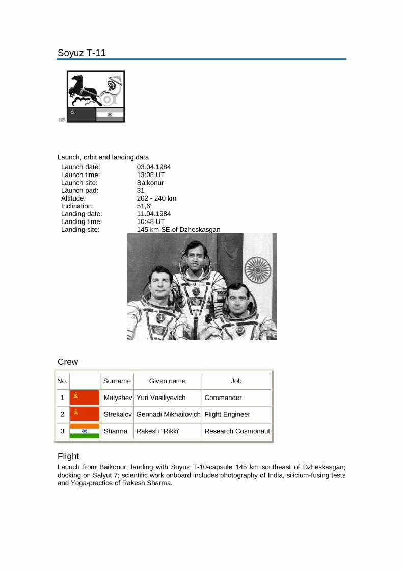
Soyuz T-11
Launch, orbit and landing data Launch date: 03.04.1984 Launch time: 13:08 UT Launch site: Baikonur Launch pad: 31 Altitude: 202 - 240 km Inclination: 51,6° Landing date: 11.04.1984 Landing time: 10:48 UT Landing site: 145 km SE of Dzheskasgan
Crew
No. Surname Given name Job
1 Malyshev Yuri Vasiliyevich Commander
2 Strekalov Gennadi Mikhailovich Flight Engineer
3 Sharma Rakesh "Rikki" Research Cosmonaut
Flight Launch from Baikonur; landing with Soyuz T-10-capsule 145 km southeast of Dzheskasgan; docking on Salyut 7; scientific work onboard includes photography of India, silicium-fusing tests and Yoga-practice of Rakesh Sharma.

NASA - NSSDC - Spacecraft - Details
http://nssdc.gsfc.nasa.gov/nmc/spacecraftDisplay.do?id=1984-073A[03/12/2010 23:30:23]
Saturday, 04 December 2010
Description
Soyuz T-12 was a manned Soviet mission launched from theBaikonur cosmodrome and carried cosmonauts V.A.Dzhanibekov, S.E. Savitsakaya and I.P. Volk to the Salyut 7space station to conduct scientific and technical studies andexperiments. The spacecraft was recovered on July 29, 1984at 12:55 GMT.
Soyuz T-12
NSSDC ID: 1984-073A
Alternate Names
15119
Facts in Brief
Launch Date: 1984-07-17LaunchVehicle: Modified SS-6(Sapwood) with 2ndGeneration (Longer) UpperStageLaunch Site: Tyuratam(Baikonur Cosmodrome),U.S.S.RMass: 7020.0 kg
Funding Agency
Unknown (U.S.S.R)
Discipline
Human Crew
AdditionalInformation
Launch/Orbitalinformation for Soyuz T-12
Experiments on Soyuz T-12
Data collections fromSoyuz T-12
Questions or commentsabout this spacecraft canbe directed to: CoordinatedRequest and User SupportOffice.
NSSDC MasterCatalog Search
Spacecraft
Experiments
Data Collections
Personnel
Publications
Maps
New/Updated Data
Lunar/Planetary Events
+ Privacy Policy and Important Notices NASA Official: Dr. Ed GrayzeckCurator: E. Bell, II

Soyuz T-12
Launch, orbit and landing data Launch date: 17.07.1984 Launch time: 17:40 UT Launch site: Baikonur Launch pad: 31 Altitude: 282 - 309 km Inclination: 51,6° Landing date: 29.07.1984 Landing time: 12:55 UT Landing site: 140 km SE of Dzheskasgan
Crew
No. Surname Given name Job
1 Dzhanibekov Vladimir Aleksandrovich Commander
2 Savitskaya Svetlana Yevgeniyevna Flight Engineer
3 Volk Igor Petrovich Research Cosmonaut
Flight Launch from Baikonur; landing 140 km southeast of Dzheskasgan; docking on Salyut 7; EVA by Dzhanibekov and Savitskaya on 25.07.1984 (3h 35m); first EVA of a woman; welding work.

Photos / Drawings

NASA - NSSDC - Spacecraft - Details
http://nssdc.gsfc.nasa.gov/nmc/spacecraftDisplay.do?id=1984-049A[03/12/2010 23:30:46]
Saturday, 04 December 2010
Description
Spacenet 1
NSSDC ID: 1984-049A
Alternate Names
Spacenet F1
14985
Facts in Brief
Launch Date: 1984-05-23Launch Vehicle: ArianeLaunch Site: Kourou,French GuianaMass: 705.0 kg
Funding Agency
GTE/GTE Spacenet(United States)
Discipline
Communications
AdditionalInformation
Launch/Orbitalinformation for Spacenet1
Experiments on Spacenet1
Data collections fromSpacenet 1
Questions or commentsabout this spacecraft canbe directed to: CoordinatedRequest and User SupportOffice.
NSSDC MasterCatalog Search
Spacecraft
Experiments
Data Collections
Personnel
Publications
Maps
New/Updated Data
Lunar/Planetary Events
+ Privacy Policy and Important Notices NASA Official: Dr. Ed GrayzeckCurator: E. Bell, IIVersion 4.0.14, 08 October 2010
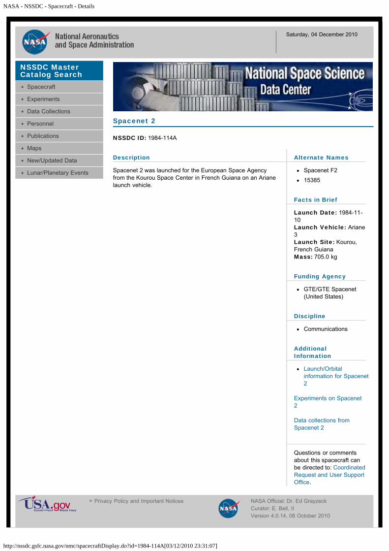
NASA - NSSDC - Spacecraft - Details
http://nssdc.gsfc.nasa.gov/nmc/spacecraftDisplay.do?id=1984-114A[03/12/2010 23:31:07]
Saturday, 04 December 2010
Description
Spacenet 2 was launched for the European Space Agencyfrom the Kourou Space Center in French Guiana on an Arianelaunch vehicle.
Spacenet 2
NSSDC ID: 1984-114A
Alternate Names
Spacenet F2
15385
Facts in Brief
Launch Date: 1984-11-10Launch Vehicle: Ariane3Launch Site: Kourou,French GuianaMass: 705.0 kg
Funding Agency
GTE/GTE Spacenet(United States)
Discipline
Communications
AdditionalInformation
Launch/Orbitalinformation for Spacenet2
Experiments on Spacenet2
Data collections fromSpacenet 2
Questions or commentsabout this spacecraft canbe directed to: CoordinatedRequest and User SupportOffice.
NSSDC MasterCatalog Search
Spacecraft
Experiments
Data Collections
Personnel
Publications
Maps
New/Updated Data
Lunar/Planetary Events
+ Privacy Policy and Important Notices NASA Official: Dr. Ed GrayzeckCurator: E. Bell, IIVersion 4.0.14, 08 October 2010

NASA - NSSDC - Spacecraft - Details
http://nssdc.gsfc.nasa.gov/nmc/spacecraftDisplay.do?id=1984-011A[03/12/2010 23:31:37]
Saturday, 04 December 2010
Description
STS 41-B was the fourth Challenger shuttle flight with VanceBrand, Robert Gibson, Bruce McCandless, Ronald McNair,and Robert Stewart on board. Misson Highlights consisted ofthe first untethered space walks by McCandless and Stewart,using manned maneuvering unit. WESTAR-VI and PALAPA-B2 satellites were deployed, but failure of Payload AssistModule-D (PAM-D) rocket motors left them in radical low-Earthorbits. German-built Shuttle Pallet Satellite (SPAS), first flownon STS-7, became the first satellite refurbished and flownagain. SPAS remained in the payload bay due to electricalproblem with Remote Manipulator System (RMS). The RMSmanipulator foot restraint was first used, and practiceprocedures performed for Solar Maximum satellite retrievaland repair planned for next mission. Integrated RendezvousTarget (IRT) failed due to internal failure. Five Get AwaySpecial canisters were flown in the cargo bay and a Cinema-360 camera was used by the crew. Other payloadsconsisted of: Acoustic Containerless Experiment System (ACES);Monodisperse Latex Reactor (MLR); and Radiation MonitoringEquipment (RME), and Isoelectric Focusing (IEF) payload. Themission duration was 191 hours 15 minutes 55 seconds.
STS 41B
NSSDC ID: 1984-011A
Alternate Names
STS 10
14681
Facts in Brief
Launch Date: 1984-02-03LaunchVehicle: ShuttleLaunch Site: CapeCanaveral, United StatesMass: 15342.0 kg
Funding Agency
NASA-Office of SpaceFlight (United States)
Discipline
Human Crew
AdditionalInformation
Launch/Orbitalinformation for STS 41B
Experiments on STS 41B
Data collections from STS41B
Questions or commentsabout this spacecraft canbe directed to: CoordinatedRequest and User SupportOffice.
Other Sources of STS 41B Information/Data
STS 41B information (NASA KSC)STS 41B Press Release images (NASA JSC)
NSSDC MasterCatalog Search
Spacecraft
Experiments
Data Collections
Personnel
Publications
Maps
New/Updated Data
Lunar/Planetary Events
STS 41B
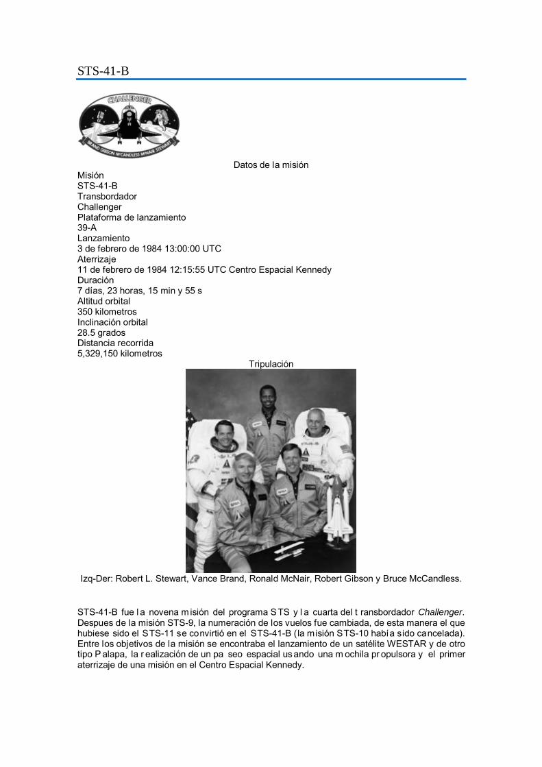
STS-41-B
Datos de la misión
Misión STS-41-B Transbordador Challenger Plataforma de lanzamiento 39-A Lanzamiento 3 de febrero de 1984 13:00:00 UTC Aterrizaje 11 de febrero de 1984 12:15:55 UTC Centro Espacial Kennedy Duración 7 días, 23 horas, 15 min y 55 s Altitud orbital 350 kilometros Inclinación orbital 28.5 grados Distancia recorrida 5,329,150 kilometros
Tripulación
Izq-Der: Robert L. Stewart, Vance Brand, Ronald McNair, Robert Gibson y Bruce McCandless.
STS-41-B fue l a novena m isión del programa STS y l a cuarta del t ransbordador Challenger. Despues de la misión STS-9, la numeración de los vuelos fue cambiada, de esta manera el que hubiese sido el STS-11 se convirtió en el STS-41-B (la misión STS-10 había sido cancelada). Entre los objetivos de la misión se encontraba el lanzamiento de un satélite WESTAR y de otro tipo P alapa, la r ealización de un pa seo espacial usando una m ochila pr opulsora y el primer aterrizaje de una misión en el Centro Espacial Kennedy.
Tripulación

NASA - NSSDC - Spacecraft - Details
http://nssdc.gsfc.nasa.gov/nmc/spacecraftDisplay.do?id=1984-034A[03/12/2010 23:32:41]
Saturday, 04 December 2010
Description
STS 41-C was the fifth Challenger shuttle flight. On boardwere Robert Crippen, Frances Scobee, Terry Hart, GeorgeNelson, and James Van Hoften.
This was the first direct ascent trajectory for Space Shuttle.Using the manned maneuvering unit, astronauts replaced analtitude control system and coronagraph/polarimeterelectronics box in the Solar Max satellite while it remained inorbit. The Long Duration Exposure Facility (LDEF) wasdeployed, carrying 57 experiments. It was left on orbit with theintention of retrieving during later mission. Other payloadsincluded: IMAX camera; Radiation Monitoring Equipment(RME); Cinema 360; Shuttle Student Involvement Program(SSlP) experiment. The mission duration was 167 hours 40minutes 7 seconds.
STS 41C
NSSDC ID: 1984-034A
Alternate Names
STS 11
14897
Facts in Brief
Launch Date: 1984-04-06LaunchVehicle: ShuttleLaunch Site: CapeCanaveral, United StatesMass: 17334.0 kg
Funding Agency
NASA-Office of SpaceFlight (United States)
Discipline
Human Crew
AdditionalInformation
Launch/Orbitalinformation for STS 41C
Experiments on STS 41C
Data collections from STS41C
Questions or commentsabout this spacecraft canbe directed to: CoordinatedRequest and User SupportOffice.
Related Information/Data at NSSDC
Solar MaxLDEF
NSSDC MasterCatalog Search
Spacecraft
Experiments
Data Collections
Personnel
Publications
Maps
New/Updated Data
Lunar/Planetary Events
STS 41C

NASA - NSSDC - Spacecraft - Details
http://nssdc.gsfc.nasa.gov/nmc/spacecraftDisplay.do?id=1984-034A[03/12/2010 23:32:41]
Other Sources of STS 41C Information/Data
STS 41C information (NASA KSC)STS 41C Press Release images (NASA JSC)
+ Privacy Policy and Important Notices NASA Official: Dr. Ed GrayzeckCurator: E. Bell, IIVersion 4.0.14, 08 October 2010

STS-41-C
Datos de la misión
Misión STS-41-C Transbordador Challenger Plataforma de lanzamiento 39-A Lanzamiento 6 de abril de 1984 13:58:00 UTC Aterrizaje 13 de abril de 1984 13:38:07 UTC Base Aérea Edwards Duración 6 días, 23 horas, 40 min y 7 s Altitud orbital 580 kilometros Inclinación orbital 28.5 grados Distancia recorrida 4,619,000 kilometros
Tripulación
Izq-Der: Francis R. Scobee, George D. Nelson, James D. van Hoften, Terry J. Hart y Robert L.
Crippen.
STS-41-C fue la misión 11 del programa STS y la quinta del transbordador Challenger. El lanzamiento fue el primero con una trayectoria ascendente directa en una misión. El vuelo se extendió por un dia debido a los problemas para atrapar al satélite Solar Max. El aterrizaje se realizó en la base Edwards pese a que estaba programado en el Centro Espacial Kennedy.
Los dos objetivos principales de la misión fueron el recuperar, reparar y relanzar el satélite Solar Max, y el lanzamiento del Servicio de Exposición de Larga Duración (LDEF).

Tripulación
Momento en que los astronautas reparan el satélite Solar Max.

NASA - NSSDC - Spacecraft - Details
http://nssdc.gsfc.nasa.gov/nmc/spacecraftDisplay.do?id=1984-093A[03/12/2010 23:34:16]
Saturday, 04 December 2010
Description
STS-41D was the first Discovery shuttle flight. On board wereHenry Hartsfield, Michael Coats, Richard Mullane, StevenHawley, Judith Resnik, and Charles Walker. This missioncarried out experiments including OAST-1 solar array structuraltesting.
Three satellites were deployed: Satellite Business SystemSBS-D, SYNCOM IV-2 (also known as LEASAT2) andTELSTAR. The 102- foot-tall, 13-loot-wide Office of Applicationand Space Technology (OAST-1) solar wing extended from thepayload bay. The wing carried different types of solar cells andextended to full height several times. It demonstrated largelightweight solar arrays for the future in building large facilitiesin space such as the International Space Station. Otherpayloads included: Continuous Flow Electrophoresis System(CFES) Ill; Radiation Monitoring Equipment (RME); ShuttleStudent Involvement Program (SSIP) experiment; lMAXcamera, being flown for the second time; and an Air Forceexperiment, Cloud Logic to Optimize Use of Defense Systems(CLOUDS). The mission duration was 144 hours 56 minutes 4seconds.
STS 41D
NSSDC ID: 1984-093A
Alternate Names
STS 12
15234
Facts in Brief
Launch Date: 1984-08-30LaunchVehicle: ShuttleLaunch Site: CapeCanaveral, United StatesMass: 21524.0 kg
Funding Agency
NASA-Office of SpaceFlight (United States)
Discipline
Human Crew
AdditionalInformation
Launch/Orbitalinformation for STS 41D
Experiments on STS 41D
Data collections from STS41D
Questions or commentsabout this spacecraft canbe directed to: CoordinatedRequest and User SupportOffice.
NSSDC MasterCatalog Search
Spacecraft
Experiments
Data Collections
Personnel
Publications
Maps
New/Updated Data
Lunar/Planetary Events
+ Privacy Policy and Important Notices NASA Official: Dr. Ed GrayzeckCurator: E. Bell, IIVersion 4.0.14, 08 October 2010
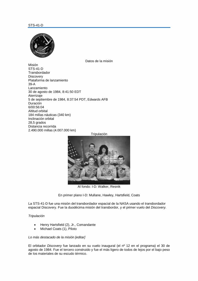
STS-41-D
Datos de la misión
Misión STS-41-D Transbordador Discovery Plataforma de lanzamiento 39-A Lanzamiento 30 de agosto de 1984, 8:41:50 EDT Aterrizaje 5 de septiembre de 1984, 8:37:54 PDT, Edwards AFB Duración 6/00:56:04 Altitud orbital 184 millas náuticas (340 km) Inclinación orbital 28,5 grados Distancia recorrida 2.490.000 millas (4.007.000 km)
Tripulación
Al fondo: I-D: Walker, Resnik
En primer plano I-D: Mullane, Hawley, Hartsfield, Coats
La STS-41-D fue una misión del transbordador espacial de la NASA usando el transbordador espacial Discovery. Fue la duodécima misión del transbordor, y el primer vuelo del Discovery.
Tripulación
•
Henry Hartsfield (2), Jr., Comandante • Michael Coats (1), Piloto
Lo más destacado de la misión [editar
El orbitador Discovery fue lanzado en su vuelo inaugural (el nº 12 en el programa) el
]
30 de agosto de 1984. Fue el tercero construido y fue el más ligero de todos de lejos por el bajo peso de los materiales de su escudo térmico.

La misión en un principio estaba planeada para el 25 de junio, pero por diversos problemas técnicos, incluyendo el translado al VAB para reemplazar un motor principal, el lanzamiento se llevó a cabo hasta las 8:41 a.m. EDT, el 30 de agosto, después de un retraso de 6 minutos y 50 segundos por la entrada de un avión privado en el espacio aéreo restringido, cerca de la plataforma de despegue. Fue al cuarto intento de lanzamiento para el Discovery. El intento de lanzamiento de junio significó ser la primera vez que una nave espacial tripulada sufría el apagado de sus motores justo antes del lanzamiento, desde el Gemini 6A.
El lanzamiento del STS-41-D.
Por el retraso de dos meses, se canceló la misión STS 41-F (la STS 41-E ya estaba cancelada) y su carga útil principal se incluyó al vuelo STS 41-D. En total la carga sobrepaso las 47.000 lb (21.000 kg), un récord par el transbordador hasta la fecha.
Los seis tripulantes de la tripulación eran Henry W. Hartsfield Jr., comandante, en su segunda misión en el transbordador; el piloto Michael L. Coats; los tres especialistas de la misión: — Judith A. Resnik, Richard M. Mullane y Steven A. Hawley; y un especialista de la carga, Charles D. Walker, un empleado de la corporación McDonnell Douglas. Walker fue el primer especialista de carga con un patrocinador en volar abordo del transbordador.
La carga primaria consistía en tres satélites de comunicaciones, SBS-D para Satellite Business Systems, Telstar 3-C para Telesat (Canada) y el SYNCOM IV-2, ó Leasat-2, un enorme satélite arrendado a la Marina. El Leasat-2 fue el primer gran satélite de comunicaciones diseñado específicamente para ser desplegado por el transbordador espacial. Los tres satélites se fueron desplegados sin problemas y quedaron operativos.
Otra carga que llevaba fue el panel solar OAST-l, un dispositivo de 13 pies (4 m) de ancho, y 102 pies (31 m) de alto, plegado en un paquete de 7 pulgadas (180 mm) de profundidad. El ala portaba diferentes tipos de células fotovoltaicas experimentales y varias veces fue extendida hasta su mayor amplitud. Con lo que se convirtió en la estructura más grande jamas extendida

desde un vehículo tripulado y, demostró la viabilidad los grandes paneles solares ligeros para futuras aplicaciones en instalaciones de gran envergadura como la Estación espacial.
El experimento Continuous Flow Electrophoresis System (CFES) patrocinado por McDonnell Douglas, usando células vivas, fue más elaborado que su antecesor y el especialista de carga Walker lo dirigió más de 100 horas durante el vuelo. Se realizó el experimento de un estudiante para estudiar el crecimiento de los cristales en microgravedad. Con una cámara IMAX se filmaron los mejores momentos de la misión, que luego se pudieron ver en la película The Dream is Alive.
La misión duró 6 días, 56 minutos, con el aterrizaje en la pista 17 de la Edwards AFB, a las 8:37 a.m. PDT, el 5 de septiembre. Viajó 2,21 millones de millas (3,6 milliones de km) e hizo 97 orbitas. El 10 de septiembre fue transportado de regreso al KSC.

NASA - NSSDC - Spacecraft - Details
http://nssdc.gsfc.nasa.gov/nmc/spacecraftDisplay.do?id=1984-108A[03/12/2010 23:35:40]
Saturday, 04 December 2010
Description
The 13th flight of the Space Shuttle (STS 41-G) carried theOSTA-3 (Office of Space and Terrestrial Applications) payloaddesigned for conducting experiments in earth remote sensing.This experiment payload consisted of 1) a Shuttle ImagingRadar (SIR-B) for studies of the earth's surface, 2) a LargeFormat Camera (LFC) for cartographic mappings of the earth,3) a Measurement of Air Pollution from Satellite (MAPS)experiment to determine the distribution of CO in theatmosphere, and 4) a Feature Identification and LocationExperiment (FILE) for classification of surface materials. TheSIR-B was an upgraded version of the SIR-A flown on theOSTA-1 payload during the STS-2 mission (NSSDC ID 81-111A-01). The MAPS and FILE sensors were the reflies ofthose same instruments on the OSTA-1 payload (NSSDC ID81-111A-04 and 81-111A-03). The mission lasted 8 days and,except for SIR-B, all instruments met their prelaunchrequirements.
STS 41G
NSSDC ID: 1984-108A
Alternate Names
OSTA 3/STS 41G
STS 13
15353
Facts in Brief
Launch Date: 1984-10-05LaunchVehicle: ShuttleLaunch Site: CapeCanaveral, United StatesMass: 10629.0 kg
Funding Agencies
NASA-Office of SpaceScience Applications(United States)
NASA-Office of SpaceFlight (United States)
Disciplines
Communications
Earth Science
Human Crew
AdditionalInformation
Launch/Orbitalinformation for STS 41G
Experiments on STS 41G
Data collections from STS41G
Questions or commentsabout this spacecraft canbe directed to: CoordinatedRequest and User SupportOffice.
NSSDC MasterCatalog Search
Spacecraft
Experiments
Data Collections
Personnel
Publications
Maps
New/Updated Data
Lunar/Planetary Events

NASA - NSSDC - Spacecraft - Details
http://nssdc.gsfc.nasa.gov/nmc/spacecraftDisplay.do?id=1984-108A[03/12/2010 23:35:40]
Personnel
Name Role Original Affiliation E-mail
Dr. Mark Settle Program Scientist NASA Headquarters
Mr. Louis J. Demas Program Manager NASA Headquarters
+ Privacy Policy and Important Notices NASA Official: Dr. Ed GrayzeckCurator: E. Bell, IIVersion 4.0.14, 08 October 2010

STS-41-G
Datos de la misión
Misión STS-41-G Transbordador Challenger Plataforma de lanzamiento 39-A Lanzamiento 5 de octubre de 1984 11:03:00 UTC Aterrizaje 13 de octubre de 1984 16:26:33 UTC Centro Espacial Kennedy Duración 8 días, 5 horas, 23 min y 33 s Altitud orbital 404 kilómetros Inclinación orbital 57 grados Distancia recorrida 5,293,847 kilómetros
Tripulación
Al frente, Izq. a Der.: Jon A. McBride, Sally K. Ride, Kathryn D. Sullivan and David C. Leestma. Al fondo, Izq. a Der.: Paul D. Scully-Power, Robert L. Crippen and Marc Garn

NASA - NSSDC - Spacecraft - Details
http://nssdc.gsfc.nasa.gov/nmc/spacecraftDisplay.do?id=1984-113A[03/12/2010 23:36:52]
Saturday, 04 December 2010
Description
STS 51-A was the second Discovery shuttle flight. On boardwere Frederick Hauck, David Walker, Joseph Allen, AnnaFisher, and Dale Gardner. Canadian communications satelliteTELESAT-H (ANIK), attached to Payload Assist Module-D(PAM-D), was deployed into geosynchronous orbit on flight daytwo. On third day, defense communications satellite SYNCOMIV-I (also known as LEASAT-1) was deployed. Allen andGardner, wearing jet-propelled manned maneuvering units,retrieved two malfunctioning satellites: PALAPA-B2 andWESTAR-VI, both deployed on Mission 41-B. Fisher operatedthe remote manipulator system, grappling the satellites anddepositing them in the payload bay. Middeck payloadsconsisted of: Diffusive Mixing of Organic Solutions (DMOS),and Radiation Monitoring Equipment (RME). The missionduration was 191 hours 44 minutes 56 seconds.
STS 51A
NSSDC ID: 1984-113A
Alternate Names
STS 14
15382
Facts in Brief
Launch Date: 1984-11-08LaunchVehicle: ShuttleLaunch Site: CapeCanaveral, United StatesMass: 20523.0 kg
Funding Agency
NASA-Office of SpaceFlight (United States)
Discipline
Human Crew
AdditionalInformation
Launch/Orbitalinformation for STS 51A
Experiments on STS 51A
Data collections from STS51A
Questions or commentsabout this spacecraft canbe directed to: CoordinatedRequest and User SupportOffice.
NSSDC MasterCatalog Search
Spacecraft
Experiments
Data Collections
Personnel
Publications
Maps
New/Updated Data
Lunar/Planetary Events
+ Privacy Policy and Important Notices NASA Official: Dr. Ed GrayzeckCurator: E. Bell, IIVersion 4.0.14, 08 October 2010

STS-51-A
Datos de la misión
Misión STS-51-A Transbordador Discovery Plataforma de lanzamiento 39-A Lanzamiento 8 de noviembre de 1984 12:15:00 UTC Aterrizaje 16 de noviembre de 1984 11:59:56 UTC Centro Espacial Kennedy, Pista 15 Duración 7 días, 23 horas, 44 min y 56 s Altitud orbital 343 kilometros Inclinación orbital 28.5 grados Distancia recorrida 5,293,786 kilometros
Tripulación
Izq-Der: Gardner, Walker, Fisher, Hauck, Allen
STS-51-A fue la misión catorce del programa STS y la número dos del transbordador Discovery. La misión tuvo una misión unica al lanzar dos satélites de comunicación y recuperar a otros dos que se encontraban en una órbita incorrecta.
• Masa: o Orbitador al despegue: 119,441 kg o Orbitador al aterrizaje: 94,120 kg o Carga: 20,550 kg
• Perigeo: 289 km • Apogeo: 297 km

• Inclinación: 28.4° • Periodo orbital: 90.4 min

NASA - NSSDC - Spacecraft - Details
http://nssdc.gsfc.nasa.gov/nmc/spacecraftDisplay.do?id=1984-081B[03/12/2010 23:38:06]
Saturday, 04 December 2010
Description
TELECOM 1A
NSSDC ID: 1984-081B
Alternate Names
15159
Facts in Brief
Launch Date: 1984-08-04Launch Vehicle: Ariane3Launch Site: Kourou,French GuianaMass: 690.0 kg
Funding Agency
France Telecom (France)
Discipline
Communications
AdditionalInformation
Launch/Orbitalinformation for TELECOM1A
Experiments on TELECOM1A
Data collections fromTELECOM 1A
Questions or commentsabout this spacecraft canbe directed to: CoordinatedRequest and User SupportOffice.
NSSDC MasterCatalog Search
Spacecraft
Experiments
Data Collections
Personnel
Publications
Maps
New/Updated Data
Lunar/Planetary Events
+ Privacy Policy and Important Notices NASA Official: Dr. Ed GrayzeckCurator: E. Bell, IIVersion 4.0.14, 08 October 2010

NASA - NSSDC - Spacecraft - Details
http://nssdc.gsfc.nasa.gov/nmc/spacecraftDisplay.do?id=1984-093D[03/12/2010 23:39:29]
Saturday, 04 December 2010
Description
Telstar 3C was an AT&T communications satellite deployed bythe shuttle Discovery during the STS-41D mission. It wasplaced in a geosynchronous orbit at 86 degrees W and had adesign life of 10 years. The spacecraft was launched with themain communications reflector and the outer cylinder stowed,a configuration the made it possible to launch either withexpendable rocket boosters or from the space shuttle. Thecompact stowed configuration allowed the spacecraft to standupright in the cargo bay, occupying a minimum of linear space.It was 7 feet, 1 inch (2.16 meters) in diameter. Its height withantennas and the telescoping solar panel deployed was 22feet, 5 inches (6.84 meters). Like their predecessor satellites,the Telstar 3 satellites operated at 6/4 GHz (C-band).Simultaneous long distance telephone call capacity was21,600. The satellite furnished voice, video, and high speeddata services to the continental US, Hawaii, Alaska, andPuerto Rico.
Telstar 3C
NSSDC ID: 1984-093D
Alternate Names
15237
Facts in Brief
Launch Date: 1984-09-01LaunchVehicle: ShuttleLaunch Site: CapeCanaveral, United StatesMass: 1225.0 kg
Funding Agency
American Telephone andTelegraph Company(United States)
Discipline
Communications
AdditionalInformation
Launch/Orbitalinformation for Telstar 3C
Experiments on Telstar 3C
Data collections fromTelstar 3C
Questions or commentsabout this spacecraft canbe directed to: CoordinatedRequest and User SupportOffice.
NSSDC MasterCatalog Search
Spacecraft
Experiments
Data Collections
Personnel
Publications
Maps
New/Updated Data
Lunar/Planetary Events
+ Privacy Policy and Important Notices NASA Official: Dr. Ed GrayzeckCurator: E. Bell, IIVersion 4.0.14, 08 October 2010

NASA - NSSDC - Spacecraft - Details
http://nssdc.gsfc.nasa.gov/nmc/spacecraftDisplay.do?id=1984-021B[03/12/2010 23:41:11]
Saturday, 04 December 2010
Description
The experiments selected to be part of the UOSAT 2 payloadhad several objectives which included the following: to providethe educational community with an operational scientificsatellite which could be utilized with a minimal ground station;to provide the scientific community with a new source of datato aid in the understanding of the electro-magnetic propertiesof the near earth environment; and to provide the amateurradio community with a full complement of instruments for thestudy and monitoring of radio propagation conditions from highfrequency to microwave. In order to meet these objectives thefollowing instruments comprised the UOSAT 2 payload; atriaxial fluxgate magnetometer with a resolution of plus orminus 2 nT and maximum vector sample rate of 6.25 per s;two charged particle counters with threshold energies of 20and 60 keV; four phase-referenced high-frequency beacons at7, 14, 21, and 28 MHz; two microwave beacons at 2.4 and10.47 GHz; and a CCD earth-imaging camera with 2 kmresolution, and spectral response of 0.4 -1.0 micrometers. OneVHF and one UHF telemetry channel provided data instandard FSK ASCII at a variety of baud rates, as well asMorse code and synthesized voice formats. Though thedescriptions are the same, there were some differencesbetween UOSAT 2 and UOSAT experiments.
UOSAT 2
NSSDC ID: 1984-021B
Alternate Names
Oscar 11
14781
Facts in Brief
Launch Date: 1984-03-01Launch Vehicle: DeltaLaunchSite: Vandenberg AFB,United StatesMass: 52.0 kg
Funding Agencies
Radio Amateur SatelliteCorporation (UnitedStates)
University of Surrey(United Kingdom)
Disciplines
Communications
Space Physics
AdditionalInformation
Launch/Orbitalinformation for UOSAT 2
Experiments on UOSAT 2
Data collections fromUOSAT 2
Questions or commentsabout this spacecraft canbe directed to: CoordinatedRequest and User SupportOffice.
NSSDC MasterCatalog Search
Spacecraft
Experiments
Data Collections
Personnel
Publications
Maps
New/Updated Data
Lunar/Planetary Events

NASA - NSSDC - Spacecraft - Details
http://nssdc.gsfc.nasa.gov/nmc/spacecraftDisplay.do?id=1984-021B[03/12/2010 23:41:11]
Personnel
Name Role Original Affiliation E-mail
Dr. M. N. Sweeting ProjectManager
University of Surrey
Mr. Richard L.Daniels
ProgramManager
NASA Headquarters
Dr. Ronald A.Parise
ProjectScientist
AMSAT Corporation [email protected]
Dr. J. A. King ProgramScientist
AMSAT Corporation
+ Privacy Policy and Important Notices NASA Official: Dr. Ed GrayzeckCurator: E. Bell, IIVersion 4.0.14, 08 October 2010
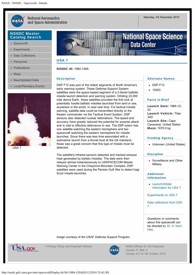
NASA - NSSDC - Spacecraft - Details
http://nssdc.gsfc.nasa.gov/nmc/spacecraftDisplay.do?id=1984-129A[03/12/2010 23:42:30]
Saturday, 04 December 2010
Description
DSP F12 was part of the oldest segments of North America'searly warning system. These Defense Support Systemsatellites were the space-based segment of a 2-tiered ballisticmissile launch detection and warning system. Orbiting 23,000mile above Earth, these satellites provided the first look atpotentially hostile ballistic missiles launched from land or sea,anywhere in the world, in near-real time. For tactical missilewarning, satellite data could be transmitted directly to thetheater commander via the Tactical Event System. DSPsensors also detected nuclear detonations. The speed andaccuracy have greatly reduced the potential for surprise attackand is vital to effective deterrance to war. The DSP sytem hasone satellite watching the eastern hemisphere and twospacecraft watching the western hemisphere for missilelaunches. Since there was less time associated with asubmarine launch from a Soviet boat at the US mainland,these was a great concern that this type of missile must bedetected.
The satellite's infrared sensors detected and tracked exhaustheat generated by balistic missiles. The data were thenrelayed almost instantaneously to USSPACECOM MissileWarning Center in the Cheyenne Mountain Complex. DSPsatellites were used during the Persian Gulf War to detect IragiScud missile launches.
USA 7
NSSDC ID: 1984-129A
Alternate Names
DSP F12
15453
Facts in Brief
Launch Date: 1984-12-22Launch Vehicle: Titan34DLaunch Site: CapeCanaveral, United StatesMass: 1670.0 kg
Funding Agency
Unknown (United States)
Discipline
Surveillance and OtherMilitary
AdditionalInformation
Launch/Orbitalinformation for USA 7
Experiments on USA 7
Data collections from USA7
Questions or commentsabout this spacecraft canbe directed to: Dr. H. KentHills.
Image courtesy of the USAF Defense Support Program.
NSSDC MasterCatalog Search
Spacecraft
Experiments
Data Collections
Personnel
Publications
Maps
New/Updated Data
Lunar/Planetary Events
USA 7
+ Privacy Policy and Important Notices NASA Official: Dr. Ed GrayzeckCurator: E. Bell, IIVersion 4.0.14, 08 October 2010

NASA - NSSDC - Spacecraft - Details
http://nssdc.gsfc.nasa.gov/nmc/spacecraftDisplay.do?id=1984-125A[03/12/2010 23:45:11]
Saturday, 04 December 2010
Description
This spacecraft mission combined a Venus swingby and aComet Halley flyby. Two identical spacecraft, Vega 1 andVega 2, were launched December 15 and 21, 1984,respectively. After carrying Venus entry probes to the vicinity ofVenus (arrival and deployment of probes were scheduled forJune 11-15, 1985), the two spacecraft were retargetted usingVenus gravity field assistance to intercept Comet Halley inMarch 1986. The first spacecraft encountered Comet Halley onMarch 6, 1986, and the second three days later. The flybyvelocity was 77.7 km/s. Although the spacecraft could betargetted with a precision of 100 km, the position of thespacecraft relative to the comet nucleus was estimated to beknown only to within a few thousand kilometers. This, togetherwith the problem of dust protection, led to estimated flybydistances of 10,000 km for the first spacecraft and 3000 km forthe second.
Spacecraft and SubsystemsThe spacecraft was three-axis stabilized. Its main featureswere large solar panels, a high-gain antenna dish, and anautomatic pointing platform carrying those experiments thatrequired pointing at the comet nucleus. The automatic platformcould rotate through + or -110 deg and + or -40 deg in twoperpendicular directions with a pointing accuracy of 5 arc-minand a stability of 1 arc-min/s. It carried the narrow- and thewide-angle camera, the three-channel spectrometer, and theinfrared sounder. All other experiments were body-mounted,with the exception of two magnetometer sensors mounted on a2-m boom and various plasma probes and plasma wavwanalyzers mounted on a 5-m boom. The total scientificpayloadweighed 125 kg and had a data rate of 65 kbs in fast telemetrymode for encounter. There was also a slow telemetry mode forthe cruise mode. The comet-encounter science data-take wasfrom 2.5 h before until 0.5 h after the closest approach, withseveral periods of data-take before and after, each lastingabout 2 h. Continuous coverage for plasma and dustinstruments was provided by an onboard memory (5-megabittape recorder). The spacecraft was shielded from hypervelocitydust impacts by a shield consisting of a 100-micrometermultilayer sheet 20 to 30 cm from the spacecraft, and a 1-mmAl sheet 5 to 10 cm from the spacecraft. Approximately half ofthe VEGA spacecraft was devoted to the Halley module, andhalf to the Venus lander package. The total scientific payloadweight was 144.3 kg.
Venus Descent ModuleThe Venus package consisted of a sphere 240 cm in diameter,which separated two days before arrival at Venus and enteredthe planet's atmosphere on an inclined path, without active
Vega 1
NSSDC ID: 1984-125A
Alternate Names
Venera-Halley 1
15432
Facts in Brief
Launch Date: 1984-12-15Launch Vehicle: ProtonLaunch Site: Tyuratam(Baikonur Cosmodrome),U.S.S.RMass: 2500.0 kg
Funding Agency
Soviet Academy ofSciences (U.S.S.R)
Disciplines
Planetary Science
Space Physics
AdditionalInformation
Launch/Orbitalinformation for Vega 1
Experiments on Vega 1
Data collections from Vega1
Questions or commentsabout this spacecraft canbe directed to: Dr. David R.Williams.
NSSDC MasterCatalog Search
Spacecraft
Experiments
Data Collections
Personnel
Publications
Maps
New/Updated Data
Lunar/Planetary Events
Vega 1
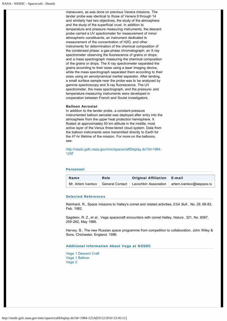
NASA - NSSDC - Spacecraft - Details
http://nssdc.gsfc.nasa.gov/nmc/spacecraftDisplay.do?id=1984-125A[03/12/2010 23:45:11]
maneuvers, as was done on previous Venera missions. Thelander probe was identical to those of Venera 9 through 14and similarly had two objectives, the study of the atmosphereand the study of the superficial crust. In addition totemperature and pressure measuring instruments, the descentprobe carried a UV spectrometer for measurement of minoratmospheric constituents, an instrument dedicated tomeasurement of the concentration of H2O, and otherinstruments for determination of the chemical composition ofthe condensed phase: a gas-phase chromatograph; an X-rayspectrometer observing the fluorescence of grains or drops;and a mass spectrograph measuring the chemical compositionof the grains or drops. The X-ray spectrometer separated thegrains according to their sizes using a laser imaging device,while the mass spectrograph separated them according to theirsizes using an aerodynamical inertial separator. After landing,a small surface sample near the probe was to be analyzed bygamma spectroscopy and X-ray fluorescence. The UVspectrometer, the mass spectrograph, and the pressure- andtemperature-measuring instruments were developed incooperation between French and Soviet investigators.
Balloon AerostatIn addition to the lander probe, a constant-pressureinstrumented balloon aerostat was deployed after entry into theatmosphere from the upper heat protection hemisphere. Itfloated at approximately 50 km altitude in the middle, mostactive layer of the Venus three-tiered cloud system. Data fromthe balloon instruments were transmitted directly to Earth forthe 47-hr lifetime of the mission. For more on the balloons,see:
http://nssdc.gsfc.nasa.gov/nmc/spacecraftDisplay.do?id=1984-125F
Personnel
Name Role Original Affiliation E-mail
Mr. Artem Ivankov General Contact Lavochkin Association [email protected]
Selected References
Reinhard, R., Space missions to Halley's comet and related activities, ESA Bull., No. 29, 68-83,Feb. 1982.
Sagdeev, R. Z., et al., Vega spacecraft encounters with comet Halley, Nature, 321, No. 6067,259-262, May 1986.
Harvey, B., The new Russian space programme from competition to collaboration, John Wiley &Sons, Chichester, England, 1996.
Additional Information About Vega at NSSDC
Vega 1 Descent CraftVega 1 BalloonVega 2

NASA - NSSDC - Spacecraft - Details
http://nssdc.gsfc.nasa.gov/nmc/spacecraftDisplay.do?id=1984-125A[03/12/2010 23:45:11]
Vega mission profile and the Vega atmospheric probeVega atmospheric probe model on display at the NPO Lavochkin Museum(Probe image courtesy of Alexander Chernov and the Virtual Space Museum)
Vega 1 Halley data on CD-ROMOrder the International Halley Watch CD-ROMsMore on the International Halley Watch CD-ROMs
Other International Halley Watch Missions
GiottoICESakigakeSuisei
Related Information at NSSDC
Venus pageComet page
+ Privacy Policy and Important Notices NASA Official: Dr. Ed GrayzeckCurator: E. Bell, IIVersion 4.0.14, 08 October 2010

NASA - NSSDC - Spacecraft - Details
http://nssdc.gsfc.nasa.gov/nmc/spacecraftDisplay.do?id=1984-125F[03/12/2010 23:47:18]
Saturday, 04 December 2010
Description
A constant-pressure instrumented balloon aerostat wasdeployed from the upper heat protection hemisphere of each ifthe two Vega lander craft immediately after entry into theatmosphere. The primary scientific objective of the Vegaballoon probes was to obtain information about the large- andsmall-scale motions, structure, and cloud properties of theVenus atmosphere at the float altitude. The probes floated atan altitude of about 54 km in the middle, most active layer ofthe Venus three-tiered cloud system and measured the localatmospheric dynamics, pressure, temperature, lightning,illumination levels, and cloud properties over a period of about46 hours in both the night- and day-side.
Spacecraft and SubsystemsThe Vega balloon probe comprised a 3.4 meter diameterballoon and a gondola, suspended below the balloon by a 13meter long tether strap. The total mass of the deployed balloonprobe was 21.5 kg: 12.5 kg for the balloon and tether, 6.9 kgfor the gondola, and 2.1 kg of helium in the balloon. Theballoon, gondola, parachute, ballast, tanks of helium, andtiming electronics and pyrotechnic release devices with a totalmass of 120 kg were stored in a toroidal compartmentsurrouding the lander antenna before deployment.
The balloon was made of a teflon cloth matrix coated withteflon film and filled with helium to 30 mbar overpressure. Thediffusion of helium from the balloon was slow enough that theballoon would outlast the probe battery lifetime, losing lessthan 5% of its helium and 500 meters of altitude. The balloonitself was transparent to the downlink radio frequency used.
The gondola was 1.2 meters high and had three parts,connected by straps. The upper section, connected to thetether, was a 37 cm long, 15 degree half-angle conicalantenna 14 cm diameter at its base. The middle section wasconnected by two straps to the upper section with dimensionsapproximately 40.8 x 14.5 x 13.0 cm. The upper part of thesection contained a radio transmitter and modulator, data-handling system, and signal-processing and power-regulatingelectronics. The lower part had pressure and illuminationsensors and a deployable arm which held temperature sensorsand an anemometer. The lower section was 9.0 x 14.5 x 15.0cm, was also connected to the middle section by two straps,and held the batteries and nephelometer. The gondola waspainted with a white coating that resisted corrosion by sulfuricacid and increased the surface albedo.
The radio transmitter had two modes of operation. In telemetry,or TM, mode a 30 second transmission of pure carrier signal
Vega 1 Balloon
NSSDC ID: 1984-125F
Alternate Names
15859
Facts in Brief
Launch Date: 1984-12-15Launch Vehicle: ProtonLaunch Site: Tyuratam(Baikonur Cosmodrome),U.S.S.RMass: 21.5 kg
Funding Agency
Soviet Academy ofSciences (U.S.S.R)
Discipline
Planetary Science
AdditionalInformation
Launch/Orbitalinformation for Vega 1Balloon
Experiments on Vega 1Balloon
Data collections from Vega1 Balloon
Questions or commentsabout this spacecraft canbe directed to: Dr. David R.Williams.
Selected References
Sagdeev, R. Z., et al., TheVEGA Venus balloonexperiment, Science, 231, No.4744, 1407, Mar. 1986.
NSSDC MasterCatalog Search
Spacecraft
Experiments
Data Collections
Personnel
Publications
Maps
New/Updated Data
Lunar/Planetary Events
Vega 1 Balloon

NASA - NSSDC - Spacecraft - Details
http://nssdc.gsfc.nasa.gov/nmc/spacecraftDisplay.do?id=1984-125F[03/12/2010 23:47:18]
for use in the VLBI tracking was followed by a 270 secondperiod of transmission of 900 bits (at 4 bits/s for the first 840bits and 1 bit/s for the last 60) of data collected over theprevious 30 minutes, followed by another 30 second carriertransmission. In coordinated transmission (KI) mode two toneswith a suppressed carrier were transmitted for 330 seconds foruse in the VLBI tracking. Three consecutive TM transmissionsand one KI were made every 2 hours during the first 10 hoursand from roughly hours 22 to 34 of the flight, at other timesone TM and one KI transmission were made every two hoursto conserve battery power. The carrier signal frequency was1.6679 GHz and the radiated power was about 4.5 W. Thepower supply consisted of 1 kg of lithium batteries with 250 W-hrs capacity and an expected life of 46 to 52 hours.
Twenty ground stations were used for Very Long BaselineInterferometry (VLBI) tracking of the balloons. Six of thesestations were on Soviet territory and were coordinated by IKI,the Soviet space agency. The other fourteen antennas werecoordinated by CNES (France) and included three NASA DeepSpace Network antennas and eleven radio astronomyobservatories.
Mission ProfileThe Vega 1 Lander/Balloon capsule entered the Venusatmosphere (125 km altitude) at 2:06:10 UT (Earth receivedtime; Moscow time 5:06:10 a.m.) on 11 June 1985 at roughly11 km/sec. At approximately 2:06:25 UT the parachuteattached to the landing craft cap opened at an altitude of 64km. The cap and parachute were released 15 seconds later at63 km altitude. The balloon package was pulled out of itscompartment by parachute 40 seconds later at 61 km altitude,at 8.1 degrees N, 176.9 degrees east. A second parachuteopened at an altitude of 55 km, 200 seconds after entry,extracting the furled balloon. The balloon was inflated 100seconds later at 54 km and the parachute and inflation systemwere jettisoned. The ballast was jettisoned when the balloonreached roughly 50 km and the balloon floated back to a stableheight between 53 and 54 km some 15 to 25 minutes afterentry. The mean stable height was 53.6 km, with a pressure of535 mbar and a temperature of 300-310 K in the middle, mostactive layer of the Venus three-tiered cloud system. Theballoon drifted westward in the zonal wind flow with an averagespeed of about 69 m/s at nearly constant latitude. The probecrossed the terminator from night to day at 12:20 UT on 12June after traversing 8500 km. The probe continued to operatein the daytime until the final transmission was received at00:38 UT on 13 June from 8.1 N, 68.8 E after a total traversedistance of 11,600 km. It is not known how much further theballoon travelled after the final communication.
Kremnev, R. S., et al., VEGABalloon System andInstrumentation, Science,231, No. 4744, 1408, Mar.1986.
Sagdeev, R. Z., and V. I.Moroz, Project Vega firststage: missions to Venus,Sov. Astron. Lett., 12, No. 1,Jan.-Feb. 1986.
Sagdeev, R. Z., et al., TheVEGA balloon experiments,Sov. Astron. Lett., 12, No. 1,3, Jan.-Feb. 1986.
Kremnev, R. S., et al., TheVega balloons - A tool forstudying atmospheredynamics on Venus, Sov.Astron. Lett., 12, No. 1, 7,Jan.-Feb. 1986.
Vega 1 SpacecraftVega 1 LanderVega 2 Balloon - Informationon Vega 1's companionmission
Vega atmospheric probemodel on display at the NPOLavochkin Museum(Probe image courtesy ofAlexander Chernov and theVirtual Space Museum)
Venus home page
+ Privacy Policy and Important Notices NASA Official: Dr. Ed GrayzeckCurator: E. Bell, IIVersion 4.0.14, 08 October 2010

NASA - NSSDC - Spacecraft - Details
http://nssdc.gsfc.nasa.gov/nmc/spacecraftDisplay.do?id=1984-125E[03/12/2010 23:49:35]
Saturday, 04 December 2010
Description
The Vega 1 lander probe was identical to those of Venera 9through 14 and similarly had two objectives, the study of theatmosphere and the study of the superficial crust. The landerconsisted of a hemispherical insulated pressure vesselmounted with shock absorbers on a deformable landing ring.On top of the pressure vessel was a disc-shaped aerobrakewhich also served as a reflector for the cylindrical fixedcommunications antenna above it. The lander was held duringthe cruise to Venus and atmospheric entry in an insulated heatprotection sphere 240 cm in diameter, consisting of an upperand lower hemisphere joined nonhermetically.
InstrumentationIn addition to temperature and pressure measuringinstruments, the descent probe carried an ISAV UVspectrometer for measurement of minor atmosphericconstituents, a VM-4 hygrometer dedicated to measurement ofthe concentration of H2O, an IPF aerosol analyzer, an ISAV-Aparticle size spectrometer/nephelometer and other instrumentsfor determination of the chemical composition of thecondensed phase: a Sigma 3 gas-phase chromatograph; aBDRP-AM25 X-ray spectrometer observing the fluorescenceof grains or drops; and a Malachite mass spectrographmeasuring the chemical composition of the grains or drops.The X-ray spectrometer separated the grains according to theirsizes using a laser imaging device, while the massspectrograph separated them according to their sizes using anaerodynamical inertial separator. After landing, a small surfacesample near the probe was to be collected by a drilling deviceand analyzed by a GS-15-SCV gamma ray spectrometer andX-ray fluorescence spectrometer. The UV spectrometer, themass spectrograph, and the pressure- and temperature-measuring instruments were developed in cooperationbetween French and Soviet investigators. Data collected by theinstruments were transmitted to the Vega 1 spacecraft andrelayed to Earth.
Mission ProfileThe lander separated from the Vega 1 spacecraft two daysbefore arrival at Venus and entered the planet's atmosphereon an inclined path, without active maneuvers, as was done onprevious Venera missions. (The flyby spacecraft was thenretargetted using Venus gravity assistance to intercept CometHalley in March 1986.) After separation from the Vega 1spacecraft the lander entered the Venus atmosphere on 11June 1985 at 01:59:49 UT at 10.75 km/s with an entry angle of18.23 degrees. The pilot parachute was deployed at 02:00:27UT at an altitude of 65 km and the braking parachute opened11 seconds later at 64.5 km. The upper heat protection
Vega 1 Descent Craft
NSSDC ID: 1984-125E
Alternate Names
Vega 1 Lander
Vega 1 Balloon Aerostat
15858
Facts in Brief
Launch Date: 1984-12-15Launch Vehicle: ProtonLaunch Site: Tyuratam(Baikonur Cosmodrome),U.S.S.R
Funding Agency
Soviet Academy ofSciences (U.S.S.R)
Discipline
Planetary Science
AdditionalInformation
Launch/Orbitalinformation for Vega 1Descent Craft
Experiments on Vega 1Descent Craft
Data collections from Vega1 Descent Craft
Questions or commentsabout this spacecraft canbe directed to: Dr. David R.Williams.
NSSDC MasterCatalog Search
Spacecraft
Experiments
Data Collections
Personnel
Publications
Maps
New/Updated Data
Lunar/Planetary Events
Vega 1 Descent Craft

NASA - NSSDC - Spacecraft - Details
http://nssdc.gsfc.nasa.gov/nmc/spacecraftDisplay.do?id=1984-125E[03/12/2010 23:49:35]
hemisphere was released at this time and the lowerhemisphere 4 seconds later at 64.2 km. The upper hemispherecontained the deployment system for the balloon aerostats.The parachute was released at 02:09:37 at 47 km. After thisthe lander was allowed to aerobrake through the thick Venusatmosphere, with drag devices minimizing vibrations and spinand providing stability. At an altitude of 18 km a mechanicalshock of unknown origin (possibly due to a jammed valve in anupper compartment suddenly releasing) triggered a ground-contact accelerometer which caused early deployment of thesoil drill of the X-ray flourescence spectrometer. This drill wasrendered unusable at landing due to the prematuredeployment. A toroidal system similar to that on Veneras 13and 14 was designed to absorb shock on landing. The landertouched down at 03:02:54 UT on 11 June 1985 at 7.5 N, 177.7E, just north of eastern Aphrodite Terra. The altitude of thetouchdown site was 0.6 km below the planetary mean radius.The measured pressure at the landing site was 95 atm and thetemperature was 740 K. The balloon measured downwardgusts of 1 meter/s and showed horizontal wind velocities up to240 km/hr.
Balloon AerostatsIn addition to the lander probe, a constant-pressureinstrumented balloon aerostat was deployed after entry into theatmosphere from the upper heat protection hemisphere. Itfloated at approximately 50 km altitude in the middle, mostactive layer of the Venus three-tiered cloud system. Data fromthe balloon instruments were transmitted directly to Earth forthe 47-hr lifetime of the mission. For more on the balloons,see:
http://nssdc.gsfc.nasa.gov/database/MasterCatalog?sc=1984-125F
Personnel
Name Role Original Affiliation E-mail
Mr. Artem Ivankov General Contact Lavochkin Association [email protected]
Selected References
Harvey, B., The new Russian space programme from competition to collaboration, John Wiley &Sons, Chichester, England, 1996.
Surkov, Yu. A., et al., Uranium, thorium, and potassium in the Venusian rocks at the landingsites of Vega 1 and 2, J. Geophys. Res., 92, No. B4, E537-E540, Mar. 1987.
Surkov, Yu. A., et al., The water vapor content profile in the Venusian atmosphere according tothe results of experiments from Vega 1 and 2, J. Geophys. Res., 91, No. B13, E219-E221, Nov.1986.
Sagdeev, R. Z., and V. I. Moroz, Project Vega first stage: missions to Venus, Sov. Astron. Lett.,12, No. 1, Jan.-Feb. 1986.
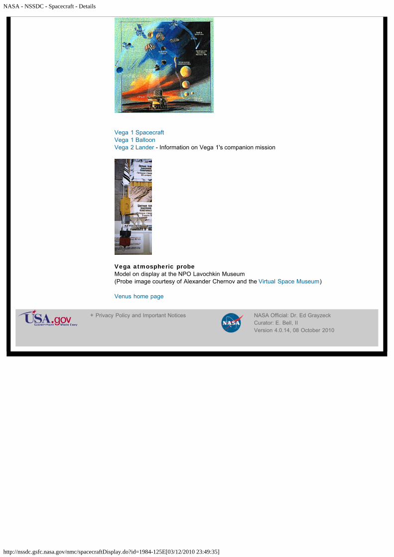
NASA - NSSDC - Spacecraft - Details
http://nssdc.gsfc.nasa.gov/nmc/spacecraftDisplay.do?id=1984-125E[03/12/2010 23:49:35]
Vega 1 SpacecraftVega 1 BalloonVega 2 Lander - Information on Vega 1's companion mission
Vega atmospheric probeModel on display at the NPO Lavochkin Museum(Probe image courtesy of Alexander Chernov and the Virtual Space Museum)
Venus home page
+ Privacy Policy and Important Notices NASA Official: Dr. Ed GrayzeckCurator: E. Bell, IIVersion 4.0.14, 08 October 2010

NASA - NSSDC - Spacecraft - Details
http://nssdc.gsfc.nasa.gov/nmc/spacecraftDisplay.do?id=1984-128A[03/12/2010 23:52:28]
Saturday, 04 December 2010
Description
This spacecraft mission combined a Venus swingby and aComet Halley flyby. Two identical spacecraft, Vega 1 andVega 2, were launched December 15 and 21, 1984,respectively. After carrying Venus entry probes to the vicinity ofVenus (arrival and deployment of probes were scheduled forJune 11-15, 1985), the two spacecraft were retargetted usingVenus gravity field assistance to intercept Comet Halley inMarch 1986. The first spacecraft encountered Comet Halley onMarch 6, 1986, and the second three days later. The flybyvelocity was 77.7 km/s. Although the spacecraft could betargetted with a precision of 100 km, the position of thespacecraft relative to the comet nucleus was estimated to beknown only to within a few thousand kilometers. This, togetherwith the problem of dust protection, led to estimated flybydistances of 10,000 km for the first spacecraft and 3000 km forthe second.
Spacecraft and SubsystemsThe spacecraft was three-axis stabilized. Its main featureswere large solar panels, a high-gain antenna dish, and anautomatic pointing platform carrying those experiments thatrequired pointing at the comet nucleus. The automatic platformcould rotate through + or -110 deg and + or -40 deg in twoperpendicular directions with a pointing accuracy of 5 arc-minand a stability of 1 arc-min/s. It carried the narrow- and thewide-angle camera, the three-channel spectrometer, and theinfrared sounder. All other experiments were body-mounted,with the exception of two magnetometer mounted on a 2-mboom and various plasma probes and plasma wave analyzersmounted on a 5-m boom. The total scientific payload weighed125 kg and had a data rate of 65 kbs in fast telemetry modefor encounter. There was also a slow telemetry mode for thecruise mode. The comet-encounter science data-take was from2.5 h before until 0.5 h after the closest approach, with severalperiods of data-take before and after, each lasting about 2 h.Continuous coverage for plasma and dust instruments wasprovided by an onboard memory (5-megabit tape recorder).The spacecraft was shielded from hypervelocity dust impactsby a shield consisting of a 100-micrometer multilayer sheet 20to 30 cm from the spacecraft, and a 1-mm Al sheet 5 to 10 cmfrom the spacecraft. Approximately half of the Vega spacecraftwas devoted to the Halley module, and half to the Venuslander package. The total scientific payload weight was 144.3kg.
Venus Descent ModuleThe Venus package consisted of a sphere 240 cm in diameter,which separated two days before arrival at Venus and enteredthe planet's atmosphere on an inclined path, without active
Vega 2
NSSDC ID: 1984-128A
Alternate Names
Venera-Halley 2
15449
Facts in Brief
Launch Date: 1984-12-21Launch Vehicle: ProtonLaunch Site: Tyuratam(Baikonur Cosmodrome),U.S.S.RMass: 2500.0 kg
Funding Agency
Soviet Academy ofSciences (U.S.S.R)
Disciplines
Planetary Science
Space Physics
AdditionalInformation
Launch/Orbitalinformation for Vega 2
Experiments on Vega 2
Data collections from Vega2
Questions or commentsabout this spacecraft canbe directed to: Dr. David R.Williams.
NSSDC MasterCatalog Search
Spacecraft
Experiments
Data Collections
Personnel
Publications
Maps
New/Updated Data
Lunar/Planetary Events
Vega 2
NASA - NSSDC - Spacecraft - Details
http://nssdc.gsfc.nasa.gov/nmc/spacecraftDisplay.do?id=1984-128A[03/12/2010 23:52:28]
maneuvers, as was done on previous Venera missions. Thelander probe was identical to those of Venera 9 through 14and similarly had two objectives, the study of the atmosphereand the study of the superficial crust. In addition totemperature and pressure measuring instruments, the descentprobe carried a UV spectrometer for measurement of minoratmospheric constituents, an instrument dedicated tomeasurement of the concentration of H2O, and otherinstruments for determination of the chemical composition ofthe condensed phase: a gas-phase chromatograph; an X-rayspectrometer observing the fluorescence of grains or drops;and a mass spectrograph measuring the chemical compositionof the grains or drops. The X-ray spectrometer separated thegrains according to their sizes using a laser imaging device,while the mass spectrograph separated them according to theirsizes using an aerodynamical inertial separator. After landing,a small surface sample near the probe was to be analyzed bygamma spectroscopy and X-ray fluorescence. The UVspectrometer, the mass spectrograph, and the pressure- andtemperature-measuring instruments were developed incooperation between French and Soviet investigators.
Balloon AerostatsIn addition to the lander probe, a constant-pressureinstrumented balloon aerostat was deployed after entry into theatmosphere from the upper heat protection hemisphere. Itfloated at approximately 50 km altitude in the middle, mostactive layer of the Venus three-tiered cloud system. Data fromthe balloon instruments were transmitted directly to Earth forthe 47-hr lifetime of the mission. For more on the balloons,see:
http://nssdc.gsfc.nasa.gov/nmc/spacecraftDisplay.do?id=1984-128F
Personnel
Name Role Original Affiliation E-mail
Mr. Artem Ivankov General Contact Lavochkin Association [email protected]
Selected References
Reinhard, R., Space missions to Halley's comet and related activities, ESA Bull., No. 29, 68-83,Feb. 1982.
Sagdeev, R. Z., et al., Vega spacecraft encounters with comet Halley, Nature, 321, No. 6067,259-262, May 1986.
Harvey, B., The new Russian space programme from competition to collaboration, John Wiley &Sons, Chichester, England, 1996.
Additional Information About Vega at NSSDC
Vega 2 Descent CraftVega 2 BalloonVega 1

NASA - NSSDC - Spacecraft - Details
http://nssdc.gsfc.nasa.gov/nmc/spacecraftDisplay.do?id=1984-128A[03/12/2010 23:52:28]
Vega mission profile and the Vega atmospheric probeVega atmospheric probe model on display at the NPO Lavochkin Museum(Probe image courtesy of Alexander Chernov and the Virtual Space Museum)
Vega 2 Halley data on CD-ROMOrder the International Halley Watch CD-ROMsMore on the International Halley Watch CD-ROMs
Other International Halley Watch Missions
GiottoICESakigakeSuisei
Related Information at NSSDC
Venus pageComet page
+ Privacy Policy and Important Notices NASA Official: Dr. Ed GrayzeckCurator: E. Bell, IIVersion 4.0.14, 08 October 2010

NASA - NSSDC - Spacecraft - Details
http://nssdc.gsfc.nasa.gov/nmc/spacecraftDisplay.do?id=1984-128F[03/12/2010 23:54:12]
Saturday, 04 December 2010
Description
A constant-pressure instrumented balloon aerostat wasdeployed from the upper heat protection hemisphere of each ifthe two Vega lander craft immediately after entry into theatmosphere. The primary scientific objective of the Vegaballoon probes was to obtain information about the large- andsmall-scale motions, structure, and cloud properties of theVenus atmosphere at the float altitude. The probes floated atan altitude of about 54 km in the middle, most active layer ofthe Venus three-tiered cloud system and measured the localatmospheric dynamics, pressure, temperature, lightning,illumination levels, and cloud properties over a period of about46 hours in both the night- and day-side.
Spacecraft and SubsystemsThe Vega balloon probe comprised a 3.4 meter diameterballoon and a gondola, suspended below the balloon by a 13meter long tether strap. The total mass of the deployed balloonprobe was 21.5 kg: 12.5 kg for the balloon and tether, 6.9 kgfor the gondola, and 2.1 kg of helium in the balloon. Theballoon, gondola, parachute, ballast, tanks of helium, andtiming electronics and pyrotechnic release devices with a totalmass of 120 kg were stored in a toroidal compartmentsurrouding the lander antenna before deployment.
The balloon was made of a teflon cloth matrix coated withteflon film and filled with helium to 30 mbar overpressure. Thediffusion of helium from the balloon was slow enough that theballoon would outlast the probe battery lifetime, losing lessthan 5% of its helium and 500 meters of altitude. The balloonitself was transparent to the downlink radio frequency used.
The gondola was 1.2 meters high and had three parts,connected by straps. The upper section, connected to thetether, was a 37 cm long, 15 degree half-angle conicalantenna 14 cm diameter at its base. The middle section wasconnected by two straps to the upper section with dimensionsapproximately 40.8 x 14.5 x 13.0 cm. The upper part of thesection contained a radio transmitter and modulator, data-handling system, and signal-processing and power-regulatingelectronics. The lower part had pressure and illuminationsensors and a deployable arm which held temperature sensorsand an anemometer. The lower section was 9.0 x 14.5 x 15.0cm, was also connected to the middle section by two straps,and held the batteries and nephelometer. The gondola waspainted with a white coating that resisted corrosion by sulfuricacid and increased the surface albedo.
The radio transmitter had two modes of operation. In telemetry,or TM, mode a 30 second transmission of pure carrier signal
Vega 2 Balloon
NSSDC ID: 1984-128F
Alternate Names
15857
Facts in Brief
Launch Date: 1984-12-21Launch Vehicle: ProtonLaunch Site: Tyuratam(Baikonur Cosmodrome),U.S.S.RMass: 21.5 kg
Funding Agency
Soviet Academy ofSciences (U.S.S.R)
Discipline
Planetary Science
AdditionalInformation
Launch/Orbitalinformation for Vega 2Balloon
Experiments on Vega 2Balloon
Data collections from Vega2 Balloon
Questions or commentsabout this spacecraft canbe directed to: Dr. David R.Williams.
Selected References
Sagdeev, R. Z., et al., TheVEGA Venus balloonexperiment, Science, 231, No.4744, 1407, Mar. 1986.
NSSDC MasterCatalog Search
Spacecraft
Experiments
Data Collections
Personnel
Publications
Maps
New/Updated Data
Lunar/Planetary Events
Vega 2 Balloon

NASA - NSSDC - Spacecraft - Details
http://nssdc.gsfc.nasa.gov/nmc/spacecraftDisplay.do?id=1984-128F[03/12/2010 23:54:12]
for use in the VLBI tracking was followed by a 270 secondperiod of transmission of 900 bits (at 4 bits/s for the first 840bits and 1 bit/s for the last 60) of data collected over theprevious 30 minutes, followed by another 30 second carriertransmission. In coordinated transmission (KI) mode two toneswith a suppressed carrier were transmitted for 330 seconds foruse in the VLBI tracking. Three consecutive TM transmissionsand one KI were made every 2 hours during the first 10 hoursand from roughly hours 22 to 34 of the flight, at other timesone TM and one KI transmission were made every two hoursto conserve battery power. The carrier signal frequency was1.6679 GHz and the radiated power was about 4.5 W. Thepower supply consisted of 1 kg of lithium batteries with 250 W-hrs capacity and an expected life of 46 to 52 hours.
Twenty ground stations were used for Very Long BaselineInterferometry (VLBI) tracking of the balloons. Six of thesestations were on Soviet territory and were coordinated by IKI,the Soviet space agency. The other fourteen antennas werecoordinated by CNES (France) and included three NASA DeepSpace Network antennas and eleven radio astronomyobservatories.
Mission ProfileThe Vega 2 Lander/Balloon capsule entered the Venusatmosphere (125 km altitude) at 2:06:04 UT (Earth receivedtime; Moscow time 5:06:04 a.m.) on 15 June 1985 at roughly11 km/sec. At approximately 2:06:19 UT the parachuteattached to the landing craft cap opened at an altitude of 64km. The cap and parachute were released 15 seconds later at63 km altitude. The balloon package was pulled out of itscompartment by parachute 40 seconds later at 61 km altitude,at 7.45 degrees S, 179.8 degrees east. A second parachuteopened at an altitude of 55 km, 200 seconds after entry,extracting the furled balloon. The balloon was inflated 100seconds later at 54 km and the parachute and inflation systemwere jettisoned. The ballast was jettisoned when the balloonreached roughly 50 km and the balloon floated back to a stableheight between 53 and 54 km some 15 to 25 minutes afterentry. The mean stable height was 53.6 km, with a pressure of535 mbar and a temperature of 308-316 K in the middle, mostactive layer of the Venus three-tiered cloud system. Theballoon drifted westward in the zonal wind flow with an averagespeed of about 66 m/s at nearly constant latitude. The probecrossed the terminator from night to day at 9:10 UT on 16June after traversing 7400 km. The probe continued to operatein the daytime until the final transmission was received at00:38 UT on 17 June from 7.5 S, 76.3 E after a total traversedistance of 11,100 km. It is not known how much further theballoon travelled after the final communication.
Kremnev, R. S., et al., VEGABalloon System andInstrumentation, Science,231, No. 4744, 1408, Mar.1986.
Sagdeev, R. Z., and V. I.Moroz, Project Vega firststage: missions to Venus,Sov. Astron. Lett., 12, No. 1,Jan.-Feb. 1986.
Sagdeev, R. Z., et al., TheVEGA balloon experiments,Sov. Astron. Lett., 12, No. 1,3, Jan.-Feb. 1986.
Kremnev, R. S., et al., TheVega balloons - A tool forstudying atmospheredynamics on Venus, Sov.Astron. Lett., 12, No. 1, 7,Jan.-Feb. 1986.
Vega 2 SpacecraftVega 2 LanderVega 1 Balloon - Informationon Vega 2's companionmission
Vega atmospheric probemodel on display at the NPOLavochkin Museum(Probe image courtesy ofAlexander Chernov and theVirtual Space Museum)
Venus home page
+ Privacy Policy and Important Notices NASA Official: Dr. Ed GrayzeckCurator: E. Bell, IIVersion 4.0.14, 08 October 2010

NASA - NSSDC - Spacecraft - Details
http://nssdc.gsfc.nasa.gov/nmc/spacecraftDisplay.do?id=1984-128E[03/12/2010 23:55:56]
Saturday, 04 December 2010
Description
The Vega 2 lander probe was identical to those of Venera 9through 14 and similarly had two objectives, the study of theatmosphere and the study of the superficial crust. The landerconsisted of a hemispherical insulated pressure vesselmounted with shock absorbers on a deformable landing ring.On top of the pressure vessel was a disc-shaped aerobrakewhich also served as a reflector for the cylindrical fixedcommunications antenna above it. The lander was held duringthe cruise to Venus and atmospheric entry in an insulated heatprotection sphere 240 cm in diameter, consisting of an upperand lower hemisphere joined nonhermetically.
InstrumentationIn addition to temperature and pressure measuringinstruments, the descent probe carried an ISAV UVspectrometer for measurement of minor atmosphericconstituents, a VM-4 hygrometer dedicated to measurement ofthe concentration of H2O, an IPF aerosol analyzer, an ISAV-Aparticle size spectrometer/nephelometer and other instrumentsfor determination of the chemical composition of thecondensed phase: a Sigma 3 gas-phase chromatograph; aBDRP-AM25 X-ray spectrometer observing the fluorescenceof grains or drops; and a Malachite mass spectrographmeasuring the chemical composition of the grains or drops.The X-ray spectrometer separated the grains according to theirsizes using a laser imaging device, while the massspectrograph separated them according to their sizes using anaerodynamical inertial separator. After landing, a small surfacesample near the probe was to be collected by a drilling deviceand analyzed by a GS-15-SCV gamma ray spectrometer andX-ray fluorescence spectrometer. The UV spectrometer, themass spectrograph, and the pressure- and temperature-measuring instruments were developed in cooperationbetween French and Soviet investigators. Data collected by theinstruments were transmitted to the Vega 2 spacecraft andrelayed to Earth.
Mission ProfileThe lander separated from the Vega 2 spacecraft two daysbefore arrival at Venus and entered the planet's atmosphereon an inclined path, without active maneuvers, as was done onprevious Venera missions. (The flyby spacecraft was thenretargetted using Venus gravity assistance to intercept CometHalley in March 1986.) After separation from the Vega 2spacecraft the lander entered the Venus atmosphere on 15June 1985 at 01:59:30 UT at 10.80 km/s with an entry angle of19.08 degrees. The pilot parachute was deployed at 02:00:05UT at an altitude of 65 km and the braking parachute opened11 seconds later at 64.5 km. The upper heat protection
Vega 2 Descent Craft
NSSDC ID: 1984-128E
Alternate Names
Vega 2 Lander
Vega 2 Balloon Aerostat
15856
Facts in Brief
Launch Date: 1984-12-21Launch Vehicle: ProtonLaunch Site: Tyuratam(Baikonur Cosmodrome),U.S.S.R
Funding Agency
Soviet Academy ofSciences (U.S.S.R)
Discipline
Planetary Science
AdditionalInformation
Launch/Orbitalinformation for Vega 2Descent Craft
Experiments on Vega 2Descent Craft
Data collections from Vega2 Descent Craft
Questions or commentsabout this spacecraft canbe directed to: Dr. David R.Williams.
NSSDC MasterCatalog Search
Spacecraft
Experiments
Data Collections
Personnel
Publications
Maps
New/Updated Data
Lunar/Planetary Events
Vega 2 Descent Craft

NASA - NSSDC - Spacecraft - Details
http://nssdc.gsfc.nasa.gov/nmc/spacecraftDisplay.do?id=1984-128E[03/12/2010 23:55:56]
hemisphere was released at this time and the lowerhemisphere 4 seconds later at 64.2 km. The upper hemispherecontained the deployment system for the balloon aerostats.The parachute was released at 02:09:15 at 47 km. After thisthe lander was allowed to aerobrake through the thick Venusatmosphere, with drag devices minimizing vibrations and spinand providing stability. A toroidal system similar to that onVeneras 13 and 14 was designed to absorb shock on landing.The lander touched down at 03:00:50 UT on 15 June 1985 at8.5 S, 164.5 E, in eastern Aphrodite Terra. The altitude of thetouchdown site was 0.1 km above the planetary mean radius.The measured pressure at the landing site was 91 atm and thetemperature was 736 K. The surface sample was found to bean anorthosite-troctolite. The balloon measured downwardgusts of 1 meter/s and found horizontal winds up to 240 km/hr.
Balloon AerostatsIn addition to the lander probe, a constant-pressureinstrumented balloon aerostat was deployed after entry into theatmosphere from the upper heat protection hemisphere at analtitude of 54 km. The balloon released from the hemisphere,deployed a two-stage parachute, and then unfolded andinflated. The 3.4 meter diameter balloon supported a total massof 25-kg. A 5-kg payload hung suspended 12 meters below theballoon. It floated at approximately 50 km altitude in the middle,most active layer of the Venus three-tiered cloud system. Datafrom the balloon instruments were transmitted directly to Earthfor the 47-hr lifetime of the mission. (The batteries had alifetime of 60 hrs.) Onboard instruments were to measuretemperature, pressure, vertical wind velocity, visibility (densityand size of local aerosols), light level and to detect lightning.Very long baseline interferometry was used to track the motionof the balloon to provide the wind velocity in the clouds. Thetracking was to be done by a 6-station network on Sovietterritory and by a network of 12 stations distributed world-wide(organized by France and the NASA Deep Space Network).After two days the balloon entered the dayside of Venus andexpanded and burst due to solar heating.
Personnel
Name Role Original Affiliation E-mail
Mr. Artem Ivankov General Contact Lavochkin Association [email protected]
Selected References
Harvey, B., The new Russian space programme from competition to collaboration, John Wiley &Sons, Chichester, England, 1996.
Surkov, Yu. A., et al., Uranium, thorium, and potassium in the Venusian rocks at the landingsites of Vega 1 and 2, J. Geophys. Res., 92, No. B4, E537-E540, Mar. 1987.
Surkov, Yu. A., et al., The water vapor content profile in the Venusian atmosphere according tothe results of experiments from Vega 1 and 2, J. Geophys. Res., 91, No. B13, E219-E221, Nov.1986.
Sagdeev, R. Z., and V. I. Moroz, Project Vega first stage: missions to Venus, Sov. Astron. Lett.,12, No. 1, Jan.-Feb. 1986.

NASA - NSSDC - Spacecraft - Details
http://nssdc.gsfc.nasa.gov/nmc/spacecraftDisplay.do?id=1984-128E[03/12/2010 23:55:56]
Vega 2 SpacecraftVega 2 BalloonVega 1 Lander - Information on Vega 2's companion mission
Vega atmospheric probeModel on display at the NPO Lavochkin Museum(Probe image courtesy of Alexander Chernov and the Virtual Space Museum)
Venus home page
+ Privacy Policy and Important Notices NASA Official: Dr. Ed GrayzeckCurator: E. Bell, IIVersion 4.0.14, 08 October 2010

NASA - NSSDC - Spacecraft - Details
http://nssdc.gsfc.nasa.gov/nmc/spacecraftDisplay.do?id=1984-011B[03/12/2010 23:57:16]
Saturday, 04 December 2010
Description
Westar 6 was a domestic communications satellite deployed bythe STS 41-B mission for Western Union.
Westar 6
NSSDC ID: 1984-011B
Alternate Names
14688
Facts in Brief
Launch Date: 1984-02-03LaunchVehicle: ShuttleLaunch Site: CapeCanaveral, United StatesMass: 1200.0 kg
Funding Agency
Unknown (United States)
Discipline
Communications
AdditionalInformation
Launch/Orbitalinformation for Westar 6
Experiments on Westar 6
Data collections fromWestar 6
Questions or commentsabout this spacecraft canbe directed to: CoordinatedRequest and User SupportOffice.
NSSDC MasterCatalog Search
Spacecraft
Experiments
Data Collections
Personnel
Publications
Maps
New/Updated Data
Lunar/Planetary Events
+ Privacy Policy and Important Notices NASA Official: Dr. Ed GrayzeckCurator: E. Bell, IIVersion 4.0.14, 08 October 2010


![lanzamientos.files.wordpress.com · NASA - NSSDC - Spacecraft - Query Results 03/11/2010 0:05:38] Wednesday, 03 November 2010. Spacecraft ...](https://static.fdocuments.us/doc/165x107/5b1672207f8b9a4f6d8c00a5/-nasa-nssdc-spacecraft-query-results-03112010-00538-wednesday-03.jpg)