


MARINE White November 2016 TECHNOLOGYdigitalmagazines.marinelink.com/NWM/MarineTechnology...November...
28
MARINE TECHNOLOGY REPORTER White Papers November 2016 A special content edition of MTR Unmanned Marine and Subsea Vehicles edition
Transcript of MARINE White November 2016 TECHNOLOGYdigitalmagazines.marinelink.com/NWM/MarineTechnology...November...
MARINETECHNOLOGY
R E P O R T E R
White Papers
November 2016
A special content edition of MTR
UnmannedMarine and
Subsea Vehiclesedition

ContentsMTR White Papers / No. 3
The Lead
www.marinetechnologynews.com
NEW YORK118 E. 25th St., New York, NY 10010
Tel: (212) 477-6700; Fax: (212) 254-6271
FLORIDA215 NW 3rd St., Boynton Beach, FL 33435Tel: (561) 732-4368; Fax: (561) 732-6984
PUBLISHER John C. O’Malley
Associate Publisher & EditorGregory R. Trauthwein
Web Editor Eric Haun
Contributing EditorsKira Coley, United Kingdom
Capt. Edward Lundquist, USN (Ret.) Claudio Paschoa
William Stoichevski
Production ManagerIrina Vasilets
Production & Graphic DesignNicole Ventimiglia
Corporate StaffManager, Marketing
Mark O’[email protected]
AccountingEsther Rothenberger
Manager, Information Technology ServicesVladimir Bibik
CIRCULATIONKathleen Hickey
ADVERTISINGVice President, Sales and Marketing
Tel: (561) 732-4368 • Fax: (561) 732-6984
Advertising Sales Manager Mike Kozlowski
[email protected]: (561) 733-2477 • Fax: (561) 732-9670
2 Unmanned Science Yields Pioneering Ocean Discoveries
By: Melissa Rossi - Teledyne Marine Director of Marketing-Vehicles
By Andrew Orthmann, Charting Program Manager, TerraSond Limited, Palmer, Alaska (USA) and Michael Redmayne, Account Manager, Teledyne CARIS (USA)
Sensors
Hydrographic Processing Software
ROV
16 Sensor Suites and Our Engineering Challenge
10 VideoRay Pioneers New Concept for ROV DesignEach Mission Specialist system contains exactly the components and
configuration needed for its mission.
22 Onboard Data Processing with Autonomous Surface Vehicles in the Bering SeaNear real time data processing facilitates the success of pioneering autono-
mous survey operations in support of national charting surveys of the USA.
Imag
e Co
urte
sy o
f Sco
ttis
h As
soci
atio
n of
Mar
ine
Scie
nce
http://whitepapers.marinetechnologynews.com/ Marine Technology Reporter 1

The Lead
Unmanned vehicle technology, once considered a scientific experiment itself, is now a reliable tool for researchers to con-duct scientific experiments and gain knowledge in ways that were previously unavailable. The outcome is often faster and more efficient data collection, saving operators both time and money. Confidence inand adoption of the technology in many markets including defense, security, aquaculture, offshore en-ergy, hydrography, and oceanographic research, continue to increase as the technology matures. The oceans, which cover approximately seventy one percent
of the earth’s surface, remain largely unexplored and unchar-acterized, despite decades of research. Until recently, ocean research has been laboriously slow, mostly manual, incredibly expensive, and accomplished mainly by large ships with ship-board sensors or sensor-laden mooring strings collect samples from discreet areas of the ocean. Over the past decade or two, unmanned “robots”have been developed that can operate re-
motely or independently for periods of time and access ar-eas that were largely inaccessible by larger vessels. Many are considered low logistics, requiring little to no infrastructure to launch and recover, thus reducing the cost of operation.The practical utility of these vehicles, however, had been ham-pered by the slow development of viable sensors that meet the form factor and power requirements of these new vehicles. Today there is an increasing number of sensors available for these unmanned systems and thus the market for them has in-creased, making unmanned vehicles a desirabletoolto monitor and gather data from near and remote areas of the ocean.This article examines the use of Teledyne’s broad range of
unmanned vehicles and the forward thinking Universities and researchers that employ the technology in sometimes novel ways to gathering data and answer questions that until now have gone unanswered.
Unmanned Science Yields Pioneering Ocean Discoveries
Image Courtesy of Mingxi Zhou AOSL
By Melissa Rossi - Teledyne Marine Director of Marketing-Vehicles
2 MTR White Papers MTR White Papers / Edition Three
Mapping Treacherous IcebergsDr. Ralf Bachmayer, an Associate Professor at Memorial
University in Newfoundland, is also the founder of the Auton-omous Ocean Systems Laboratory (AOSL). One of AOSL’s important projects is the Ice Ocean Sentinel System (IOSS), which uses a collection of technologies to monitor and pro-file icebergs above, on, and below the sea surface. The overall goal of this project is to improve the predictions of iceberg movements and iceberg decay and reduce the risk for marine transportation in the region. The data are important for sea ice management and situational awareness.To monitor and characterize icebergs below the water line,
AOSL is using a Slocum hybrid glider from Teledyne Webb Research. The glider carries a variety of sensors including a USBL modem (Teledyne Benthos, North Falmouth, MA) and an ADCP (Teledyne RD Instruments, Poway, CA). The glider has a thruster installed to allow for horizontal flight and an extended nose cone outfitted with scanning sonar. Collecting data on the icebergs over long periods of time is expensive using traditional methods. Gliders, however, are significantly less costly to operate and are ideally suited for long term de-ployments. Dr. Bachmayer explains that the gliders are using a specialized algorithm developed at Memorial Universitythat enables them to operate autonomously around the icebergs by compensating for the both the movement and the decay of the icebergs. The algorithm runs on the glider utilizing a separate computer that interfaces with the glider control system, send-ing the glider new headings as needed. “People often refer to it (the algorithm) as the back seat driver”, explains Dr. Bach-
mayer. As the glider flies around the iceberg underwater, the scanning sonar is used to determine the path of the iceberg and also to map the iceberg. “The glider was moving on its own without us setting waypoints of any kind while mapping the iceberg” said Dr.Bachmayer. AOSL is not only collecting data about the shape of the icebergs (including mass estimates), but they are also collecting oceanographic and metrological data around the icebergs. “It is an input-output relationship” explains Dr. Bachmayer. “The input is currents, winds, and waves. The iceberg itself has its shape, which will affect how it is going to be pushed by the winds, waves and currents. In addition, we are also collecting data around the iceberg. That’s where the glider is important. The ADCP is also important for the current profiles. The glider is supposed to stay with the iceberg for an extended period of time, weeks if possible, and report the data back over satellite.” AOSL provides the data output to the operators and also to modelers who can then work on improving their iceberg forecasts and their iceberg models. “The main factors for us are the endurance and robustness
of the glider. The glider has a long endurance already, so that matches well with the goal of this project, which is long term observation. We know the glider very well. I have been work-ing with gliders for over 13 years now and we know where they lack and we know where their strengths are, so we find this is a good match”, summarizes Dr. Bachmayer.For more information about the AOSL and their research,
please visit www.engr.mun.ca/aosl.
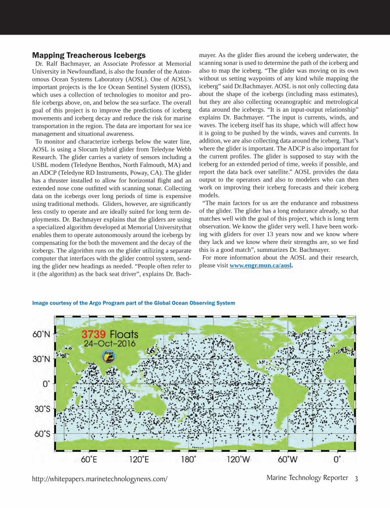
Image courtesy of the Argo Program part of the Global Ocean Observing System
http://whitepapers.marinetechnologynews.com/ Marine Technology Reporter 3

The Lead
Studying Neolithic LandscapesBased on the Scottish west coast, the Scottish Association
for Marine Science (SAMS) is Scotland’s largest and oldest independent marine science organization. Dr. John Howe is head of the Biogeochemistry and Earth science department at SAMS and has recently used the Teledyne Gavia AUV, which is named Freya, for a project studying Neolithic landscapes in Orkney that date back 5,000-7,000 years. “Sea levels were a lot lower previously than they are now so you can look at the off-shore landscape as being the previously terrestrial landscape”, explained Dr. Howe. Working with Aberdeen University and the University of St. Andrews, the team looked at some areas off Orkney around the famous Ring of Brodgarstone circle. The AUV also operated in the Loch of Stenness and the Bay of Firth. During the surveying, some interesting features were lo-cated on the bathymetry and side scan images. The areas of in-terest were photographed, revealing stones on the seabed that may be an indication of previous settlements now drowned by the rising sea levels. The project, which took place in a shallow water coastal zone, had unique challenges directly at-tributed to the water’s depth, which is not a typical operating
depth for AUVs. Operating safely in relatively un-surveyed water of less than 10m depth was significant and most of the operations took place in about 6m of water. The vehicle had to “understand”it was in shallow water and effectively had to run as a mini surface vehicle. The team borrowed row boats to retrieve the AUV, a demonstration of the low logistic design. “We travelled with Freya in the back of a van and drove up to Orkney then carried her into the water wearing dry-suits and launched her. For us it demonstrated the utility of the vehicle and the idea thatTeledyne Gavia has been promoting, which is the low logistics of the vehicle. Having this small footprint also helps keep costs down”, said Dr. Howe.Dr. Howe and his colleagues have now set their sights on
launching the AUV in underwater Fjords off the coast of Pa-tagonia in February or March of 2017. To learn more about SAMS, their programs, and their research, visit www.sams.ac.uk. Follow @ScotMarineInston twitter.
Monitoring Scallop PopulationsThe primary range for the Atlantic sea scallop fishery is
from the Mid-Atlantic to the US/Canada border. Sea scallops,
Freya AUV about to dive in front of the Fjortende Julibreen glacier
Imag
e Co
urte
sy o
f Sco
ttis
h As
soci
atio
n of
Mar
ine
Scie
nce
4 MTR White Papers MTR White Papers / Edition Three

which were nearly wiped out 20 years ago, are now a sustain-able $1 billion industry due to several actions that were taken to help the population recover. Keeping track of these popula-tions is important in the overall management of the species. Research scientist Dr. Arthur Tremban is and his team atthe
University of Delaware’s Robotic Discovery Lab,have been studying scallop populations using a Teledyne Gavia AUV to collect population density and mapping data of known sea scallop habitats. “We have had our Gavia AUV systems for about eight years now in both a base configuration and a map-ping configuration. The modules we have are side scan sonar, a camera, and some water quality sensors including, dissolved O2, chlorophyll turbidity and an acoustic modem” describes, Trembanis. Dr Trembanis’ team uses the Gavia’s base vehicle configuration frequently for seafloor and habitat mapping ef-forts. They have been mapping sea scallops off the east coast using the Gavia’s camera, allowing the team to count the scal-lops and establish their abundance. AUVs have replaced more costly and inefficient methods of monitoring scallop popula-tions and opened up a number of avenues for researchers inter-ested in studying their habitats. The AUVs can cover a larger area in less time than other methods and have the added ben-
efit of being able to act and move on their own (autonomous operation) and collect samples without constant direct input from a surface-based control station. They can be operated alone or in coordinated fleets. “We use the AUV to fly over the seabed and take hundreds of thousands of photos each in a sequence”, explained Trembanis. The research and data being collected have already aided in developing limited fisheries in the closed areas of Georges Bank. In addition to providing managers with precise stock as-
sessment information, the surveys constitute a large exami-nation of the environmental impacts of bottom-tending mo-bile fishing gear. The scallop fishery predominantly utilizes paired or single scallop dredges throughout the entire range of the fishery. Trawl gear is used, to a lesser extent, in other regions. Trembanis and his team at the University of Delaware conducted research, using the AUV, on incidental mortality caused by fishing with dredges and trawl gear. Photographic surveys taken before and after a scallop dredge gave research-ers new insight on the effects of the practice, which led to reduced dredging time and haseased the damaging effects to the scallop population from fishing on the sea floor. “The sci-entific community is increasingly relying on optical solutions.
Imag
e Co
urte
sy o
f UD
Calib
re S
yste
ms
BO
EM s
tudy
http://whitepapers.marinetechnologynews.com/ Marine Technology Reporter 5

The Lead
They want to be able to pull up a photo and see that that was a pipe or that was a mine or a wreck. The scientific and mapping communities are moving toward using optical approaches for mapping and examining habitat. It’s the only way you can get at species level stuff. I can tell you there is a reef there or some rock or sand or mud, but I can’t tell you anything about spe-cies until I actually have photos on it,” said Trembanis.Read more about the University of Delaware’s work on scal-
lops at https://www.ceoe.udel.edu/our-people/profiles/art/incident-mortality-sea-scallops. To learn more about the Robotic Discovery Lab visit: https://www.ceoe.udel.edu/schools-departments/school-of-marine-science-and-poli-cy/robotics/about
Monitoring Oceans for Climate ChangeResearchers that want to measure the salinity, temperature,
and pressure data from the ocean employ CTD sensors. The CTD provides scientists with the physical and chemical param-eters of the water column. Originally, large shipboard CTDs were used that were comprised of small probes mounted to a large metal rosette wheel. Shipboard deployment can be cost-ly and requires a large footprint, including a winch on the ship to lower and raise the CTD through the water. Shipboard sam-pling techniques require the ship to travel to a designated posi-
tion and maintain station as close as possible throughout the CTD cast. Weather conditions and ship capabilities can make this a challenge. “Getting ships into these areas where you want to conduct CTD measurements is not easy, especially in the Southern Ocean because nobody goes there.” said Profes-sor Stephen Riser of the University of Washington, School of Oceanography. Professor Riser was one of the early develop-ers of the international Argo float array. Argo is a global array of more than 3,000 free-drifting profiling floats that measure the temperature and salinity of the upper 2000 meters of the ocean. This allows, for the first time, continuous monitoring of the temperature, salinity, and velocity of the upper ocean, with all data being relayed and made publicly available within hours after collection. 1
Researchers at the University of Washington began working with Doug and Dan Webb during the 1990s. “Doug Webb in particular was a designer of the APEX buoyancy engine to control the floats’ depth, and we were one of the first users of it in an Atlantic project. We got the buoyancy engine working, and then a CTD to mate with it; this allowed us to collect high quality temperature, salinity, and pressure data. That was the first time this was possible without a research ship,” said Dana Swift, research scientist at UW. CTDs had been shipboard instruments prior to that time. “The University of Washing-
1 “What is Argo” Argo website. http://www.argo.ucsd.edu/ (accessed October 21, 2016).
Imag
e co
urte
sy o
f Uni
vers
ity o
f Was
hing
ton
6 MTR White Papers MTR White Papers / Edition Three
ton and Webb built and launched the Autonomous Profiling Explorer (APEX) and this was essentially the beginning of everything that followed”explains Swift.In 1999 the Argo program was established. Argo is a broad-
scale global array of temperature/salinity profiling floats. Argo has become the standard by which other developing ocean ob-serving systems design their programs. “The goal of the pro-gram is to maintain over 3000 floats to monitor the oceans’ heat and freshwater content“, said Riser. “Our group at UW has purchased some 1700 floats from Webb Research to date. There are 32 countries involved in this international program.”Argo has made remarkable progress toward the objectives
that were set in 1998. It is the mainstay of in situ ocean-ob-serving system and its extremely rich dataset have made pos-sible research and operational activities that were previously impossible. Argo data have shed light on some of the key questions about the oceans’ role in the earth’s climate system.“The plan from the very beginning was to make this global.
It took about seven years to get the array large enough that it was truly global. We started out with zero floats and after seven years we had 3000 floats”, said Riser. “The plan was for the US to have roughly half the floats, and today roughly half of the US floats are Teledyne APEX floats.” The Southern Ocean Carbon and Climate Observations and
Modeling (or SOCCOM) floats are something different than Argo. SOCCOM floats use similar hardware and collect the same basic CTD data but SOCCOM floats also collect dis-solved oxygen, nitrate, chlorophyll, and pH data with instru-mentation that was developed at the University of Washington. SOCCOM is largely funded by the National Science Founda-tion. “The Argo floats are looking at the physical oceanogra-phy of the ocean, as do the SOCCOM floats but SOCCOM also looks at the chemistry and biology. Where Argo is look-ing at primarily the ocean heat content on a global scale, SOC-COM is trying to assess the carbon system and CO2 uptake of the ocean”, explains Riser.“When you are looking at cli-mate and climate change, over 70% of the world is covered by oceans. Something like over 90% of the excess heat is stored in the ocean and not in the atmosphere. Argo has been one of the main ways we know that.”Learn more about the University of Washington’s Physical
Oceanography program at http://www.ocean.washington.edu/story/Physical_Oceanography. Visit the UW Argo web-site at http://runt.ocean.washington.edu/
Mapping a Glacial LandslideIn October of 2015 a massive landslide was detected at Tyn-
dall glacier in southeast Alaska. An estimated 180 million tonnes of valley wall collapsed into Taan Fiord. Researcher Dan Shugar from the University of Washington Tacoma trav-eled with a team this summer to investigate the damage caused by the landslide. Dan Shugar explains, “Taan Fiord is an arm of Icy Bay in southeast Alaska, the valley there was full of ice not too long ago, within the last few decades. Over the past
several decades, Tyndall Glacier has retreated.When these glaciers retreat they don’t hold up the valley walls anymore. The glaciers erode the valleys to make very steep sidewalls and when the glaciers retreat those sidewalls are oversteep-ened. One of the side effects of that over steepening and then debuttressing is that the walls can collapse catastrophically in the form of massive landslides.” Seismologists at Columbia University detected the seismic signature from thousands of miles away in New York. With a grant from the National Science Foundation, Shugar’s
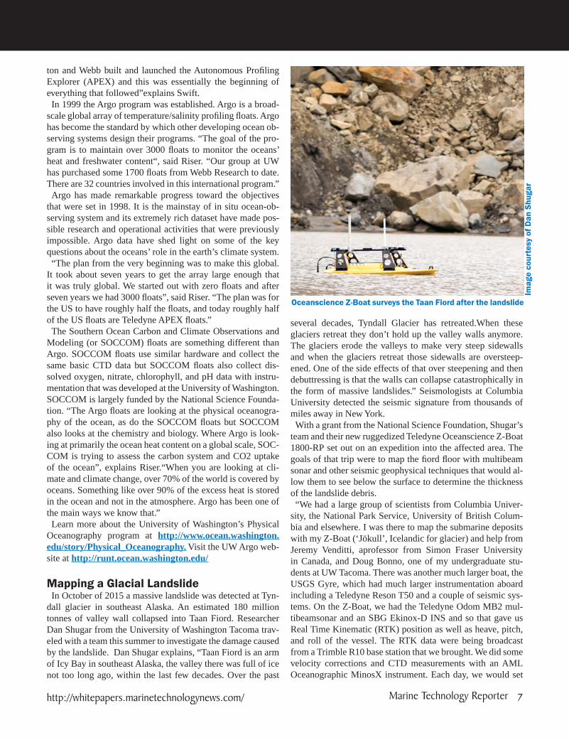
team and their new ruggedized Teledyne Oceanscience Z-Boat 1800-RP set out on an expedition into the affected area. The goals of that trip were to map the fiord floor with multibeam sonar and other seismic geophysical techniques that would al-low them to see below the surface to determine the thickness of the landslide debris. “We had a large group of scientists from Columbia Univer-
sity, the National Park Service, University of British Colum-bia and elsewhere. I was there to map the submarine deposits with my Z-Boat (‘Jökull’, Icelandic for glacier) and help from Jeremy Venditti, aprofessor from Simon Fraser University in Canada, and Doug Bonno, one of my undergraduate stu-dents at UW Tacoma. There was another much larger boat, the USGS Gyre, which had much larger instrumentation aboard including a Teledyne Reson T50 and a couple of seismic sys-tems. On the Z-Boat, we had the Teledyne Odom MB2 mul-tibeamsonar and an SBG Ekinox-D INS and so that gave us Real Time Kinematic (RTK) position as well as heave, pitch, and roll of the vessel. The RTK data were being broadcast from a Trimble R10 base station that we brought. We did some velocity corrections and CTD measurements with an AML Oceanographic MinosX instrument. Each day, we would set
Imag
e co
urte
sy o
f Dan
Shu
gar
Oceanscience Z-Boat surveys the Taan Fiord after the landslide
http://whitepapers.marinetechnologynews.com/ Marine Technology Reporter 7

The Lead
up a makeshift office, which was a little table with a couple of chairs on top of bouldery landside deposits on shore. We had a field laptop, power supply with solar panels, and radio anten-nas to communicate with the Z-Boat.” The researchers needed to work very efficiently, out in the middle of the wilderness with everything powered by batteries. The Z-Boat proved to be a useful tool, dodging icebergs and getting into areas too dangerous for the larger ship. “The Z-Boat was such a great tool for this particular project. We were working on a gigantic landslide in very steep terrain in front of a calving glacier, which is a pretty hazardous place to be around, so you don’t necessarily want to have a vessel with people aboard in this kind of environment. The slope that collapsed is potentially unstable even now and so another landslide could occur. You don’t want to be too close to the calving face of the glacier because if a big piece comes off,it could generate a wave that could flip your boat. The Z-Boat allowed us to get into these otherwise inaccessible locations that the larger USGS boat wasn’t comfortable doing, either because it was too danger-ous or potentially too shallow. We were able to fill in the gaps where the big boat didn’t really want to go” said Shugar.Having the Z-Boat greatly increases their chances of con-
tinuing to collect important data and gain access to remote locations. “As a geoscientist that studies geo-hazards in par-ticular, the ability to go where we have never been able to
go or map what we have never been able to map, with this kind of resolution, in these extreme environments and remote areas is the major advantage. Not only can we answer more profoundly scientific questions than we’ve been able to in the past but also we can ask new questions” concluded Shugar. Learn more about Dr. Shugar and the Water SHED Lab at http://faculty.washington.edu/dshugar/ (WaterSHED Lab). Follow Dr. Shugar’s latest expeditions on twitter at https://twitter.com/WaterSHEDLab.
SummaryUnmanned systems are an important contributor to ocean re-
search and exploration. Their ability to access remote areas, sample for longer periods, and keep humans largely out of harm’s way while providing scientists with high quality data to better understand the complexities of the ocean or the im-pacts of climate change are all significant accomplishments. The benefit of partnerships between manufacturers and re-searchers are obvious from the advances that have been made in unmanned vehicle technology and the sensors they carry. Teledyne Marine is proud to partner with the researchers in this article and elsewhere who continue to challenge the tech-nology and demand more so that they can continue to ask and answer the questions that help us better understand the world we live in.
Makeshift Office at Taan Fiord
Imag
e co
urte
sy o
f Dan
Shu
gar
8 MTR White Papers MTR White Papers / Edition Three

Teledyne Marine Vehicles
www.teledynemarinesystems.com
Oceanscience Remotely Operated Q and Z BoatsWebbResearch
APEX Profiling Floats
Gavia Autonomous Underwater Vehicles (AUVs)
SeaBotix Remotely Operated Vehicles (ROVs)
Webb Research Slocum Glider
Benthos Deep Tow System
Proven performance and reliability from surface to seafloor

ROV
Up until very recently, all ROV manufacturers have based their vehicle designs one or more specific models, each with their own set of thrusters, camer-
as, accessories, power, tether, and control systems. Only Vid-eoRay allows a wide variety of instruments and accessories to be added in the field, as required, by the end user. In fact, the 9-pin Pro 3/4 accessory adapter has become the de-facto standard for the industry, and there are dozens of available sensor and tools that use this. But even VideoRay users have
had only one set of thrusters and base camera to work with – the VideoRay Pro 4
For the latest generation of solutions for underwater tasks, VideoRay engineers have reversed this process of adding ac-cessories to a base ROV. The new Mission Specialist Series (MSS) is the result of this change in thinking. Rather than develop a standard vehicle, then adding a few accessories as needed, they have developed components that are designed to
VideoRay Pioneers New Concept for ROV Design
Each Mission Specialist system contains exactly the components and configuration needed for its mission.
10 MTR White Papers Special Content Edition / Number Three

A crew of 3 successfully operates the Mission Specialist and the VideoRay Pro 4 on a variety of aquaculture missions in Norway.

ROV
be “mixed and matched.” The entire vehicle is configured and optimized for payload, depth, maneuverability, thrust, sensors, and tools required for a specific task. In essence, the thrusters, power, communications, lights, and cameras are all accessories – they have the same status as the sen-sors and tools that were previously “accessories” added to a standard vehicle. Since absolutely any one of these can be added as needed - where needed, to a frame (which itself is customized for a solution,) the ROV designer can produce the optimal tool for each underwater mission.
There are three main benefits to this approach:1. System Portability and Deployment – since only the necessary components are included, the resulting system is smaller and lighter. This improves options for shipping and deployment.
2. Performance – the ability to work in higher cur-rents, and with longer tethers, is largely a result of the flexibility inherent in this system. There are no un-necessary accessories or tools or communications or power modules, and there are as many thrusters, in whatever configuration is required, to get the job done.
3. Price – since each systems does not include unnec-essary thrusters, lights, cameras, tools, or sensors, the end user cost can be much lower than it would be oth-erwise. While this was true of 9 pin accessories in the VideoRay Pro line, it now extends to every aspect of what used to be “standard” lights, camera, thrusters, and power and communication modules.
Some recent examples of Mission Specialist vehicles:This Mission Specialist System was configured for a
Nordic Aquaculture service company. They needed to in-spect moorings in more than 300m of water in currents that sometimes exceeded 2 knots. The ROV also needed to be able to document and position key pen infrastructure. The Mission Specialist system was outfitted with an HD camera system which allows for 1080p video capture and 13 mega-pixel still grabs. The ROV also worked with the ship’s Olex charting system allowing the crew to mark pen moorings for the farm owner’s and regulators.
This system was completely different. It was configured to inspect and clean for an offshore UWILD inspection. This inspection was on a Floating Production, Storage, and Offloading (FPSO) vessel. The system needed to clean ar-eas of the ship hull including weld seams so it could be ob-served by class inspectors. The Mission Specialist was set-up with a specialized cavitation lance which was connected
The Mission Specialist with a Cavitation Cleaning lance is ready for deployment.
The Mission Specialist 6 thruster model compared with a Pro 4
Special Content Edition / Number Three

ROV
to top-side pump via a stiff high pressure hose. The system was optimized for mini-mum weight – so it could be easily moved around the FPSO eliminating the need for a ROV operation vessel. The system re-quired maximum power to fight seasonal currents. The system was optimized with a high definition camera and a powerful, multi-purpose LED array.
This system was configured for a Sci-ence & Research foundation performing university research. The customer required flexibility to add sensors and depth range as they added new clients and projects. Initially missions were in shallow water (less than 300 meters), but eventually the team wanted to dive to 2,000 meters. This system includes a forward looking sonar, 2 axis multi-function manipulator and 400 meters of neutral tether, and met the cus-tomer’s budget. The customer can upgrade the depth rating of their current system by simply changing the tether, ROV power source and flotation - at a fraction of the cost of purchasing a new ROV system.
Mission Specialist systems have also been ordered and delivered to Navies for Mine Countermeasures and Diving and Salvage operations. Details are confidential.
While there are challenging missions that require the power and flexibility of Mission Specialist, over 90% of observa-tion requirements can be achieved with the standard Pro 4, with the instruments or tools already available. The Pro 4 is often referred to as the “pickup truck” of the ob-servation class of ROVs for its flexibility and ubiquity. Just one example: The US Coast Guard uses the VideoRay
Pro 4 equipped with a forward looking Multibeam sonar and a hull crawler acces-sory to perform ship hull and port security sweeps.
14 MTR White Papers Special Content Edition / Number Three

Sensors
Whether it is an ASV, AUV, ROV or indeed a sea mammal such as a seal or dolphin, all instrument-ed vehicle types need various sensors to meet and
maintain design criteria or operational demands. The chal-lenge for us as manufacturers is to match those demands with sensor designs and packages that meet varying specifications of size, weight, material, depth, power constraints and budgets without making each requirement a “one off” (as there are of course additional cost and time implications associated with a ‘one off’).Valeport has so far met this challenge with varying designs
and success with a mix of bespoke packaged sensor products, or simple OEM sensor options for customer integration.Conductivity, Temperature and Depth (CTD) and Speed of
Sound, Temperature and Depth (SVP) are common require-ments and necessary for complementary or corrective data to other parameters being measured. More specific parameters such as Chlorophyll, Rhodamine, Fluorescein, Turbidity and Crude Oil in water are also coming on line as both indepen-dent and packaged products.
Use Existing Technology!Utilising existing proven technology with respect to circuits
and sensors is by far the easiest approach to meeting custom-er requirements for vehicles. Adapting what we have in the form of re-packaging is a way of keeping product costs at a sensible level whilst maintaining that reliability and accuracy. Re-using this technology will also greatly reduce the need for prolonged testing of prototypes. This also has the benefit of reducing timescales for completion of the end product and ul-timately keeping the customer happy. Because Valeport cover all key processes in house such as design, machining, envi-
ronmental testing, assembly and calibration, we can quickly determine with minimum fuss and maximum confidence if an answer to a customer’s request or specification is feasible for us to engage with.
Autonomous Surface Vehicles (ASVs) and deployment of probesSensor packs for ASVs are not so constrained to size or pow-
Sensor Suites and Our Engineering Challenge
Valeport’s miniSVS positioned on a Seafloor Systems small ASV
16 MTR White Papers Special Content Edition / Number Three
er requirements, especially with larger vehicles where this is certainly not a problem. It also gives scope for a more multi-parameter approach to conduct water quality evaluations. Most ASVs want probes that can be profiled to a reasonable depth from an on-board winch either as pre-programmed or on demand. Key to this after a successful deployment pro-cess is the transfer of data upon recovery to the ASV via hard wired or wireless systems. Doing this automatically greatly reduces customer intervention and makes it one less pro-cess to worry about. At Valeport, we proactively work with manufacturers to achieve this through their own software or control systems with integration of our own code. Products available to operate like this already are the SWiFT SVP, fast-CTD and rapidCTD all of which have Bluetooth communica-tion capability and internal batteries. Small ASVs generally require sensors for surface measurement only and typical of this would be a sound velocity sensor like the miniSVS for
input into a single or multi-beam echo sounder where it is hull mounted.
Autonomous Underwater Vehicles (AUVs) and core parametersAUV sensors are certainly the main challenge to us and this
fast changing technology ranges from large commercial or military to small scientific vehicles. Sensors for internal and flooded area use, or hydrodynamically sympathetic to the host vehicle certainly stretch design criteria especially when trying to adopt a “one fits all” approach where possible. Our work in this area has evolved from a very successful programme of using marine mammals as a host vehicle via the Sea Mammal Research Unit (SMRU), University of St Andrews, Scotland. This saw the development of a CTD Oceanographic sensor for integration into an intelligent logging tag, to provide an essential tool which allows researchers to better understand
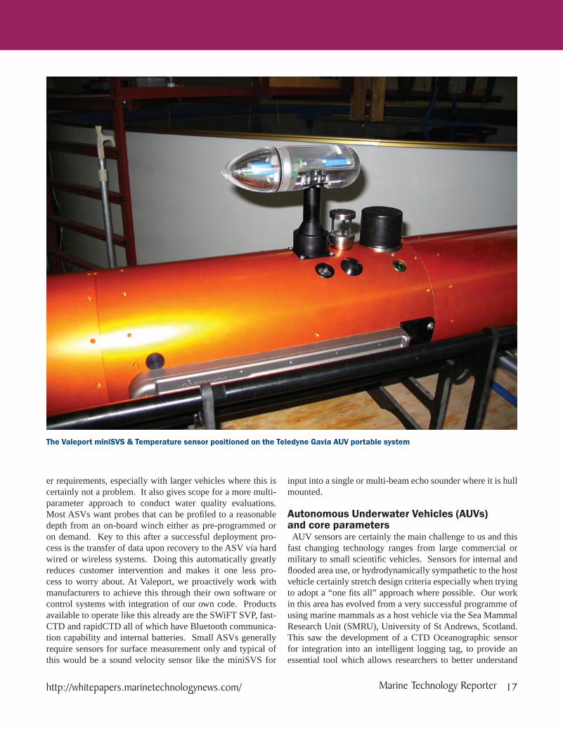
The Valeport miniSVS & Temperature sensor positioned on the Teledyne Gavia AUV portable system
http://whitepapers.marinetechnologynews.com/ Marine Technology Reporter 17
Sensors
the behavioural characteristics of sea mammals in relation to the environment in which they live. This is realised through the combined monitoring of the mammal’s detailed dive and haul out information with the key oceanographic parameters, temperature and salinity being measured to an acceptable sci-entifi c standard. This technology is now enhanced with the ad-dition of a Fluorometer to measure Chlorophyll as well whilst still retaining the main footprint in a compact and rugged ar-rangement.Military AUV requirements are able to benefi t from our com-
mercial off the shelf (COTS) technology where a combination of sensors are combined into a small and lightweight package,
whilst still being rugged enough to endure the tough working environments and meeting military standards. Typical of this is the UV-SVP which offers accurate Sound Velocity, Temper-ature and Depth in a compact and lightweight titanium hous-ing for 3000m operation. By adding an Altimeter and optical sensor such as a Fluorometer then makes it an interesting ad-dition to any payload.
Remotely Operated Vehicles (ROVs)From the large and deep water work class and scientifi c ve-
hicles to those that you can hold in the palm of your hand for shallow water use, the challenge has many similarities to those
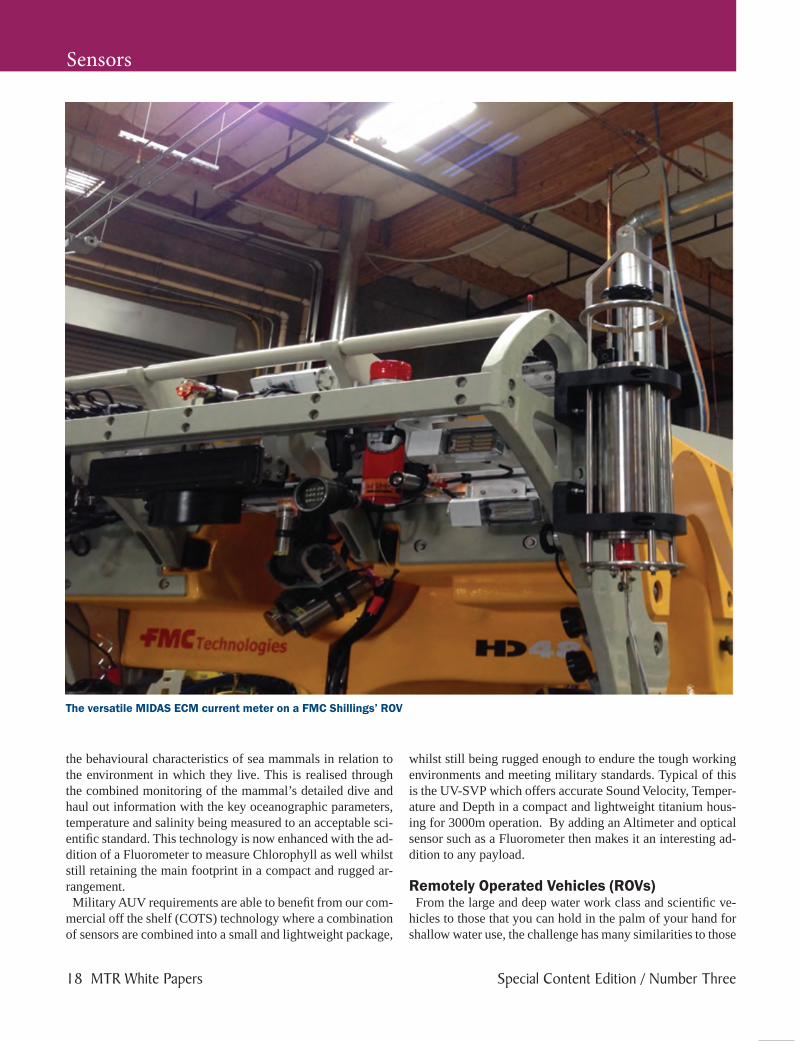
The versatile MIDAS ECM current meter on a FMC Shillings’ ROV
18 MTR White Papers Special Content Edition / Number Three

Sensors
of instrumenting AUVs. High accuracy depth and bathymetry when working so deep is critical to operations. On line, Den-sity corrected data from accurate Bathypacks are key to this role and having robustly packaged, yet accurate sensors that can operate to 1100 bar in some specific cases contribute to this requirement. Our own Midas Bathypack and VA500 Al-timeter combination uses the correct sensors to generate preci-sion Sound Velocity and Density profiles for highly accurate depth and height data. Operating in strong underwater cur-rents can significantly affect vehicle performance and whilst some designs stand up well in these conditions, the need to measure current flow either remotely or on-board is important operationally. This can be done using electromagnetic current meters with, or without compass (direction) data with integra-tion directly on the vehicle or its tethered management system (TMS / Garage) to provide extra data for the pilots in control. Additional sensors such as Conductivity, Temperature, Depth and Turbidity can also be added to current meter products such as the Midas ECM.
For Good Measure Valeport is the UK’s leading manufacturer of oceanographic,
hydrographic and hydrometric instrumentation.Valeport designs and manufactures instrumentation for the
oceanographic, hydrographic and hydrometric communities with a worldwide customer base that includes: defence, envi-ronmental, oil and gas, renewable energy, construction, dredg-ing and civil engineering sectors. Valeport has supplied to the subsea sector since it was es-
tablished in 1969, now an independent, family owned busi-ness, Valeport employs more than 80 people from their base in Devon, in the south west of the UK and works with a global network of agents to ensure a responsive and efficient world-wide service.
Valeport’s UV-SVP has been adopted by Bluefin Robotics and shown here on the Bluefin 9 AUV
Valeport’s CTD sensor fitted to seal tags of the Sea Mammal Research Unit (SMRU) of St Andrews University Scotland
For further information: please contact
Kevin Edwards,
Valeport sales & marketing manager,
call +44 (0) 1803 869292
www.valeport.co.uk
20 MTR White Papers Special Content Edition / Number Three
Hydrographic Processing Software
IntroductionTerraSond, a hydrographic services company based in
Palmer, Alaska (USA), recently used a C-Worker 5 (CW5) unmanned Autonomous Surface Vessel (ASV) in conjunction with a 105’ (32 m) research vessel from June through August, 2016 for a major hydrographic survey in the Bering Sea re-gion of Alaska. The project was an industry first in using ASV technology to maximize productivity in a hydrographic sur-vey in remote areas, and the work proved the benefits of using autonomous vehicles.
One of the key technologies used throughout the survey was the use of CARIS Onboard, a near real time data processing software that enabled rapid generation of processed datasets from the ASV.
BackgroundTerraSond has worked with autonomous technologies for
hydrographic survey for some time, and is experienced in re-alizing the benefits of autonomy to reduce survey time and increase data productivity. In the case of surveys in Alaska,
Onboard Data Processing with Autonomous Surface Vehicles in the Bering Sea
Near real time data processing facilitates the success of pioneering autonomous survey operations in support of
national charting surveys of the USA.
By Andrew Orthmann, Charting Program Manager, TerraSond Limited, Palmer, Alaska (USA) and Michael Redmayne, Account Manager, Teledyne CARIS (USA)

autonomy is particularly beneficial due to the remote locations of survey areas. Much of the Alaska coastline is far from ports and requires expensive mobilizations of relatively large ves-sels and time-consuming transits to reach. By utilizing a force multiplier such as an ASV, a survey can be completed in a smaller timeframe, which is of particular benefit when the area is only open to surface traffic during the summer months due to sea ice pack. In 2016 TerraSond was awarded a U.S. National Oceanic
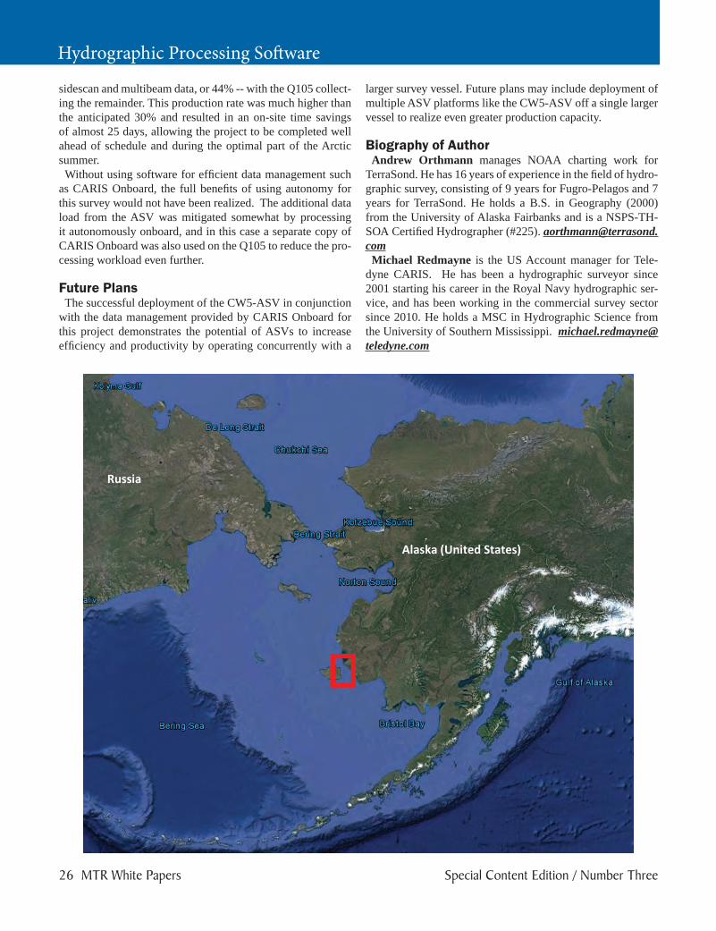
and Atmospheric Administration (NOAA) contract for a 570 square nautical mile survey area in the Bering Sea region of Alaska, near Nunivak Island in Etolin Strait. This survey was well suited for ASV deployment.
Survey AreaLike much of Alaska’s Arctic coast, the area is remote, with
fuel and supplies days away by water. The 105’ research ves-sel, the RV Q105, would need to be mobilized in Homer, Alas-ka – the “closest” port to the survey area on the road system – and transit 900 nautical miles for four days to reach the sur-vey area. The closest source of fuel and supplies was Bethel, a roundtrip transit of 600 nautical miles or about three days.
Survey HardwareA C-Worker 5 (CW5-ASV) was chartered from ASV, LLC.
The CW5-ASV was developed from the ground-up as a hy-drographic force multiplier. At 18’ (5.5 m) the vessel is large enough to handle marginal weather conditions and support a variety of survey instrumentation but small enough to fit on the deck of small to mid-sized support vessels like the Q105. Other features which made it well-suited for this project in-clude 4-5 days of continuous survey endurance and 6 to 7 knot survey speedsBoth the ASV and Q105 were configured with identical sur-
vey systems. Major components consisted of Reson 7101 mul-tibeams, Edgetech 4200 sidescans, and Applanix POSMVs. The decision to equip both vessels with the same equipment was intentional – this meant the survey data quality would be comparable and minimized logistical concerns of spares in such a remote location.
Data ManagementControlling and monitoring the ASV required an additional
four dedicated personnel aboard the Q105 for 24 hour opera-tions. This consisted (per 12-hour shift) of one ASV person-
http://whitepapers.marinetechnologynews.com/ Marine Technology Reporter 23

Hydrographic Processing Software
nel to monitor the CW5-ASV and one TerraSond personnel to monitor the survey equipment suite. A fifth person from ASV was also aboard to assist with issues if needed, especially since the CW5 was a new survey platform for 2016.The survey systems on the ASV were monitored by remote
desktop methods over a standalone IP radio system. This al-lowed the two survey grade PCs on the ASV and the associ-ated survey software to be monitored in real time. However, transmission of raw data over the radio link to the Q105 was not possible because of the large data volume generated.Although having the additional vessel increased the rate of
data production, two challenges were presented - first how to provide quality control for data that was not accessible in real-time, and second how to deal with twice the amount of data due to the additional vessel. To address these challenges a new software package offered by CARIS was used, CARIS Onboard. CARIS Onboard is a near real time survey data processing
software, which monitors the directory where survey data lines are logged and automatically processes them in accor-dance with a pre-defined workflow. The software was run on the ASV’s multibeam computer, and was used to generate both a processed CARIS dataset and survey products, such as TIN models showing both the quality of the data and the bathymetry.
This approach allowed quality control of processed data to occur despite a limited bandwidth connection, as the surveyor on the Q105 could check that data was meeting the required survey standards. The second challenge of data volume was also met by the use of CARIS Onboard, as a processed dataset was available both during the survey and immediately upon recovery of the ASV.
OperationsRadio bandwidth was adequate for real-time monitoring and
tuning of the acquisition systems but insufficient to transfer raw sensor data, which could be up to 100 GB/day. To prevent a data bottleneck, firstly CARIS Onboard was used to allow the surveyors on the manned platform to visualize the pro-cessed dataset to look at the bathymetry and also monitor the quality of the processed dataset. Secondly, data was down-loaded whenever the ASV was recovered aboard the Q105, which on one occasion was 3 ½ days after deployment. By using CARIS Onboard the duration between recoveries could be maintained with greater confidence at this long interval.
ResultsDespite a relatively complex survey instrumentation suite
that included towed sidescan, the CW5-ASV acquired 2,275 nautical miles of the project total of 5,200 nautical miles of
24 MTR White Papers Special Content Edition / Number Three

Focus on the Tough Stuff
CARIS Onboard™ automates many of the standard processing steps required in a modern hydrographic survey that not only reduces subjectivity but allows your skilled staff to work on the most important tasks. With the ever expanding volume of data being collected at higher resolutions CARIS Onboard will reduce your data Ping-to-Chart™ timeline.
Built on decades of hydrographic data processing expertise and supported by the highly scalable CSAR framework, CARIS Onboard enables users to process data in near real-time resulting in minimized data conversion and processing times. Designed with autonomous operations in mind, CARIS Onboard will save valuable time so you can focus on the tough stuff.
Contact us about deploying CARIS Onboard on your survey platform.
Copyright © 2016 Teledyne CARIS, Inc. All rights reserved. CARIS and Ping-to-Chart are registered trademark of Teledyne CARIS, Reg. USPTO.
[email protected] | www.caris.com
DESDESK-1620 - MRT_Onboard (June 2016) Final.indd 1 6/21/2016 1:44:19 PM
Hydrographic Processing Software
sidescan and multibeam data, or 44% -- with the Q105 collect-ing the remainder. This production rate was much higher than the anticipated 30% and resulted in an on-site time savings of almost 25 days, allowing the project to be completed well ahead of schedule and during the optimal part of the Arctic summer.Without using software for efficient data management such
as CARIS Onboard, the full benefits of using autonomy for this survey would not have been realized. The additional data load from the ASV was mitigated somewhat by processing it autonomously onboard, and in this case a separate copy of CARIS Onboard was also used on the Q105 to reduce the pro-cessing workload even further.
Future PlansThe successful deployment of the CW5-ASV in conjunction
with the data management provided by CARIS Onboard for this project demonstrates the potential of ASVs to increase efficiency and productivity by operating concurrently with a
larger survey vessel. Future plans may include deployment of multiple ASV platforms like the CW5-ASV off a single larger vessel to realize even greater production capacity.
Biography of AuthorAndrew Orthmann manages NOAA charting work for
TerraSond. He has 16 years of experience in the field of hydro-graphic survey, consisting of 9 years for Fugro-Pelagos and 7 years for TerraSond. He holds a B.S. in Geography (2000) from the University of Alaska Fairbanks and is a NSPS-TH-SOA Certified Hydrographer (#225). [email protected] Redmayne is the US Account manager for Tele-
dyne CARIS. He has been a hydrographic surveyor since 2001 starting his career in the Royal Navy hydrographic ser-vice, and has been working in the commercial survey sector since 2010. He holds a MSC in Hydrographic Science from the University of Southern Mississippi. [email protected]
26 MTR White Papers Special Content Edition / Number Three