
Law and the Geoweb’ Panel Discussion. 2011 AAG Conference
16
LAW AND THE GEOWEB WORKSHOP Association of American Geographers Annual Meeting Redmond, WA April 11, 2011 Greg Babinski, MA, GISP Finance & Marketing Manager King County GIS Center, Seattle, WA President-Elect Urban and Regional Information Systems Association
-
Upload
greg-babinski -
Category
Leadership & Management
-
view
203 -
download
0
Transcript of Law and the Geoweb’ Panel Discussion. 2011 AAG Conference

LAW AND THE GEOWEB WORKSHOP
Association of American Geographers Annual Meeting
Redmond, WAApril 11, 2011
Greg Babinski, MA, GISPFinance & Marketing ManagerKing County GIS Center, Seattle, WA
President-ElectUrban and Regional Information Systems Association
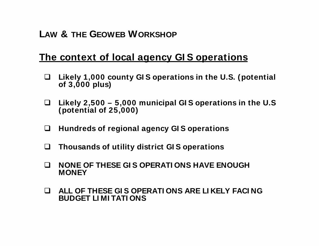
LAW & THE GEOWEB WORKSHOP
The context of local agency GIS operations
Likely 1,000 county GIS operations in the U.S. (potential of 3,000 plus)
Likely 2,500 – 5,000 municipal GIS operations in the U.S (potential of 25,000)
Hundreds of regional agency GIS operations
Thousands of utility district GIS operations
NONE OF THESE GIS OPERATIONS HAVE ENOUGH MONEY
ALL OF THESE GIS OPERATIONS ARE LIKELY FACING BUDGET LIMITATIONS

LAW & THE GEOWEB WORKSHOP
The context of local agency GIS operations
GIS data development and maintenance to meet local agency business needs is complex, expensive, and provides no direct benefit in and of itself
GIS business applications data needs provide the ROI and drive data development and maintenance

LAW & THE GEOWEB WORKSHOP
King County GIS475 maintained data layers
1,200 data layers obtained from other regional agencies via GIS Data sharing program
Other than imagery, there is little viable market provided GIS data that meets our municipal business needs

LAW & THE GEOWEB WORKSHOP
Local government limitations relative to the Geoweb
Capability levels of local agency GIS operations vary greatly
Process maturity levels of local agency GIS operations vary greatly and the concept of maturity is poorly understood

LAW & THE GEOWEB WORKSHOP
Local government limitations relative to the Geoweb
The ROI from local agency GIS is assumed – but needs to be proven:
Spatial Information in the New Zealand Economy, LINZ 2009, ACIL Tasman
King County GIS ROI Study via UW CBA Center
Twin Cities, Metro GIS ROI Study
Multnomah County GIS Application ROI Study
LAW & THE GEOWEB WORKSHOP
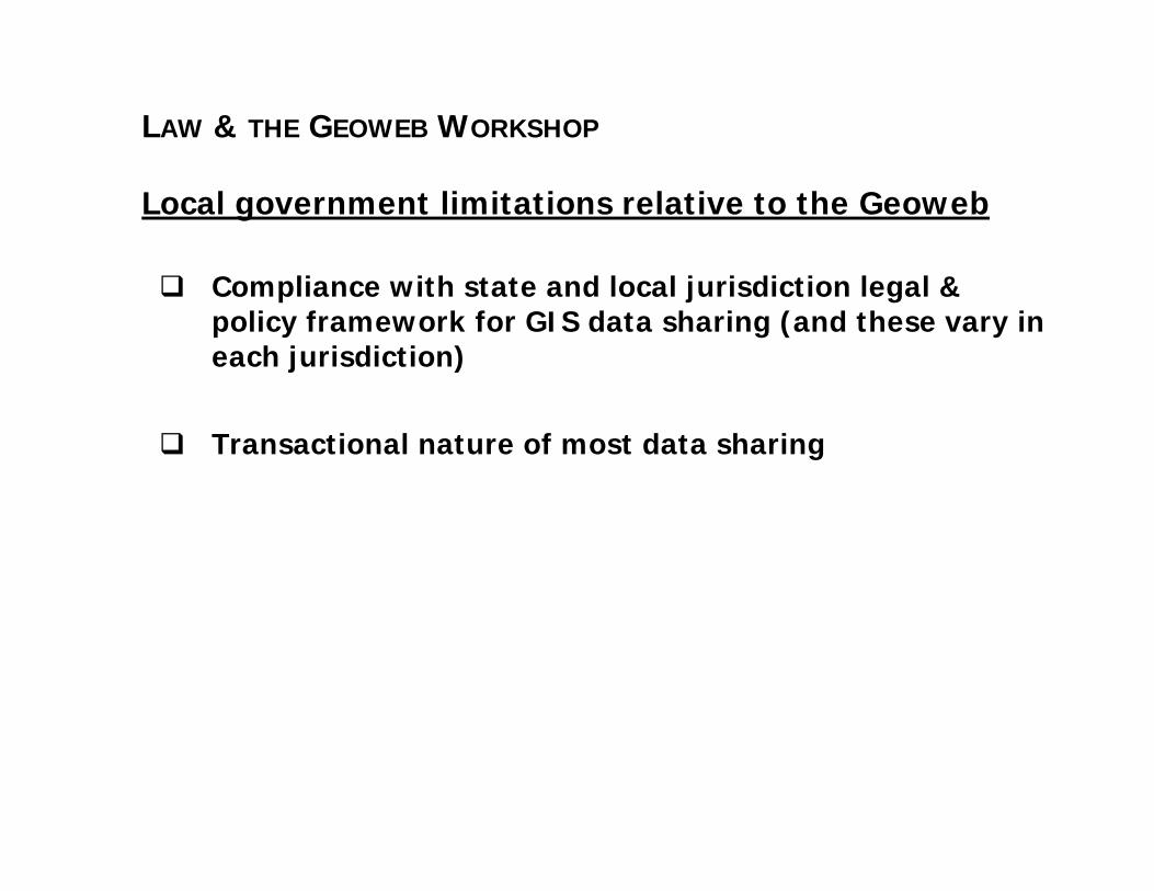
Local government limitations relative to the Geoweb
Compliance with state and local jurisdiction legal & policy framework for GIS data sharing (and these vary in each jurisdiction)
Transactional nature of most data sharing
LAW & THE GEOWEB WORKSHOP
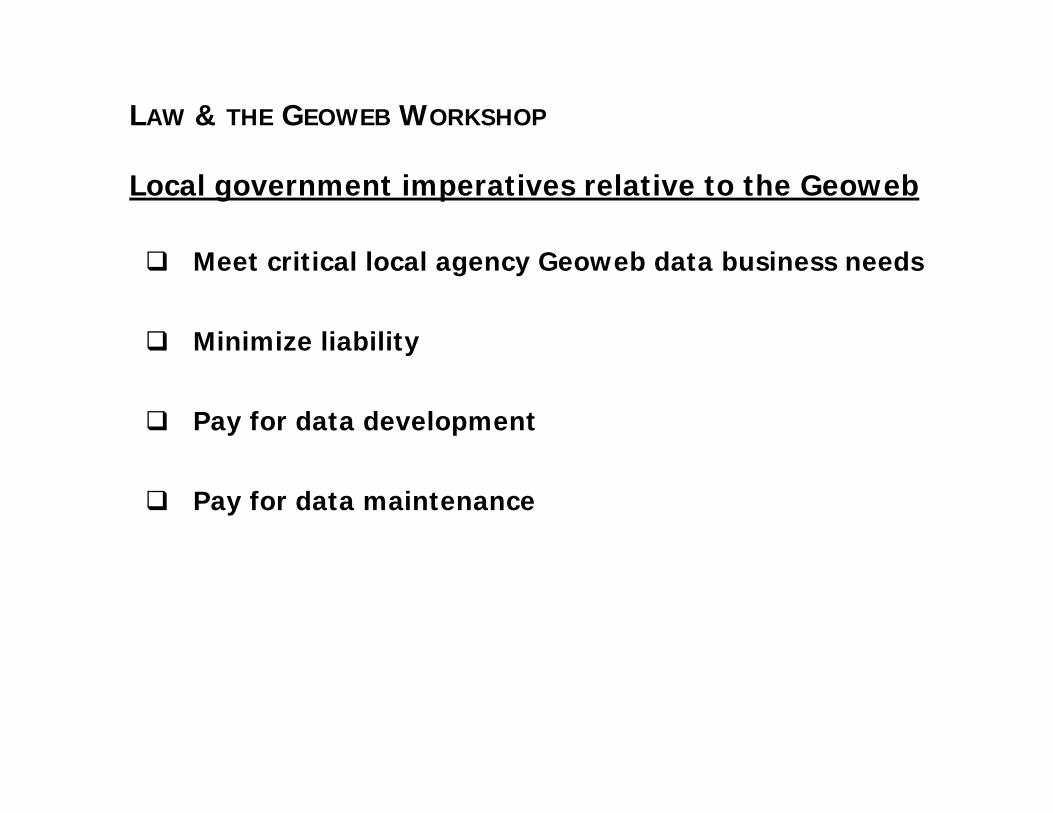
Local government imperatives relative to the Geoweb
Meet critical local agency Geoweb data business needs
Minimize liability
Pay for data development
Pay for data maintenance

LAW & THE GEOWEB WORKSHOP
Pressures on local government GIS operations
Provide data for free
Customize data for outside users
Sign industry data access agreement, rather than local agency licenses

LAW & THE GEOWEB WORKSHOP
Local government options
Copyright
State law limitations on cost recovery
Licensing
Liability issues

LAW & THE GEOWEB WORKSHOP
The failure of the market to build the Geoweb
Limitations of crowd sourced data to meet government agency needs
Inability of the market to develop Geoweb data for its own needs
Unwillingness of the market to develop Geoweb data to meet local agency business needs
Possible exceptions: Environmental Data Resources, marketing demographics data providers, others?

LAW & THE GEOWEB WORKSHOP
Possible local agency vision for GIS data sharing
Prove ROI of implementing local agency GIS
Prove regional ROI from making local agency GIS data freely available for business, academic, and citizen use
Treat GIS data as a utility - developed, maintained, and managed by entrepreneurial multi-jurisdictional consortia (parallel with development of electric utilities from 125 years ago)
Private industry – public agency GIS data sharing via creative commons

LAW & THE GEOWEB WORKSHOP
Possible ways forward
Model state data sharing laws
Develop model local agency data license
Voluntary private industry revenue sharing
Local open data access web portals
Incentive federal financial support for core data posted to the NSDI

LAW & THE GEOWEB WORKSHOP
Possible ways forward
Proposed URISA GIS Capability Maturity Model:
Designed to measure capability and support statewide GIS assessments and COGO’s proposed Geospatial Technology Report Card for the Nation
Designed to increase ROI by focusing on attention on process maturity
URISA focus on local agency GIS ROI study & process

LAW & THE GEOWEB WORKSHOP
What makes me lose sleep at night
Uninformed decision makers assuming that local agency GIS data is easier to develop and maintain than it is
Public agency GIS data slipping into the control of private industry via copyright law
Crowd-sourced data as an alternative to critical framework municipal data layers
Erosion of local agency GIS funding support as municipal decision makers assume that the market (or the mob) can step in and supply and maintain useful data

LAW & THE GEOWEB WORKSHOP
Acknowledgement:
Linda Gerull, GISP, IT DirectorPierce County, WA
George Horning, GIS ManagerKing County GIS Center, Seattle, WA
Mary Phillips, GIS ManagerBenton County, WA
Contact:
Greg Babinski206-263-3753Greg.babinski@kingcounty.govwww.kingcounty.gov/gis