
Lavendon Neighbourhood Plan 2019 to 2031 - Milton Keynes
58
LAVENDON PARISH COUNCIL Lavendon Neighbourhood Plan 2019 to 2031 Referendum Version November 2019
Transcript of Lavendon Neighbourhood Plan 2019 to 2031 - Milton Keynes
LAVENDON PARISH COUNCIL
Lavendon Neighbourhood Plan
2019 to 2031
Referendum Version
November 2019

This page is intentionally blank
LAVENDON NEIGHBOURHOOD PLAN
Contents Introduction 3
Plan Making Process 9
Community Engagement 12
Our vision 14
Environment 16
Character and Design 20
Flood Risk 25
Highways and Transport 28
Community 32
Housing 35
Business and Employment 43
Policies Map
Annex Annex A: Ancient Monuments and Listed Buildings
Annex B: Glossary
LAVENDON NEIGHBOURHOOD PLAN
1
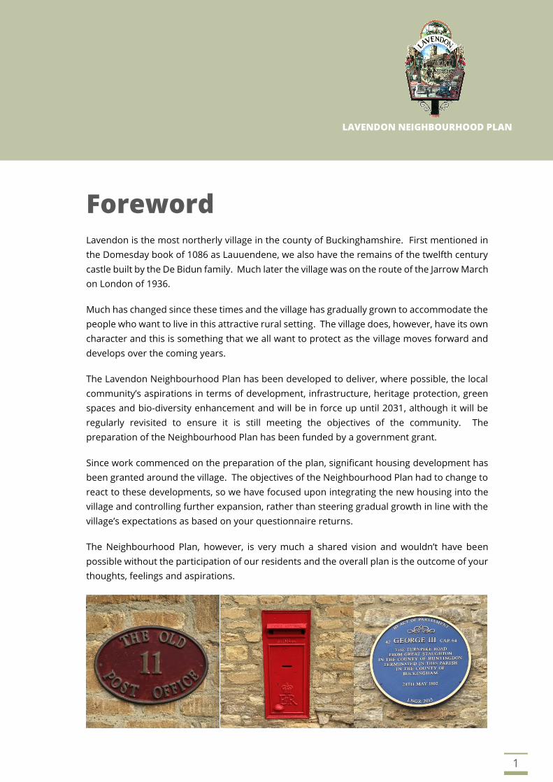
Foreword Lavendon is the most northerly village in the county of Buckinghamshire. First mentioned in
the Domesday book of 1086 as Lauuendene, we also have the remains of the twelfth century
castle built by the De Bidun family. Much later the village was on the route of the Jarrow March
on London of 1936.
Much has changed since these times and the village has gradually grown to accommodate the
people who want to live in this attractive rural setting. The village does, however, have its own
character and this is something that we all want to protect as the village moves forward and
develops over the coming years.
The Lavendon Neighbourhood Plan has been developed to deliver, where possible, the local
community’s aspirations in terms of development, infrastructure, heritage protection, green
spaces and bio-diversity enhancement and will be in force up until 2031, although it will be
regularly revisited to ensure it is still meeting the objectives of the community. The
preparation of the Neighbourhood Plan has been funded by a government grant.
Since work commenced on the preparation of the plan, significant housing development has
been granted around the village. The objectives of the Neighbourhood Plan had to change to
react to these developments, so we have focused upon integrating the new housing into the
village and controlling further expansion, rather than steering gradual growth in line with the
village’s expectations as based on your questionnaire returns.
The Neighbourhood Plan, however, is very much a shared vision and wouldn’t have been
possible without the participation of our residents and the overall plan is the outcome of your
thoughts, feelings and aspirations.
2
Neighbourhood planning was introduced through the Localism Act of 2011 to ensure that local
communities are involved in the planning decisions that affect them. The Lavendon
Neighbourhood Plan will become part of the Development Plan for Milton Keynes and the
policies contained within it will be used by Milton Keynes Council to determine planning
applications within our parish.
It has taken over a year to get to this stage and thanks must go to the steering group who have
been involved from the start, our Clerk Jane who has kept us under “control” and Chris Akrill,
a Planning Consultant, who has been central to getting the plan collated and produced.
What has been apparent throughout this process is that there is a real sense of community
within Lavendon and this needs to be nurtured as we move forward. This as this is the real
essence of our village, something we should be proud of and something that future
generations can take forward.
Steve Axtell, Chairman, Lavendon Parish Council

LAVENDON NEIGHBOURHOOD PLAN
3
Introduction
Setting
1.1 Lavendon village is situated midway between Northampton and Bedford, to the north east of
Olney. The northern boundary of the Parish follows the county boundaries of
Northamptonshire and Milton Keynes, formally part of Buckinghamshire.
1.2 The village is set within a rolling predominately agricultural landscape, with arable fields
interspersed with small areas of woodland. The River Great Ouse forms part of the southern
boundary of the Parish and this river valley dictates the sloping topography of the area with
the land generally falling north to south towards the river.
Figure 1: View from the Church tower

4
Character
1.3 The village has grown in the centre of the key farms in the area, derived from the remaining
manors, now known as Abbey Farm, Uphoe Manor, Castle Farm and Snelson Farm.
Northampton Road and the High Street form the backbone of the village, which has also grown
along Olney Road, Castle Road and Harrold Road.
1.4 The core of the village features many buildings constructed from local limestone, with slate or
tiled roofs. More modern housing is located to the north and south west of the village.
Historical Context
1.5 The origin of the village name is derived from a personal name and a place-name element
from the Old English language, ‘Lafan’ and ‘denu’, which means 'Lafa's valley'. The village was
referred to in the Doomsday Book as Lauuendene and at that time much of the parish, formed
from 10 manors would have been covered with woodland.
1.6 The Bury Ancient Monument is a medieval fortifications ringwork and associated earthworks
located to the north of Lavendon Church, occupied from the late Anglo-Saxon period to the
later 12th century. The earthwork remains comprise a circular enclosure with an overall
diameter of 40m formed by a bank up to 10m wide at base and averaging 1m high. The
earthworks could be a precursor to the nearby Lavendon Castle.
1.7 At Castle Farm are the earthworks of a motte-and-bailey castle created in the twelfth century
by de Bidun family as the headquarters of their barony of Lavendon. The castle was last
recorded in 1232 and is a designated Ancient Monument.
1.8 Uphoe Manor Farm is believed to have been founded in 1259 when lands at Lavendon were
transferred, as part of a dowry settlement, from Richard de St Mark to Henry de Norwich, in
whose family it remained for 400 years. Moated earthworks, now a designated Ancient
Monument, remain but have been altered from their original form by later landscaping.
Where visible they include the remains of a roughly circular moated enclosure with a projected
diameter of some 90m.
1.9 The village was once the location of a Premonstratensian abbey, founded between 1155 and
1158 by John de Bidun. The abbey was suppressed in the Dissolution of the Monasteries in
1536. It stood at what is now Grange Farm and is a designated Ancient Monument.
1.10 According to the ecclesiastical census of 1563 Lavendon then had thirty-five families. By 1851
the population was 755, rising rapidly to a population of 916 in 1871. It soon declined
thereafter to a population of 581 in 1951. In 1854, the village had numerous bakers, two
shops, a butcher, a blacksmith, a carpenter, a shoemaker, a mason, a wheelwright and a flour-
dealer. The village had all its three public houses the George, the Horseshoe and the Green
Man, at least as early as the end of the eighteenth century, if not sooner. Part of the Green
Man is dated 1678.
5
1.11 Lavendon never came to be dominated by a single family. Amongst the Farrer family’s papers
is a mid-18th century memorandum that “In the parish of Lavendon are four Manors”, Snelson,
the Castle, the Grange and Uphoe. Court rolls of the seventeenth and eighteenth centuries
survive for all four.
1.12 From 1537 to 1788 Snelson and the Castle were combined in the same hands, and a single
court was held for the two of them at least for the latter part of this period. In 1798 the Farrers
bought the Castle, having already acquired Uphoe in 1719, and they remained lords of both
manors until the 1920’s.
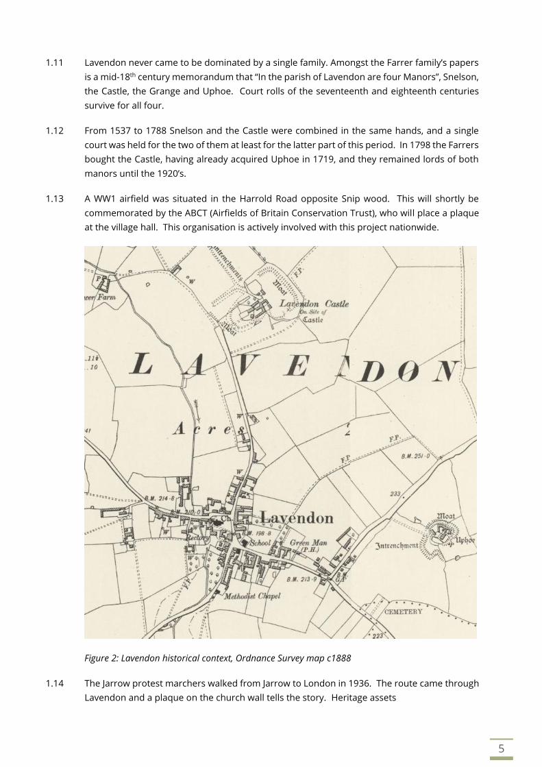
1.13 A WW1 airfield was situated in the Harrold Road opposite Snip wood. This will shortly be
commemorated by the ABCT (Airfields of Britain Conservation Trust), who will place a plaque
at the village hall. This organisation is actively involved with this project nationwide.
Figure 2: Lavendon historical context, Ordnance Survey map c1888
1.14 The Jarrow protest marchers walked from Jarrow to London in 1936. The route came through
Lavendon and a plaque on the church wall tells the story. Heritage assets

6
1.15 The National Heritage List for England has one Grade I and 23 Grade II listed building records
for the Parish, reflecting the historic nature of many buildings found within Lavendon. A full
list and details of these buildings can be found at Annex A.
Figure 3: Lavendon Heritage Assets (Conservation Area, Scheduled Monuments and Listed Buildings)
1.16 North of the village is Lavendon Castle, an Ancient Monument (AM), covering parts of Castle
Farm. Closer to the centre of the village is The Bury (AM), a circular earthwork 100 metres
from Lavendon Church. West of the village is Lavendon Abbey (AM), the site of a
Premonstratensian abbey, fishponds and field system at Lavendon Grange. East of the village
is a moated site (AM) and associated enclosure at Uphoe Manor Farm.
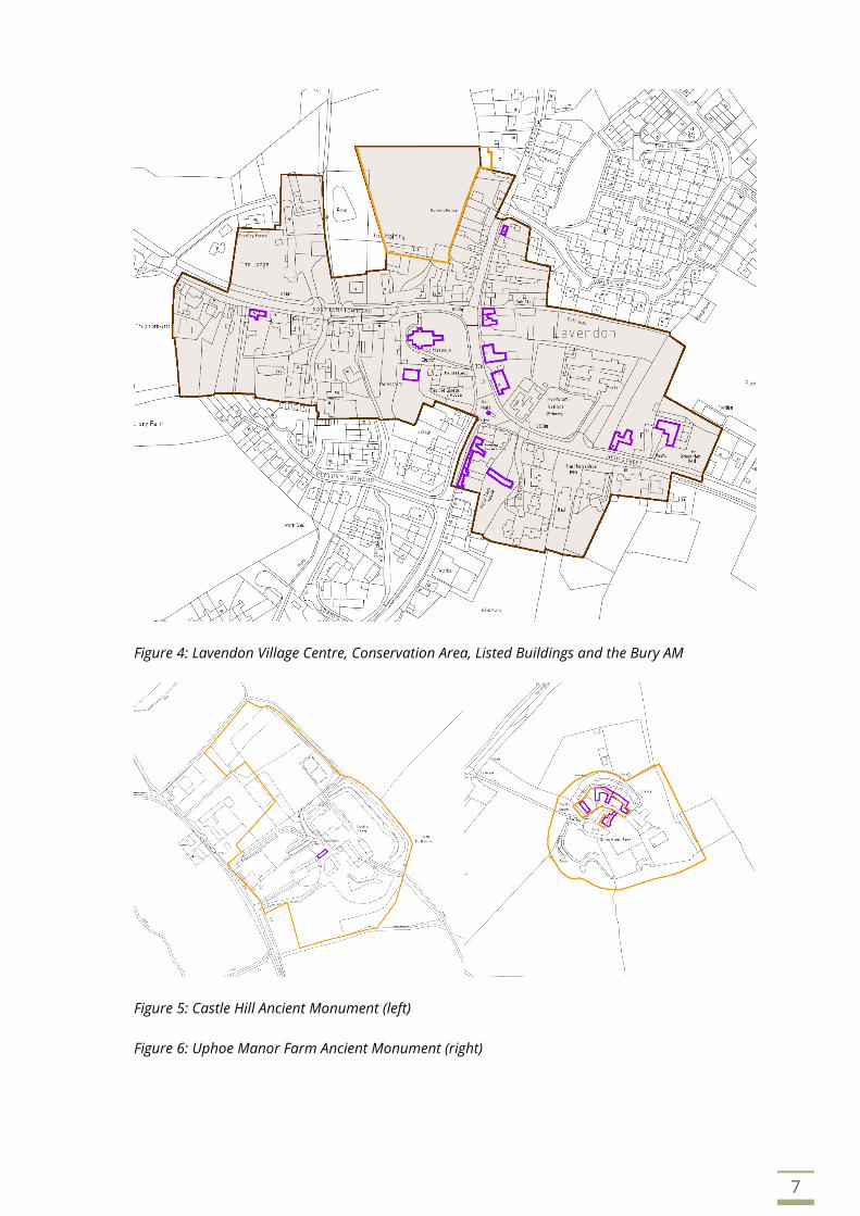
1.17 The number of AM’s in the Parish demonstrate the long and rich history of the village. A plan
extract showing the Conservation Area (brown shading), Ancient Monuments (orange outline)
and distribution of listed buildings (purple outline) within the village can be seen below.
1.18 The Lavendon Conservation Area was designated in October 1979 and covers a large part of
the village, as shown by the plan at Figure 3 above, recognising that the character of the village
should be protected.
7
Figure 4: Lavendon Village Centre, Conservation Area, Listed Buildings and the Bury AM
Figure 5: Castle Hill Ancient Monument (left)
Figure 6: Uphoe Manor Farm Ancient Monument (right)
8
Lavendon today
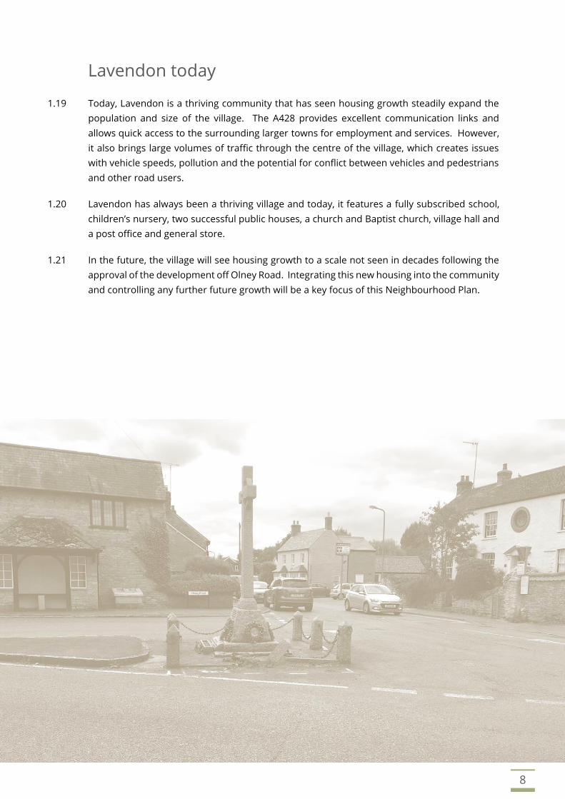
1.19 Today, Lavendon is a thriving community that has seen housing growth steadily expand the
population and size of the village. The A428 provides excellent communication links and
allows quick access to the surrounding larger towns for employment and services. However,
it also brings large volumes of traffic through the centre of the village, which creates issues
with vehicle speeds, pollution and the potential for conflict between vehicles and pedestrians
and other road users.
1.20 Lavendon has always been a thriving village and today, it features a fully subscribed school,
children’s nursery, two successful public houses, a church and Baptist church, village hall and
a post office and general store.
1.21 In the future, the village will see housing growth to a scale not seen in decades following the
approval of the development off Olney Road. Integrating this new housing into the community
and controlling any further future growth will be a key focus of this Neighbourhood Plan.

LAVENDON NEIGHBOURHOOD PLAN
9
Plan Making Process 2.1 Preparation of the Neighbourhood Plan commenced in August 2017 and has involved an
extensive amount of consultation and engagement with the local community and interested
parties.
2.2 A consultation statement has been prepared alongside the Neighbourhood Plan detailing each
stage of consultation tabling responses received and the actions taken by the Neighbourhood
Plan Steering Group (NPSG) to shape the next iteration of the Neighbourhood Plan.
Figure 7: The Neighbourhood Plan Process

10
Planning Policy Context
2.3 The updated National Planning Policy Framework (NPPF) was published in February 2019. The
Neighbourhood Plan must demonstrate that it is consistent with the approach suggested by
the NPPF. Paragraphs 29 and 30 concern neighbourhood plan production and highlight the
benefits that neighbourhood plans offer communities to develop a shared vision for their
area.
2.4 Neighbourhood Plans can shape, direct and help to deliver sustainable development, by
influencing local decisions as part of the statutory development plan. A neighbourhood plan
should not promote less development than set out in the strategic polices for the area or
undermine those strategic polices.
2.5 Once a neighbourhood plan has shown that it generally conforms with the Local Plan’s
strategic policies and is brought into force, its policies take priority over non-strategic policies
in the local plan where they are in conflict.
Purpose of the Neighbourhood Plan
2.6 In April 2012, the Localism Act 2011 amended the Town and Country Planning Act 1990
introducing new rights and powers to allow local communities to shape new development in
their community by preparing a neighbourhood plan.
2.7 The Neighbourhood Plan will shape the future growth of the village setting out design criteria
for new development, necessary to protect the distinctive character of Lavendon. It will also
protect important spaces from development and will ensure that the necessary infrastructure
can be delivered to support the future needs of the village.
Basic Requirements of the Neighbourhood Plan
2.8 Whilst there is considerable scope for the local community to decide the content of the
Neighbourhood Plan and the policies therein, the plan must meet basic conditions.
2.9 The Basic Requirements include:
• Have appropriate regard to national planning policy.
• Promote the principles of sustainable development.
• Be in general conformity with the strategic policies of the Development Plan for the local
area.
• Be compatible with EU obligations, for example environmental and human rights
legislation.
The Submitting Body and the Designated Area
2.10 This Neighbourhood Plan is submitted by Lavendon Parish Council, who are the qualifying
body as defined by the Localism Act 2011.

11
2.11 In accordance with Part 2 of the Regulations, Lavendon Parish Council applied to Milton
Keynes Council to designate the parish as a neighbourhood area for the purposes of
producing the Neighbourhood Plan. This application was approved on the 10th October 2017.
2.12 The Neighbourhood Plan covers the whole of the parish of Lavendon, as defined by Figure 8.
Figure 8: The designated Lavendon Neighbourhood Plan Area
Plan Period, Monitoring and Review
2.13 The Lavendon Neighbourhood Plan will form part of the Milton Keynes Development Plan
documents and will run concurrently with the Milton Keynes Plan:MK (Adopted on the 20th
March 2019) until 2031.
2.14 The Lavendon Neighbourhood Plan is a response to the needs and aspirations of the local
community as understood today. It is recognised that current issues and challenges are likely
to change over the plan period and a review of the plan to accommodate new priorities may
be necessary.
Lavendon Parish Council, as the qualifying neighbourhood plan authority, will be responsible
for maintaining and periodically reviewing the plan. This will ensure that it remains relevant
and conforms with other Milton Keynes Development Plan documents and national planning
policy.

LAVENDON NEIGHBOURHOOD PLAN
12
Community Engagement 3.1 At the heart of the preparation of the Neighbourhood Plan has been the engagement with the
community to seek their views on the policies and proposals. An open day to launch the
Neighbourhood Plan to the community was held in September 2017. Following this event, a
Parish Survey was prepared and distributed to every household in the Parish in November
2017. Responses to the questionnaire were received in December 2017.
Figure 9: The Neighbourhood Plan Launch Event
3.2 It was requested that it be completed by every adult of eligible voting age. Younger members
of household were encouraged to offer views as well through their parents or guardians, to
capture as broad a profile as possible.
3.3 A total of 1044 questionnaires were distributed, and 320 completed copies were received, a
response rate of 30%. The results of the questionnaire have been used to inform the direction
of the Neighbourhood Plan. The results of the survey were analysed and incorporated into
the draft version of the Neighbourhood Plan. A copy of the survey results can be seen in the
accompanying consultation statement.
3.4 During the summer of 2018, the Neighbourhood Plan Steering Group asked for housing sites
to be put forward by landowners in the Parish. This was advertised on the Parish Council web
site, village notice boards, the village social media pages and in the Post Office.
13
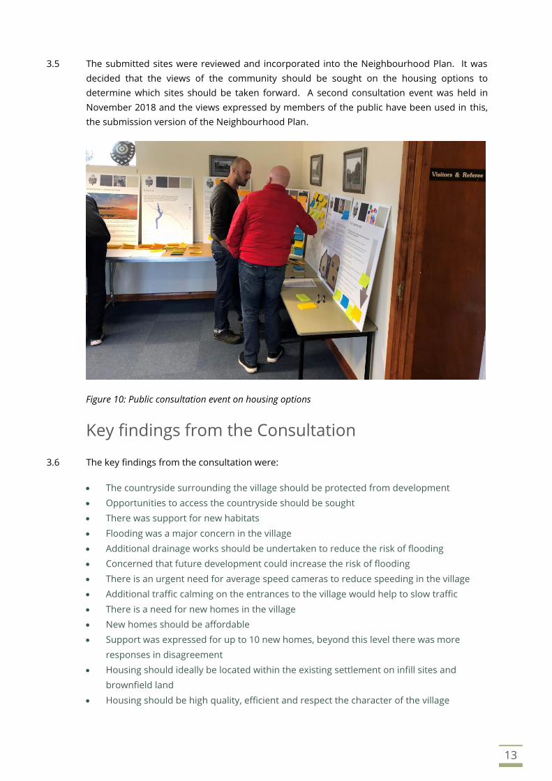
3.5 The submitted sites were reviewed and incorporated into the Neighbourhood Plan. It was
decided that the views of the community should be sought on the housing options to
determine which sites should be taken forward. A second consultation event was held in
November 2018 and the views expressed by members of the public have been used in this,
the submission version of the Neighbourhood Plan.
Figure 10: Public consultation event on housing options
Key findings from the Consultation
3.6 The key findings from the consultation were:
• The countryside surrounding the village should be protected from development
• Opportunities to access the countryside should be sought
• There was support for new habitats
• Flooding was a major concern in the village
• Additional drainage works should be undertaken to reduce the risk of flooding
• Concerned that future development could increase the risk of flooding
• There is an urgent need for average speed cameras to reduce speeding in the village
• Additional traffic calming on the entrances to the village would help to slow traffic
• There is a need for new homes in the village
• New homes should be affordable
• Support was expressed for up to 10 new homes, beyond this level there was more
responses in disagreement
• Housing should ideally be located within the existing settlement on infill sites and
brownfield land
• Housing should be high quality, efficient and respect the character of the village

LAVENDON NEIGHBOURHOOD PLAN
14
Our vision
Challenges for Lavendon
4.1 There are several challenges facing our village during the lifetime of this Neighbourhood Plan,
including unprecedented amounts of housing growth and increasing traffic passing through
Lavendon.
4.2 These include:
• The integration of substantial new housing development into the existing community.
• Protecting the countryside surrounding Lavendon from further development.
• Improving environmental diversity.
• Delivering a mix of housing types that are affordable.
• Identifying improvements to local services and facilities in response to future population
growth.
• Addressing the speed of traffic running through the village to make the community as
safe as possible.
• Protecting and enhancing the character of the village.
Vision statement
4.3 The Neighbourhood Plan Steering Group adopted the following vision to inform and direct the
policies contained within this Neighbourhood Plan.
To allow the integration of new housing into the existing village
community and ensure that Lavendon Parish remains a desirable
place to live and work, surrounded by attractive and accessible
countryside, rich in environmental diversity and heritage.
15
Community Projects
4.4 Within the policy sections of this Neighbourhood Plan, several community projects have been
identified. These have been included to address points raised by the village questionnaire
survey and consultation results. The Community Projects will be led by the Parish Council or
other working groups to deliver improvements to the village and the surrounding Parish.
4.5 The Community Projects do not form part of the land use policies of the Neighbourhood Plan
and are identified separately at the end of the relevant chapter after the land use policies.
4.6 Development proposals that would aid the delivery of community projects would be viewed
favourably, but only if such proposals do not conflict with the other policies of the
Neighbourhood Plan or Development Plan.
LAVENDON NEIGHBOURHOOD PLAN
16
Environment
Context and justification
5.1 The review of the Neighbourhood Plan questionnaire has revealed that the residents of
Lavendon strongly support the protection and enhancement of green spaces, habitats and
local wildlife. Therefore, under the scope of the Neighbourhood Plan there is an opportunity
to implement several measures aimed to preserve and enhance the environment of the
Parish.
5.2 Through the Neighbourhood Plan, opportunities to improve the environment and biodiversity
of the Parish will be sought were possible for the benefit of existing and future generations.
This could include new wildlife habitat and landscape features, alongside ensuring that new
development protects existing landscape features and delivers a positive net gain in
biodiversity.
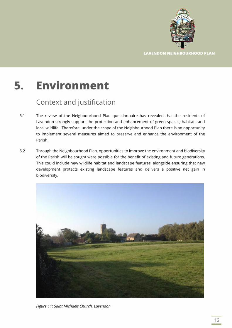
Figure 11: Saint Michaels Church, Lavendon
17
5.3 The policies support proposals to improve access to the countryside including the delivery of
connections between Lavendon and the surrounding villages. Proposals that encourage
cycling and walking, aiding sustainable travel choices will be supported, subject to compliance
with other policies in the Neighbourhood Plan.
5.4 Landscaping schemes should enhance the quality of the proposed development and
surrounding area, using native species that benefit wildlife and biodiversity and using plants
of a size and planting density that create a reasonable level of positive impact from the outset.
Planting schemes that use inappropriate planting species or have plants that are too young
and small taking a long time to become established should be avoided.
5.5 Proposals for low carbon and renewable energy projects will be supported where they meet
the requirements of Plan:MK Policy SC3.
Objectives
• To promote access to the countryside for recreation and enjoyment where possible.
• To support the provision and enhancement of habitats for wildlife.
• To seek opportunities to enhance the quality of the environment within the Parish,
including biodiversity and wildlife networks.
• To ensure any development proposals do not adversely impact natural features
including mature trees and hedgerows.
Policies
POLICY E1: ACCESS TO THE COUNTRYSIDE
Proposals to improve public access to the countryside will be encouraged and
supported, including the opening of new footpaths, bridleways and cycling
routes to improve connections between Lavendon and the surrounding villages.
POLICY E2: BIODIVERSITY OFFSET AND DEVELOPMENT
Development proposals should enhance the natural environment and
contribute to biodiversity net gains within the Parish in line with Plan:MK Policy
NE3. Biodiversity Improvements will help in mitigating against the adverse
effects that development has on the environment.
Development proposals should include baseline information on the
environmental value of the site and demonstrate how its quality can be
maintained or enhanced through the introduction of adequate mitigation.
Proposals that would benefit the wider Parish will be looked at favourably.
Continued overleaf…

18
Implementation
5.6 These policies will be implemented through consultation with Milton Keynes Council during
the planning application process. Early discussion and communication with the Parish Council
when formulating a scheme will assist developers to obtain feedback on their proposals.
POLICY E2: BIODIVERSITY OFFSET AND DEVELOPMENT CONTINUED…
Planting of high-quality native trees and shrubs will be expected as part of the
development landscaping scheme.
To avoid habitat fragmentation and maintain/enhance existing ecological
networks, on-site mitigation will be encouraged. Where this cannot be achieved,
development proposal will have to demonstrate why and contribute towards
effective off-site mitigation projects.
Developers will be expected to maintain new planting schemes for a period of 2
years from completion of construction works, either directly or through the
appointment of a management company. The developer will be expected to
remove and replace any dead/dying/decaying vegetation identified within that
timeframe.
POLICY E3: TREES AND HEDGEROWS
All development proposals should identify any significant trees within the site or
affected by the proposals and demonstrate how these trees will be protected in
accordance with BS5837 or the equivalent standards.
Mitigation and protection schemes must be implemented prior to construction
work commencing and must be retained in good order throughout the
construction period.
If the loss of trees and/or other established vegetation cannot be avoided, all
development proposals will have to allow for clear, effective measures to offset
the loss of biodiversity. This may include (but may not be limited to) planting new,
high-quality trees and/or funding off-site planting schemes (although on-site
mitigation is encouraged).
19
Community project… improving our environment
5.7 The Parish Council will take a lead in enhancing the ecological and biodiversity value of land
that they control, through habitat creation and adopting alternative management practices.
In turn this could encourage other landowners to do the same on their own sites, with support
and guidance if required.
5.8 To protect existing natural capital, improve biodiversity and the quality of green spaces and to
support the provision of ecosystem services, the Parish Council will work to deliver
environmental and biodiversity enhancements through the implementation of dedicated
management plans. The proposed actions may include but are not limited to the following:
• Copse –Improvements will be sought through a new management plan that could include
new habitat features (i.e. habitat log piles) and installing additional bird and bat boxes.
• Playing Field - Planting trees within the grounds; developing shrubs and stands of wildflowers
along the boundaries; installing habitat boxes with a focus on birds, bats, hedgehog and
invertebrates.
• Roadside verges - Introduction of wildflowers along selected sections of the grass verge.
• Allotments – creation of dedicated features to provide wildlife habitat (i.e. compost heaps and
introduction of pollinator-friendly plants) and introduction of sustainable management
practices such as water harvesting, etc.
• Enhancement of the new community open space (see Policy CF2).
• Proposals by landowners to improve the health, quality and number of trees within the
Parish will be supported, including those within woodland and field margins.
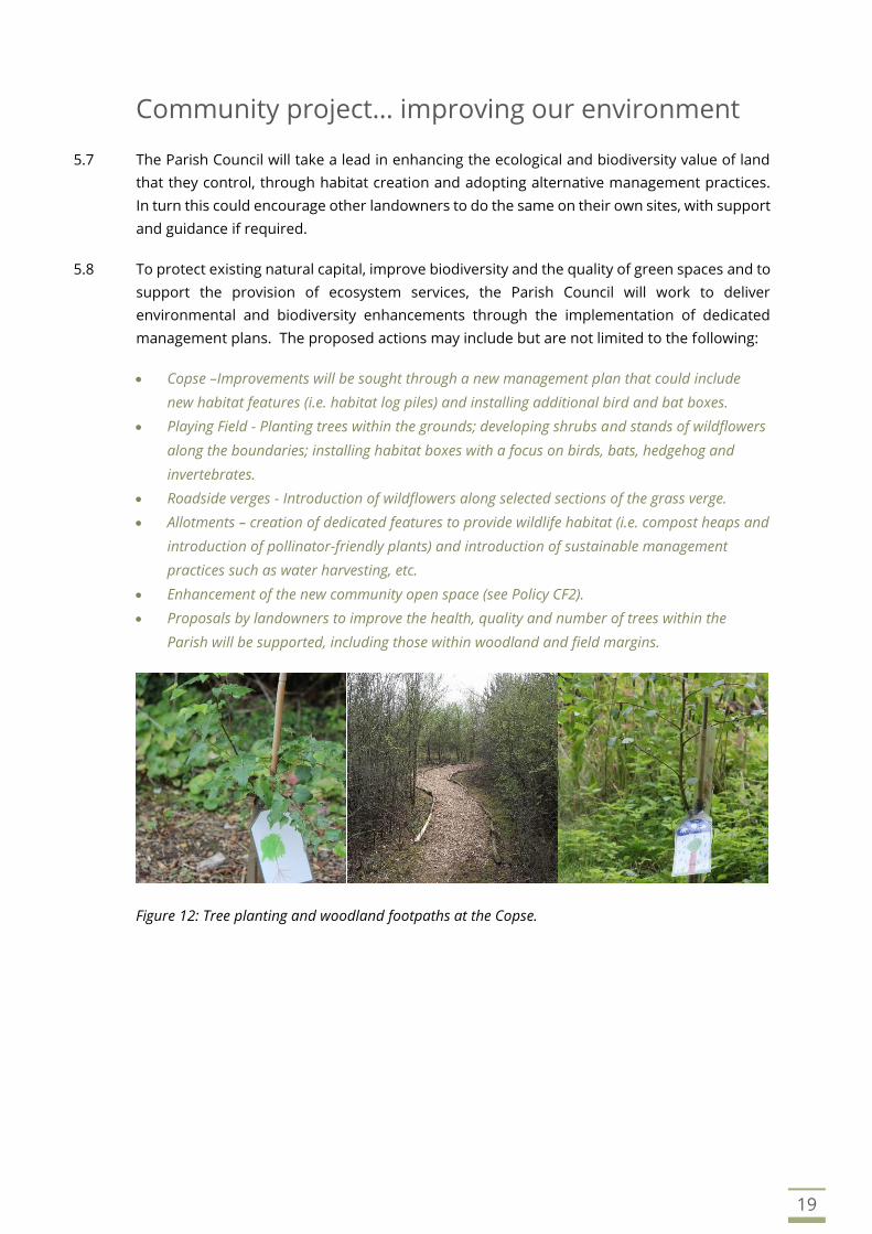
Figure 12: Tree planting and woodland footpaths at the Copse.
LAVENDON NEIGHBOURHOOD PLAN
20
Character and Design
Context and justification
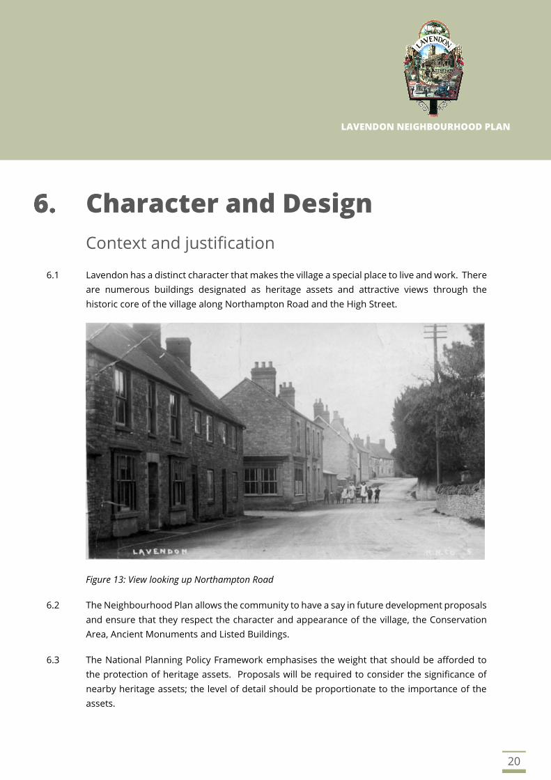
6.1 Lavendon has a distinct character that makes the village a special place to live and work. There
are numerous buildings designated as heritage assets and attractive views through the
historic core of the village along Northampton Road and the High Street.
Figure 13: View looking up Northampton Road
6.2 The Neighbourhood Plan allows the community to have a say in future development proposals
and ensure that they respect the character and appearance of the village, the Conservation
Area, Ancient Monuments and Listed Buildings.
6.3 The National Planning Policy Framework emphasises the weight that should be afforded to
the protection of heritage assets. Proposals will be required to consider the significance of
nearby heritage assets; the level of detail should be proportionate to the importance of the
assets.

21
6.4 Good design should contribute towards making places better for people, providing buildings
that are fit for purpose, adaptable and sustainable. The delivery of good design is key to the
planning system and a requirement of the National Planning Policy Framework
6.5 The choice of high-quality building materials, stone walls and good landscaping will help
development proposals to respect and blend into the character of the village. The
Neighbourhood Plan seeks to ensure that the village evolves in a managed way for the benefit
of future generations.
Figure 14: Cottages feature a blend of materials and some fine detailing
Figure 15: Relatively recent new housing within the village.

22
Objectives
• To maintain and enhance the character of the village, ensuring that changes are
carefully considered to be harmonious with existing buildings and development.
• To safeguard, conserve and enhance the important open areas, buildings and features
that contribute to the significance, character and setting of the Conservation Area and
heritage assets.
• To integrate new development into the village, to avoid a sense of ‘add-on’ estates.
• To ensure that new buildings and extensions are designed to the very best standards
and reflect the rural setting of the village and use high-quality materials that enhance
the surroundings.
• To ensure that new development protects important views, buildings and character
elements that the community cherish.
Policies
POLICY CD1: CONSERVATION AND HERITAGE
Development proposals should protect, conserve and, wherever possible,
enhance the significance of heritage assets within the Parish, including the
character and appearance of the Conservation Area, Listed Buildings, Ancient
Monuments and their settings.
This will include consideration of the following:
a) The setting of any nearby listed buildings and their curtilages.
b) The setting of Ancient Monuments.
c) Impact on the character and setting of the Conservation Area.
d) Site specific design issues, including demonstration that proposals would
make a positive contribution to the street scene, would be sympathetic to
the character of neighbouring properties and would incorporate high-
quality materials.
Development proposals that would harm the character and setting of the
Conservation Area and heritage assets will be resisted.
POLICY CD2: HIGH QUALITY DESIGN
All new development should demonstrate high quality design, respect the
character of the surrounding area and enhance the quality of design within the
village wherever possible. Development proposals that would enhance the
character and appearance of the Conservation Area will be supported.
Continued overleaf…

23
POLICY CD2: HIGH QUALITY DESIGN CONTINUED
A central part of achieving high quality design is responding to and integrating
with local surroundings and landscape context, as well as the built environment,
through:
a) Demonstrate how proposals achieve sustainable development and are
integrated into the village to promote social inclusion and support of village
facilities.
b) Using high quality materials that complement the existing palette of
materials used within the area.
c) Being of a scale, density, massing, height, design and layout that reflect the
character of the village or particular area in which the development
proposal is located.
d) Using stone walling and / or green hedging as appropriate for highway
boundaries wherever possible, in keeping with the existing streetscape.
e) Ensuring safe access for pedestrians, cyclists and road users.
f) Providing adequate refuse and recycling storage incorporated into the
scheme to minimise visual impact.
g) Innovative design that is sustainable in its design, construction and
operation.
h) Promoting high quality interior spaces and the use of natural light and solar
gain.
i) Adopting the principles of sustainable urban drainage, where appropriate.
All dwellings capable of being inhabited by families should provide sufficient
private garden amenity space to meet household recreational needs. These
should be in scale with the dwelling, reflect the character of the area and be
appropriate in relation to topography and privacy.
Parking spaces should be located in a manner that ensures that parked cars do
not overly dominate the street scene and do not form clusters of frontage car
parking. Parking should be designed so that it fits in with the character of the
proposed development.
Considerations should include:
j) Garages designed to reflect the architectural style of the house they serve.
k) Garages set back from the street frontage.
l) Parking located in between houses (rather than in front) so that it does not
dominate the street scene.

24
Implementation
Development proposals affecting heritage assets will also be considered against the
requirements of Plan:MK Policy HE1. These policies will be implemented through consultation
with Milton Keynes Council during the planning application process. Early discussion and
communication with the Parish Council when formulating a scheme will assist developers to
obtain feedback on their proposals.

LAVENDON NEIGHBOURHOOD PLAN
25
Flood Risk
Context and justification
7.1 Lavendon is located on the slopes of the Great Ouse river valley, with the rolling landscape
falling broadly to the south and west from higher ground in the north and east. This can lead
to flooding situations occurring during storm rainfall, predominately caused by surface water
run-off from the roads and fields overwhelming the drainage system.
7.2 The Environment Agency Flood Map for Planning identifies parts of the village as being at risk
from surface water (Pluvial) flooding.
Figure 16: Environment Agency surface water flood risk map.
7.3 The Neighbourhood Plan promotes the creation of new flood attenuation measures and
requires development proposals to adopt effective surface water management to ensure that
the risk of flooding is not exacerbated elsewhere. In addition, development proposals should
take account of the policies in Plan:MK on Managing and Reducing Flood Risk.

26
7.4 Other improvement works to the drainage system surrounding the village will be delivered
through discussion with landowners surrounding the village to investigate ways of holding
surface water in the higher catchment area to reduce the risk of storm water flooding in the
centre of the village.
7.5 A programme of maintenance for the drainage systems within and around the village will also
be investigated by the Parish Council, including establishing riparian ownership, to improve
ditch capacity by regular clearance and maintenance. Opportunities to improve storm water
flow and remove restrictions should also be sought and supported.
Objectives
• To promote sustainable development and respond to climate change.
• To require development to be safe from flooding and not exacerbate the risk of flooding
elsewhere.
• To encourage the improvements in drainage systems to capture surface water run-off
before it reaches the village where possible.
Figure 17: Example of a flood attenuation pond.

27
Policies
Implementation
7.6 The Neighbourhood Plan will deliver these policies through the planning application process
when considering development proposals and through discussion and agreements reached
with landowners and other agencies concerned with drainage in the village.
Community project… reducing flood risk
7.7 In order to aid and improve the drainage throughout the village, a working group will be
established to clear drains and ditches of vegetation and debris, subject to safe access being
achievable and landowner’s permission.
7.8 The Parish Council will work with Milton Keynes Council, the Environment Agency and
landowners to identify suitable locations and secure funding towards the scheme.
POLICY FR1: DEVELOPMENT AND FLOOD RISK
To promote sustainable development and combat climate change, all new
development in the Parish will be expected to adopt sustainable drainage
schemes.
Surface water runoff should be attenuated on site whenever possible, and if
achievable, should be combined with semi-natural balancing ponds to provide
enhanced biodiversity and new wildlife habitats.
Encouragement will be given to enhancement of up-catchment flood storage, to
hold surface water runoff away from the village.
POLICY FR2: DELIVERY OF NEW FLOOD STORAGE PONDS
Support will be given to proposals to create new up-catchment flood storage
ponds, to hold back surface water during storm events or in circumstances
where the infiltration is inadequate.
The ponds should be located where connectivity between them utilising by
existing vegetation can be achieved where possible, to provide a series of linked
natural habitats.
LAVENDON NEIGHBOURHOOD PLAN
28
Highways and Transport
Context and justification
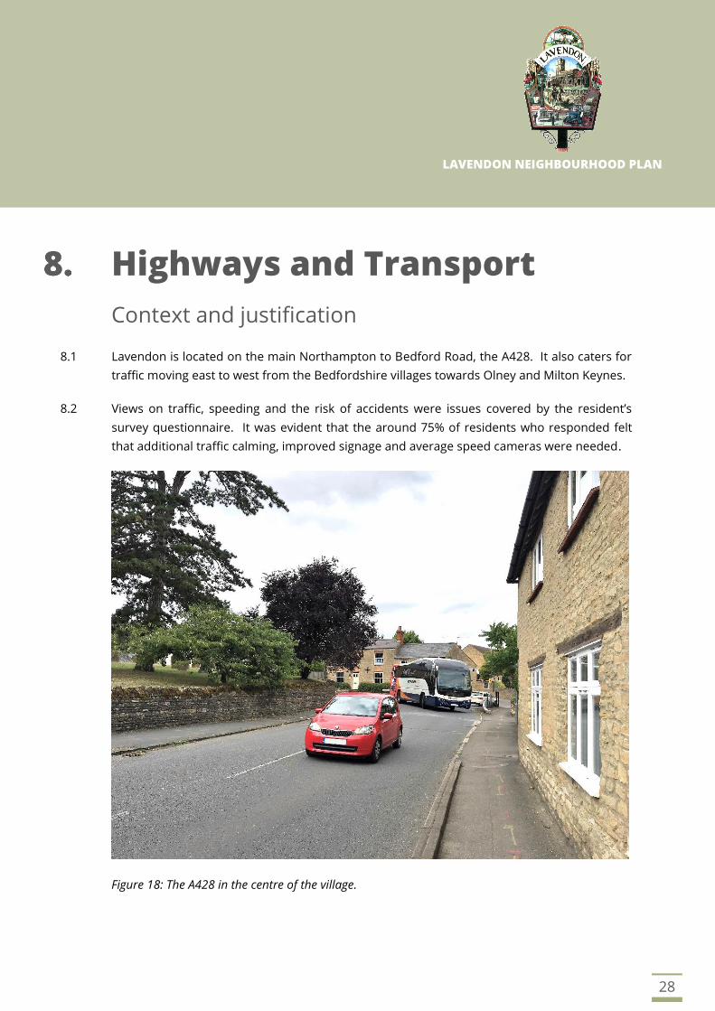
8.1 Lavendon is located on the main Northampton to Bedford Road, the A428. It also caters for
traffic moving east to west from the Bedfordshire villages towards Olney and Milton Keynes.
8.2 Views on traffic, speeding and the risk of accidents were issues covered by the resident’s
survey questionnaire. It was evident that the around 75% of residents who responded felt
that additional traffic calming, improved signage and average speed cameras were needed.
Figure 18: The A428 in the centre of the village.
29
8.3 Private cars dominate for journeys out of the village as to be expected for a rural area. The
village has a limited bus service, which provides a vital lifeline for those residents who do not
use a car and need to access services in the surrounding towns and was relatively well used
by around 14% of respondents.
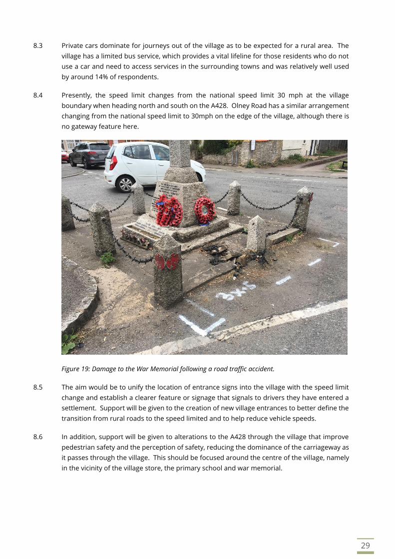
8.4 Presently, the speed limit changes from the national speed limit 30 mph at the village
boundary when heading north and south on the A428. Olney Road has a similar arrangement
changing from the national speed limit to 30mph on the edge of the village, although there is
no gateway feature here.
Figure 19: Damage to the War Memorial following a road traffic accident.
8.5 The aim would be to unify the location of entrance signs into the village with the speed limit
change and establish a clearer feature or signage that signals to drivers they have entered a
settlement. Support will be given to the creation of new village entrances to better define the
transition from rural roads to the speed limited and to help reduce vehicle speeds.
8.6 In addition, support will be given to alterations to the A428 through the village that improve
pedestrian safety and the perception of safety, reducing the dominance of the carriageway as
it passes through the village. This should be focused around the centre of the village, namely
in the vicinity of the village store, the primary school and war memorial.
30
Objectives
• To ensure that footpaths, bridleways and cycling routes throughout the Parish are
maintained and accessible.
• To consider ways to improve off-road car parking for existing properties, where this can
be achieved without adverse impacts on the character of the village streets.
• To ensure that the new homes in the village have information available to promote non-
car transport choices supporting sustainable development.
Policies
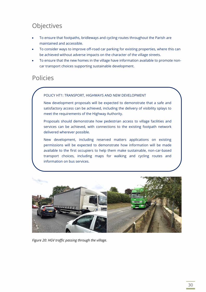
Figure 20: HGV traffic passing through the village.
POLICY HT1: TRANSPORT, HIGHWAYS AND NEW DEVELOPMENT
New development proposals will be expected to demonstrate that a safe and
satisfactory access can be achieved, including the delivery of visibility splays to
meet the requirements of the Highway Authority.
Proposals should demonstrate how pedestrian access to village facilities and
services can be achieved, with connections to the existing footpath network
delivered wherever possible.
New development, including reserved matters applications on existing
permissions will be expected to demonstrate how information will be made
available to the first occupiers to help them make sustainable, non-car-based
transport choices, including maps for walking and cycling routes and
information on bus services.

31
Implementation
8.7 These policies will be delivered in conjunction with the requirements of the Milton Keynes
Residential Development Design Guide and will be applied through the consideration of
planning applications. Parking standards are set out in the Milton Keynes Parking Standards
SPD. Contributions will be sought from developments towards the village entrance
improvements from development proposals.
Community project… improving car parking and
reducing speeding
8.8 A working group has been established to plan for and deliver an expansion of the car park serving
the village hall to the rear of the building. This will greatly improve car parking capacity and reduce
instances of on-street car parking in the area.
8.9 Speeding vehicles within Lavendon and the wider Parish is a significant concern to the community.
A community speed watch group has been established, and this will continue on a voluntary basis.
The Parish Council will investigate ways to secure appropriate signage and warnings to drivers to
reduce speed upon entering the village, particularly where existing signage can be improved, whilst
avoiding an over proliferation of signs.
8.10 The Parish Council will also investigate and promote the delivery of average speed cameras through
the village, as seen within other communities along the A428.
POLICY HT2: VILLAGE HIGHWAY ENHANCEMENT
Development proposals that include measures to reduce the impact of traffic,
improve the highway environment within Lavendon and the wider Parish and to
increase use of non-car modes of transport will be supported, subject to
compliance with other policies of the Development Plan.
LAVENDON NEIGHBOURHOOD PLAN
32
Community
Context and justification
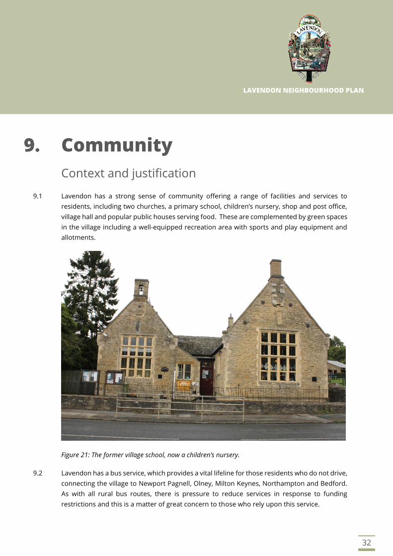
9.1 Lavendon has a strong sense of community offering a range of facilities and services to
residents, including two churches, a primary school, children’s nursery, shop and post office,
village hall and popular public houses serving food. These are complemented by green spaces
in the village including a well-equipped recreation area with sports and play equipment and
allotments.
Figure 21: The former village school, now a children’s nursery.
9.2 Lavendon has a bus service, which provides a vital lifeline for those residents who do not drive,
connecting the village to Newport Pagnell, Olney, Milton Keynes, Northampton and Bedford.
As with all rural bus routes, there is pressure to reduce services in response to funding
restrictions and this is a matter of great concern to those who rely upon this service.

33
9.3 It is recognised that the Neighbourhood Plan cannot control the provision of bus services in
Lavendon. Nevertheless, it is important to recognise the role that bus services play to our
community, meeting the needs of those who do not drive or have access to a car. The objective
to support the bus services and respond to any proposed changes is one that the Parish
Council will embody and take forward when representing the interests of the village.
Objectives
• To support the provision of new and protection of existing community facilities,
including open space.
Policies
POLICY CF1: COMMUNITY FACILITIES
There will be a presumption in favour of the protection of existing community
facilities for current and future generations. Proposals that would involve the
loss of a community facility, or its change of use to a non-community beneficial
use, will not be supported without evidence to justify the loss and suitable
alternative provision first being secured.
For the avoidance of doubt, community facilities within the village are defined
as:
a) Baptist Church
b) St. Michaels Church
c) Lavendon Village Hall
d) The recreation area
e) The Pavilion
f) The copse
g) The allotments
Proposals for improvements to existing community facilities, or additional
services and facilities within the village, will be supported subject to
consideration of the potential for noise, disturbance, fumes or smell, traffic
generation and car parking.

34
Community project… open space and reducing litter
9.4 The Parish Council will formulate a management plan for the community open space, which will be
maintained with the help of volunteers.
9.5 With significant traffic passing through the village, littering has been a problem. A working group
has been established to clear litter from the verges and along the roads in the village on a periodic
basis. This helps us to demonstrate the spirit of our community and improve the environment of
our village.
Figure 22: The Village Hall and The Pavilion
POLICY CF2: COMMUNITY OPEN SPACE
Land at Harrold Road as shown on the proposals map is designated as
community open space and shall be protected from built development. Use of
this land for the benefit of the community will be supported and could include:
a) Space for informal recreation and dog walking, connected to the existing
public footpath network.
b) Community led tree planting schemes and biodiversity enhancements.
c) Planting of a community orchard.
d) Nature and play trail.
e) Cycling track.
LAVENDON NEIGHBOURHOOD PLAN
35
Housing
Context and justification
10.1 The National Planning Policy Framework describes the achievement of sustainable
development as the purpose of the planning system, (NPPF, Para 7). Plans and decisions
should apply a presumption in favour of sustainable development and should plan positively
to meet the development needs in their area, (NPPF, Para 11).
10.2 Neighbourhood plans should not promote less development than set out in strategic policies
for the area (NPPF, Para 29) and once in force take precedence over the non-strategic policies
of the local plan (NPPF, Para. 30).
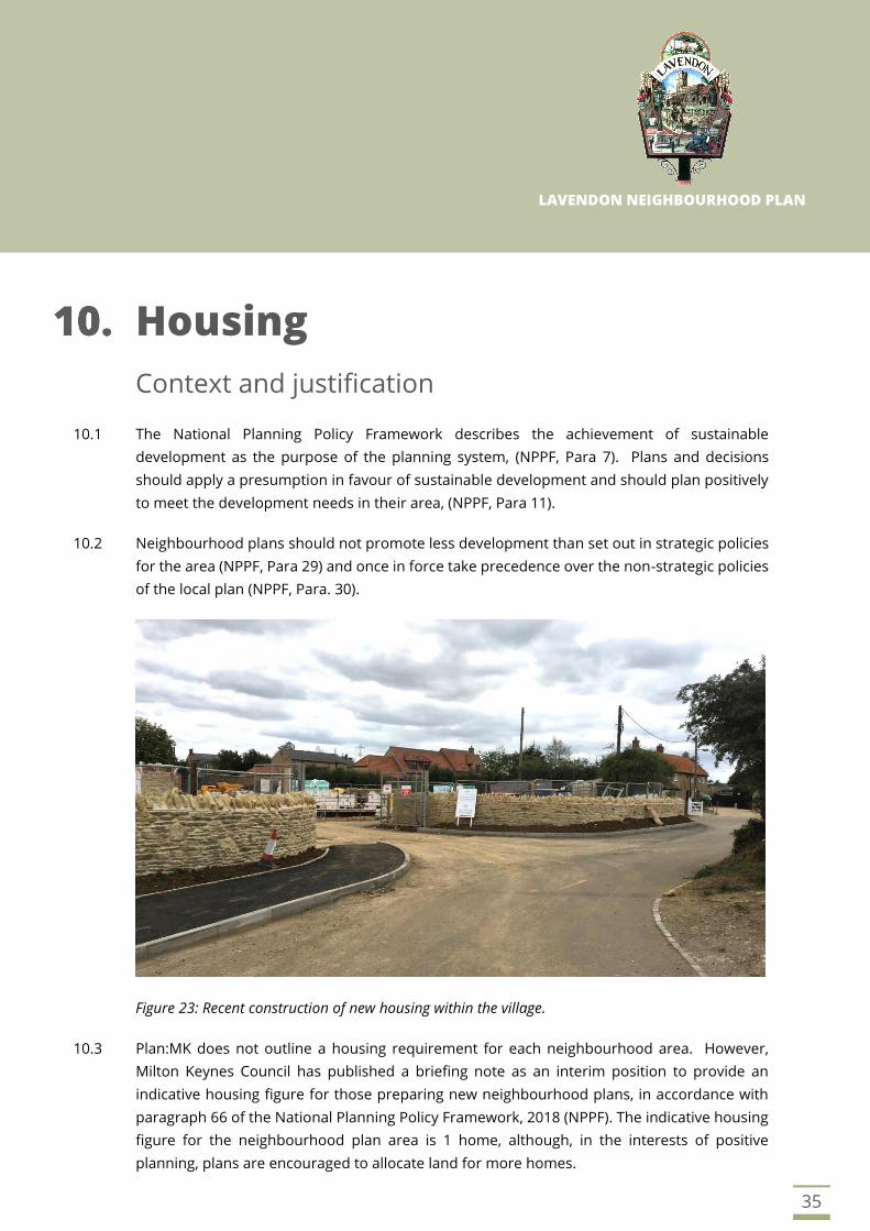
Figure 23: Recent construction of new housing within the village.
10.3 Plan:MK does not outline a housing requirement for each neighbourhood area. However,
Milton Keynes Council has published a briefing note as an interim position to provide an
indicative housing figure for those preparing new neighbourhood plans, in accordance with
paragraph 66 of the National Planning Policy Framework, 2018 (NPPF). The indicative housing
figure for the neighbourhood plan area is 1 home, although, in the interests of positive
planning, plans are encouraged to allocate land for more homes.

36
10.4 Consultation has taken place with the community prior to the preparation of the
Neighbourhood Plan to identify views on the type of housing needed in the village and the
overall amount over the plan period. The survey results have been considered in the light of
recent planning permissions, which have allowed a considerable amount of new housing in
the village.
Figure 24: The existing settlement boundary (black outline) and recent housing permissions (yellow
shading).
Site 8
Site 7
Site 6
2
Site 1
Site 4
Site 5
Site 3
Site 2

37
10.5 The Neighbourhood Plan defines the Lavendon settlement boundary, as shown on the Policies
Map, to shape the physical growth of the village over the plan period. The village settlement
boundary is defined by Plan M:K, which updates the boundary defined by the 2005 Local Plan
and has been amended to include developments recently completed in the village.
10.6 The location of the planning permissions for new housing at the current time can be seen at
Figure 24 on the preceding page. These are:
• Site 1 - Old Brickyard, New Row (9 dwellings)
• Site 2 - 45a Northampton Road (1 dwelling)
• Site 3 - 37 Northampton Road (2 dwellings)
• Site 4 - Land at Castle Road (1 dwelling)
• Site 5 - Land north of the Glebe (14 dwellings)
• Site 6 – The Old Stoneyard, Bedford Road (8 dwellings)
• Site 7 – Land south of 28 Northampton Road (2 dwellings)
• Site 8 - Land South of Olney Road (95 dwellings)
10.7 In total these planning permissions and appeals, both recently completed and not yet started
deliver an additional 132 dwellings to our village.
Survey results and call for sites
10.8 The questionnaire results have highlighted that 68% of respondents supported 1 to 5 new
dwellings, as opposed to 32% not supporting that number. For 6 to 10 dwellings, support was
given by 60% of respondents, versus 40% not supporting. Up to 20 dwellings, the level of
support was broadly similar at 45%, with 55% not supporting that amount.
10.9 To determine where future development could be delivered, a call for sites was made in
August 2018, which resulted in four sites being put forward by landowners. One of these sites
(Site 1) has been granted planning permission by Milton Keynes Council, leaving the remaining
three sites to be considered for inclusion within the Neighbourhood Plan.
10.10 The sites were presented to the village community as part of the draft plan consultation in
September 2018, and all comments and feedback has been assessed.
10.11 The inclusion of no further housing within the Neighbourhood Plan is not an option that would
be compliant with National Planning Policies. The Neighbourhood Plan must be positively
prepared, meeting the housing needs of the designated Neighbourhood Area. To take a
robust position and ensure that the Neighbourhood Plan cannot be challenged by a
speculative developer in the future, it is recommended that the Neighbourhood Plan allocates
one of the proposed housing sites.
38
Objectives
• To ensure that new housing proposals within the Parish show general accord with the
wishes and needs of the community in relation to scale, location and mix of dwellings.
• To require new housing to be carefully integrated into the built form of the village and
not cause harm to existing important views or heritage assets.
• To secure commitment that any new housing will be highly sustainable, both in
construction and operation to reduce the building’s carbon footprint.
• New housing should use high quality materials and include measures to enhance the
biodiversity of its setting.
Policies
POLICY H1: HOUSING REQUIREMENTS
The Lavendon Neighbourhood Plan will provide for around 140 homes to meet
the housing needs of the Parish over the plan period 2019 to 2031.
New housing will be supported on sites that lie within the Settlement Boundary
of Lavendon as shown on the Policies Map in accordance with other relevant
policies of the development plan.
New housing will be delivered through:
a) Dwellings which have planning consent at July 2019 as shown on the
Policies Map;
b) Windfall opportunities in accordance with Policy H3 and Plan:MK Policy DS5
and the NPPF;
c) The housing allocation for about 8 dwellings at Harrold Road under Policy
H5.
POLICY H2: DEVELOPMENT STRATEGY
There is a presumption in favour of sustainable development within the
settlement boundary shown on the Policies Map, provided that the proposals
comply with the provisions of the Lavendon Neighbourhood Plan and the Milton
Keynes Development Plan.
Continued overleaf…
39
POLICY H2: DEVELOPMENT STRATEGY CONTINUED
There is a presumption in favour of sustainable development within the
settlement boundary shown on the Policies Map, provided that the proposals
comply with the provisions of the Lavendon Neighbourhood Plan and the Milton
Keynes Development Plan.
Development proposals, including windfall development, should:
a) Preserve or enhance the character and appearance of the Conservation
Area and/or listed buildings and/or conserve and enhance the setting of
Ancient Monuments.
b) Protect and wherever possible, enhance the rural character of the village.
c) Preserve the wider landscape setting of the village.
Outside of the settlement boundary the remainder of the Parish is defined as
countryside. Development proposals will be supported where they are
appropriate to the rural area and are in accordance with the NPPF and the
Milton Keynes Development Plan.
POLICY H3: WINDFALL DEVELOPMENT
Small scale residential proposals will be supported where such proposals are
located within the defined settlement boundary and where the following criteria
can be met:
a) The proposal would be an infill plot appropriately located between existing
buildings.
b) It would not have an adverse impact on the character, appearance or
setting of the Conservation Area, or cause harm to the significance of a
Listed Building or Ancient Monuments, whether directly or within its setting.
c) The proposal can be situated without harming the amenities and privacy of
existing neighbours.
d) The proposal includes good design, high quality materials and respects
local vernacular.
e) Acceptable access arrangements can be achieved, and on-site parking can
be provided to meet the demands of the development.
f) The scheme would not increase the risk of flooding elsewhere.

40
New housing allocation
10.12 The Neighbourhood Plan makes an allocation for new housing off Harrold Road. The
development shall provide up to eight new dwellings, on an area of land no greater than 0.75
hectares. This site received the least number of comments during the public consultation
feedback.
10.13 Development proposals will be expected to provide a mix and range of housing types and
sizes that meet a range of needs. Both houses and bungalows would be supported. The
development should present a frontage to Harrold Road and be of high-quality design
appropriate to the approach to the village. Proposals will be expected to provide landscaping
to the boundaries to create a new ‘edge’ to the settlement and also to protect the amenities
of the existing residents on The Glebe.
10.14 The development will be expected to provide surface water attenuation to ensure that surface
water run-off is unchanged and there is no greater flood risk to existing dwellings. There
should also be net gain in biodiversity and a detailed planting and management plan to
demonstrate that the scheme will improve habitat for wildlife.
10.15 The development of this site presents an opportunity to provide an area of community open
space for the village, located adjacent to the new housing allocation, which would be secured
through a legal agreement or statutory undertaking.
POLICY H4: INTEGRATION OF NEW HOUSING
Proposals for new housing development, including details submitted for
schemes with outline planning permission, should be well integrated with the
village and demonstrate how they will ensure that new residents can access
facilities and services.
Opportunities to provide new footpath links, open spaces and areas for
community recreation should be included where possible, to ensure that the
wider community benefits from new development within the village.
Proposals that lead to ‘enclosed or private’ housing estates, segregated from the
community should be avoided.
This policy will apply to all housing development proposals, including outline
planning permissions where reserved matters applications have not been made
or determined.

41
POLICY H5: HARROLD ROAD NEW HOUSING ALLOCATION
Land west of Harrold Road adjoining the existing settlement is allocated for a
new housing development of about 8 dwellings. The development, including
gardens and amenity space, shall be no greater than 0.75 hectares to control the
size and scale of the proposal.
Proposals will be supported where it can be demonstrated they:
a) Provide a balanced mix of housing, including a range of house types and
sizes suitable for meeting a range of needs.
b) Be very sensitive to the site surroundings and nearby heritage assets,
including below ground archaeology and demonstrate through appropriate
assessment that the scheme will make a positive contribution to the
character and appearance of the area.
c) Incorporate good design, high quality materials and local vernacular design
details.
d) Provide a high-quality landscaping scheme to the site boundaries and
demonstrate through an effective management plan that there will be net
gain in biodiversity.
e) Ensure that the proposed houses are highly sustainable, including energy
efficiency measures and meet lifetime homes standards.
f) A single point of access should be taken from Harrold Road.
g) Parking spaces and turning areas should be provided to fully meet the needs
of each house and should include visitor spaces and turning for refuse and
delivery vehicles.
h) Provide future residents with landscaped shared spaces and private
amenity gardens.
i) Include stone walls to the boundaries of the site where appropriate, to
reflect those found elsewhere in the village.
j) Ensure that the relationship of the new dwellings to neighbouring
properties is carefully considered to avoid creating significant adverse
impacts in terms of amenity, light, privacy and noise.
k) Provide on-site attenuation for drainage and prevent surface water runoff
causing a greater level of flood risk elsewhere.
The developer(s) will also be expected to make provision for community open
space, as specified by Policy CF2 and secured through legal agreement or
statutory undertaking. This should be located on land adjacent to the housing
allocation and accessible from the existing public footpath network ensuring that
the new housing allocation is well connected to the rest of the village.

42
Implementation
10.16 These policies will be implemented through the development management process and with
early engagement from developers, including informal discussions prior to applications being
made if necessary. Developers will be expected to demonstrate through their design and
access statements how the policy requirements of the Neighbourhood Plan are to be
delivered.
Community Project… Developer Engagement
10.17 Whilst not a land use policy, the Parish Council will encourage the engagement of developers
with the Parish Council to consider the options for the layout and design of new housing
development.
LAVENDON NEIGHBOURHOOD PLAN
43
Business and Employment
Context and justification
11.1 Lavendon features a number of employment opportunities, including the public houses, car
repairs, the village stores and Tustings leather goods. In addition, there are residents who
work from home on a self-employed basis. The village is also surrounded by farms, and whilst
agricultural employment is not as significant to the village as it once was, it remains important
to the rural way of life.
11.2 When asked how businesses in Lavendon should be supported, over half of respondents to
the village survey felt that better mobile phone reception and faster broadband were
important. Whilst internet access speed within the village has improved, the need to ensure
online connectivity remains as fast as possible remains. This is particularly important to
support flexible home working and ensuring access to an increasingly digital world.
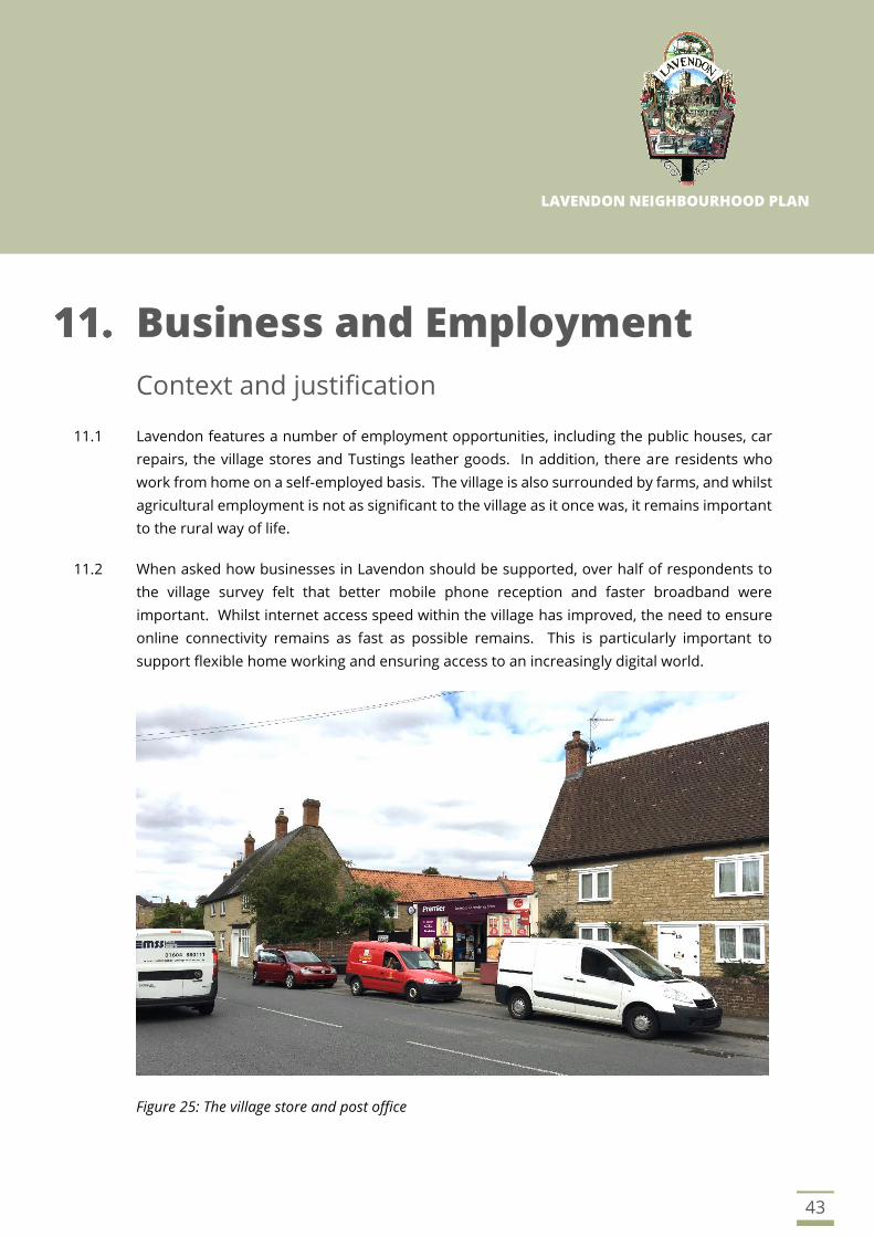
Figure 25: The village store and post office

44
Objectives
• To support local businesses to grow within the Parish and encourage employment
opportunities such as home working.
Policies
Implementation
11.3 This policy will be applied through the consideration of planning applications in conjunction
with Milton Keynes Council.
POLICY BE1: BUSINESS AND EMPLOYMENT
Applications for development that will create employment will be positively
supported subject to meeting the following criteria:
a) The site is located within the defined settlement boundary or is an existing
building suitable for conversion. New buildings outside of the settlement
boundary will be supported in accordance with NPPF policy on the rural
economy and the Milton Keynes Development Plan.
b) The proposed development can be accommodated into its surroundings in
terms of design, materials and is sympathetic to the character of the area.
c) There would not be an adverse impact on the amenity of neighbouring
properties and the character of the area by virtue of parking, lighting, noise,
vibration and fumes.
d) The development can be safely accessed by the expected volume and size
of vehicles, including staff and deliveries and would not generate traffic to
such an extent that would harm the rural character of the village.

LAVENDON NEIGHBOURHOOD PLAN
45
Policies Map
46
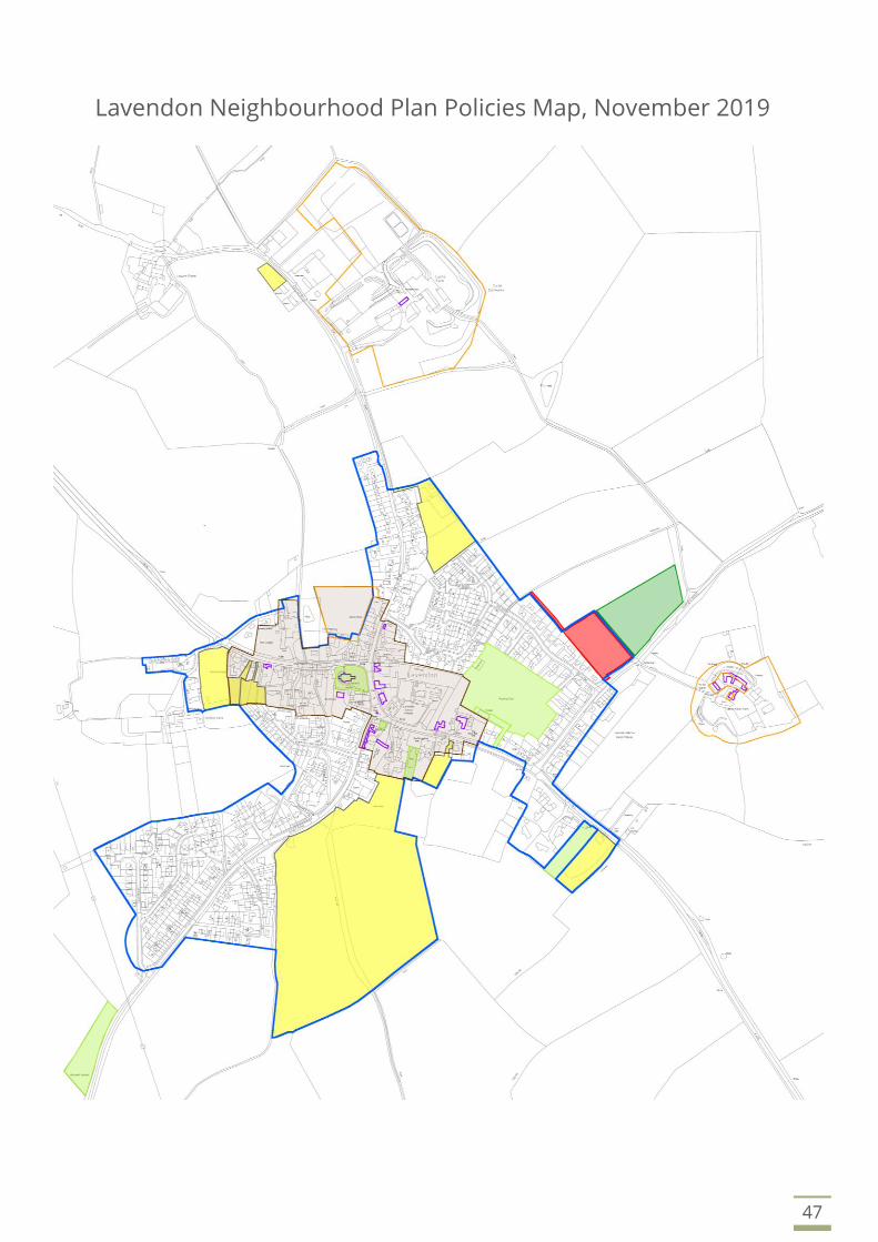
Lavendon Neighbourhood Plan Policies Map, November 2019
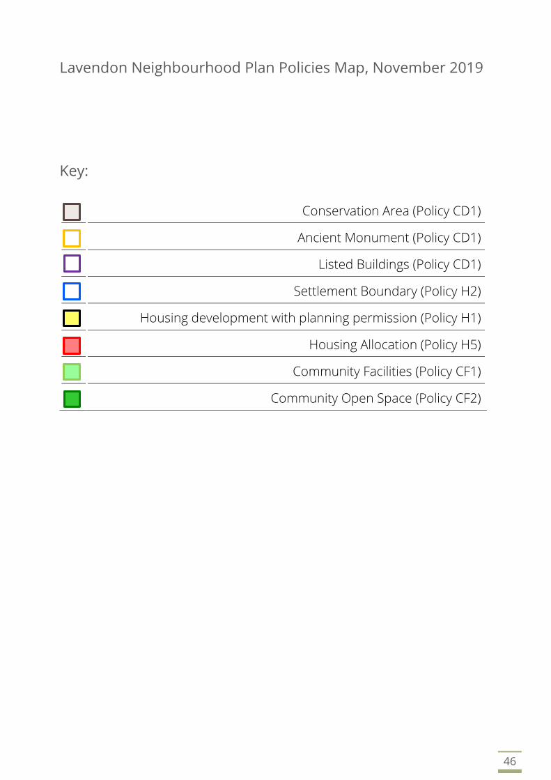
Key:
Conservation Area (Policy CD1)
Ancient Monument (Policy CD1)
Listed Buildings (Policy CD1)
Settlement Boundary (Policy H2)
Housing development with planning permission (Policy H1)
Housing Allocation (Policy H5)
Community Facilities (Policy CF1)
Community Open Space (Policy CF2)
47
Lavendon Neighbourhood Plan Policies Map, November 2019

LAVENDON NEIGHBOURHOOD PLAN
Annex A: Ancient Monuments
and Listed Buildings

Ancient Monuments and Listed buildings in Lavendon
Parish
Building Listing No. Grade Address
Lavendon Grange 1289456 2 Warrington Rd Lavendon MK46 4HL
Lavendon Abbey and fishponds 1011309 AM Warrington Rd Lavendon MK46 4HL
Sundial Lavendon Grange 1289457 2 Warrington Rd Lavendon MK46 4HL
Piers and wall south of Lavendon
Grange
1212665 2 Warrington Rd Lavendon MK46 4HL
Abbey Farm House 1212681 2 Warrington Rd Lavendon MK46 4HL
Stable block and barn south of
Lavendon Grange
1212665 2 Warrington Rd Lavendon MK46 4HL
Lavendon Mill House 1212624 2 Olney Rd Lavendon MK46 4HJ
Lavendon War Memorial 1458137 2 Olney Rd junction High St MK46 4EU
The Rectory 1365718 2 2 Olney Rd Lavendon MK46 4EU
The Forge 1365720 2 1 Olney Rd Lavendon MK46 4EU
7-11 Olney Rd 1212623 2 7-11 Olney Rd Lavendon MK46 4EU
The Post Office 1365714 2 11 and 13 High St Lavendon MK46 4EX
The Green Man P.H. 1365716 2 High St Lavendon MK46 4HA
15 High Street 1365715 2 15 High St Lavendon MK46 4EX
35 High St 1212616 2 35 High St Lavendon MK46 4HA
St Michaels Church 1212619 1 High St Lavendon MK46 4JD
Manor Farmhouse 1212617 2 High St Lavendon MK46 4HA
Haddon Cottage The Old Deanery 1212562 2 1 High St Lavendon MK46 4EX
Uphoe Manor Farmhouse 1212603 2 Harrold Rd Lavendon MK46 4HX
Moat and enclosure Uphoe Manor 1011305 AM Harrold Rd Lavendon MK46 4HX
Large barn Uphoe Manor 1212560 2 Harrold Rd Lavendon MK46 4HX
Small barn Uphoe Manor 1212561 2 Harrold Rd Lavendon MK46 4HX
Cart shed Uphoe Manor 1212608 2 Harrold Rd Lavendon MK46 4HX
The Bury ringwork of associated
earthworks
1011295 AM Northampton Rd Lavendon MK446 4EY
33 Northampton Rd 1212621 2 Northampton Rd Lavendon MK46 4EY
Castle Farmhouse 1212559 2 Castle Rd Lavendon MK46 4JG
14 Castle Rd 1289464 2 14 Castle Rd Lavendon MK46 4JD
Site of Lavendon Castle 1009542 AM Castle Rd Lavendon MK46 4JG
AM – Ancient Monument
Source: Historic England (March 2018)

LAVENDON NEIGHBOURHOOD PLAN
Annex B: Glossary

ADOPTION – The final confirmation of a development plan by a local planning authority.
ANCIENT MONUMENT – A nationally important archaeological site, building or structure which is protected against
unauthorised change by the Ancient Monuments and Archaeological Areas Act 1979.
BIODIVERSITY – The degree of variation of life forms within a particular ecosystem. Biodiversity is a measure of the health
of an ecosystem. Human activity generally tends to reduce biodiversity, so special measures often need to be taken to
offset the impact of development on natural habitats.
BROWNFIELD LAND – Land that has been previously developed.
CHANGE OF USE – A material change in the use of land or buildings that is of significance for planning purposes e.g. from
retail to residential.
COMMUNITY – A group of people that who hold something in common. They could share a common place (e.g. individual
neighbourhood) a common interest (e.g. interest in the environment) a common identity (e.g. age) or a common need (e.g.
a particular service focus).
COMMUNITY ENGAGEMENT AND INVOLVEMENT – Involving the local community in the decisions that are made regarding
their area.
CONDITIONS – Planning conditions are provisions attached to the granting of planning permission.
CONFORMITY – There is a requirement for neighbourhood plans to have appropriate regard to national policy and to be in
conformity with local policy.
CONSERVATION AREA – An area of special architectural or historic interest, the character and appearance of which are
preserved and enhanced by local planning policies and guidance.
CONSERVATION AREA CONSENT – Consent needed for the demolition of unlisted buildings in a conservation area.
CONSULTATION – A communication process with the local community that informs planning decision-making
DEVELOPMENT – Legal definition is “the carrying out of building, mining, engineering or other operations in, on, under or
over land, and the making of any material change in the use of buildings or other land.”
DEVELOPMENT MANAGEMENT (also known as Development Control) – The process of administering and making decisions
on different kinds of planning applications.
DEVELOPMENT PLAN – A document setting out the local planning authority’s policies and proposals for the development
and use of land in the area.
FLOOD ZONE – A designation to categorise the risk of flooding. Flood Zone 1 Low Risk, Flood Zone 2 Medium Risk, Flood
Zone 3a High Risk, Flood Zone 3b Functional Floodplain.
GENERAL (PERMITTED DEVELOPMENT) ORDER (GPDO) – The Town and Country Planning General (Permitted Development)
Order is a statutory document that allows specified minor kinds of development (such as small house extensions) to be
undertaken without formal planning permission.
GREENFIELD SITE – Land where there has been no previous development.
GREEN INFRASTRUCTURE – Landscape, biodiversity, trees, allotments, parks, open spaces and other natural assets.
GREEN SPACE – Those parts of an area which are occupied by natural, designed or agricultural landscape as opposed to
built development; open space, parkland, woodland, sports fields, gardens, allotments, and the like.
HIGHWAY AUTHORITY – The body with legal responsibility for the management and maintenance of public roads. In the
UK the highway authority is usually the county council or the unitary authority for a particular area, which can delegate
some functions to the district council.
INDEPENDENT EXAMINATION – An examination of a proposed neighbourhood plan, carried out by an independent person,
set up to consider whether a neighbourhood plan meets the basic conditions required.
LISTED BUILDINGS – Any building or structure which is included in the statutory list of buildings of special architectural or
historic interest.
LISTED BUILDING CONSENT – The formal approval which gives consent to carry out work affecting the special architectural
or historic interest of a listed building.
LOCALISM – Shifting power away from central government control to the local level. Making services more locally
accountable, devolving more power to local communities, individuals and councils.

LOCAL AUTHORITY – The administrative body that governs local services such as education, planning and social services.
LOCAL PLAN – The name for the collection of documents prepared by your local planning authority for the use and
development of land and for changes to the transport system. Can contain documents such as development plans and
statements of community involvement.
LOCAL PLANNING AUTHORITY – Local government body responsible for formulating planning policies and controlling
development; a district council, metropolitan council, a county council, a unitary authority or national park authority.
LOCAL REFERENDUM – A direct vote in which communities will be asked to either accept or reject a particular proposal.
MATERIAL CONSIDERATIONS – Factors which are relevant in the making of planning decisions, such as sustainability, impact
on residential amenity, design and traffic impacts.
MIXED USE – The development of a single building or site with two or more complementary uses.
NATIONAL PLANNING POLICY FRAMEWORK (NPPF) – The government policy document adopted in February 2019 intended
to make national planning policy and guidance less complex and more accessible. The National Planning Policy Framework
introduces a presumption in favour of sustainable development. It gives five guiding principles of sustainable development:
living within the planet’s means; ensuring a strong, healthy and just society; achieving a sustainable economy; promoting
good governance; and using sound science responsibly.
NEIGHBOURHOOD AREA – The local area in which a neighbourhood plan or Neighbourhood Development Order can be
introduced.
NEIGHBOURHOOD PLAN (NP) – A planning document created by a parish or town council or a neighbourhood forum, which
sets out vision for the neighbourhood area, and contains policies for the development and use of land in the area.
Neighbourhood plans must be subjected to an independent examination to confirm that they meet legal requirements,
and then to a local referendum. If approved by a majority vote of the local community, the neighbourhood plan will then
form part of the statutory development plan.
NEIGHBOURHOOD PLANNING – A community-initiated process in which people get together through a local forum or
parish or town council and produce a plan for their neighbourhood setting out policies and proposals for the development
they wish to see in their area.
OPERATIONAL DEVELOPMENT – “The carrying out of building, engineering, mining or other operations in, on over, or under land”;
part of the statutory definition of development (the other part being material changes of use of buildings or land).
PERMITTED DEVELOPMENT – Certain minor building works that don’t need planning permission e.g. a boundary wall below
a certain height.
PARKING STANDARDS – The requirements of a local authority in respect of the level of car parking provided for different
kinds of development.
PLAN-LED – A system of planning which is organised around the implementation of an adopted plan, as opposed to an ad
hoc approach to planning in which each case is judged on its own merits.
PLANNING GAIN – The increase in value of land resulting from the granting of planning permission. This value mainly
accrues to the owner of the land, but sometimes the local council negotiates with the developer to secure benefit to the
public, either through Section 106 Planning Obligations or the setting of a Community Infrastructure Levy.
PLANNING PERMISSION – Formal approval granted by a council allowing a proposed development to proceed.
PRESUMPTION IN FAVOUR OF SUSTAINABLE DEVELOPMENT – The concept introduced in 2018 by the UK government with
the National Planning Policy Framework to be the ’golden thread running through both plan making and decision taking‘.
The NPPF gives five guiding principles of sustainable development: living within the planet’s means; ensuring a strong,
healthy and just society; achieving a sustainable economy; promoting good governance; and using sound science
responsibly.
QUALIFYING BODY – Either a parish/town council or neighbourhood forum, which can initiate the process of neighbourhood
planning.
REFERENDUM – A vote by the eligible population of an electoral area may decide on a matter of public policy.
Neighbourhood Plans and Neighbourhood Development Orders are made by a referendum of the eligible voters within a
neighbourhood area.
SETTING – The immediate context in which a building is situated, for example, the setting of a listed building could include
neighbouring land or development with which it is historically associated, or the surrounding townscape of which it forms
a part.

SIGNIFICANCE – The qualities and characteristics which define the special interest of a historic building or area.
SITE ALLOCATION PLAN – A plan accompanying a planning policy document or statement which identifies sites within the
plan area on which certain kinds of development are proposed, e.g. residential or retail development.
STATEMENT OF COMMUNITY INVOLVEMENT – A formal statement of the process of community consultation undertaken in
the preparation of a statutory plan.
STATUTORY UNDERTAKER – An agency or company with legal rights to carry out certain developments and highway works.
Such bodies include utility companies, telecom companies, and nationalised companies. Statutory undertakers are exempt
from planning permission for many minor developments and highway works they carry out.
SUSTAINABLE DEVELOPMENT – An approach to development that aims to allow economic growth without damaging the
environment or natural resources. Development that “meets the needs of the present without compromising the ability of
future generations to meet their own needs”.
TOWN AND COUNTRY PLANNING ACT 1990 – Currently the main planning legislation for England and Wales is consolidated
in the Town and Country Planning Act 1990; this is regarded as the ‘principal act’.

LAVENDON NEIGHBOURHOOD PLAN
This page is intentionally blank

LAVENDON PARISH COUNCIL
Prepared with the support of Town Planning Services
The Exchange, Colworth Park, Sharnbrook, Bedfordshire, MK44 1LZ
01234 924 920
www.townplanning.services
17539-NP v9