Introduction to Prospecting - gov.nu.ca · Iron $4.3 Diamonds $8.1 ... ‘backpack’ drill (drill...
62
Introduction to Prospecting Session One – Introduction to Prospecting
Transcript of Introduction to Prospecting - gov.nu.ca · Iron $4.3 Diamonds $8.1 ... ‘backpack’ drill (drill...

Introduction to Prospecting
Session One – Introduction to Prospecting
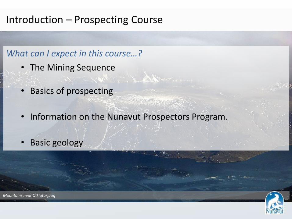
Introduction – Prospecting Course
What can I expect in this course…?
• The Mining Sequence
• Basics of prospecting
• Information on the Nunavut Prospectors Program.
• Basic geology
Mountains near Qikiqtarjuaq

Nunavut Prospectors Program (NPP)
What is the Nunavut Prospectors Program?
• Encourage the discovery of Nunavut’s resources, and provide future opportunities for Nunavummiut.
• Funding (up to 8000$/year) for prospectors interested in pursuing a project of their own.

Session Four – Ore Deposits
Session Three – Minerals
What to Look Forward to in this Course
Session One – Introduction to Prospecting
Session Two – Geology
Session Five – Prospecting
Saturday (optional) – Taking your skills outside!


Session One – Introduction to Prospecting
Session Two – Geology
Session Five – Prospecting
Saturday (optional) – Taking your skills outside!
Session Four – Ore Deposits
Session Three – Minerals


Session One – Introduction to Prospecting
Session Two – Geology
Session Three – Minerals
Session Five – Prospecting
Saturday (optional) – Taking your skills outside!
What to Look Forward to in this Course
Session Four – Ore Deposits


Session One – Introduction to Prospecting
Session Two – Geology
Session Four – Ore Deposits
Session Five – Prospecting
Saturday (optional) – Taking your skills outside!
Session Three – Minerals

Session One – Introduction to Prospecting
Session Two – Geology
Session Five – Prospecting
Saturday (optional) – Taking your skills outside!
Session Four – Ore Deposits
Session Three – Minerals


Session One – Introduction to Prospecting
Session Two – Geology
Session Five – Prospecting
Taking your skills outside!
What to Look Forward to in this Course
Session Four – Ore Deposits
Session Three – Minerals


Prospecting
Have Inuit prospectors discovered significant mineral deposits in Nunavut?
Mary River Mine – Baffinland (ArcelorMittal)
• The hill of iron (now Mary River Mine) was known to local Inuit, they showed it to
Ron Sheardown and Murray E. Watts in 1962
• Now a fully operational mine as of 2014
Unloading rock truck in Arviat
Re-supply plane at Mary River

Beluga Sapphire Project
• First high-quality transparent sapphire in Canada.
• Brothers Seemeega and Nowdluk Aqpik from Kimmirut discovered the gems on a hilltop southwest of town.

Soapstone quarries throughout Nunavut
• 77 soapstone deposits were confirmed.
John Tugak’s gold findings: • Recently signed an option deal
with Agnico Eagle

2017 Exploration & Deposit Appraisal Expenditures (Preliminary estimates; $ millions)
19
Precious Metals $152.0
Base metals $4.6
Uranium $0.5
Iron $4.3
Diamonds $8.1
Nunavut Total
$169.5 million
Source: NRCan Mineral Statistics, as of February 2018 (unadjusted for inflation)

Exploration & Deposit Appraisal Investment
0
100
200
300
400
500
600
$ M
illio
ns
Juniors Seniors
Over $4.1 billion investment in Nunavut since 1999 20 Source: NRCan Mineral Statistics, as of February 2018 (unadjusted for inflation)
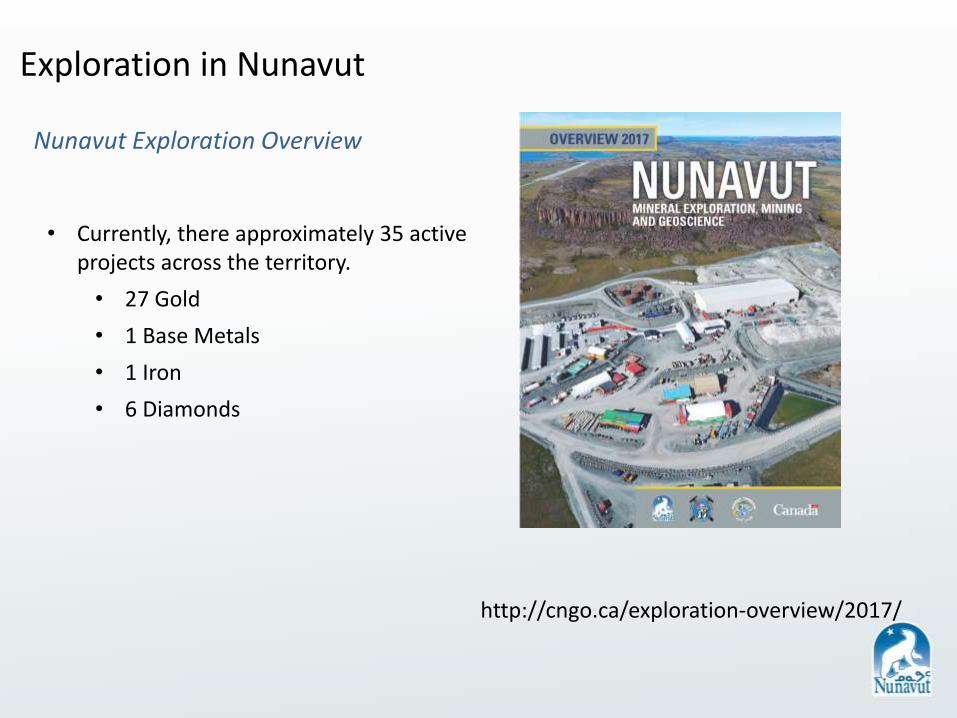
Exploration in Nunavut
Nunavut Exploration Overview
• Currently, there approximately 35 active projects across the territory.
• 27 Gold
• 1 Base Metals
• 1 Iron
• 6 Diamonds
http://cngo.ca/exploration-overview/2017/

Aberdeen Lake
Amadjuak
Lake
River
Baker Lake
DubawntLake
Kazan
Nettilling
Lake
South HenikLake
Thlewiaza River
Yathkyed Lake
Riv
er
Riv
er
Back
Great Slave Lake
Grand lac des Esclaves
Great Bear Lake
Grand lac de l'Ours
Lake Athabasca
Lac Athabasca
Cop
per
min
e
Riv
er
Th
elo
n
Riv
erD
ub
aw
nt
BAIE DE BAFFIN
BAIE D' HUDSON
Détroit de D
avis
Détroit d' Hudson
Baie d'Ungava
BAFFIN BAY
HUDSON BAY
Davis Strait
FOXE
BASIN
Hudson Strait
C H A N N E L
Prince Gustaf AdolfSea
Amundsen
Gulf
Foxe Channel
M'C
linto
ck
Gu
lf of Boothia
Pri
nce
Reg
ent
Inle
t
Viscount
Taverner Bay
Ungava Bay
Vic
tori
a Str
ait
Wager Bay
Wellington Bay
Wellin
gto
n C
ha
nn
el
Bay
of
God
s M
ercy
Agu Bay
Alexander Bay
Andrew Gordon Bay
Ad
mira
lty In
let
Barrow Strait
Bear Bay
Belcher
Bernier Bay
Bowman Bay
By
am
Ma
rtin C
ha
nn
el
Committee
Bay
Coronation Gulf
Cumberland Sound
Daly Bay
Dease Strait
Dolphin and U
nion Strait
Exeter Sound
Finnie Bay
Foster Bay
Fra
nkl
in S
tra
it
Frobisher Bay
Fury and Hecla Strait
Garry Bay
Ha
dley
Ba
y
Ha
ssel So
un
d
Hazen Strait
Hecla
an
d G
riper B
ay
Hoare Bay
Home Bay
Ikpik
Bay
Jones Sound Lady Ann Strait
Lancaster Sound
Larsen Sound
Markham Bay
Ma
ssey Soun
d
Murray Maxwell Bay
Nauj
a B
ay
Norway Bay
Norwegian Bay
Parry Bay
Pe
el S
ou
nd
Penny Bay
Pen
ny
Stra
it
Povungnituk Bay
Queen Maud Gulf
Rasmussen
Basin
Richardson Bay
Ro
es W
elc
om
e S
ou
nd
SimpsonBay
Smit
h B
ay
South Bay
Storis Passage
Ch
an
nel
Melville Sound P A R R Y
Channel
Steensby Inlet
Mil
ne
Inle
t
Eclip
seSound
ALBERTA
NORTHWEST TERRITORIES
TERRITOIRES DU NORD-OUEST
SASKATCHEWAN
ÎLE
BAFFIN
DE
BAFFINVICTORIA ISLAND
DEVON ISLAND
MELVILLE ISLAND
BATHURST
ISLAND
SOMERSET
ISLAND
PRINCE OF WALESISLAND
SOUTHAMPTON
ISLAND
Amund Ringnes Island
Cornwall I.Lougheed Island
Graham I.
Cornwallis
Island
Byam Martin I.
StefanssonIsland
Bylot Island
King
WilliamIsland
Prince
Charles
Island
Air Force I.
Nottingham
Island
Coats
Island Mansel
Island
Cameron Island
Rowley I.
Wales I.
Salisbury
Island Big
Island
ISLAND
Resolution
Island
Charles
Island
Akpatok
Island
PARRYISLANDS
Kivalliq
Kitikmeot
Qikiqtani
Devon
Ice Cap
Barnes
Ice Cap
Penny
Ice CapAuyuittu
q NP
Beverly CPMA
Bowman
Bay WS
Bylot Island MBS
Nirjutiqavvik
NWA
Dewey Soper
MBS
East Bay MBS
Harry
Gibbons
MBS
Iqalugaarjuup
Nunanga TP
Niginganiq NWA
Kekerten TP
Kugluk TP
Mallikjuaq
TP
McConnell River MBS
NorthernBathurst Island(Proposed NP)
Polar Bear Pass
NWA
Prince Leopold
Island MBS
Qamanirjuaq
CPMA
Queen Maud GulfMBS
Seymour IslandMBS
Sirmilik NP
Sylvia Grinnell a
nd
Qaummaarviit TP
Thelon WS
Ukkusiksalik
(Proposed NP)
Ovayok Park TP(Mt. Pelly)
Inuujaarvik TP
Pitsuktinu Tungavik TP
Katannilik TP
Qaqulluit N
WA
Akpait NWATuktutNogaitNP
Sirmilik
NP
Qikiq
tarjuaq
Kimmirut
IQALUIT
Pangnirtung
Arviat
Chesterfield Inlet
Cape Dorset
Whale Cove
Rankin Inlet
Coral Harbour
Repulse BayBathurst Inlet
Umingmaktok
Kugluktuk
Baker Lake
Cambridge Bay
Pond Inlet
Hall Beach
Igloolik
Arctic Bay
Grise Fiord
KugaarukGjoa Haven
Taloyoak
Clyde River
Resolute
YELLOWKNIFE
ARCTIC CIRCLE
CERCLE ARCTIQUE
Hackett River
High Lake
Izok LakeGeorge Lake
Goose Lake
Hope Bay - Doris
Meliadine
Kiggavik
Mary River Mine
Coppermine River
Wishbone
Committee BayHood River
Itchen Lake
Ulu
Wishbone Gold
ATLAS
Luxx
Qilalugaq
Nanuq
Amaruq
Greyhound Lake
Kiyuk
Pistol Bay
Aberdeen
Turqavik
Angilak
Agnico-Eagle OptionInuit Owned Lands
Kiggavik North
Kiggavik South
Borden
Storm
West Melville
Chidliak
Qilaq
Mel
Roche Bay
Tuktu
Jericho MineLupin Mine
Nanisivik Mine
Polaris Mine
Meadowbank Mine
.
.
.
.
..
.
.
.
.
.
.
.
.
.
.
.
.
.
.
..
.
.
.
.
.
.
.
.
.
.
.
.
.
.
.
.
.
.
.
.
.
.
.
4
7
1
3
6
5
2
, 8
50°W60°W
70°W
70°W
80°W
80°W
90°W
90°W
100°W
100°W
110°W
110°W120°W
70°N
70°N
60°N
60°N
NUNAVUT
20 Kitikmeot Active Projects
18 Kivalliq Active Projects
9 Qikiqtani Active Projects
Projection:Canada Lambert Conformal Conic, NAD 83
0 100 200 30050
Kilometres

• Liaising body between industry, government and communities.
• Promotion of mineral exploration for the territory.
• Education of the mineral exploration industry.
• Several mine training initiatives in conjunction with industry.
• Regulatory body in Nunavut. • Handles all permitting and fees for
work performed. • Land tenure & Map staking initiative. • Assessment reporting. • Mining Recorder’s Office. • Contain all physical and digital
resources for future exploration.
DEVOLUTION
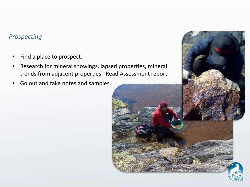
Prospecting
• Find a place to prospect.
• Research for mineral showings, lapsed properties, mineral trends from adjacent properties. Read Assessment report.
• Go out and take notes and samples.
Research and planning
Bedrock geology maps and government reports - targets are volcanic belts, igneous rocks and economic geology sections.
Assessment reports - have targets that have already been sampled. These reports have known mineral occurrences.

The Mining Sequence
Staking
• Putting up posts outlining your property, and submitting a staking form.
• Initial ‘stake’ is valid for 2 years without work.
• Work must be done each year to keep your claim.
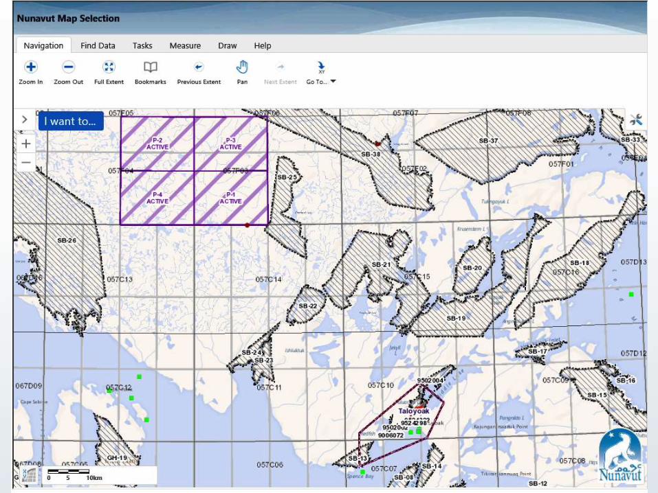
• Before staking: Check out Nunavut Map Viewer.
• Once you have a staked claim, you must submit and assessment report each year.

Mary River: Red areas are active mineral claims and the green areas are active mineral exploration permits.

Geological Mapping & Sampling
• Mapping is a fundamental prospecting activity.
• Take samples of rocks of interest.
• Label rock types identified and your sample locations on a map.
GN image

Trenching & Geochemical Sampling
• The overburden is stripped off to reveal the rock underneath.
• Reveals rock structure and mineralization .
Trenching and cutting in northern Ontario.

Drilling
• Drilling is the most common exploration activity.
• Diamond drilling is most common form.
• Results are most targeted by investors, and can generate future funding for a project.
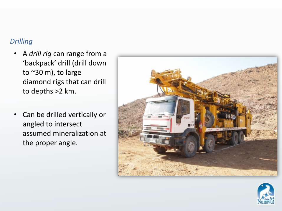
Drilling
• A drill rig can range from a ‘backpack’ drill (drill down to ~30 m), to large diamond rigs that can drill to depths >2 km.
• Can be drilled vertically or angled to intersect assumed mineralization at the proper angle.

Introduction to Prospecting
The Mining Sequence
Drilling
• A drill rig can range from a ‘backpack’ drill (drill down to ~30 m), to large diamond rigs that can drill to depths >2 km.
• Consists of a diesel engine, casing, rods, fuel and core materials.
• Can be drilled vertically or angled to intersect assumed mineralization at the proper angle.
• A diamond drill produces drill core.
Universal Drill in the Atacama Desert, Chile
Drill It Log It
Store It
Drilling
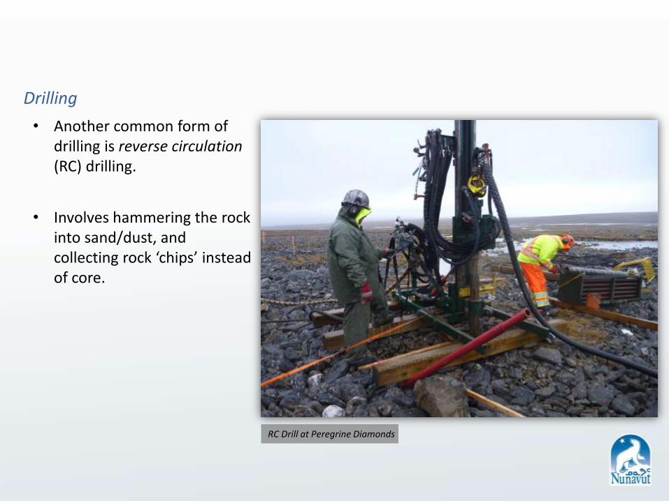
• Another common form of drilling is reverse circulation (RC) drilling.
• Involves hammering the rock into sand/dust, and collecting rock ‘chips’ instead of core.
RC Drill at Peregrine Diamonds

Introduction to Prospecting
The Mining Sequence
Drilling
• With varying sizes of rigs come varying sizes of core.
• Another common form of drilling is reverse circulation (RC) drilling.
• Involves hammering the rock into sand/dust, and collecting rock ‘chips’ instead of core.
• RC rigs can also range from small ‘backpack’ rigs to massive rigs with rod diameters >2 ft.
RC Drill at Peregrine Diamonds

Drilling
• Drilling results are typically inputted into GIS Software.
• Generate a 3D model, showing interpretation of mineralization underground.

Geophysics
• Geophysical surveys search for mineral deposits by measuring physical properties of near-surface rocks.
• Electrical, magnetic, electromagnetic and radioactive properties are measured.

• All the data collected through the various tools of exploration increase the project’s confidence.
• A mine will not be created without the highest level of confidence – a proven resource and reserve.
• The engineering and construction of a mine are completely dependent on the high level of confidence of what will be encountered underground.

Development
• All the mine studies are done, all the reserves have been proven.
• A mine can take anywhere from 3-5 years, depending on the “size” of the mine, ore processing procedures, and the infrastructure.
Meadowbank Mine (Agnico Eagle)

Ore Processing & Production
• Ore processing is what this whole process is all about. Getting the commodity out of the ground and into the market.
• Processing the commodity at the highest rate of efficiency partially determines the mine life.
Baffinland ore heading to Europe.
Diavik Diamond Mine

• Mine reclamation is built into a mine plan (i.e. they can’t build a mine without having the plan and money for reclamation).
• Reclamation processes can begin long before a mine shuts down.
Reclamation & Remediation
North Rankin Nickel Mine (1957-1962)

Right: Barge headed for Polaris Mine (1981-2002) Left: Polaris Mine in 2002
• Reclamation for Polaris began in 2000 – 2 years before the mine closed.
• Most infrastructure was dismantled and shipped to disposal sites. Other infrastructure was buried.
• Environmental monitoring continued to 2011.
Reclamation & Remediation – Polaris Mine

What is an ore deposit?
Naturally occurring large body of economically valuable minerals, as measured by its grade
(value) and tonnage (amount).
Types of Deposits

Gold
• Gold occurrence is dependent on several geological factors, such as host rock type, tectonic setting, etc.
• Volcanogenic Massive Sulphide (VMS) deposits can yield gold.
• Meadowbank gold Mine hosted in Banded Iron Formation type rocks.

Gold
• Lode gold is a broad type of deposit, however typically refers to gold associated with geological fluid events, resulting in associated quartz and sulphides.
• Placer deposits are those found in streams and lakes.
Photo Courtesty of John Tugak

Iron
• Typically mined out of large swaths of banded iron (BIFs) formations, which represents the largest source of iron in the world.
• Mary River is a special case for iron ore, as the quality of the ore is so high, it does not need additional processing onsite.

Diamonds
• Diamonds deposits are very sought after in Nunavut.
• Deposits have been found in all 3 regions of the territory.

Diamonds
• Found to be associated with deep, ancient volcanic eruptions called kimberlite.
• Kimberlites are often found in clusters, and are mainly found in Archean cratons (rocks older than 2.5 Billion Years old!)
commons.wikimedia.org/wiki/File:Chidliak_Kimberlite.jpg

Base Metals
• Practical metals, such as copper, nickel and zinc.
• Volcanogenic Massive Sulphide (VMS) deposits are one of the primary deposit types for many base metals.
• They are typically created in ancient volcanic regions.
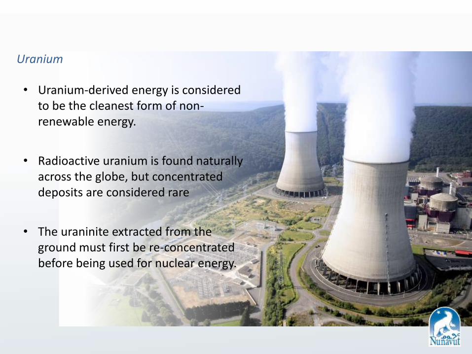
Uranium
• Uranium-derived energy is considered to be the cleanest form of non-renewable energy.
• Radioactive uranium is found naturally across the globe, but concentrated deposits are considered rare
• The uraninite extracted from the ground must first be re-concentrated before being used for nuclear energy.
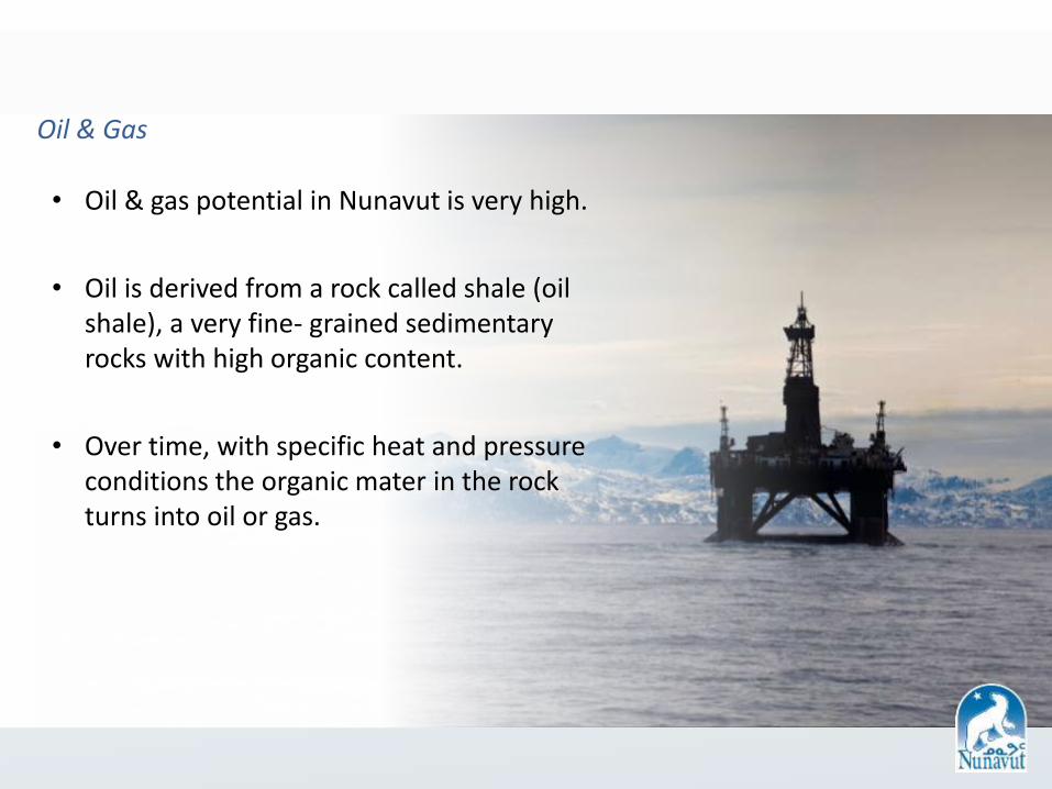
Oil & Gas
• Oil & gas potential in Nunavut is very high.
• Oil is derived from a rock called shale (oil shale), a very fine- grained sedimentary rocks with high organic content.
• Over time, with specific heat and pressure conditions the organic mater in the rock turns into oil or gas.

The Environment Environmental Studies
• Strict environmental regulations are at the forefront of prospecting, exploration and mining throughout Nunavut.
• Companies are required to perform environmental baseline studies and monitoring in order to measure the environmental impact created from their activities.

Nunavut Impact Review Board
• The Nunavut Impact Review Board (NIRB) handles environmental and socio-economic assessment for all projects in Nunavut.
• All projects in Nunavut are assessed by NIRB before any permits and/or licences are granted.

Water Usage
• Water usage throughout the territory is closely monitored.
• Exploration companies must apply for water use license before commencing any work.
• The Nunavut Water Board (NWB) regulates the use of water in the territory.

• The Nunavut Planning Commission (NPC) handles a review of land use of projects in Nunavut.
• All projects in Nunavut are screened first via Approved Land Use Plans.
Nunavut Planning Commission
commons.wikimedia.org/wiki/File:20070818-0001-strolling_reindeer.jpg
Permitting
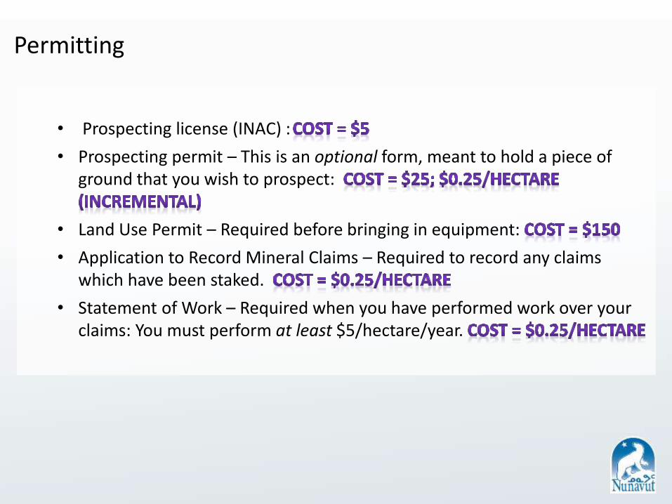
• Prospecting license (INAC) :
• Prospecting permit – This is an optional form, meant to hold a piece of ground that you wish to prospect:
• Land Use Permit – Required before bringing in equipment:
• Application to Record Mineral Claims – Required to record any claims which have been staked.
• Statement of Work – Required when you have performed work over your claims: You must perform at least $5/hectare/year.
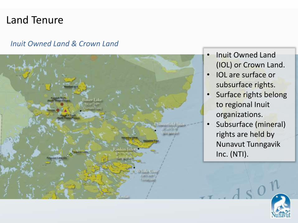
Land Tenure
Inuit Owned Land & Crown Land
• Inuit Owned Land (IOL) or Crown Land.
• IOL are surface or subsurface rights.
• Surface rights belong to regional Inuit organizations.
• Subsurface (mineral) rights are held by Nunavut Tunngavik Inc. (NTI).
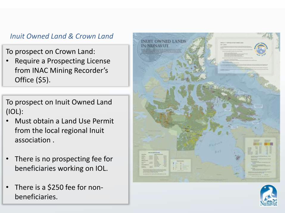
Inuit Owned Land & Crown Land
To prospect on Crown Land: • Require a Prospecting License
from INAC Mining Recorder’s Office ($5).
To prospect on Inuit Owned Land (IOL): • Must obtain a Land Use Permit
from the local regional Inuit association .
• There is no prospecting fee for beneficiaries working on IOL.
• There is a $250 fee for non-beneficiaries.

Nunavut Prospectors Program Funding Application and Sample Description Sheet
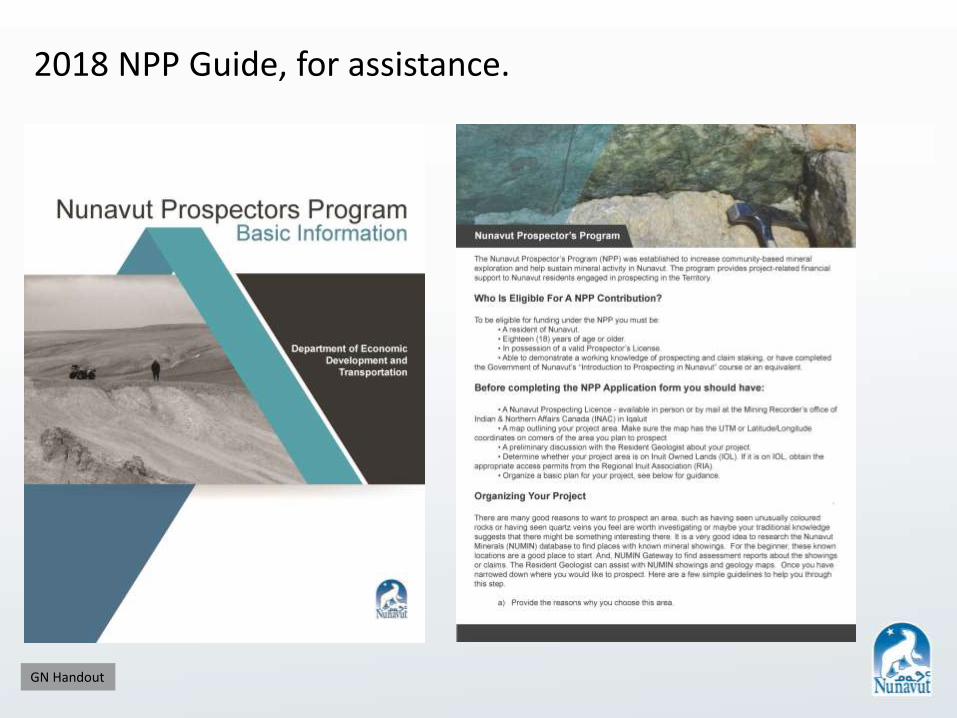
2018 NPP Guide, for assistance.
GN Handout

What Did We Learn?